
NOTE for readers…
Alaska is a unique adventure when visiting many of its 23 National Parks. “Unique” can take on myriad definitions. But in context of maintaining daily trip reports and blog posts, some parks are just not conveniently located near any WiFi connection. The three days I will be in Katmai National Park and Preserve is one example. Brown bears are a primary resident of this park and they have never heard of WiFi, or electronic devices for that matter; they get along fine without them. So, if you see a few days of no posts, it is because I cannot connect to the internet.
DAY 18 (July 30) - Glacier Bay National Preserve does not look changed from my visit eight years ago. It continues to be just 91 square miles, compared to 5,131 square miles for the Park portion. Remember, the entire area used to be just Glacier Bay National Monument, but politics and special interests got in the way, creating two legal entities: a park and a preserve. On the Alaska Air flight to Yakutat (from Juneau) we flew over the main attraction of Glacier Bay National Park, the end of Tarr Inlet where everyone stops to see the Grand Pacific Glacier and Margerie Glaciers calve (there was one big cruise ship this morning… very hard to see in the photo). Plenty of glaciers, snow, and ice fields in the park. The runway at Dry Bay is still narrow, made of grass and a little gravel, carved from an evergreen forest. Water is running in the Alsek River (photo), with salmon easily seen from overhead. This trip was via helicopter, my first travel on such a piece of equipment. Hans, the pilot (and co-owner of Coastal Air Service), pointed out a female moose resting on a large swath of grass. A few large white birds were along the riverbank. Then there were the three outdoorsmen, plus gear, at the Dry Bay air strip waiting for a ride back to civilization. We could see 18,008’ tall Mount St. Elias, in Wrangell – St. Elias National Park, off in the northeast distance. Hans and Tanya now have a snazzy looking Otter plane. It must be the best-looking aircraft in southern Alaska. But no need to take that for one person out to the Preserve. Hopefully the below image will give you some idea of where the SE Alaska parks are located relative to one another, between Juneau, Yakutat, and Sitka (all reached via Alaska Air).


DAY 17 (July 29) - I am including Ebey’s Landing National Historical Reserve in the Alaska section since I stopped to visit this park on my return trip to Alaska to pick up Glacier Bay National Preserve. Colonial Isaac Ebey came to Whidbey Island in 1851 and filed a donation claim for land. His family soon followed. He thought the bottom land formed by 4,100 feet of ice and rock from 17,000 years ago was perfect for farming. He was right. The 50-foot depth of drift and till left by the glacier retreat made for rich soil. But the governor of the Washington Territory was afraid of attacks by Indigenous peoples (including Alaska and Canada tribes) after white men began settling Whidbey Island. He ordered farmsteads to build blockhouses. Four survive to this day on the island, including the Ebey Blockhouse, reconstructed in 1930 with the original materials. This blockhouse stands in front of Jacob and Sarah Ebey’s home. They were Isaac’s parents. The Coupeville Wharf is within the boundaries of the Reserve. Once a busy port due to the protected harbor, visitors now stroll through quaint shops and eat at laid-back restaurants. The photo is of the pier. The locals banded together and in 1978 the NPS created the Reserve so no further commercialization of the land could take place.


DAY 16 (June 15) - An “off day” on the 14th was the precursor to this day. Brooks Range Aviation flew me to Gates of the Arctic National Preserve. Along the way we stopped at Walker Lake (top photo) in the Park portion, to drop off rafting supplies to a group. A few minutes later we were at Nutuvukti Lake in the Preserve. The surface of the water was like glass. As mentioned before, the sole purpose of Congress to take a bit of the park and calling it a preserve is to allow a few people to hunt. But, due to the required legislation, this makes the Preserve a standalone unit for the NPS count. Thanks to Tom, the pilot, for taking me to the Preserve.
When we landed back in Bettles, we were informed a small burst of wind had blown through the runway. The main casualty was the flipping of the company’s C-206. This was a first for everyone in town.
The Gates of the Arctic Park and Preserve VC in Bettles had nice displays, and a large map detailing the northern section of Alaska. One artifact from the park was the tusk of a Woolly Mammoth, at least 4,000 years old, the time when the last Mammoths in Siberia and Alaska died off.


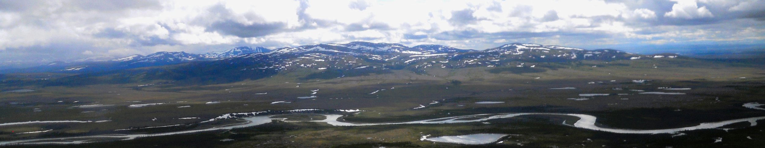
DAY 15 (June 13) - Bering Land Bridge NPres was the morning’s trip. The plane had to fly over 30 miles of open water to reach Cape Espenberg. We then turned southwest towards Serpentine Hot Springs. The first feature were remnants of defunct volcanos, which after they blew their tops hundreds of years ago, collapsed and formed volcano lakes. Think Crater Lake in Oregon, but without the 1,000-foot tall distance to the rim.
As we flew over two separate groups of Caribou, a cousin of the pilot radioed that the landing area was still under water. We made a u-turn to head to the beach, where we touched down. In between we saw two more groups of Caribou, one being about 25-head strong. Throw in a couple of Musk Ox and the wildlife box was checked. This area has been home to indigenous peoples for thousands of years. Current folk continue to survive as their ancestors did. There are no roads to this 2.7 million acre land.
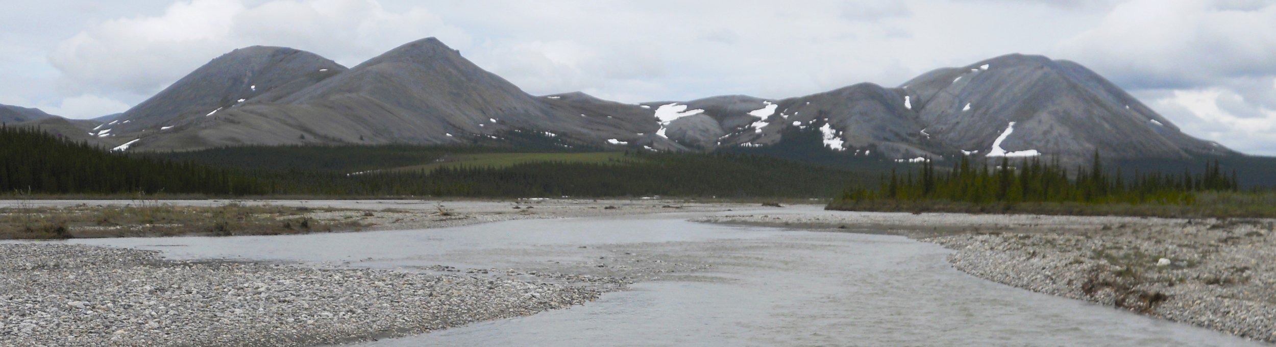
The flight to Gates of the Arctic NP included rainstorms, as well as another landing on a gravel sand bar in the middle of a river (can you make out the tracks of the tires in the gravel?). This time it was the Upper Ambler River. Scientists have determined humans began living in this area over 10,000 years ago. There are no roads in the park, accessible mainly by bush pilots (or one can hike more than a few miles from the Dalton Highway). Expert hikers consider 6 miles a day as a good number since there are no trails, except maybe animal trails. If you come to a river, you probably have to find a way across it. This was serenity at its bets.
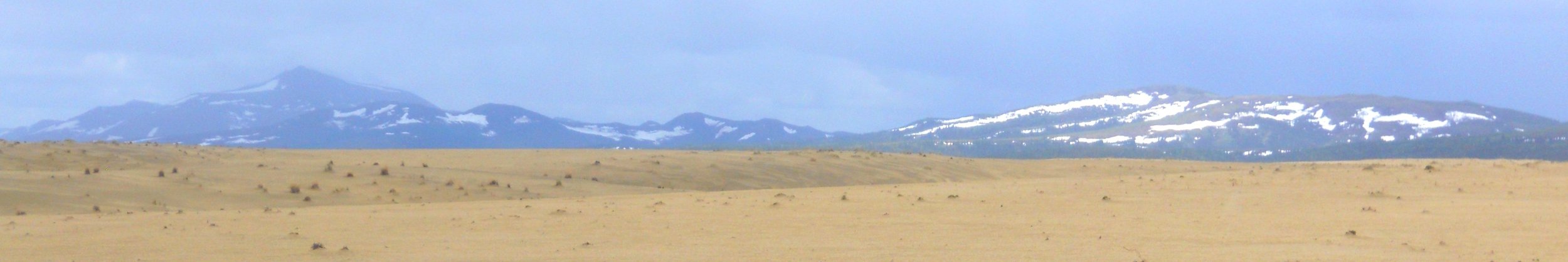
60 miles back west was the realm of Kobuk Valley NPark, the home of 25 square miles of 100-foot tall sand dunes. Yes, sand dunes in the middle of Alaska and above the Arctic Circle (first image is looking west, the second is facing east, after landing). Go figure. But this sand comes from the work of glaciers, different from Florida beach sand. The sand was slightly wet, which made for an interesting landing and turn-around.
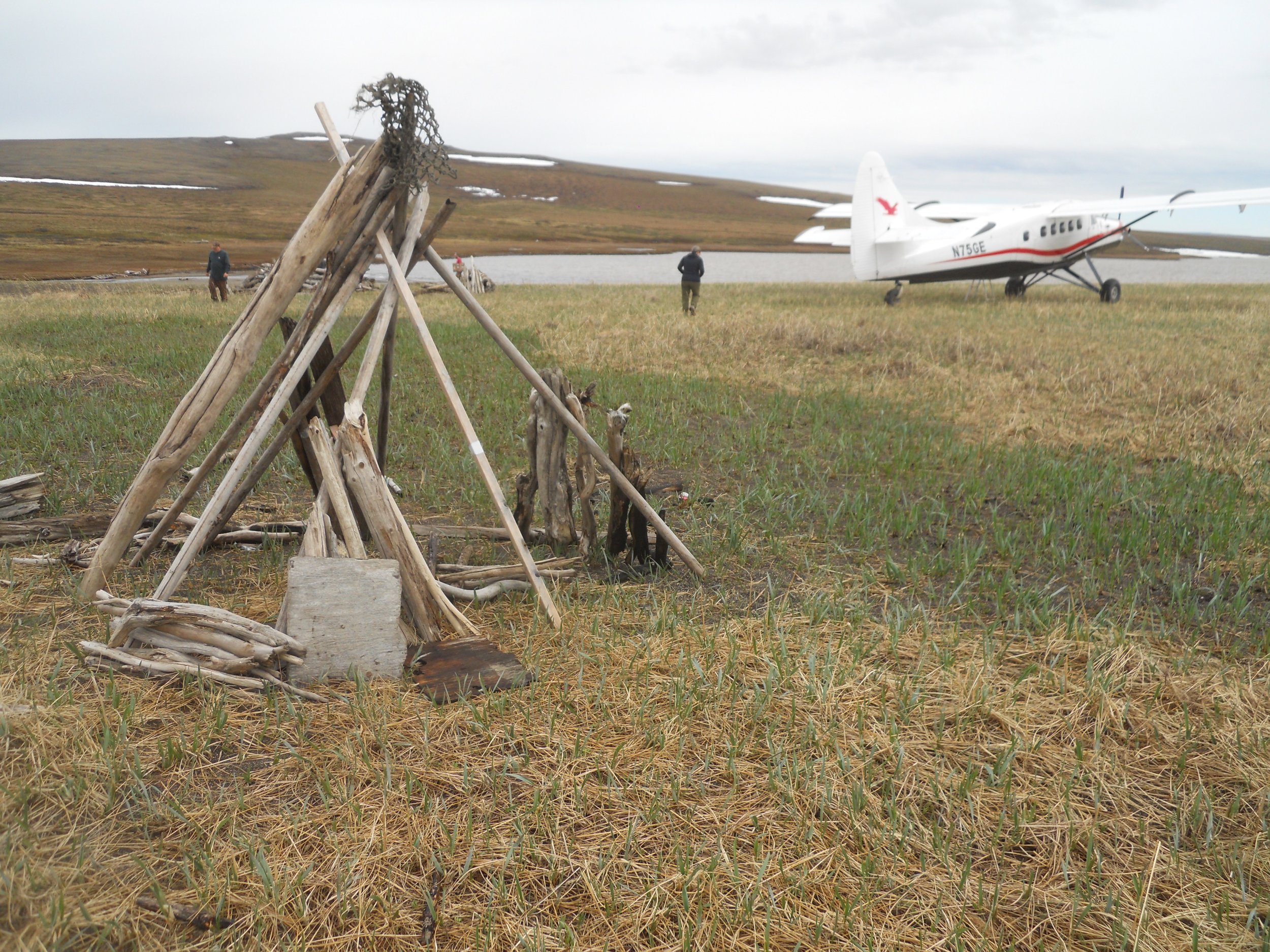
Footprints in the sand give the illusion no one has been here before. But at least nine people showed up today. The last image is the official Member Meetup photo for the NPTC. The seven club members had the pleasure of meeting Alan (to the left of me in my blue Quest shirt) and Kit (holding the yellow sign) who had contacted Golden Eagle for this flight. They may wind up joining the 3,000+ member strong club.


DAY 14 (June 12) - Kotzebue is the hub for accessing the parks above the Arctic Circle. One can get to a couple of the parks via air taxi services on the Dalton Highway, and Bering Land Bridge can be reached from Nome. But, to do all five in one day, fly into the small village of Kotzebue.
And you would have a full 24 hours in one day to get to the five parks. From June 3 to July 9 the sun shines around the clock, literally.
Golden Eagle Outfitters put us on their de Havilland Otter and we headed to Cape Krusenstern NMon. Ice was still heavy out in the Chukchi Sea, which borders the monument. By this time of year the ice is mostly gone, but this past winter was not normal for snowfall. People will fly or boat over to the park to hunt birds. The stacked wood was a spot near our landing. Before landing we flew over some Musk Ox.
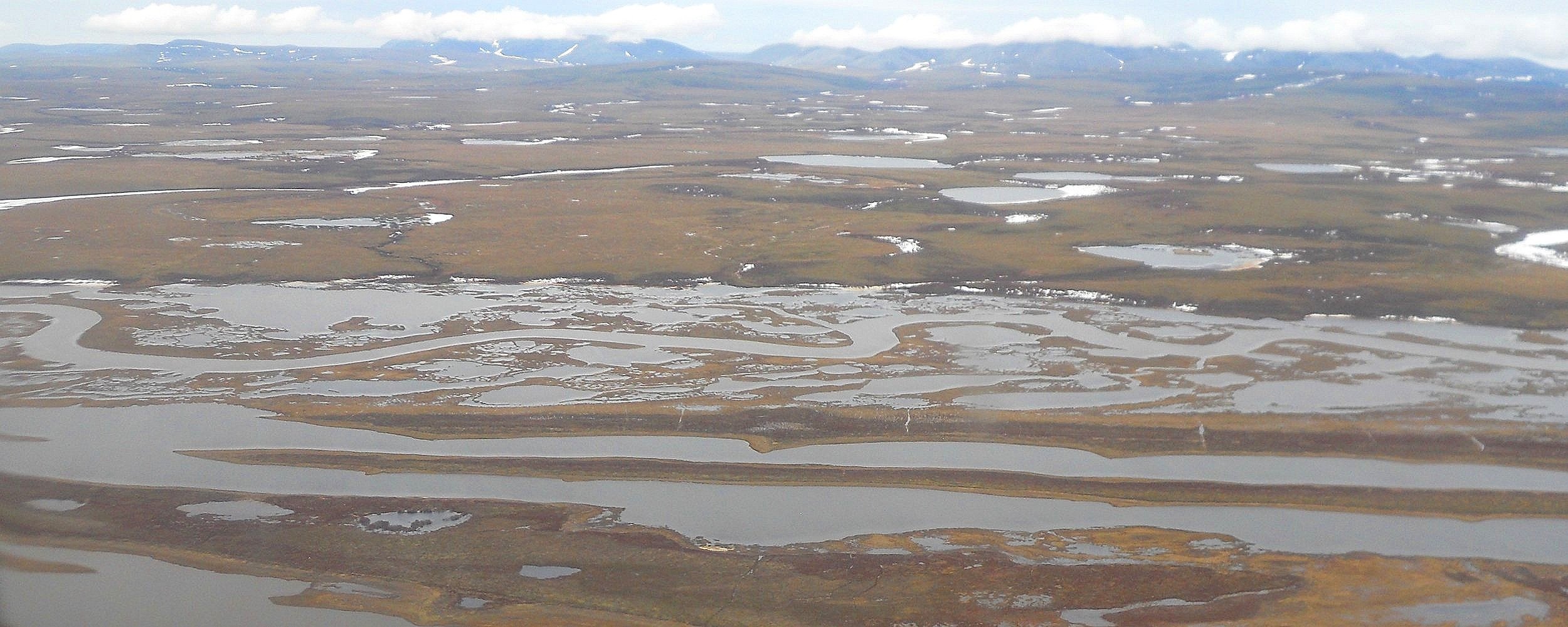
Next up was Noatak NPres, a mountain-ringed river basin. The Noatak River runs 280 miles, through stunning beauty, offering unsurpassed float-trip options. We landed on a gravel bar in the middle of the river (bottom left photo).


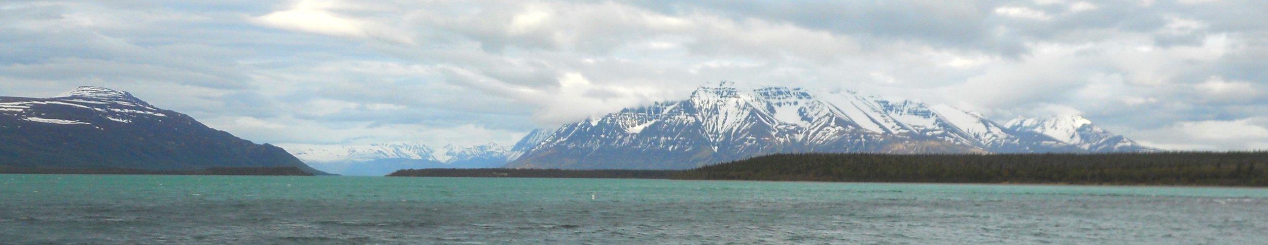
Day 13 (June 11) - This was the day-trip to Yukon-Charley Rivers National Preserve, via Wright Air Services out of Fairbanks. It was not until we were close to our designated landing place that the Yukon River came into view. The Yukon River is great for rafting trips, while the Charlie River is for whitewater enthusiasts. This is a land of solitude, per the NPS. An old mining camp sits in the Coal Creek area, where we landed. The wood device in the photo was used to run gold laden water into other sections of the separation process. Just before the return takeoff, a black bear waddled across the runway. A couple of dredges have been surrounded by the forest, looking like they did decades ago when mining ceased.
A treat on the way back was a fly-over of the Fort Knox Gold Mine, east of Fairbanks. It is the largest open-pit-only gold mine in the country. Us passengers had a hard time seeing the large mine haulers all the way at the bottom of the pit.
A couple of followers have asked if I can provide maps of the parks. I should be able to do so, with the below being the first attempt.


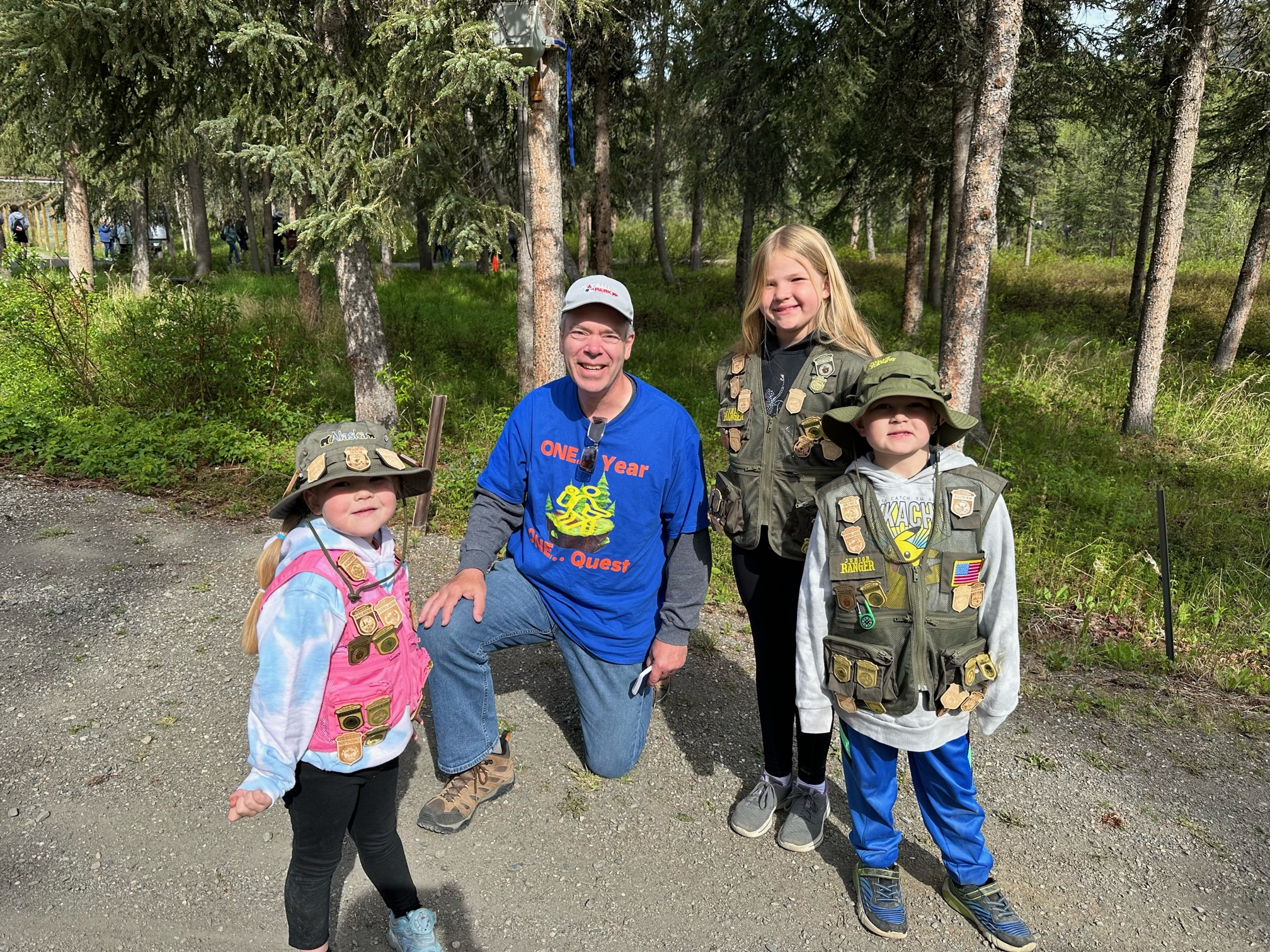
DAY 12 (June 10) - This then became our second day in Denali National Park. A couple of our group were able to get the last two Bus Tour tickets for 8:40 AM and 9:40 AM. The rest of us went to the Sled Dog Kennels and demonstration. These are Alaskan Huskies, not to be confused with regular Huskies. They have been bred with special features for the fun chore of pulling sleds. If you don’t think that would be fun, you should have heard the lot of 30 dogs go ballistic as five were led out to the demonstration. That was enthusiasm on Thor level. The shuttle bus had just arrived at the 9:45 AM feeding, which is what the red/blue device is. The dogs have learned to hit, turn, and push the toy to output food pellets. I had the pleasure of meeting three youngsters and their parents. They are on their own quest, to gather as many Jr. Park Ranger badges as possible. Here is how they look with their current cache. These are the “Kids from TN”.
The Park Road allows any vehicle to go to Mile Marker 15, the Savage River turnaround. The last photo is from Mountainview Vista, which used to be a work camp in the mid-20th century.


DAY 11 (June 9) - An email from Sheldon Air Services in Talkeetna said they were watching the weather in Denali National Preserve. We arrived in the quaint village, had lunch, and waited for the weather to clear. This gave me time to buy a new pair of sunglasses at an outdoor gear company. The group said I looked like Elton John. The middle of Alaska may not be the fashion capital of the world, but it doesn’t have to be. It has the hand of Nature on its side.
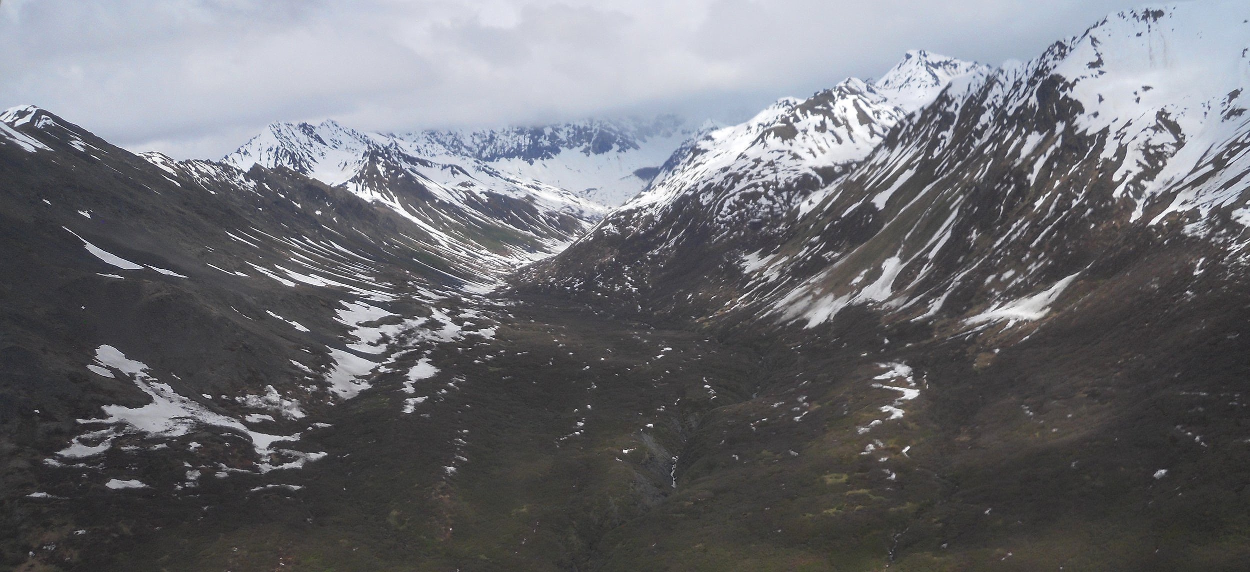
We took off. What an experience. We headed up the west fork of the Yentna River (photo). Glaciers were coming down to the river, and melting snow up high was feeding waterfalls.
As a bonus, the pilot flew us into the Park portion, suggesting we try for a landing on Ruth Glacier (the long stretch of snow/ice). But radio communications with other pilots indicated the snow was too sticky… we could land but we would never be able to get back up. We chose to be sae.


DAY 10 (June 8) - The morning provided this one photo looking east in the Park portion of Katmai (All the Brooks areas are in the Park). Naknek Lake was whipped up by 30 mph East winds, which required all float planes to land at Brooks Lake. Normally planes land at the park’s VC which is on the shore of Naknek. The greenish hue of the water is from glacier melt.
Brooks Lodge consists of many single cabins and one 10-unit building. A main building houses the dining room, kitchen, meeting area, and bar. Each cabin has two bunk beds. I think the rate this year is $960 per night, or $240 per person if you have four people in the room. Save your pennies.
One unique feature is this park can place moose antlers in front of their signs. Won’t see this on the National Mall in D.C.
I am not able to provide any photos of Aniakchak National Monument or Preserve at this time. The other members of the group will share theirs with me in a day or two and I will then post them.


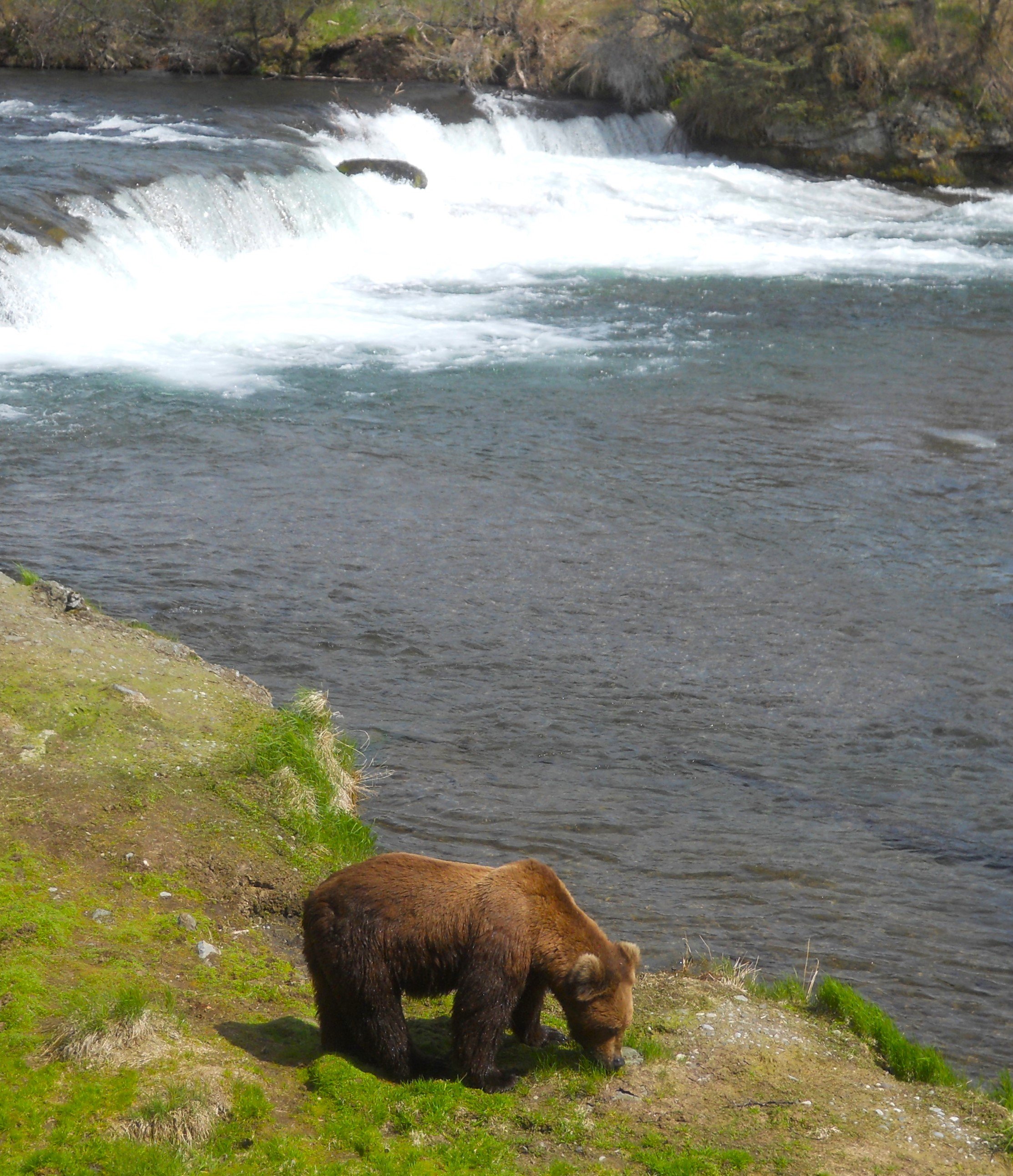
DAY 9 (June 7) - Brooks Lake, Brooks Lodge, Brooks River, and Brooks Falls were the highlights for this day. Though our group might have liked to say the food at the Lodge was the treat for the three-day stay, seeing the requisite Brown Bear at Brooks Falls takes the preverbal cake. One just has to play a waiting game at the Falls, this early in the season. Earlier in the morning after waiting for about 1.5 hours, we left the platform. We heard later that a bear showed up 20 minutes after that. We planned to stay the whole afternoon, after lunch, but within 45 minutes this guy arrived, walking down the center of the river, before coming up the embankment to the platform. I had to yell at three people who had left just two minutes before, so they could quickly walk back to the platform. Everyone should help others in these situations.
As the bear left the upper falls’ platform I “quickly walked” to the lower platform, where one can be within six feet of touching the critters, if you were to lean over the railing. Of course, none of us would do that, right?
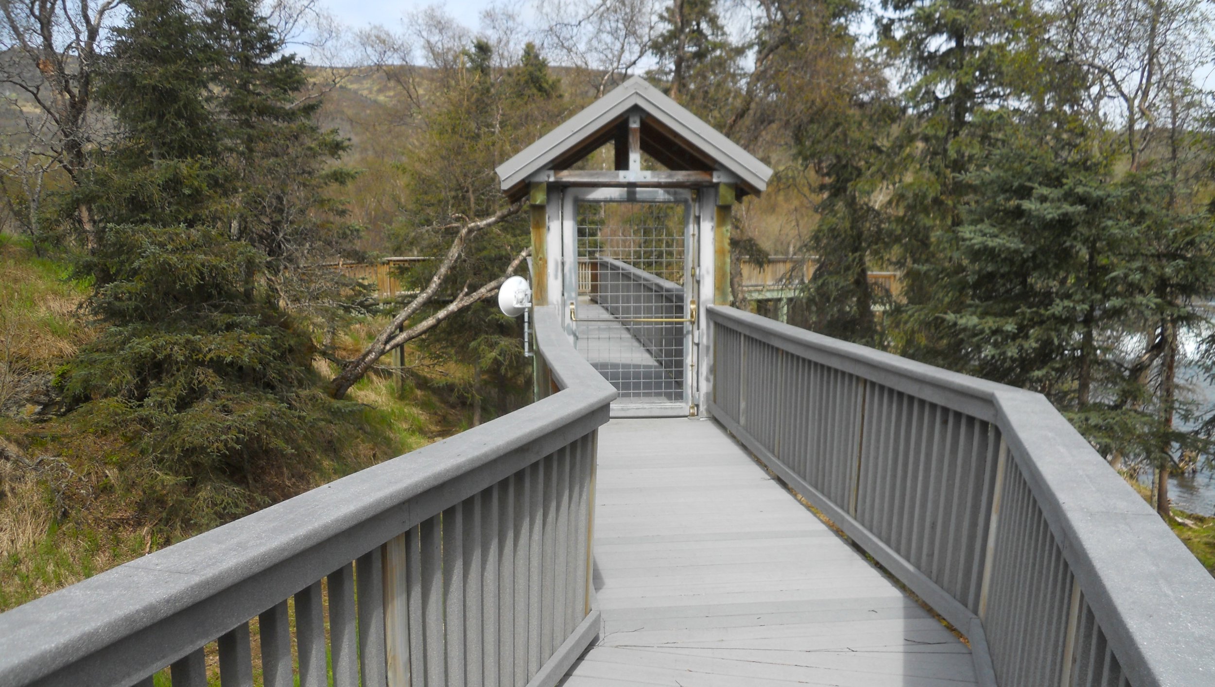
There are multiple gates one has to go through to reach the platform from the trail. it is a 1.6-mile hike from the lodge area to the falls’ platform.
I will explain the positives and negatives of coming to Brooks Falls in June versus July/August over in the Blog.


DAY 8 (June 6) - Alagnak Wild River is out there, and I mean literally out there. Nothing for miles upon miles, just beautiful forests, shorelines, brush, wildlife, and the like.
There are only a couple of locations on the river which can permit a de Havilland Beaver plane (with floats) to land. A tight squeeze for seven passengers.
The river runs from Katmai National Park and Preserve to the Bering Sea. It is reached via float plane from King Salmon (which can be reached via Alaskan Airlines out of Anchorage). The river is one of the “hot spots” in Alaska for fishing. We landed a few hundred yards from one of the fishing camps.
Next stop was Katmai National Preserve. Plenty of tundra around Peanut Lake, which is where we landed. The Preserve was created from the Park in order for a small number of people to hunt.


DAY 6/7 (June 4/5) - The first half of June 4 was visiting some of the mining buildings in Kennecott. The General Store sold canned goods on one side, and clothing items on the other. Campbell’s Soup options included Mock Turtle and Ox Tail. See if you can get today’s kids to eat those flavors. The one cottage was built in 1915. This is what management-level staff lived in. Then, another image of the Mill. The crushers are on the top level, where ore came down on trams from the mine shafts. The concentration efforts were three-fold, after the initial crushing. Ammonia leaching and Flotation were done in the far-left buildings. Two sets of railroad tracks ran between the right and left sections, for the loading of ore to be shipped to Tacoma, WA.
Last, a return drive on the McCarthy Road. Ouch. And ouch again. But we did see a pair of Trumpeter Swans on their nest in a large wetland area next to the road.
Then, today (the 5th), I visited Kenai Fjords National Park. The only part of the park with vehicle-access is Exit Glacier. That is the very white section in between the two mountains. The top of the glacier connects to the Harding Ice Field. After hiking up to viewing locations of the glacier, one can look back on the valley where the waters flow out to the Gulf of Alaska. If you like snow covered mountains, this is the state to visit. It is Colorado on steroids. One of the trails to the glacier viewing spots has signs showing where Exit Glacier ended in the past. The glacier is a mere fraction of its previous glory. Even after 8 years (I visited in 2015), I could tell the glacier has retreated.
No Daily Trip Report or Blog for the next three days, if not more. I am heading out into the wilds.


DAY 5 (June 3) - Wrangell - St Elias NP and NPres is the largest combined park in the National Park System, over 13.2 million acres of glaciers, mountains, forests, etc.. Kennecott is an historic mining town started just after 1900. By 1911 a railroad line arrived from Cordova, allowing massive operations to dig for copper and silver. By 1938 the place was deserted due to the price of copper going through the floor, and all the good ore having been mined. Today, tourism keeps this small town, and its neighbor, McCarthy, in business. A main feature is the Concentration Mill (photo), where the ore ended its journey, from the mountainside mines, to be processed.
Root Glacier is one of the most popular hikes in this part of the park. With the sun doing its magic of heating the ice surface there was enough traction to walk up the glacier without the use of crampons. It seemed like another world on top of a sea of white. The other side of the valley has the Kennecott Glacier, covered in a few feet of gravel. A long string of mountains is a great backdrop.
The McCarthy road is famous in Alaska, the one vehicle path to Kennecott off Alaska route 4. Rental car companies forbid you to take their cars on the road… and from today’s adventure, I see why.


DAY 4 (June 2) - Yesterday was a travel day, between Juneau and Anchorage. Today was Lake Clark National Park and Preserve; two separate units thanks to Congress. This combination is one big tract of land, around 4 million acres. The tallest/largest active volcano in the park might have been spitting steam, but there was so much snow on its summit, no one could tell from the plane. There is one “settlement” which most folks fly into, that being Port Alsworth. From there, the easiest means to reach the Park portion is to take the Tanalian Falls Trail, from the airstrip to the falls and Kontrashibuna Lake. The first part of the hike goes through the Preserve portion. With the additional distance to get from the Lake & Pen building (airline) to get to the trailhead, this was a 6.5-mile hike. I passed the lone food truck in the town. Since airplanes are so value-added to the community, the diner gives preferred parking spots to those craft.
I met Carl at the park’s VC. He is another member of the National Park Travelers Club. The hike was uneventful. The falls seemed to be working overtime, with plenty of flow. Most of the park never sees a human. The one photo (from the plane) shows a part of the massive mountain range which runs through the park, still with plenty of snow.


DAY 3 (May 31) - The town of Sitka is lovely. Even with 5,000 cruise ship visitors who were wandering the streets today. Many toured the National Park site on the east end of the historic downtown. Ranger Tim met me as I entered the VC. He had already voiced plenty of “Hellos”. My impression is that most folks come to view the beautiful Tlingit and Haida totem poles which are located around the park, with some preserved in the VC. But the main purpose for this NHP is to honor the Battle of Sitka. The Tlingit had lived here for centuries, but Russia claimed the territory in 1741. In 1802, the Tlingit in this area forced out the Russians. Two years later, the Russians returned, and in force. A great battle was fought on the land which the park encompasses. The fort the Tlingit had built was no match. Though the Russians moved back in, tensions continued until 1867, when Russia sold Alaska to the United States. A clearing in the forest along with a tall totem mark the location of the fort.
I had the pleasure to meet Tommy Joseph, one of five master Tlingit carvers. He has been creating totem poles for over 50 years, and continues to use traditional Tlingit tools to make these masterpieces. A major project now is to duplicate the red cedar totem in yellow cedar wood. The NPS was not able to obtain a red cedar log of sufficient dimensions. This specific totem is meant to mean “twins”, which requires two poles. He and his team hope to have the new totem done in four months. A work shelter is behind the VC, allowing visitors to watch Tommy at work.
There are three main trails in the park, with one being the Totem Trail. Many totems line the trail.
The Park Service also owns the Russian Bishop House. This was the Russian Orthodox “outpost”, being so far from the motherland of Russia. It is one of the only four remaining buildings still standing from the Russian Colonization of the Americas from 250 years ago. Many of the articles in the building are original, such as the furniture and tea service in the parlor (painting of Czar Alexander II is on the wall).


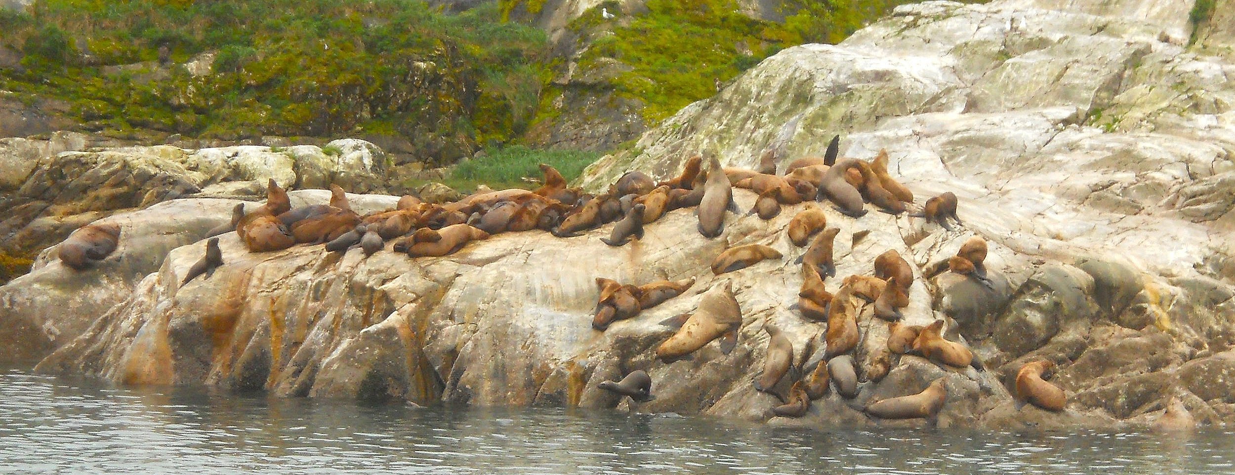
DAY 2 (May 30) - Glacier Bay NP can be the “poster boy” for wild Alaska. Countless Stellar Sea Lions call the rocks of South Marble Island their home. Ranger Jen said most of these guys are bachelors. A few Sea Otters were among the crowd, but most of those cute mammals were lounging out in open water, on their backs. A few immature Bald Eagles were resting in one of the trees on one of the rocks. At the end of Glacier Bay, a section called Tarr Inlet, the huge Margerie Glacier (200-feet tall cliff) was slowly moving towards the water. Jen said it propels itself at about 5 to 7 feet a day. Calving at the end of the glacier will happen unexpectedly. We did not see any pieces break off. But, after we turned around and started southward, we came across ten Orcas. Four were to starboard while the other six were to port and stern. By the way, I also saw four Humpback Whales (there were two other sightings, but I did not see those), five Brown Bears (aka Grizzlies), two Mountain Goats, Tufted Puffins, and many other bird species. The 25 passengers on the two-hull catamaran had a wonderful day. And to think that just 300 years ago the entire Glacier Bay was solid ice, one gigantic glacier.
In July-2001, Snow, a known female humpback since 1975, died after being hit by a cruise ship propeller. The NPS cleaned her bones and placed her at the Barlett Cove boat dock so she can teach all of us about the majesty of her species.


DAY 1 (May 29) - Klondike Gold Rush NHP is one of the NPS parks with multiple sites. That is why it is a NHP and not a NHS. Skagway is the home-base for the Alaska sites of this park. Thousands of people were in town today, due to four gigantic cruise ships. The folks were here to learn the history of the gold rush to the Klondike River. Nearly 100,000 middle-class men, and a few women, tried to climb from the ocean shorelines to the summit of White Pass, to seek gold. Treasure hunters who were rich, instead took comfortable ferry boats up the Yukon River. About 30,000 made it over the pass and into Canada, only to learn the gold fields in Dawson were still over 500 miles away. The rush lasted just two years, and only a handful of men became rich. The completion of the White Pass and Yukon RR eliminated the hell of climbing the Chilkoot and White Pass trails. Today, most tourists take the White Pass and Yukon RR train ride on one of the most scenic excursions you can experience.
Most of historic Skagway is within the Klondike Gold Rush NHP boundaries. Since most of the buildings were constructed around 1897-1899, they are pretty much original. The initial White Pass and Yukon RR depot (photo of two buildings) is now the park’s VC and museum.


