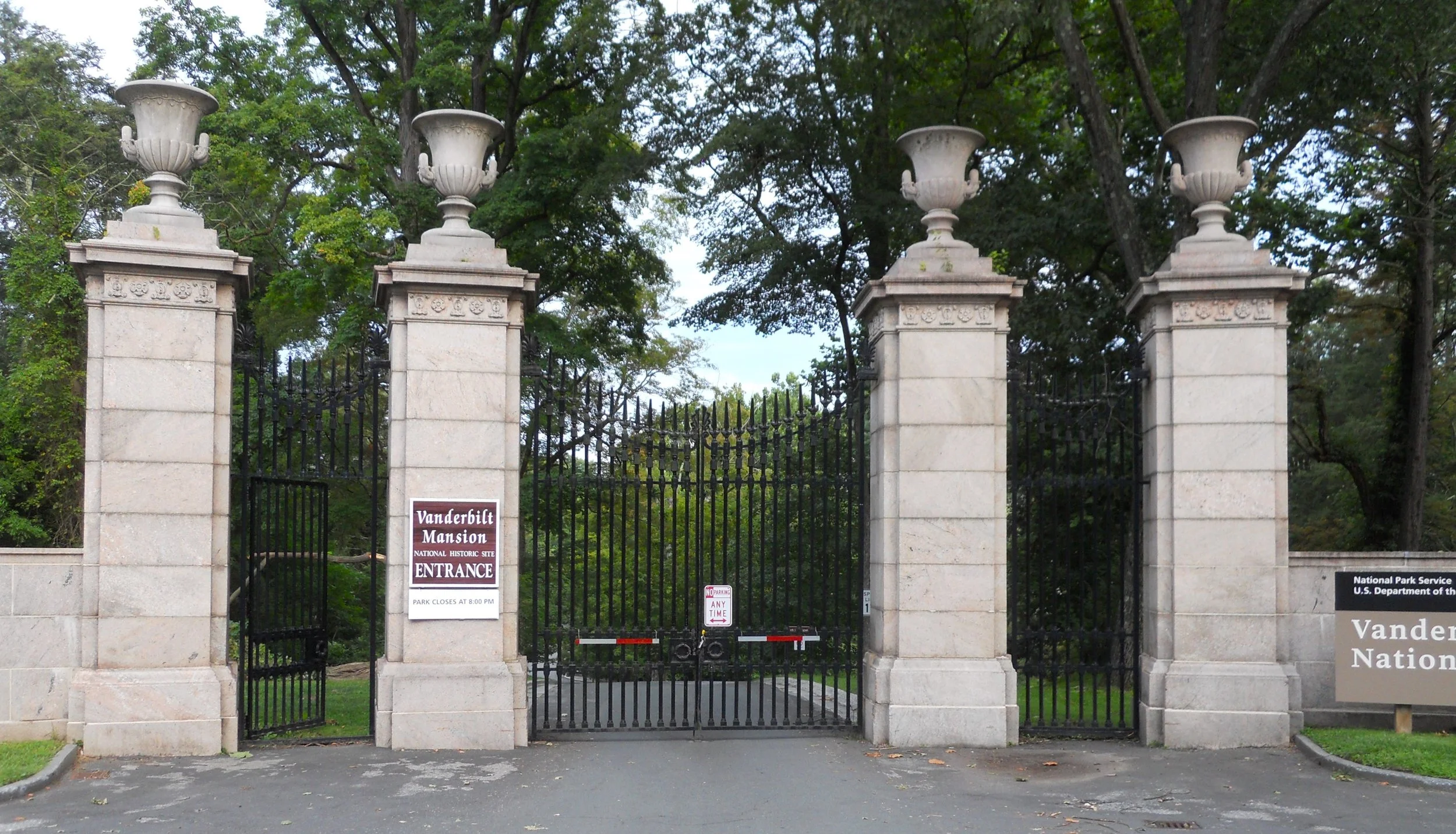
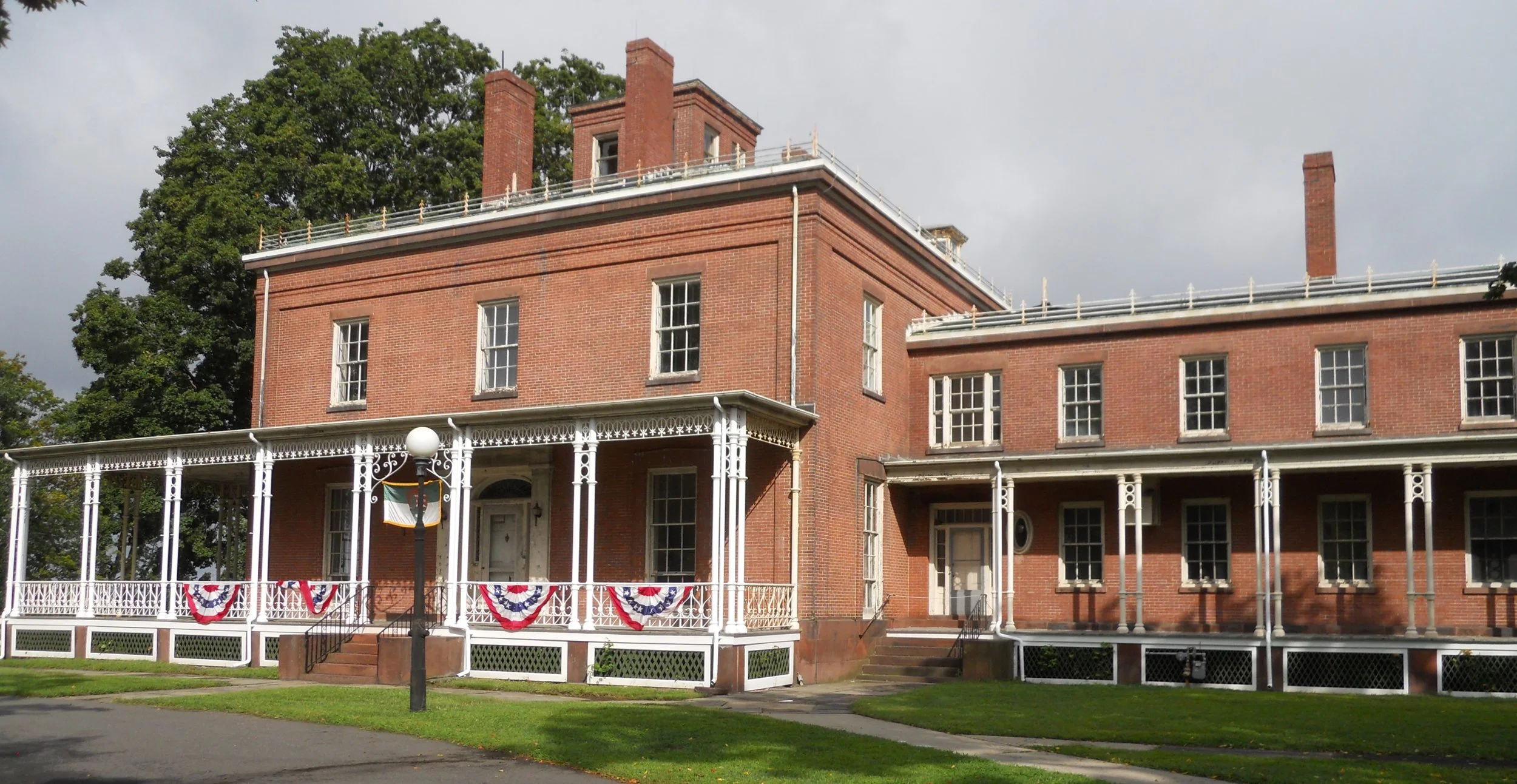
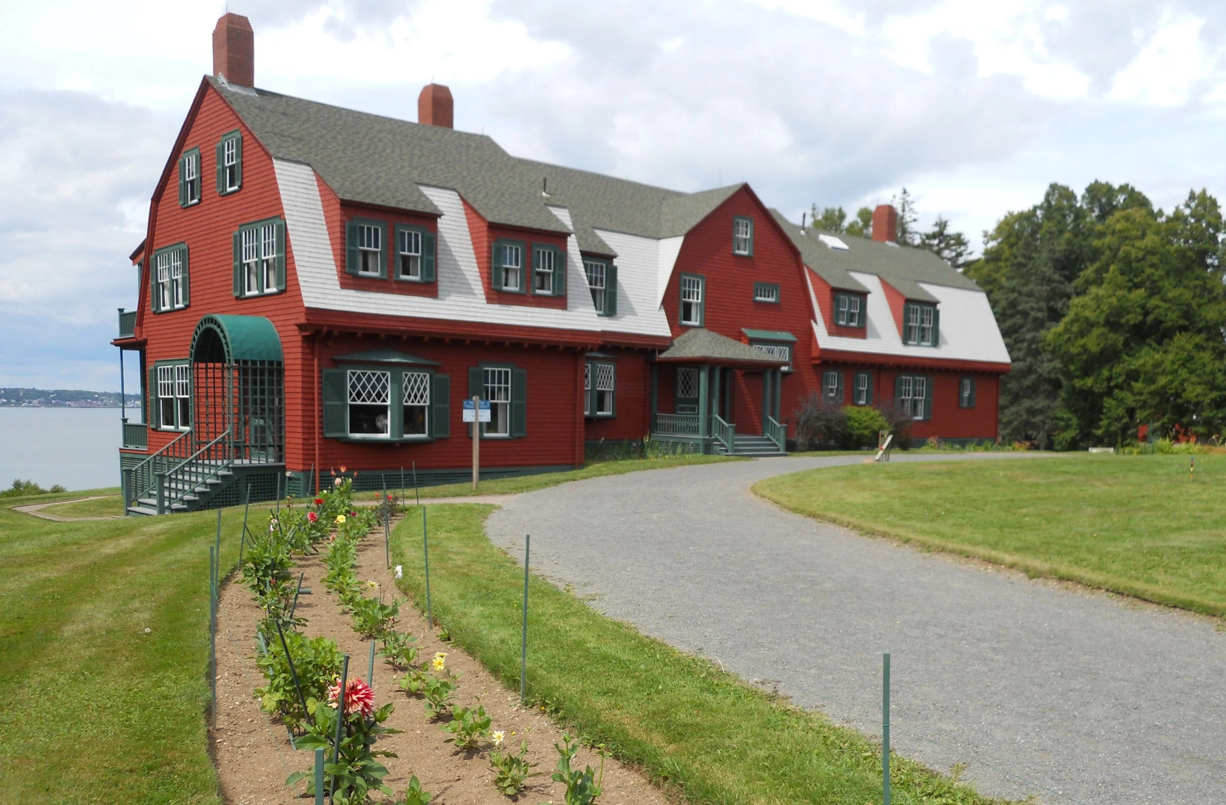
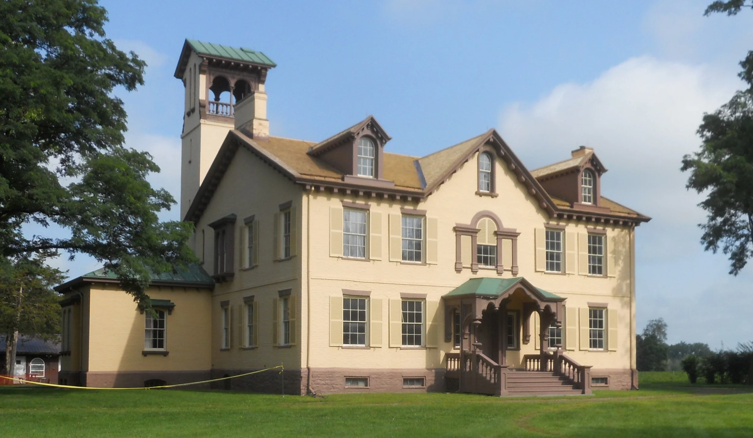
DAY 11 (August 14) - Vanderbilt Mansion NHS is one big house. It has 54 rooms, designed by the preeminent firm McKim, Mead, and White. Built between 1896 and 1899 (originally on 600 acres… today the park is 200 acres), this is opulence at its highest level. Frederick and Louise Vanderbilt used the property as a vacation home. Frederick died in 1938, leaving the estate to a niece, who in 1940 donated the grounds and residence to the NPS. And if the four-pillar driveway entry does not hint at the extravagance waiting a visitor, the size and decoration of the Coach House will. The structure must have been a “30-Carriage” garage.
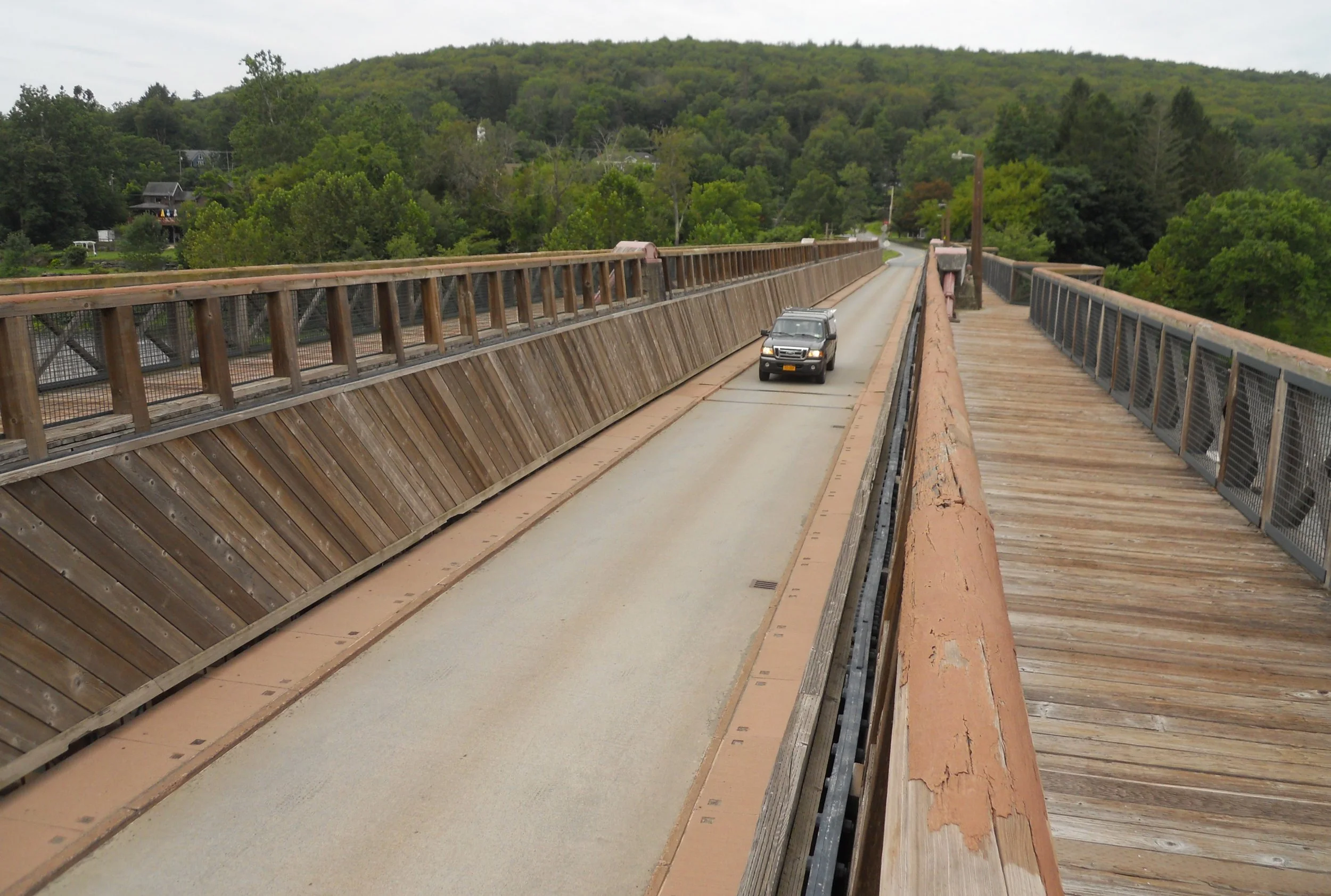
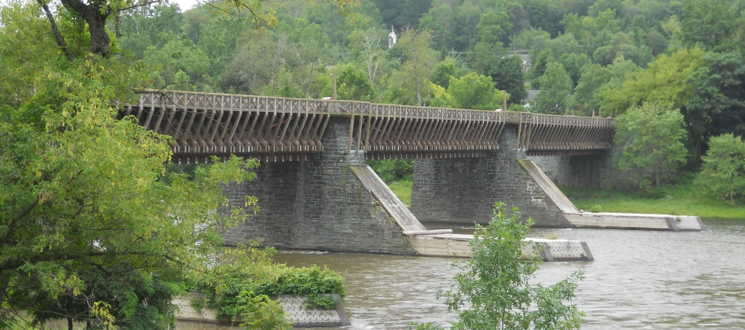
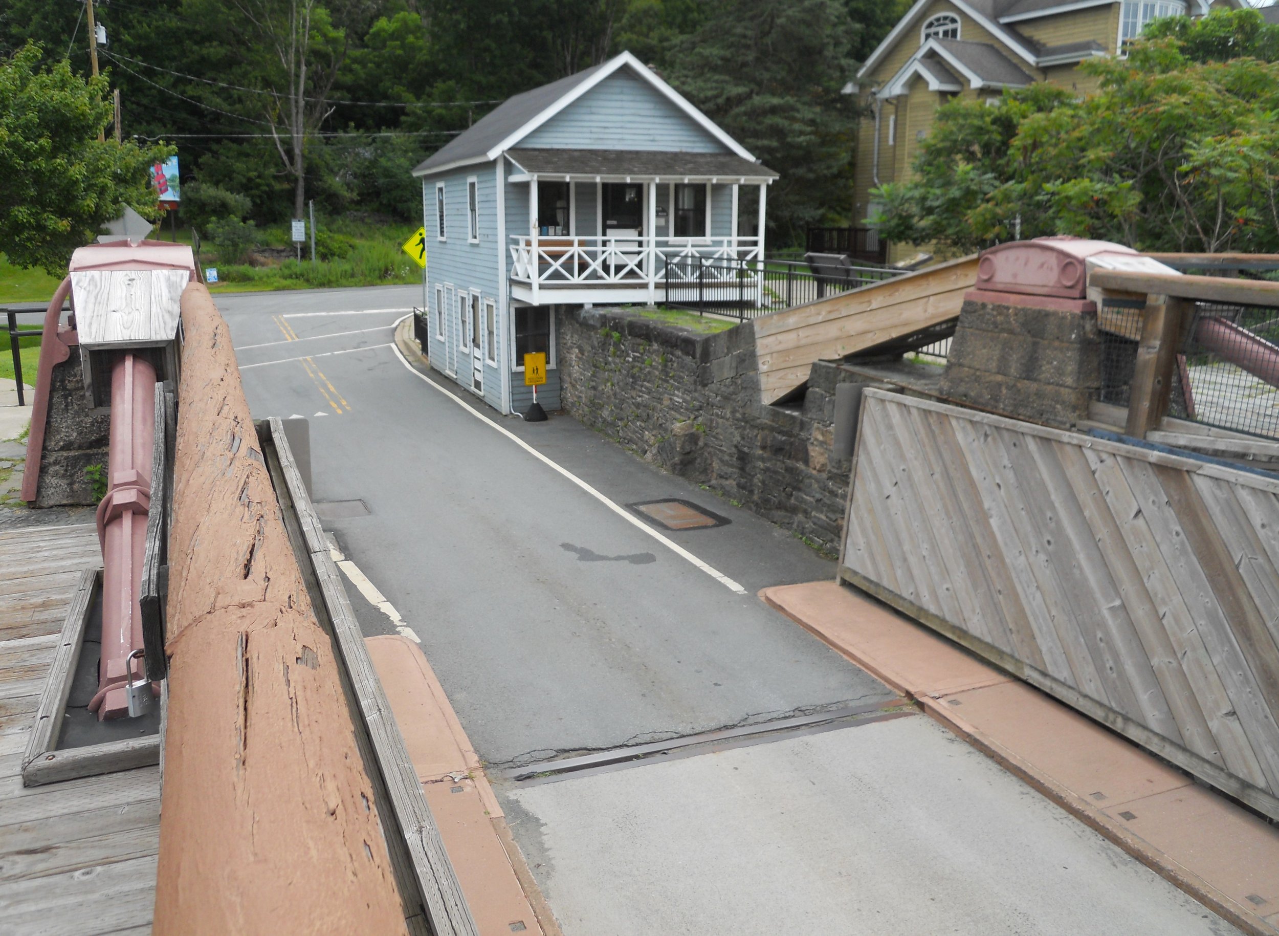
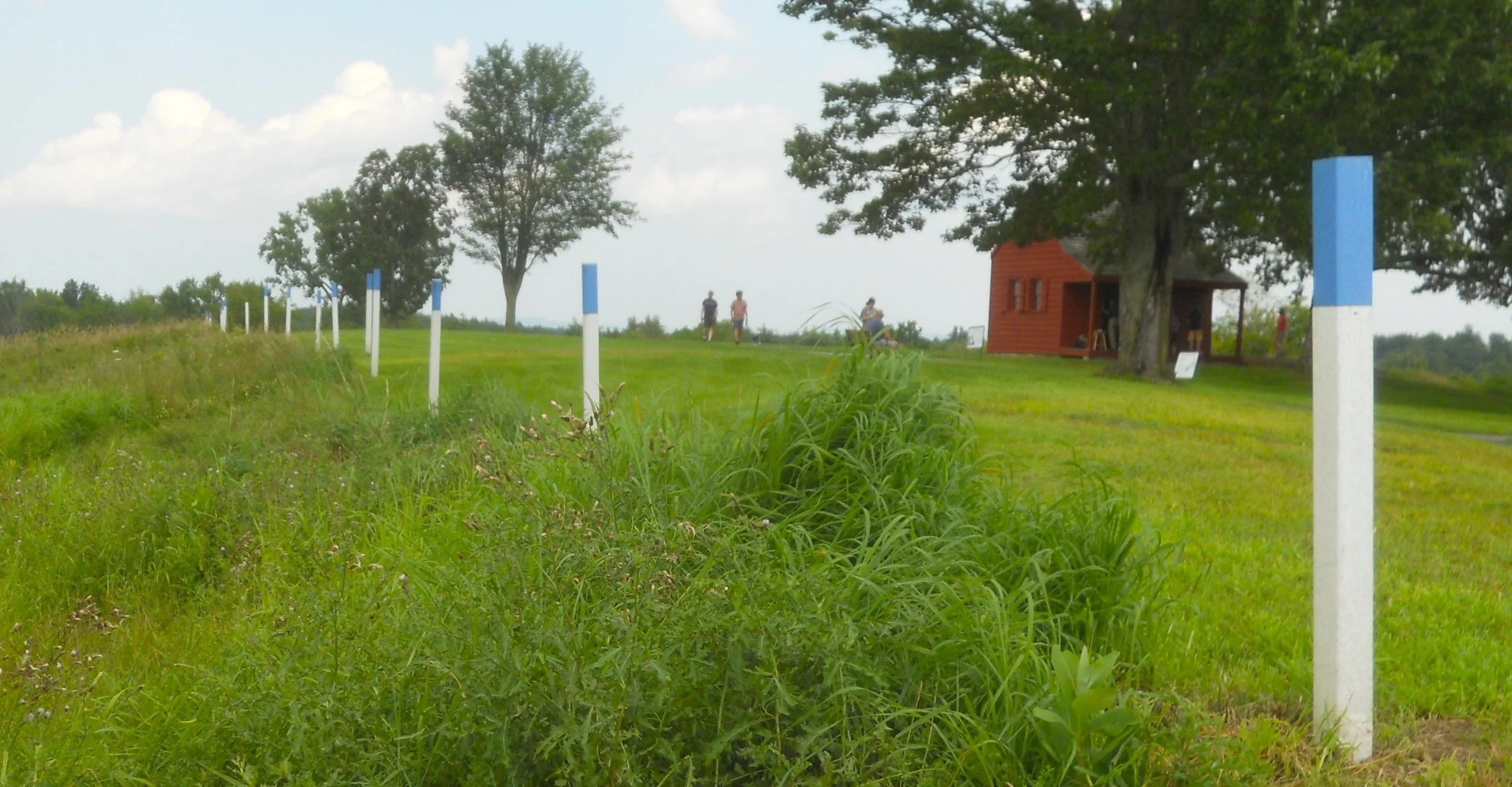
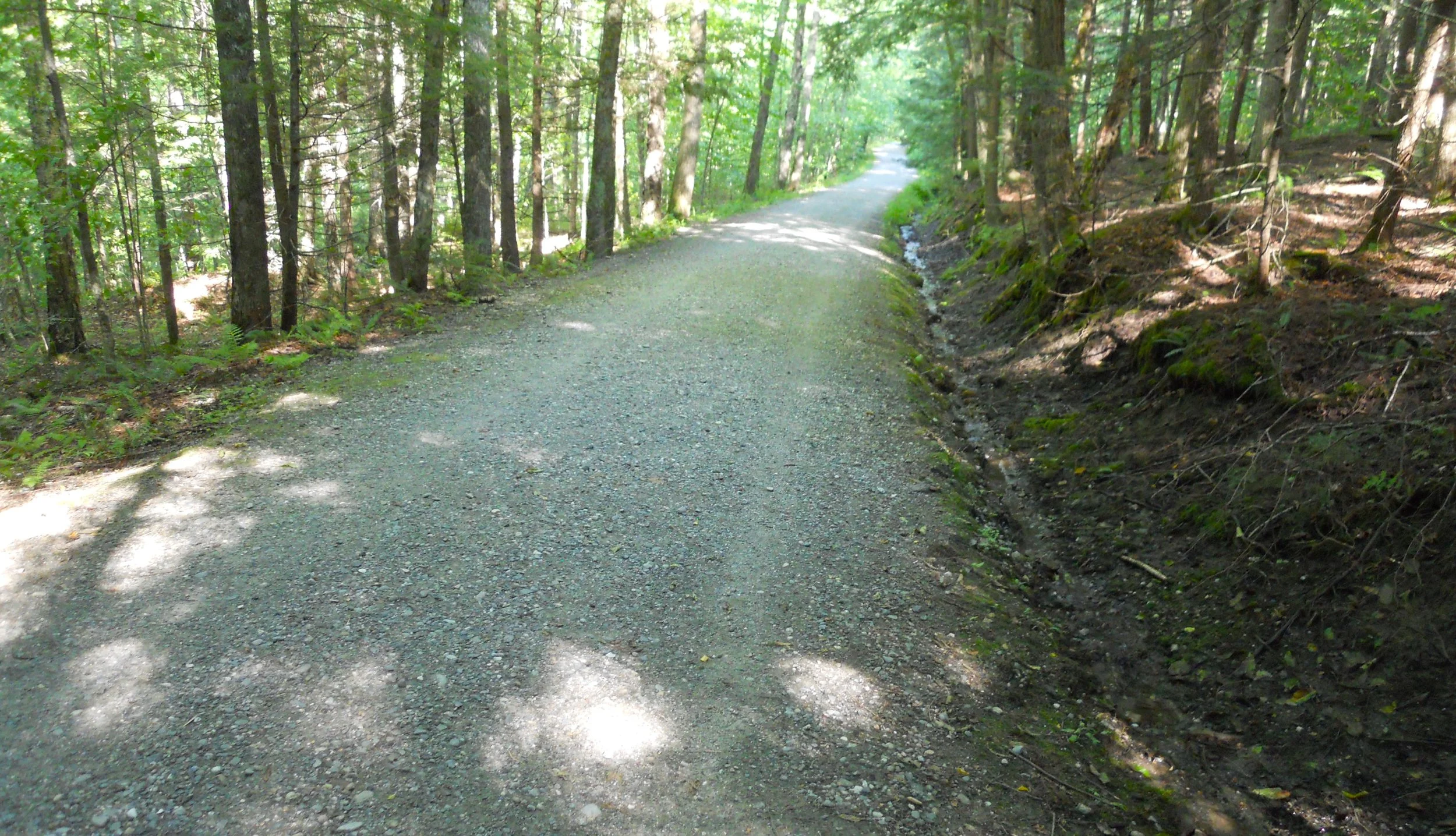
Upper Delaware Scenic and Recreational River is part of the longest undammed river in the eastern United States. The first photo shows the river next to the old D&H (Delaware and Hudson) Canal and todays bike/hike trail. One of the stops near the southern end of the park is Corwin Farm. In the center is the famous Roebling Bridge, part of the Delaware Aqueduct. The bridge has been converted to allow for modern vehicles. The blue toll house (on the NY side of the river) can be toured. The Zane Grey home is part of the park and can be toured, when open. Grey lived her from 1905 to 1918.
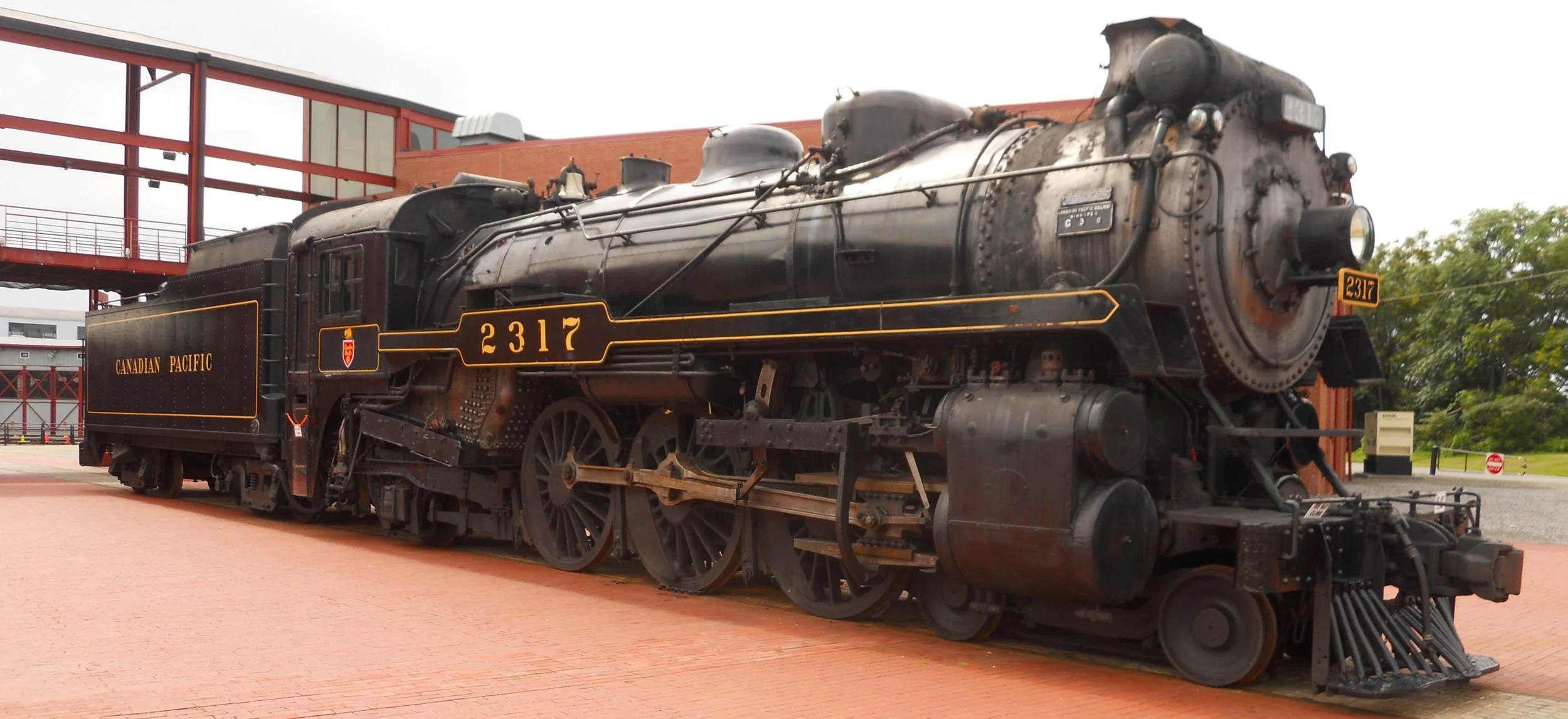
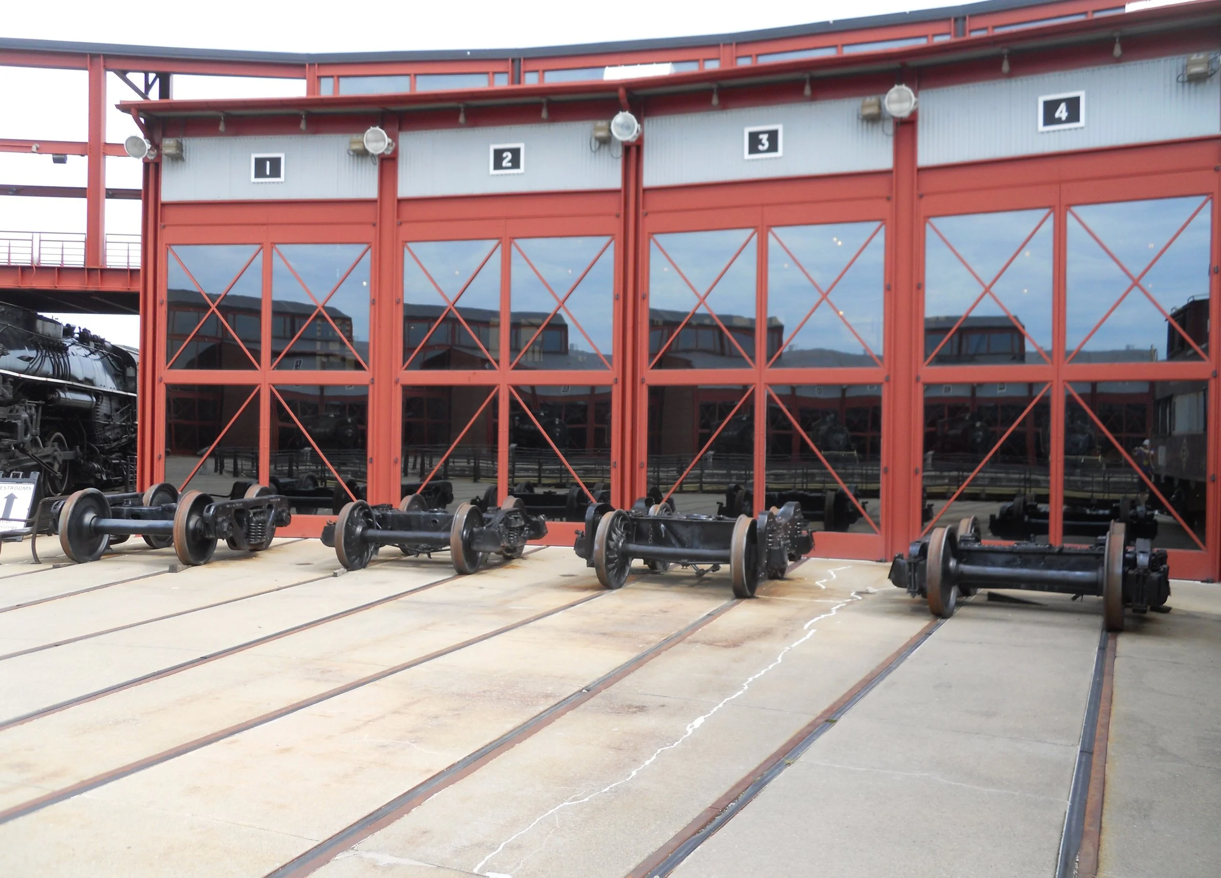
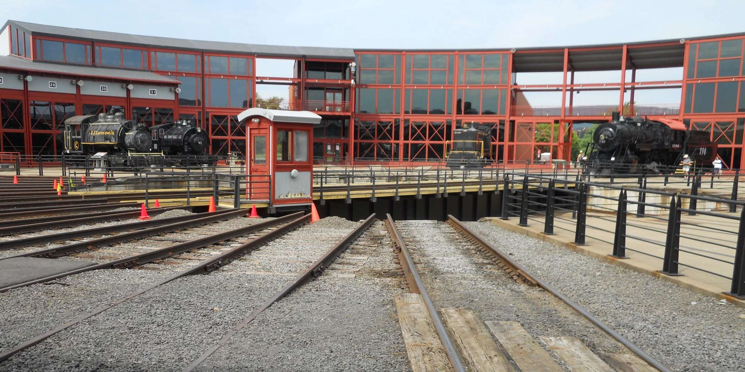
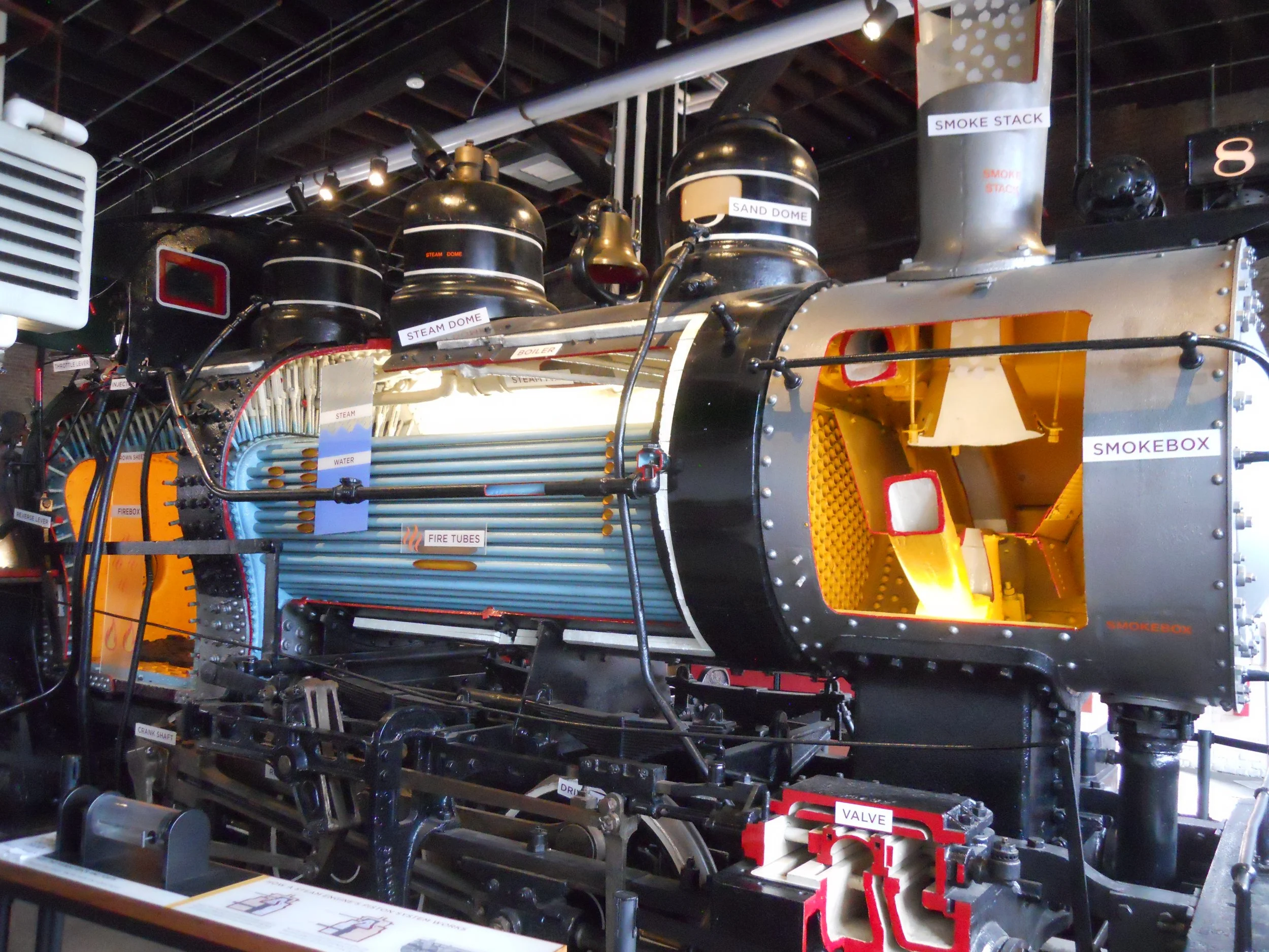
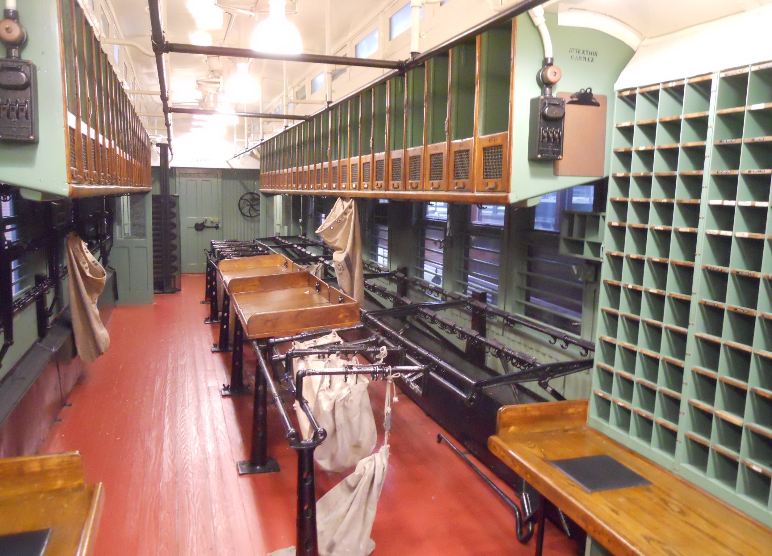
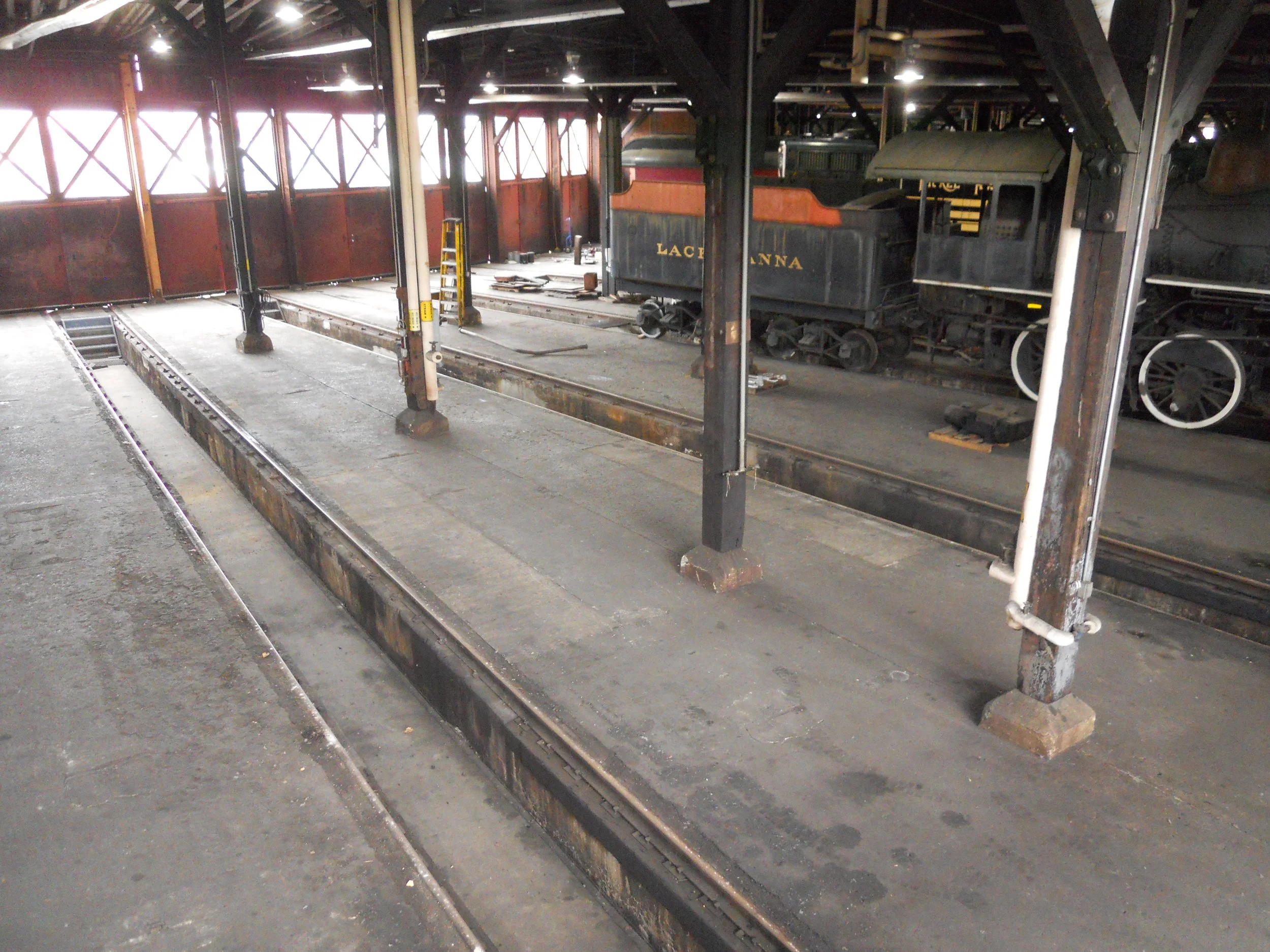
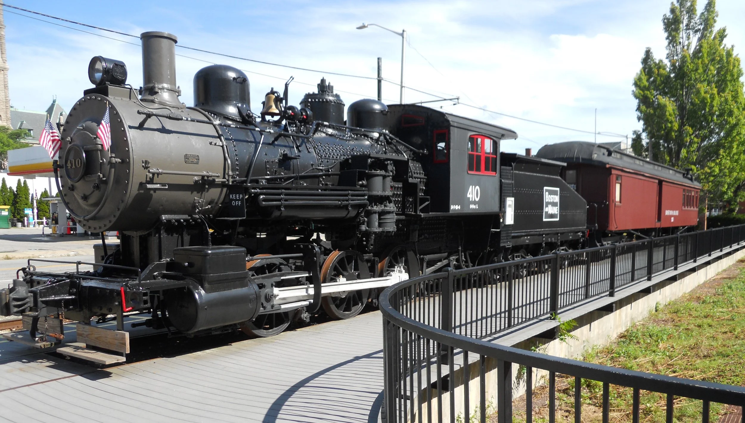
Steamtown NHS is a railroad enthusiast’s dream museum. The park’s operational 90-foot Turntable and associated Roundhouse are the center pieces of the experience. There are plenty of trains, including the 1923 Canadian Pacific’s #2317, a 4-6-2 design, built by the Montreal Locomotive Works. It was used to pull Pullman Cars. Today, it is one of the park’s excursion engines (running on TH/FR/SA/SU). The Technology Museum has a cut-away of a steam locomotive so visitors can see each of the parts involved in its operation. The History Museum includes a USPS car. How would like to have sorted mail while swaying back and forth on a moving train? The Roundhouse has channels cut in the concrete bed so workers can get under an engine… those things weigh more than a car, so using a hydraulic lift like at a Goodyear store is not feasible.

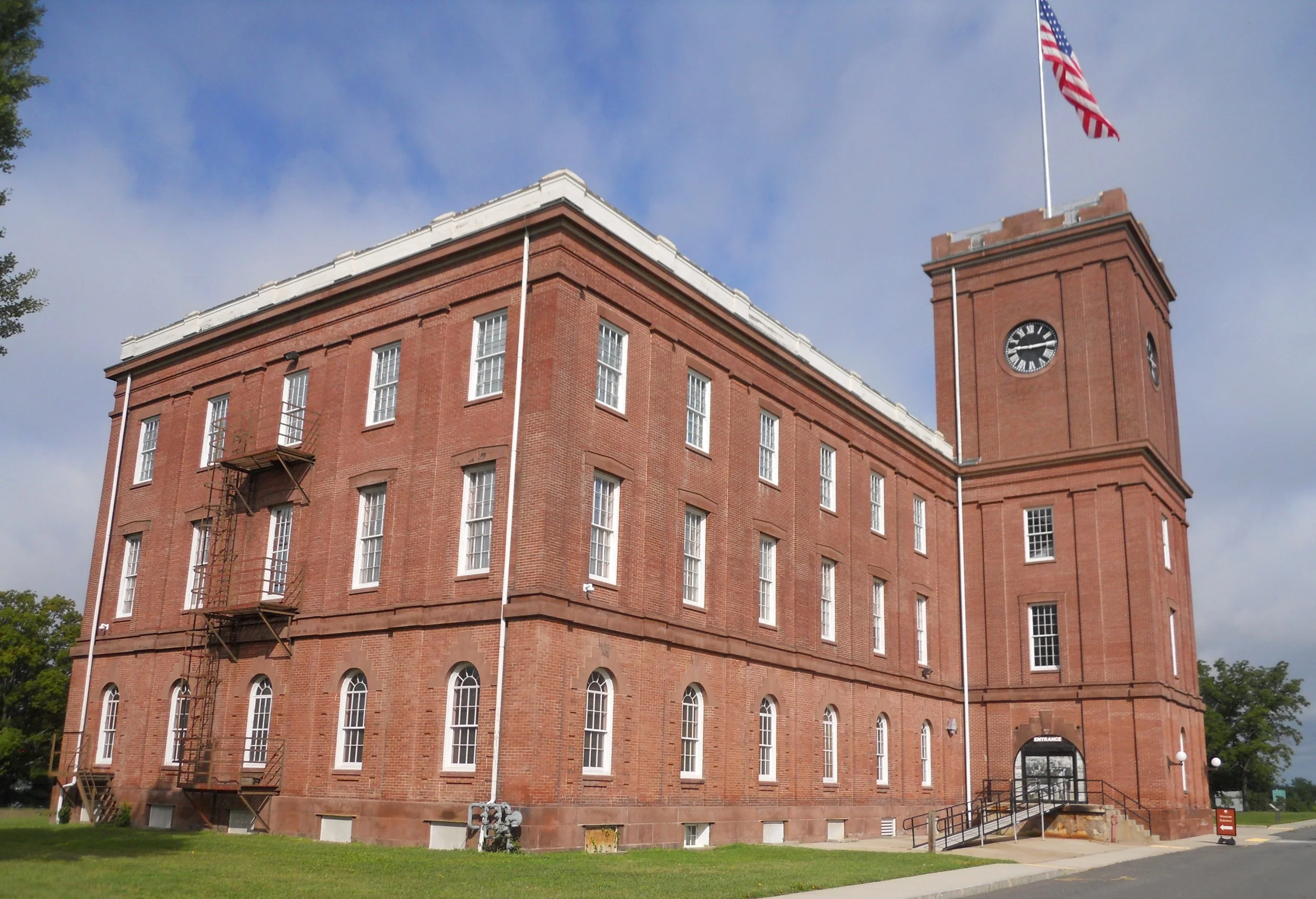
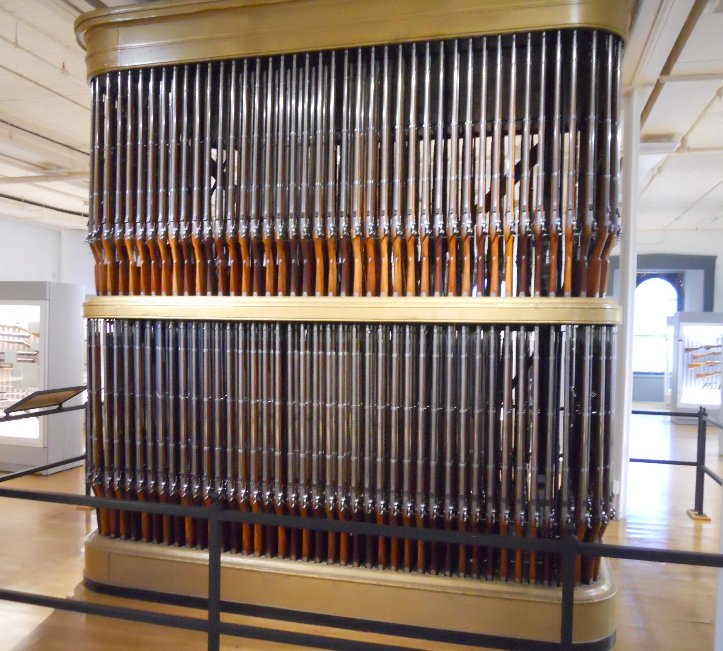
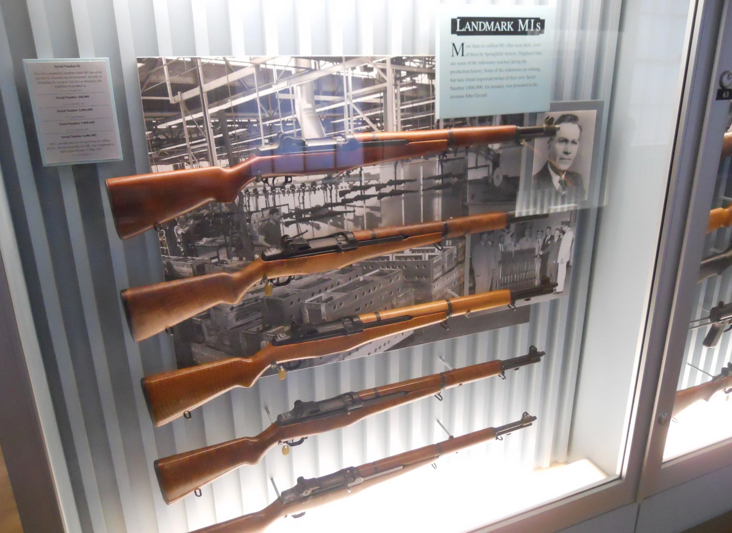
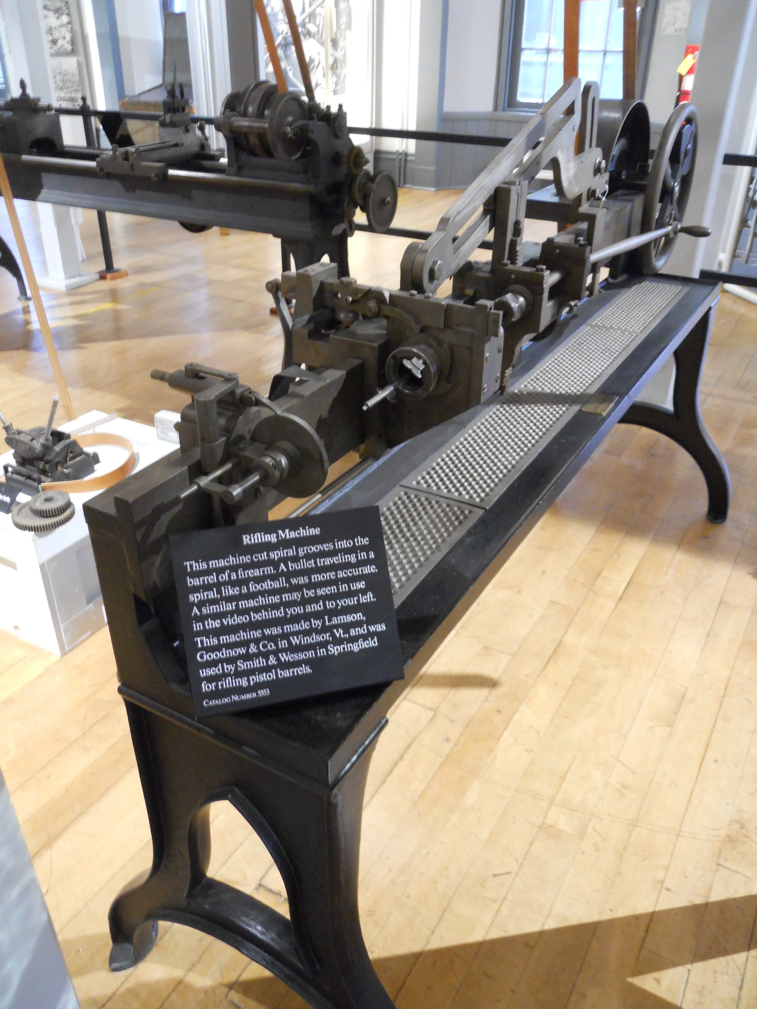
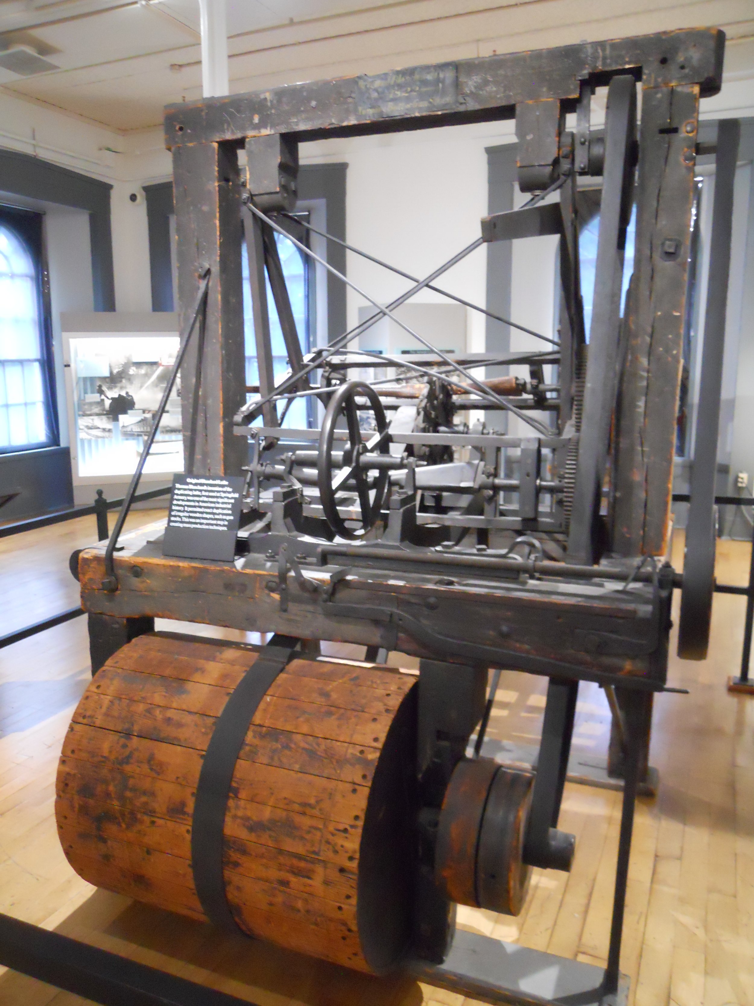
DAY 10 (August 13) - Springfield Armor NHS is down the street from the Basketball Hall of Fame. But I stayed in the park. The main building from the armory’s 174 years of operations is now the VC and museum. And if you want to see what came out of this factory complex by the tens of thousands, the museum has examples, from muskets to breechloaders, to repeaters, to the M1 and M14 (the last production small arms model), and the M60 machine gun. This complex was the first Federal armory. One of the more fascinating displays in the museum is the Organ of Muskets. Model 1861 guns are in the “organ”, which can hold up to 1,100 rifles. Equipment used to make the various rifles over the decades can be viewed, such as the Rifling Machine which cuts spiral grooves into the barrel of a firearm. An original Blanchard Lathe is on the floor. This machine was able to duplicate irregularly shaped wooden pieces quickly, significantly increasing the speed of making rifles. The highest volume model made here was the M1, with over 6 million rifles sent to military units. The last production unit is at the bottom of the photo, made in May-1957. Thirty-four commanding officers lived in the “mansion” over the course of the 174 years.
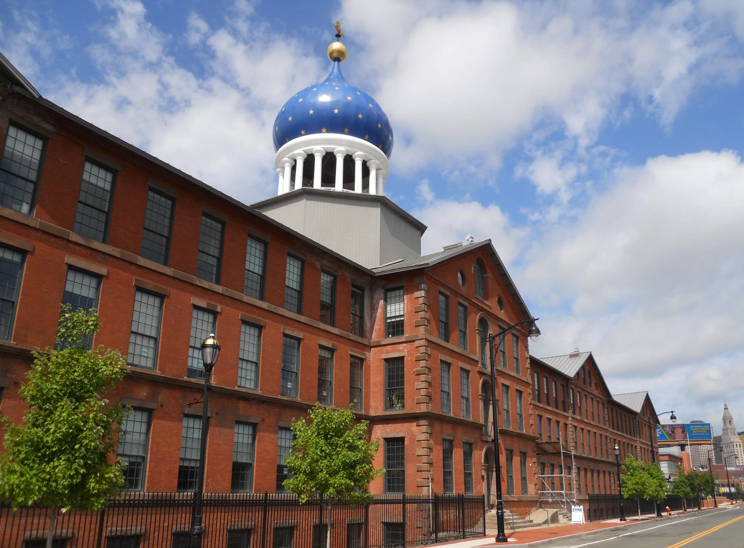
Speaking of guns, I stopped at the authorized Coltsville NHP in Hartford, CT, where Colt had its original factory. The park is not yet established, so is not in the official count of 425, but one day it will be (that is the reason I visited, just in case it happens in 2023). The Blue Onion Dome sits on top of the old East Armory. This has been seen on Hartford’s skyline since 1855.
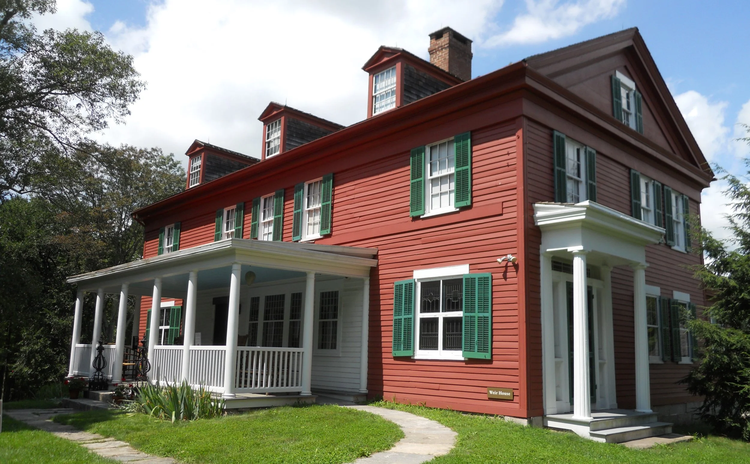
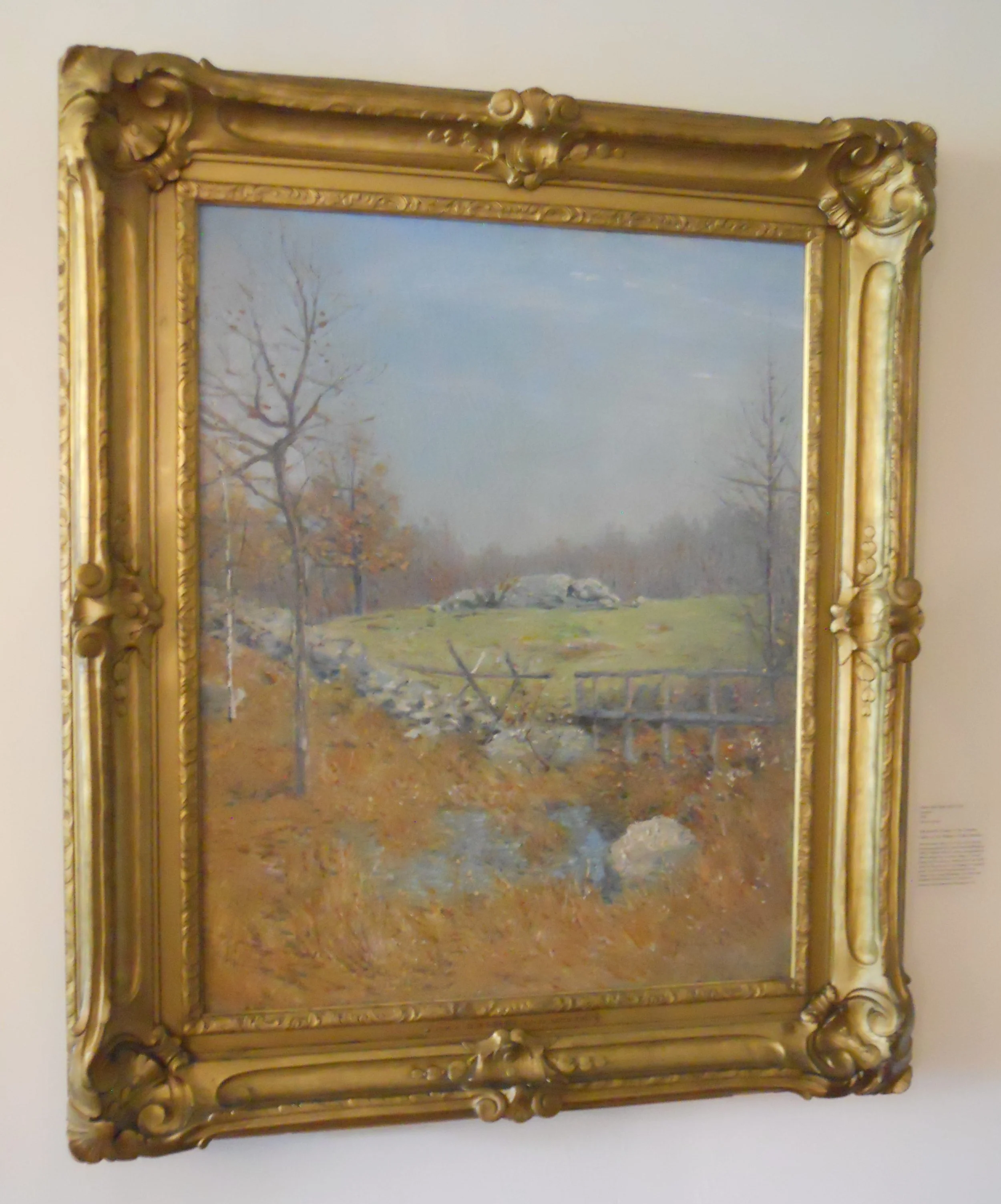
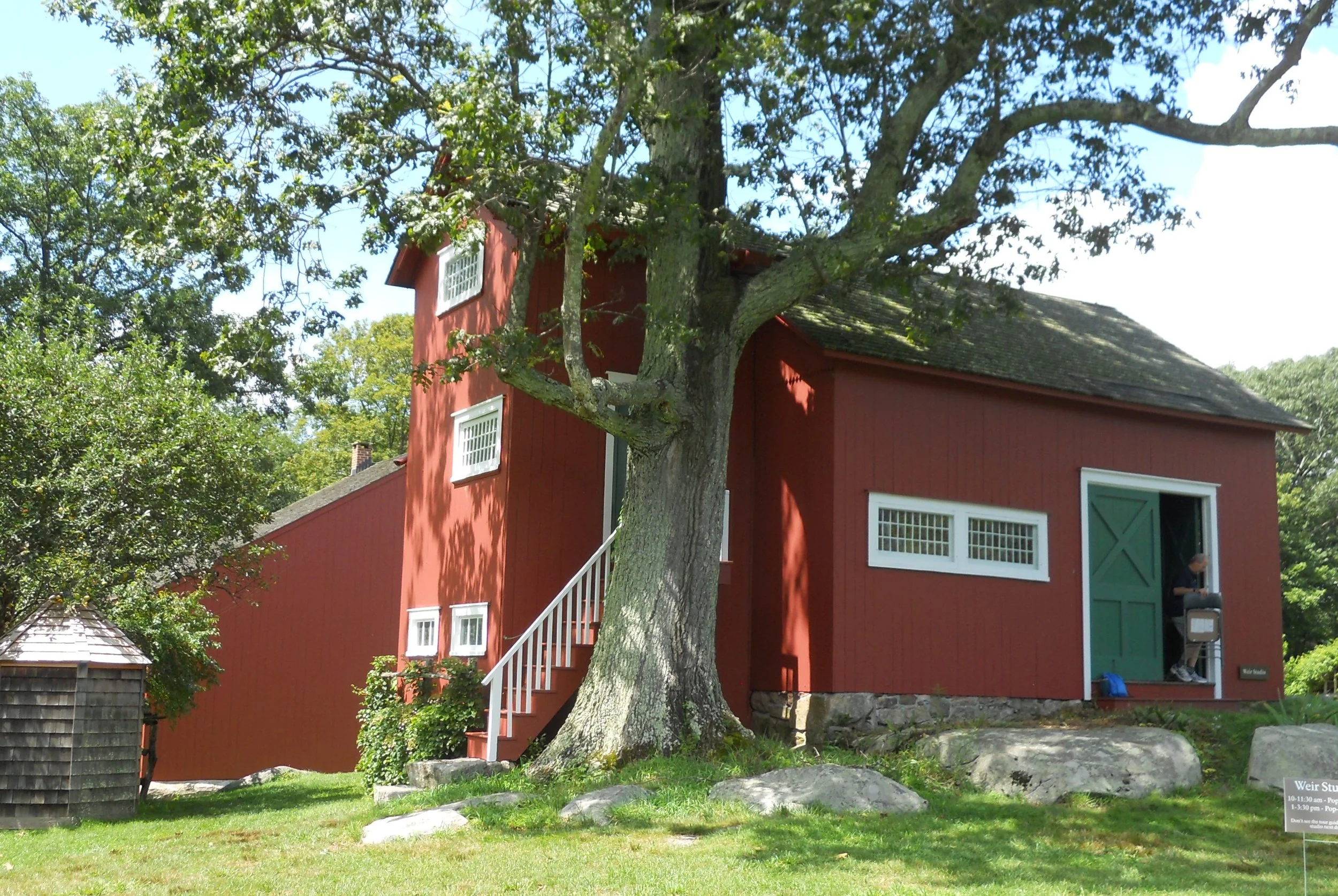
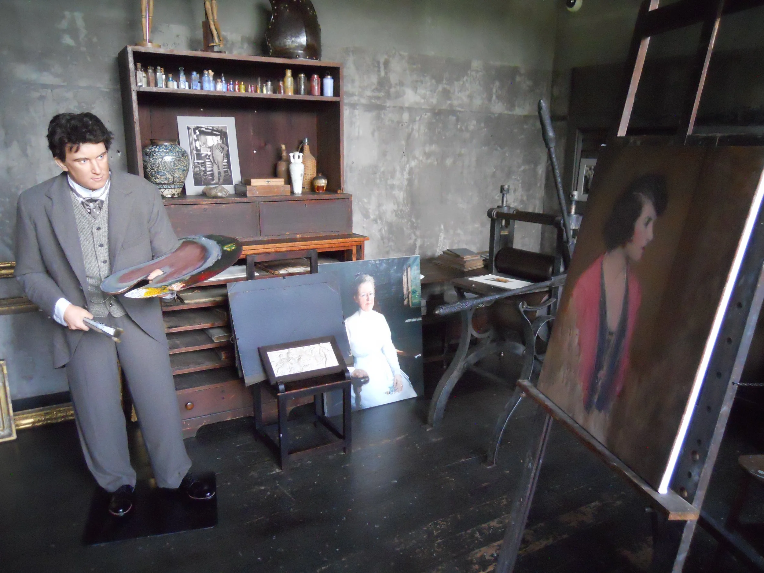
Weir Farm NHP is situated in the lovely, relaxing countryside of western Connecticut. This is what drew J. Alden Wier to the site. He need inspiration for his impressionist paintings. Three generations of artists resided on this property. The first floor of Weir’s home is open for tours. One of Weir’s paintings, Autumn, is hanging on one wall.
Behind the house are two studios. A staff member was welcoming visitors to the one closest to me. Inside seemed like a kid’s playland with all kinds of paint and paint supplies.
The VC has a great quote. “A young man came to me once and said he couldn’t sell anything. I told him to throw away his brushes, go out in the country, and paint with a stick.” Might be useful advice for many aspects of life.
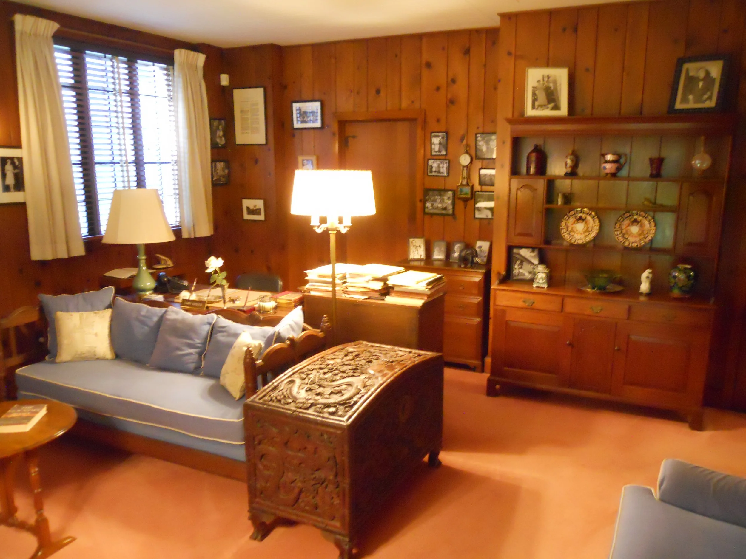
Val-Kill was the home of Eleanor Roosevelt. It was built in 1926. Eleanor stayed here whenever Franklin was not in Hyde Park, such as during his four terms as President when he lived in the White House. She died in 1962, with the property being bought by commercial developers in 1970. Public outcry was so severe that an effort was started to preserve the property, allowing the NPS to buy the land, followed by the site being designated a National Historic Site in 1977.
One must drive across the Pond Bridge to access Val-Kill and the adjacent Stone Cottage. Eleanor’s office area for the last decade of her life is on the first floor. The property doubled as the family’s outdoor playground. The in-ground pool at Stone Cottage was the first addition for physical activities (tennis courts are on the other side of the building). There are still people in the neighborhood who worked with and knew Eleanor, including a 103-years-old woman who will come to the park to talk with the staff.
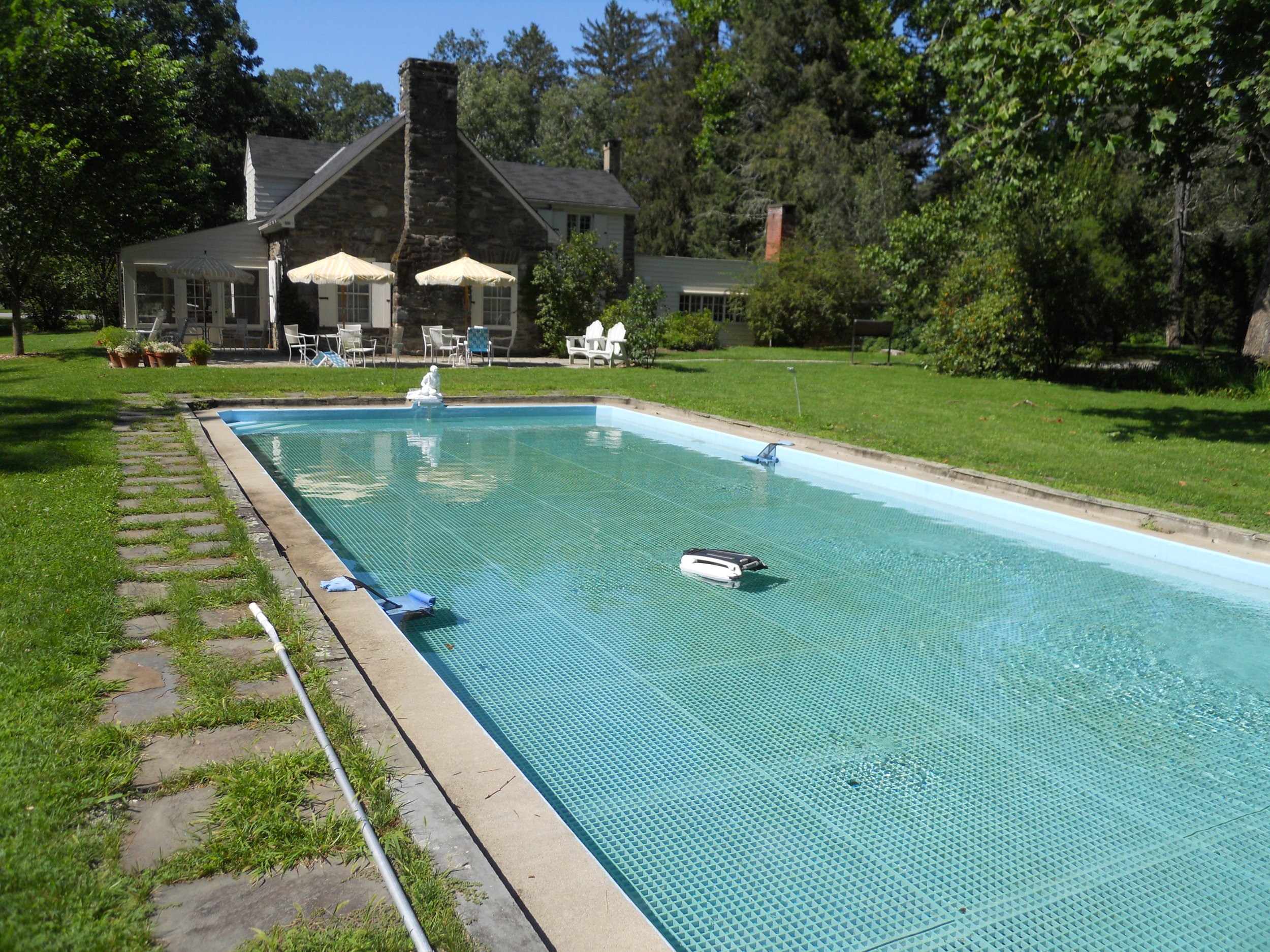
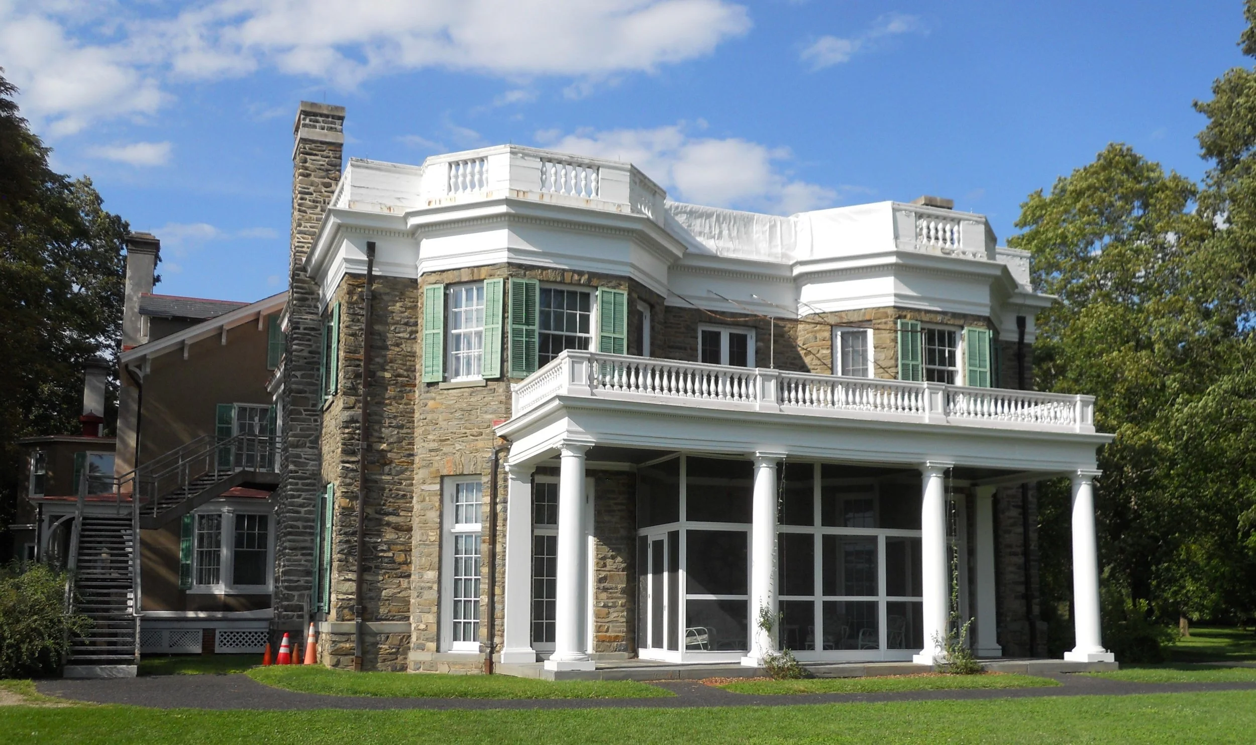
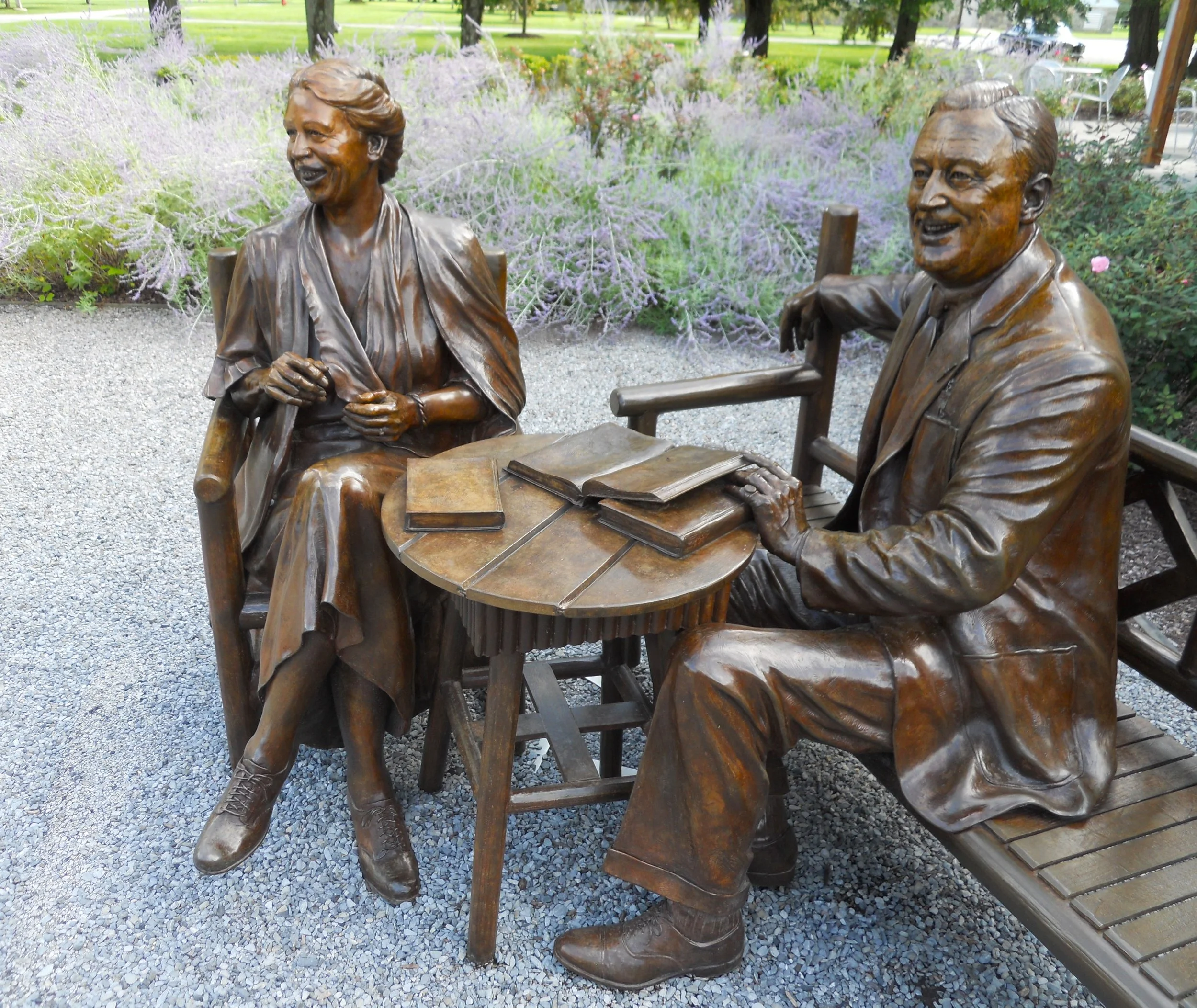
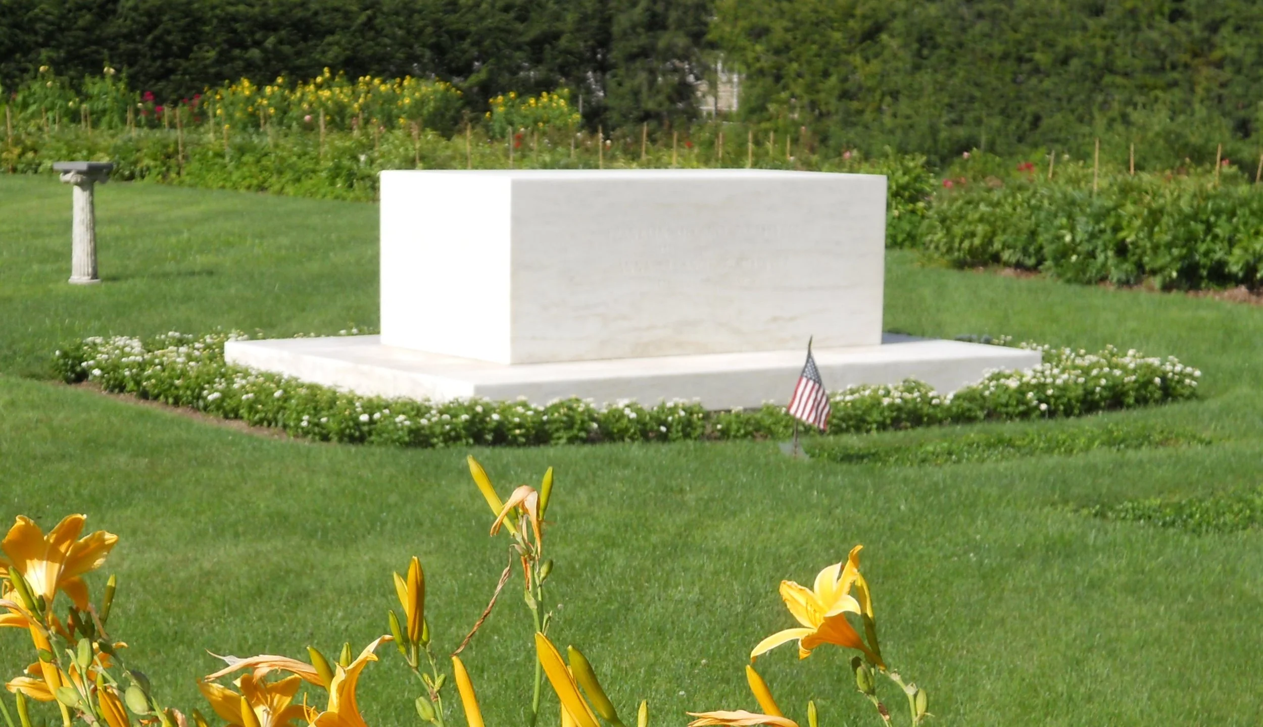
A few miles down the road is FDR’s home, Springwood. His father, James, had bought the property in 1866 for about $40,000. The estate covered roughly one square mile. FDR was born in the house, in 1882. He and Eleanor are buried here. A sculpture of the two seated, both smiling, is near the house. Even though his father died early, in 1900, his mother lived until 1941. This was her house, and she allowed FDR and the grandchildren to live here. Eventually, in 1938, FDR built his own home, Top Cottage, a couple miles down the road. But he used Springwood for formal occasions such as entertaining royalty (King George VI of England) from other countries.


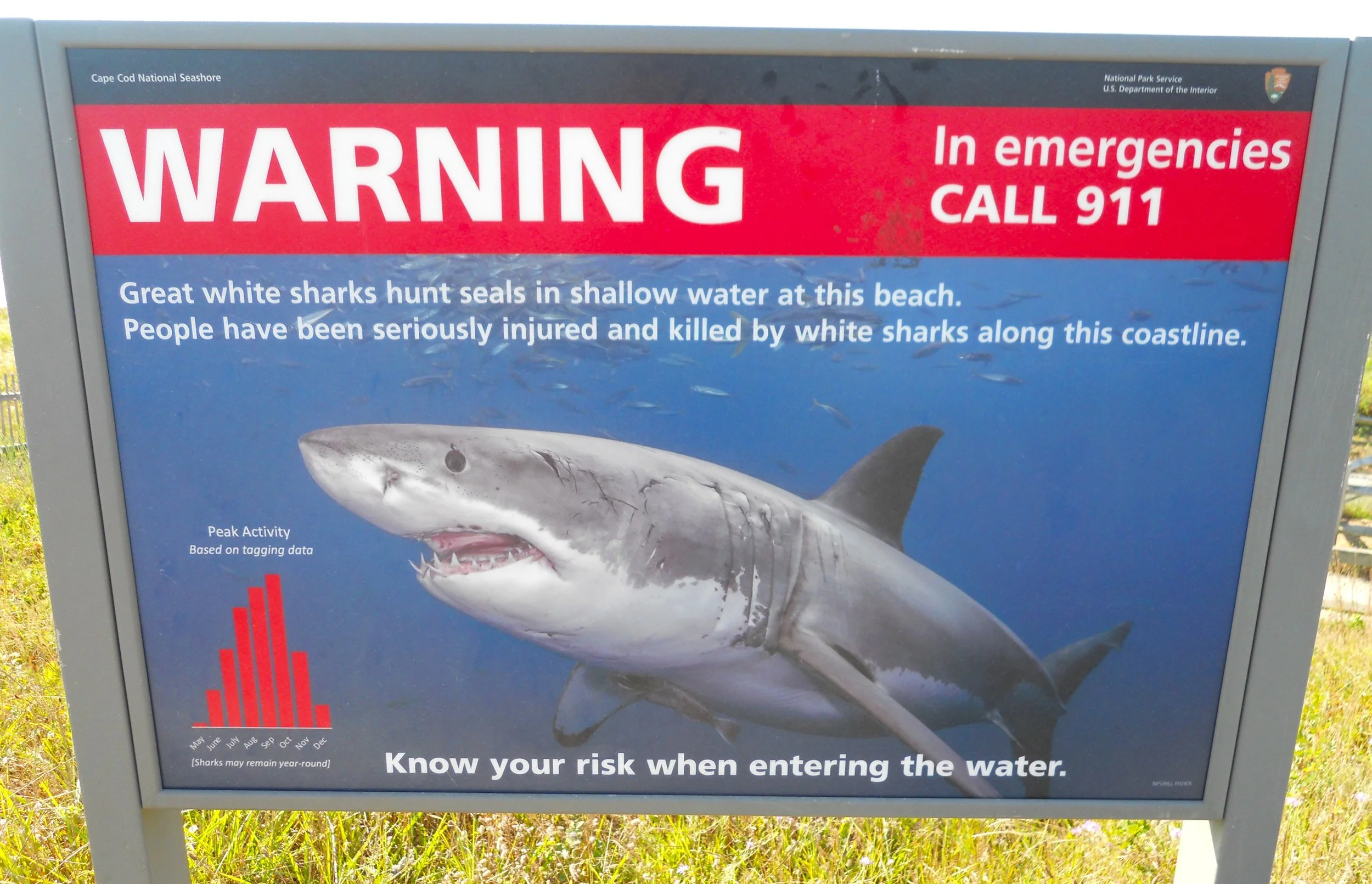
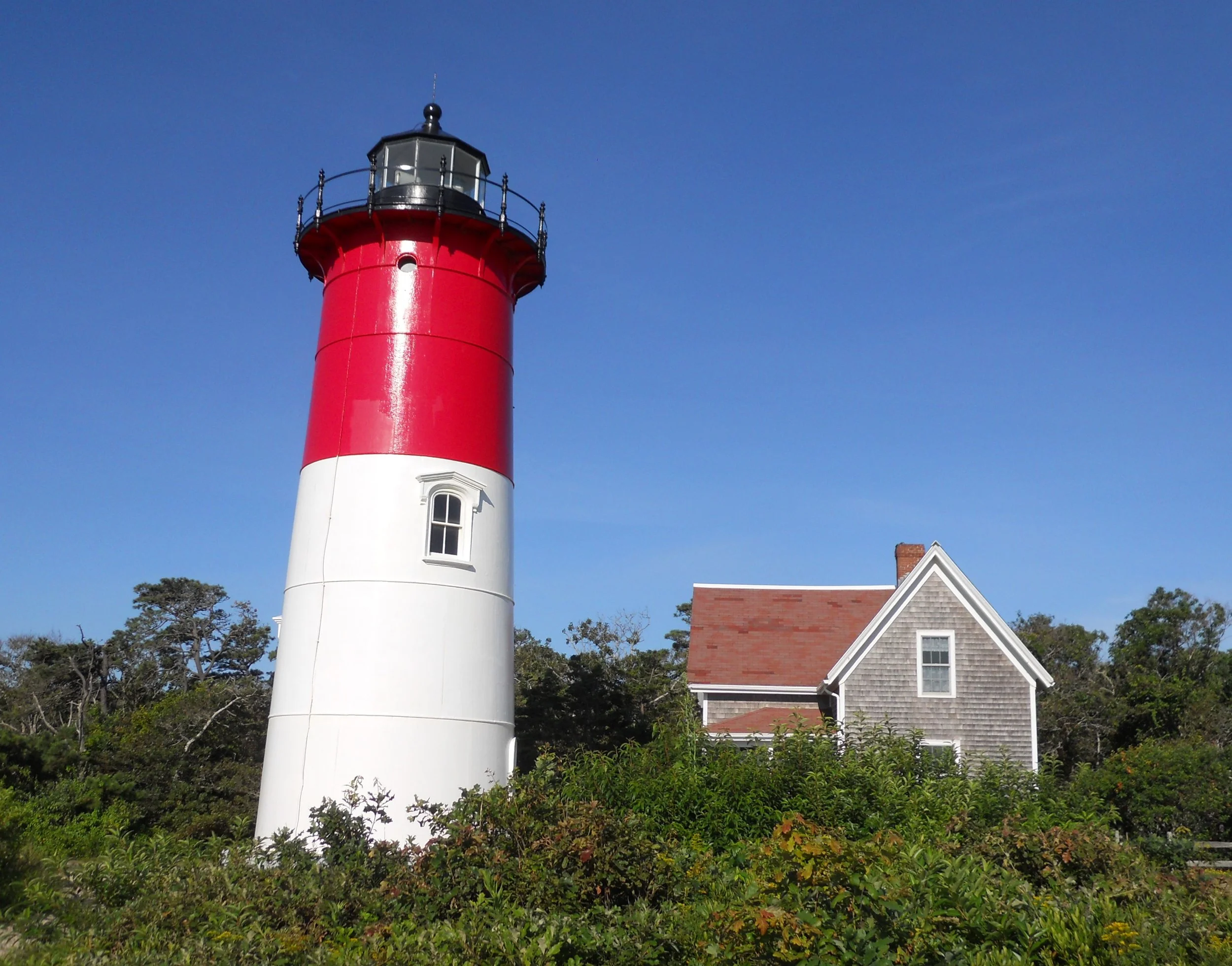
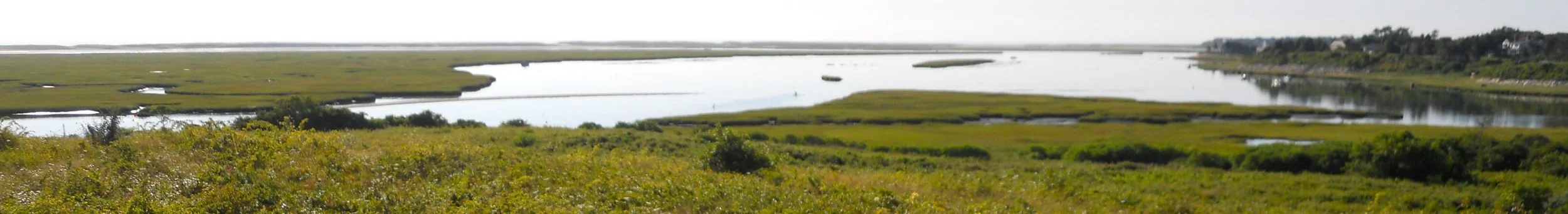
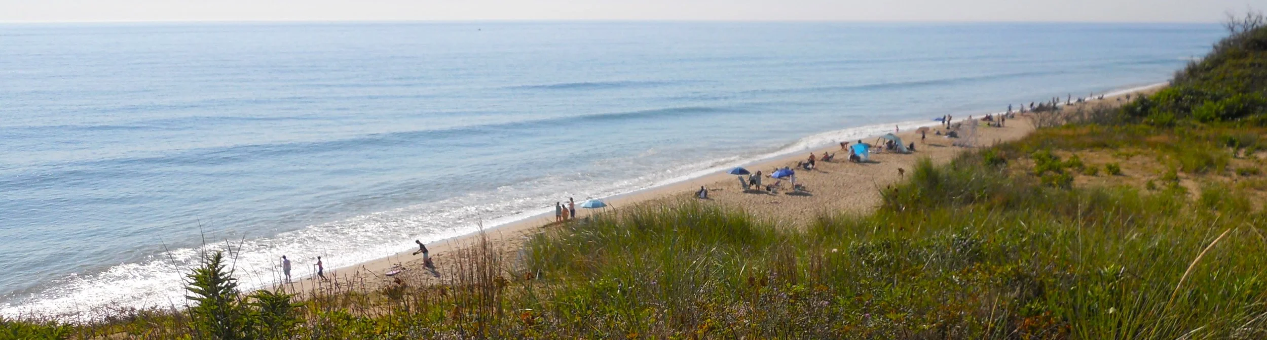
DAY 9 (August 12) - Cape Cod NS can be a fun beach experience, or possibly deadly. At one beach a large sign said to be aware of your surroundings, relative to Great White sharks. Seals live up and down the coast and Great Whites like to hunt those creatures. Sadly, us humans can look like a seal at times. Therefore, I stayed on land, checking four different light houses, one being the Nauset Light (and the keeper’s house). A keeper manned the light house for 114 years, until 1952 when the light was automated. In 1996, there was less than 40 feet between the land cliff and the sea, so the light was moved inland to its current location. From the Fort Hill section of the park, one can view the Nauset Marsh. Plenty of blue ocean today.
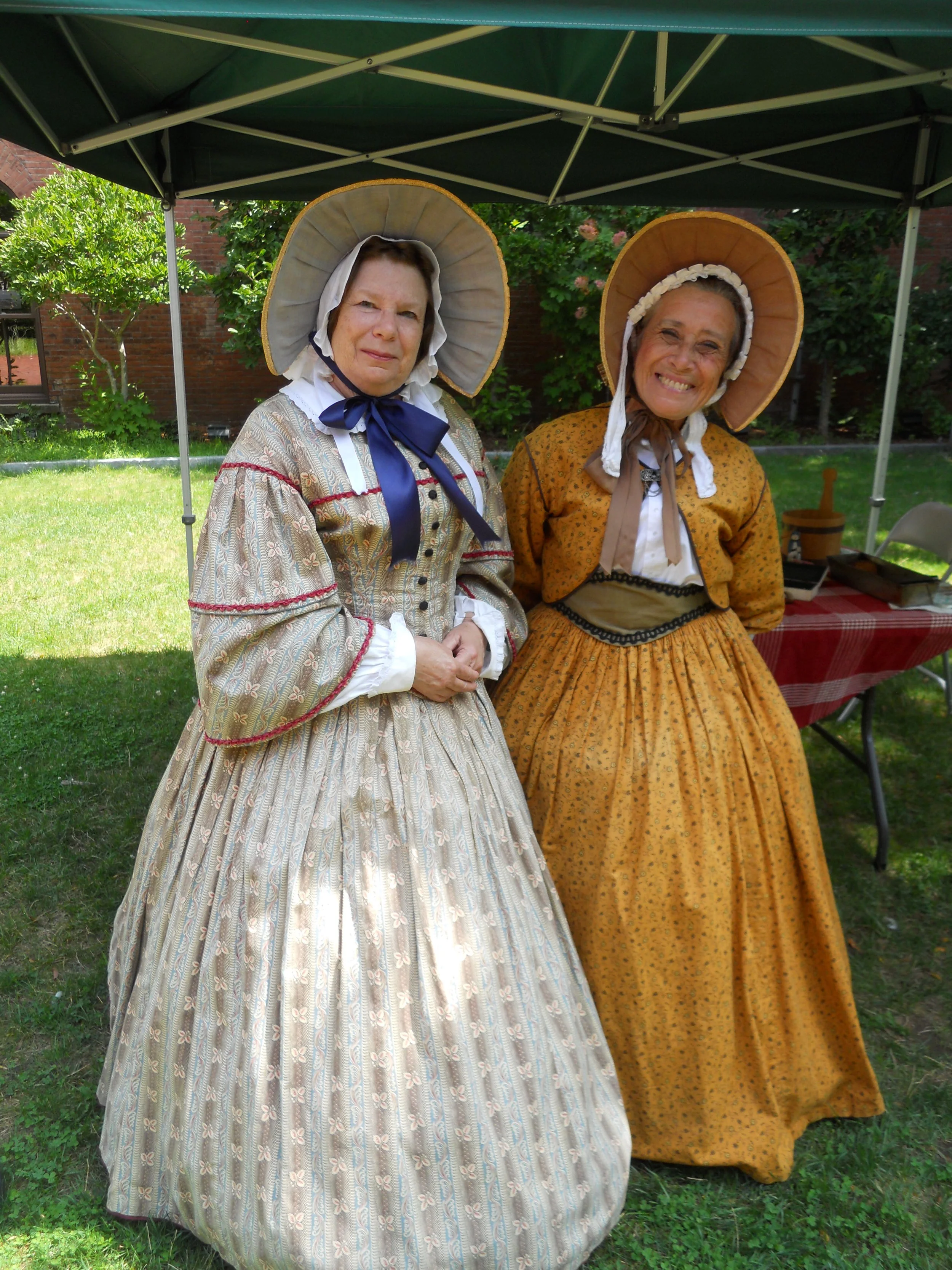
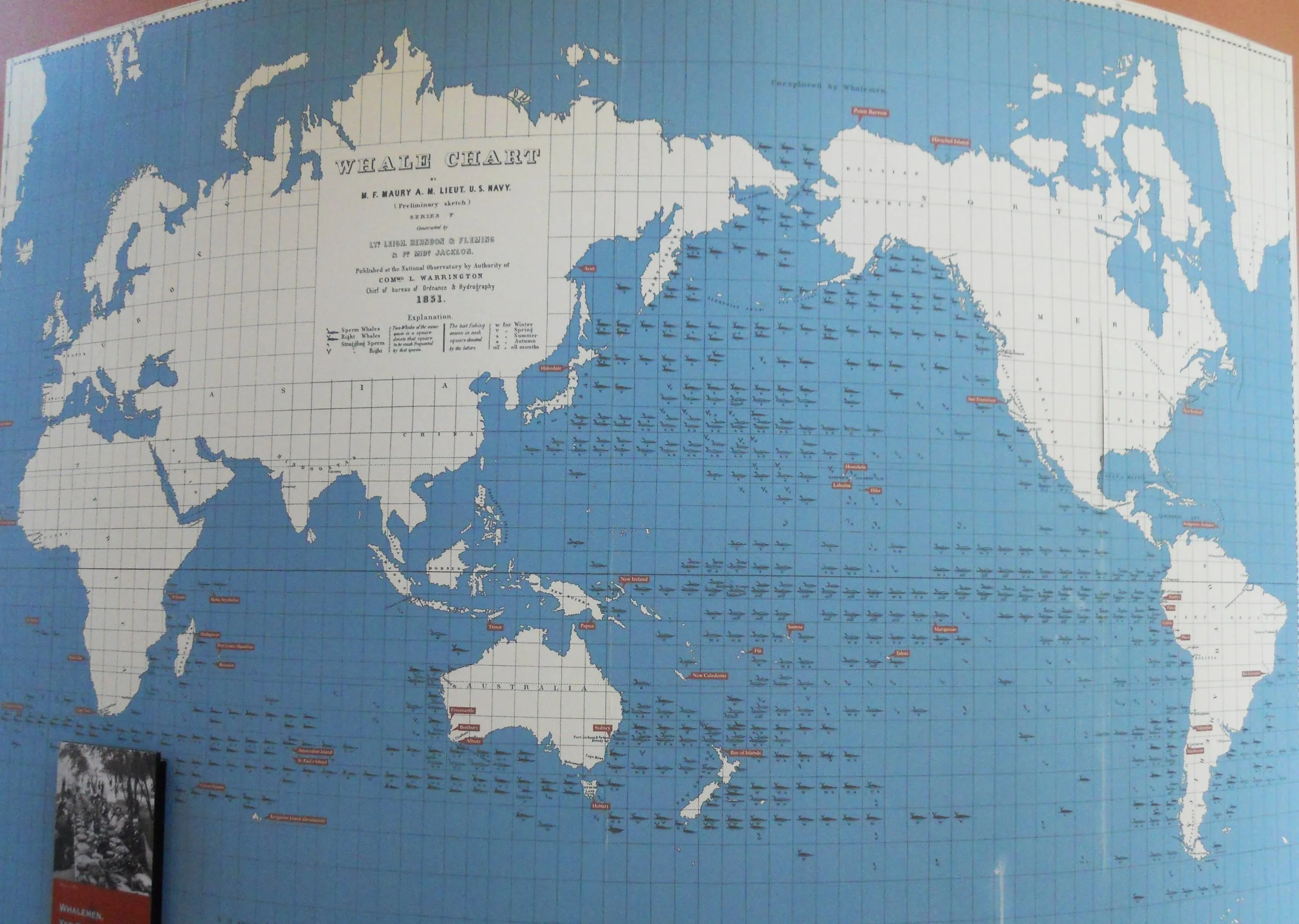
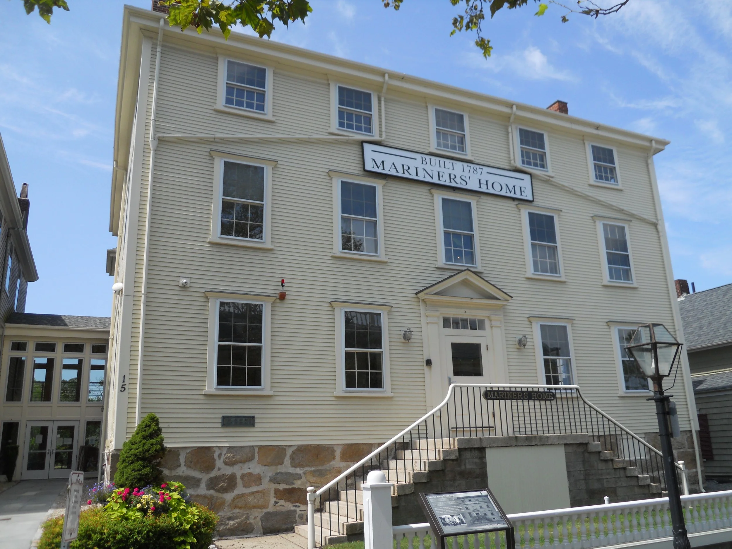
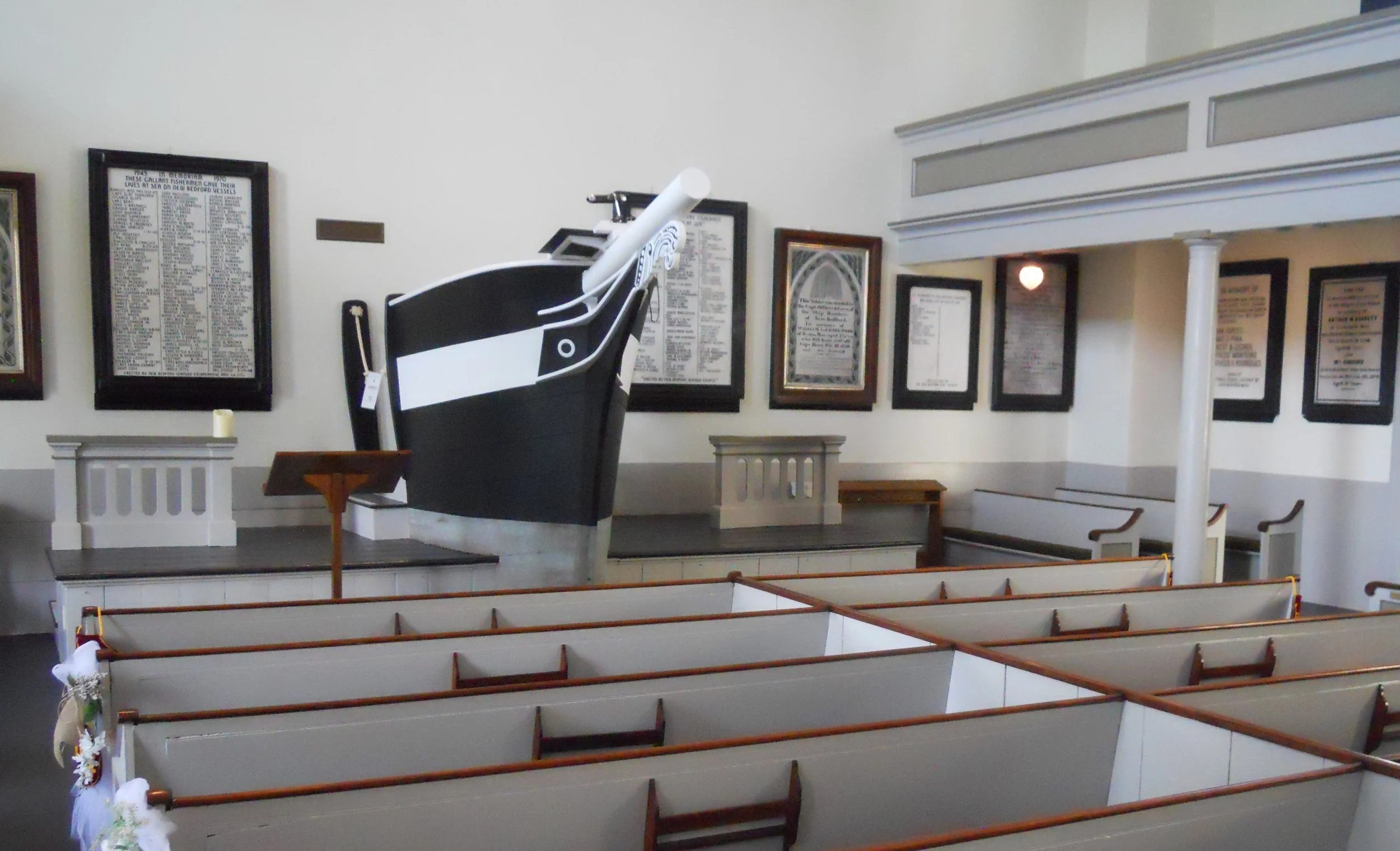
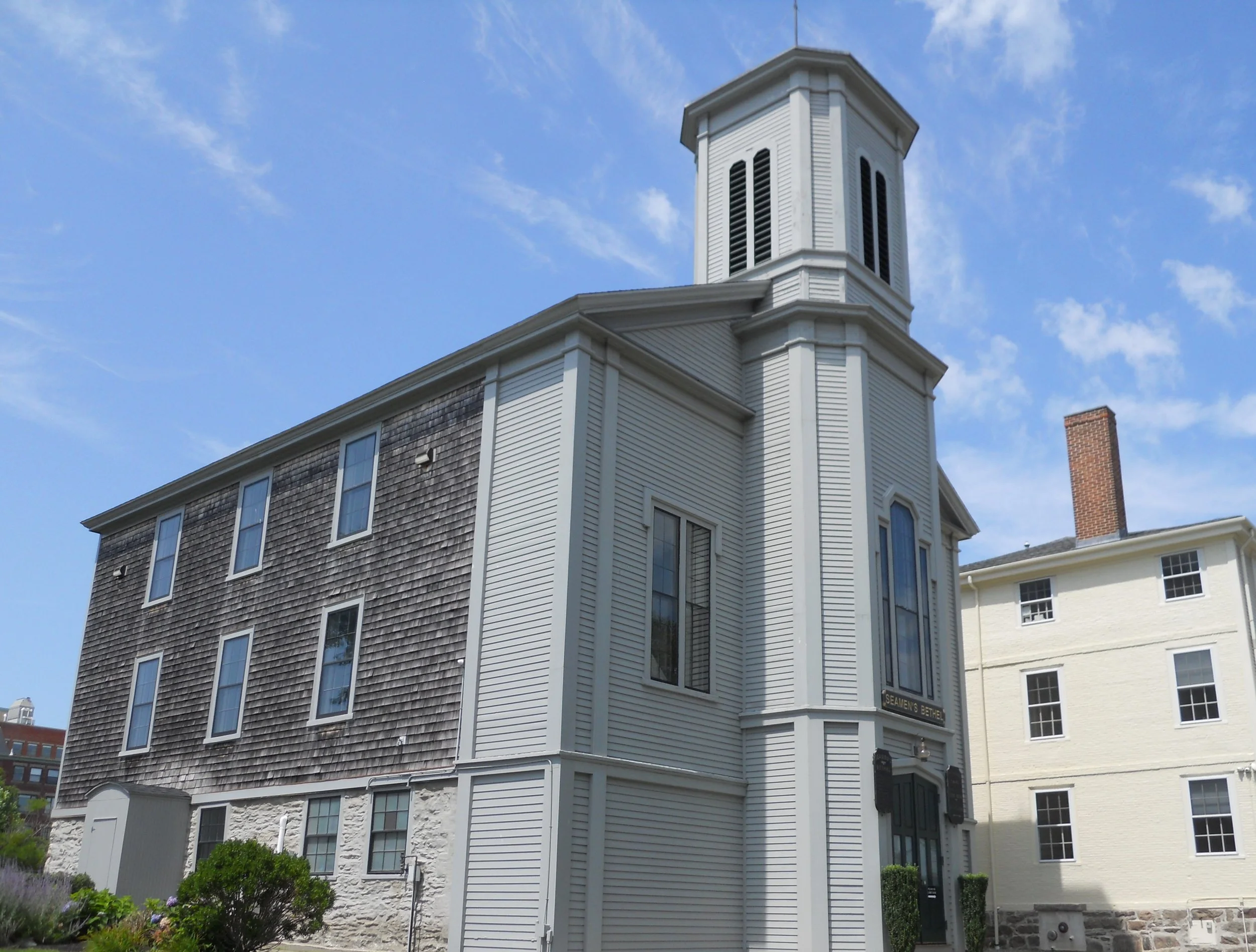
New Bedford Whaling NHP had two women volunteers dressed in period attire. They had artifacts associated with the life of whaling. These were items which one would find throughout the 1800s in New Bedford, the Whaling Capital of the world. The city had a deep harbor for easy passage of ships, and was close to large cities, such as Boston and New York. A large mural from an 1851 study of whale populations, and where to find them, is on one wall in the VC. When sailors returned from a hunt, they had no place to stay until the next hunt. The Mariner’s Home was built in 1795 to mitigate the issue. Next to it stands the Seaman’s Bethel (Chapel). The city felt there was a need to impart “moral, intellectual, and religious instruction” on Seamen when returning to port, so built the Bethel in 1832. Think of the 1956 movie Moby Dick when viewing the inside of the Bethel.
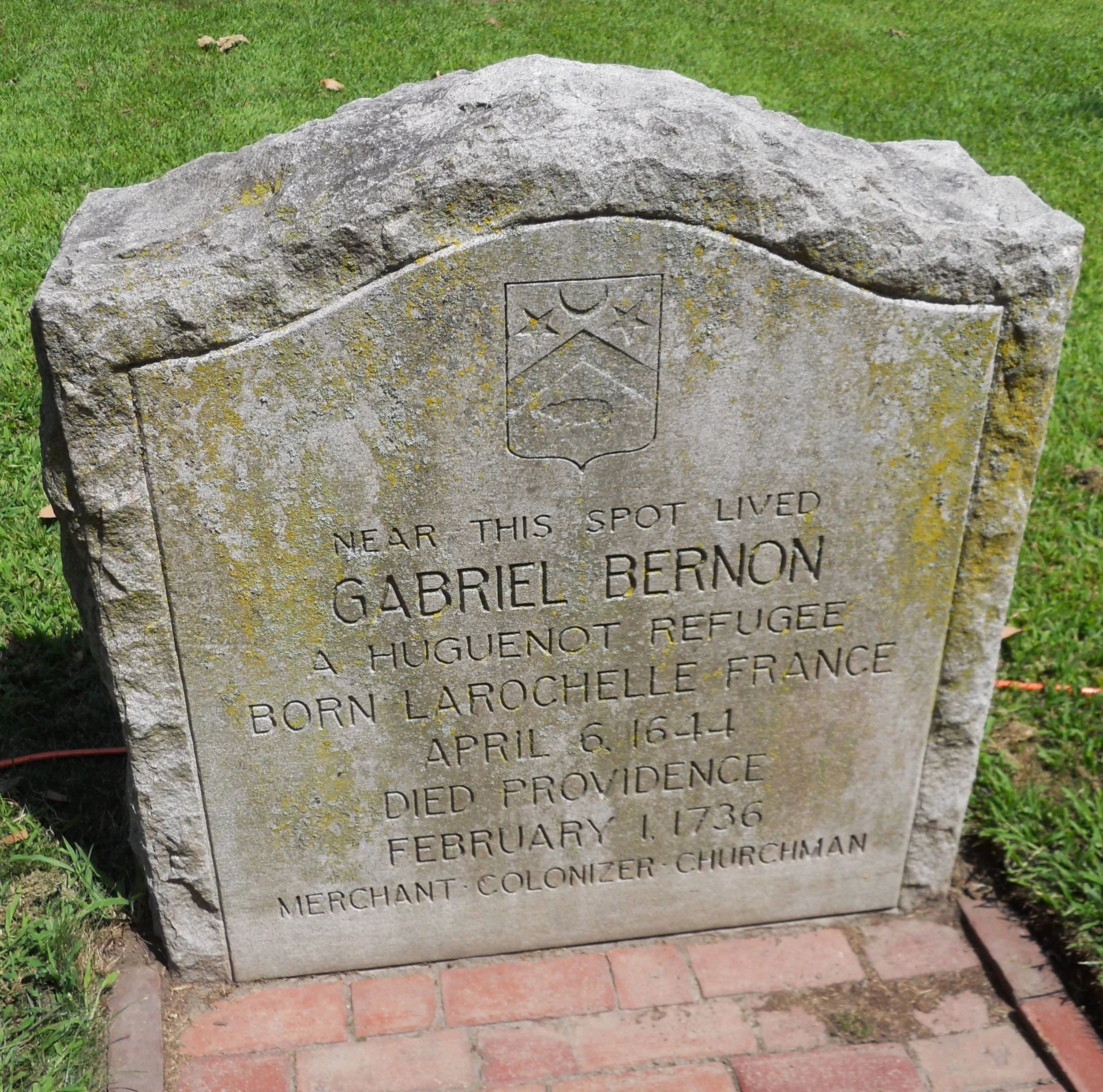
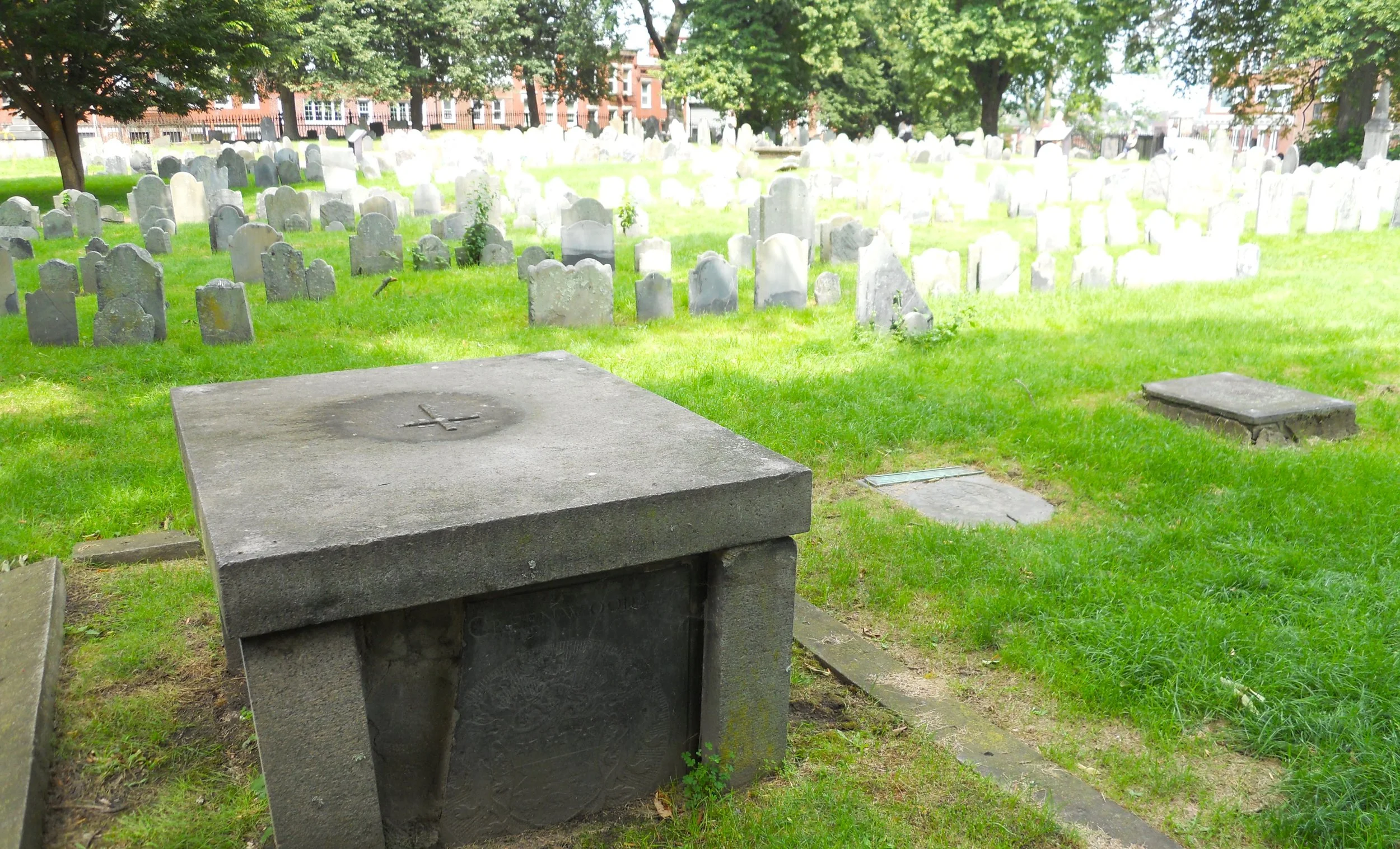
Roger Williams National Memorial honors the founder of the great State of Rhode Island. The year 1636 is when he created the town of Providence, a place anyone could come and live their life as they saw fit. The park is rectangular in shape. A ranger told me it is 25th from last place out of the 425 parks in land area. But the tall trees, trimmed hedges, and pretty flowers make for a relaxing retreat. A stone marker states Gabriel Bernon lived near this spot, a refugee from France (born there in 1644… died in Providence in 1736). Williams came to this spot himself because of a nearby freshwater spring, building a house across the current street. The park was having a festival today. A local zoo had brought a Box Turtle to educate youngsters.
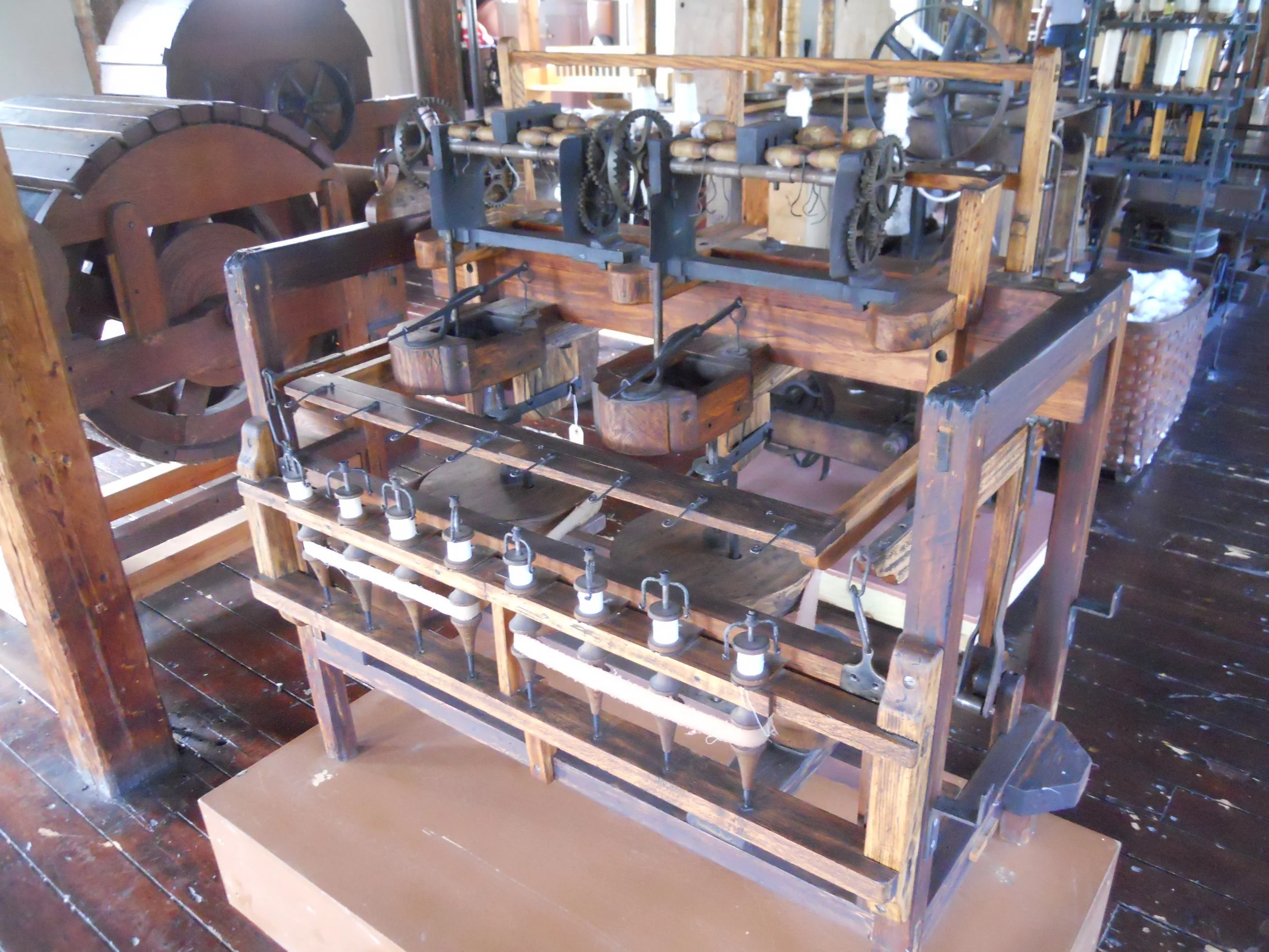
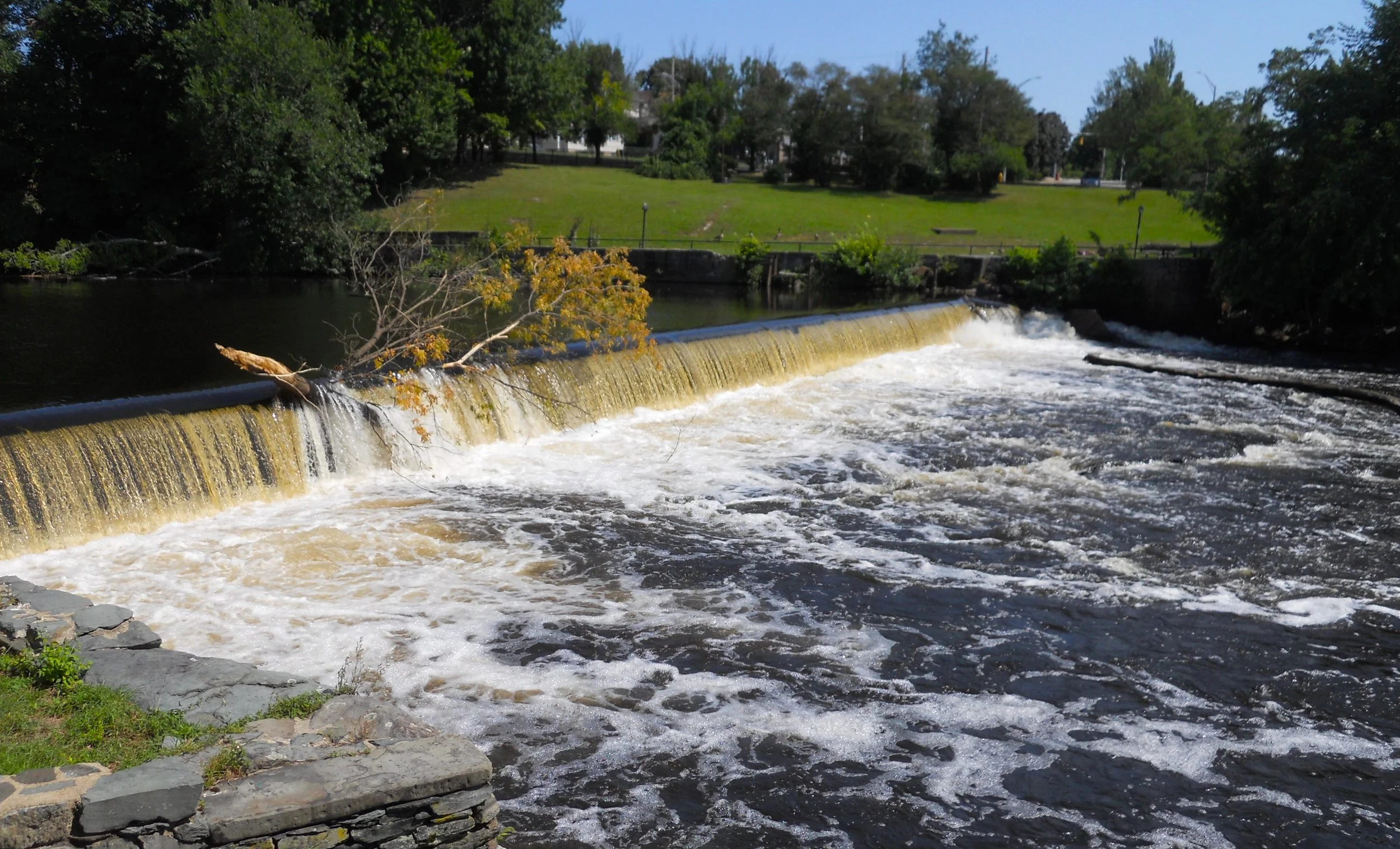
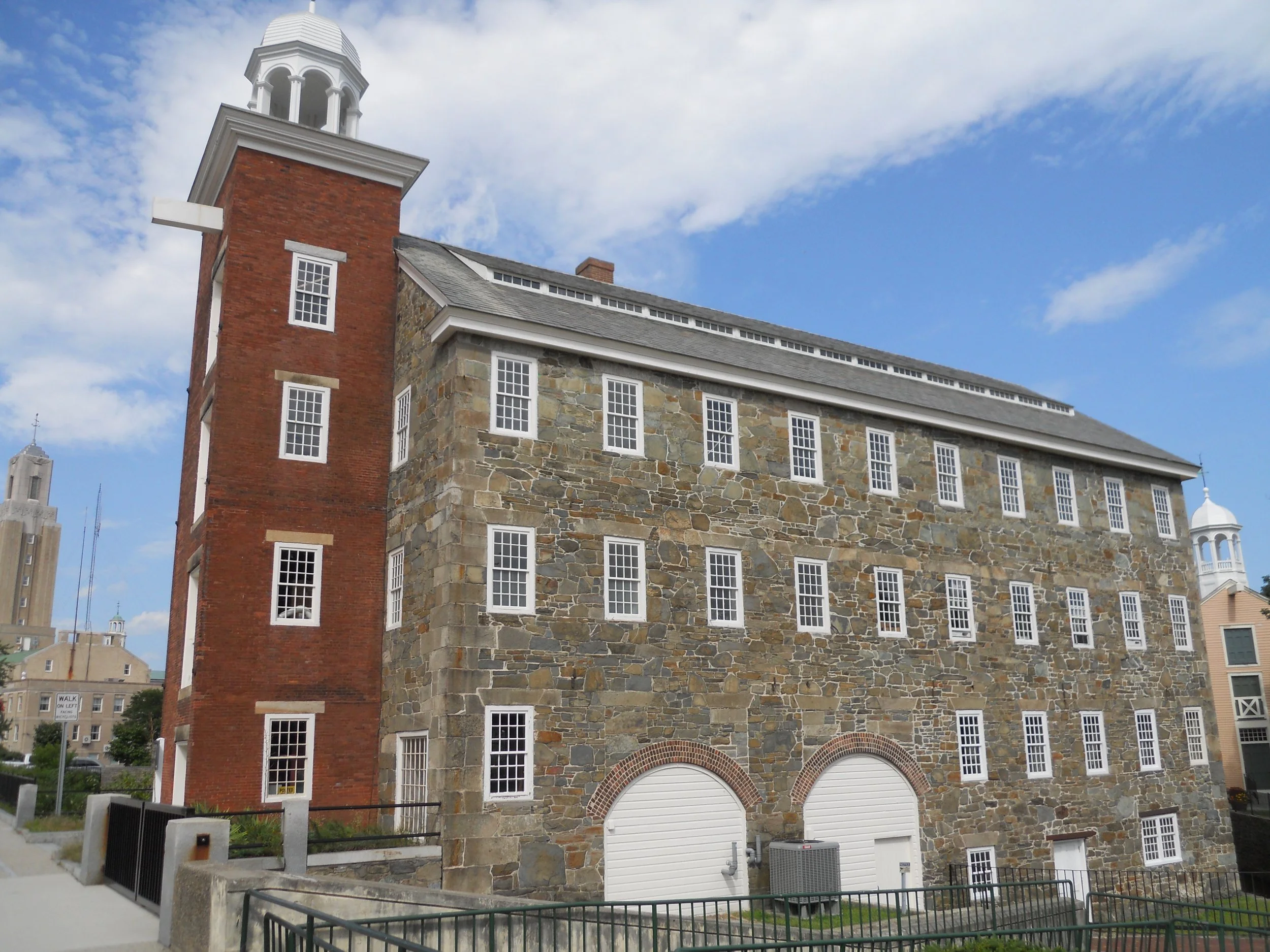
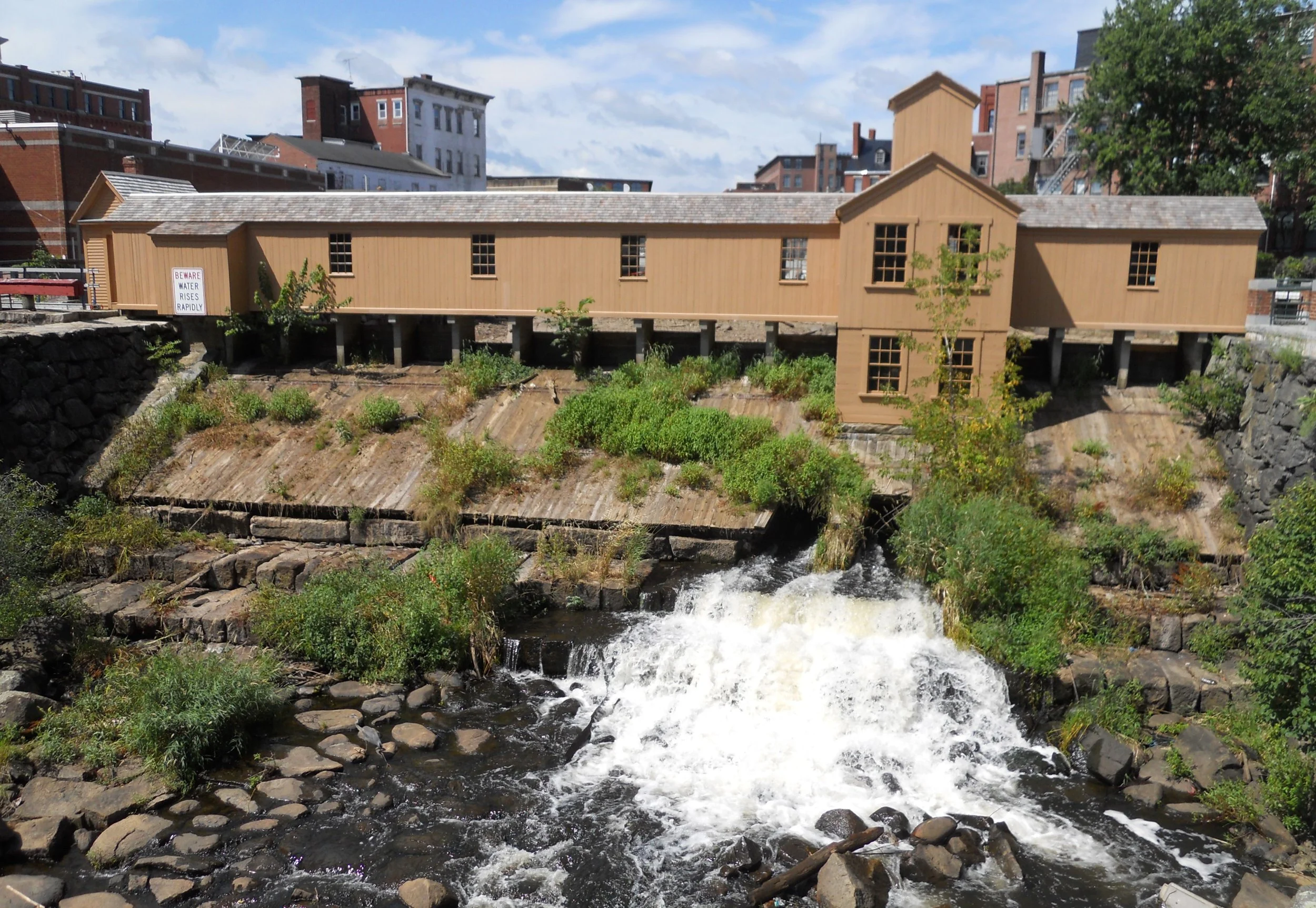
Blackstone River Valley NHP preserves the sites (there are six “Districts” in the park) of the industrial revolution in America. Slater’s Mill was the first water-powered cotton spinning mill in the country (1793), a precursor to Lowell a few decades later. The Blackstone River provided all the power needed to turn water wheels. A large tree is currently stuck at these falls. Over 100 mills eventually lined the river. But Moses Brown’s money and Samuel Slater’s knowledge of mills in England started the ball rolling, or rather cotton spinning. The Wilkinson family owned the large complex next door, with plenty of skilled craftsmen to help build the machines which Slater needed. The equipment in the mill is original to the site.


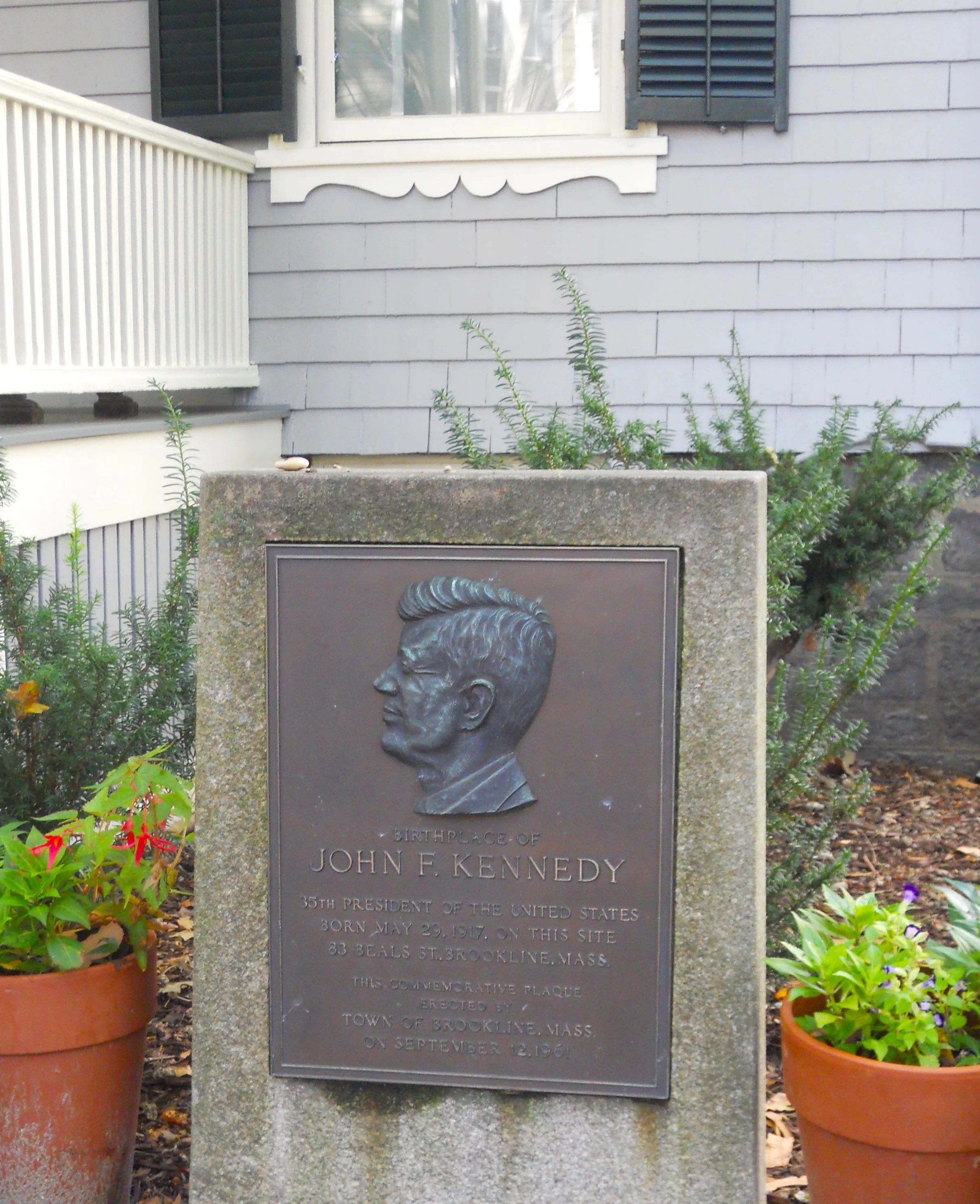
DAY 8 (August 11) - John F. Kennedy’s birthplace home in Brookline is closed this year, so I could only walk along its exterior. A granite plaque sits in the front yard, stating he was the 35th President of the United States of America.
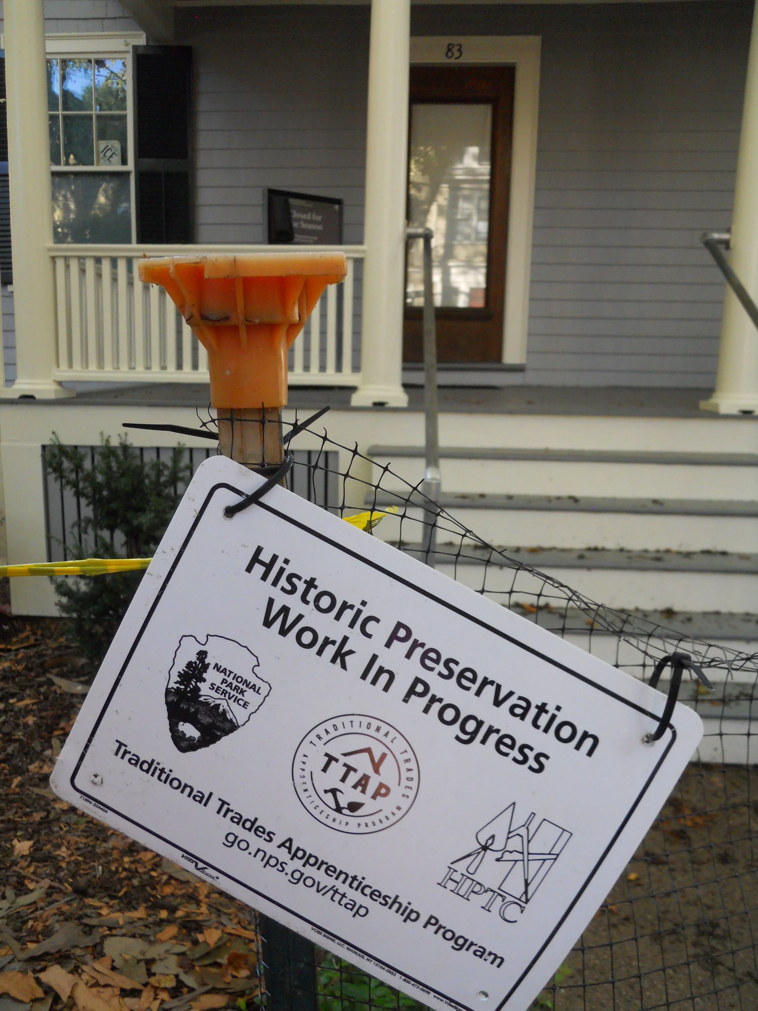
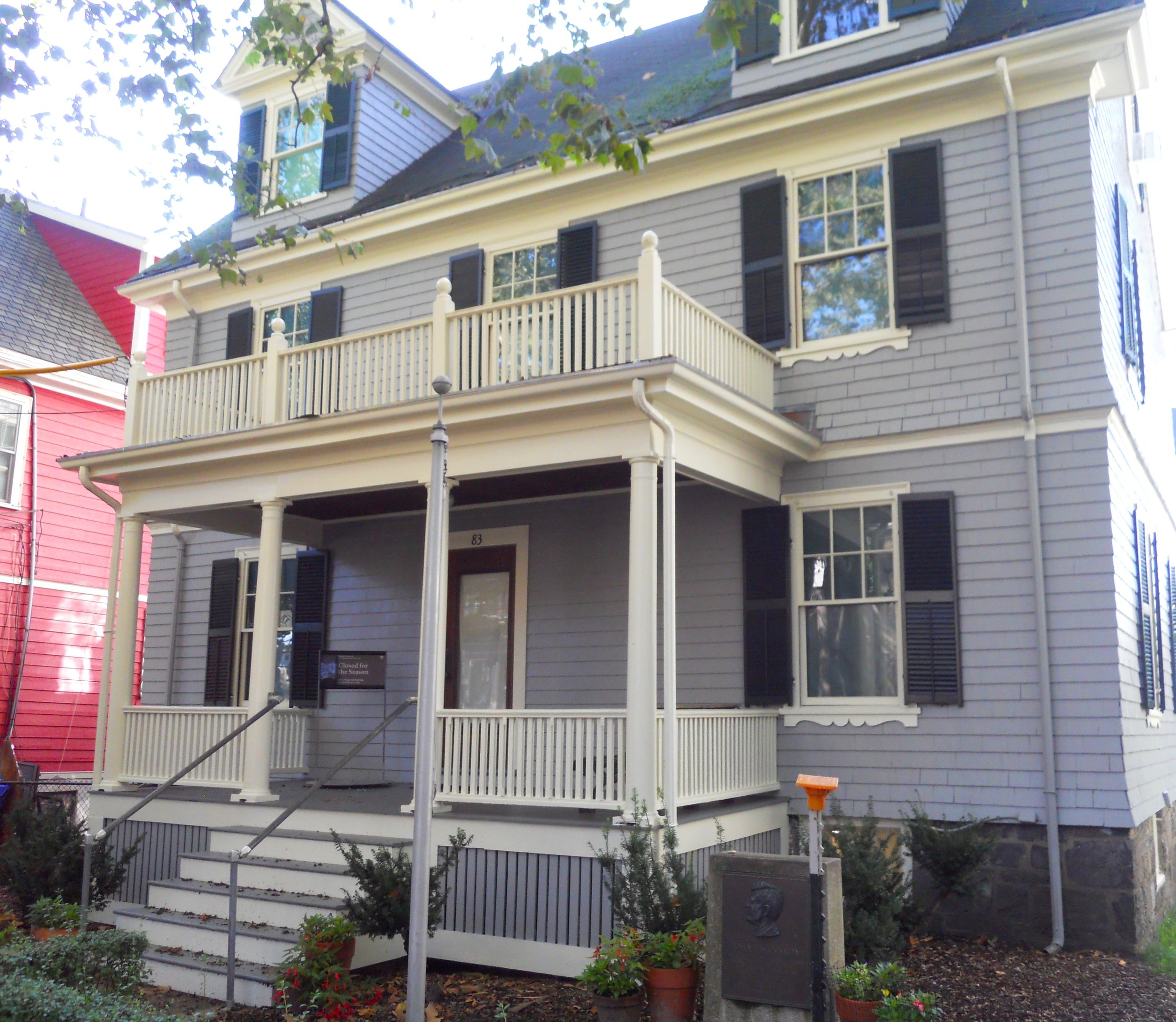
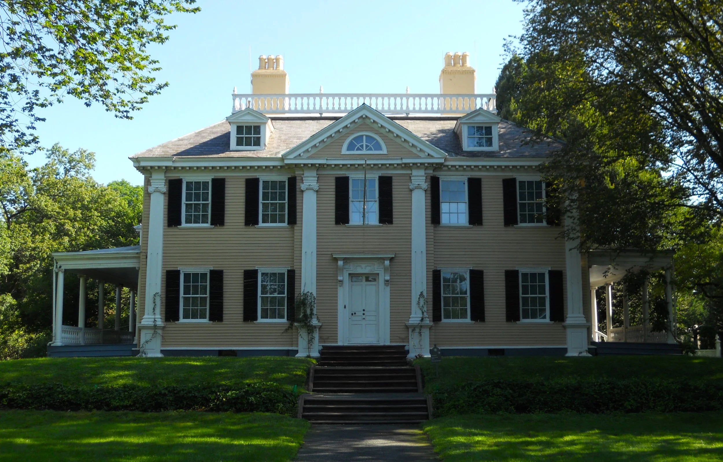
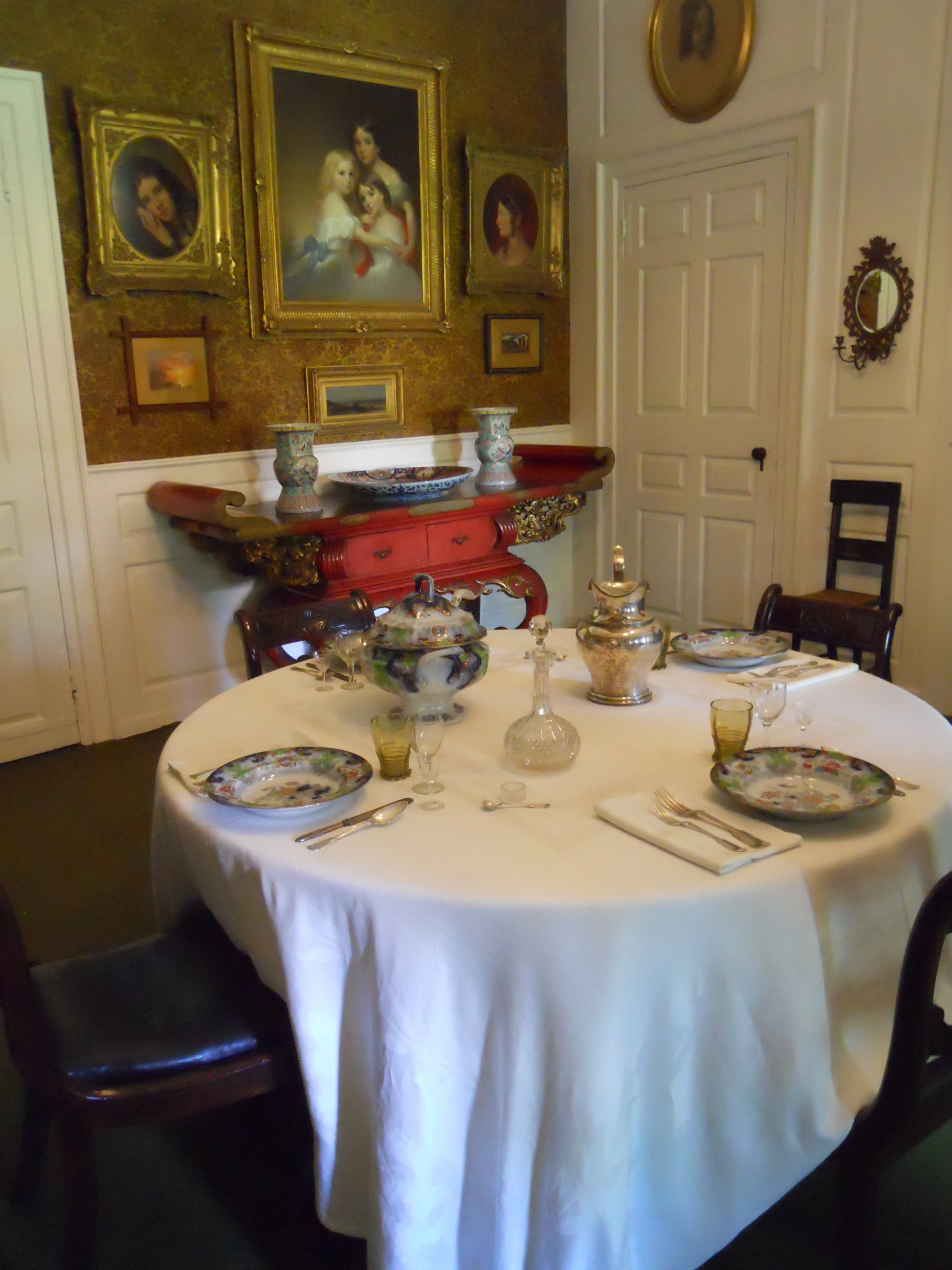
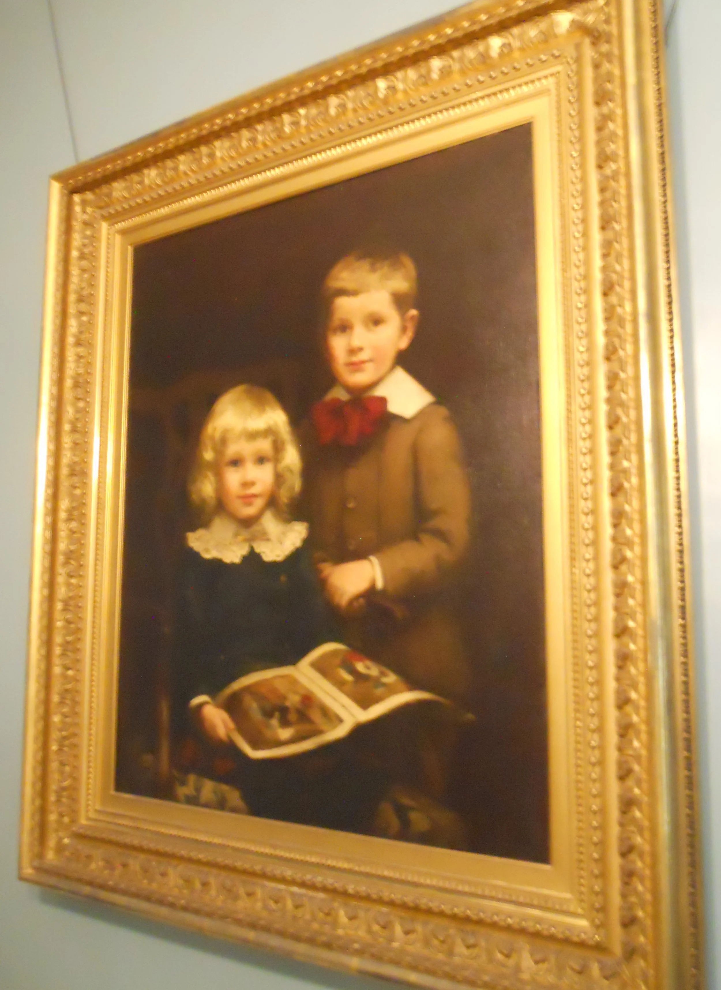
Longfellow House Washington HQs NHS is in Cambridge, the home of Harvard University. In fact, Henry Longfellow taught at the school (he knew eight languages) after moving to this house in 1836. He was aware General Washington had used the house as the Continental Army HQs in 1775-1776. This was during the Siege of Boston, which Washington eventually prevailed, forcing the British out of the city. Nothing in the house is from Washington’s stay (he packed his belongings in mid-1776 and left), so all the artifacts are from multiple generations of the Longfellow family. The ranger reminded our tour group not to touch anything and to stay on the identified path so as not to damage the original carpeting. The dining table at which Longfellow dined with guests and family sits in front of a portrait of his three daughters. The youngest son in the one portrait (seated) was responsible for the preservation of the family’s items which visitors have the privilege of seeing today. Longfellow’s study where he penned his famous poems has his work table and chair, and a portrait.
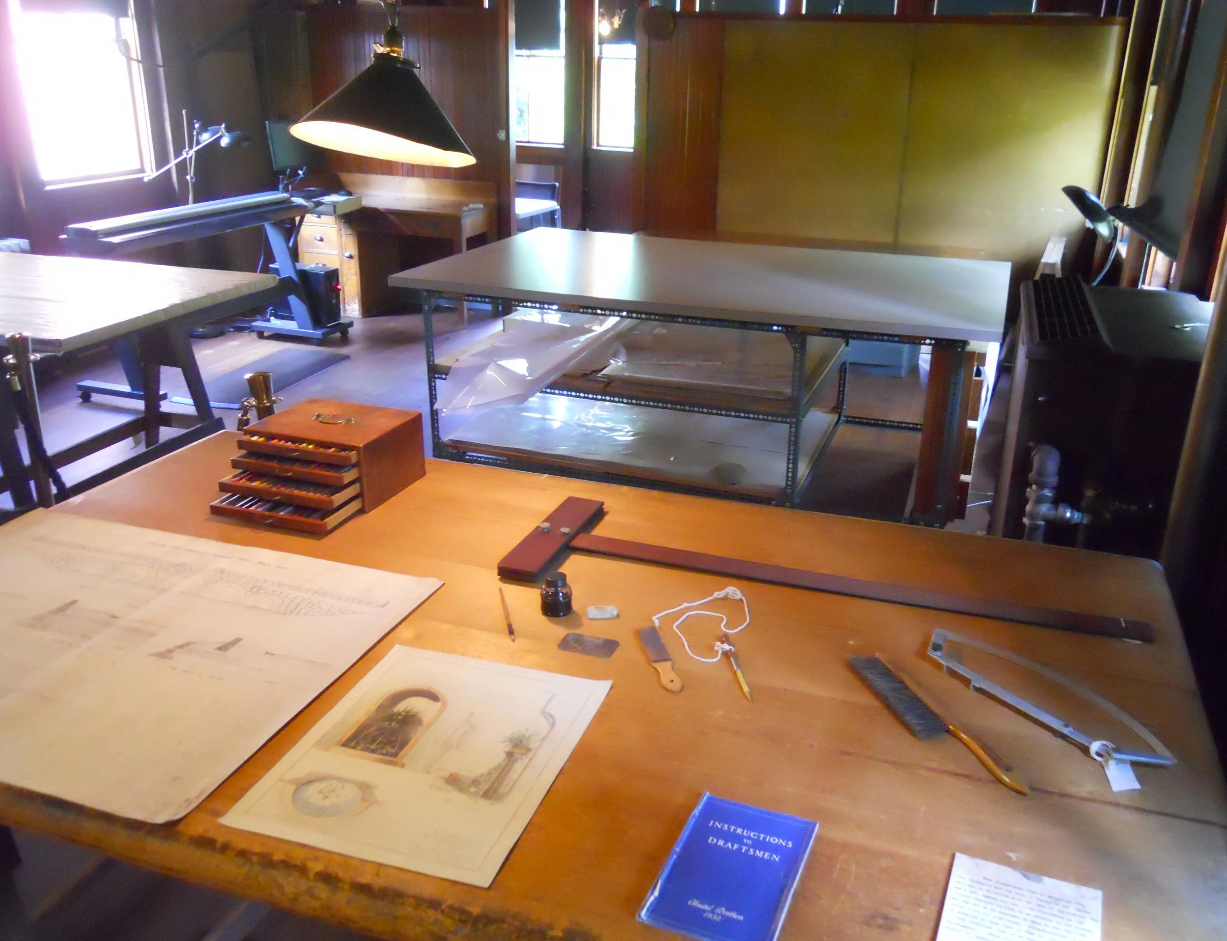
Frederick Law Olmsted NHS preserves the offices of America’s foremost landscape architect. Olmsted became known as the country’s “park maker”. The rooms in the building sequence the steps needed to design and document landscape visions, from drafting, to drawing, to printing, and blueprinting. A Civil Engineer would feel right at home. A new device from Germany allowed the team to make blueprints without the use of sunlight, which was the traditional method. A ranger told me the front room (far right photo) of the extensive building complex was the main office, where Olmsted would greet clients, and that in this room the Organic Act was written. This is the legislation that created the National Park Service in 1916. The tens of thousands of photographs and blueprints which the company made over one hundred years are preserved in a climate-controlled vault. Since Olmsted did designs for national parks (Acadia NP and Yosemite NP are examples), sometimes NPS staff have to pull out old photos and blueprints.
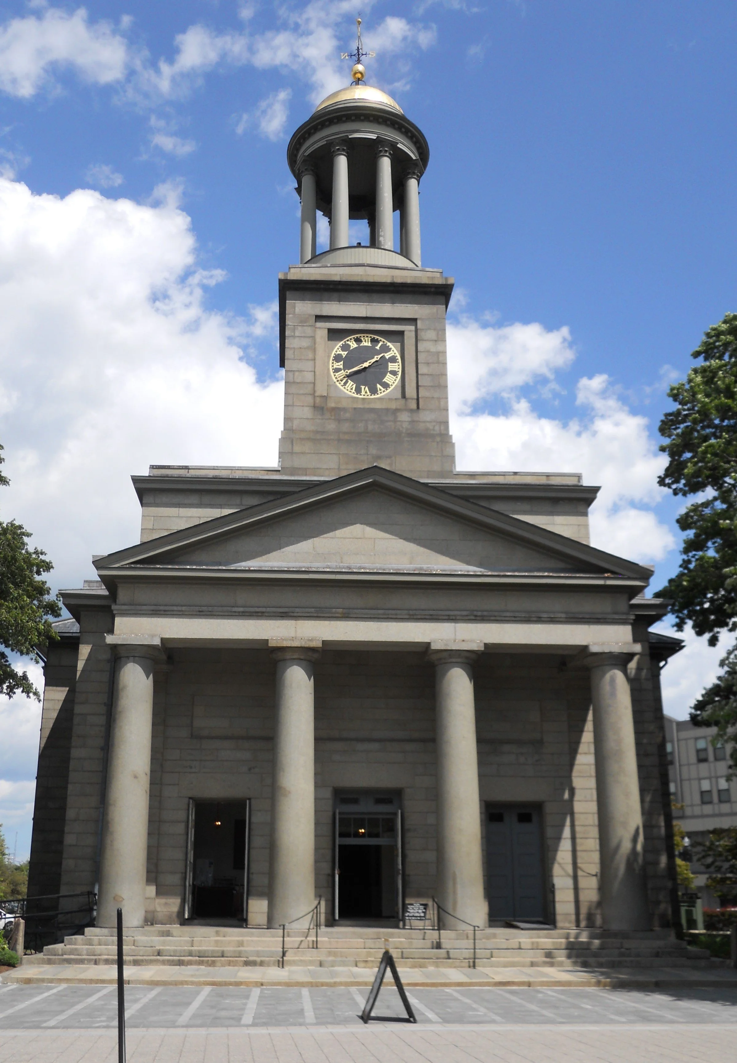
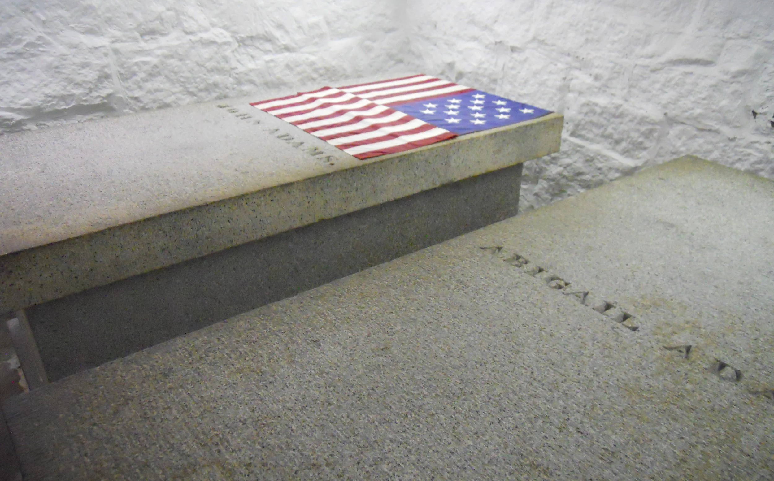
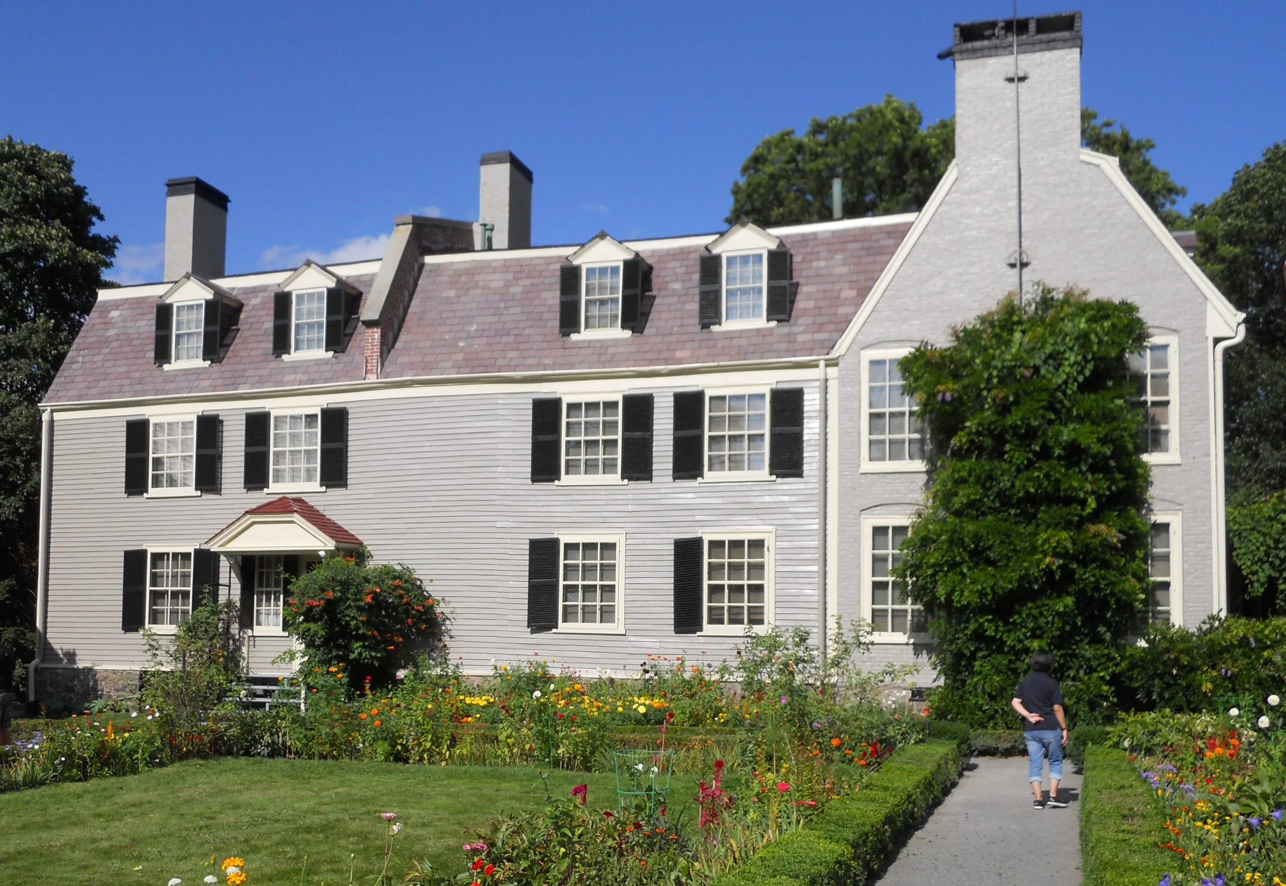
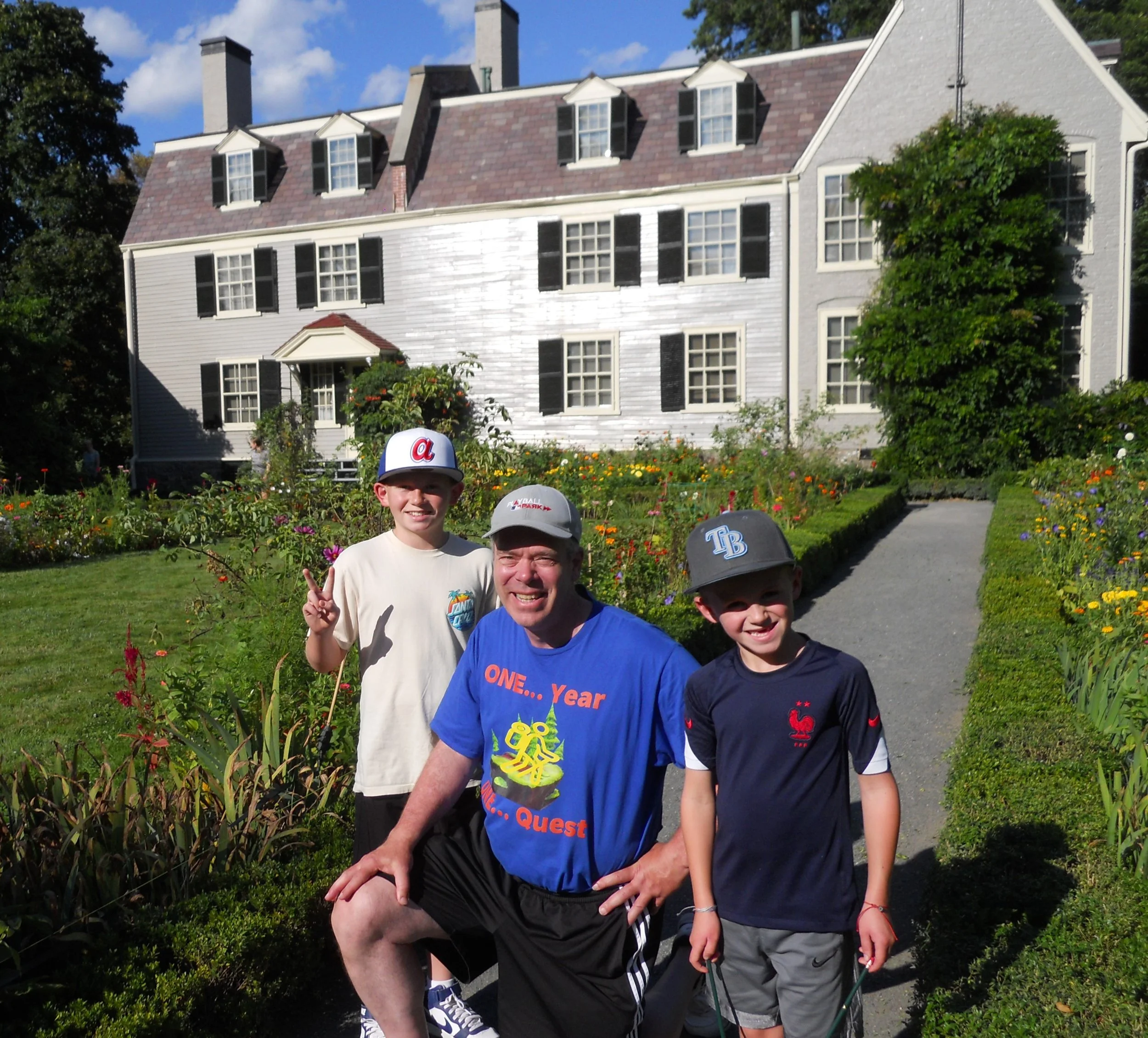
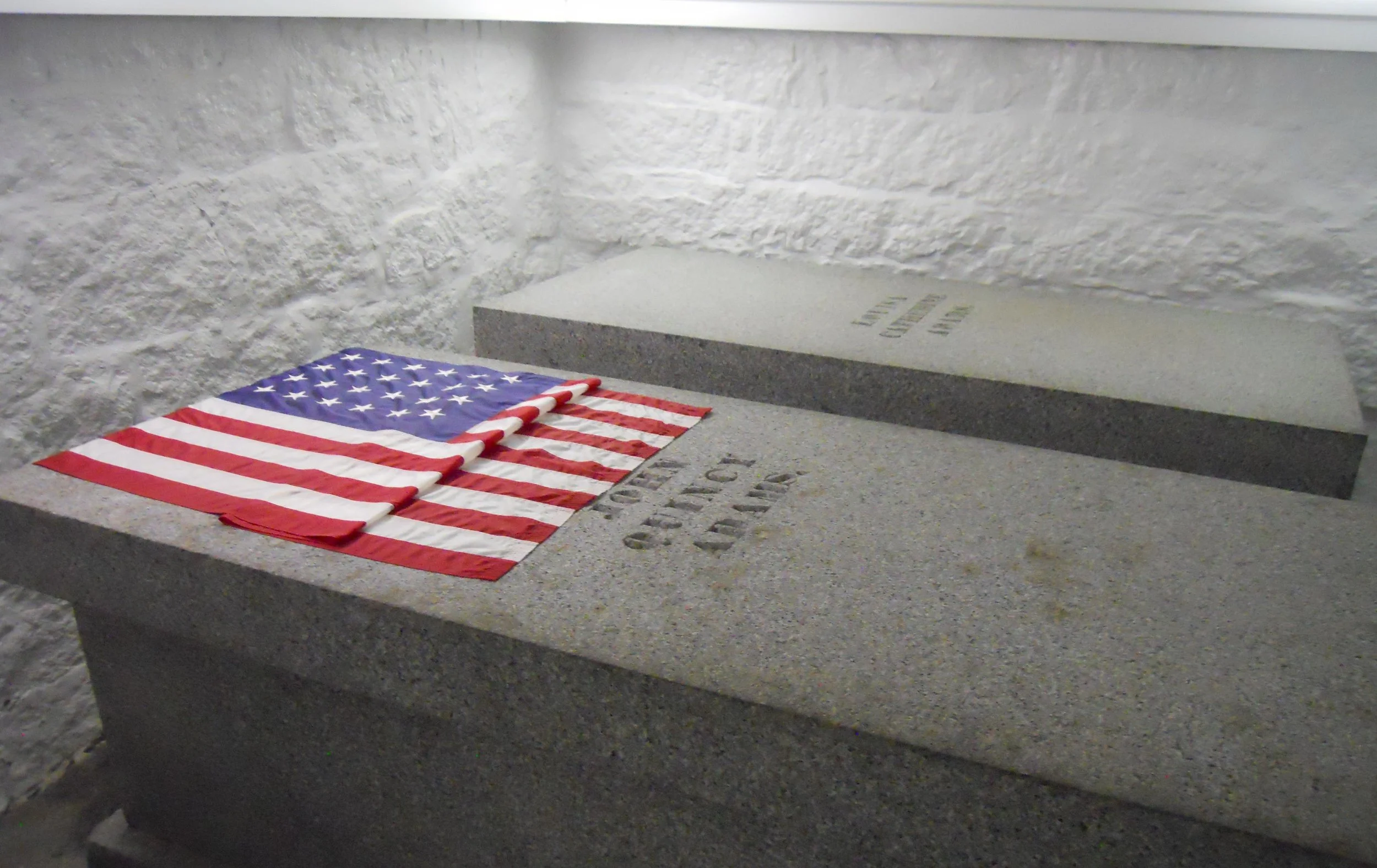
The last stop of the day was at Adams NHP. Both John Adams and John Quincy Adams, and their wives, are buried in a crypt at the United First Parish Church in Quincy, MA. John Quincy was the driving force to have the church building erected, in 1828. The congregation, though, goes back to 1639. The granite stones used for the construction came from the Adams’ quarry. As was the way with many churches of the time, people had to “buy” their pews (higher priced seats were closer to the pulpit). If two white buttons were shown on the railing of your pew, you were “paid up”. The crypt has a 15-star flag on John’s tomb, while John Quincy has a 24-star flag on his. Though the church is not within the NPS unit, it is important to visit.
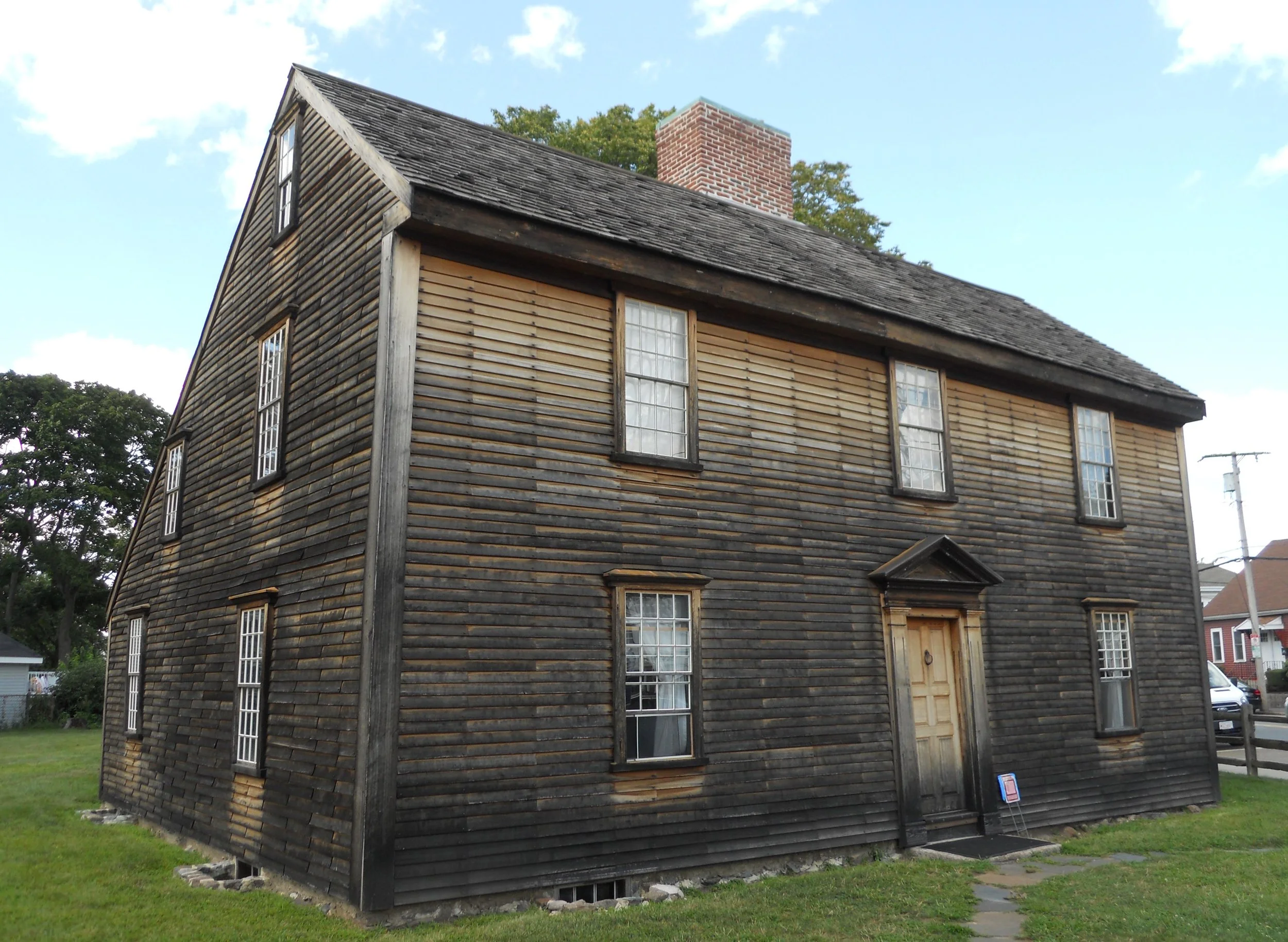
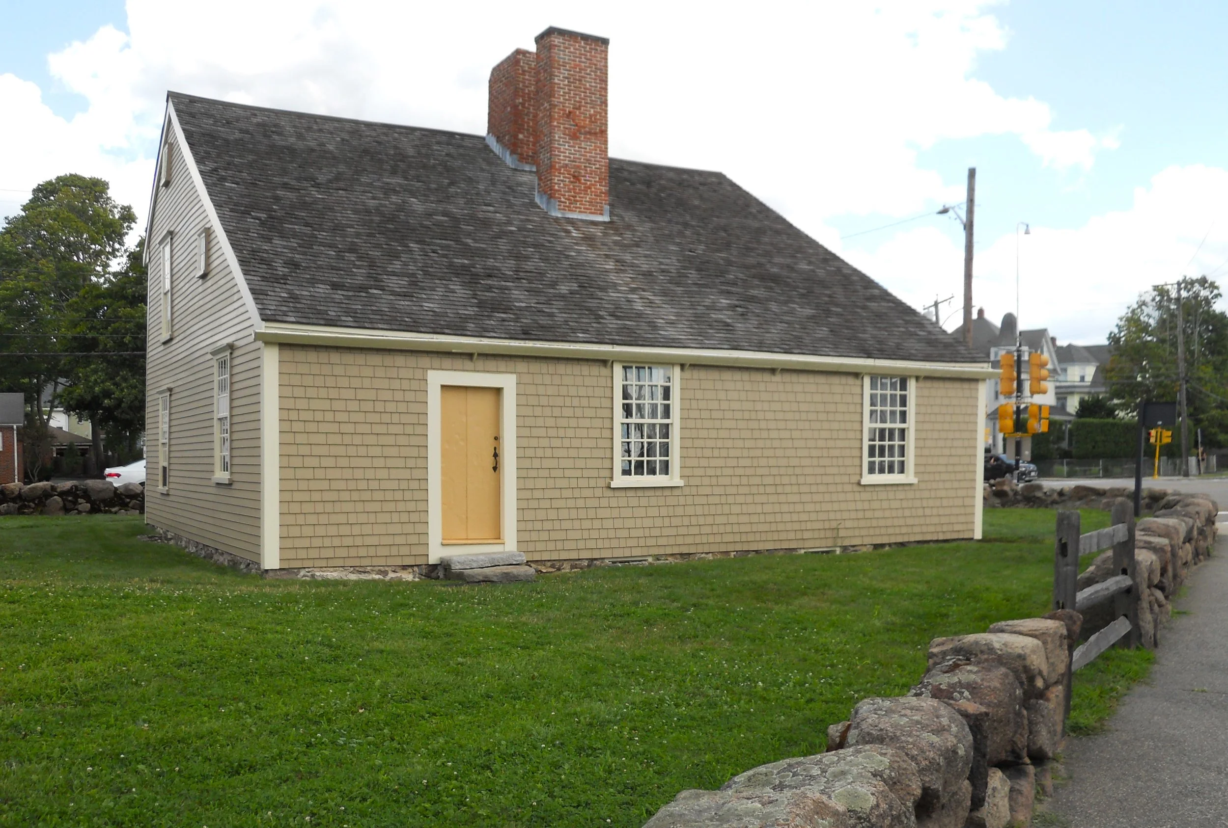
What is in the park are the two houses in which the two men were born (John in the left, John Quincy in the right), and then the large home in which the family resided after returning from Europe in 1784. The two houses are only 70-feet apart, lying along the famous Post Road which ran from Boston to Plymouth. Though the house structures are original, none of the items inside are from the Adams’ families.
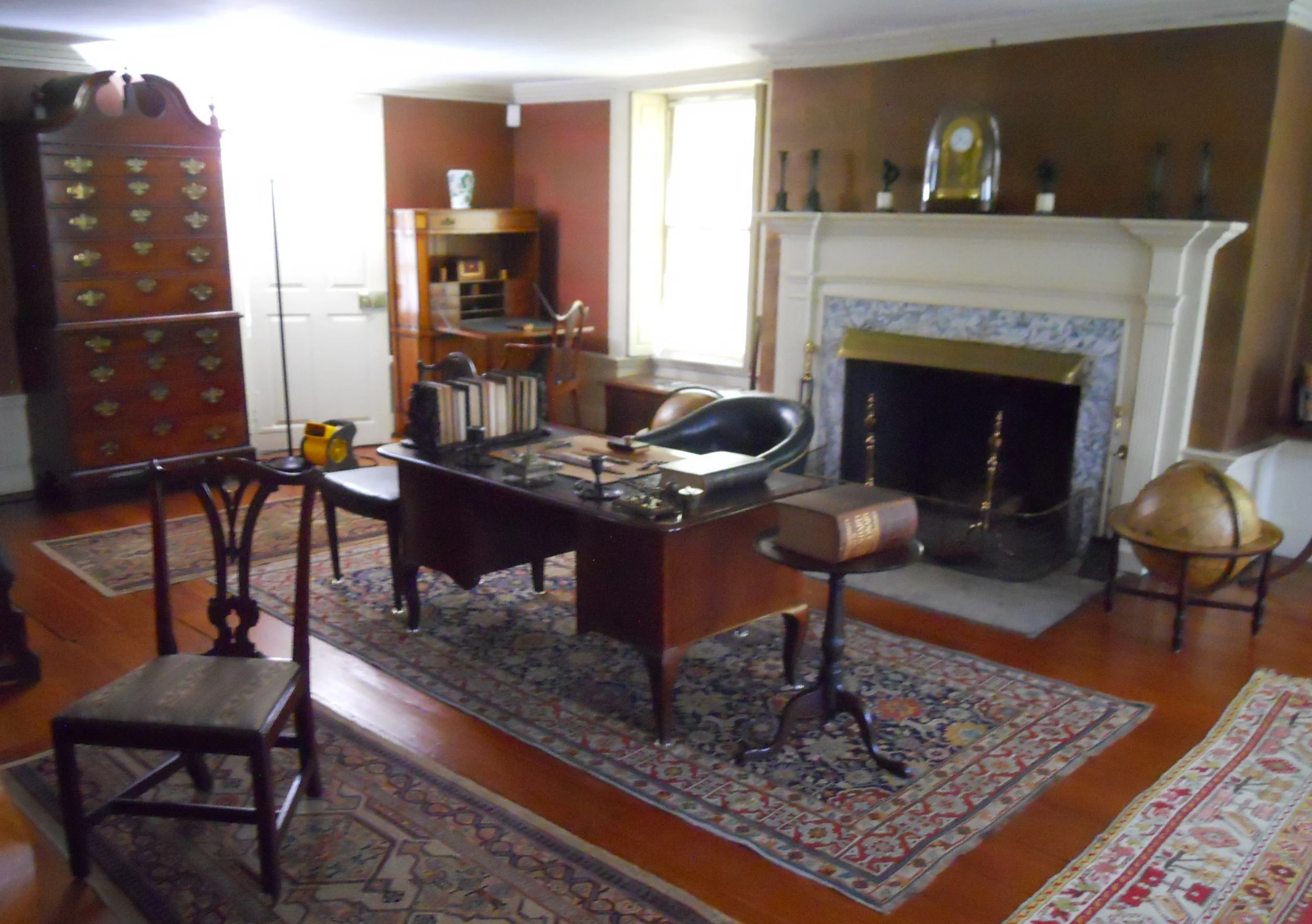
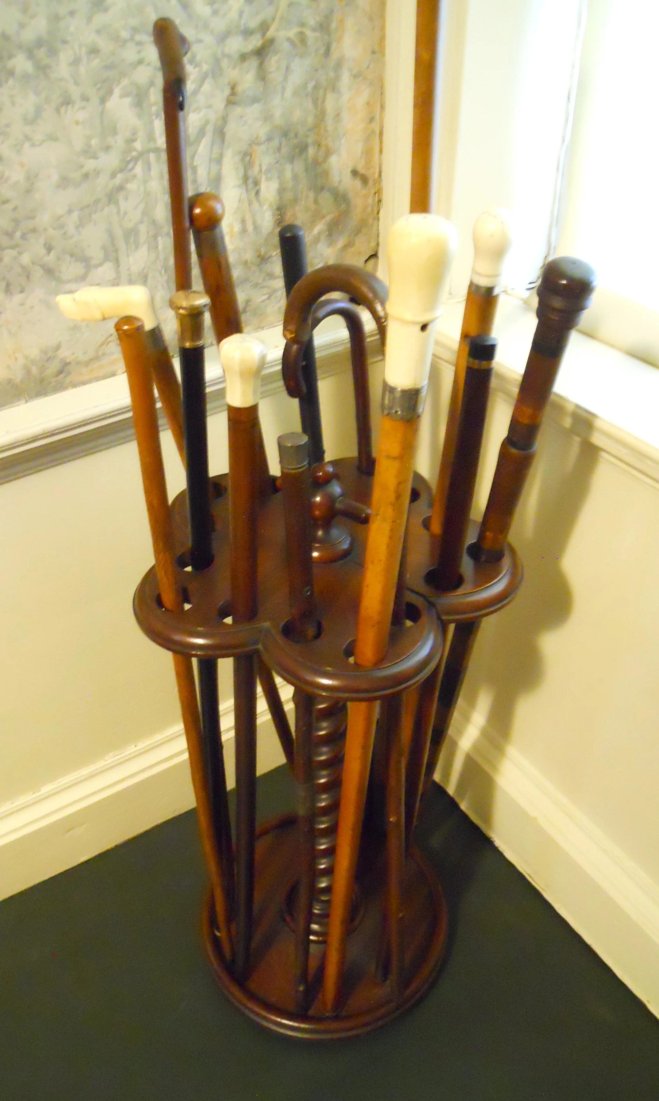
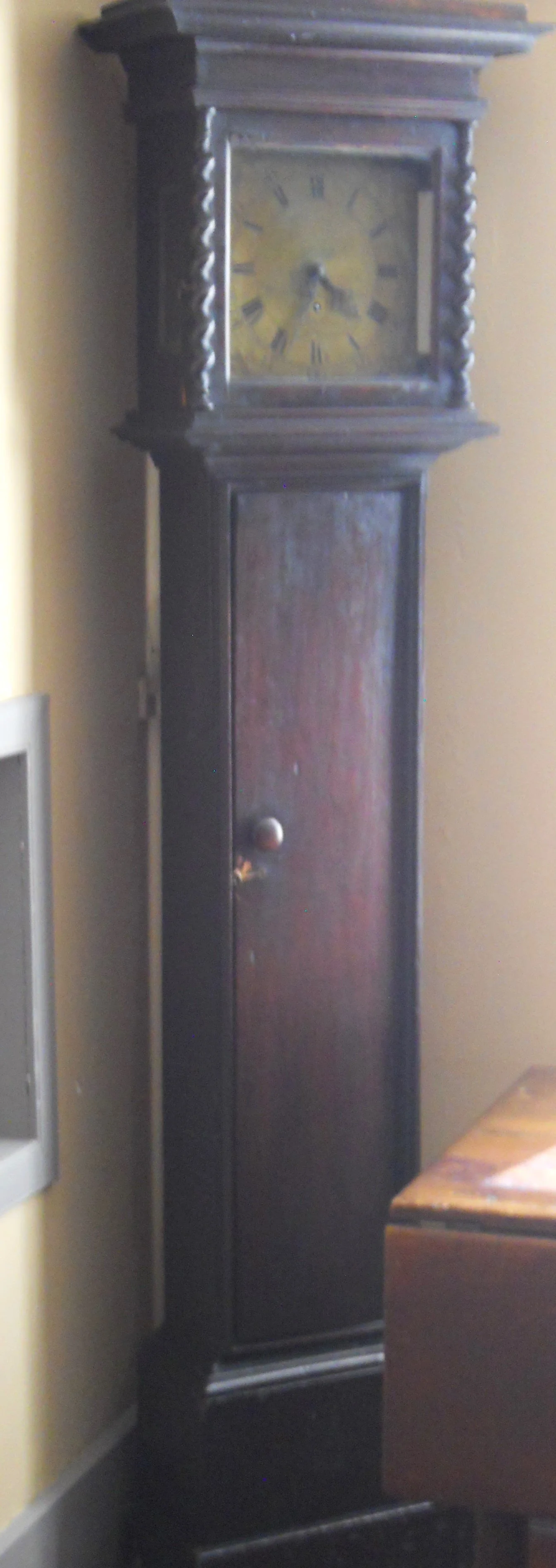
But that is not the case with the Old House, on the other end of Quincy. Everything from four generations of Adams is original, including the walking sticks/canes at the front door. John bought the house from the same man who built/owned Longfellow’s home in Cambridge… that guy was really rich, but he was a loyalist. The study/office has John Quincy’s desk (back corner) and Charles Franics’ desk (in the middle). The oldest artifact in the large complex is the mid-1600s clock. It still keeps time accurately, only needing to be turned once a week… it is a 7-day clock.
I had the treat of meeting Dash and Mack on the tour of the three homes. They are from Utah. Since there is no nearby MLB to their hometown, one cheers for the Atlanta Braves (they and the Chicago Cubs are the two oldest MLB teams, from the 1876 creation of the National League) and the other for the Tampa Bay Rays. Thankfully, for their parents, they only have to square off against each other at the most three times a year due to Interleague Play. Their Quest is to visit all 30 MLB stadiums. It is great to see other NPS and MLB fans around the country.

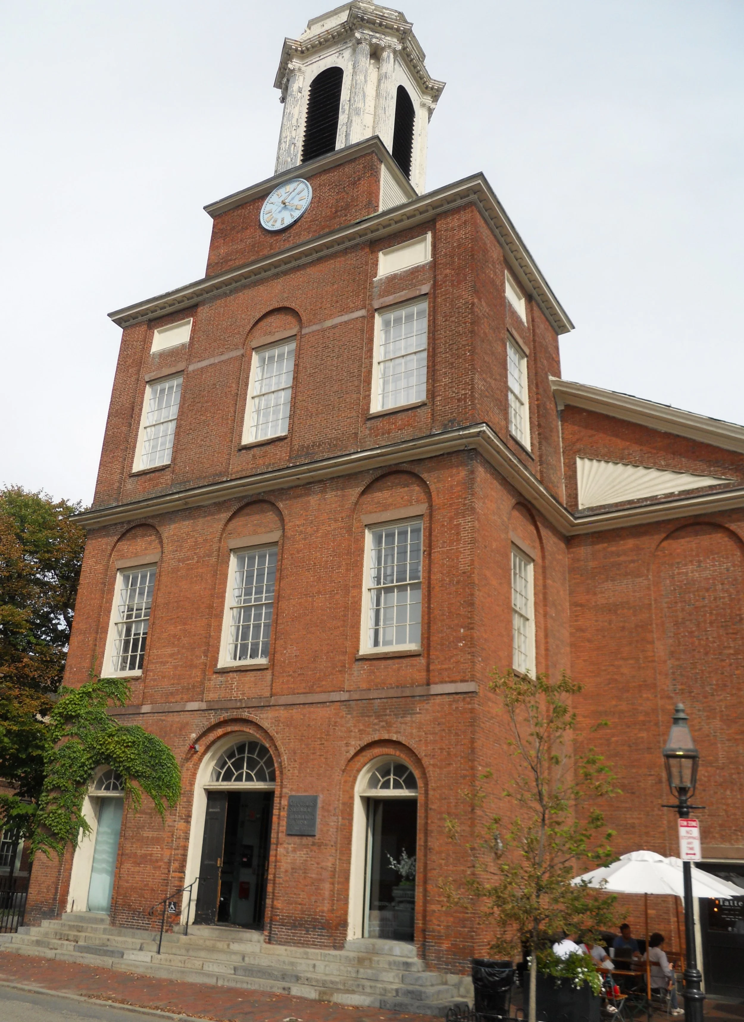
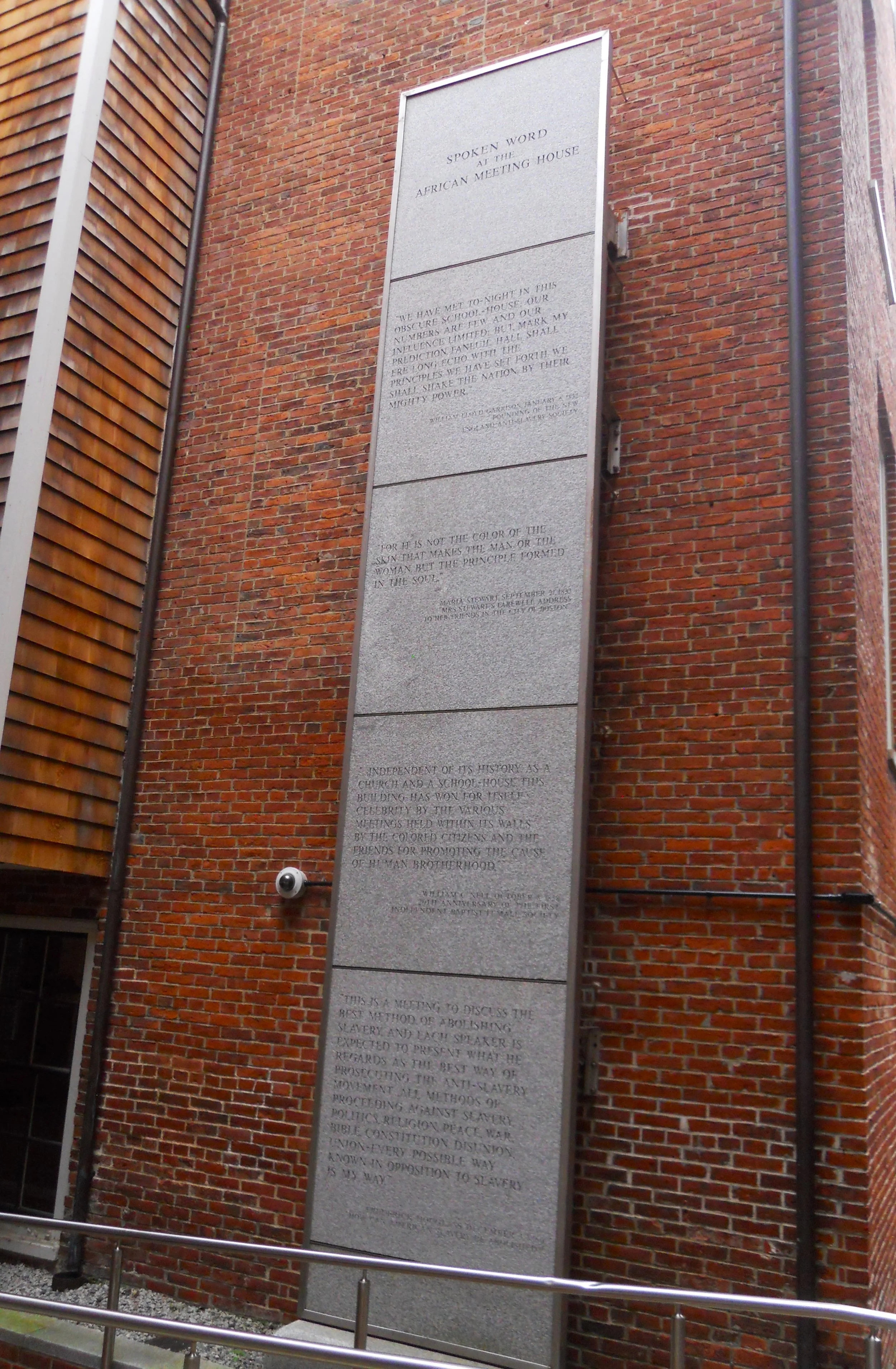
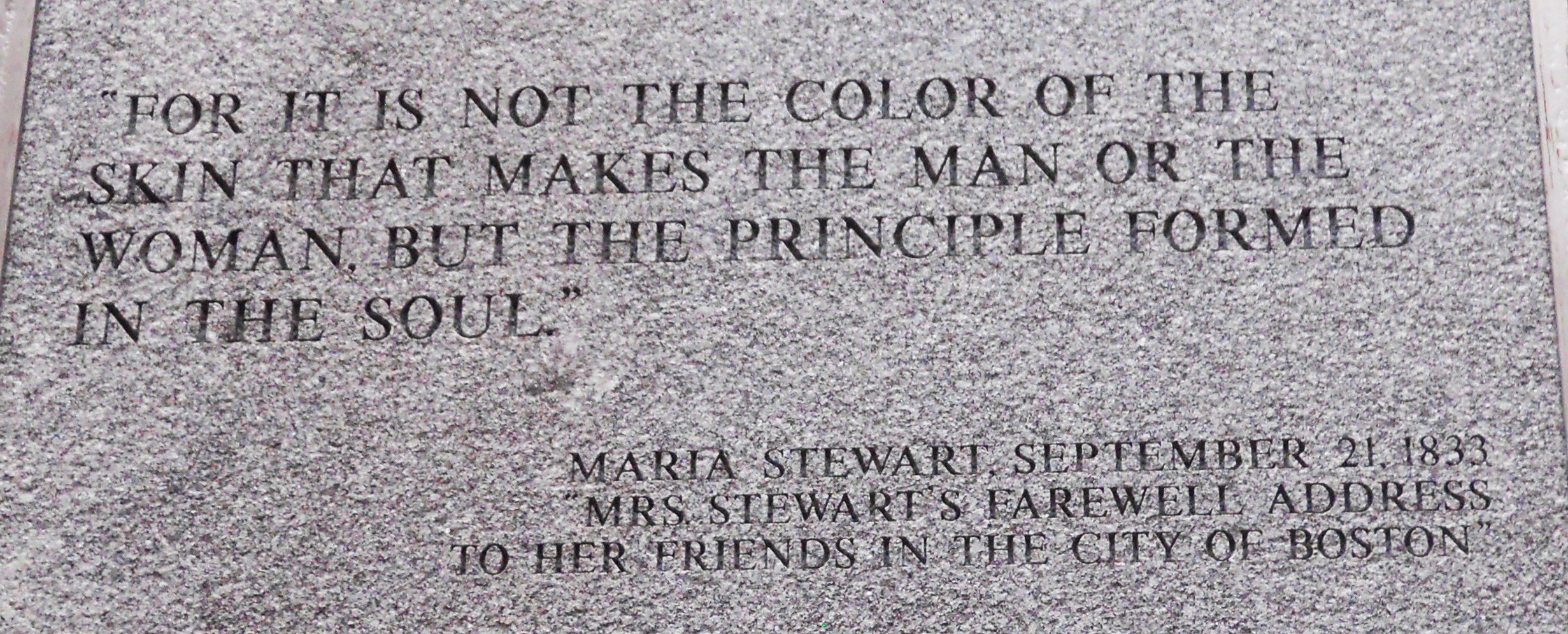
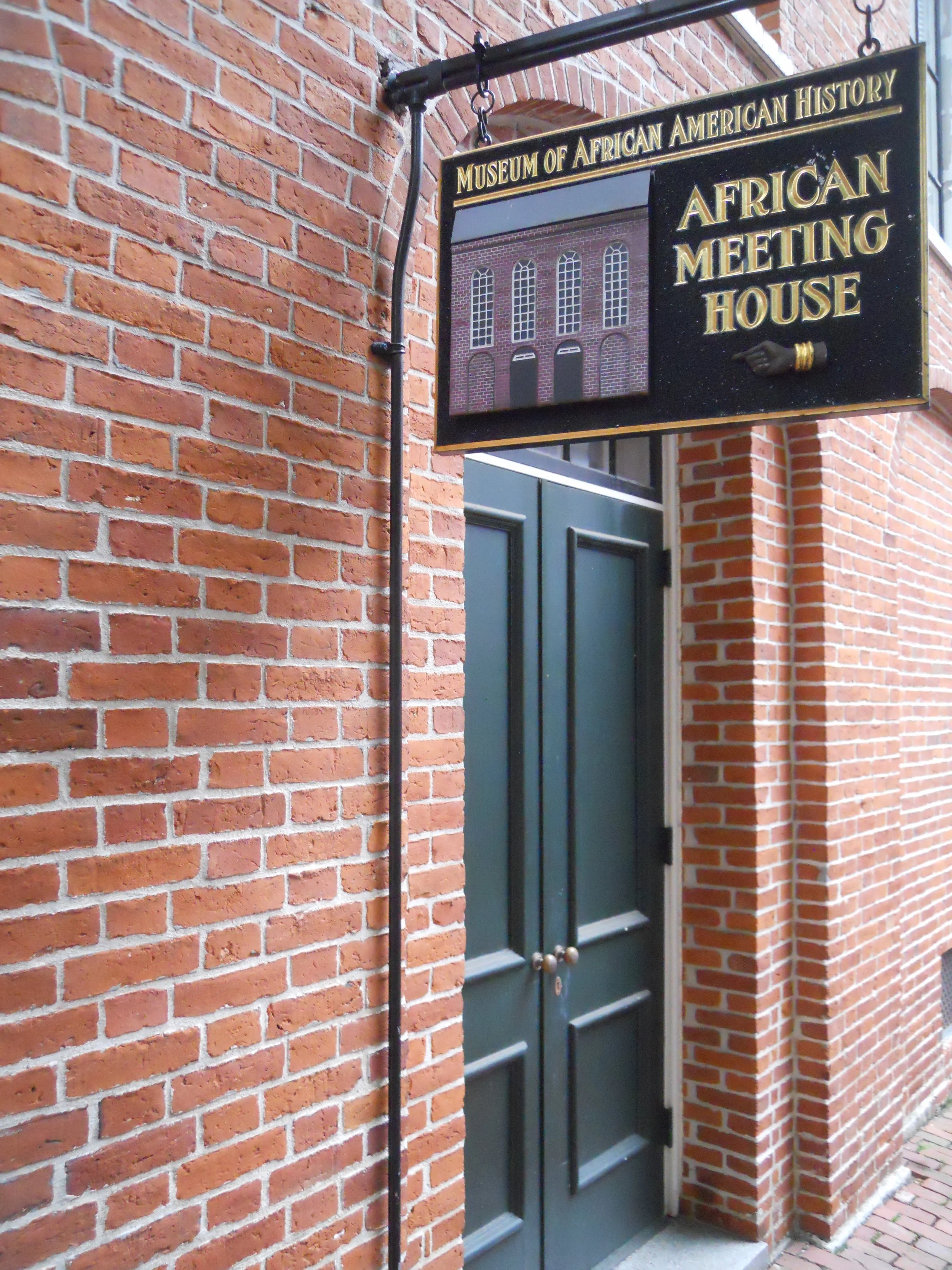
DAY 7 (August 10) - The Boston African American NHS tells the story of Beacon Hill residents in the 1800s, fighting for racial justice and equality. This group led the country in seeking to abolish slavery. The Underground Railroad came through this neighborhood. The Black Heritage Trail was developed to lead visitors around the community, to showcase some of the buildings associated with the movement. The Charles Street Meeting House used to be a Baptist Church (with segregation), until 1876 when the building was sold to the African Methodist Episcopal Church. Throughout the abolition days, many anti-slavery speeches were given here, followed by women suffragists in the late-1800s. The African Meeting House is the oldest Black Church building in the country. It became known as the “Black Faneuil Hall”. A granite slab on the back of the building has quotes from some of the great movement leaders. My favorite is shown. An UGRR safe house was across the street from the Meeting House.
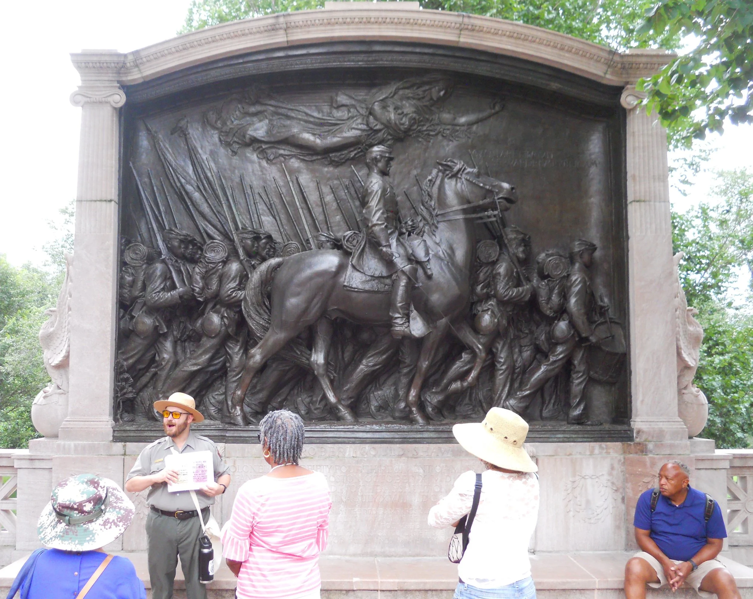
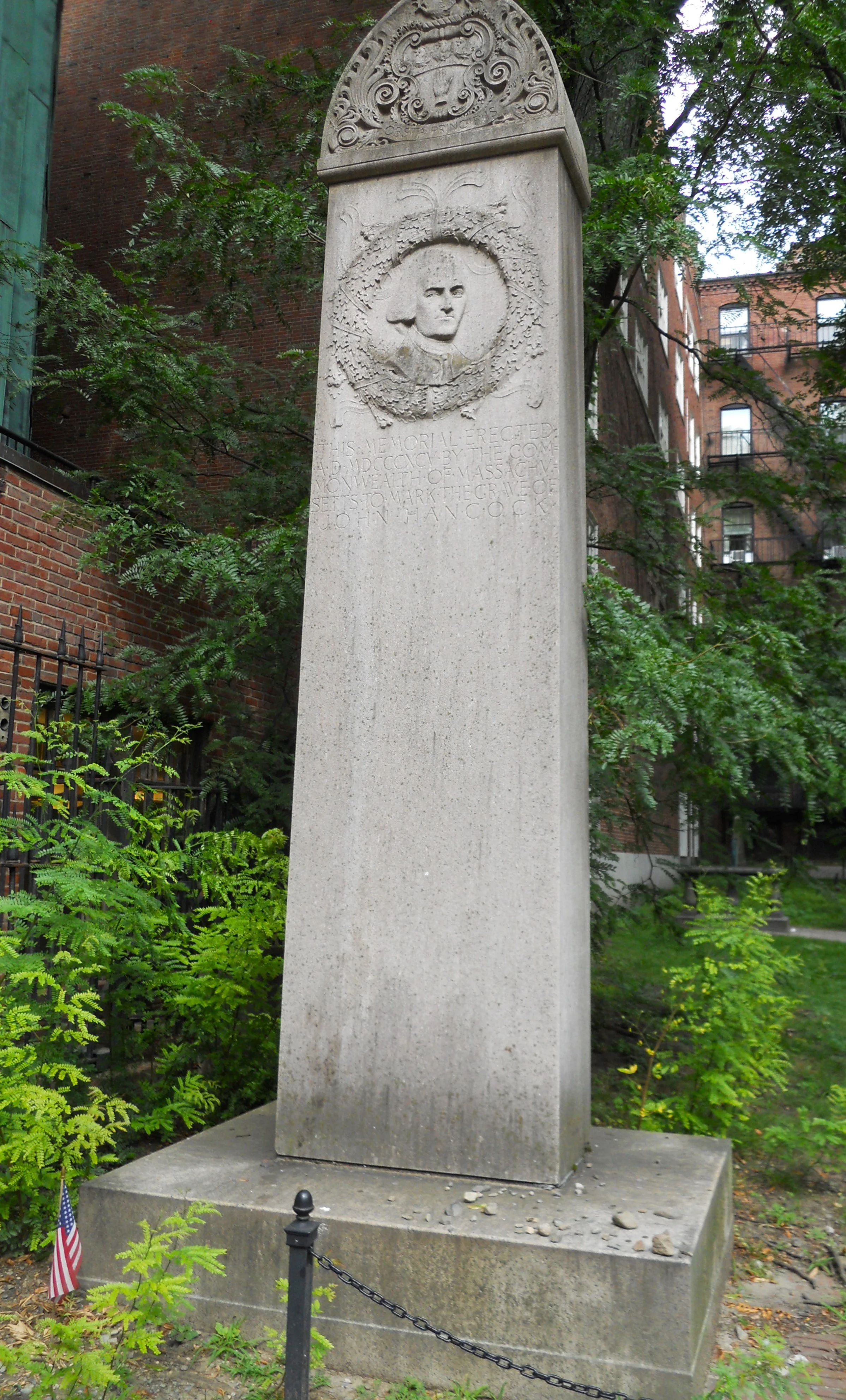
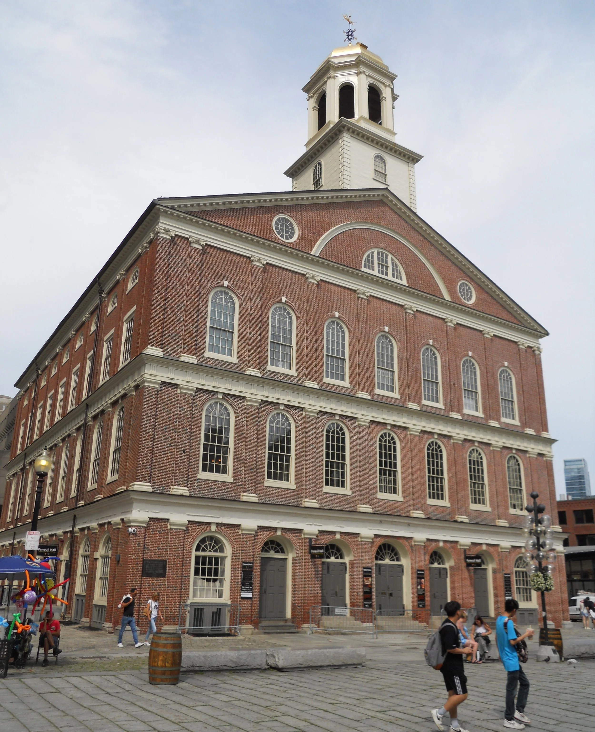
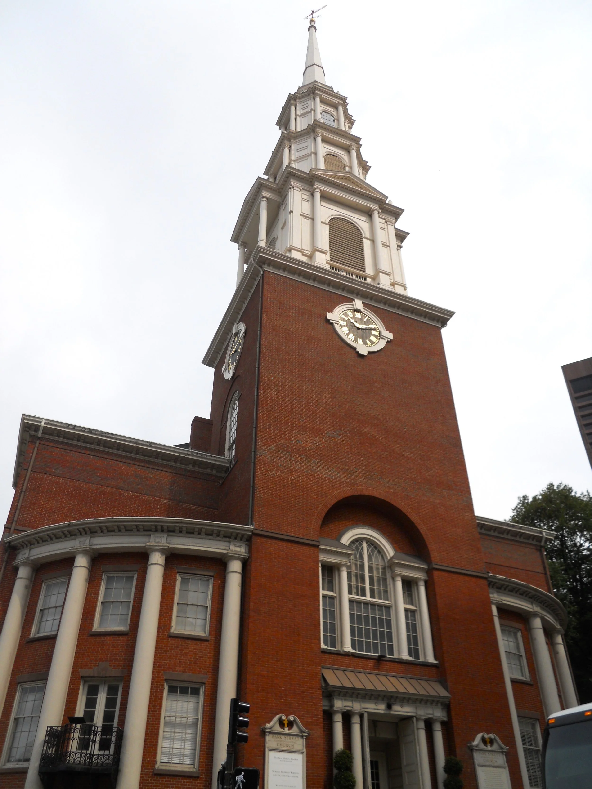
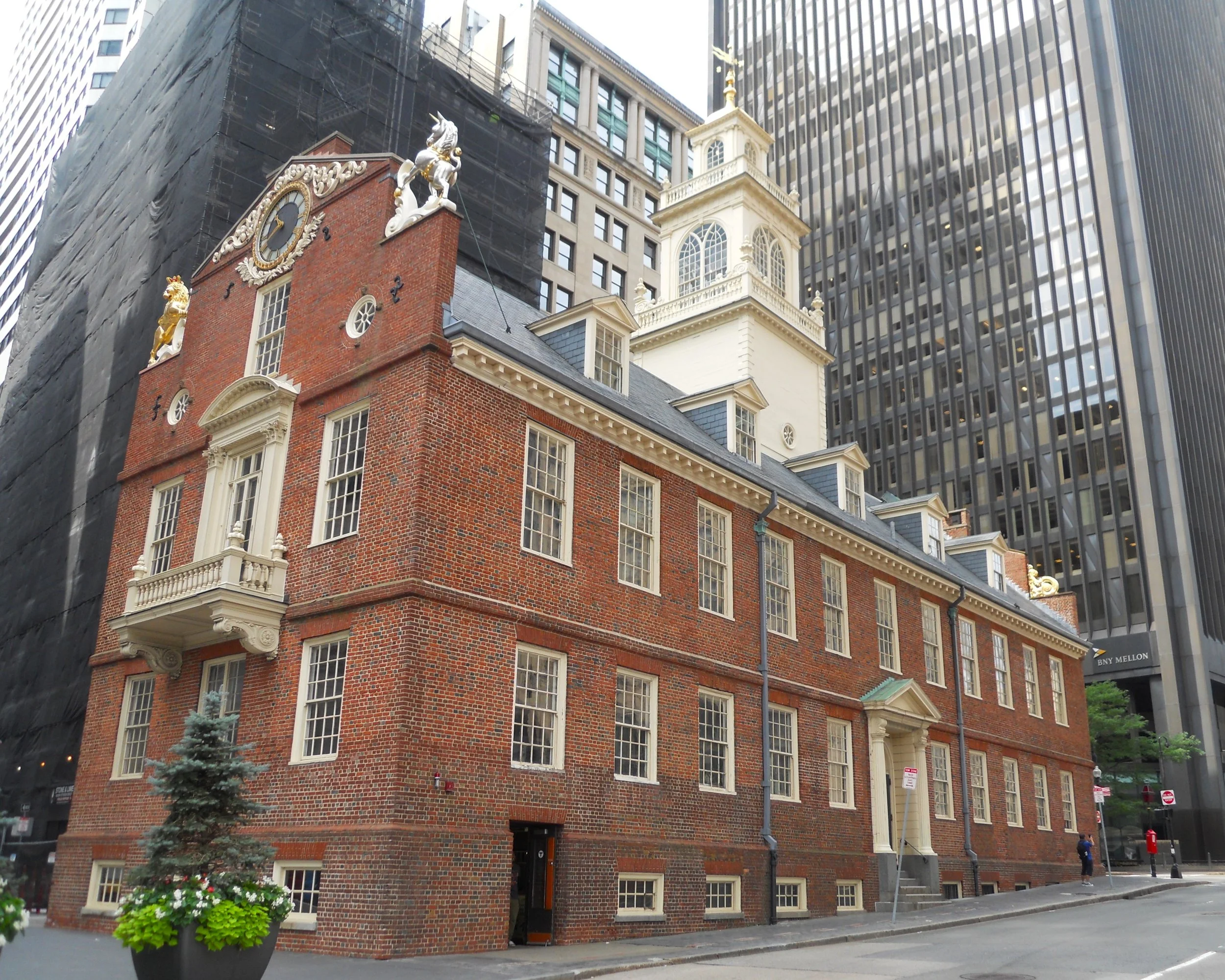
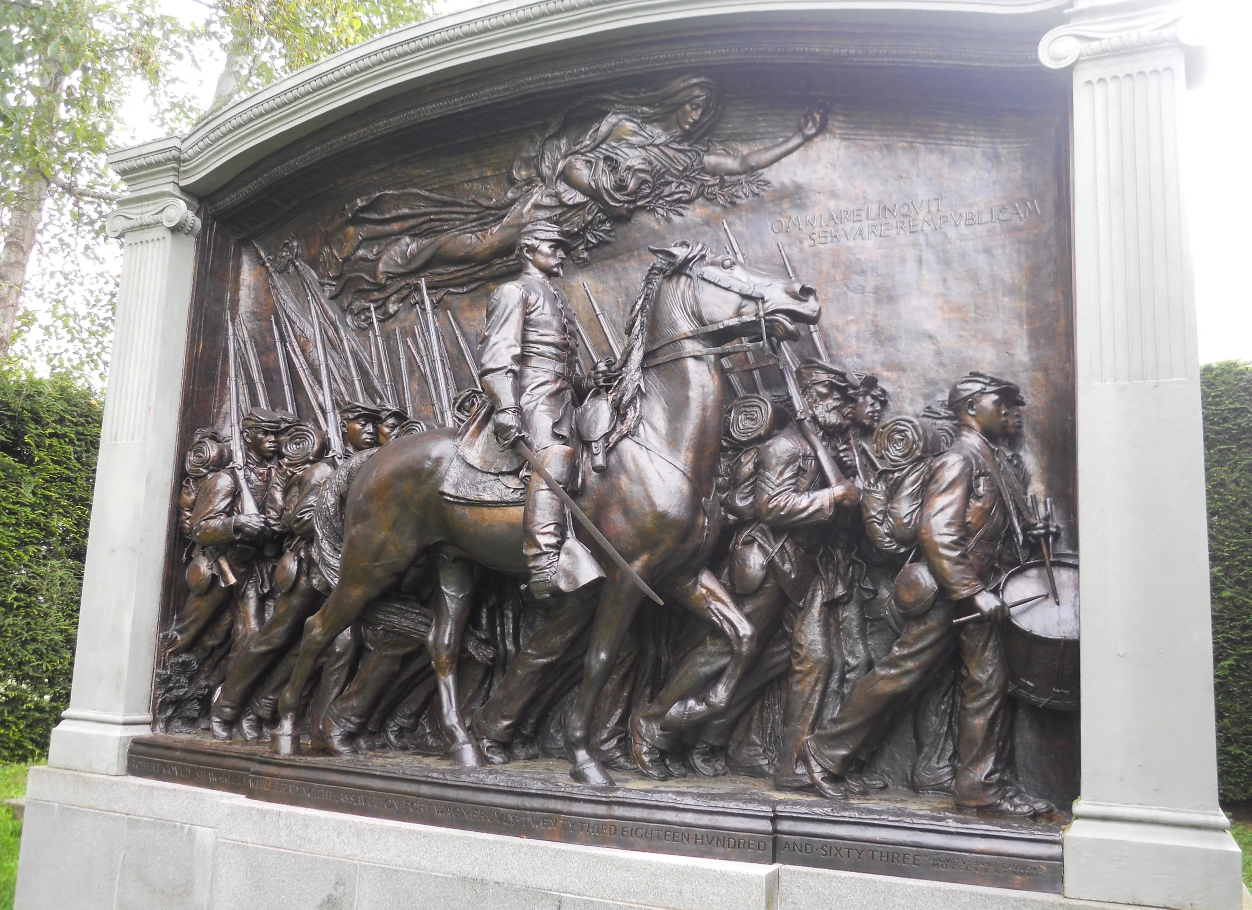
The rest of the day was spent walking the Freedom Trail, a 2.5-mile-long walk covering most of the historical highlights of downtown Boston. It also connects with the Black Heritage Trail. First stop may look familiar to readers. Yes, this is Saint-Gaudens bronze sculpture of Col. Shaw and the 54th Massachusetts. The version at his home, which I visited a few days ago, had a flaw, per Saint-Gaudens, so he created a new iteration with a few tweaks. The “new” one is on display in Boston Commons, the oldest public park in the country. Park Street Congregational Church, founded in 1809, is down the street. The congregation was one of the first in the new country to discuss civil rights for all. Next to it is the famous Granary Burying Ground. John Hancock (photo), Paul Revere, and other prominent Boston residents are buried here. Four blocks later, after passing Kings Chapel Burying Ground, is the Old State House, built in 1713. The infamous Boston Massacre happened just outside its doors. The first Boston reading of the Declaration of Independence was heard from its balcony. A couple streets later was Faneuil Hall, the Cradle of Liberty. Lectures, discussions, and demonstrations are still heard in the second floor.
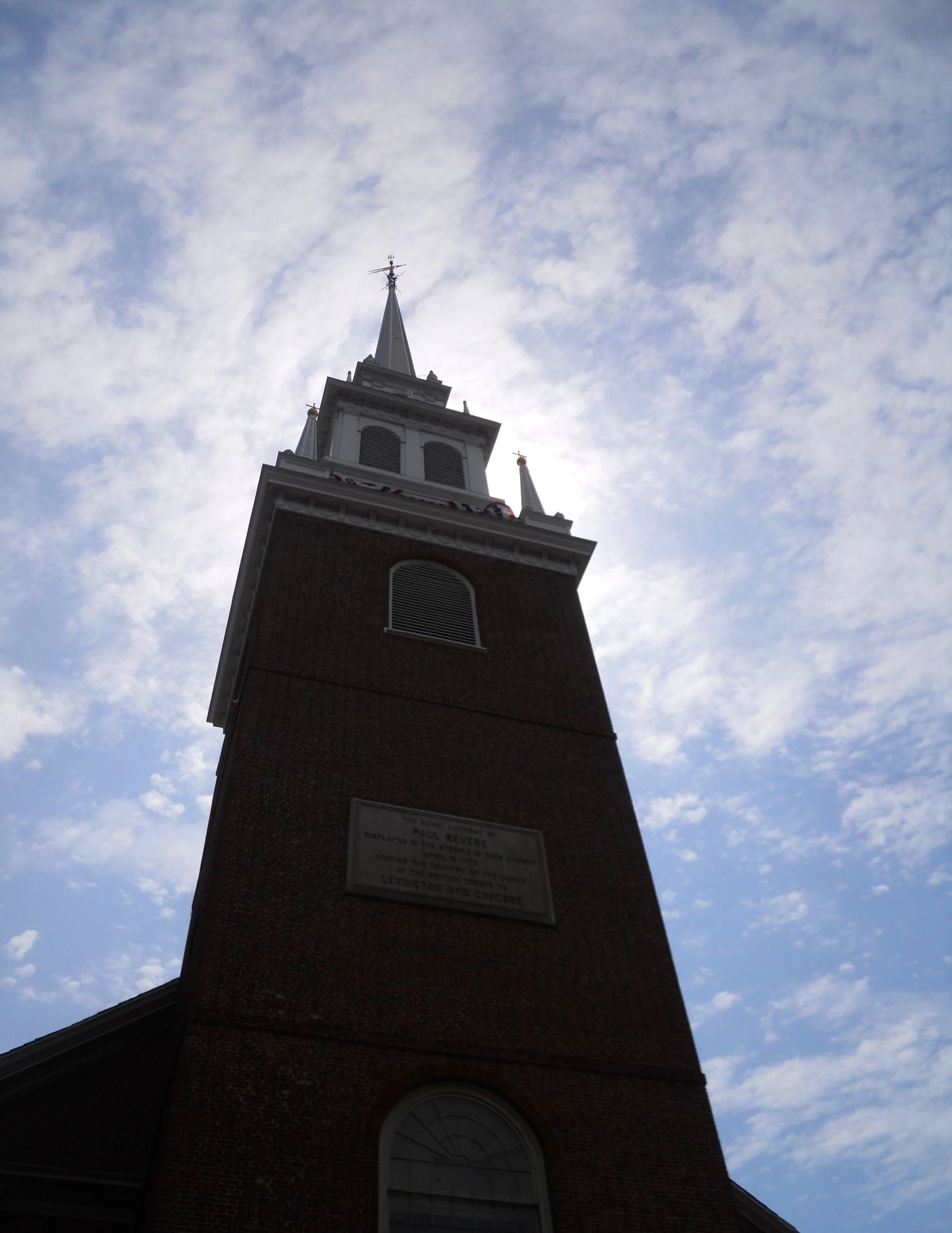
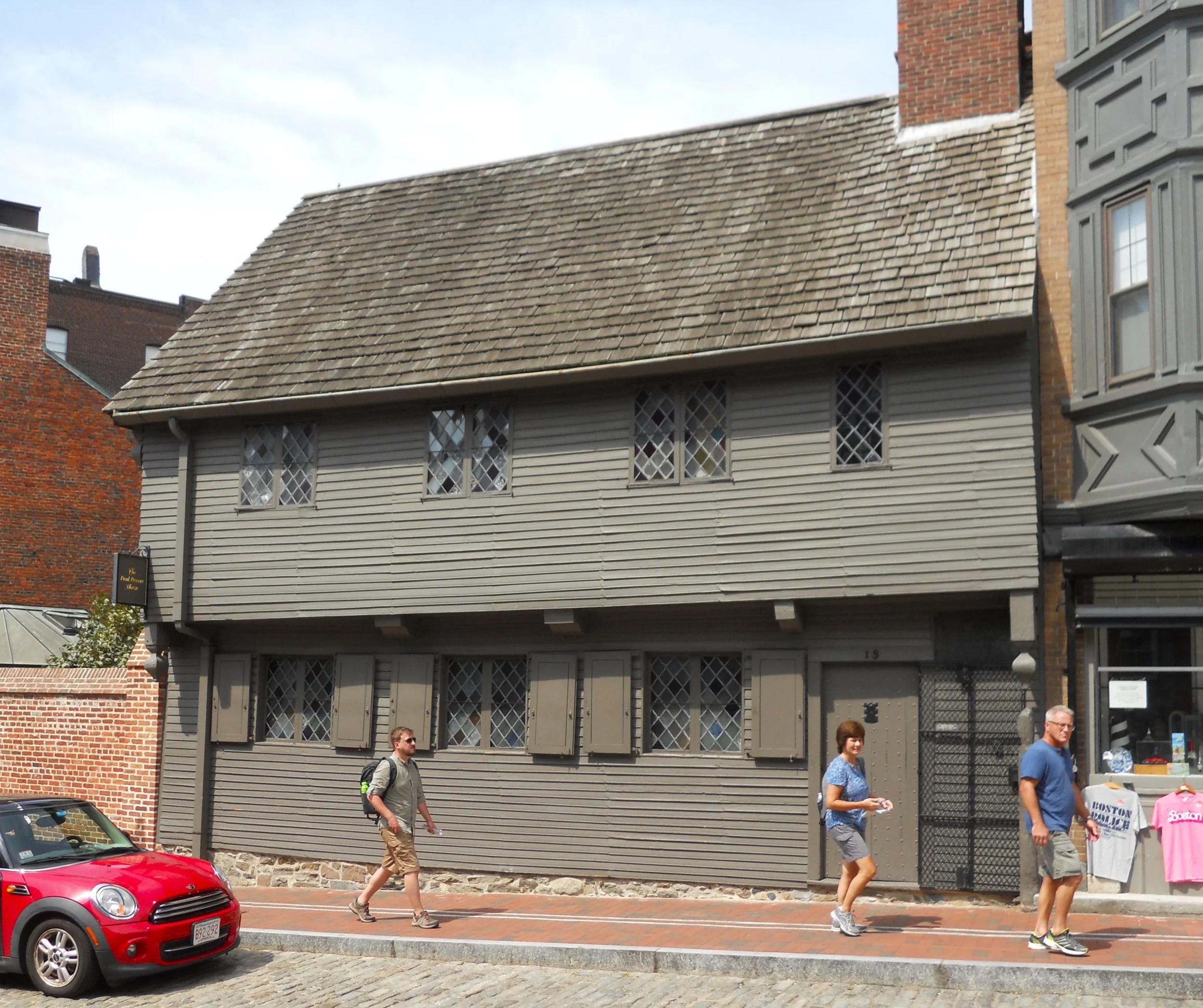
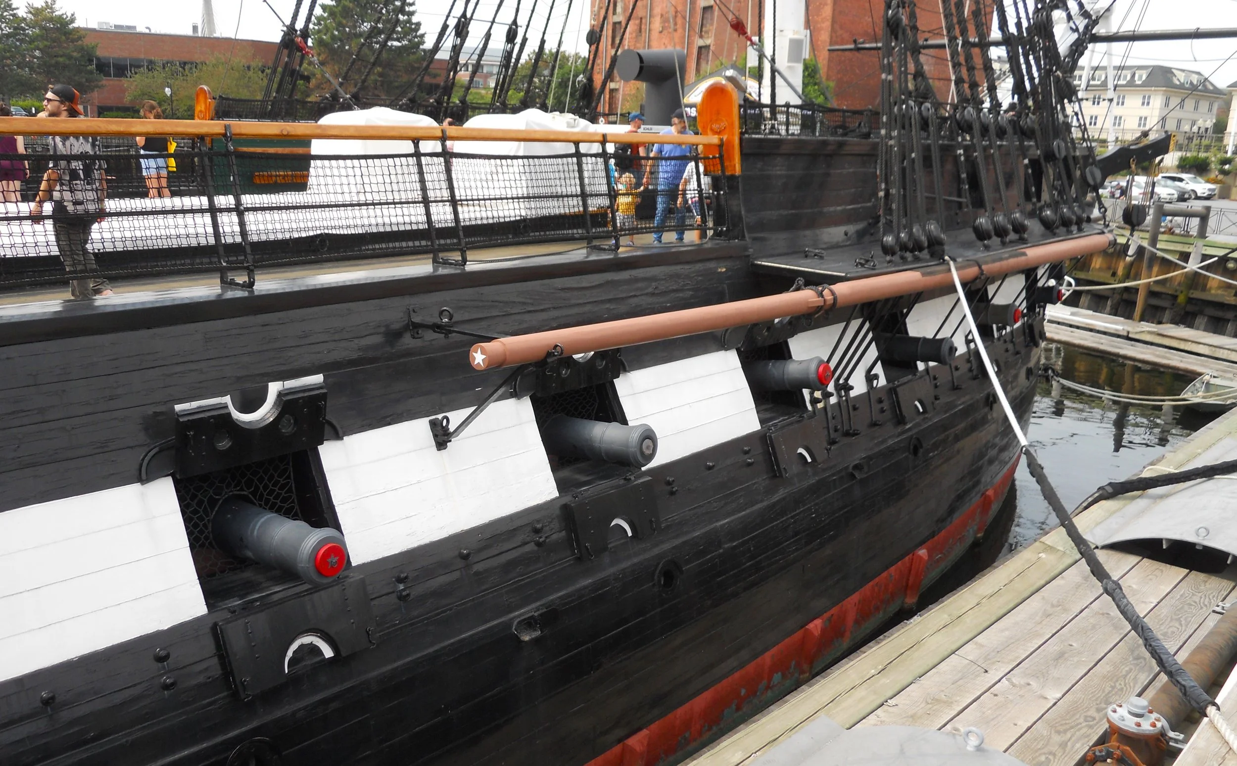
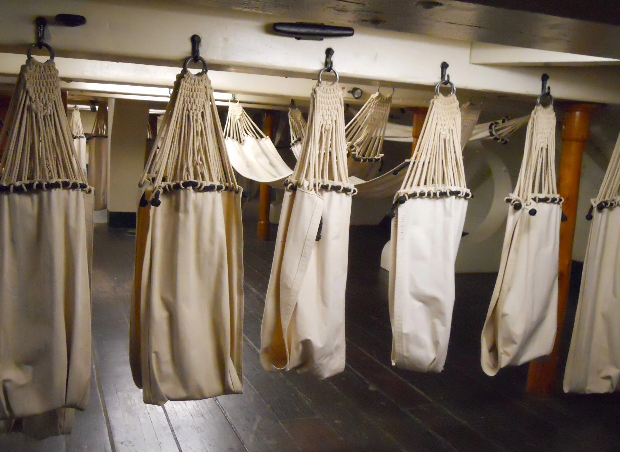
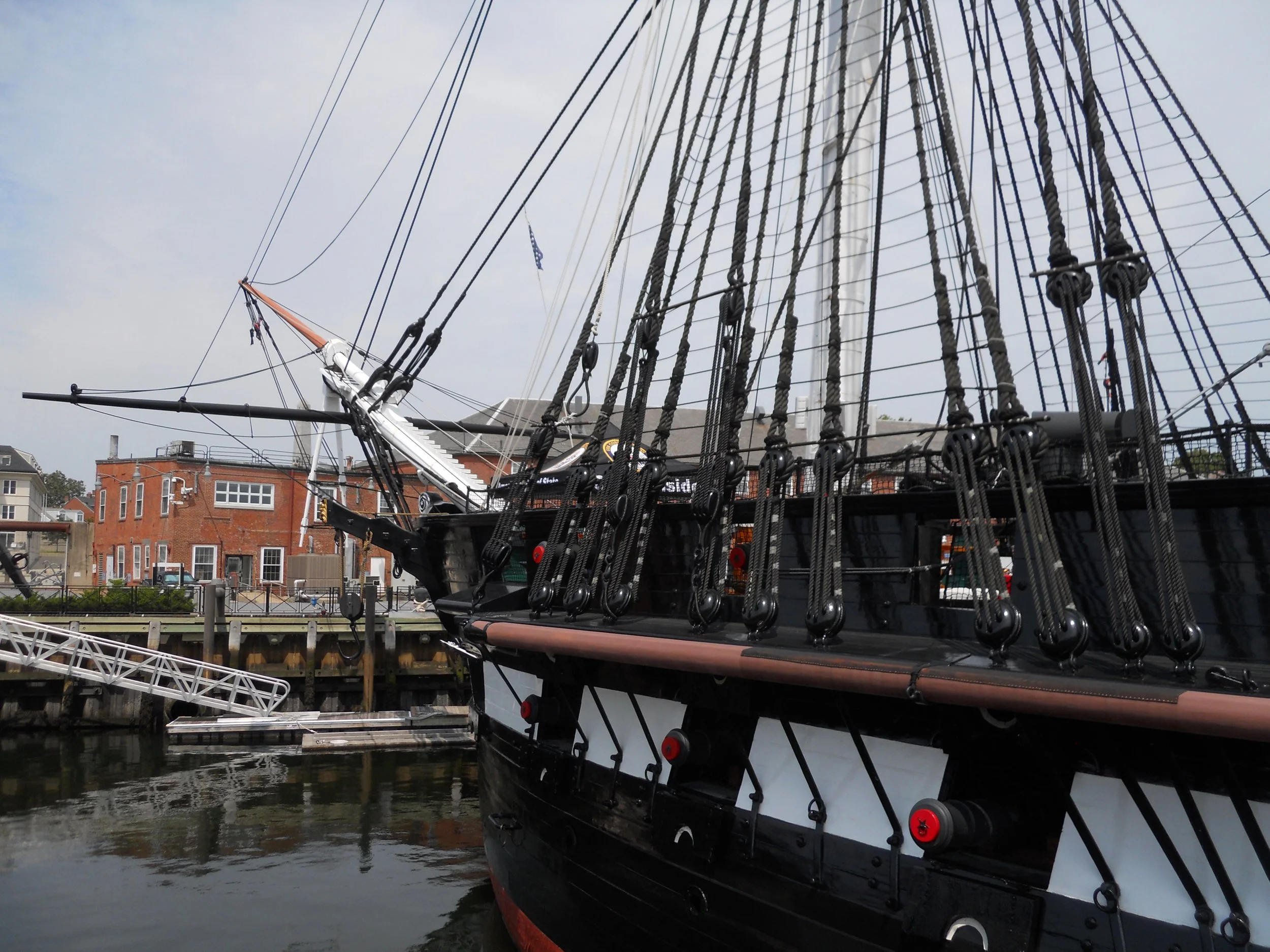
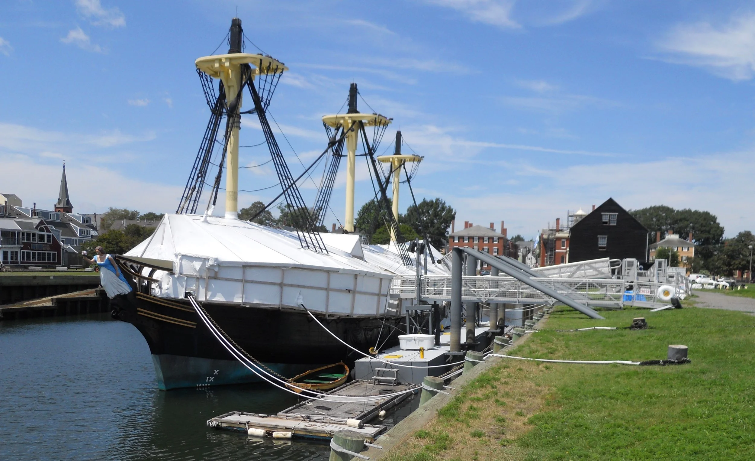
After walking over I-93 (which is now underground thanks to the Big Dig a couple decades ago) I came to Paul Revere’s home. This is the oldest building in downtown Boston, dating to 1680. It looks as if from a different world. A few minutes later I was at the Old North Church. Stand there and imagine what Paul Revere and William Dawes felt when they looked at the steeple the night of April 18, 1775. Next up was Copp’s Hill Burying Ground. Twenty-five men who participated in the Boston Tea Party are buried here. One then has to walk across a bridge (over the Charles River) to reach Charlestown and the most famous warship in our country’s history. Cannons continue to be pointed out from their gunports. The U.S.S. Constitution is still in active service, evident by all the U.S. Navy service people around the ship and dock. Two of the lower decks are open to tour. The bottom deck is where the enlisted men slept, in hammocks stretched between beams.
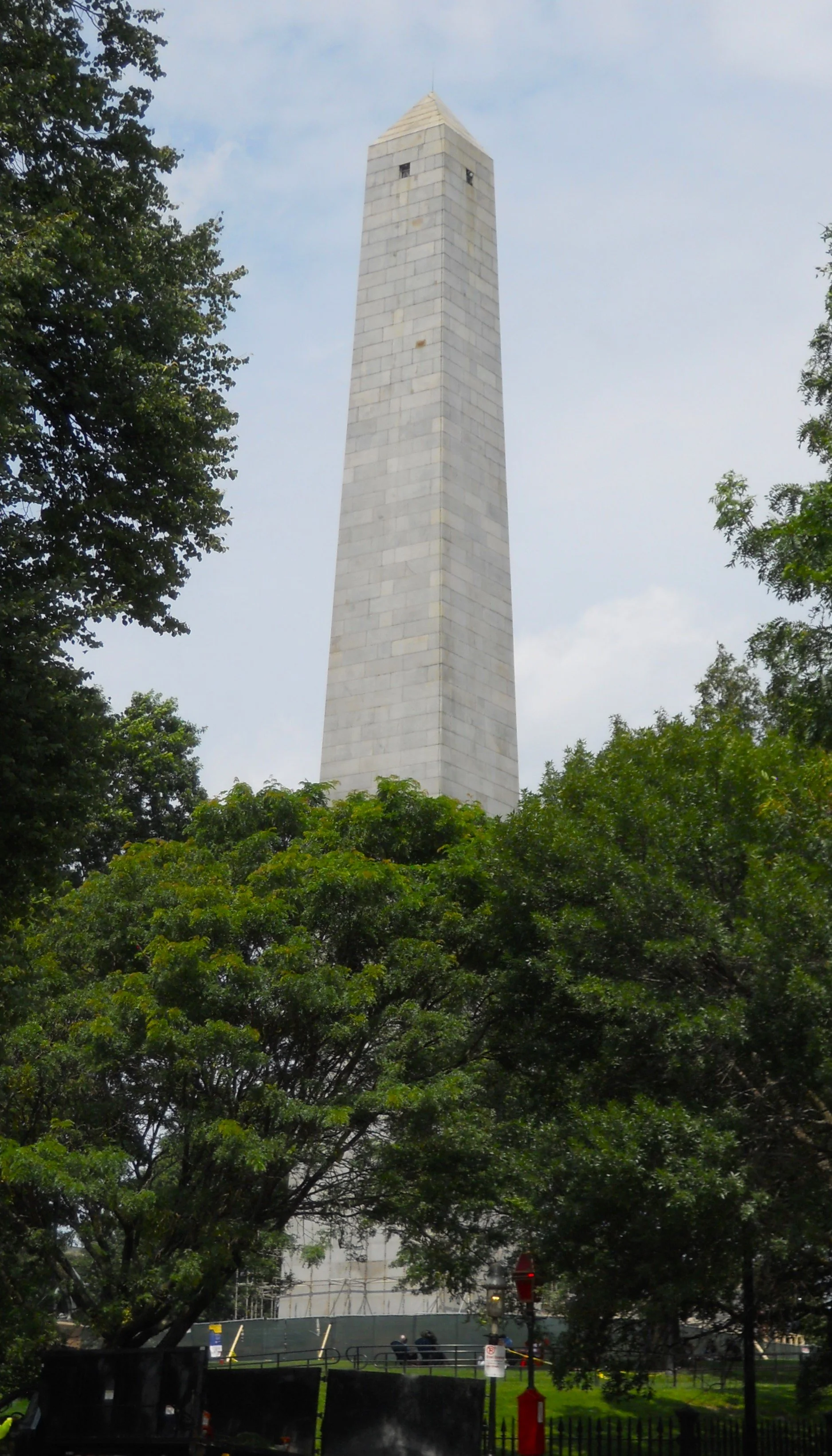
Last, but not by any means least, is Bunker Hill. The Battle of Bunker Hill was fought on June 17, 1775. Though both sides were intent on securing the height advantage of Bunker Hill (110 feet above sea level), almost all the fighting took place on neighboring Breed’s Hill. The British were victorious but at a great cost, losing many more men than the colonists. The lasting effect though was positive, the British now realizing the colonial militias could fight toe-to-toe with them.
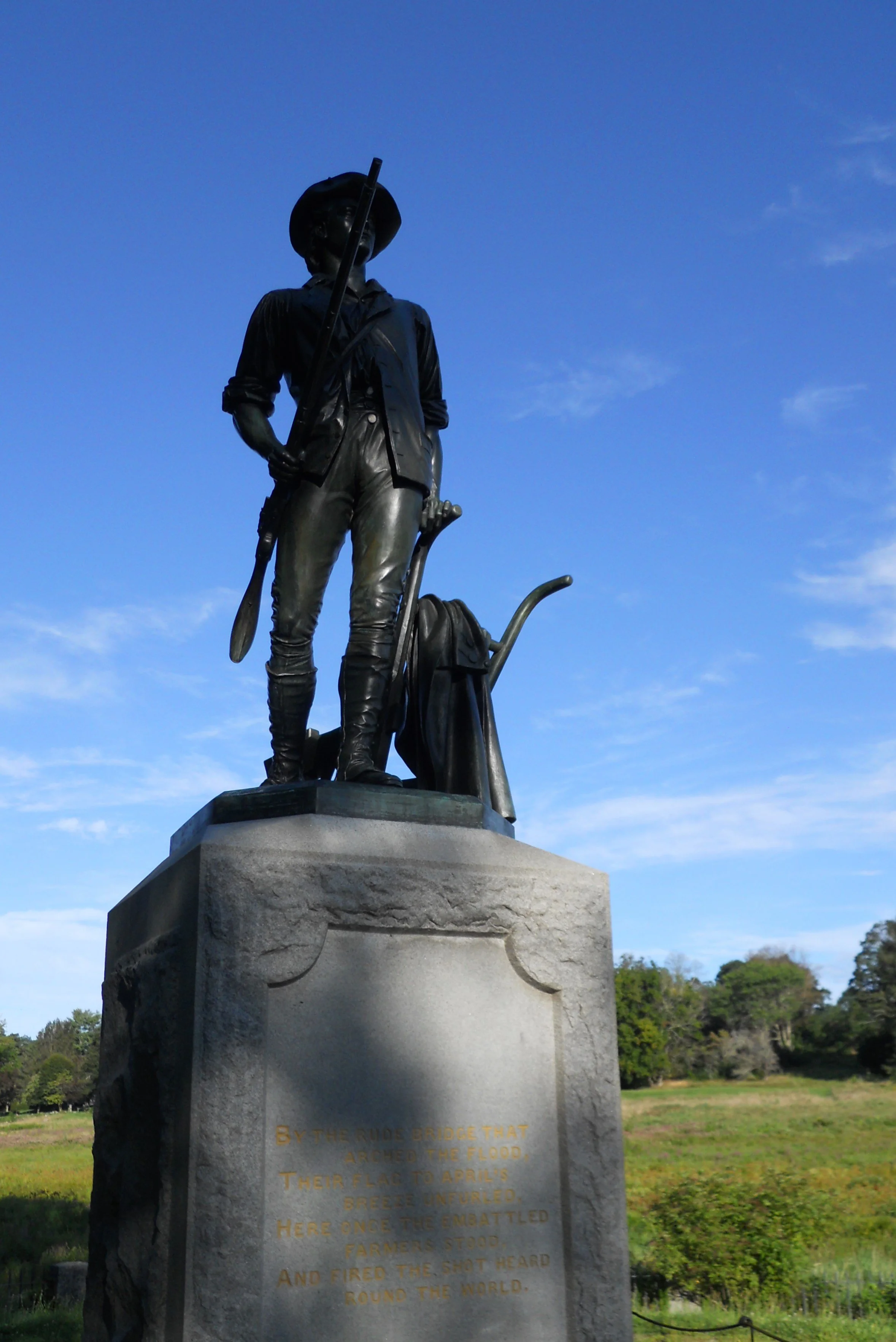
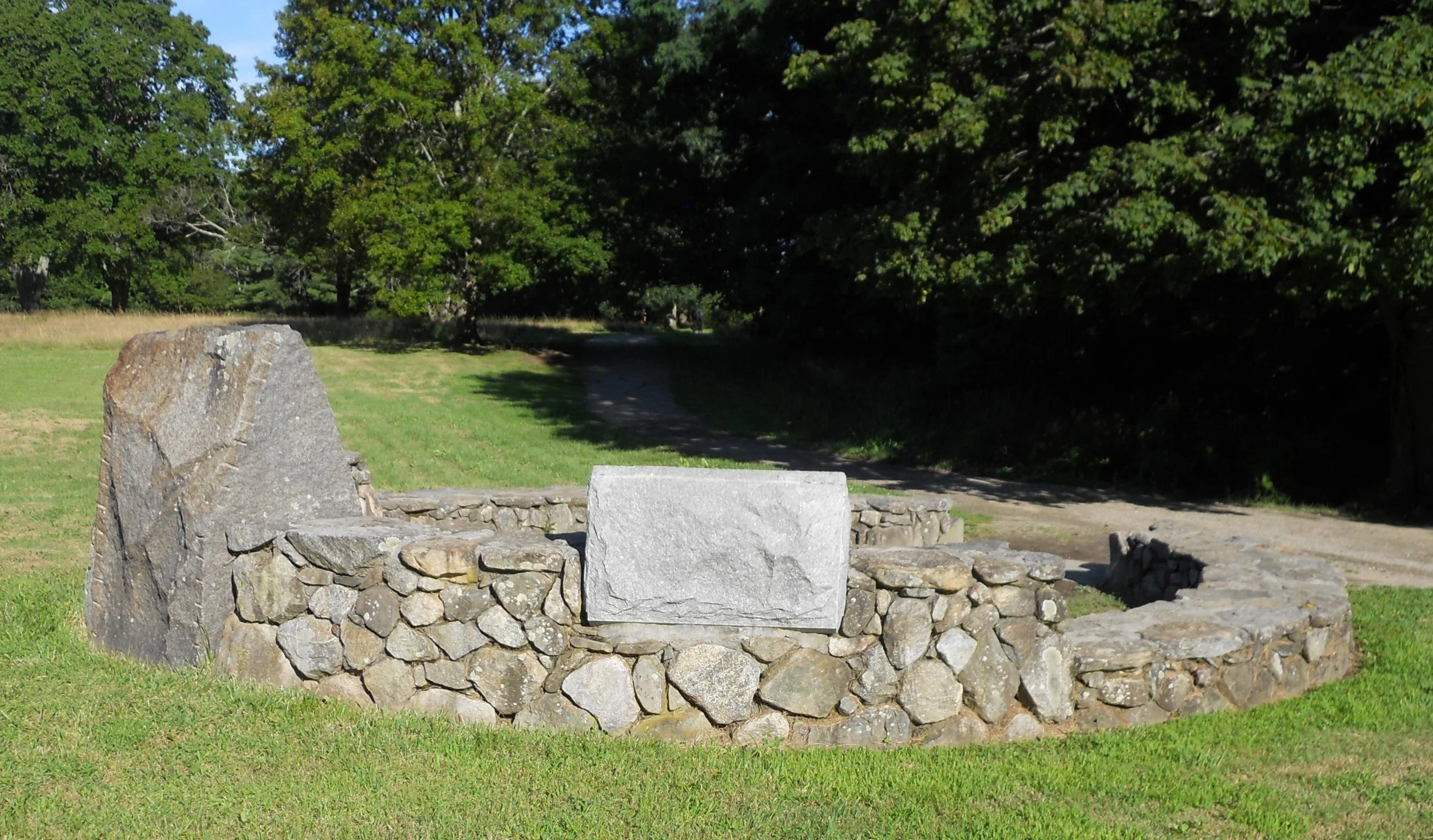
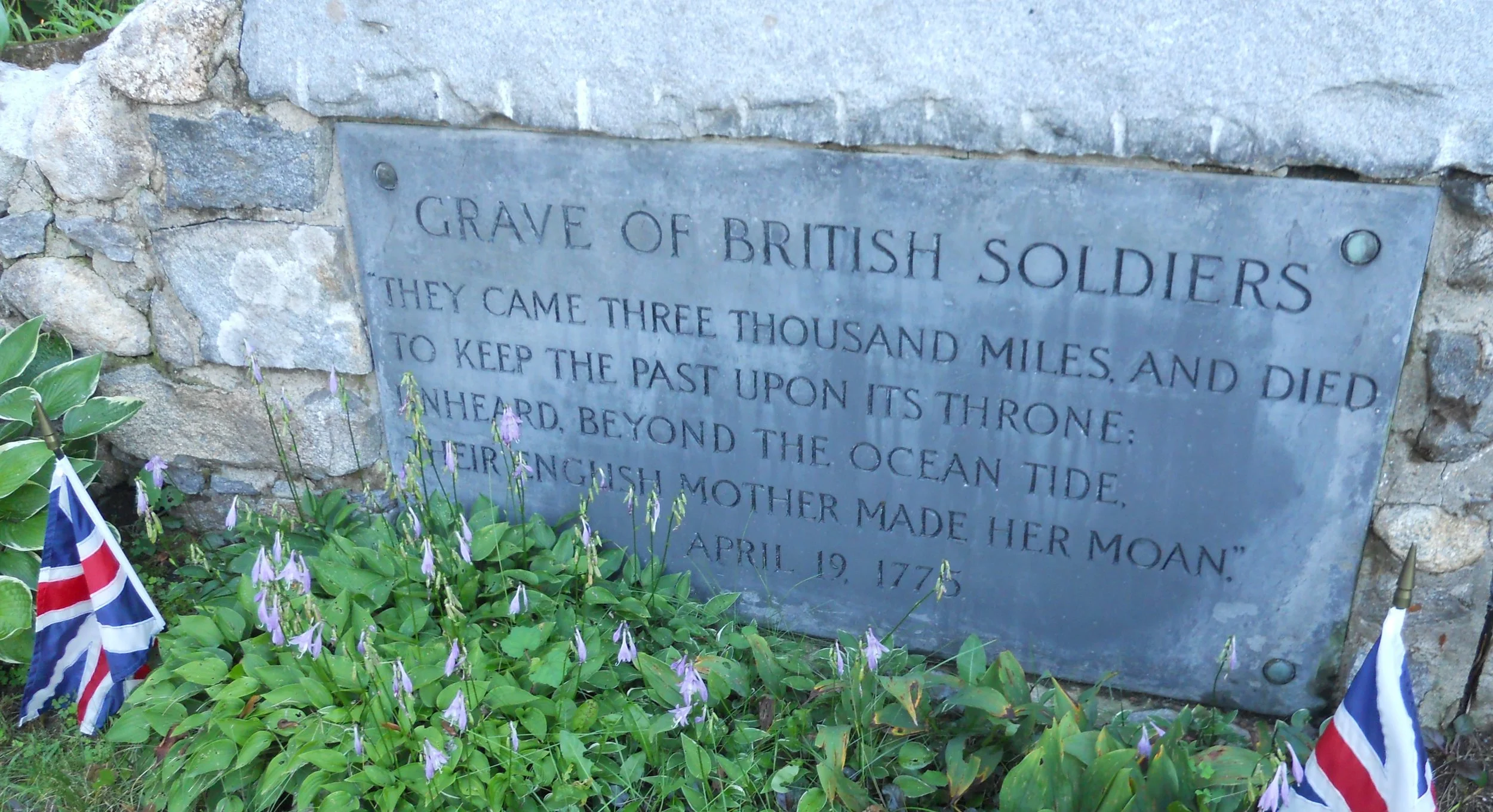
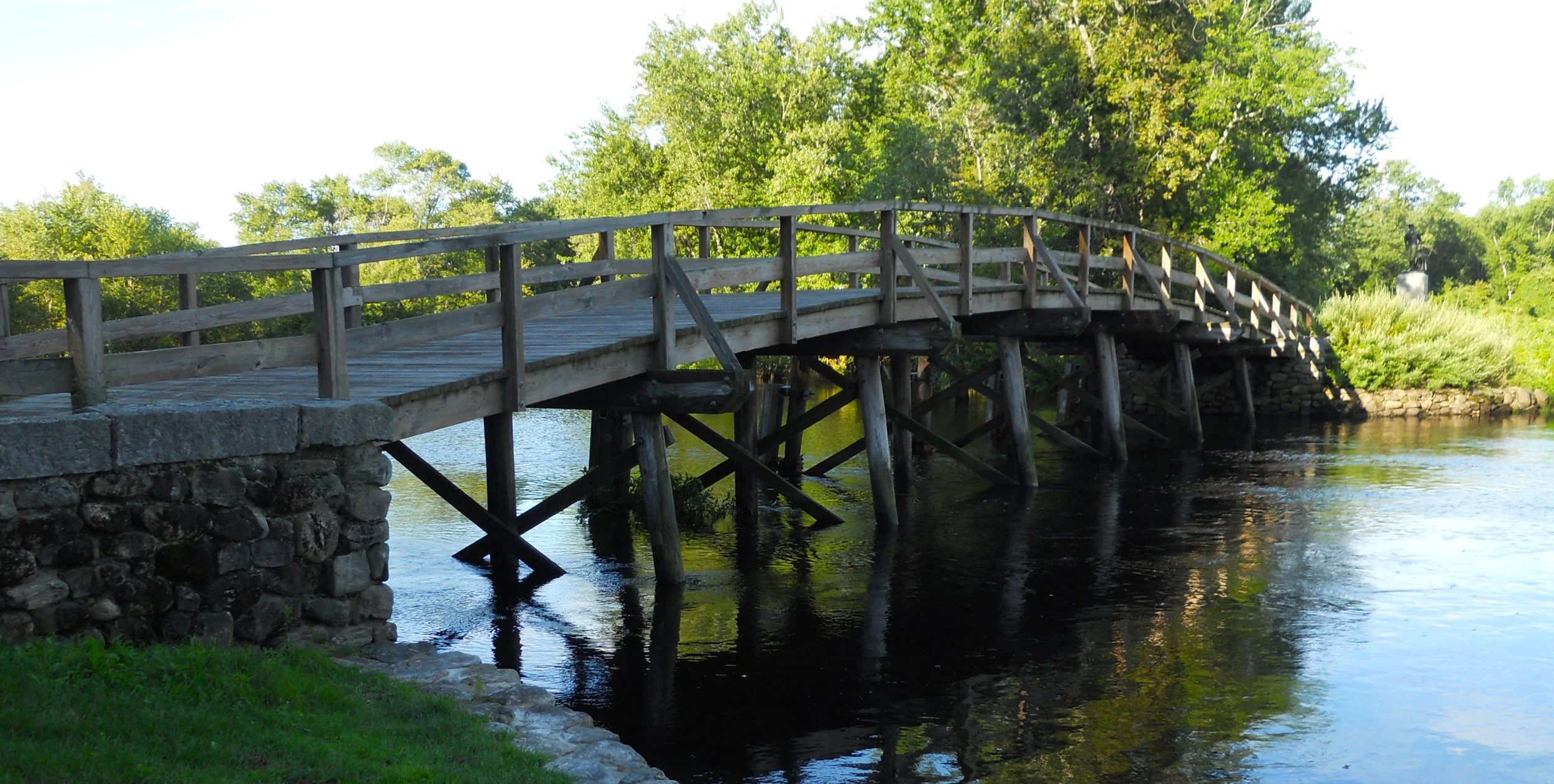
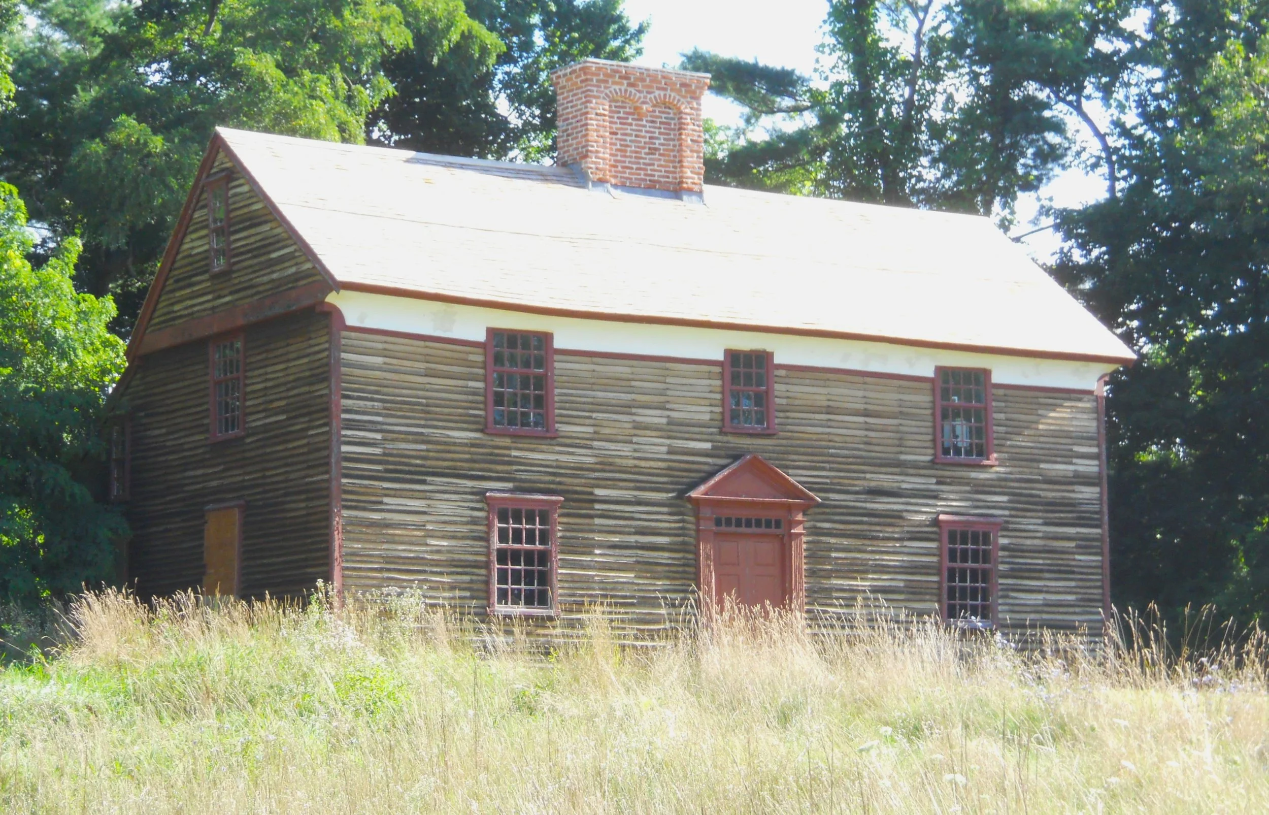
DAY 6 (August 9) - Minute Man NHP preserves the land on which the American Revolutionary War began. A militia figure stands tall at the North Bridge, where the British tried to cross the Concord River on April 19, 1775. The majority of the park encompasses a 5-mile stretch of the Battle Road, the lane which the British marched on to approach the North Bridge, and then to retreat back to Boston. One spot on the road is famous for Lincoln Minute Man William Thorning. The photo on the far right is the row of stones he hid behind when the British soldiers passed by, then fired from behind, killing two (they are buried on the other side of the road). The spot at which Paul Revere was captured, thereby ending the famous “Midnight Ride of Paul Revere”, is identified by a stone marker. Revere, William Dawes, and Samuel Prescott were detained by ten British officers. Prescott escaped and continued on to Concord to raise the alarm (Dawes escaped back towards Lexington). Also on the Battle Road is the home of Captain William Smith, commander of the Lincoln Minute Men (and brother of Abigail Adams), the first militia to arrive at the North Bridge that morning. There are graves of British soldiers in the park, with one site being at the North Bridge.
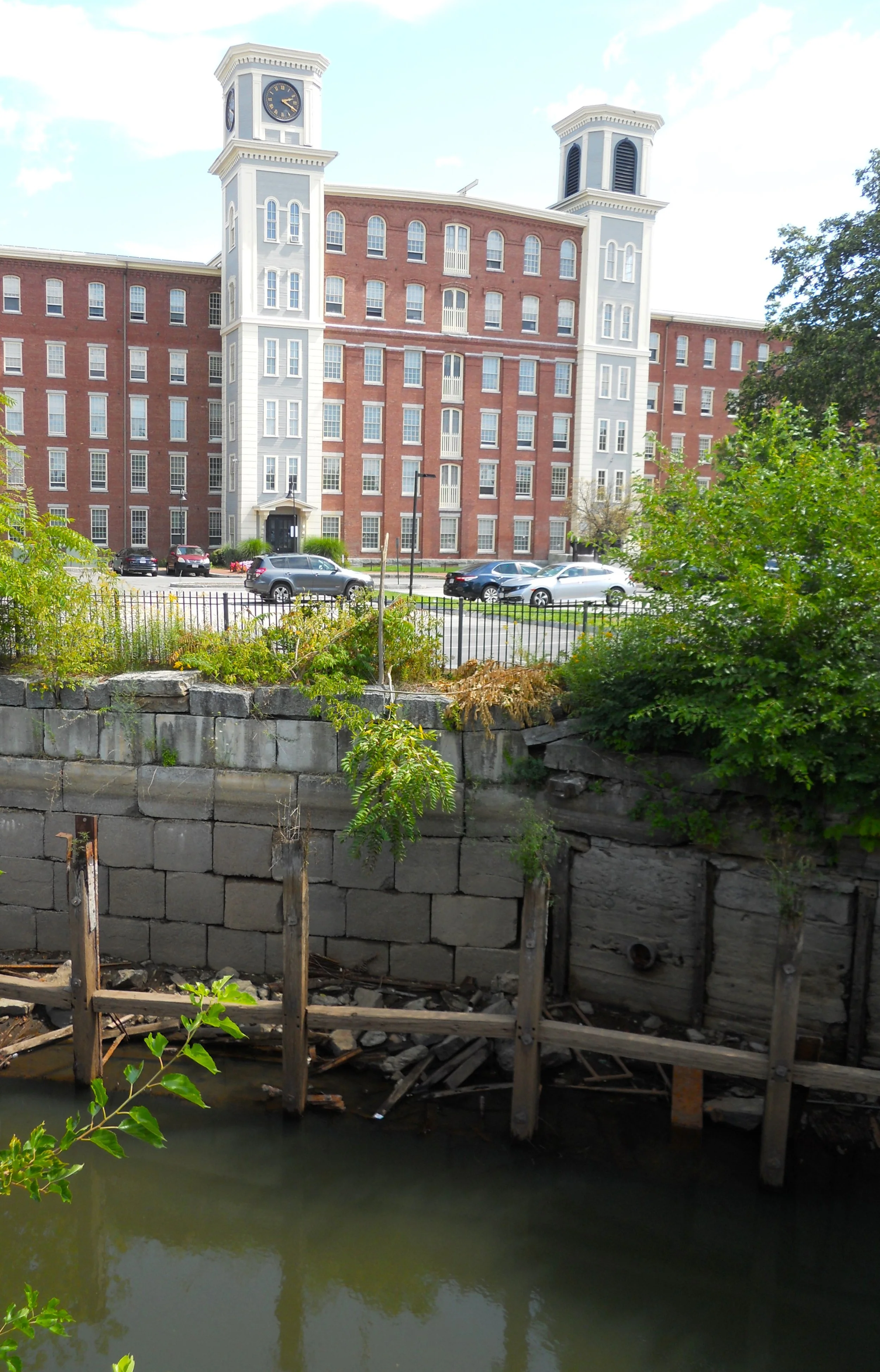
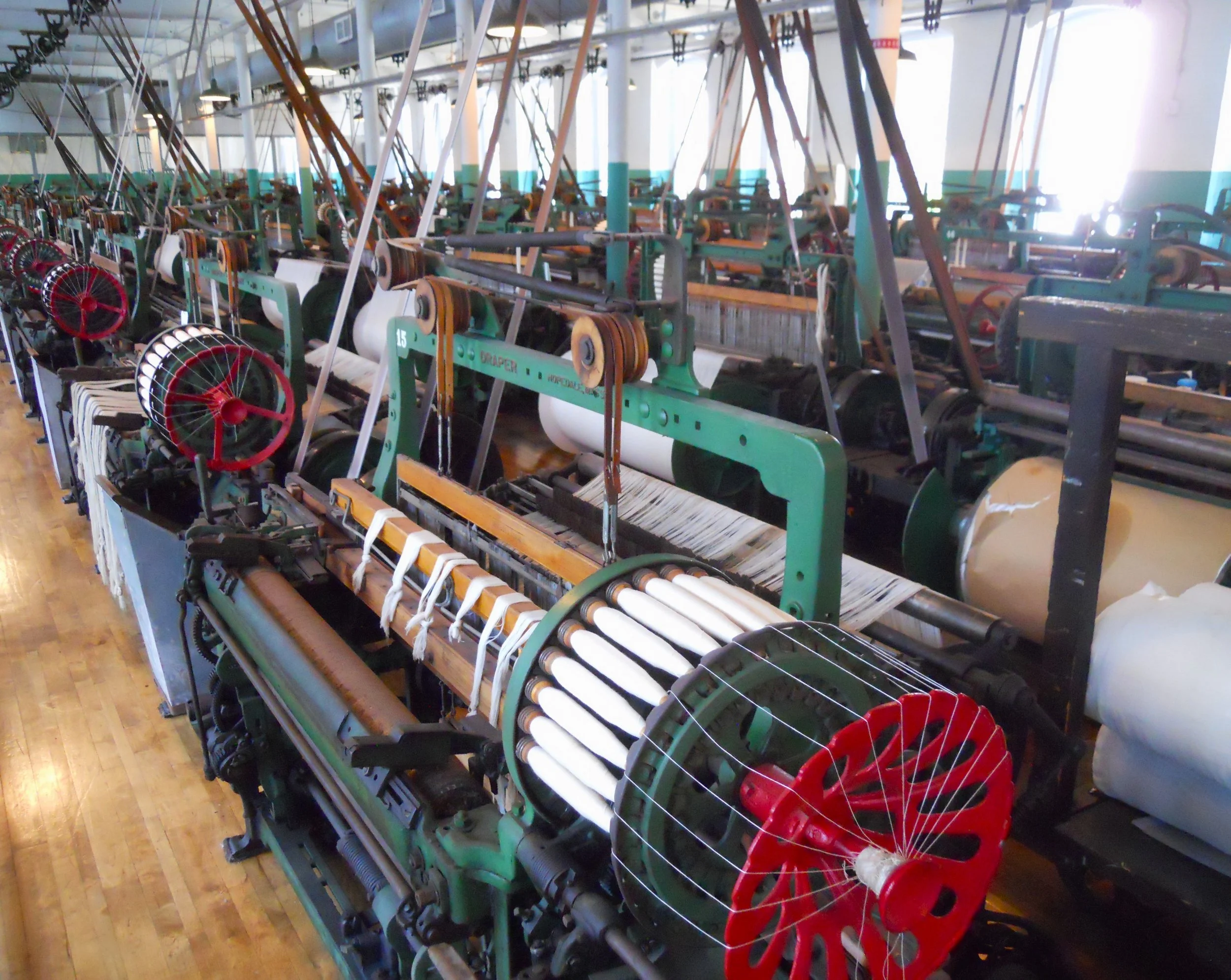
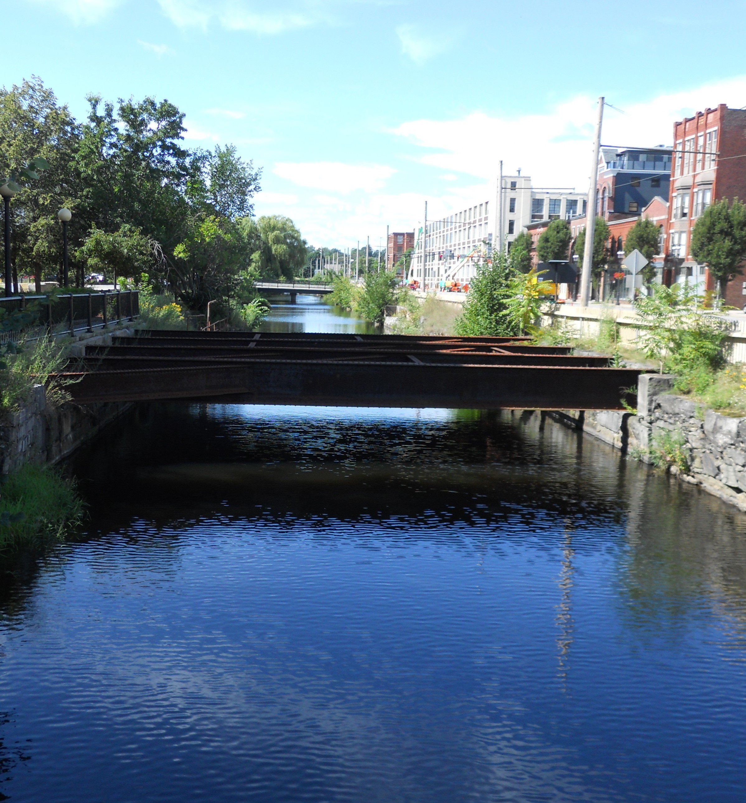
Lowell NHP is the site of the first modern industrial city in America. The Merrimack River provided enough kinetic energy for textile mills to operate. By 1836 there were 55 mills, employing 6,000 people, mainly women (in the second half of the century, immigrants such as the Irish, began to take over those jobs). The railroads were key to bringing in raw materials and sending out finished goods. The only mill left to visit is the Boott Cotton Mill, part of the park. A visitor can walk through the first floor of 110 Draper-model looms, running on belts and pullies. The automation of bobbins for this type of equipment allowed a worker to tend 24 looms instead of 8. Can anyone say, “productivity increase”? Two park associates were running six of the looms as I toured. Their ear plugs were getting a workout. Any other buildings still standing, such as the Massachusetts Mill (photo, in front of Eastern Canal), have been repurposed as apartments, small businesses, or other ventures. A one-mile walking path around town took me to the Lower Locks and its gate house. Water was coming out from the Pawtucket Canal. The Merrimack Canal looked more peaceful (photo). St. Anne Episcopal Church is near the VC. It was a hub for the Underground Railroad during the 19th century.
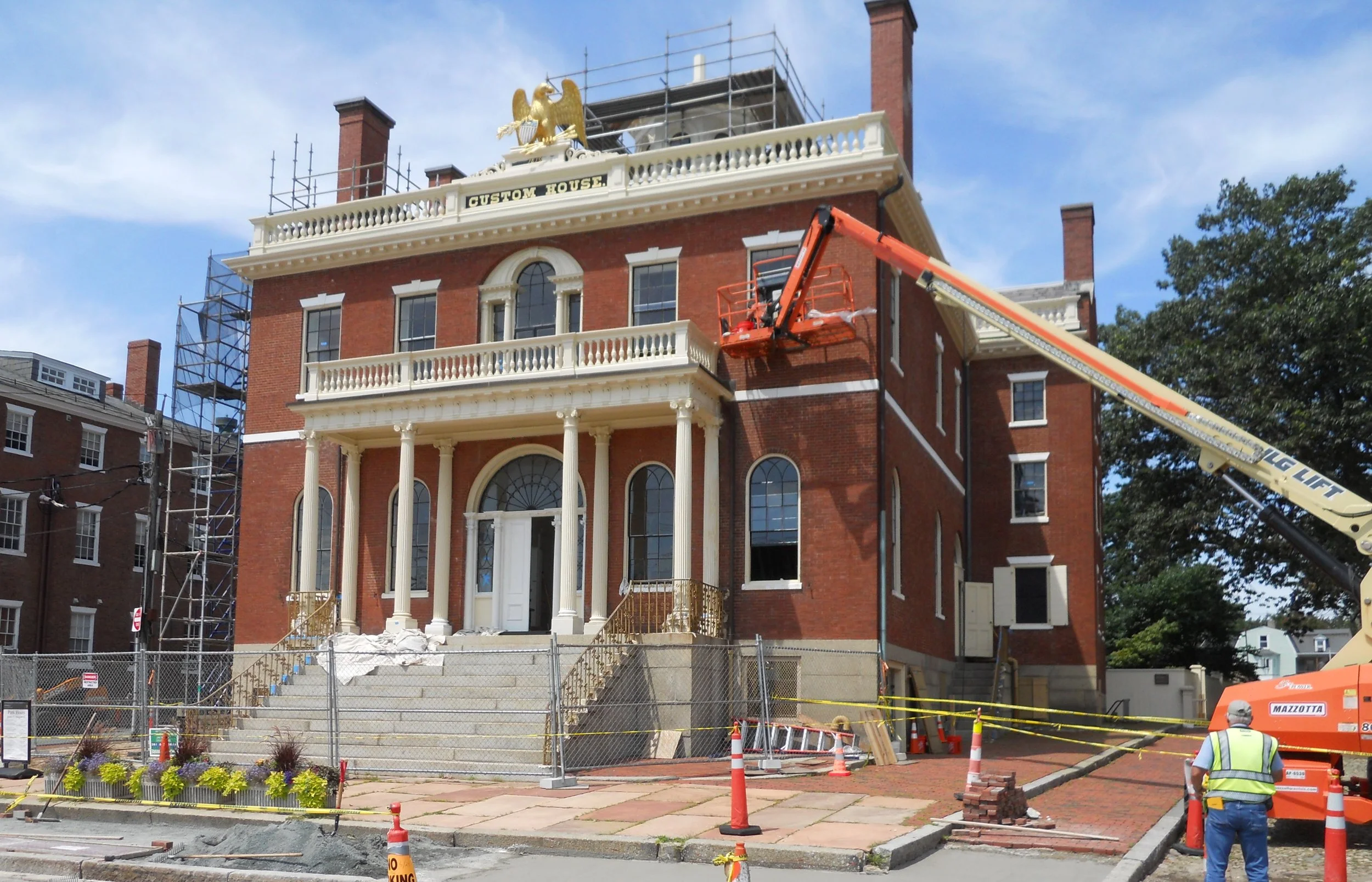
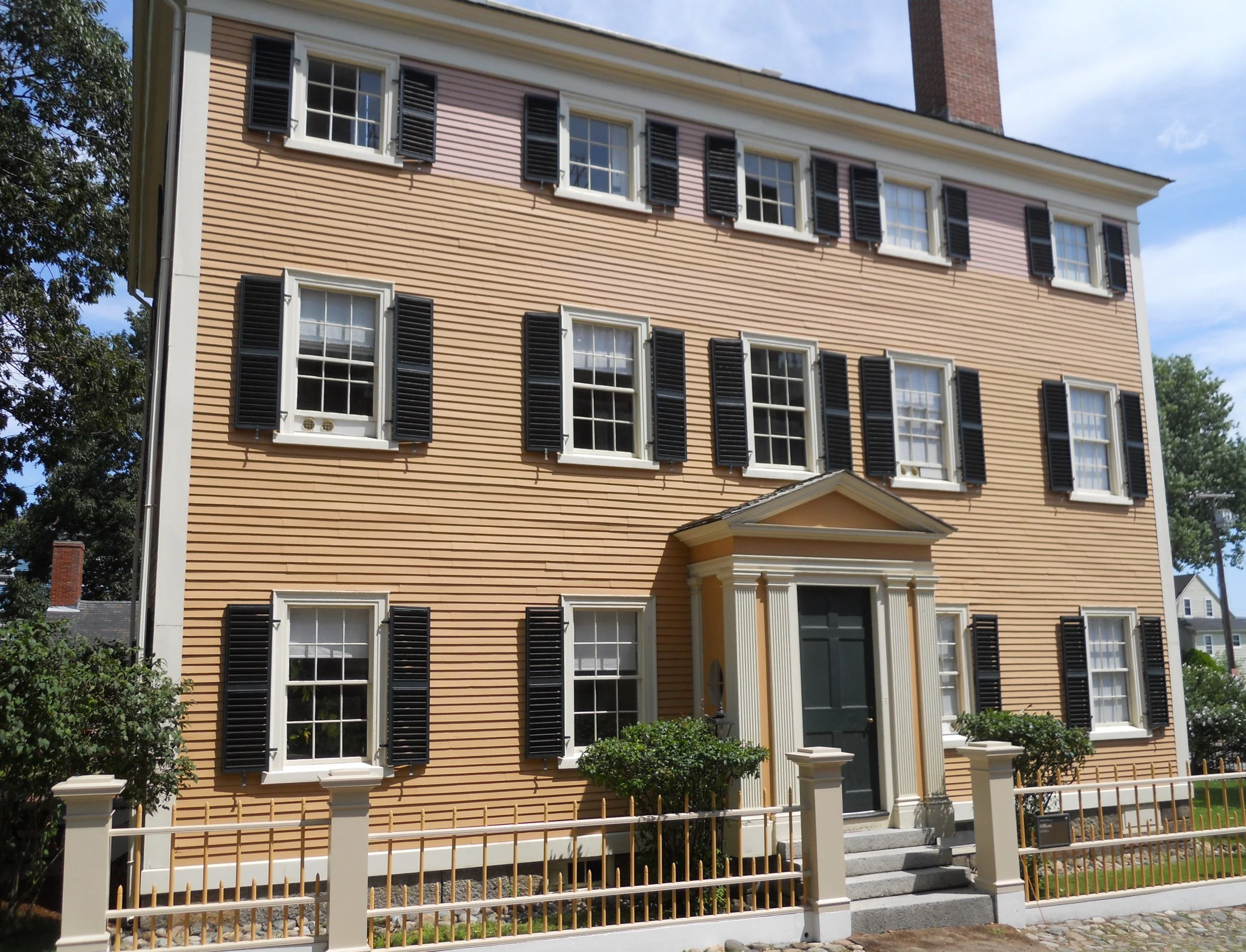
Salem Maritime NHS was the first park with the NHS designation, in 1938. The famous Customs House was around long before that. The first building was constructed in 1649, for England to tax imported cargos. The current House was built in 1819. This summer it is going through some repairs. Two doors down is Derby House, the oldest brick building in Salem. In between is the Hawkes House. The Derby family wanted a bigger home than their first house, so just twenty years later began to create a 5,000 square foot mansion. But they moved elsewhere before it was finished, allowing Benjamin Hawkes to buy it 1801. With all the ship traffic coming and going the Customs House, a need for a lighthouse arose. The Derby Wharf Lighthouse fit the bill. If you are wondering about the ship Friendship, it is going through an overhaul. Even the masts were pulled off. Next year it should be ready to take visitors back out on the waters.
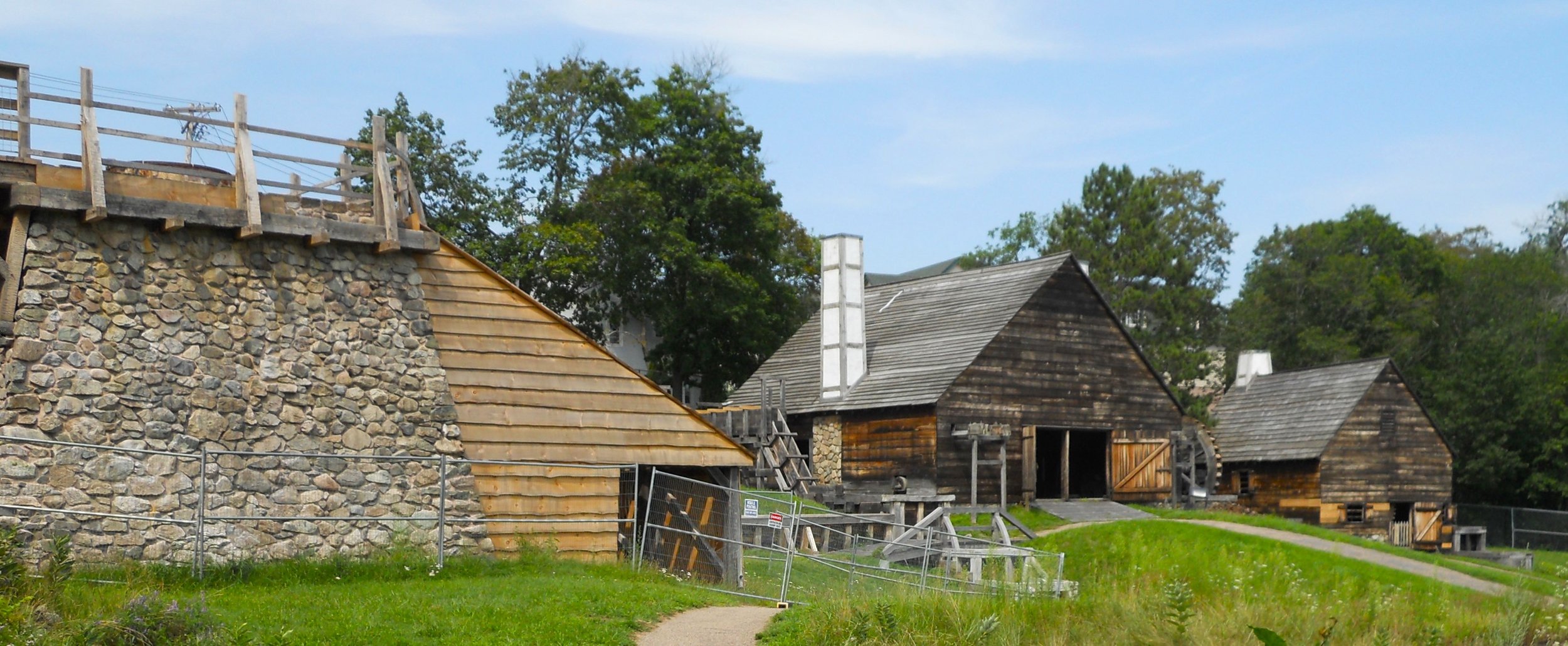
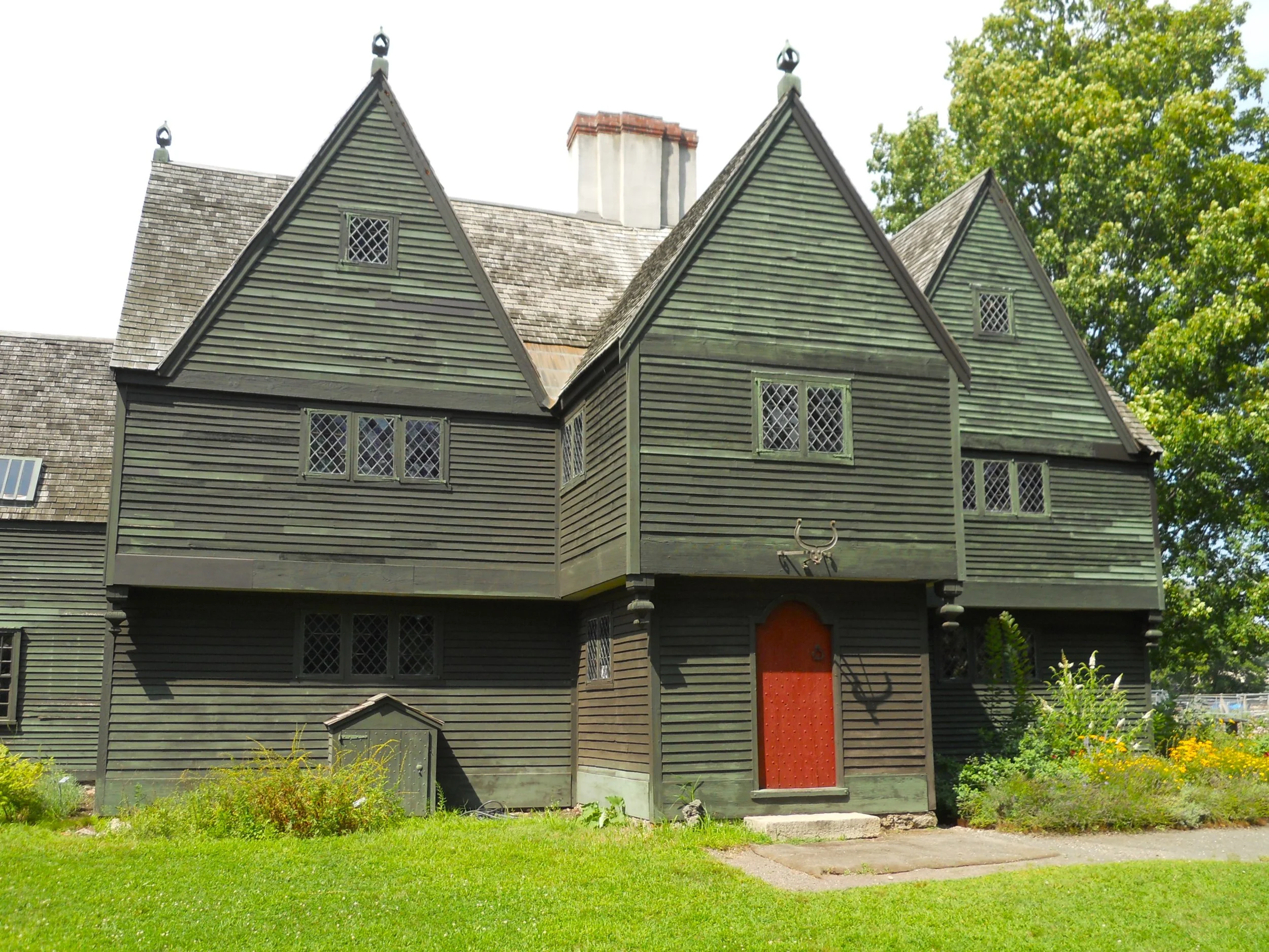
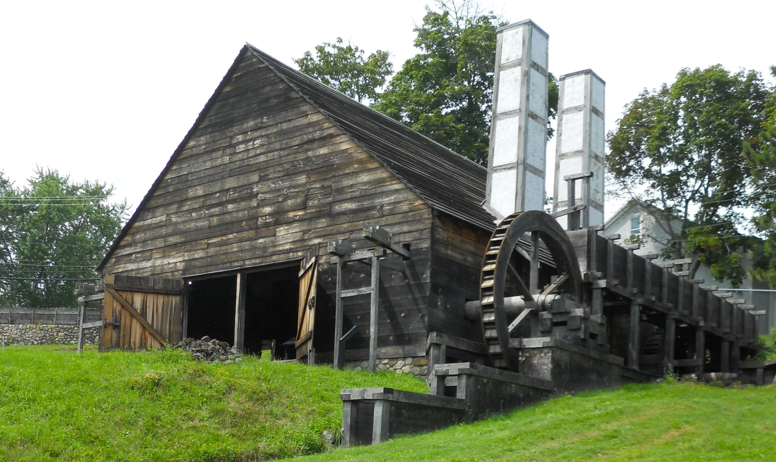
Saugus Iron Works NHS is situated on the Saugus River, a 12-acre parcel of land which was the beginning of iron making in the colonies, back in the 1600s. A blasting furnace, forge, and casting shed, also known as a slitting mill (left to right in photo) can be toured. A nature trail goes by the Saugus River and the waters that made the flywheels turn. Though these buildings are recreations, the Iron Works House is original, dating back to at least 1681 (the oldest bill of sale which can be found). Without the making of iron in the new colonies there would never have been a chance to win the Revolutionary War. The Saugus River was the means by which the finished iron could be shipped to markets.
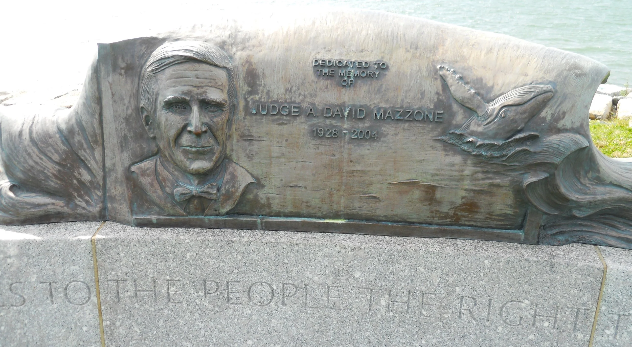
Last stop was Boston Harbor Islands NRA. There are three vehicle access points to the park for visitors (a fourth can only be used by City of Boston personnel for Fire and Police training facilities). But the rest of the park is on islands (34 islands and peninsulas), and one needs to take various ferries. I chose Deer Island for a short hike. The island is home to one of Boston’s wastewater treatment plants (the hiking trail goes around the perimeter of the plant). The land had been used for internment of native peoples during King Philip’s War in 1675-1676. A granite marker commemorates the work by Judge A. David Mazzone who presided over the federal lawsuit which forced Boston to clean up its act. In the 1980s, Boston Harbor was considered the filthiest harbor in America.

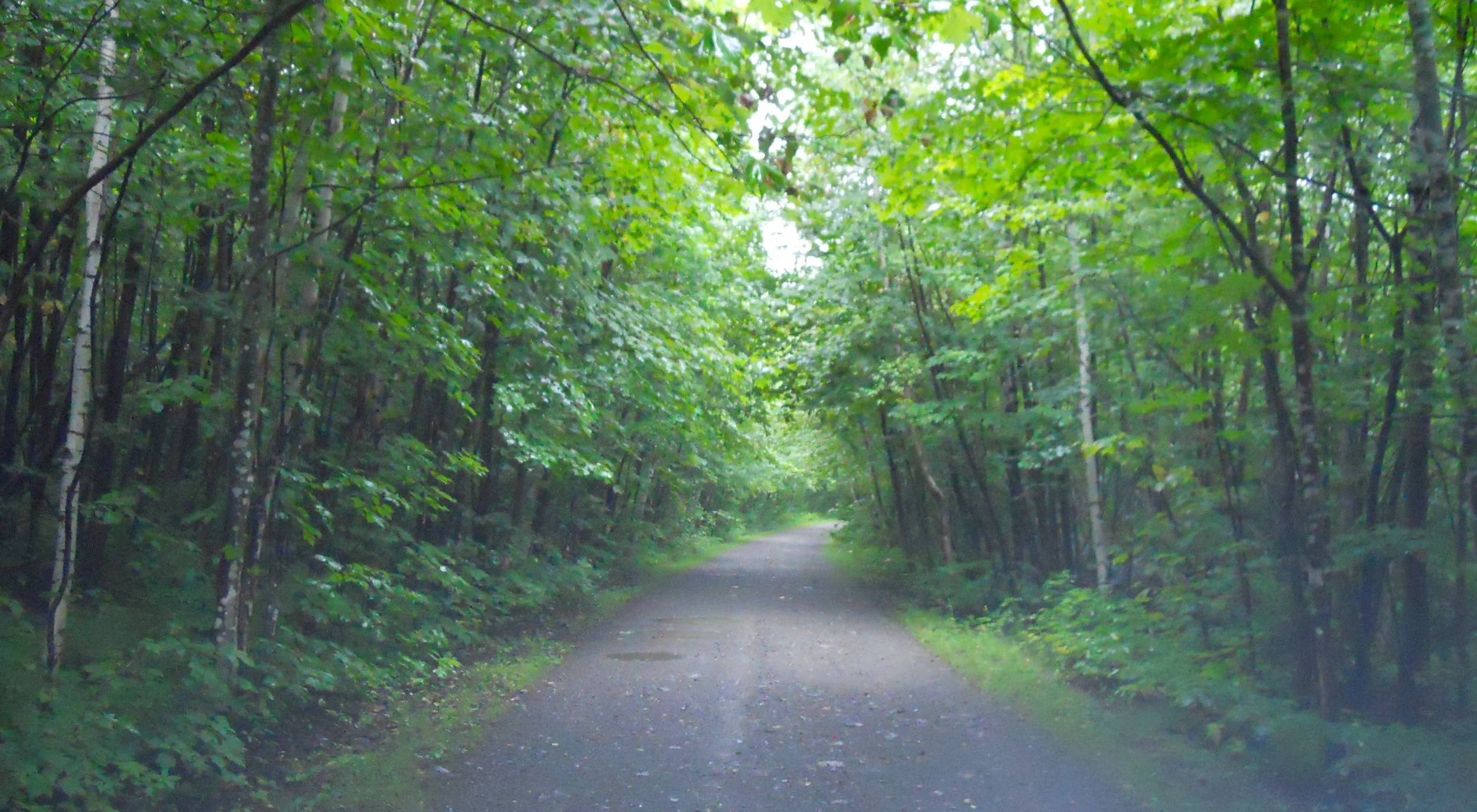
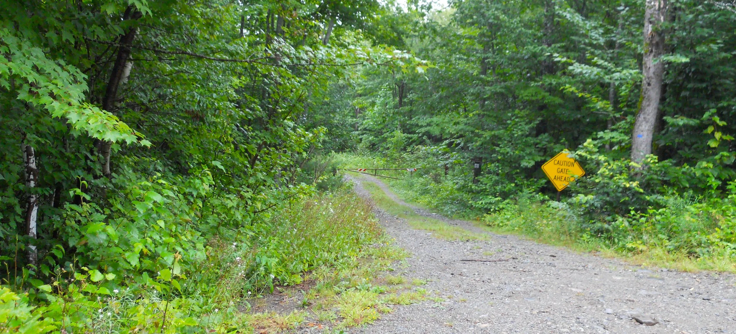
DAY 5 (August 8) - The rainstorms slashing the Northeast today put a damper on my visit to Katahdin Woods and Waters NMon. I made it to the North Entrance with no issue, then driving south on Messer Pond Road (unpaved… photo). The Old River Road (sign shown in the photo) was a new experience, but all I could see was the Penobscot River and a lot of trees and brush, amid all the rain. A gate was closed (can be seen in the photo) for the road to Stair Falls, so had to pass on that view. I headed to the South Entrance, west of Shelby. But when I turned onto Swift Brook Road, a man in a white pickup waved me to stop. He was a ranger, with bad news. A culvert had to be replaced, so no access to the park and the main attraction; the Katahdin Loop Road. Thankfully, I had accessed the park via the North Entrance. The rain is supposed to be gone by tomorrow.

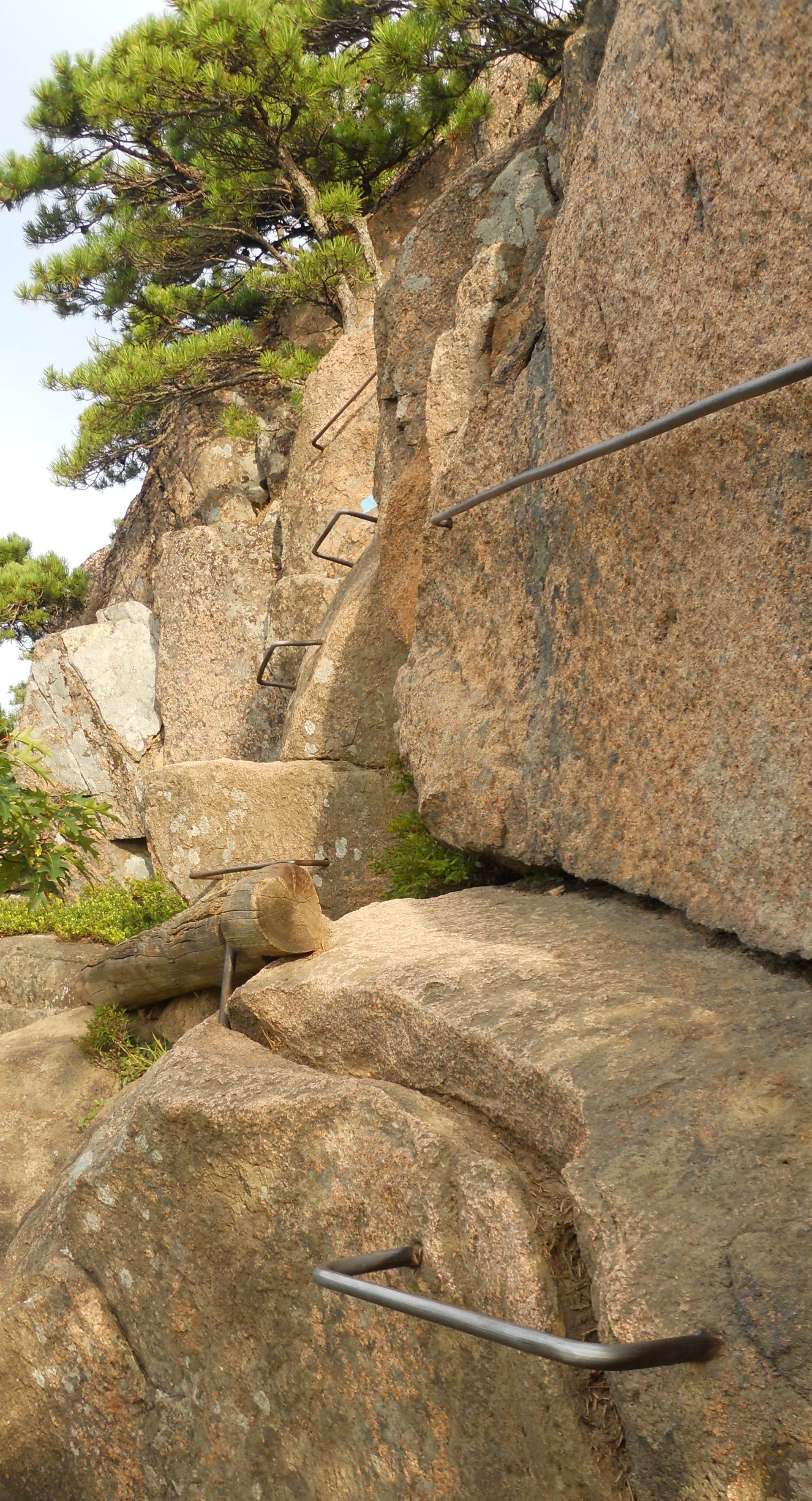
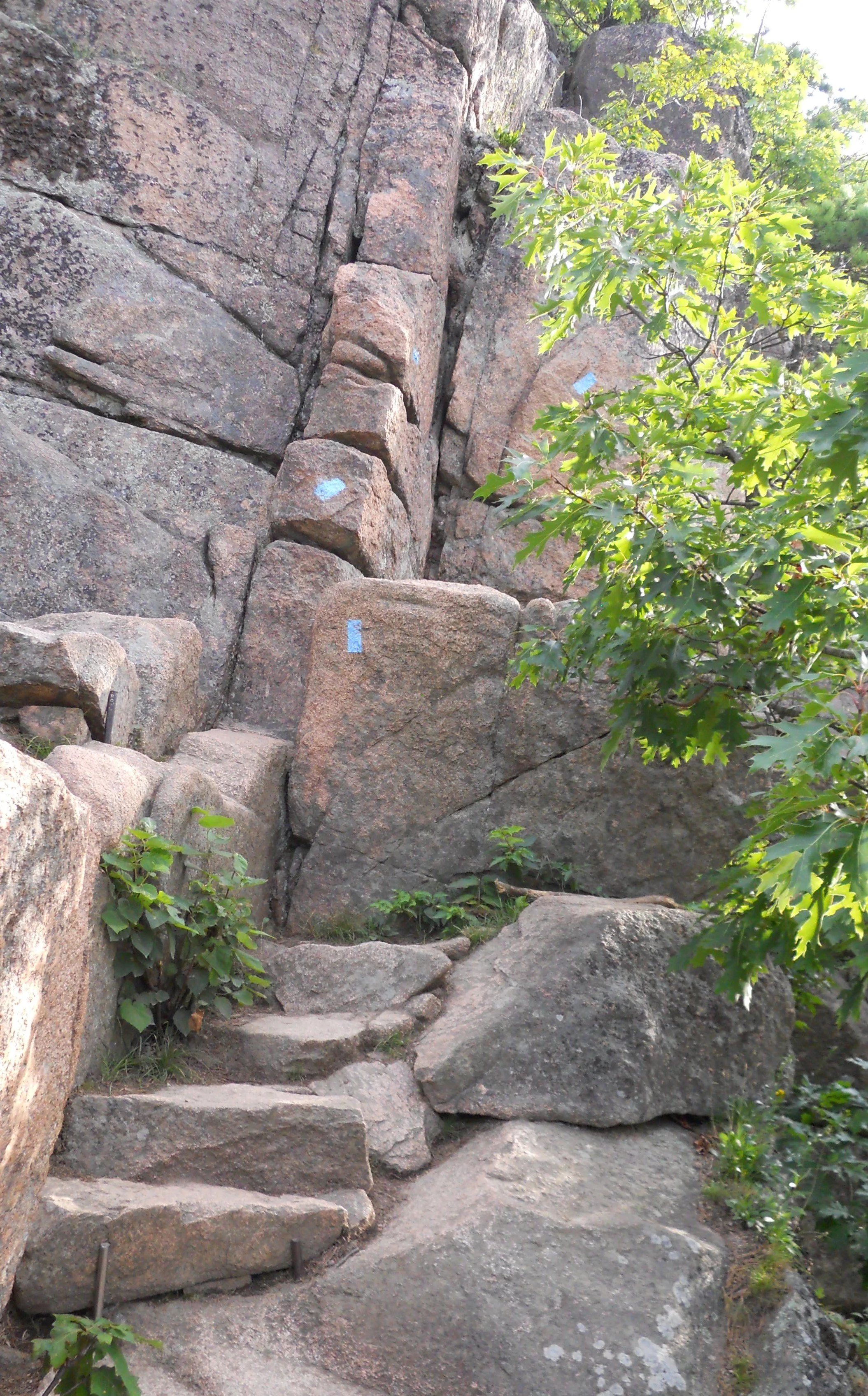
DAY 4 (August 7) - Acadia National Park is a gem. The mass of visitors I saw today validates that view. I began the day by climbing the Bee Hive. I was going to do the much harder Precipice Loop, but the difficult section was closed for Peregrin falcon nesting issues. The Bee Hive still has iron rungs, granite slopes, narrow stone steps, and the like. It is not for people who dislike heights or cannot navigate vertical steps against a cliff wall. There were signs at the start of the trail warning hikers of the potential dangers (the signs at Precipice Loop were larger).
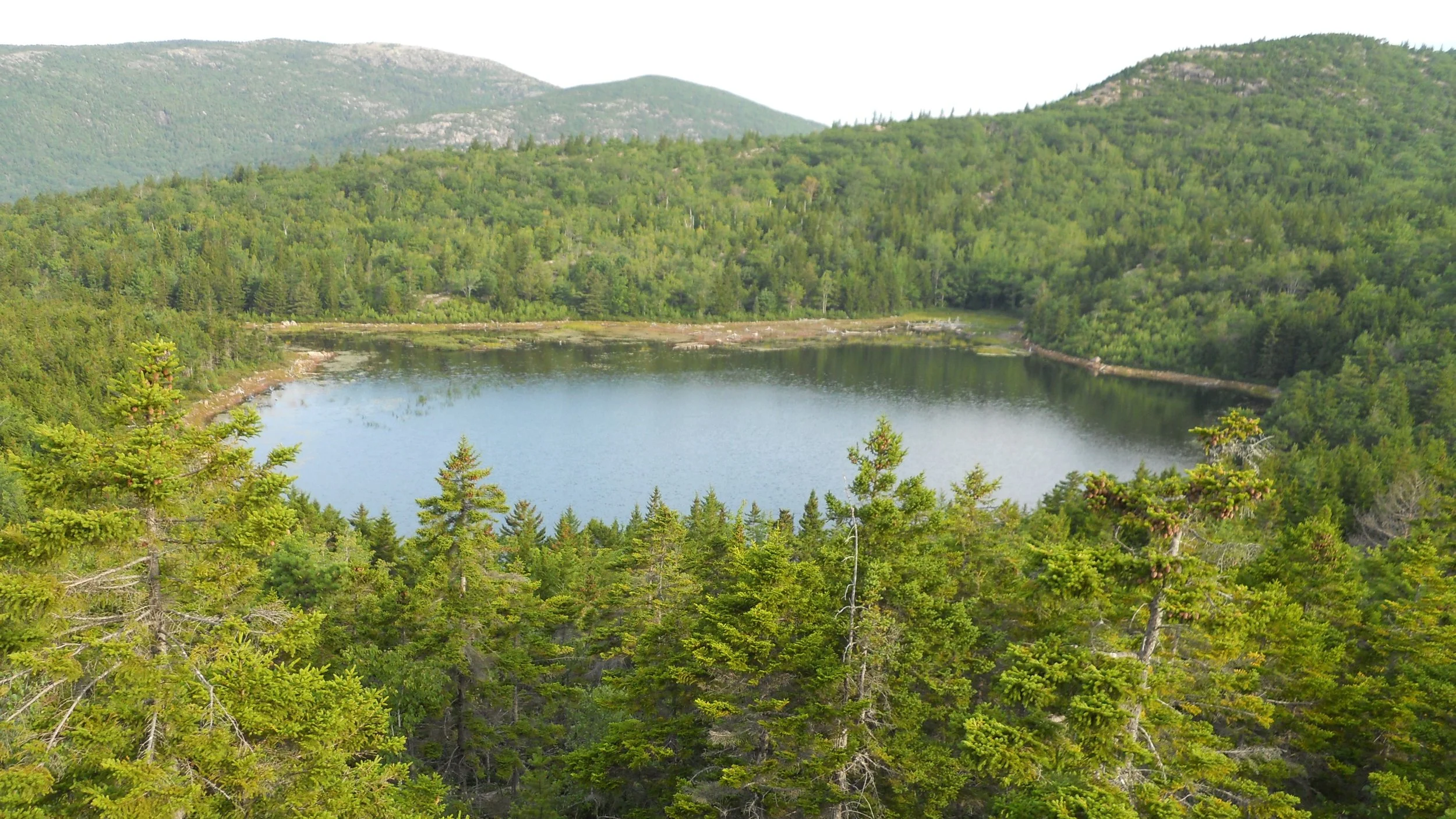
The next trail was the Bowl Trail, which leads to an overlook of… wait… you guessed it; “The Bowl”. This is one peaceful pond.
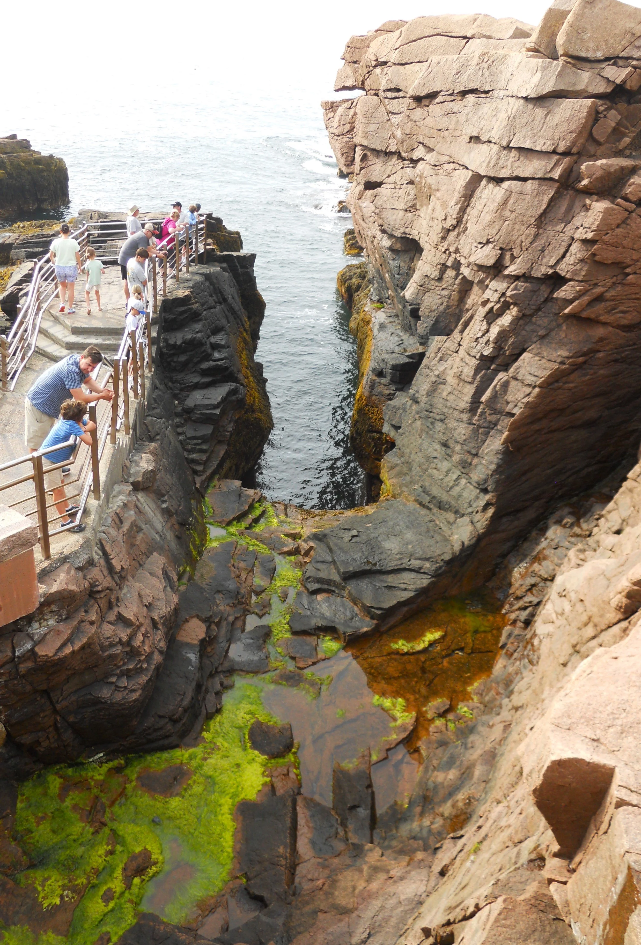
I stopped at the Thunder Hole, but this was low-tide time, so no explosive water towers to see.
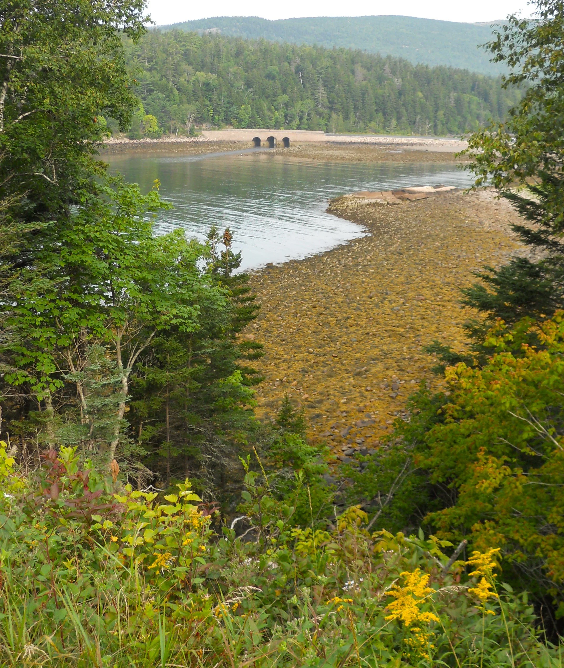
A little ways later on the Park Loop Road was Otter Creek.
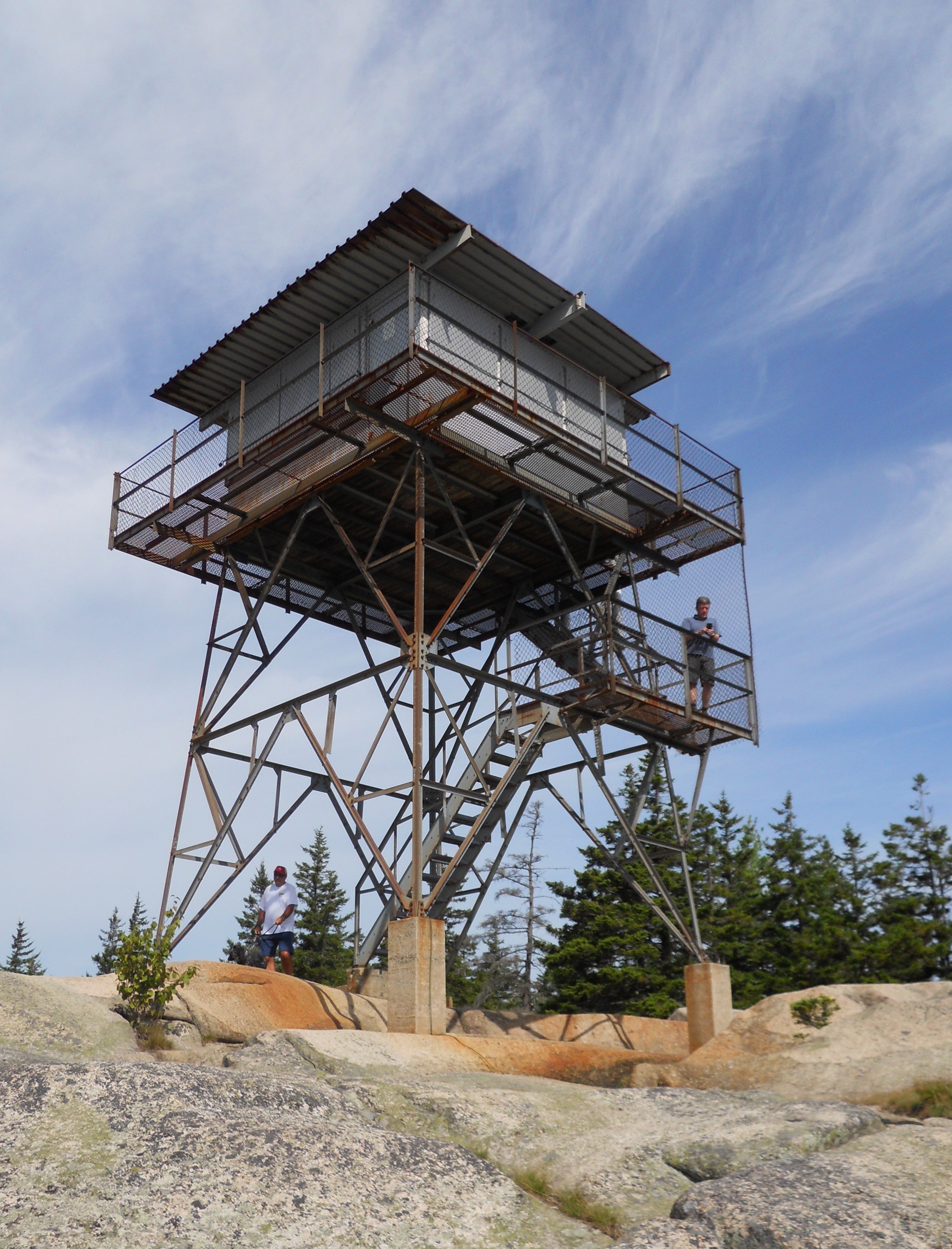
Last activity in Acadia was Beech Mountain Trail. This leads to the summit of Beech Mountain and the old Fire Tower. Plenty of dogs were enjoying this hike along with their handlers.
Along highway US 1 a person can take a 13-mile detour to Campobello Island. Before crossing the bridge to Canada, one goes through the town of Lubec, the farthest east city of the 50 states. The reason for driving your car over to Canada onto an island is to visit Roosevelt-Campobello International Park. This is the home which Franklin’s mom gave to Eleanor and Franklin as a wedding present. Every summer would find the Roosevelt family living here. Franklin and the kids loved water sports. This is an affiliated site for the NPS, so not part of the #425 count, but it is worth a visit. Be sure to bring your U.S. passport.
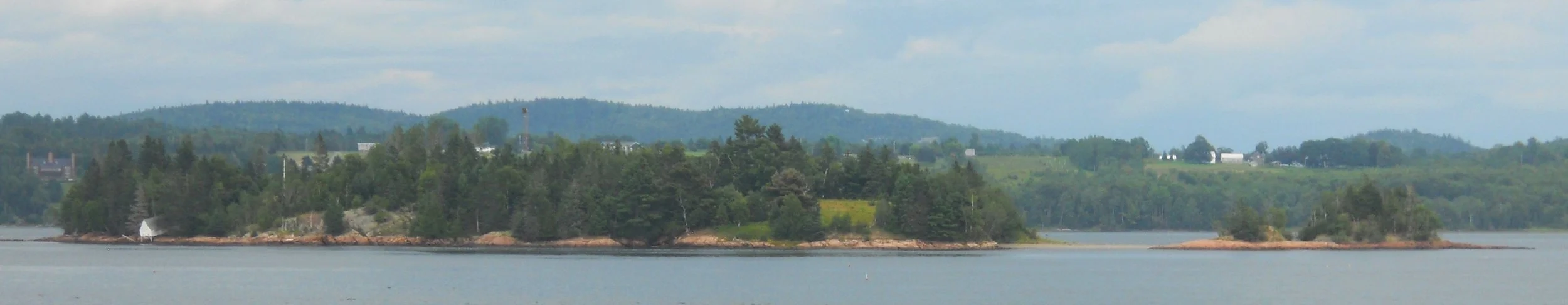
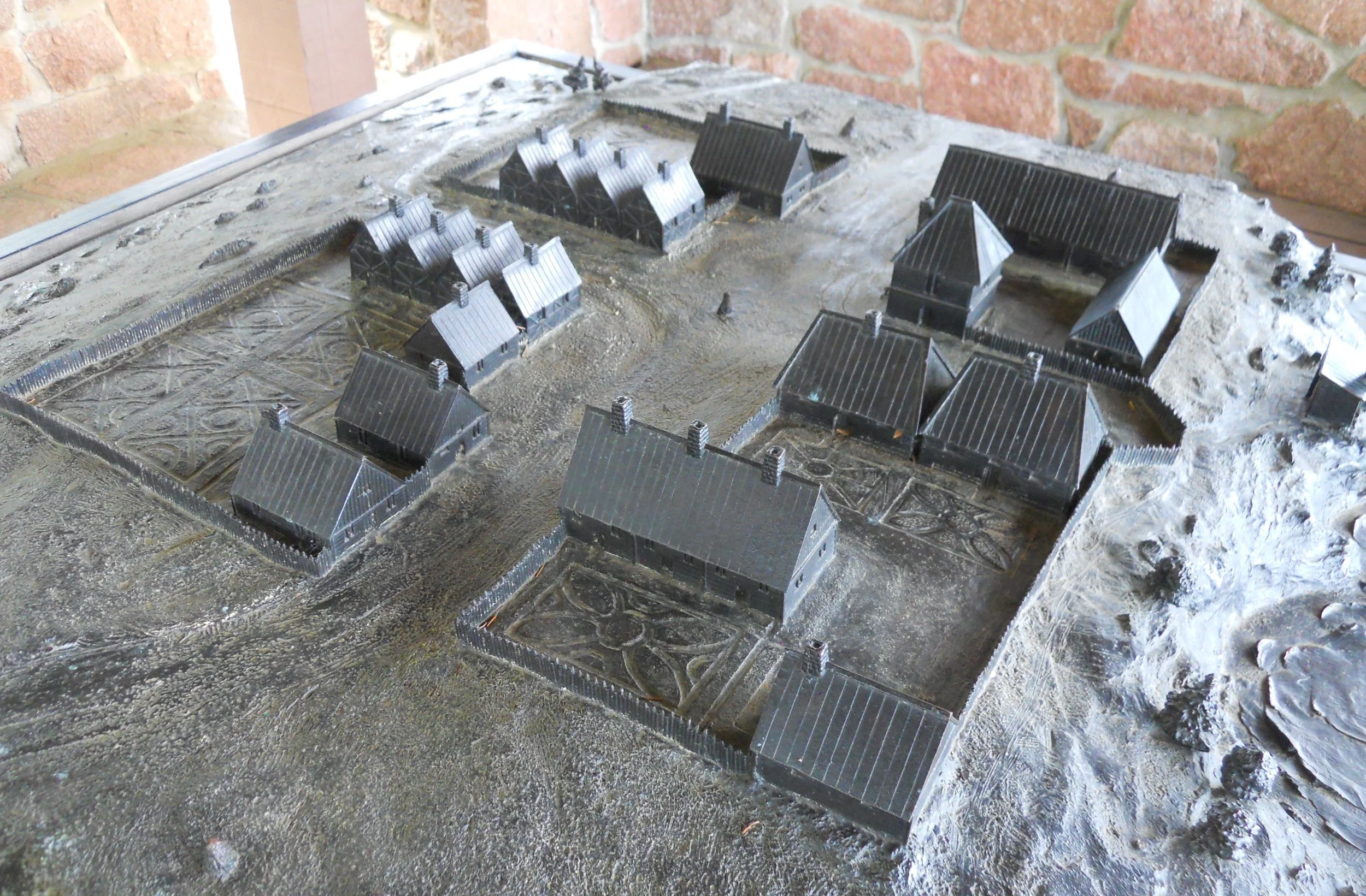
Last stop of the day was at St. Croix Island International Historic Site. This is the only NPS park with the IHS designation. As the ranger at the VC said, this was Jamestowne before Jamestowne. The French, led by Pierre Dugua, landed on the island in late-1604. The winter was severe, causing 35 of the 79 men to die. They are still buried on the island. In 1605 the group moved to a new settlement at Port Royal in what is today called Nova Scotia. But the 1604 settlement was the beginning of the French presence in the New World. A model of the fort, based on a description by Samuel Champlain (who Lake Champlain in New York and Vermont is named after), is displayed near the water’s edge. Champlain survived that winter and went on to become famous for other expeditions in Canada. The park boundary includes an area called Red Rock Beach, where members of the expedition might have come ashore during their stay on the island.

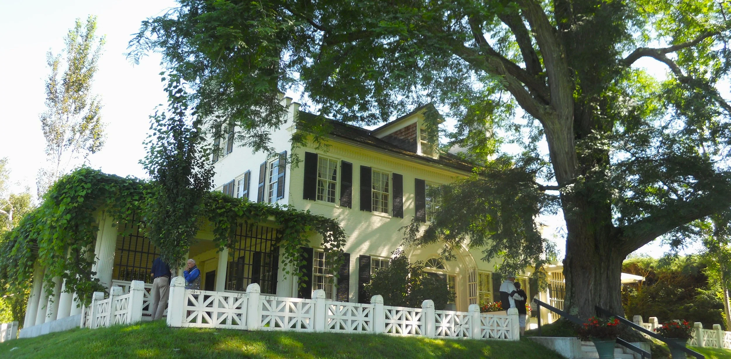
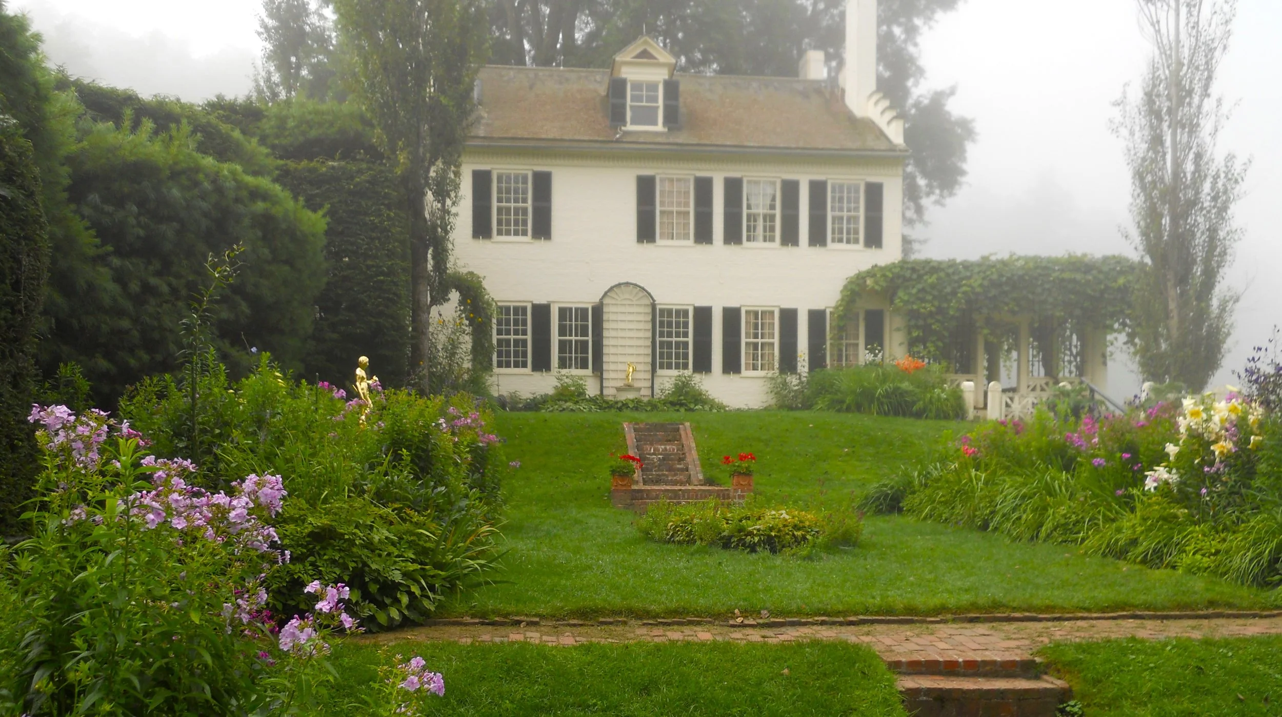
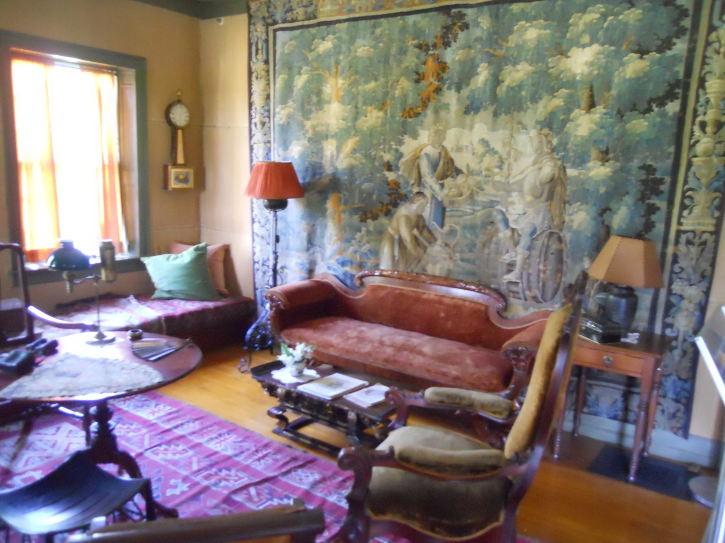
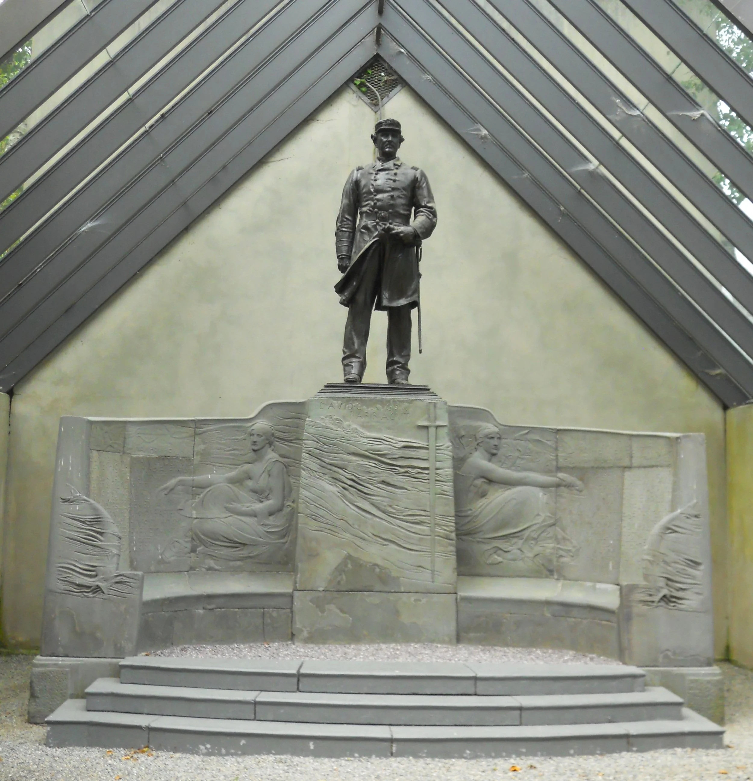
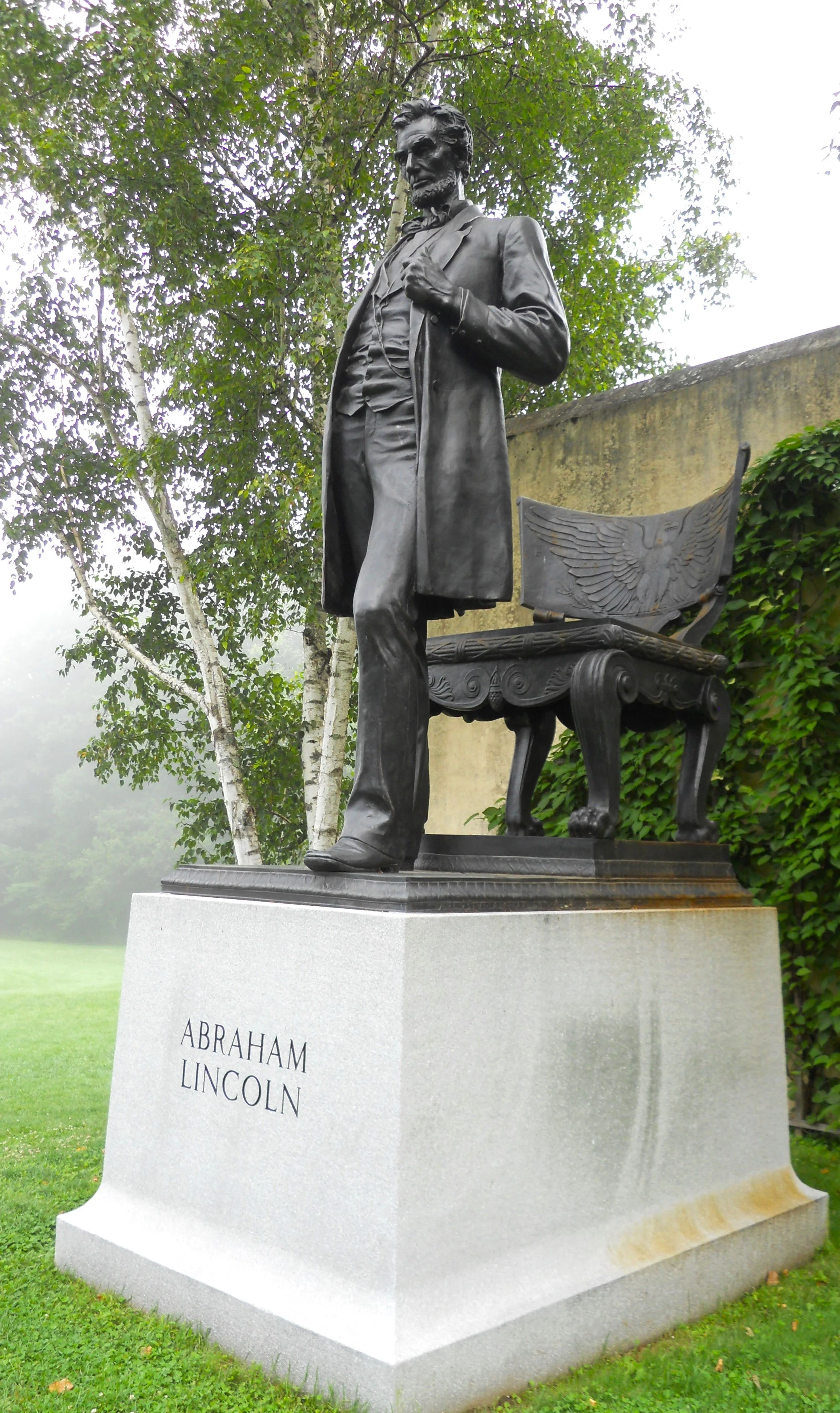
DAY3 (August 6) - Saint-Gaudens NHP preserves the home and studios of America’s most famous sculptorer. He called the house “Aspet” after his father’s hometown in France. The large tree is a thornless horny locus. It was planted in 1886. Coin collectors recognize Saint-Gaudens work on the $10 and $20 gold coins, and consider those coins to be the most beautiful of all U.S. Mint pieces. He was the first non-Mint engraver to design a coin. President Theodore Roosevelt commissioned Saint-Gaudens for the work. The grounds have many gardens as well as a number of his sculpture works, including Colonel Shaw and the 54th (above Lincoln… which Auguste Rodin considered one of the greatest works ever), Abraham Lincoln, and Admiral Farragut (next to Lincoln). The gardens were the work of his wife, Augusta, who he met while in Rome during his younger days of study in Europe. Augusta’s father refused to allow Saint-Gaudens to marry his daughter until he could prove financial stability. Two years later after receiving his first commission, they were married. The interior of the home is pretty much the way it was when Saint-Gaudens died in 1907. A Flemish tapestry hangs on the wall of this one room.
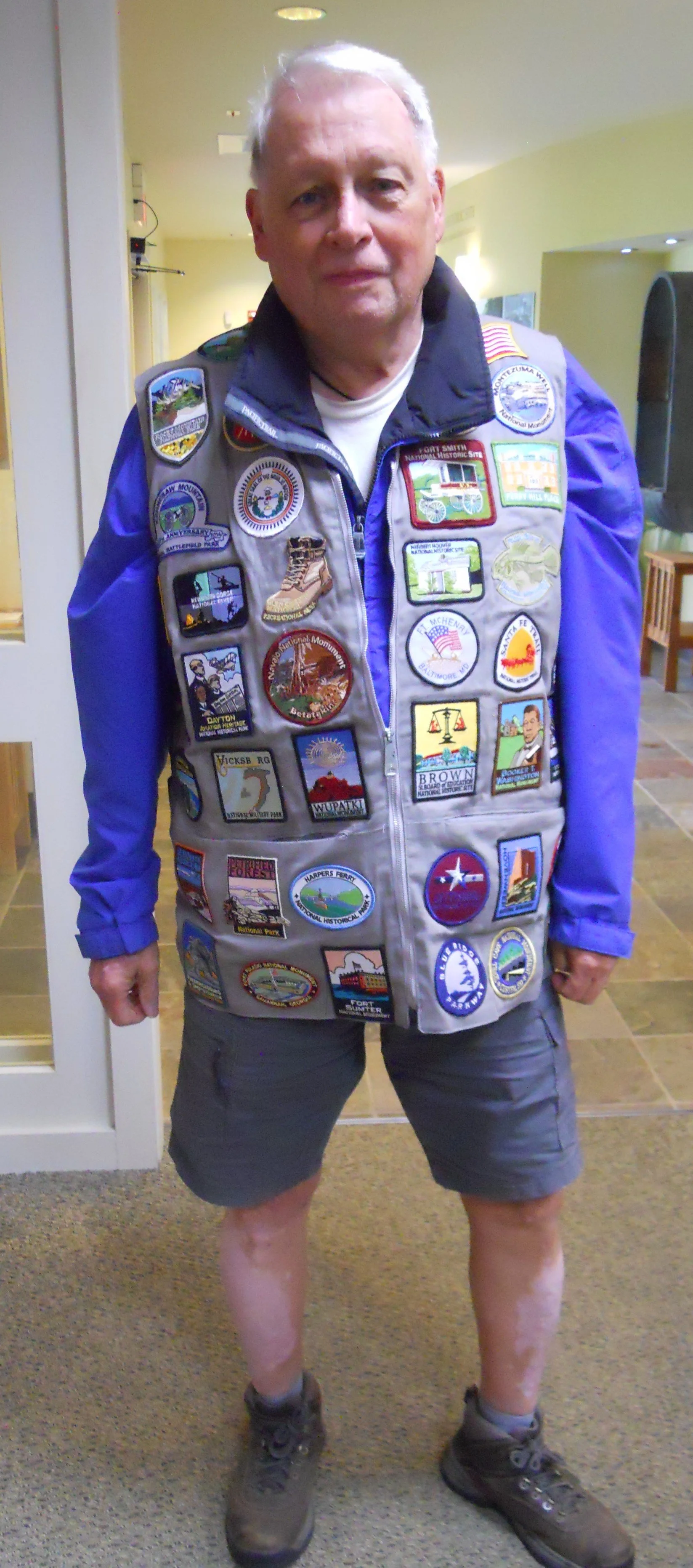
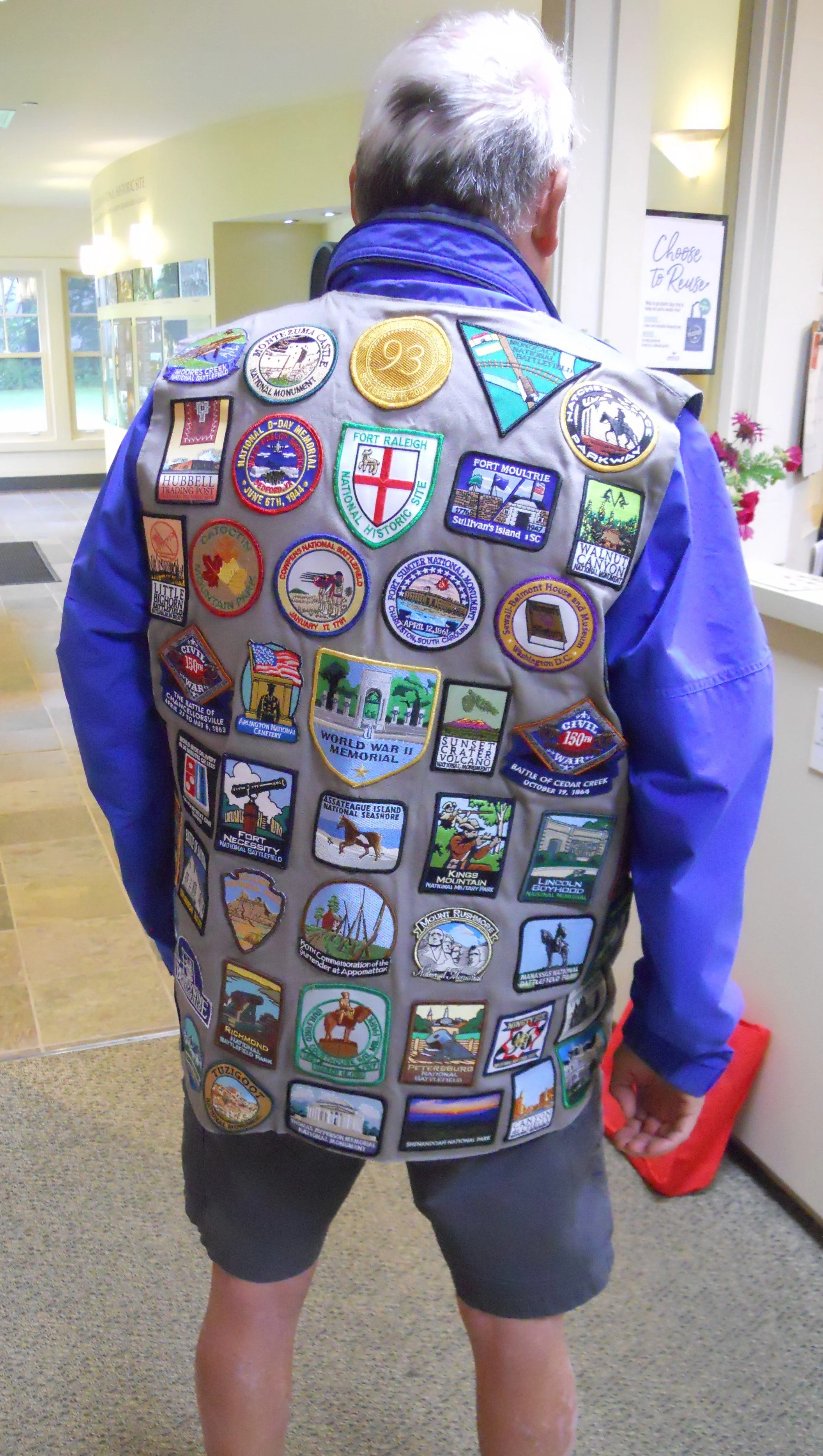
I met Danny, from Richmond, in the VC. He walked in with a vest covered by National Park patches. He is around 150 parks visited. This is quite a collection. Keep on trekking.
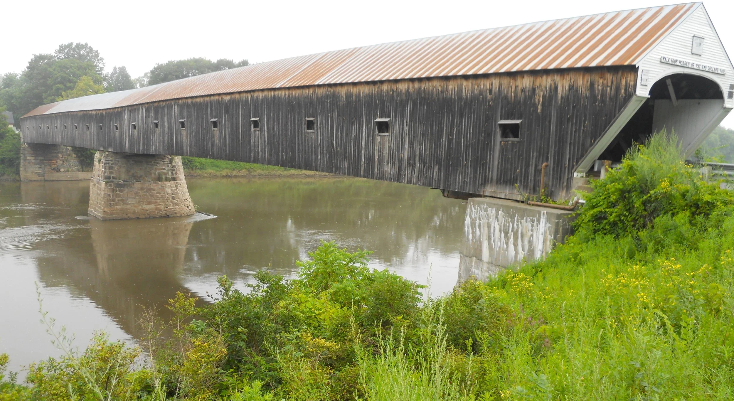
The last photo is of the Cornish-Windsor Bridge. See the Blog for details.
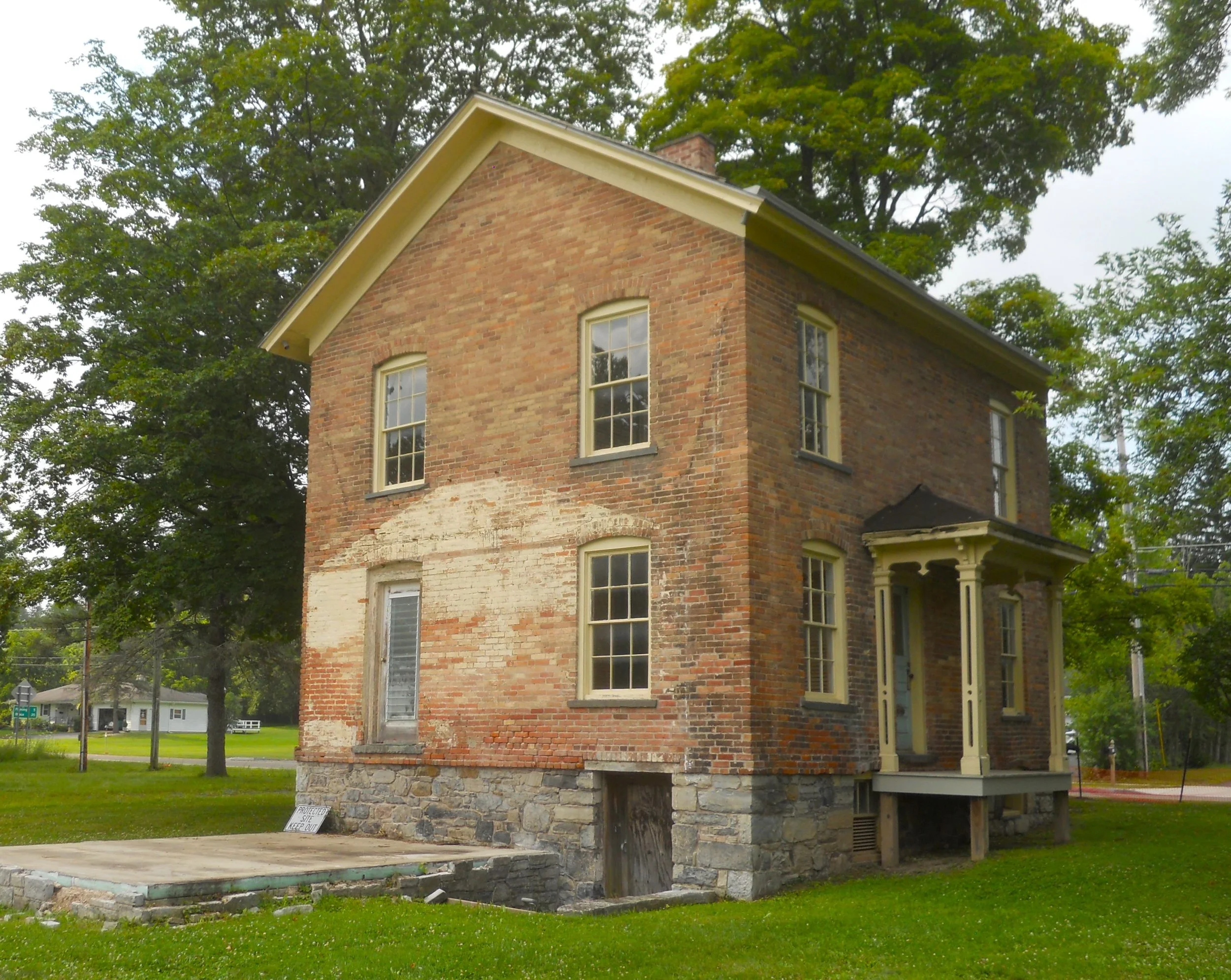
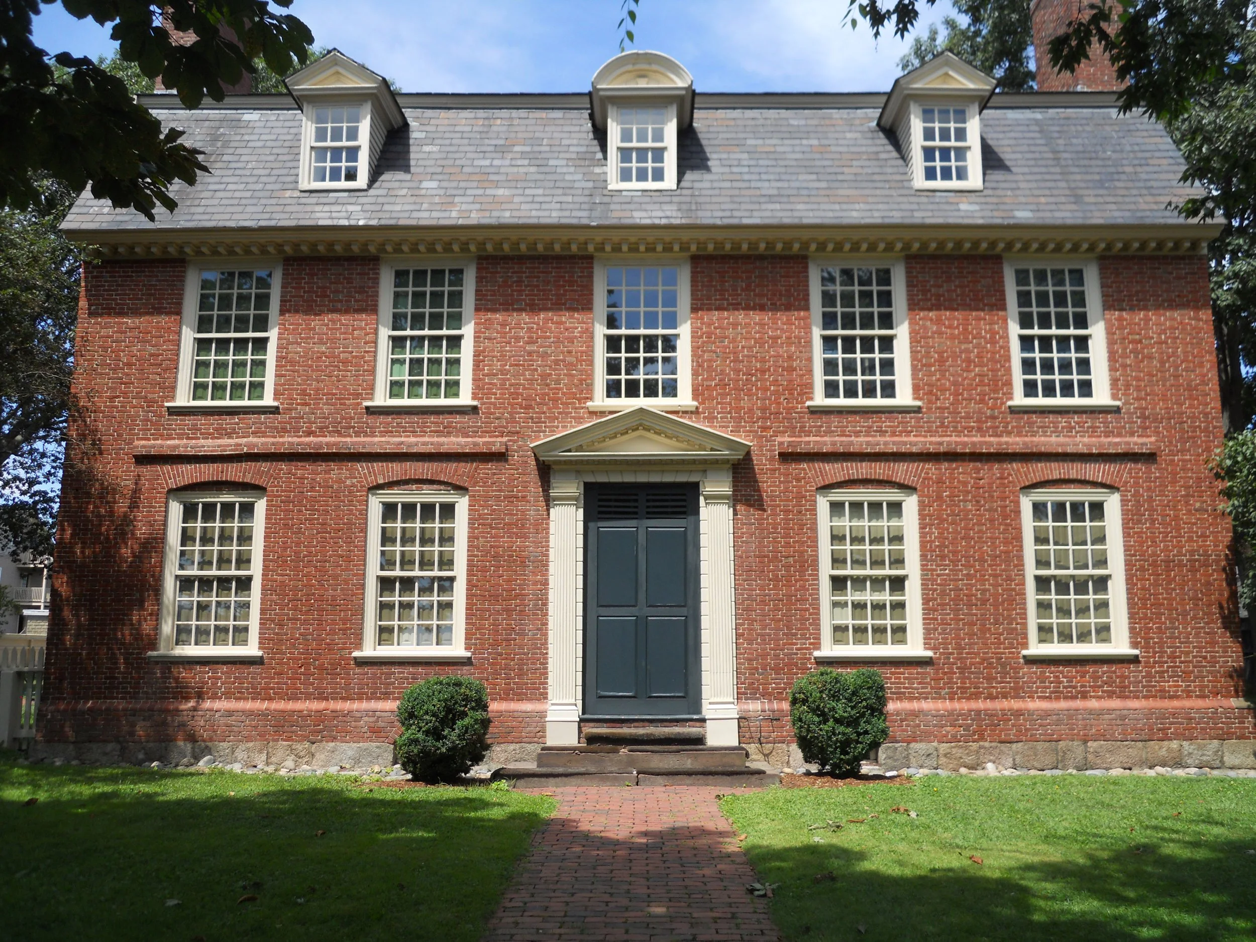
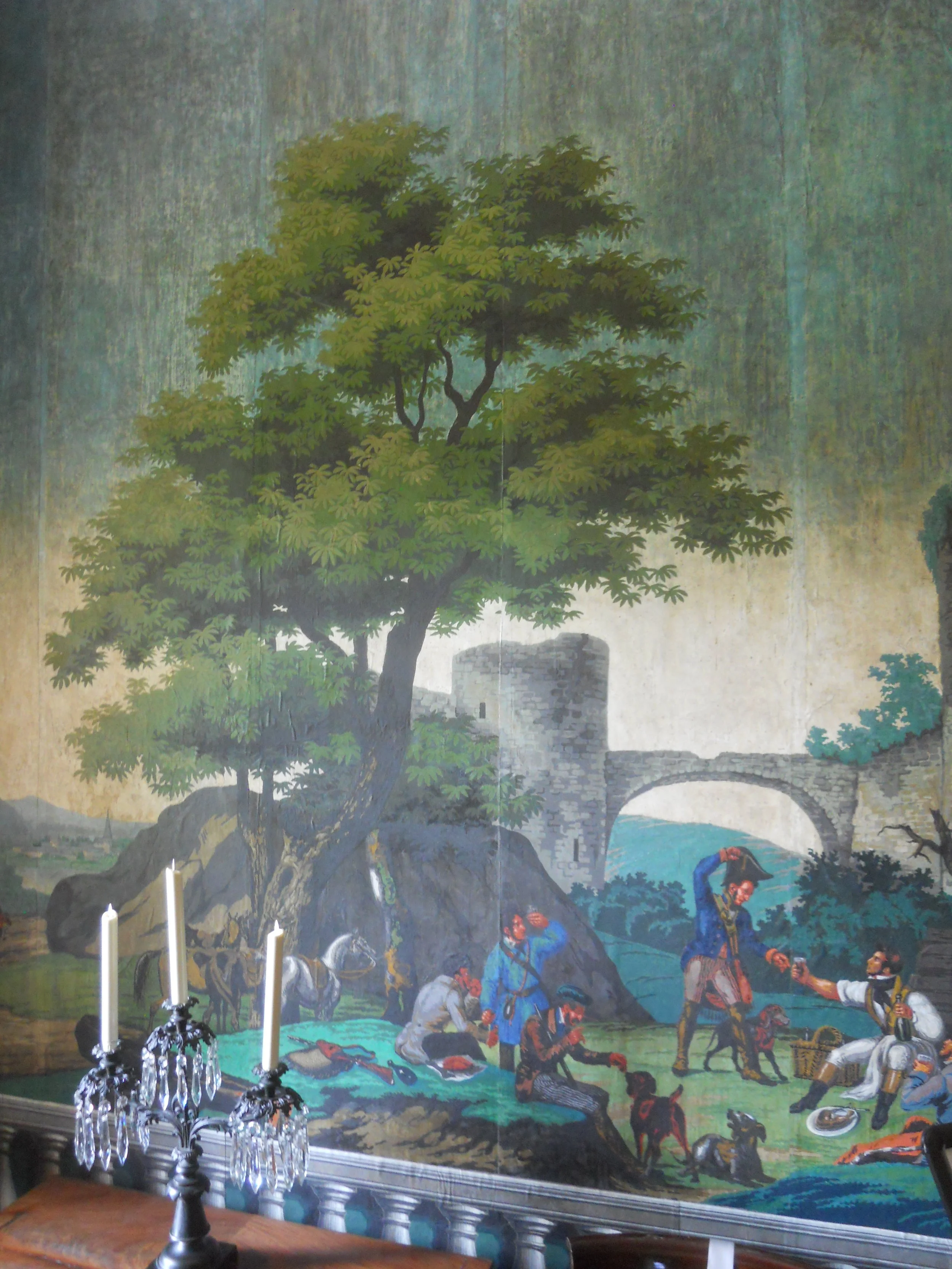
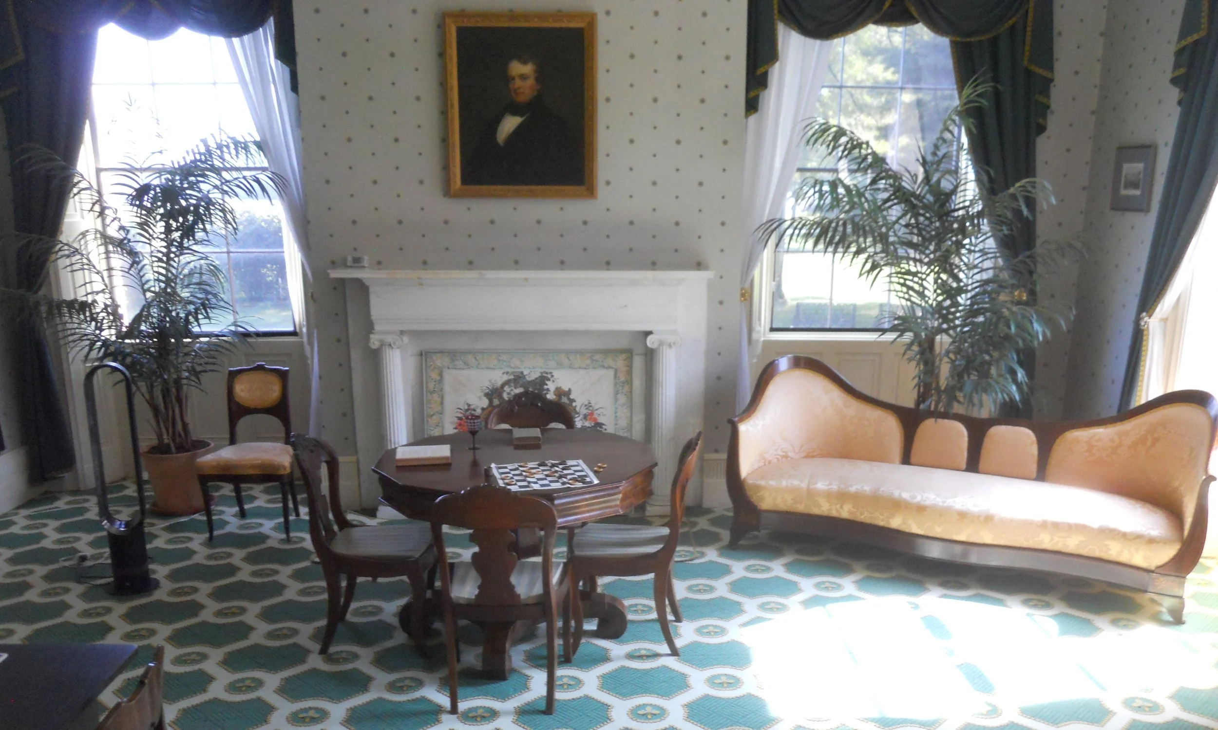
DAY 2 (August 5) - Martin Van Buren was the first American-born citizen to be a U.S. President, having arrived in this world after America secured its freedom from England. After his presidency he returned to Kinderhook, NY to manage his new farm (obtained in 1839… house was built in 1797) and attempt to return to the White house. The house was called Lindenwald. The front door opens to a large entry room where Van Buren greeted guests, locals, and family. The wallpaper in this room (photo) is original, selected by Van Buren. Many of the items in the house are original to the Van Buren family, including his bed (in which he laid when he died in 1862). The back part of the home, including the tall tower, was added in 1850 since Van Buren’s four sons started having many grandkids which would stay for extended periods. The house was the first in the area to have running water installed… remember, this was 1839. The Green Room has a portrait of Van Buren’s second eldest son, John.
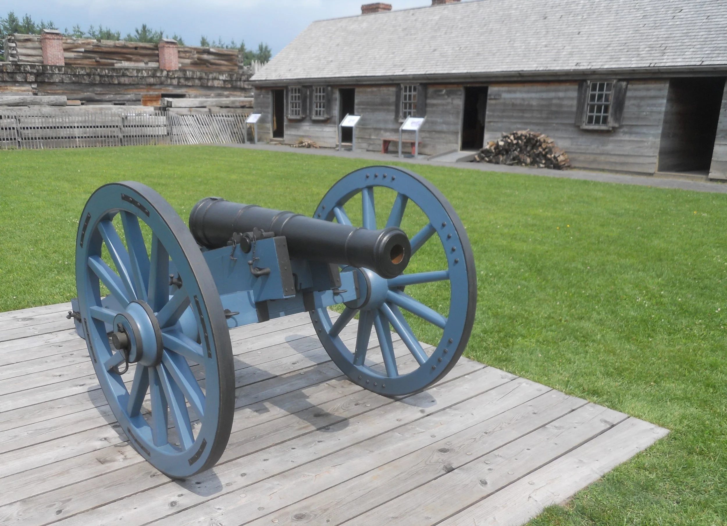
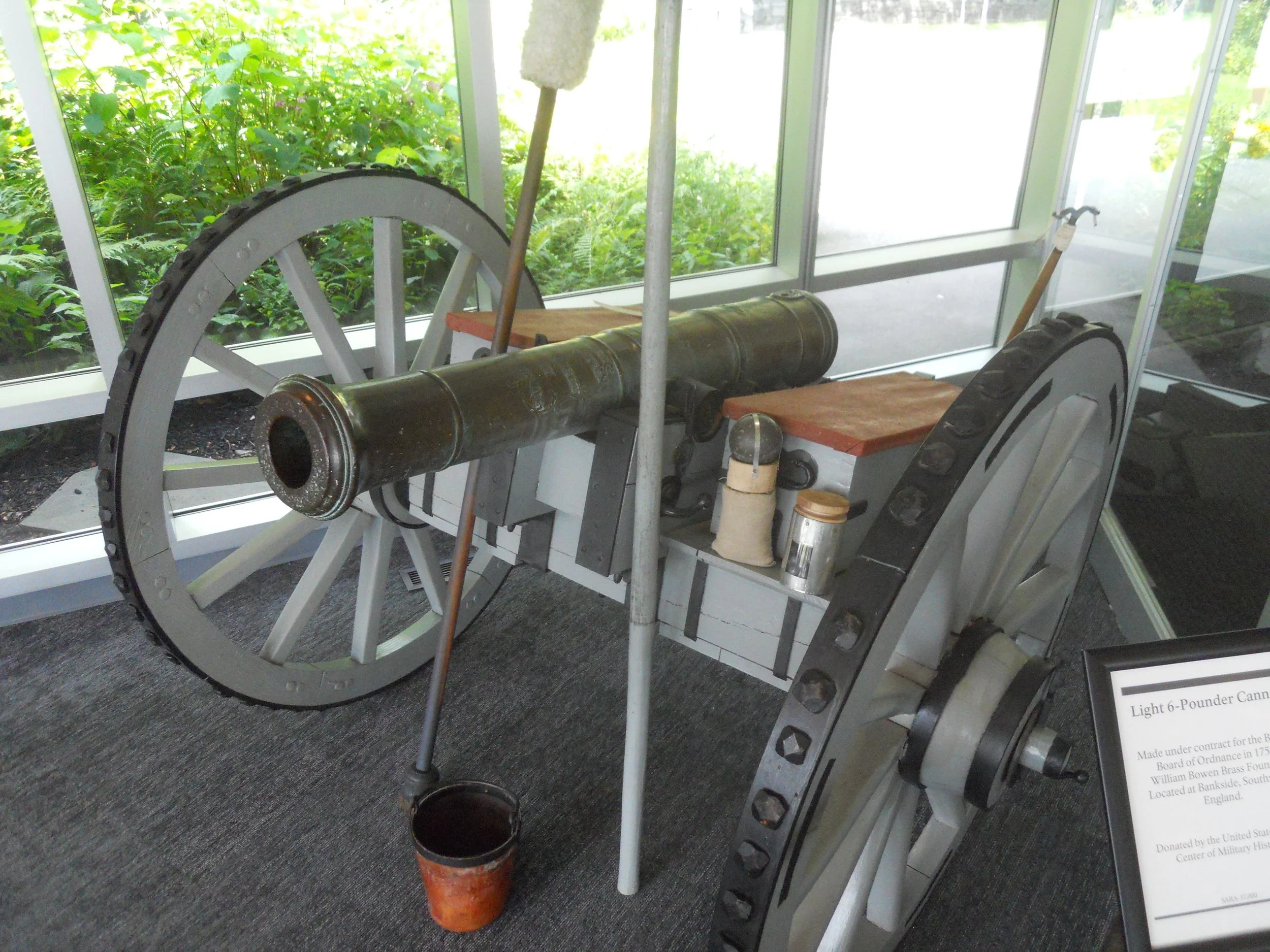
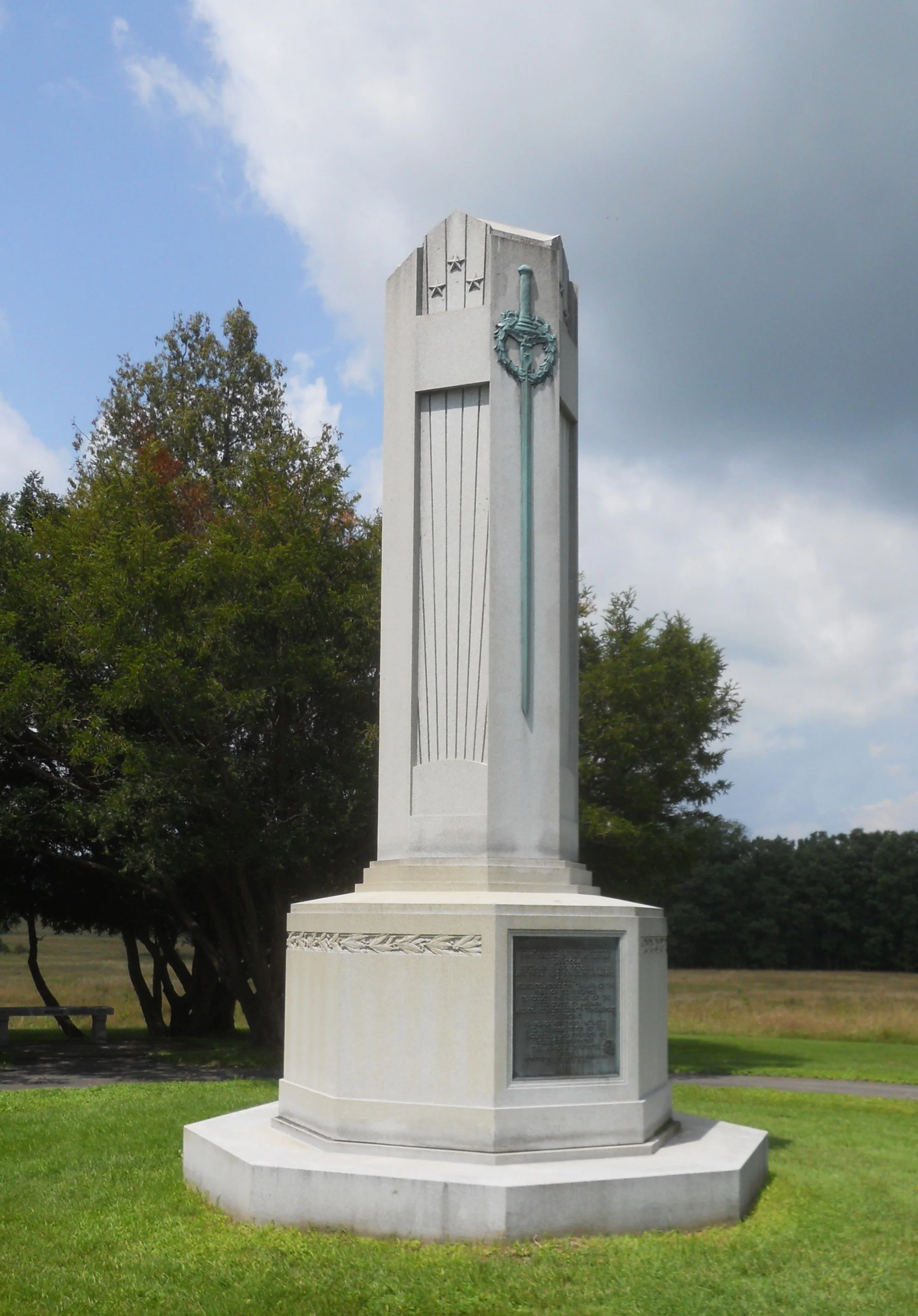
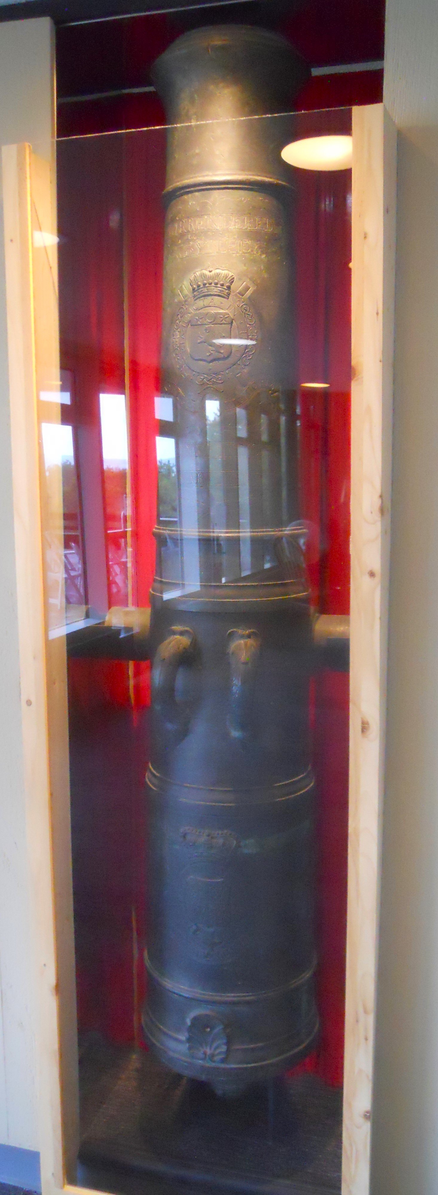
Saratoga NHP is the site of one of the turning points of the American Revolutionary War. The VC has three unique cannons. The first is a Light 6-Pounder, made in 1756 in England. These cannons were the most prized on both sides due to their light weight (i.e. maneuverability for moving by horses and men) and destructiveness. The other two British cannons were captured at Saratoga in the 1777 battle. They are over 240 years old, considered “Trophy Cannons”. A number of Revolutionary soldiers who died in the two battles (September 16, October 7) were never identified. The one monument was erected to signify the unmarked graves on the battlefield. The NPS has marked the American and British fortification lines with wood posts (blue for America, red for Britian). The red house in the photo is the Neilson Farm. It is original, having stood on this spot since 1775 when it was built by John and Lydia Neilson. They had left the farm prior to the battles.
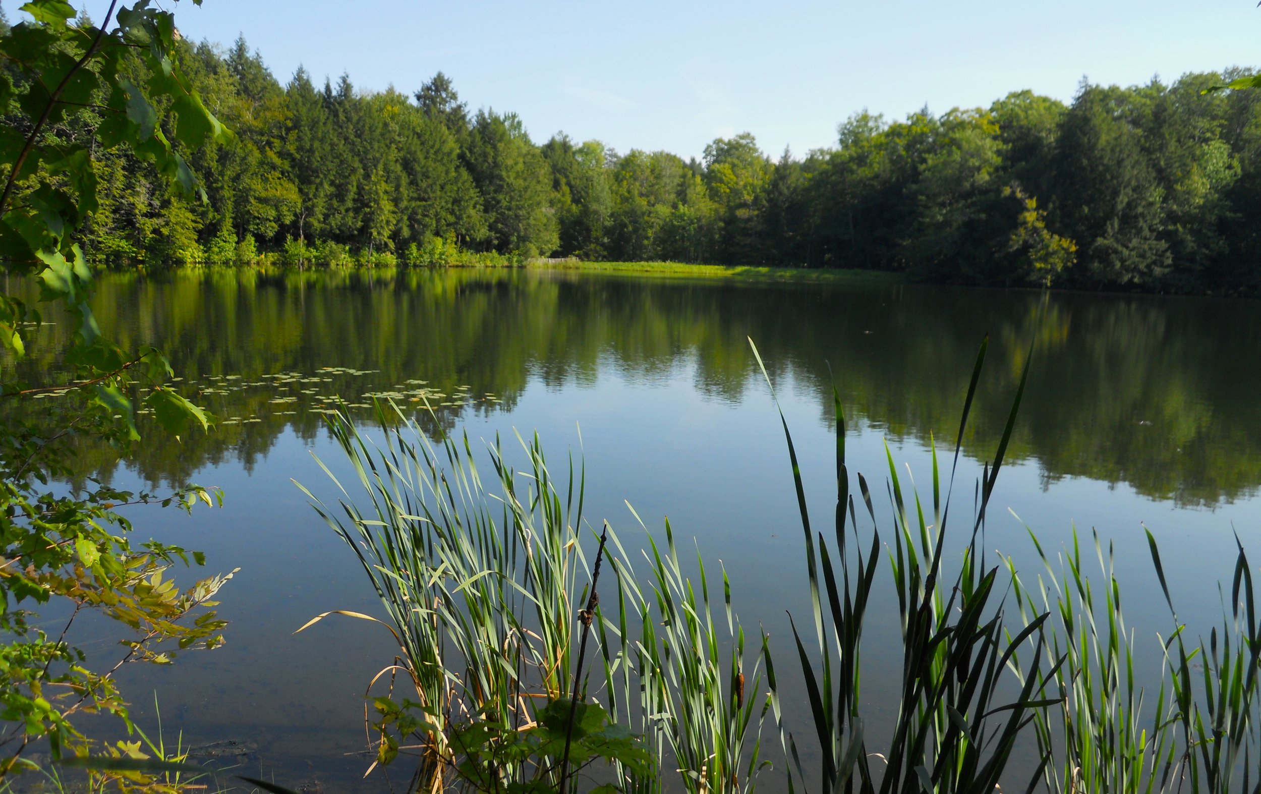
Marsh-Billings-Rockefeller NHP protects a landscape that had been ripped apart by greedy businessmen but was recovered by the local residents. Photos in the park VC (used to be the Carriage Barn for the owners) show the hillsides devoid of vegetation and trees after 100% clearcutting in the 1800s, and then 70 years later life having returned. Now the land is conserved and protected as a great hiking, horse riding, and skiing location for the public. My wife’s cousin’s husband, Paul, came down to meet me and talk a walk on a couple of the park’s trails. We hiked to The Pogue, a 14-acre man-made pond in the center of the park. One could easily tell the influence of the Rockefeller family, with the carriage lanes crossing through the property.

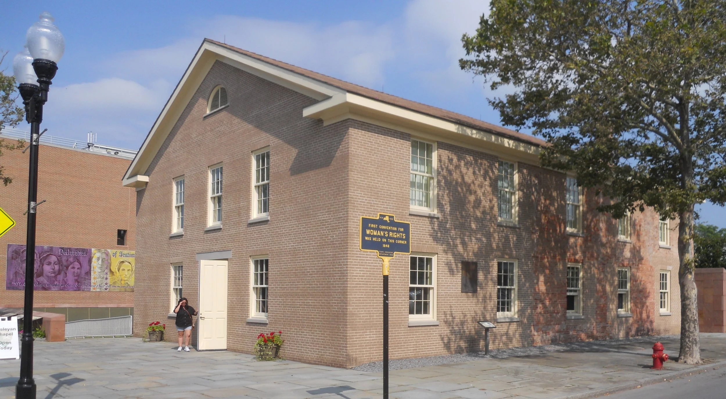
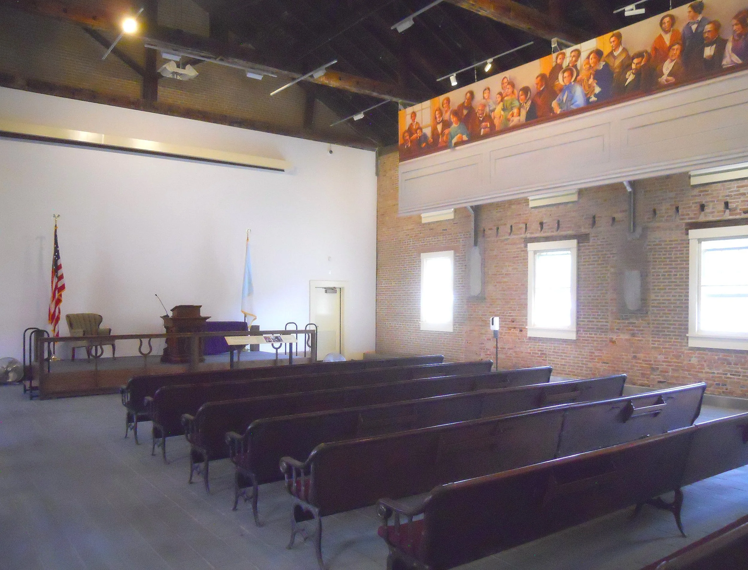
DAY 1 (August 4) - Women’s Rights NHP preserves the beginnings of the first Women’s Rights Convention, held on July 19-20, 1848, in Seneca Falls, NY. The Wesleyan Chapel was the primary location for the convention. The stone foundation, wooden rafters, and roof sheathing are original. The building was renovated in 1993.
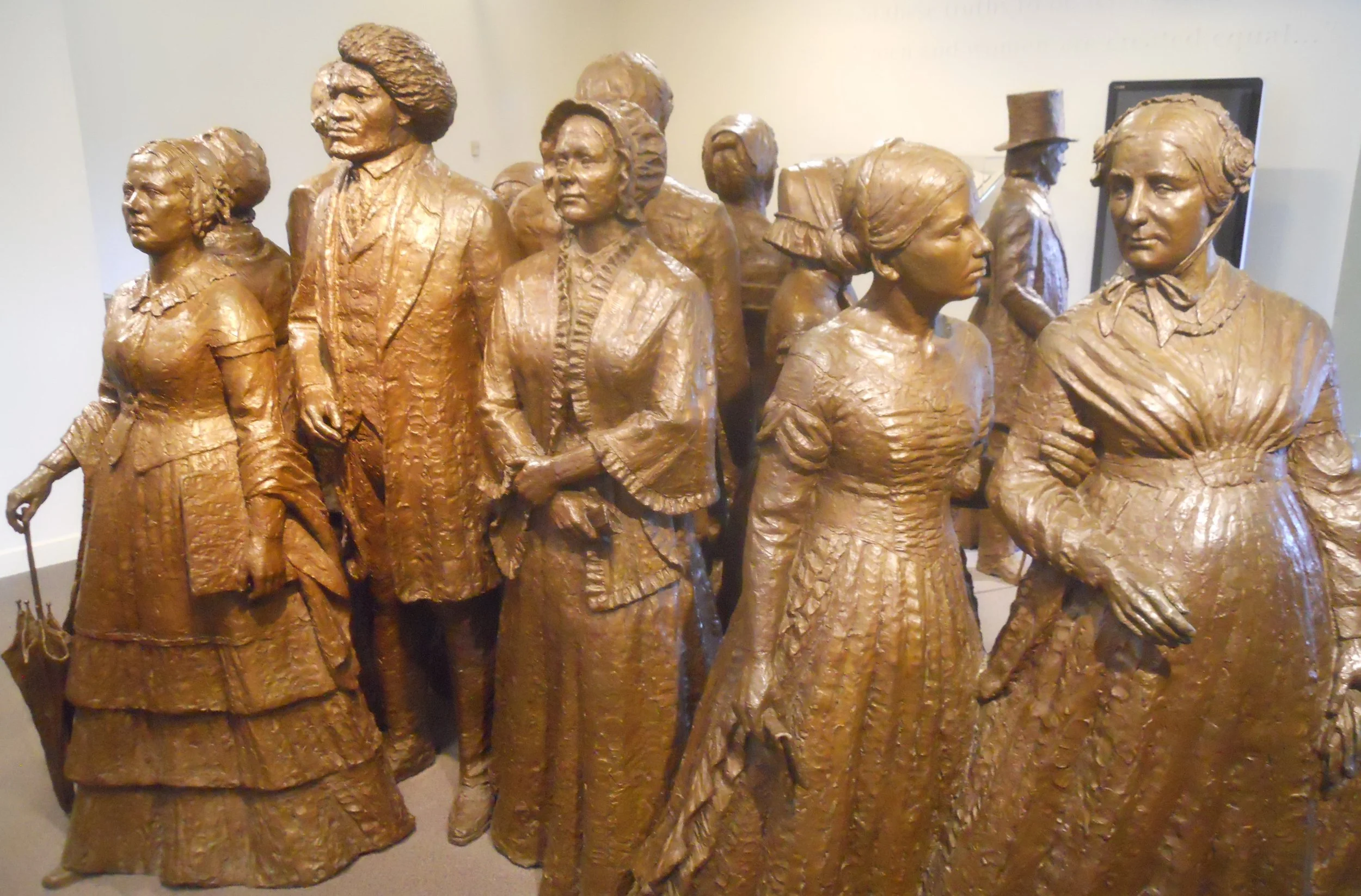
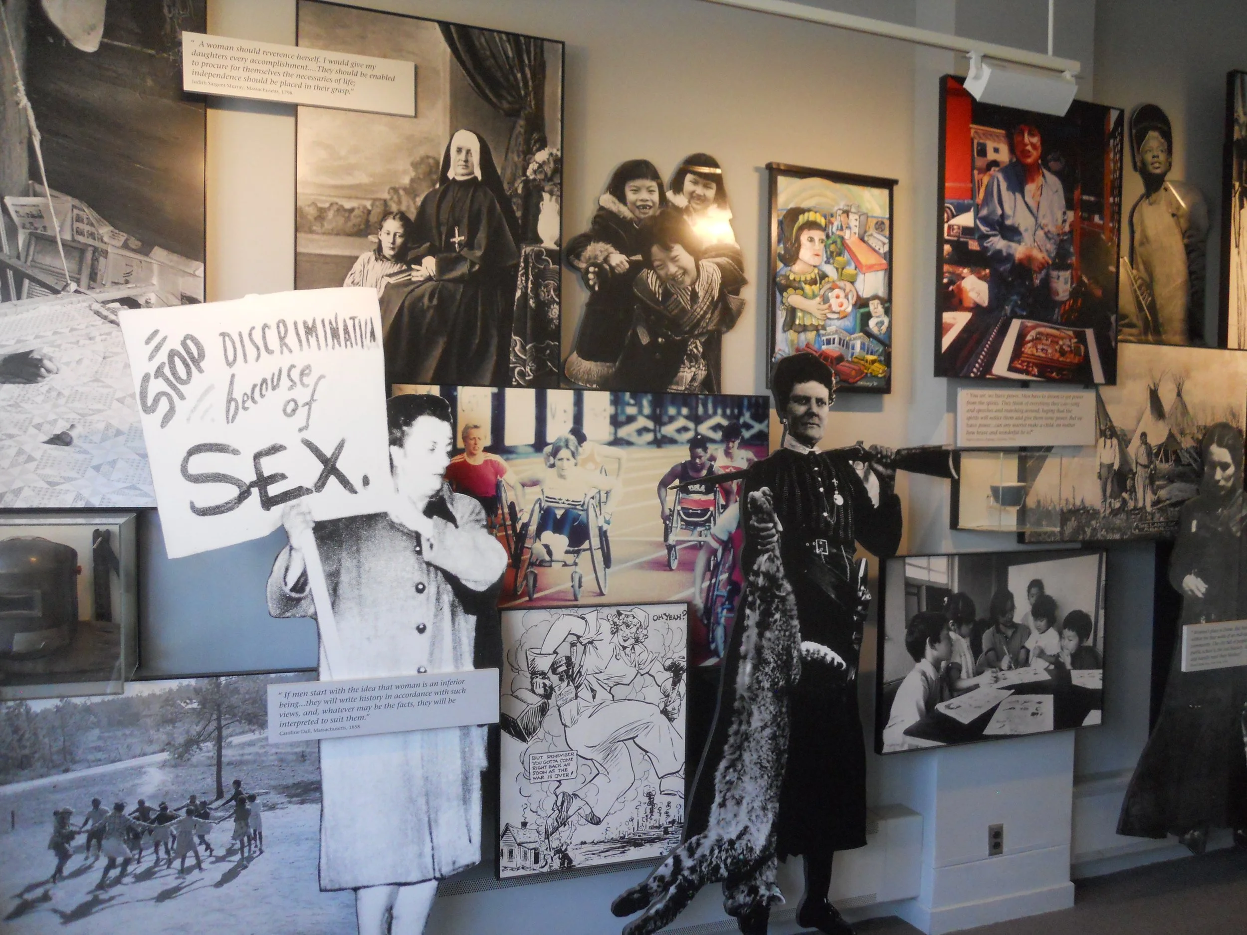
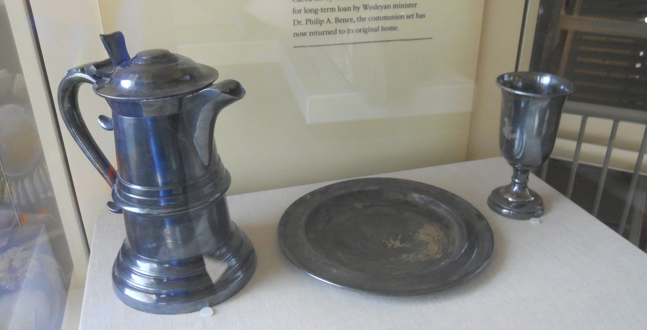
Bronze sculptures in the VC are of famous civil rights leaders. The far left is Elizabeth Cody Stanton, with Frederick Douglas next to her. Martha Coffin Wright is on the right. After various family transfers, the VC now has the original communion set from the chapel on display. Interior walls of the VC are plastered with photographs, signage, and cartoons, depicting the strife and efforts to eliminate inequality between men and women. About one mile from the chapel and VC stands the home of Elizabeth Cody Stanton, the driving force for organizing the 1848 Convention.
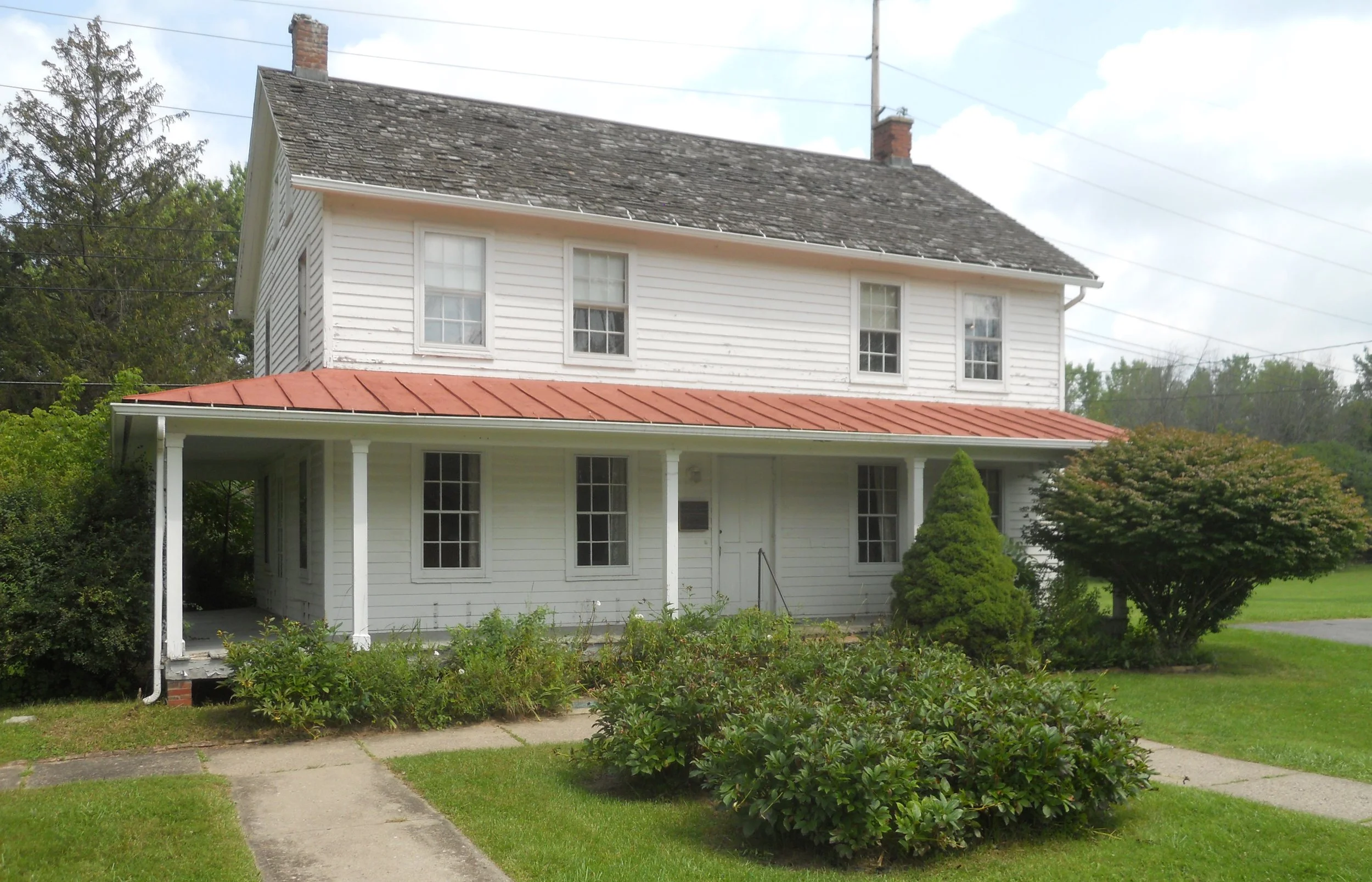
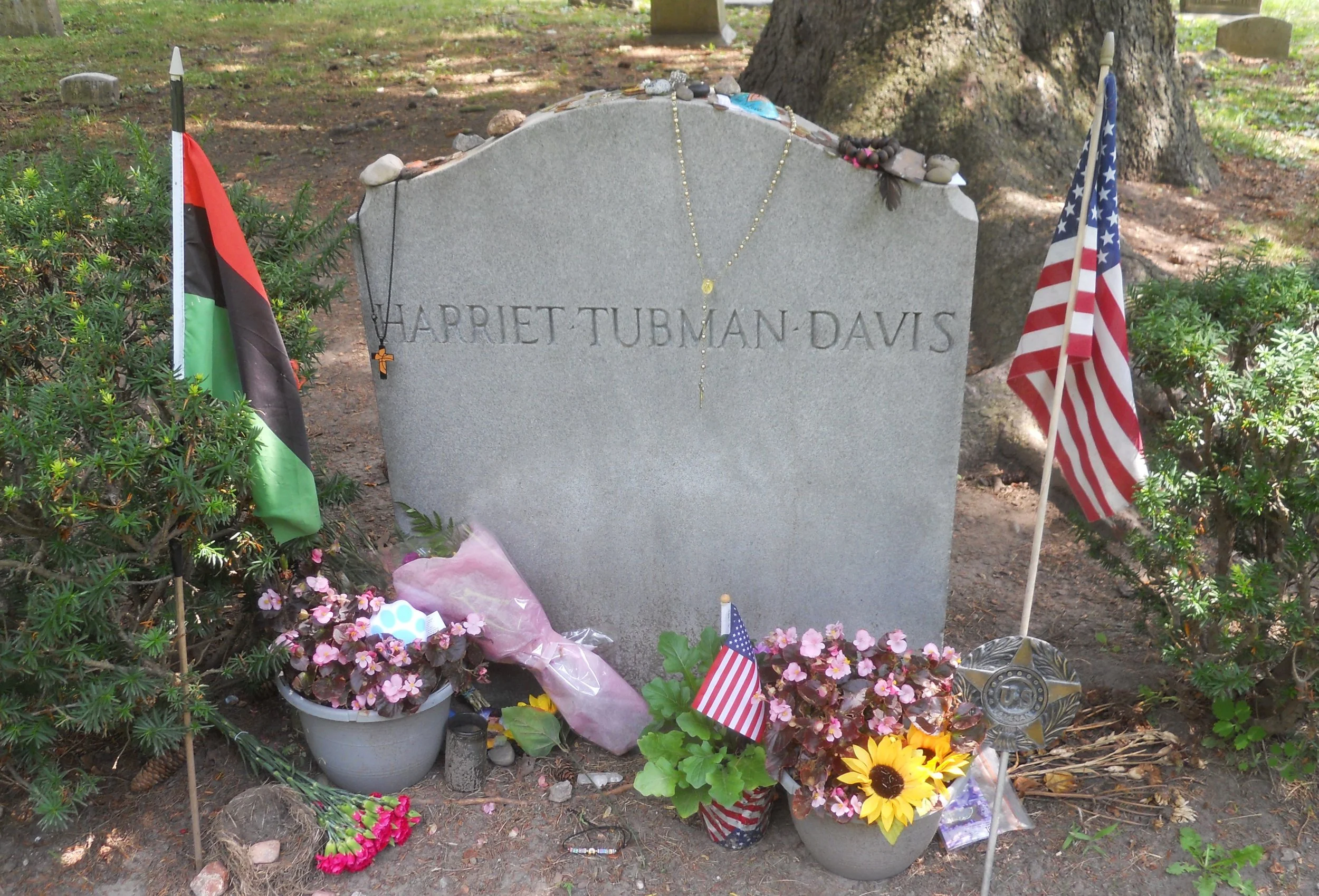
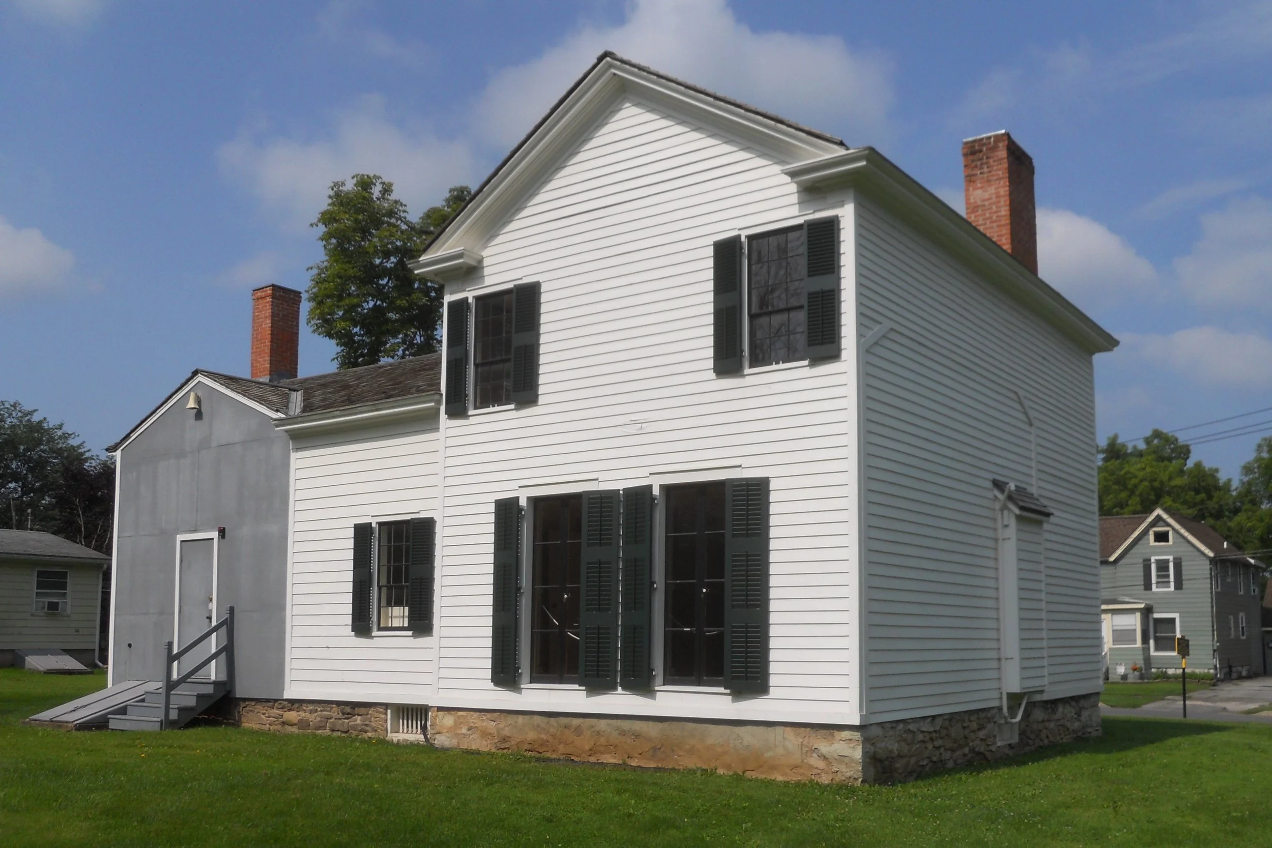
Harriet Tubman NHP is a few miles down the road. The main portion of the park includes the Harriet Tubman Home for the Aged (left photo) and her residence (right photo). She moved to Auburn in 1859 from Ontario, living here until her death in 1913. The interiors can only be accessed on one of the two daily tours. Tubman was known as the Moses of her people. She was a Union spy during the Civil War. Her burial site is in Fort Hill Cemetery, a couple miles from her homes. Close by is the Thompson Memorial A.M.E. Zion Church. Tubman helped finance the founding of the church in 1891. Her funeral was held there. The NPS is currently restoring the structure, to be reopened later this year.
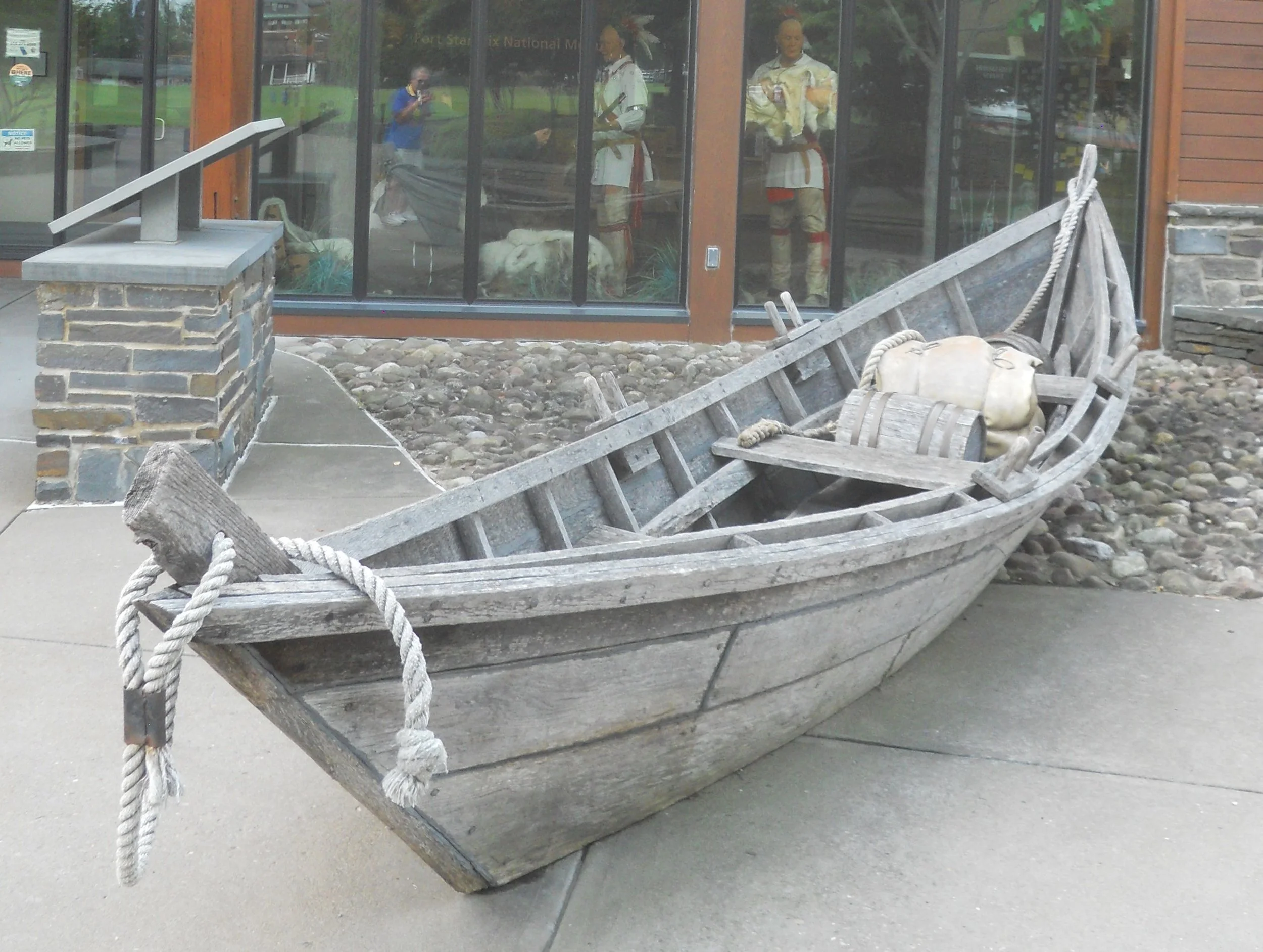
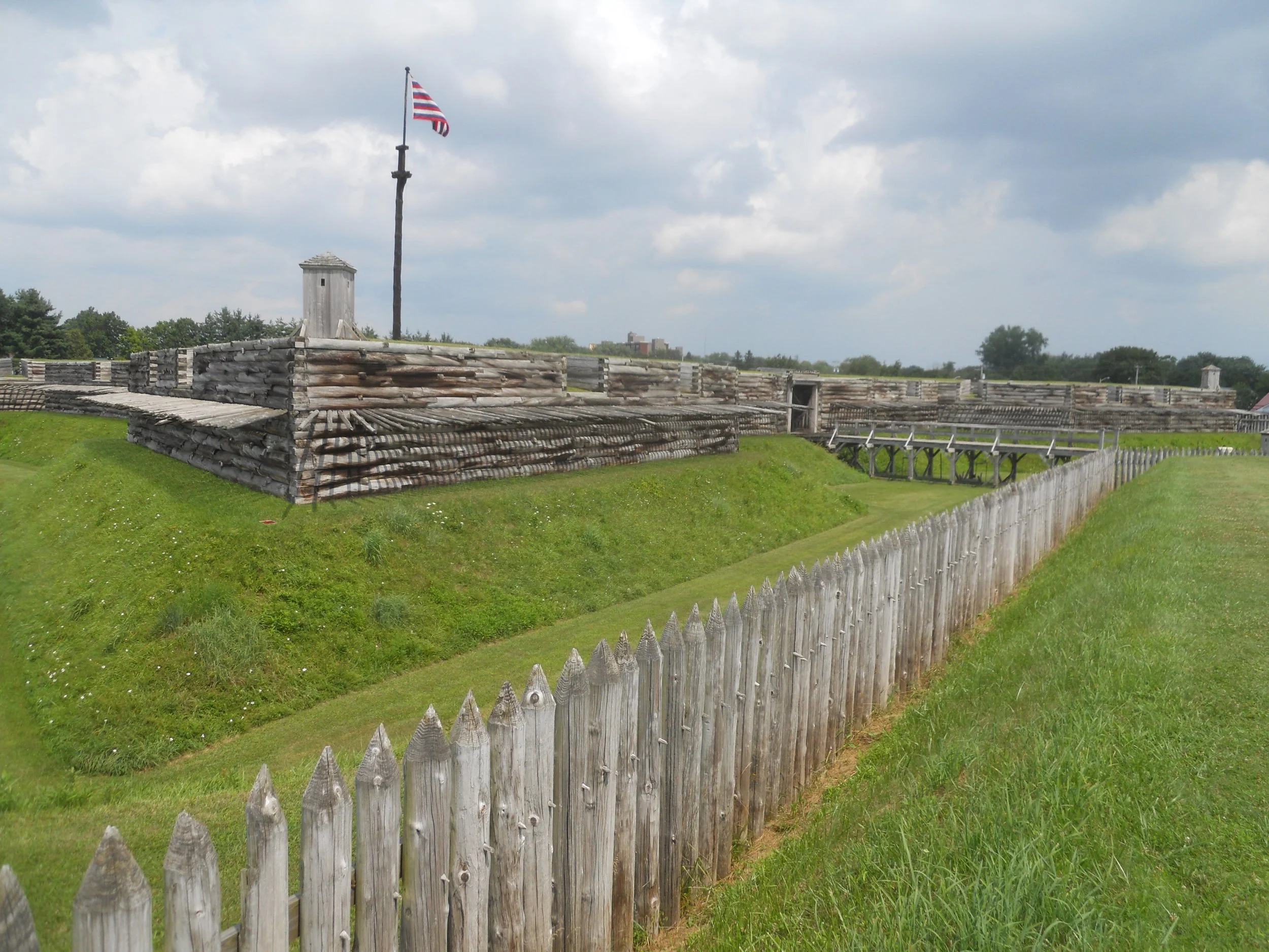
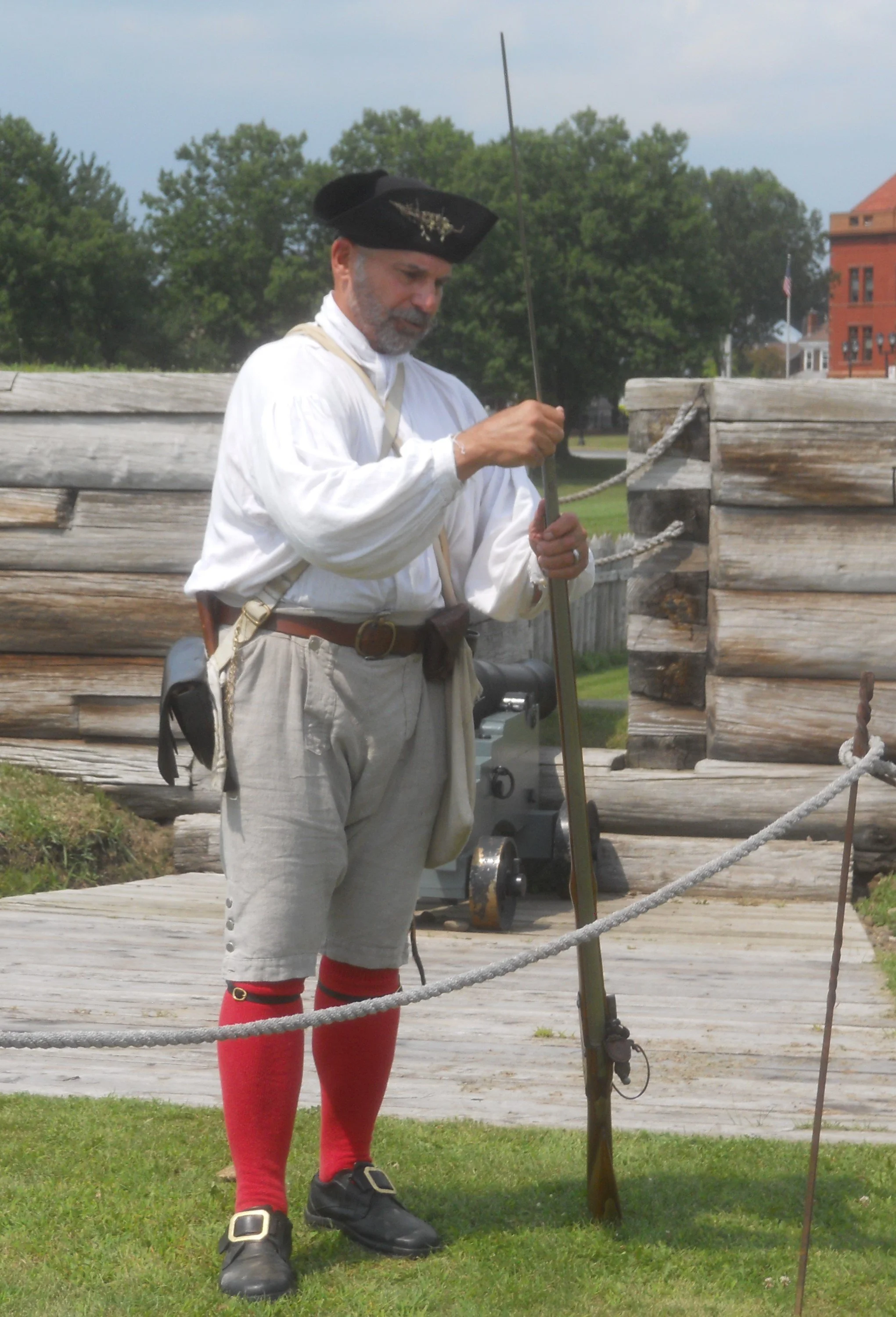
Fort Stanwix NMon is situated at the Oneida Carry, a 6-mile portage between the Mohawk River and Woods Creek, a vital commercial junction allowing people to transport between the Atlantic Ocean and the Great Lakes. So, of course, someone had to build a fort to guard the area. A large wooden canoe sits outside the VC. The fort is famous for its 1777 siege, when British forces tried to overrun American soldiers, to take back western New York lands. With their defeat at Saratoga and not able to budge this group of Americans, the British gave up in the north and began to focus their attention on the southern colonies. The fort has a number of cannons. It was burned to the ground in May-1781 (believed to be arson) so everything a visitor sees today is a reconstruction. A staff member demonstrated how to load (12 steps) and fire a 75-calibre Brown Bess flintlock musket. Rest assured, no musket ball was involved.