DAY 8 - Due to a winter storm which descended on north central Texas, I only made Waco Mammoth NMon today.
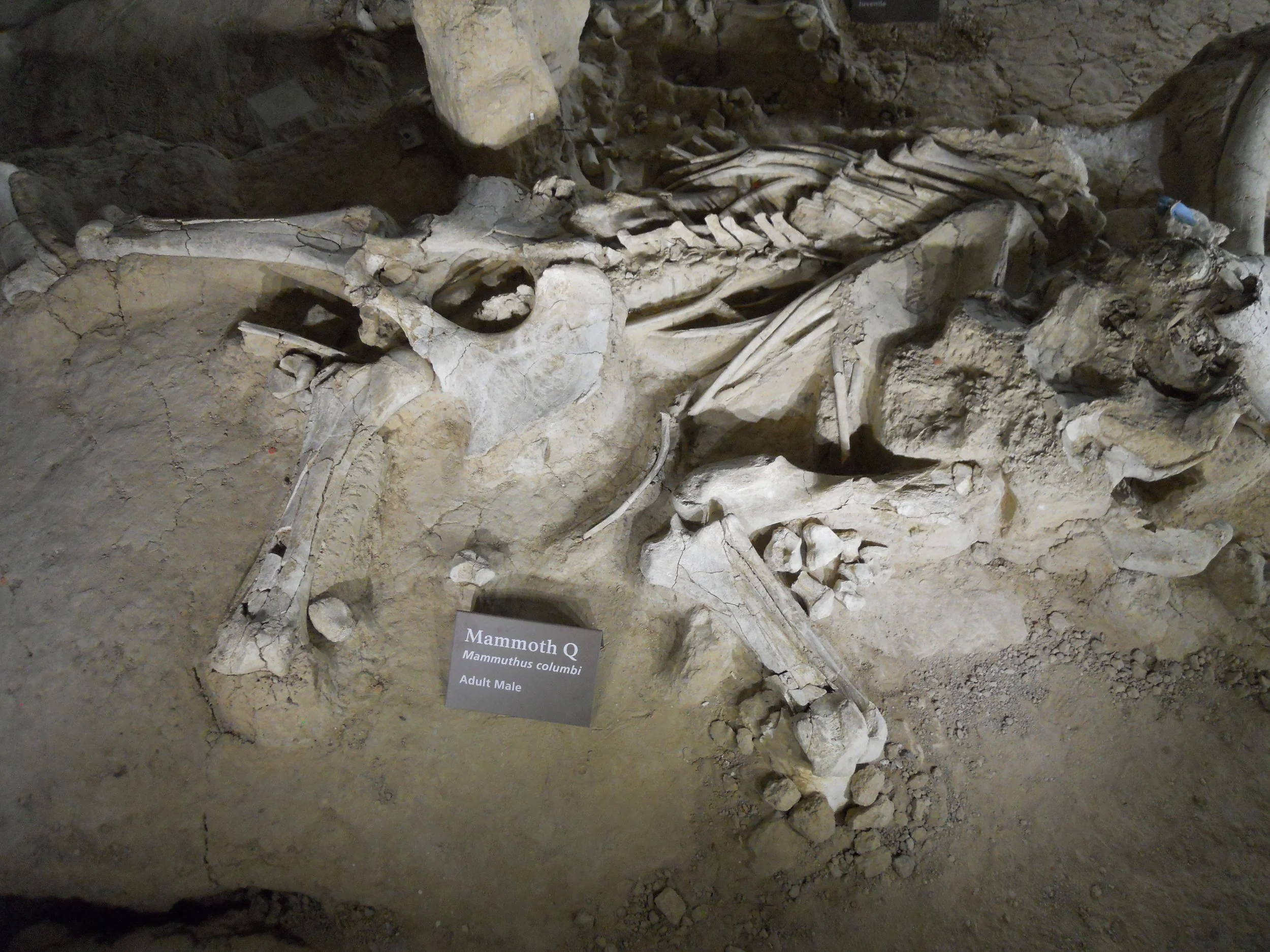
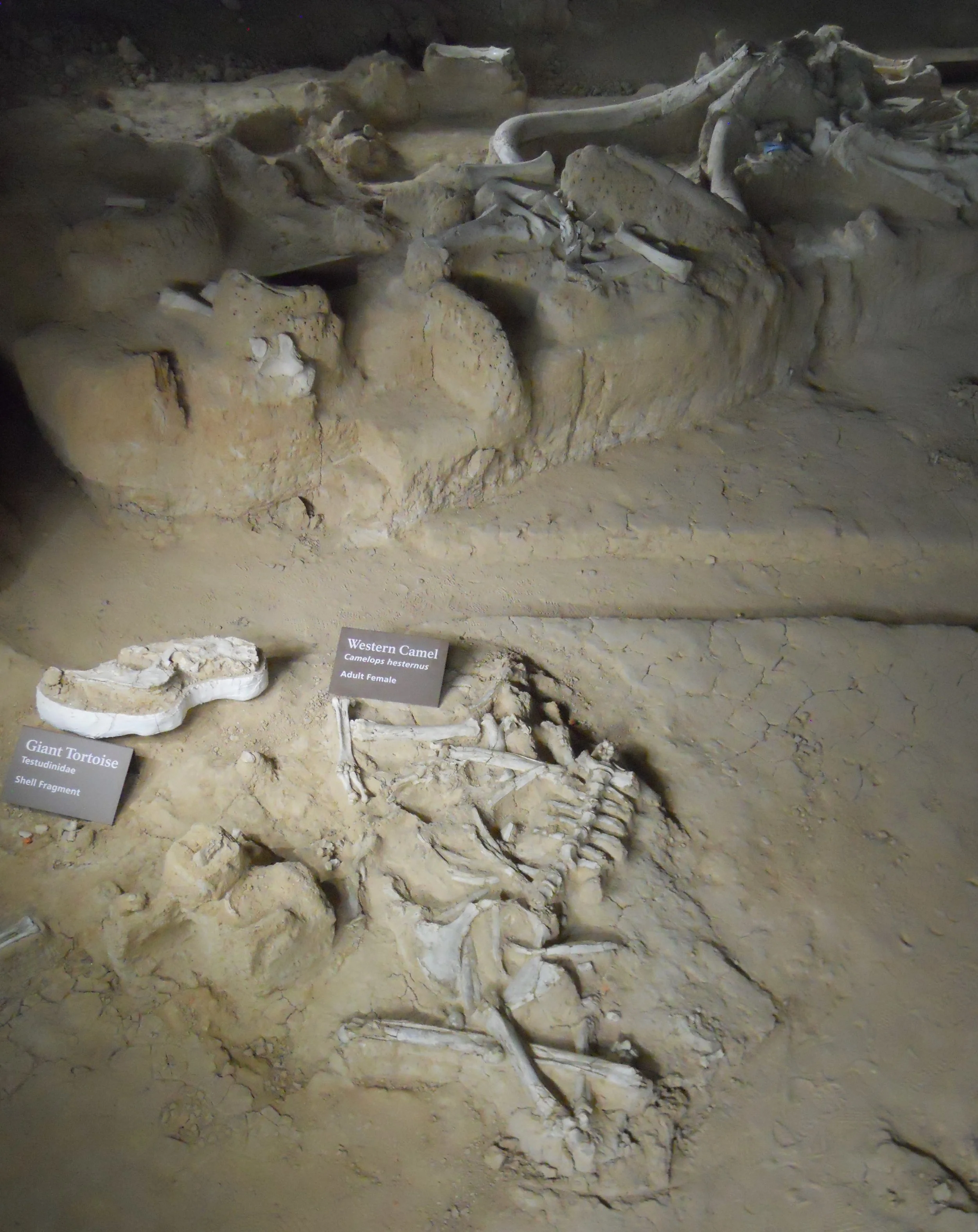
It is hard to believe Columbian mammoths (14 feet tall and 20,000 pounds) roamed this land up to 10,000 years ago. There were two eras of mammoths in this region, a nursery herd from 65,000 years ago (19 animals appear to have been trapped by rising flood waters… along with a camel), and bull mammoths from 10,000 years past.
Bones of a saber-tooth cat, a giant alligator, and a giant tortoise are also in the excavation site. The land had to be quite different than today-Texas for this mix of animals to have been living together in this area.
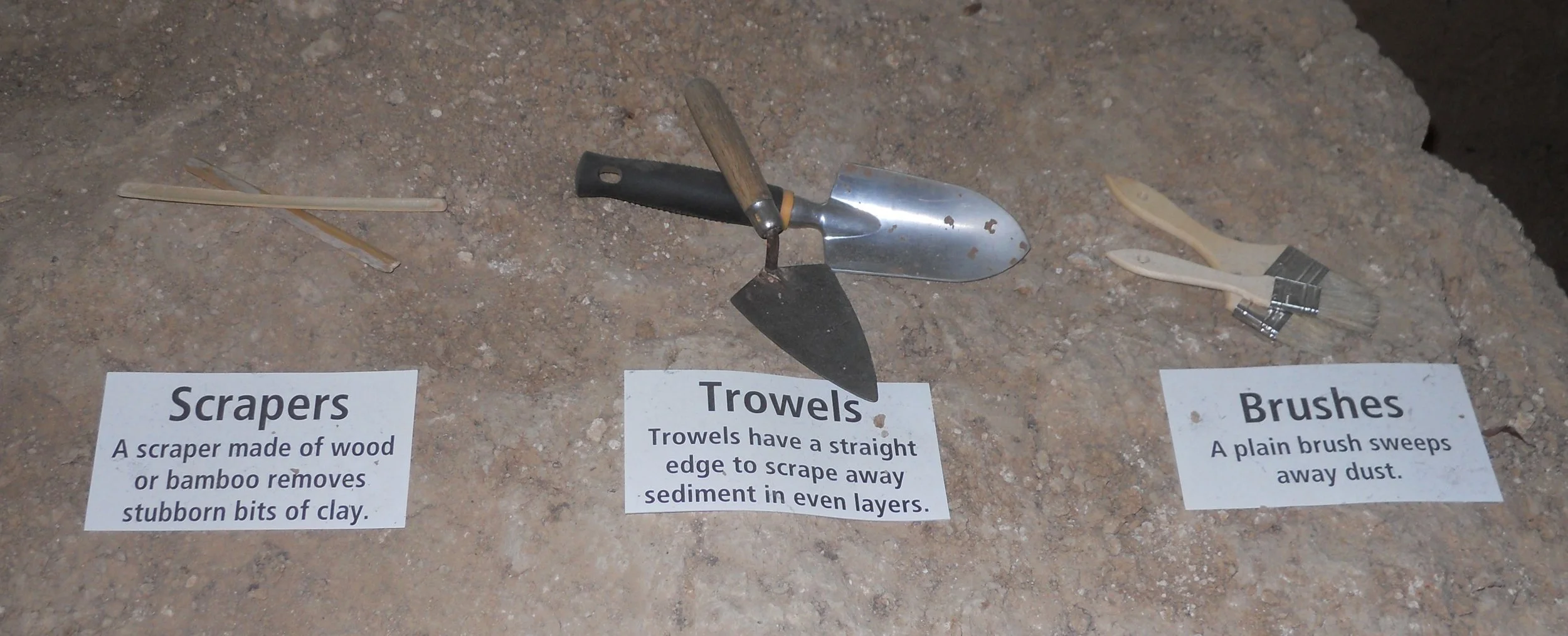
Tools used by the two discoverers of this area (they had been out looking for arrowheads) and the first research team were on display (photo).
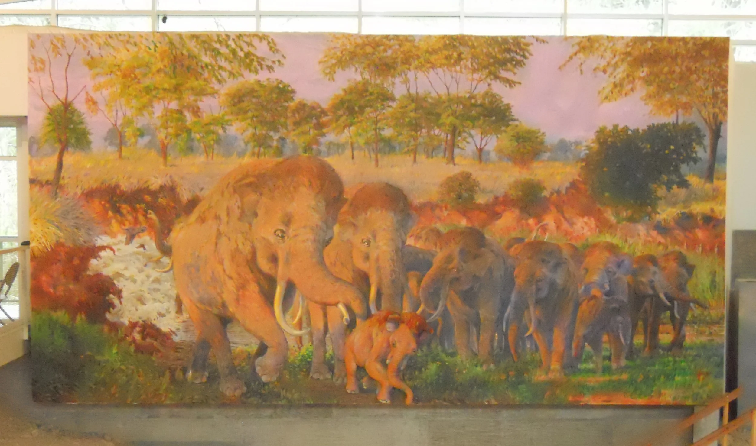
A large mural painting (photo) hangs inside the dig shelter.
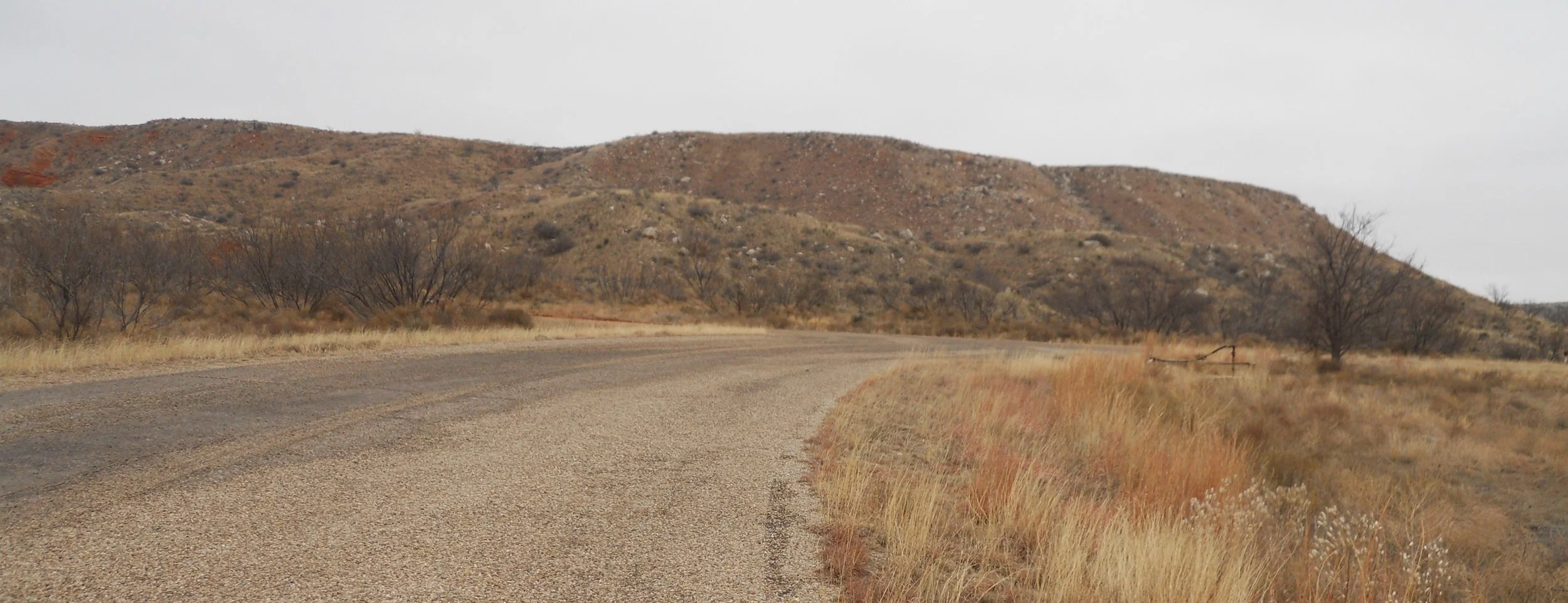
DAY 7 - 15F deg all the way from New Mexico to Alibates Flint Quarries NMon, and with blowing snow. This kept the rangers from having a tour of the quarries, but I still stepped inside the park boundary. The photo is of the tour road, just past the closed gate. Nearly 1,000 quarries have been identified in the park, many on top of mounds which you see in the photo.
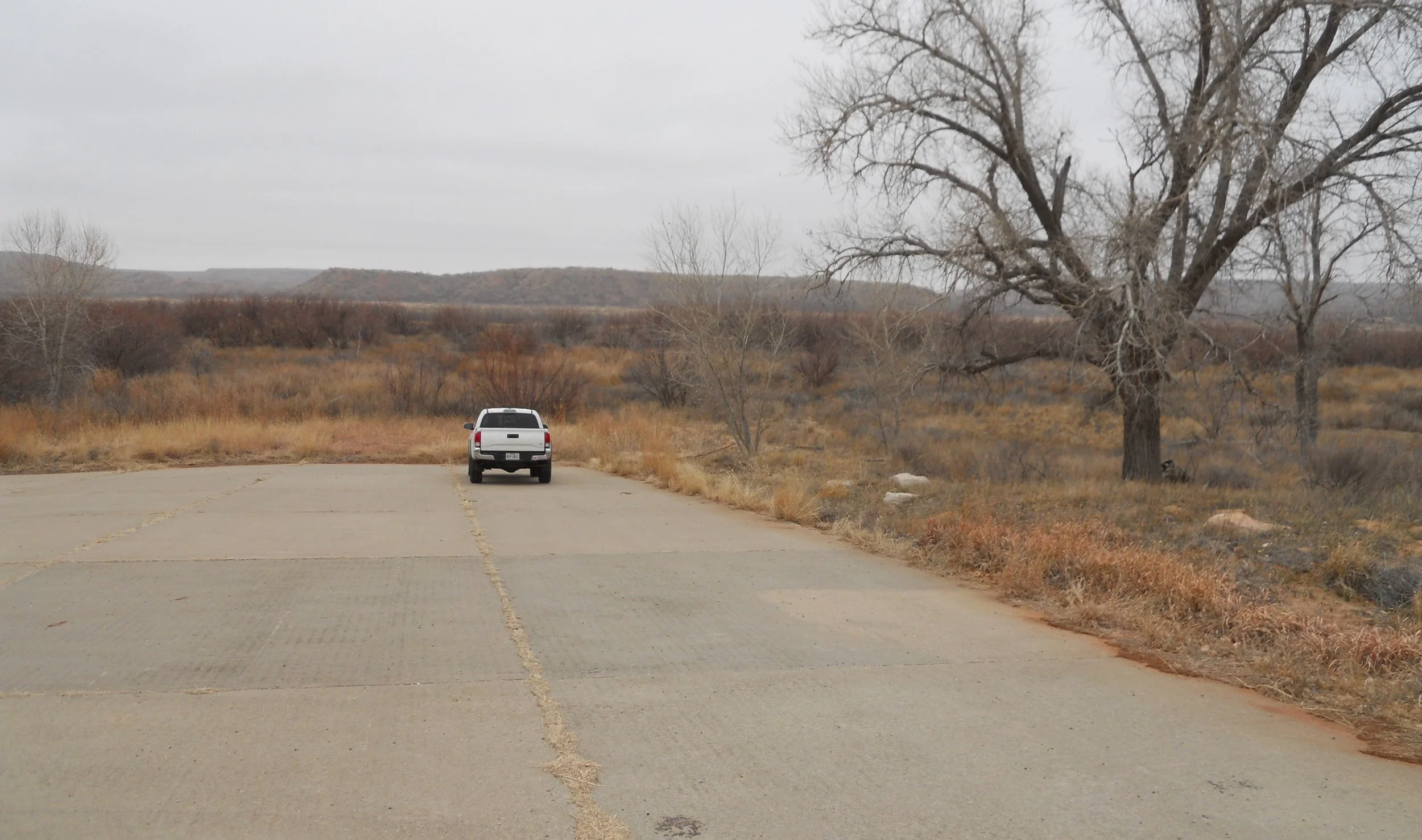
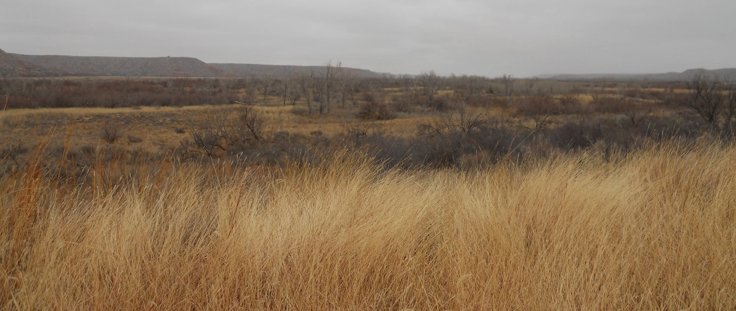
Lake Merideth NRA is much less than it used to be. Water Level is way down. The one photo shows plants and trees. All of this used to be under water years ago. One of the lake’s boat ramps shows its concrete leading into land.
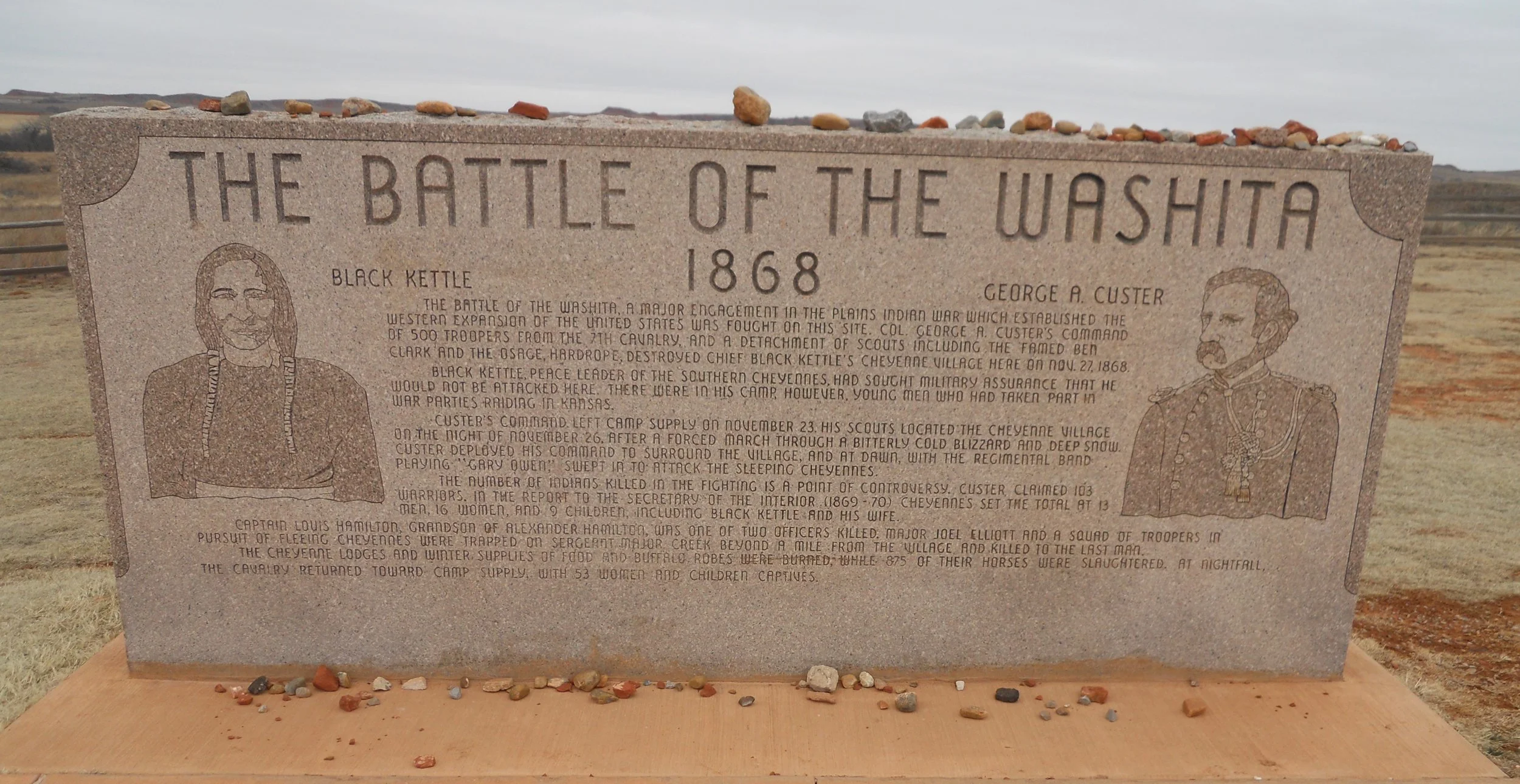
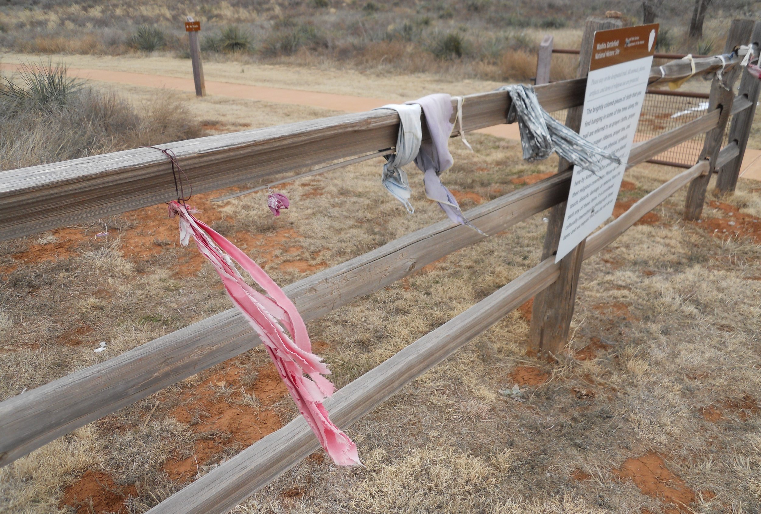
Washita NB involved Chief Black Kettle and Col. George Custer (yes, that Custer). The 7th Cavalry ambushed a Southern Cheyenne camp on the Washita River at daybreak, on November 27, 1868. After the victory, a Cheyenne Chief told Custer that since he and the U.S. Government had broken their peace promises to the tribe, death would befall Custer at the hands of native peoples. How prophetic, since in 1876 Custer was killed at the Battle of the Little Big Horn. People leave ribbons at the battlefield in memory of those massacred.
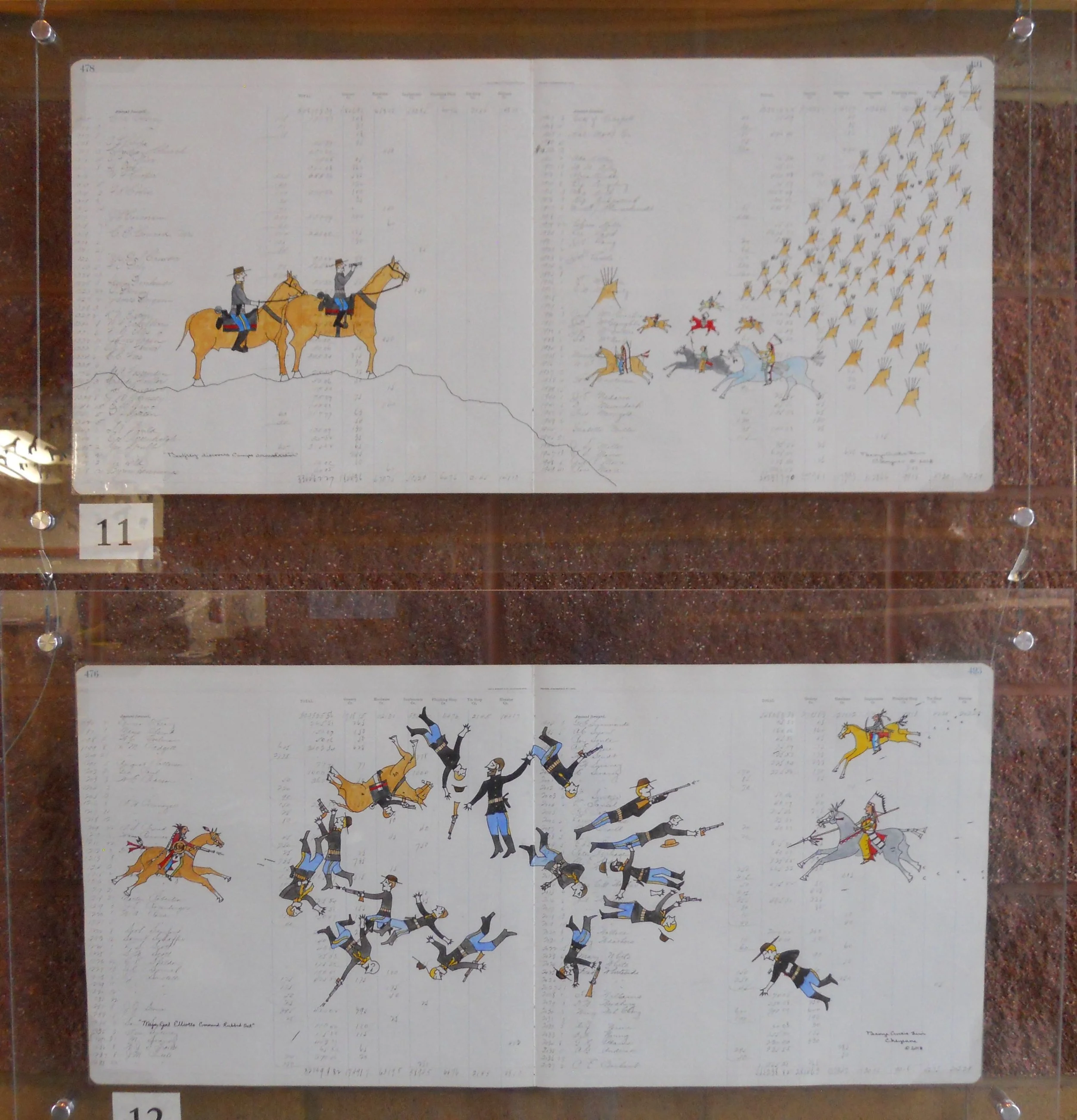
The art is by George Levi, in the method of Plains Indians via their ledger books.
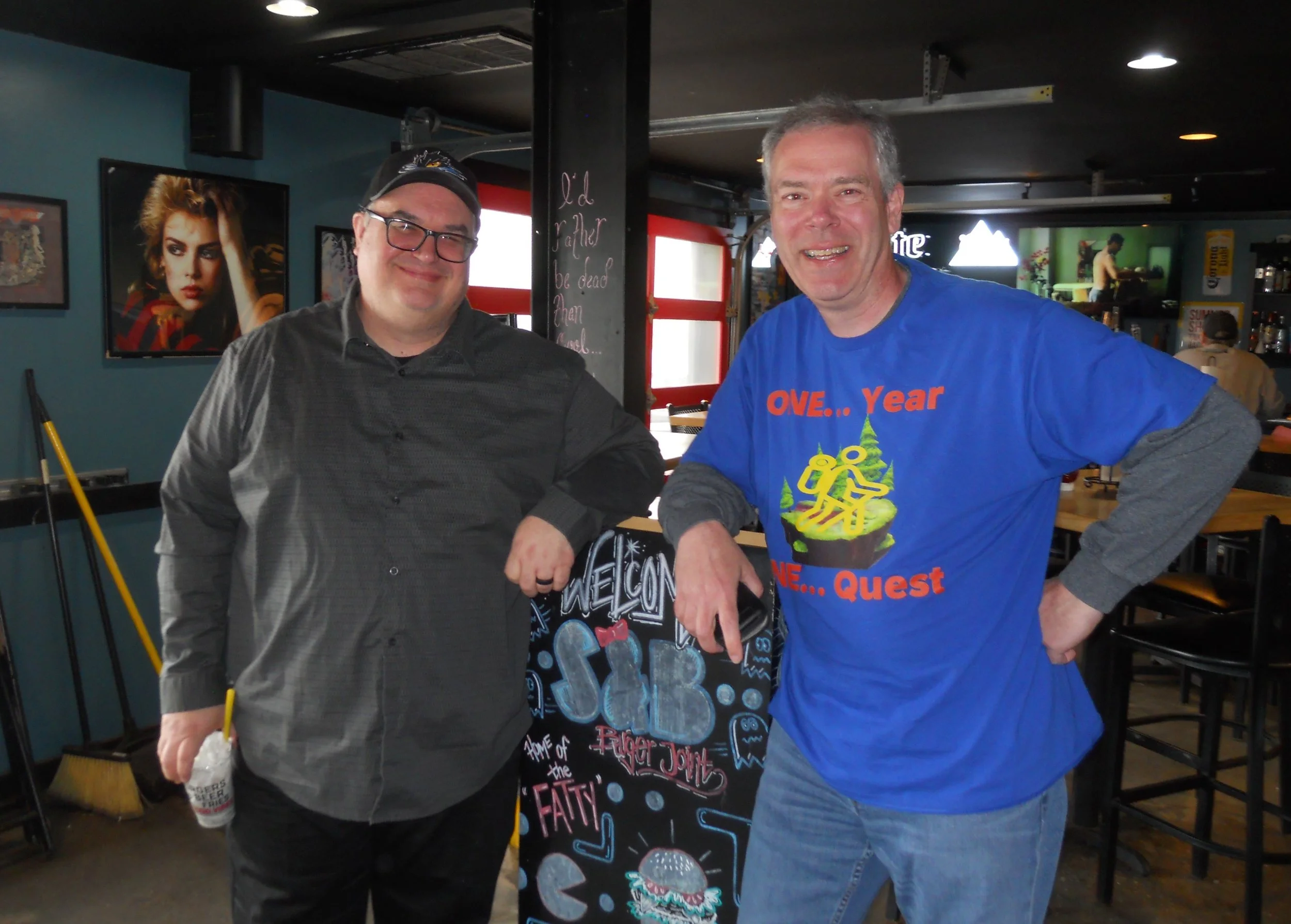
A big thank-you to Chris Weiler for coming to meet me at S&B Burger Joint in Lawton, OK. Chris is one of the great associates of the Goodyear Tire and Rubber Company. He and I worked on tires for 20 years, many of those years involving the Lawton tire plant. A shout-out to all the Lawton plant associates.
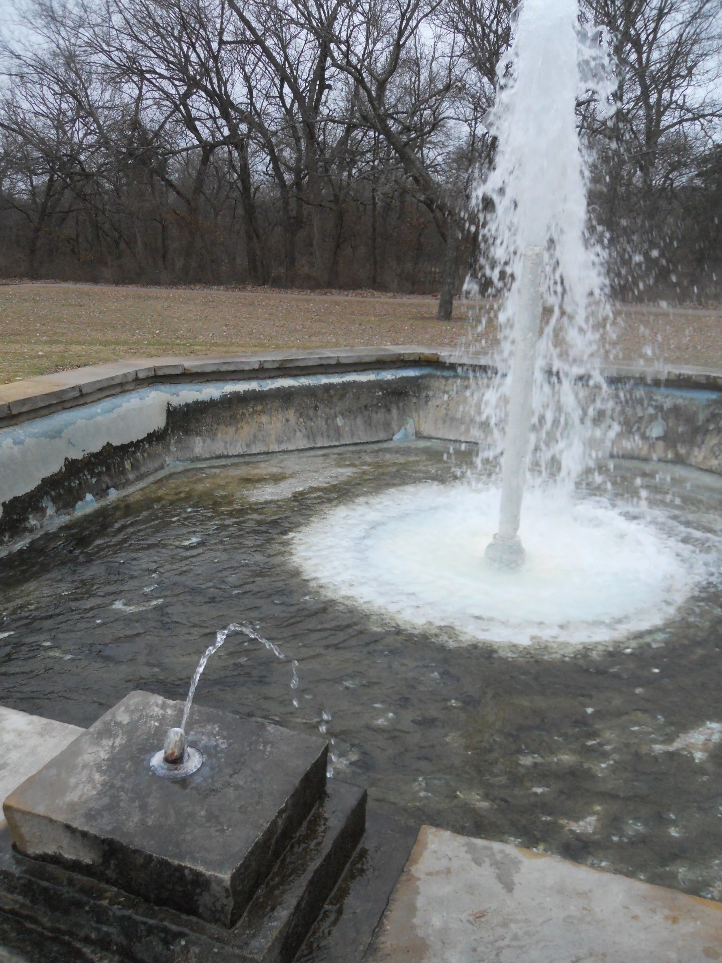
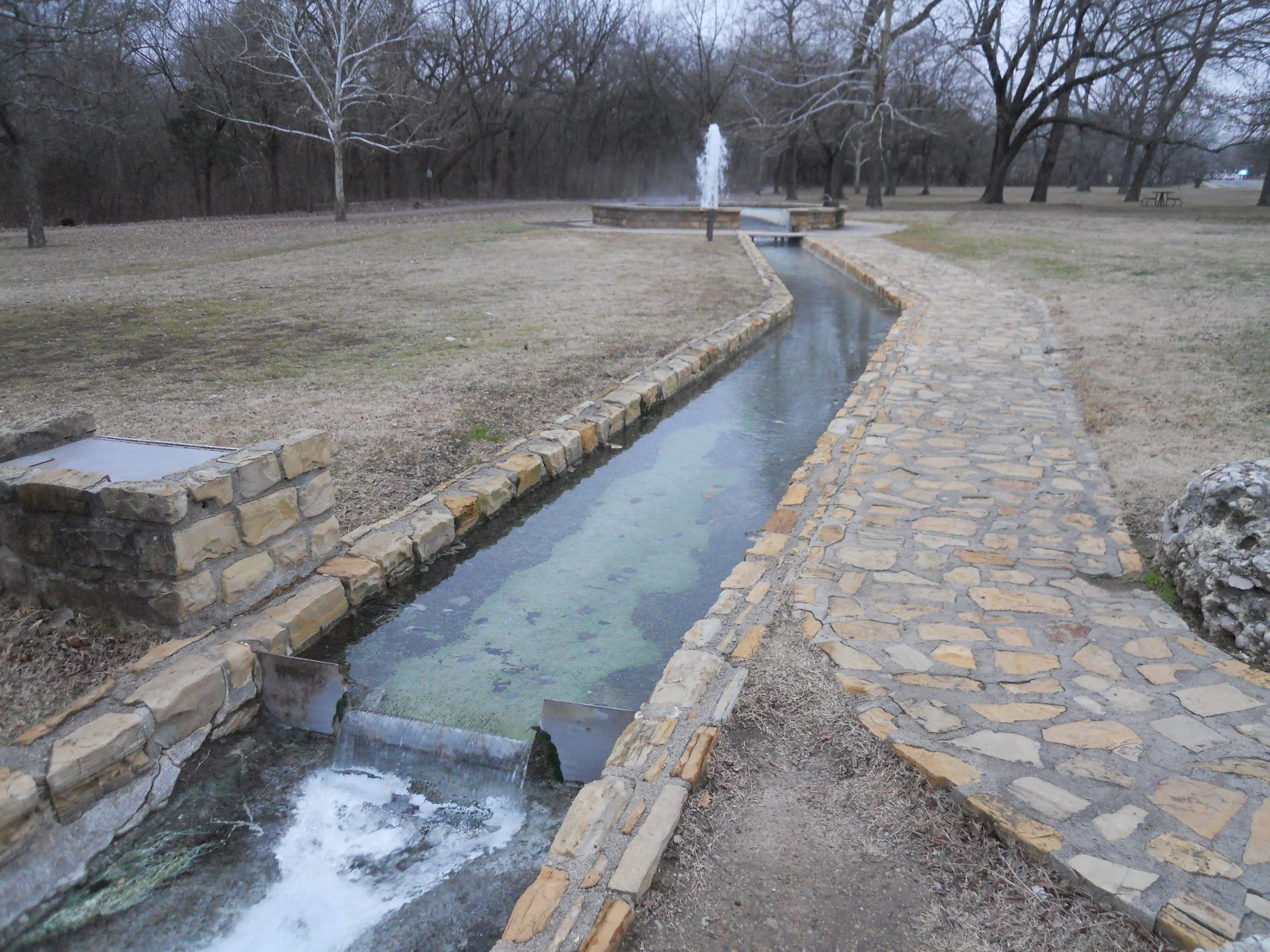
Chickasaw NRA is an oasis in the middle of Oklahoma, for water recreation. Springs feed the lake. One unique spring is an artesian well. The Vendome Well is under its own pressure, coming from a porous limestone layer well below the surface. The water you see today is roughly 10,000 years old. The water is hot and has that distinct mineral smell. The NRA is in the city of Sulpher… go figure. The water is diverted to a creek and wading pools. Stop by and take a taste sometime.
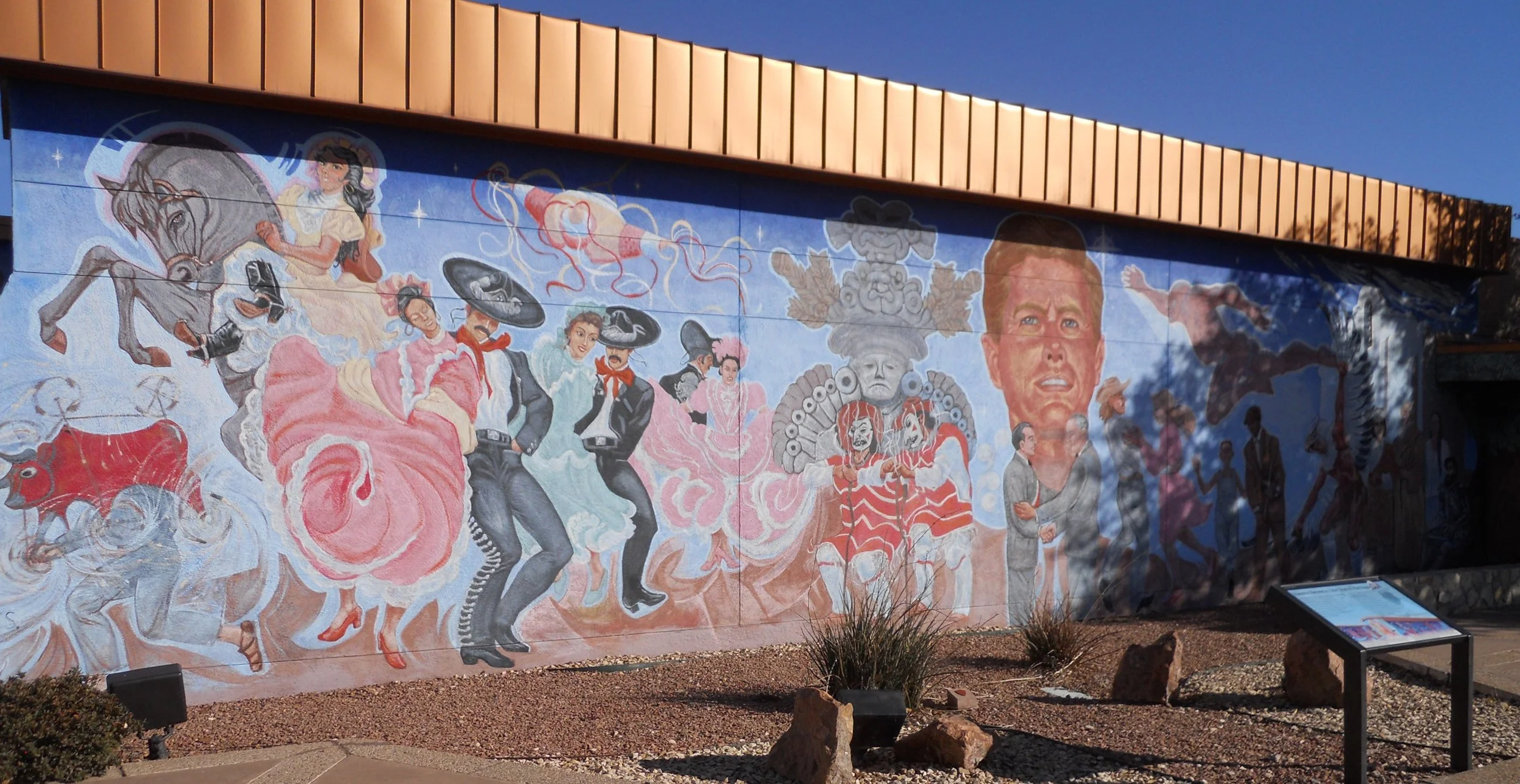
DAY 6 - The Chamizal NMem site honors the border conflict between the USA and Mexico which was resolved in 1964. The dispute began in the 1840s, since the Rio Grande River would keep changing course. The mural on the Cultural Center is “Nuestra Herencia”, or “Our Shared Heritage”.
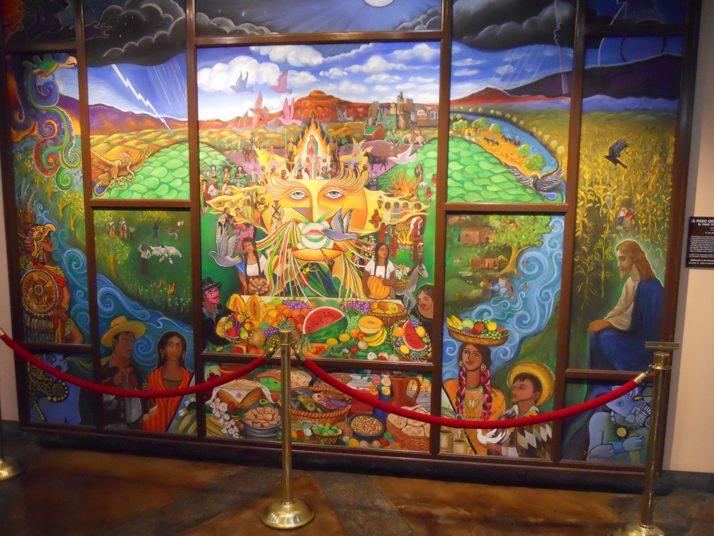
A lovely painting in the building gives thanks for the Spanish Thanksgiving, which was held 23 years before the Plymouth Rock event.
The concrete markers identify the original boundary line between our two countries from the 1840 treaty. The final 1964 treaty made all of this land a part of the United States.
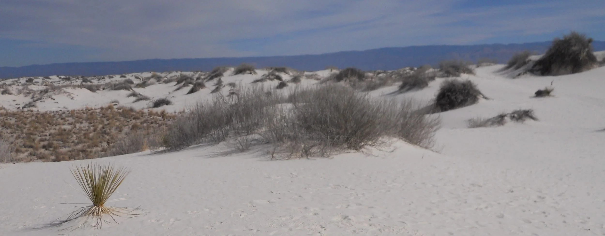
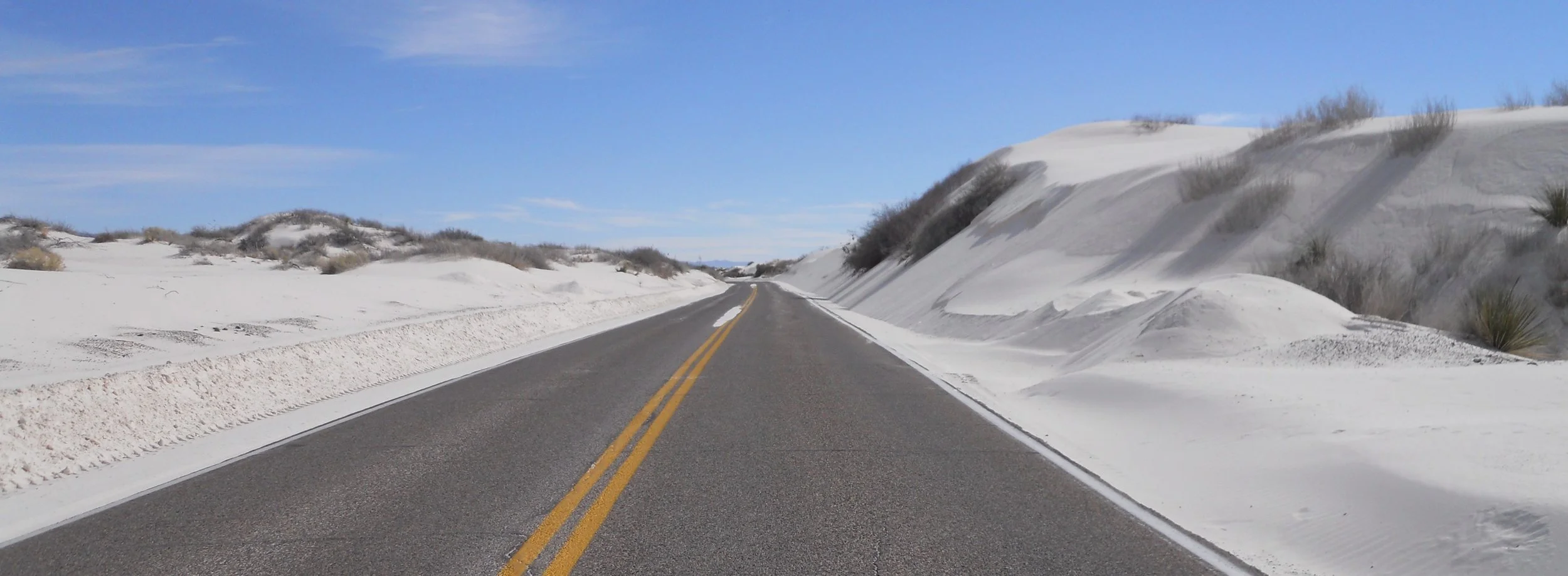
White Sands National Park sure looked white. That is right, not yellow or gold, but white. But, guess what? This is not really “sand”. Minute particles of gypsum make up this park. And gypsum is clear, not white. All those grains banging against each other, combined with reflecting sun light, makes for the appearance of white.
The wind in this valley can get cranking, pushing the gypsum onto the surface of the one road which traverses the park. Check the plow marks on the left-side of this photo. I have been at the park when one could not see the road.
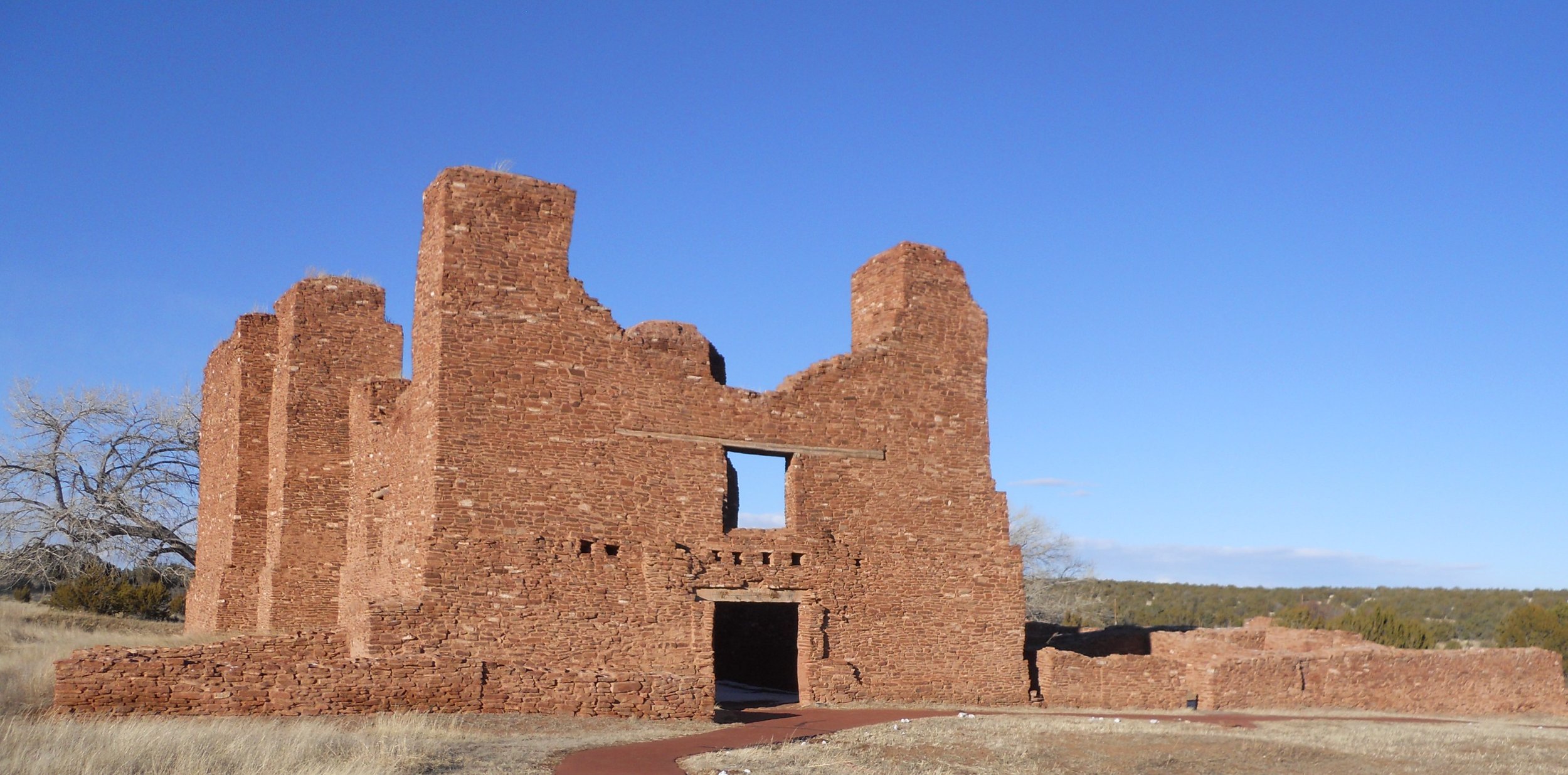
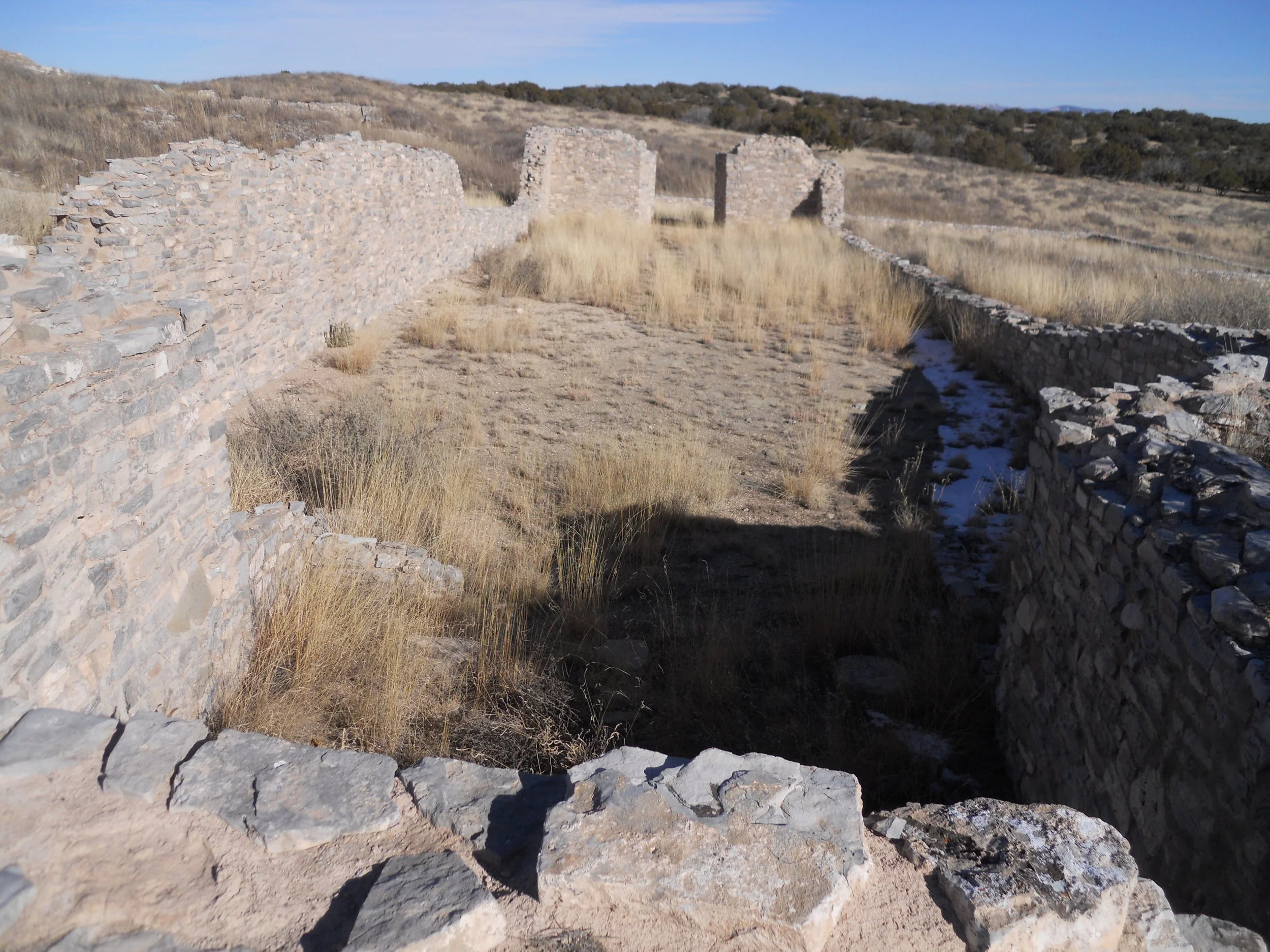
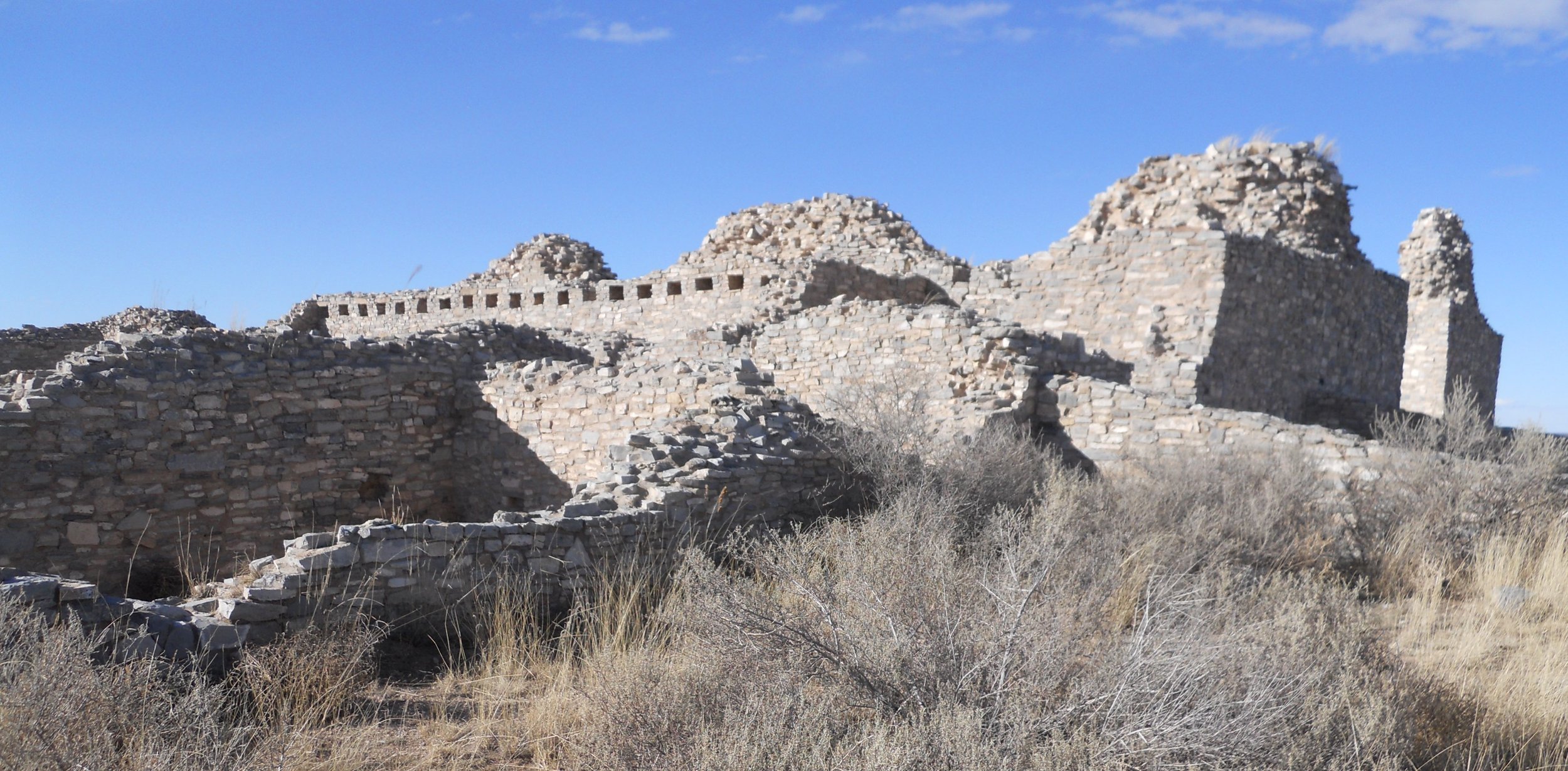
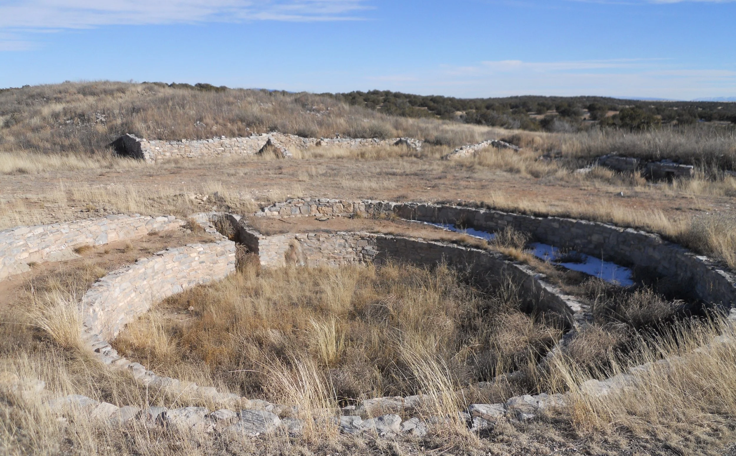
Salinas Pueblo Missions National Monument is a set of three ruins, spaced about 45 miles apart. If you can only make one of the units, consider Gran Quivira, the largest. The original 1630 church site is in the first photo. To its right is a view of the second church, looking up the hill. It is much more massive. A couple of kivas were present in the city (photo). The Franciscans for a time tolerated the local religious customs, with the native people building secret ritual sites within the complex. But after a few years they drove out all such practices.
The main ruin at the Quarai site (northern most of the three units) is comprised of red brick and mud.
Indigenous peoples had lived here for hundreds of years before the Spanish arrived in the 1500s, and Franciscans began their efforts in 1623. Ancestors of those original dwellers reside in New Mexico, Arizona, and Texas.

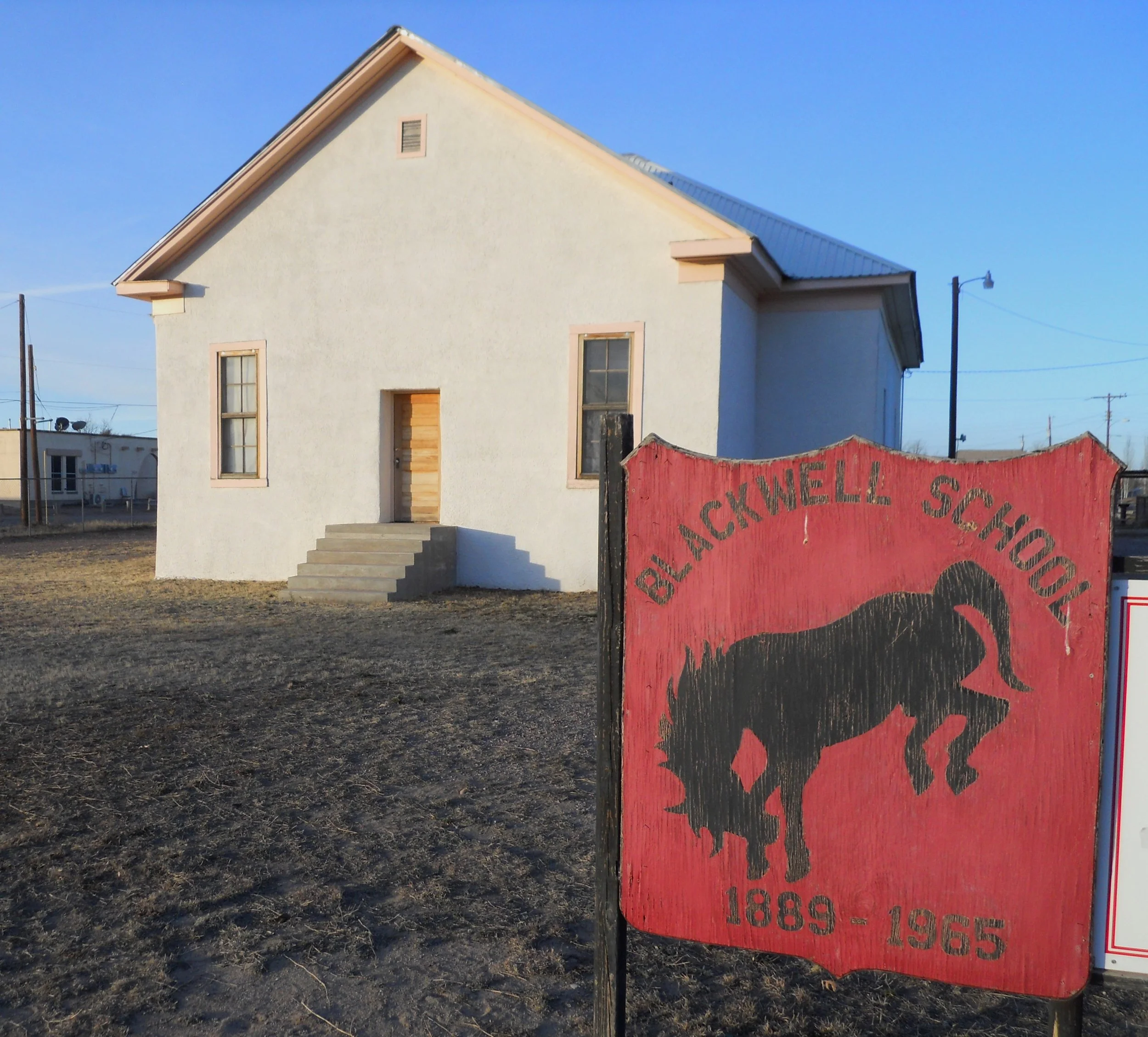
DAY 5 - A couple of Greater Roadrunners had to scamper across the roadway, to keep from being hit. But I did not see Wile E. Coyote in hot pursuit. Blackwell School is in Marfa. It has been authorized as a new NPS park, but has yet to be “established”. What you see in the photo is all that is at the property. May be a few years before the NPS has a ranger on-site.
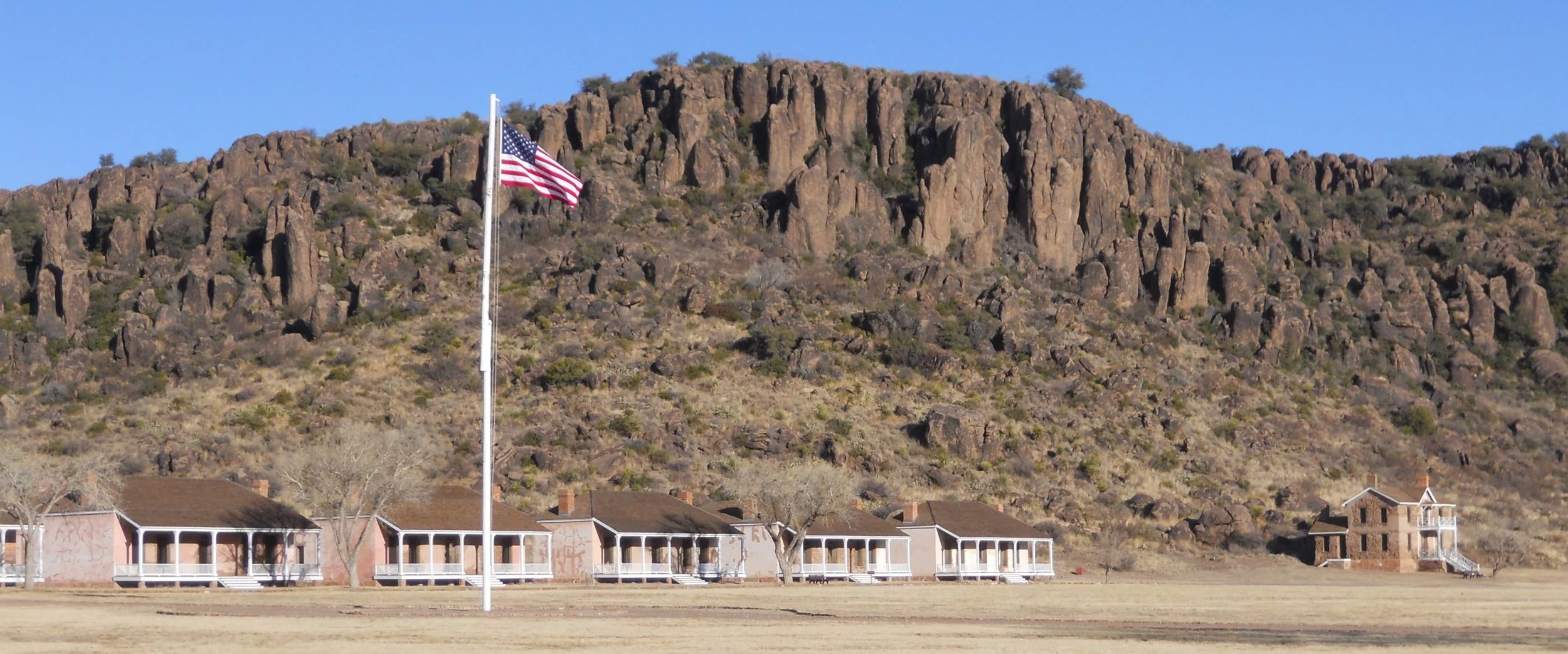
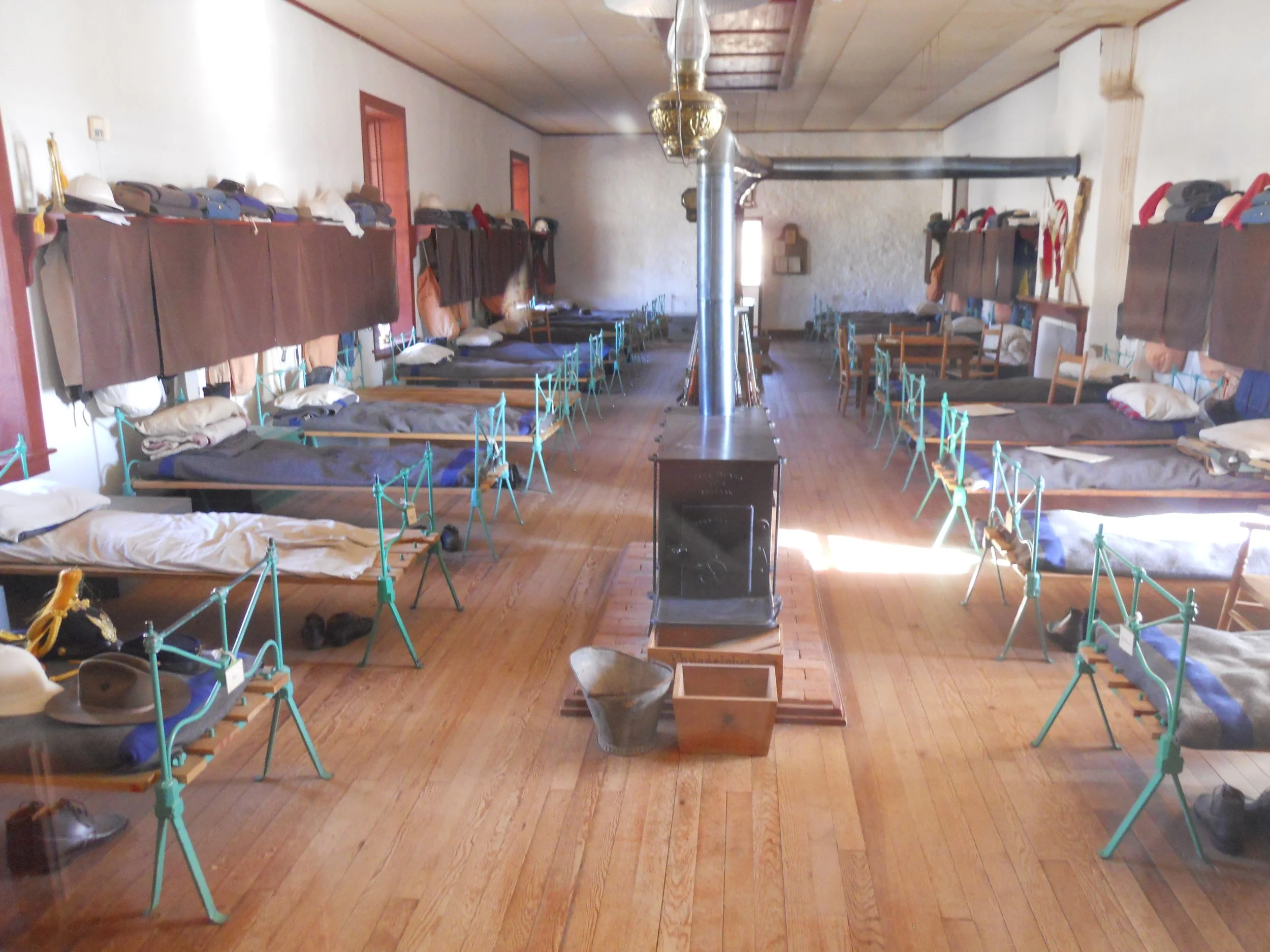
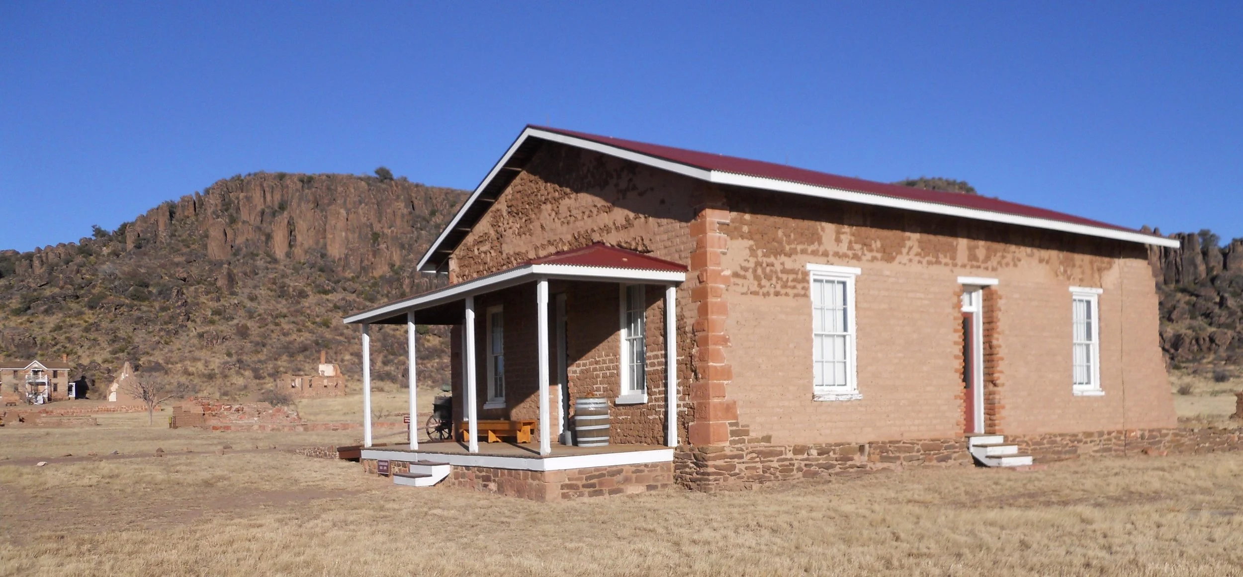
Fort Davis NHS has many ruins of both the first and second forts. It was built during the Indian Wars’ period, to protect the interests of Americans in the region, including the main trail road between El Paso and San Antonio. The period of 1854 to 1891 saw many clashes.
An enlisted men’s barracks (photo) shows the sparse life led by privates. Today’s soldiers have a slightly easier time. They were allowed to go to the Commissary (photo) to buy goods.
The first fort had its buildings oriented to true-north, while the second fort’s structures pointed to magentic-north. Who knows the difference?
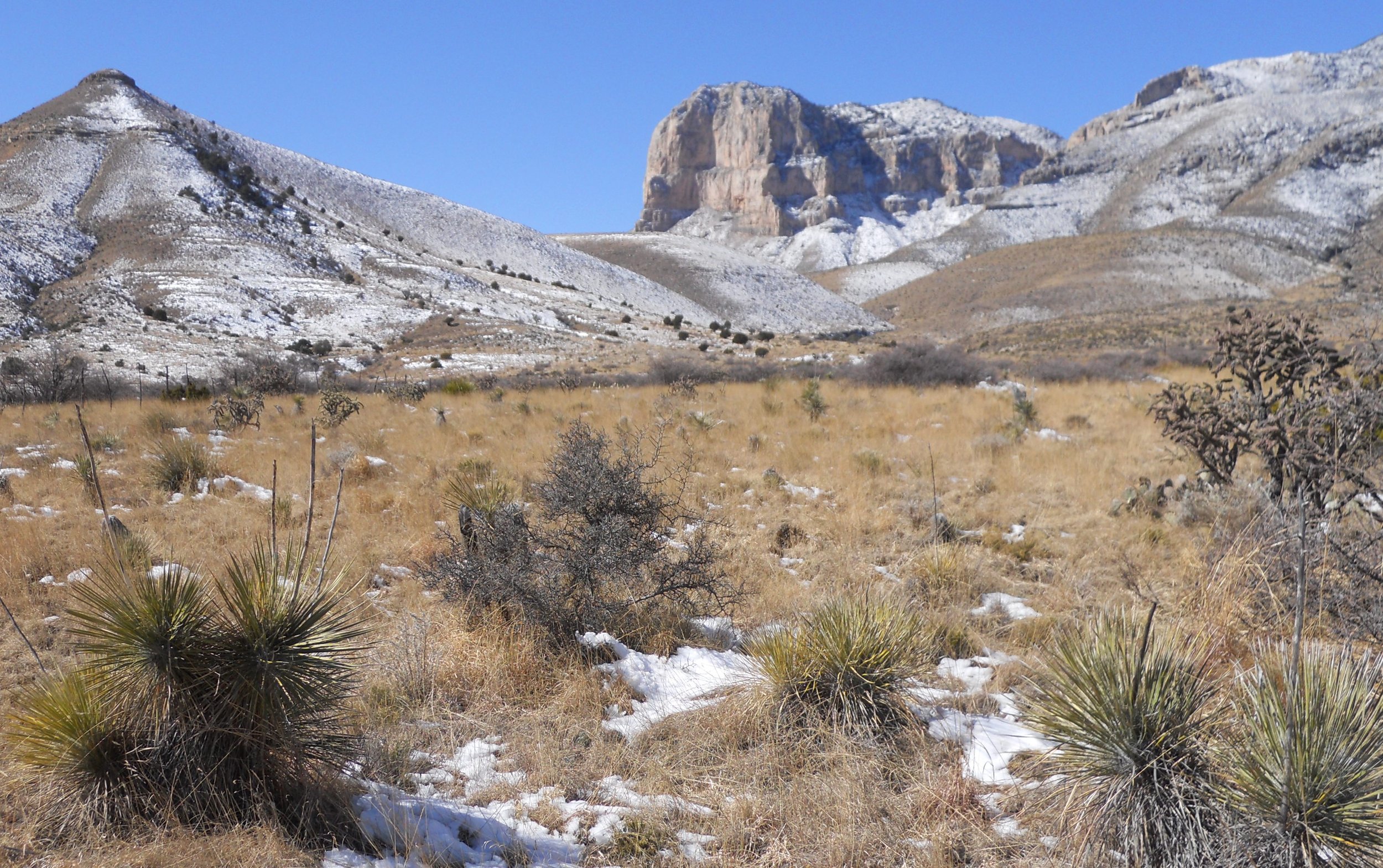
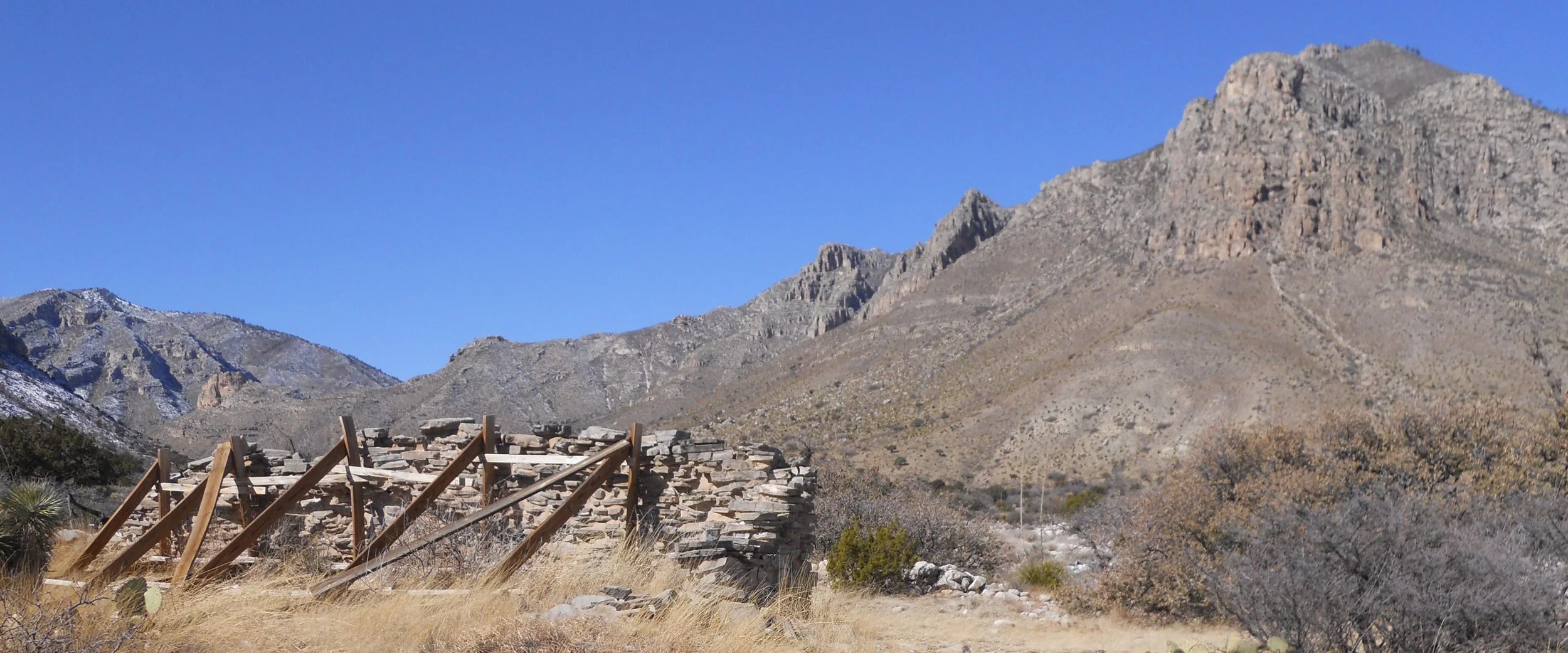
Guadalupe Mtns NP had snow covering much of the area. Guadalupe Peak (highest point in Texas) is in the center of the one photo. Ruins of the Butterfield Stage station stand in front of Hunter Peak.
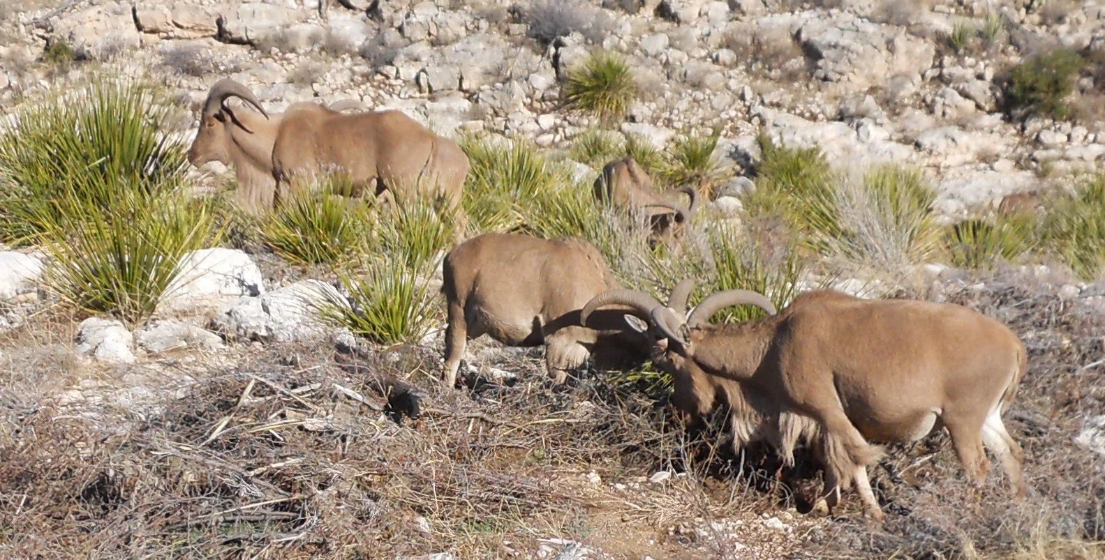
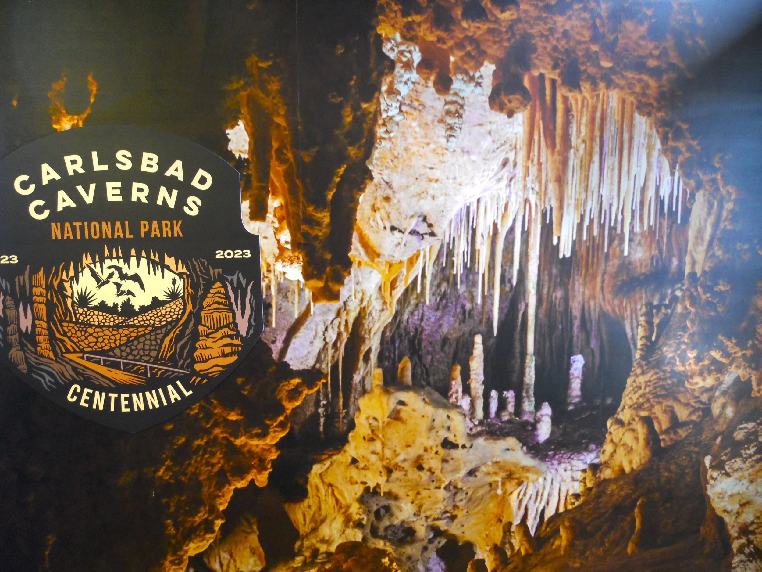
Carlsbad Caverns NP had a wildlife surprise for me; Barbary Sheep. I also saw a Spotted Towhee, a first for me. This is the park’s 100th anniversary, having been established in 1923. Unfortunately, the caves were closed this week for electrical repairs. It was a shame to miss the Big Room, the largest cave room in NA… large enough to swallow two U.S. Capitols.
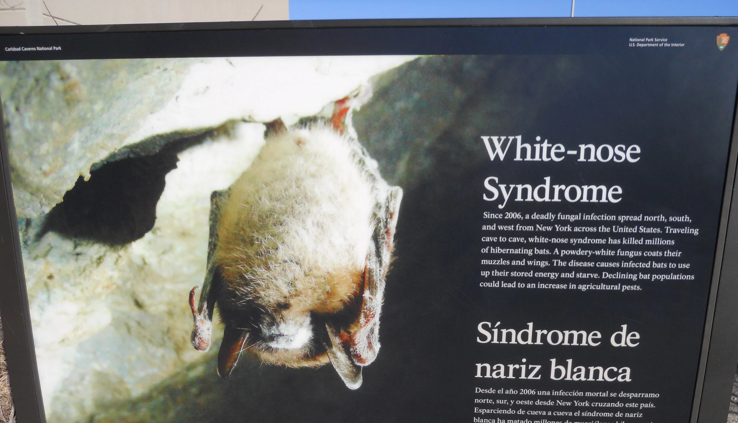
Everyone, please be aware of White-nose Syndrome. Bat populations are being decimated by this disease. If you plan to visit any place which is a bat habitat, do your part to stop the spread.
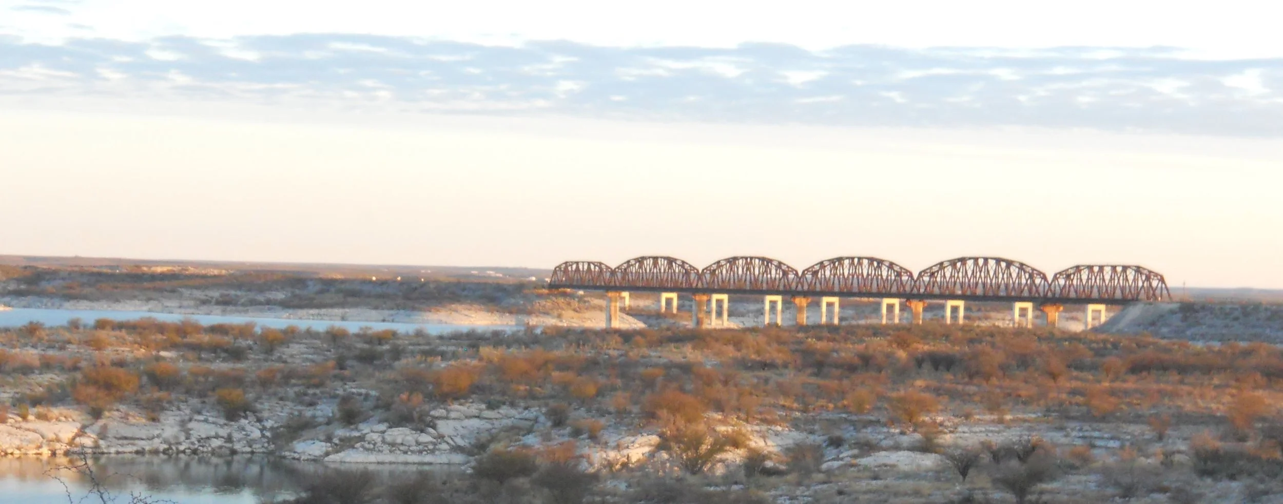
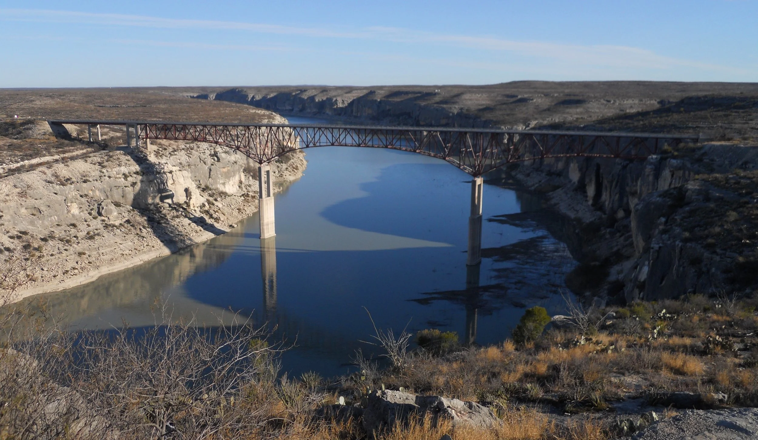
DAY 4 - Amistad NRA is a large body of water which butts up against Mexico. There are boundary buoys through the center of the Rio Grande River portion to remind folks which side of the water they are on. The two bridge photos are of the main bridge by Del Rio and the Pecos River bridge further west. Jack, a ranger at Amistad, mentioned the 1144.3 foot rule. This is the elevation water would be at for “subject to inundation level.” With the water at this height, the shoreline which would be impacted is what makes up the NRA “boundary”. Therefore, the park reaches well upstream on the Rio Grande, and the Pecos River.
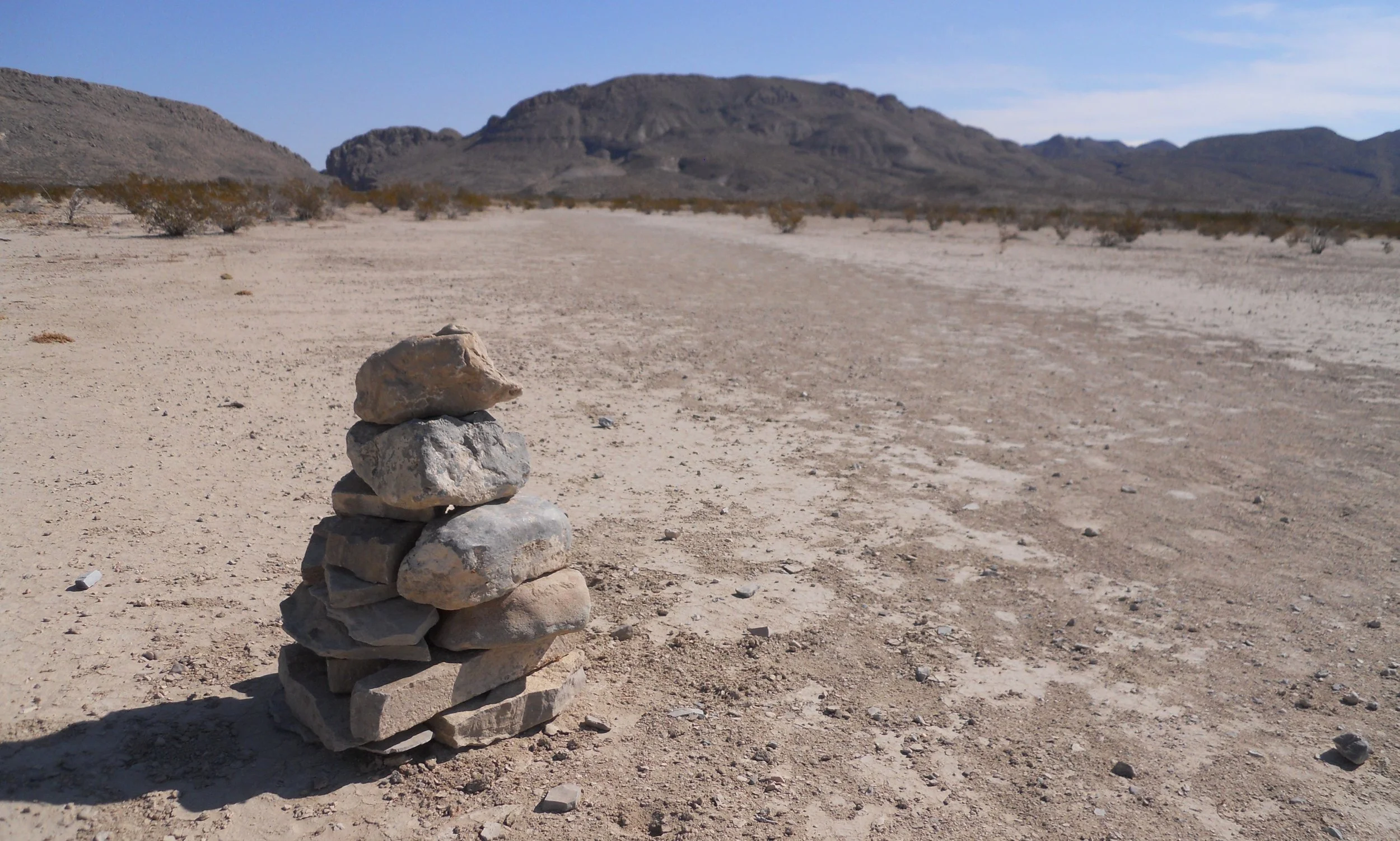
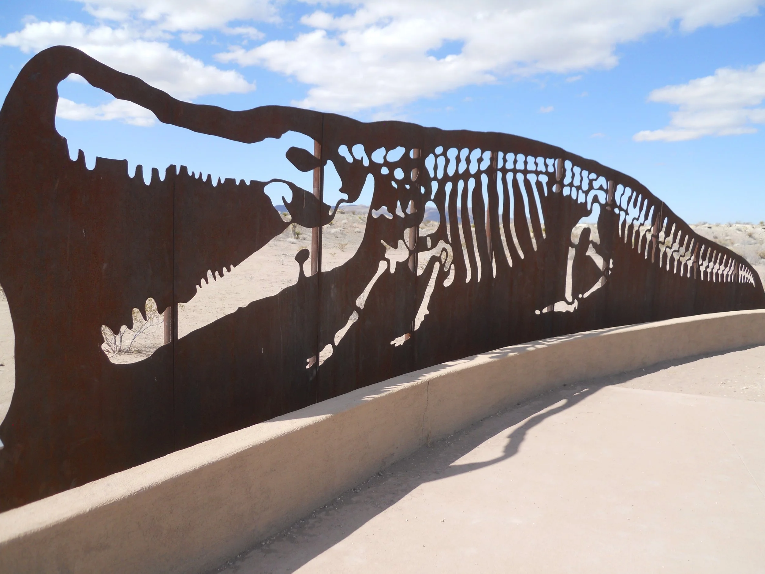
Big Bend NP has a 4-mile RT hike to Dog Canyon. Legend has it that people came across a dog guarding an oxen wagon, but no owners in sight. The canyon was named for the dog. This rock cairn is two miles from the small “v” on the left side of the photo. Not the most hospitable place to get lost. But that was not the case 75 million years ago when the land was a swamp. The metal cut out is that of the largest crocodile (Deinosuchus) in this region. This species ate anything, including dinosaurs. Jaws would be in trouble.
The next photo is of the Chisos Basin, but from the outside. An ancient lodge and wonderful trail hikes are on the inside.
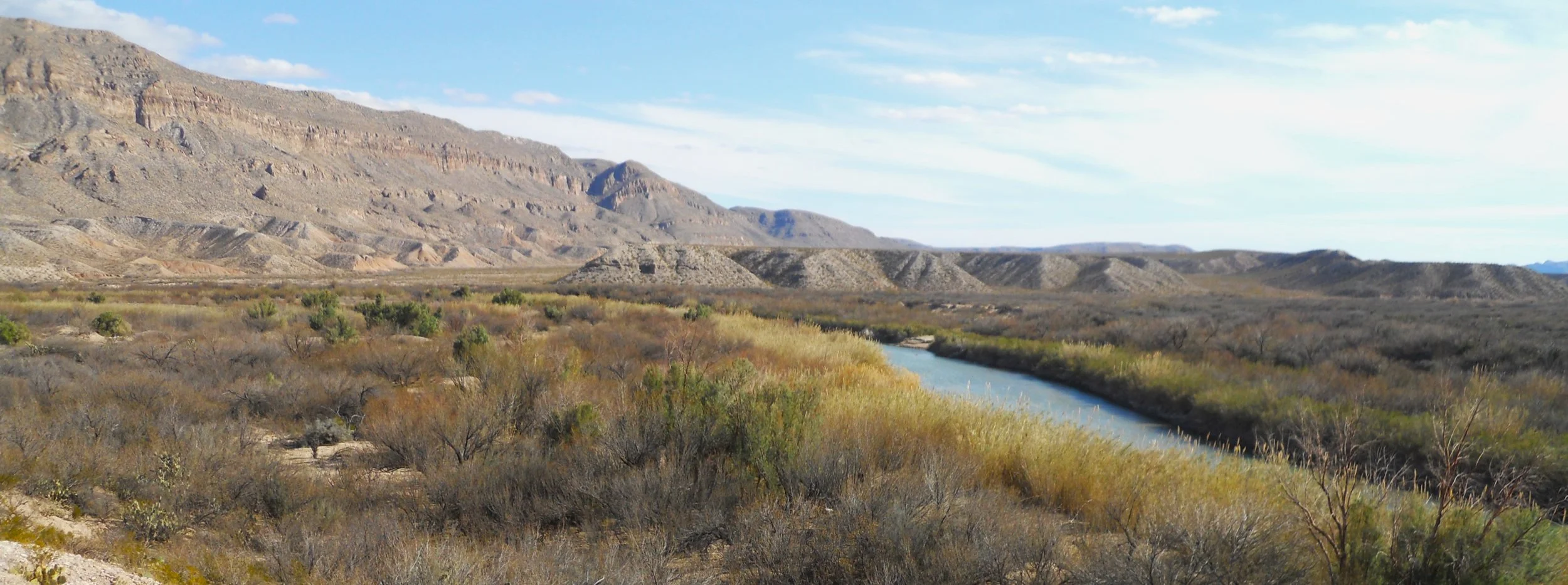
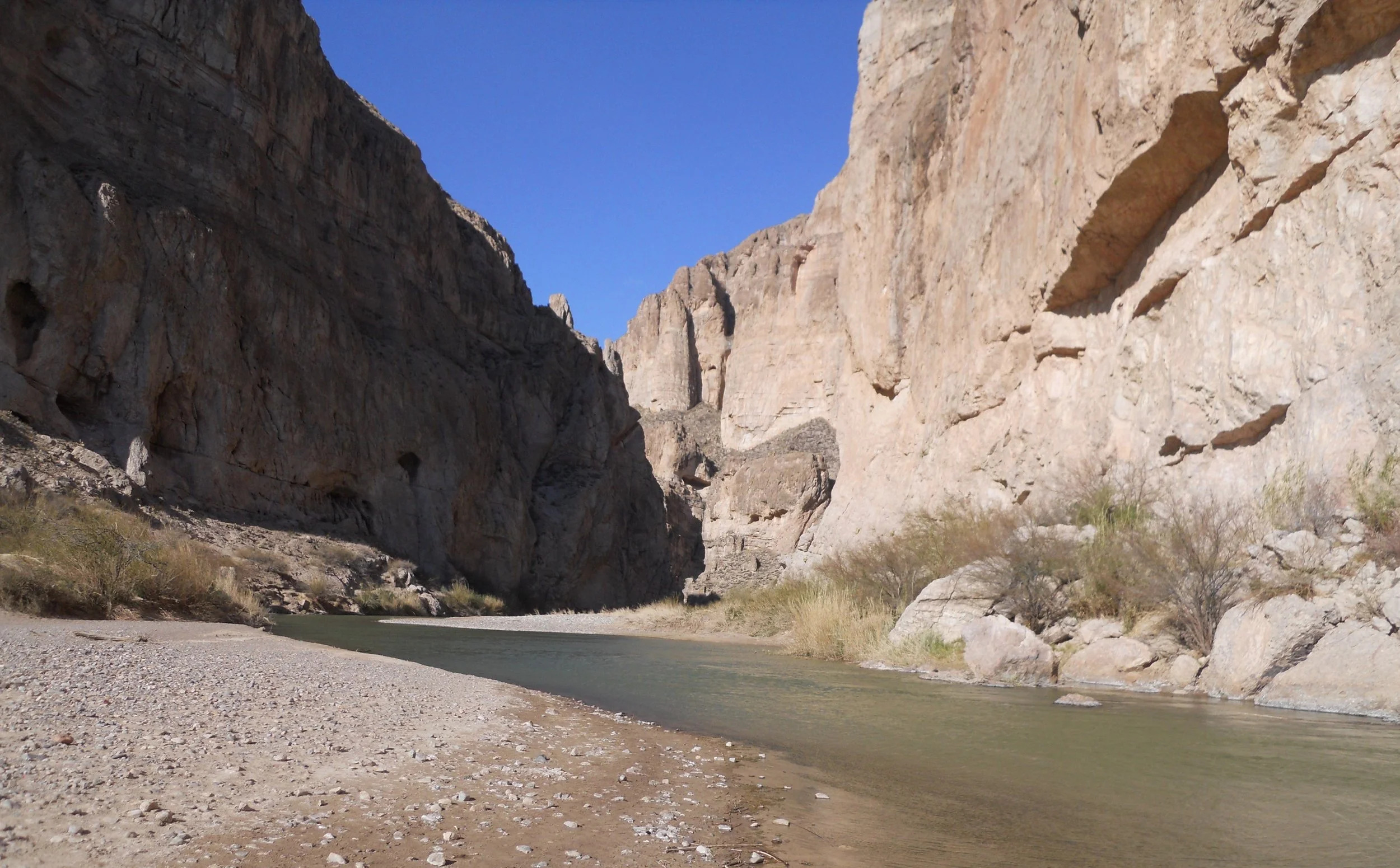
Then there is the Rio Grande, its own unit in the National Park System. The one photo shows the mountains stretching into Mexico, with the river cutting through the banks of brush and trees. The other photo is at the entrance to Boquillas Canyon. I threw a stone across the river, to hit a boulder in Mexico.

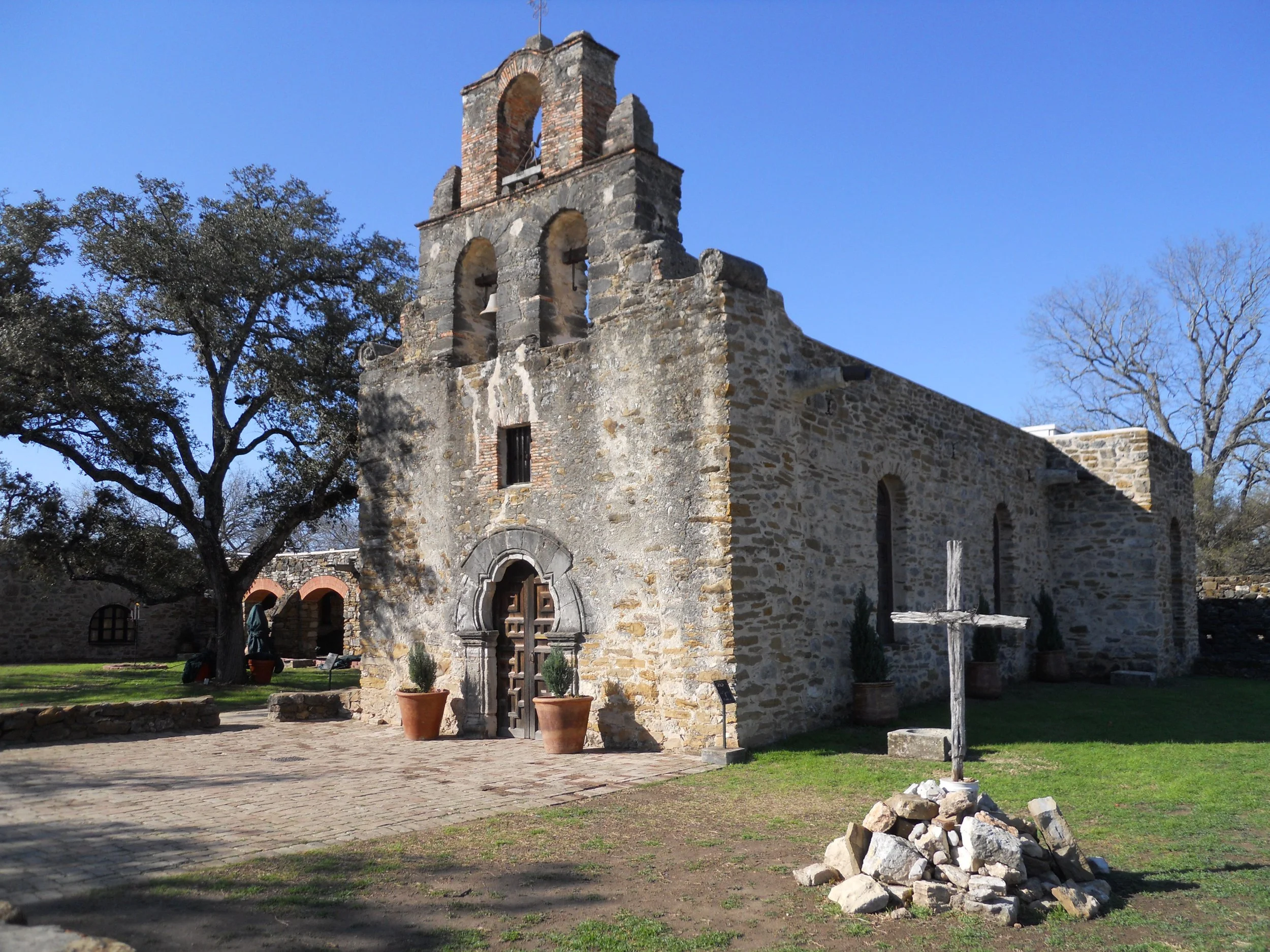
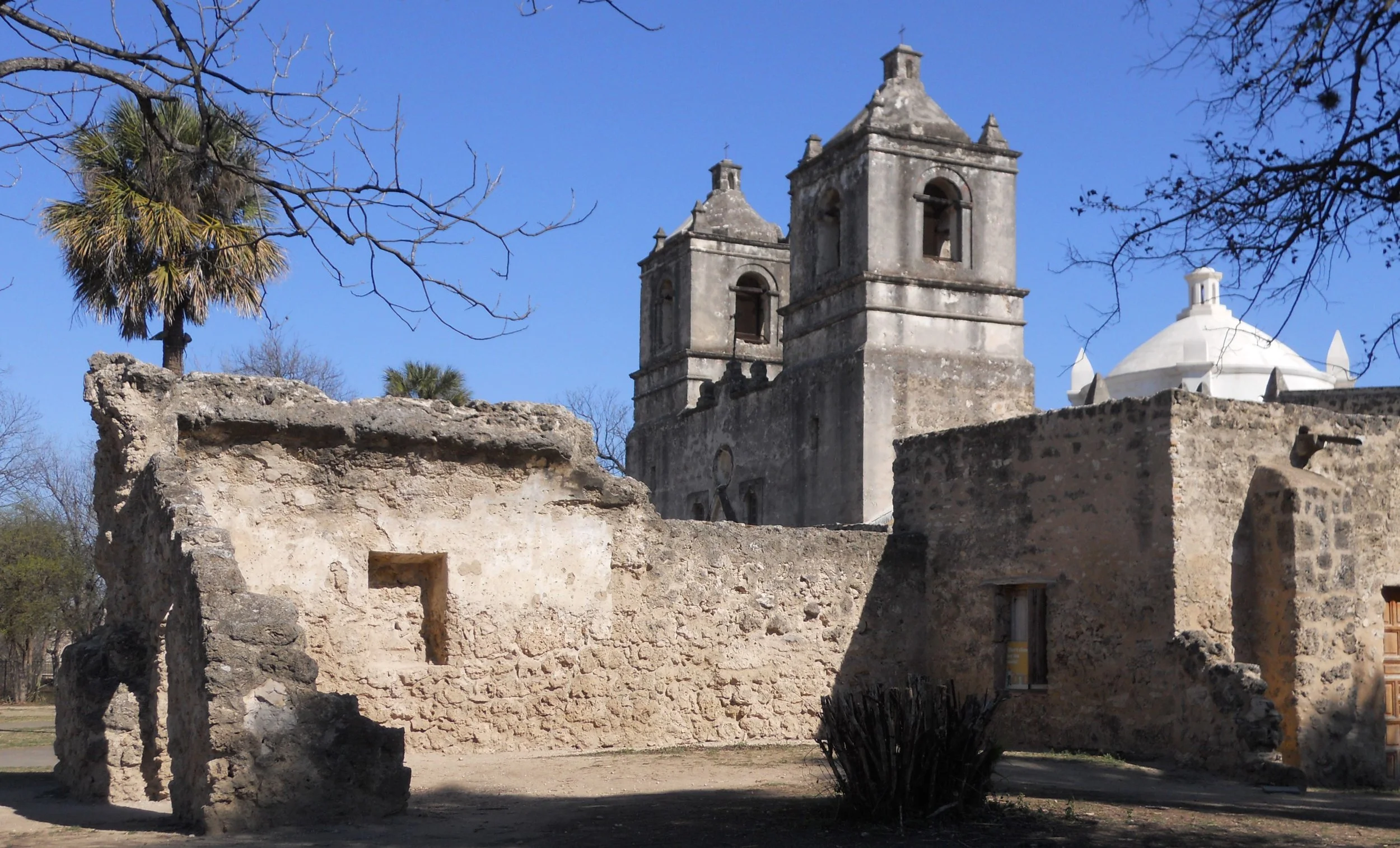
DAY 3 - Arriving at Mission Espada (first photo), I plotted the route to the three other missions which make up the San Antonio Missions NHS. The Franciscans used indigenous laborers to build these churches, while preaching to the masses that their work was helping them become closer to Christ.
Each mission is separated by about 3 miles, along the San Antonio River. The famous Alamo was also a mission, but it is owned by the city, so is not able to be part of the NPS park. Mission San Jose was next (far right). You can tell the building materials were different.
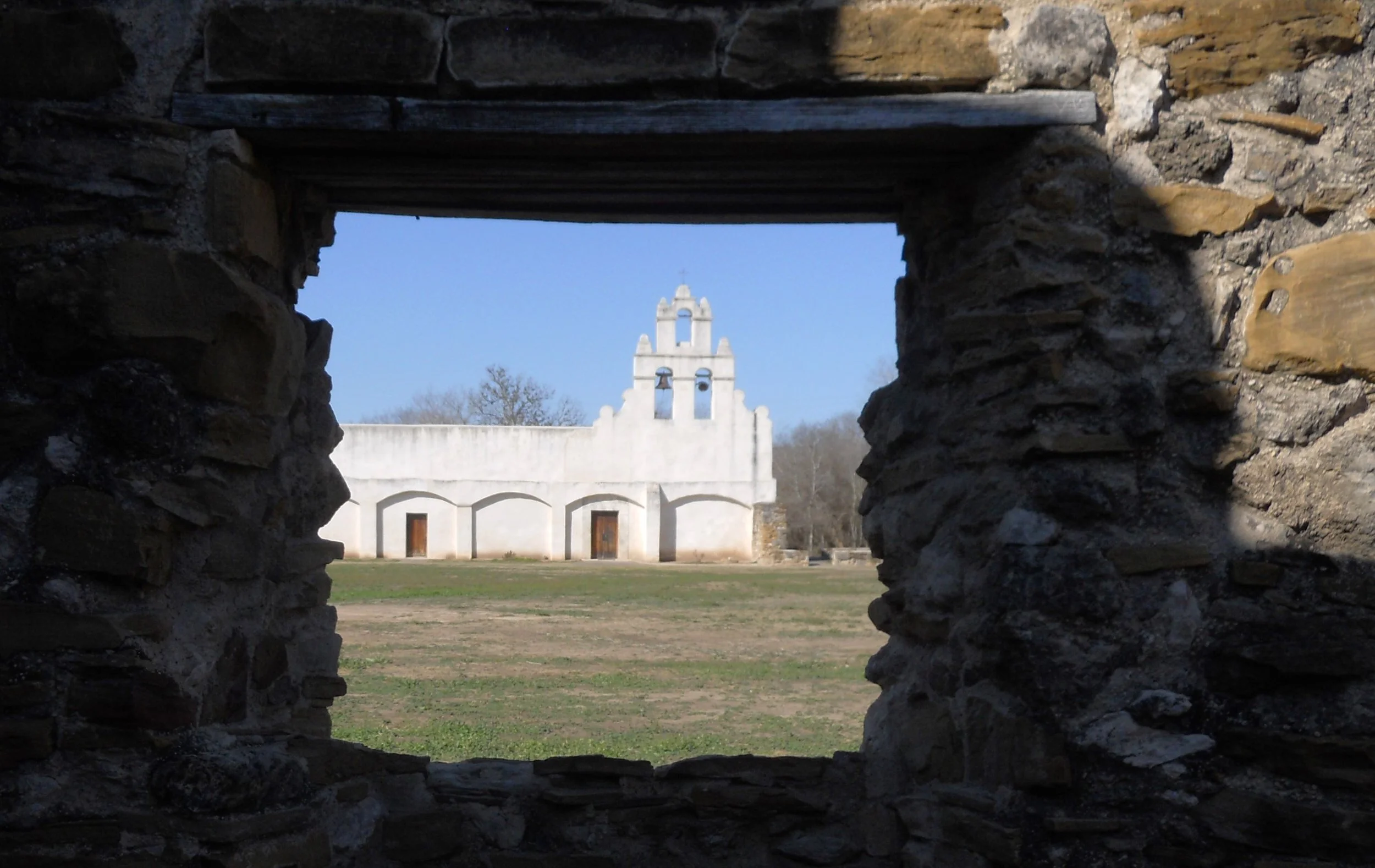
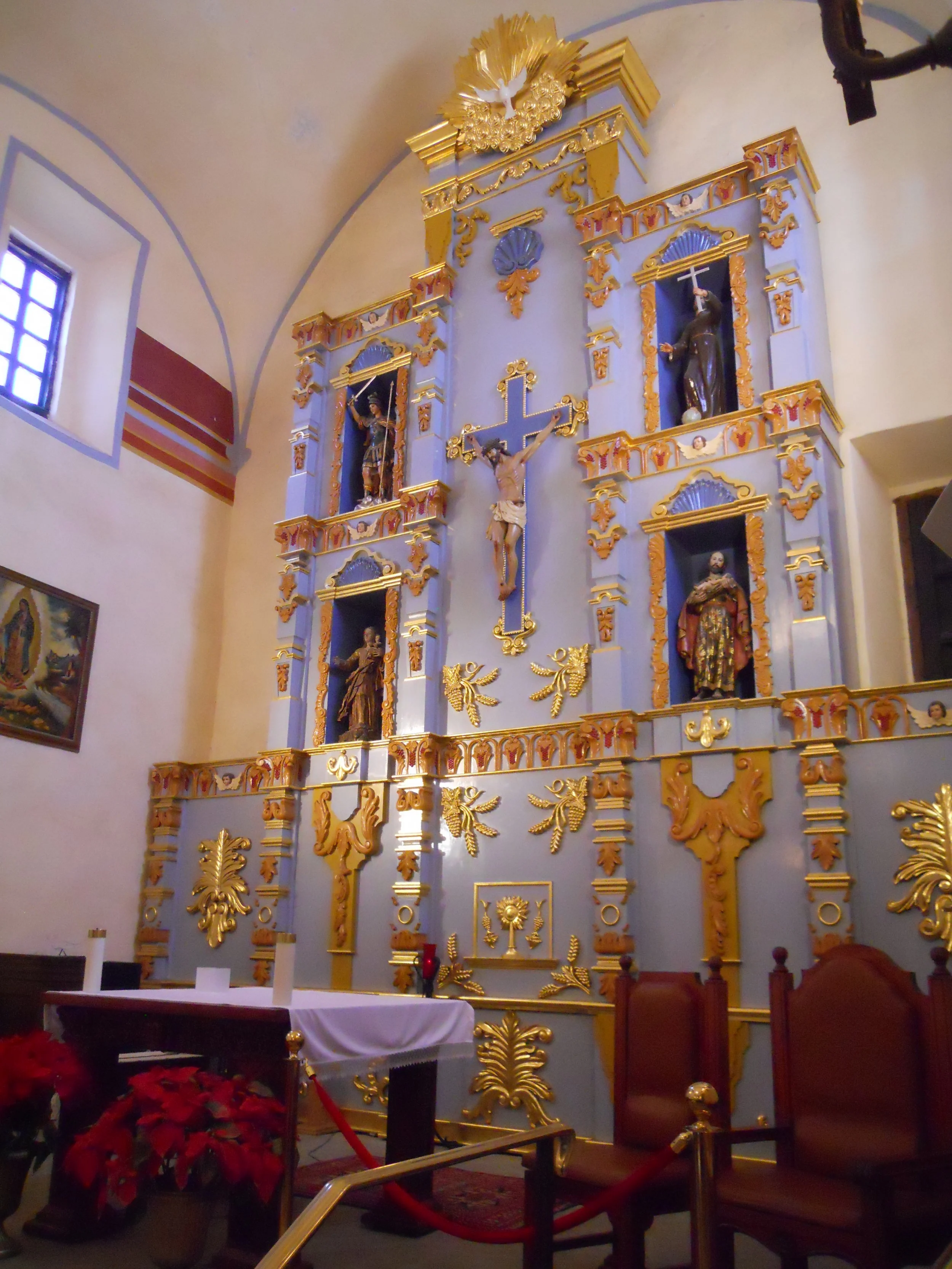
The next photos are of Mission San Juan. The alter within the sanctuary was beautiful.
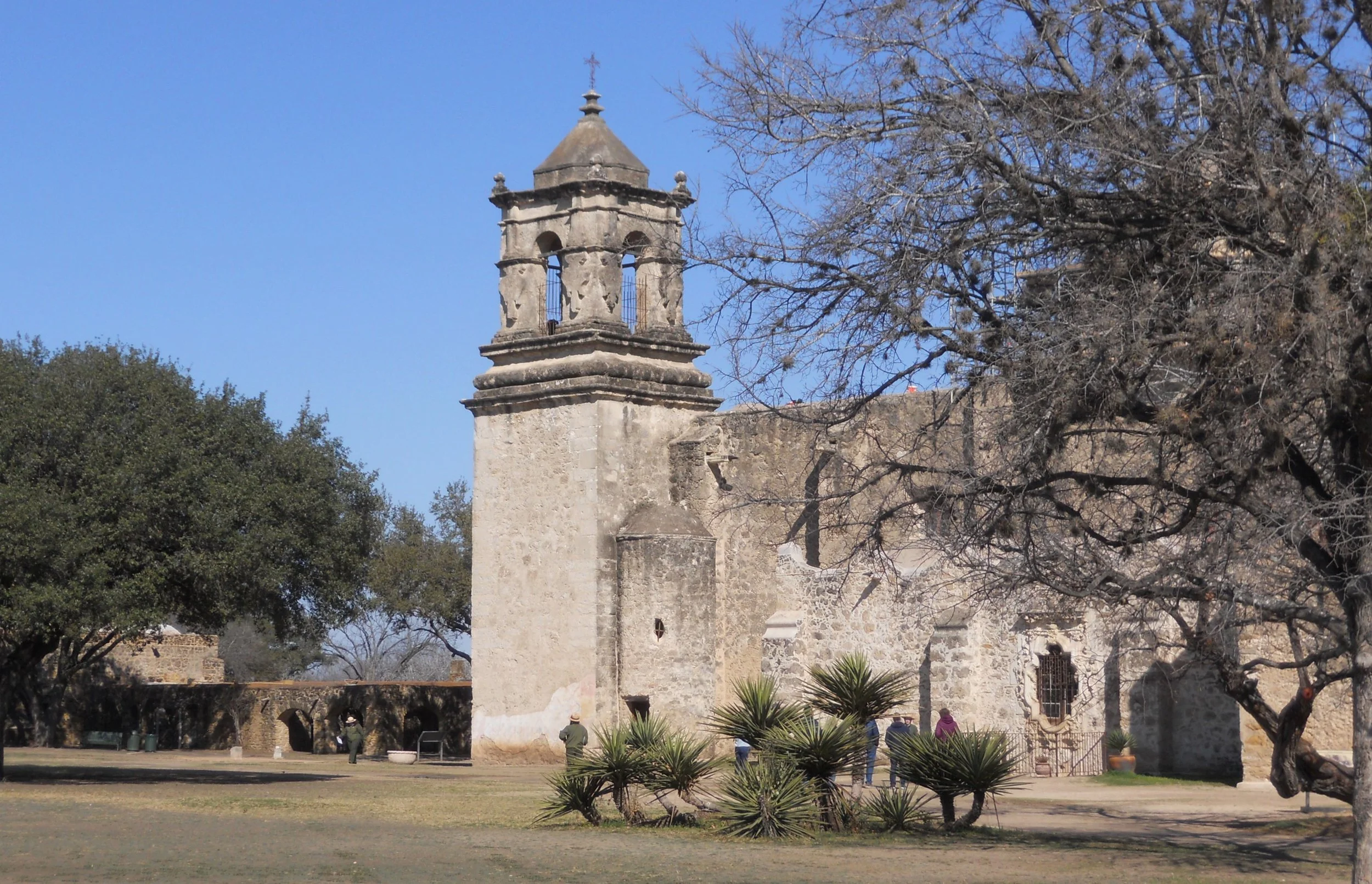
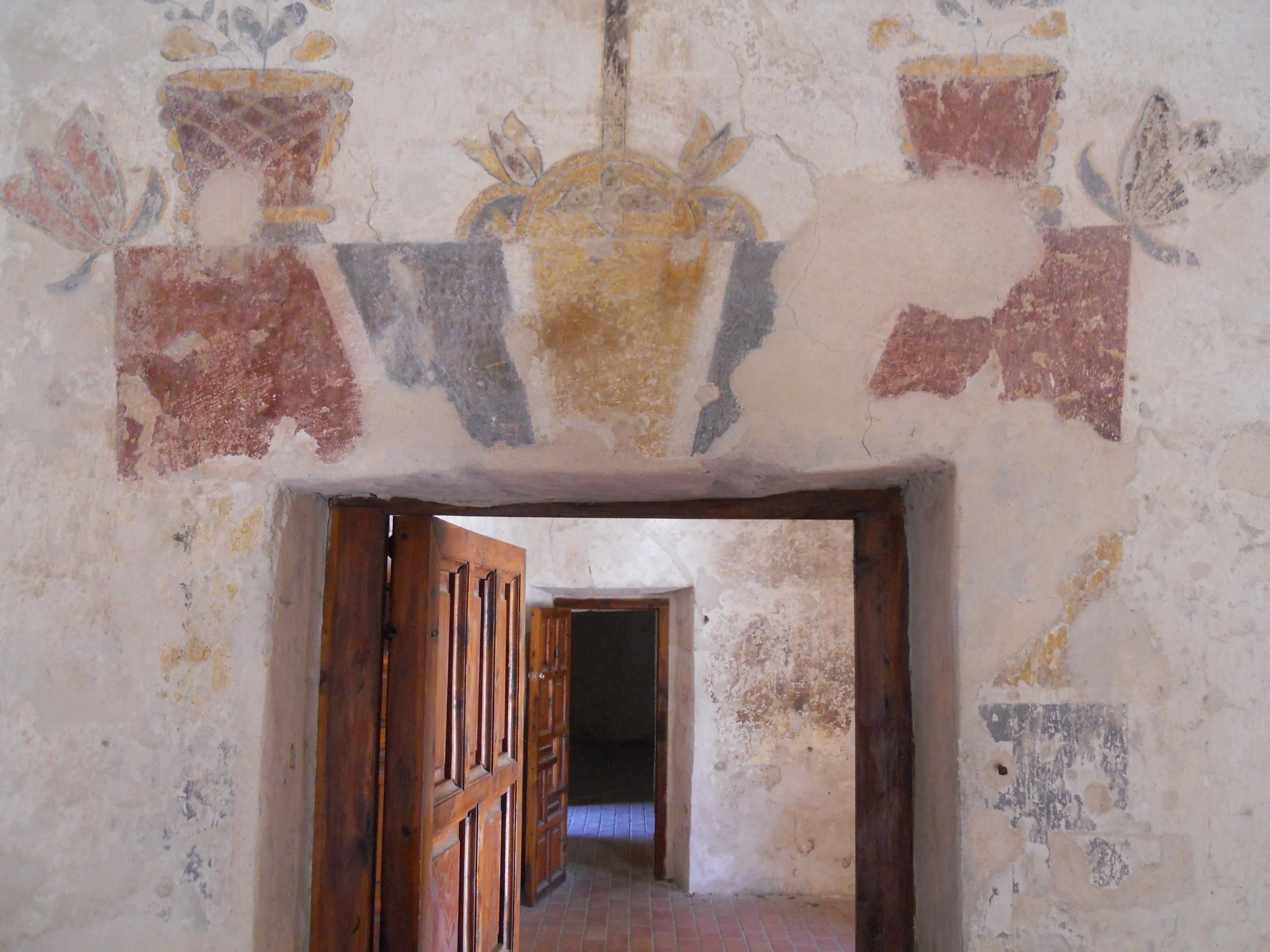
The third row of mission photos are of Mission Concepcion. Original paintings on the walls are present. 90% of this structure is original.

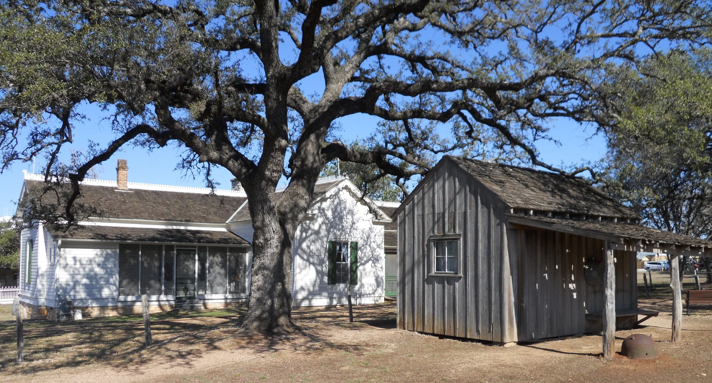
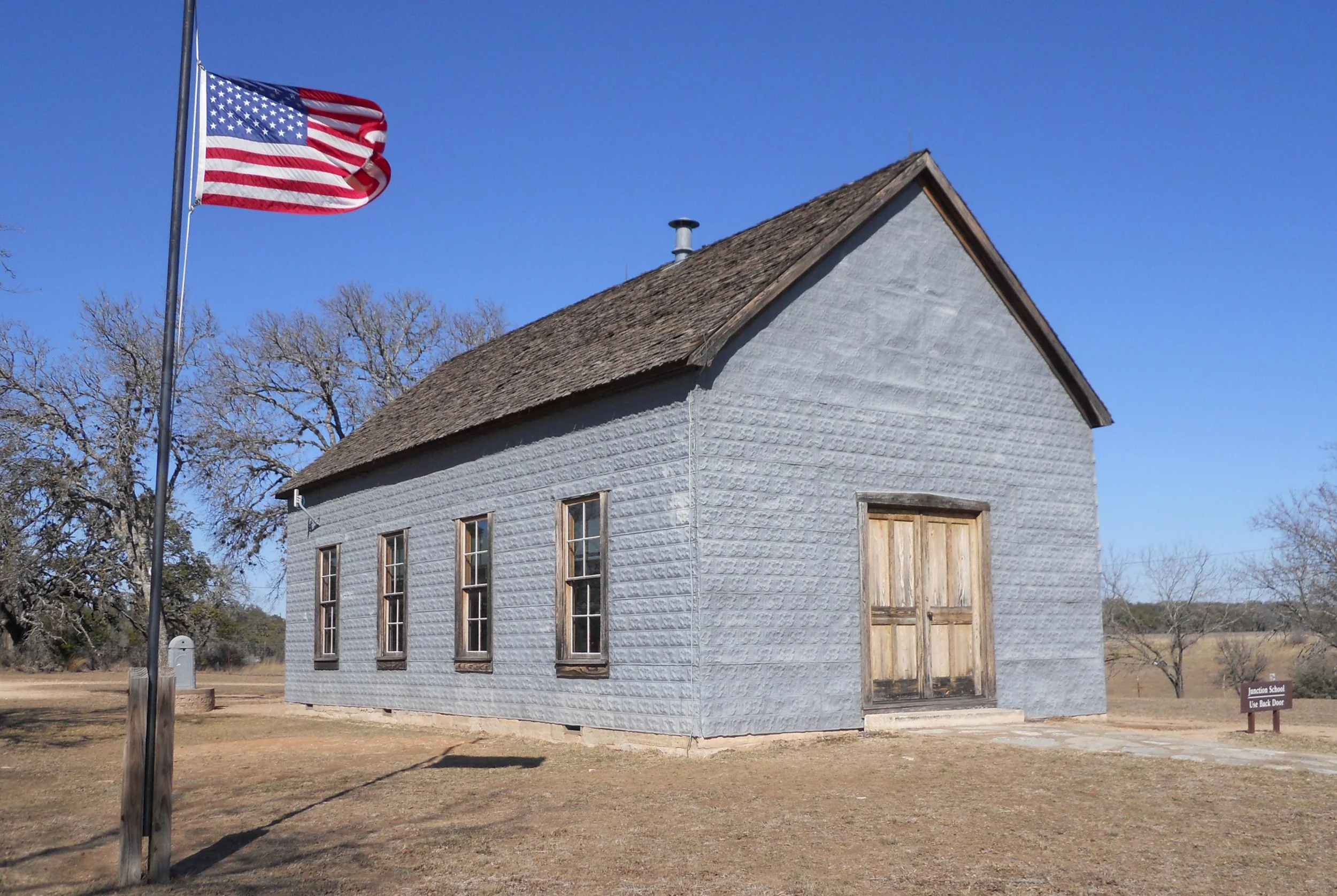
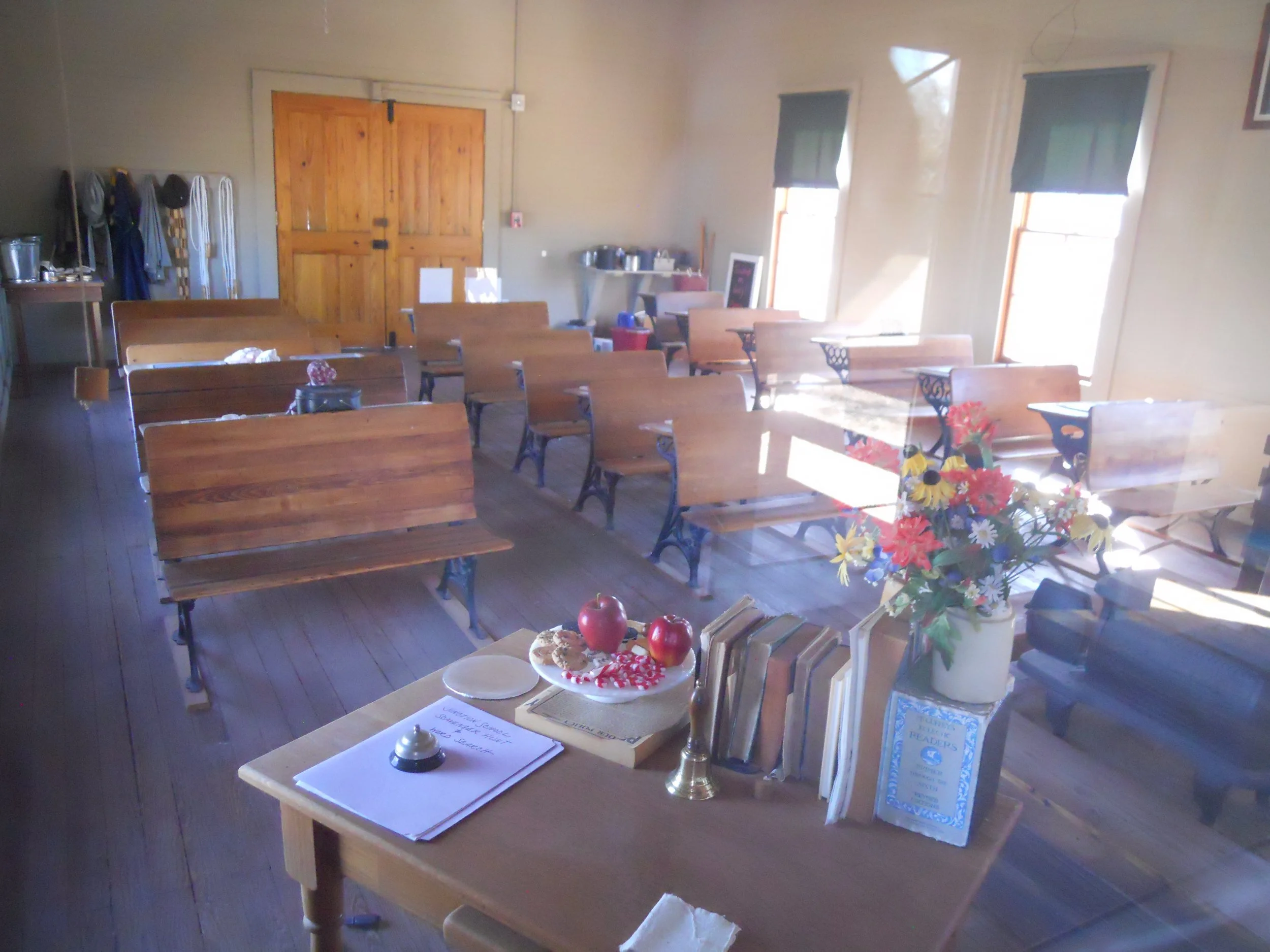
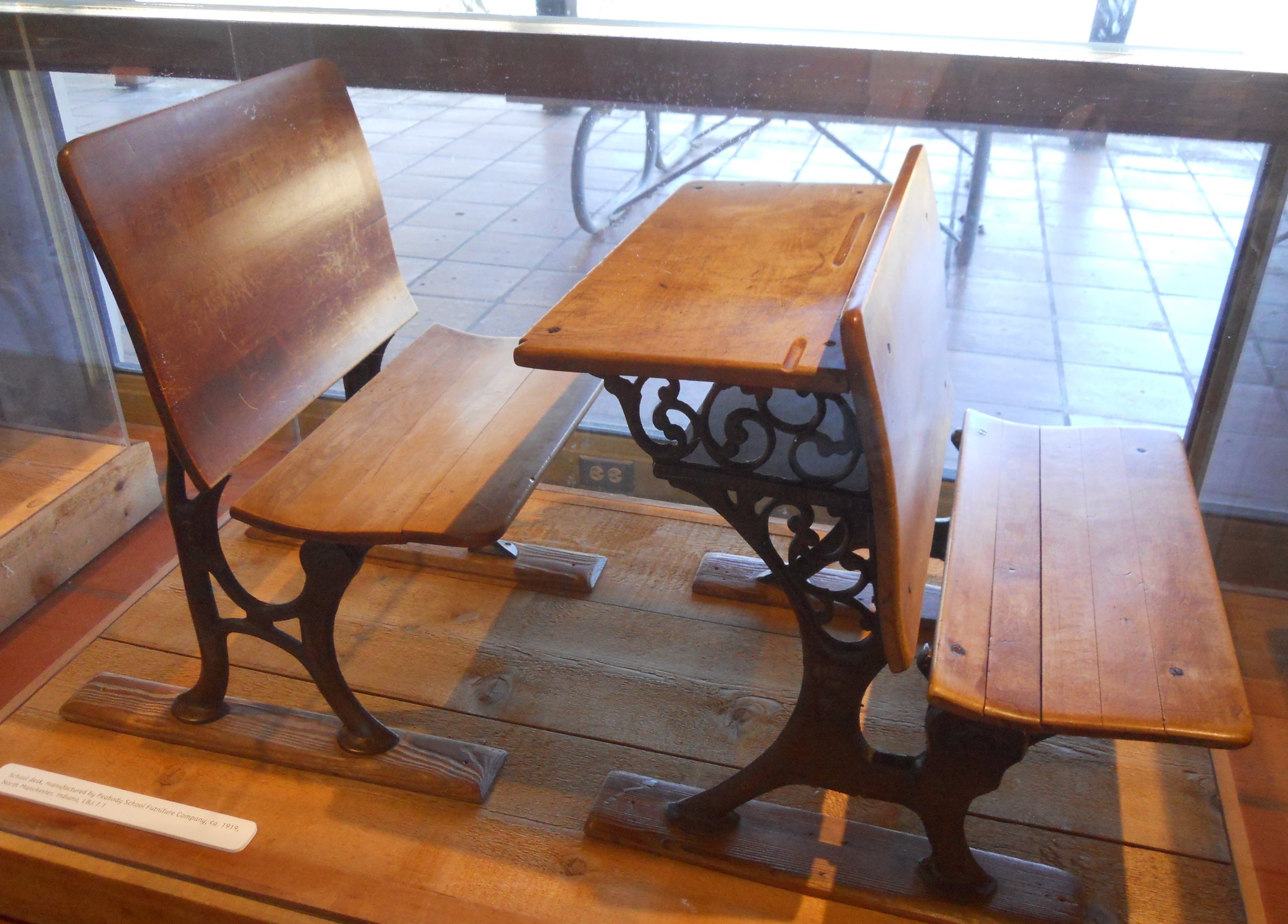
A drive north on US281 put me at Johnson City, where President Lyndon B. Johnson lived. One of his boyhood homes (photo with shed) is next to one Visitor Center. The other VC is at LBJ’s ranch, 15 miles to the west. You must obtain a pass from the Texas State Parks to drive the tour road around the ranch. The first building after crossing the Pedemales River is the one-room schoolhouse where LBJ began his schooling at the age of 4. One photo shows the inside of the building. During winter, the only heat was from a wood stove. Enduring hardships like that helped shape LBJ’s mindset which came in handy as President. He was 100% behind education, as well as Civil Rights for all Americans. The one photo shows the desk he sat in for 8th Grade. It is in a display box at the one VC.
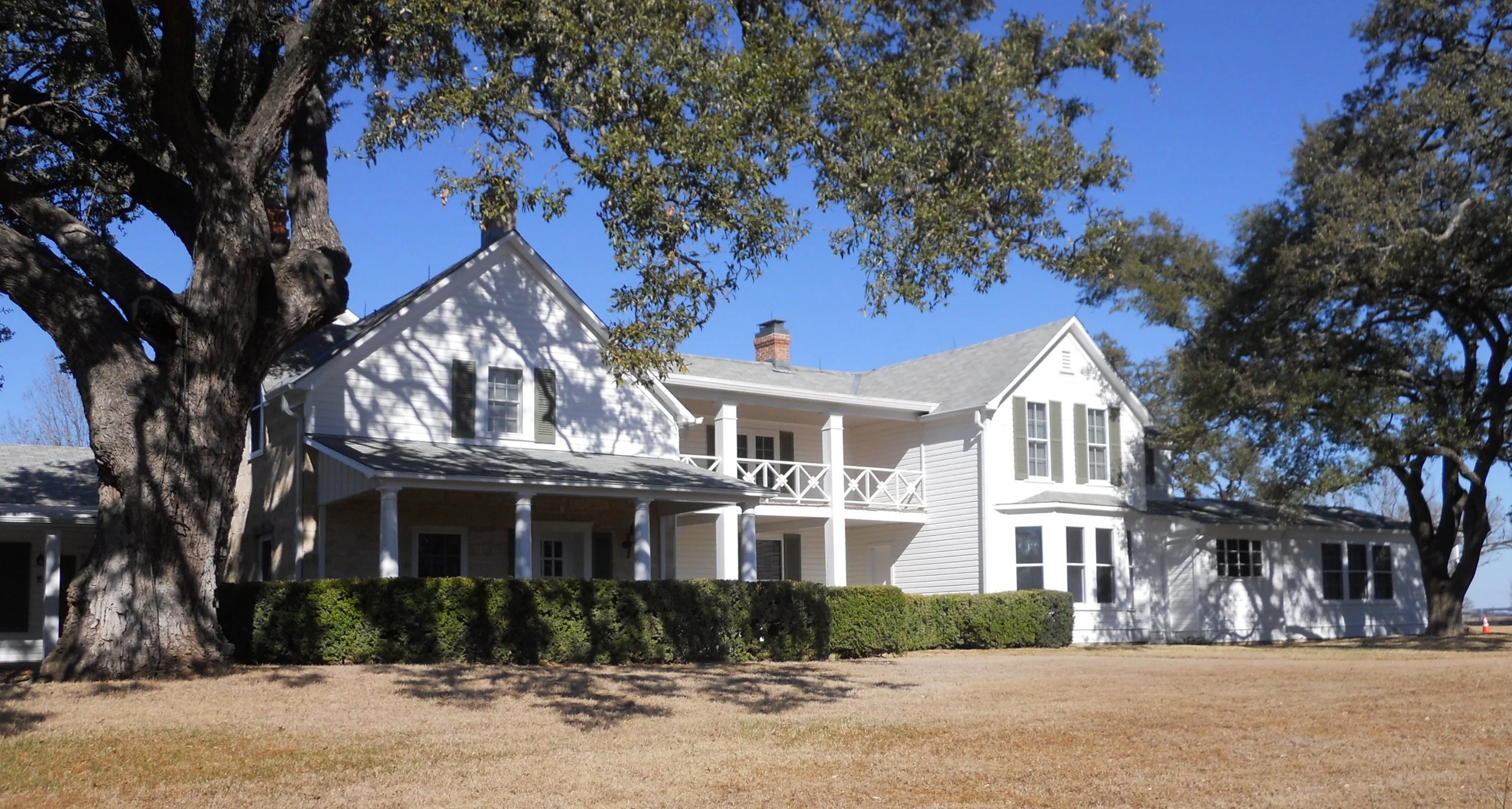
The last photo is of the Texas White House, LBJ’s home on his large ranch. He had a runway built behind the house so he could fly into and out of the ranch. The Air Force One small jet which was used while he was President, is located next to LBJ’s hanger. During those times, when the hanger was not being used for maintenance of planes, Mr. and Mrs. Johnson turned the space into a full-size theater and invited friends over to see the latest releases. Remember, no digital equipment back then.
First day of this loop was driving to Port Aransas, on the Gulf of Mexico, from the Houston airport. A stop at the home of Rich and Lisa Shepherd was included in the itinerary. Lisa, her brother Mike, and her parents Donnie and Darlene, were my family’s neighbors in West Lafayette, Indiana back in the 1970s.
To get to Port Aransas, I decided to take the path which the proverbial crow flies.
This required taking the Texas State Ferry (no fee, unlike most of the highways around Houston… are they not supposed to be called “freeways”?) from Aransas Pass to Port Aransas. Well, that ride lasted less than 90 seconds, and I am not kidding. Still trying to figure out why the state does not build a bridge. The distance is around 500 yards. Go figure.
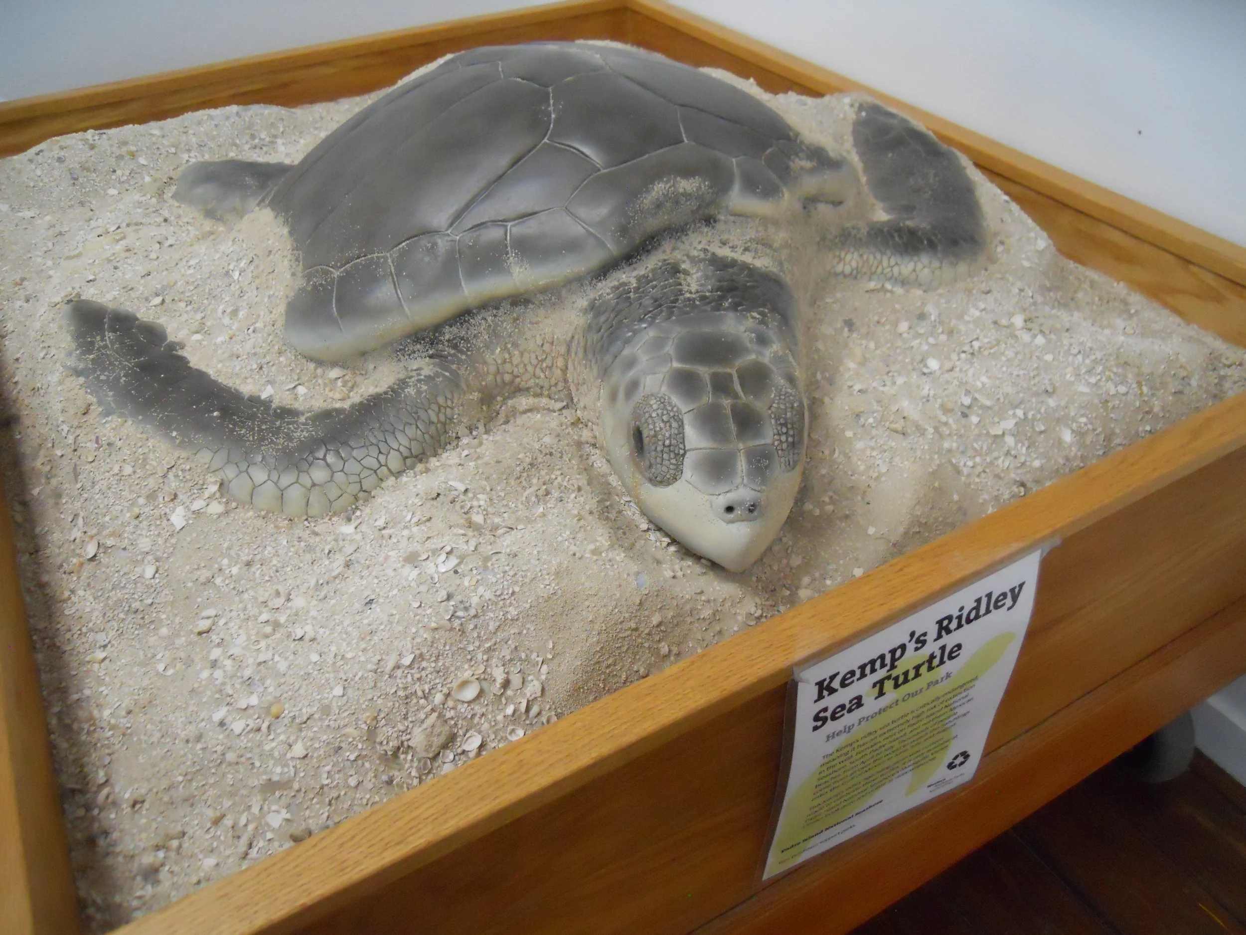
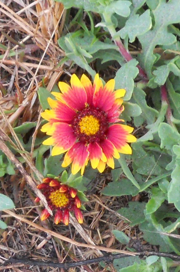

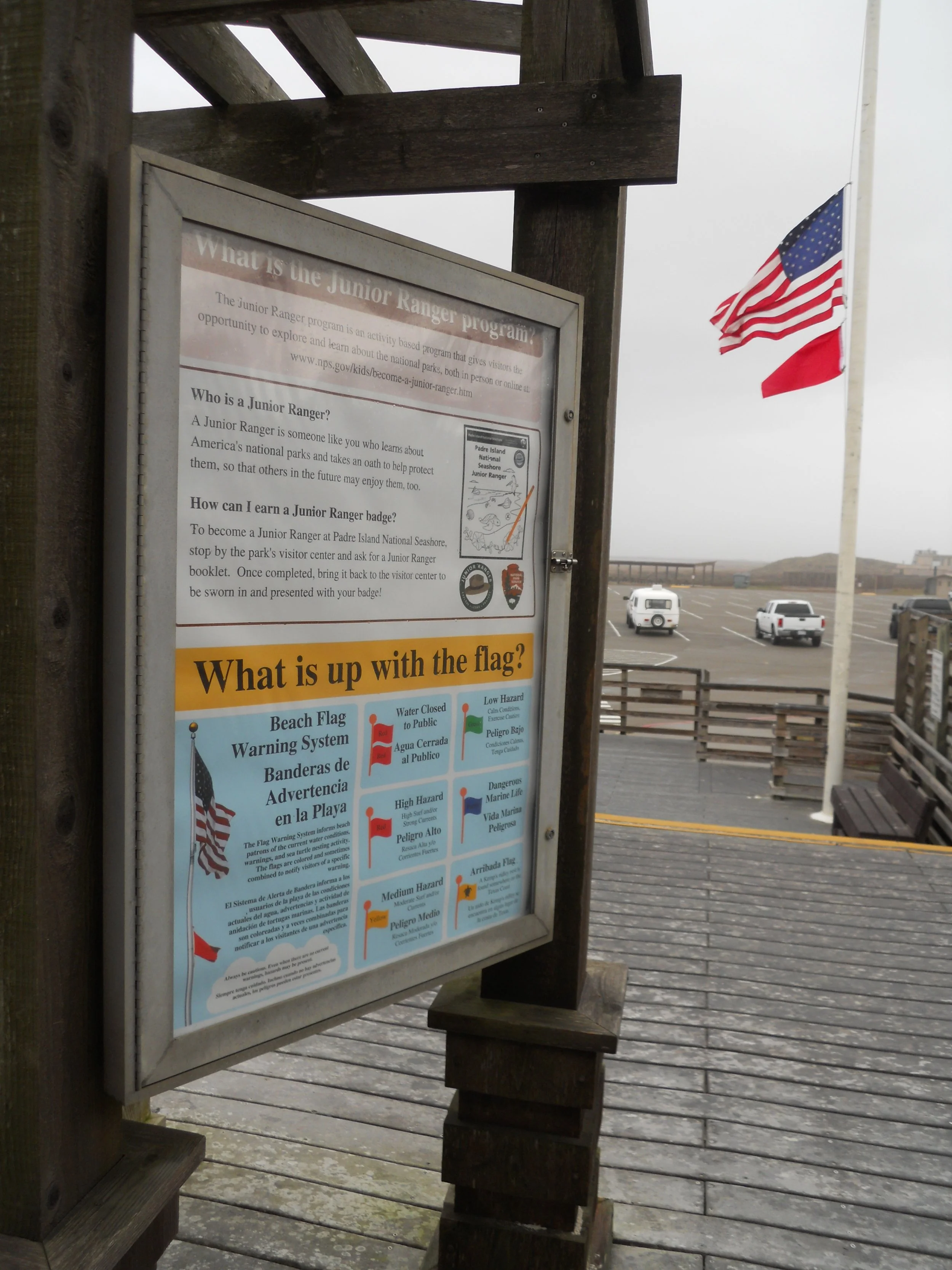
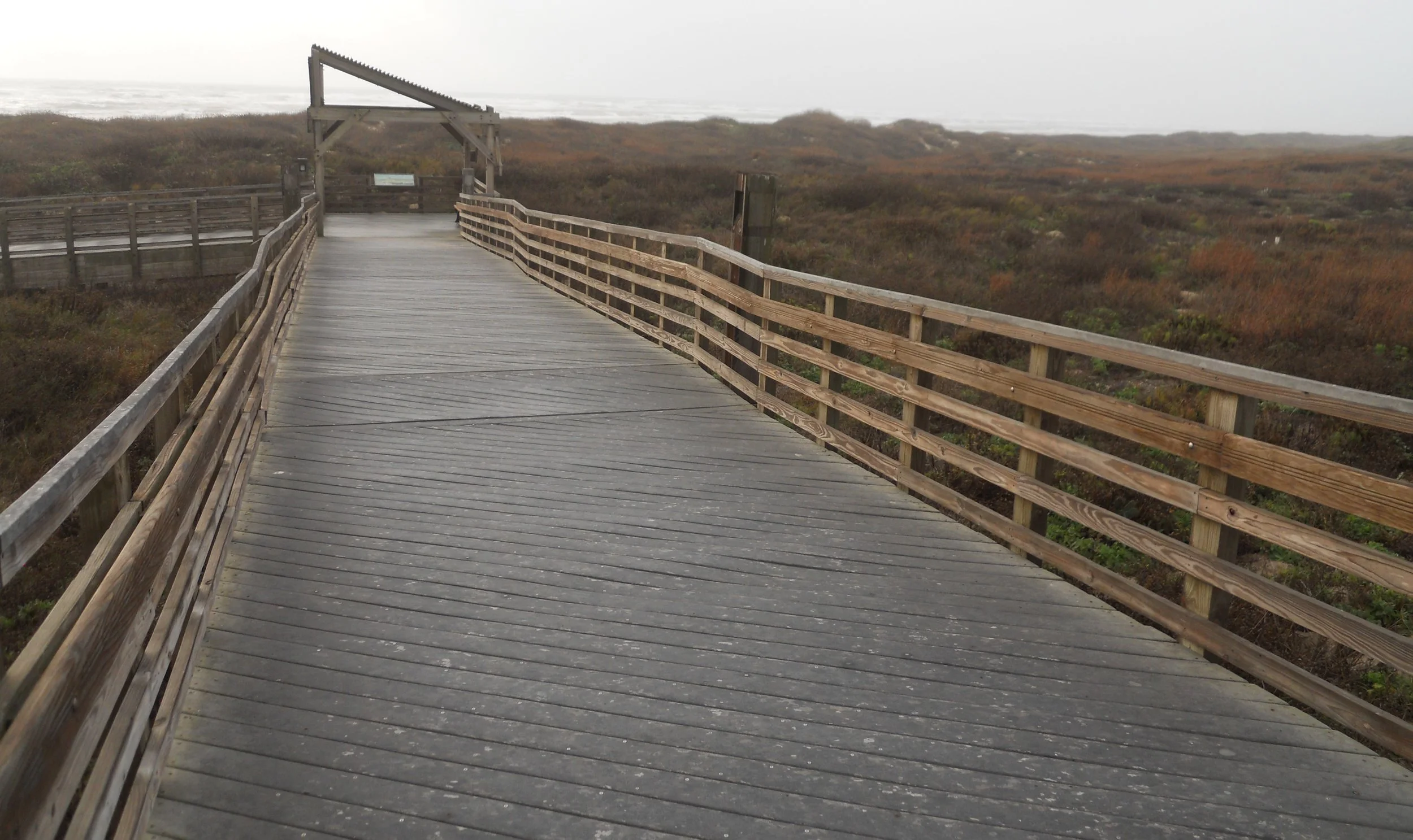
DAY 2 - The day began with a visit to Padres Island NS. Even a beach can have a miserable day, and January 24 was one of those. One red flag flying below the U.S. Flag (see photo) means high risk in the water. Winds were gusting to 40 mph. Waves were 5 feet. Cloudy, rainy, and no fun. Turns out the NPS showers were not open due to refurbishing, so even if one had ventured into the violent waters, no way to clean off. I did take the one-mile loop Nature Trial, and saw some Fire Wheel wildflowers (photo), as well as egrets and pelicans. Padres Island’s main fame in today’s world is being the number one spot for Kemp’s-Ridley turtle hatchings. In July and August, the public is invited to watch the NPS rangers release newly hatched turtles into the Gulf of Mexico. The rangers take eggs from nests after female turtles lay them, so as to protect the vulernable babies, to help the species recover.
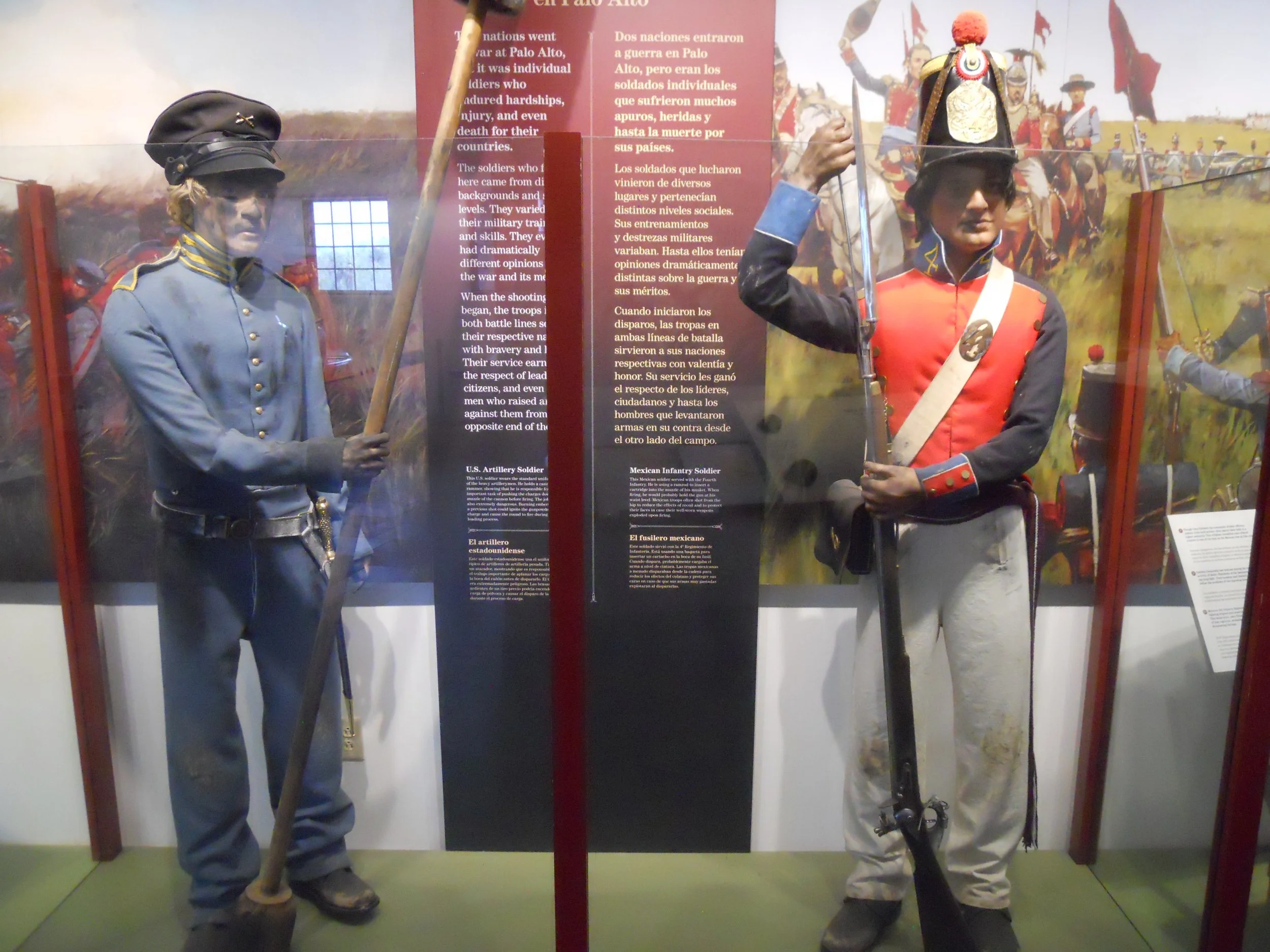
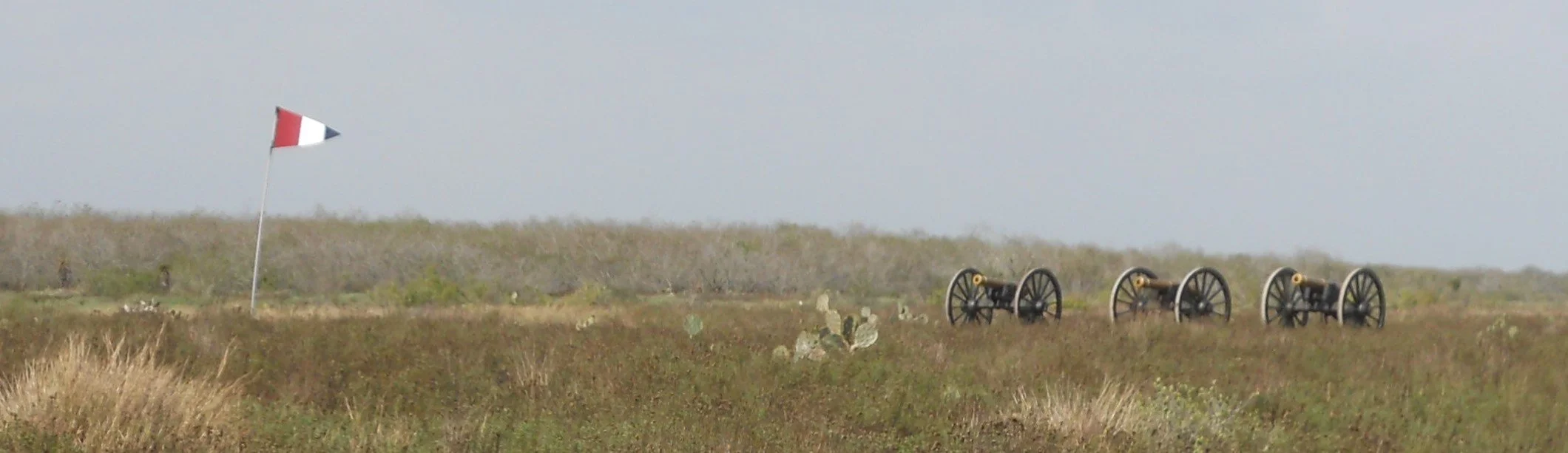
Next stop was Palo Alto NB. This was the first battle in the Mexican-American War of 1846, the war that changed the face of the Western Hemisphere. General Zachary Taylor (future President) faced off against Mexican General Mariano Arista. The superior cannon of the U.S. Army led to a victory. The one photo shows three cannon on the U.S. battleline (Texas Republic flag), one mile from the Mexican battleline.
The Mexican army retreated to Resaca de la Palma (photo), a few miles to the south, and reinforced their positions. But Taylor led his forces and drove the Arista back across the Rio Grande River. The United States now had full control of the Texas territory north of the Rio Grande.
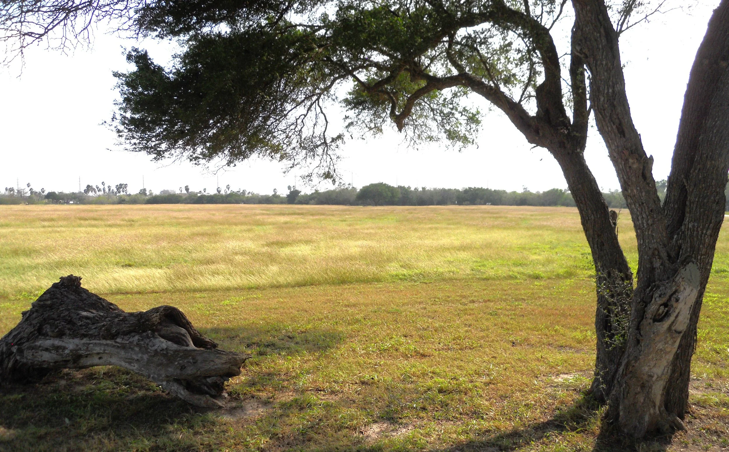
Palo Alto and Resaca were flat. In fact, from Corpus Christi to the Rio Grande River the entire landscape was flat. We are talking the X axis in an X-Y grid… you know; horizontal.