DAY 14 (May 15) - Tonight’s internet is not working well, and continuation of issues are keeping me from working on today’s report. I will be home on WED, hopefully with time to complete the log for this trip.
Well, I am now home, but my home internet just hiccupped, and I lost one hour of entries for the last two days. Let me start over.
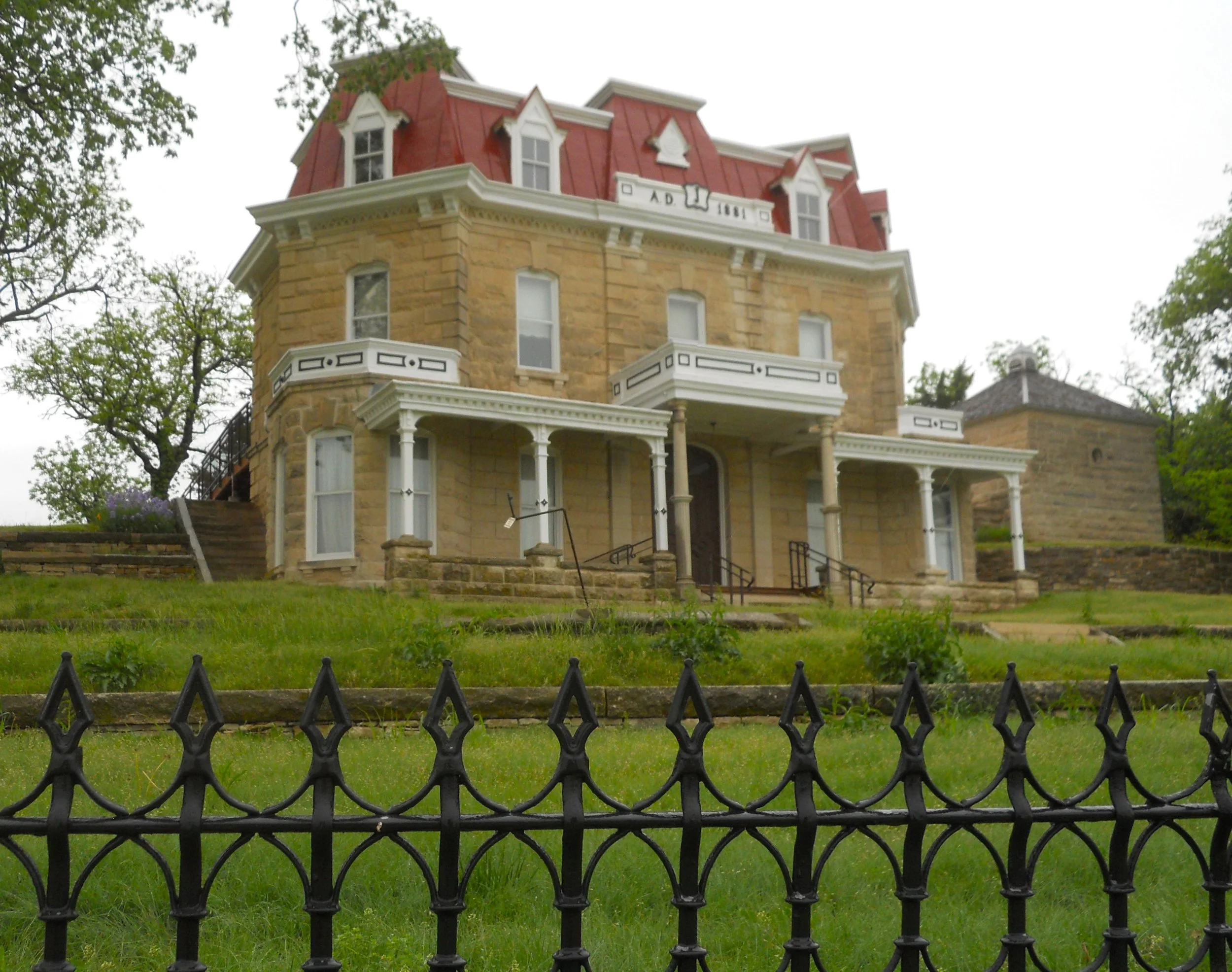
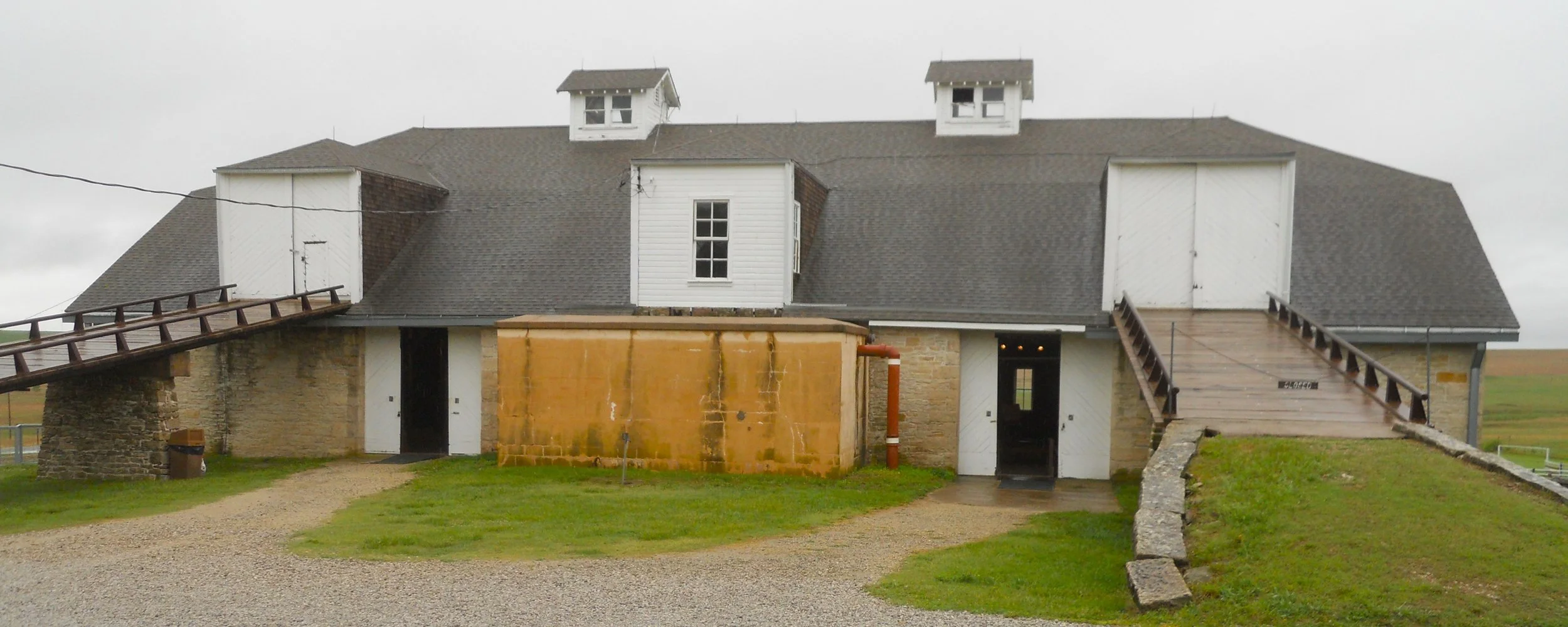
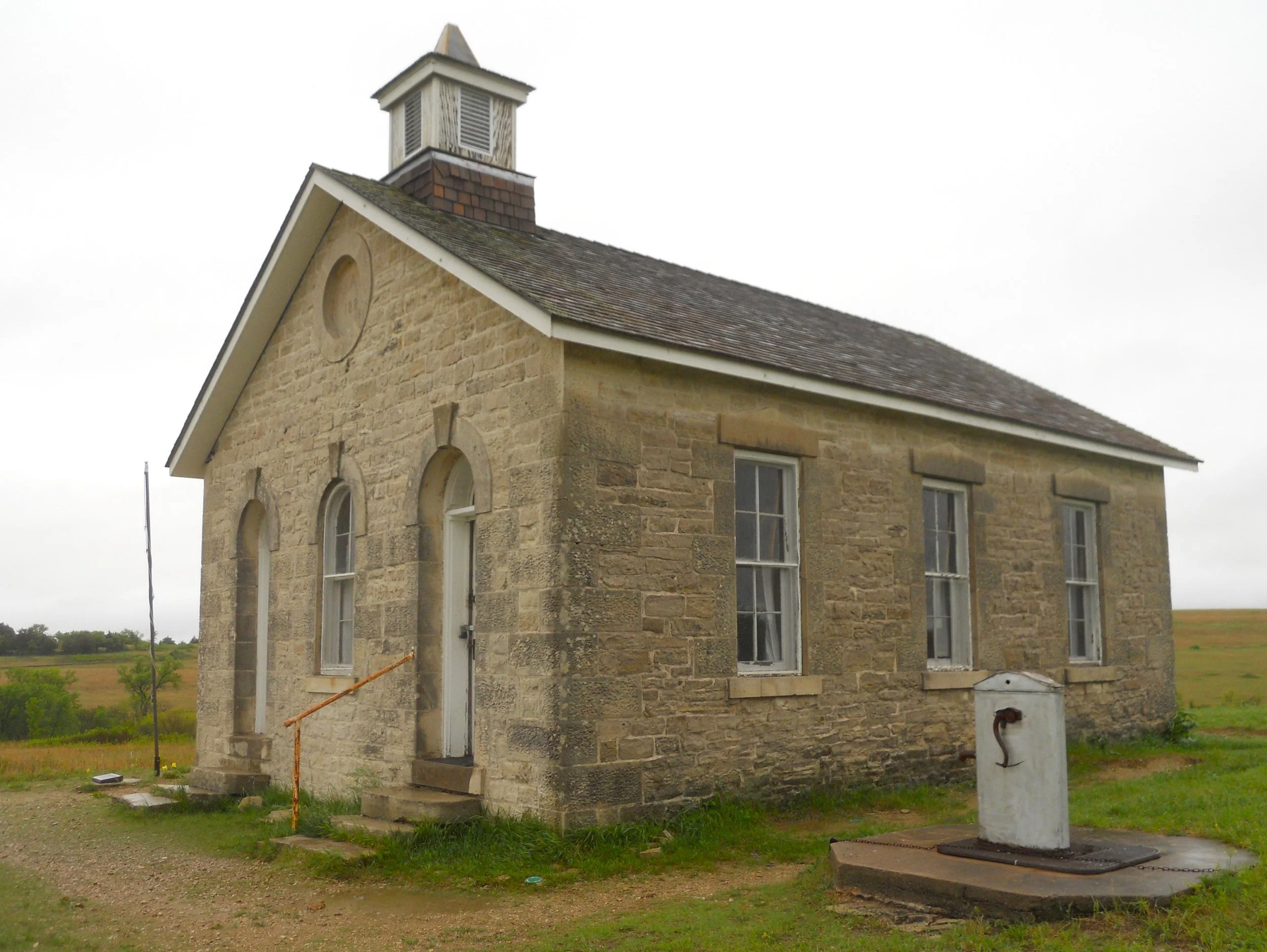
Tallgrass Prairie NPres protects a remnant of the 170 million acres of grass which covered the middle of this continent 400 years ago. Only 4% remains in the country, mostly in Kansas. Though the bus tours of the Preserve have been cancelled indefinitely, the Stephen F. Jones mansion and farm were open. The 1881 3-story limestone house was relatively opulent for the time. The 3-story barn was likewise the best in the area. One can walk into the Preserve, but it was pouring rain. Instead, I drove to the one-room schoolhouse, from which one can view the resident bison herd, if they are grazing in that area. They were not, today.
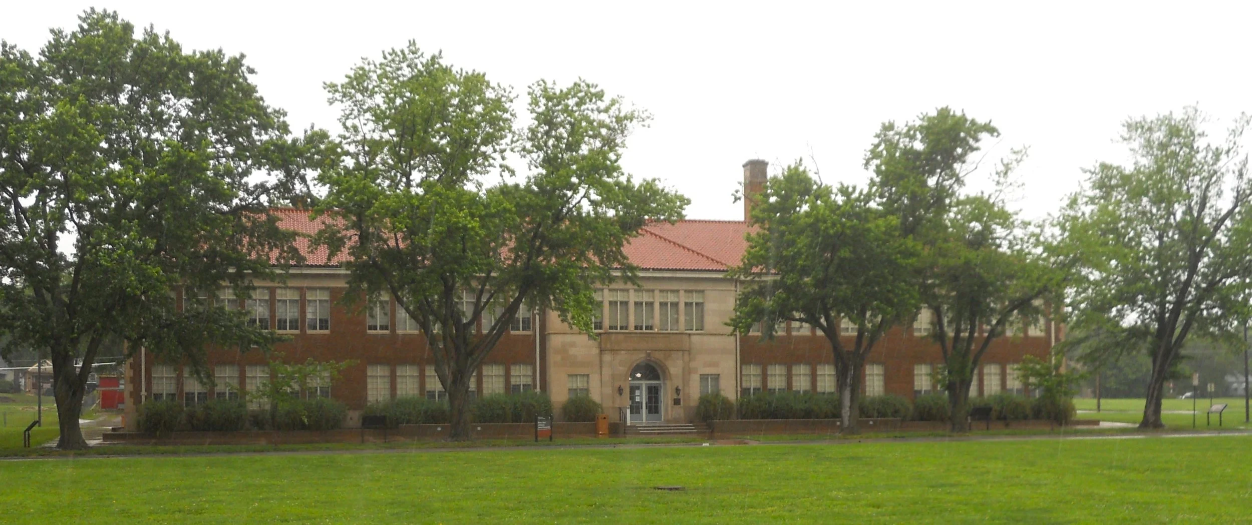
Brown vs Board of Education is another NPS park which honors the struggles for civil rights in this country. A unanimous U.S. Supreme Court in 1954, ruled Topeka was in violation of the 14th Amendment, overturning the “separate but equal” argument. The park is comprised solely of the school building. Across the street is a mural, showing images of the Civil Rights movement.
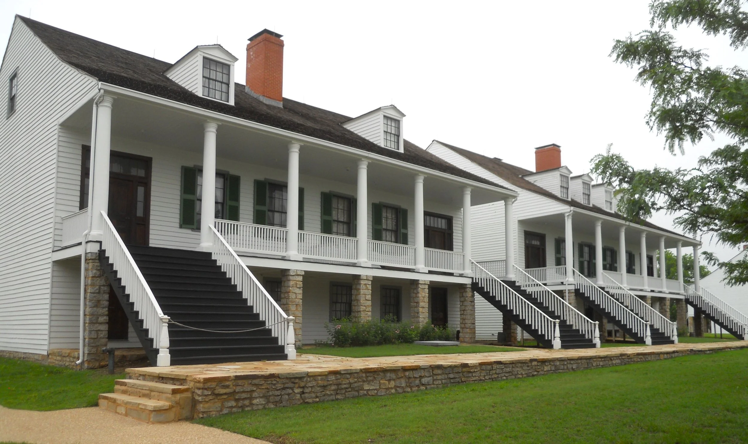
Fort Scott NHS gives visitors the chance to see one of our country’s first western frontier forts. Fort Scott was founded in 1842, at the time the edge of civil order. The mission was to keep Missourians in Missouri and native peoples out of Missouri. The Union controlled the fort during the Civil War, with logistics and supply routes being its main importance (it did not see any fighting). The two remaining Officers’ Barracks (there had been four) were open for touring. Other buildings had displays related to their activities, such as the Storeroom.
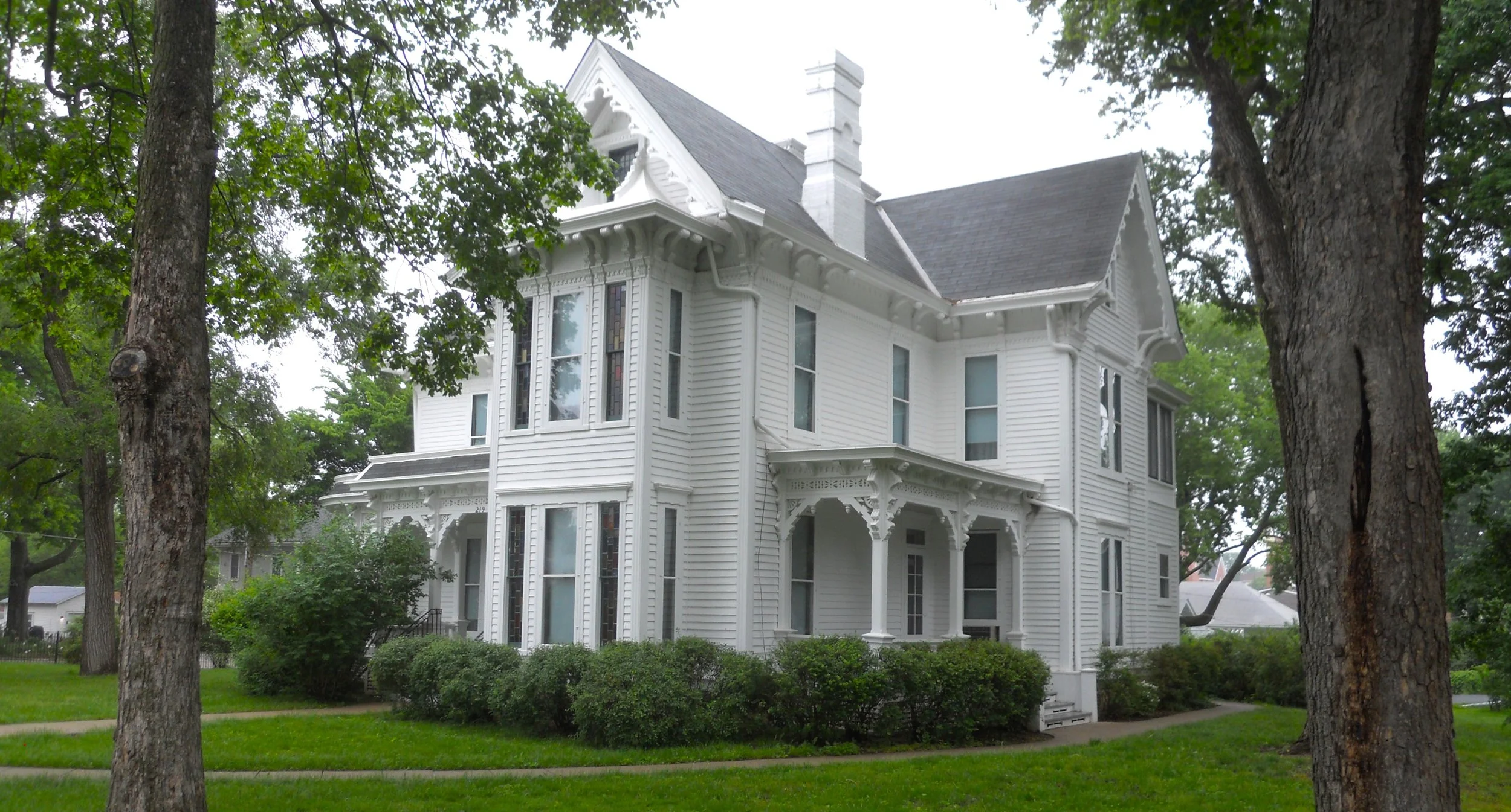
Harry S. Truman Home NHS preserves the 33rd President’s house. The park had rearranged its schedule, with home tours not given on Mondays and Tuesdays, so I had to view the exterior. The last time I visited, Truman’s overcoat and hat were on pegs in the kitchen, as if he had just been here the day before.
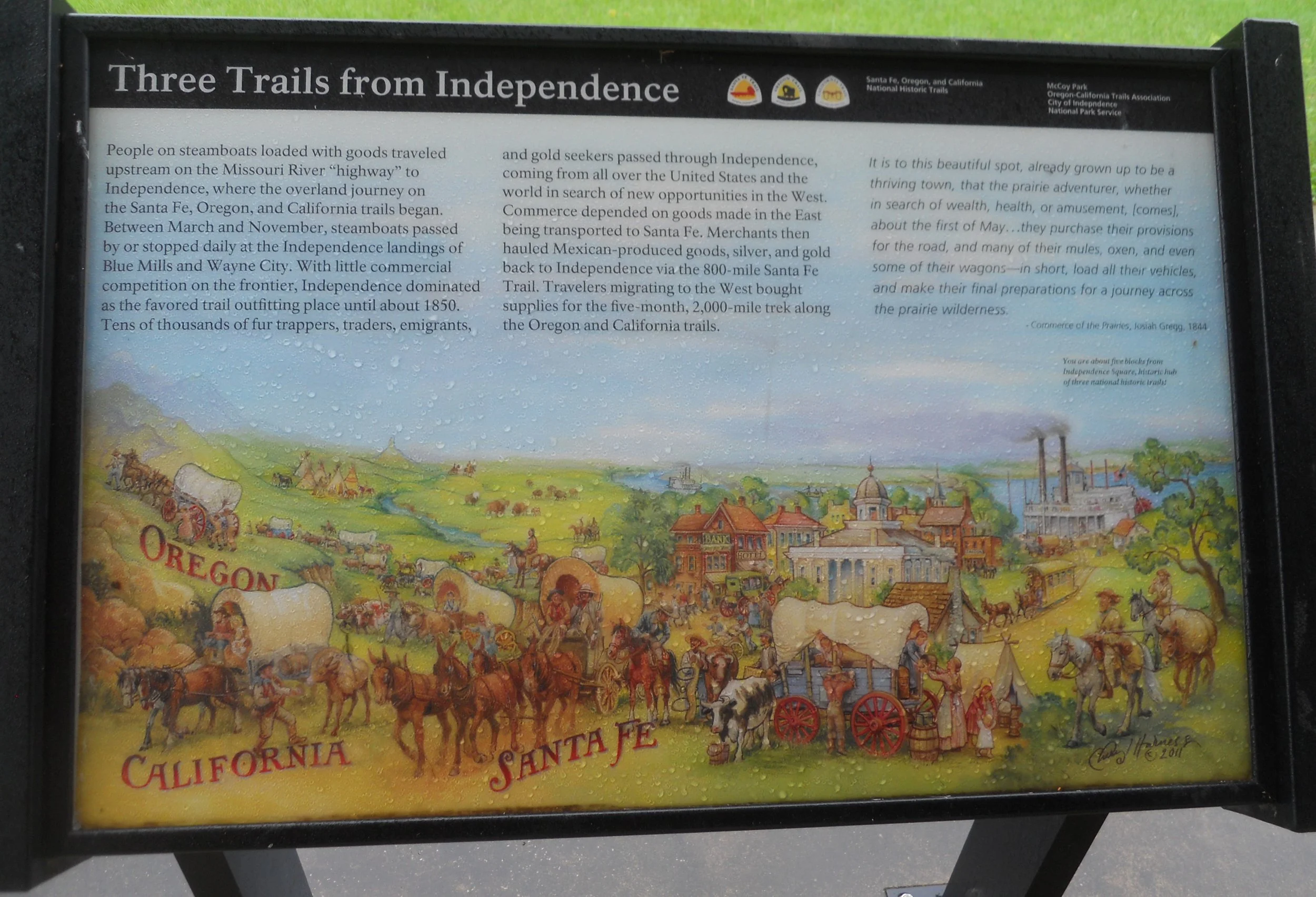
A treat for any historian of our country is just three blocks away, at McCoy Park. This was the jumping off point for the Oregon Trail, the California Trail, and the Santa Fe Trail. Though none of these trails are official NPS parks (like The AT), they are intimately associated with our nation’s history, and cross paths with various NPS parks.

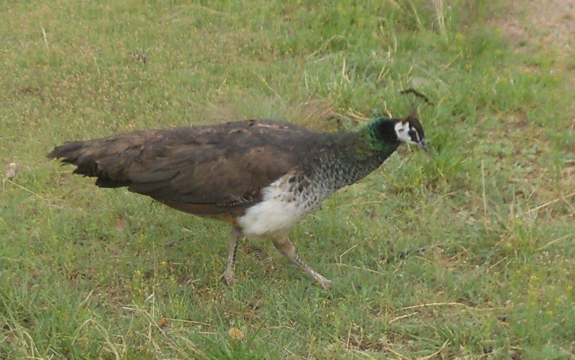
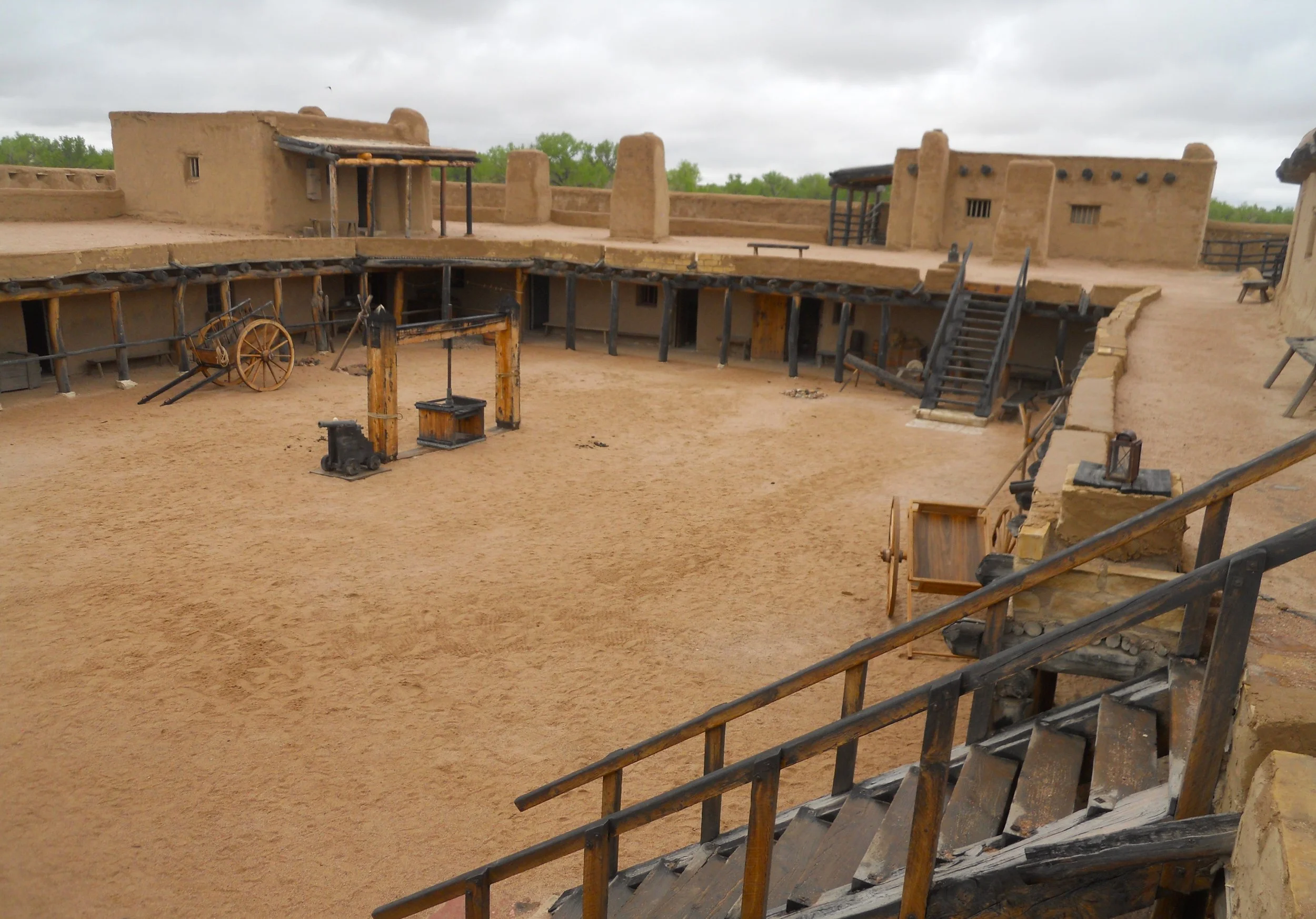
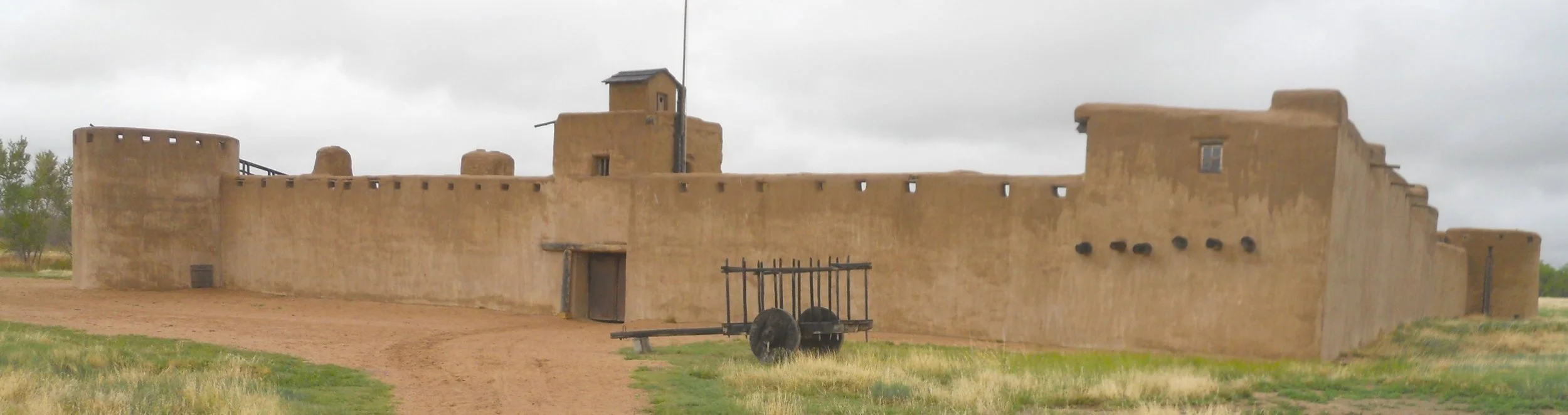
DAY 13 (May 14) - Bent’s Old Fort NHS has a local alarm system, and it was in full-throat mode. I do not know what kind of bird it is, but it sat on one of the fort’s walls and let the world know this was its territory. It flew down to the ground, within three feet of me, probably checking if I was an acceptable visitor. The structure seen today is a reconstruction. The cemetery on the grounds holds the remains of thirteen people, but only one has a marker; Edward Dorris. The hardship of traveling the Sante Fe Trail was too great for many people.
I have to apologize again. Some issues have arisen and I am not getting to the website until late. Will see how tomorrow plays out. But then I am back home for awhile and will load any remaining photos and text.
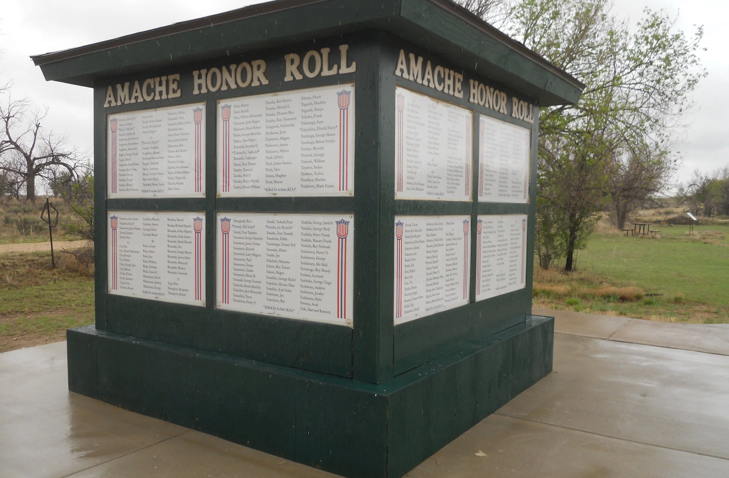
Finally back at home. So, time to complete the last two days of the trip. Between Bent’s Fort and Sand Creek Massacre, I stopped at Amache NHS. This park is authorized, but not established, so it is not “official”, yet. The local community has an organization which currently manages the site. This Japanese internment camp has a similar layout to that of Manzanar NHS (seen earlier in California). With only the Honor Roll, some placards, and walking the layout, it will be awhile before the park is established.
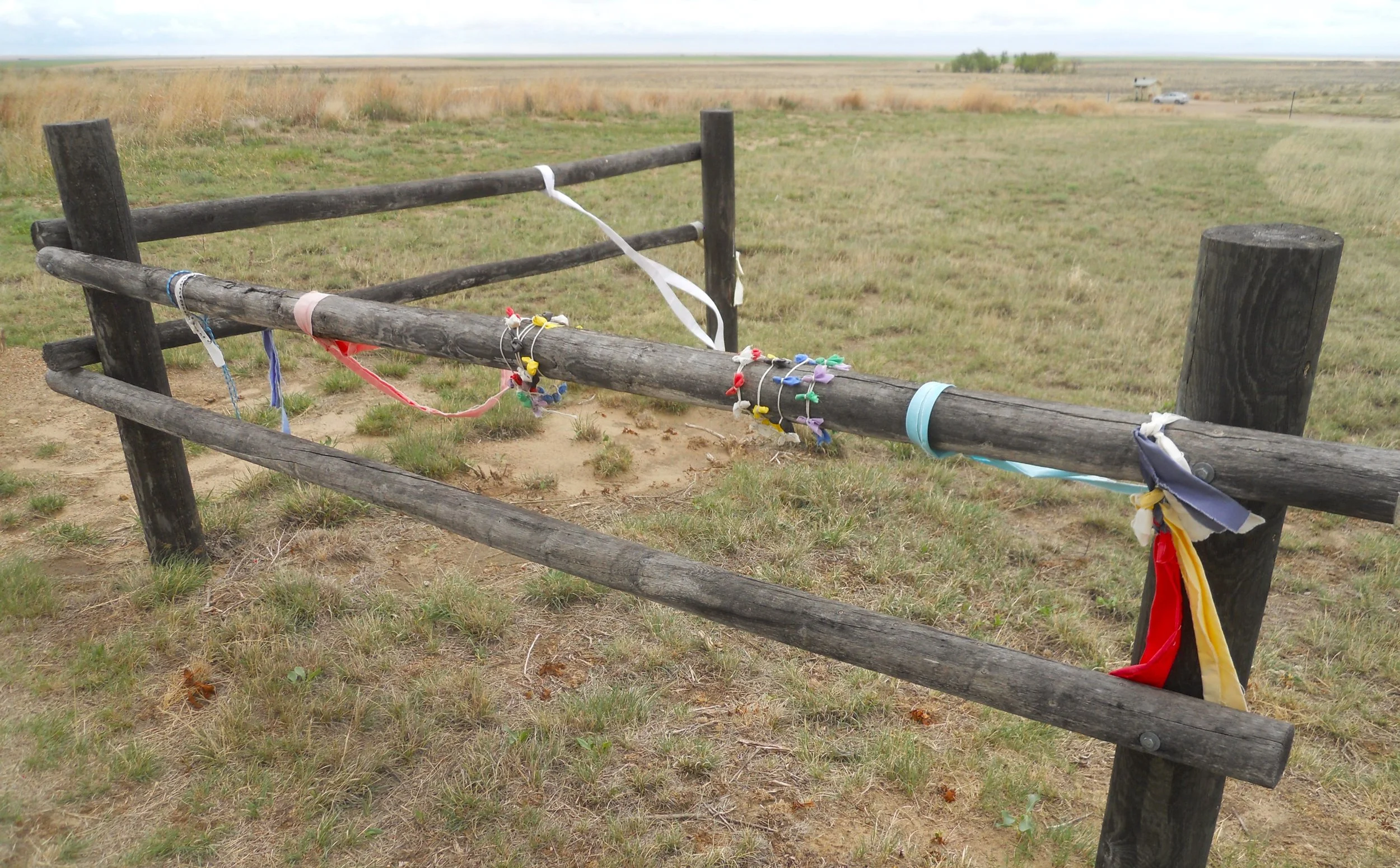
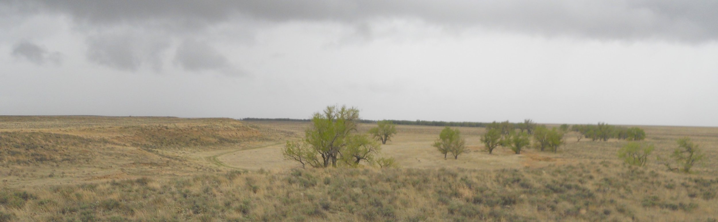
The Repatriation Site was my first stop at Sand Creek Massacre NHS. Colorful ribbons were tied to wood poles, for remembering the 750 Arapaho and Cheyenne Indians who were ambushed, with over 230 slaughtered by elements of the 1st Colorado and 3rd Colorado. The soldiers had never been given orders to leave Denver, making this one of the most barbaric actions ever by the U.S. Military. Peace negotiations had been proceeding between the tribes and the Federal Government. Chief Black Kettle had camped the men, women, and children at this bend in the Big Sandy Creek, waiting for final word to move to nearby Fort Lyons.
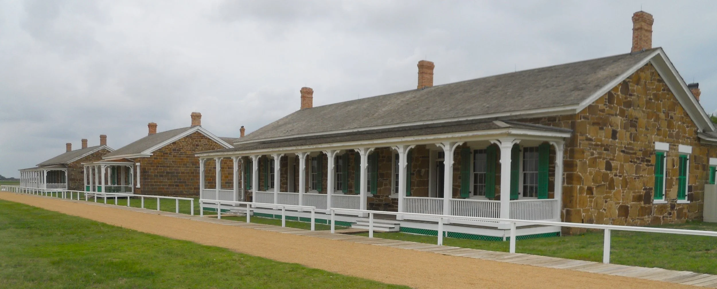
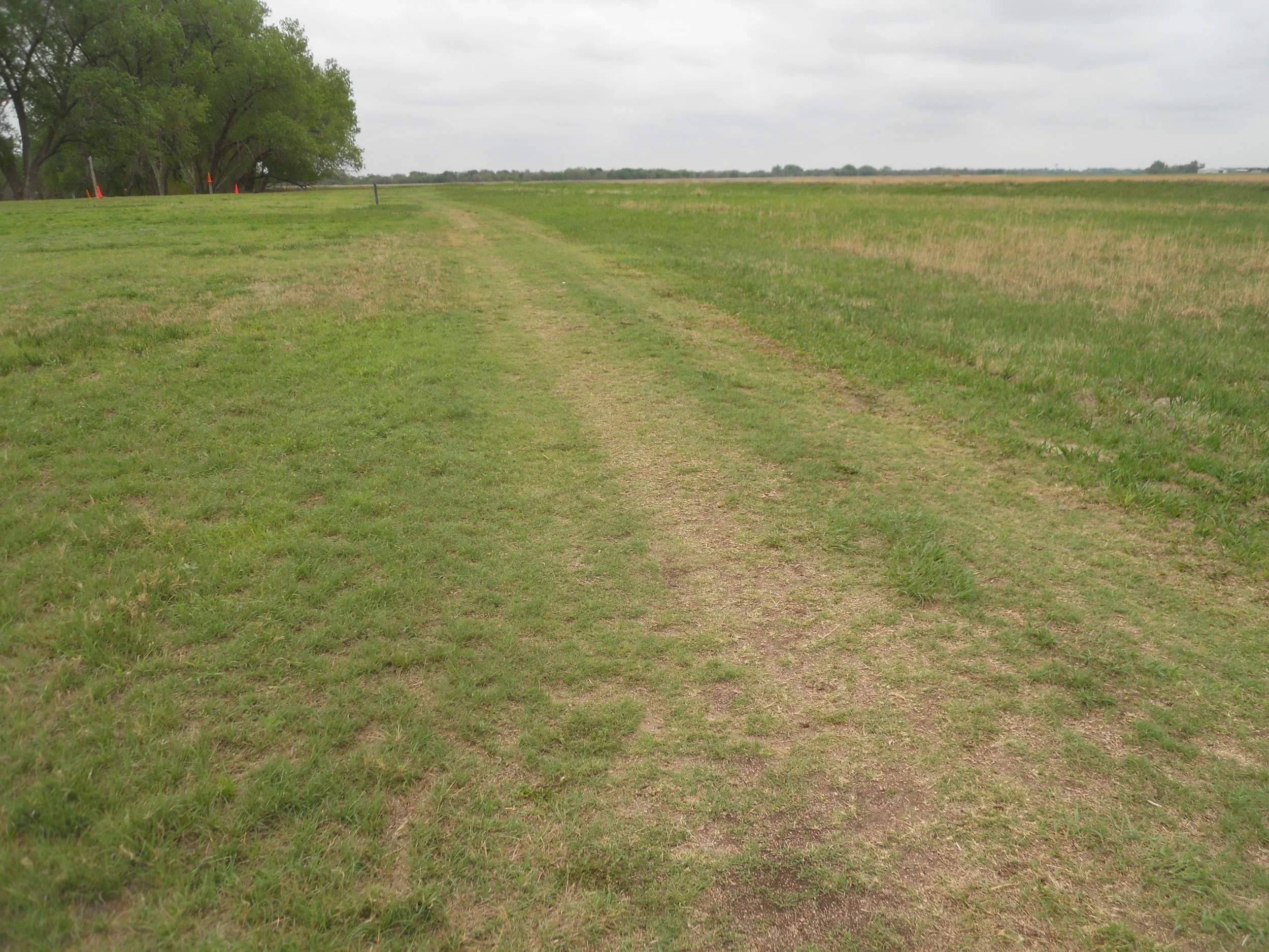
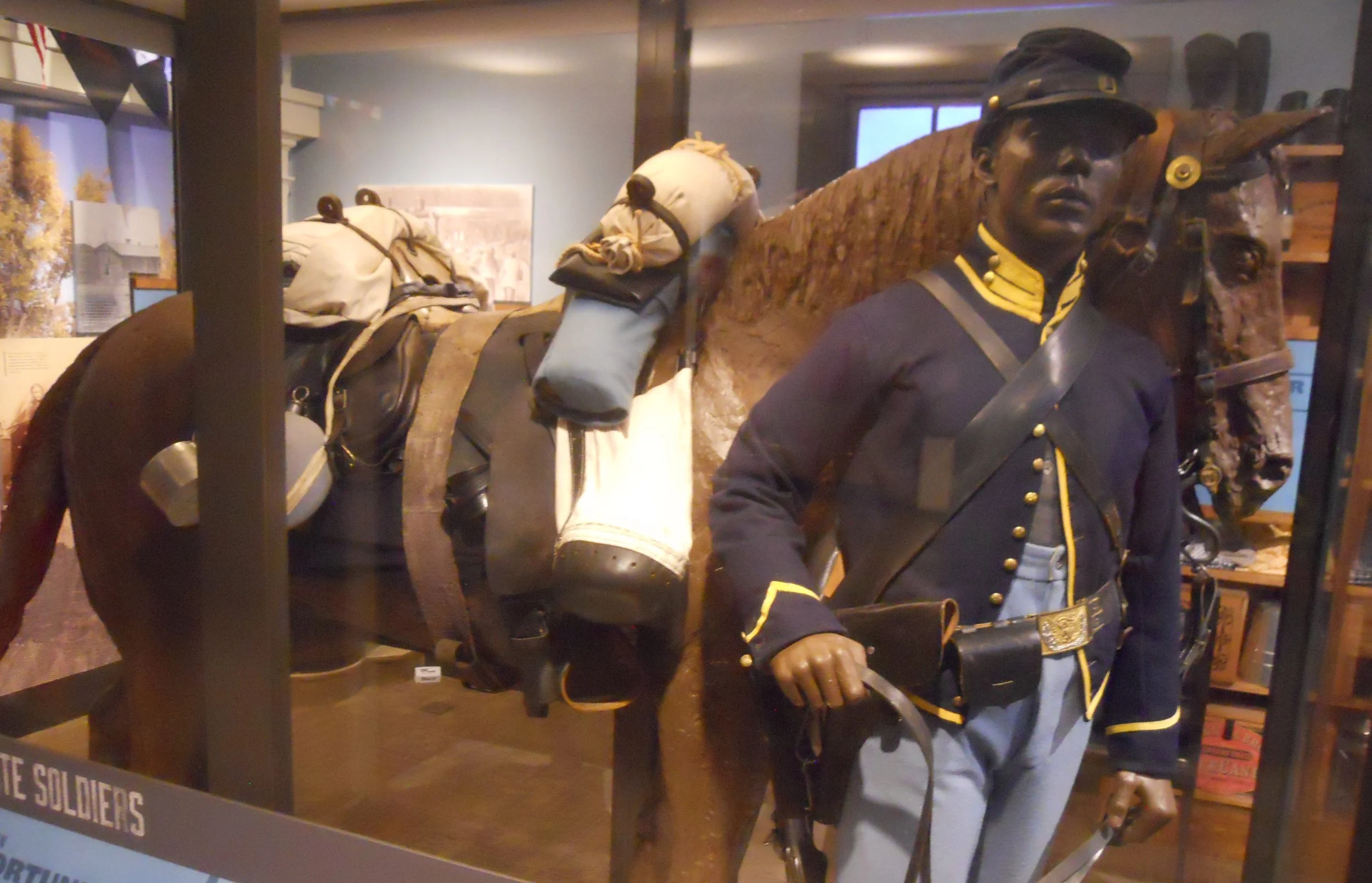
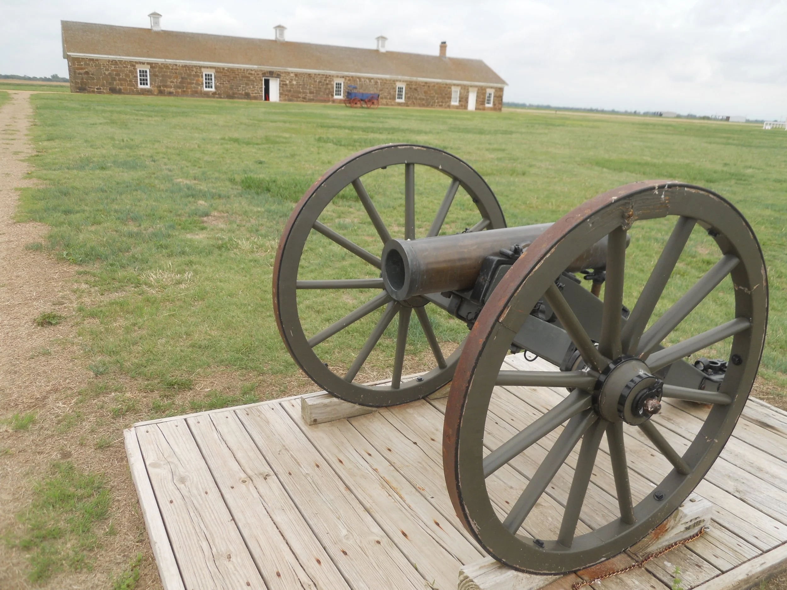
Fort Larned NHS is about the best-preserved western fort in the country. Its sandstone buildings look unaffected by the last 150 years. The fort and its soldiers became known as the “Guardians of the Santa Fe Trail”. Wagon wheel ruts of the trail can still be seen today. What a feeling to walk on the same ground. For a short period of the fort’s 20-year active status, the 10th Cavalry was stationed here. This was one of the six Buffalo Soldier regiments (2 cavalry, 4 infantry) authorized by Congress in the 1860s. The fort did have four 12-pound cannons, but during battles with native peoples it was quickly discovered the mobility of the Indians made the cannons quite ineffective.

DAY 12 (May 13) - I am going to have to wait until tomorrow to load images and text for the four parks I saw today… Thanks
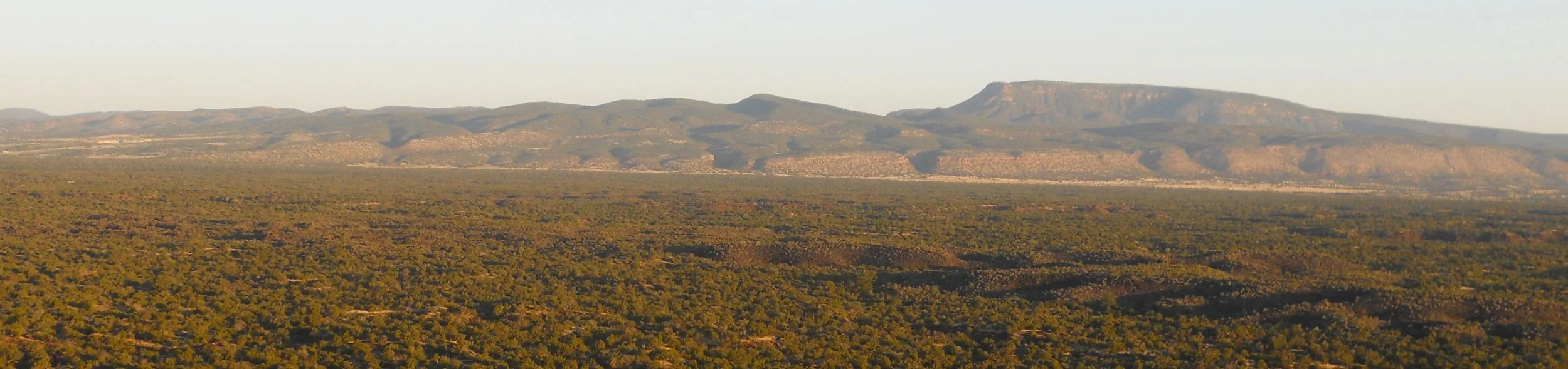
DAY 11 (May 12) - I went to the east side of El Malpais NMon this morning. A glimpse from Sandstone Bluffs overlook provided a wide and far view of the monument, with the Zuni Mountains in the far distance. Turns out this area was used by the Army in WW2 for munitions testing. There is still live ordinance under or near the surface of the park. A sign tells visitors to “retreat” and contact authorities if they come across a shell or bomb.
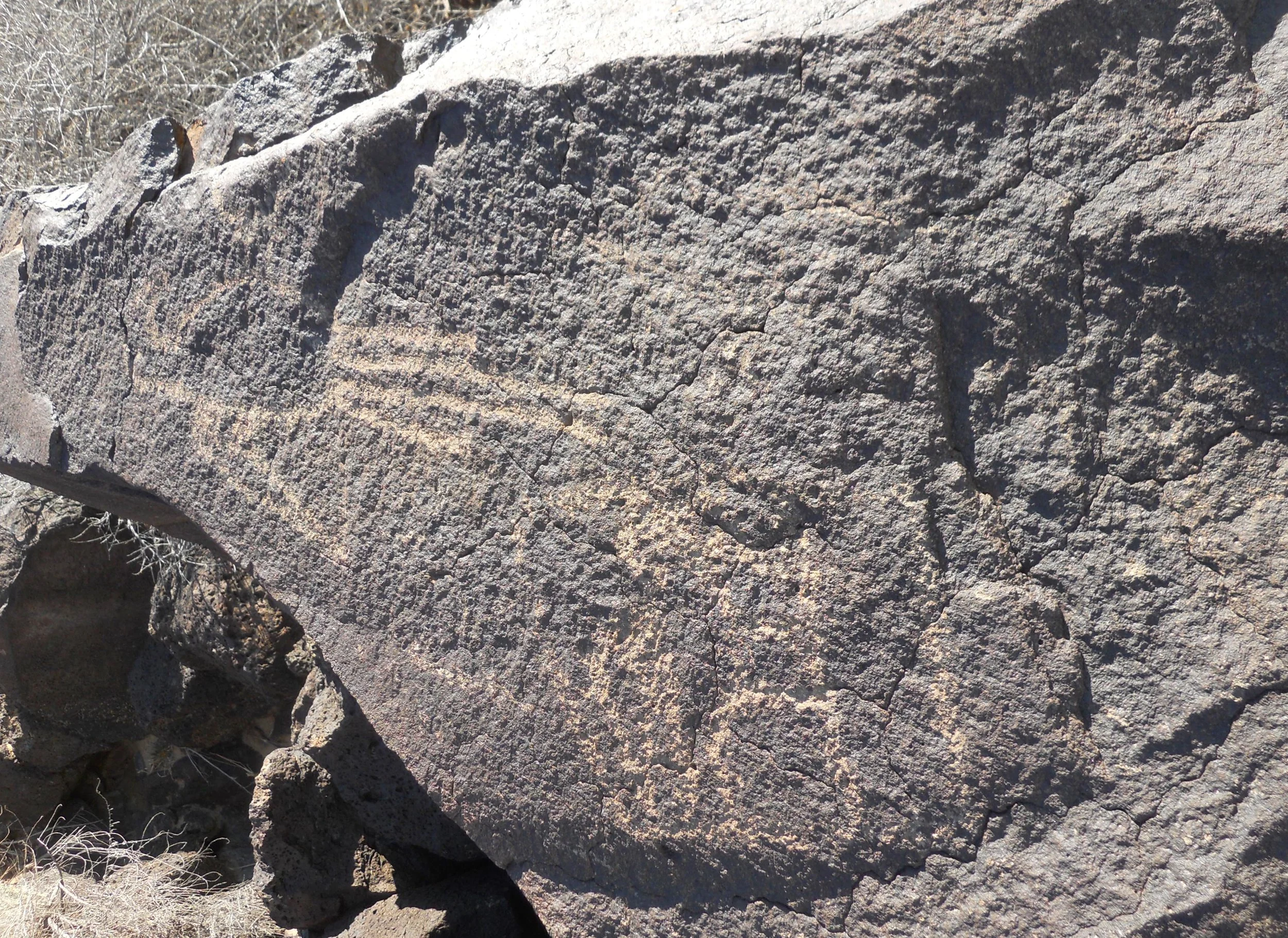
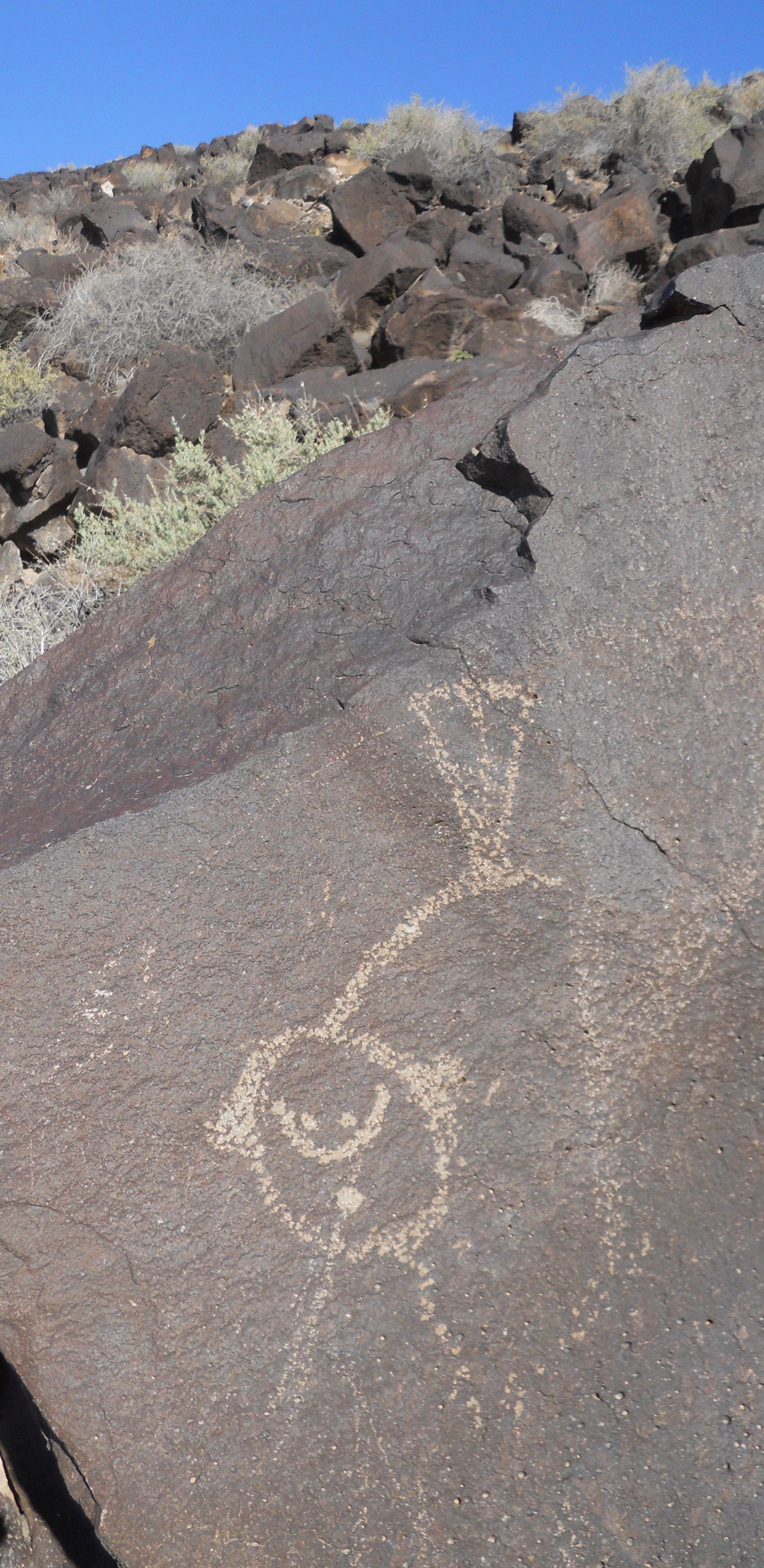
Petroglyph NMon protects rock carvings made from between 400 and 700 years ago, by native peoples and westerners. I went to the Boca Negro section to hike among its volcanic basalt field and view the artwork. Indians usually carved figures based on nature, such as birds (the middle photo) and vegetation (a yucca pod is to the far right).
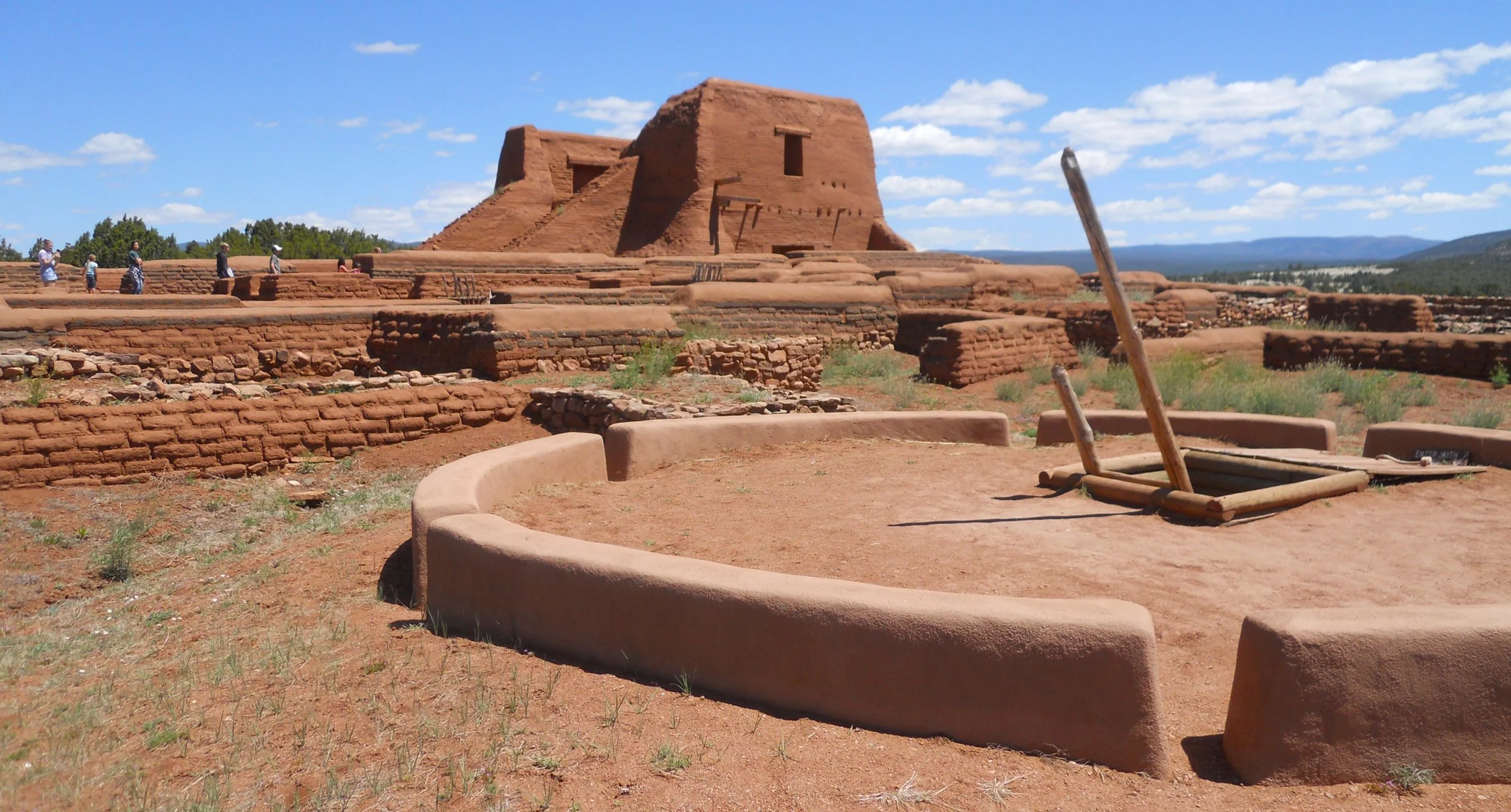
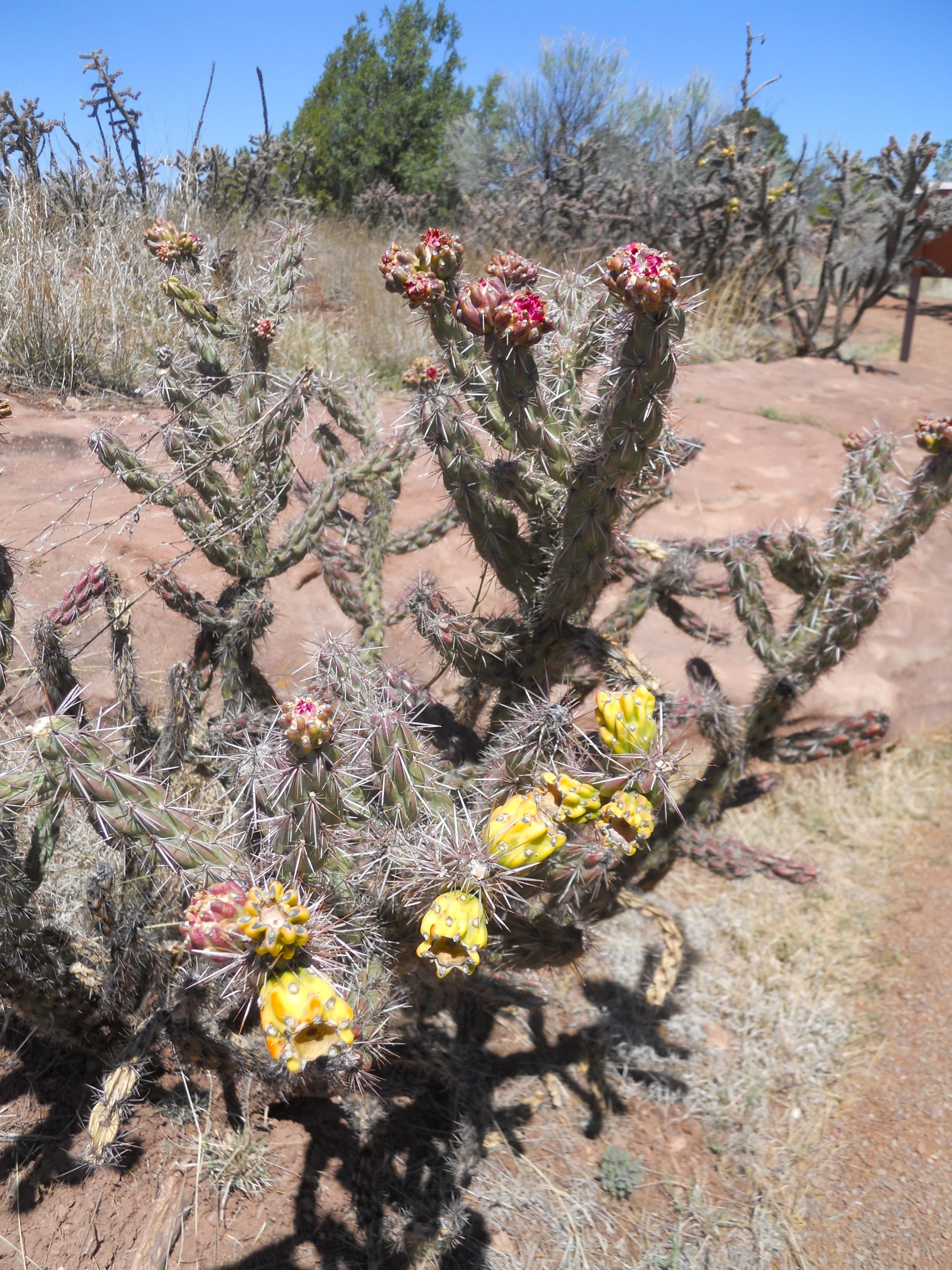
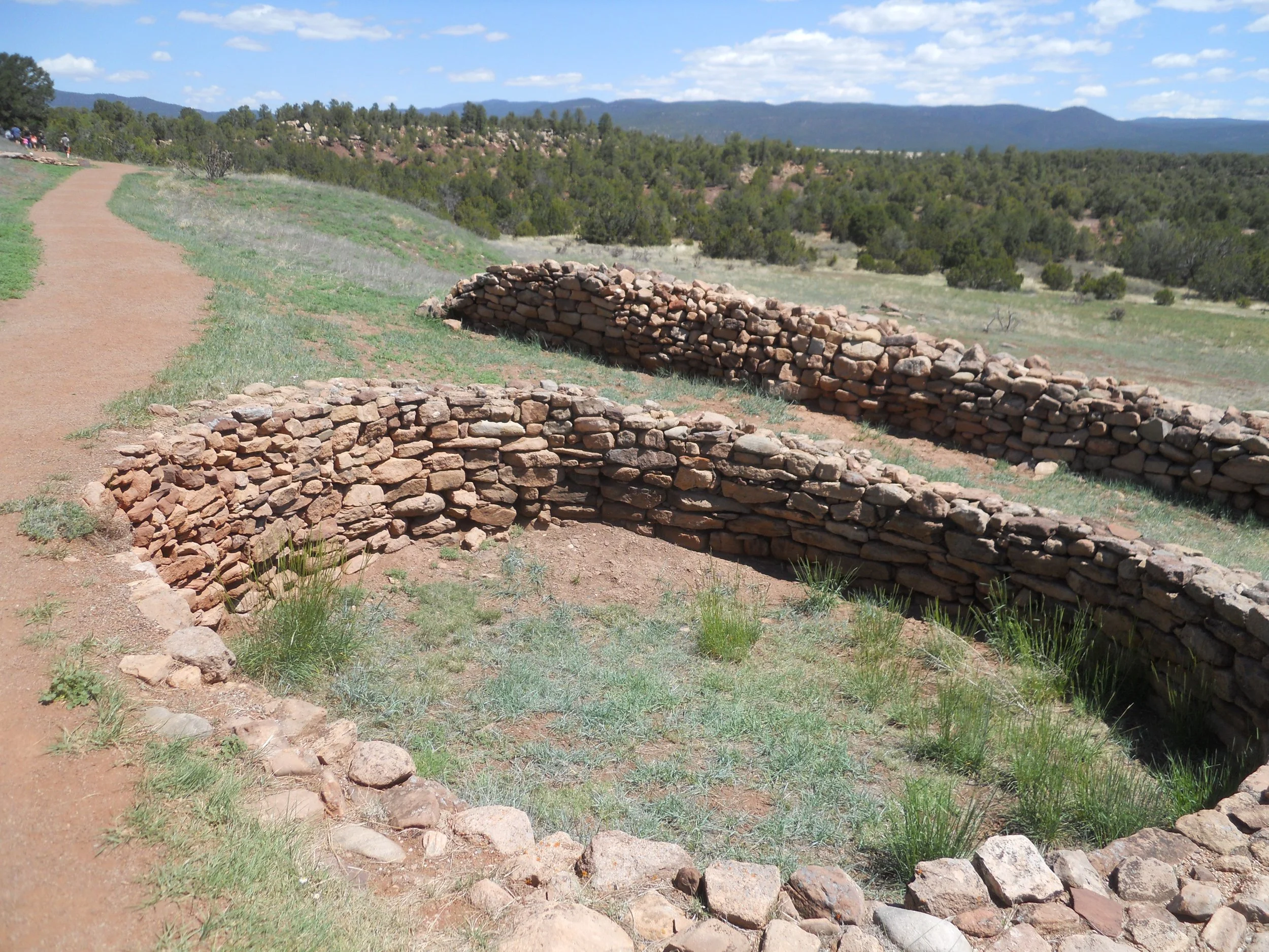
Pecos NHP is strategically located between the Southern Plains and the Arizona territory. Peoples have used the Glorieta Pass for centuries. With the Rio Grande River and Glorieta Creek nearby, native peoples thrived. Forty to fifty Puebloan groups built housing communities around the region over 1000 years ago. Then, by 1450 AD, they came together to form a single Pecos Settlement. The ruins seen today are from this period and the following period of Spanish conquest in the 1600s and 1700s. Walls of the 1717 church still stand (the foundation of the 1625 church is also present). This area is so strategically important that a Civil War battle was fought here in 1862, with the Confederate forces victorious over Union troops from Colorado. A pleasant surprise this May has been seeing flowers, bushes, and cacti show their blossoms. In another month the colors will disappear.
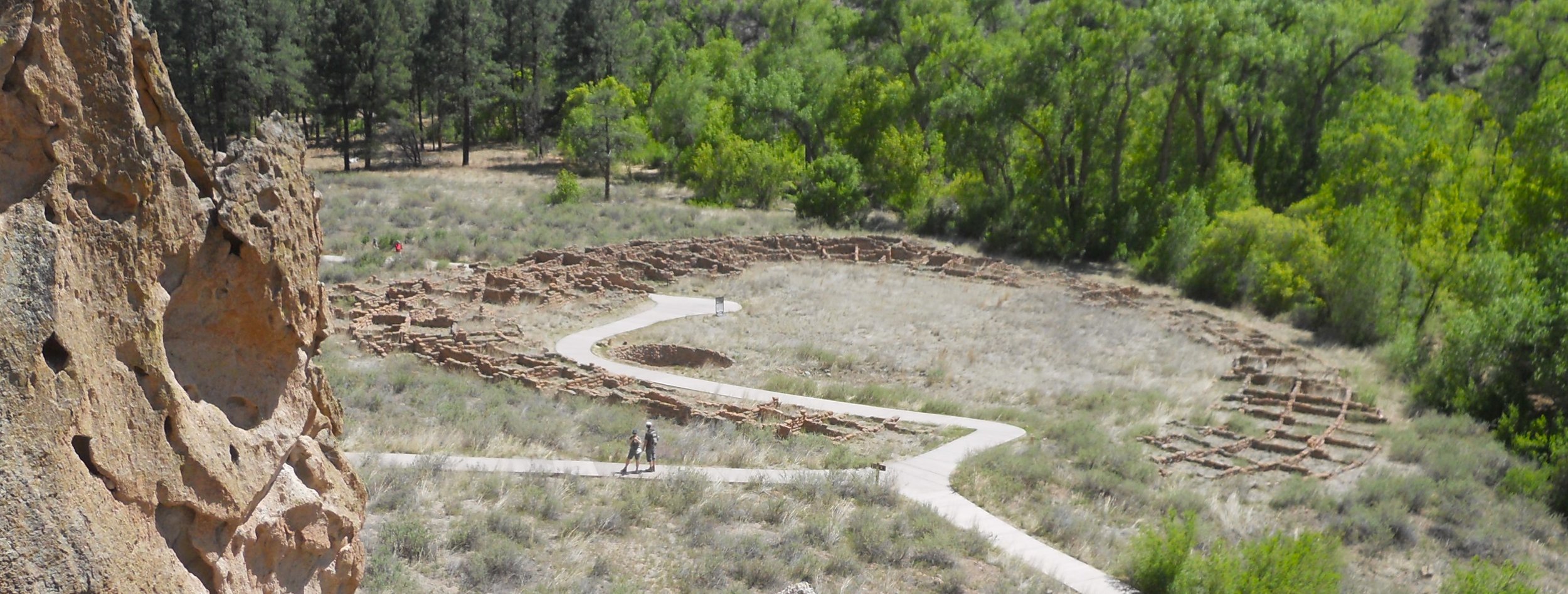
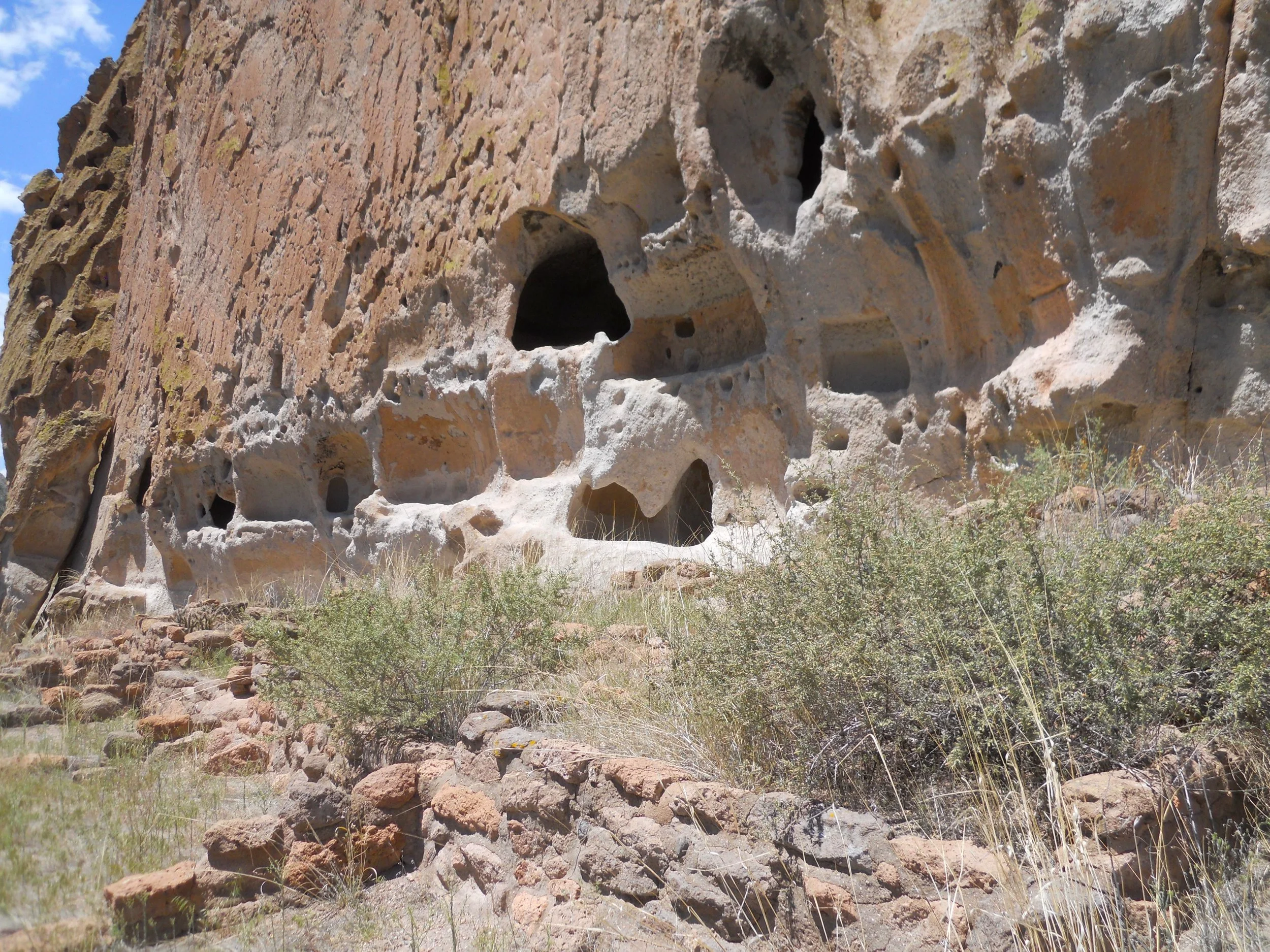
Bandelier NMon is home to 11,000 years of human history, that being the first evidence of man living in Frijoles Canyon. Ancient Puebloans built houses and kivas on flat land (like seen at Chaco Culture), and masonry structures at the base of the south facing canyon cliff. They also “drilled” into the soft cliff walls, creating caves in which to live. A natural alcove, at the end of the park’s main 2.2-mile loop trail, is 140 feet above the canyon floor. Today it is reached via multiple wood ladder sections. A small kiva-type room and other rock walls are in the alcove, evidence of habitation.
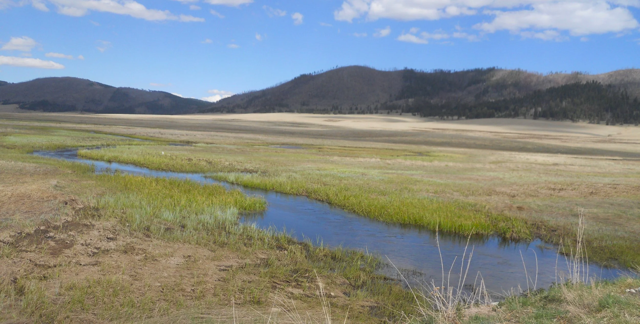
The last park today was Valles Caldera NPres. This is a 13-mile wide “crater”, formed about 1.25 million years ago from a gigantic volcanic eruption. The east fork of the Jemez River runs across the park’s flat-land section. The most noticed creature are the scads of Prairie Dogs in this section. But none would let me get close enough for a photograph. Guess they have never heard of Hollywood.


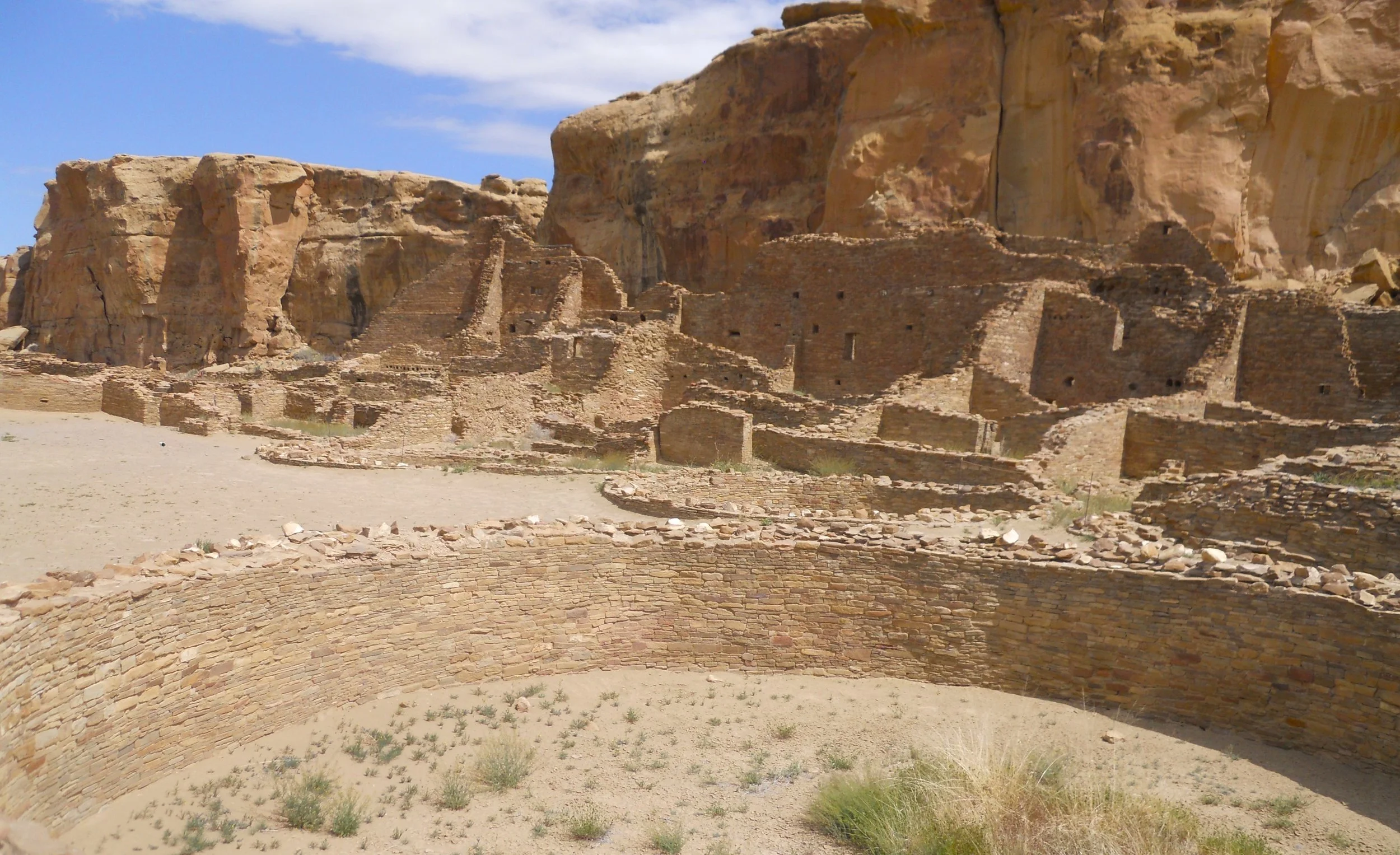
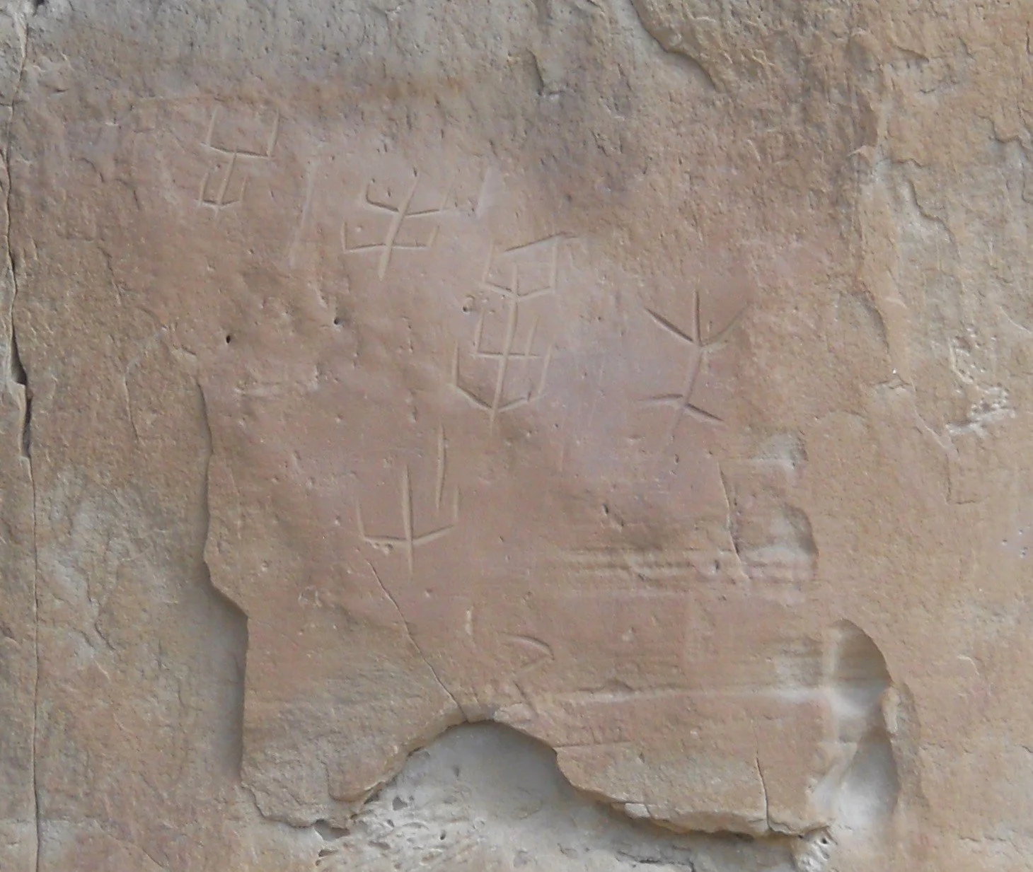
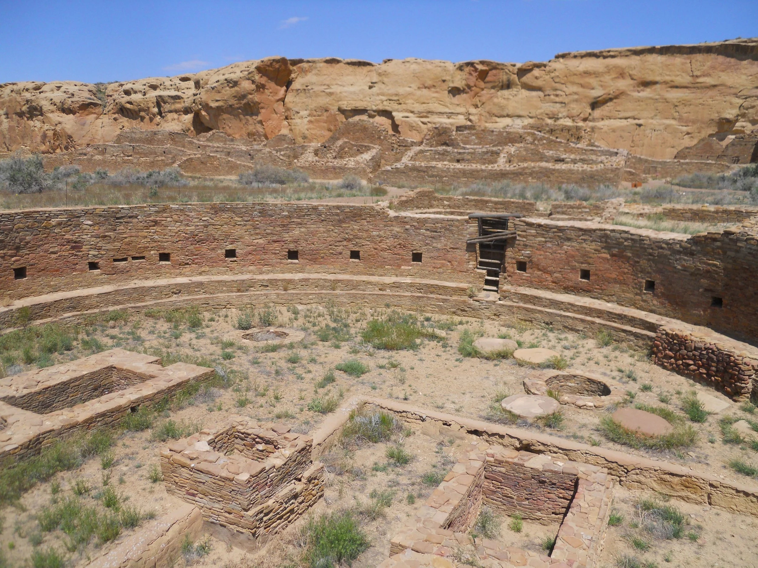
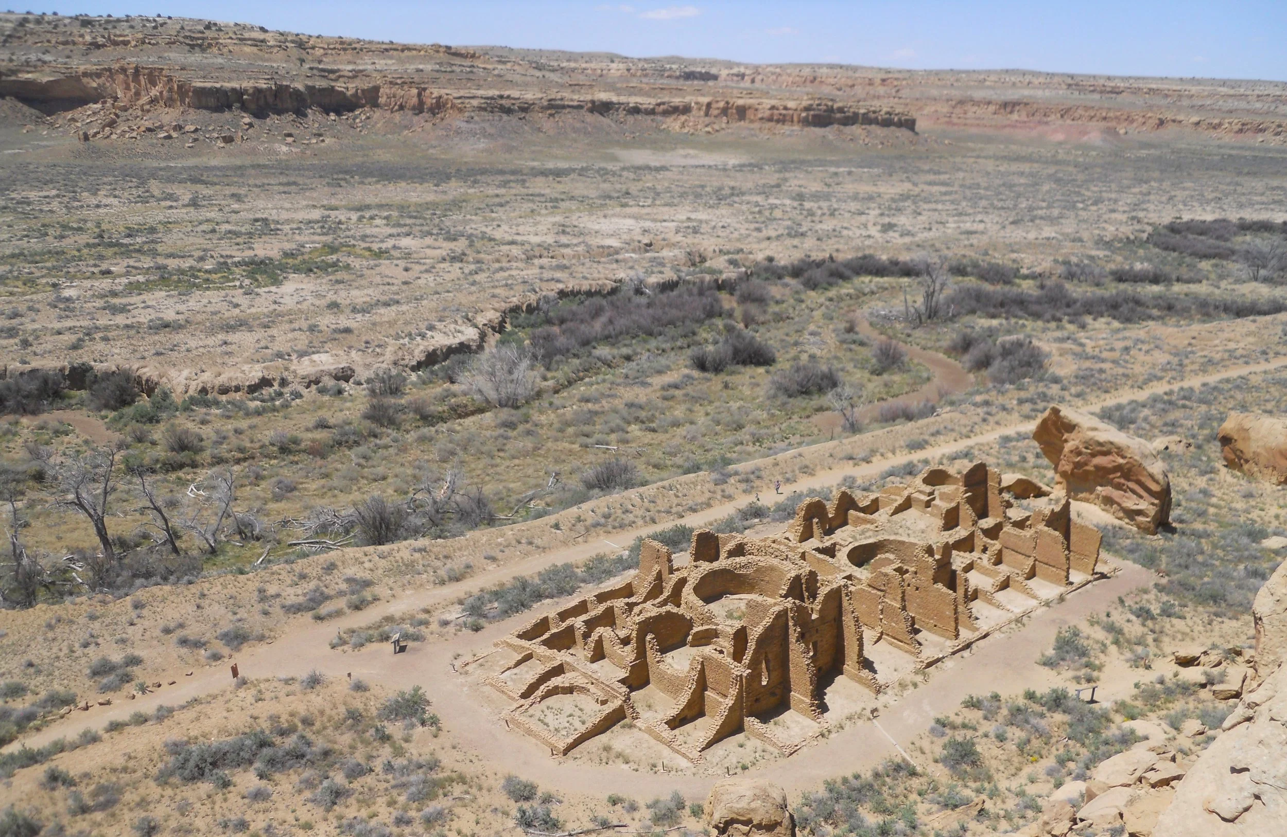
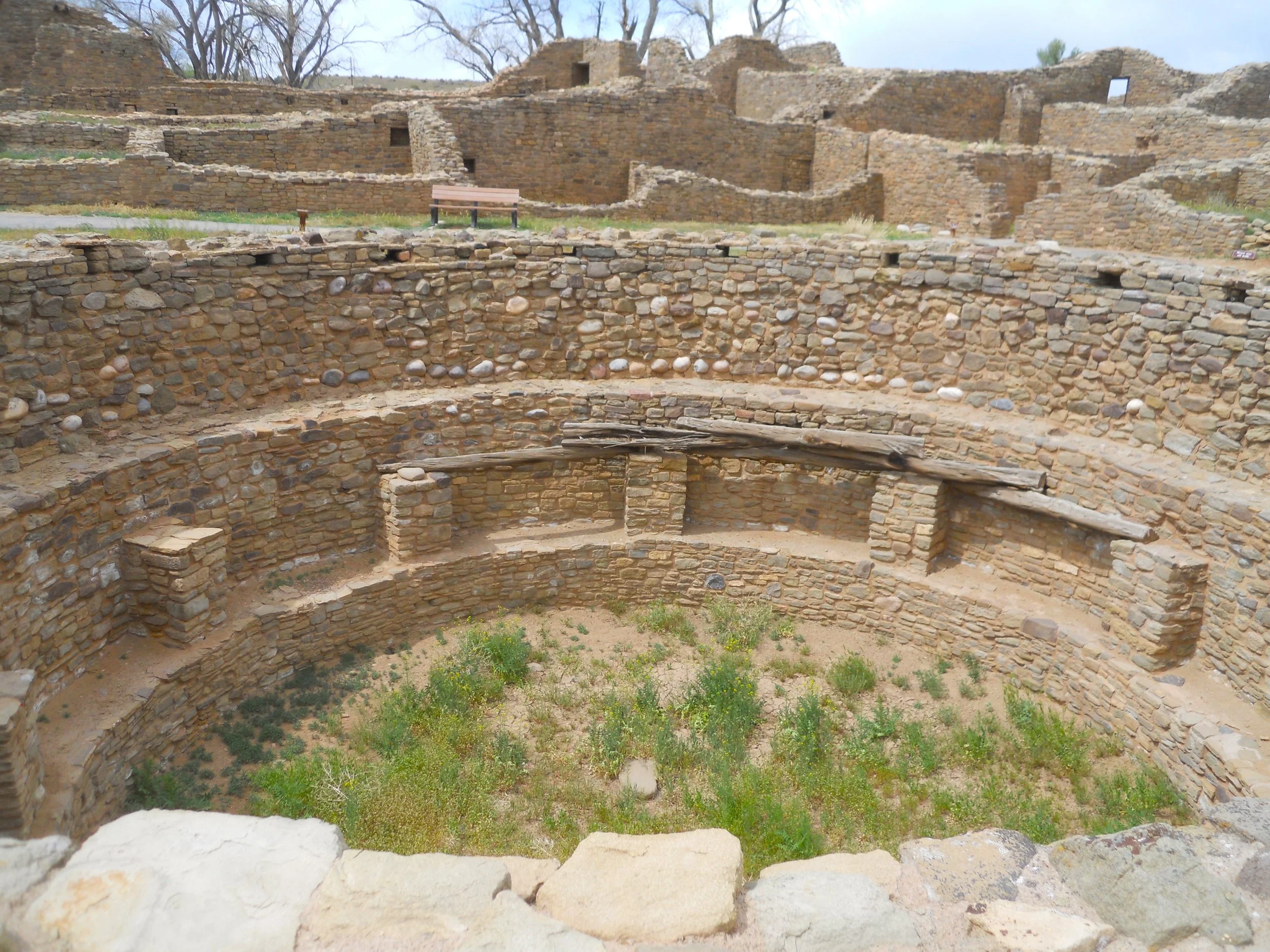
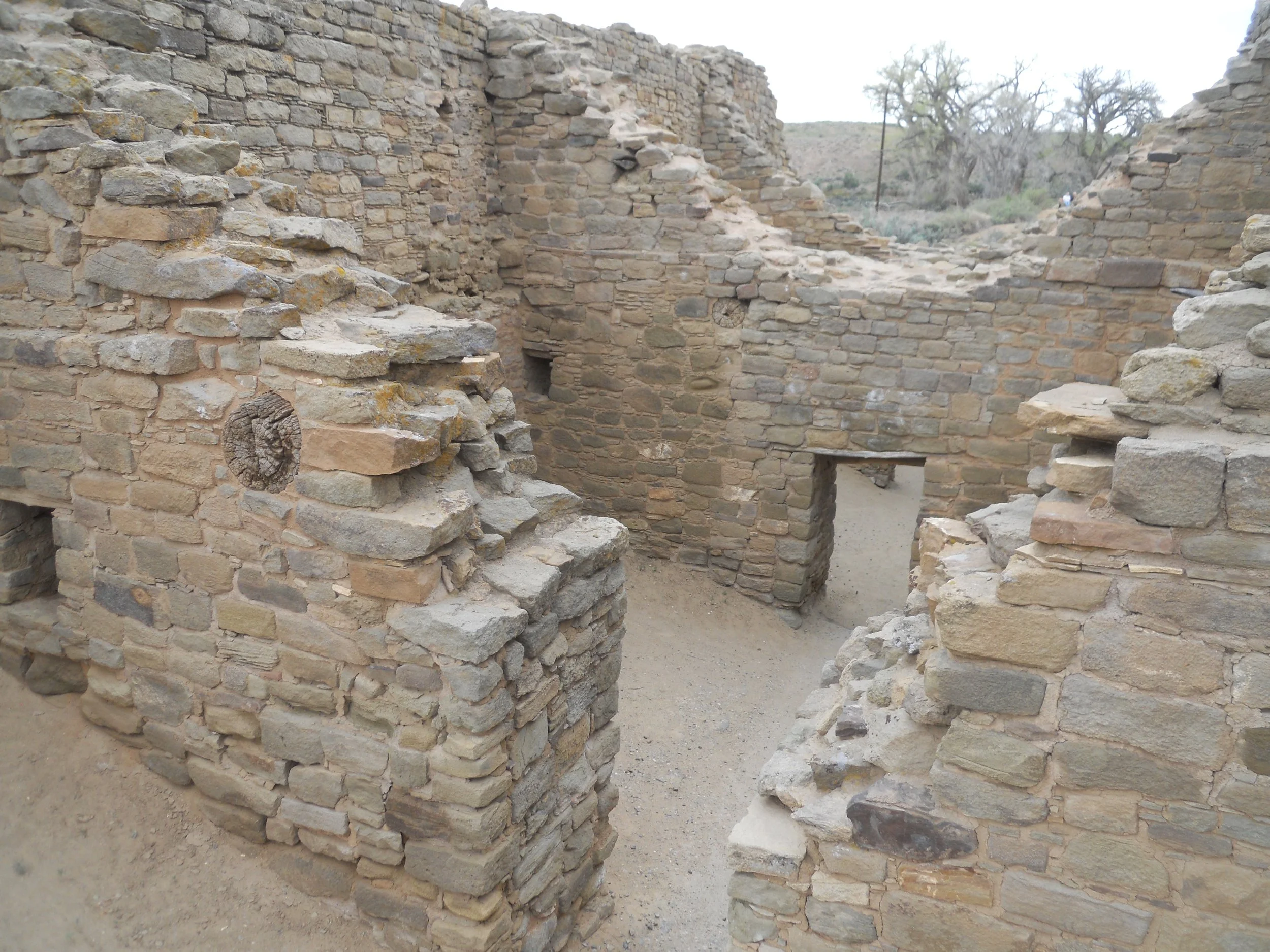
DAY 10 (May 11) - The ride to Chaco Culture NHP is a bumpy one. Eight miles of pavement, followed by six miles of stone/sand, then five miles of the opposite of paved. But Chaco Canyon is full of “houses”, built from between 750 AD and 1200s AD. As with Mesa Verde, no one knows what happened to the people by 1300 AD. Their kivas, dwellings, artifacts, and petroglyphs have been left to help us glimpse what their life was like. Pueblo Bonito is the star of the community clusters. It is the first stop on the nine-mile loop road through the canyon. An amazing feature of all the structures is the amount of wood logs used. There were no trees in the canyon, having to be brought for miles from other areas. Along the north side of the canyon, a Petroglyph Trail displays many diagrams. They have become worn after centuries, since water and wind have a knack of wearing away stone. Chetro Ketl lies to the east of Bonito. It is the second largest house, containing a very large kiva, in front of many three-story tall dwelling areas next to the cliff.
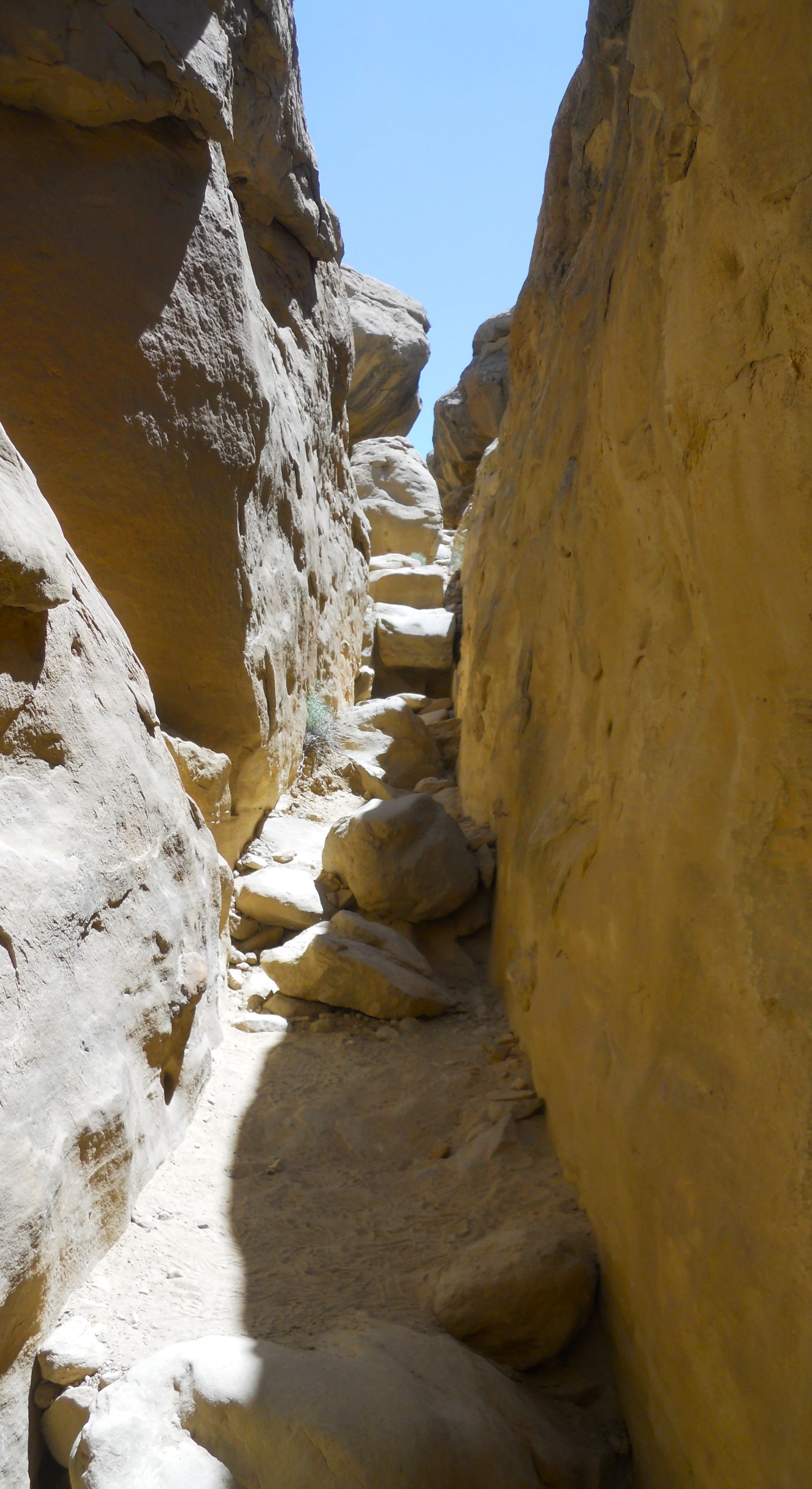
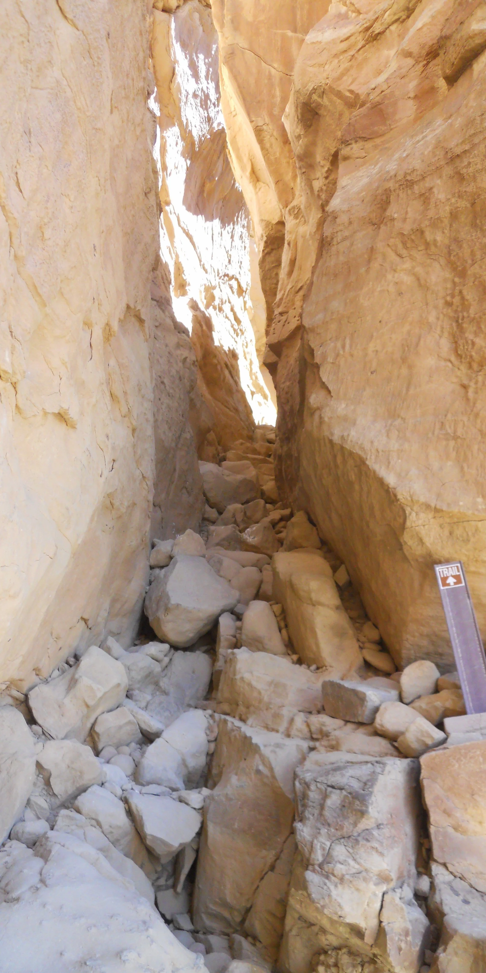
One can get a bird’s eye view of Kin Kletso, by taking an ancient staircase to the plateau top. The path was tight in a few places. One can see the expanse the locals had to work with. Chaco Wash provided water during many months, allowing the people to thrive in the canyon.
I finished the day with a quick stop at El Malpais and a longer stop at El Morro NMon. I will take more time tomorrow at El Malpais, but I now have the GPS and entrance sign actions done.
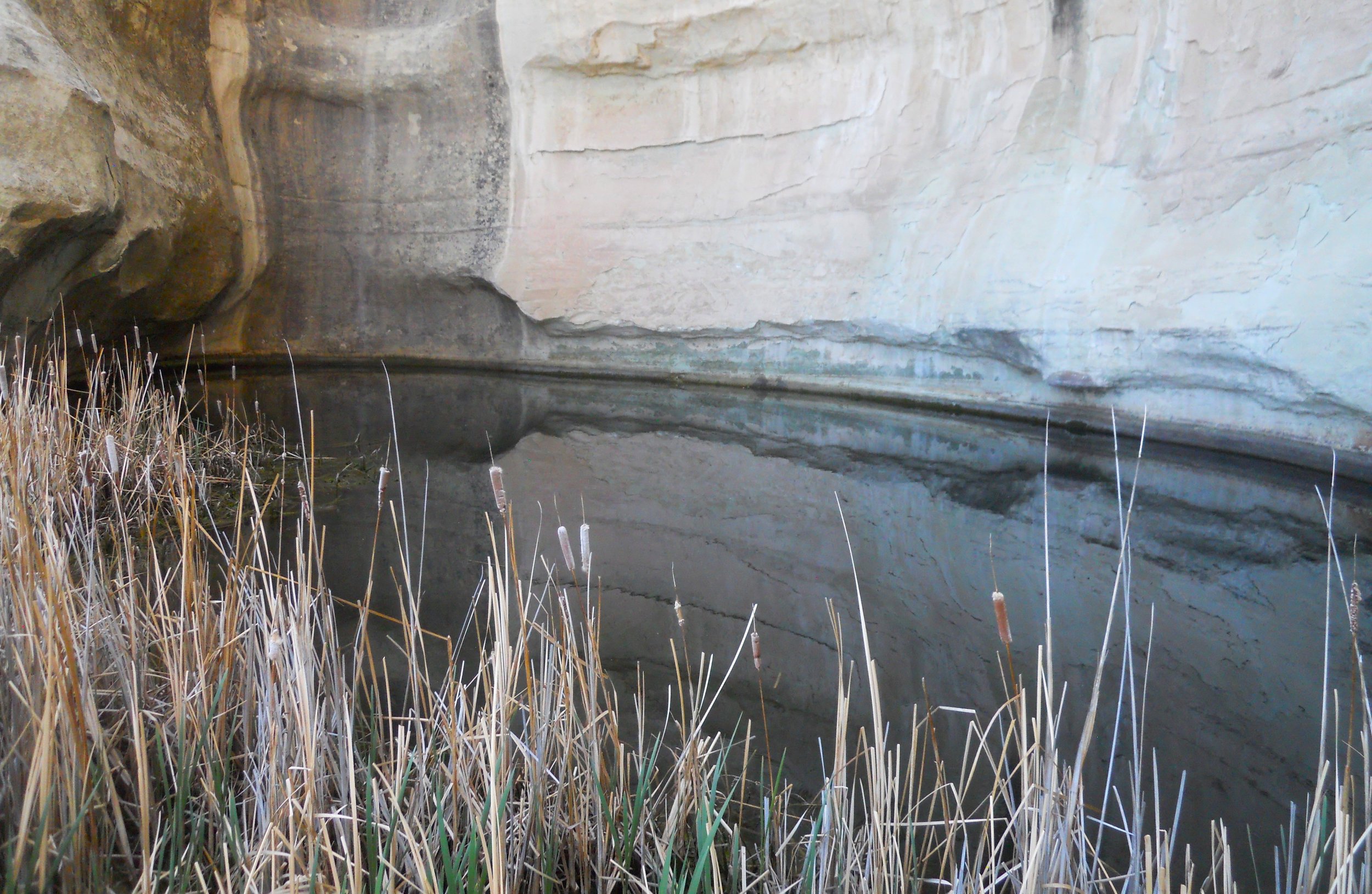
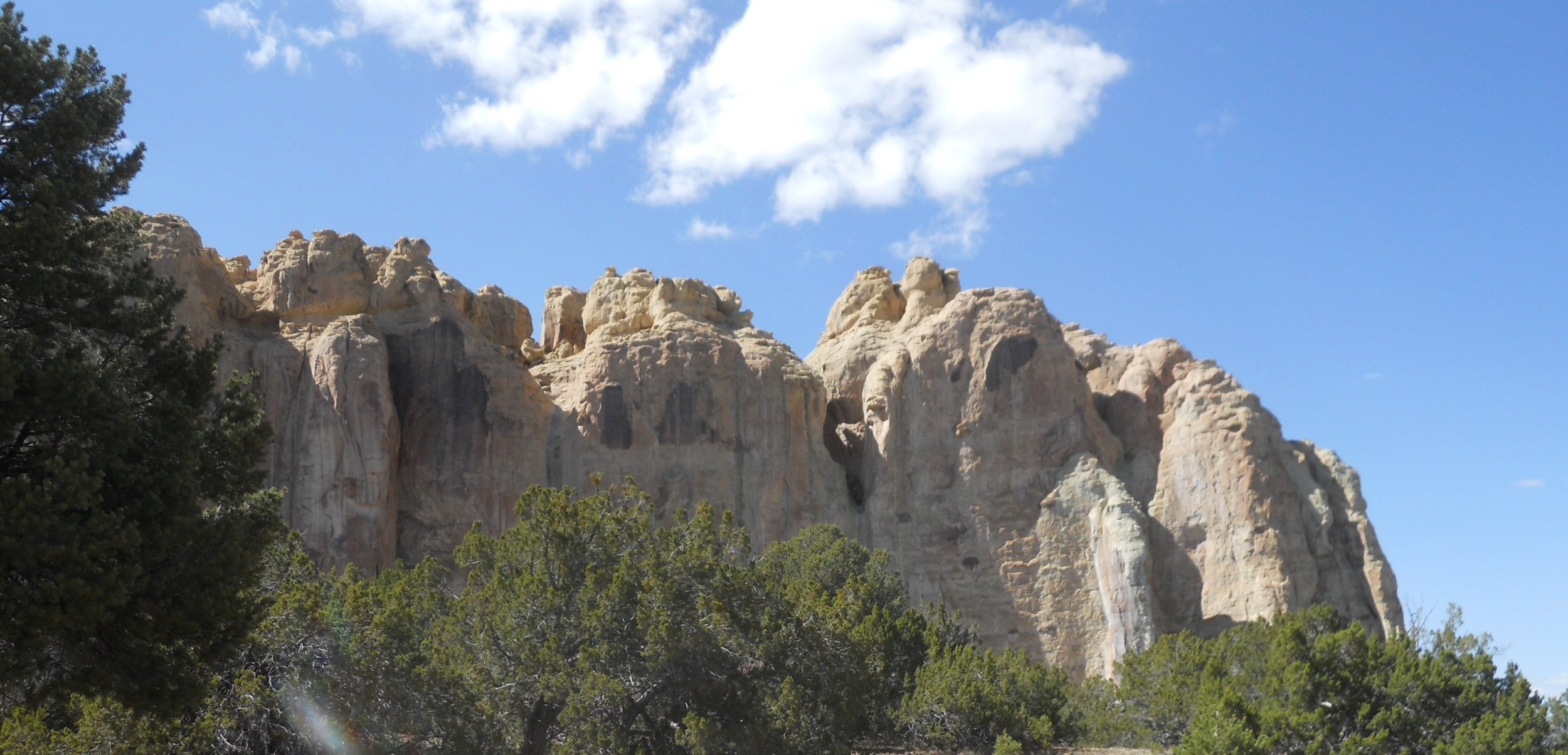
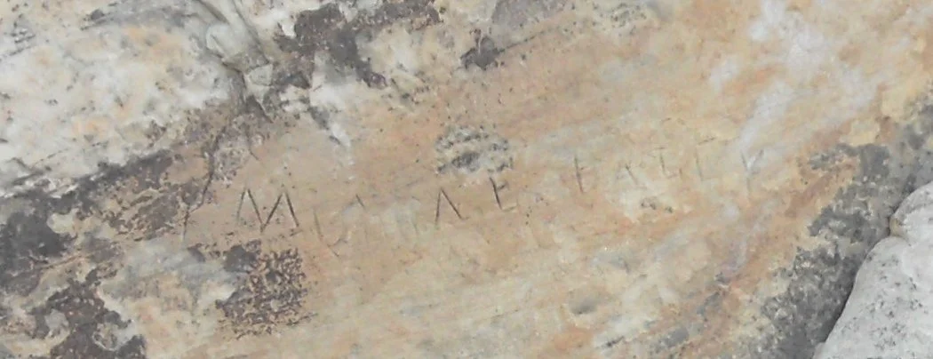
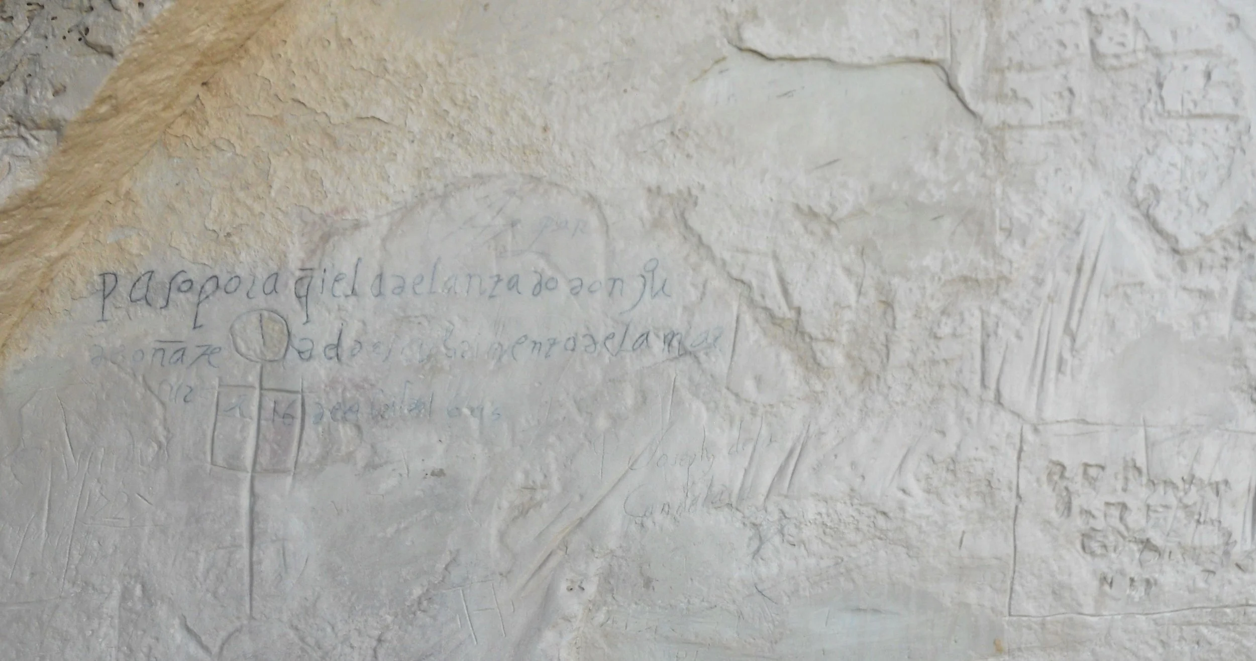
El Morro has a hidden gem. It is a water hole at the base of its tall cliffs. Humans have been living near, and stopping here on journeys, due to this life-giving blessing. The first Westerners to know of this feature were the Spanish. And what do whitemen do when they find something new? They mark their claim. And mark they did. Over 2,000 signatures, dates, symbols, and the like adorn the base of the sandstone cliffs. Very few women left their mark, but one was Ms. A. F. Bailey. About the most famous is that of the first Spanish Governor of New Mexico, Don Juan de Onate. He inscribed (bottom photo) in 1605, 15 years before the Pilgrams landed.


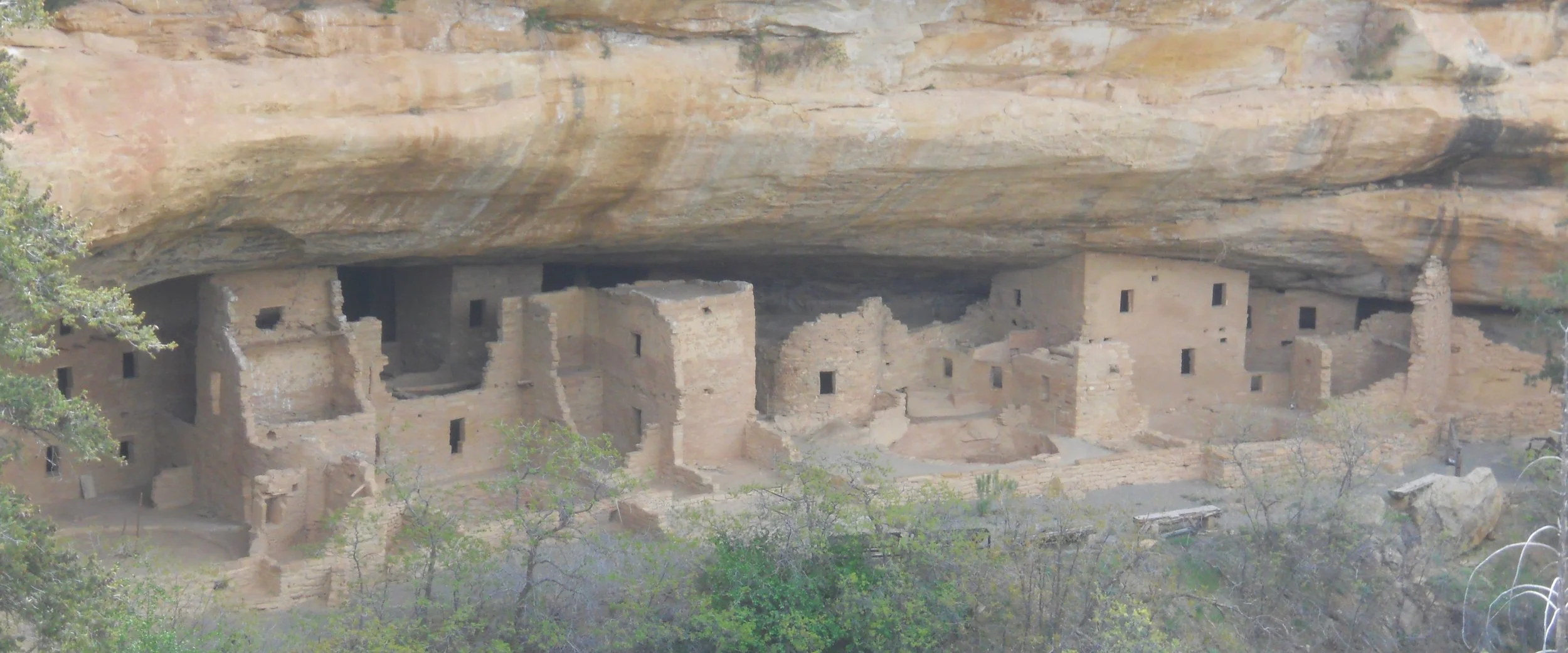
DAY 9 (May 10) - Most Americans have heard of Mesa Verde NP, and its celebrated cliff dwellings. The massive number of people reserving tour tickets to the big “houses” during the summer months is a good indication. But due to this past winter’s snow levels, the houses are not open until May 14, which meant the number of visitors today was very light. Therefore, I took advantage of the viewpoints on the park’s loop roads. First up was Spruce Tree House. Next was Cliff Palace, followed by Balcony House. You may notice the ladder in the bottom right of the third photo. Tourists have to climb up into the dwelling, and then go through a “secret tunnel” to access the main area. You may also notice a lot of little bodies. A local school was being given a tour by the rangers. I had to hike 1.2 miles RT to get to the vantage point from across the canyon to take the photograph. A little Nikon point-and-shoot is not the best for long shots. To compound logistics, the Wetherill Mesa section of the park is closed for 2023. That has two more major houses, one which is a self-guided tour. So, tickets or no tickets, today was not the best.
But, one can check out the Far View Community area. This is on top of the mesa, and predates the cliff dwellings by a few hundred years. These structures were started around 750 AD, continuing to about 1200 AD when the cliff dwellings took over. There are six sites to see on a 0.75-mile hiking loop, including a reservoir. I had never stopped at this location on my previous park visits, so good to see something new.
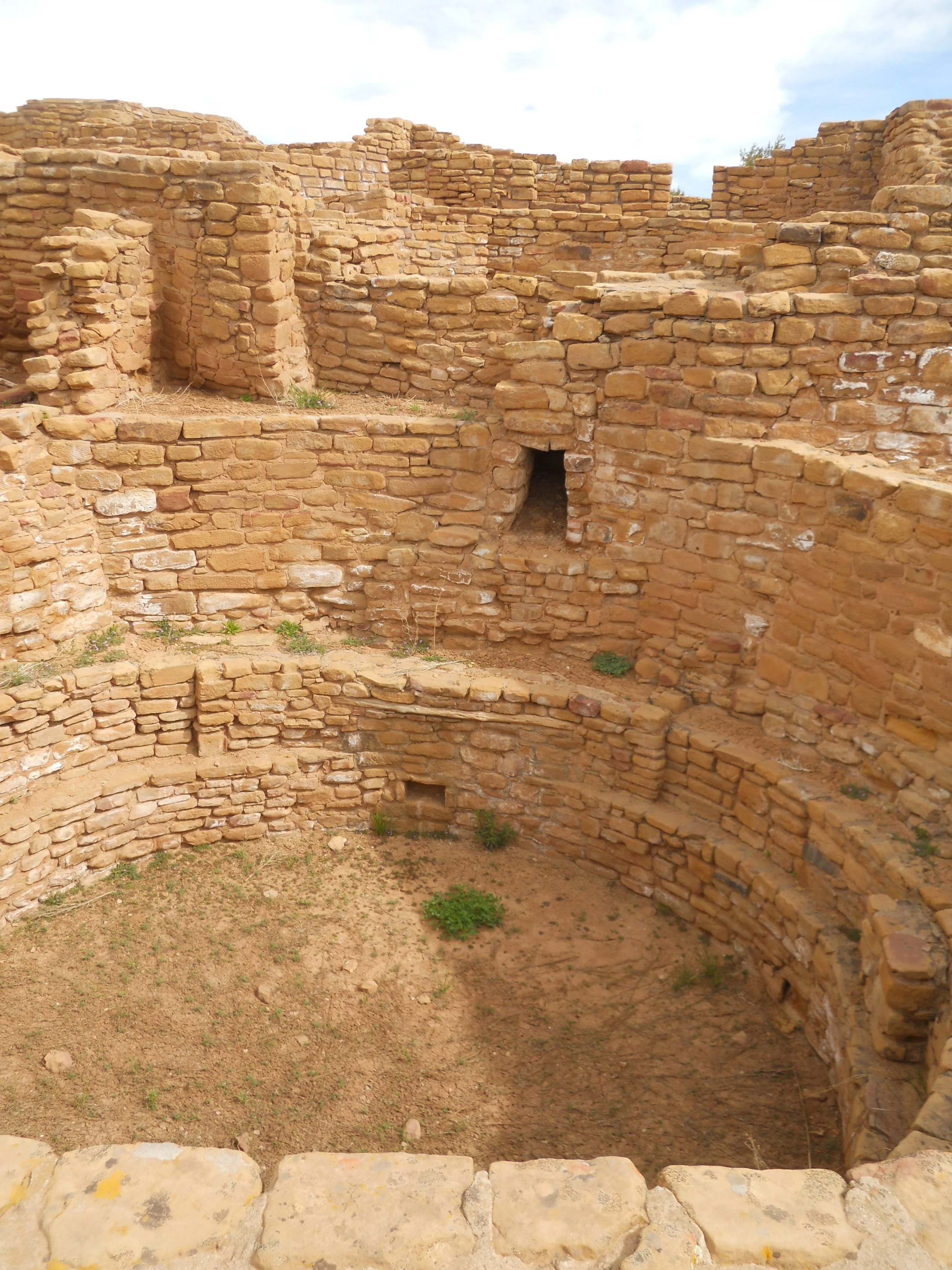
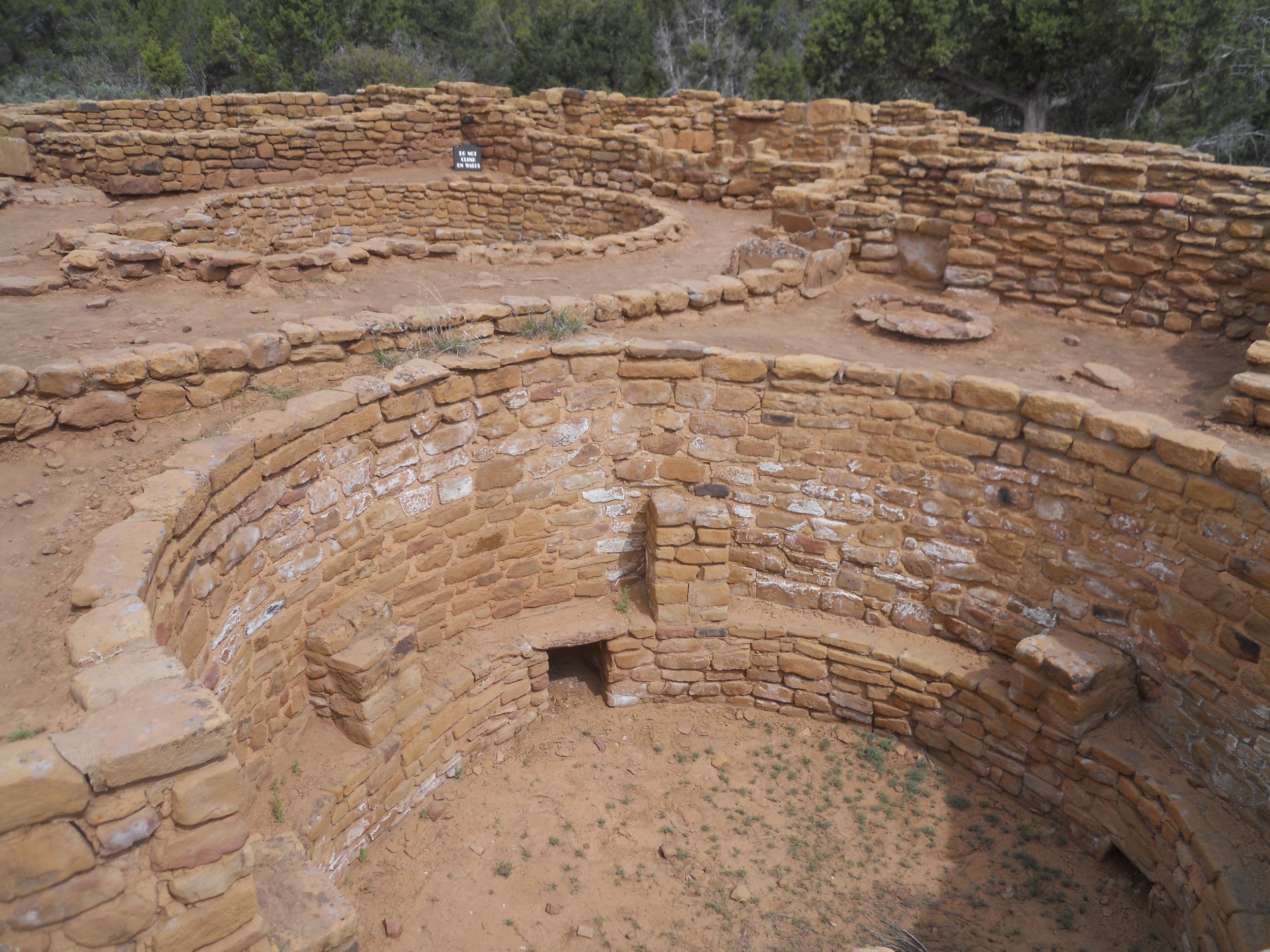
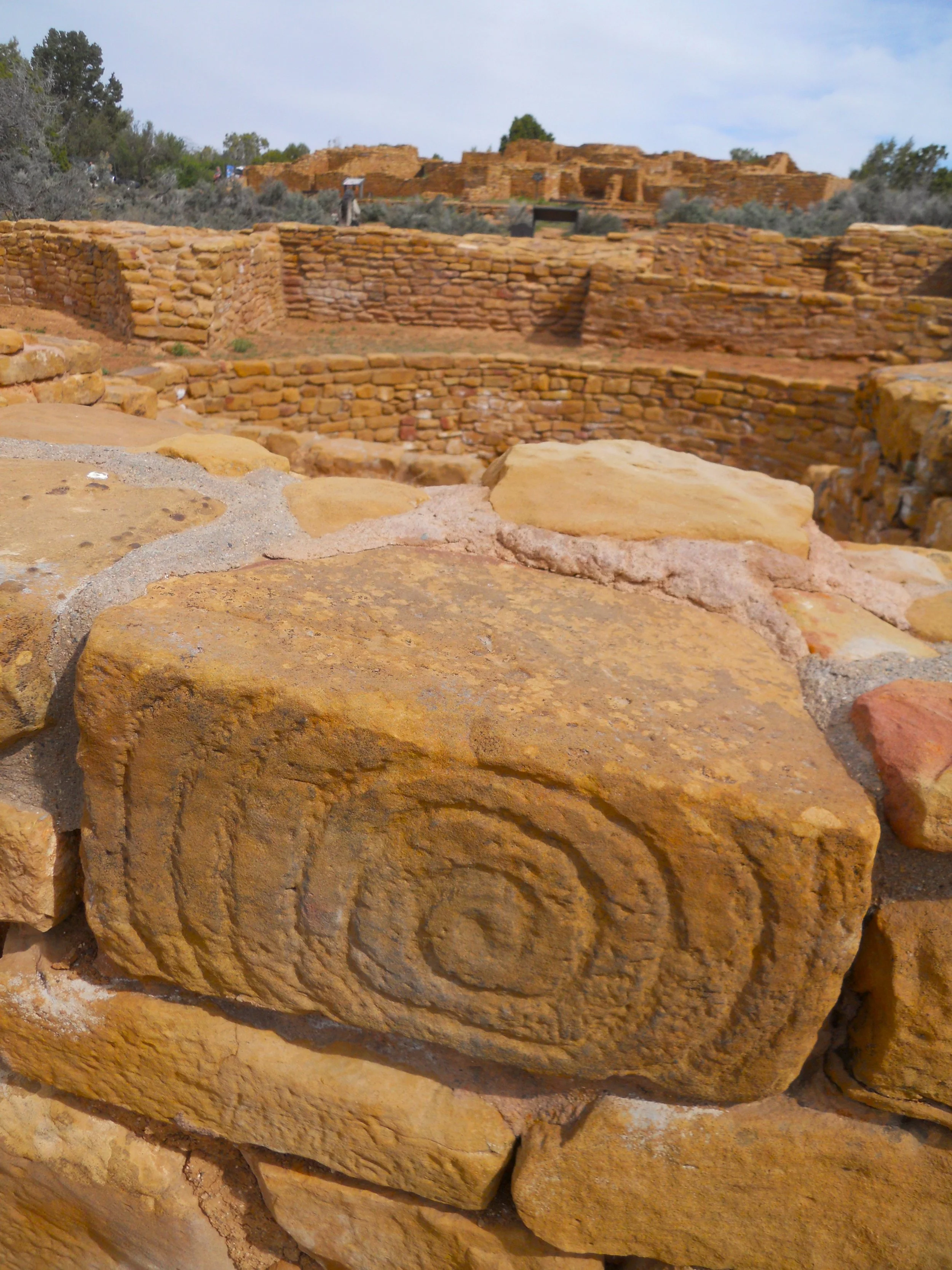
The next park for the day has many more of the structures that I saw at Far View. Aztec Ruins NMon is about 45 miles SE from Mesa Verde, as the crow flies. Its construction also dates back to the 8th century. The main feature in this park is the large, roofed Great Kiva. It is rare to find a kiva which was covered. Religious services and tribal gatherings were held inside. A trail leads through the complex, allowing a visitor to feel what it was like to walk around the community. Doorways were very low… I did some squatting to get through.
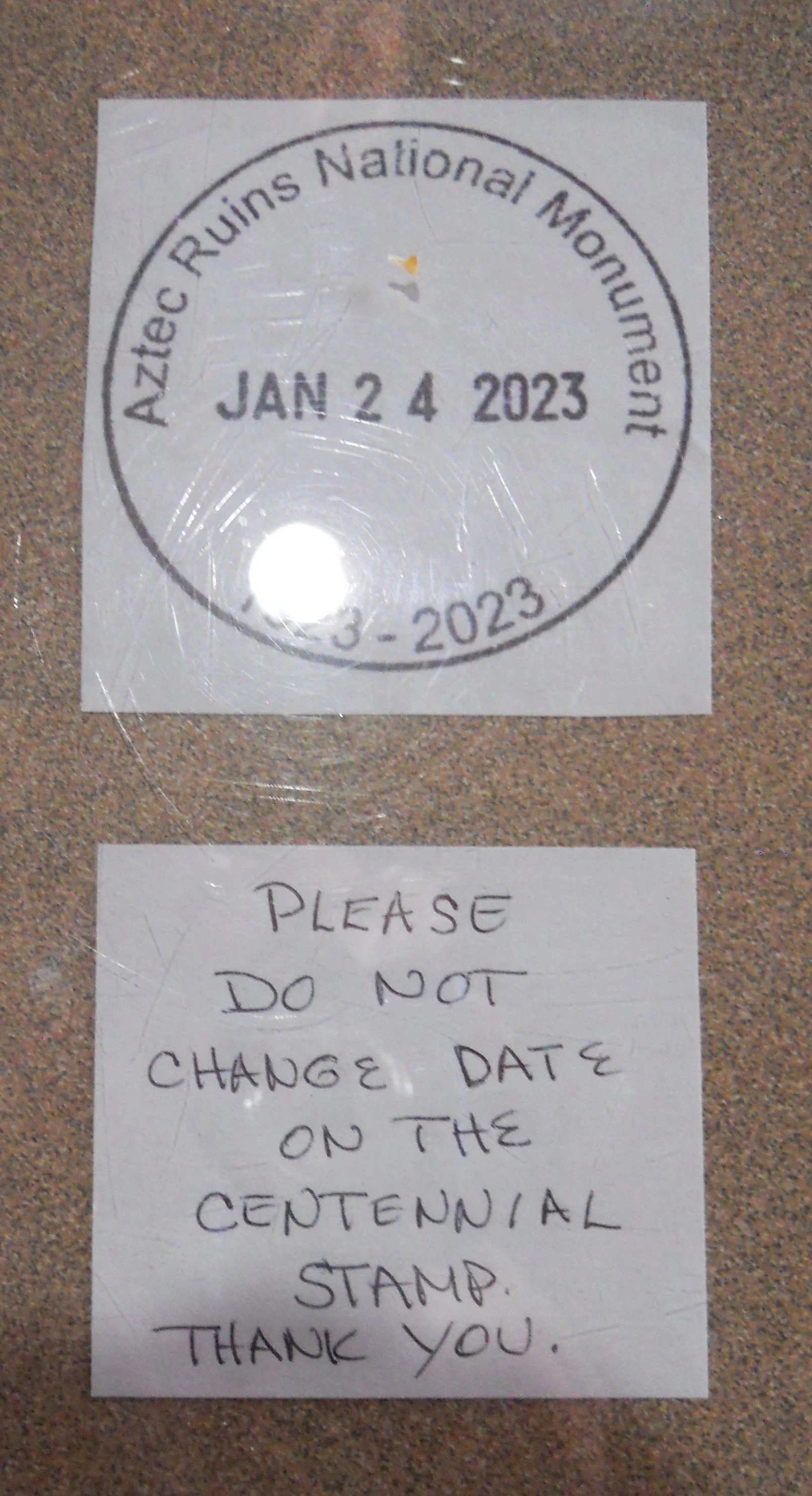
I want to mention a humorous situation in the VC, or maybe that depends on your viewpoint. This is Aztec’s 100th anniversary, having been established on January 24, 1923. A Centennial Stamp was created for the Passport Books. The problem is the stamp was made from the current general design, allowing folks to change the date. Visitors have been changing the date to reflect their visits. But the intent is to have the stamp always show January 24, 2023. The staff had to move this special stamp to the ranger counter and wrap bands around the mechanism which allows for the date change, so folks cannot mess with it. An extra reminder is taped onto the counter. Since these changes, the occurrence rate has dropped significantly.


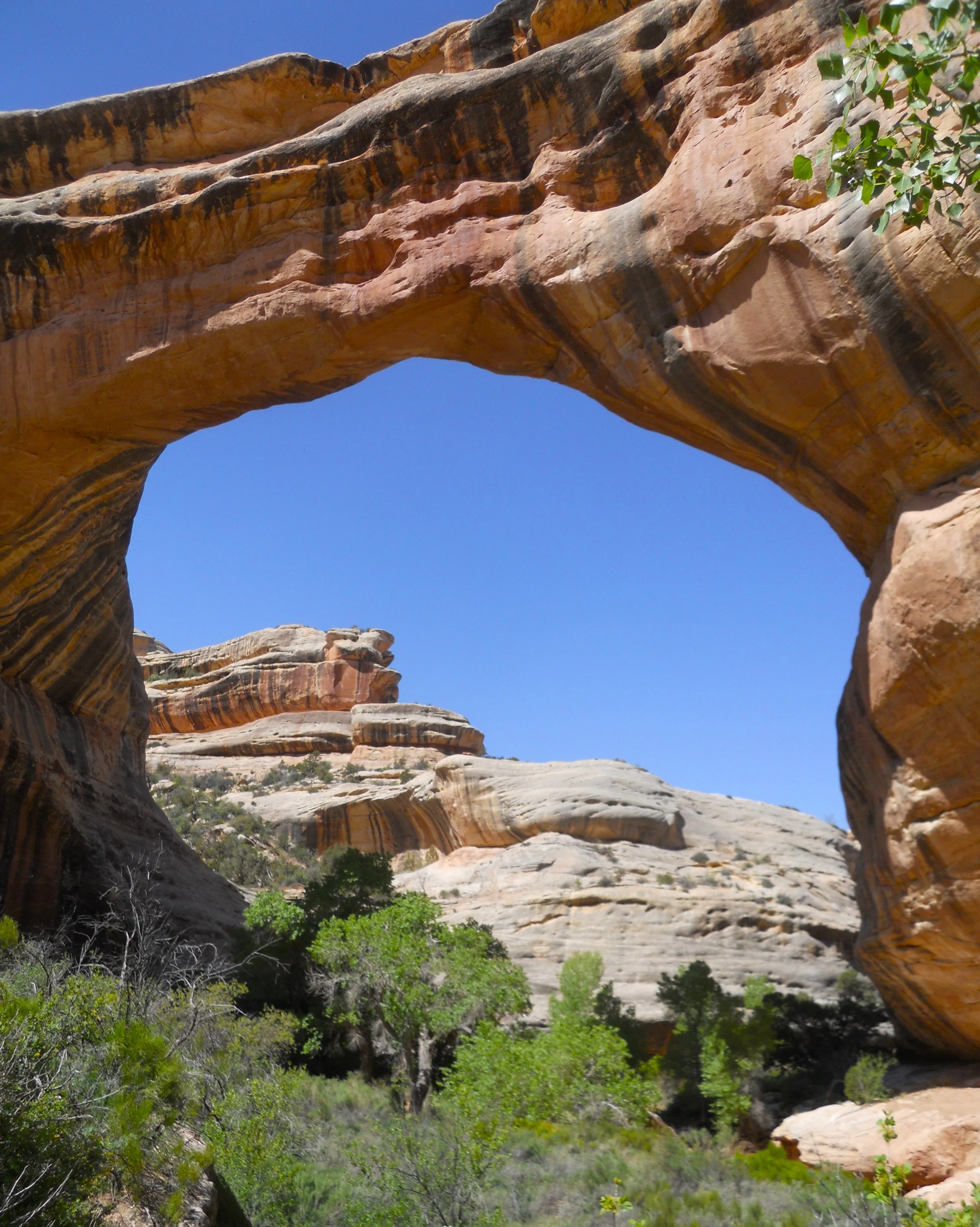
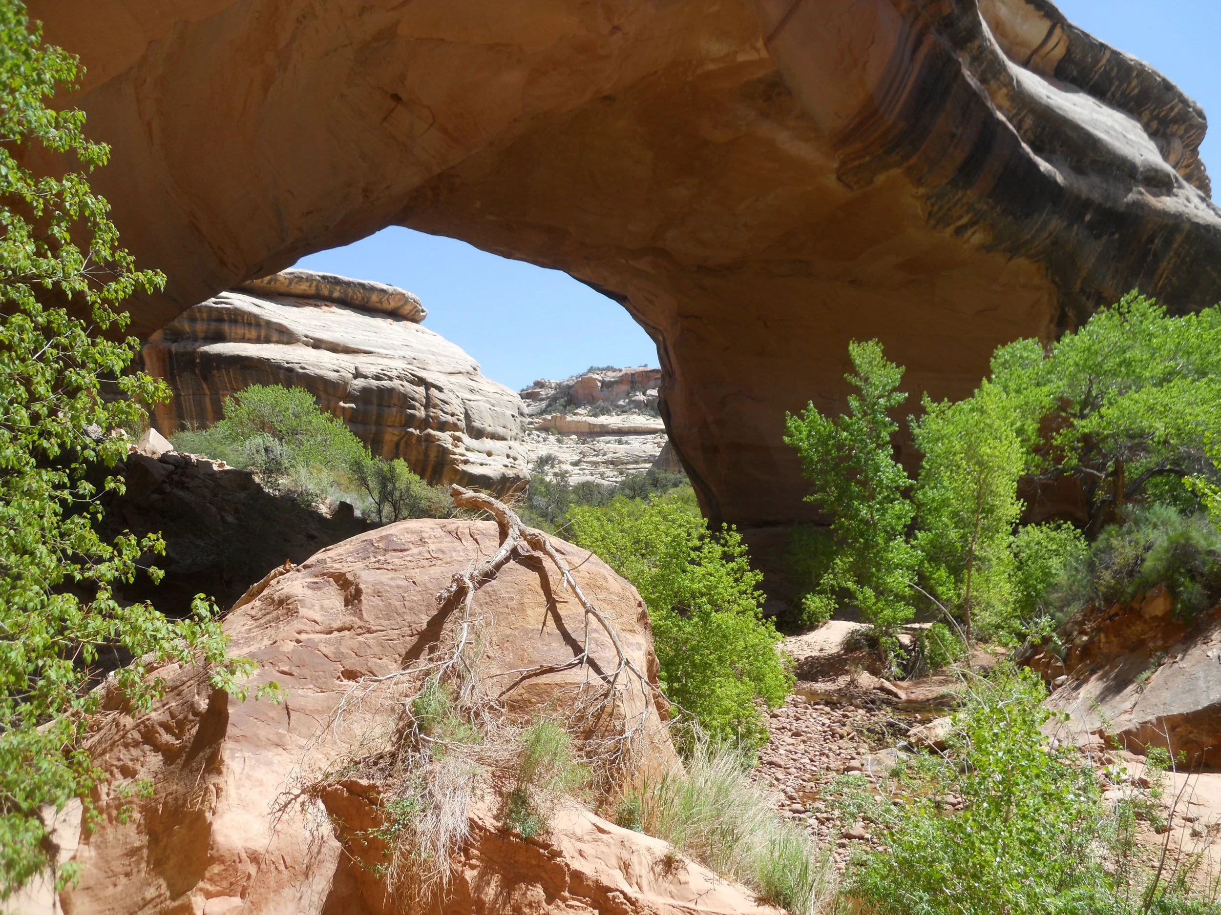
DAY 8 (May 9) - Natural Bridges NMon has three stars, each bridge having its own unique flair. Sipapu Bridge is a 1.2-mile RT hike, with 500’ of elevation. But what a thrill. Four different ladder sections, a few railings, two portions of wood steps, and plenty of rock steps. The White Canyon creek runs through the narrow valley, allowing for trees, grasses, and bushes to thrive along its path.
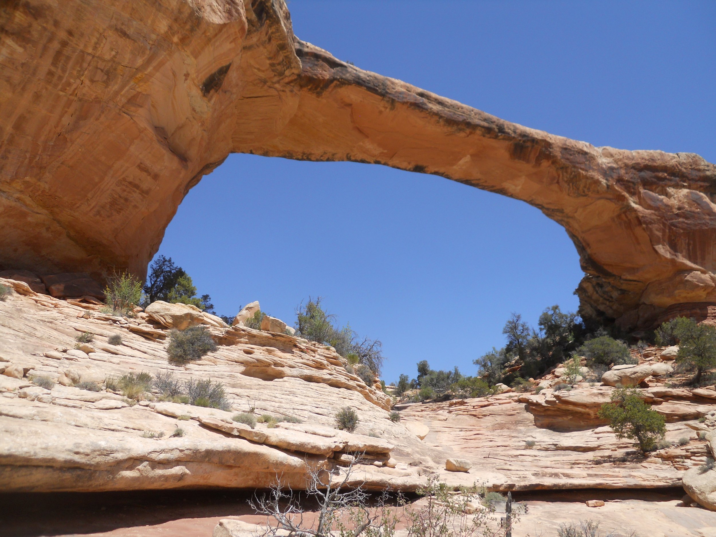
Katchina Bridge is a bit longer, but only 400’ elevation to get back to the 9-mile-long Bridge View Drive. Its girth is wider than Sipapu, but the opening is smaller.
Owachomo Bridge is the thinnest arch of the trio, but the widest opening. One only needs to hike 0.2 miles to reach the shade under its rock structure.
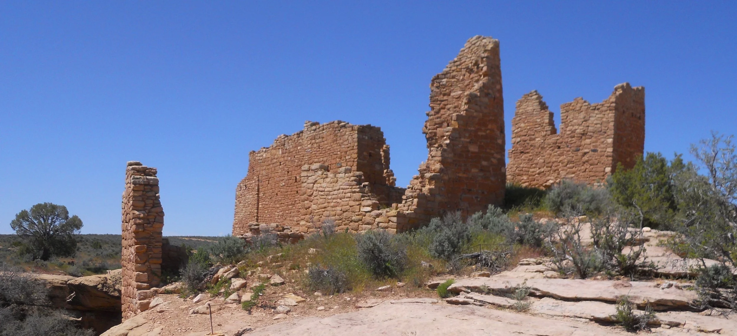
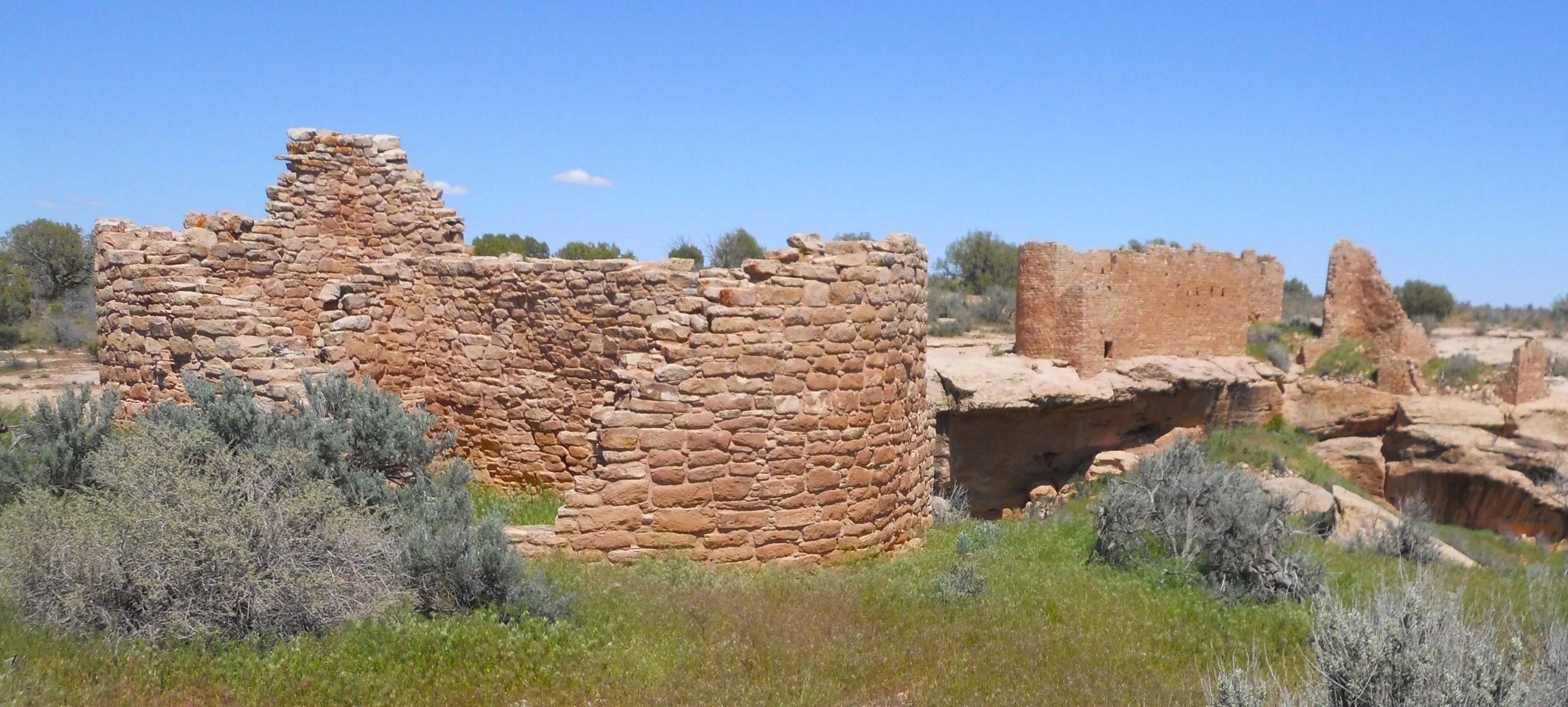
1.25 hrs later, going on county backroads, I came to Hovenweep NMon, a park which is comprised of six subunits. The primary tourist stop, though, is the Square Tower Group, probably because the other sites require 4WD and high-clearance to reach. The park’s VC is at this subunit. A 2-mile roundtrip hike on the canyon rim (includes dropping down into the canyon, then back up) takes one to most of the ruins at this site, including Hovenweep Castle. On the other side of the canyon, you can view Hovenweep House (Hovenweep Castle in the background).
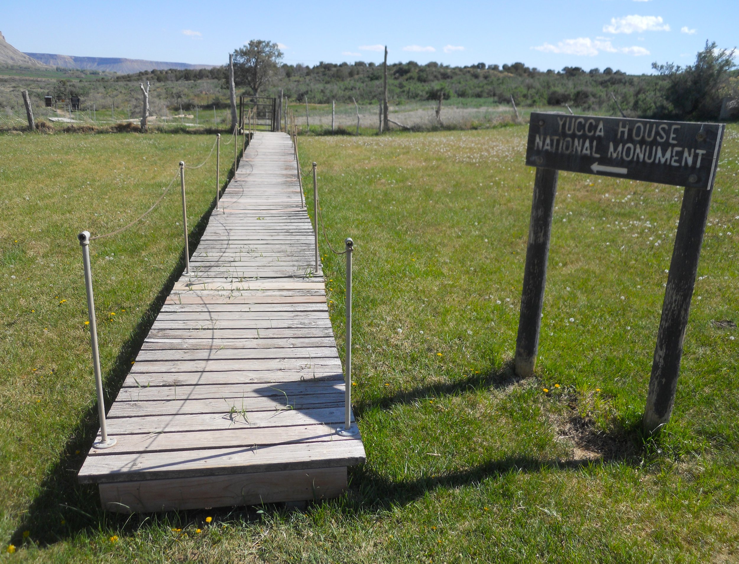
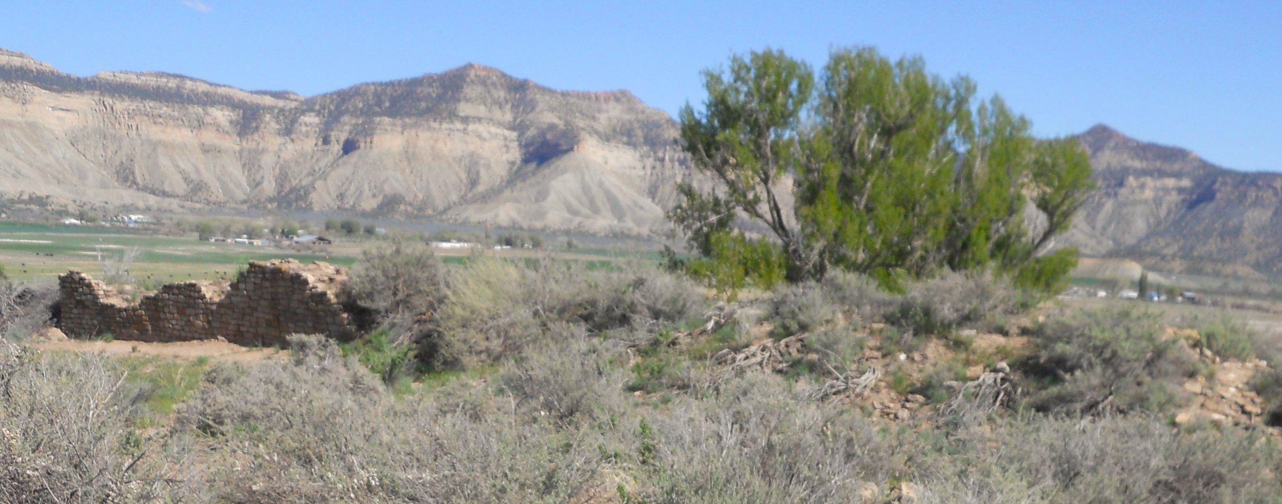
The last stop of the day was Yucca House NMon. This is one of the more questionable in the Park Service (will explain more in the blog). One has to walk across a raised boardwalk, so the landowner’s grass is not damaged, go through two gates, then stop to look at basically nothing but land. Only one wall of stone is visible. Everything else is buried.
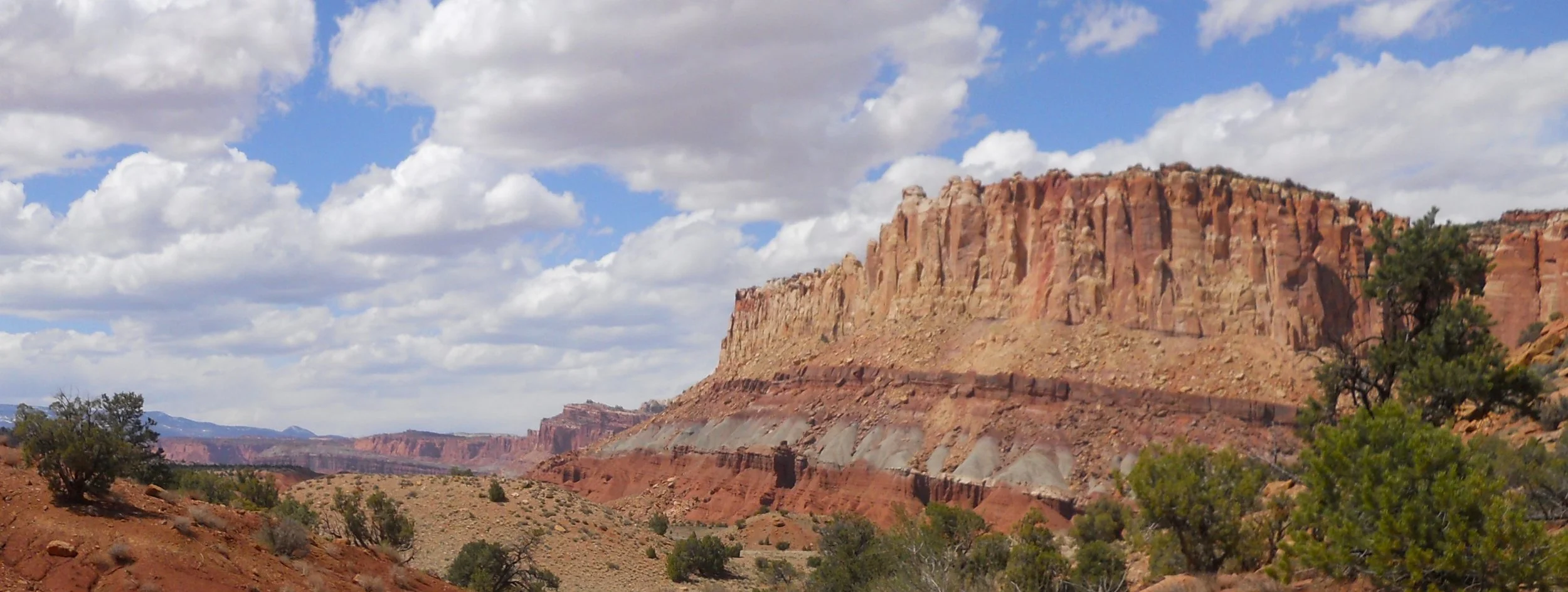
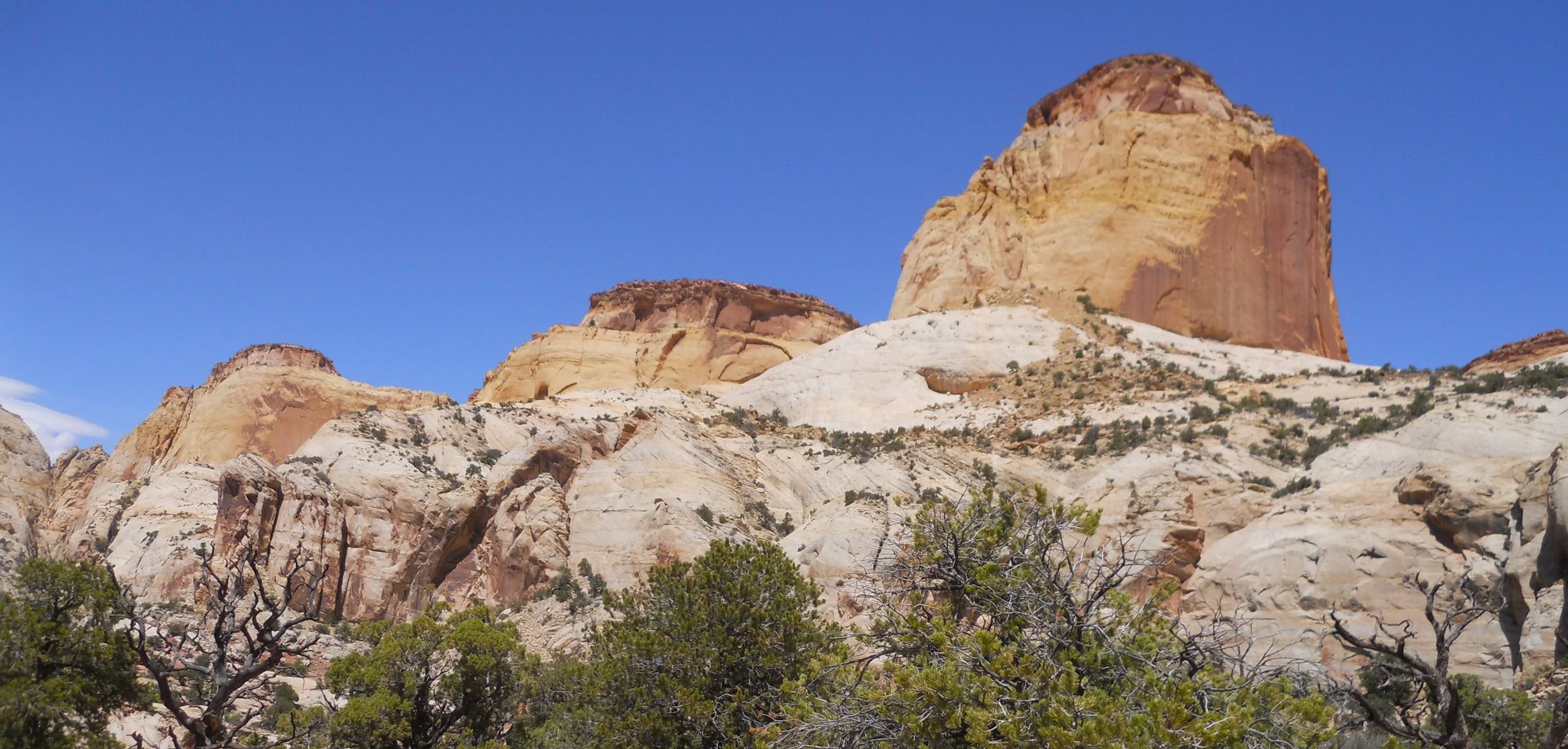
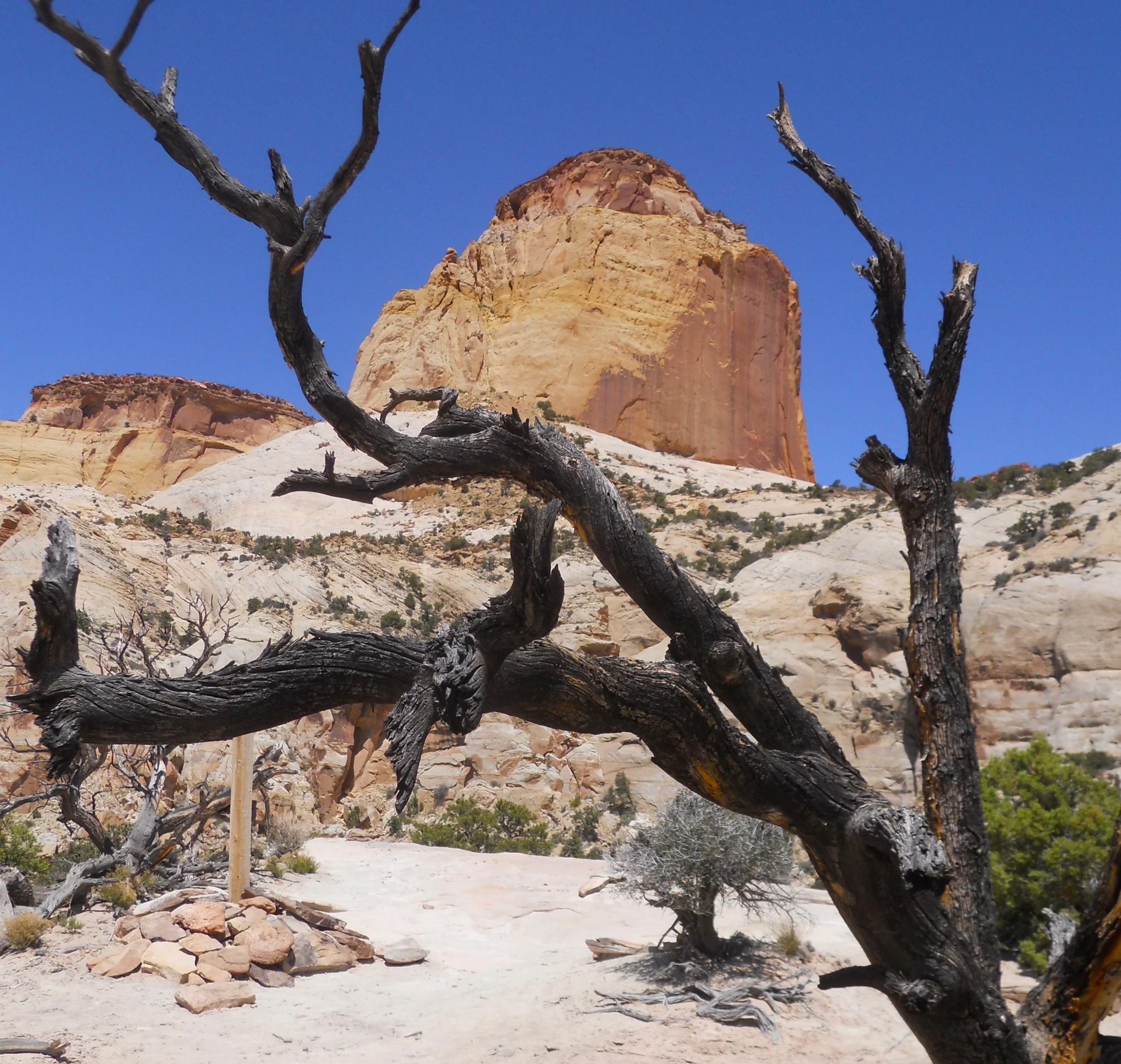
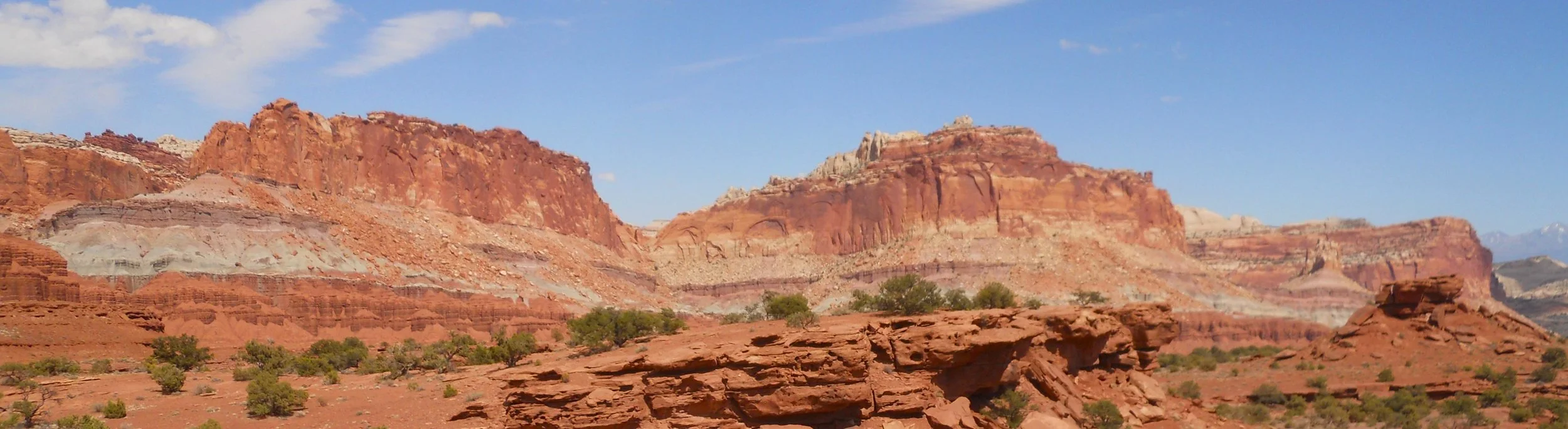
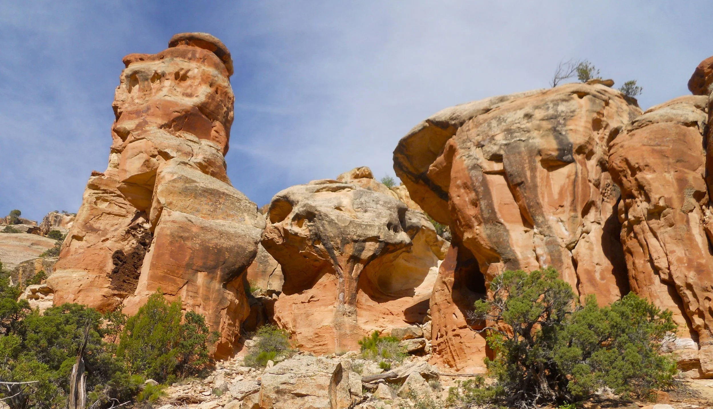
DAY 7 (May 8) - If Arches and Canyonlands are missing any red color, it can be found in Capitol Reef NP. The Waterpocket Fold is THE reason for this park. This is a geologic landform where one side of the and drops lower than the other, forming a “fold”. This feature runs for 100 miles in central Utah. It began to form 75 million years ago, during the Laramide orogeny period. The park’s boundaries do not extend that far. A paved scenic road goes for 8 miles from Utah 24, parallel to the fold, with plenty of hiking and photography opportunities. At the end of the pavement, a 1+ mile slickrock/gravel/sand road takes visitors to the Capitol Gorge area. The Golden Throne trail is designated as “Strenuous”, at 4-miles roundtrip and 730’ elevation change. The two numbers alone do not provide sufficient justice. This was a serious trail, with slickrock sandstone, boulders, rock steps, etc. The trail end provides a spectacular view of the Golden Throne, one of the park’s iconic features.
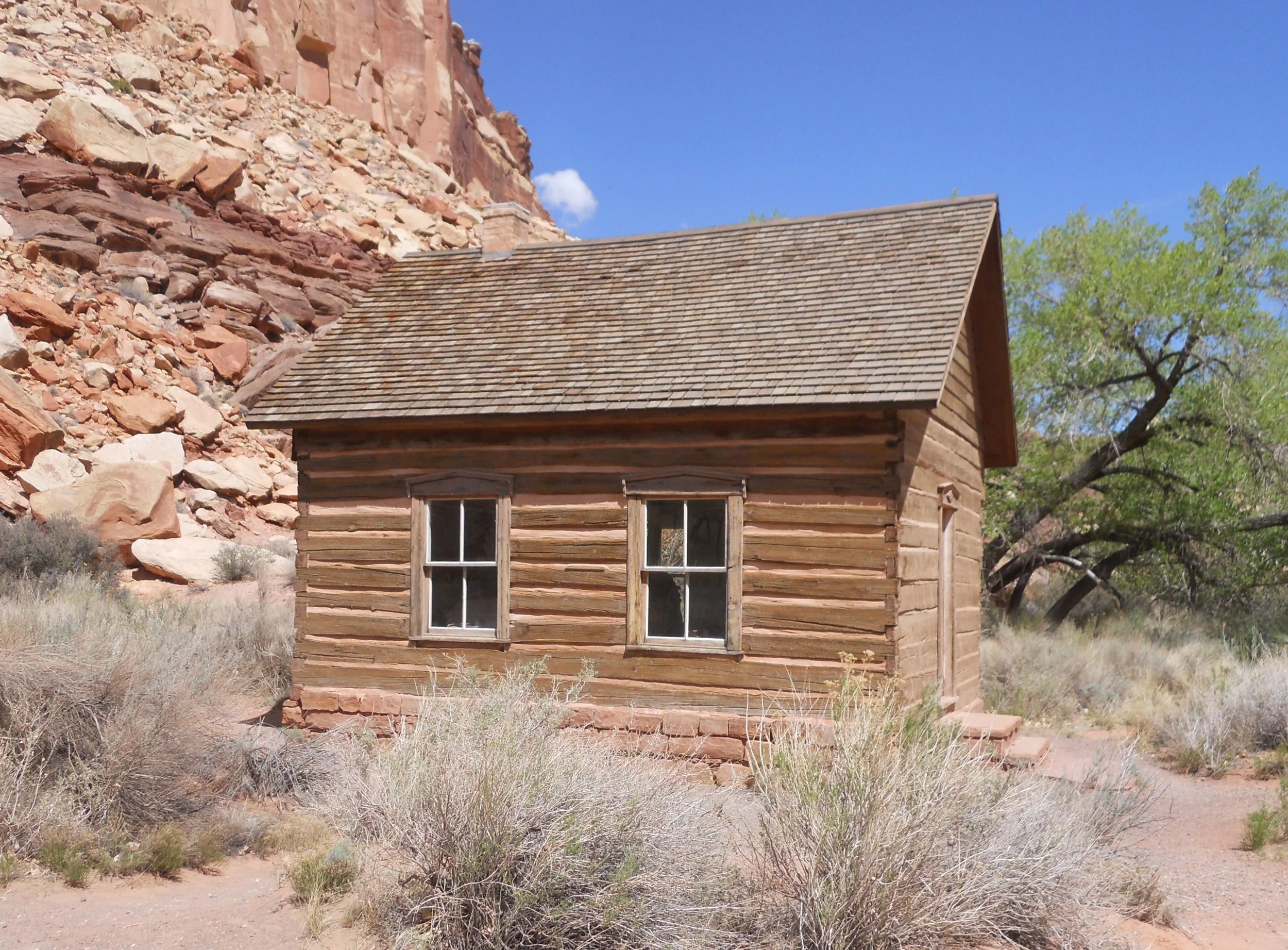
Back near the VC, I stopped at the historic Fruita schoolhouse. It was the only public structure in Fruita, which began to thrive in this valley near the turn of the 20th century. Fruit farming was so popular (due to the Freemont River and Sulpher Creek running through the valley) the area became known as The Eden of Wayne County.
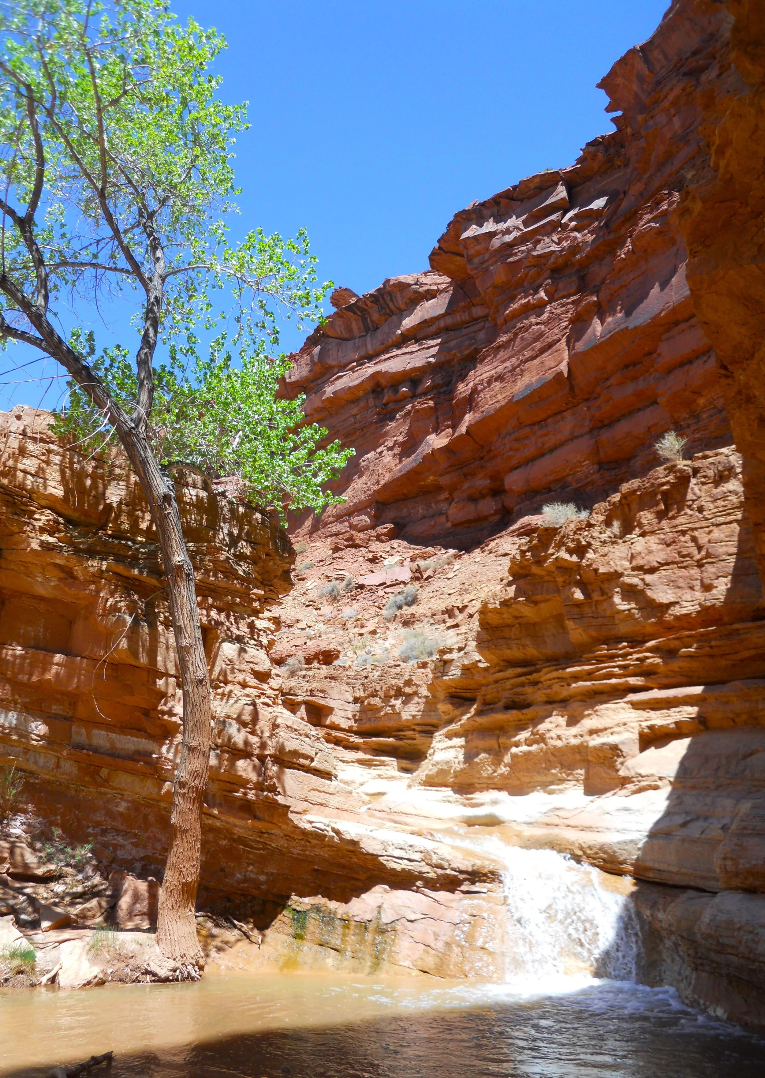
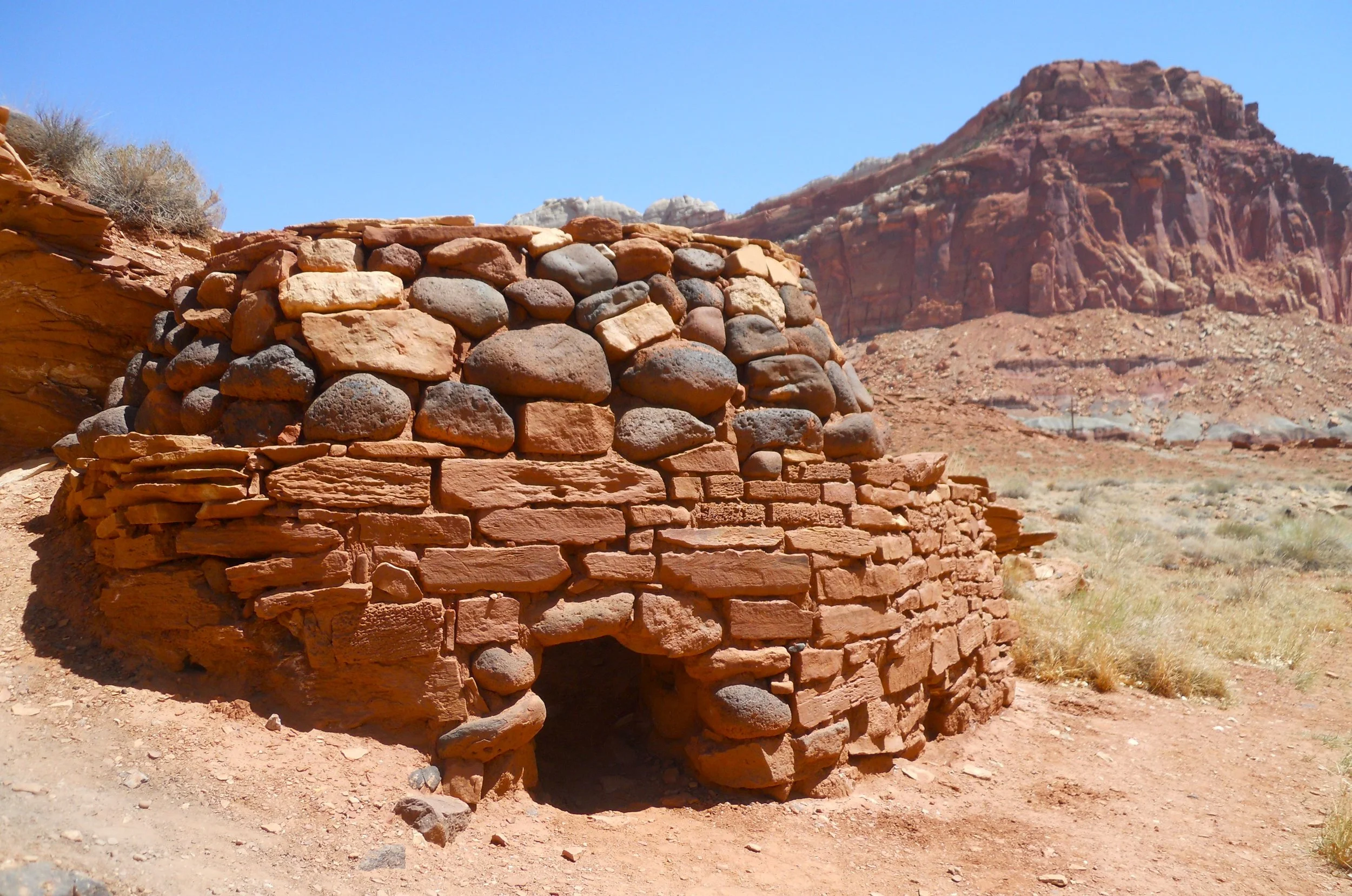
The Sulphur Creek trail starts behind the VC and works upstream for 0.7 miles before ending at a waterfall. A month ago I would have had to walk in the water to reach the falls. Today I just had to tip-toe on rocks and boulders to get from one bank to the other, crossing six times. This path was also home to lime kilns. Limestone would be heated to 1,400 degrees F for two to three days, then allowed to cool, producing lime. The remaining kiln in this area was built around 1900.
The last image is from Panorama Point, on the west side of the park, looking east. Had to wait until the afternoon so the sun would be behind me.
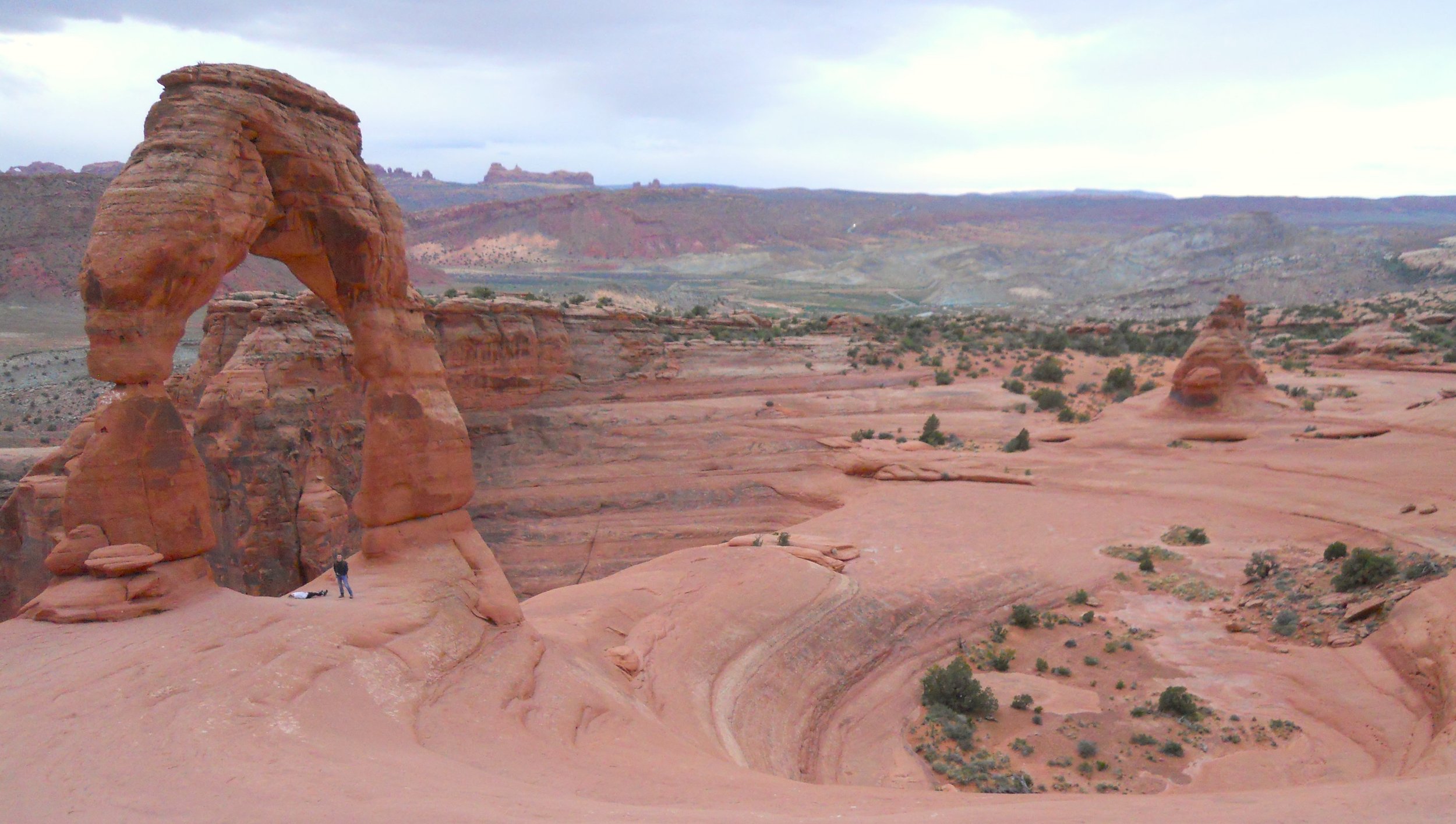
DAY 6 (May 7) - As expected, no line at the entrance booth for Arches NP at 4:30 AM. A couple cars were already at the Delicate Arch trailhead when I arrived. Great to see others able to awake at an early hour.
What you see in the photo has some blue sky color. But, see all the white clouds? The air was as thick as pea soup with respect to the billowy objects. Therefore, when the sun was supposed to peak over the horizon at 6:10 AM, none of us saw it. So, waited a half-hour to get some more light before taking photos.
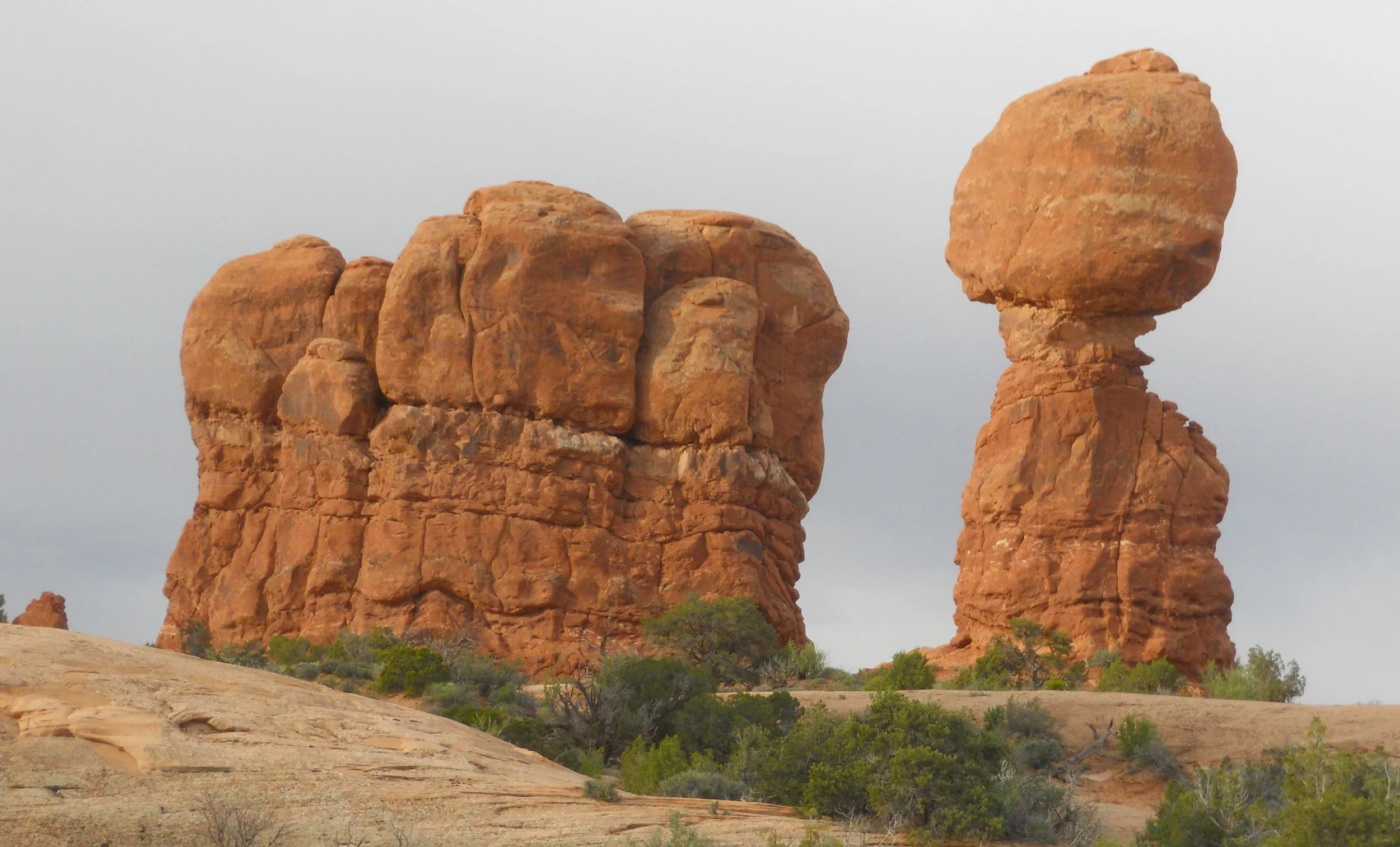
Sand Dune Arch requires a hike through deep sand to reach its location. Balanced Rock is one of the icons of the park.
Canyonlands NP is about 30 miles north of Arches, but not all in a straight line. From US 191 to the entrance kiosk is what seems to be longer than the 22 miles on Utah 313. First stop was Aztec Butte. This is a 2-mile roundtrip hike to a butte which lies out in the middle of flat landscape. On the top is a display of a stone structure, representing native peoples’ lodging. To get to the top, the last section is on slickrock, at what seemed to be a 45deg slope. Plenty of sideway moving to find the next best step to take upwards.
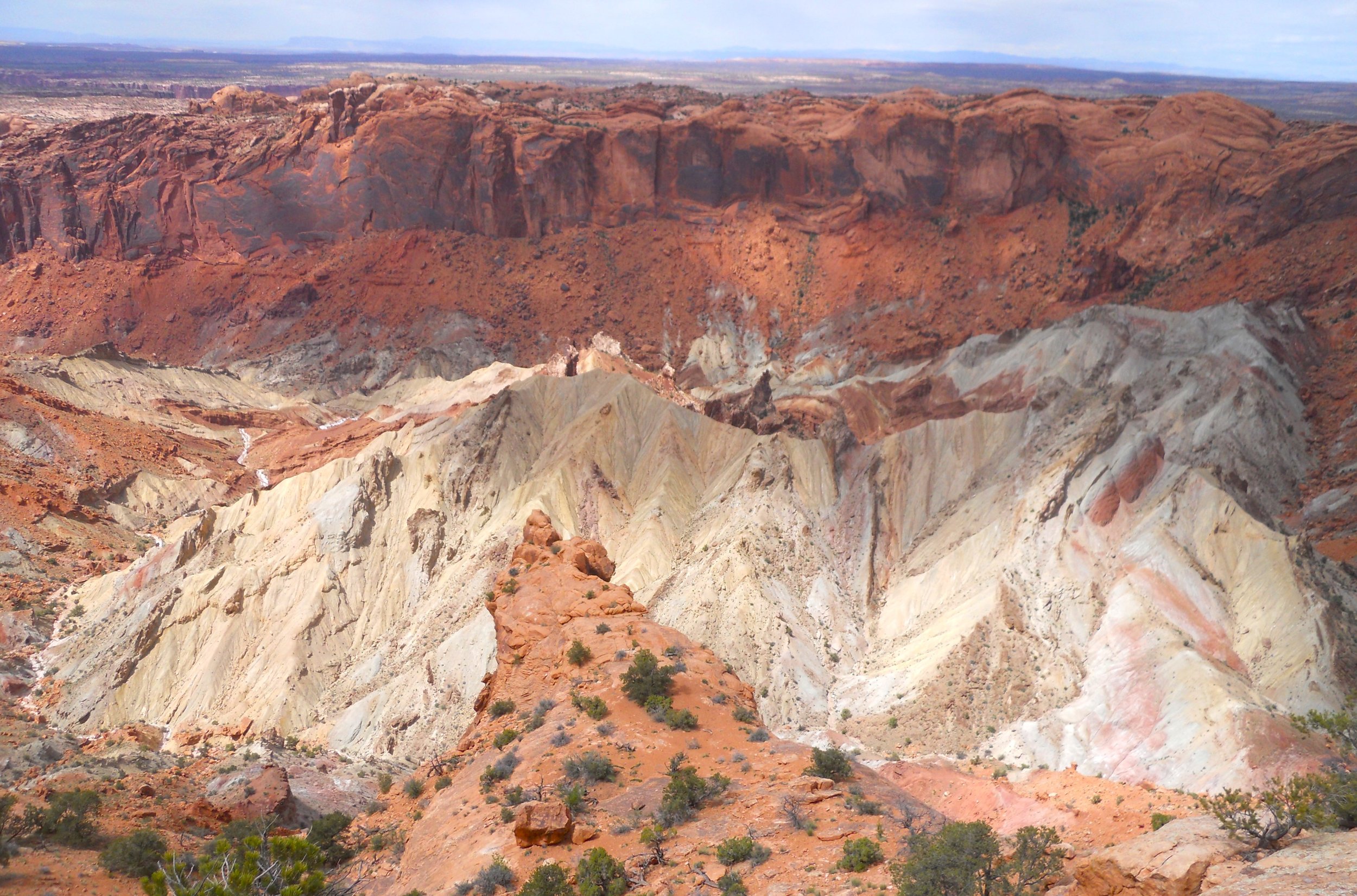
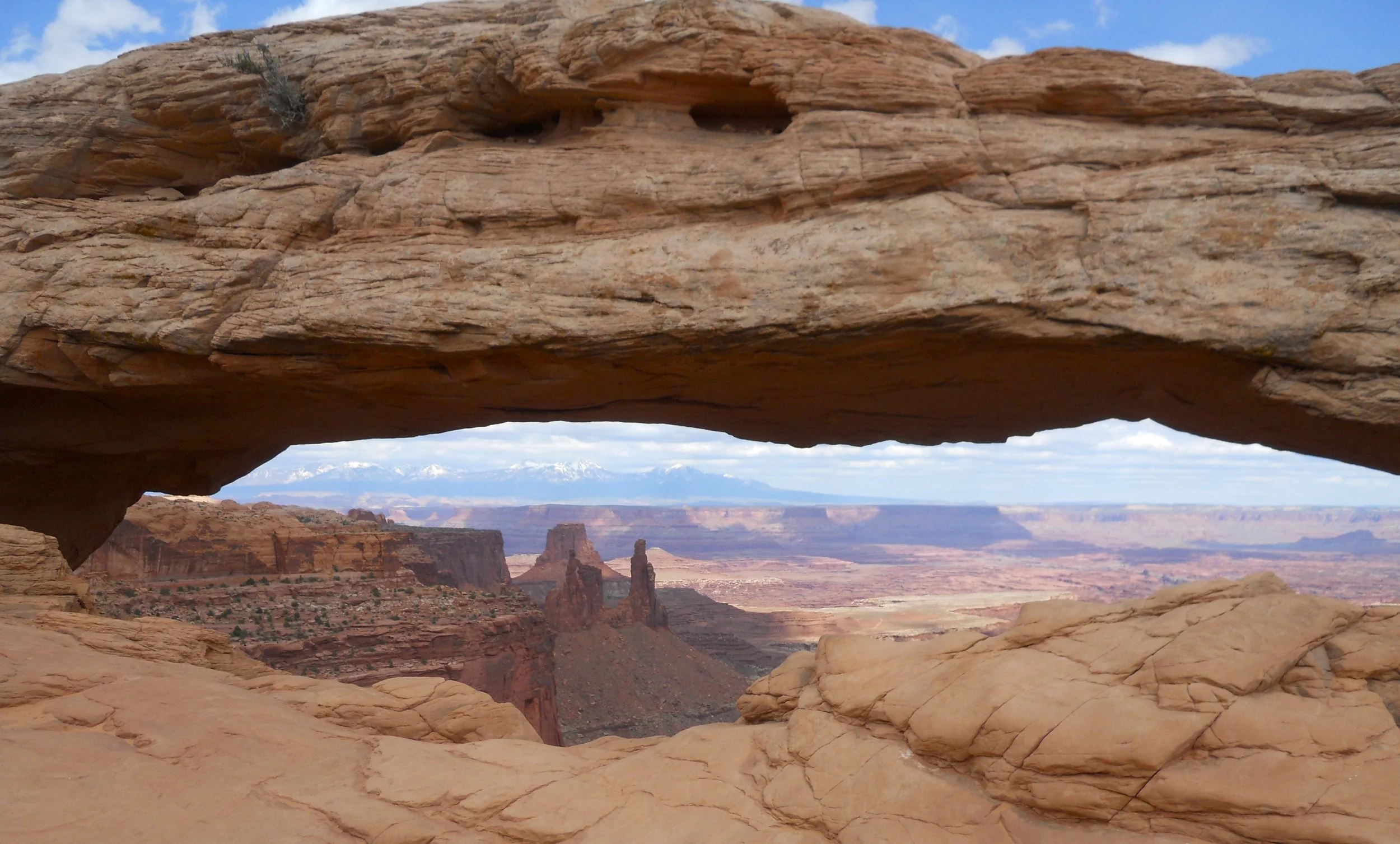
Then there was Upheaval Dome. The circular depression is 2-miles wide, and scientists do not know what created this formation. The current theory is from a meteor impact. Last stop was the iconic Mesa Arch. This geologic feature is seen around the world in various literature. Right now it is one of the screen savers Microsoft is rotating for me every few days. One can see the snow-capped La Sal Mountains, nearly 150 miles distant, through its opening.

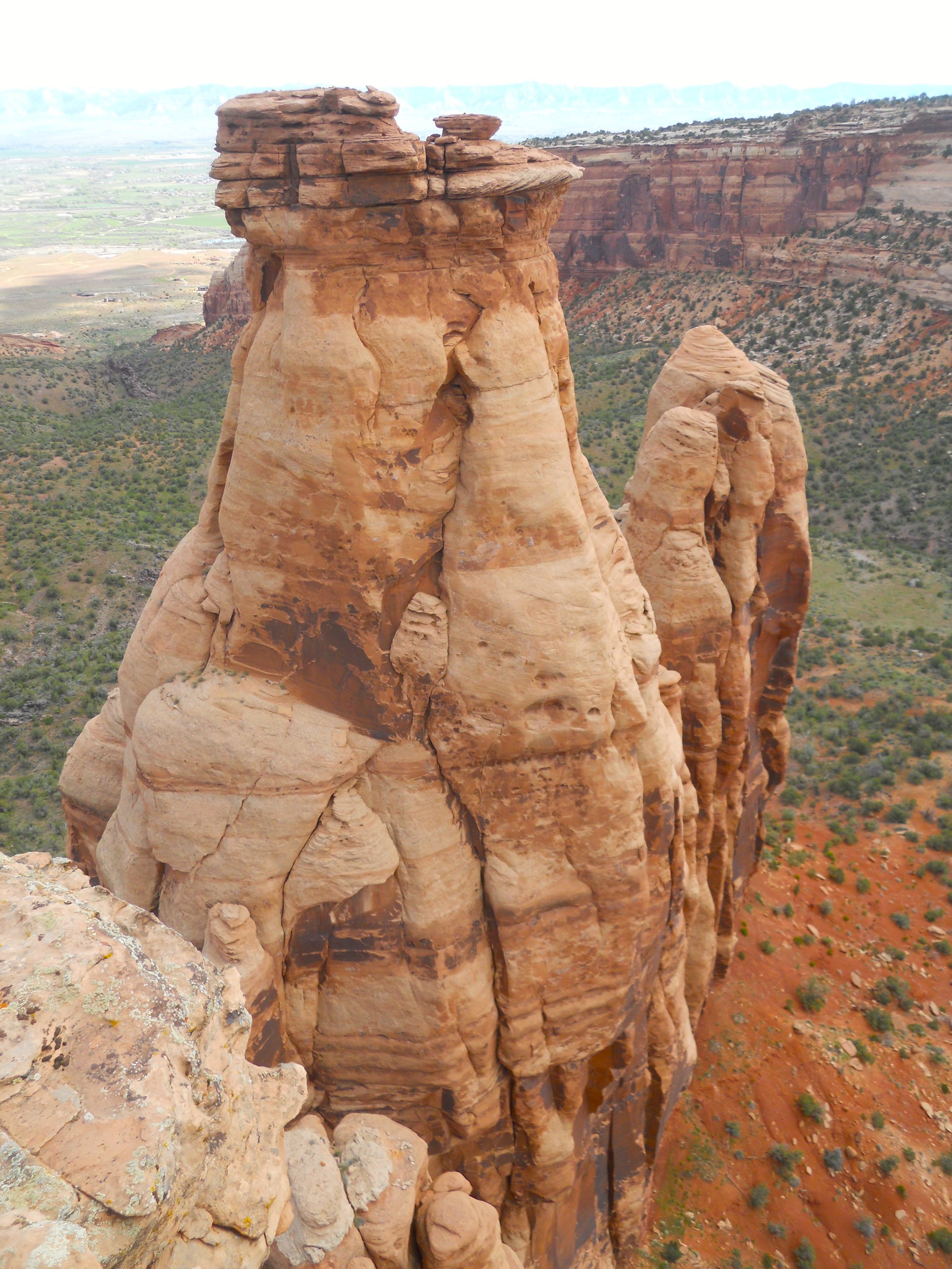
DAY 5 (May 6) - Today was Red Rock Day, at least for me. Colorado NMon and Arches NP are an endless sea of red colors. Do you remember how the rocks get the red color from an earlier Trip Report? That is right, different levels of ferrous oxides. The first hike in Colorado was to Devil’s Kitchen. Doesn’t the middle section look like some alien’s head, with large sunken eyes? The photo to its right is of the “Coke Oven”, looking like multiple ovens in one row. The last photo is of the formation seen by John Otto when he made his first ascent in this area. He was the primary champion for getting this park authorized. As with most of the trails in the park, the Otto Trail begins off Rim Rock Drive.
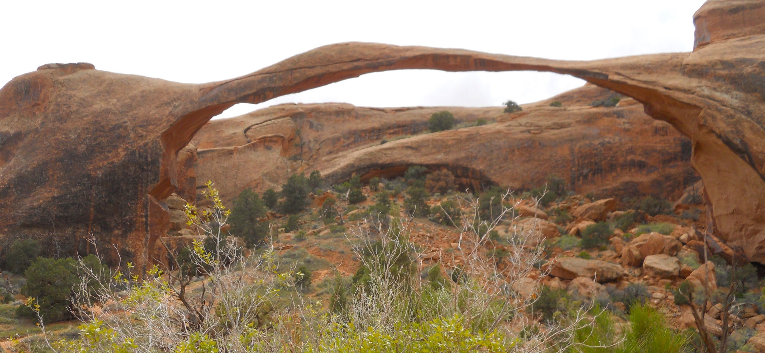
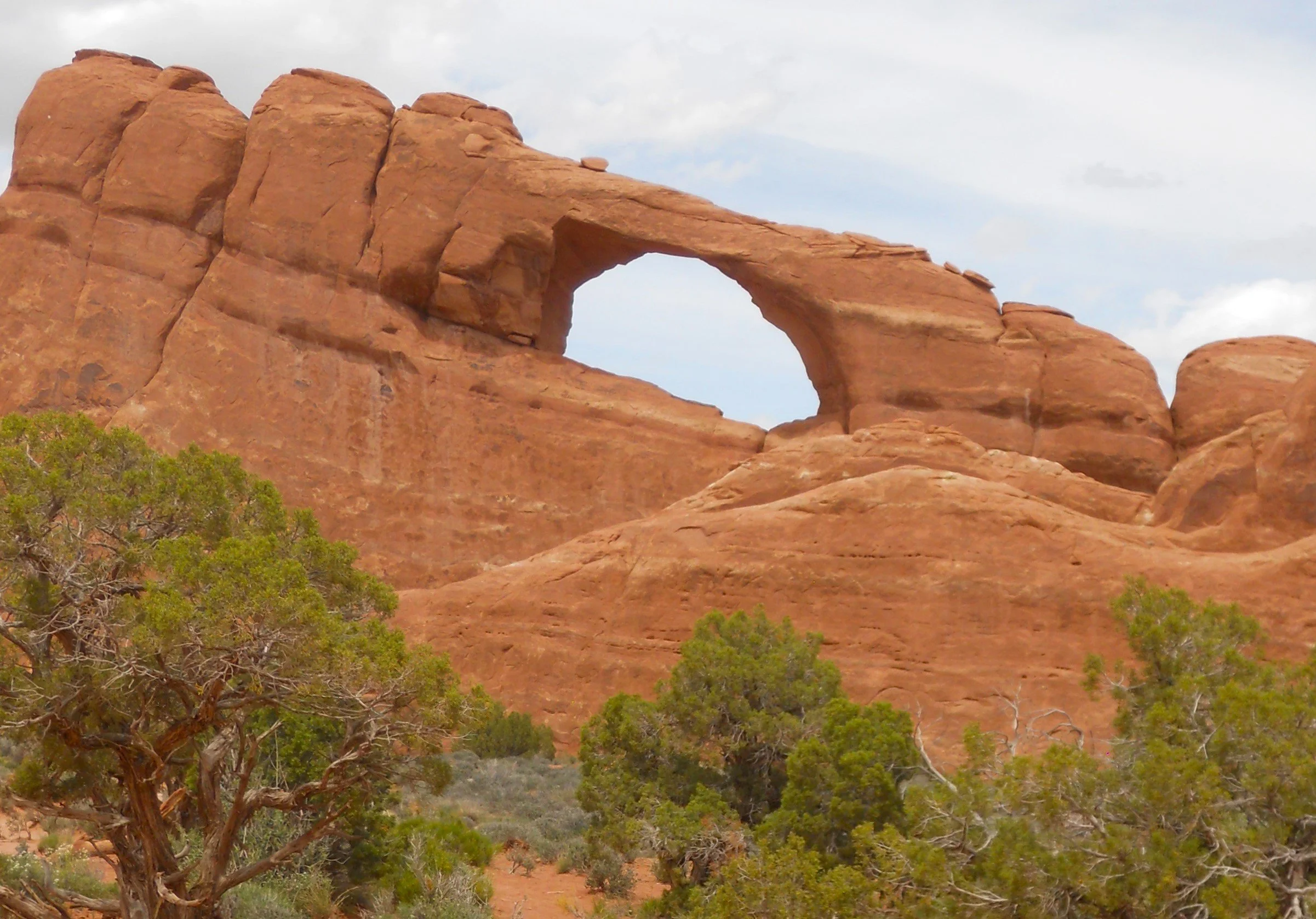
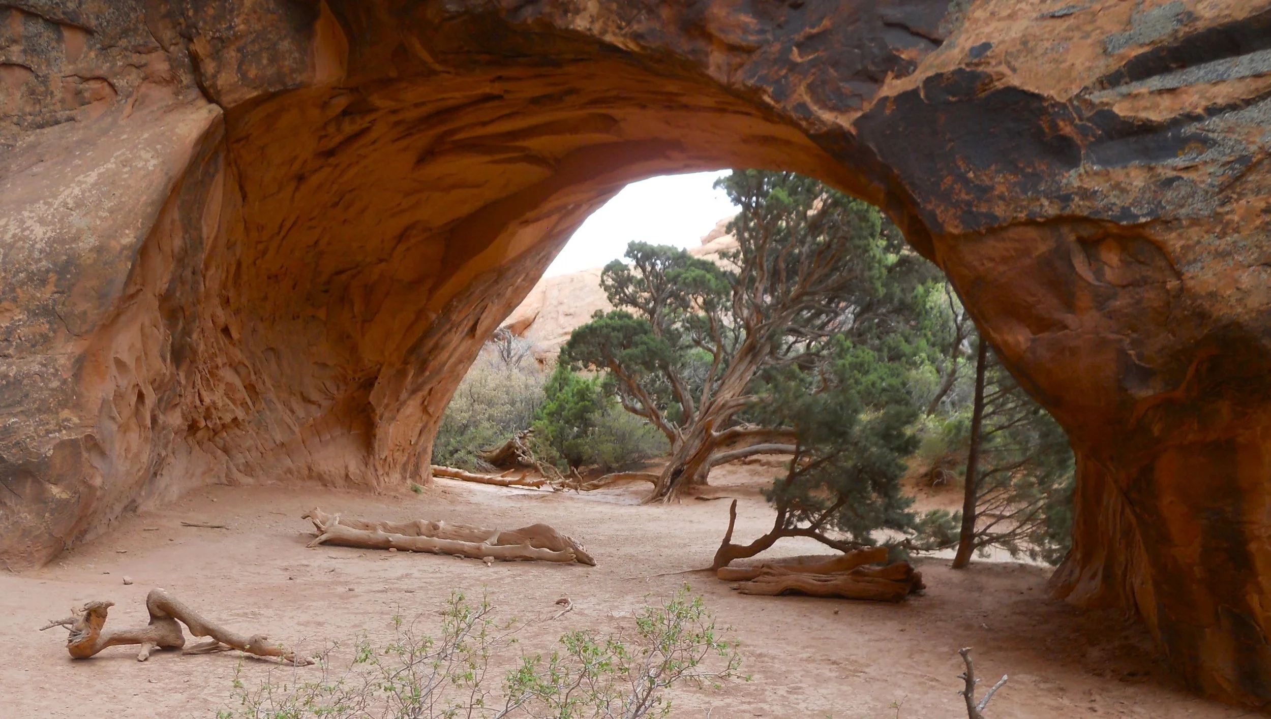
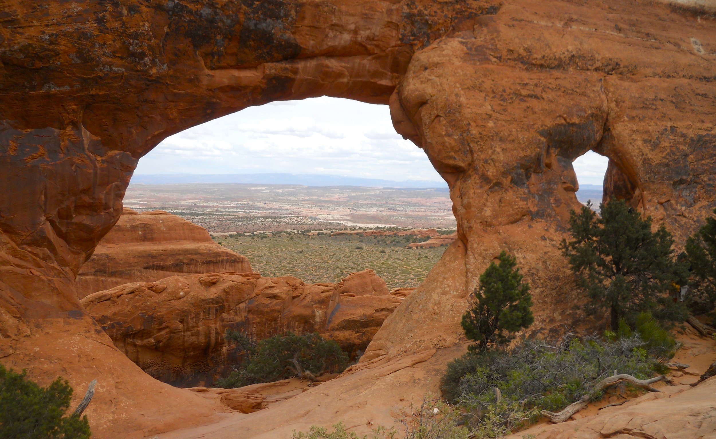
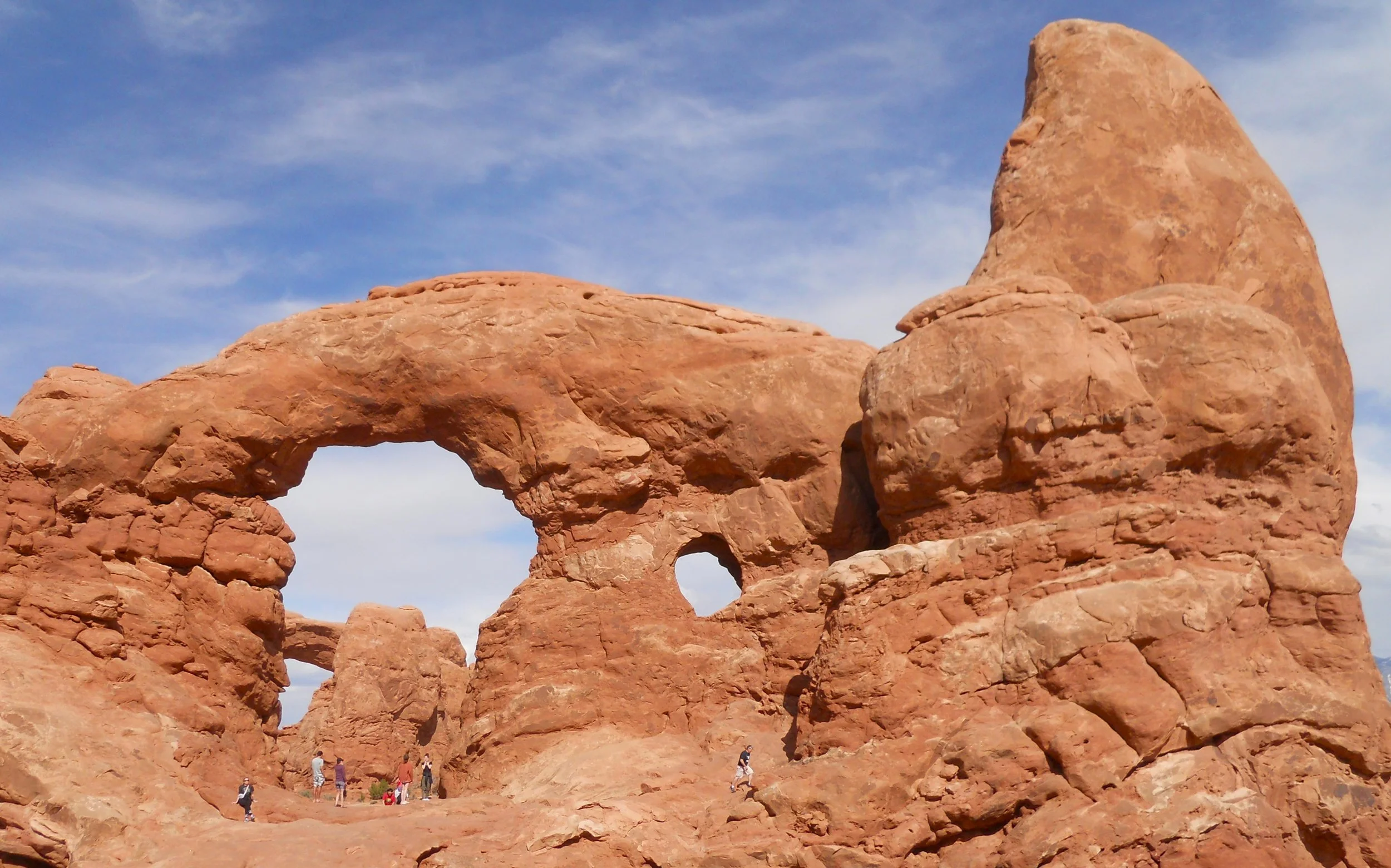
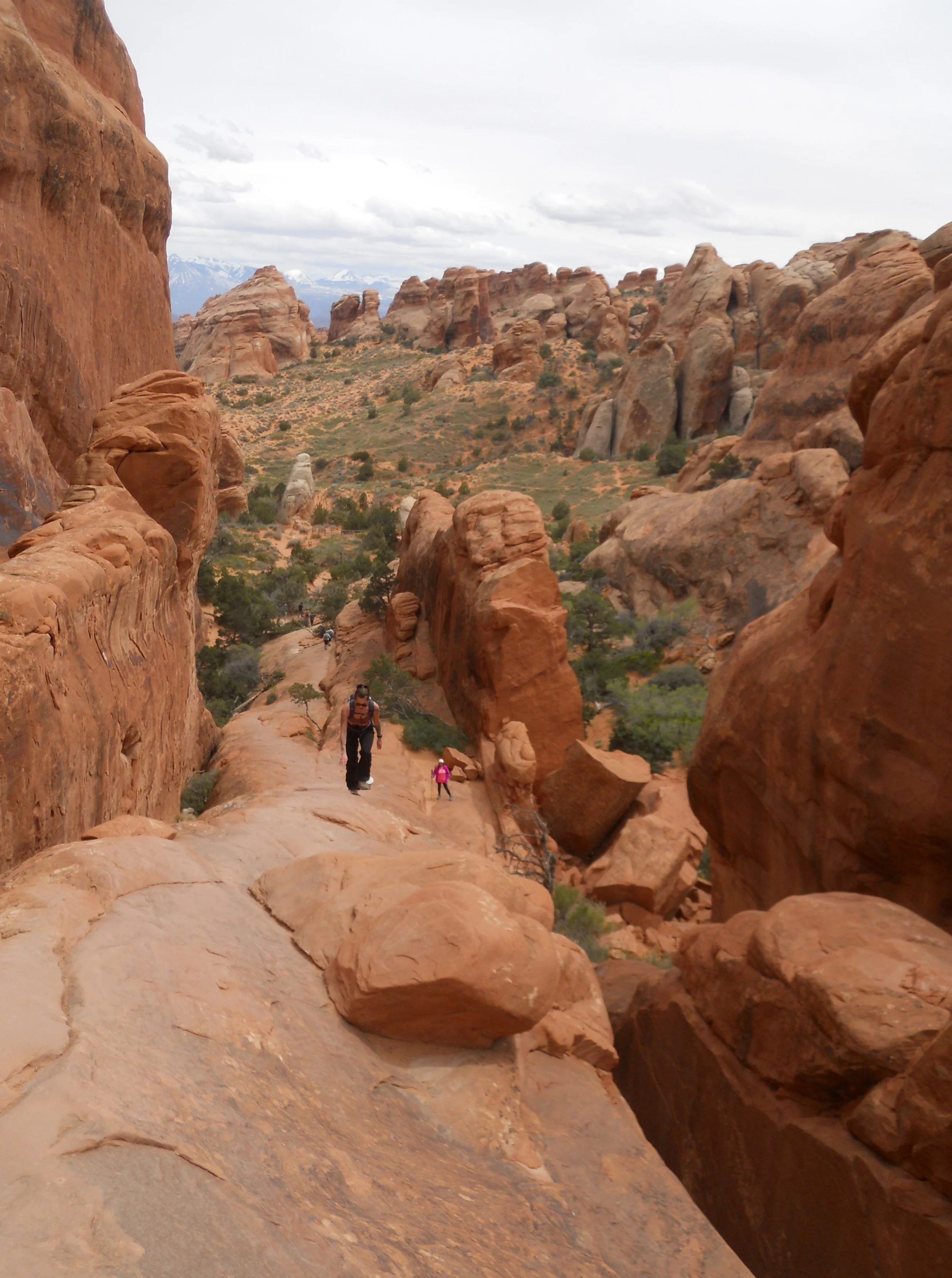
An hour and a half away was Arches NP, one of my favorite parks for hiking. Skyline Arch was first on the agenda. Then the famous Landscape Arch, along Devil’s Garden Trail, which in 1991 lost a sizeable chunk of its formation. I remember walking under the arch in 1987, but that portion of the trail has been closed since 1991. The Wall Arch, which was also along the Devil’s Garden Trail, collapsed in 2008. The trail does require some composure and climbing ability. One steep section is just sandstone (photo to the far right). But the reward is the Navajo Arch and the Partition Arch (two separated windows). A view of the Garden’s south section shows the ruggedness of the area. The last photo is of Tunnel Arch, which has to windows, but one can also see the South Window in the background (lower left of the big window).


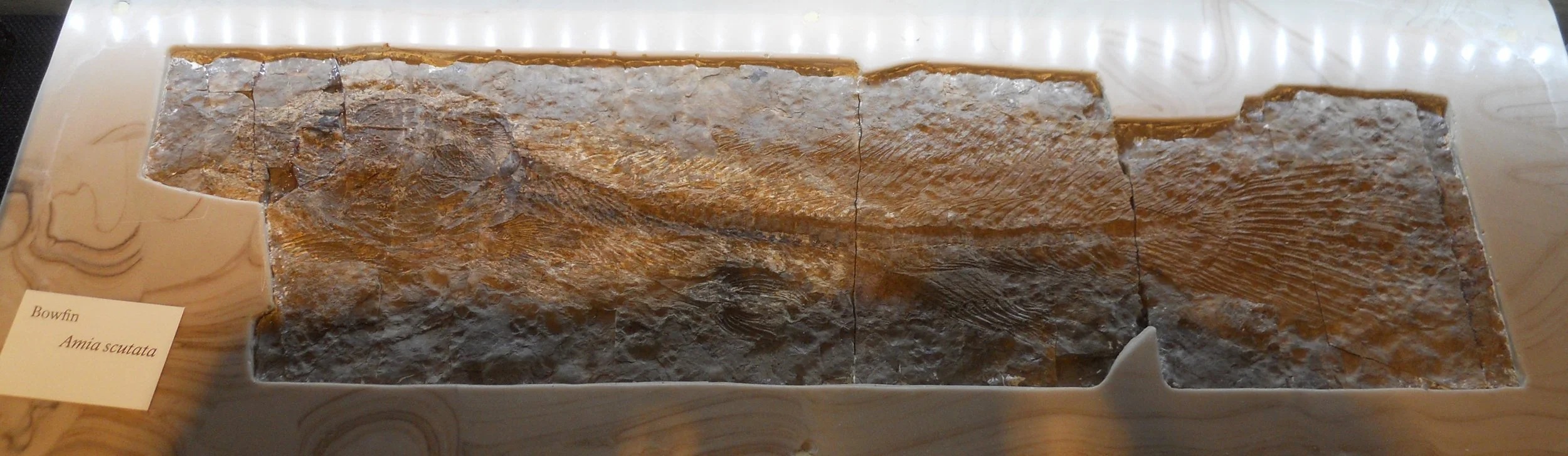
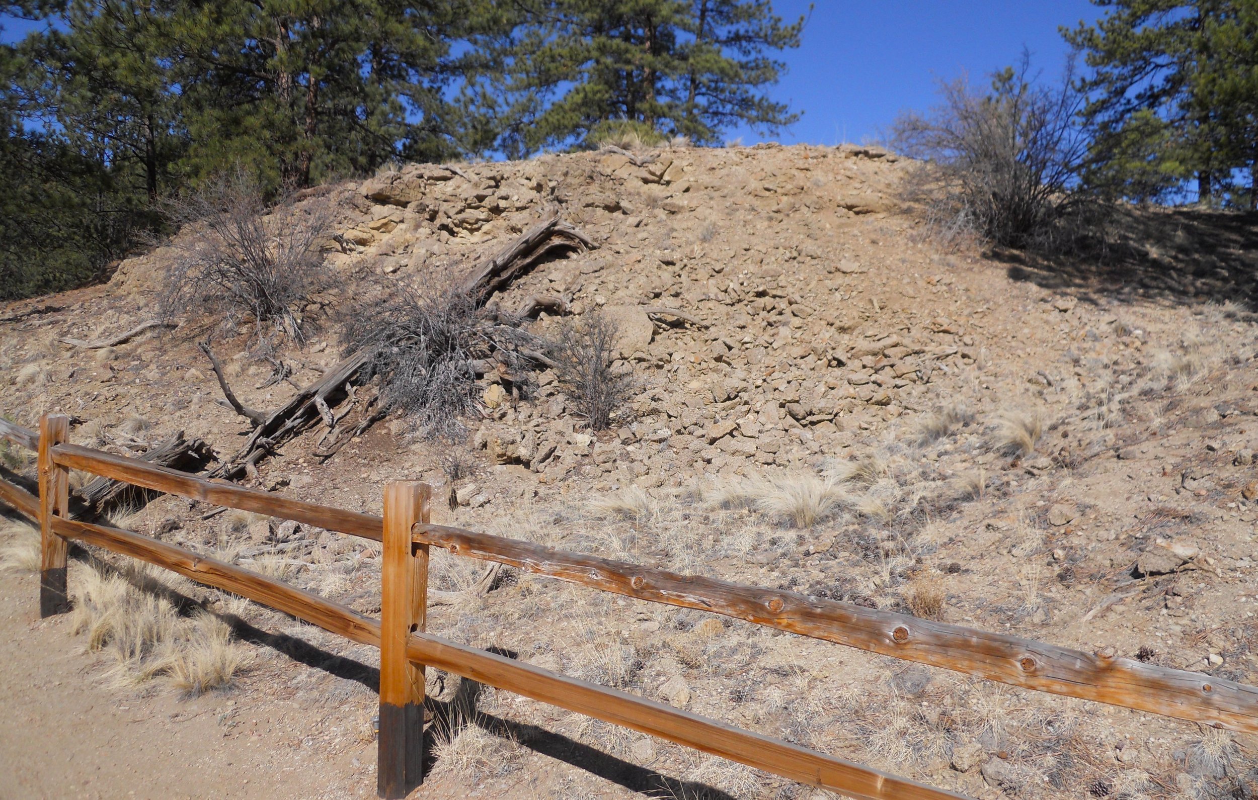
DAY 4 (May 5) - Florissant Fossil Beds NMon is not a large park in acreage, but below its surface lies a treasure trove. Millions of fossils are buried here, formed after millions of years. Insects, plants, birds, and fish (photo is of a Bowfin, on display in the VC) “artifacts” can be found across the landscape. A few trails lead a visitor past some earth piles. The one in the photo is estimated to have thousands of fossils.
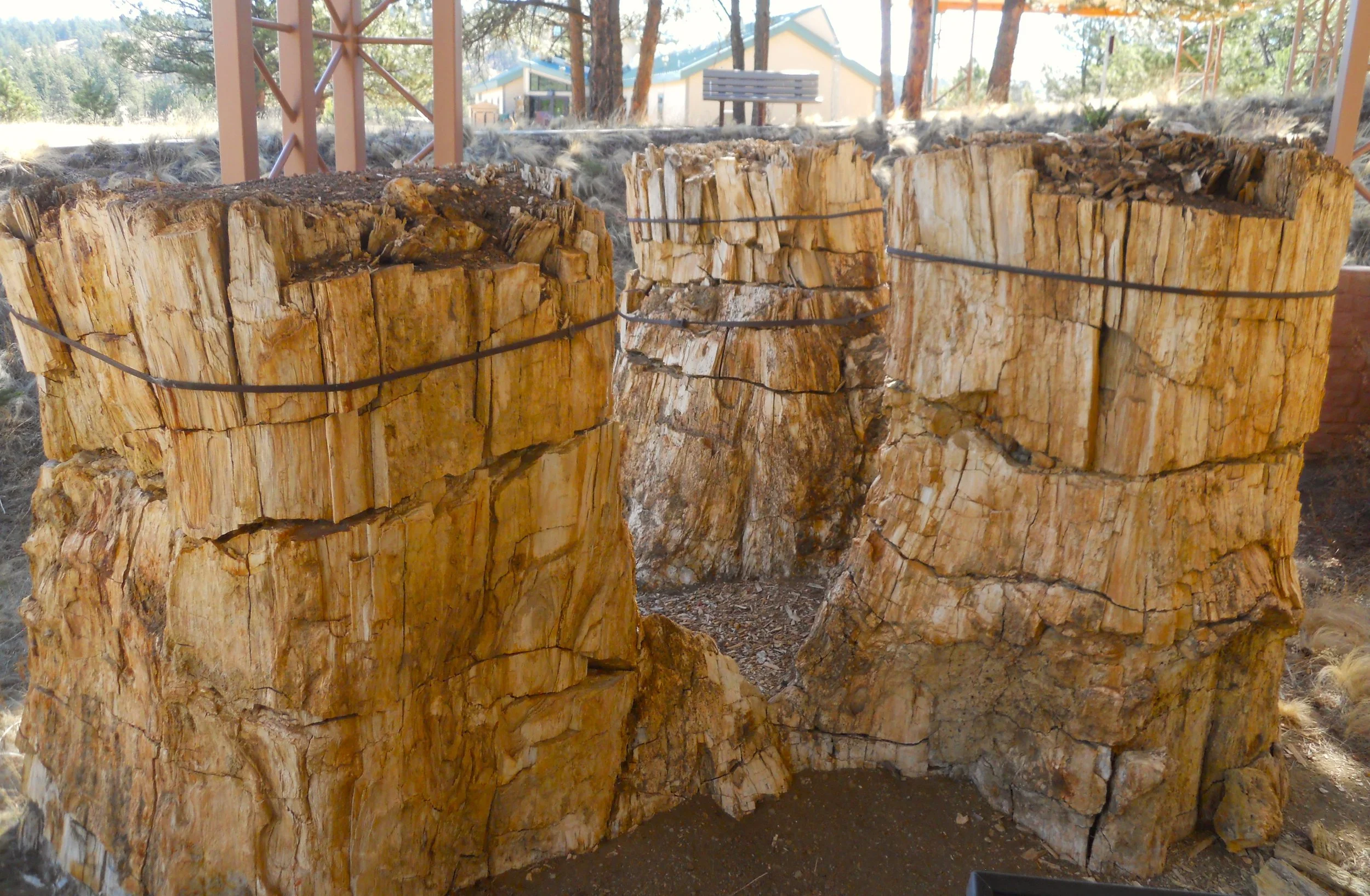
This area is also home to gigantic, petrified redwood trees. The three stumps in the one photo grew from a single central tree. Metal bands have been placed around the stumps to minimize deterioration. All were buried under the surface until excavations uncovered them.
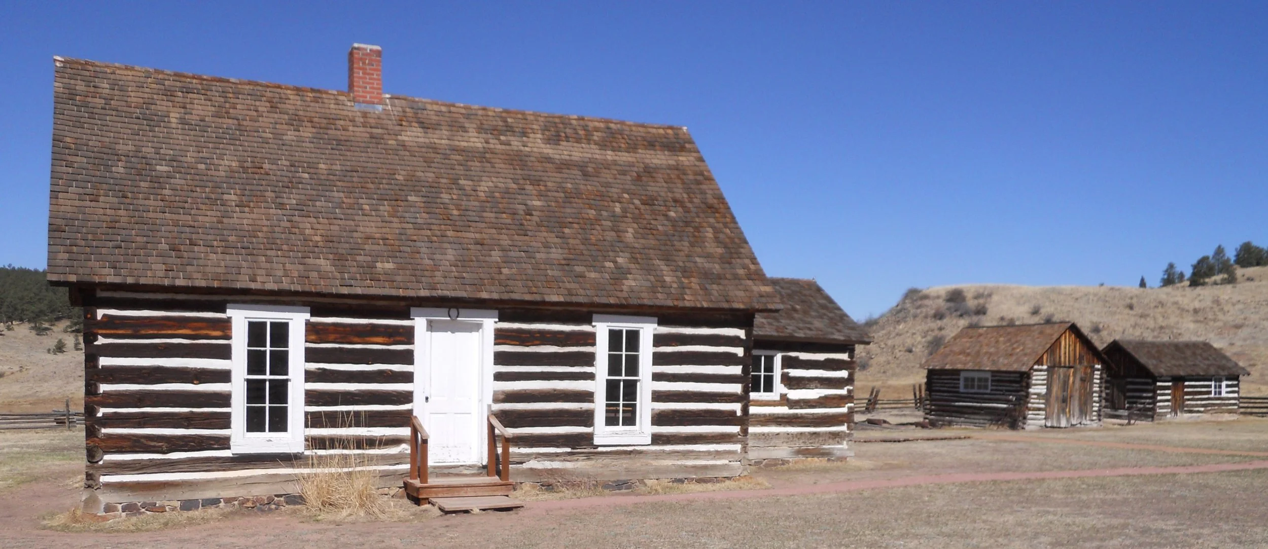
The park encompasses an original Homestead farm from the 1870’s (remember the post the other day of the Homestead Act of 1862?). Adeline Hornbek was granted 160 acres in this valley. She was a single mother of four.
Taking US 24 (and then US 50) from Florissant to Curecanti NRA, I was able to see the Collegiate Peaks in the Sawatch Range. These are 14ers (peaks above 14,000 feet elevation), named for prominent schools (Princeton, Yale, Harvard, Oxford, Colombia). I have made it to the top of eleven 14ers, but doubt any more are in my future.
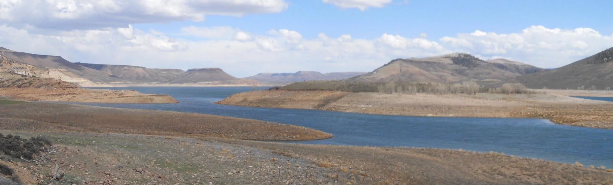
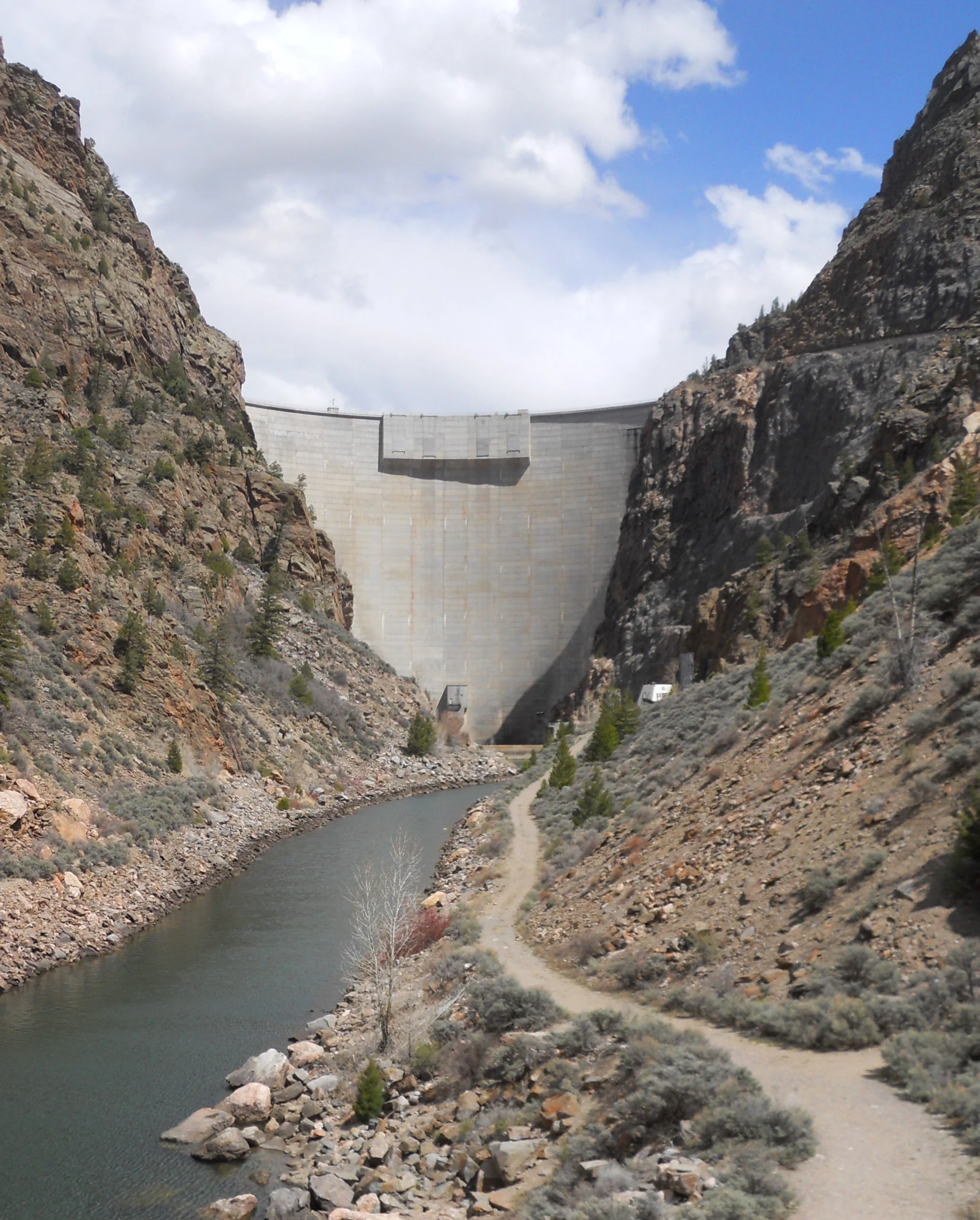
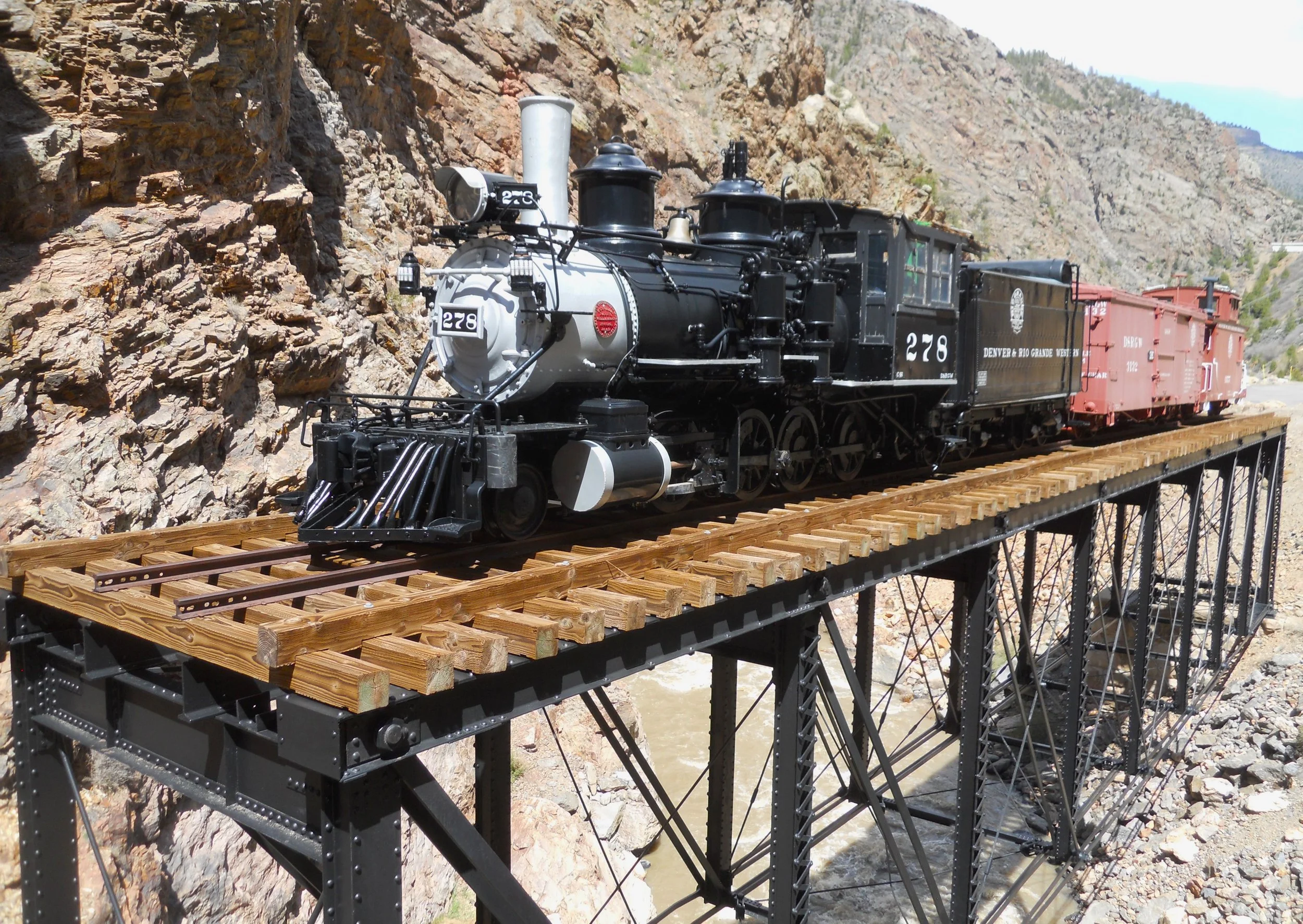
Curecanti NRA is a beautiful area. Most activities center around the water. Heck, the park’s website starts off with, “The spot for water-based recreation…” But I do not boat or fish, so I stuck to human history. At the west end of the park is Morrow Point Dam. It created an 11-mile-long lake within the park, with depths up to 450 feet, due to the tall canyon walls. The output from the dam ends up flowing through the Black Canyon of the Gunnison NP. Near the dam is a display of railroad equipment used for moving materials in support of the dam’s construction. The Cimarron River is flowing below the structure.
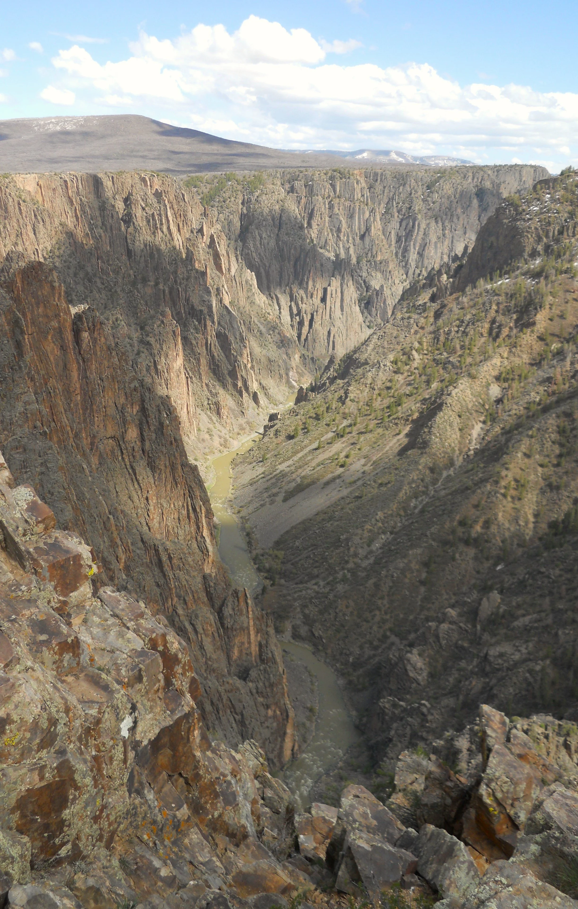
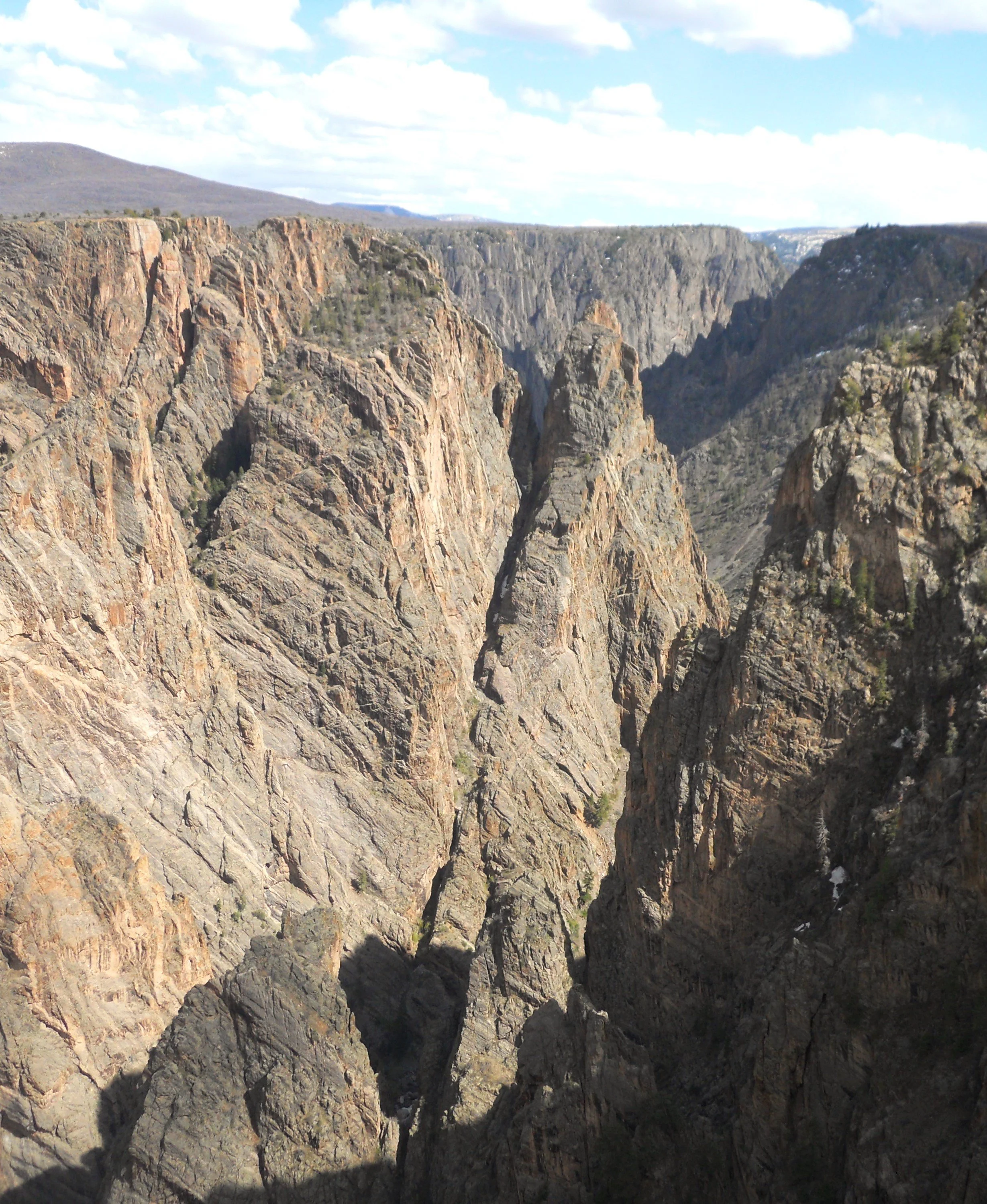
Speaking of Black Canyon, not many people on the South Rim Road today. The road to East Portal was closed. This allows one easy access to the Gunnison River and some inner canyon hiking. That was to be half of my visit, but severe road damage may have this vehicle access closed most of the year. A ranger told me I was welcomed to walk the road. But at 5 miles down, and 5 miles back up with a couple thousand feet in elevation, I declined.
The first photo was taken from Pulpit Rock. The second is of the Cross Fissures formation. It took water millions of years to carve this canyon. I wonder what it will look like that far in the future.

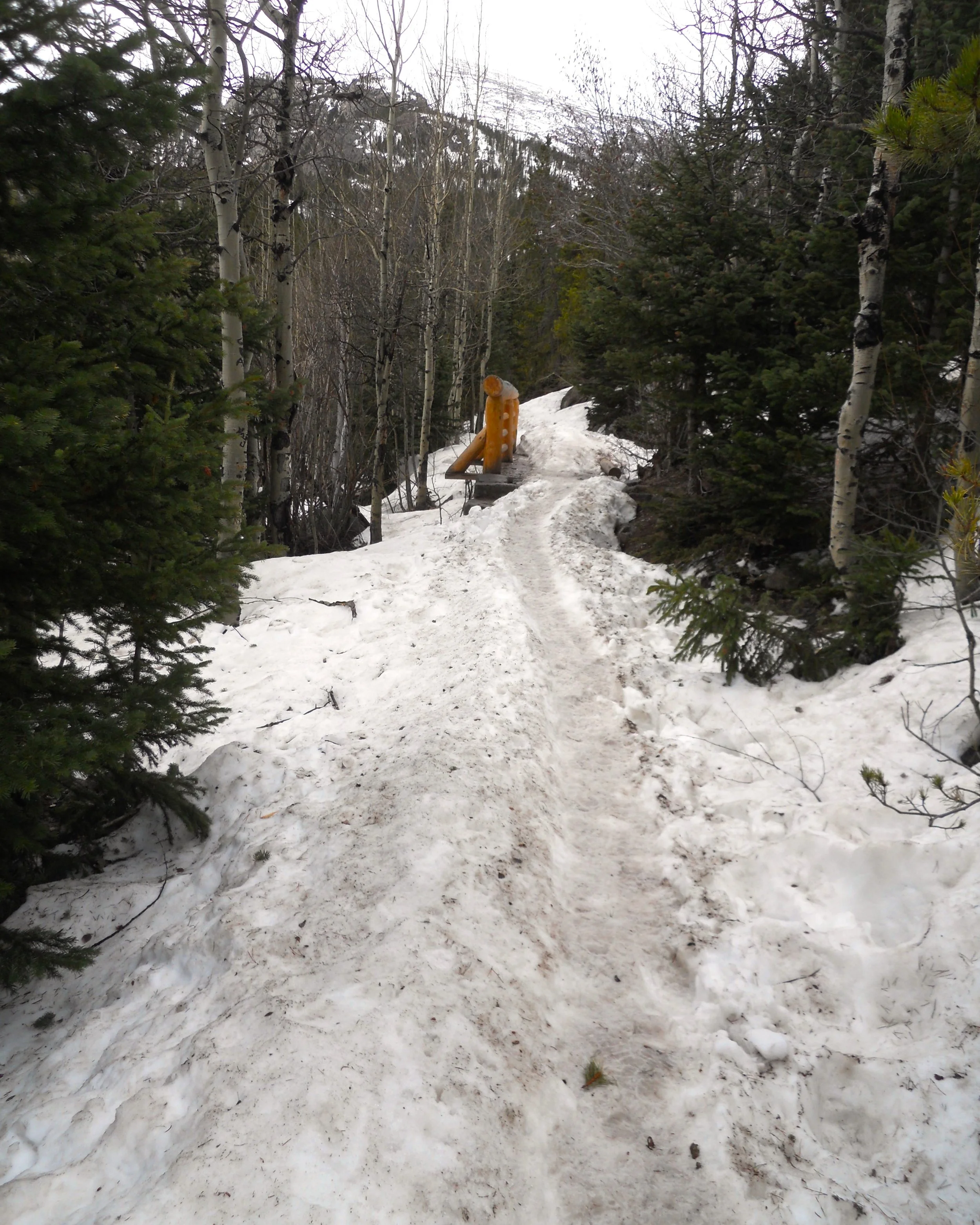
DAY 3 (May 4) - The hike to Alberta Falls required one to walk on three feet of packed snow, the entire 1.2 miles. And then having to reverse course made for a slippery trek. If you did not stay right on the narrow path, your legs would disappear. The major section of the falls is near the center of the one photo (hard to differentiate white water from white snow).
A 15-minute snowstorm hit while I was at the falls. Mother Nature sure can play tricks at 9,500-foot altitude in May. After about an hour of off-and-on sunshine, the rest of the day was rain. But the slow pace of the trails is more than offset by the lack of people and vehicles in the park. There were only a handful of other visitors. That will not be the case in July and August, when the trails are clear.
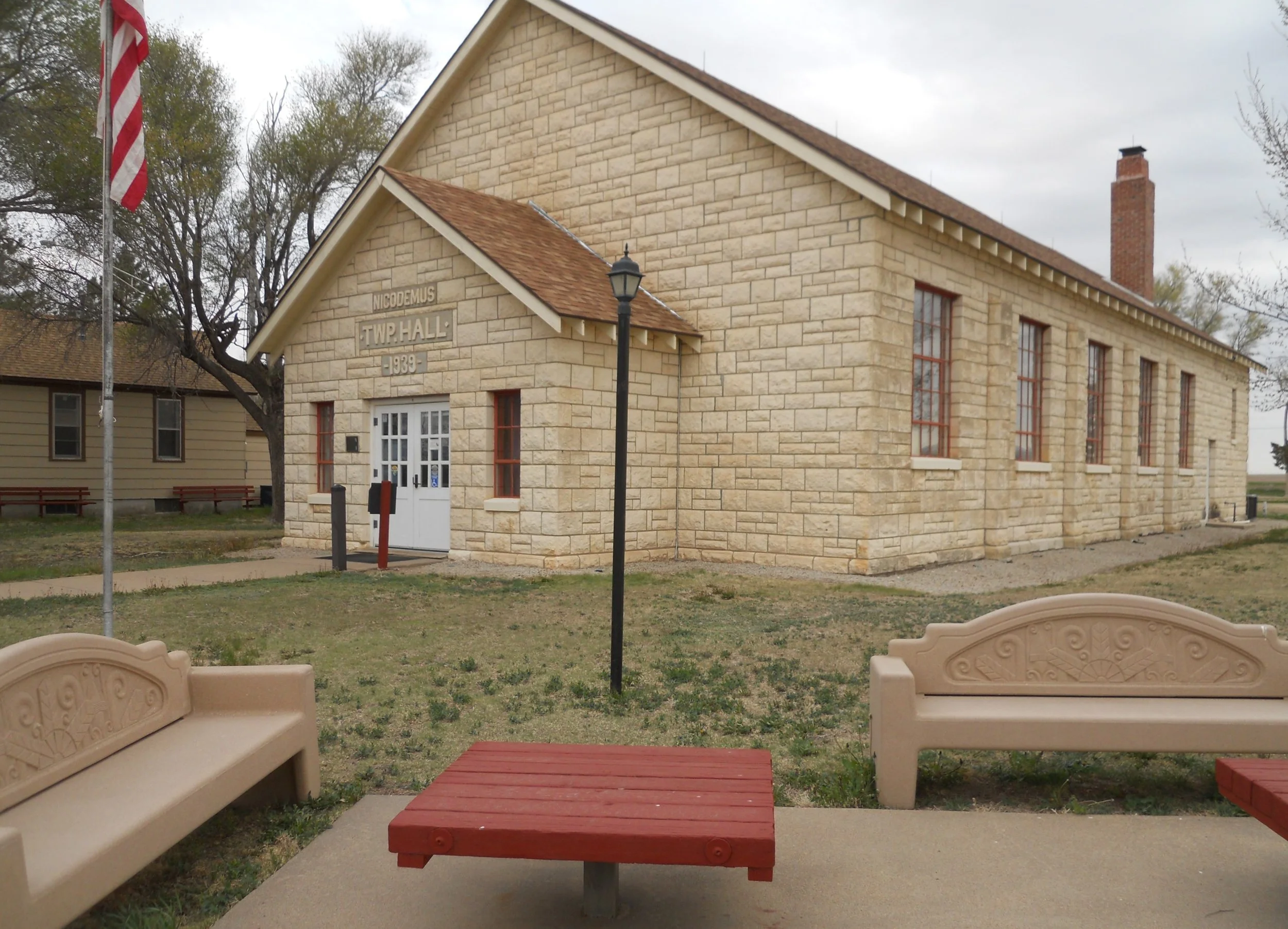
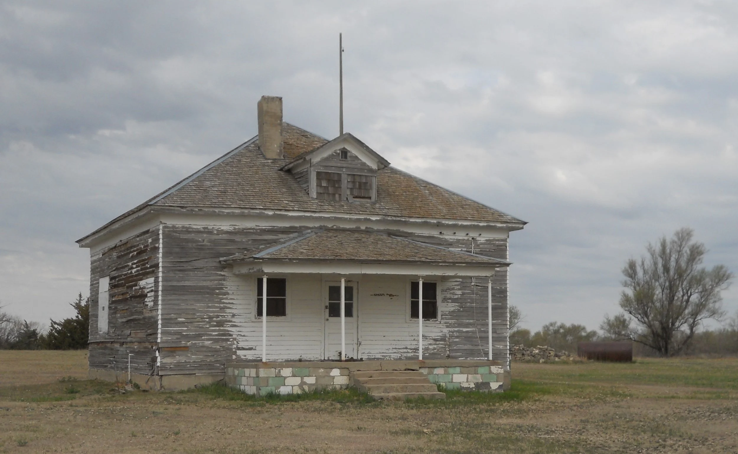
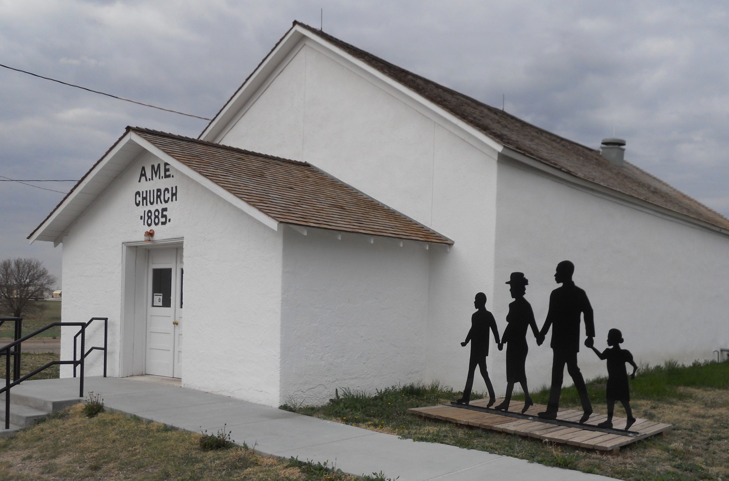
DAY 2 (May 3) - Nicodemus NHS preserves portions of the only remaining town west of the Mississippi which was established by African Americans during Reconstruction. Five historic buildings comprise the park, such as the Town Hall (today used as the park’s VC), 1-room schoolhouse, and the A.M.E. Church (built in 1885… AME stands for African Methodist Episcopal). Private citizens still reside in the other parts of town.
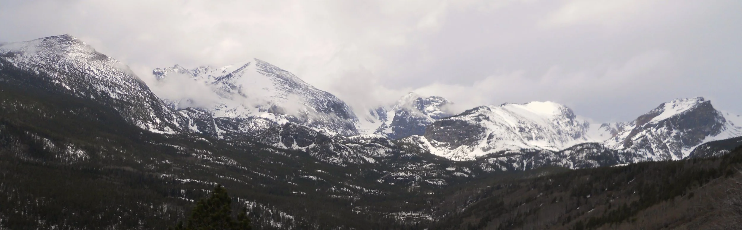
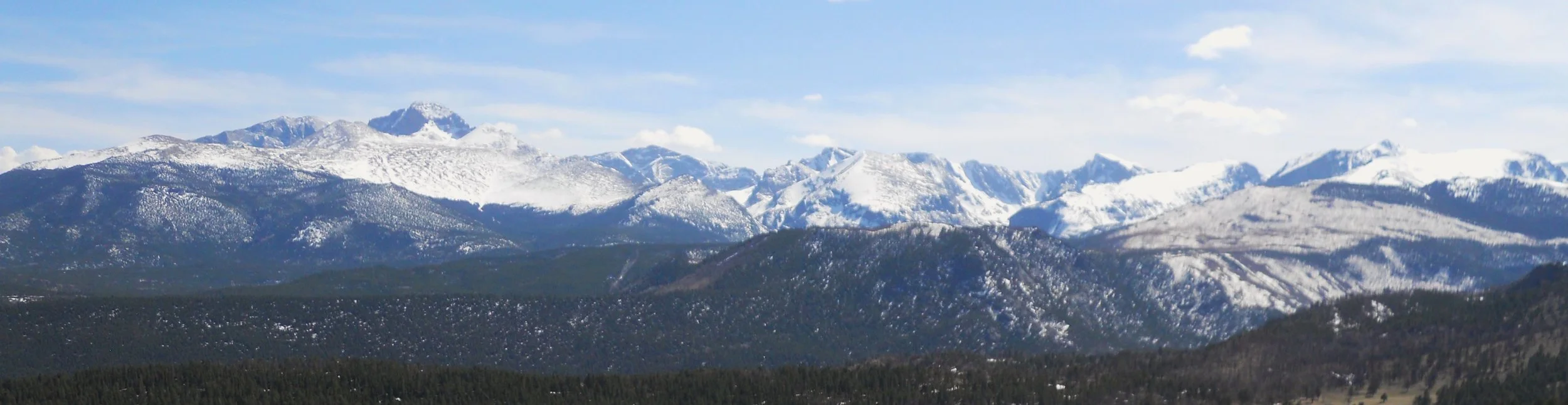
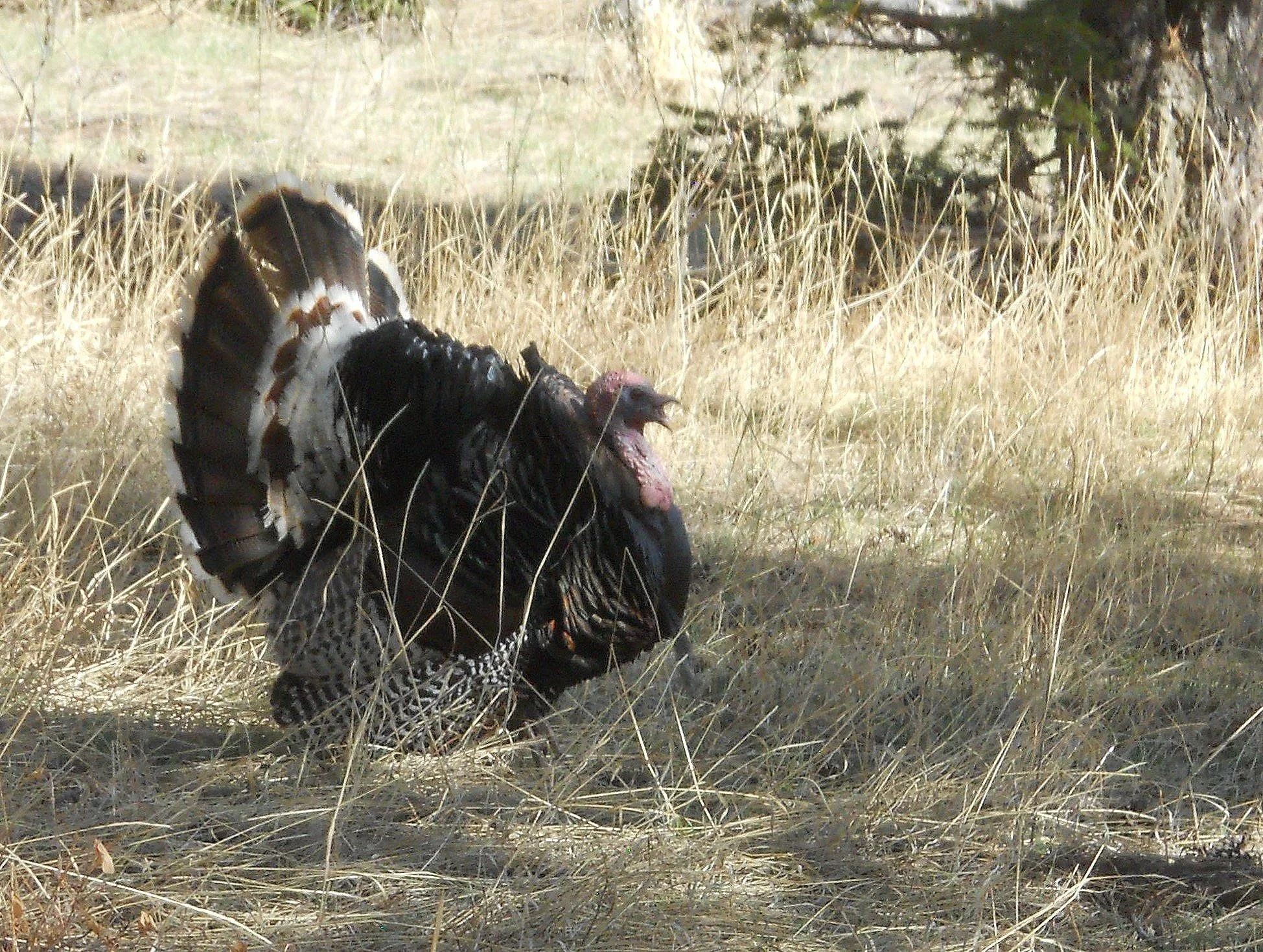
Then a longgggg haul into Colorado and Rocky Mountain NP. But the view was worth the drive. Then, at the Alluvial Fan area, I became best buddies with a gobbler (adult male turkey). Well, let’s just say he kept telling me to “back off” with his loud song. So, I backed off and went to view the “fan”. This area is a fan-shaped mass of alluvium (go look it up in the dictionary) resulting from a catastrophic flood in 1982. Three people lost their lives. Plenty of water was coming down from snow melt.
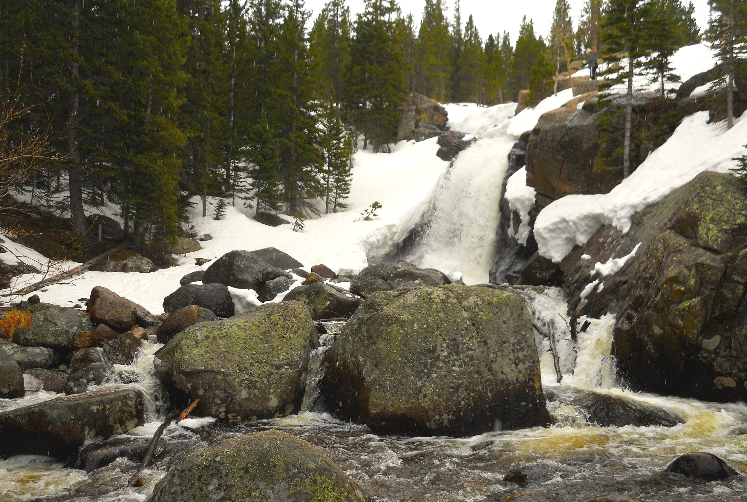
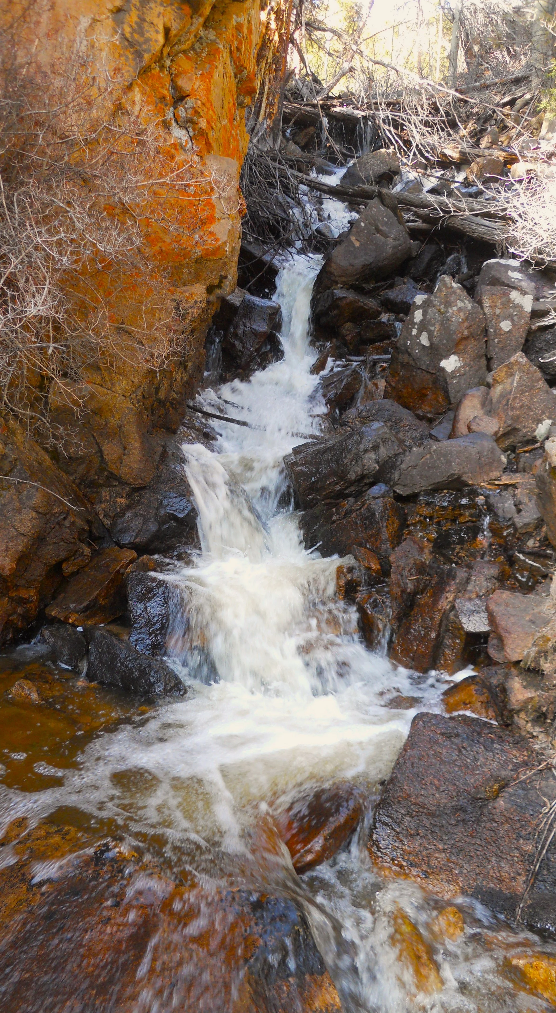
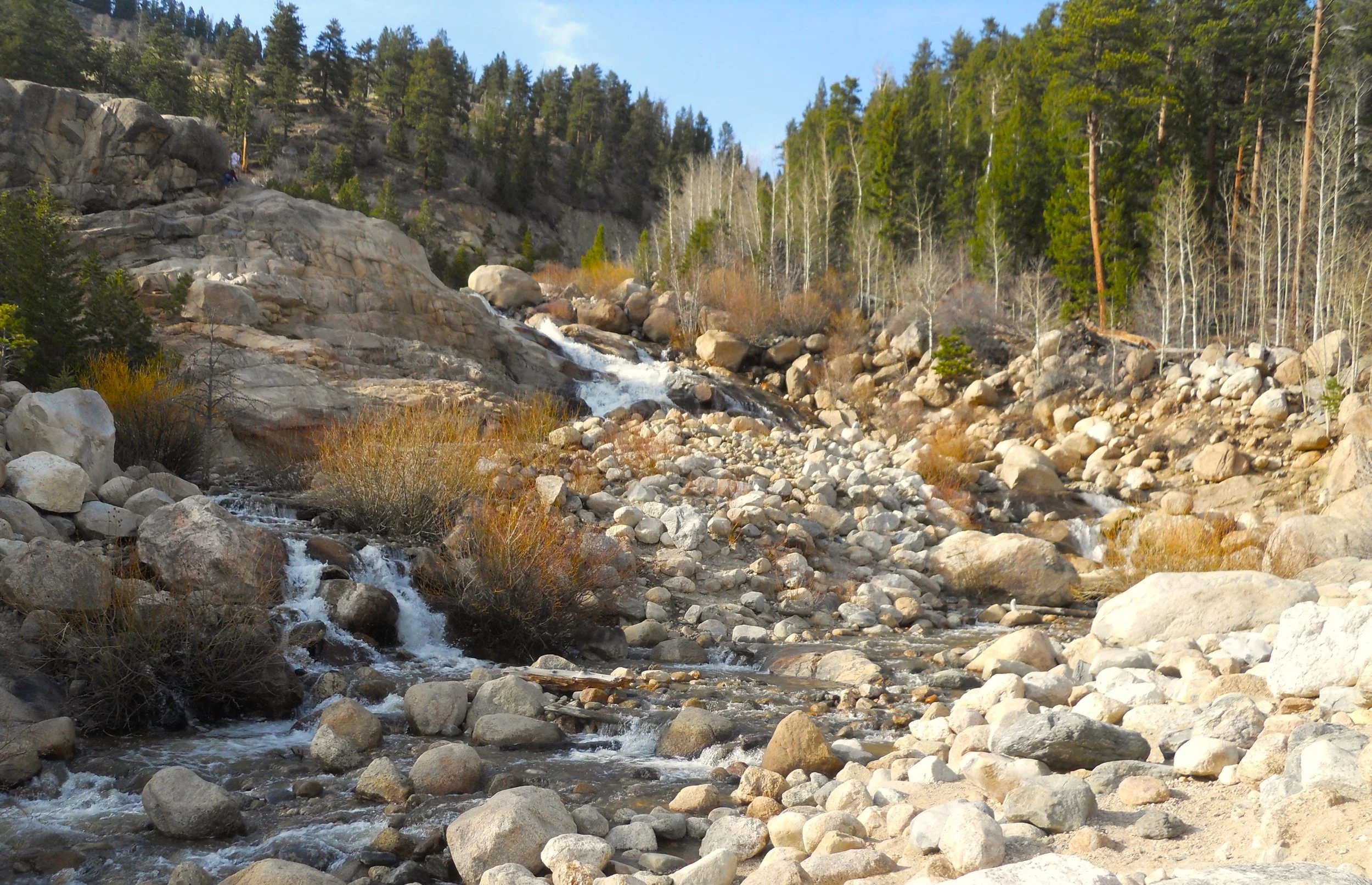
A long line of small cascading waterfalls was also at Endovalley. The one photo is just a small section of roughly 50 yards which folks can scramble upwards.
More hikes planned for tomorrow in Rocky Mountain.
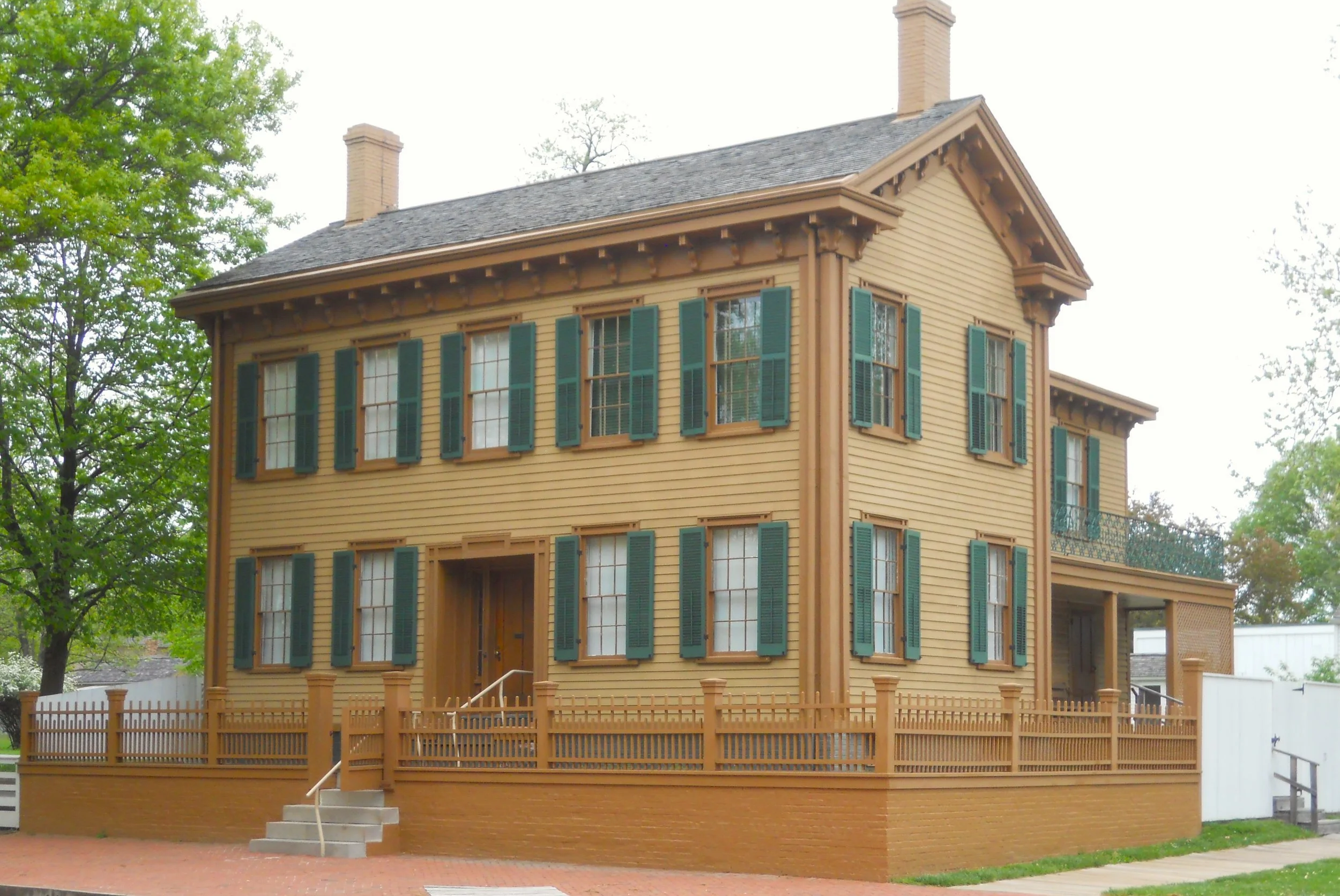
DAY 1 (May 2) - Sorry for the delayon the first day. The hotel’s WiFi was not working. Anyway, Abe Lincoln’s home in Springfield, IL was the first park stop. This is the only home Mr. Lincoln owned during his life. Almost 50% of the items in the house are original to his family. Most of the house’s structure is also original.
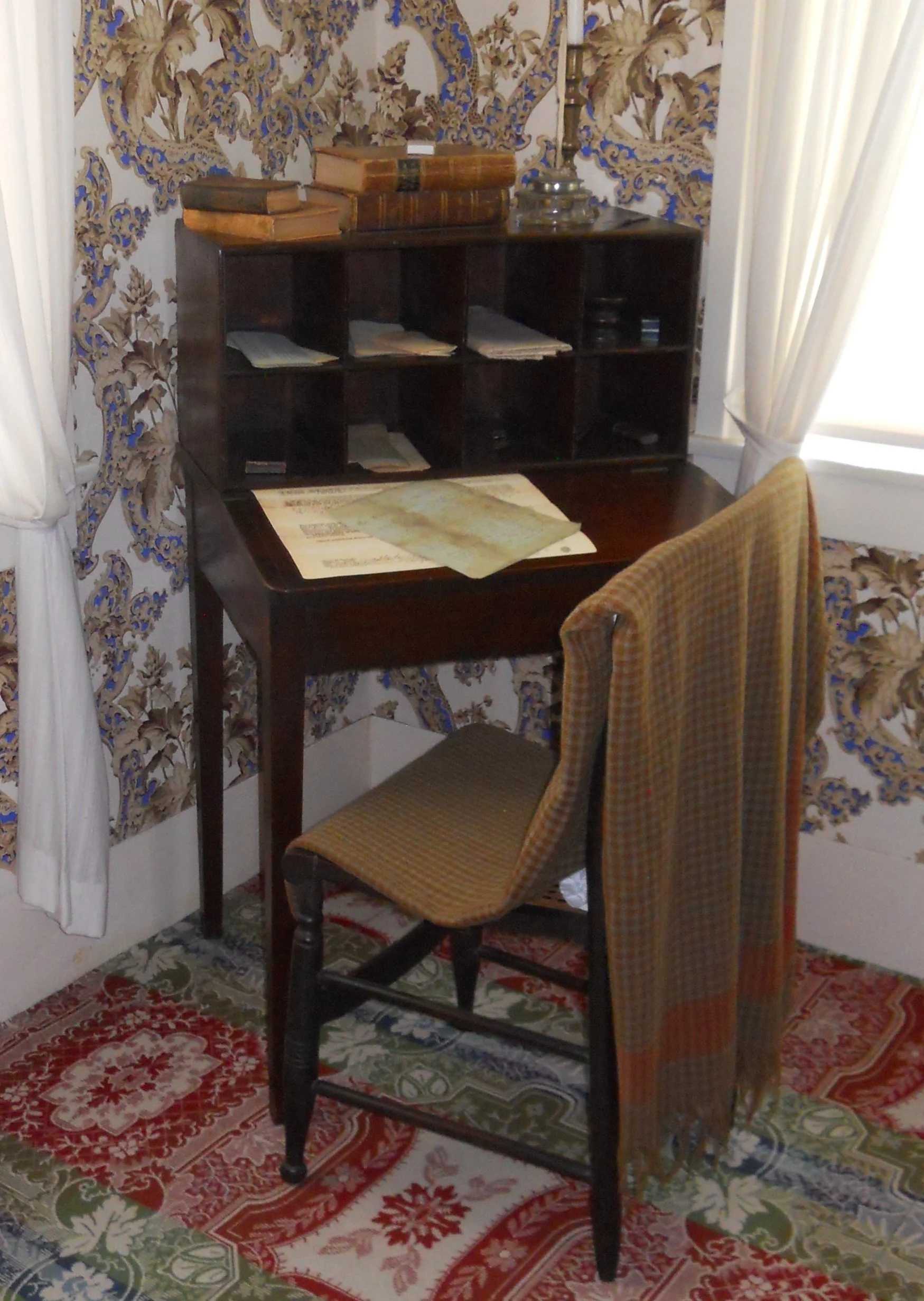
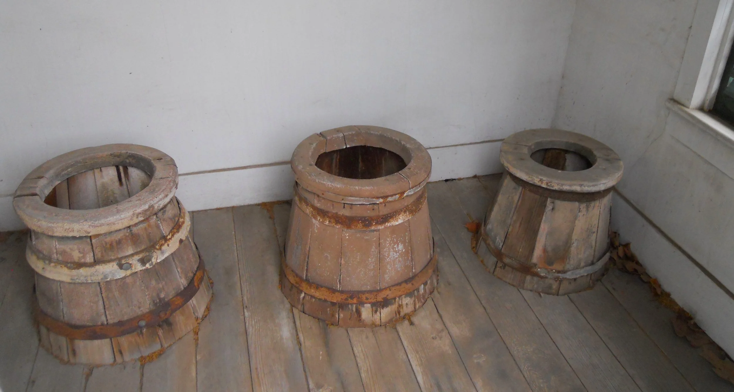
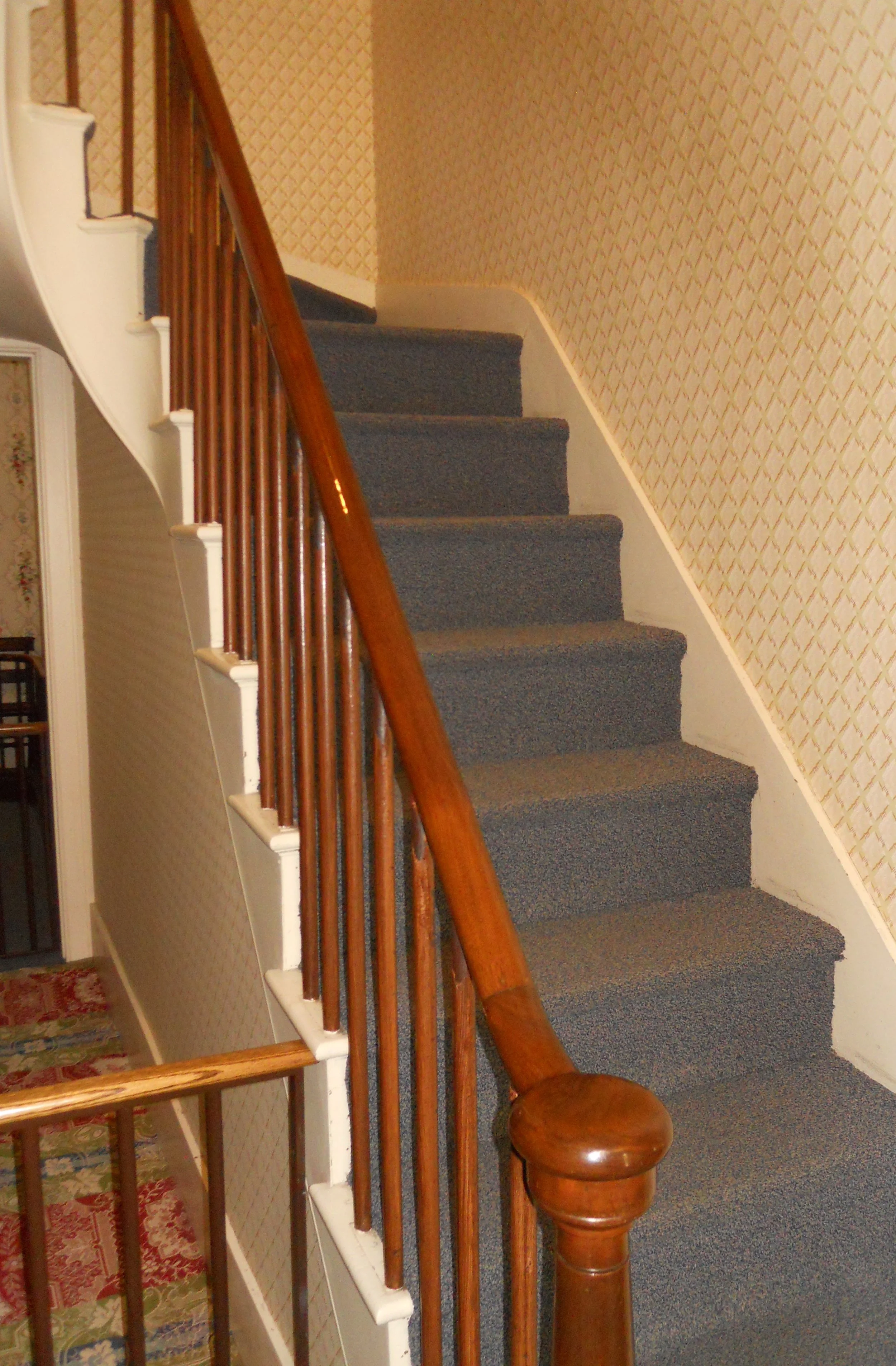
The handrailing to the 2nd floor is the only item in the house which visitors are allowed to touch of which the Lincolns held every day, as they went up and down the stairs. The 2nd floor has the master bedroom which also acted as a small office. The cubbyhole desk was Abes. See how high the bottom of the desk is from the floor. The Lincolns were the only ones on the block with a 3-holer (and 3-seater) outhouse.
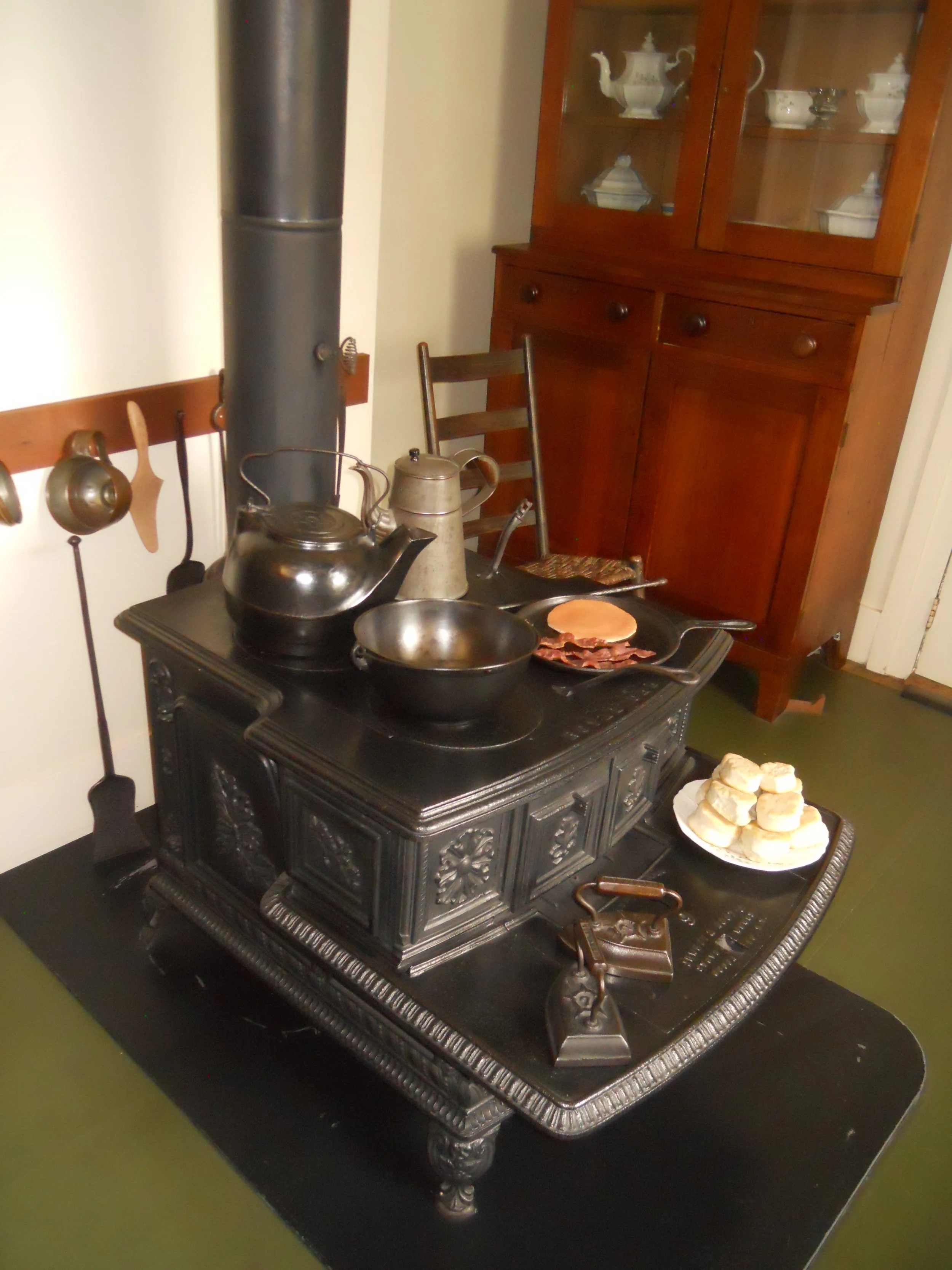
The top-of-the-line stove in the kitchen was bought for $15. Mrs. Lincoln had the finest stove/oven in the neighborhood. She loved to cook, with hopes of using this stove for many years during their retirement. She never came back to the house after the assassination.
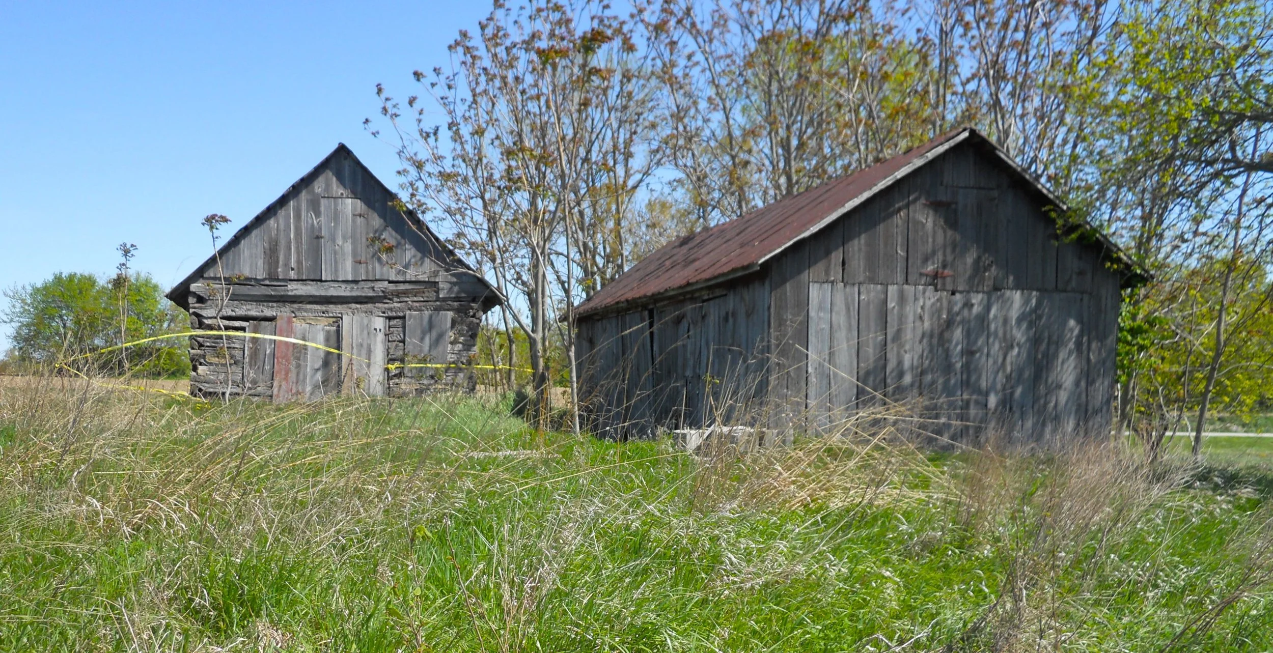
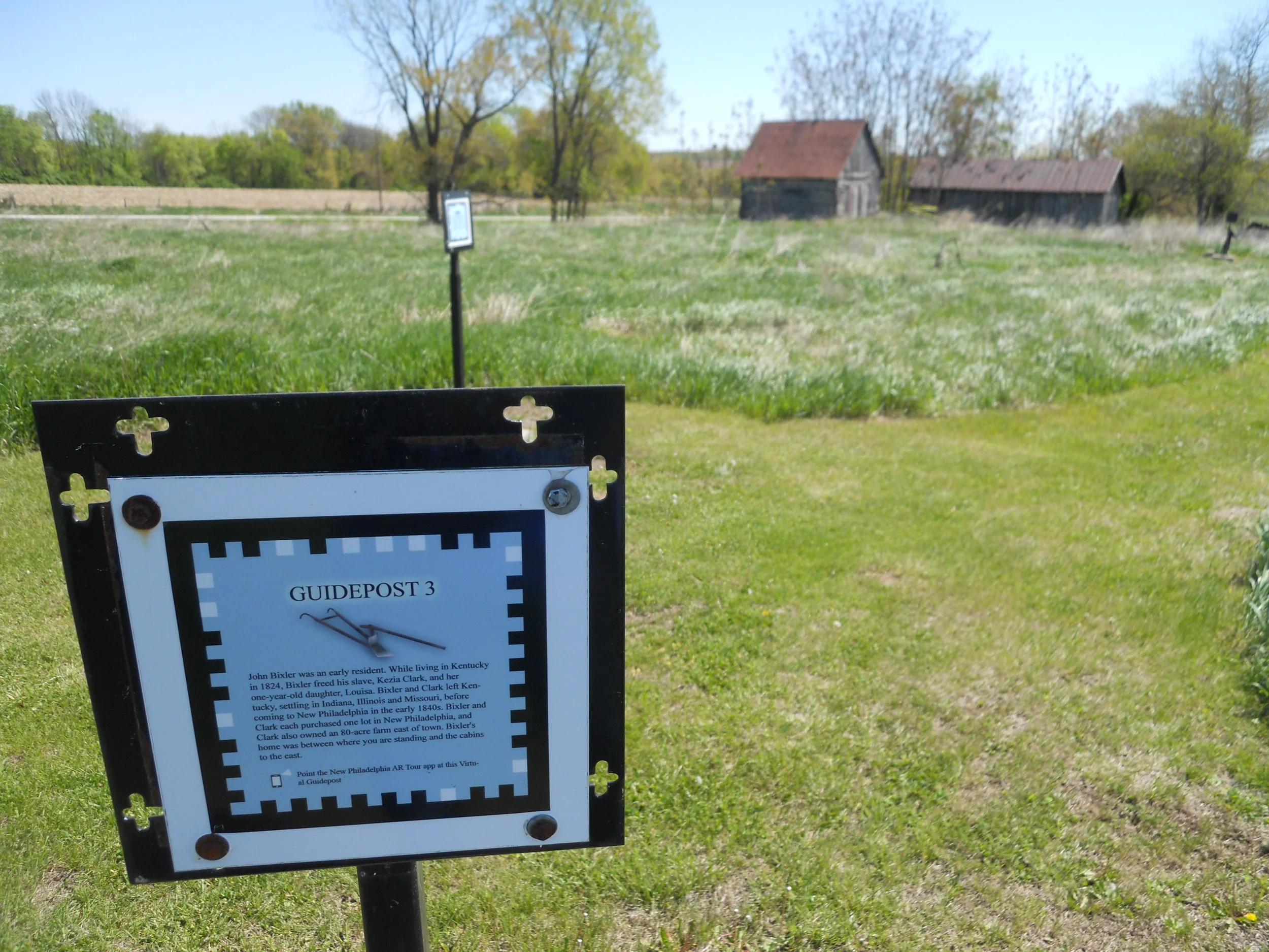
Next stop was the newest NPS unit, #424, New Philadelphia NHS. It became established on December 29, 2022. There is nothing on the site except three buildings (photo shows a family house on the left, and a granary on the right), a covered display area, and a mowed path which takes one to the spots where various buildings used to stand (placards discuss the details of each building). Free Frank and Free Lucy McWorter were the founders of New Philadelphia, in 1836. Frank was born a slave, in 1777, in South Carolina. Hopefully, the NPS can improve the site in the years ahead.
The Homestead Act of 1862 changed the country for ever. Over 10% of our country’s land, 270 million acres, was homesteaded from that point going forward. People from all walks of life filed claims for titles to lands, so they could pursue the American dream.
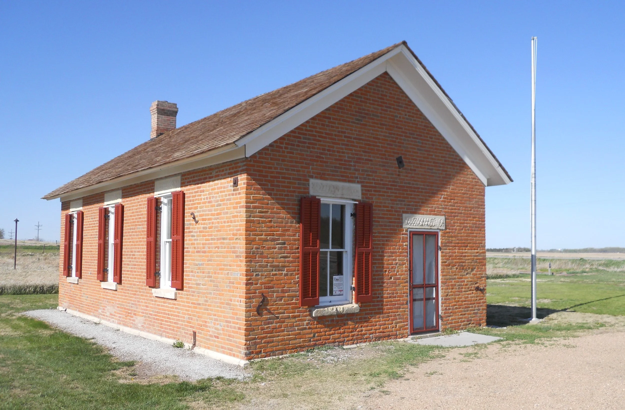
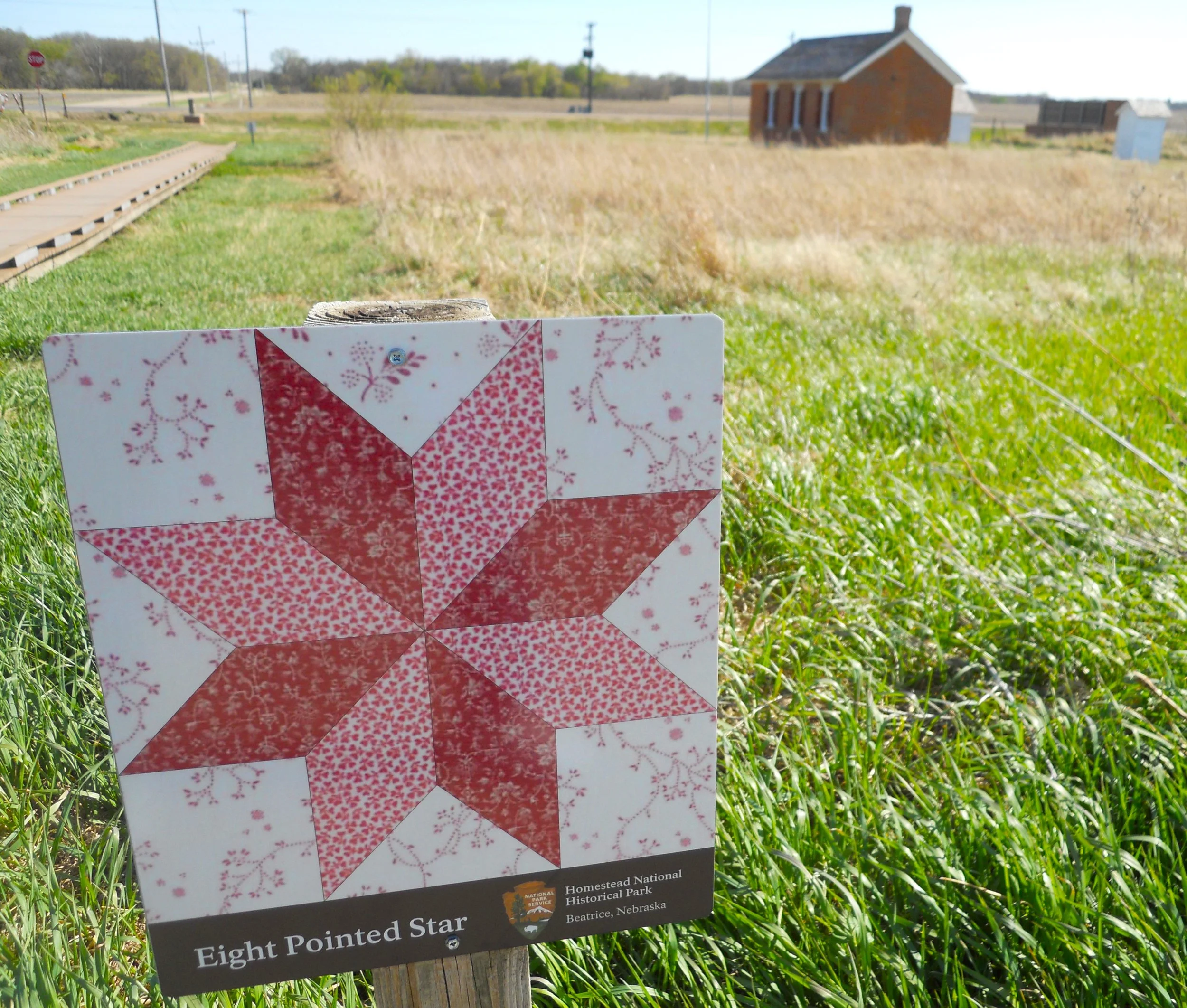
The Freeman School represents the one-room schoolhouses which dotted many regions of our country in the 1800s. Homesteaders were jack of all trades. Women made quilts, with the 8-Pointed Star as the most common motif, since it was felt stars provided guidance being that they were religious symbols.
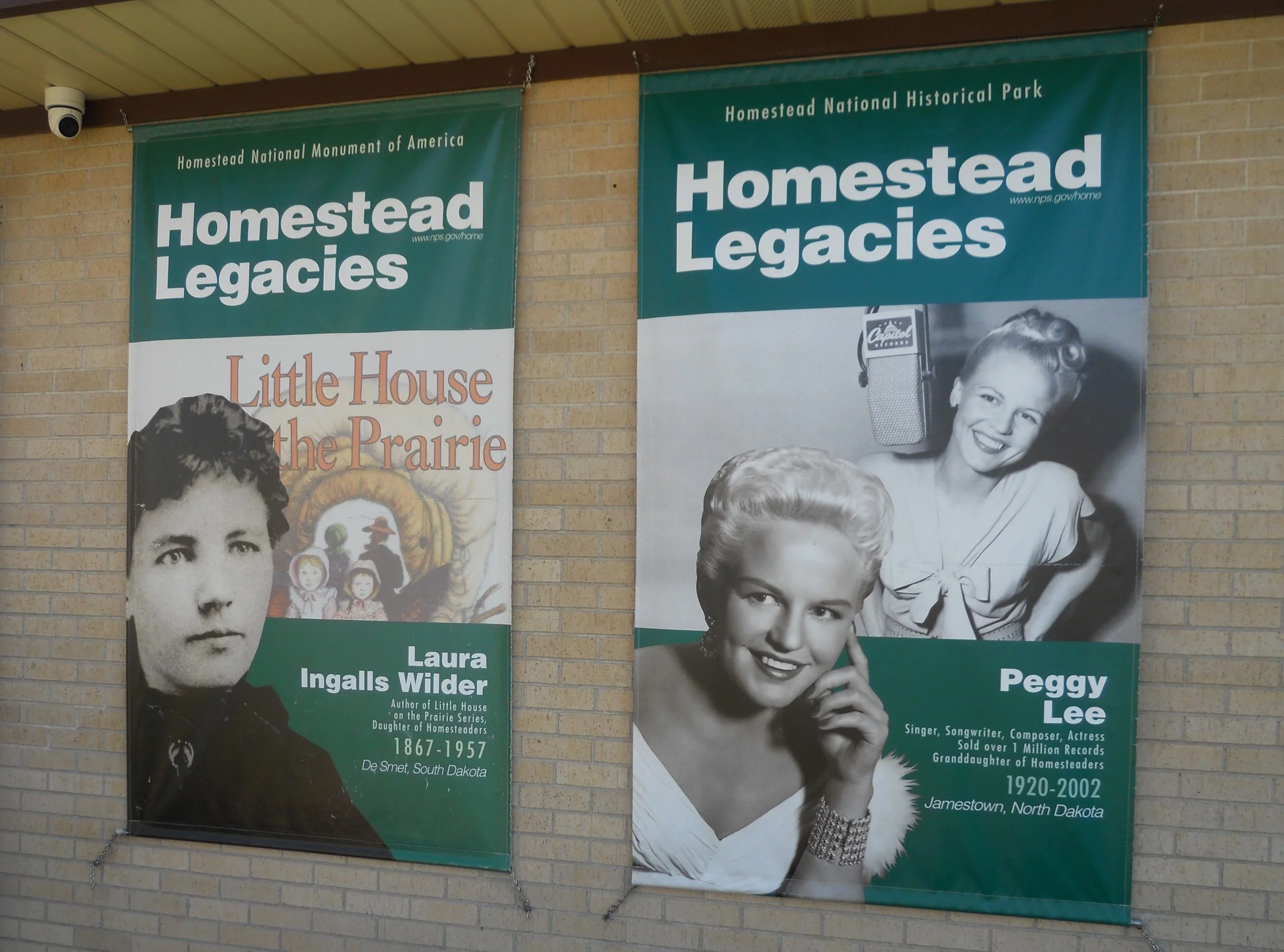
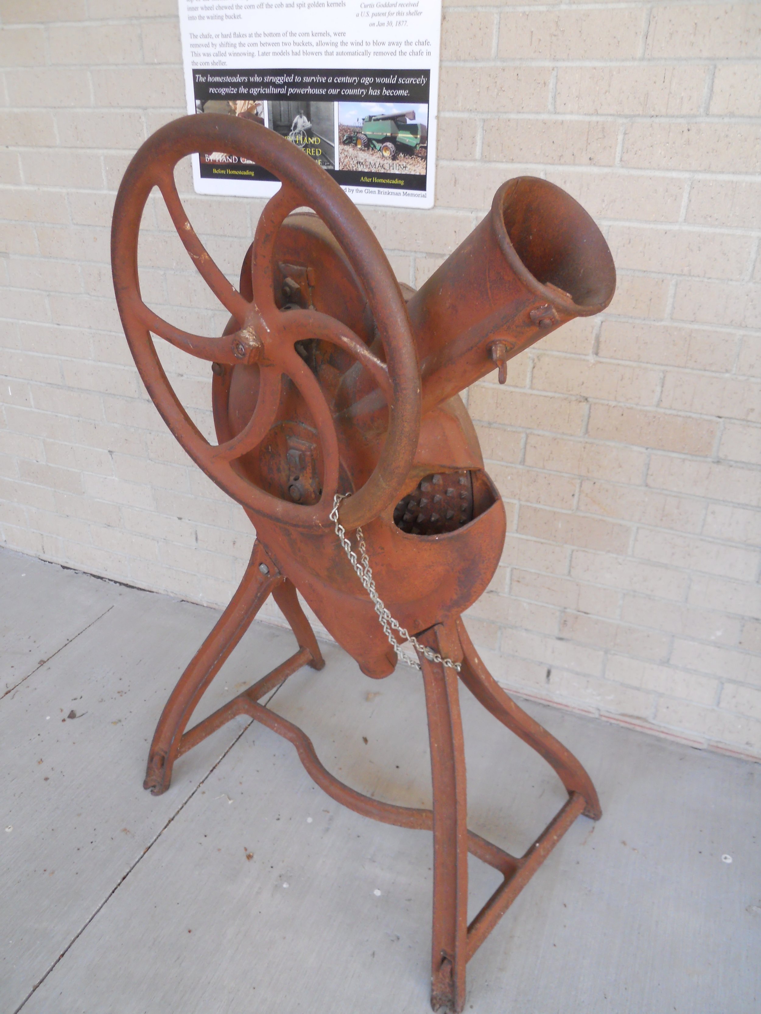
The park’s Education Center displays banners on its outer walls, honoring famous men and women who have homestead legacies. A row of farming equipment makes us 21st century people wonder how farmers ever made it into the 20th century. The device in the photo was used for shelling corn.