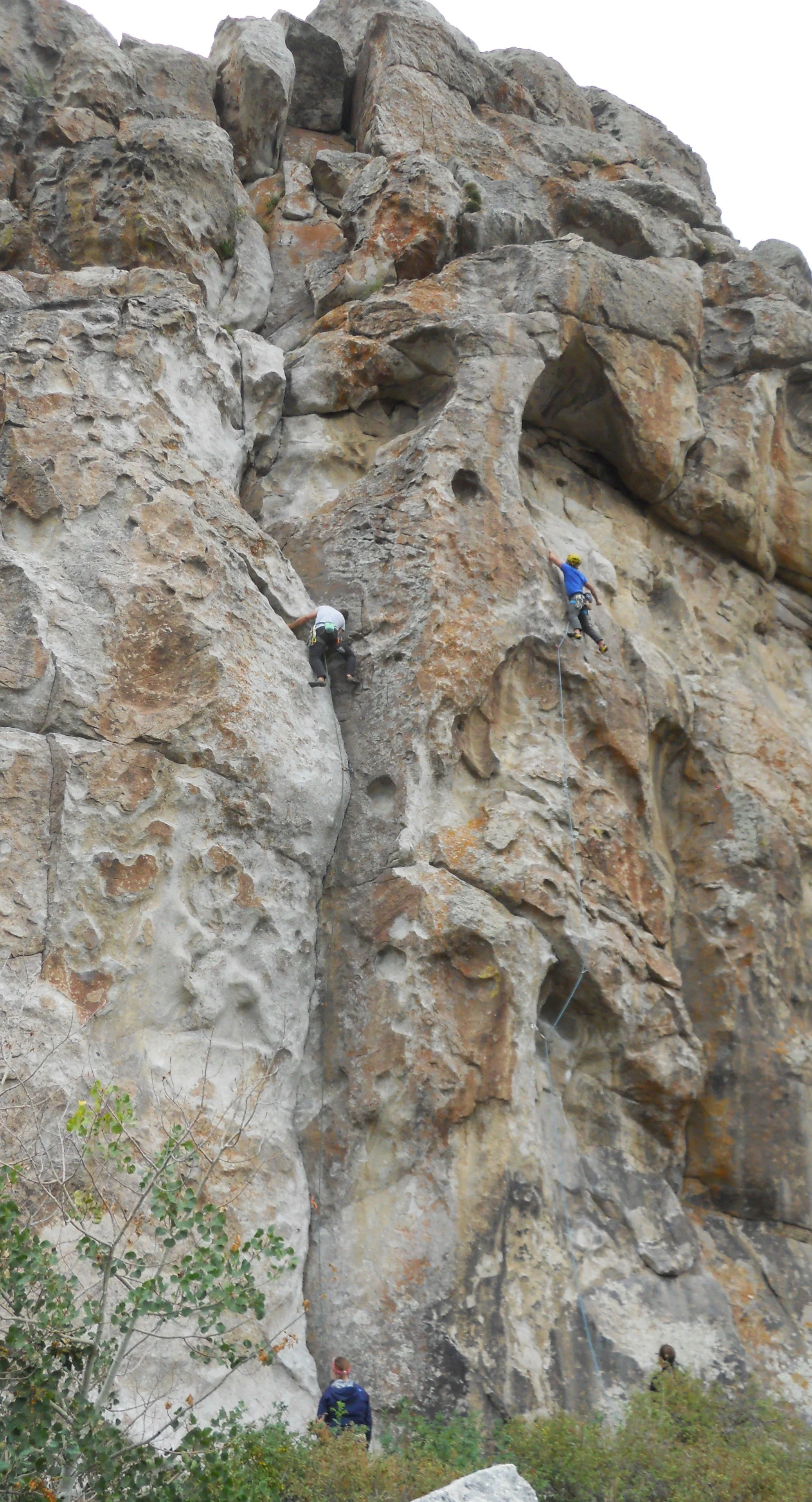
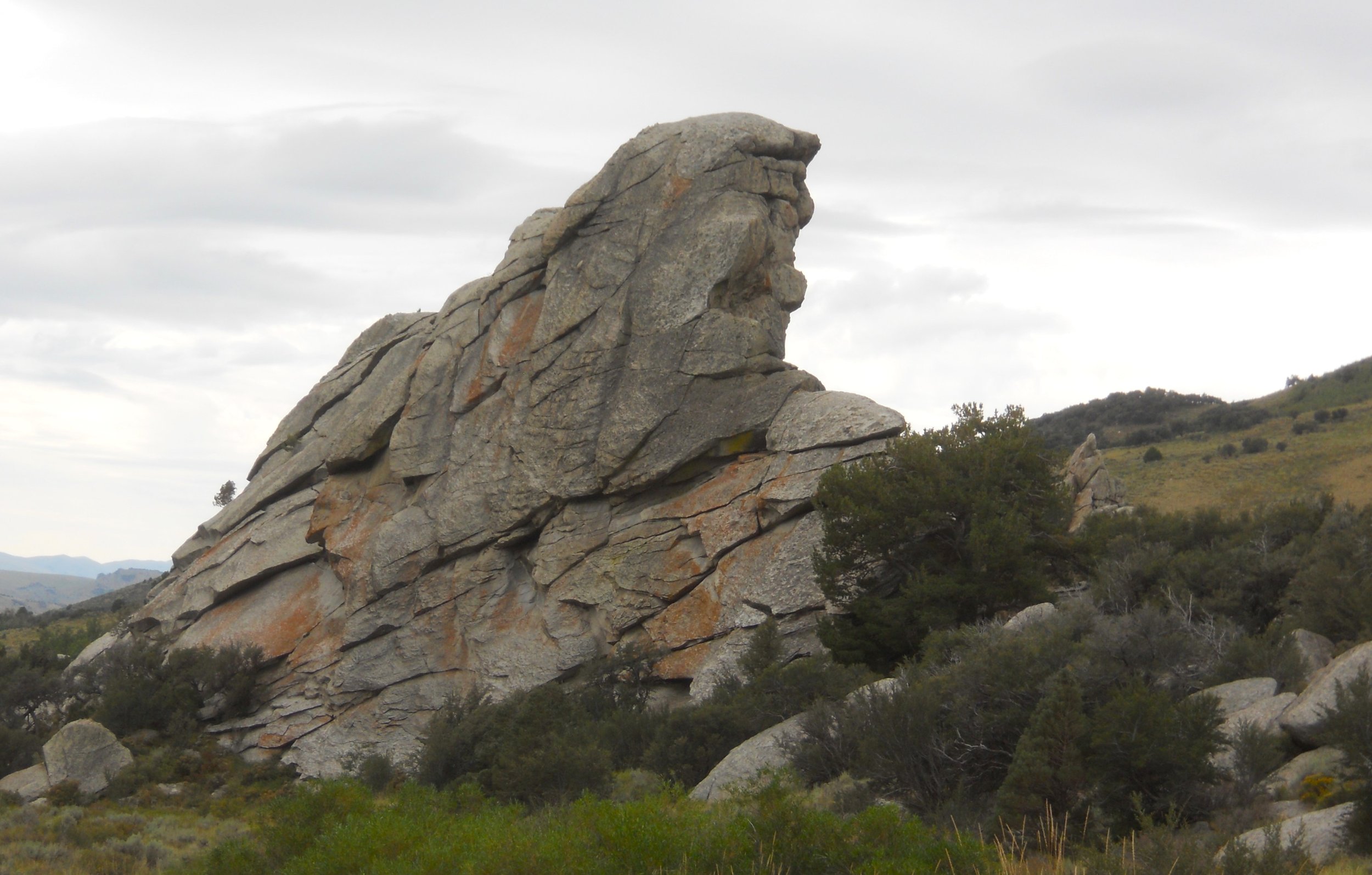
DAY 12 (September 3) - City of Rocks National Reserve is in south-central Idaho, near the Utah border. Emigrants along the California Trail from the 1800s described the area as a city of tall spires and “the silent city”. 250,000 people moved across this trail in its heyday. Many left their names on rocks. Today, visitors come to make it to the top of these rocks, some of the best technical climbing in the country. I came across two adventurers on Camp Rock.
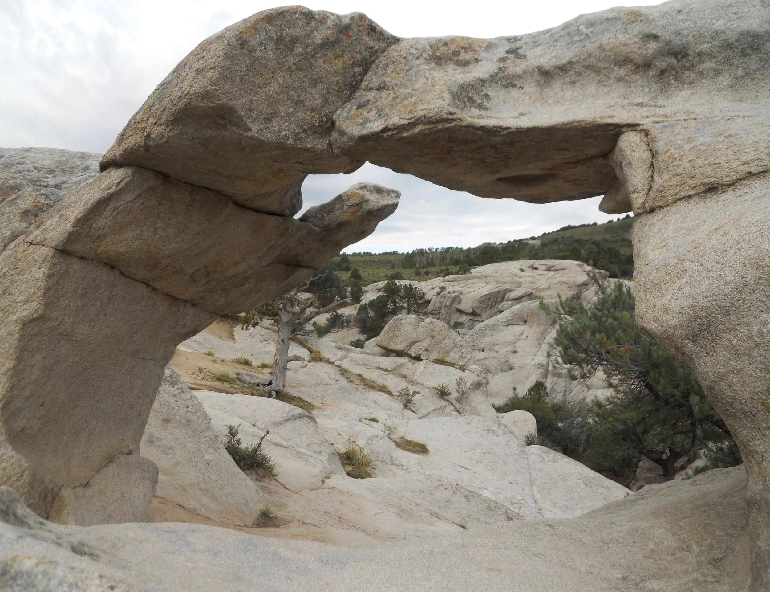
A short trail leads to Window Arch.
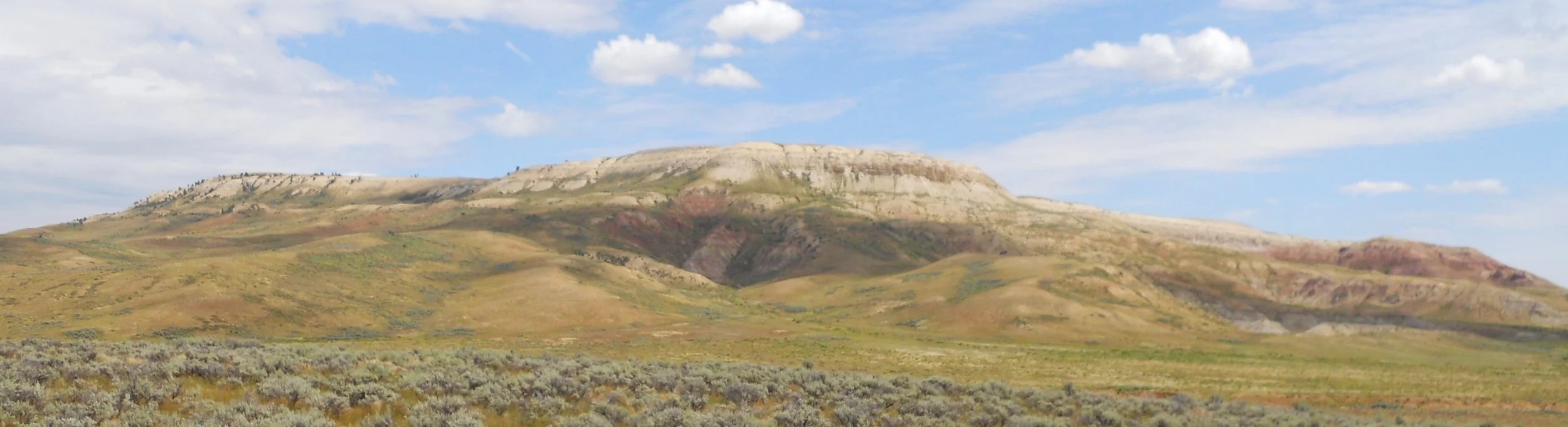
The south portion of the park has the Twin Sisters (in the photo, the 2nd and 3rd peaks from the right… the left Sister is a different granite than the right Sister and is 100 times older). This was the primary navigation reference for the folks on the California Trail. The section in the center of the photo is where the wagon caravans traversed from east to west.
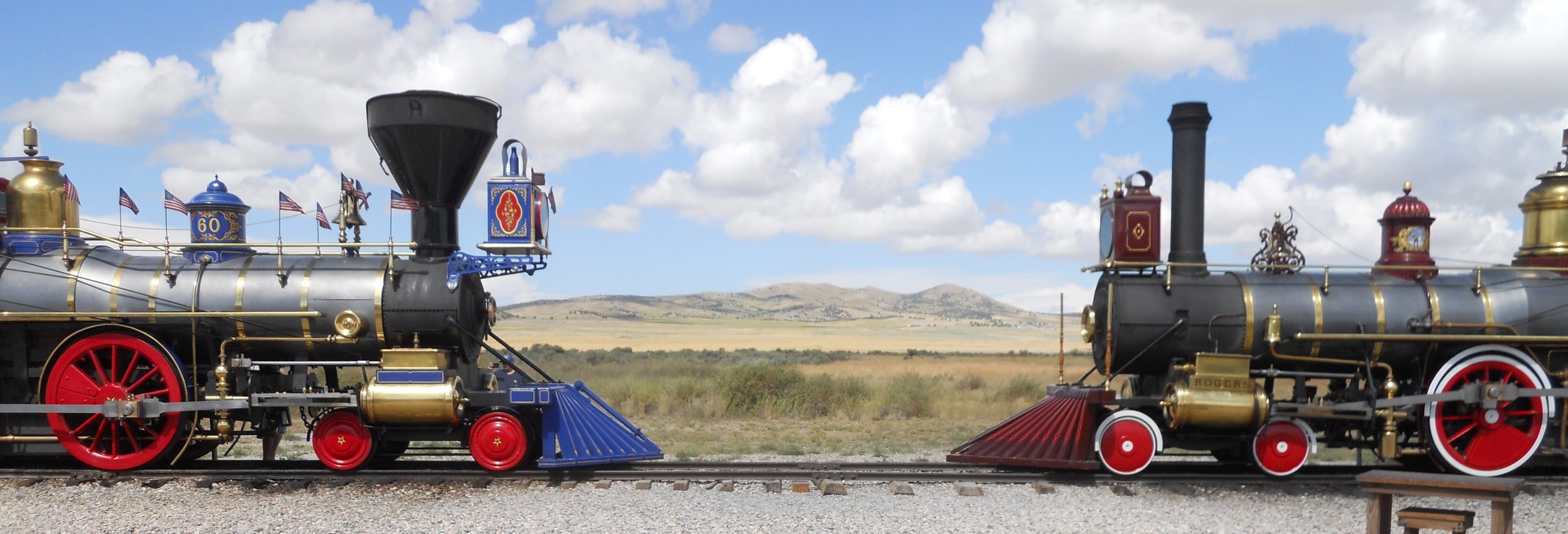
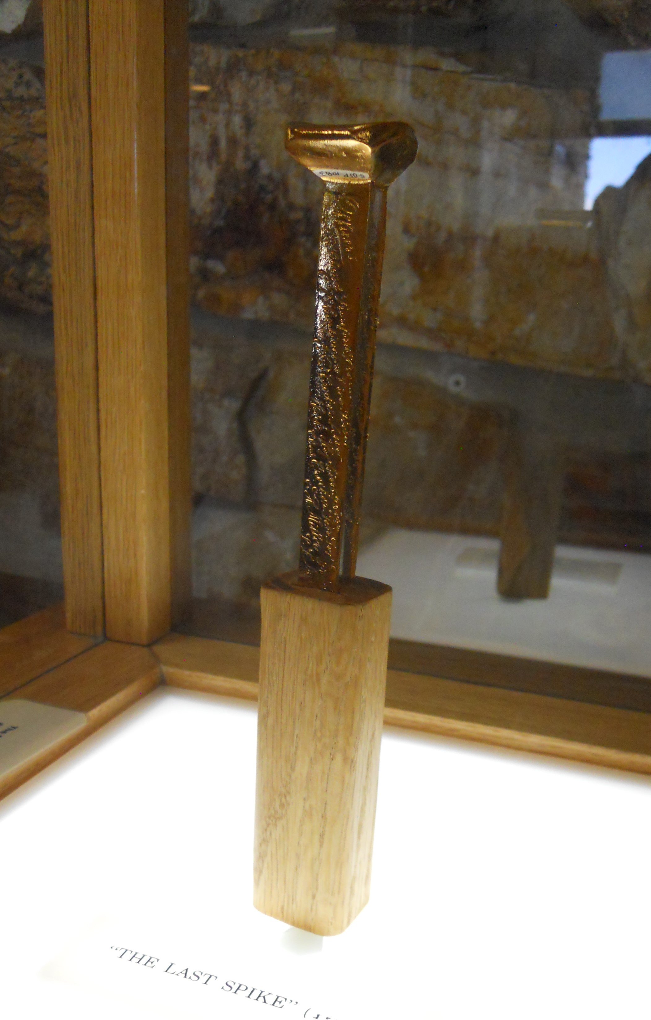
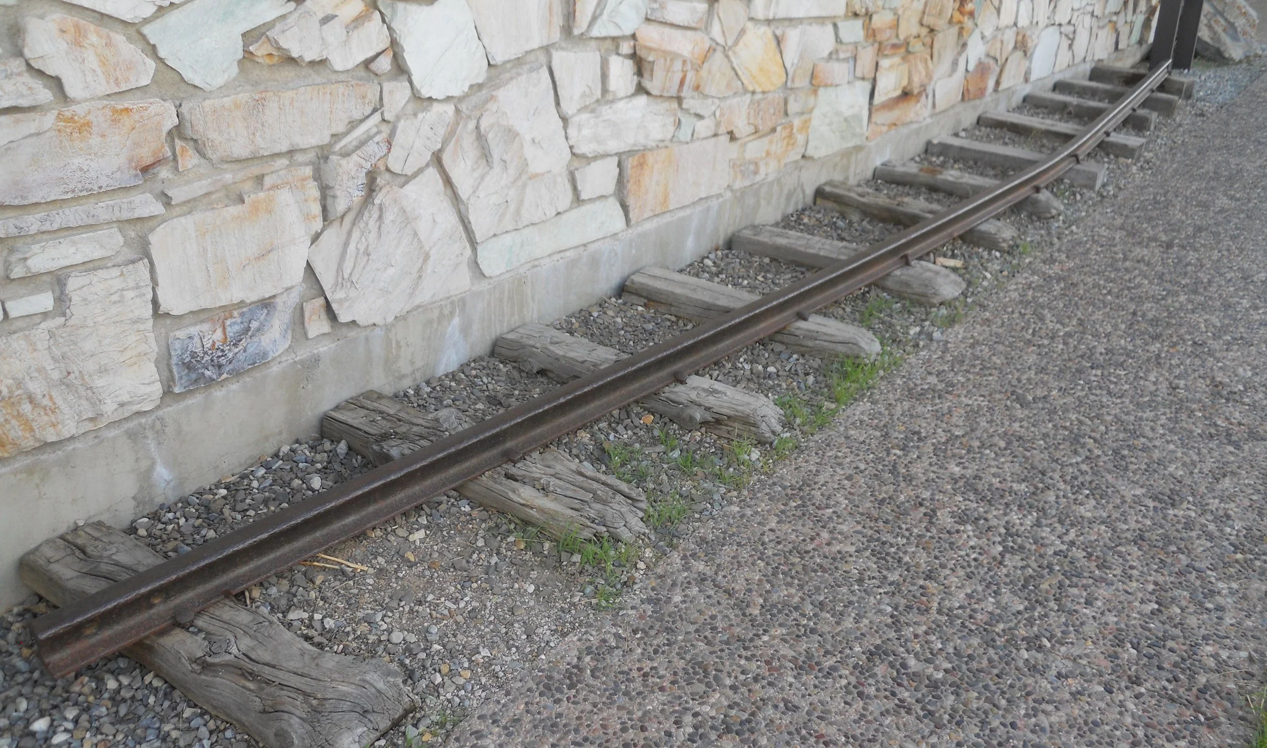
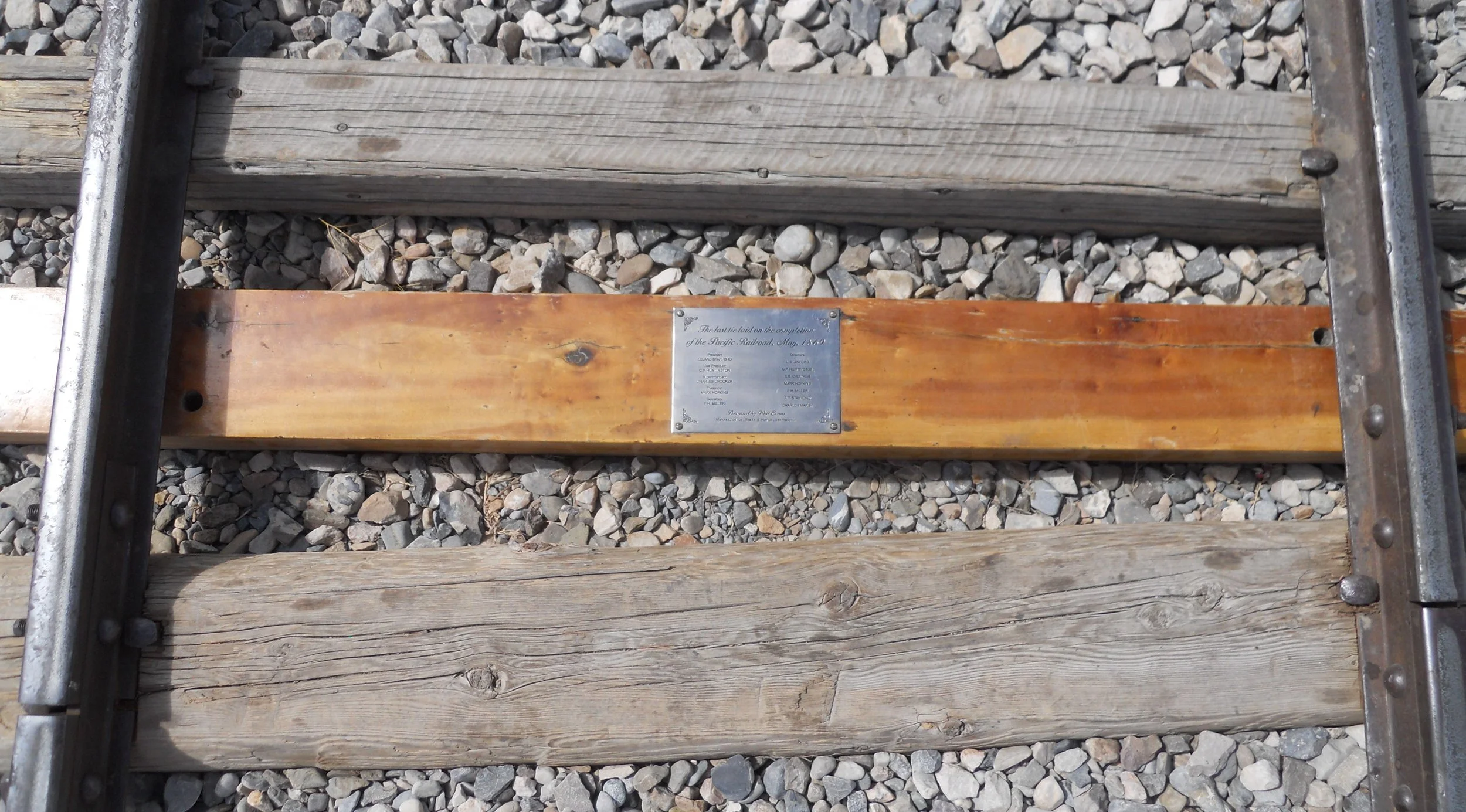
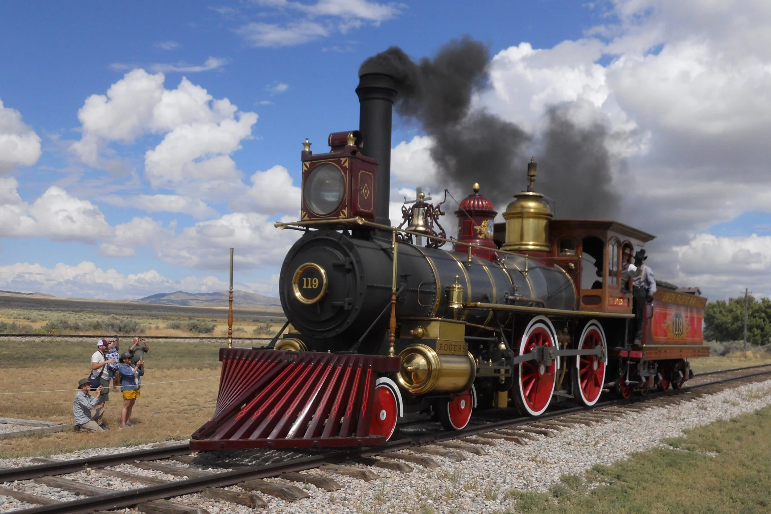
Golden Spike NHP is on the north shore of the Great Salt Lake. This honors the meeting of the Union-Pacific RR and the Central-Pacific RR at Promontory, Utah, on May 10, 1869. The importance of this act cannot be understated. President Lincoln had laid out a vision of connecting the two coasts of the country in 1862, to help move troops and freight to the west. The Jupiter and the No. 119 finally met seven years later, forever changing our country. A golden spike was used for the ceremony at the last wooden crosstie. The original spike is at Stanford University, so the VC has a replica. The replica was sent into space on the space shuttle Atlantis in 1990. This was to symbolize America’s first frontier being connected to its last frontier. Very few of the Transcontinental Railroad iron rails remain since most were pulled up and melted to support the WW2 effort, but the park has one on display, in its “pear head” design.
The actual spot where the golden spike was used is highlighted by a colored crosstie.
At 1 PM each day, the staff fires up the two engines and moves them up and down the track. The photo is of No. 119 belching black steam from its coal fired boiler.


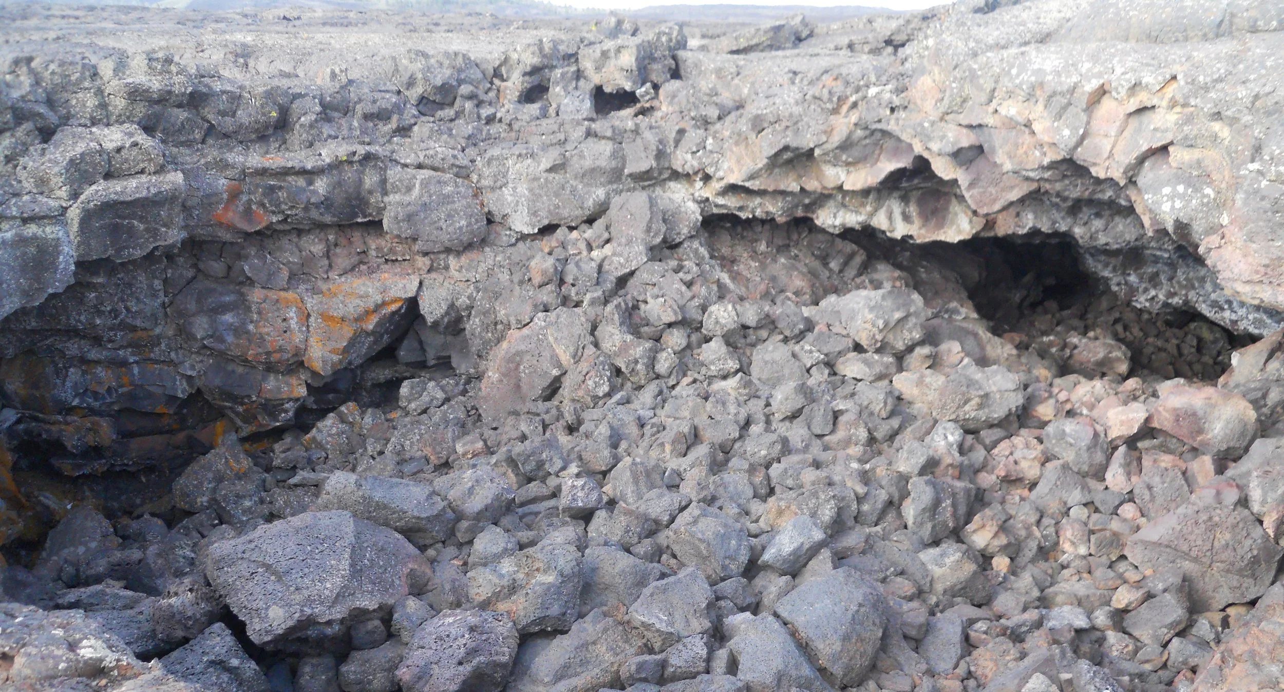
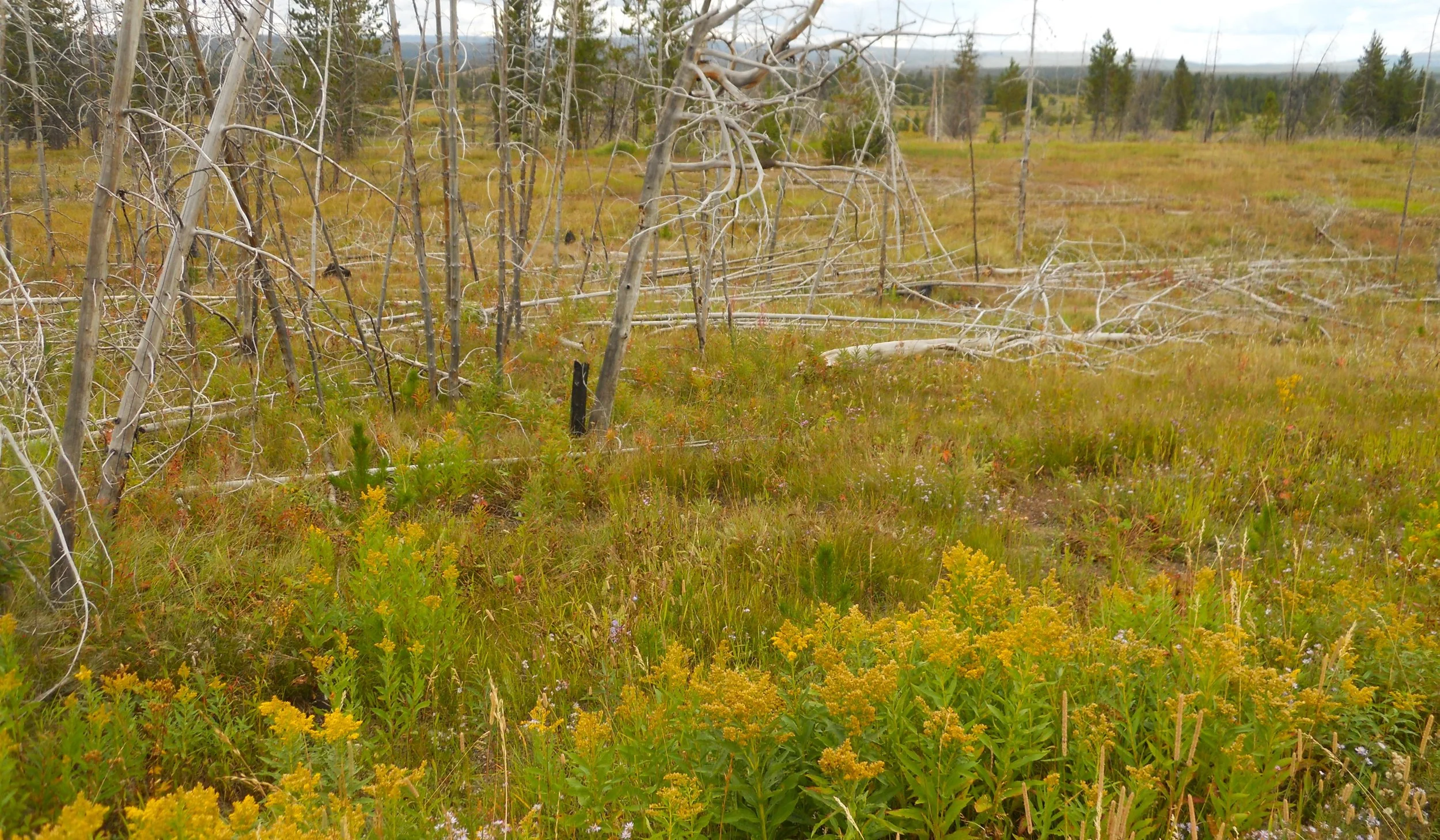
DAY 11 (September 2) - Craters of the Moon NMon and Pres is one unique looking landscape. Most people come to view the Monument portion, but I had to stop in the Preserve as well, so one photo. Much of the preserve looks like this, or is flat with desert vegetation. Some areas have lava rock.
Now for why folks come to the monument. There are lava tube caves, but some are closed due to white-nose bat syndrome. I stopped at the opening to Dewdrop Cave. Anyone entering an open cave must obtain a free permit at the VC after answering questions about clothing being in other caves in the past 10 years (that is how long the fungus can survive on clothing).
When entering the 7-mile loop road in the monument, one of the first features is the Big Craters section.
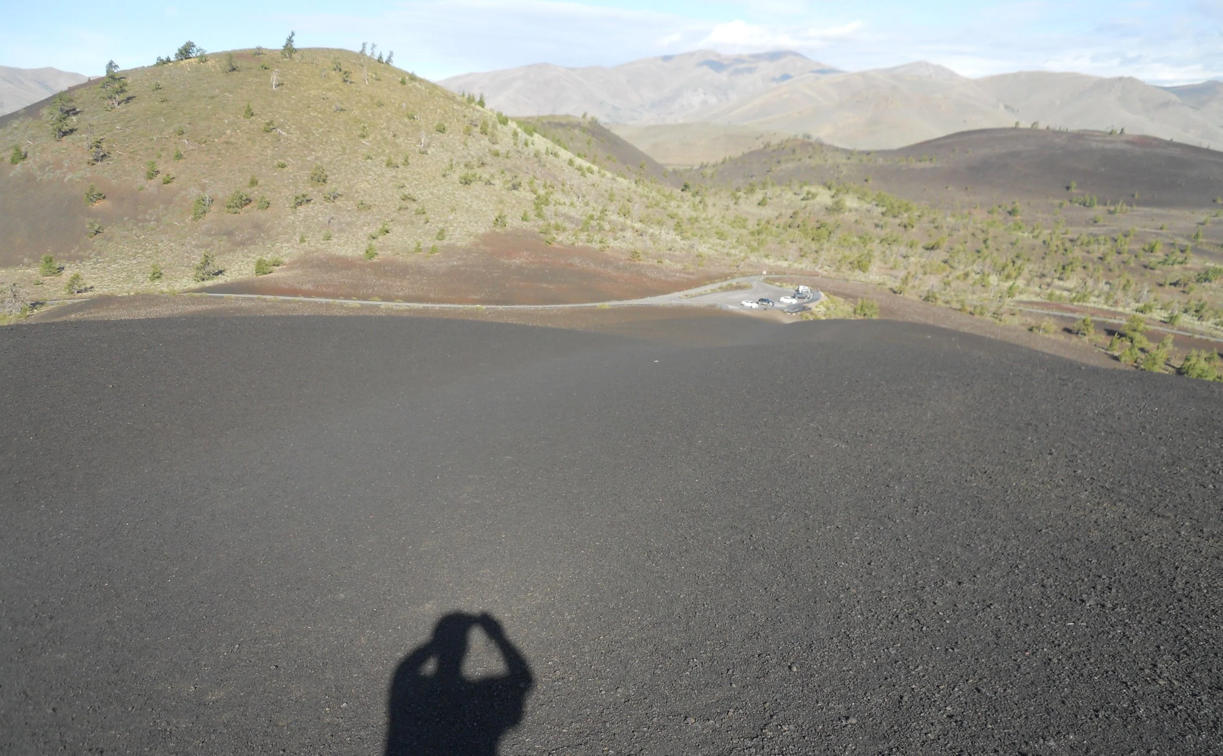
Then you come to Inferno Cone. The west side is completely black with pulverized volcanic rock. The climb to the summit is 0.2 miles and 165 feet elevation. The east side has vegetation and some trees. Hiking to the top seems to be the main tourist attraction in the park.
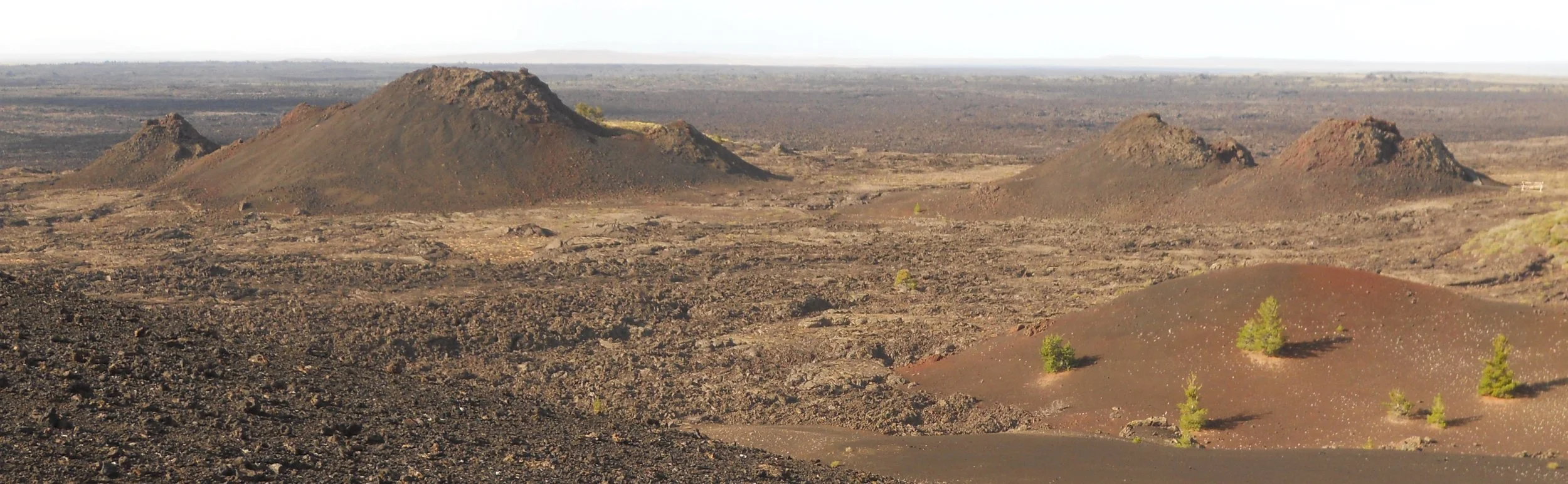
Then there are the spatter cones, one of the rarest volcanic structures on Earth. Due to the activities of past visitors, the cones look much different than 50 years ago. The NPS is restricting access to help preserve them.
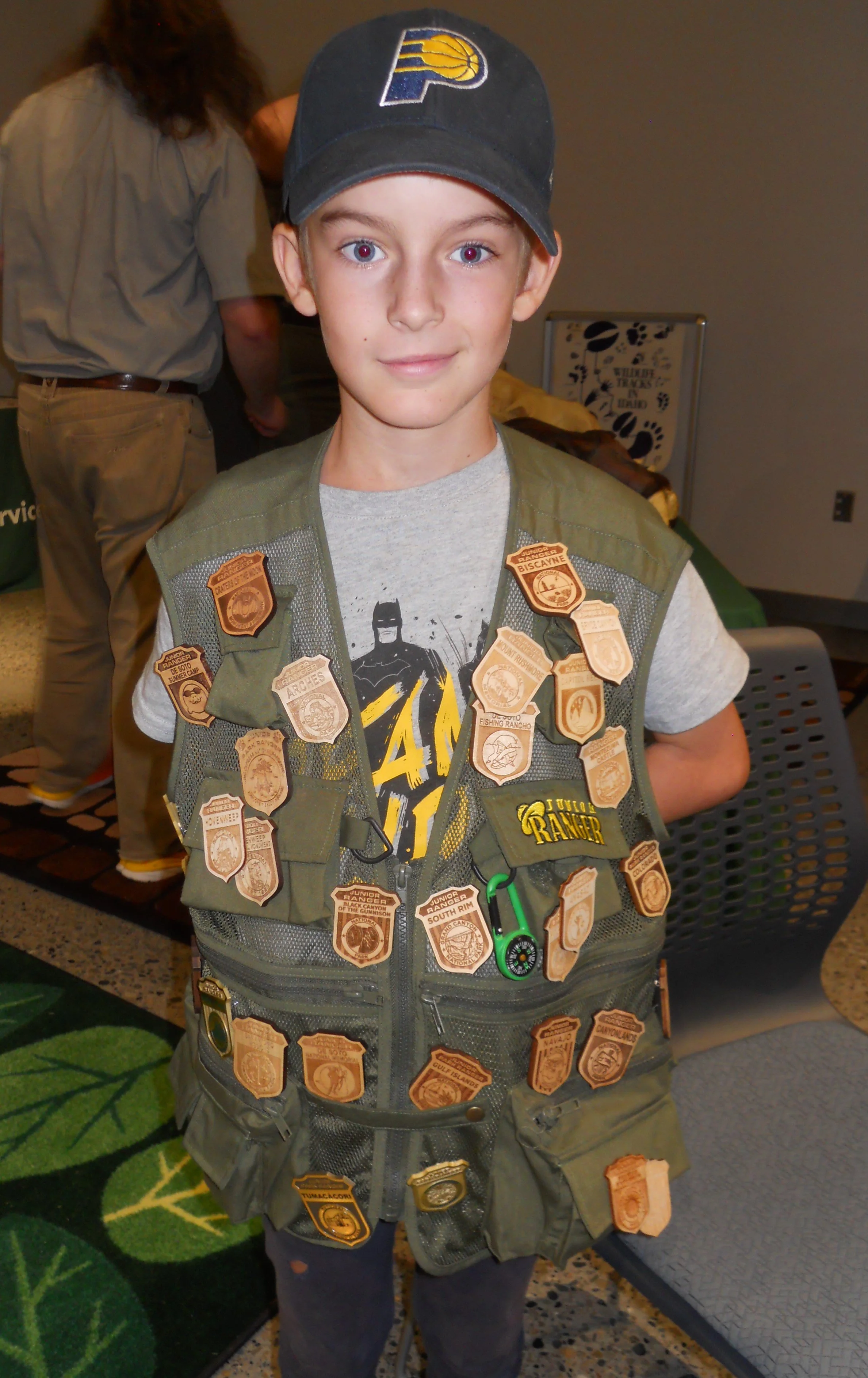
At Hagerman Fossil Beds NMon I met a family from France. Elliot, the son, was wearing a park vest with up to 30 Junior Ranger badges. He and his sister were working on this park’s Jr Ranger badge when I met them. Bravo for traveling to all these parks. The family has been focusing on the East and West Coast parks. This is one park in which visitors will not see any fossils in the field. There are two overlook spots along the Snake River, of the cliffsides where fossils have been found by the NPS and other scientists. But no one is allowed in the areas. A sign at the one overlook read that beavers are the primary fossils found, since they have been on the riverbank for 4 million years. The only place to see a fossil is at the VC. A replica of a large American Mastodon skull was on display. The VC and park are a collaboration with Thousand Springs State Park of Idaho.
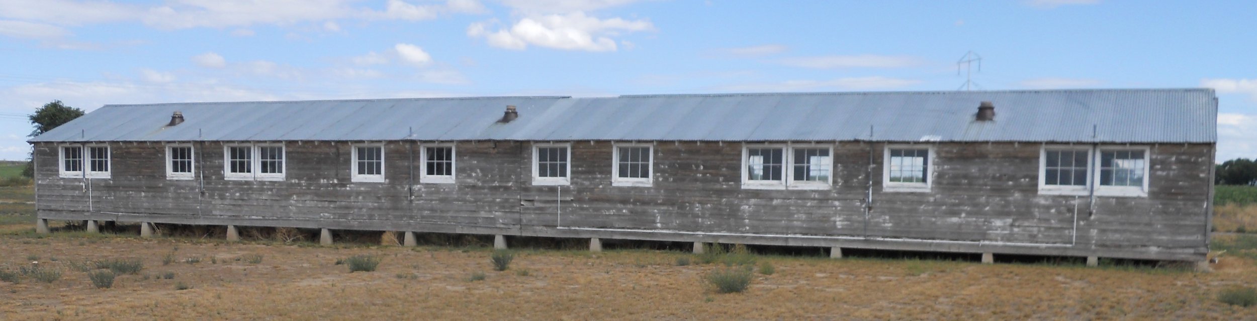
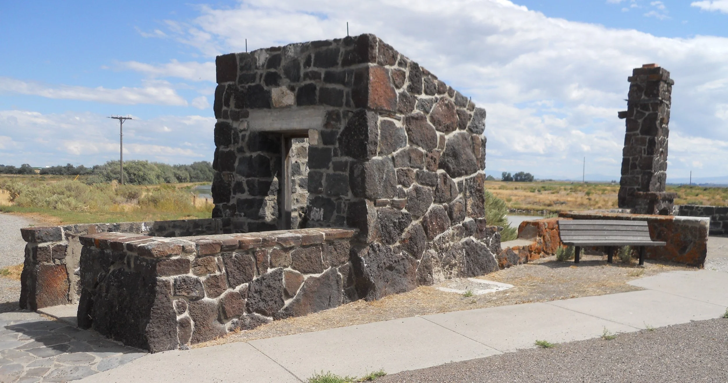
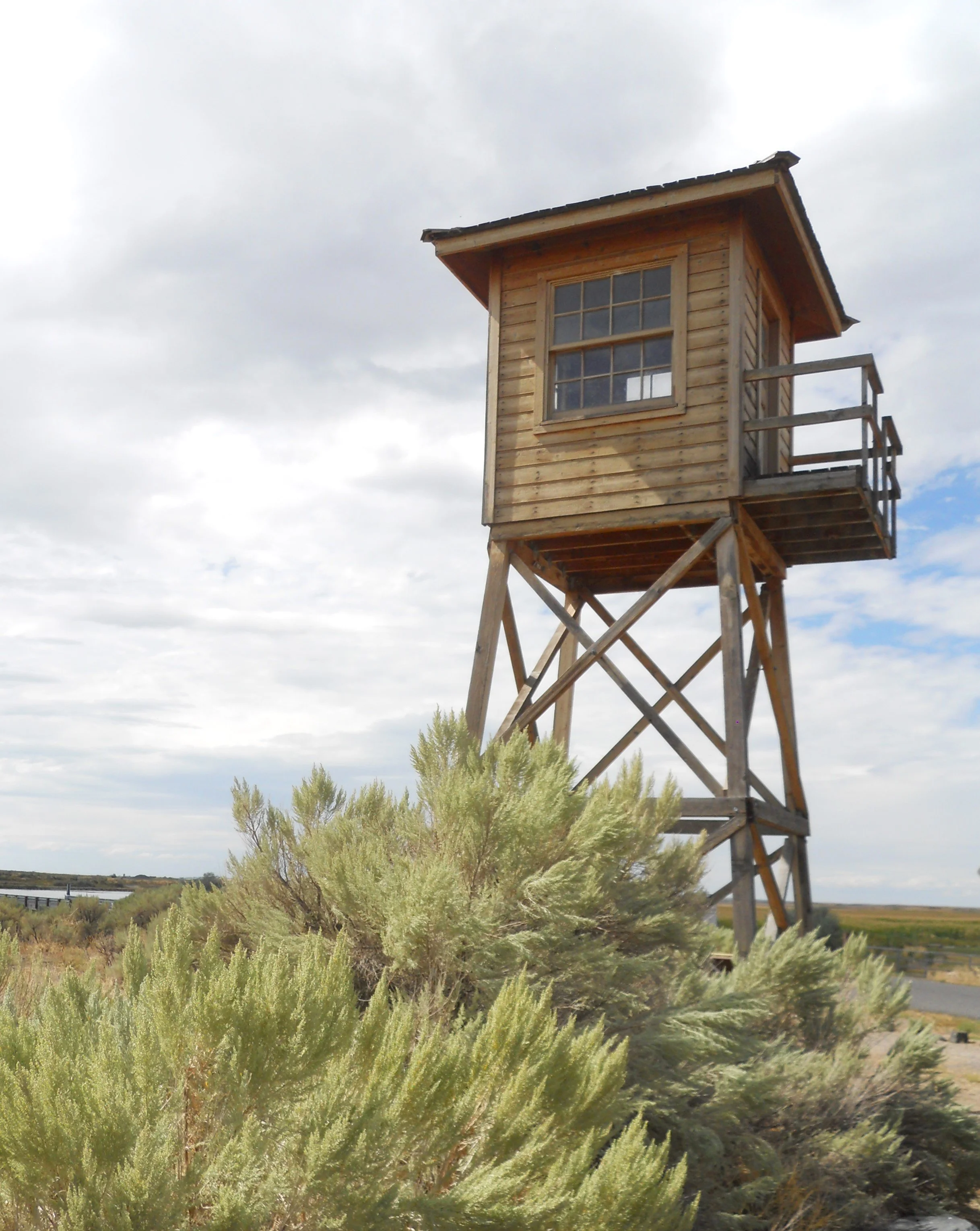
Minidoka NHS is being brought back to life to teach all Americans the value of civil liberties. The U.S. Government stole the lives of over 120,000 Japanese-Americans during WW2. This is one of ten internment camps for these citizens who lived on the West Coast. Tule Lake, Manzanar, and Amache are three other sites which are now national parks. The 30-minute film in the VC is a must-see for all visitors. A mess hall and residence hall from Block 22 (there were 44 blocks in the camp) have been preserved. Ranger Emily said the distance between Block 1 and Block 44 was 3 miles. That was a long distance if your friends or relatives were at the other end of the camp. The camp had an extraordinary baseball team which was allowed to compete against local white squads… usually beating all of them. The remains of the Military Police Building (left) and Reception Building (chimney) are at the front of the camp/park, as is a guard tower. An Honor Roll monument lists the names of the Minidoka men and women who eventually served in the Armed Forces during WW2.


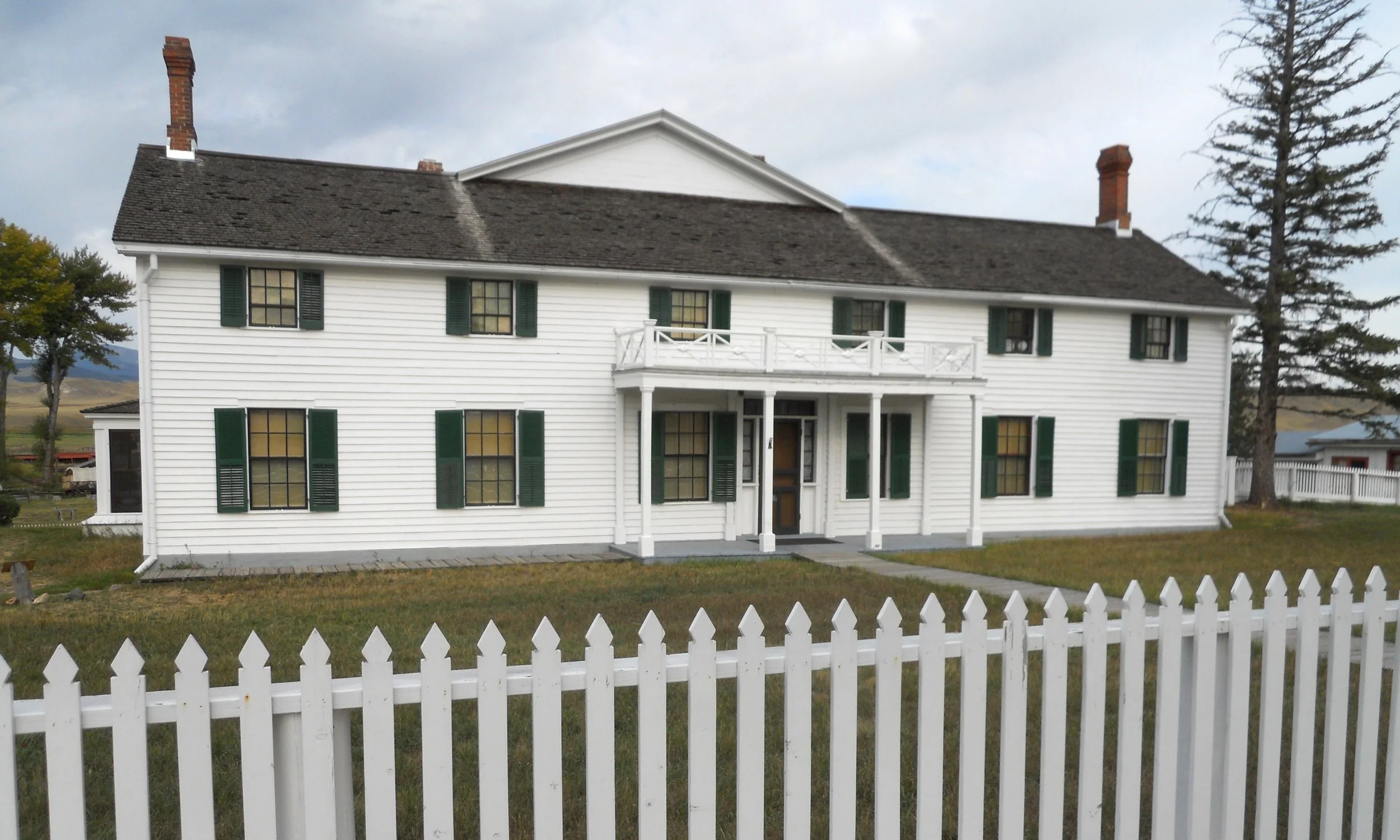
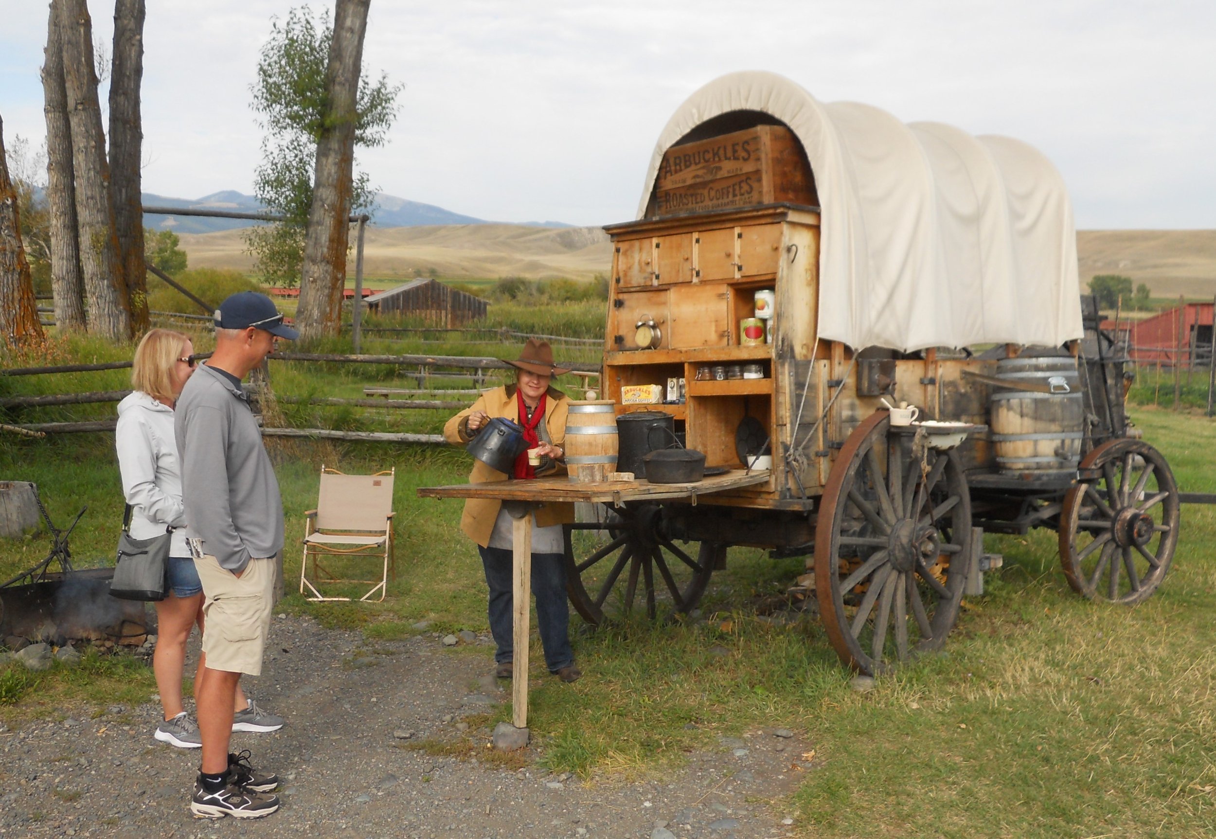
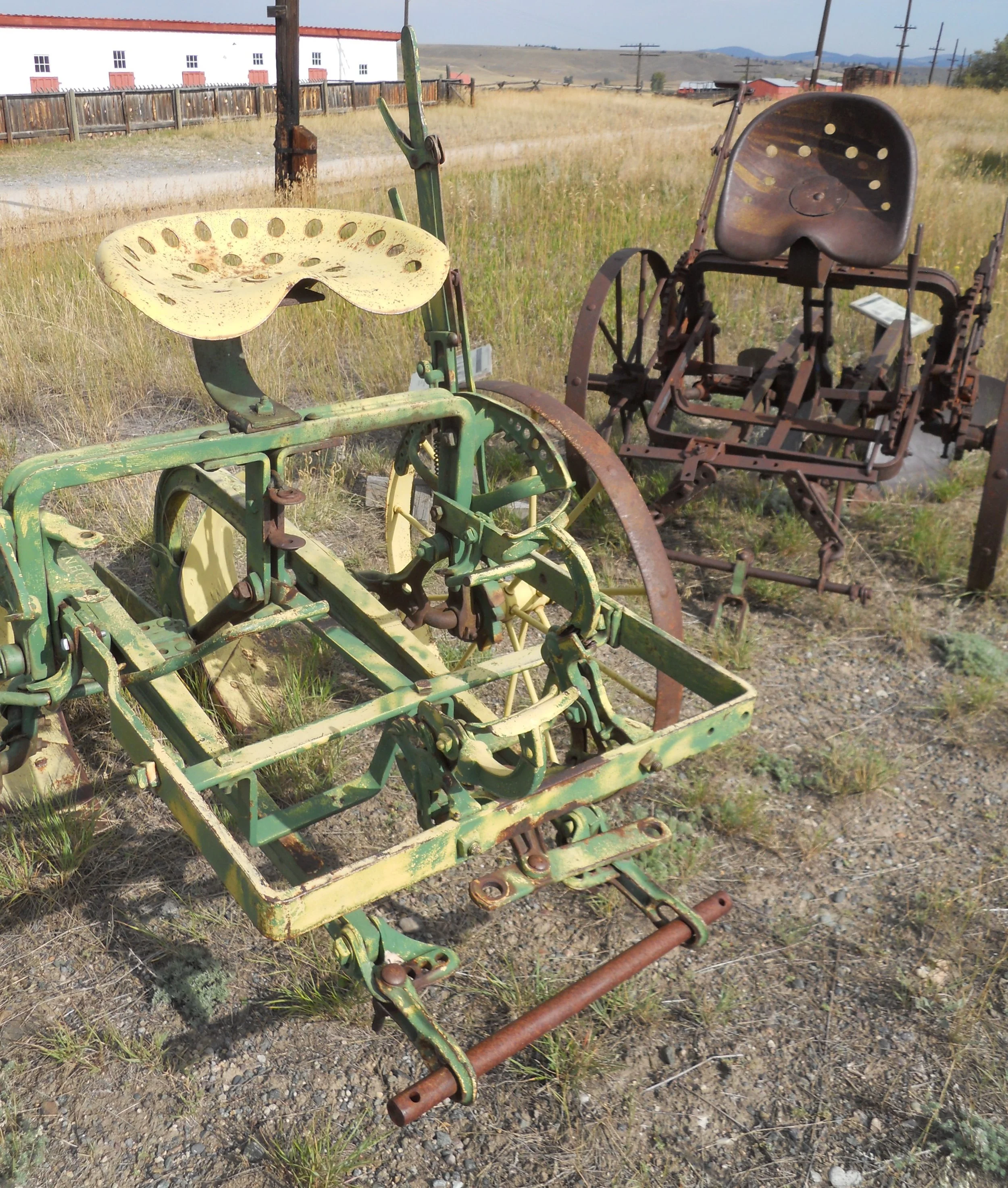
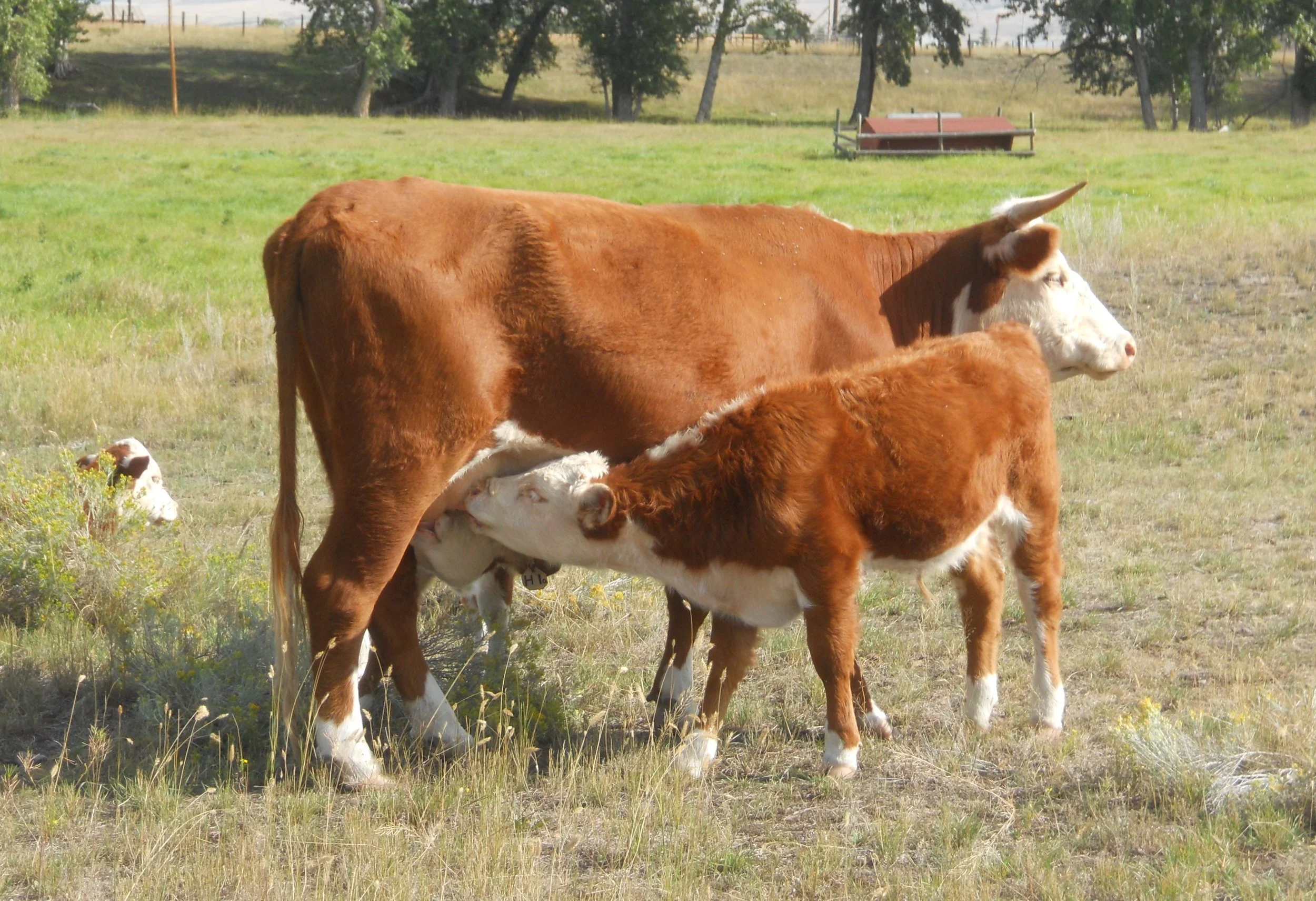
DAY 10 (September 1) - Grant-Kohrs Ranch NHS is the tale of two men; John Grant who started the ranch and Carsted Kohrs who bought the ranch and built it into a massive cattle empire, grazing over 10 million acres (now parts of 4 states and Canada). The center piece of the ranch is the main house, built in 1862 by Grant (expanded in 1890 by Kohrs and his new wife, Augusta). He sold the property to Kohrs in 1866. Kohrs’ grandson, Con Warren, sold the entire estate to the NPS in 1970, with the provision it would remain a working ranch. There is plenty of antique farm equipment across the ranch, such as the two harrows. A ranger was making coffee for a couple from Calgary, as done in chuckwagon days. There is still cattle and draft working horses on the ranch. Demonstrations of various ranch operations are performed on certain days.
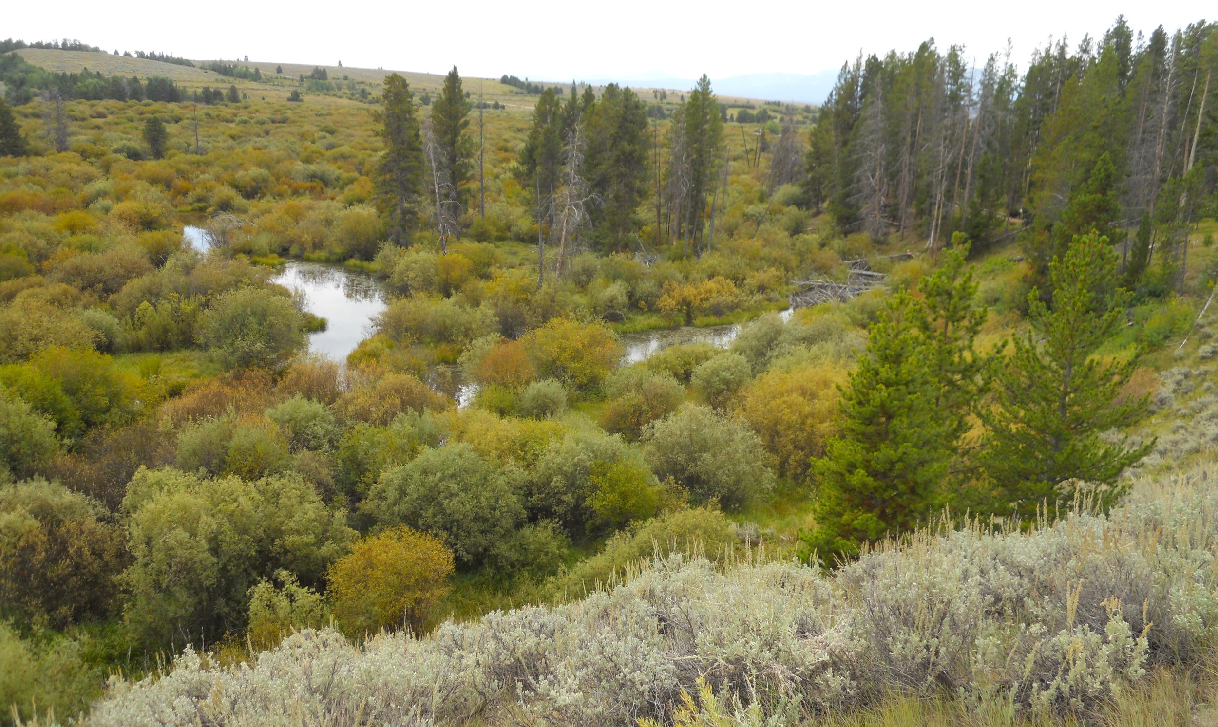
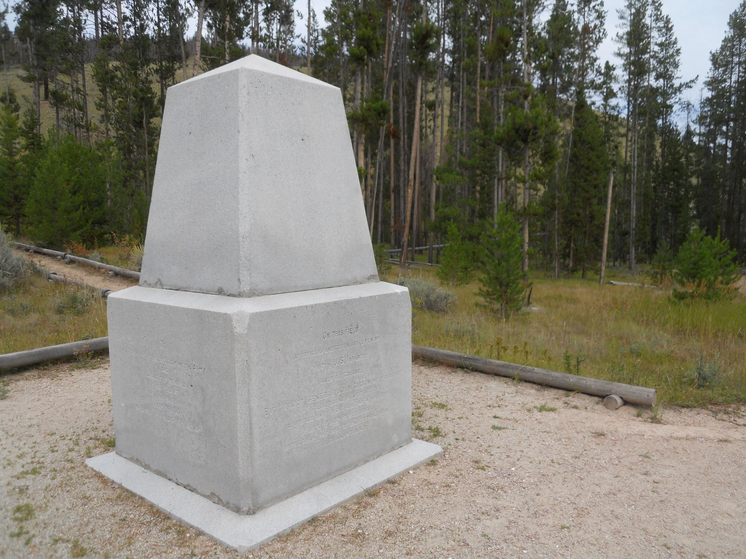
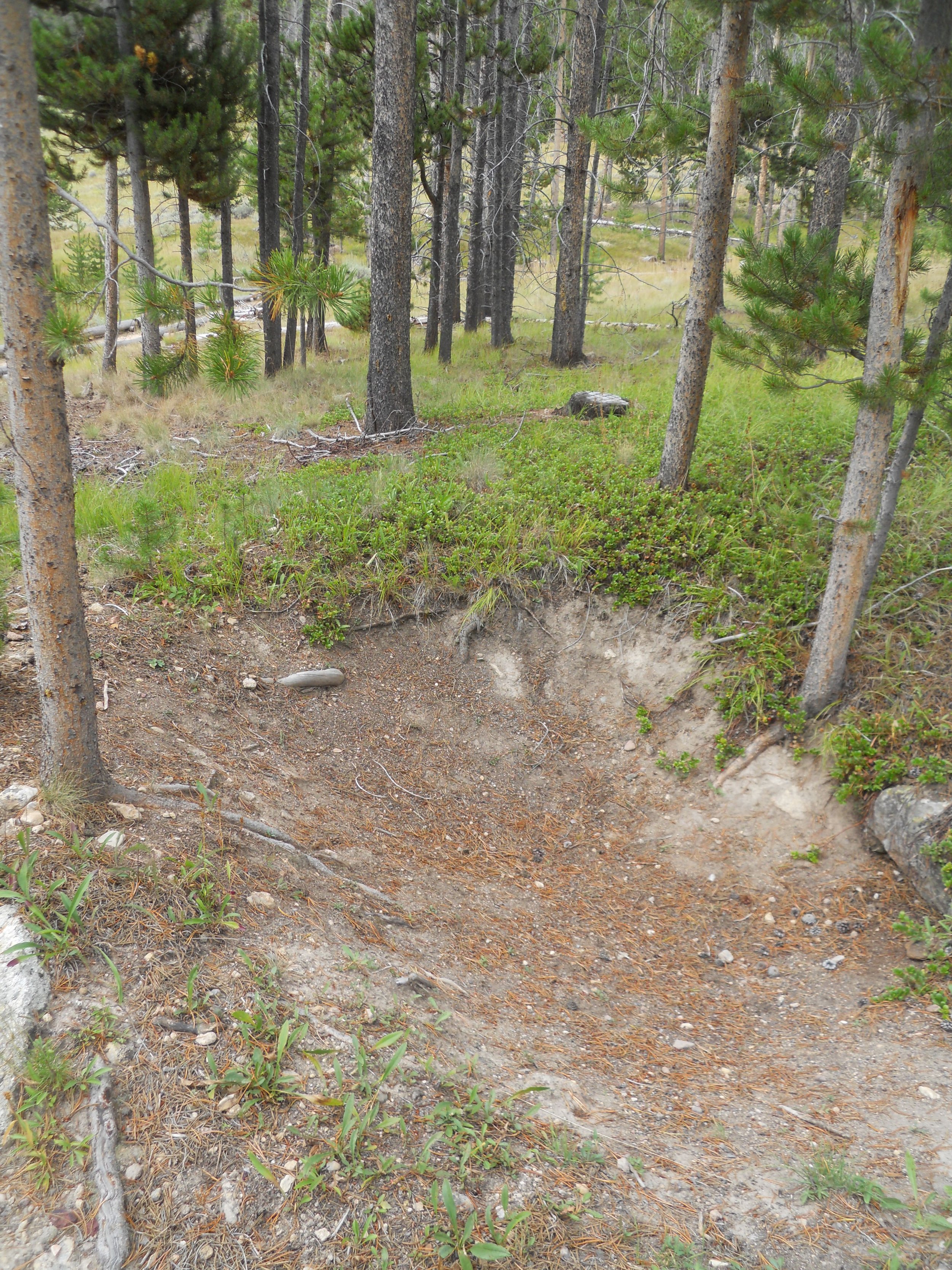
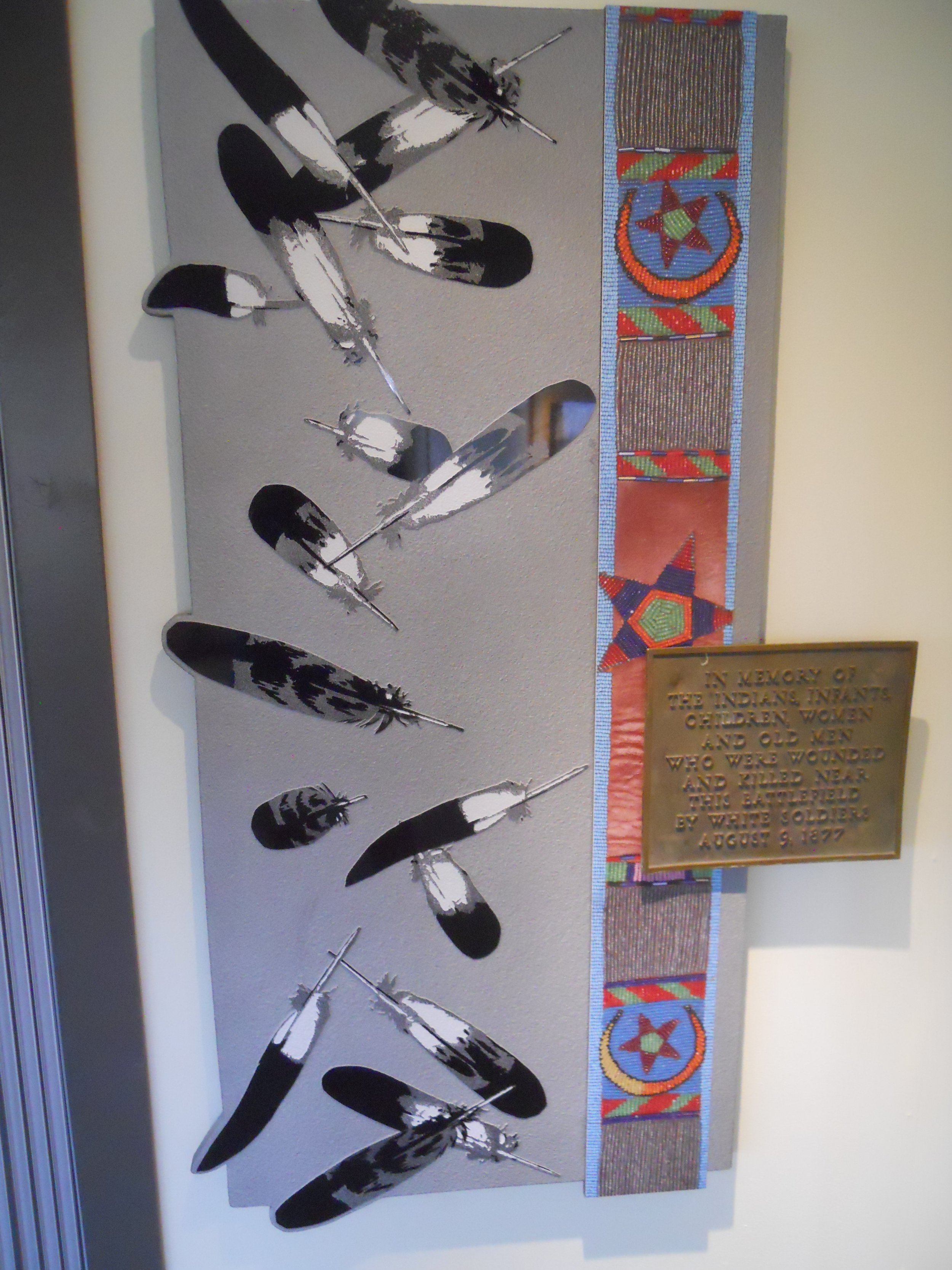
Big Hole NB is 12 miles west of Wisdom, MT, on the banks of the North Fork Big Hole River. August 9, 1877 is a day the Nez Perce nation will never forget. In one day, 90 Nez Perce and 31 soldiers/volunteers lay dead. A surprise attack by the 7th Infantry at daybreak saw slaughtering of women and children. After the initial shock, warriors regrouped and forced Col. Gibbon’s men back across the river and up a hill to take shelter in a pine forest (in photo, movement was left to right), The soldiers hurriedly dug dirt entrenchments (photo). The State of Montana erected a monument in the Siege area, for the 31 soldiers and Montana volunteers who died. A beautiful piece of artwork is in the VC, honoring the Nez Perce who died that day. Every anniversary, members of the Nez Perce return to hold a ceremony.
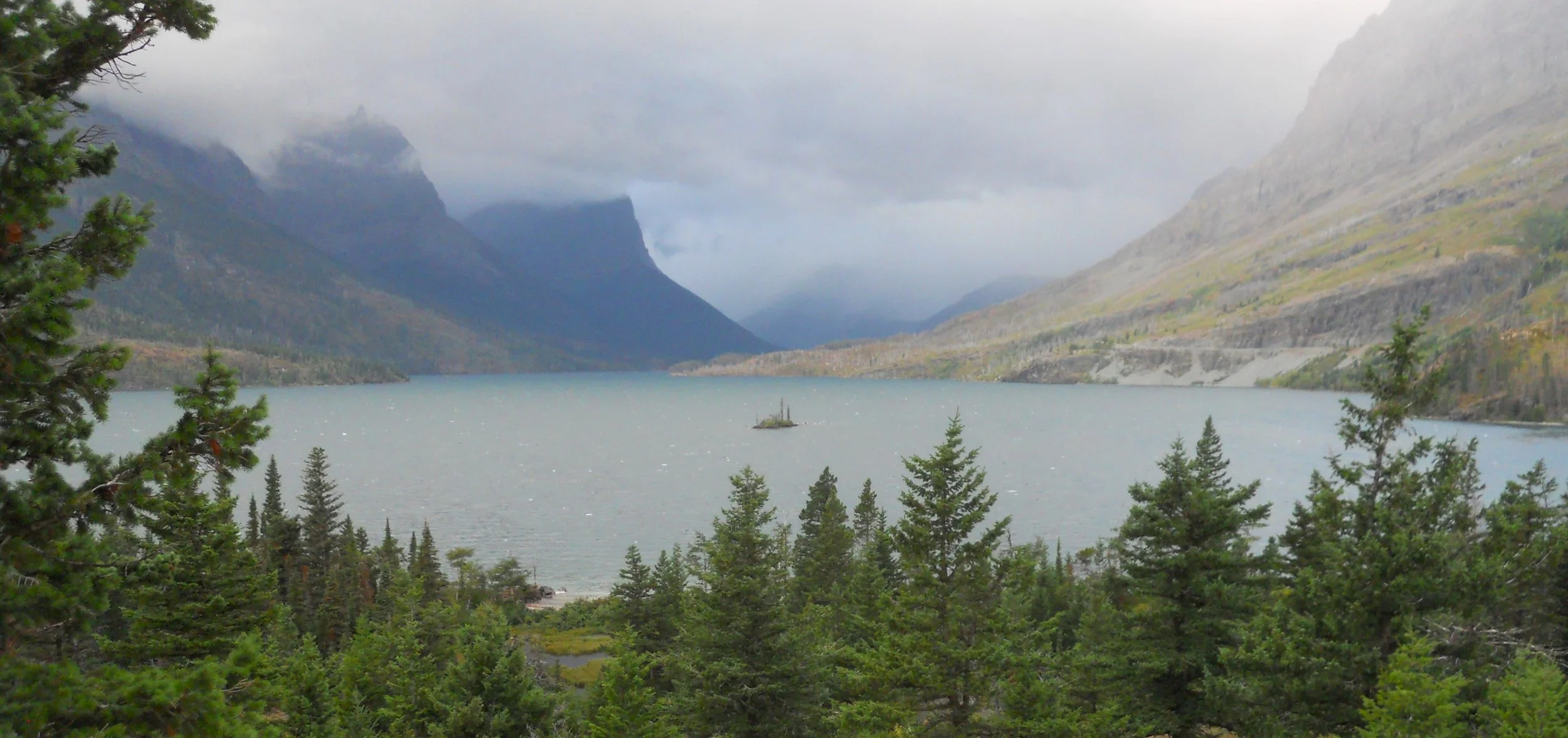
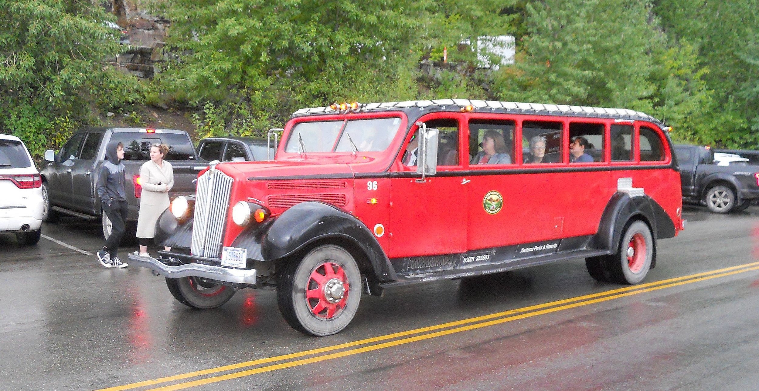
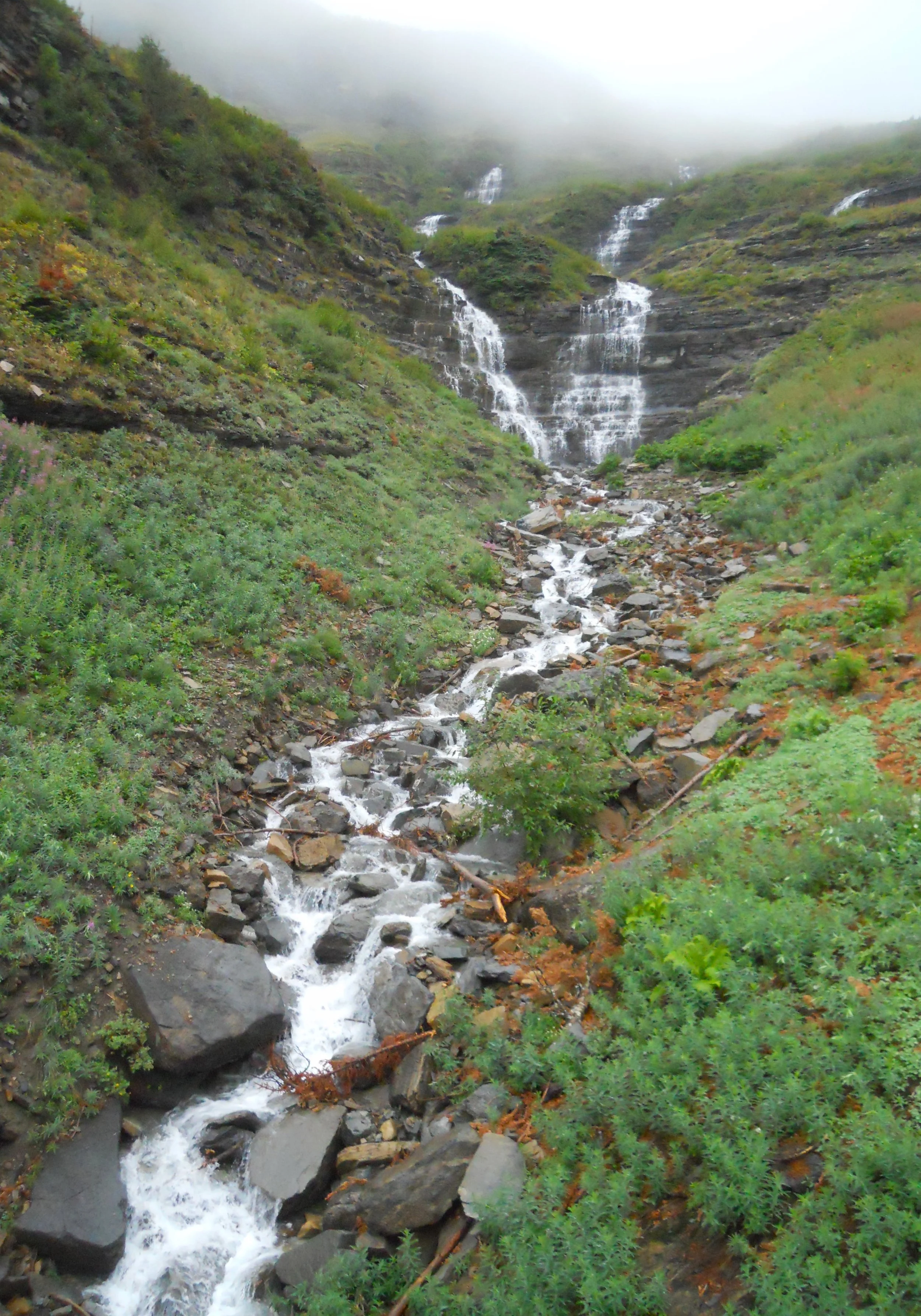
DAY 9 (August 31) - HEAVY fog, rain, and wind kept me from my primary objective of hiking the Garden Wall and Loop trails. But plenty of other natural features to view. Wild Goose Island sits in the middle of Saint Mary Lake. Bird Woman Falls has a top section (photo) then goes under the Going-to-the-Sun Road and finishes off its 492 feet. There were plenty of the iconic red buses going up and down the park road. This one happened by the falls as I was in the downhill parking lot. Close to the west entrance are the cascades at Red Rocks. This is different from the Redrock Falls where I was yesterday.


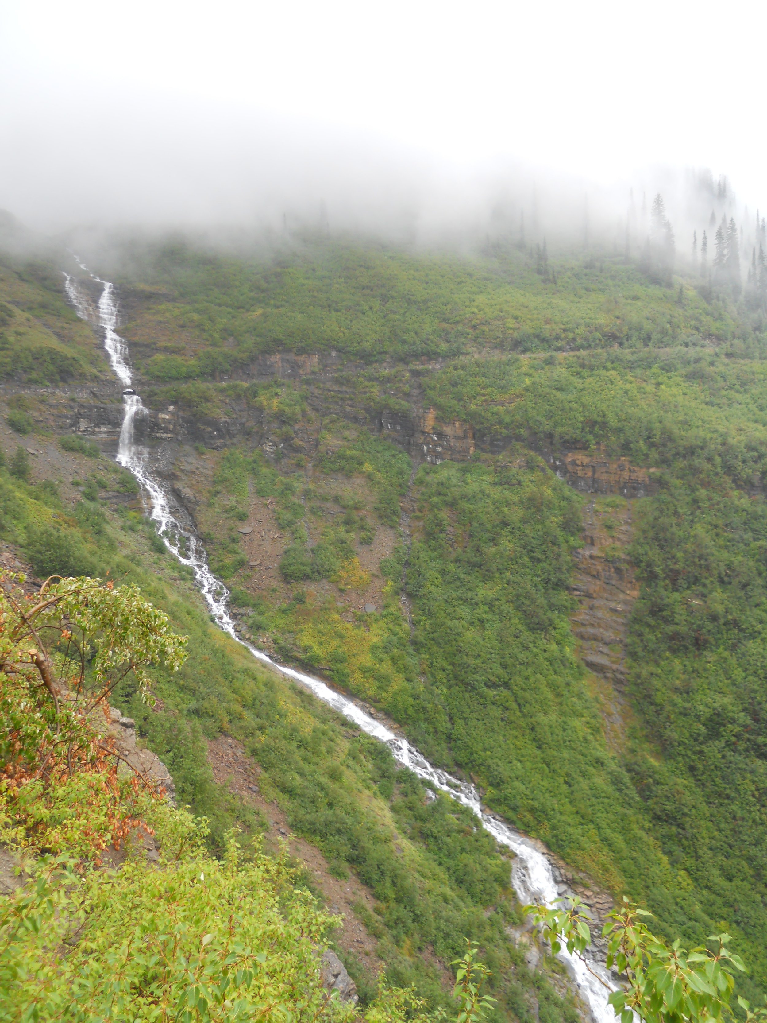
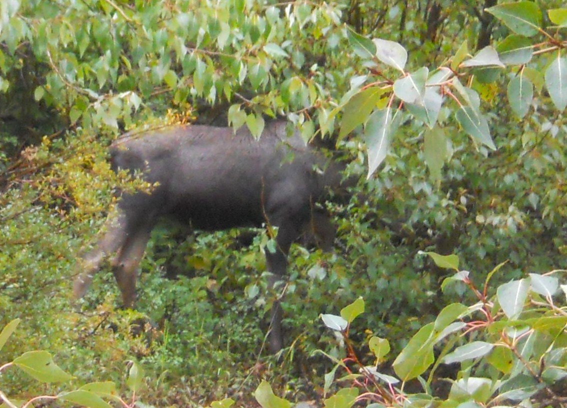
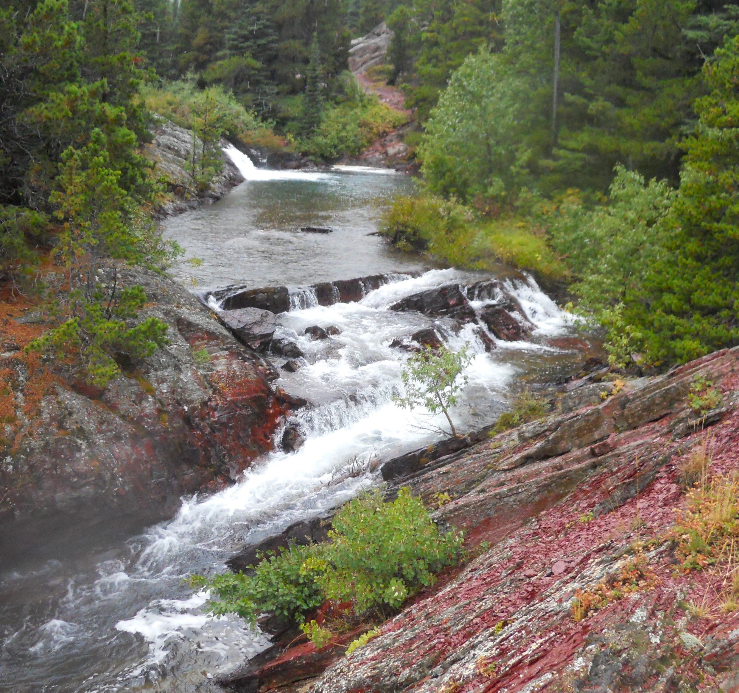
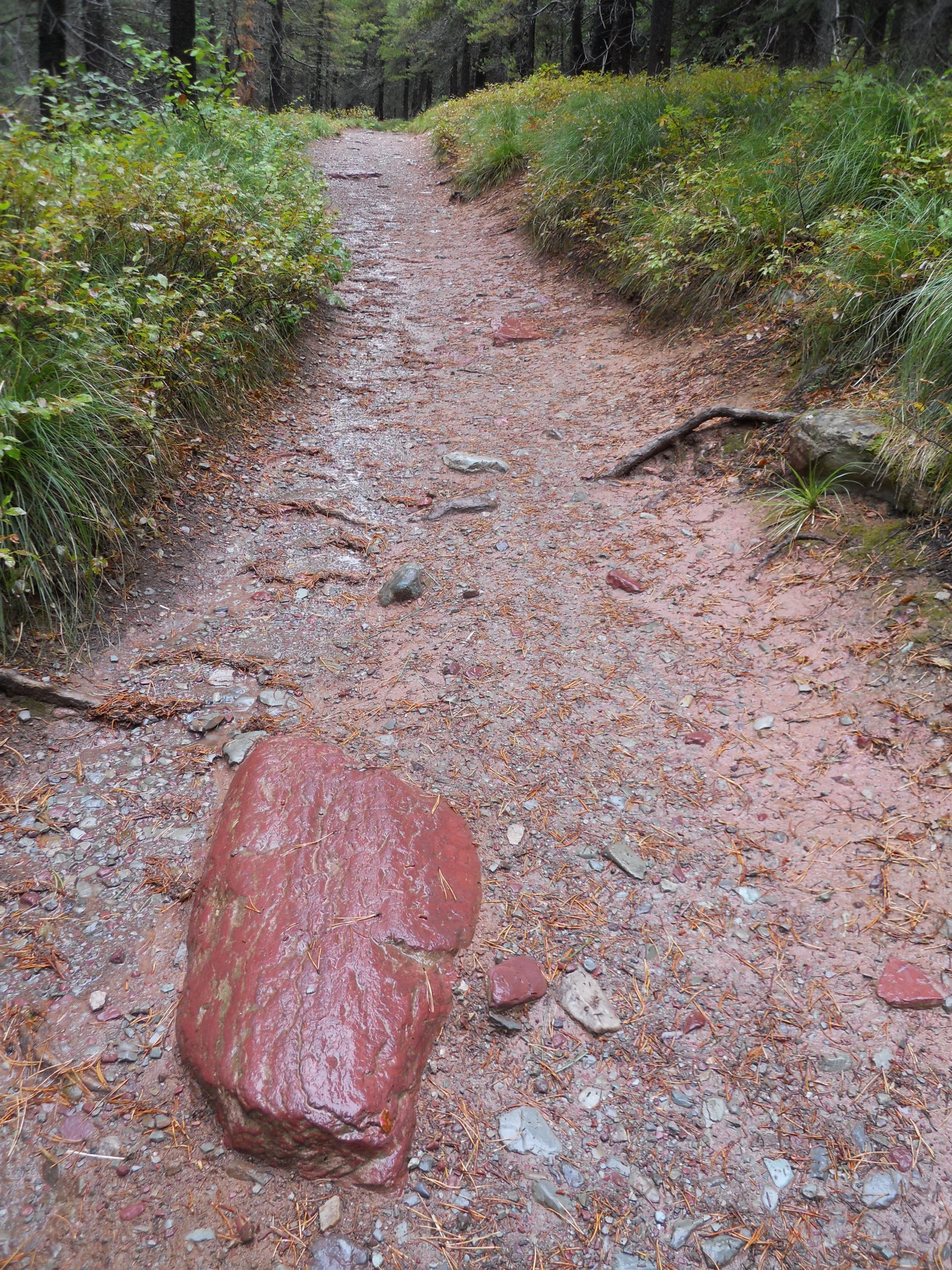
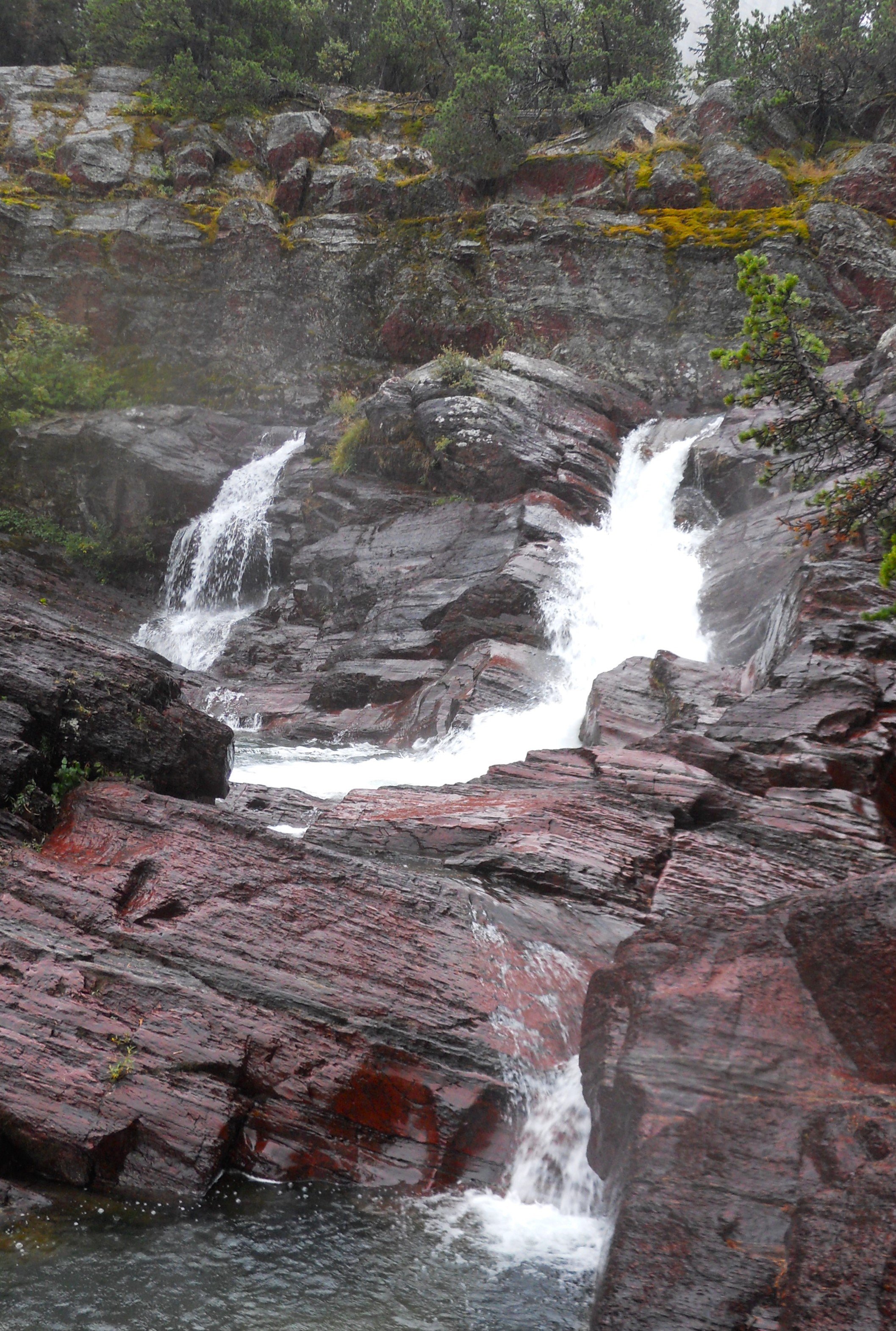
DAY 8 (August 30) - There had been a big bowling tournament in the sky overnight. The rain continued into the morning with no expectation of quitting. I started on the Redrock Falls trail, immediately crossing paths with a moose. He was not interested in poking his head out of the brush. Much of the path had small and large red rocks. Red was present at both the upper end of the falls, and the lower end. On the way back to the inn, the path shown in the one photo had plenty of water running down its middle. Not until the next morning did the rain stop.
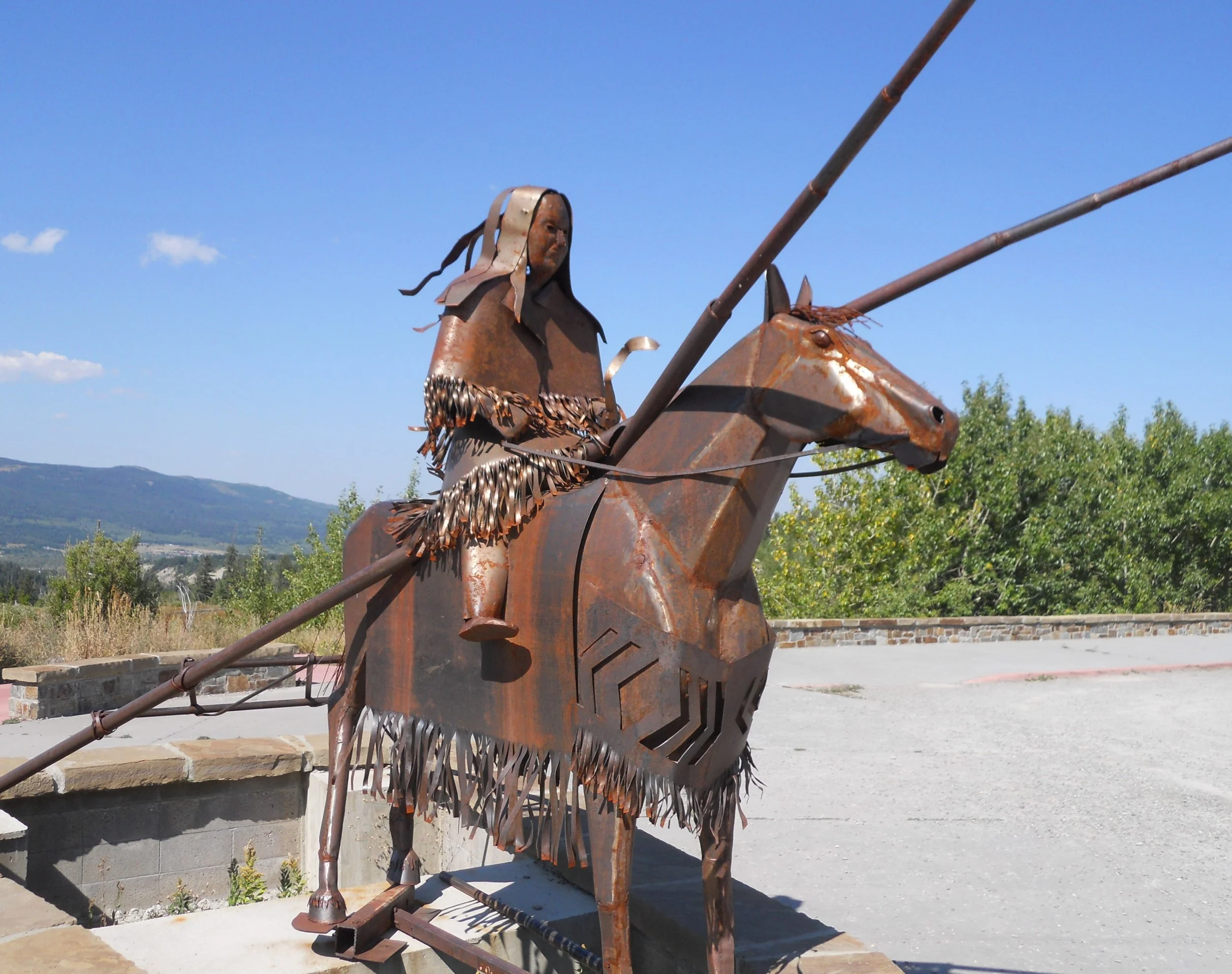
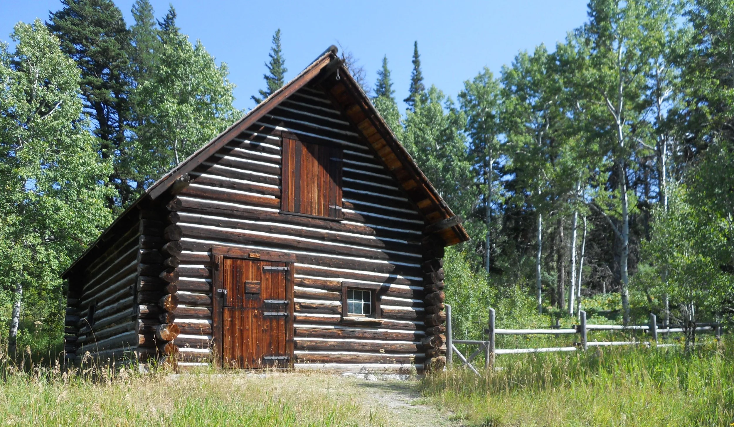
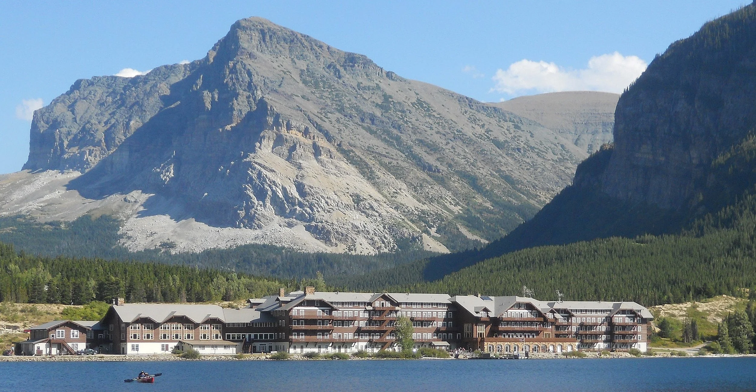
DAY 7 (August 29) - A sculpture of a Blackfeet member is outside the St. Mary entrance to Glacier NP. This is Blackfeet territory. Nearby is the 1926 Lubec Ranger Station barn. The Many Glacier Hotel is the historic lodge, alongside Swiftcurrent Lake, in this section of the park. It was built in 1915 by the Great Northern Railroad. Sorry, no A/C or televisions, in order to preserve the early-20th century feel. As you can see in the photo, this day was excellent to get out and hike… not like tomorrow.
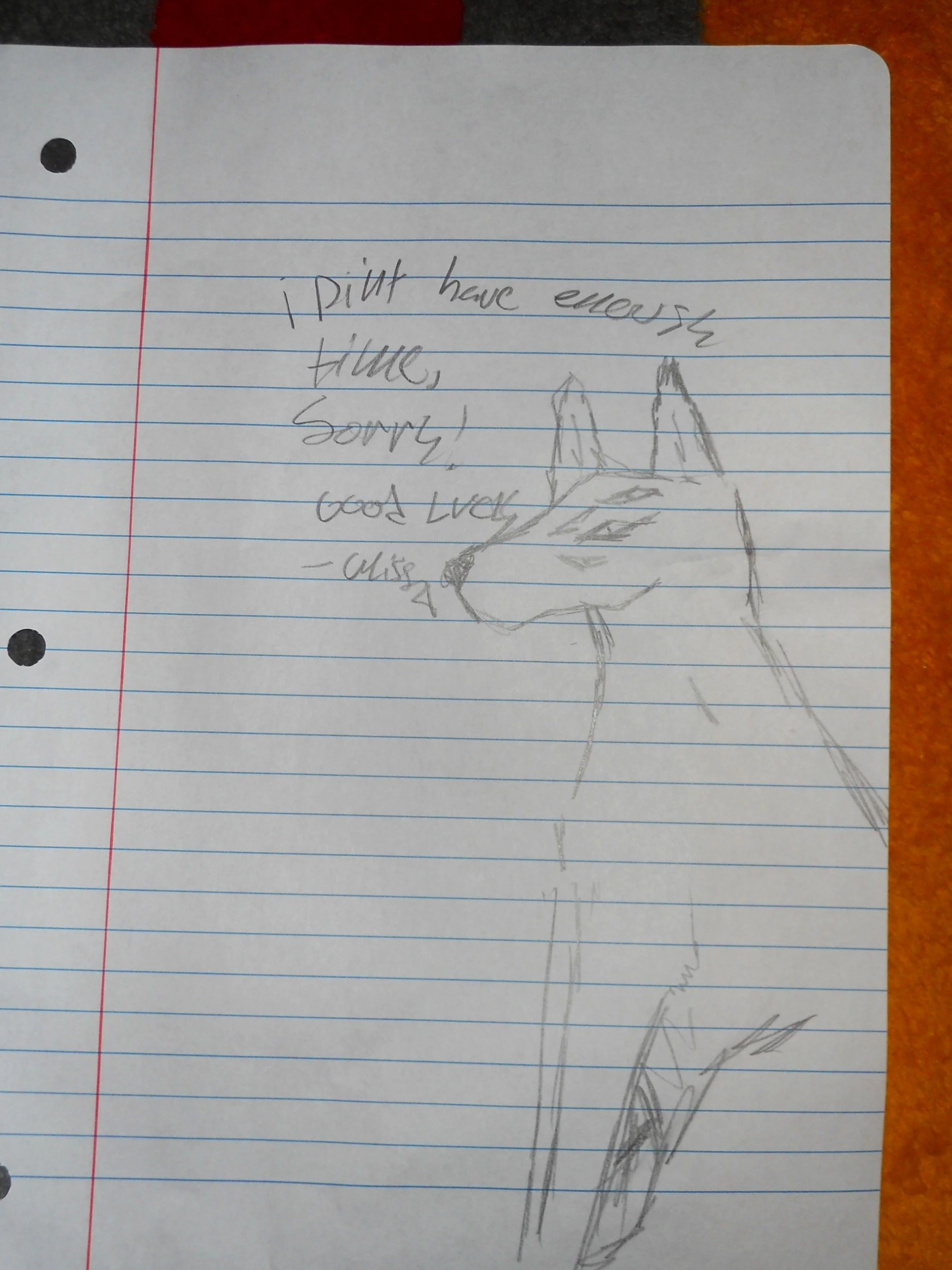
Earlier in the day I had stopped at the De La Salle Blackfeet School to give a presentation to the students. At the end of the session, Alyssa gave me a sketch she had drawn of a wolf. Thank you Alyssa, and to the entire school for their invitation.
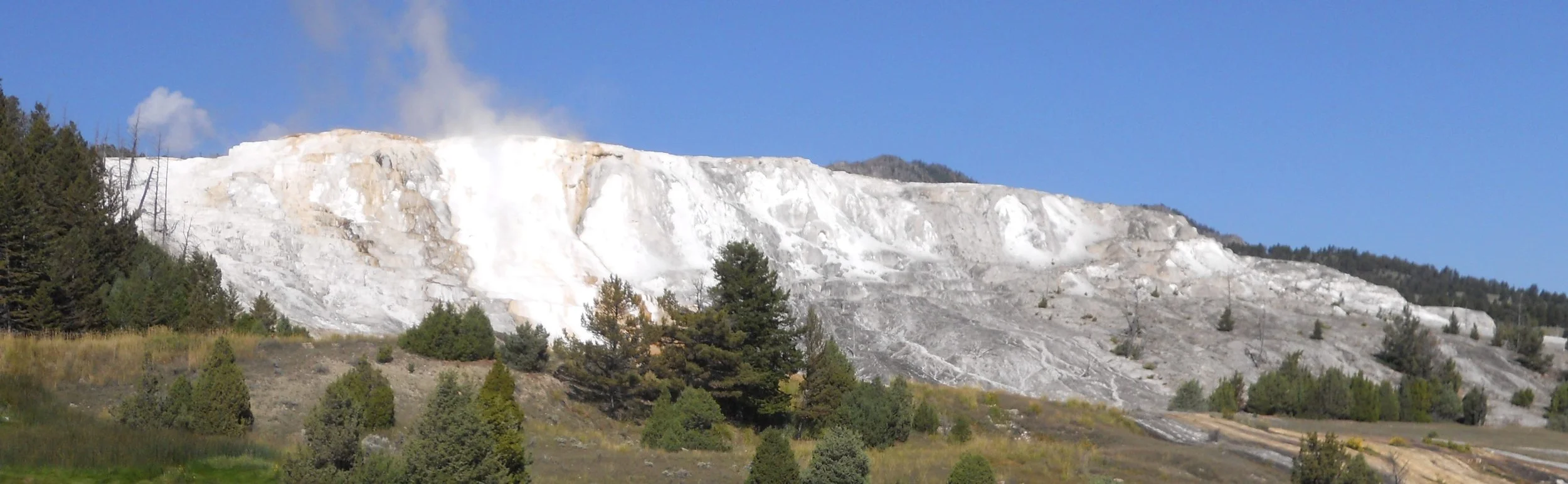
DAY 6 (August 28) - The Mammoth Hot Springs area is beautiful, both in natural features and manmade. Fort Yellowstone can be toured, built in 1886 to house soldiers who came to protect the new park. But most come to view the travertine terraces; the “white stuff”. The white comes from hot water moving upward through limestone, dissolving the calcium carbonate, then depositing calcite as the water flows away. The upper level is accessed via vehicle, with the lower area having boardwalks from parking lots. Liberty Cap is a tall white calcite structure. Palette Spring provides multiple colors at the base of the terraces.
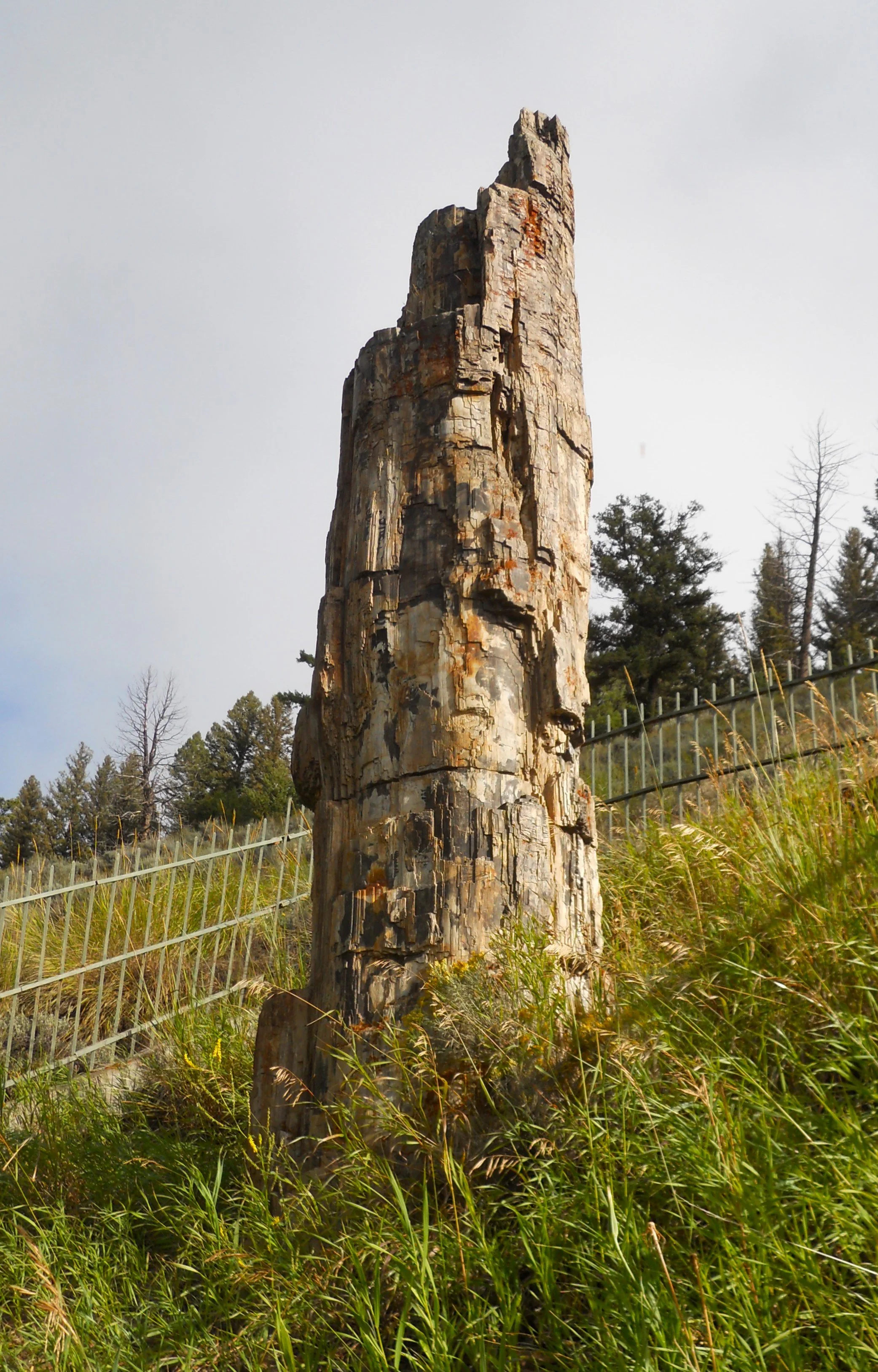
Just before the Mammoth area one can take a short drive to the Petrified Tree. It is 50 million years old. Three “trees” survived from the volcanic eruptions which buried everything in the area with ash, but souvenir hunters absconded with the two others in 1907. A fence now surrounds the last tree.
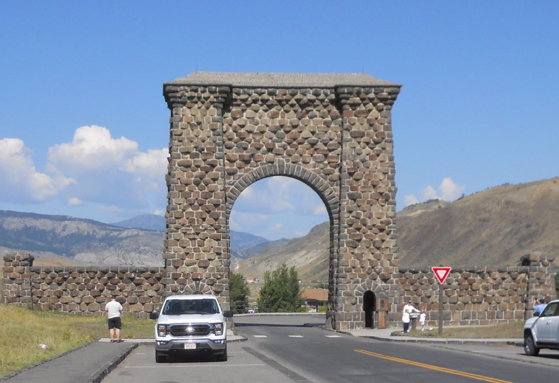
On the way out, or in depending on your direction, of the park’s north access road you can drive through the Roosevelt Arch, built in 1903. The north entrance was the first major entrance to the park.


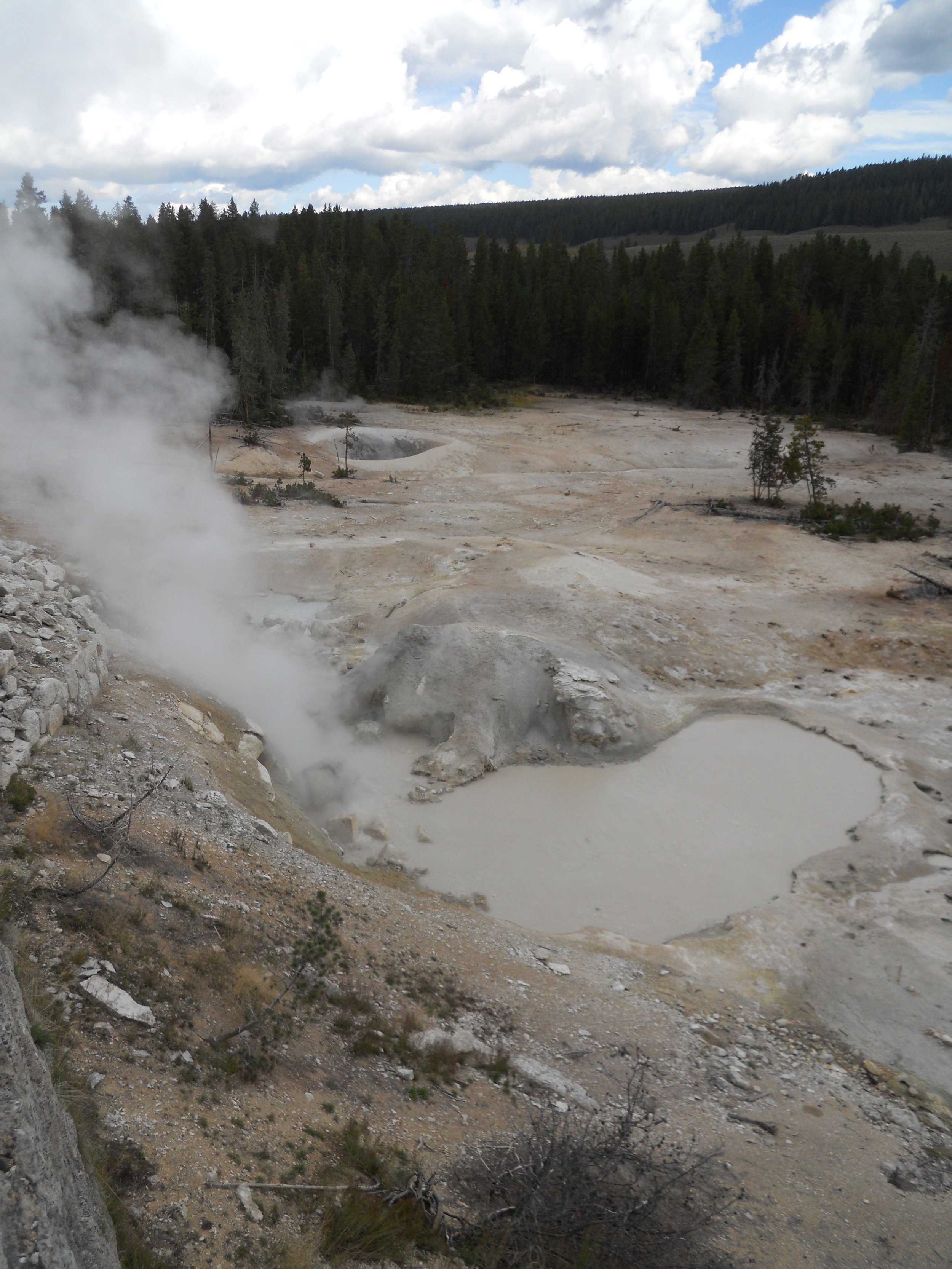
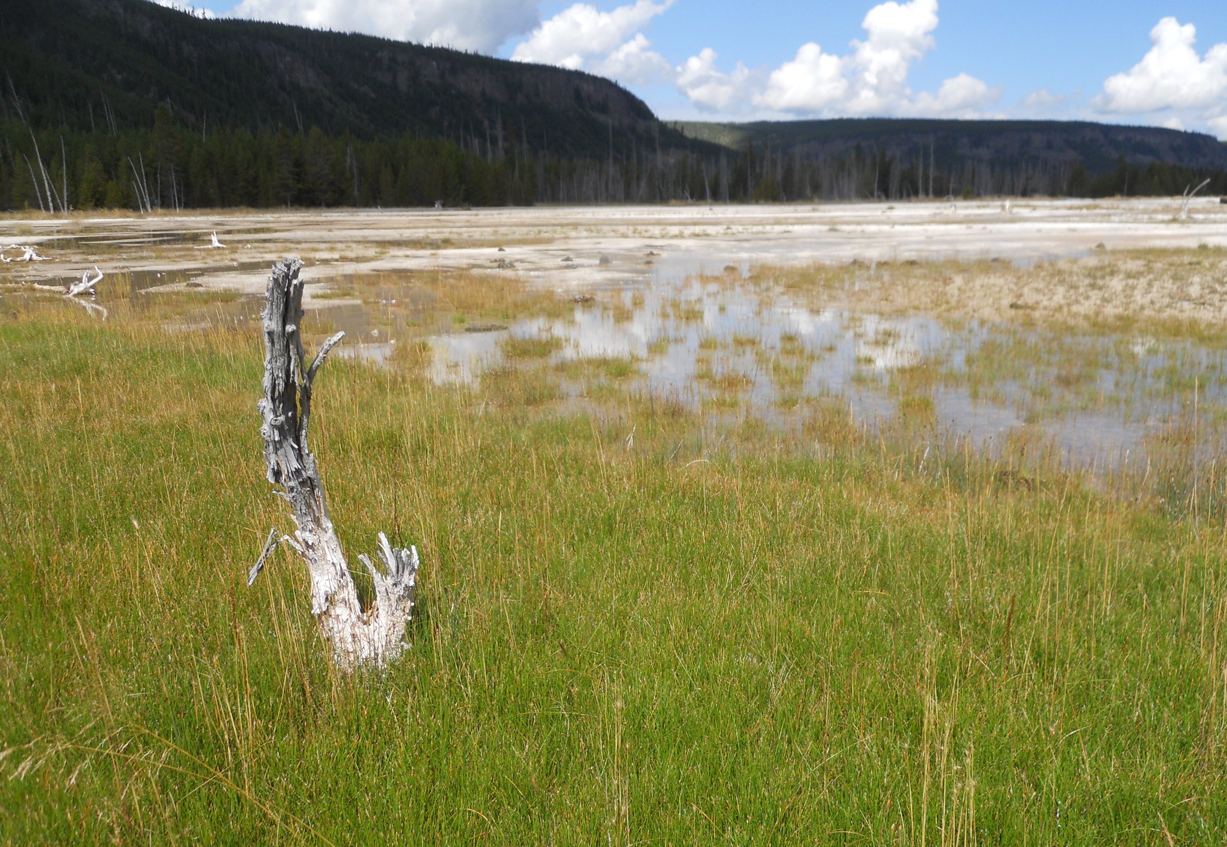
DAY 5 (August 27) - Today was spent in the central region of Yellowstone. In the Mud Volcano area, the vicious Dragon’s Mouth Spring was gurgling and spewing. The Sulphur Caleron’s toxic brew has a pH of 1… 0 is the lowest the scale goes, with 7.0 being neutral, or water. No one wants to drink this stuff.
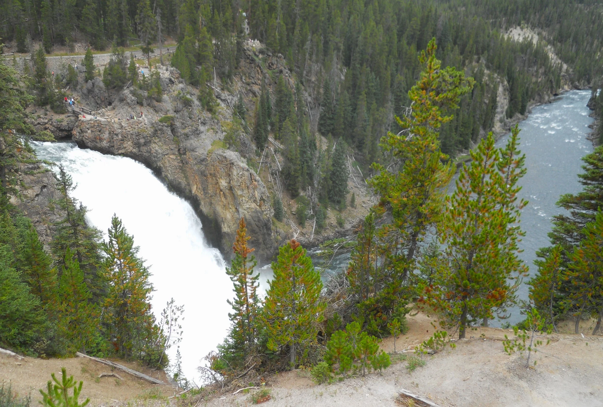
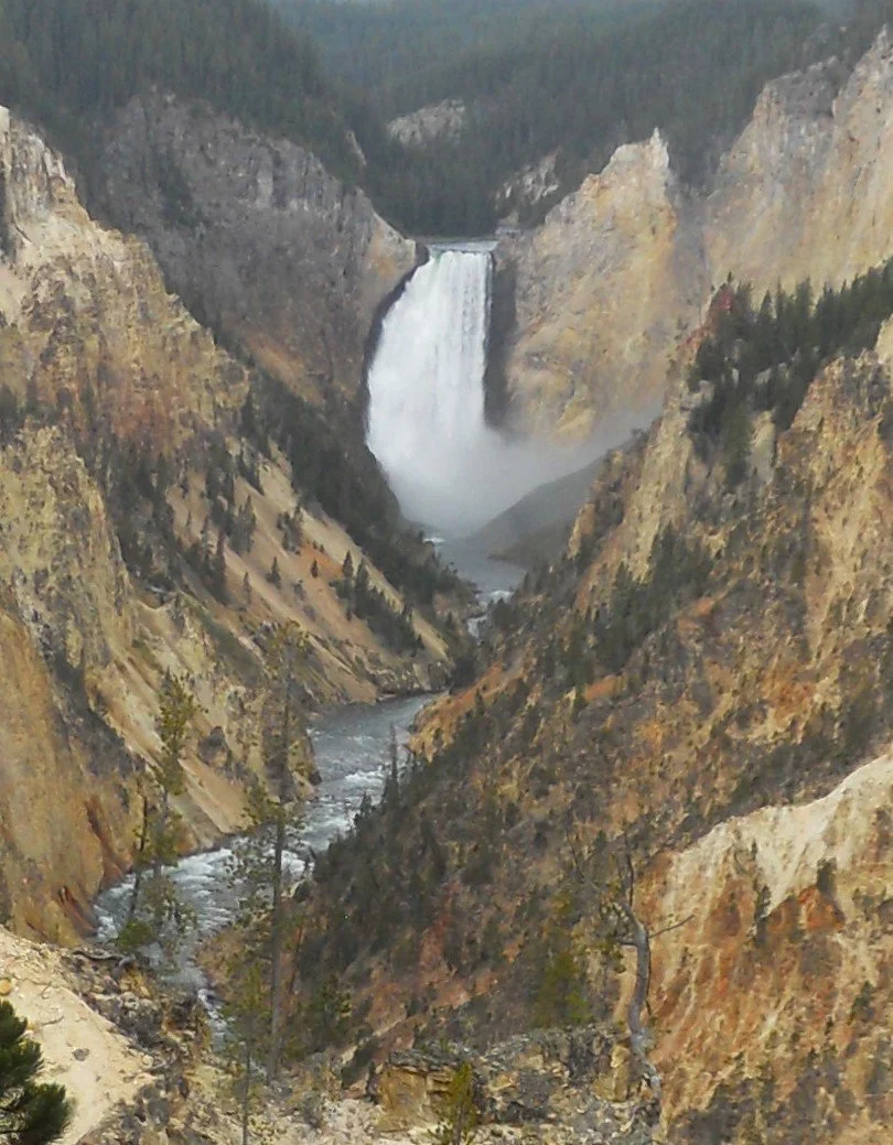
In the Canyon area, a vantage point on the South Rim Drive shows the Upper Falls (of the Yellowstone River) and the subsequent path of the river. Farther down the road is the parking area for the view of the Lower Falls.
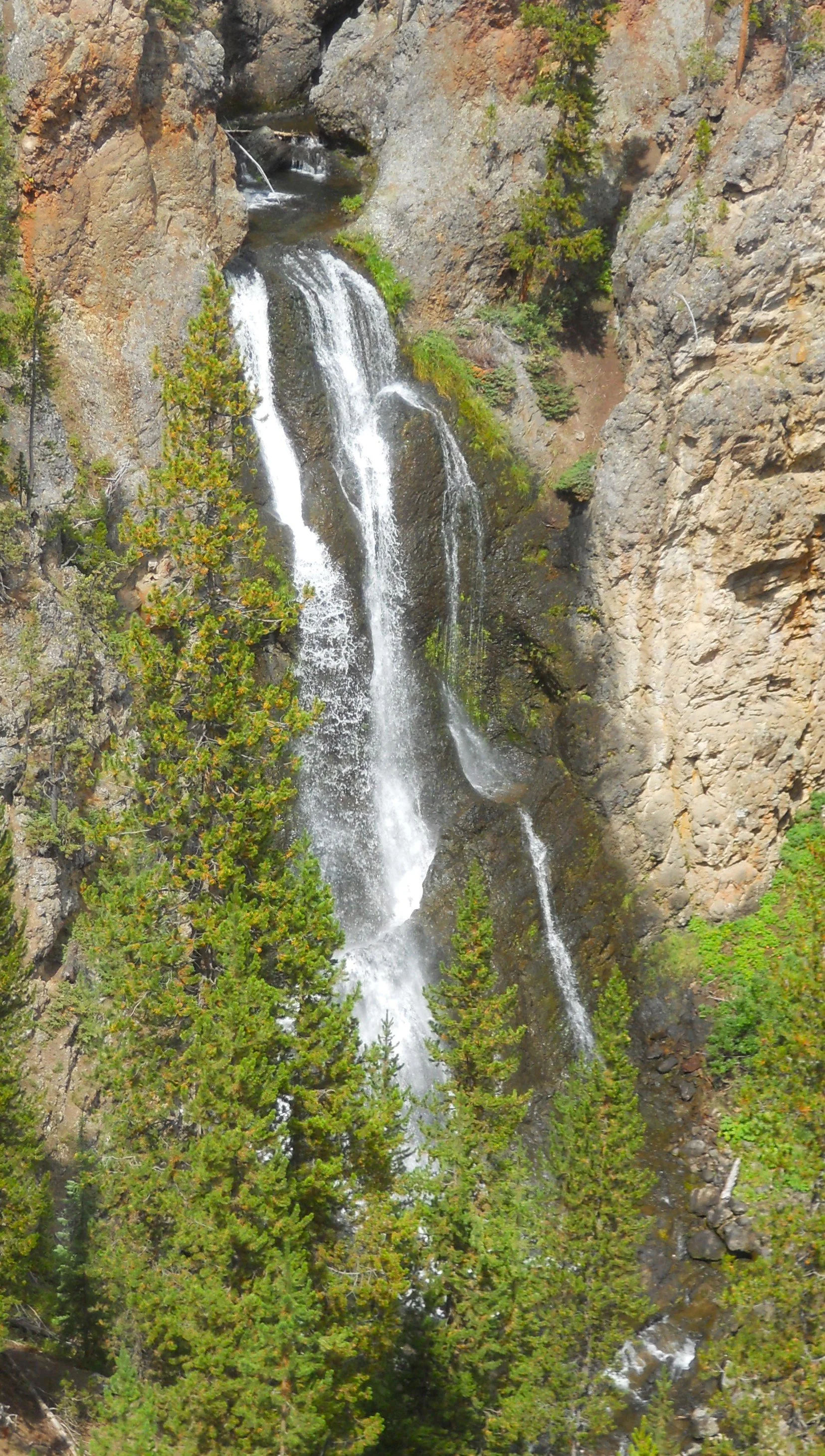
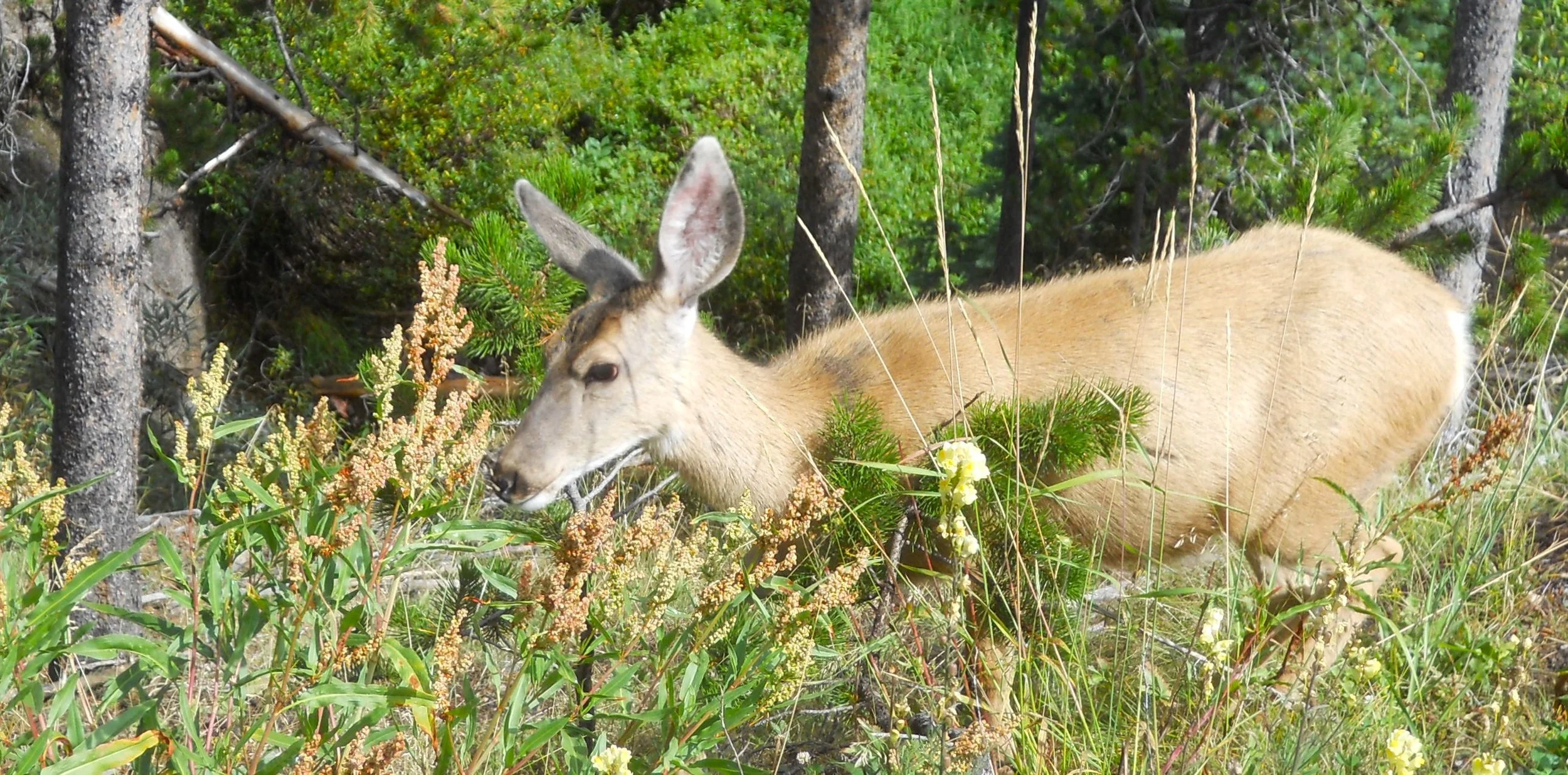
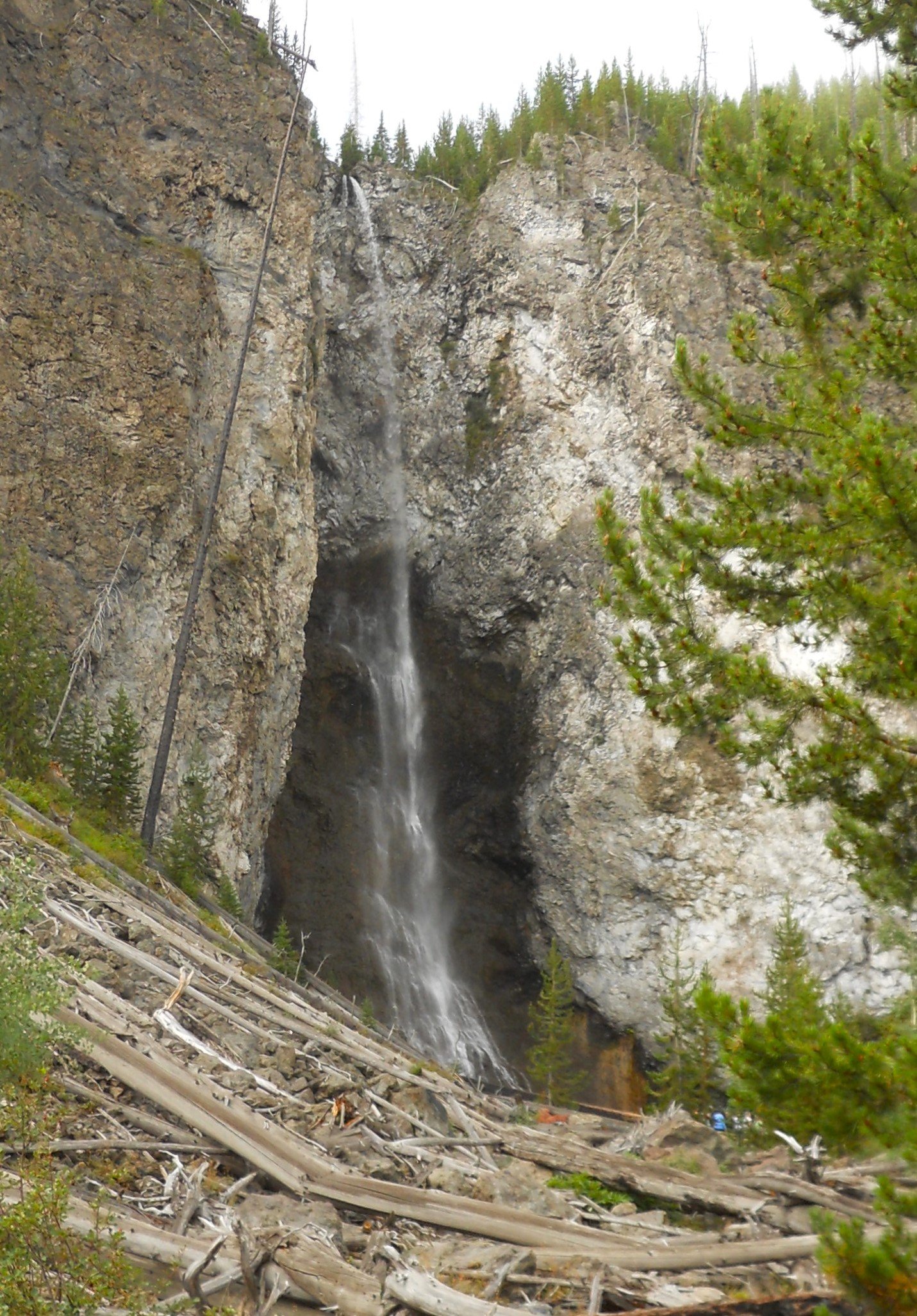
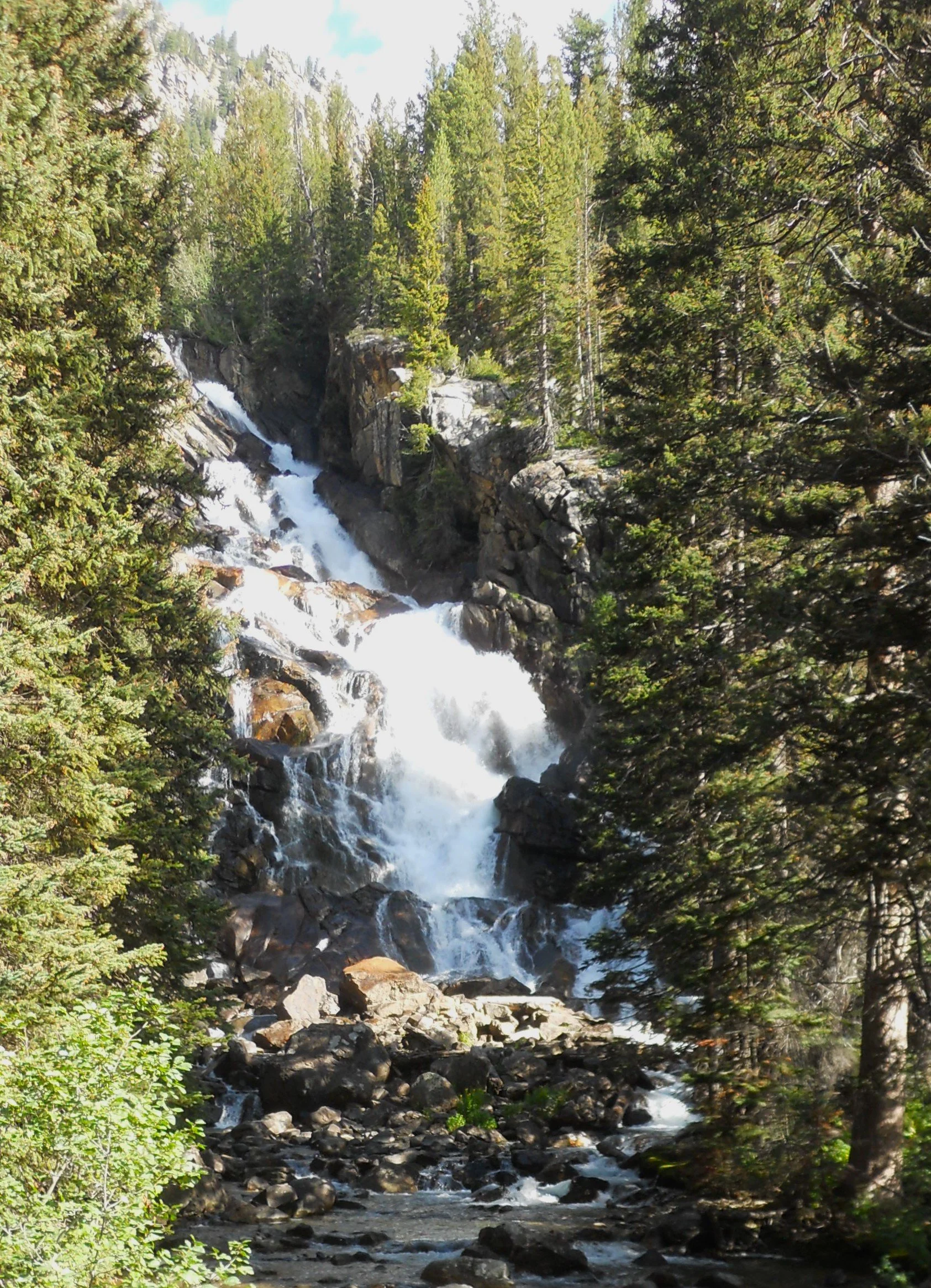
Over on the North Rim Drive, one can take a short walk to Crystal Falls, often overlooked since Upper and Lower are its neighbors. It falls 129 feet to the Yellowstone River. A denizen of the forest was at the trail to the falls.
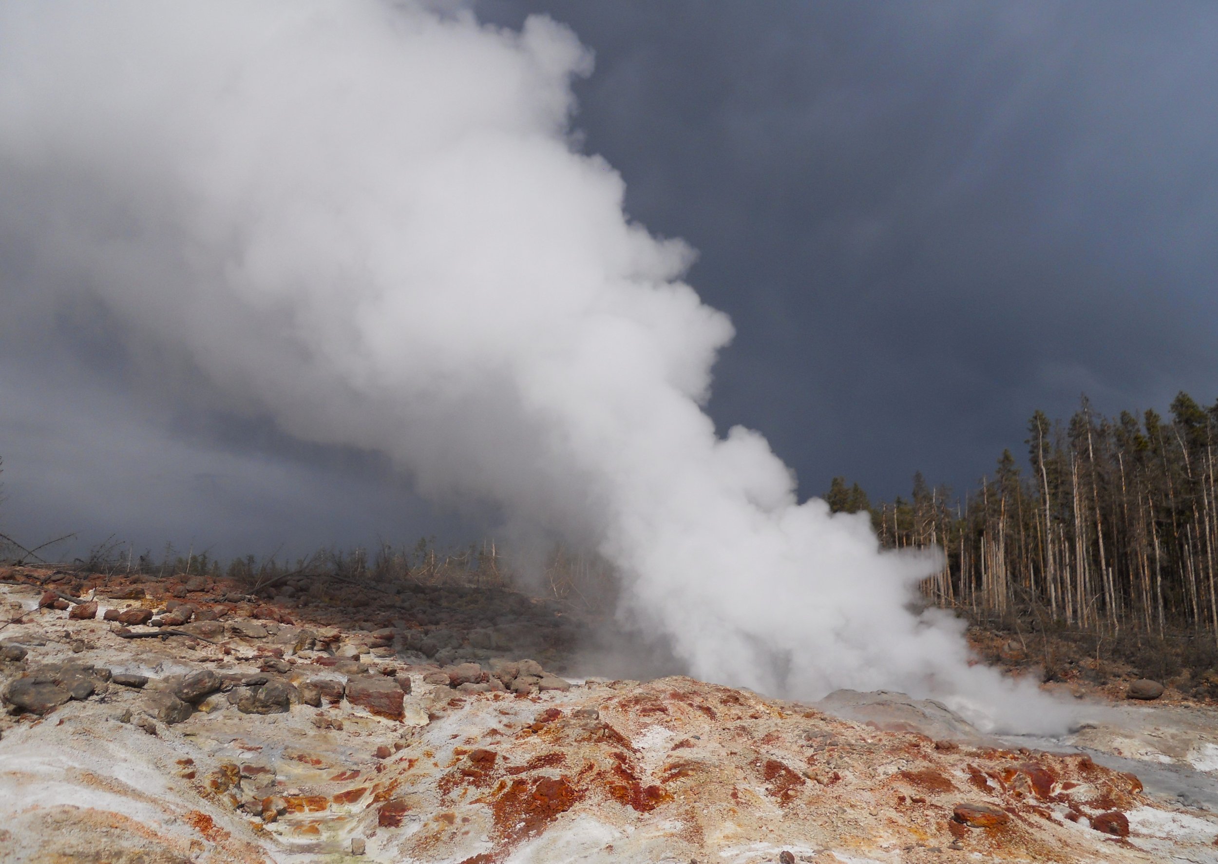
A short drive to the west side of the park, the Norris Geyser Basin area brought me close to Steamboat Geyser. This geyser has the greatest height for eruptions in the world, up to 300 feet. The problem for those who want to see the spectacle is that the events are unpredictable. They can be between four days to 50 years. There are signs in the parking lot saying you park at your own risk because Steamboat will spray sulfuric particles across the landscape during an eruption. Down the slope from Steamboat is Cistern Spring. Scientists know the two are linked since every time Steamboat erupts, Cistern empties. Today, Cistern was slowly overflowing from its blue pool, as normal.

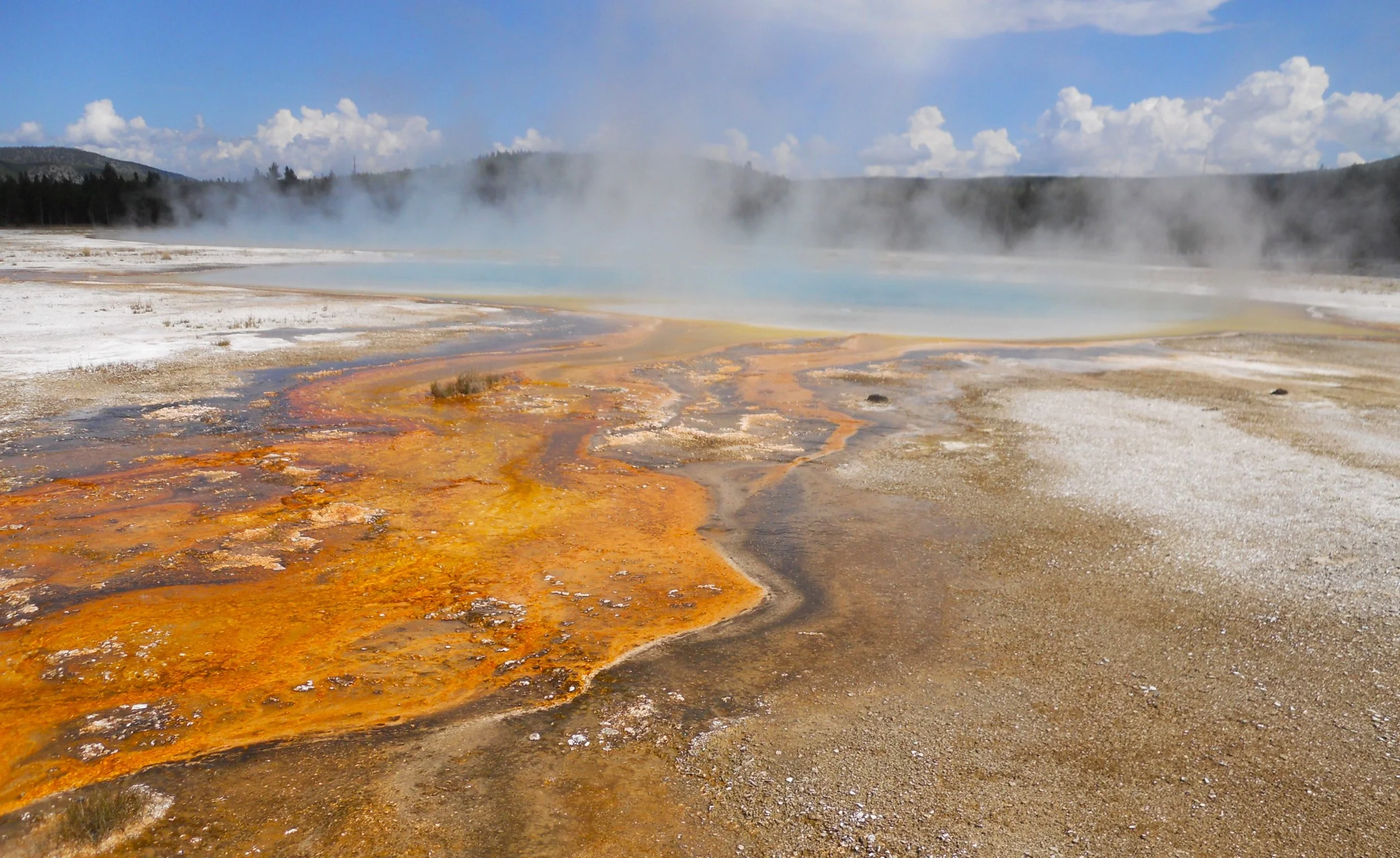
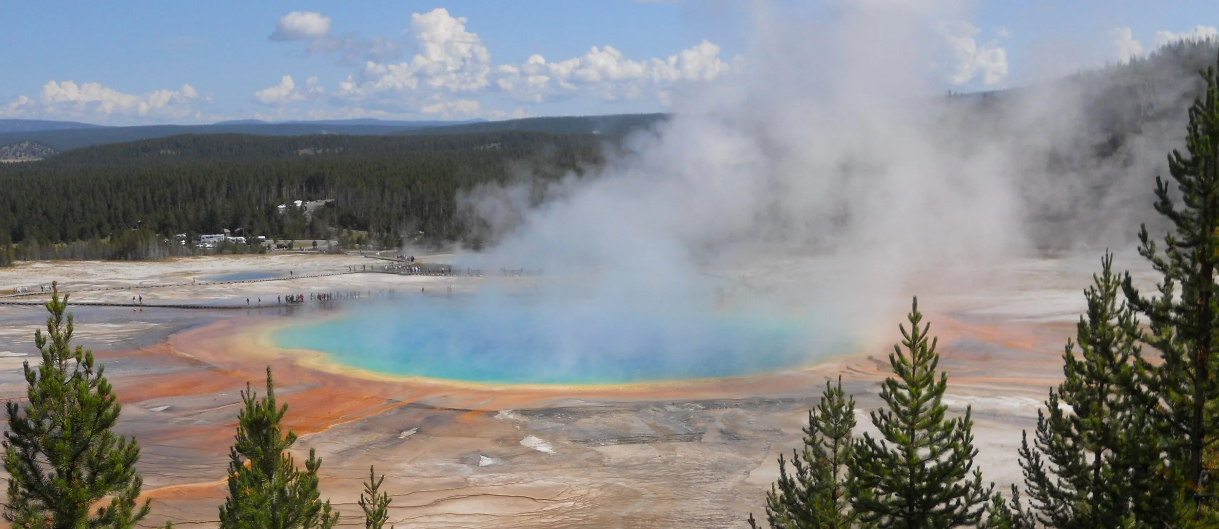
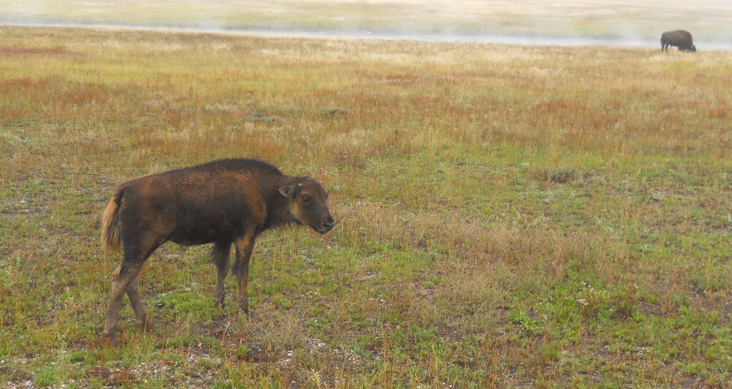
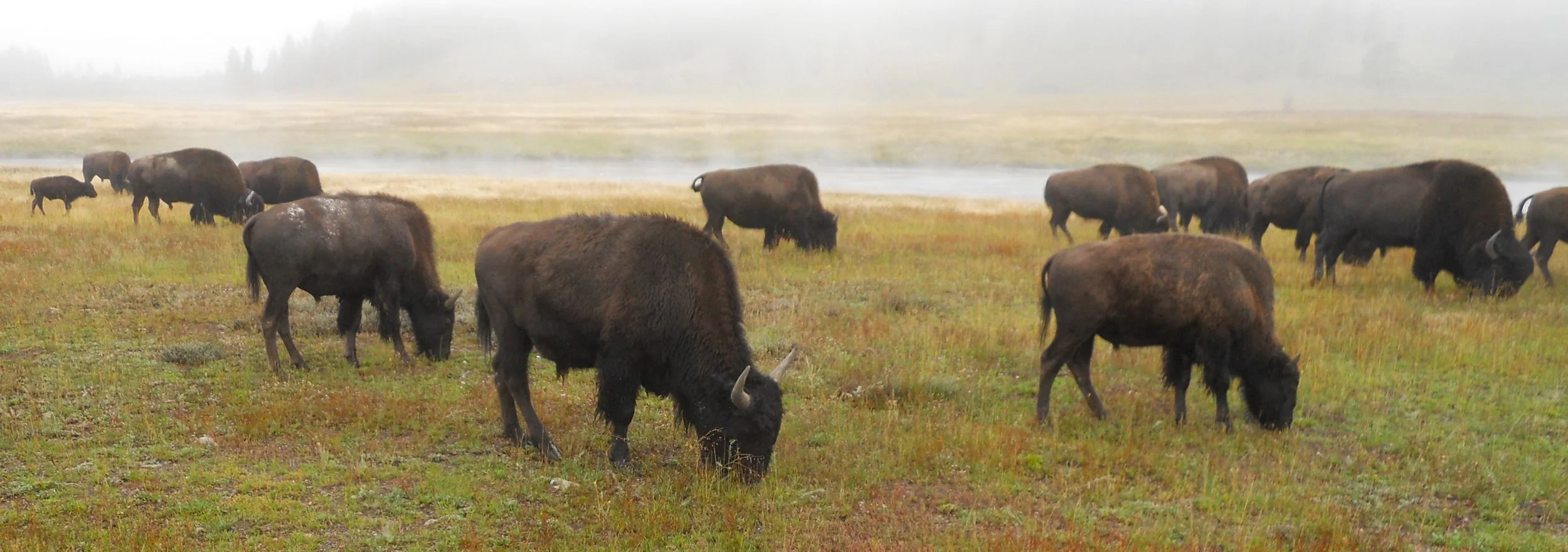
DAY 4 (August 26) - Yellowstone is THE JEWEL in the NPS inventory of parks. Just ask all the folks I saw today, more in one day than at any other park this year. The sun shining on the geysers and springs makes it a colorful world. The first photo is of the Grand Prismatic Spring in the Midway Geyser Basin. A 1.6-mile roundtrip hike is needed to get to the viewing point. I kept going after the first 0.8 miles, for another 1.7 miles to Fairy Falls. Oh, and that is Jamie, who helped bandage me after my encounter with the “Big Log”. The Old Faithful clinic said I am the fifth person this year to trip on that piece of wood, requiring their attention. Thanks to Jamie and her group from Salt Lake City. Before that hike I came across a herd of about 50 bison, old and young. This guy gave me a grunt as I snapped the camera.
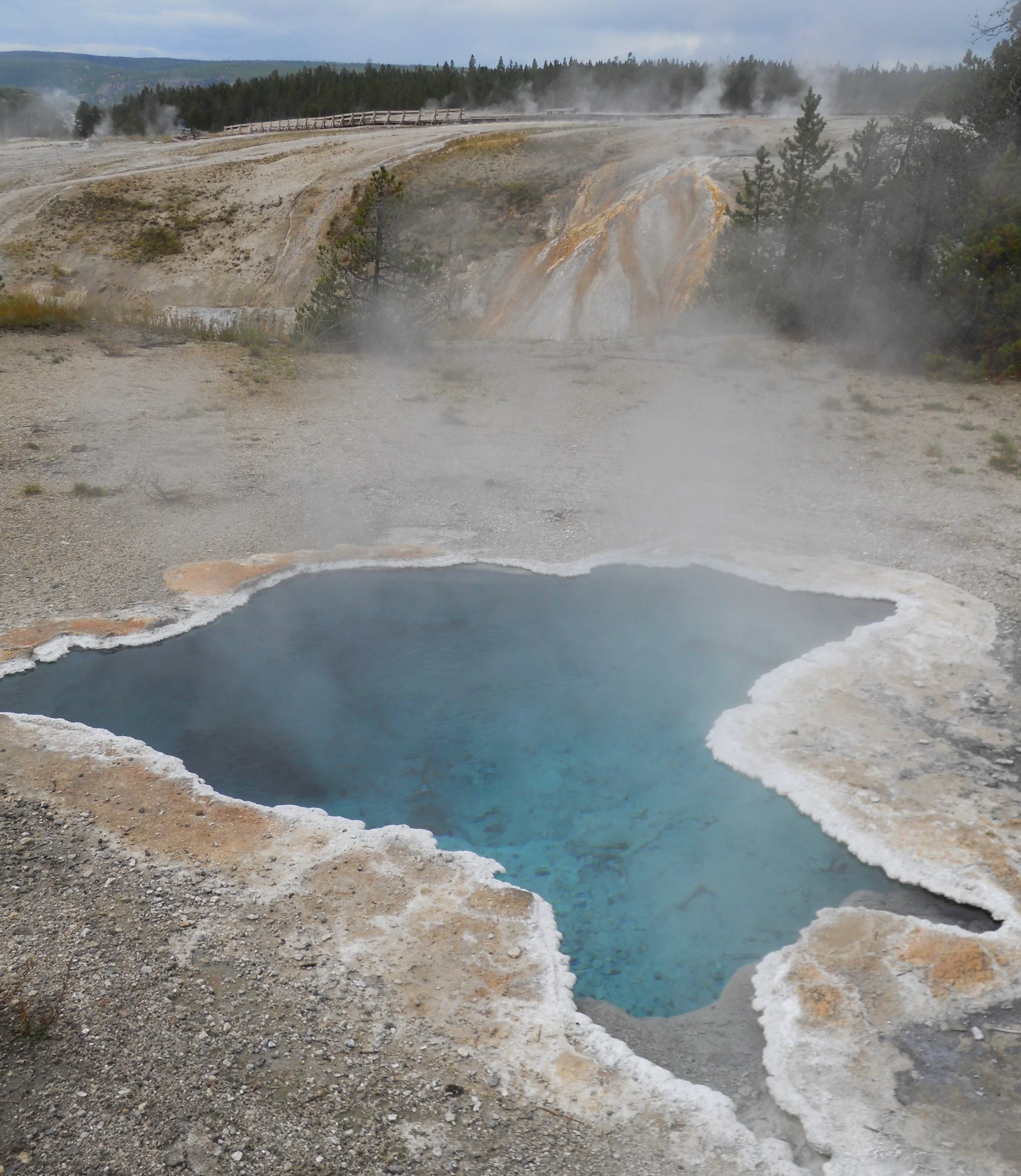
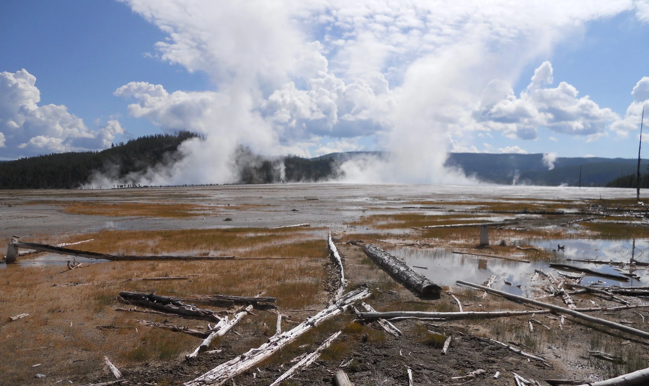
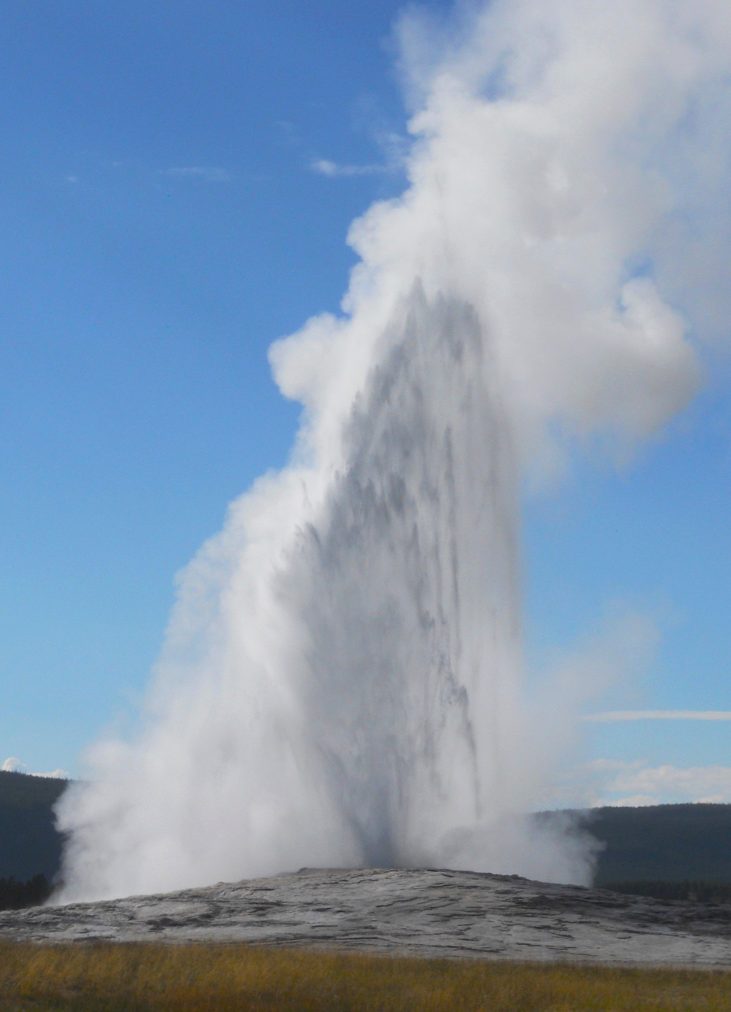
The landscape in the Upper, Mid, and Lower Geyser areas seems more like another planet. Rainbow Pool is a fitting example, with all the orange leading up to the blue pool itself. The Blue Star Spring is in the same group of thermal vents as Old Faithful. Last for today, two photos of the old gal at her 4:59 PM eruption.
Almost forgot. The safety lesson for today is not to do what the two in the bottom photo tried to do. The bull had already scared off another man who came too close.


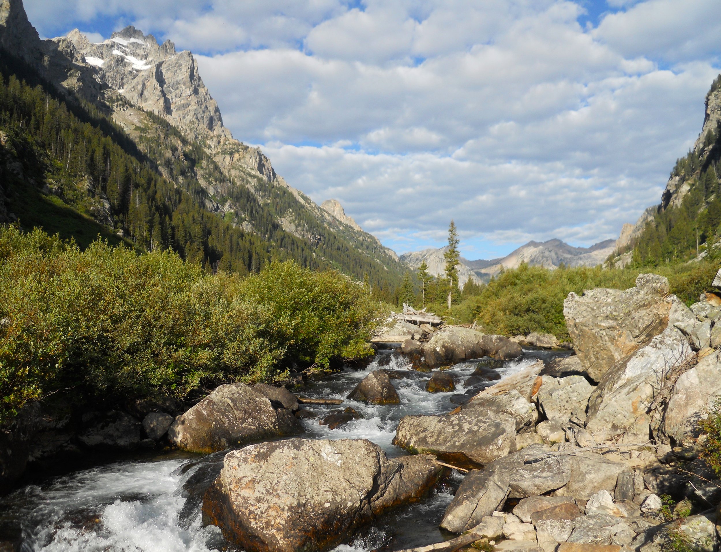
DAY 3 (August 25) - The boat shuttle to Cascade Canyon across Jenny Lake starts at 7 AM. Only four of us on the ride over. At 11 AM when I returned, every boat to the canyon was filled to capacity. That is perfectly fine for us early birders. The start of the trail includes Hidden Falls and Inspiration Point, only a 2-mile roundtrip with 500-foot or so elevation climb. This is one of the most popular hiking activities in the park. But the real fun then begins. Cascade Canyon goes for 4+ miles into the heart of the Tetons. Plenty of ripe berries. I was told last week bears were in the canyon, but nobody I crossed paths with today saw any. Just squirrels looking for humans to feed them the berries.
In the Jenny Lake area, the NPS has preserved one of the original entrance stations.
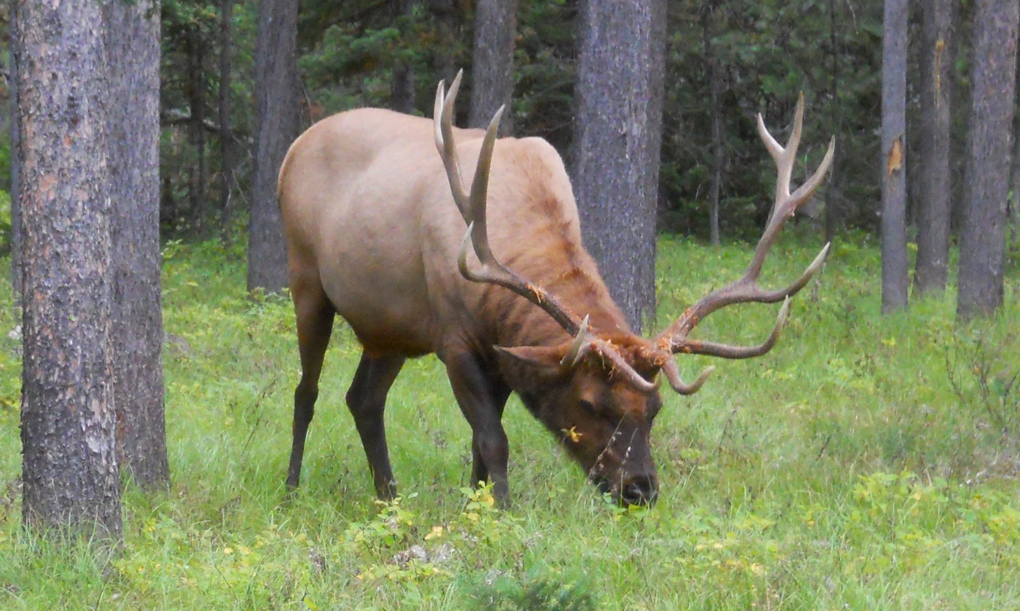
On Signal Mountain I came across a bull elk. He was more interested in the grass than me. Safety is preached every day by the rangers in the park. Try to keep your distance.
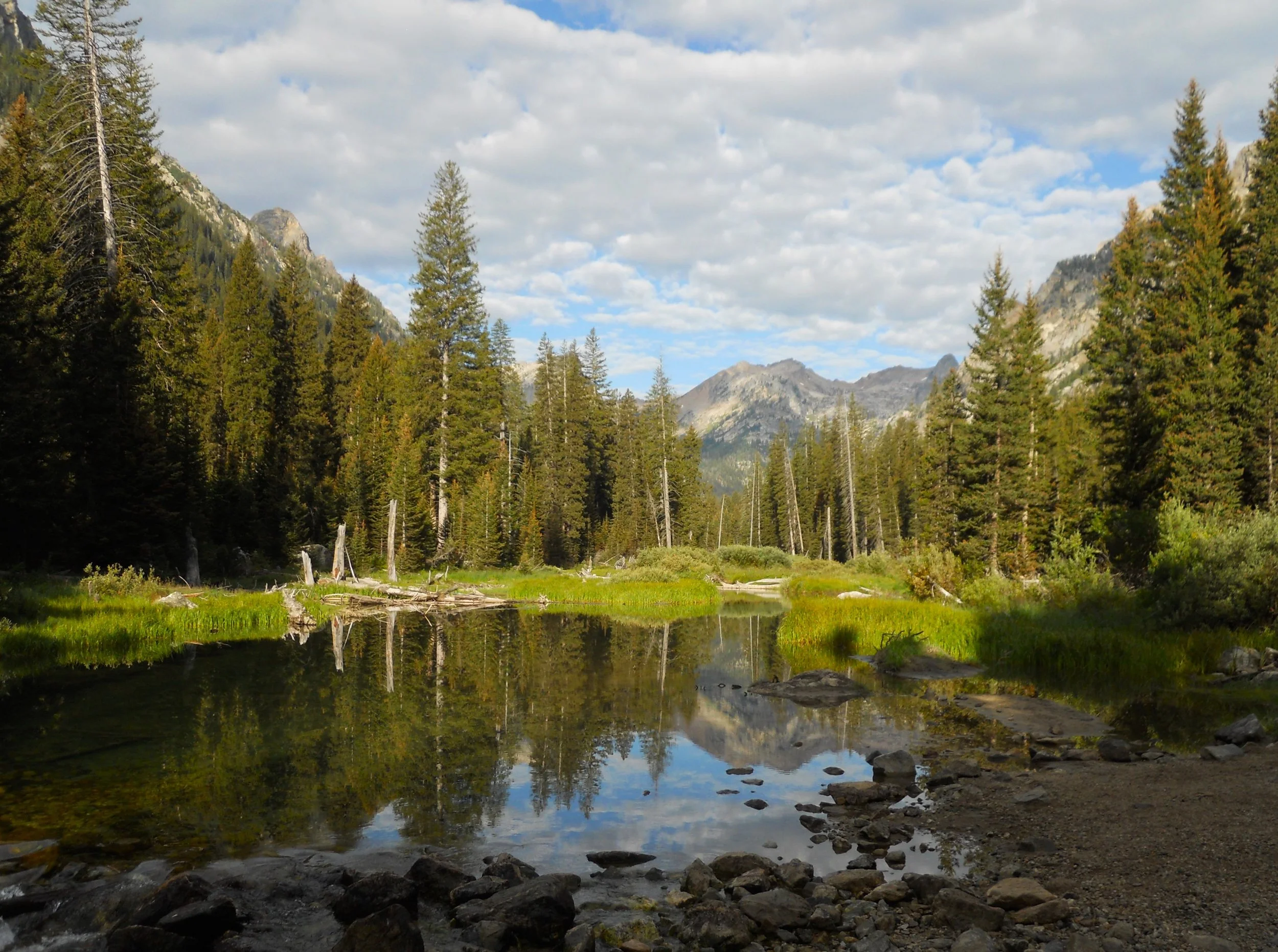
The last photo was taken from Jackson Lake as storm clouds were beginning to engulf the peaks.
The John D. Rockefeller Memorial Parkway was created from a gift by the Rockefellers so there would be a continuous NPS presence from Grand Teton to Yellowstone. There are a few places to put a boat into the Snake River, and one gas/food/info service area (Flagg Ranch). Scars from a fire which swept through the area and into Grand Teton can be seen on both sides of the parkway.


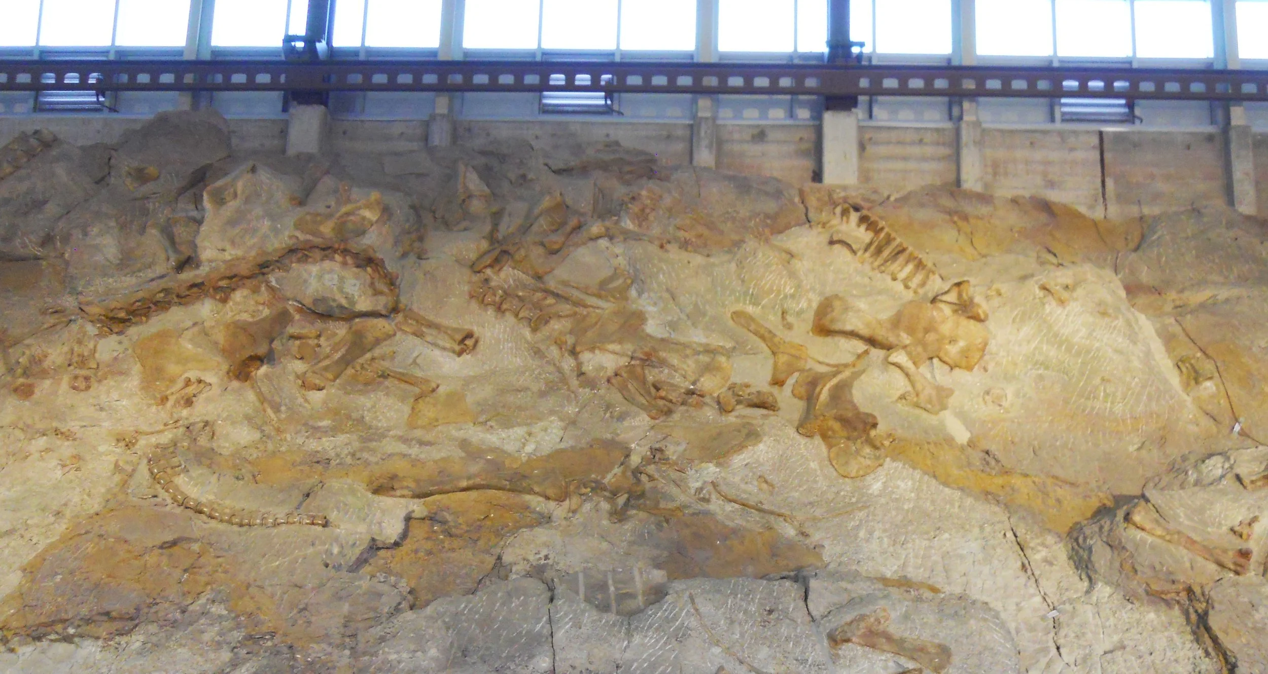
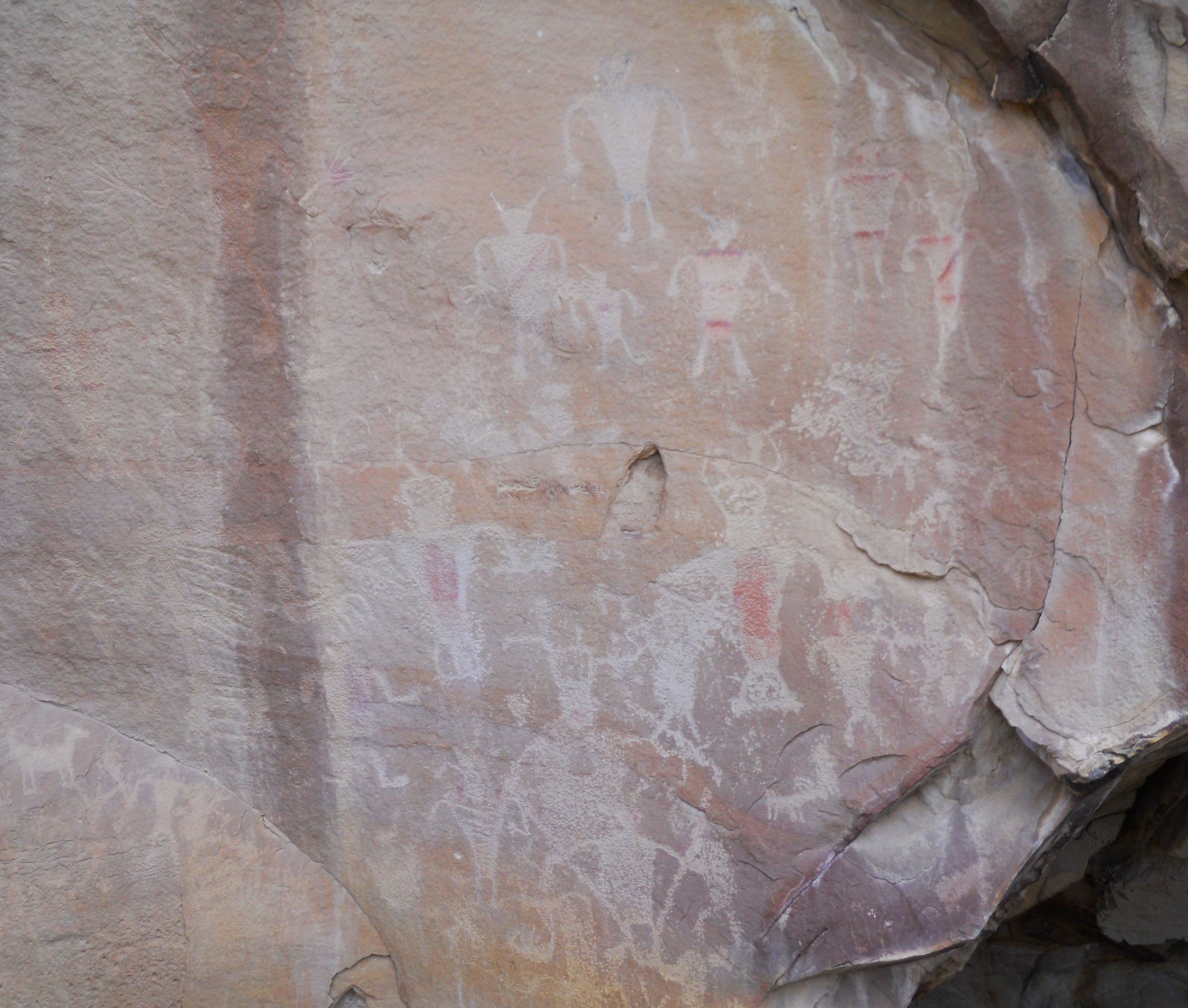
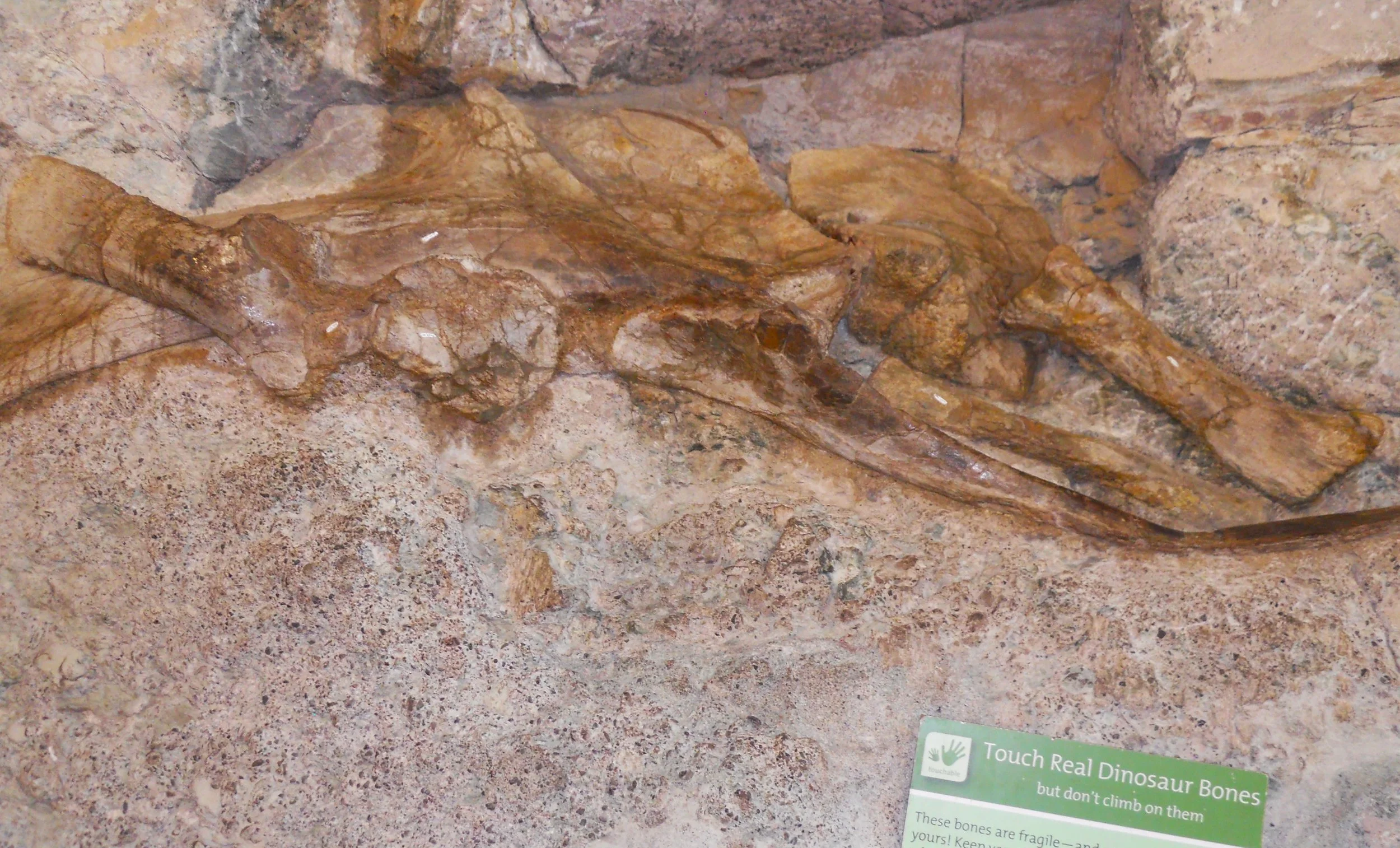
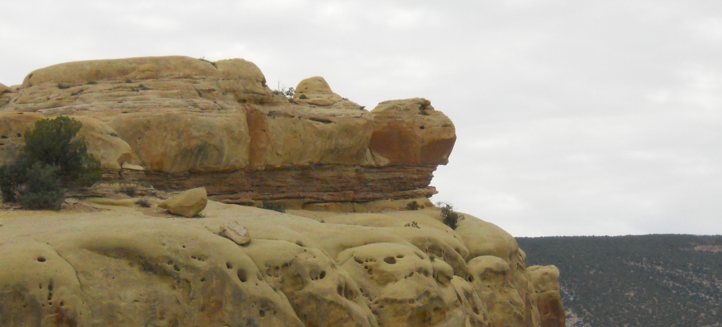
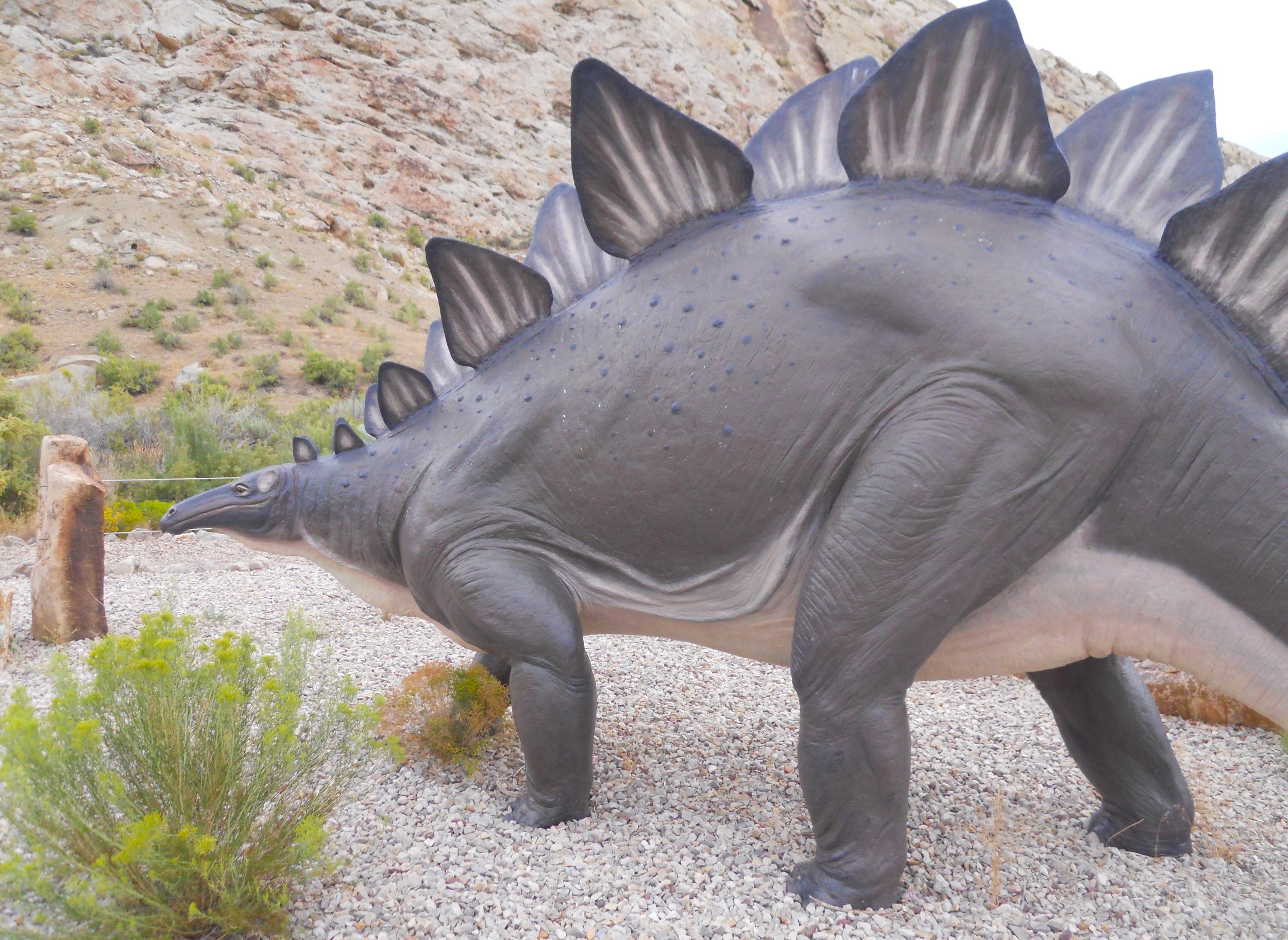
DAY 2 (August 24) - Dinosaur NMon is so large it is split between Utah and Colorado. I visited the Utah portion. Besides, this section has the famous Quarry Exhibit Hall. If you want to see dinosaur fossils, still laying in their original stone graves, untouched, this is the place. Adult dinos, juvenile dinos, dino predators, legs, backbones, shoulders, etc. you name it. Earl Douglass, in 1909, saw eight tailbones of a massive sauropad and the gold-rush was on. Carnegie Mellon University has most of those early day discoveries, but the slice of mountain left in the hall is enough for visitors. Fossils from 400 different dinosaurs have been found in this location. Over 900 years before Douglass, the Fremont people lived in this river valley. Pictographs (the red ink paintings) and petroglyphs (the carvings) from their existence can be seen on the valley’s stone walls. Another feature on the park’s main Utah paved road is Turtle Rock, silently overlooking the Green River. The VC has one of the nine life-sized Stegosaurus sculpted for the 1964 New York World’s Fair. The lower level of the Exhibit Hall has a section where visitors can walk up and touch some of these 150 million year old bones. See, the green sign says it is ok. I think the ranger said this bone was from a Diplodocus.
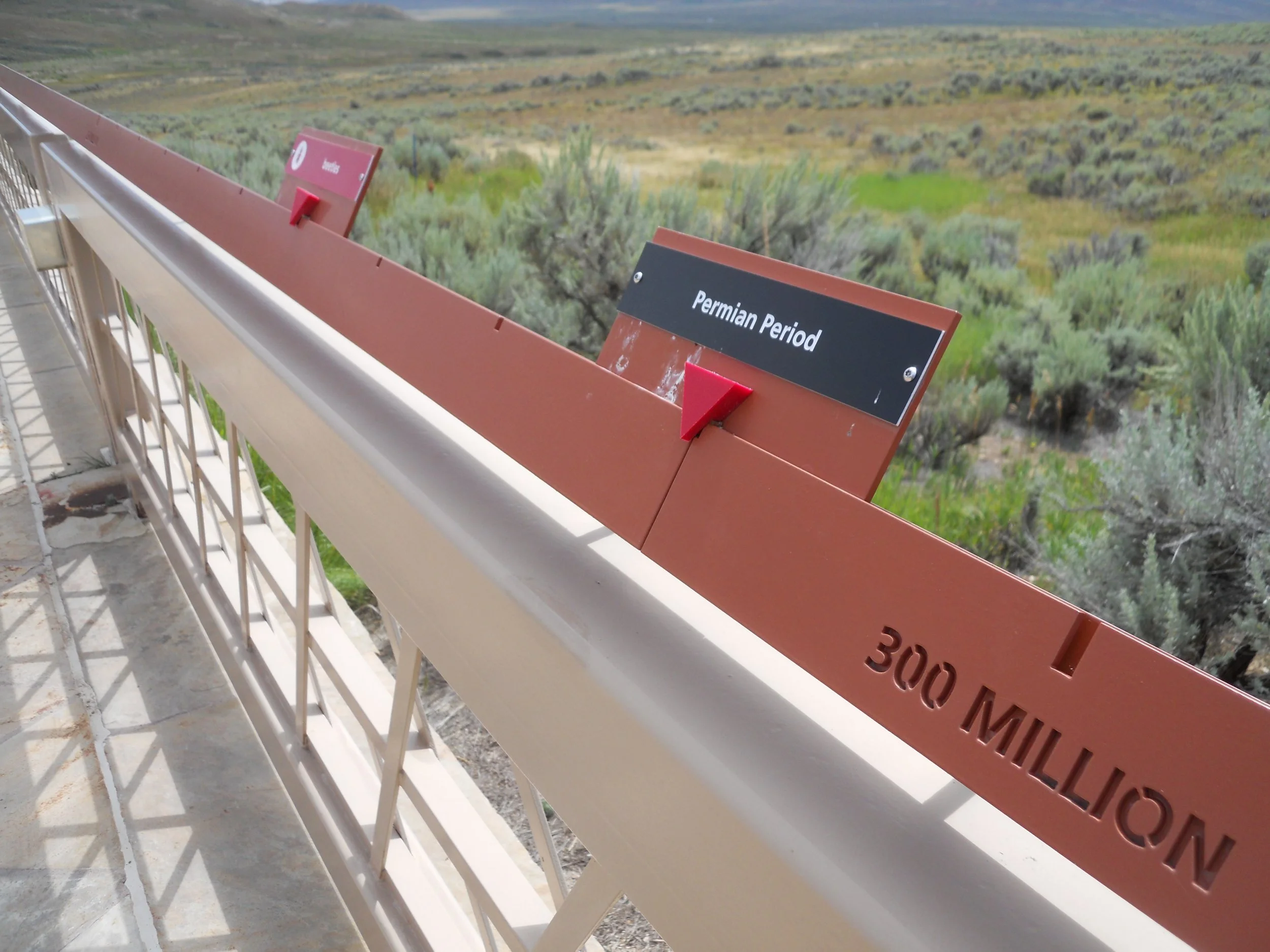
Fossil Butte NMon is north of Dinosaur. The entire corridor between the two is fossil wonderland. But Dinosaur is for its namesake while Fossil Butte is for small reptiles, fish, insects, birds, and plants. The Fossil Butte area was actually a freshwater lake, from 52 million years ago in the Eocene epoch. The one prominent butte left is where Robert Craig in 1897 began quarrying. One of the two trails in the park takes a visitor up to an old quarry. No fossils can be seen on either trail, but the VC has plenty for visual enjoyment. An interesting “trail” is the timeline from 5 billion years ago to today, with important Earth milestones shown, like the Permian Period at 300 million years. It was a long walk to cover the entire time frame.
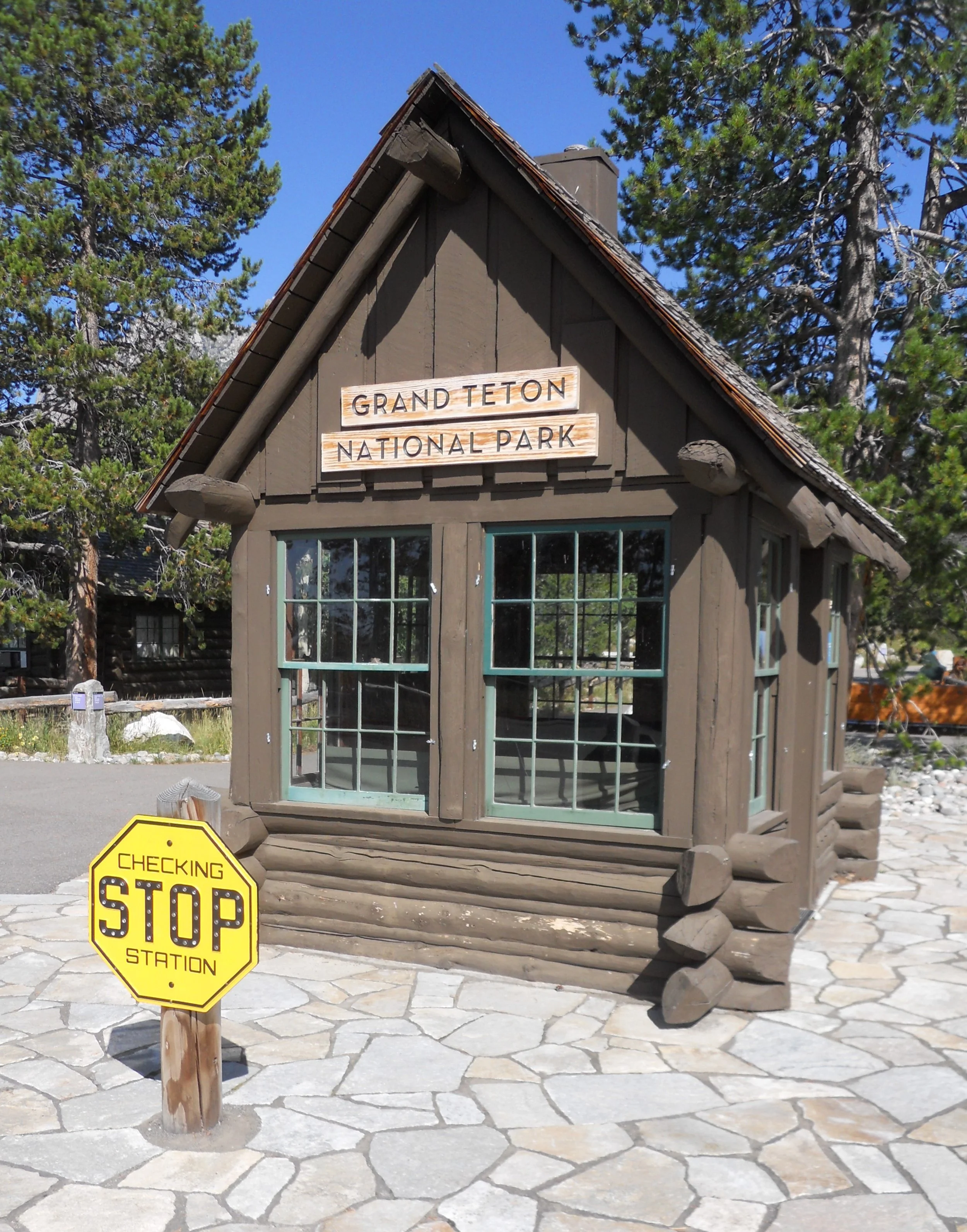
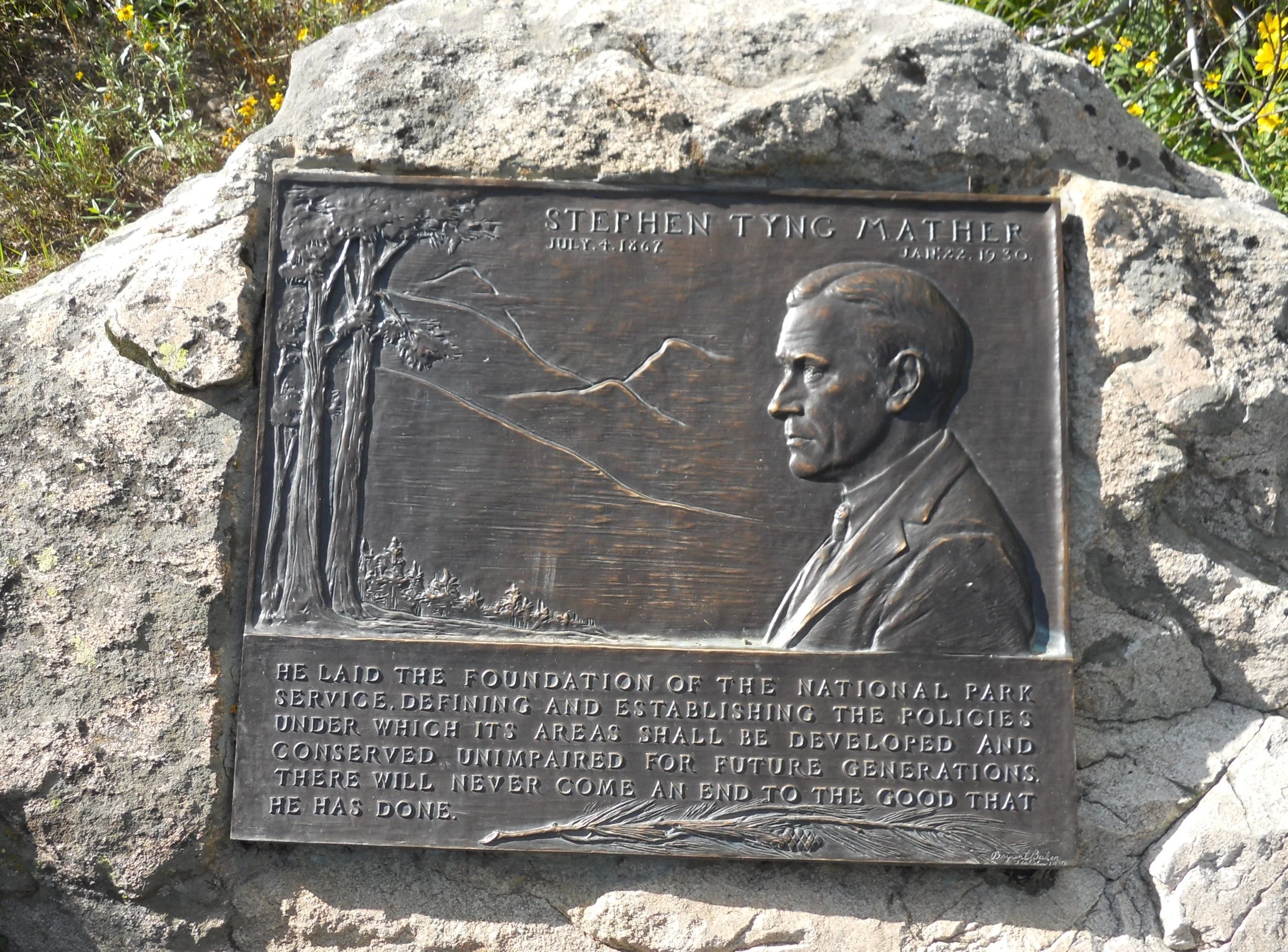
Grand Teton NP does not need an introduction. This is one of the gems in the NPS. The majestic spires stretch upwards, over 12,000 feet on eight. One of the VCs talks about the ranchers and settlers who first populated the Snake River valley. Outside was one of the Stephen Mather Memorial bronze plaques. I have heard there were 30 made, placed around the park system. Great to see Grand Teton with one (Acadia and Indiana Dunes are two other parks). I am staying in the park all tomorrow, leaving the following day, so will have more photos on August 25.


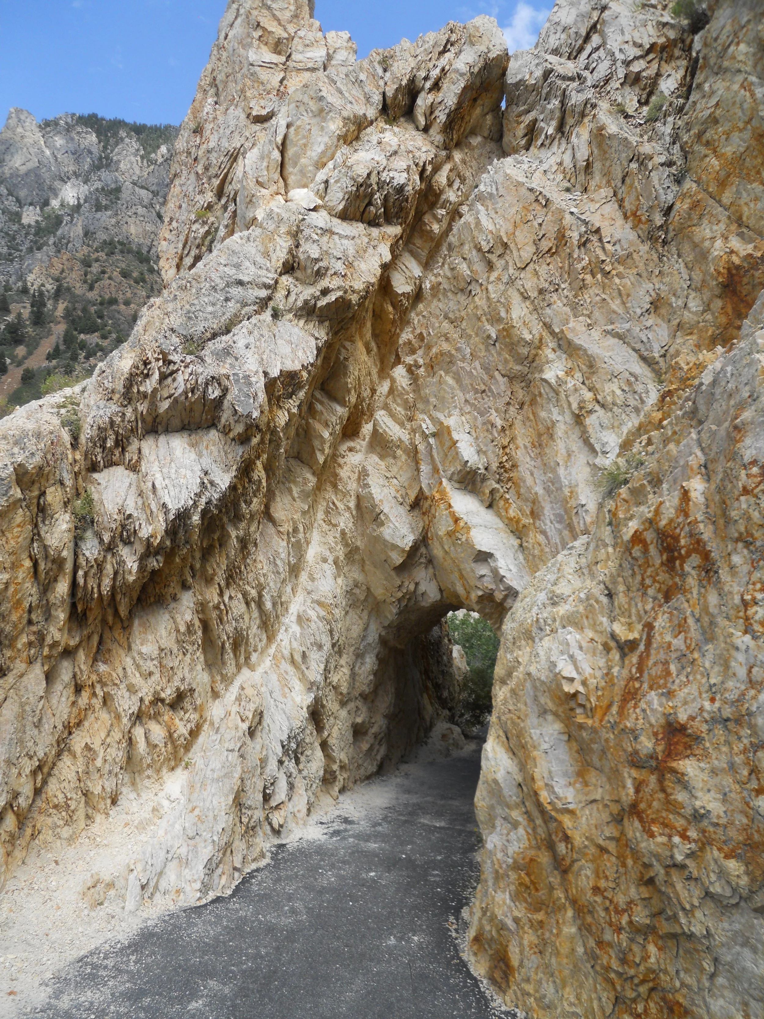
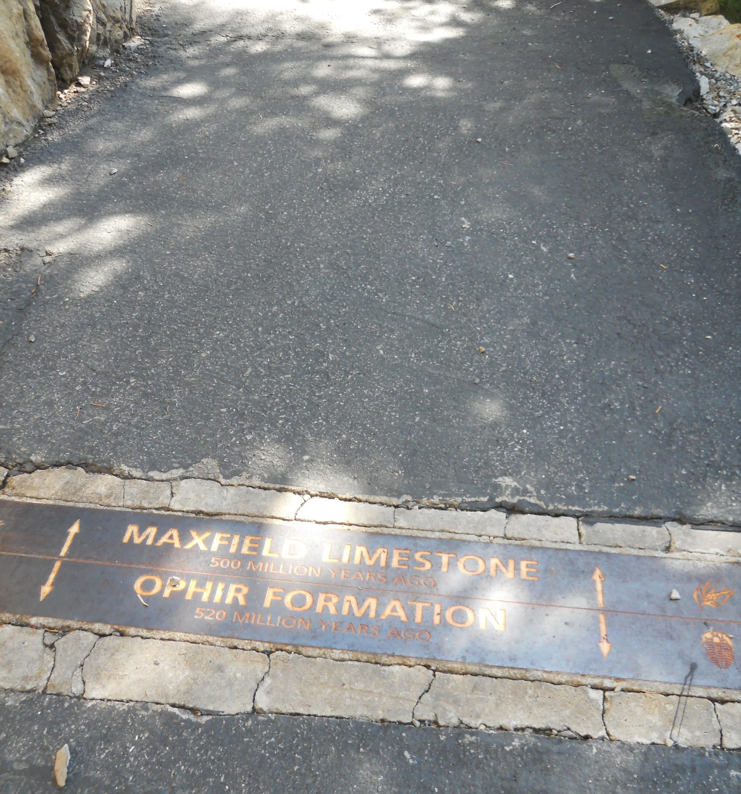
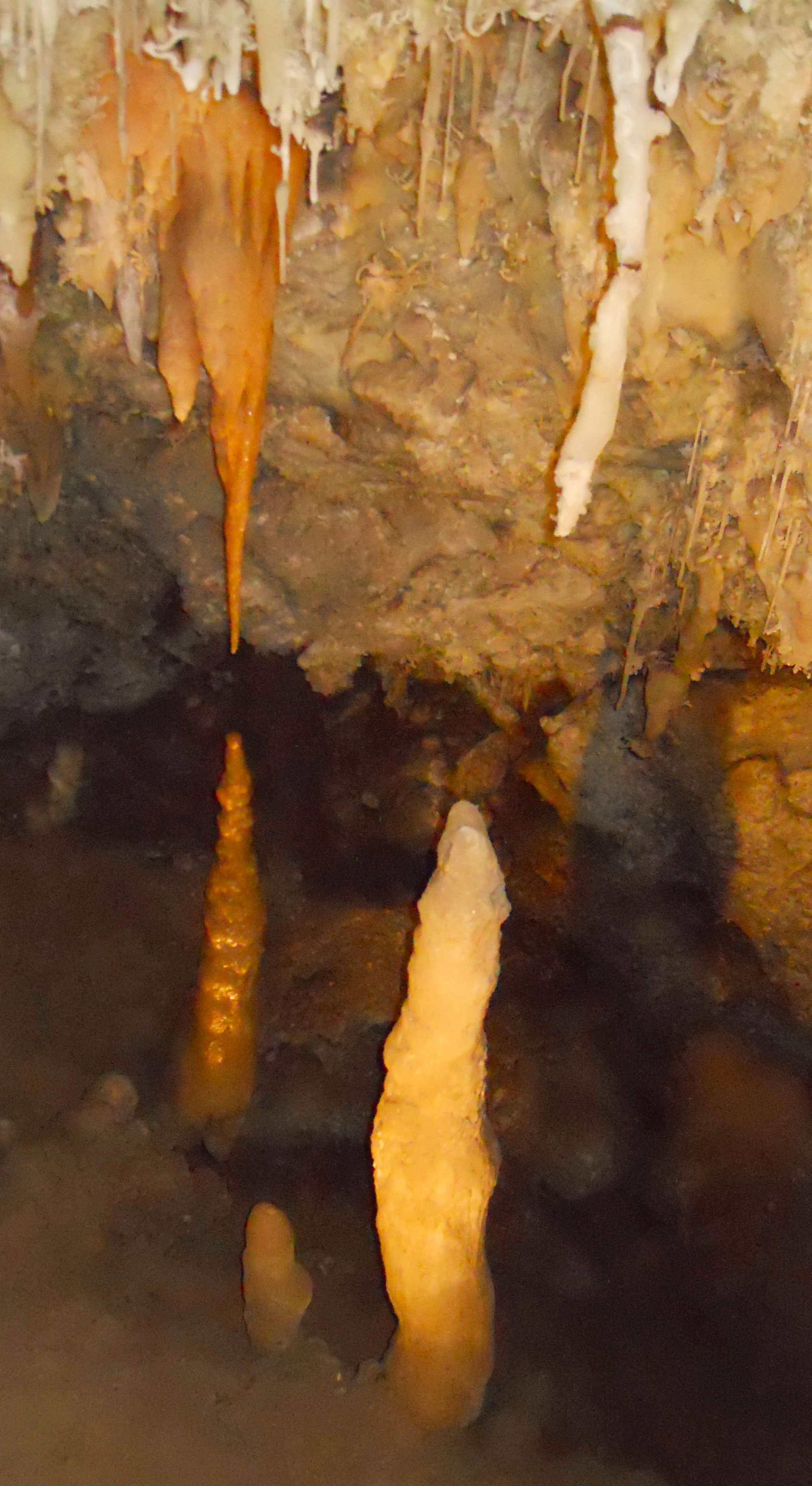
DAY 1 (August 23) - Timpanogos Cave NMon is a perfect place for some exercise. 1,100-foot elevation gain over 1.5 miles on a paved path (includes two small tunnels) takes you through Geologic Time. From Tintic Quartzite to Deseret Limestone, you can see from 540 million to 340 million years (when the cave portion was formed) of Earth’s past. There are boundary markers on the path telling a visitor when they are changing from one Time Period to the next. The namesake of the park is one of three caves which are on the standard tour. Two manmade tunnels have been cut to connect the cavity areas. The Timpanogos Cave has the park’s nightlife jewel, the Great Heart of Timpanogos. As our Ranger guide said, Wind Cave NP may have boxwork, but we have the Jewel. Plenty of “cave bacon”, straws, and other cave features throughout the tour. Most people think you have to go underground to see caves. Well, not here. Just be sure your calves and shins are ready for the trek.