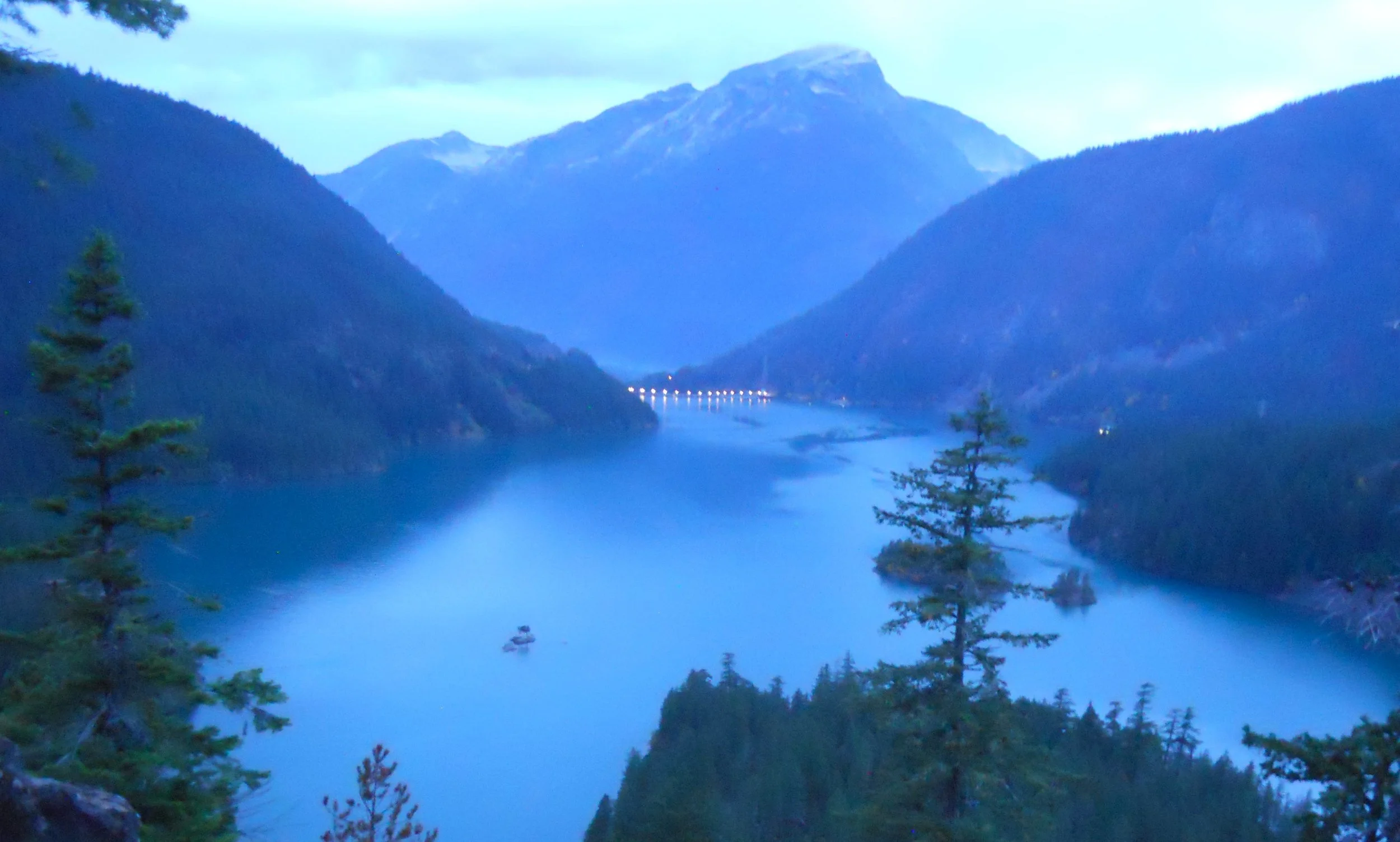
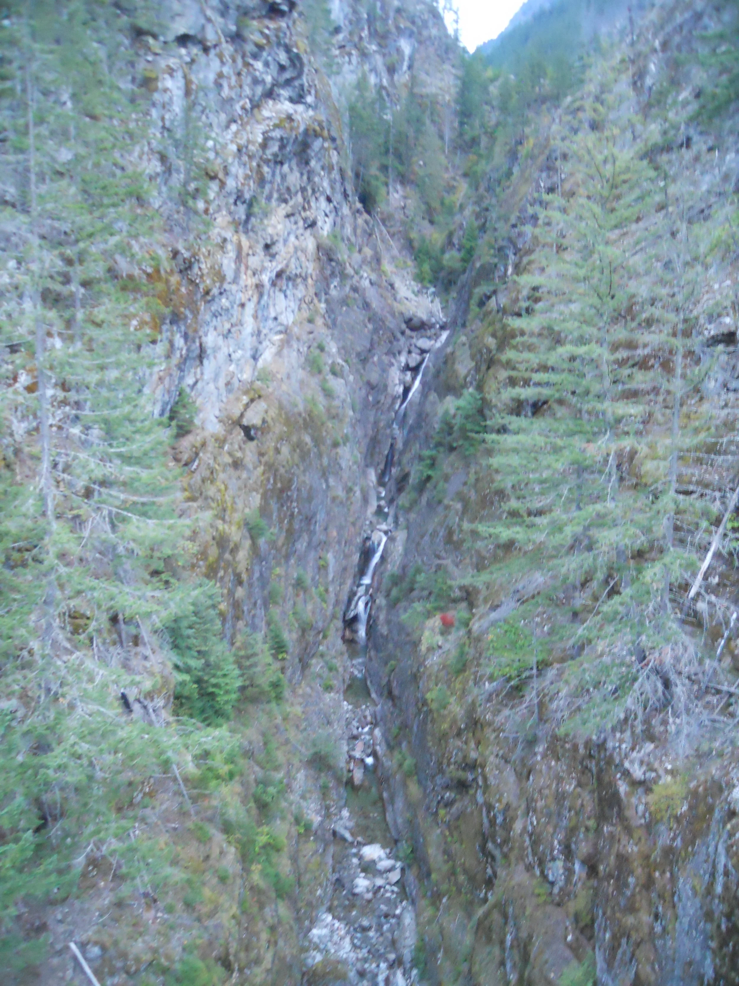
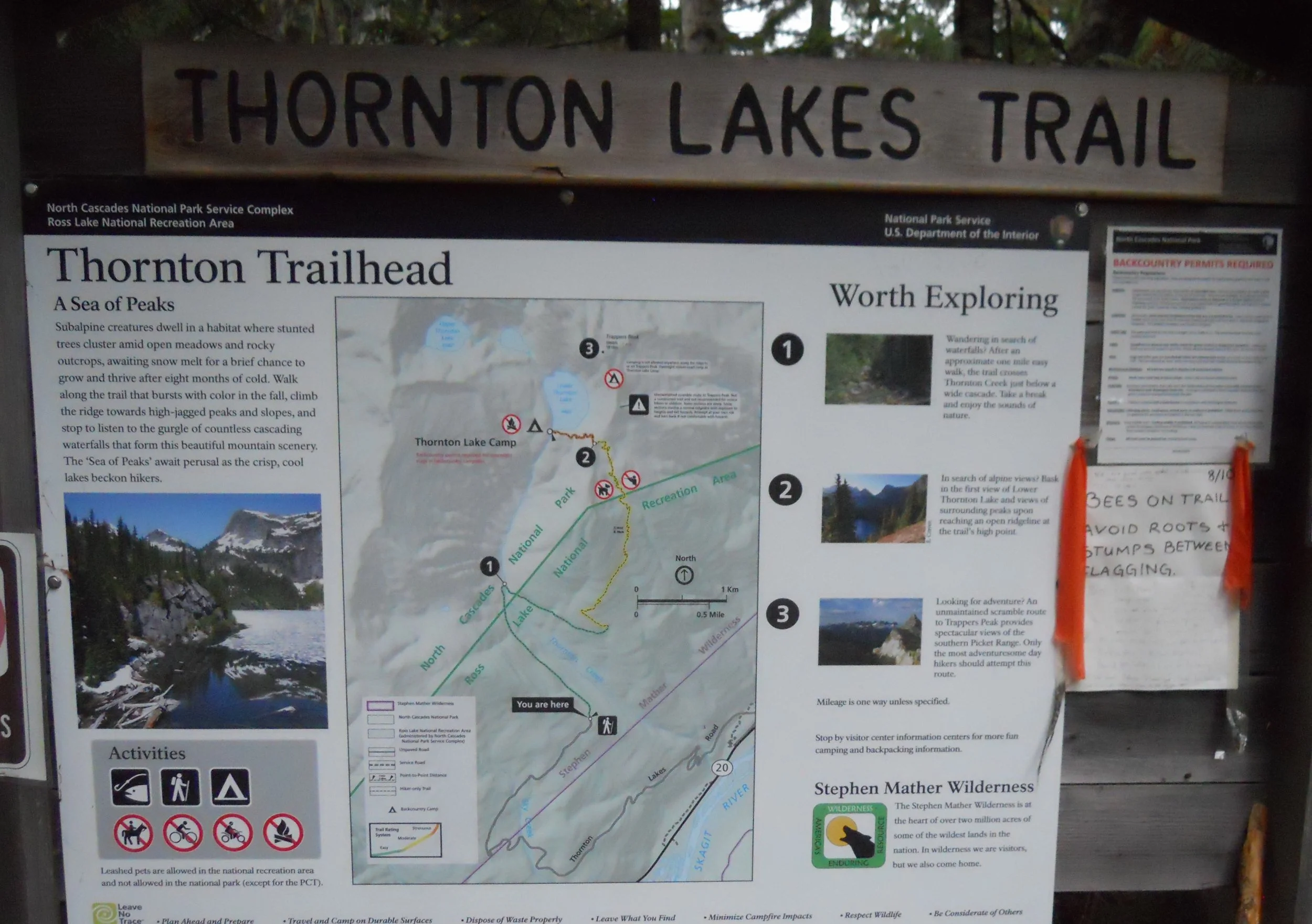
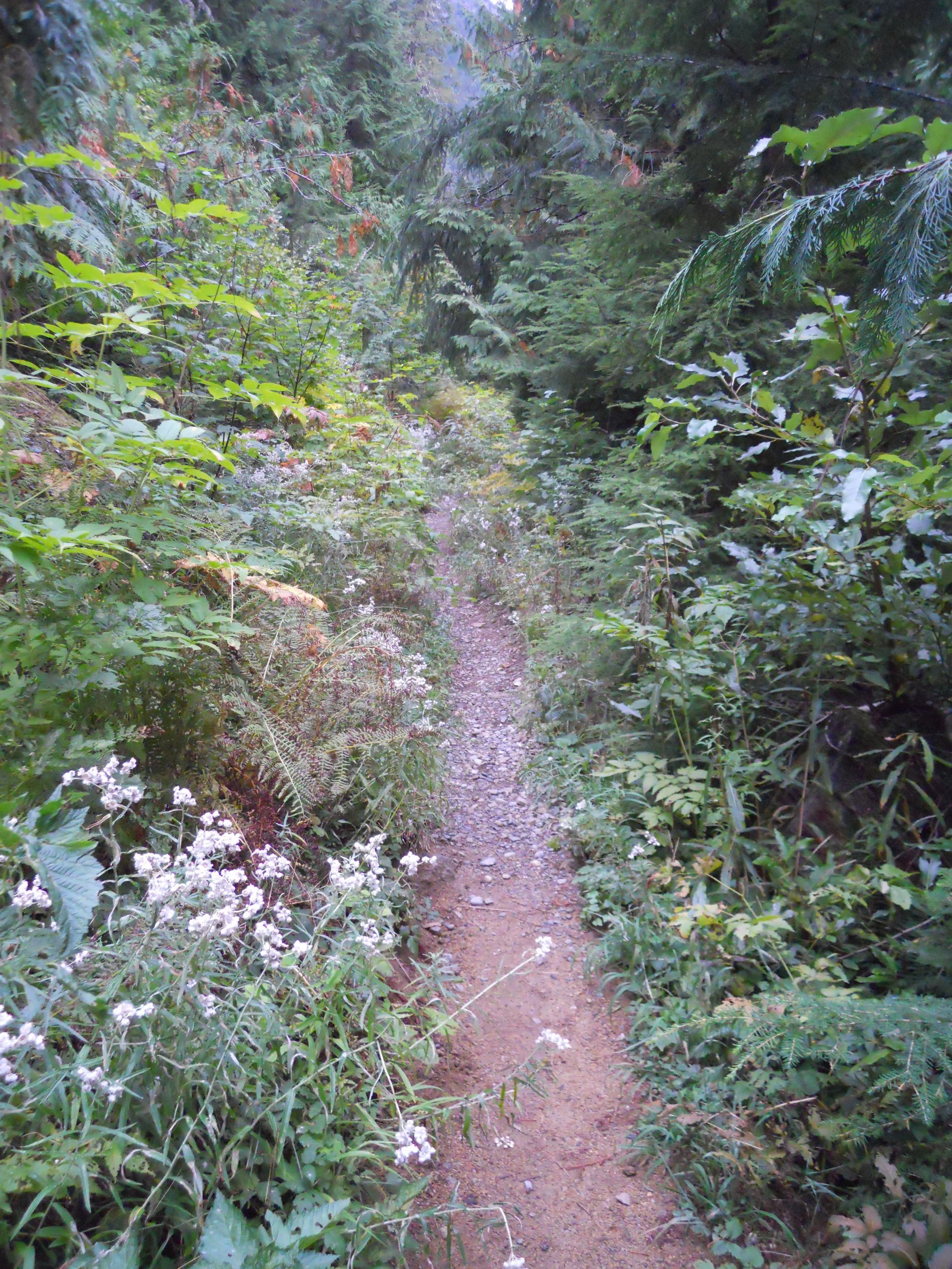
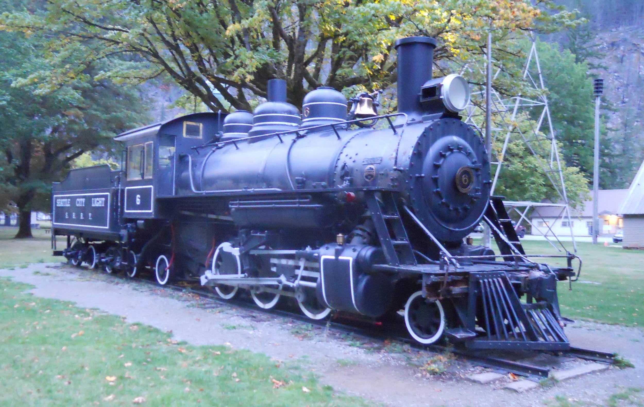
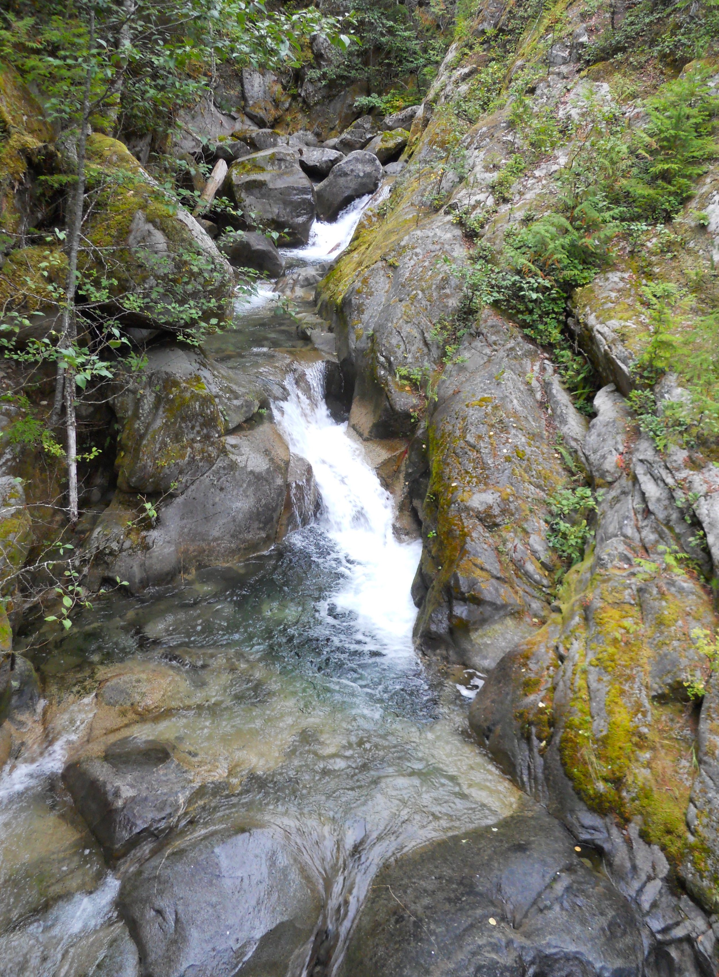
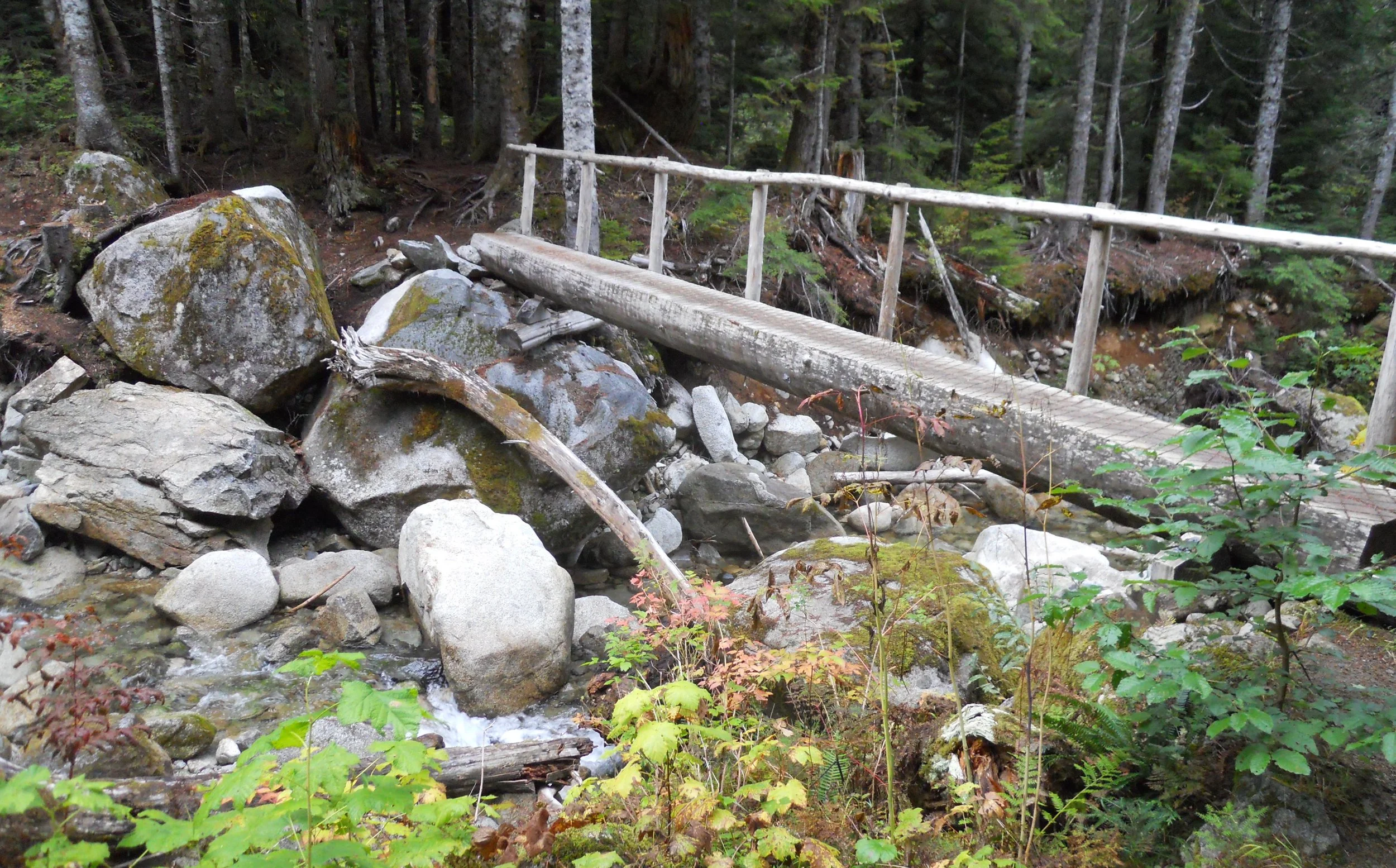
DAY 13 (October 2) - Due to my schedule on the 2nd, I am posting this DTR on the 3rd. Ross Lake NRA was first up. This seems more like a subunit of North Cascades NP. Both Lake Chelan NRA and Ross Lake NRA are within the North Cascades website. They are the only two (of 18) NRAs without separate webpages in the NPS website. And the dark green line which surrounds all three parks on the NPS map would indicate the two NRAs are within the NP. This is like Frederick Douglass NHS being within National Capital Parks - East park, such that if you are within the boundary of the NHS you are within the boundary of the other park. Diablo Lake (photo, before sunrise) is one of three main lakes in Ross Lake NRA. Diablo Dam holds back the water. Gorge Creek Falls feeds water into Gorge Lake (created by Gorge Dam). “Old Number 6” was built in 1927 to move materials for the construction of the dams. Thornton Creek sends water to the Skagit River. Because there may be disagreement on whether Ross Lake NRA is “within” North Cascades NP, I decided to settle the issue relative to my Quest. I hiked the Thornton Lakes Trail, past the boundary line of the NRA. The trail was narrow, coming to a one-lane walking bridge over Thornton Creek (past the NRA boundary).
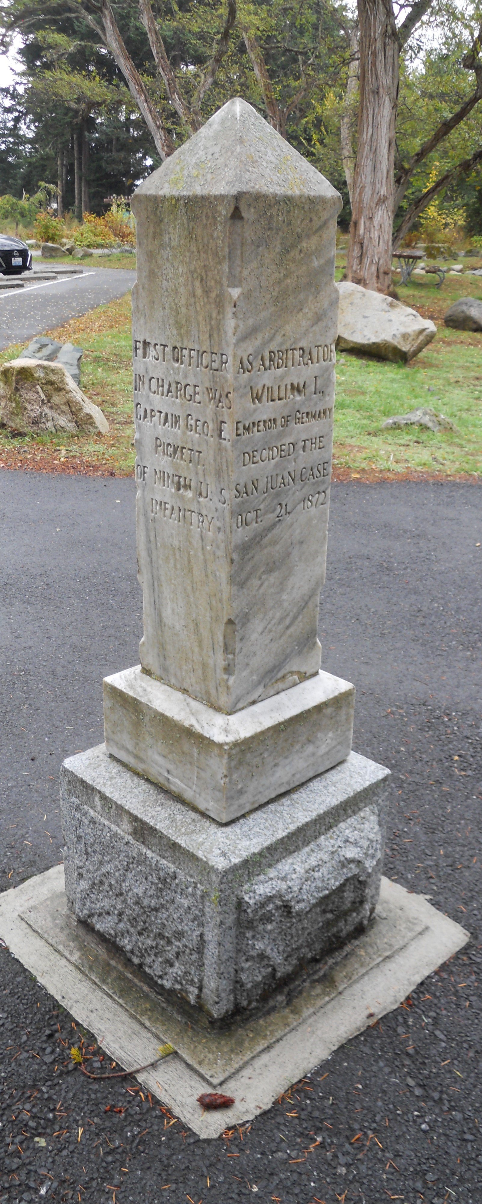
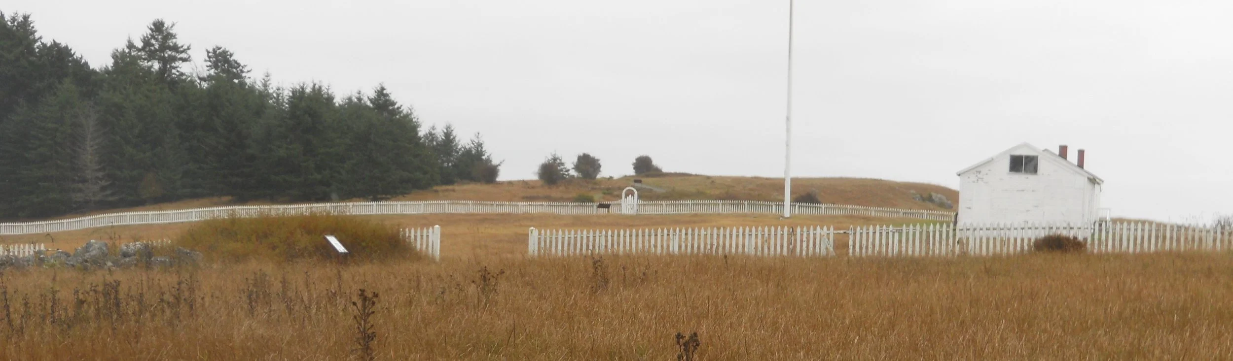
San Juan Islands NHP is comprised of two military camps; American and British. A dispute over the killing of a Hudson’s Bay Company pig, by an American farmer, in 1859, almost brought the two countries to war. While negotiations moved forward to resolve the issue, both countries agreed to have garrisons on the island. William I, the Emperor of Germany, arbitrated, finding in favor of the United States. The British left the island in 1872. The American camp is on the south end of the island, its redoubt (in the background) overlooking the Salish Sea. A marker at the VC in the American Camp commemorates the arbitration.

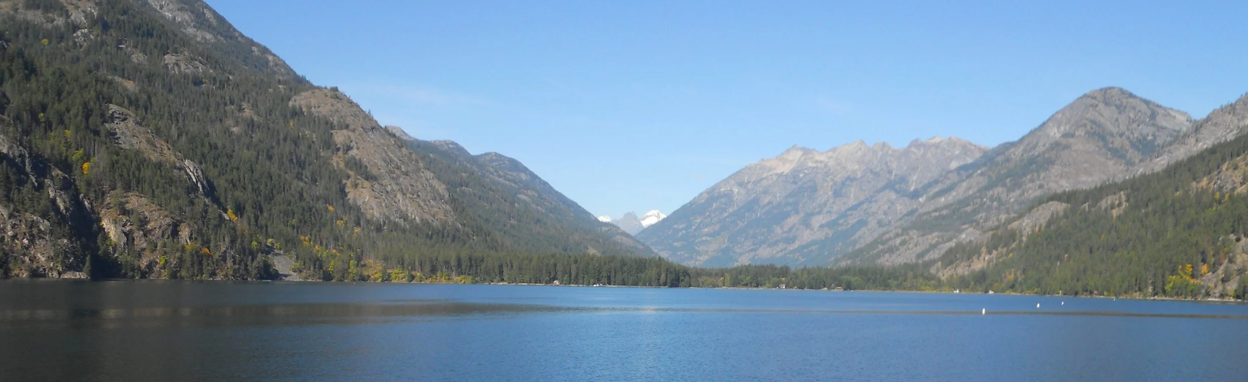
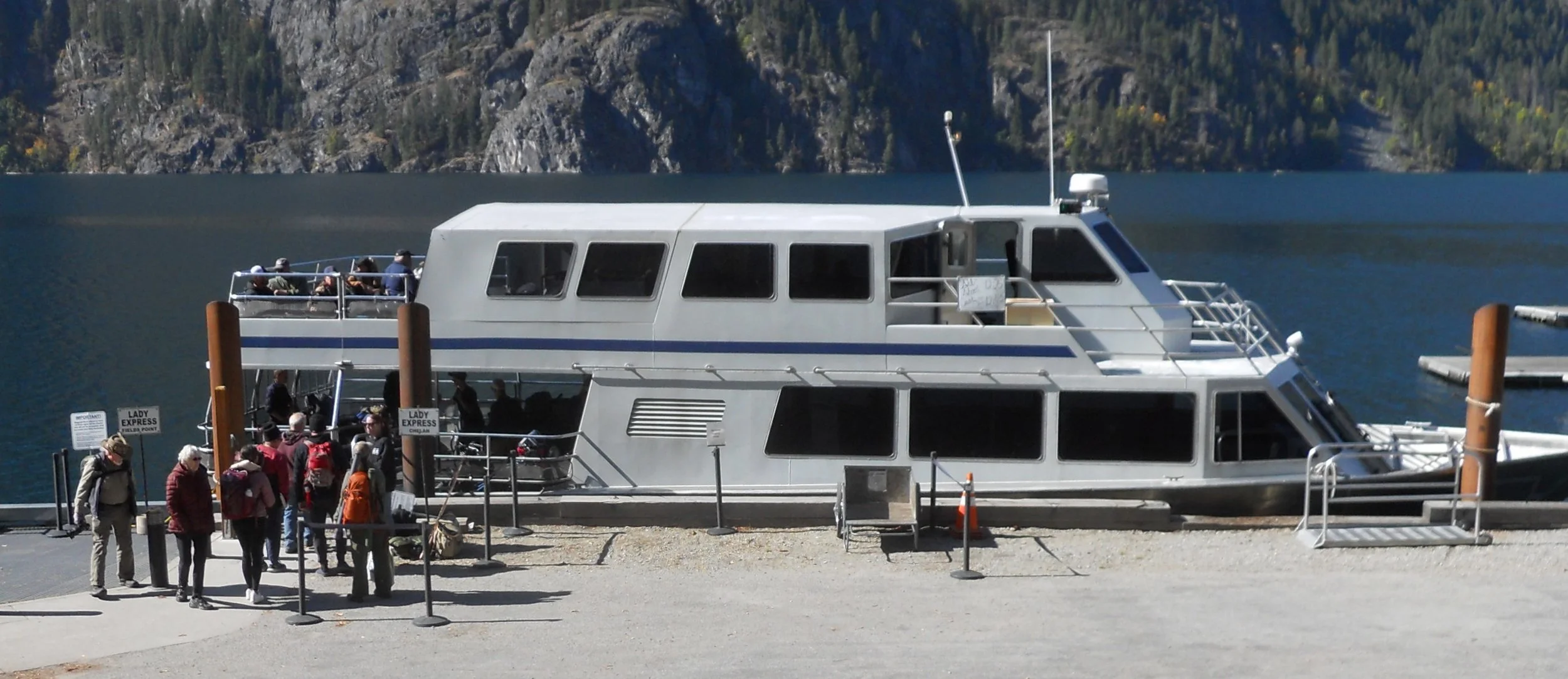
DAY 12 (October 1) - The Golden West VC in Lake Chelan NRA was open today, thanks to Congress passing a 45-day spending bill. The VC is in the town of Stehekin, which is at the end of Lake Chelan, 50 miles from Chelan, WA. The surrounding mountains and the valley which now hold the lake were formed over 2.6 million years ago. Just 16,000 years in the past, a sheet of ice at 4,400 feet deep covered the Stehekin Valley. Today, the lake’s max depth is 1,486 feet, the third deepest in the country.
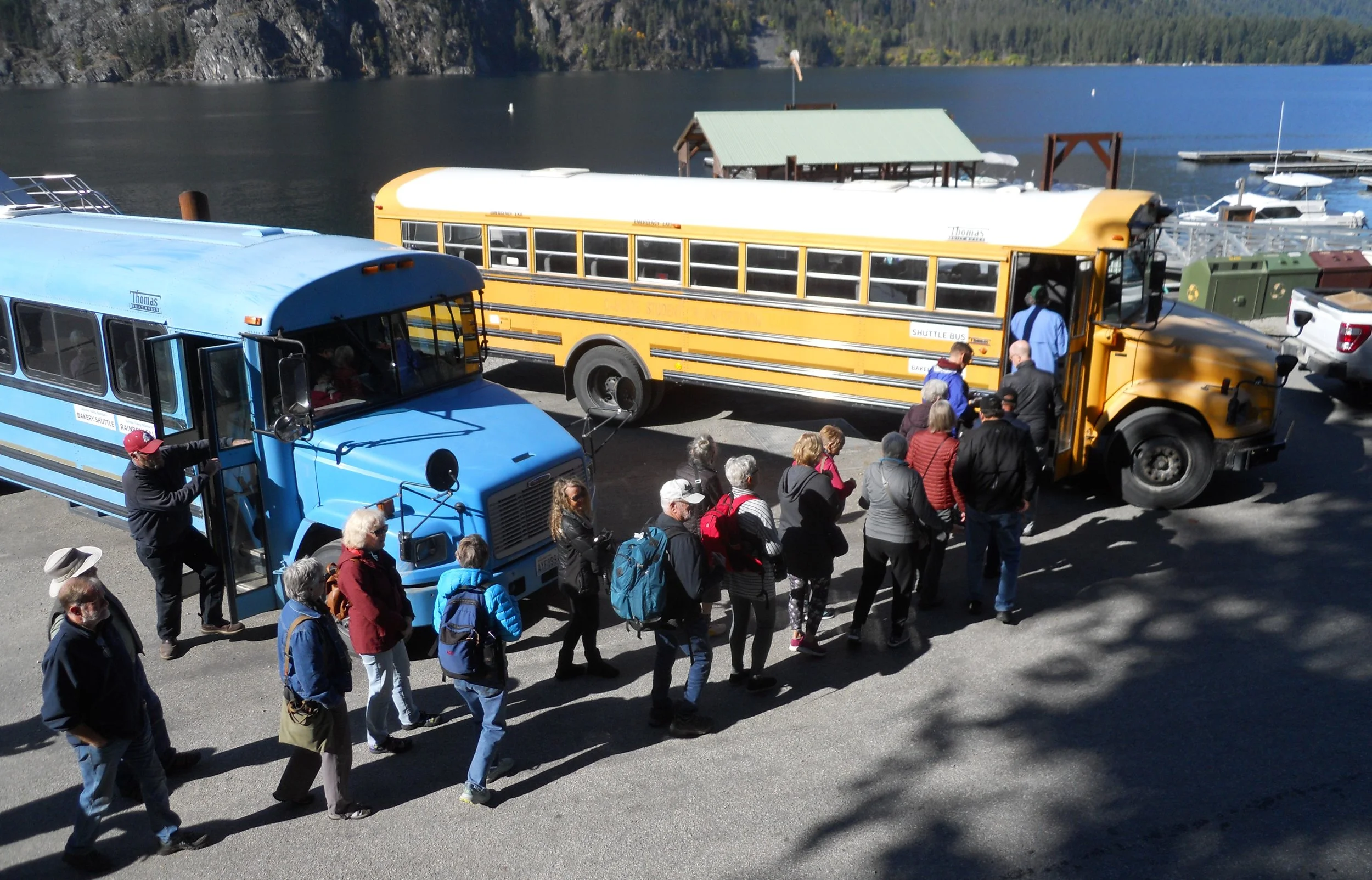
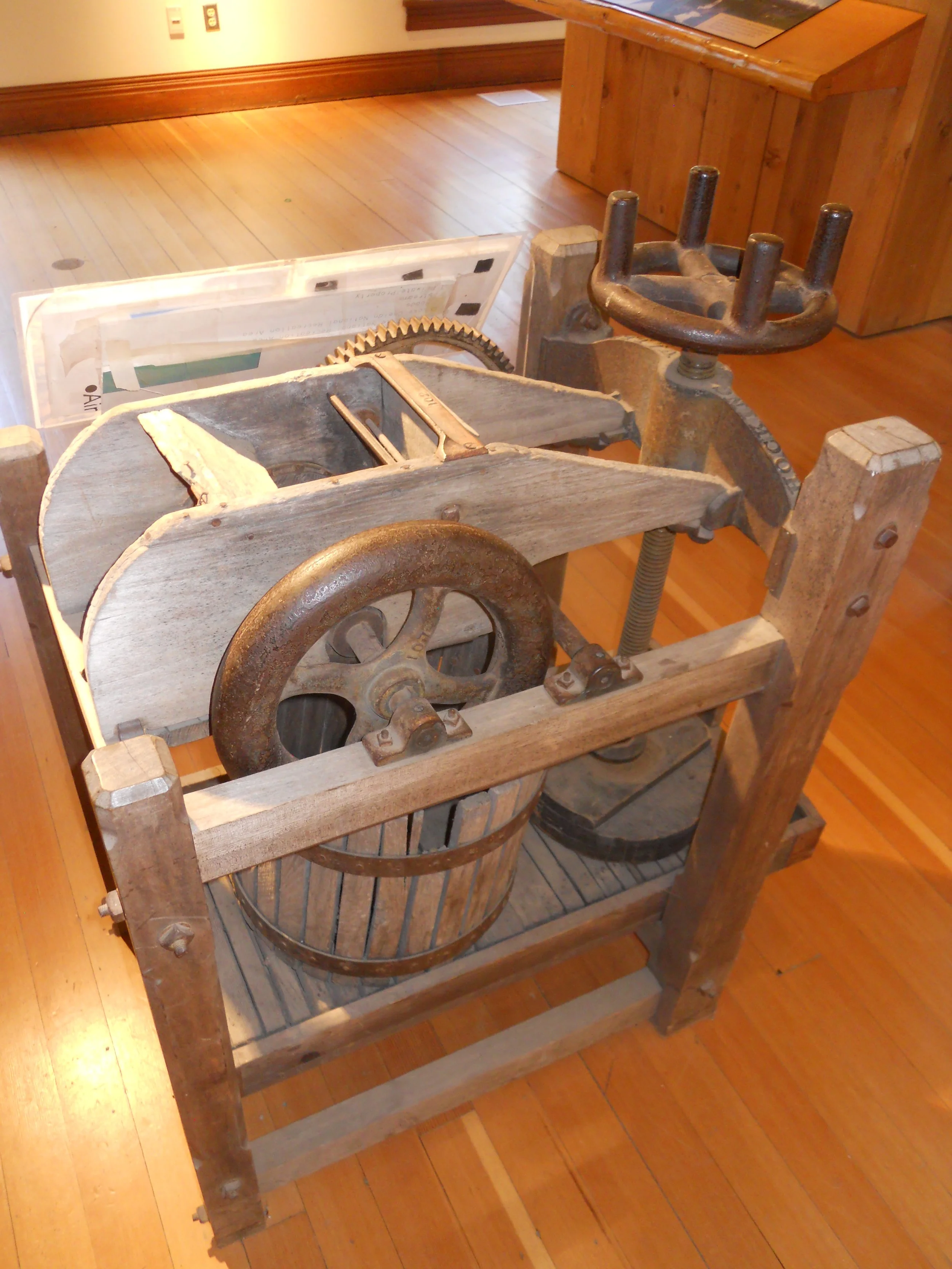
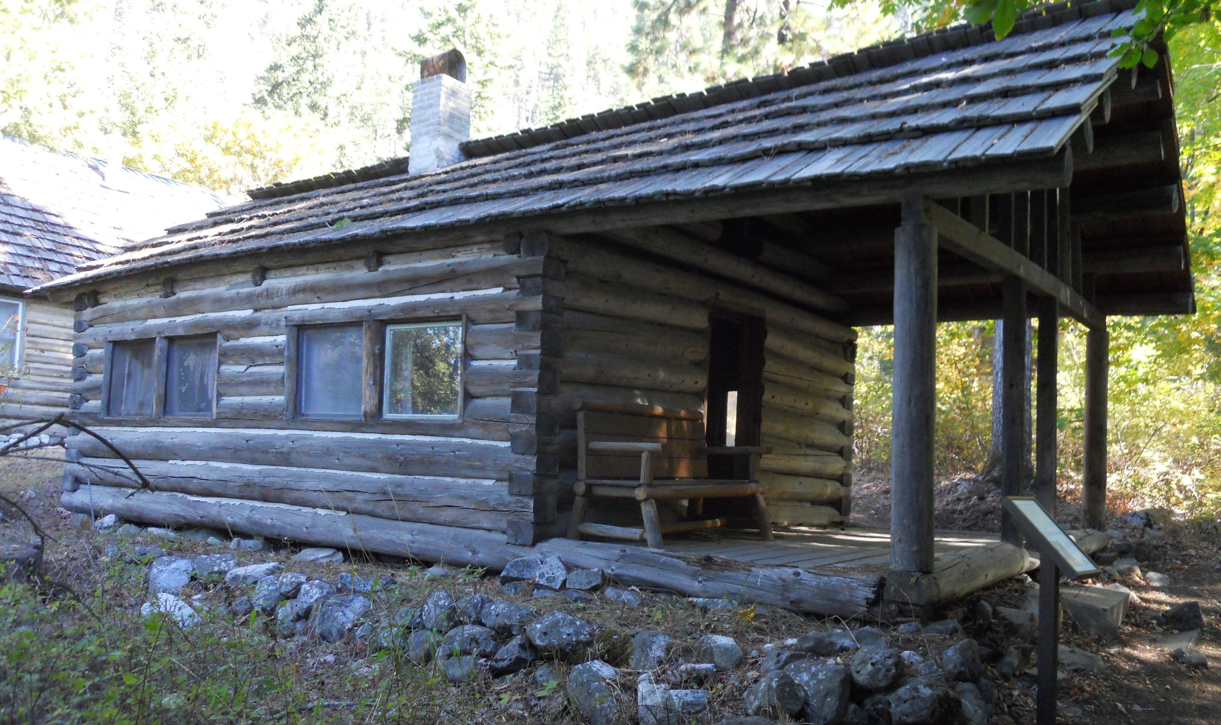
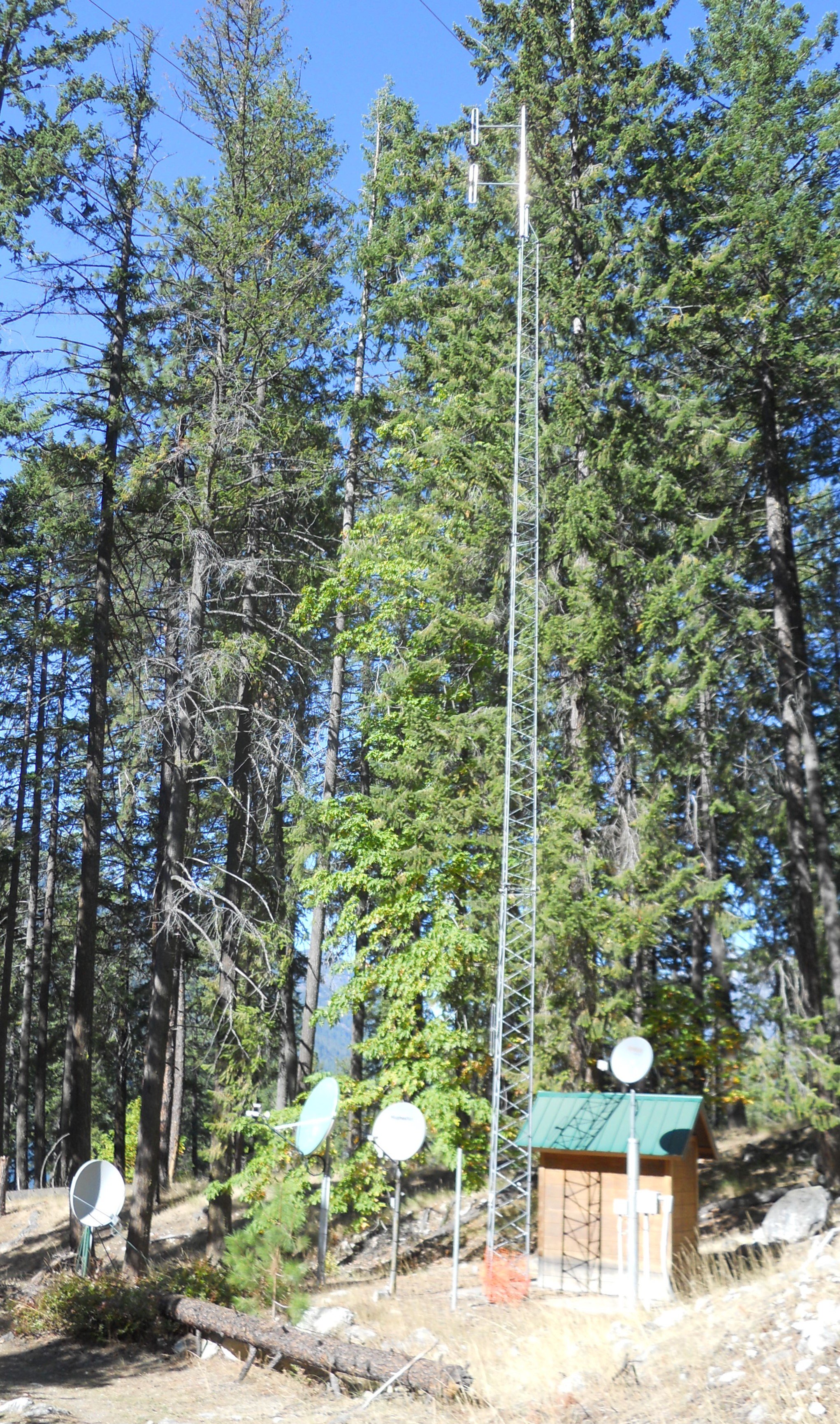
Most people exiting the Lady Express boat jumped onto the buses going to the town’s bakery, which passes fruit orchards (next weekend is the town’s annual Buckner Orchard Harvest Fest). Others went onto the bus which headed to Rainbow Falls, at 310-feet tall it is quite a sight. I took the McKeller Cabin Trail, to see what things looked like back in 1887. It is easy to say life is easier today. The VC has a few items on display, such as an apple squeezer. I also hiked a bit of the Imus Creek Trail, discovering the means the park uses to communicate with the outside world. Then it was back to the Lady Express.
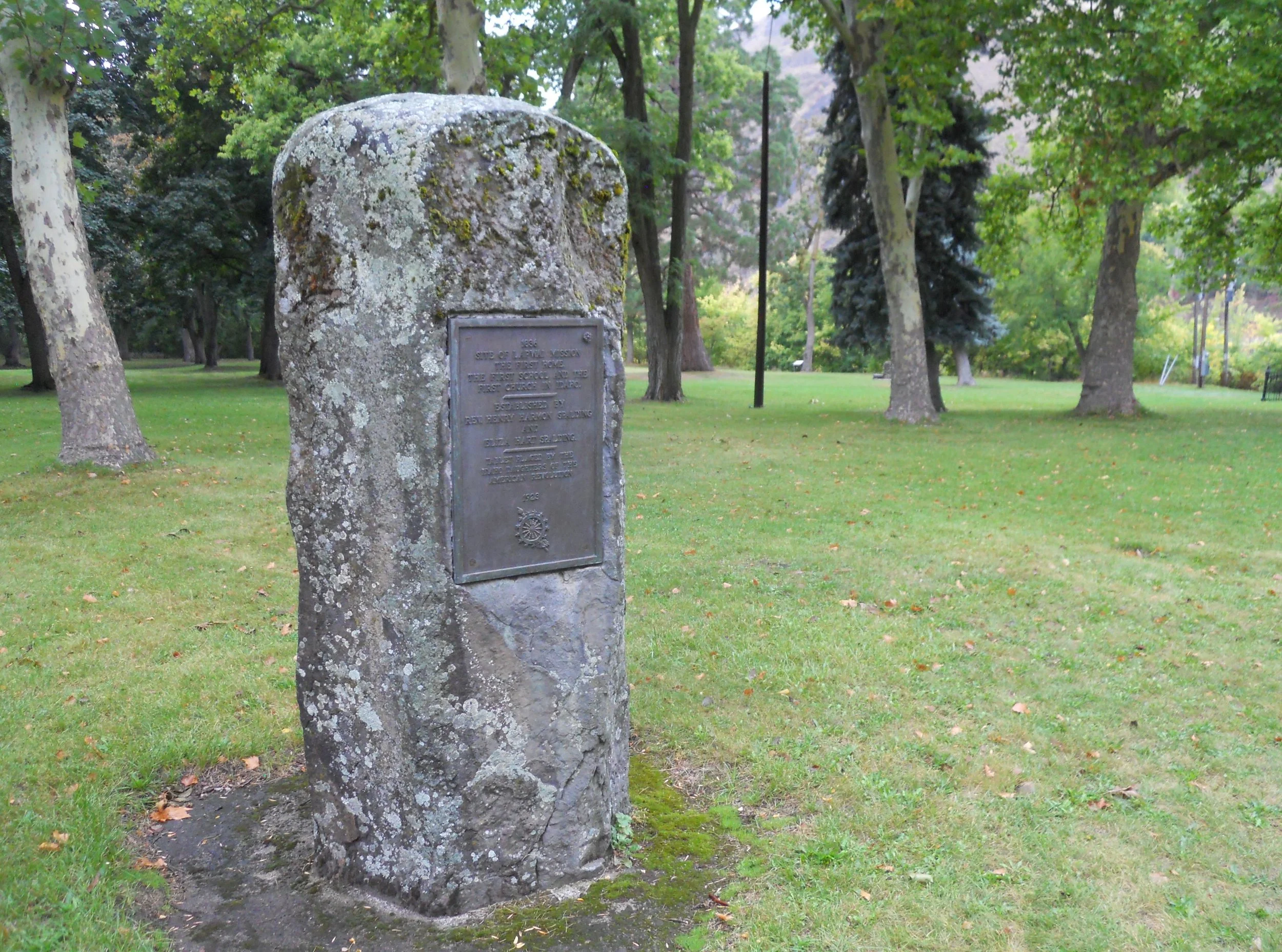
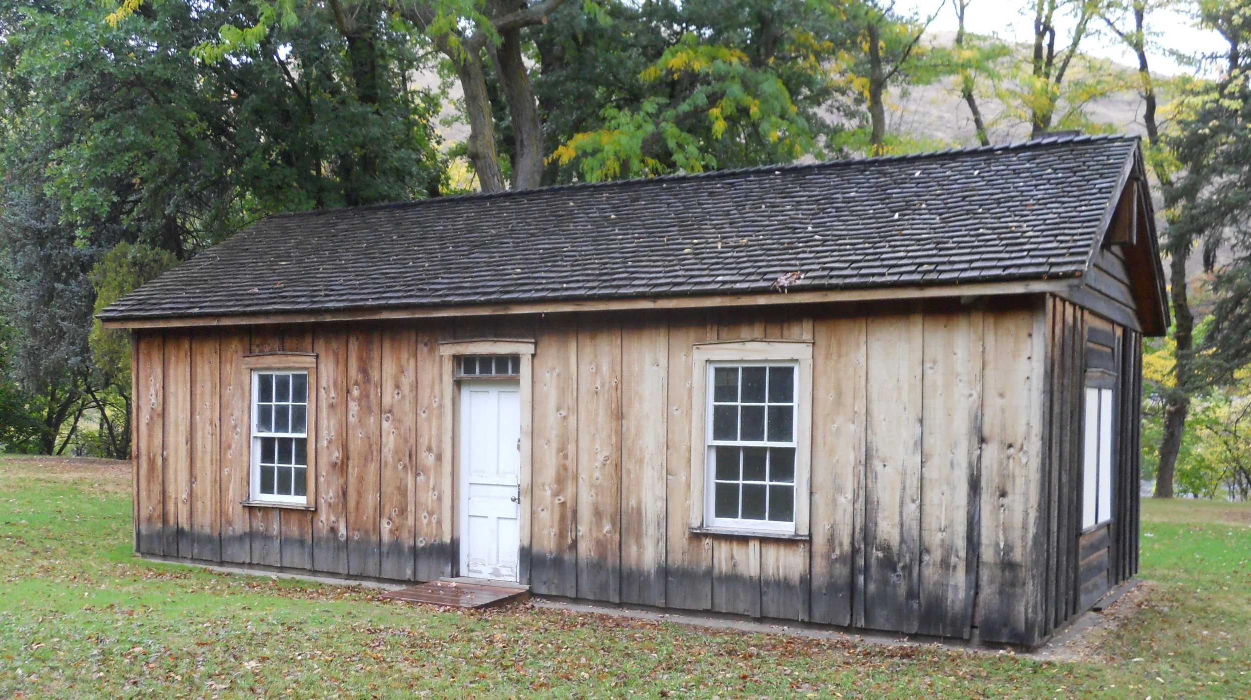
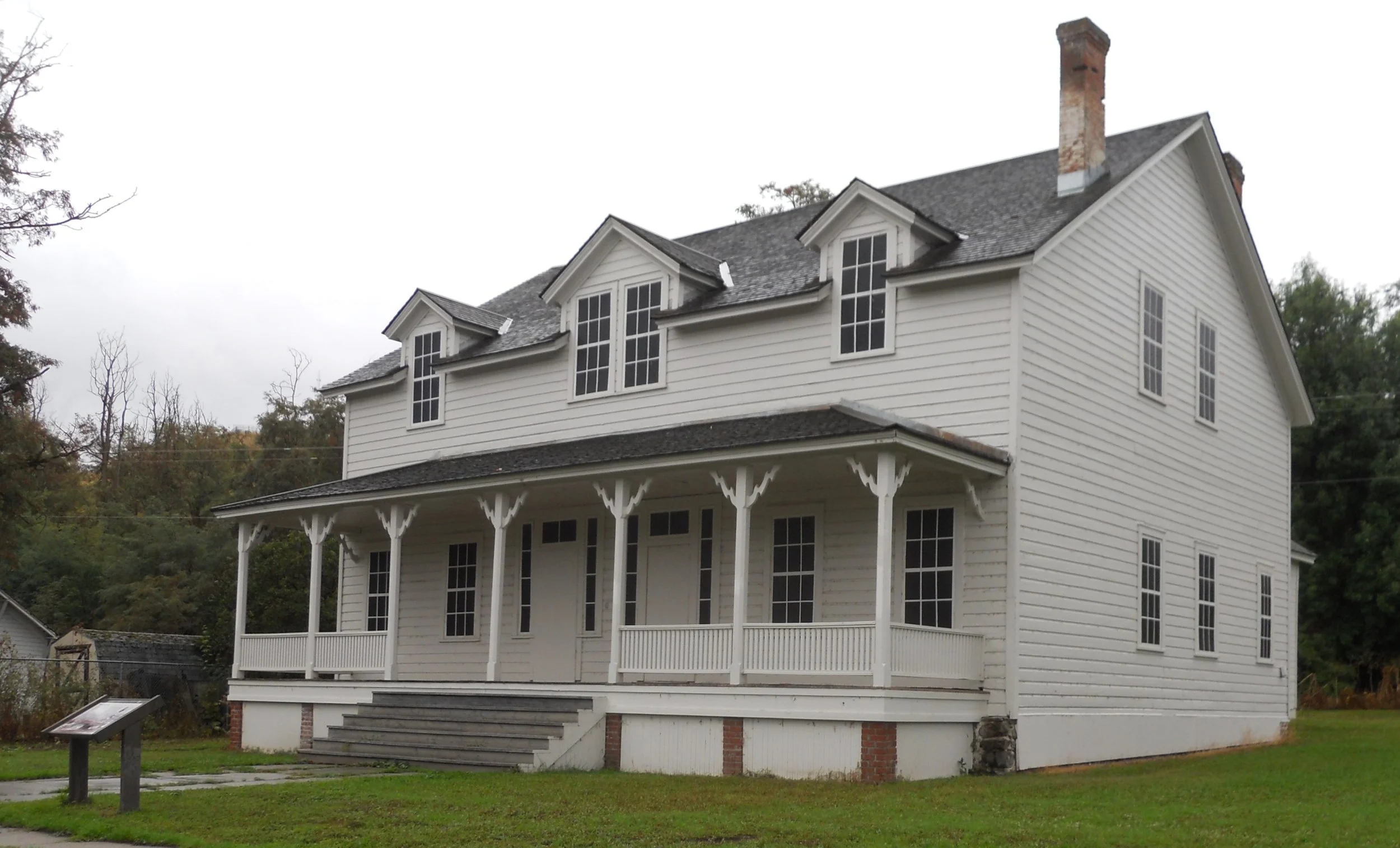
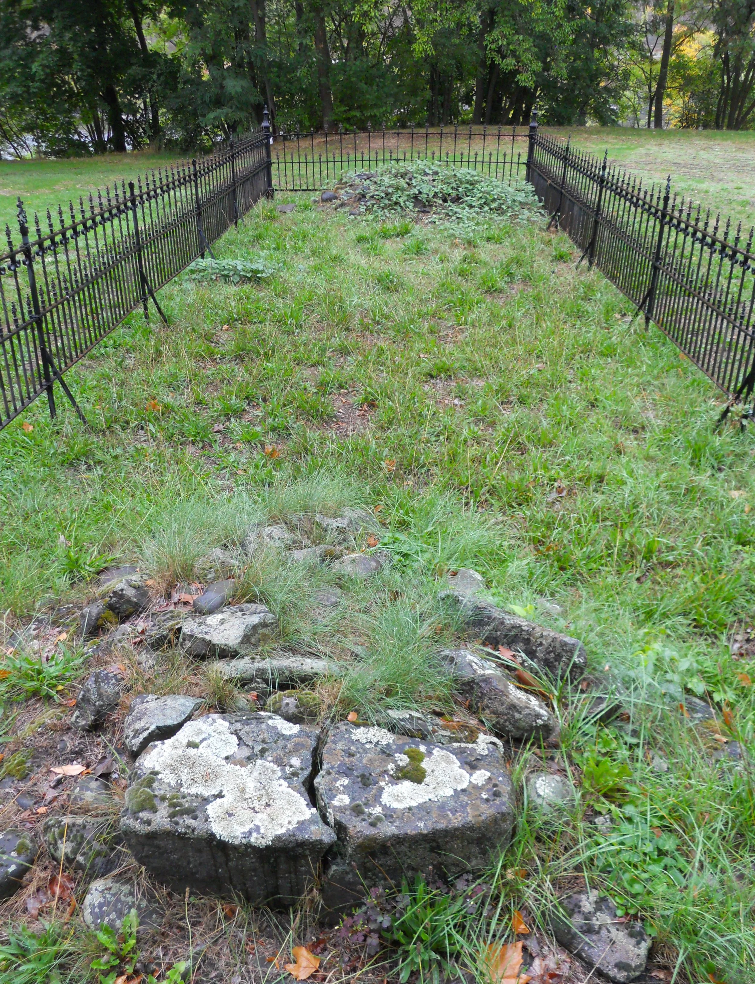
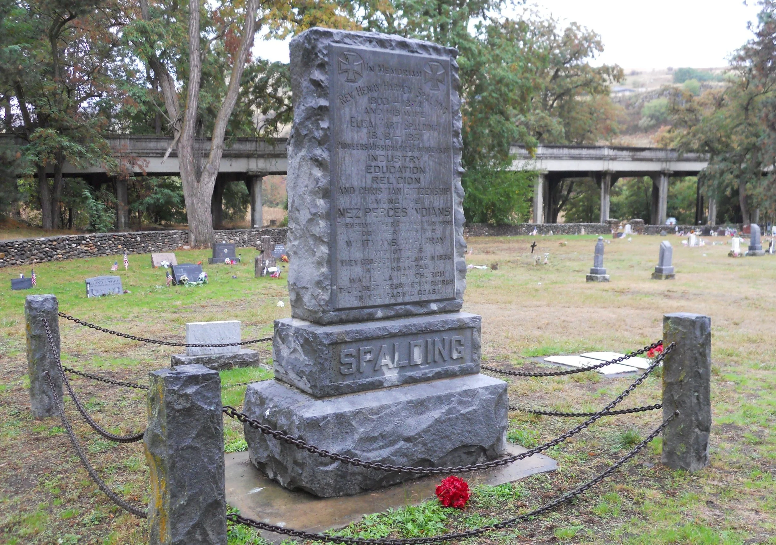
DAY 11 (September 30) - Nez Perce NHP has a special place in my heart. My mother’s father, Harold Cunningham, was born in this area, just after the turn of the 20th century. But the Nez Perce Nation had been living here for hundreds of years. Protestant and Roman Catholic missionaries began to arrive here in the 1830s. A large stone in the park area behind the VC states this was the location of the Lapwai Mission, the first home, the first school, and the first church in Idaho, in 1836, established by Rev. Henry Spalding. The original fireplaces of the home remain. The Indian Agency cabin from 1862 still stands. The government Indian Agency was charged with keeping miners and farmers off the Nez Perce lands. The mission’s cemetery is active to this day. Many Nez Perce are buried here, as are Rev. Spalding and his wife Eliza.
Fort Lapwai was created in 1862, a couple miles from the mission, to help the Indian Agency. An Officer’s Quarters duplex, built in 1883, is one of the few buildings which remain.
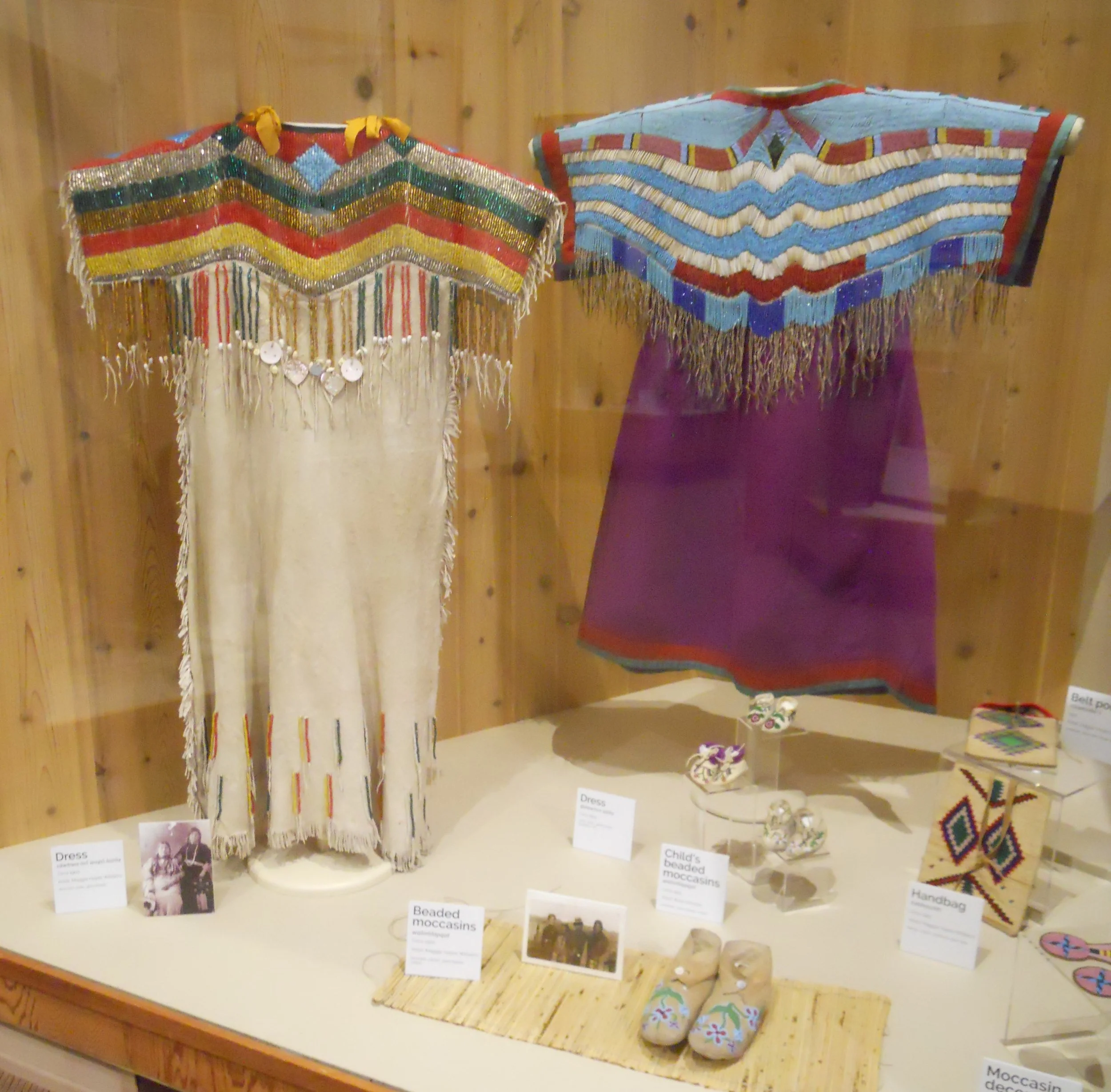
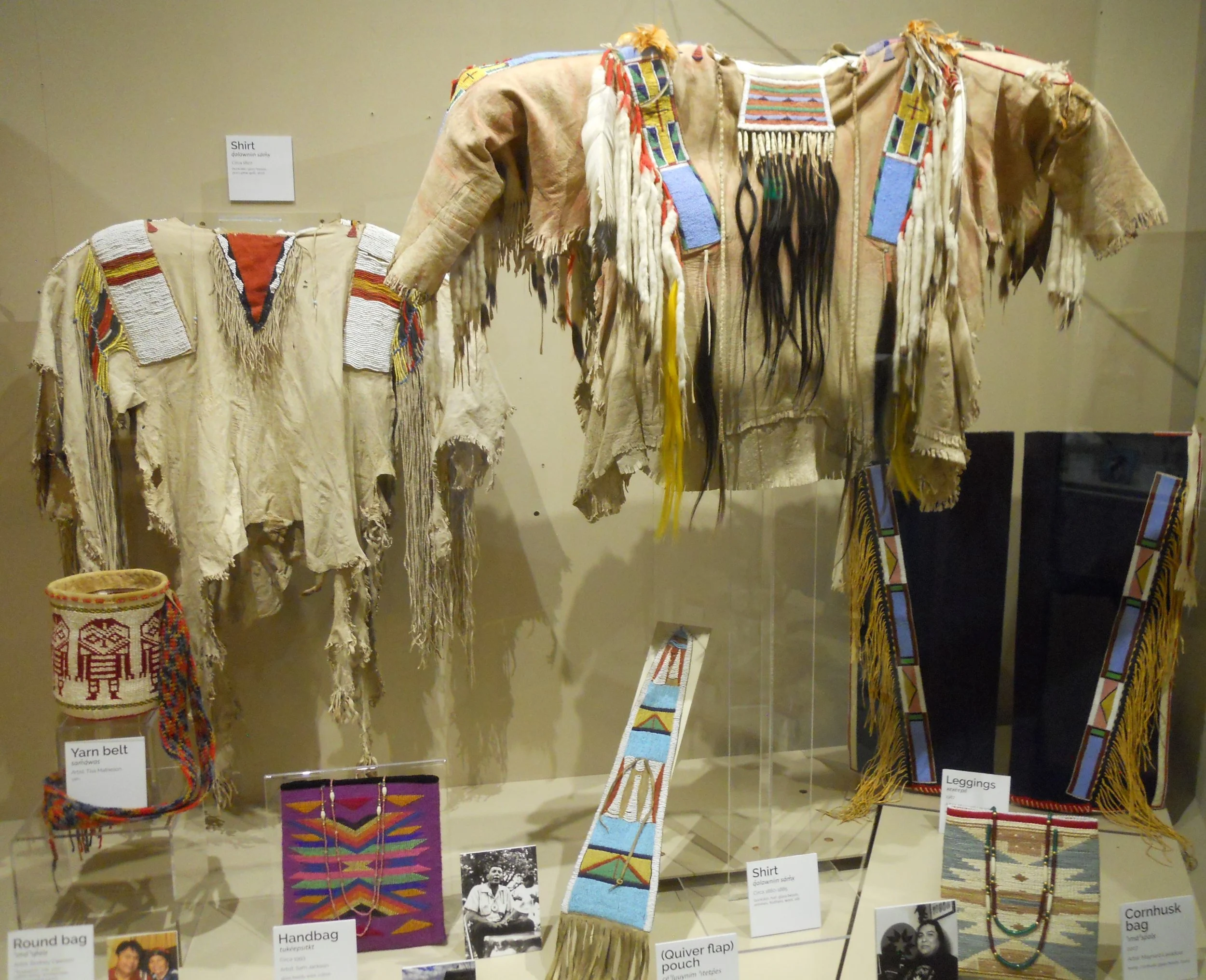
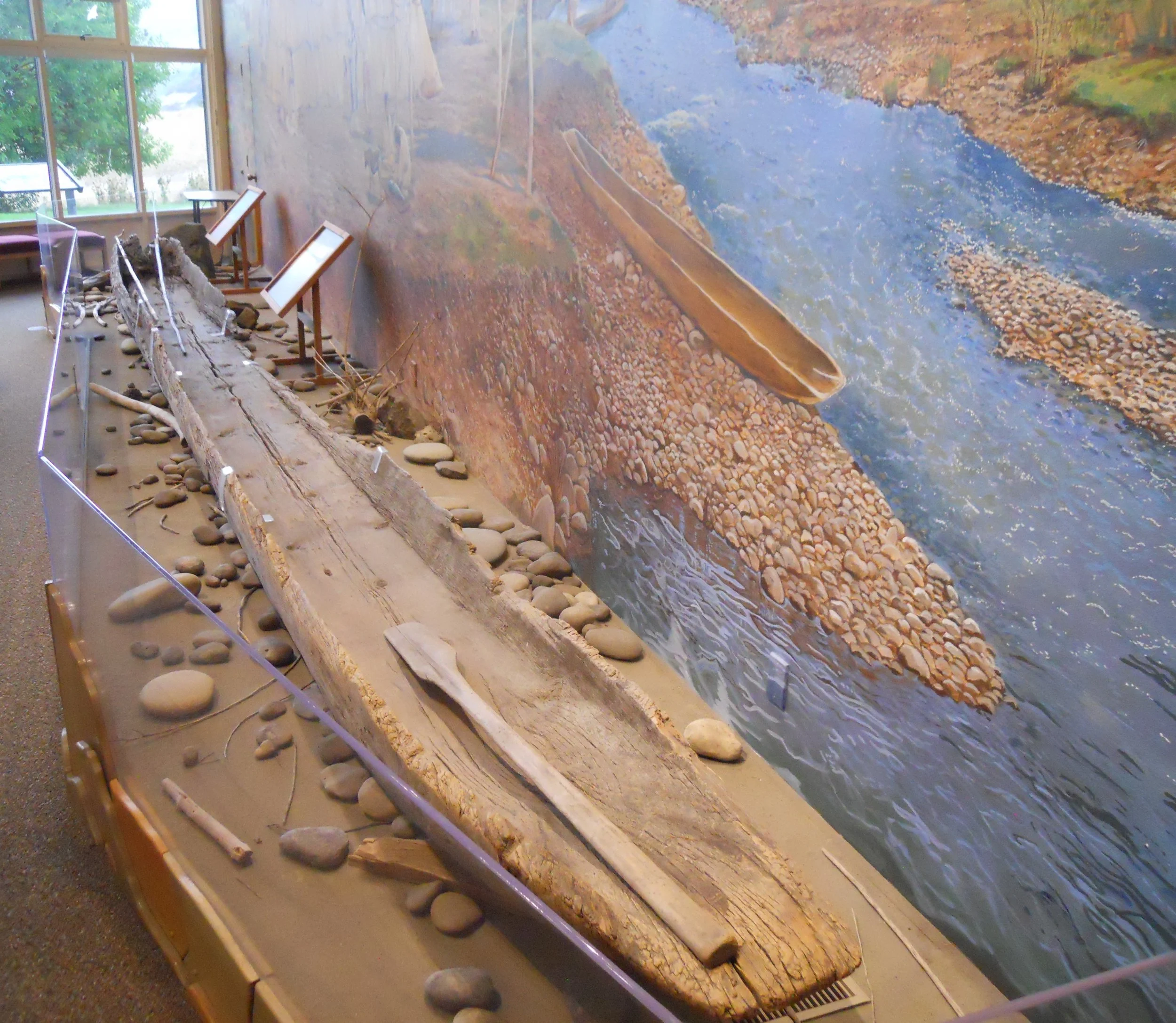
The VC has a number of wonderful Nez Perce artifacts on display. A ranger said women’s clothing had horizontal designs while men had vertical designs. An original Penawawa Canoe (named for where it was discovered) sits in front of a large river-scene mural.
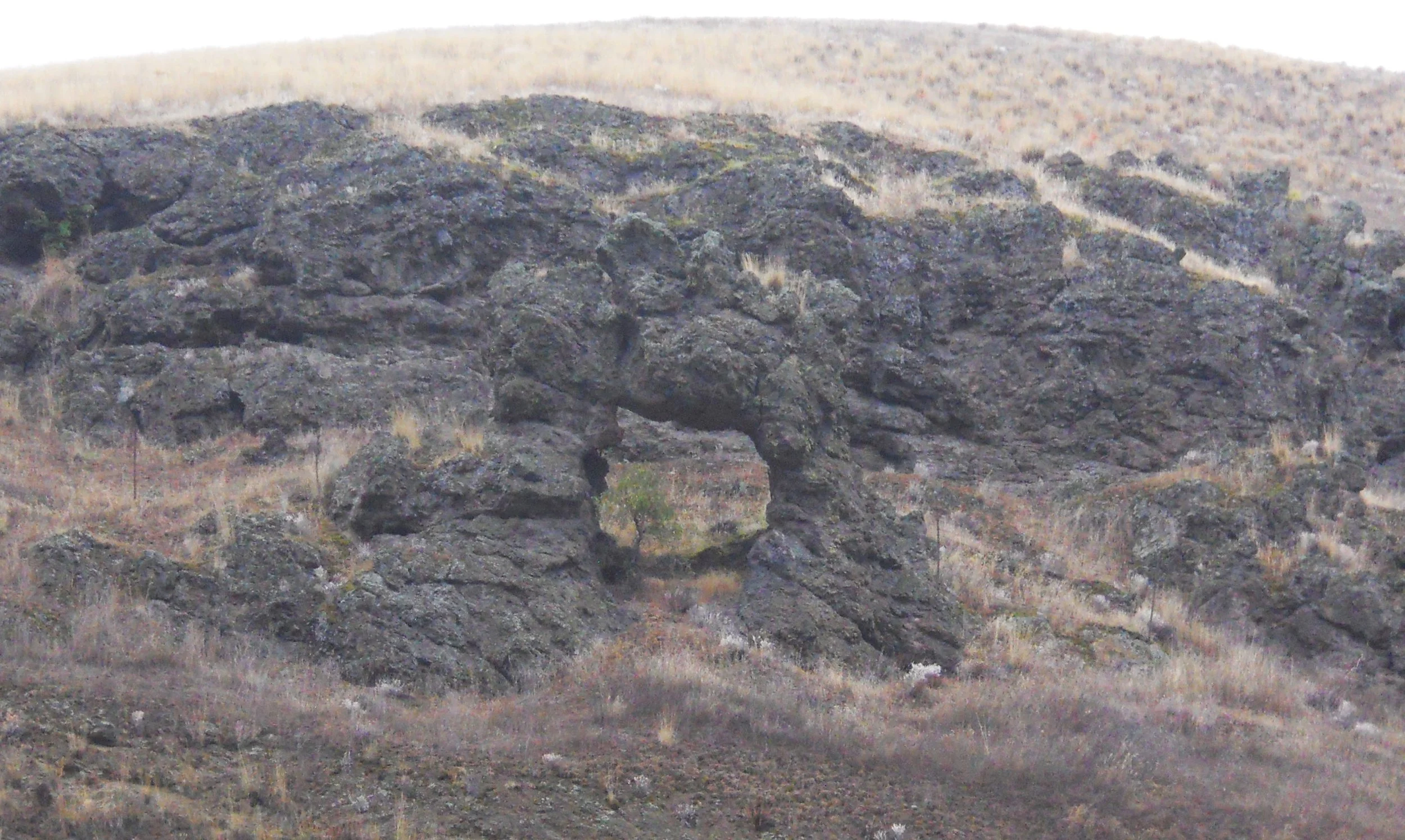
A natural feature along the Clearwater River, a basalt arch, which the Nez Perce revere, is the Ant-Yellowjacket. The two insects are fighting over a fishing site. They were turned to stone by Coyote since they did not listen to the wisdom of not fighting.
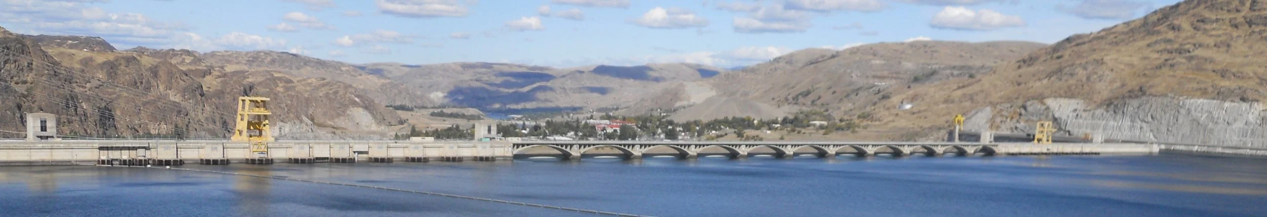
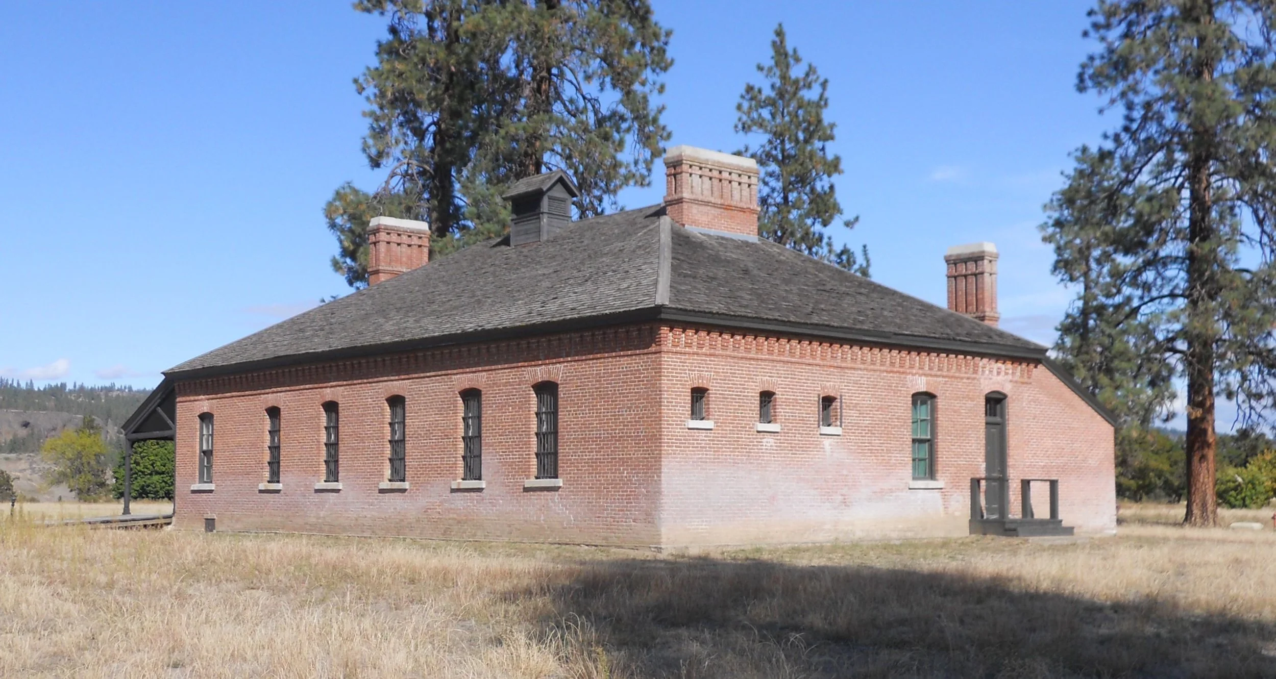
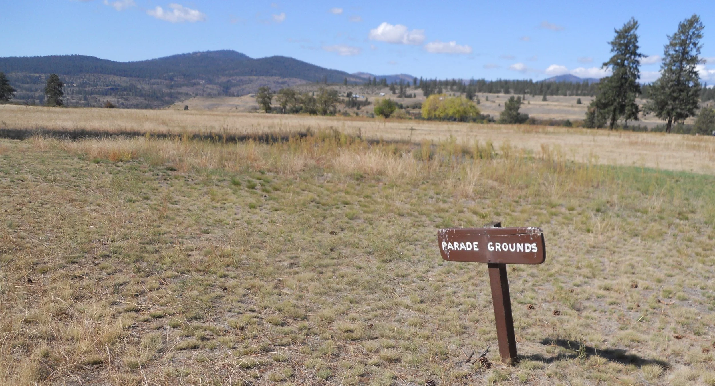
Lake Roosevelt NRA was created by the Grand Coulee Dam. The Colombia River flows through a large channel made by ice age glaciers. Fort Spokane was built in 1880, along the river, to keep the peace between native Indian tribes and the influx of settlers. This was the last Western frontier fort built in the Pacific NW region. Only a few of the original 45 buildings remain, one being the brick guardhouse, which today is the park’s VC. The Parade Grounds is next to the fort’s Baseball Field (remember, baseball was well entrenched in our country by 1880).
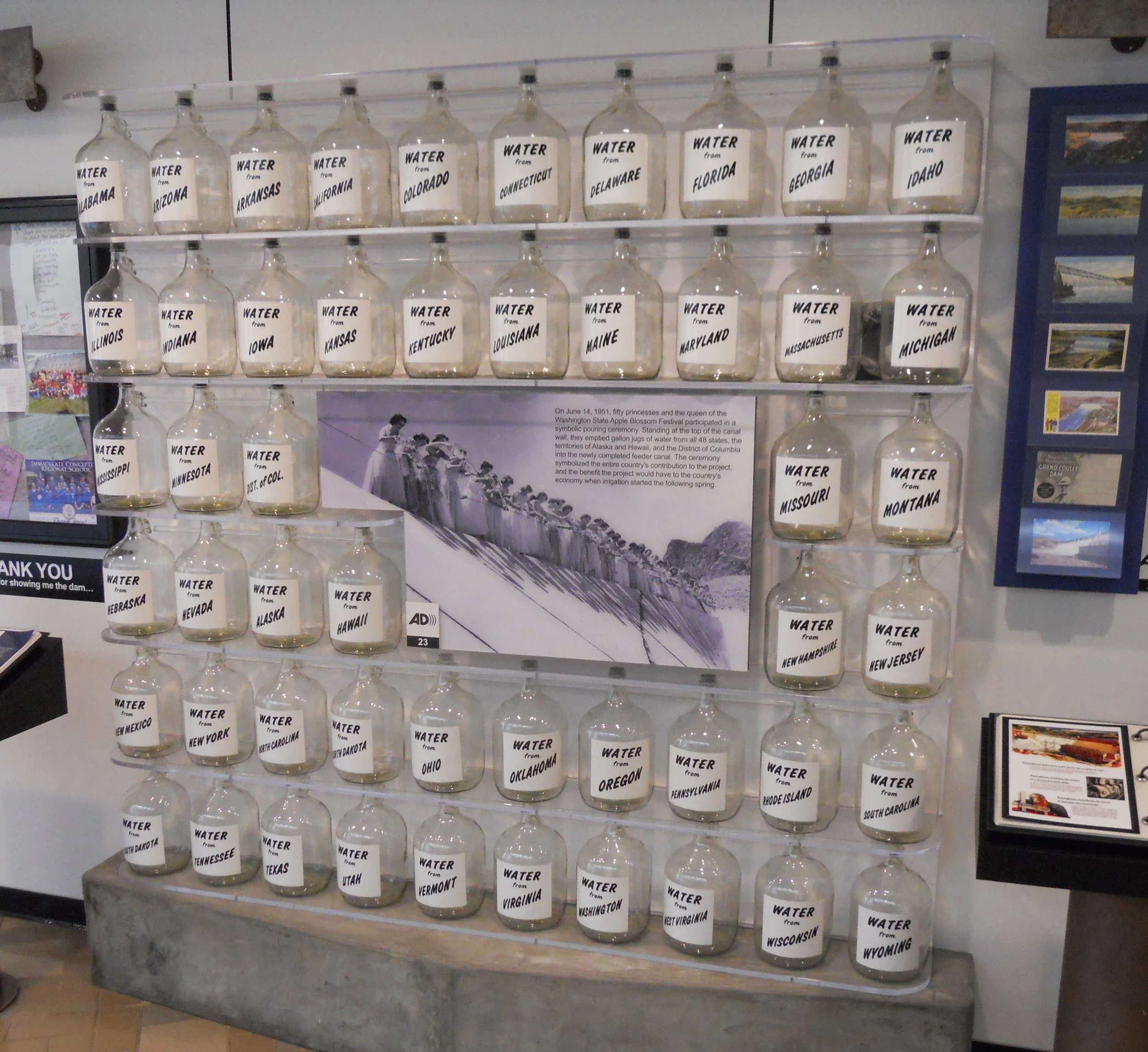
Back at the dam, its VC is one of the best you will find. My favorite display is of the 51 glass water jugs. On June 14, 1951, water from the 48 states, two territories (Hawaii and Alaska), and the D.C. was poured into the lake to symbolize the entire country’s contribution to the project.
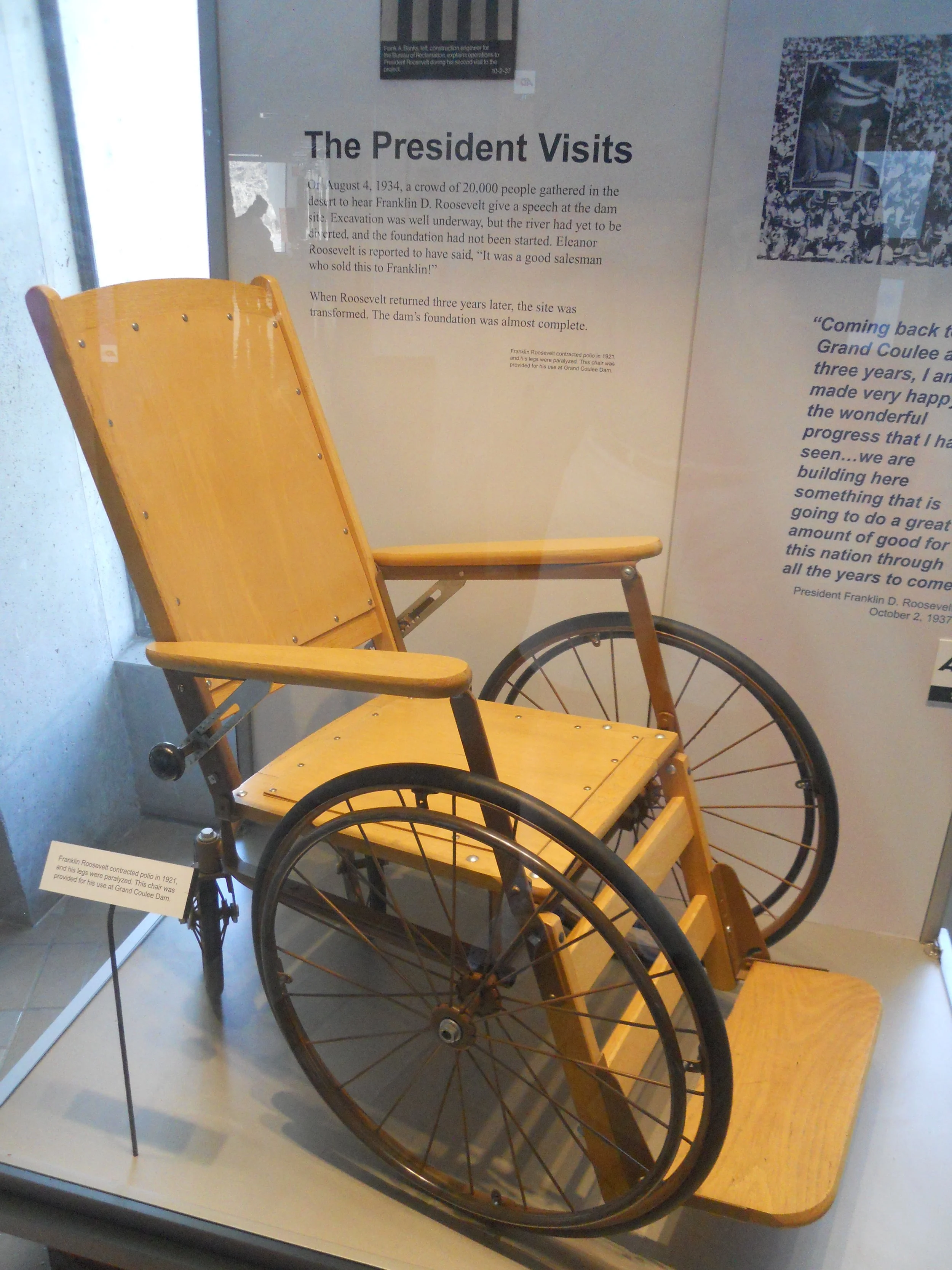
President Roosevelt visited in 1934 at the start of the project. The wheelchair he used is in the VC.
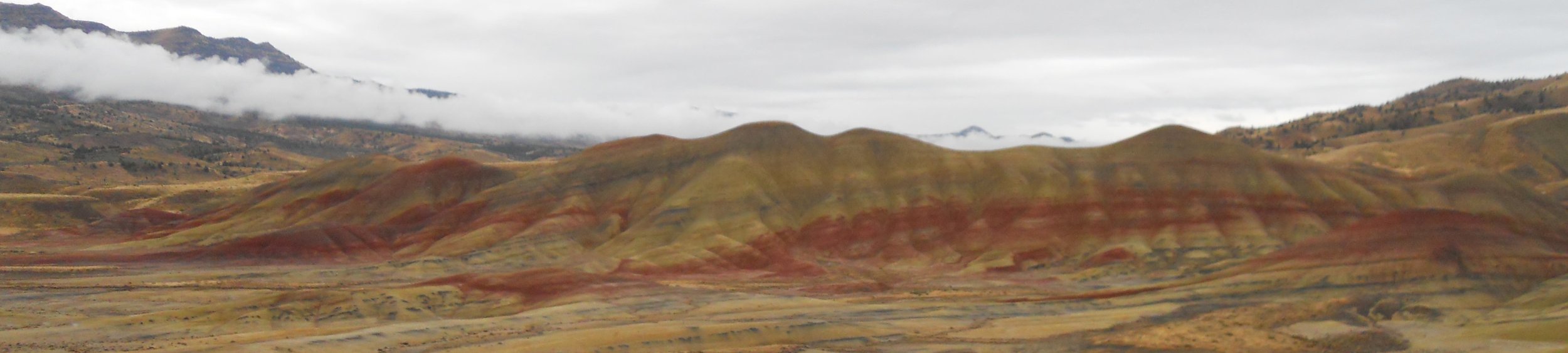
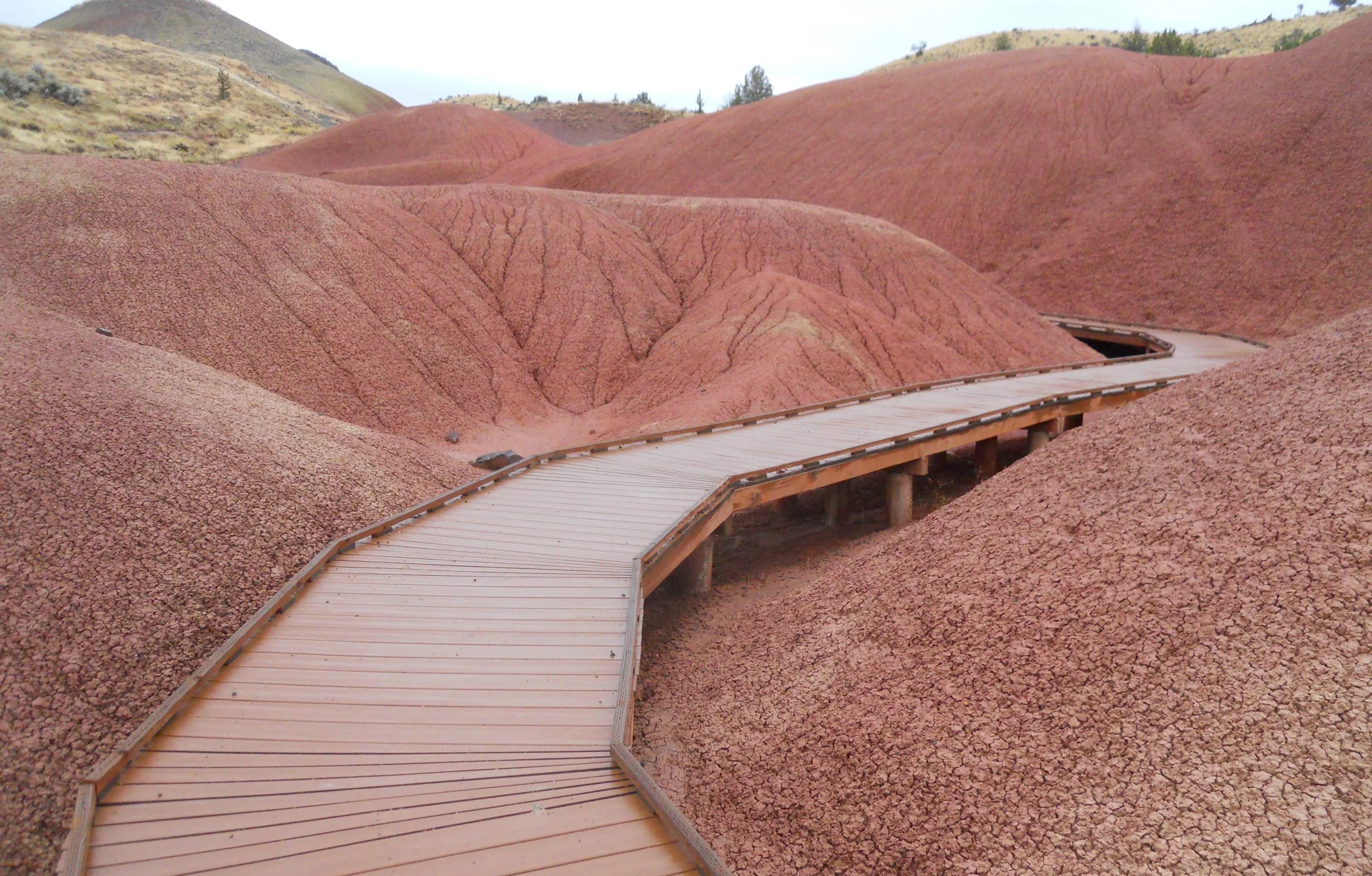
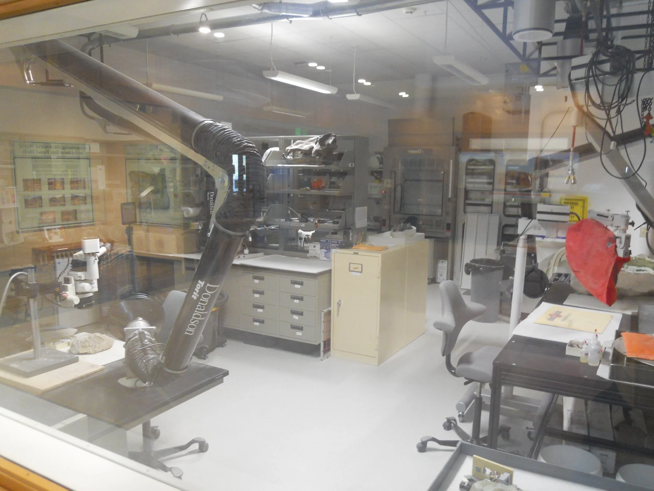
DAY 10 (September 29) - John Day Fossil Beds NMon preserves a journey through time of 40 million years, in fossils and exposed ecosystems. Iron red indicates a moist time period, while yellow and tan were drier. Black sections are from manganese. The mounds are slowly oxidizing (aka rusting) due to the presence of the iron. The first photo is from the Painted Hills unit of the park. The clouds were hanging low today. A boardwalk is available at one section to keep visitors off the terrain. The VC has a lab with plenty of neat “toys” where visitors can watch experts analyze fossils from the area. Thomas Condon, an Oregon minister, heard about the finding of fossils from Civil War soldiers in 1862. He spent the next 42 years as the paleontology expert of this region. The VC is named after Condon.
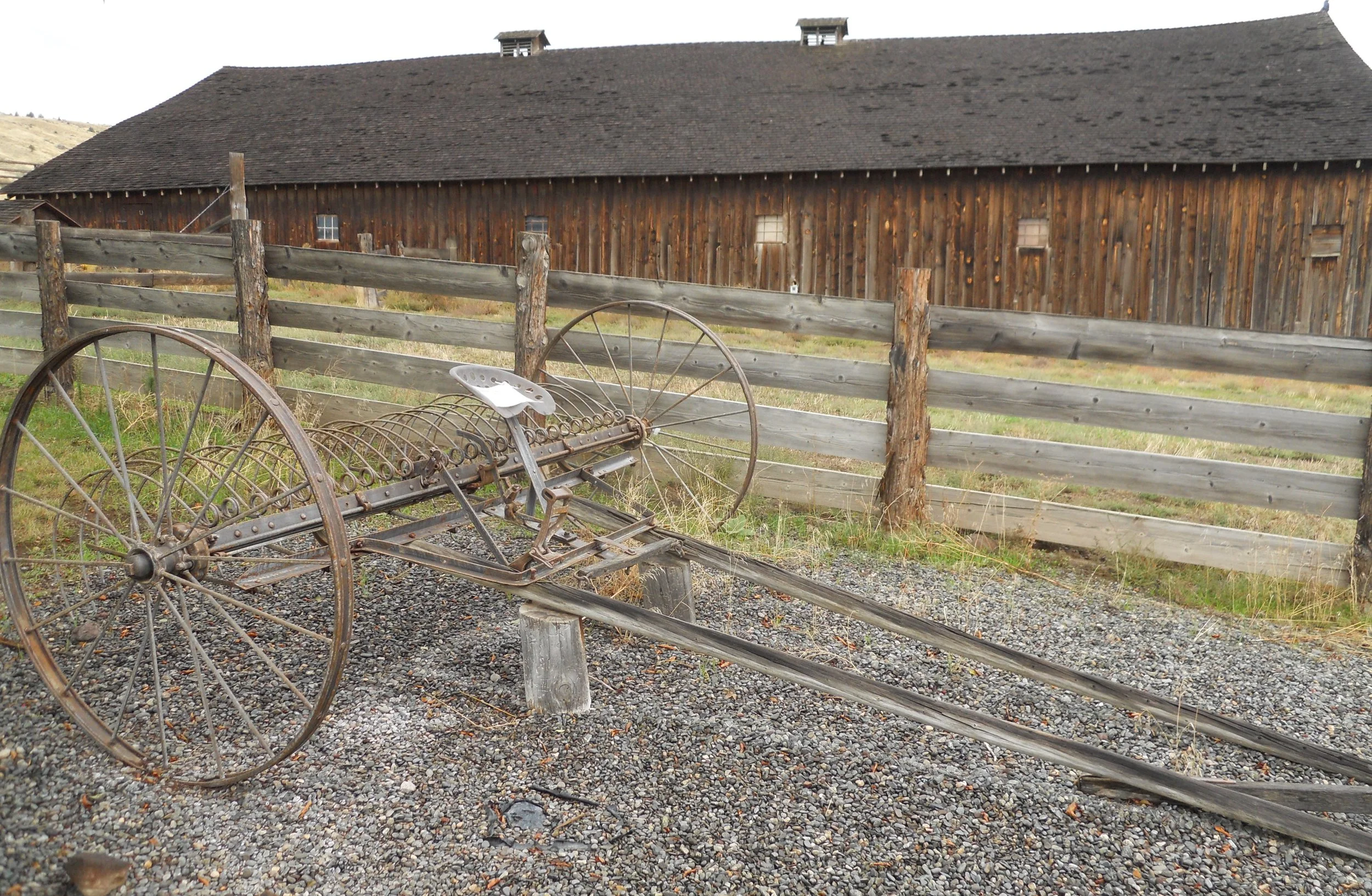
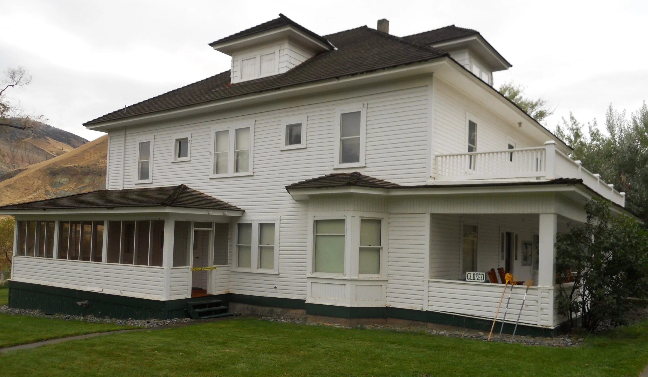
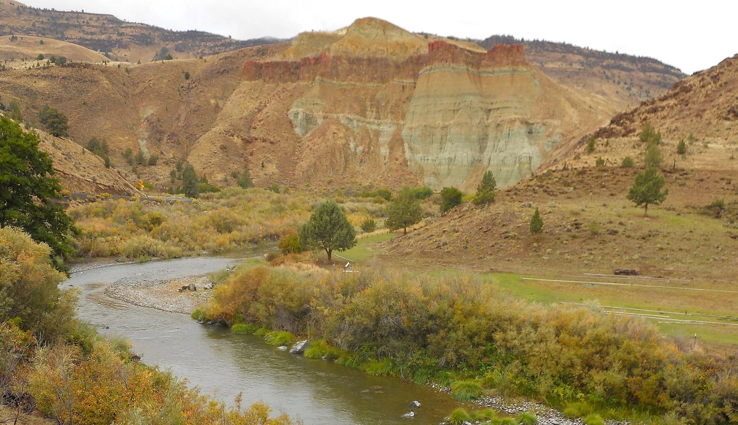
Across the street from the VC is the Cant Ranch, which includes the main house, barns, and antique farm equipment, such as the Foot Dump Hay Rake. Pressing down with one foot would dump the hay which had been accumulated. Down the road is Cathedral Rock, showing off a rainbow of colors.
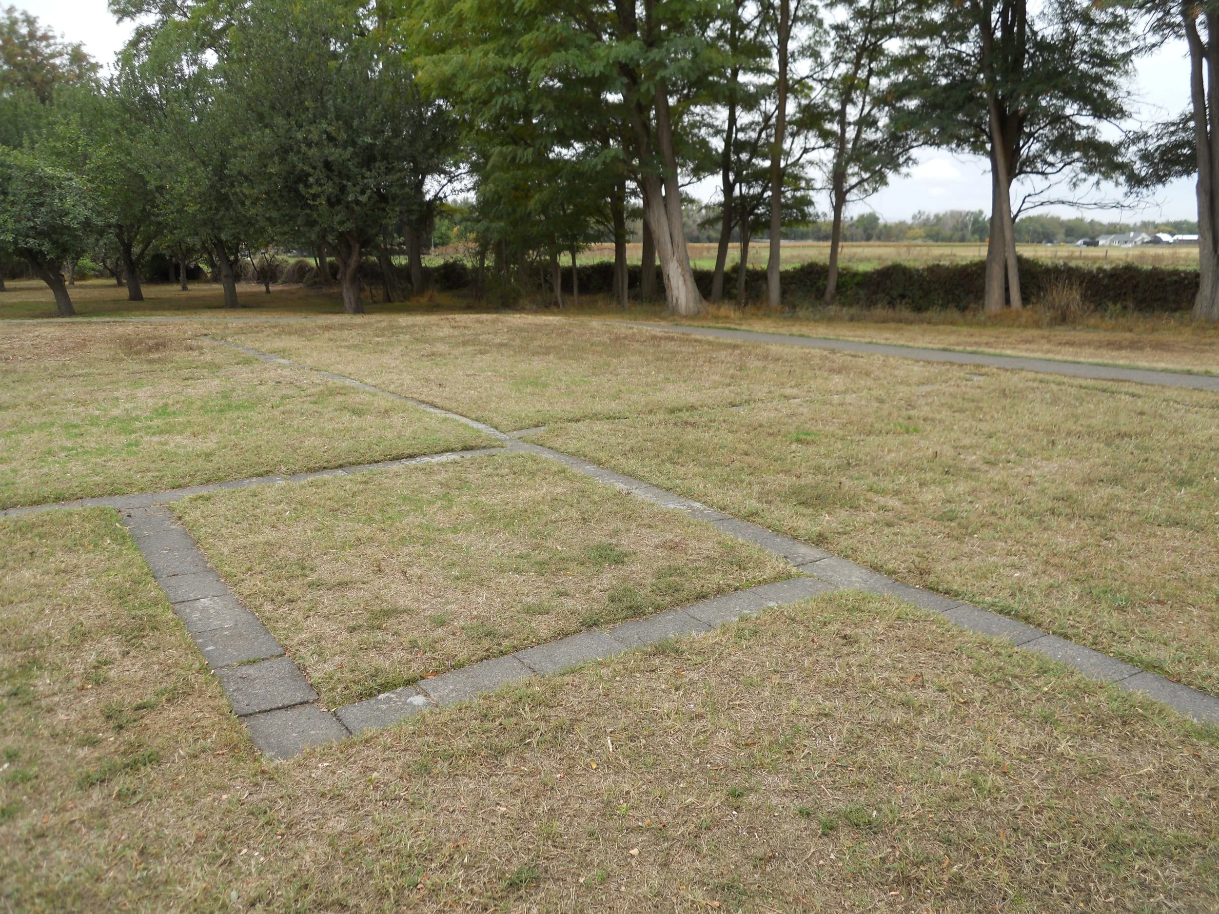
Whitman Mission was built along the Oregon Trail (today in Walla Walla, WA). The trail remains today for visitors to walk, next to a replica wagon. The influx of missionaries in the mid-19th century caused havoc with the Cayuse Indians. A small mission with a few buildings was built, anchored by the nine-room home of Marcus Whitman. None of the structures remain, but the NPS has used stones to show the outline of the buildings.
On November 29, 1847, the Cayuse attacked the missionaries. The Great Grave lists the names of the men and women who were killed, including Marcus and his wife.
A 27-foot tall Memorial Shaft was erected 50 years after the attack. It stands on the tall hill next to the mission.
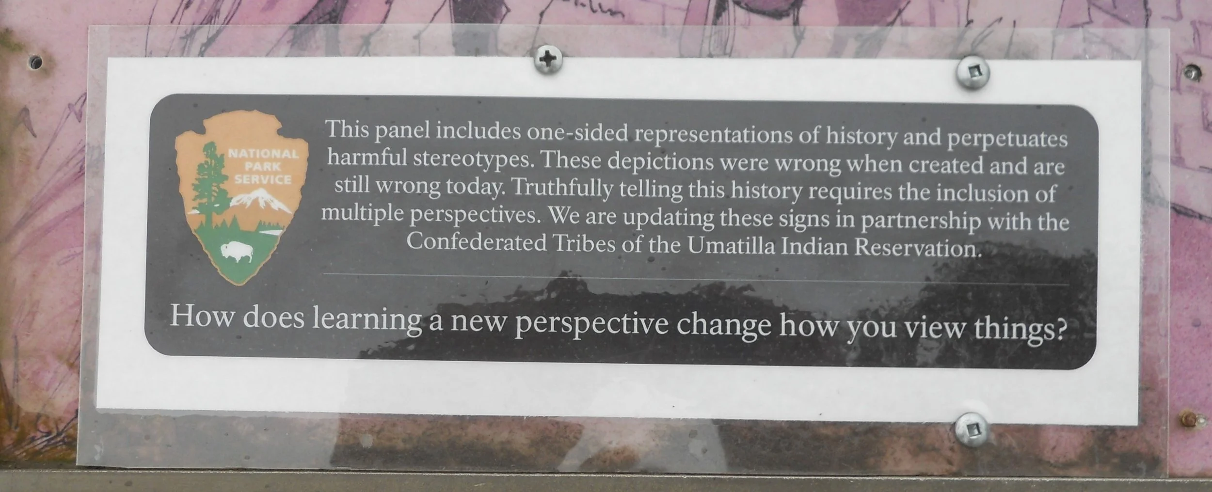
The NPS has placed placards on their panels which state the information is one-sided relative to past views of the event. Work is underway to tell the entire story of the events at the mission.


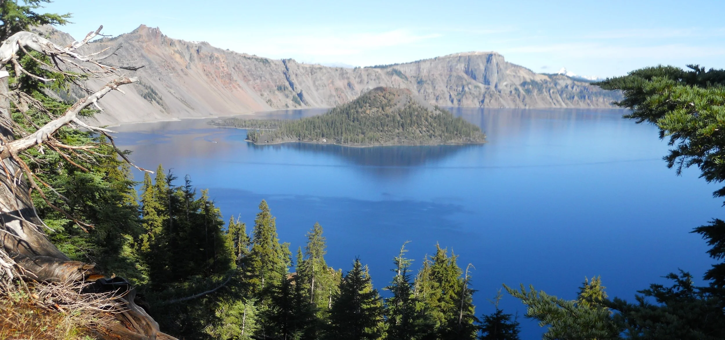
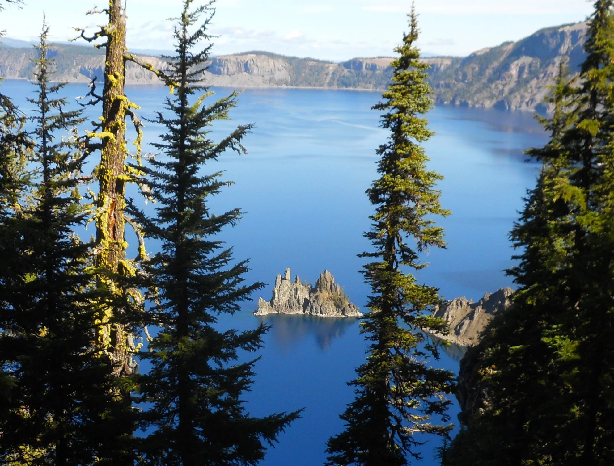
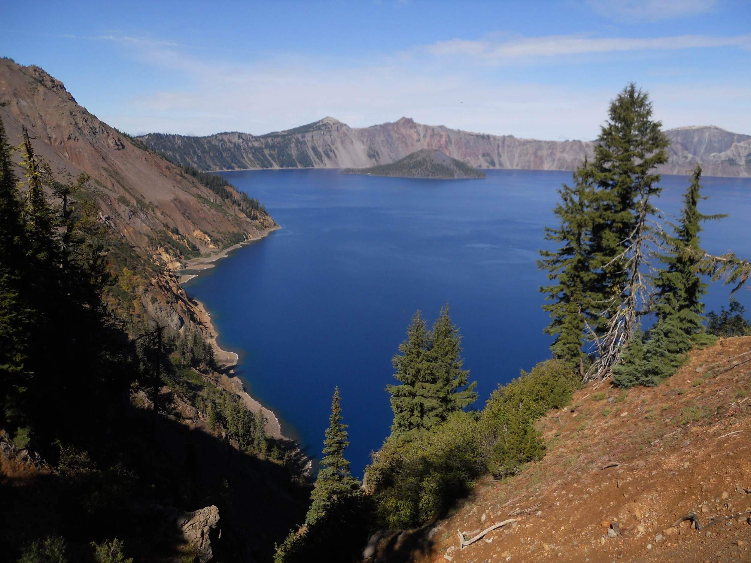
DAY 9 (September 28) - No parks on Day 8, but Crater Lake NP today made up for the pause. Some consider this to be the bluest water in the country. Wizard Island sits in the middle of the lake, 760 feet tall, itself its own volcano… a volcano sitting inside a volcano. About 7,500 years ago when Mount Mazama erupted and collapsed, this cinder cone began rising, as water filled the caldera. Andesite rock is the primary lava material in the park.
Vidae Falls is on the East Rim Road, falling 100-feet. Phantom Ship Rock, the second island in the lake, lies on the other side of the lake from Wizard Island. The island resembles a ghost ship during foggy days.
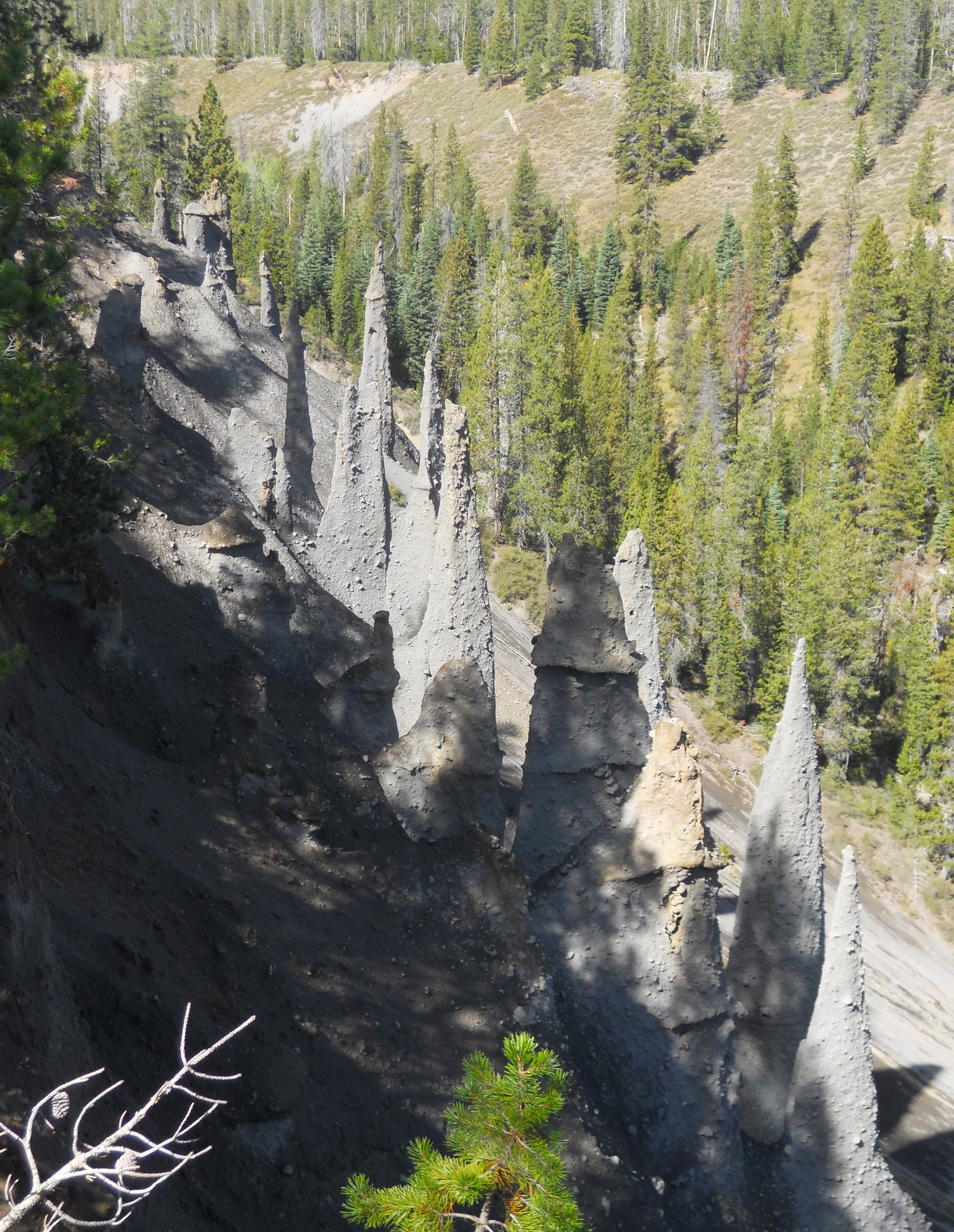
The park’s website yesterday (and just now when I rechecked) stated the Pinnacles Road was closed, as of July 31. Well, it was open, so I drove down to see the Pinnacles. Over thousands of years, ash and pumice have been worn away from the sides of a canyon, leaving behind 100-foot tall spires. Soon they will be gone.
Pumice Castle, the orange formation, will not go so easily. Its pumice material welded with hot lava, creating a harder composite which stands the test of time while the softer surroundings are weathered away.

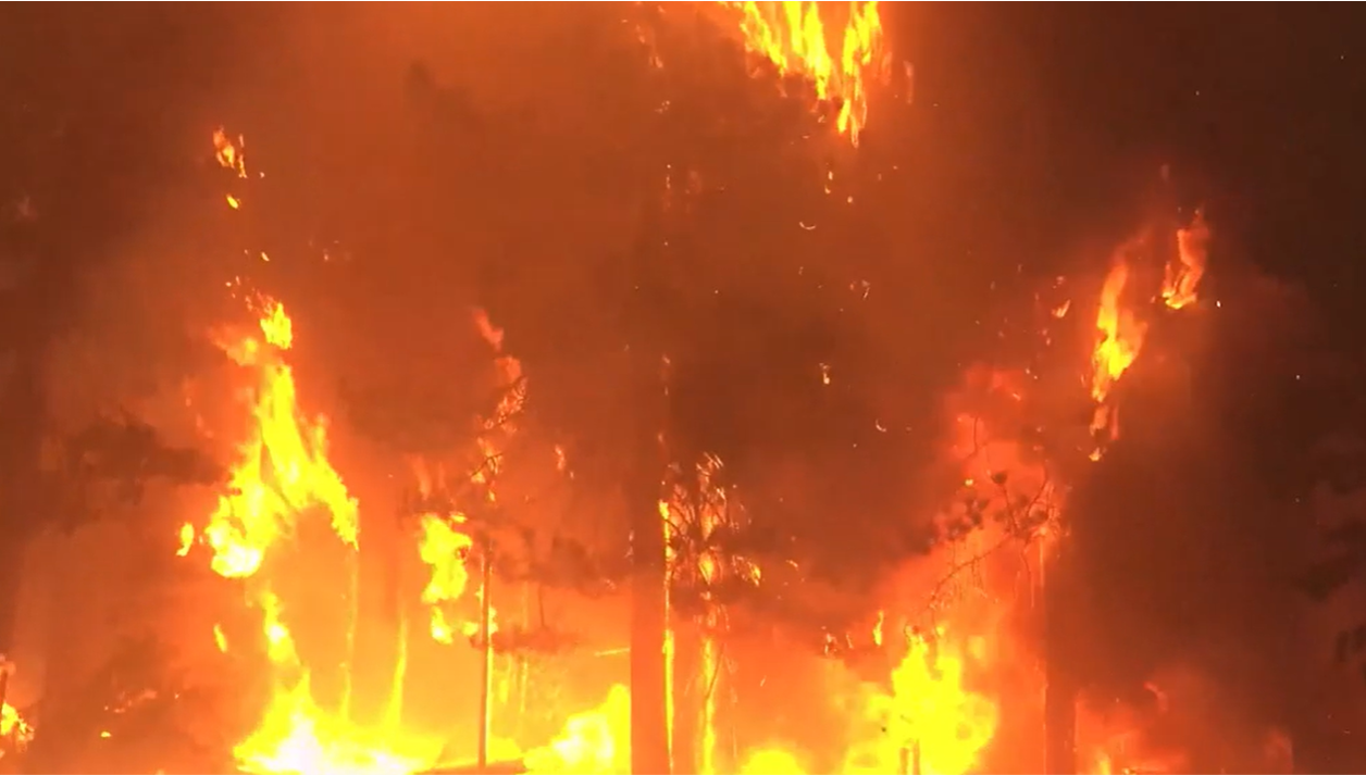
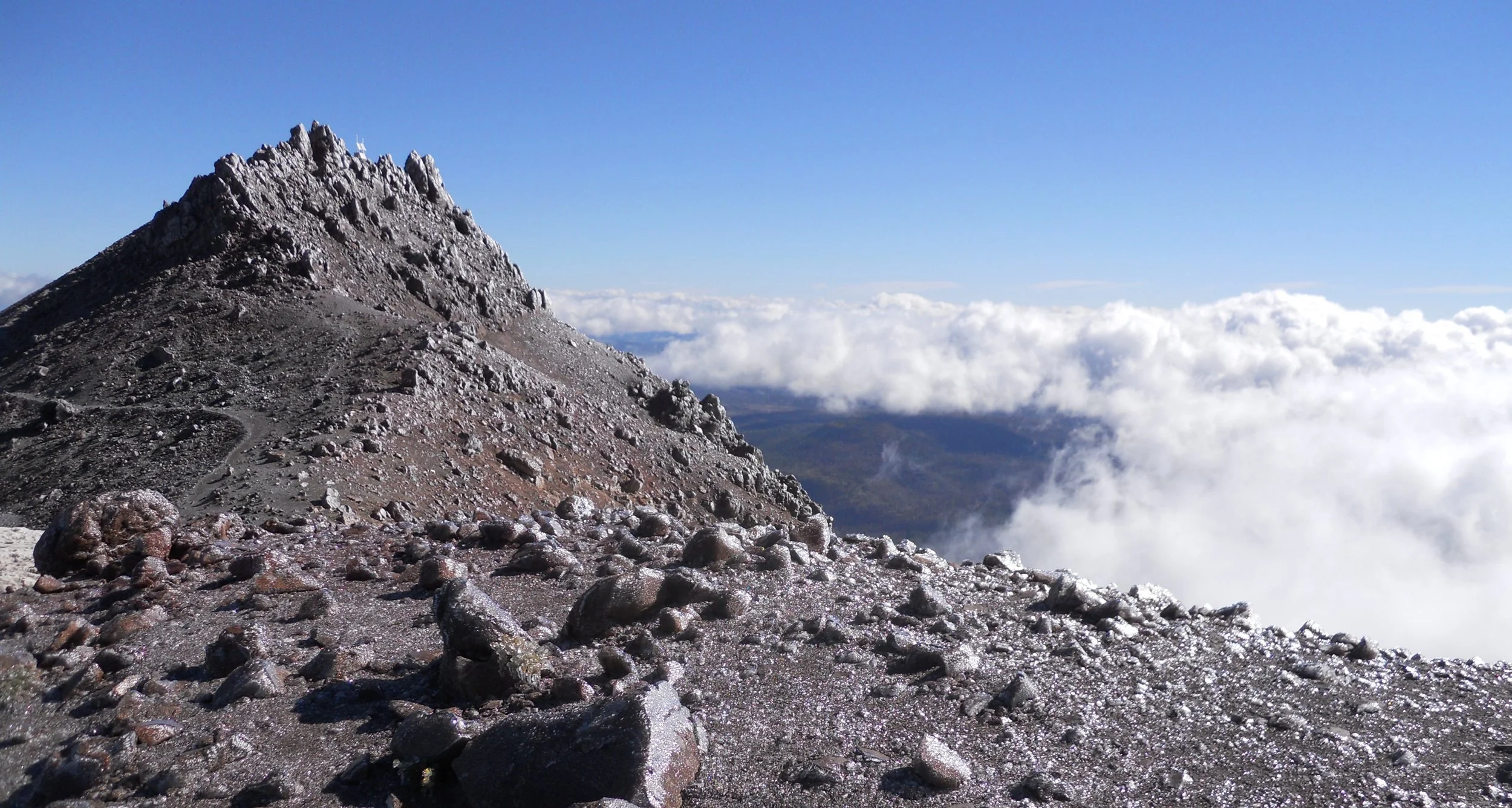
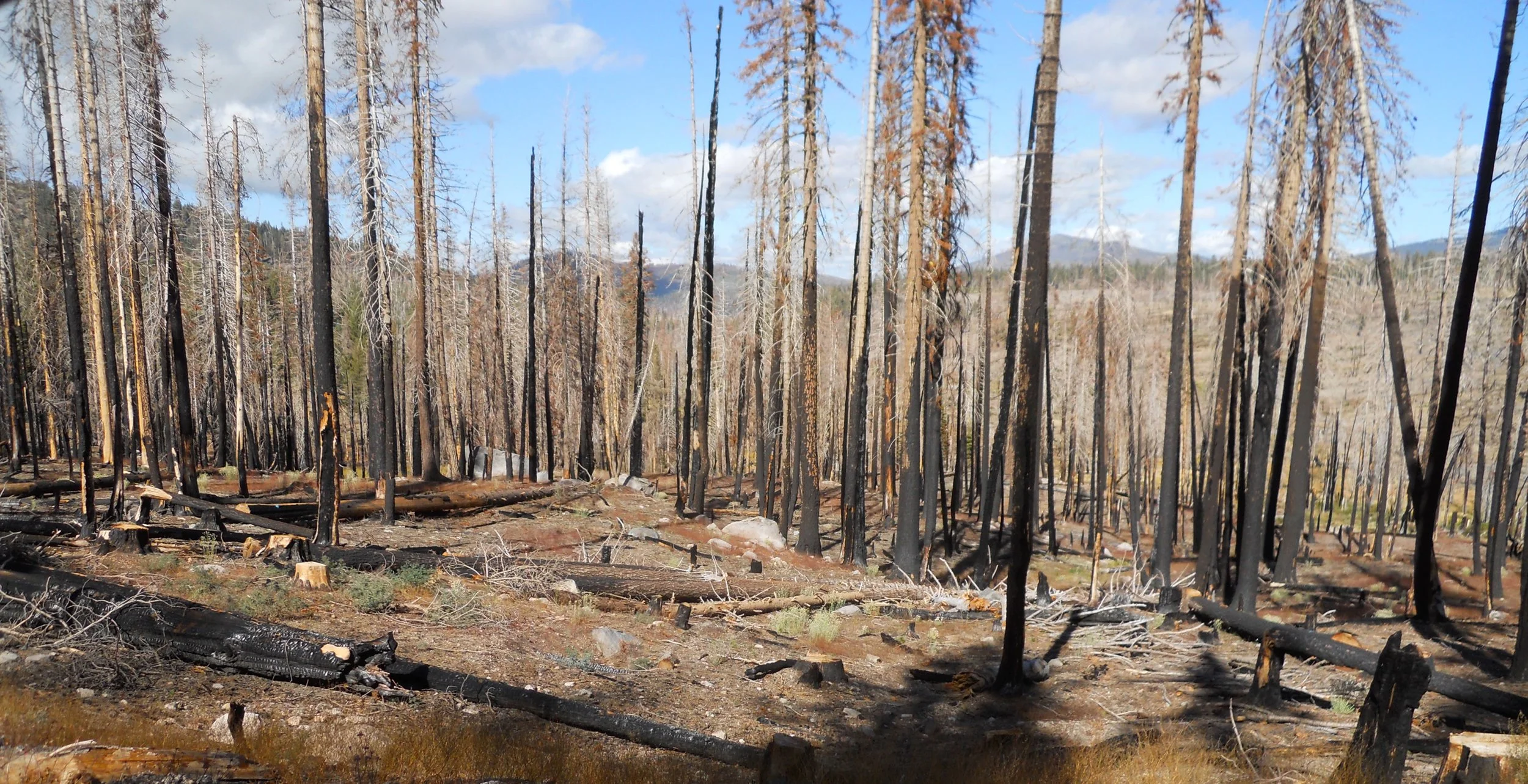
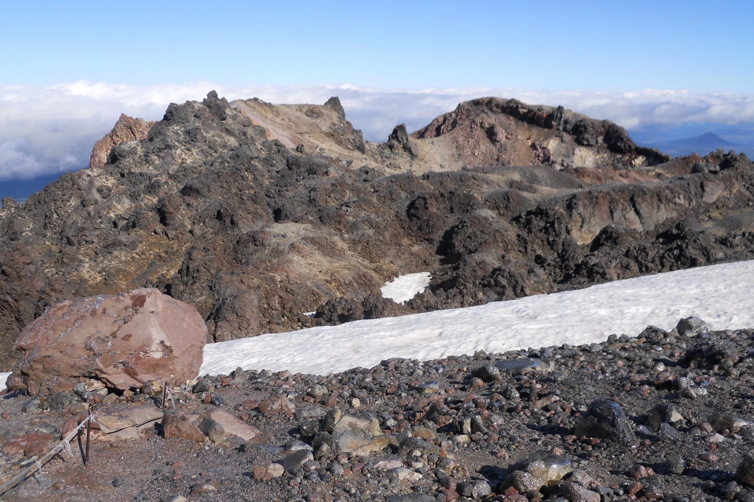
DAY 7 (September 26) - As Whiskeytown had to survive the 2018 Carr Fire, Lassen Volcano NP had to make it through the 2021 Dixie Fire (NPS image), the largest single fire in modern history at 1 million acres. The Juniper Lake section of the park is still closed. The scars remain across most of the park. Though, that was not the case on top of Lassen Peak, at 10,500 feet, well above tree line. After a 2.5-mile hike, climbing 2,000 feet, I reached the summit, above the clouds. Ice covered the ground and rocks. A snowfield was next to the caldera.
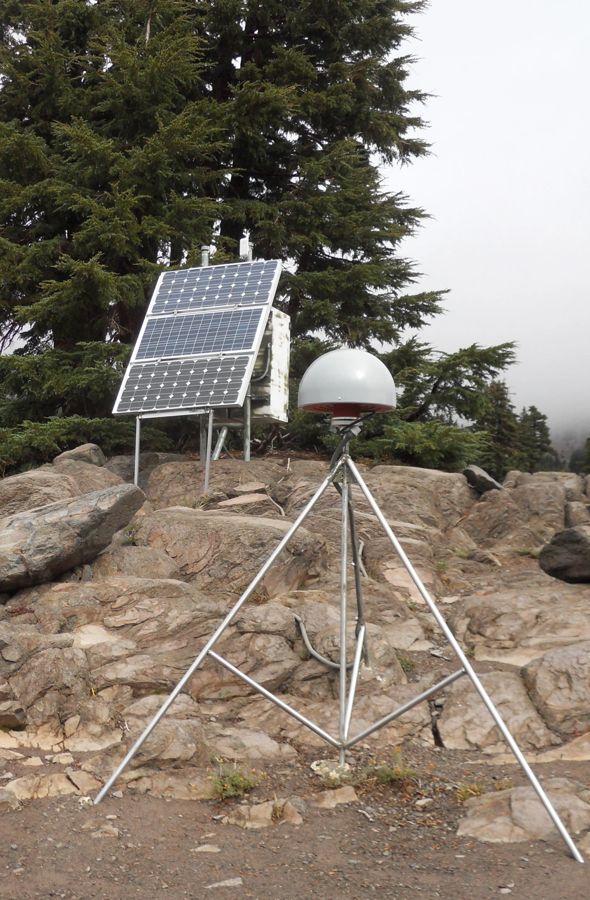
Next up was Bumpass Hell, a prime geothermal area. The NPS and USGS have installed sensors at various points in the park to provide warning if any volcanic activity starts. The park’s magma reservoir lies 3 miles underground. If this begins to move upward, the device on the tripod will register the movement, and transmit a signal to the array in the back, which sends messages to monitoring centers. With all the vents and mudpots in Bumpass Hell, this is a good place to have the device.
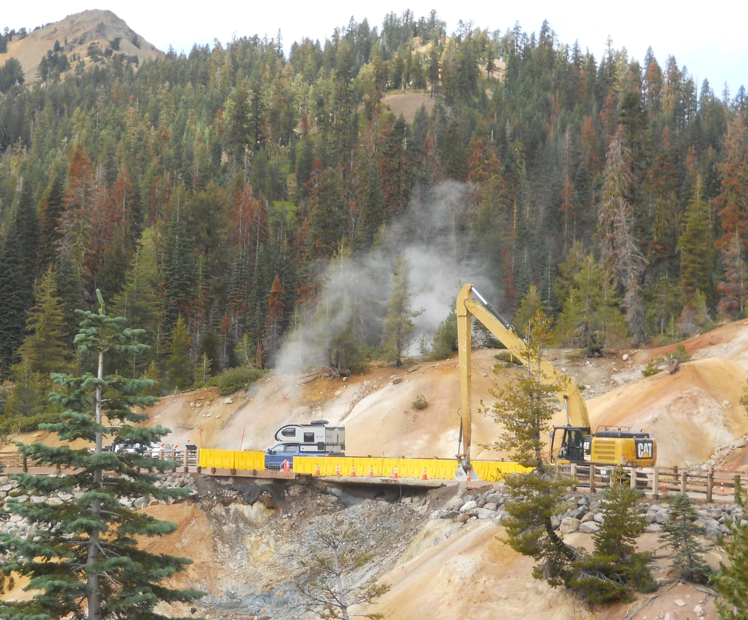
The main park road is closed from 8 AM to noon, and 1 PM to 5 PM due to the bridge at Sulphur Works collapsing. The one-hour lunch break allows visitors to access the park’s VC, then get back up into the northern portions of the park.
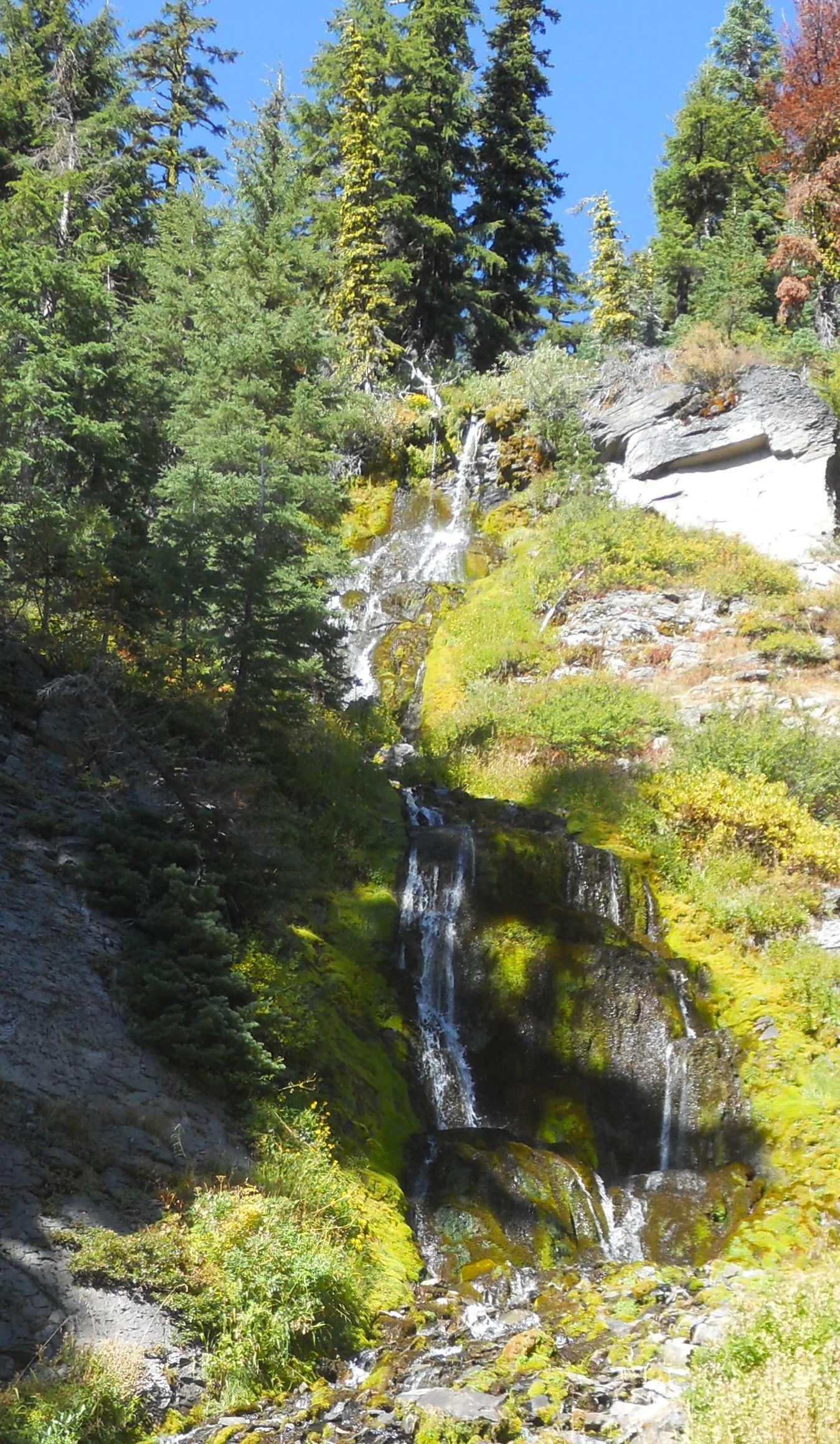
Last photo is of a small waterfall on Kings Creek.


DAY 6 (September 25) - Whiskeytown NRA was devastated in 2018 by the Carr Fire (photo by CalFire). It was the largest fire in the history of the NPS. Nearly 97% of the park was burned, along with over 100 buildings. Portions of the park remain closed to this day.
I was able to tour the Tower House Historic District. Charles Camden’s home from 1852 still stands (it was saved from the Carr Fire). The home is next to Clear Creek, where Charles pulled out $80,000 in gold (over $1 million in today’s value). Willow Creek enters Clear Creek near the house.
Up the nearby canyon is El Dorado Mine (not owned by Camden). It operated for a few years, producing $40/day of gold.
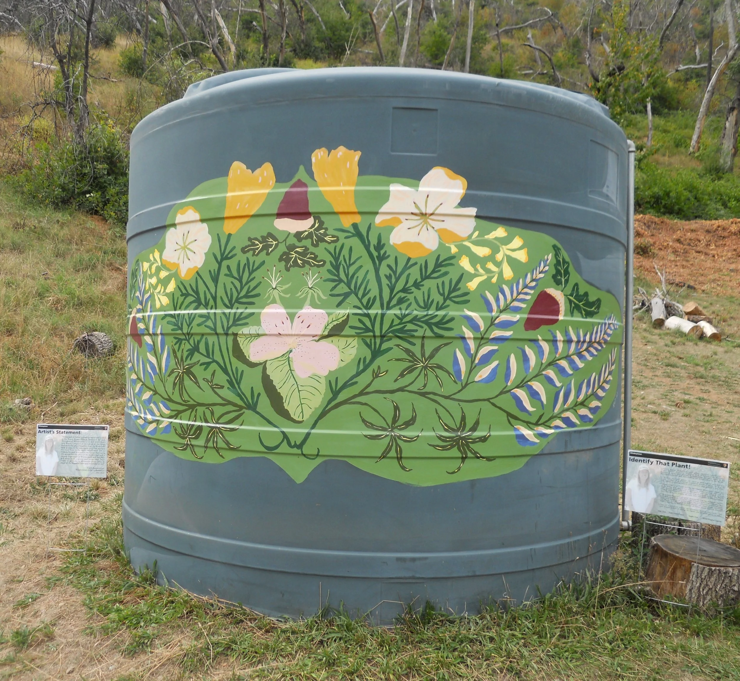
Carrie Katzenmeyer is the park’s Artist in Residence for 2023. She painted the District’s water tank with California plants and flowers.
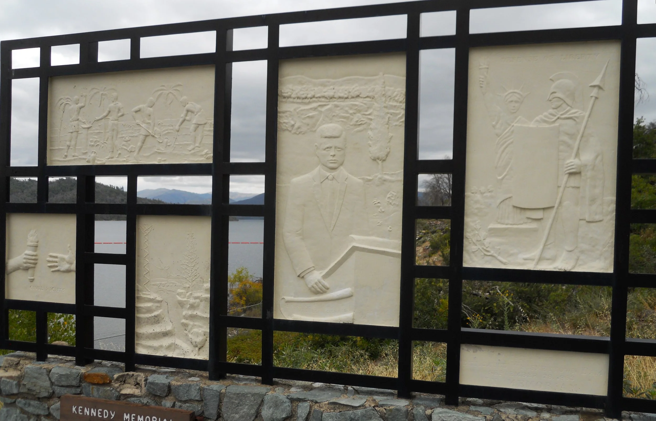
As the NPS states, Whiskeytown Lake is the focal point of the park. Clouds reigned supreme today. The Whiskeytown Dam, built in 1963, is what created the lake. The dam and lake cannot flood because of the unique “Glory Hole” (named as such because it resembles the morning glory bloom) which was installed near the dam. If water approaches the top of the dam, it will instead fall 260 feet to a tunnel which empties into Clear Creek. JFK dedicated the dam’s completion in September-1963, a few weeks before his assassination. A memorial to the late President is at the dam


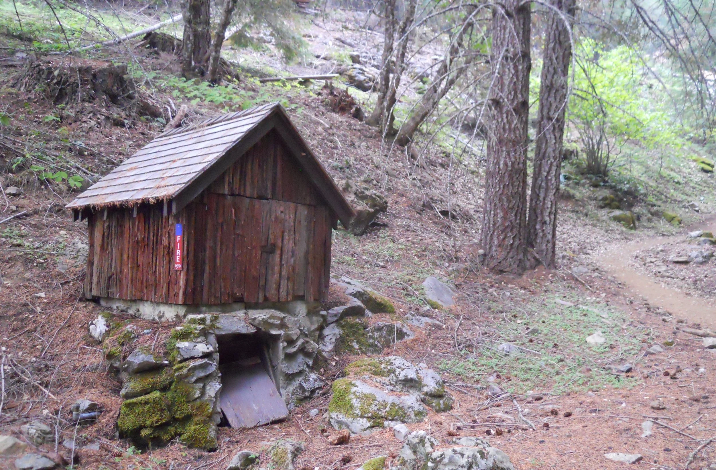
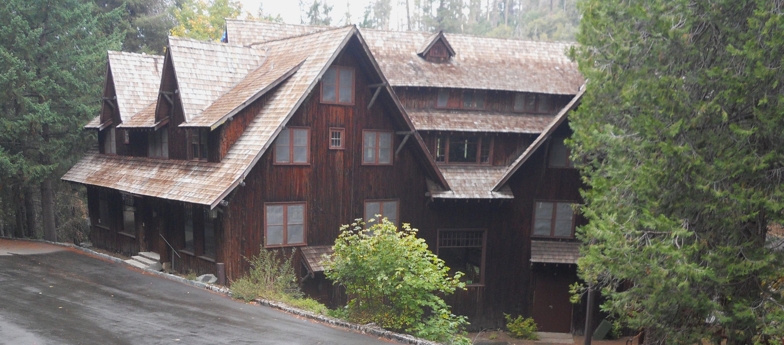
DAY 5 (September 24) - Oregon Caves NMon and Pres is smack dab down wind of the Smith River forest fire. The NPS issued a health advisory for its longest trail. Good thing the park has fire water huts (photo) near the rustic VC and famous Chateau (photo).
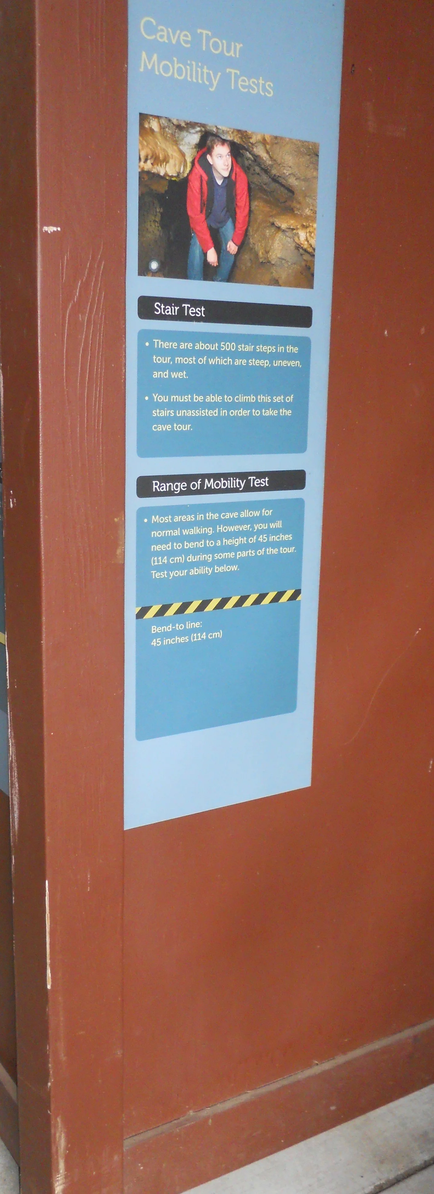
My goal was to take the cave tour. One has to be able to bend down to 45” so as to hit rock above you. A sign at the VC (photo) gives details, along with a yellow/black line for you to test your ability.
The cave was discovered in 1874. There are a few “blind leads” (photo) on the surface, but the openings do not connect to the cave system.
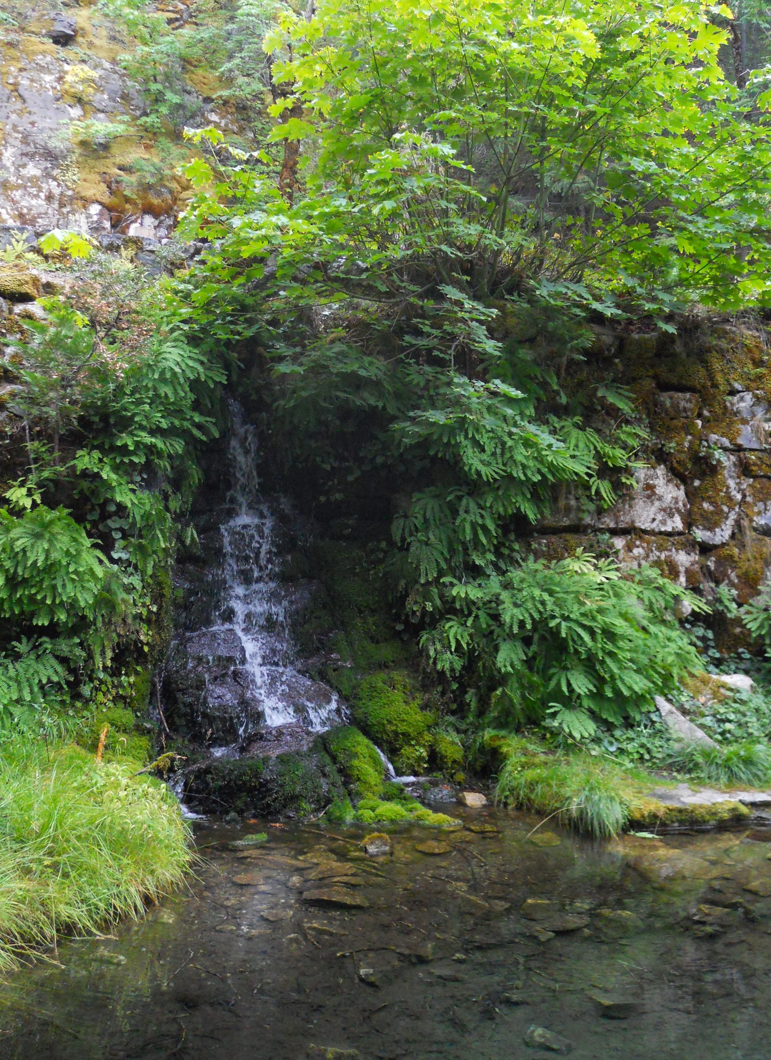
Being in a wet environment close to the Pacific Ocean, there is plenty of surface water, and therefore waterfalls. But the real splendor is beneath the forest floor.
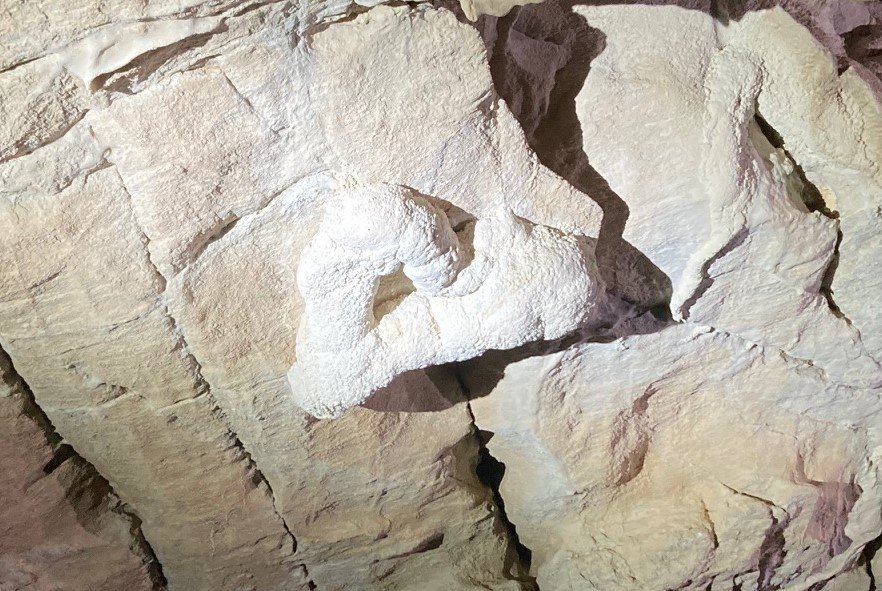
The rock which makes the cave is marble, one of three cave systems in the NPS which are composed of marble. People usually think of limestone (aka Mammoth Cave) when discussing cave creation. The one photo shows the dark hue of the marble.
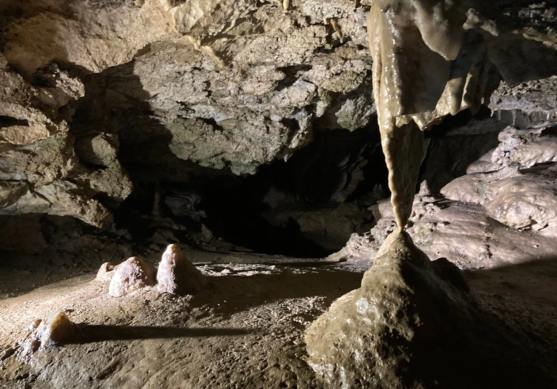
One of the formations seen on the tour is the “Heart of the Mountain”. Mount Elijah is the geological formation which houses this wonderful cave and the underground River Styx. The flow of water is actually Cave Creek, but it is the portion of the creek which goes into, then out of, the cave.
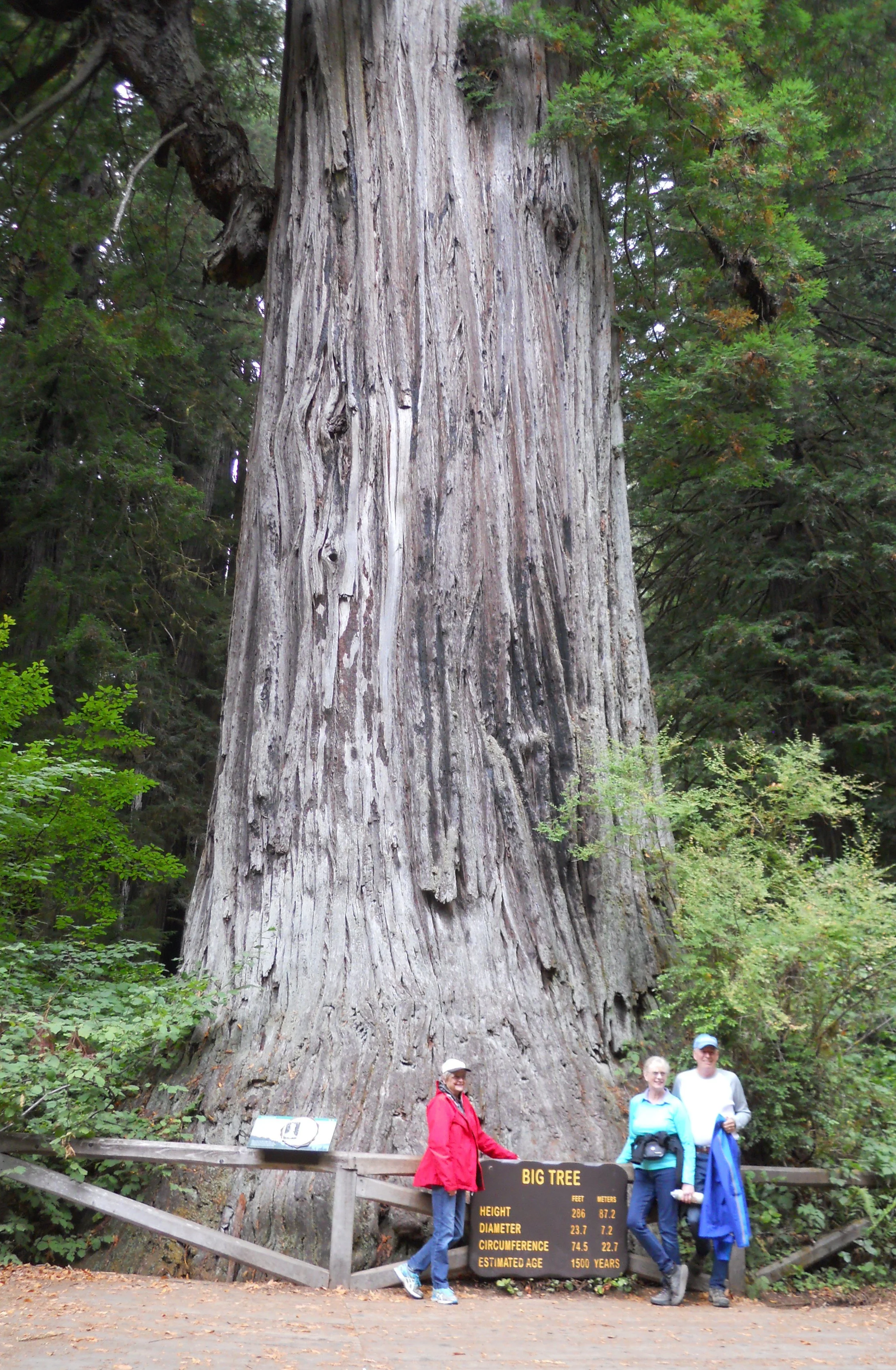
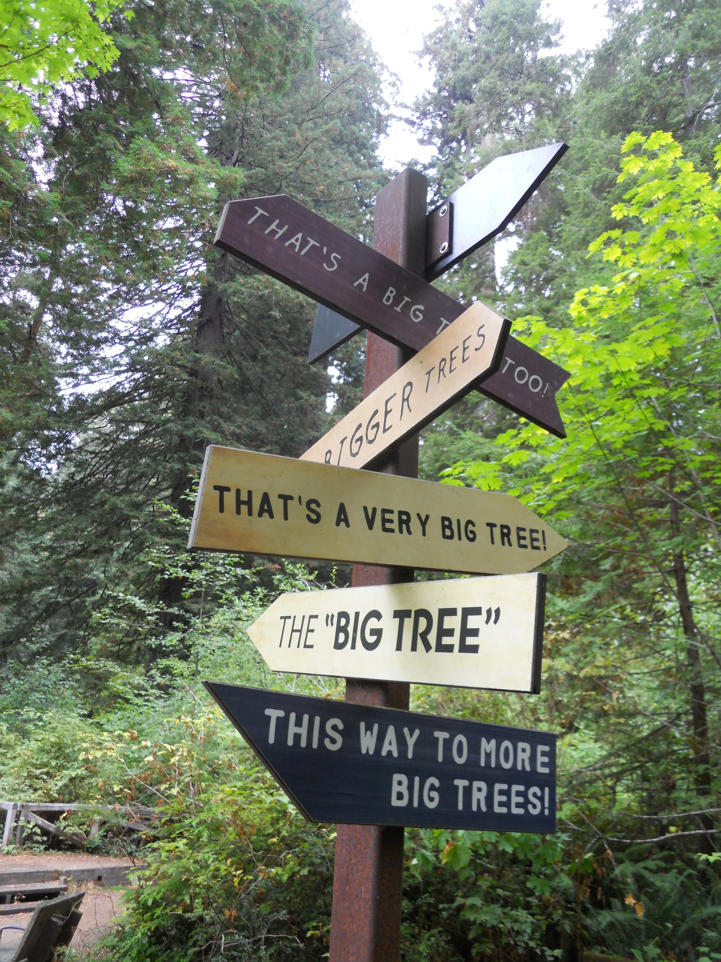
Right down US 199 from Oregon Cave is the land of giants. Yes, giants. Check out the small people standing next to the “Big Tree” in Redwood National and State Parks. This behemoth has a diameter of 23.7 feet. This size equates to roughly 1500 years of age. A slightly smaller redwood was near my car. Its width is over half the length of the car. If you think you might get lost trying to find big trees, just look at the signpost.
The park includes more than just trees and forest, with plenty of beach access. A ranger spotted a Banana Slug. A small crowd gathered to inspect one of the most recognizable stars of this rain forest environment.
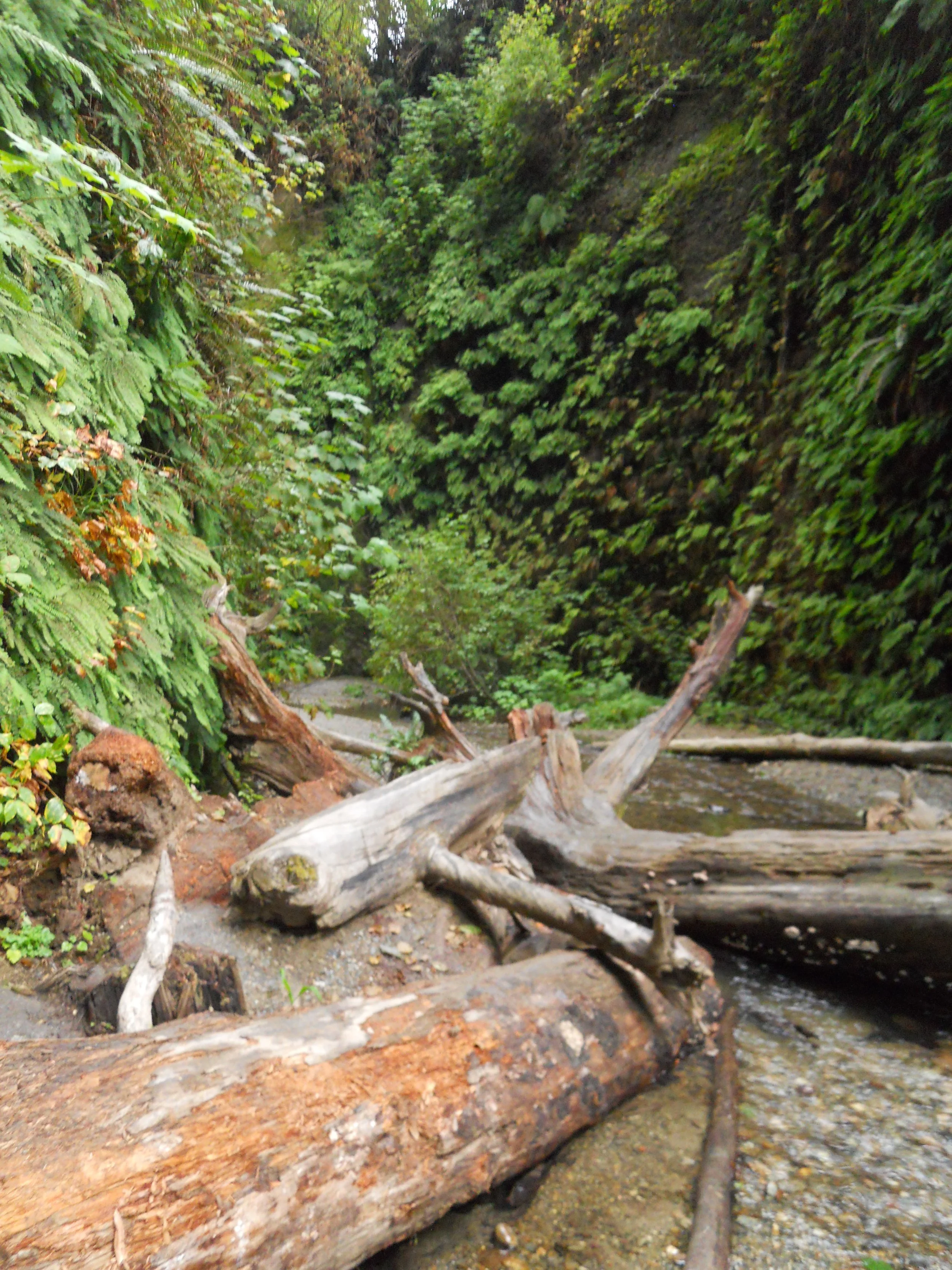
The last action of the day may have been the most fun. The drive to Gold Bluff Beach was a bit nerve wracking, including having to drive across a stream, but that was forgotten once I made the trailhead for Fern Canyon. This is a 2-story canyon, covered in ferns and other forest fauna. Steven Spielberg could have used this canyon for the opening scene of the first Indiana Jones movie. The hike upstream is supposed to be one of the highlights in the park, such that during the summer months you need a parking reservation, so get one before they run out. Or you can do the 11-mile hike from the Prairie Creek VC without a permit.
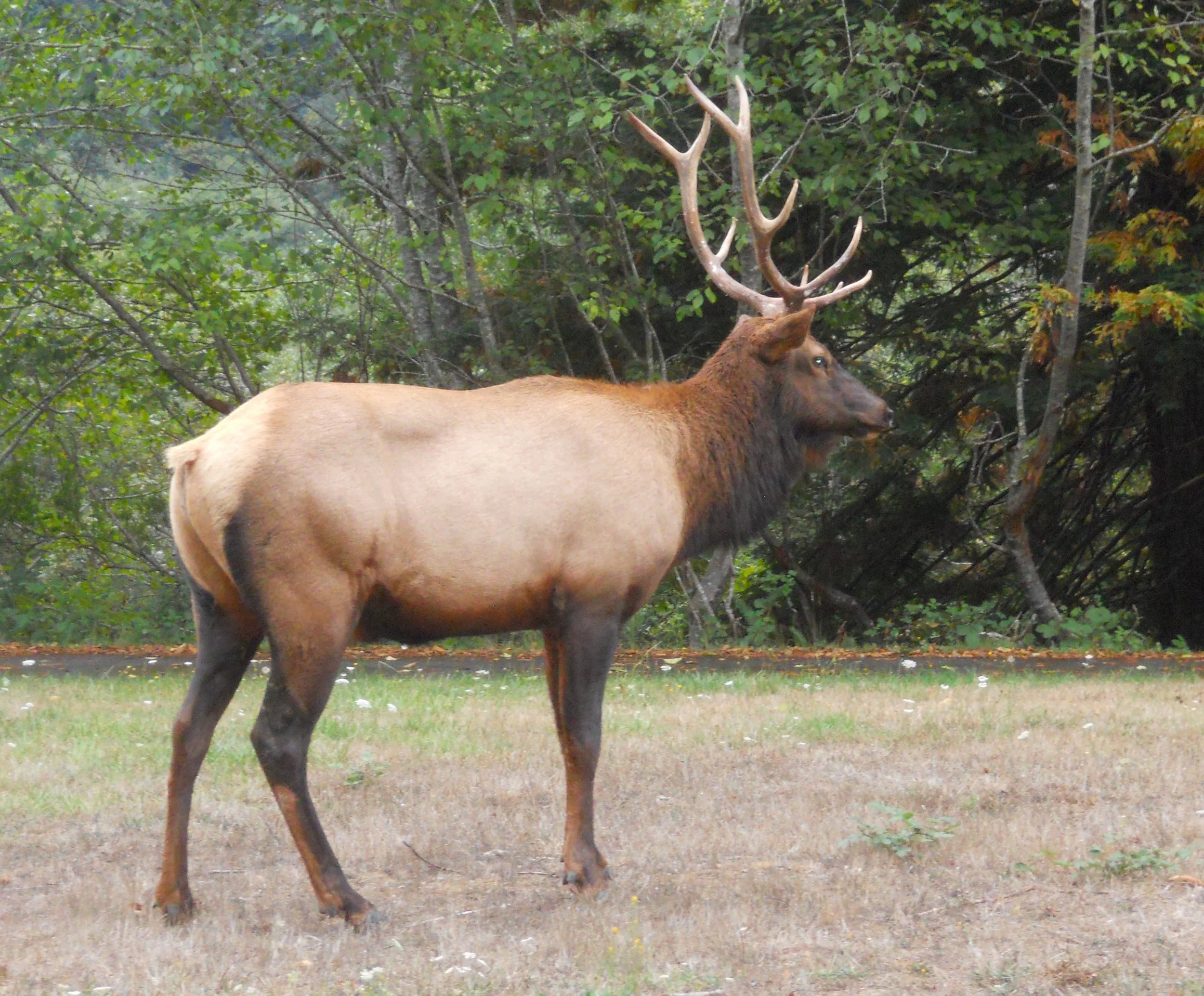
The best known animal symbol for the park is Roosevelt Elk. There were some at Gold Bluff, as well as this guy at Elk Meadow.
As I was completing this typing I checked the park’s website. The road which has the Big Tree (among many other sights and groves), the Newton B. Drury Scenic Parkway, was closed a couple hours ago, until tomorrow afternoon, due to a Pacific storm. Timing can be everything.


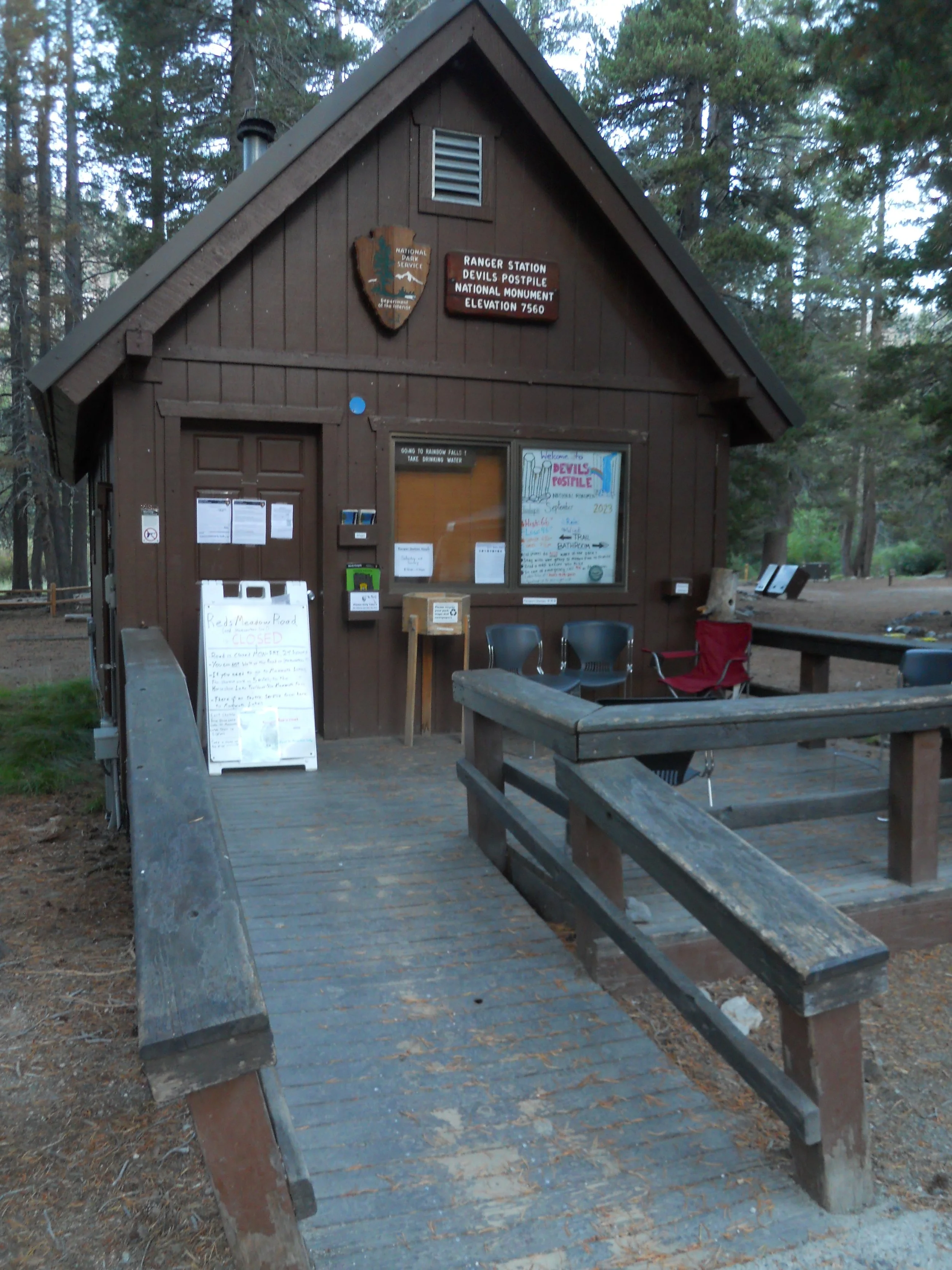
DAY 4 (September 23) - The gate to Red Meadows Road was open at 6:30 AM. Plenty of signs through Mammoth Lakes saying the road is closed Mon-Fri. With sun to the east, photos are not good, since the basalt cliff faces west. This columnar basalt is one of the finest examples in the world, rising 60 feet upwards. The base of the cliff is littered with hexagonal (one of nature’s most stable geometric shapes) sections which have broken off over thousands of years. Glaciers from the last ice age, 20,000 years ago, wore away the surface to expose the basalt columns. Continued weathering polishes the basalt surfaces. The Devils Postpile Ranger Station was built in 1941 and is today the park’s VC. The lumber came from Yosemite’s historical Sentinel Hotel.


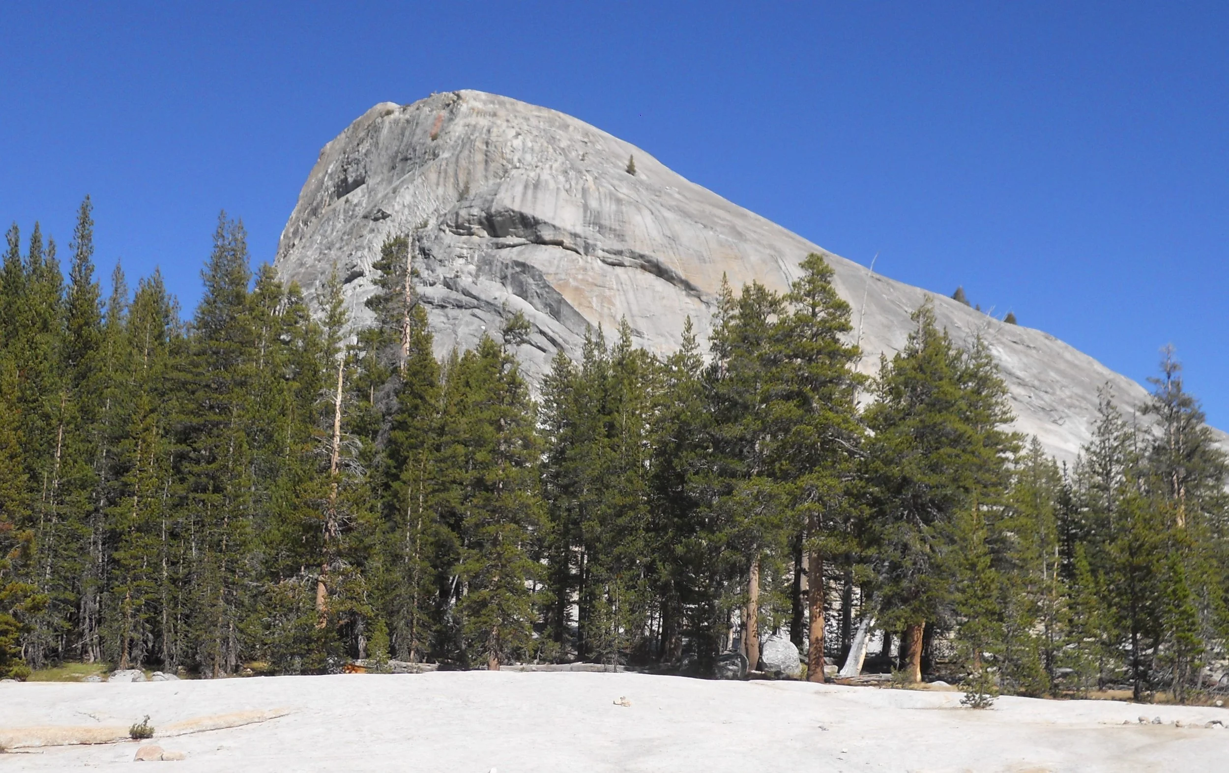
DAY 3 (September 22) - Today’s effort was to drive to Mammoth Lakes so I can enter Devils Postpile NMon tomorrow at 7 AM. It is now only open on the weekends. But, this gave me the opportunity to go into Yosemite NP, via the Lee Vining entrance on the east side. Different views in Tuolumne Meadows and the east compared to Yosemite Valley (which is where most folks target for visiting). My first stop was at Tioga Lake. Lembert Dome was calling my name. Only 850 feet vertical over two miles, but there is no marked trail once you leave the forest floor for the 500-foot climb on the granite. The trail sign in the parking lot said to identify the easiest path once you meet granite. Seemed to be between 25 and 40 degree incline. That may be why there were only two other people at the top when I arrived.


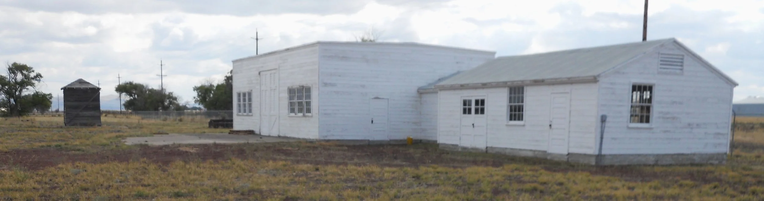
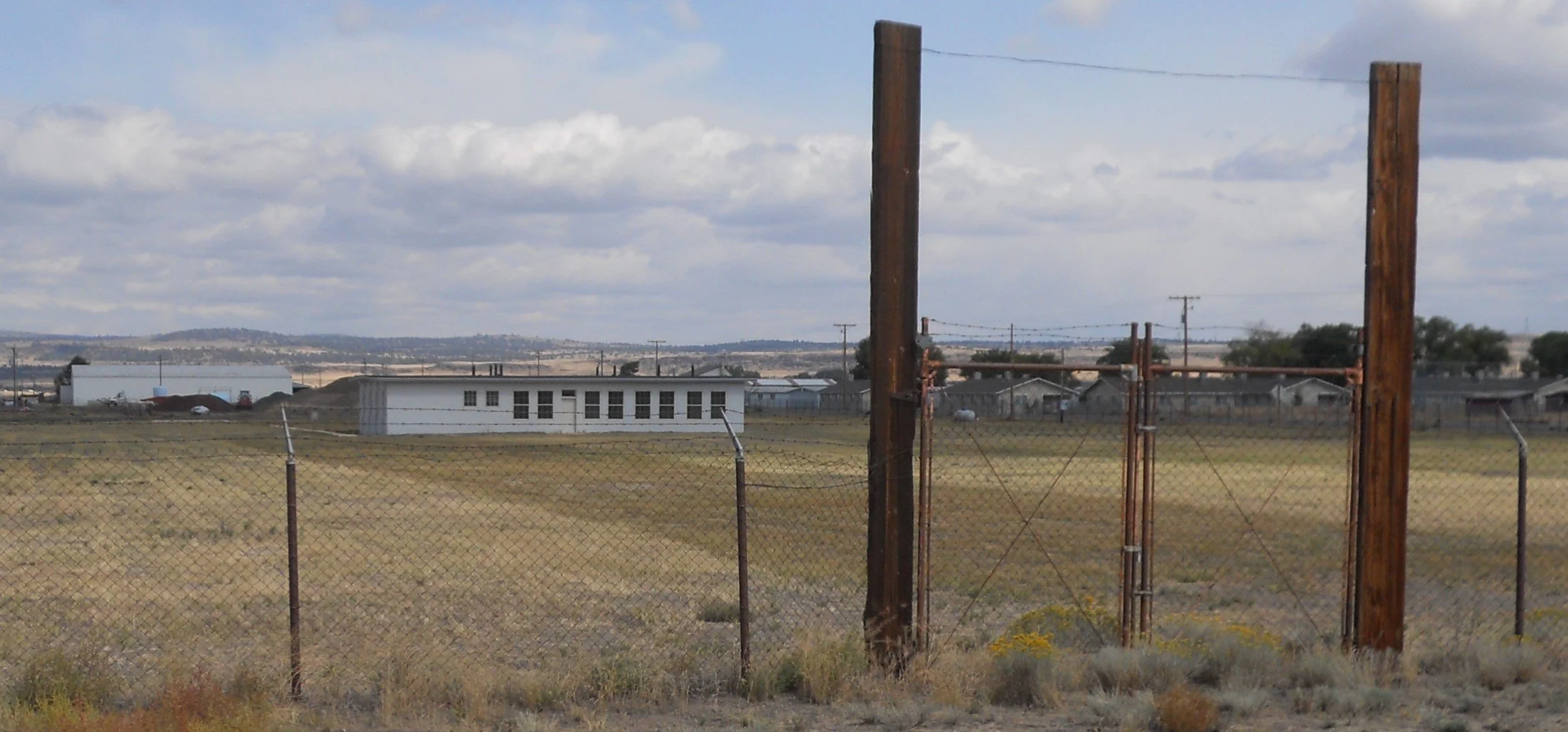
DAY 2 (September 21) - Tule Lake NMon met the requirements of the War Department in WW2 for a Japanese-American internment camp; out in the middle of nowhere and close to rail lines. Not much money has been assigned to this park. Only recently has the VC moved from the county fairgrounds to a spot within the park boundaries. A few buildings remain at Camp Tulelake, originally a CCC camp built in 1936 (after the war it was used as a Prisoner of War camp). Same situation at the Tule Lake Segregation Center, the largest of the ten WW2 incarceration camps. A baseball field is within the original camp fence line, but today is not within the official park boundary. What American does not like baseball? In the VC are images of the famous questions 27 and 28, which were given to the incarcerated before they would be allowed to leave and join the American military to help with the war.
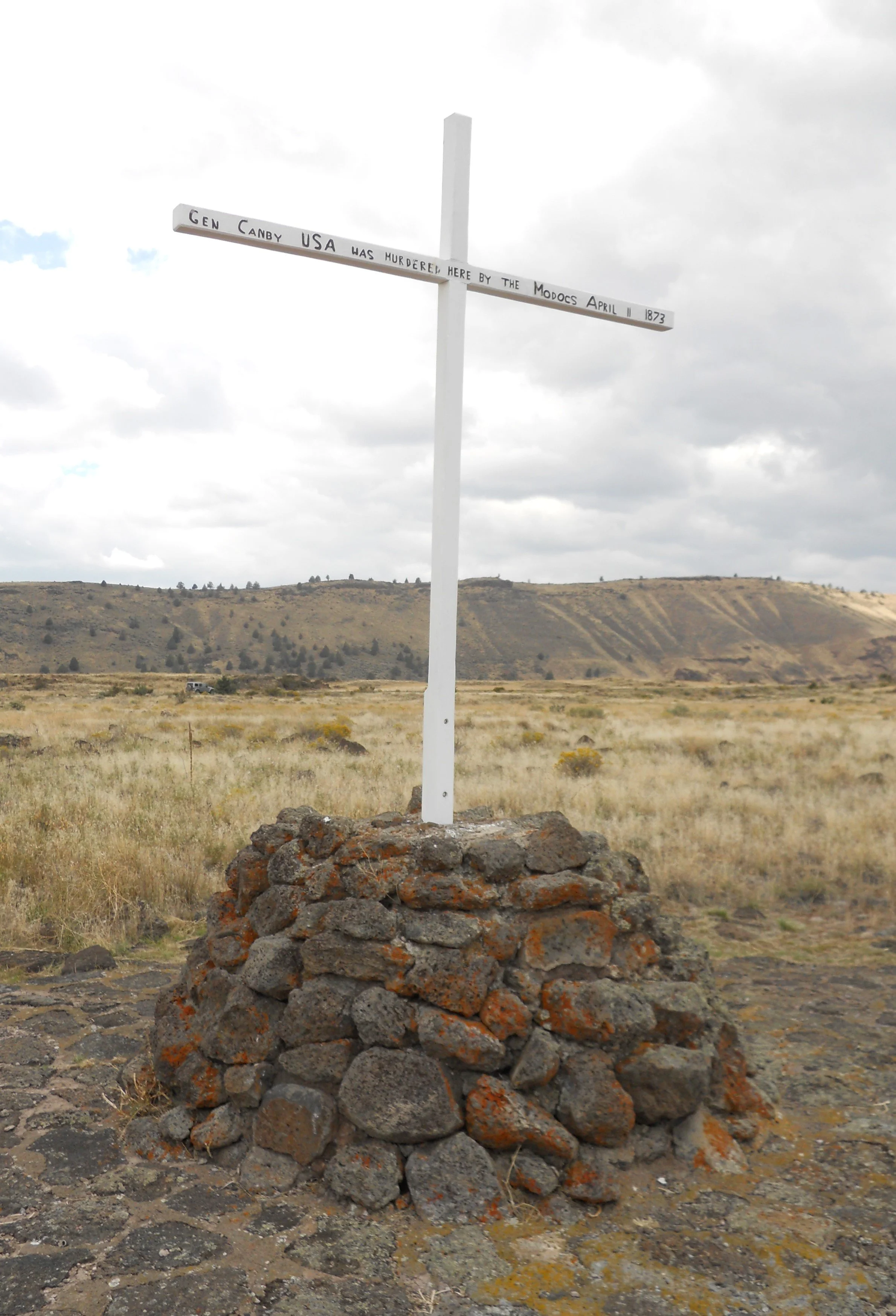
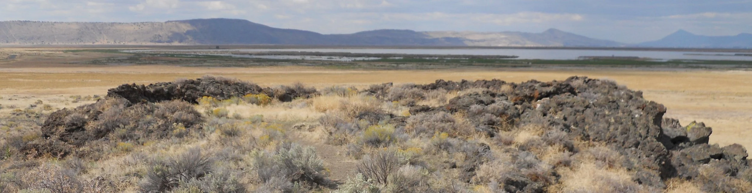
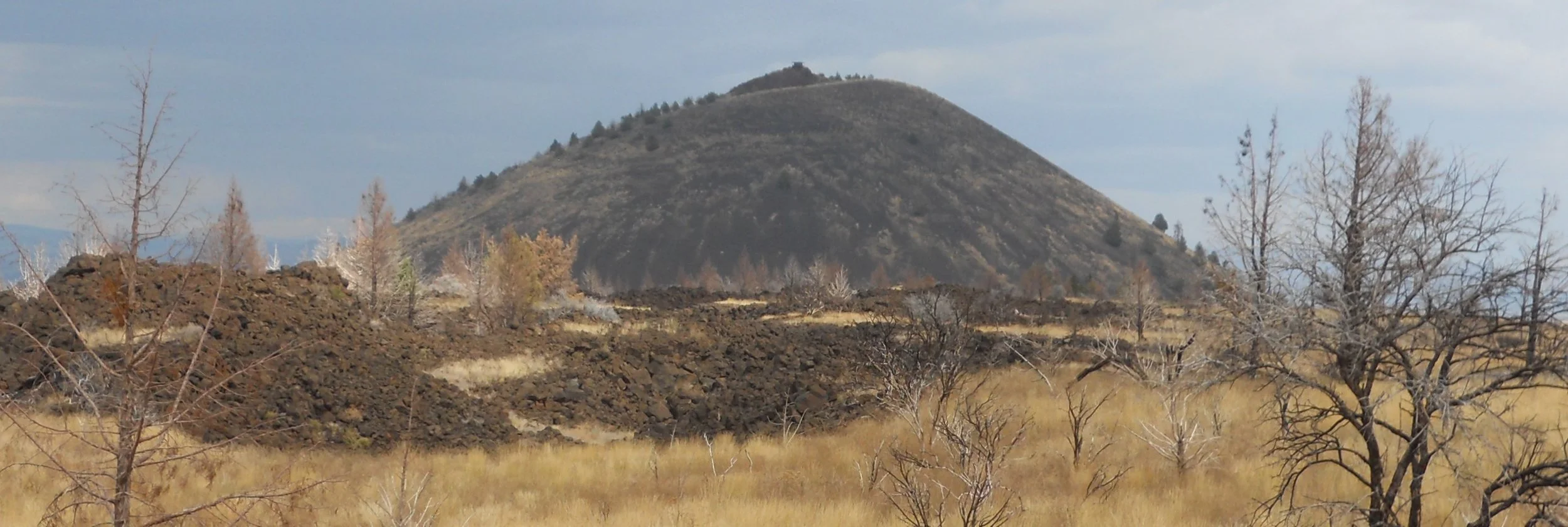
I started my visit to Lava Beds NMon by stopping at Petroglyph Point. Images were sketched on a large “island” many years ago by natives. I say island, because until 1912 most of the northern part of the park was Tule Lake. The lake was purposefully drained starting in 1912 to help homesteaders. A view of Hospital Rock shows the remaining Tule Lake Swamp in the background. Hospital Rock was the location of an Army field hospital in 1873 during the fighting with the Modoc tribe. The lava boulders surround a depressed area, making for a good defense. The Canby cross is placed where General E.R.S. Canby was killed by the Modoc, the only general ever killed during the Indian Wars. The park looks alot like Craters of the Moon NMon, with lava boulders and cinder cones. About half of the available lava tubes (aka caves) were open today. The others were closed, usually if bats are present. The VC has a Bio-Cleaning Station to help stop the spread of White-Nose Syndrome. One of the open caves was Garden Bridge. The Catacombs Cave offers spelunking options, but I did not have the right gear to go past the main channel. All of the caves on the park’s main Loop Road have ladders of some sort to help access entry, such as the one at the Golden Dome cave. Be sure to bring a light source if you want to go more than a few feet past the entrances. An iPhone works fine since the floors are basically smooth due to the physics of lava flow.


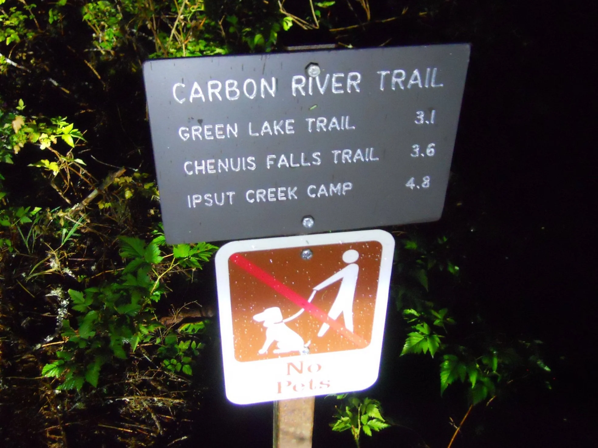
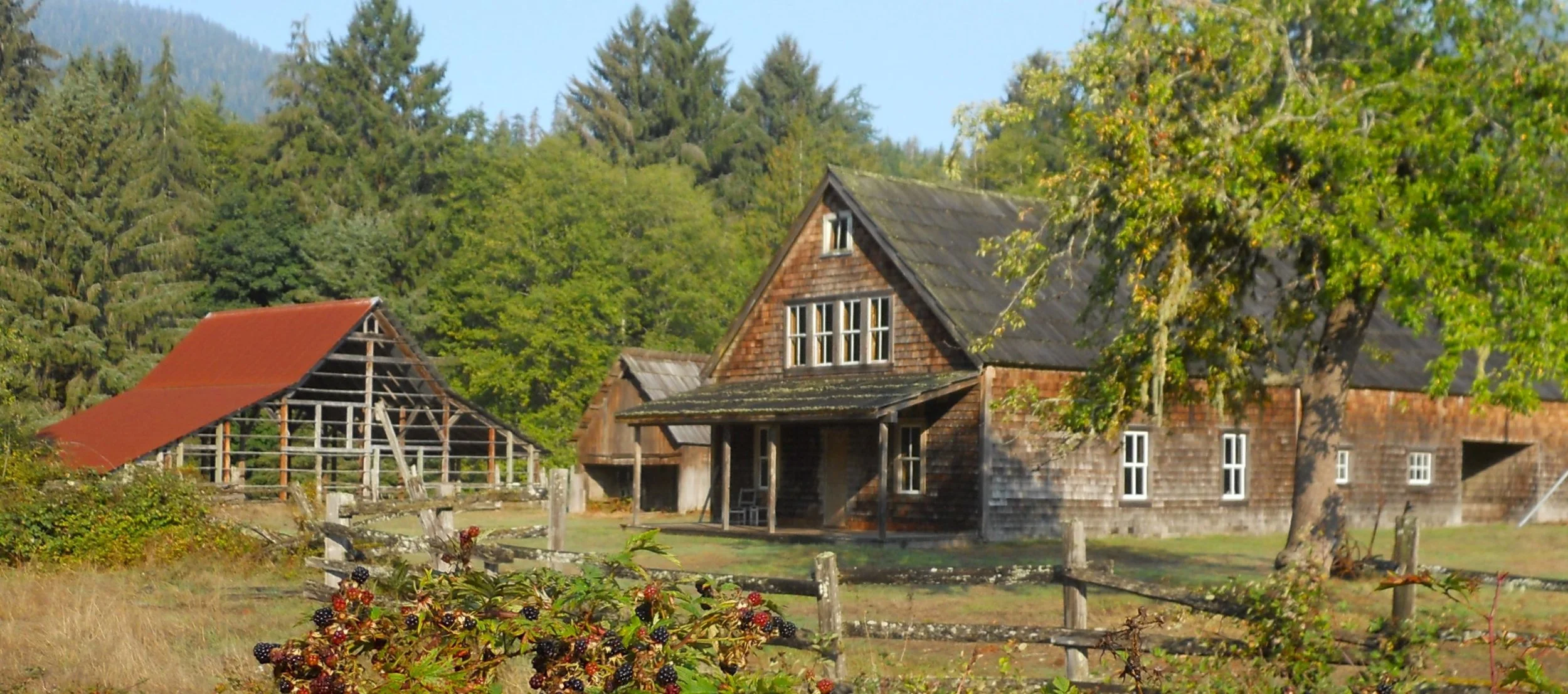
DAY 1 (September 20) - Mt Ranier NP is magnificent, if you have time to enjoy it, and then during daylight. Two strikes to start the day. I will only post a photo of the trailhead marker for the Carbon River area, taken at 5 AM, in the rain. I had intended to take the Chenuis Falls Trail, but maybe another year. Three hours were needed to get to the Quinault Rain Forest in Olympic NP. I took the South Shore Road around Lake Quinault for 10+ miles until it entered the park (the first 10 miles is not in the park, rather the Olympic National Forest). A bridge goes over the Quinault River to the North Shore Road. Two Roosevelt Elk met me on the other side. The Kestner Homestead is near the Quinault Ranger Station.
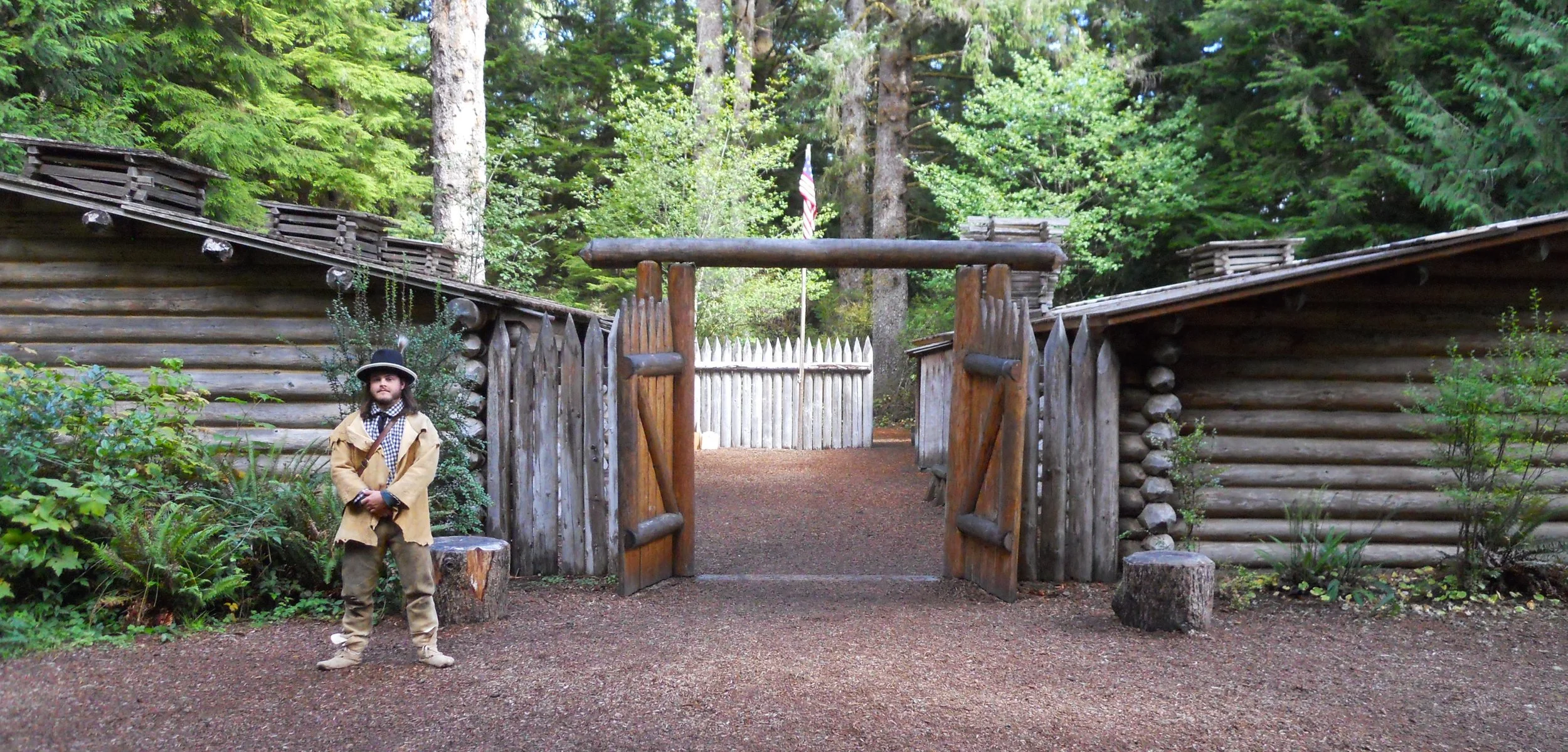
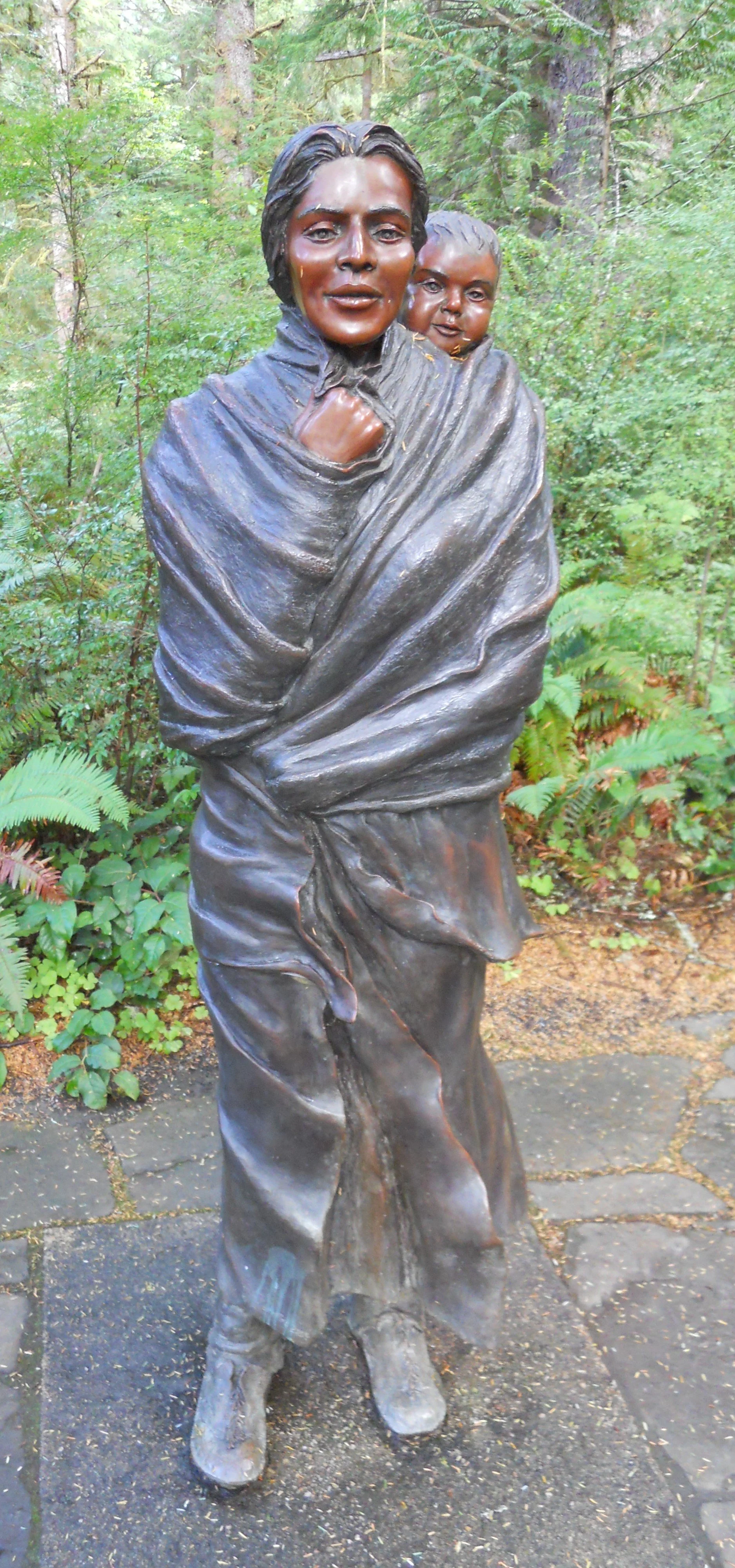
Then another three hours to the Lewis and Clark NHP in Astoria, OR. Reconstructed Fort Clatsop is the highlight of this park. An intern was preparing to enlighten a group of 7th graders on the history of the Discovery Corps and the fort. This reconstruction is just a few yards away from the original fort’s actual location. This was the group’s winter quarters starting in November-1805. Two hundred yards to the water’s edge is where Lewis and Clark came ashore when looking for a place to build their fort (the landing spot is where I am standing, looking out to the water channel). This inlet today is called the Lewis and Clark River. When the duo returned to Saint Louis in September-1806, people could not believe their eyes. The group of men had been gone for more than two years and were presumed to have perished. A sculpture of Sacagawea is near the VC.
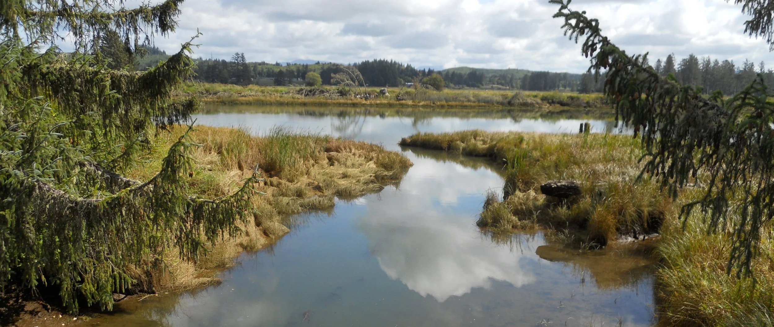
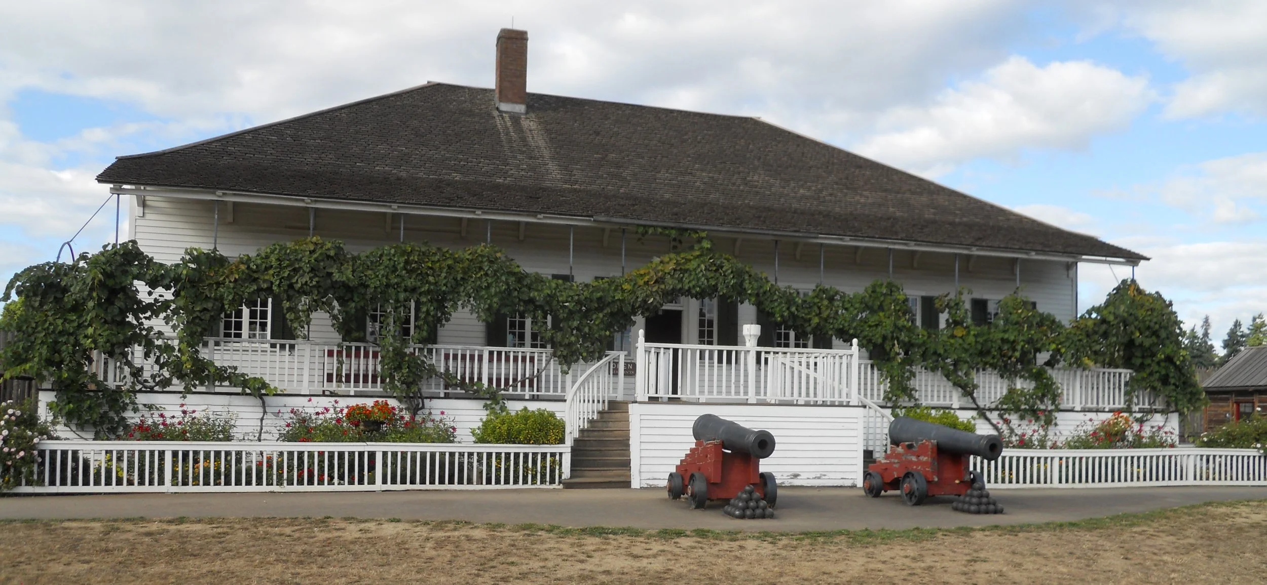
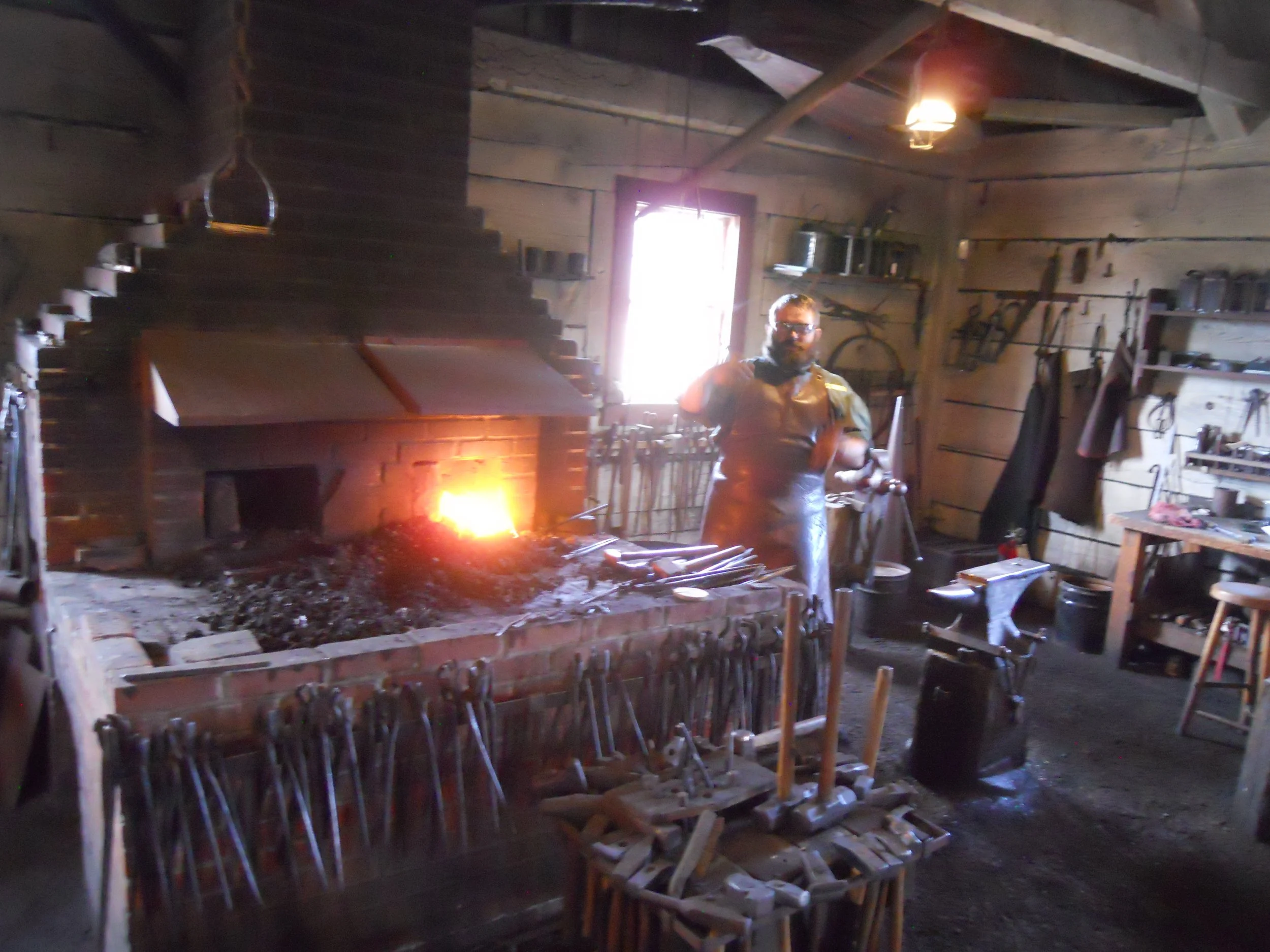
Fort Vancouver NHS is on the shores of the mighty Colombia River. The partially reconstructed fort sits on the site of the original fort. The Hudson Bay Company (HBC) was the dominant business entity in the mid 1800s, setting up shop here in the 1820s. Their Chief Factor, or man in charge, lived in the finest home in the Pacific NW. Matt was manning the blacksmith’s shop today, so I learned a bit about metallurgy. Though fresh water could be obtained from the Colombia River, it was easier to dig a well inside the fortification… who wants to lug heavy water uphill? The top of the well (to the bottom left of the photo) is the only remaining remnant of the original HBC fort. This stands in front of the Bake Shop.