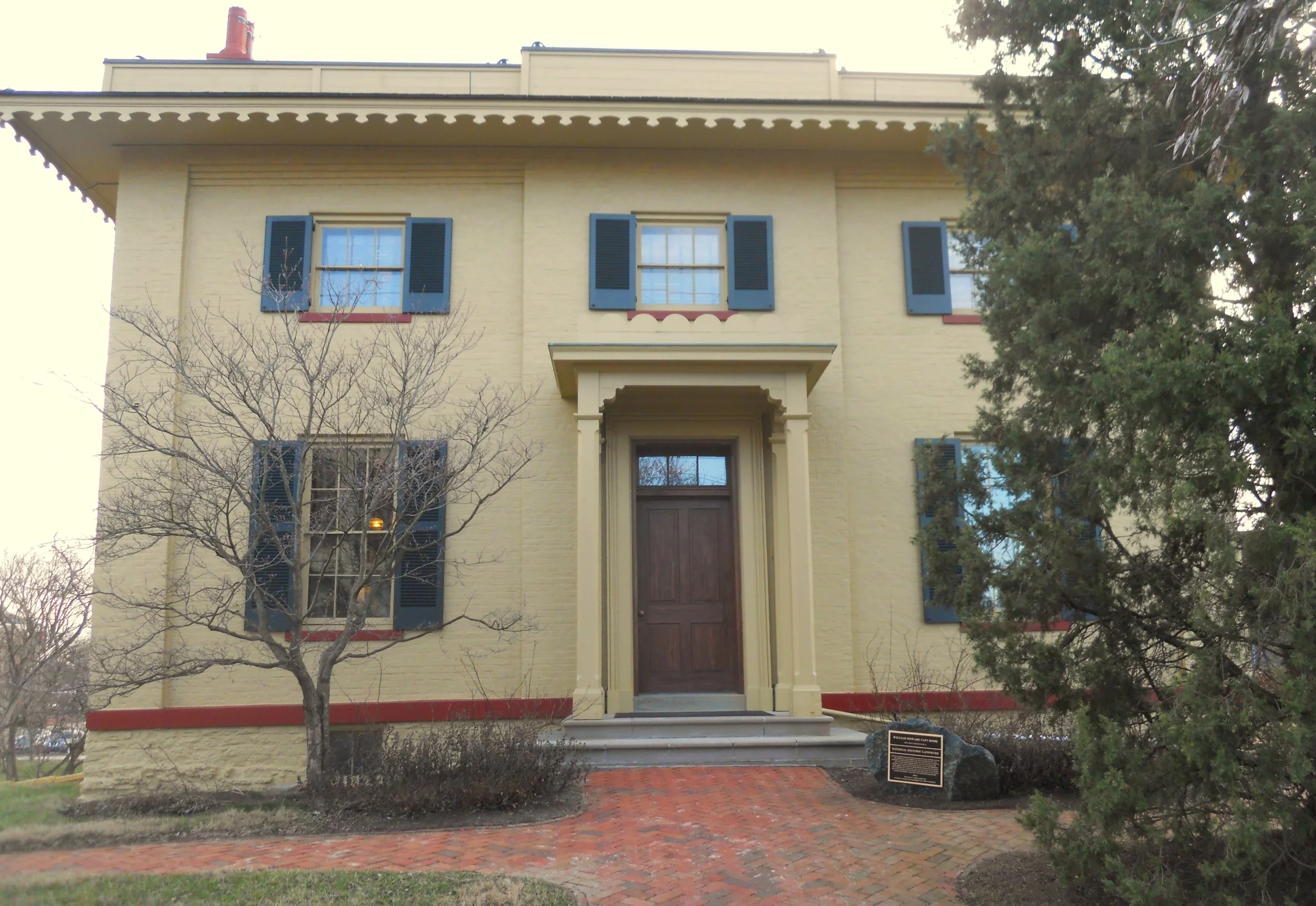
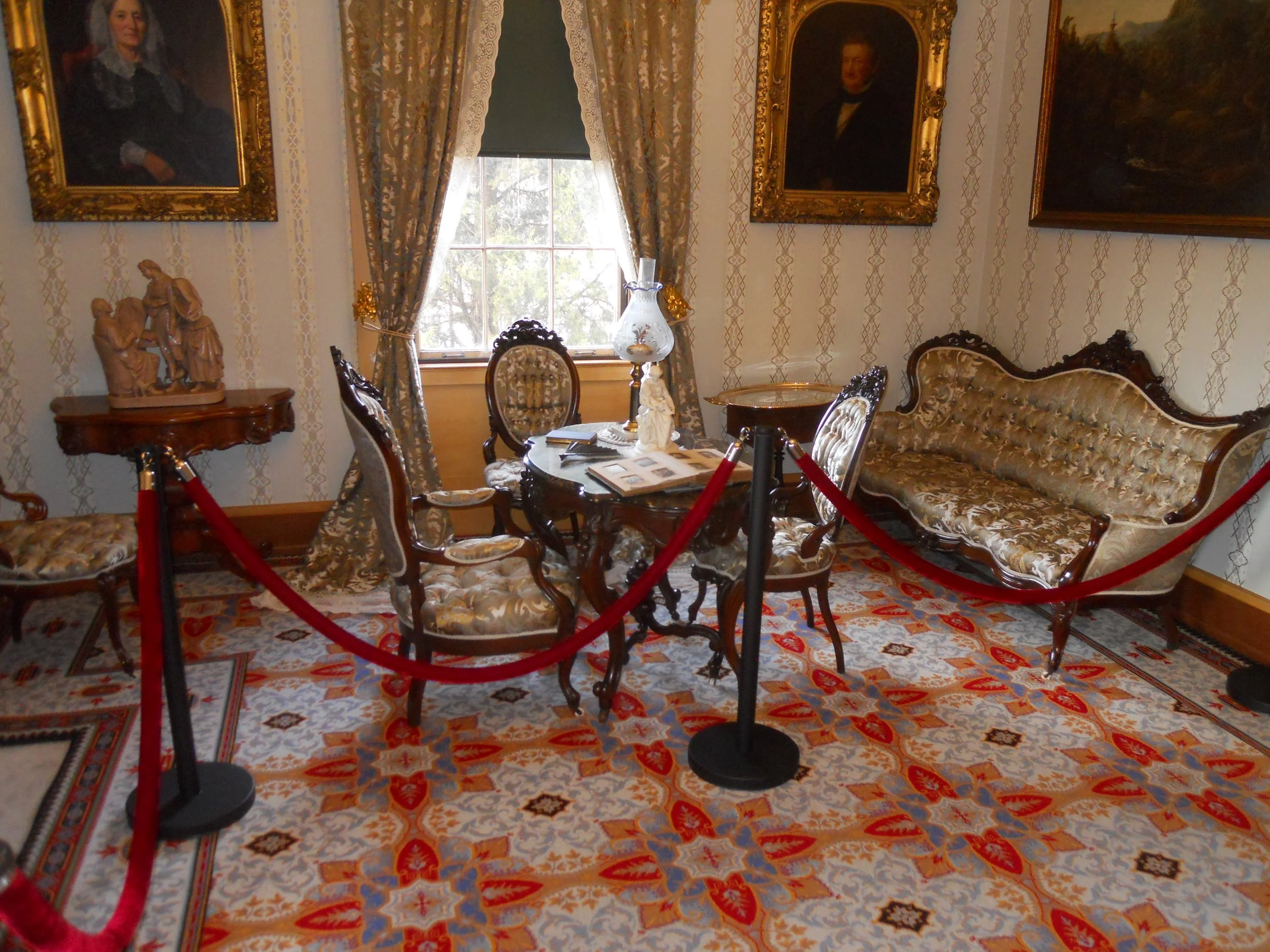
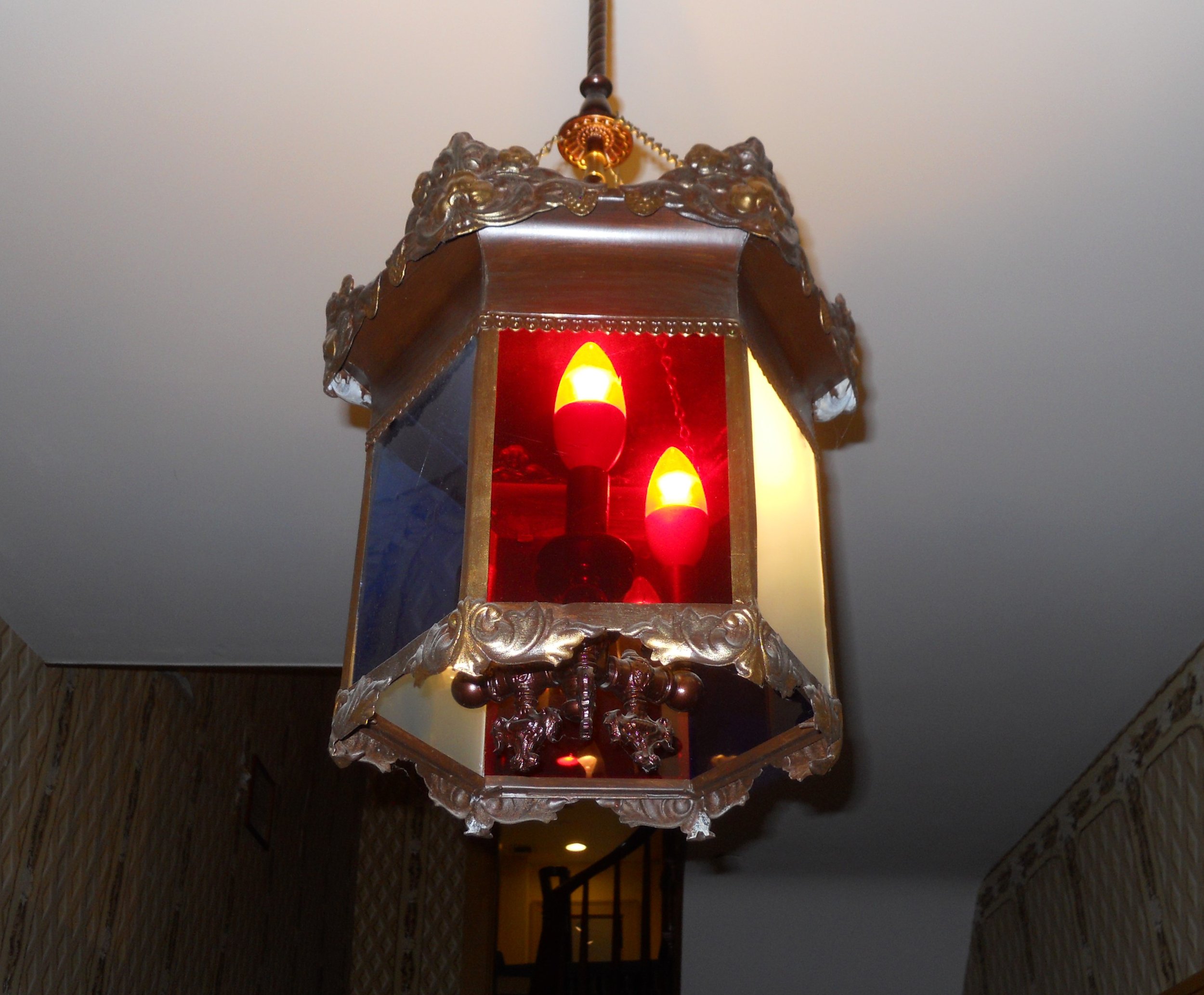
DAY 9 (February 13) - A visit to William Howard Taft’s birthplace and boyhood home began the day. NPS spent a lot of money rehabilitating the building. Over time, the property had been sold to various people, and at one time containing multiple apartments. A guided tour is given of the first floor. Visitors can then go upstairs and to the basement to view other displays. In the mid to late 1800s, this section of Cincinnati was for the wealthy. Taft graduated high school in 1874 and went off to Yale. The home was used for the funerals of his parents (held in the parlor - photo). An interesting hexagon lamp is in the central foyer with red, white, and blue panels. How appropriate for a family who decades later could count a U.S. President and Chief Justice of the Supreme Court among their ranks.
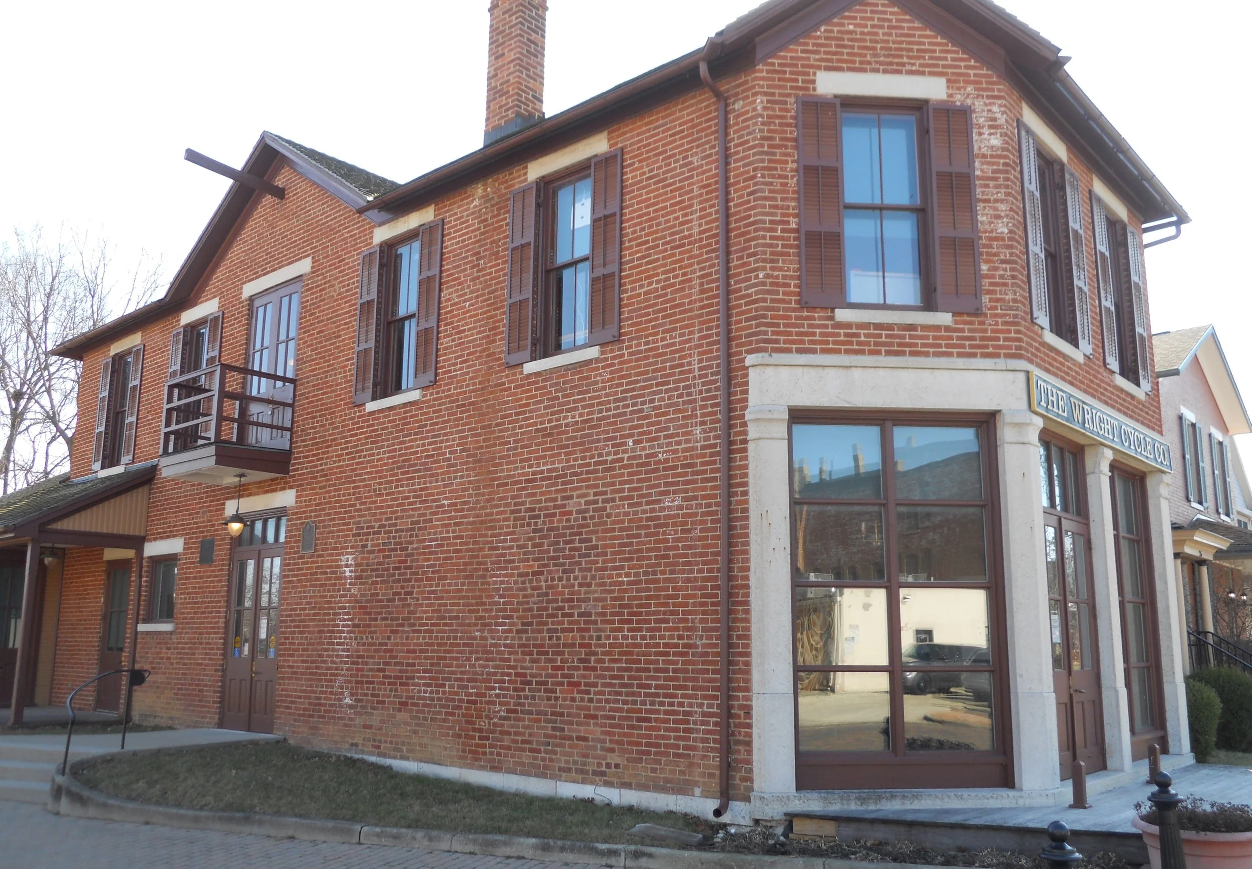
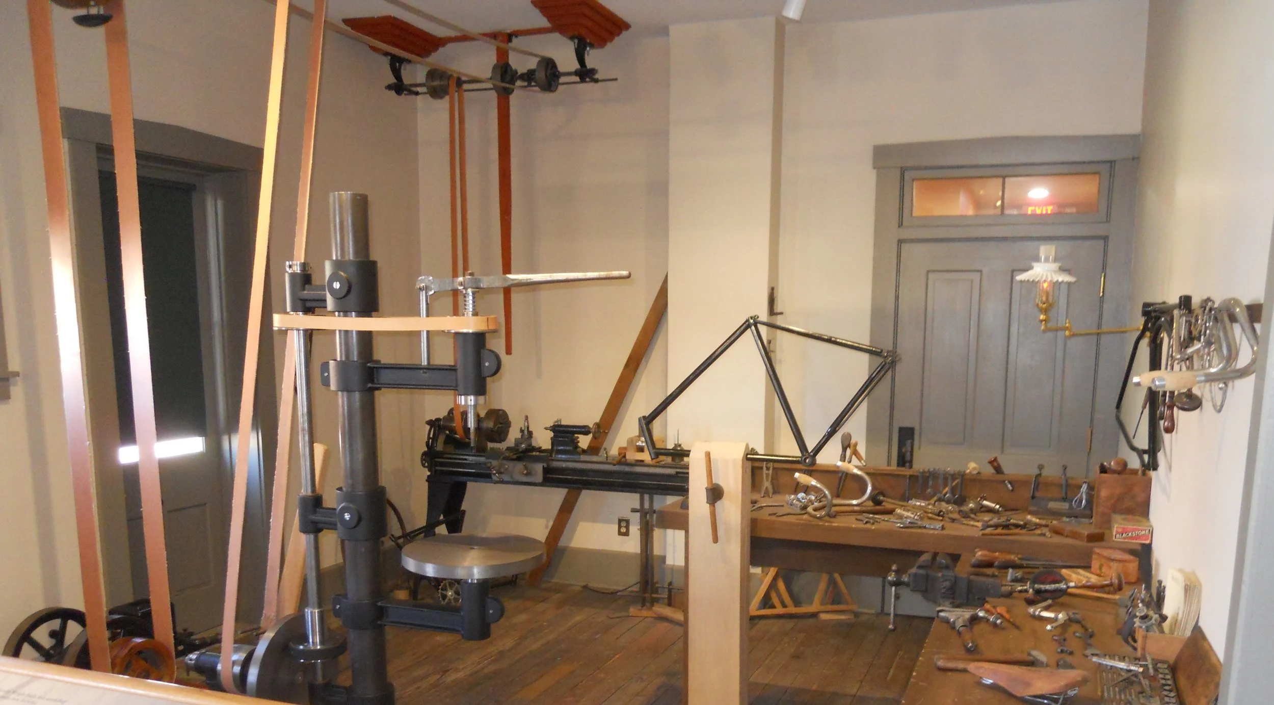
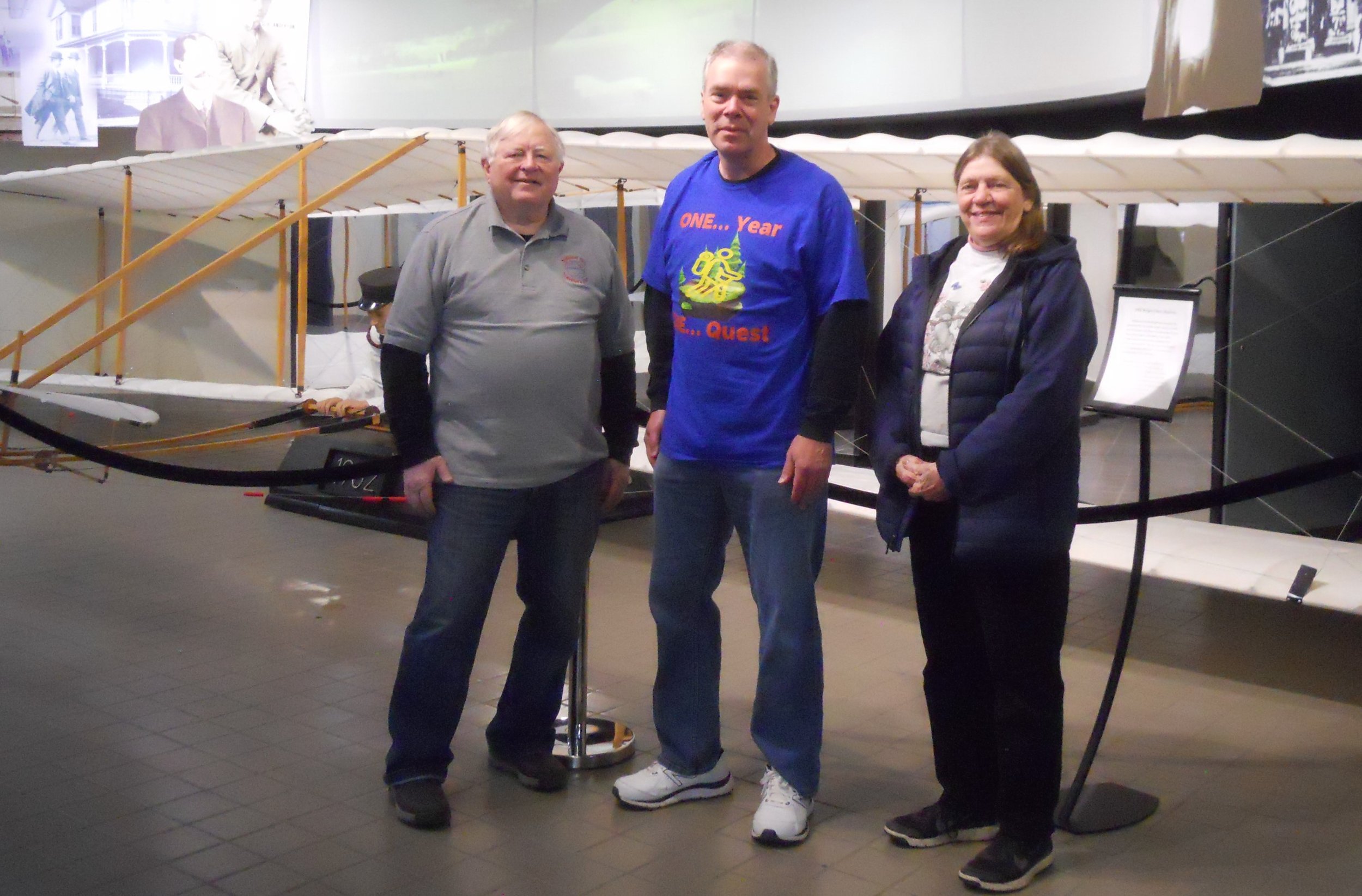
Dayton Aviation is a term many may not have heard of. But mention the “Wright Brothers” and everyone knows of them. The Bike Shop was one of four which Orville and Wilbur used over time to promote their bicycle business. The inside looks like it did when they were residents around 1896. Bob and Paula, also members of the National Park Travelers Club, met me in the park’s main VC. We are standing in front of a replica of the Wright Flyer. It is great to meet up with club members as I continue my quest. Afterwards they treated me to 5-way Chili at Skyline Chili. Southwest Ohio is known nationwide for its chili, and 5-way is the way to take it.
Last stop on this loop was Charles Young Buffalo Soldiers NMon. Only one photo to show since the home is being rehabilitated and visitors are not allowed in the structure. Young was the third African American to graduate from West Point Military Academy. He rose to the rank of Colonel. He was the military attaché to multiple countries such as Liberia.
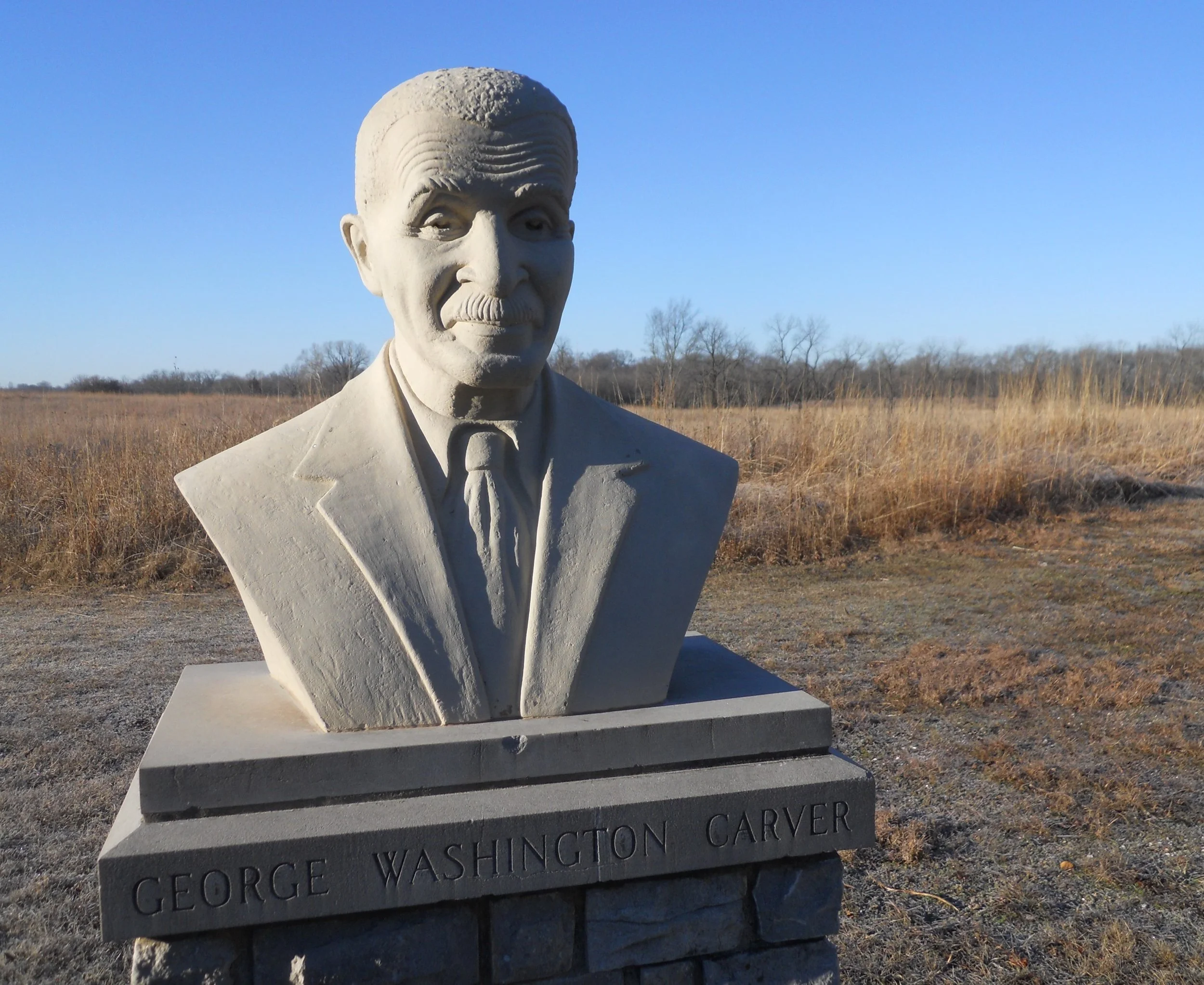
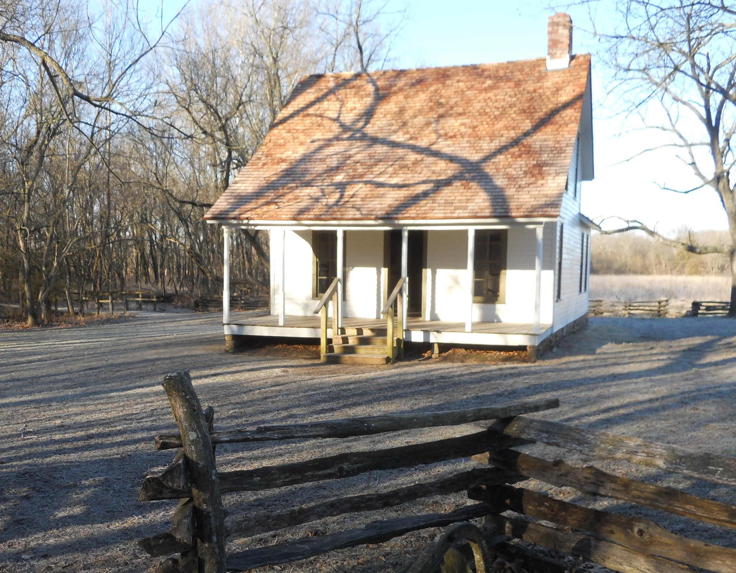
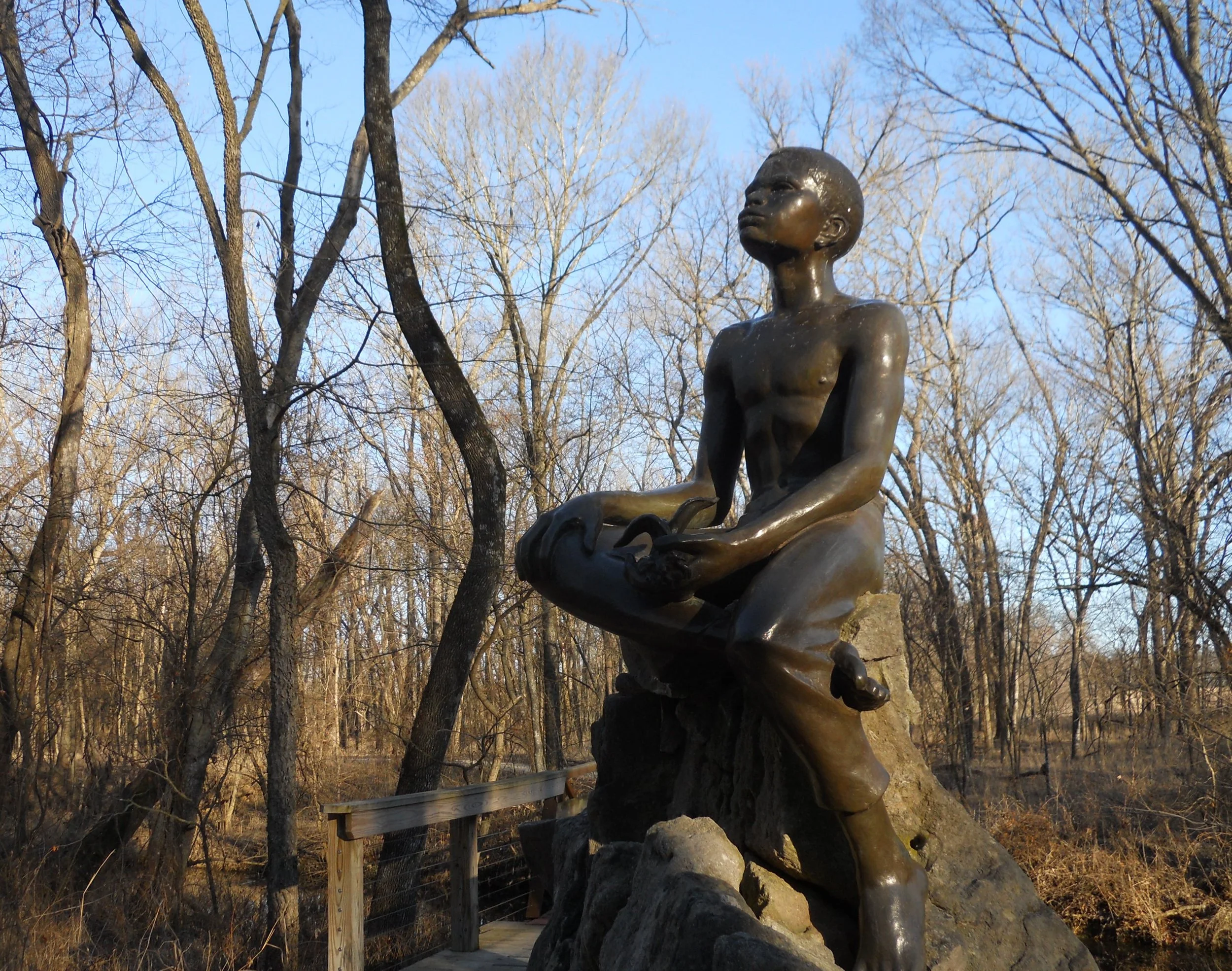
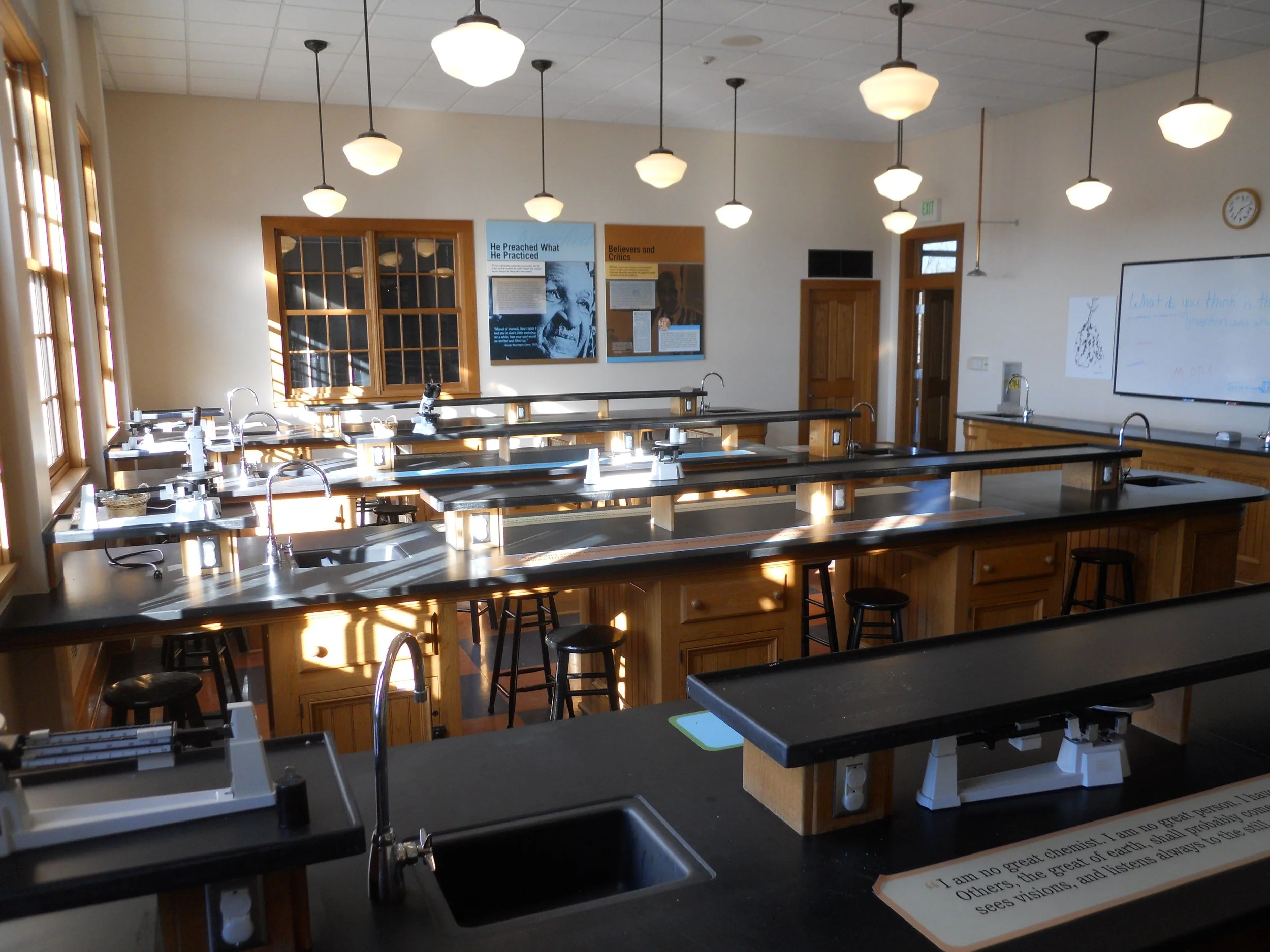
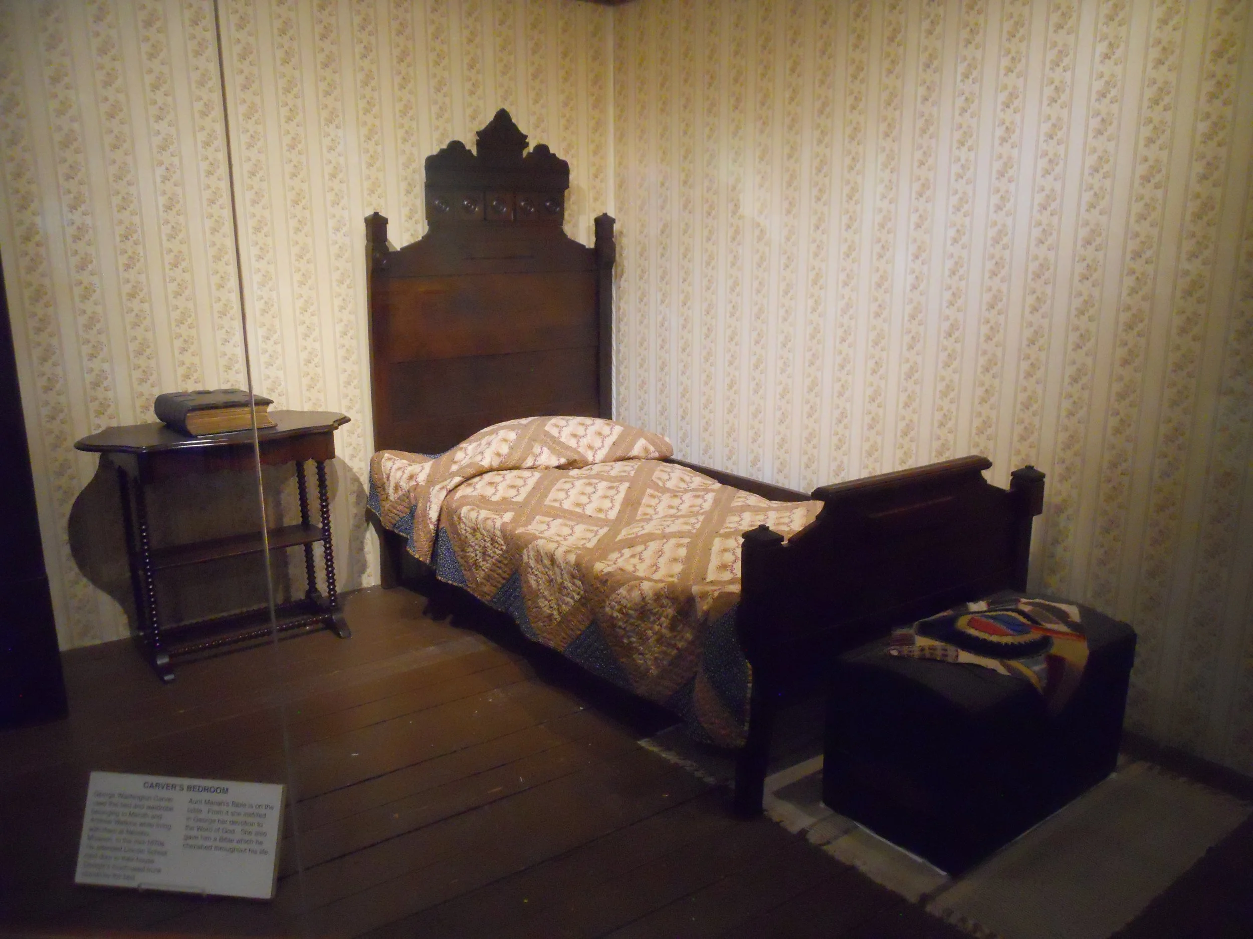
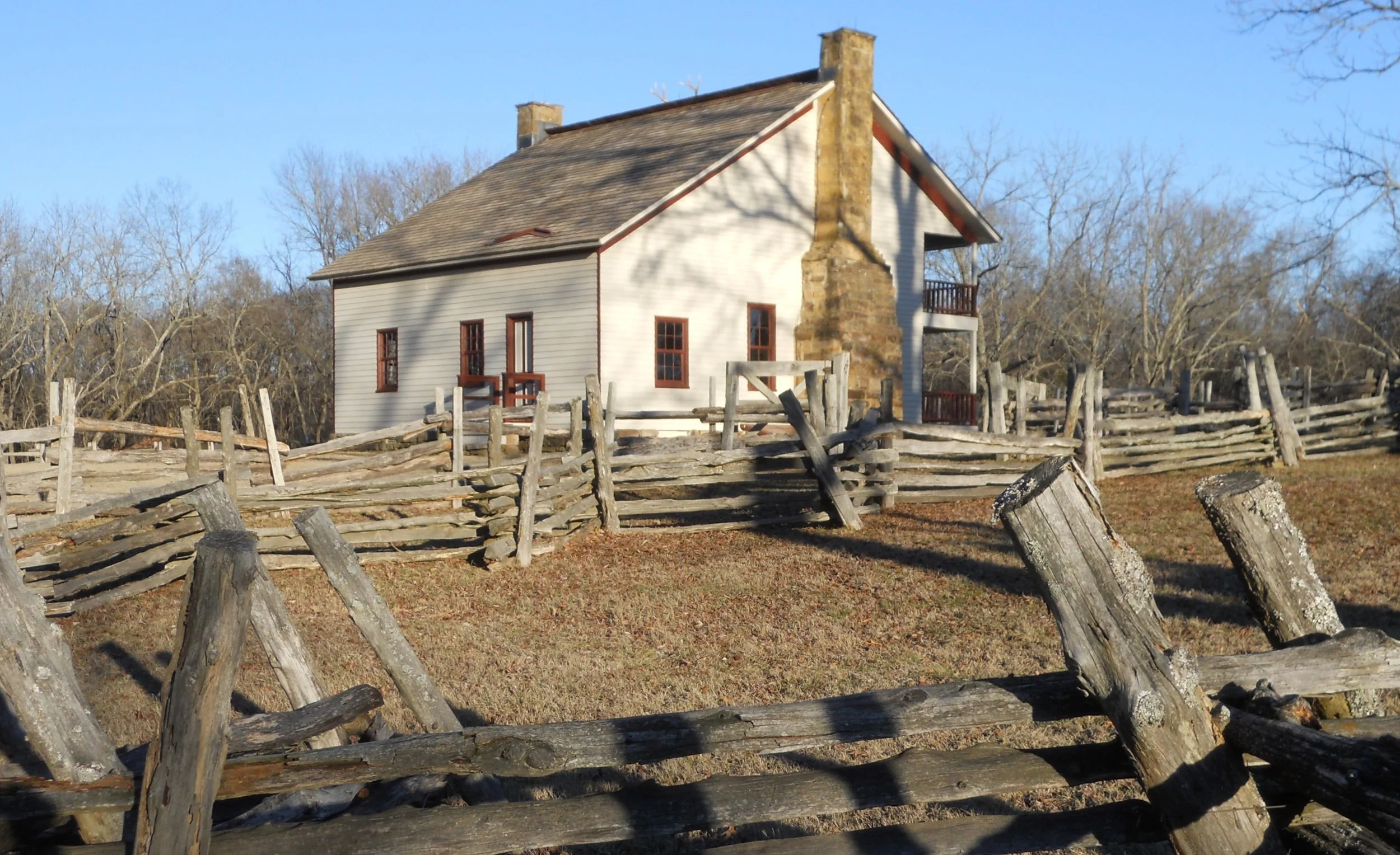
DAY 8 (February 12) - Aside from figuring out 300+ uses for peanuts, who knows George Washington Carver was big into conservation? 4.5 tons of crumb rubber from tires was used to make a portion of the loop trail at the NHS. 90% of the boardwalk by the spring and creek are from milk jugs. Carver would have been pleased. This land is where Moses and Susan Carver raised George, their slave. But unlike many slave owners, they provided education for the young George. A bust of George is on the trail. The house (photo) is the second on this site, after the first one was destroyed by a tornado in the late-1800s. A bronze statue of a young George is by the creek and spring where he began is love of the outdoors. The upstairs of the VC includes a classroom and a functional laboratory (photo). The bed, trunk, and bible were used by George when he lived for a short time in Neosho.
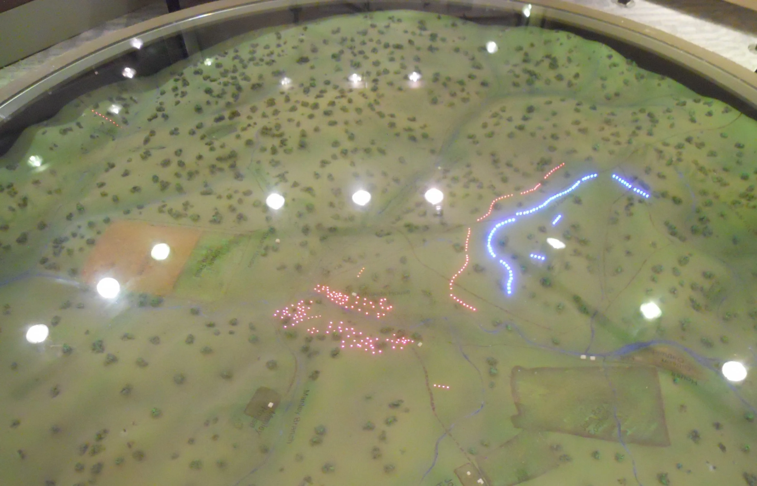
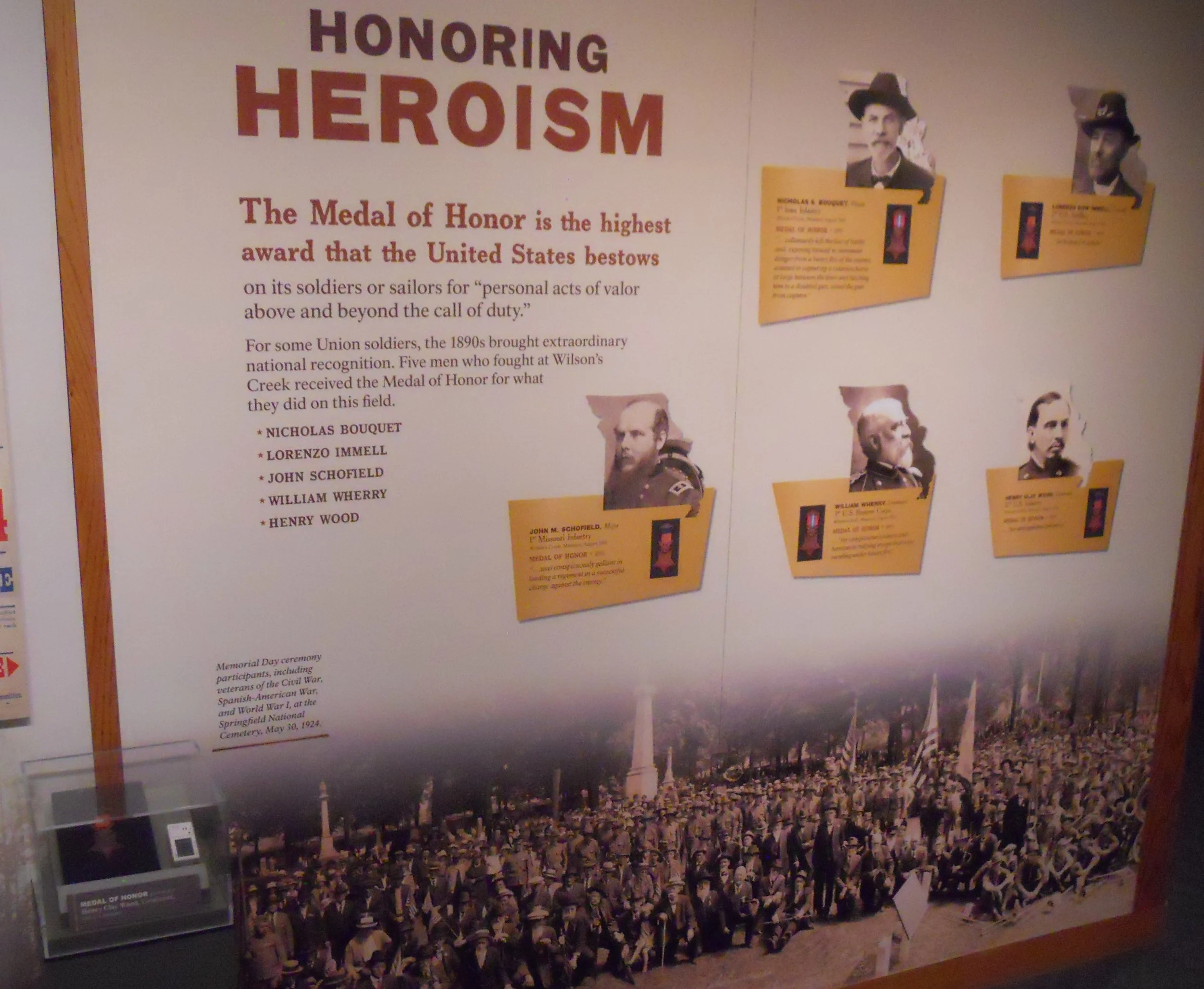
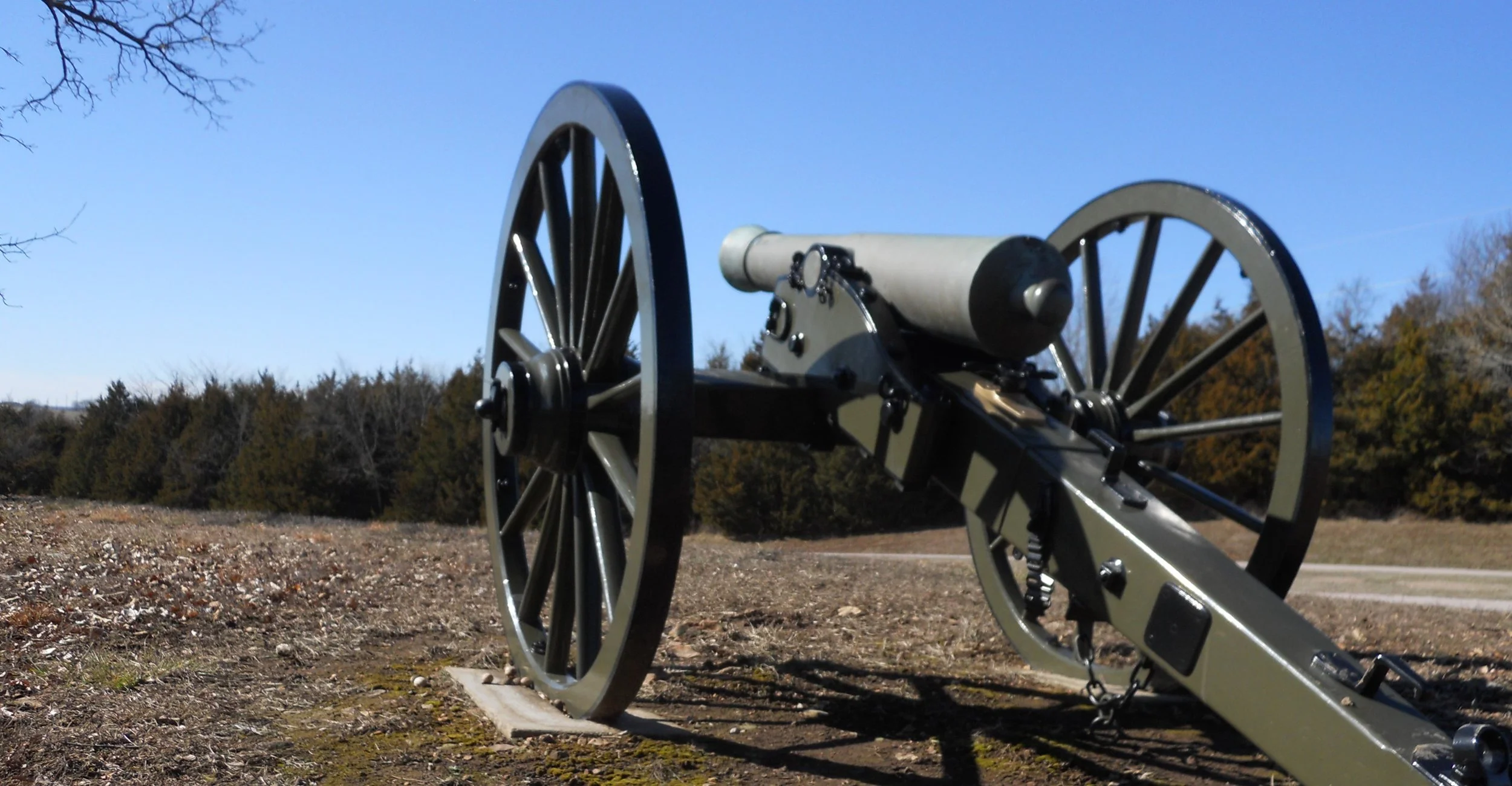
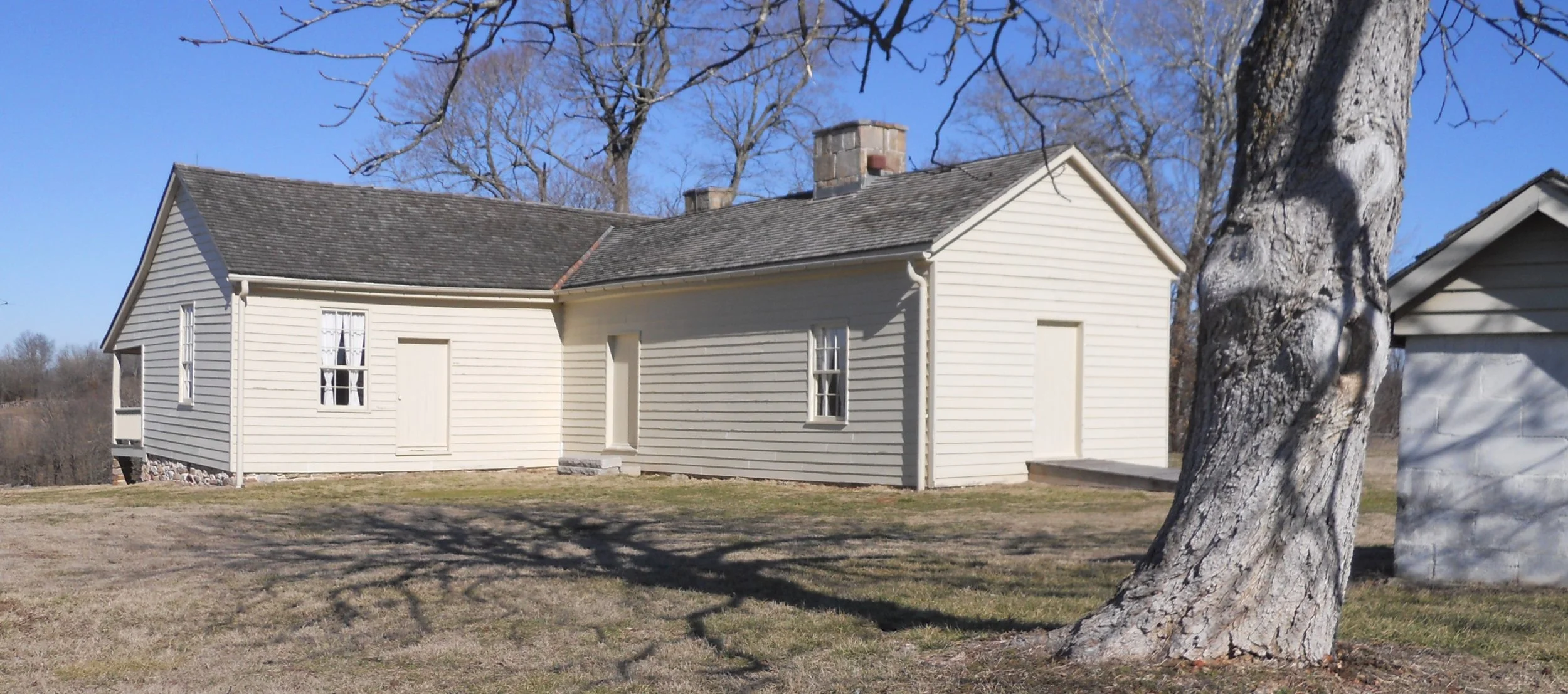
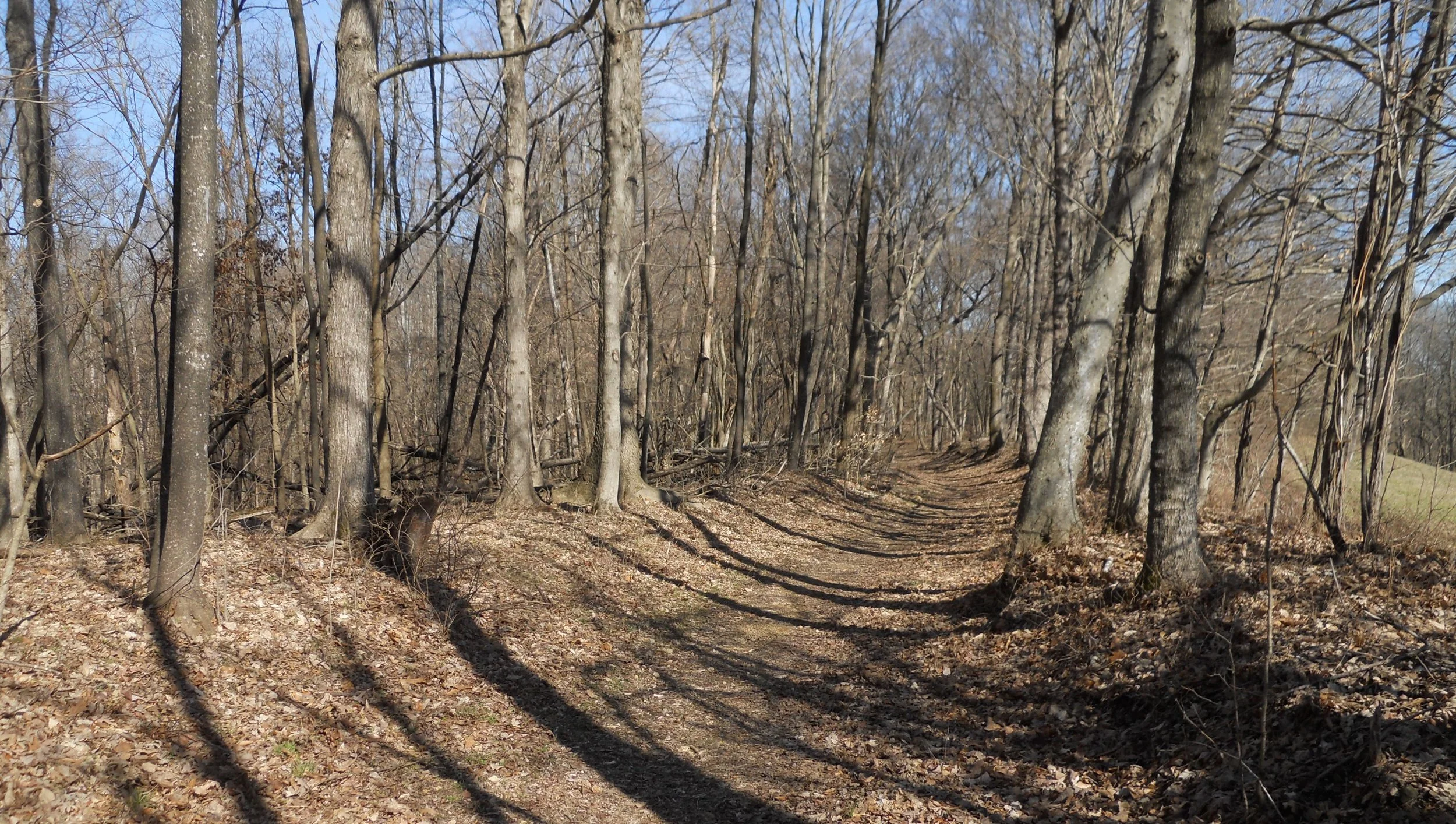
Wilson’s Creek NB is similar to Pea Ridge; no markers or monuments (just one, for Union Brig. Gen. Lyon who was killed), only a few cannon. This battle was considered the Bull Run of the West. The VC has a light-display which sequences the battle (blue for Union, red for Confederate). Every NPS park which is a battlefield should have this audio/visual device. Five Union soldiers would be awarded the Medal of Honor. The medal for Lt. Henry Wood Clay of the 11th U.S. Infantry is in the display box at the bottom left of the photo. The Ray Family home is the last surviving structure from the battle (photo). The cannon (actually, a howitzer) is located on Bloody Hill, pointing in the direction of the left flank of Maj. Gen Price’s Confederates, who tried three times to take the hill. The one photo shows Wilson’s Creek, where the Confederates were camped at the start of the battle.
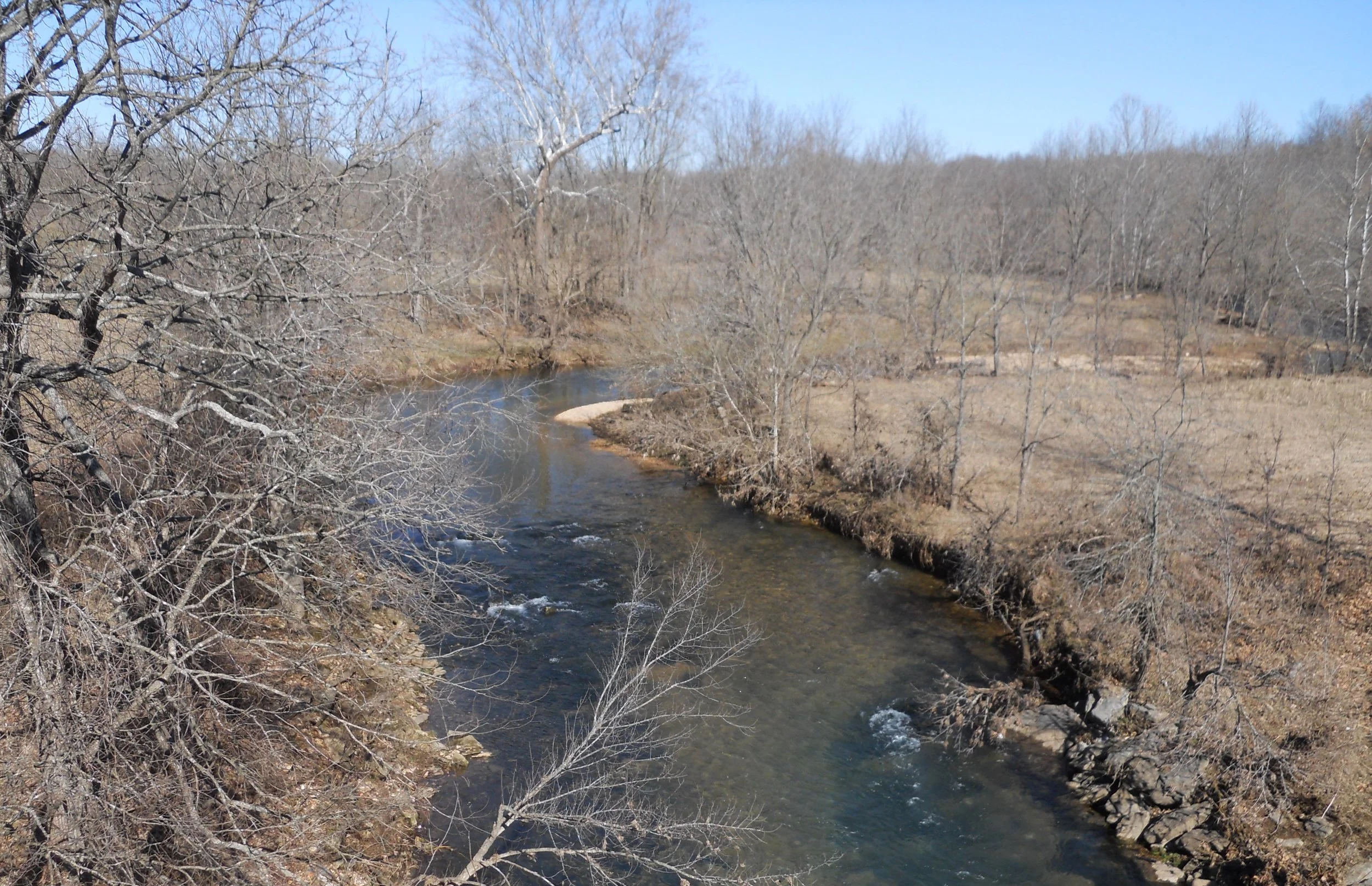
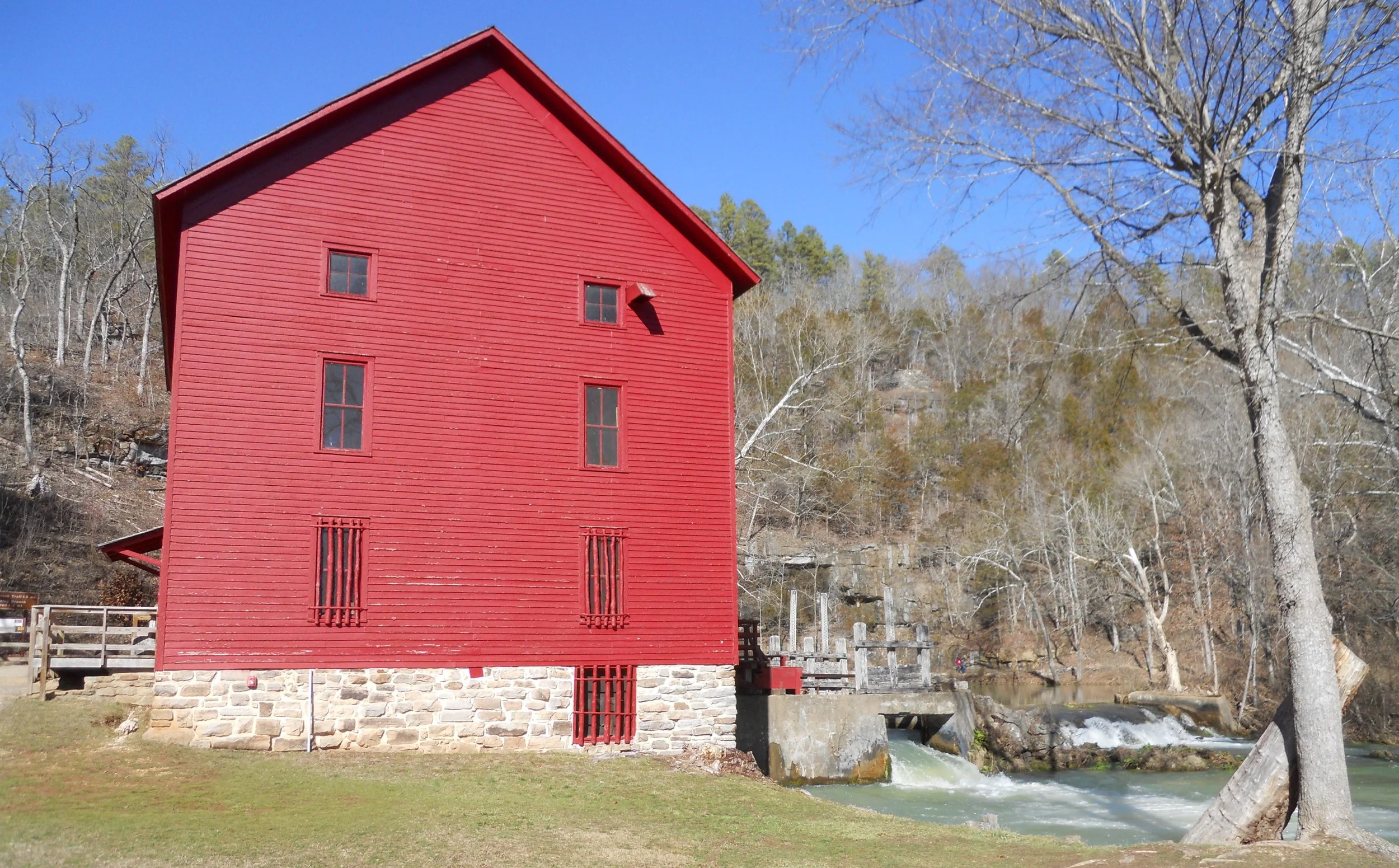
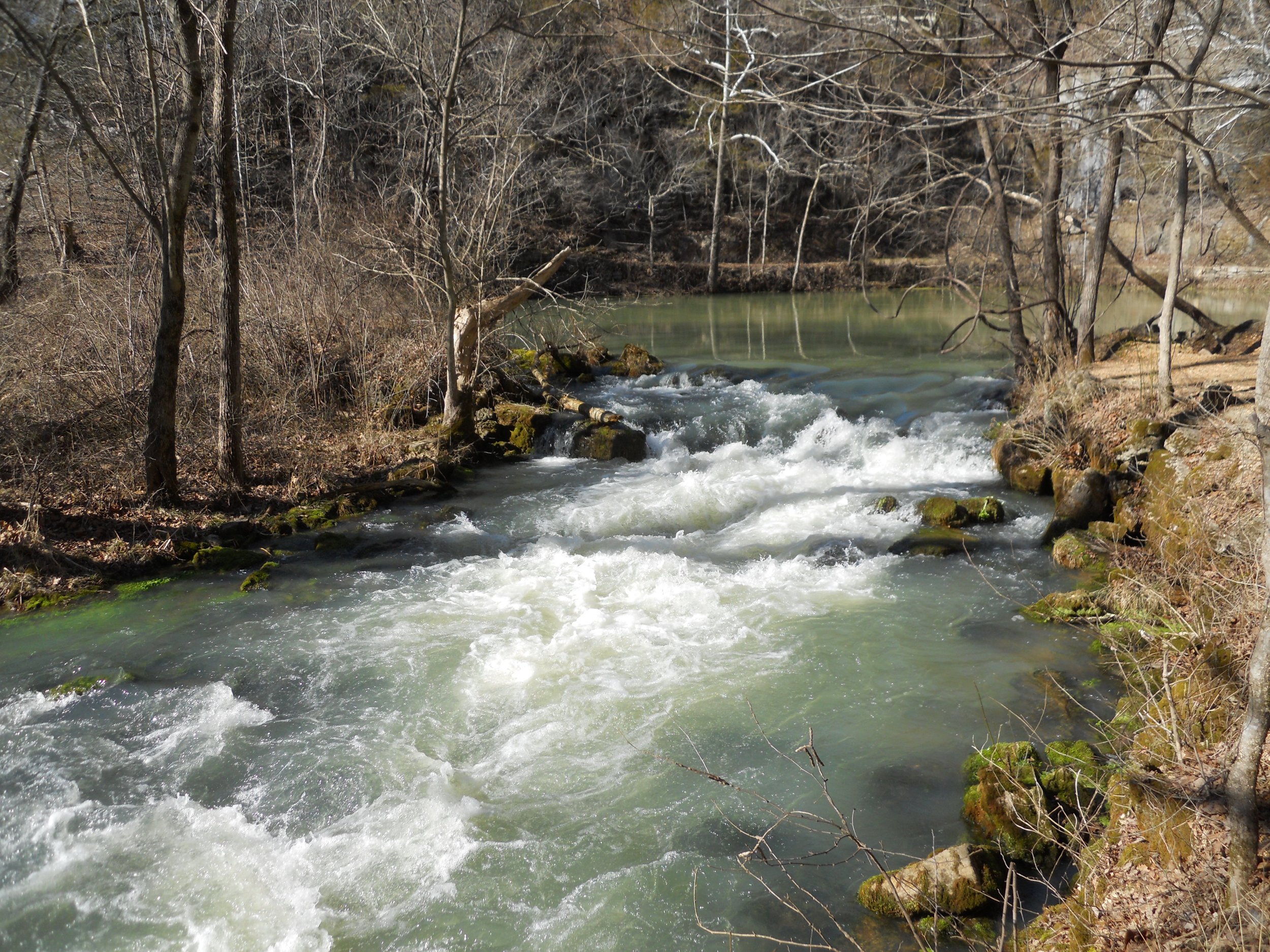
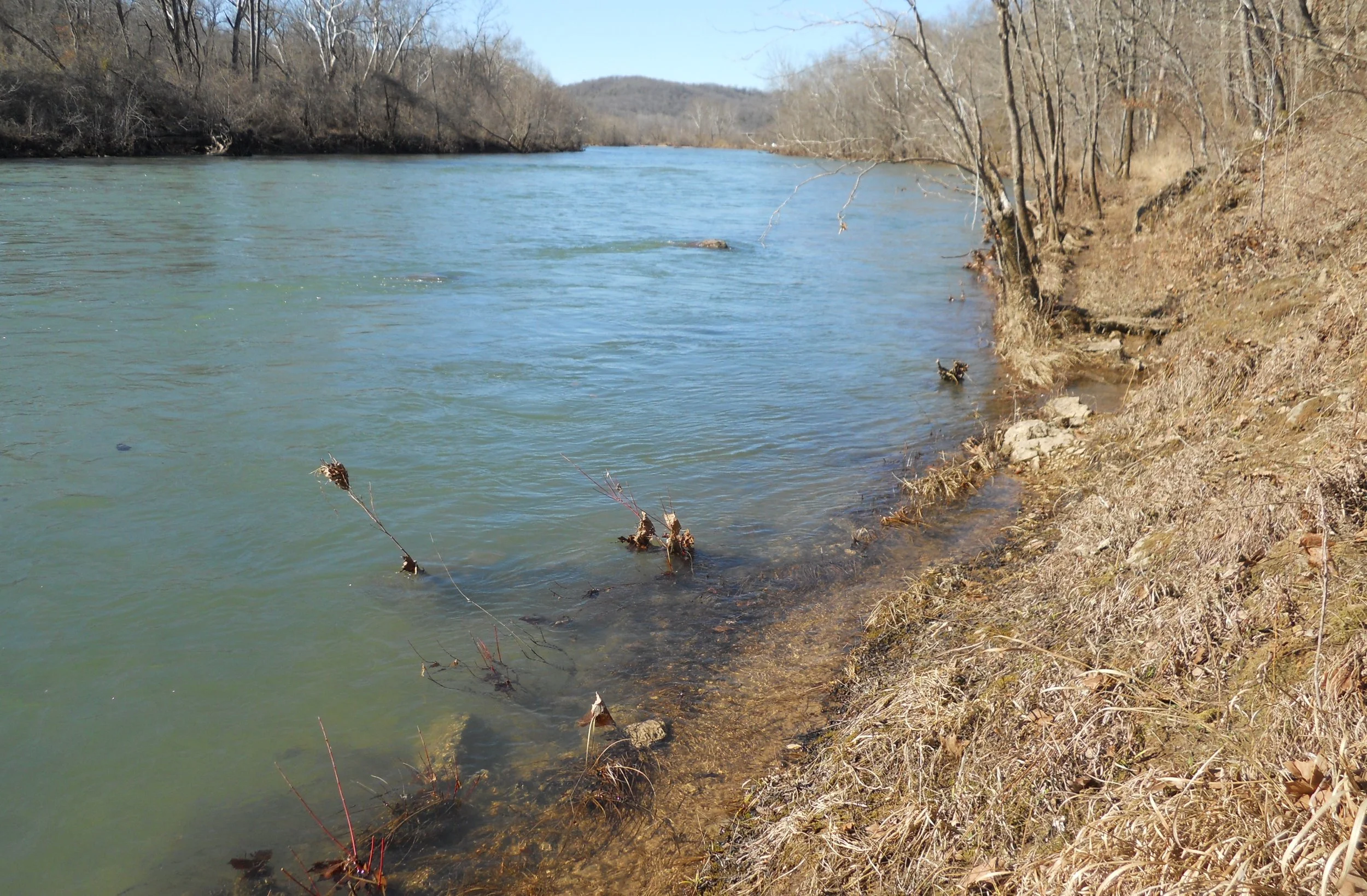
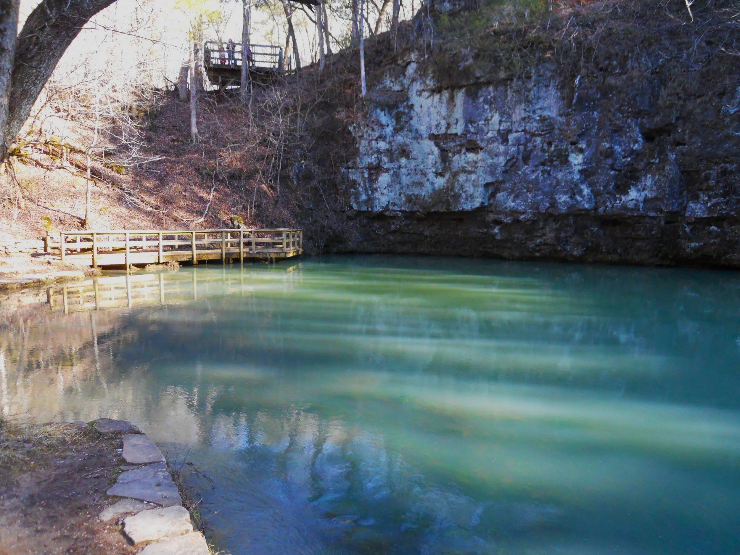
Ozark National Scenic Riverways is just that; scenic. And route AR74 from the previous day has a challenger for most exciting road to drive. MO 106 goes from the western end of the park, cutting through the center portion, over to the eastern side. Tighten your seat belt. Alley Spring and Alley Mill are a major stop for tourists (first two photos). At the Powder Mill parking area one can take a 2.5 mile roundtrip hike to Blue Springs, the bluest spring in Missouri. A couple of short portions of the trail are in the Current River. Both springs output over 80 million gallons per day.
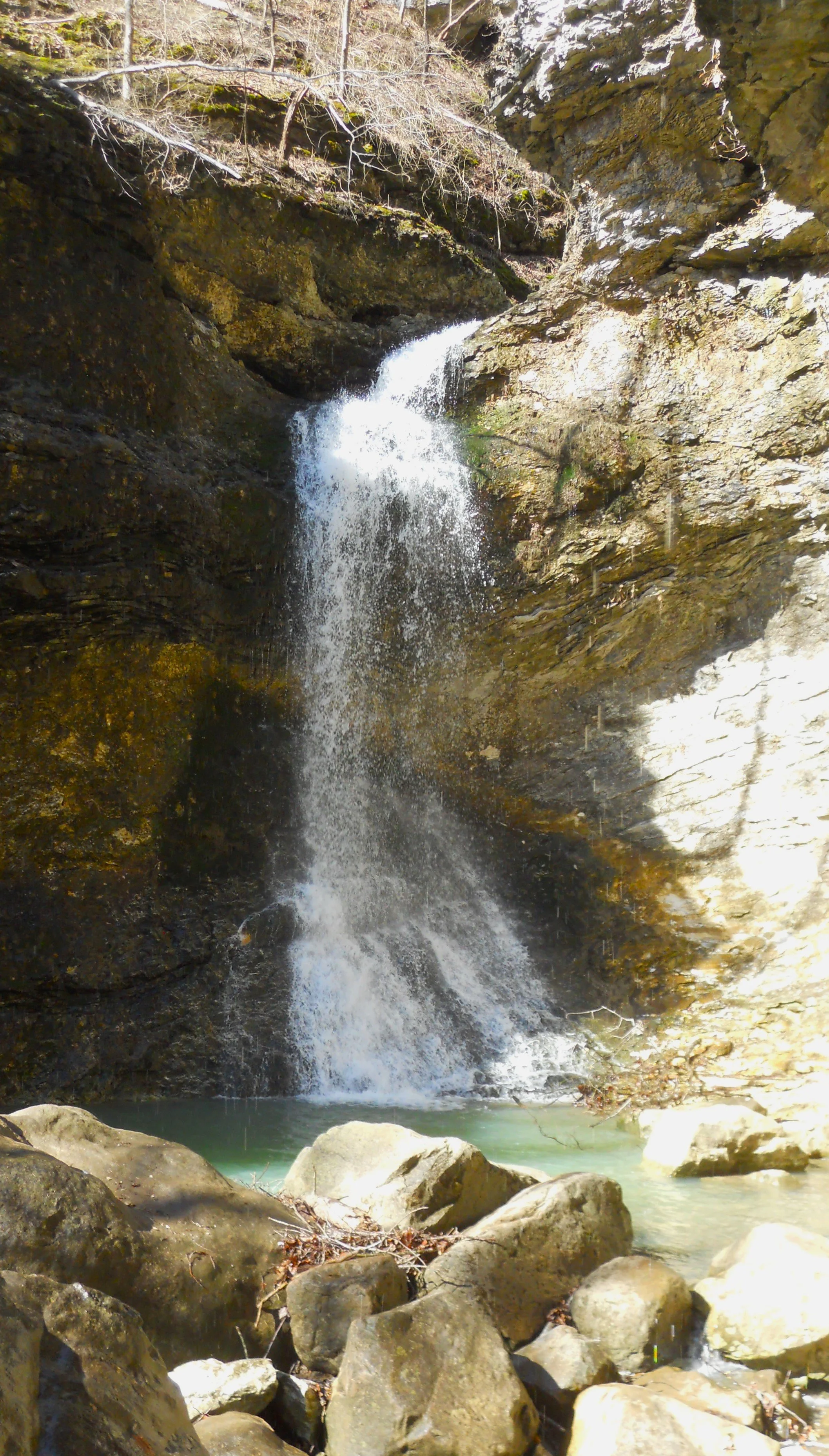
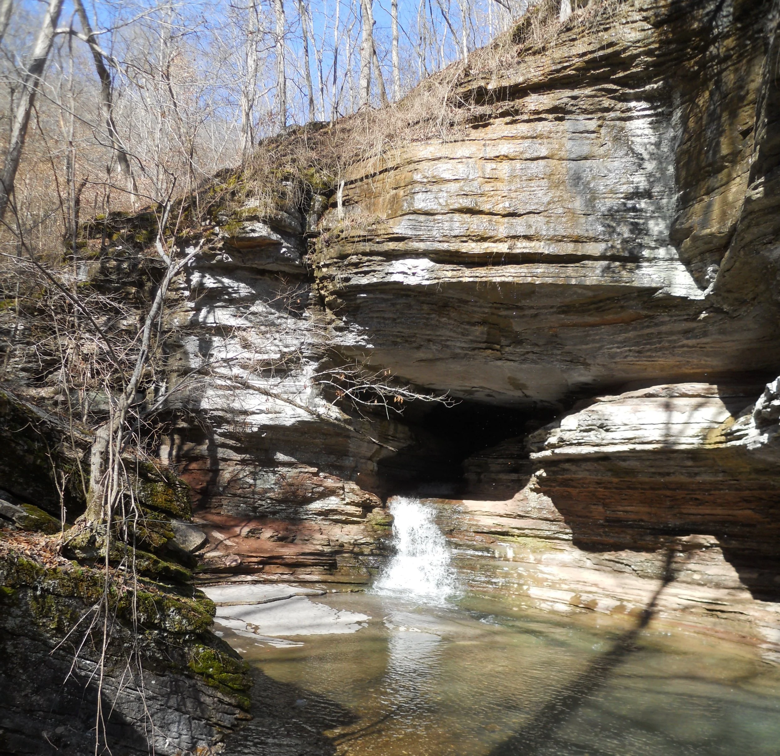
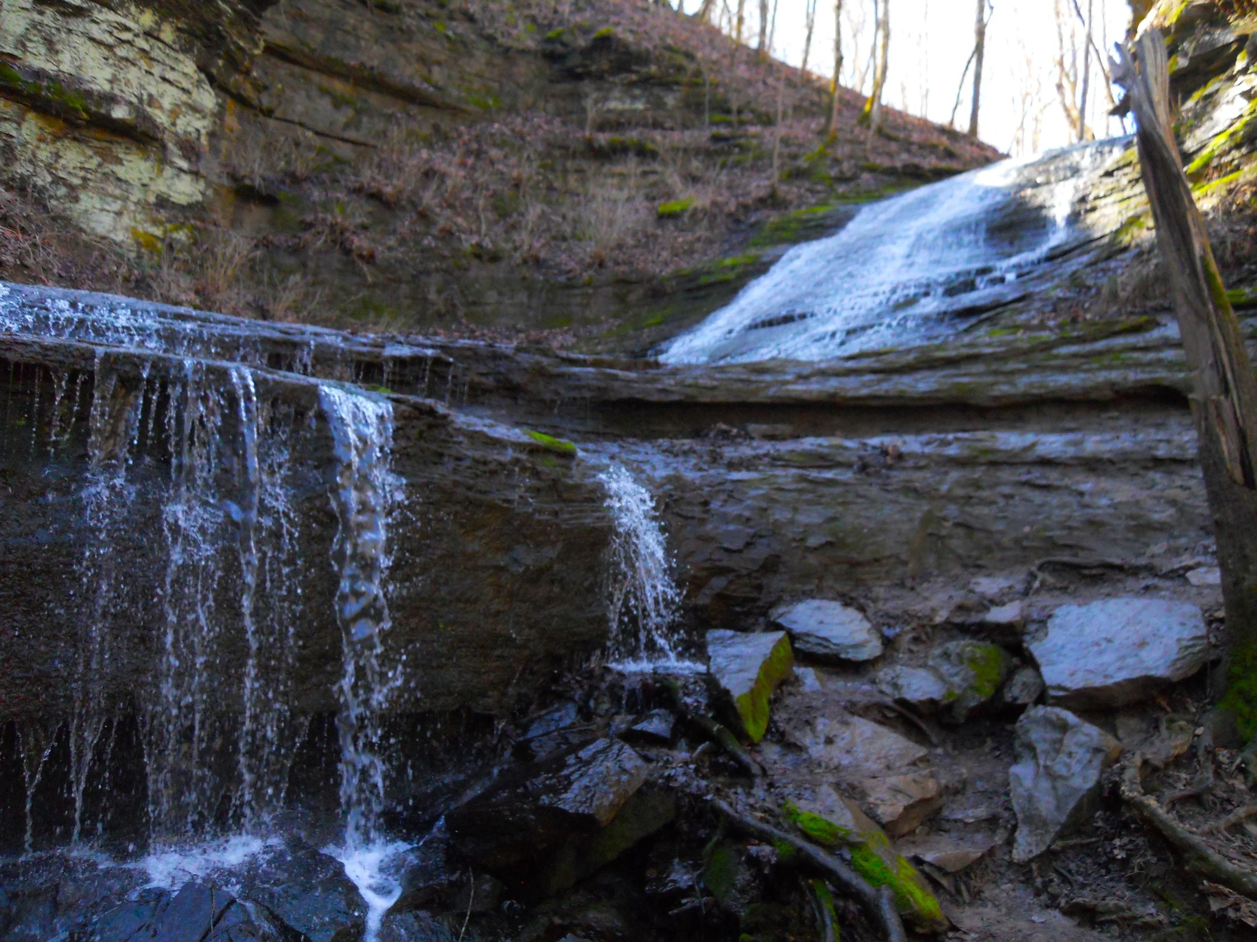
DAY 7 (February 11) - Who likes to swim in 40F deg water? Not me. Though the Buffalo National River has plenty of good swimming spots, I did not partake today. The river flows relatively slow, and can be shallow, allowing for a good swimming experience, even for those who are not Michael Phelps. Or, stick to hiking and go to the Lost Valley Trail. Edna Falls and the Natural Bridge (photos) are worth the hike. And if anyone likes to drive mountain roads, with sharp turns, wide turns, acceleration areas, braking spots, etc., take AR74 from Tyler Bend VC to Ponca Bridge. Wow!!!
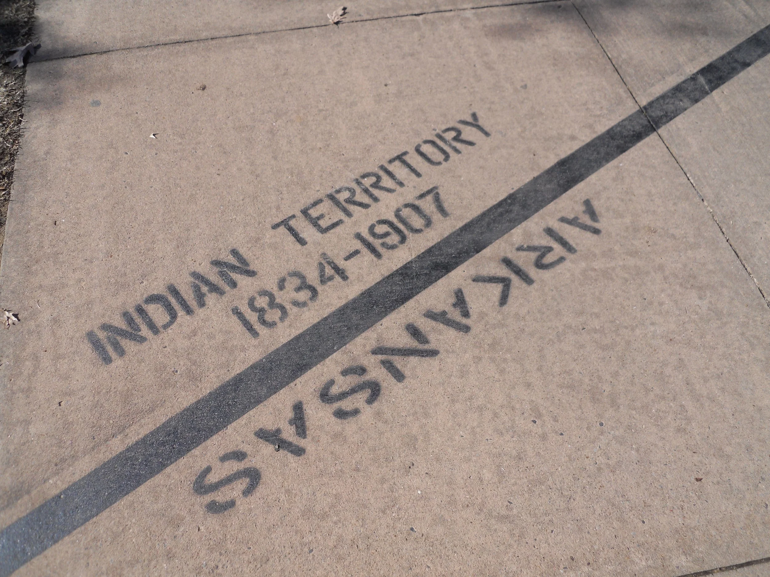
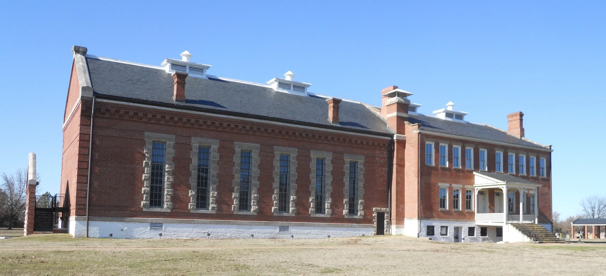
Fort Smith was the western frontier in 1817. The original fort was built (in 1817) in what Congress would order to be Indian Territory 17 years later, just to the west of the boundary with Arkansas (see photo).
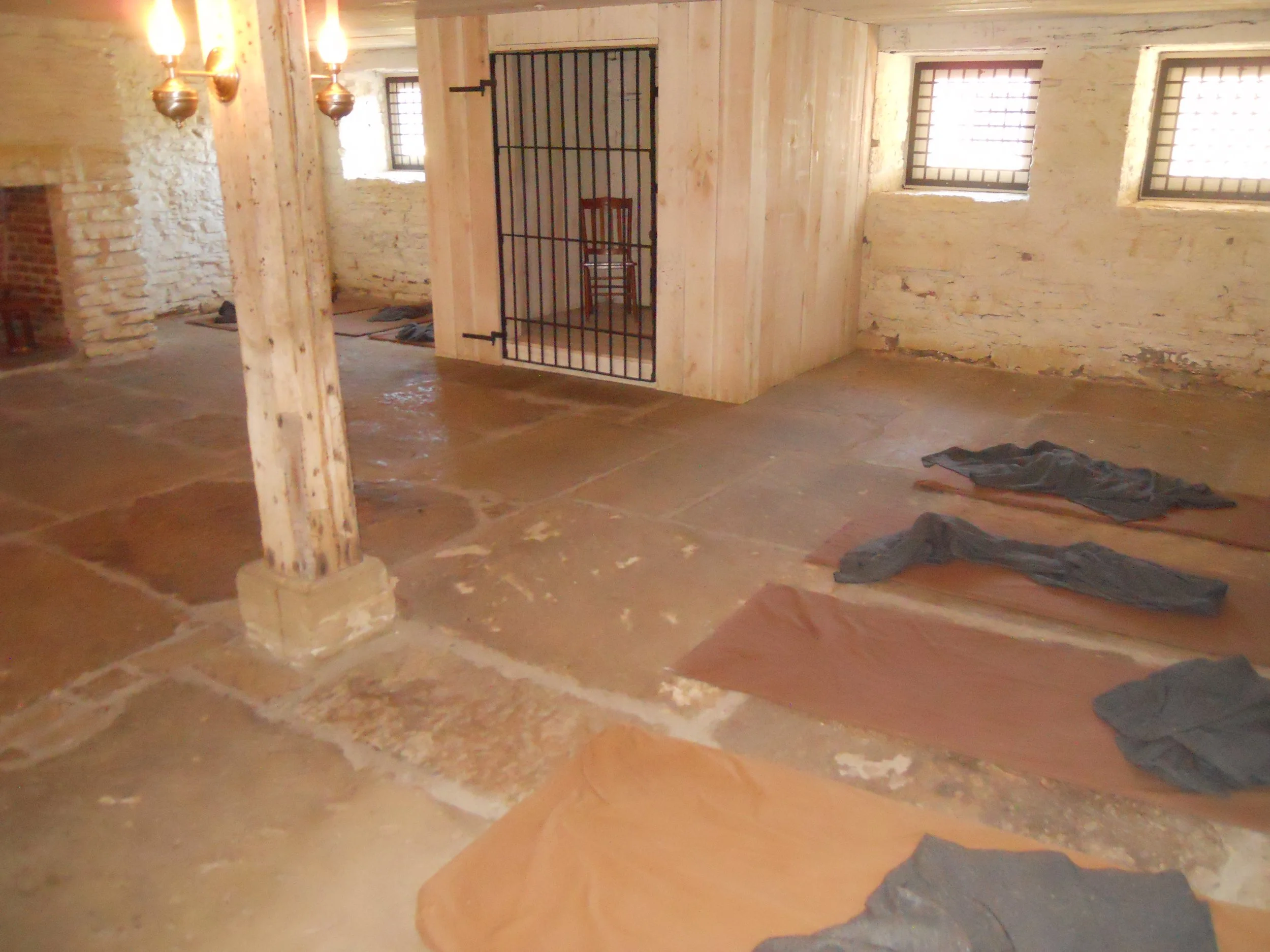
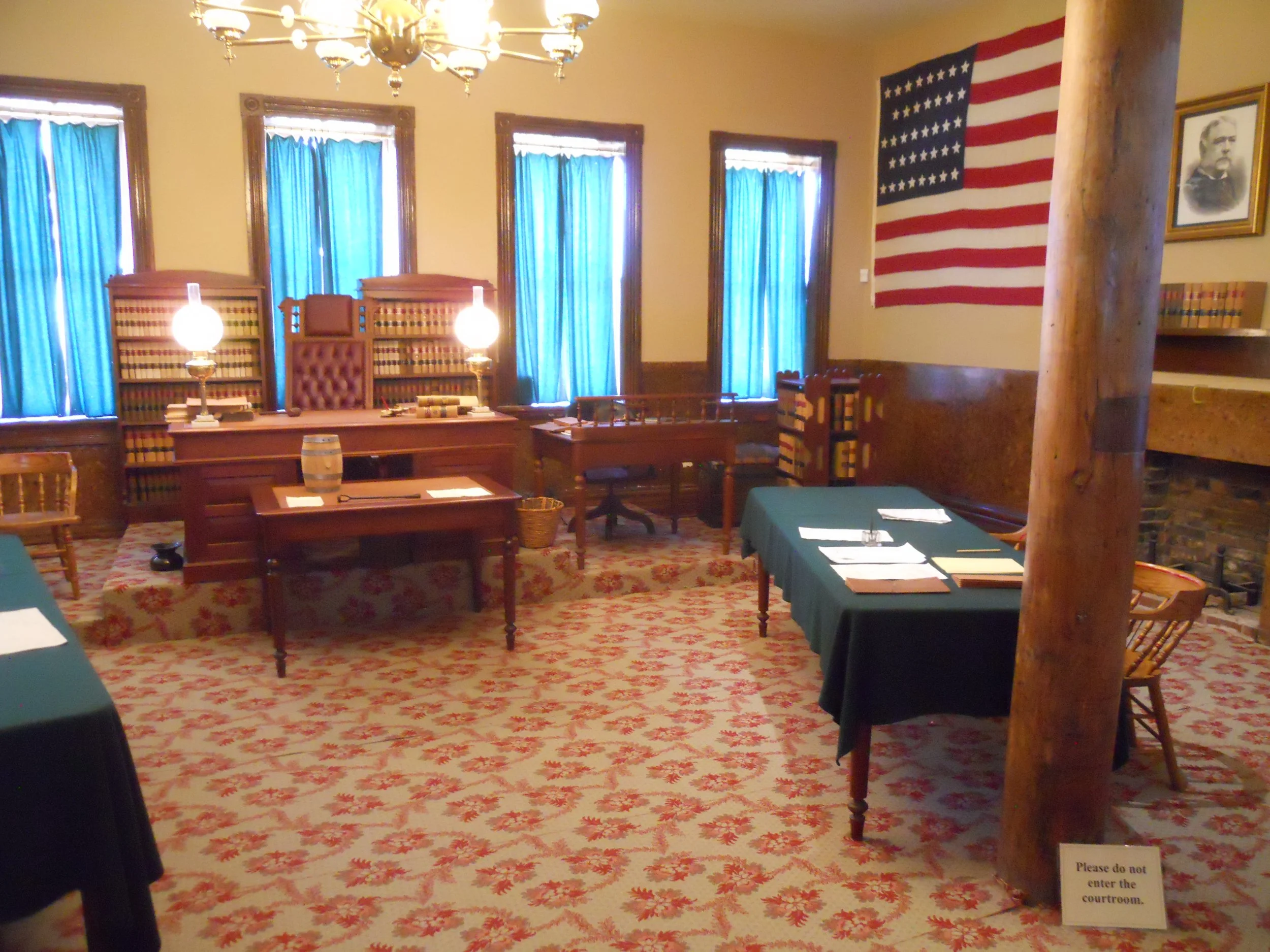
The fort then became the Federal Court for the Western part of Arkansas. Note the flag in the one photo, with 38 stars… not the 50 which adorns Old Glory today. The other photo shows the jail area in the basement of the courthouse. The jail became known as “Hell on the Border”, since there was no other Federal Court west of Fort Smith because that was Indian Territory.
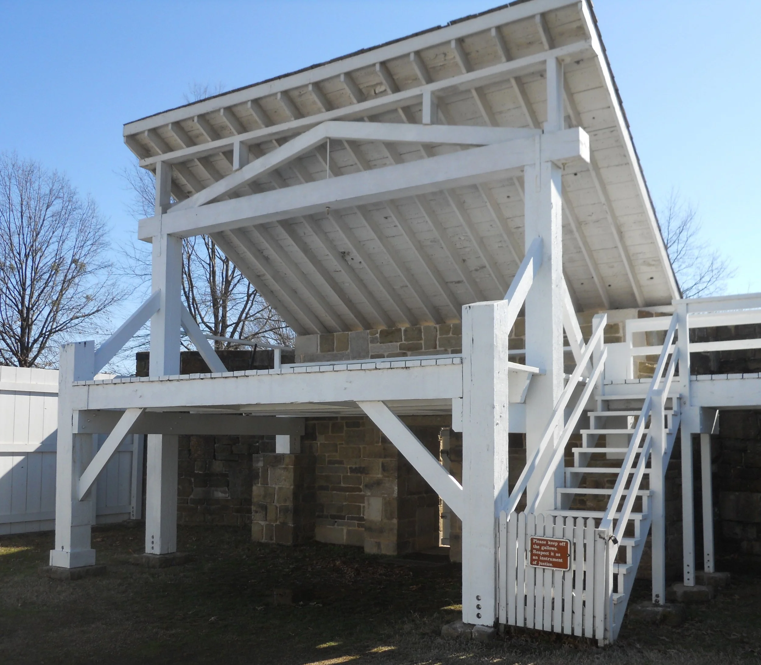
A gallows is on the grounds, to show visitors what would have awaited them if they ran afoul of Judge Isaac Parker from 1872 to 1896.
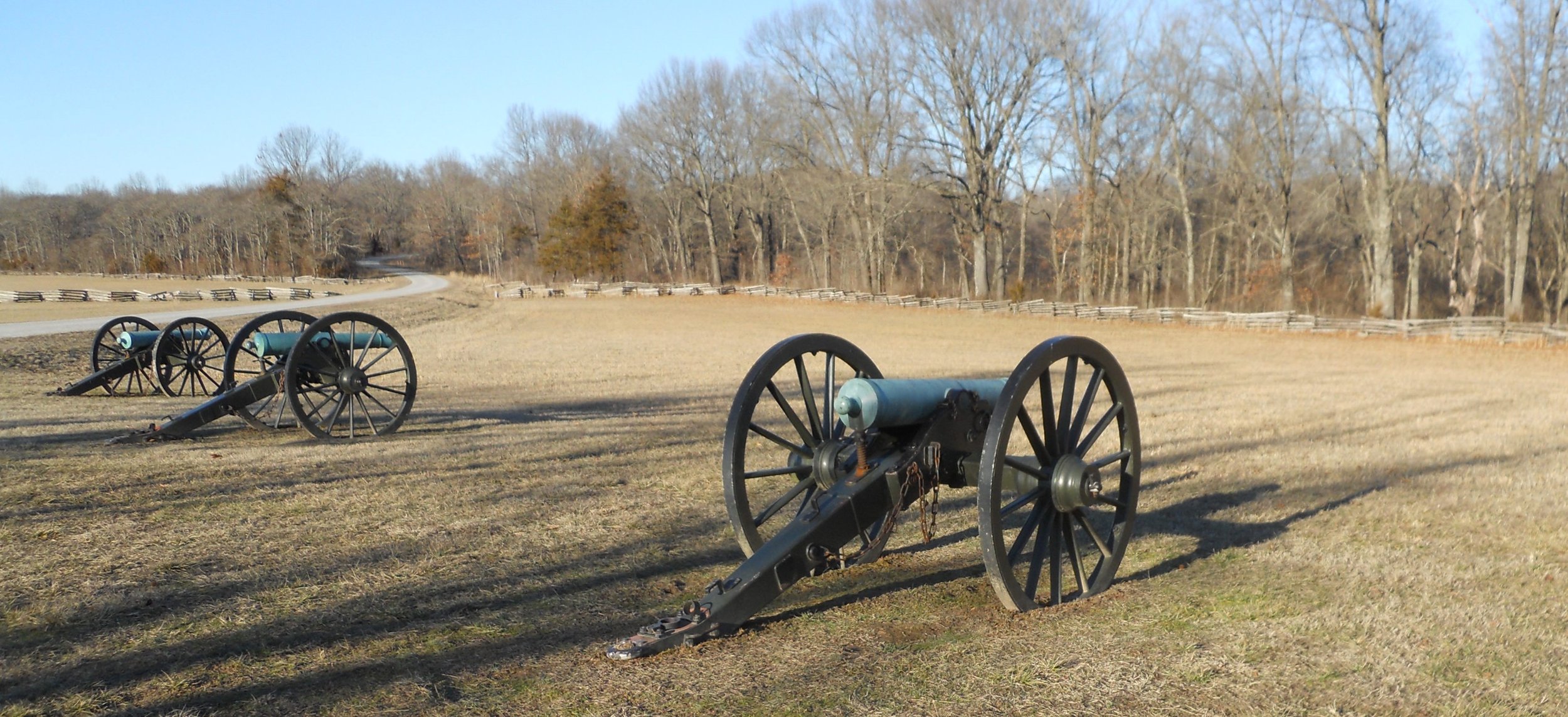
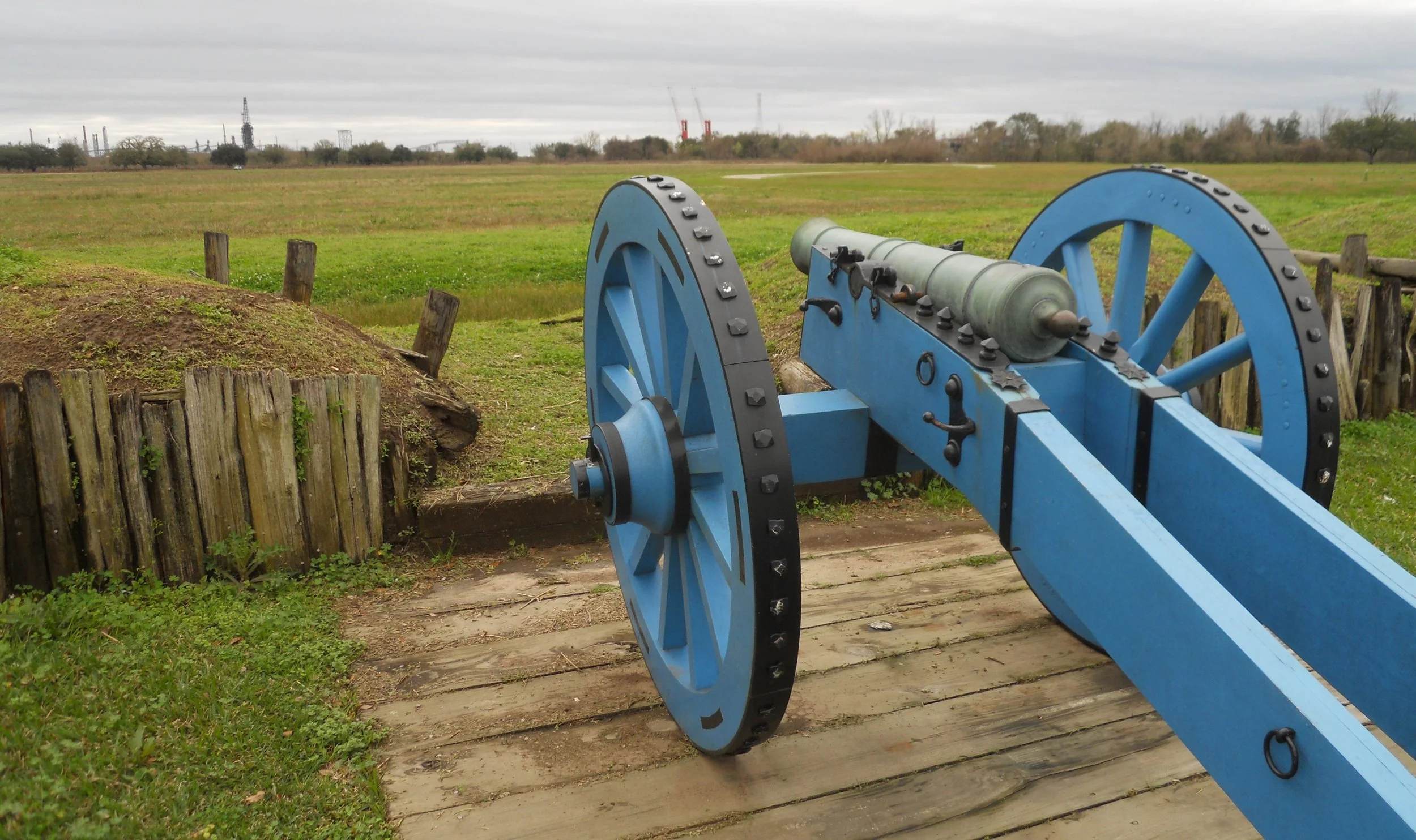
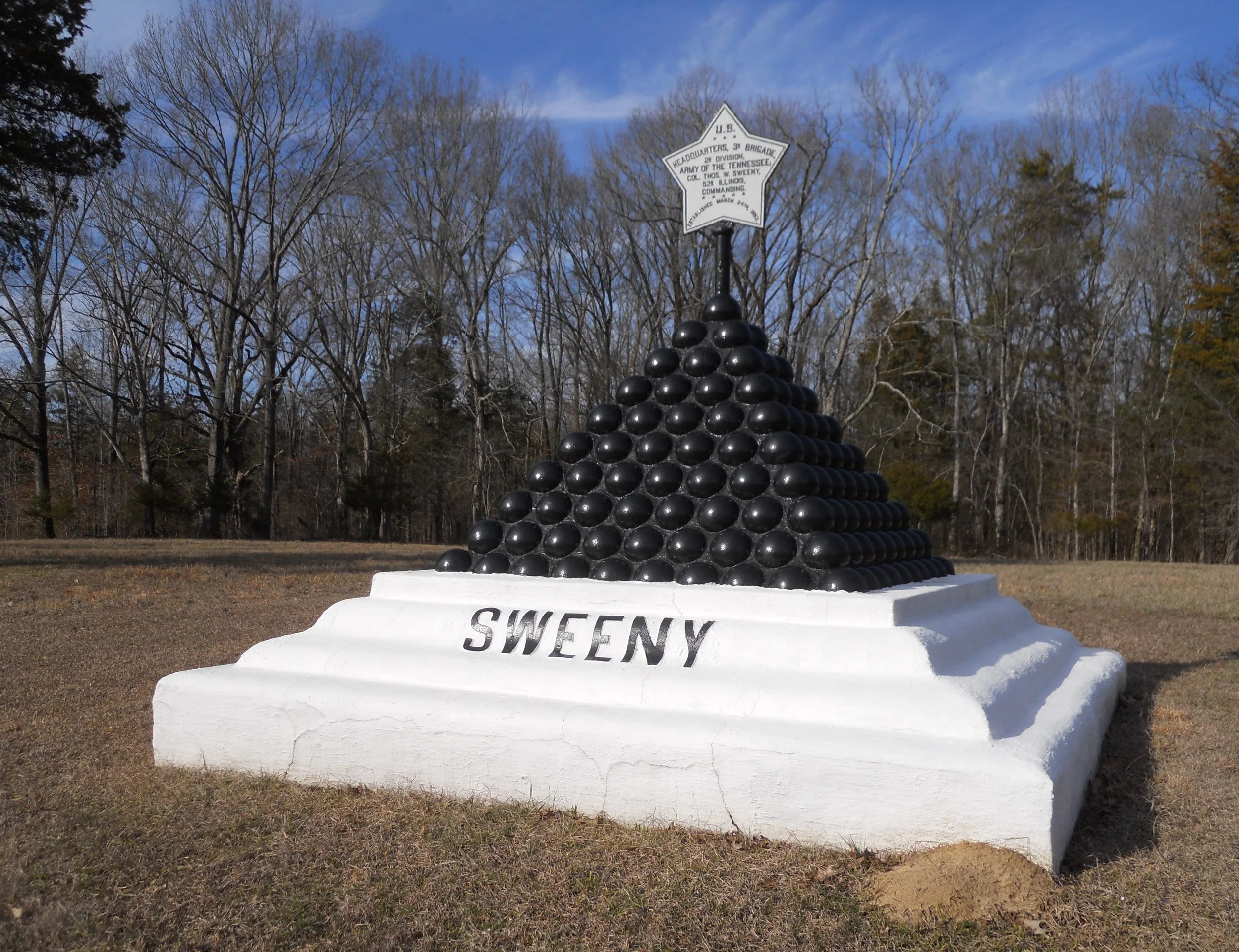
Pea Ridge NMP was a victory for the Union, but not without cost. This was one of the few battles where Confederate forces (16,000 men) outnumbered the Union (10,500 men). Confederate attacks on March 6 at Leetown were halted by two German-speaking regiments (one from Missouri, one from Illinois). Union cavalry had been routed by 7,000 Rebels. While retreating they told their infantrymen to turn and run. Without the two regiments standing firm (at the spot shown in the photo with the cannon), Pea Ridge could have become another Bull Run disaster. The next day Union forces fought their way to victory, to secure Missouri for the remainder of the war.
The battle is also known as the Battle of Elkhorn Tavern. The photo shows the reconstructed tavern. The owner’s family hid in the cellar during the battle.
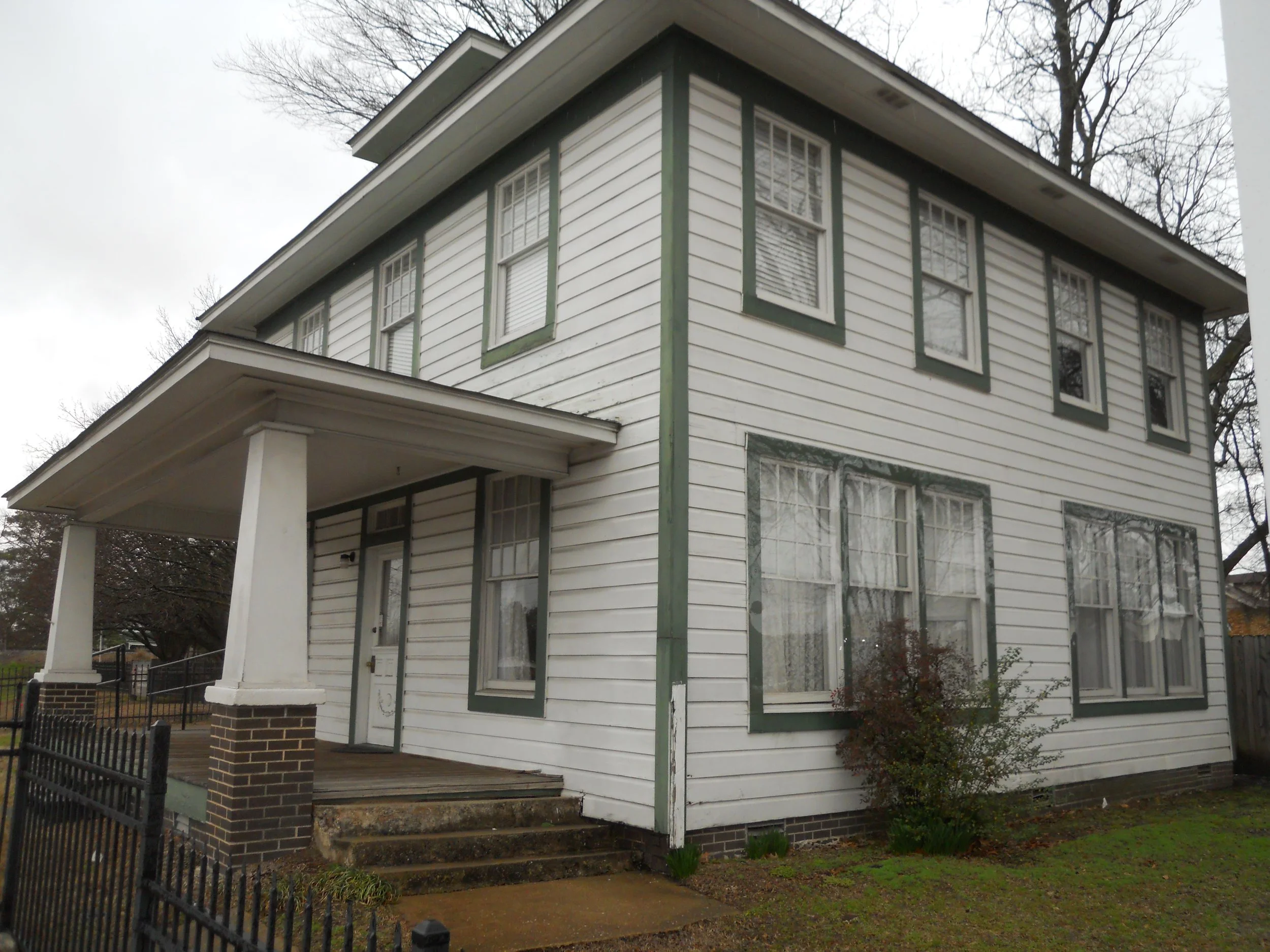
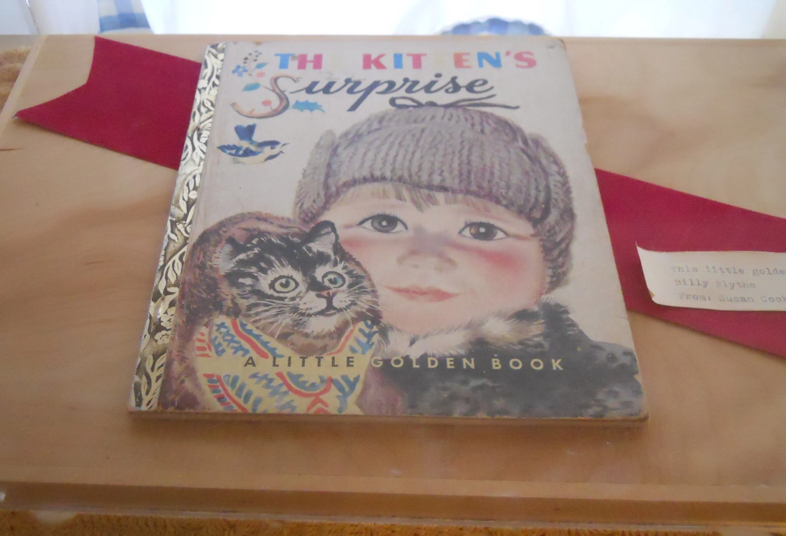
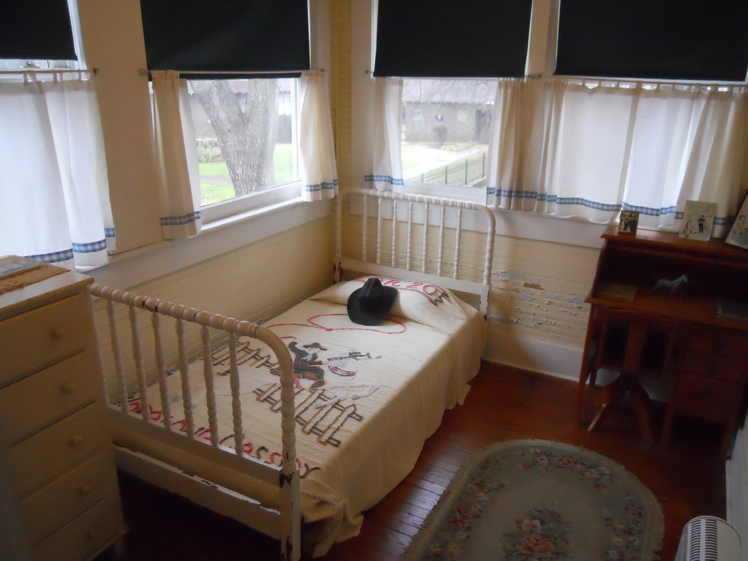
DAY 6 (February 10) - President Bill Clinton’s birthname was Blythe, not Clinton. His father was William Jefferson Blythe, Jr., who died 3 months before Bill was born, as he was traveling to see his wife, Virginia. The Clinton name comes from Virginia’s second marriage, to Roger Clinton. The interior of the Cassidy home (Virginia’s parents were James and Edith Cassidy) has been redone to look as it did in the 1940s. The one photo is of the small bedroom where Bill stayed. Only a couple of original Bill items are on display; a book (photo) and a trophy he won in a beauty contest as a 2-year-old.
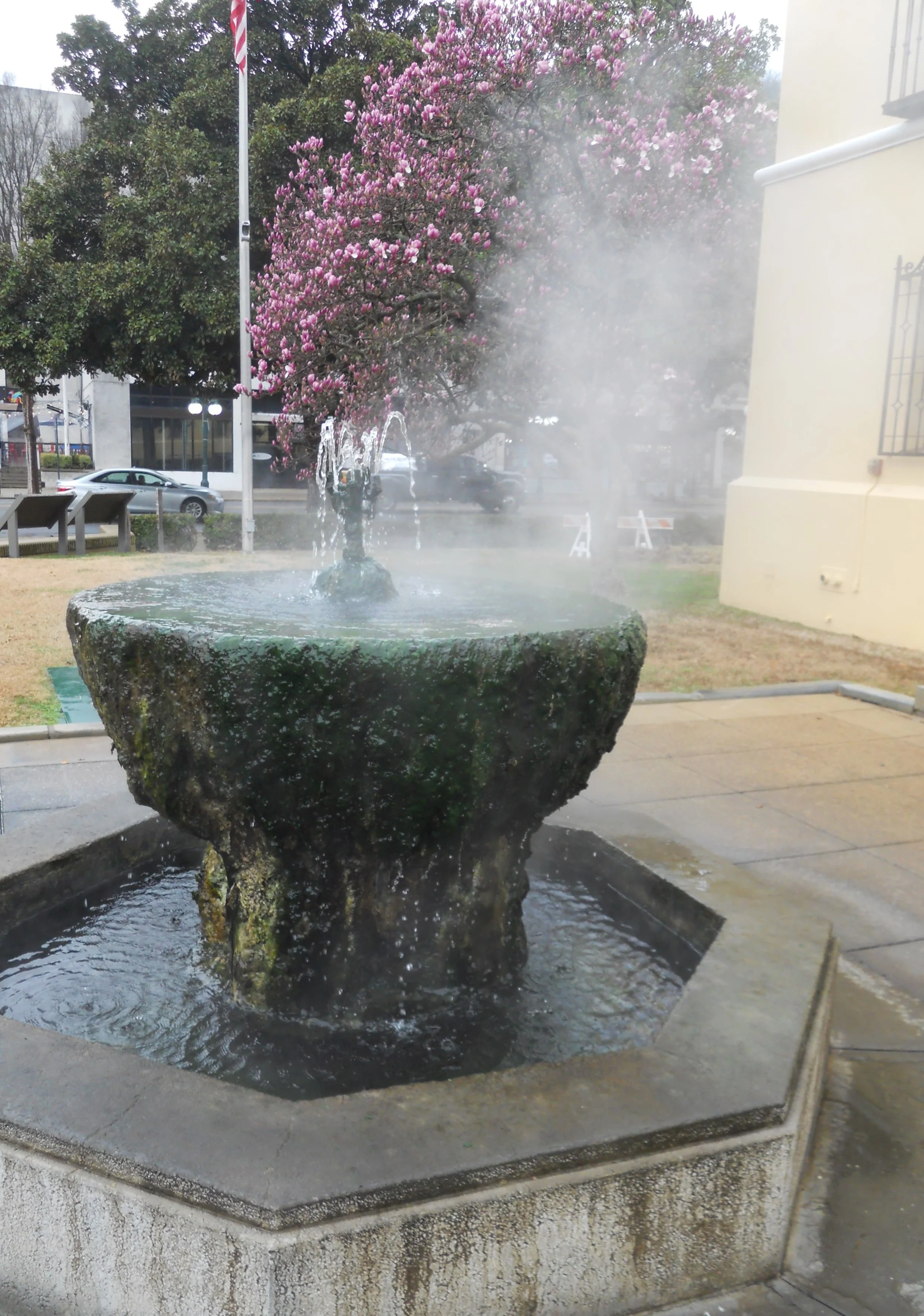
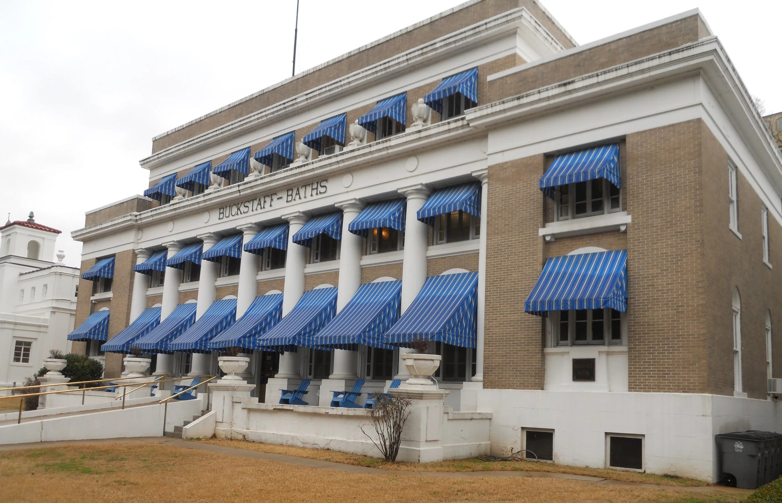
Hot Springs NP is still cranking out 4,400-years-old hot mineral water, being pumped up by natural forces. A couple of fountains by Bathhouse Row are a constant reminder (both taste and smell) of this area’s drawing card. In 1875, Hot Springs was considered the World’s Sanitarium, due to the supposed healing powers of the mineral water. The opulent bathhouses which line the street, ooze of luxury. Buckstaff (photo) is still in operation. Stop on in!!!
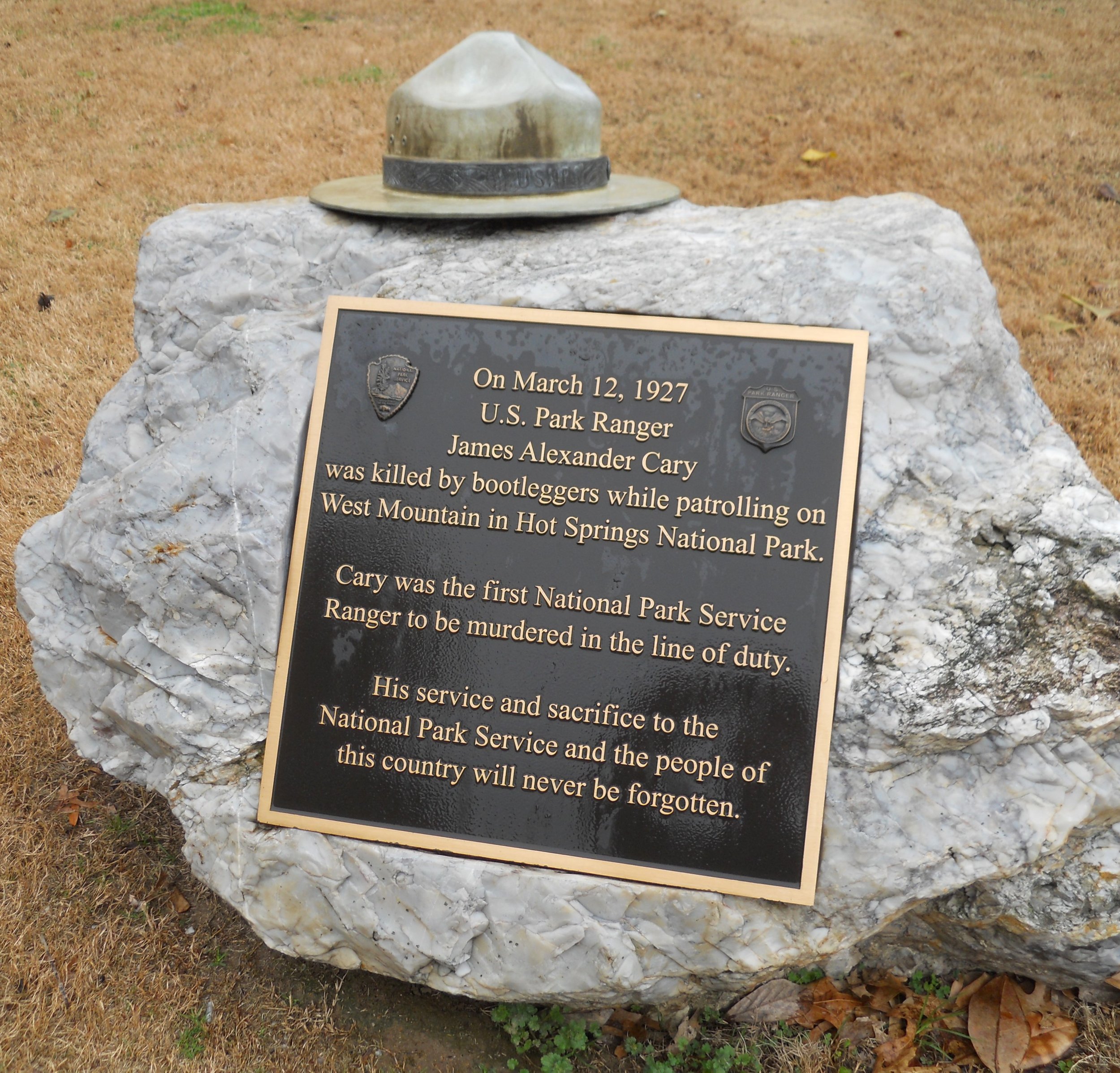
The one photo is of the memorial to Park Ranger James Cary. He was the first NPS ranger to be killed in the line-of-duty. We all should be grateful for the men and women who put their lives on the line to protect us and our country.
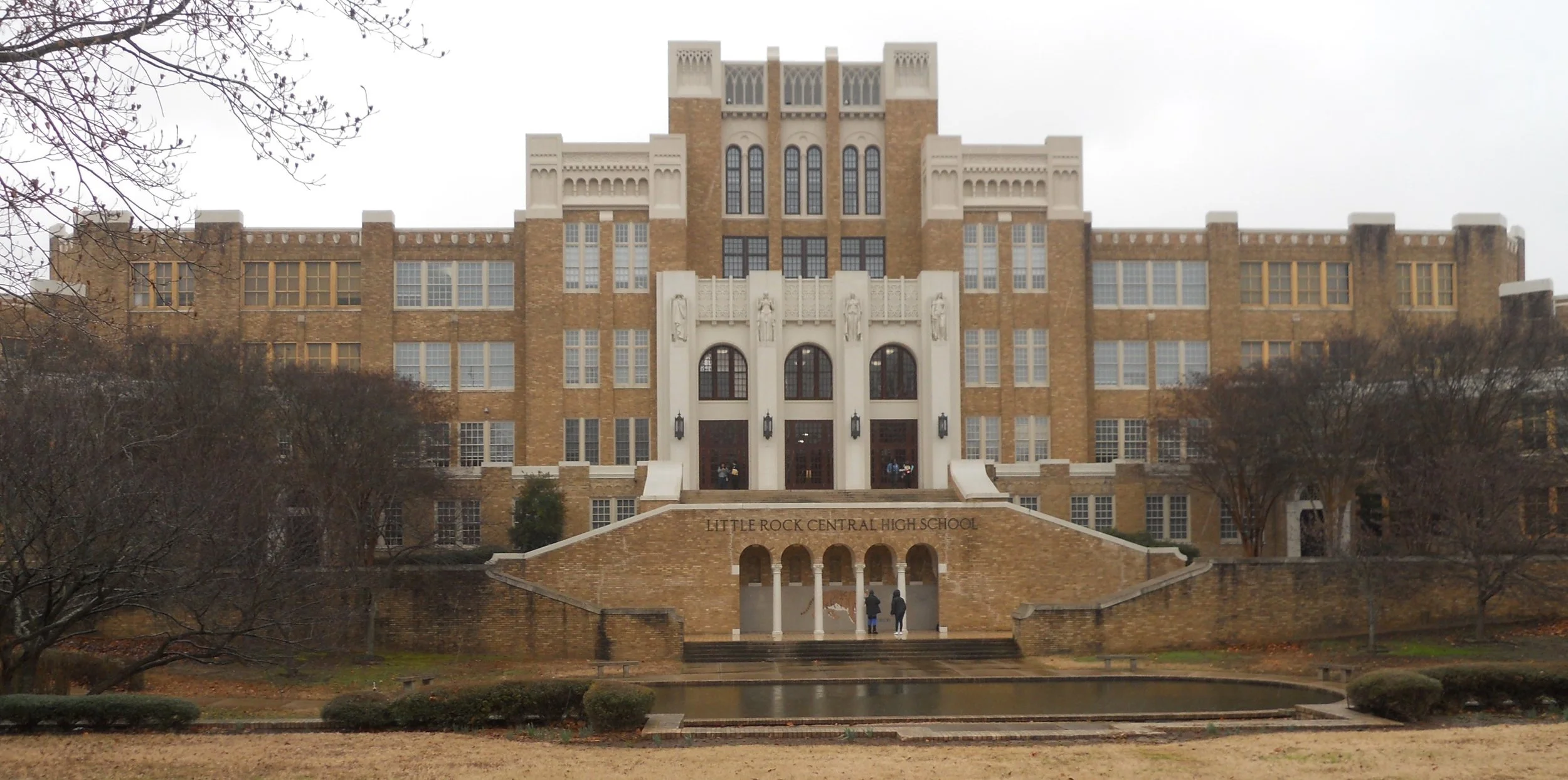
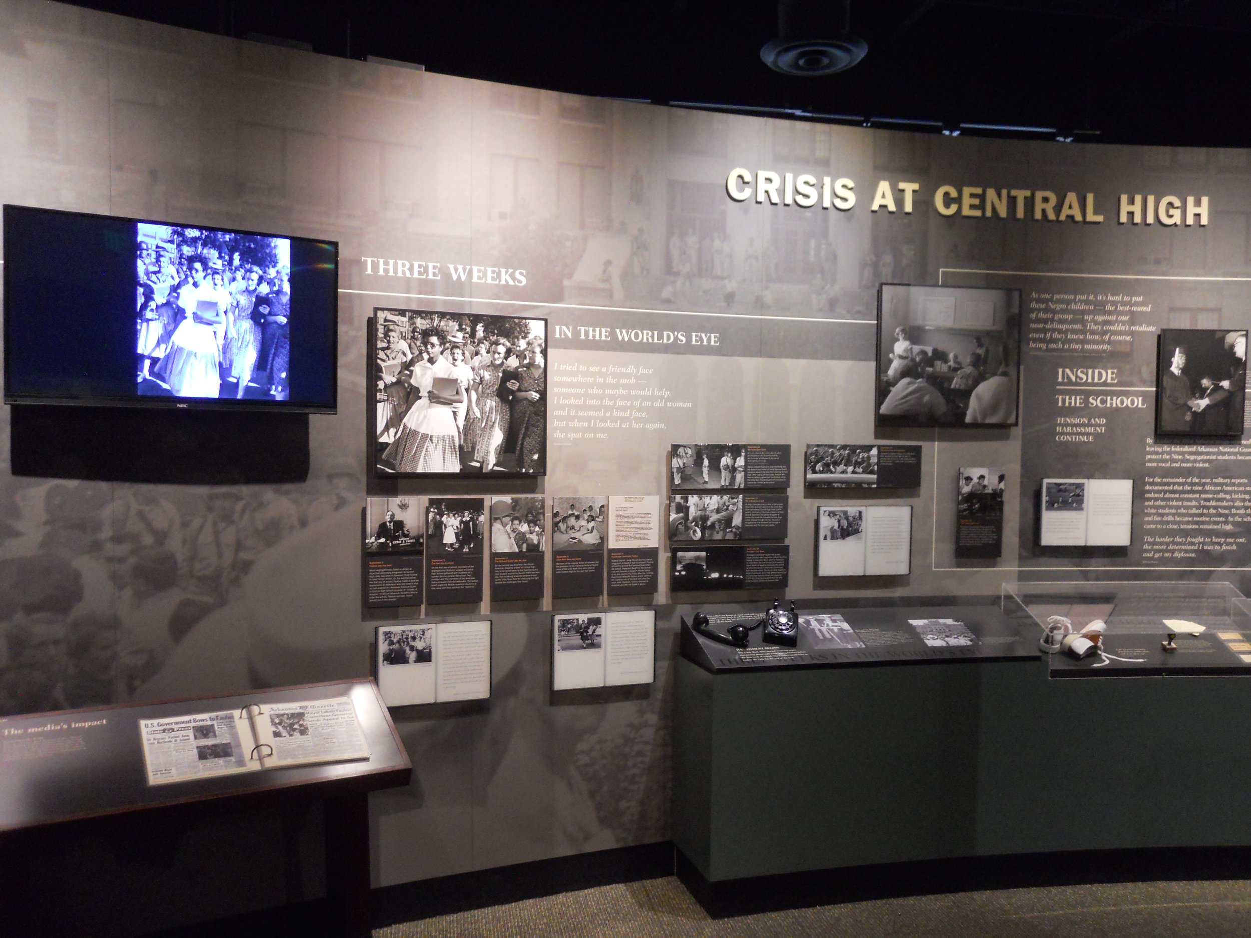
Little Rock Central High School was the focal point of September-1957 when President Eisenhower ordered Federal Troops to protect nine African-American students as they walked to and attended school in the building. The worldwide media attention this event garnered helped the Civil Rights movement. The Little Rock Nine were awarded the Congressional Gold Medal, 40 years after the event. The Visitor Center has excellent audio/visual displays of the events that era (photo). The school, when it was built, was called the biggest and most beautiful high school in the country. One has to see it to understand that viewpoint. The one photo is only a portion of the complex. Most school districts today would wish they could have such a facility.
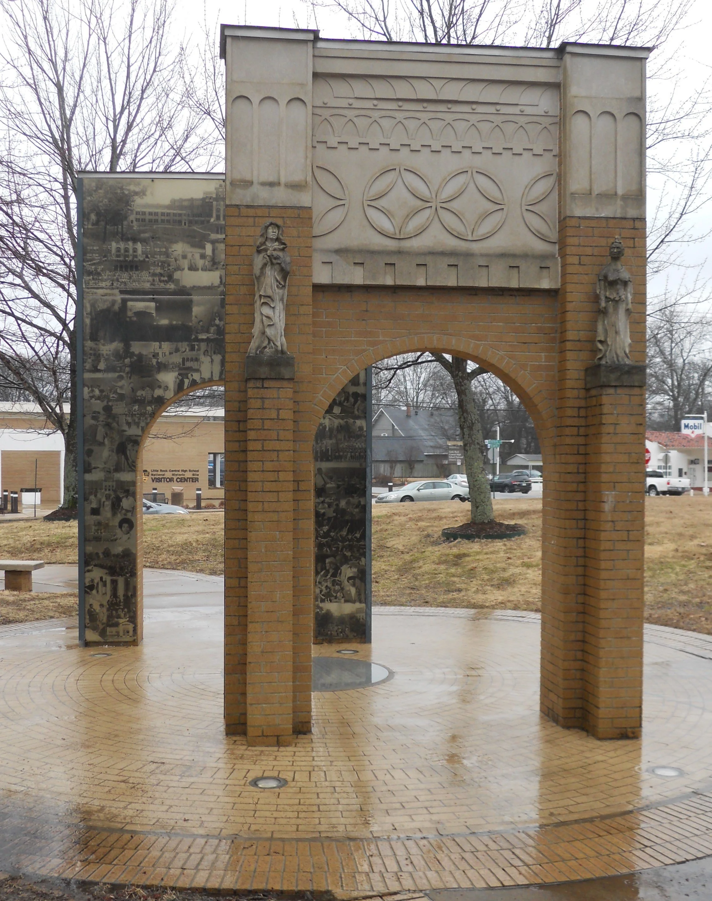
Across the street is a garden, including a two-sectioned monument. Photos of Civil Rights activities are shown on the inner sides of the two gateways.
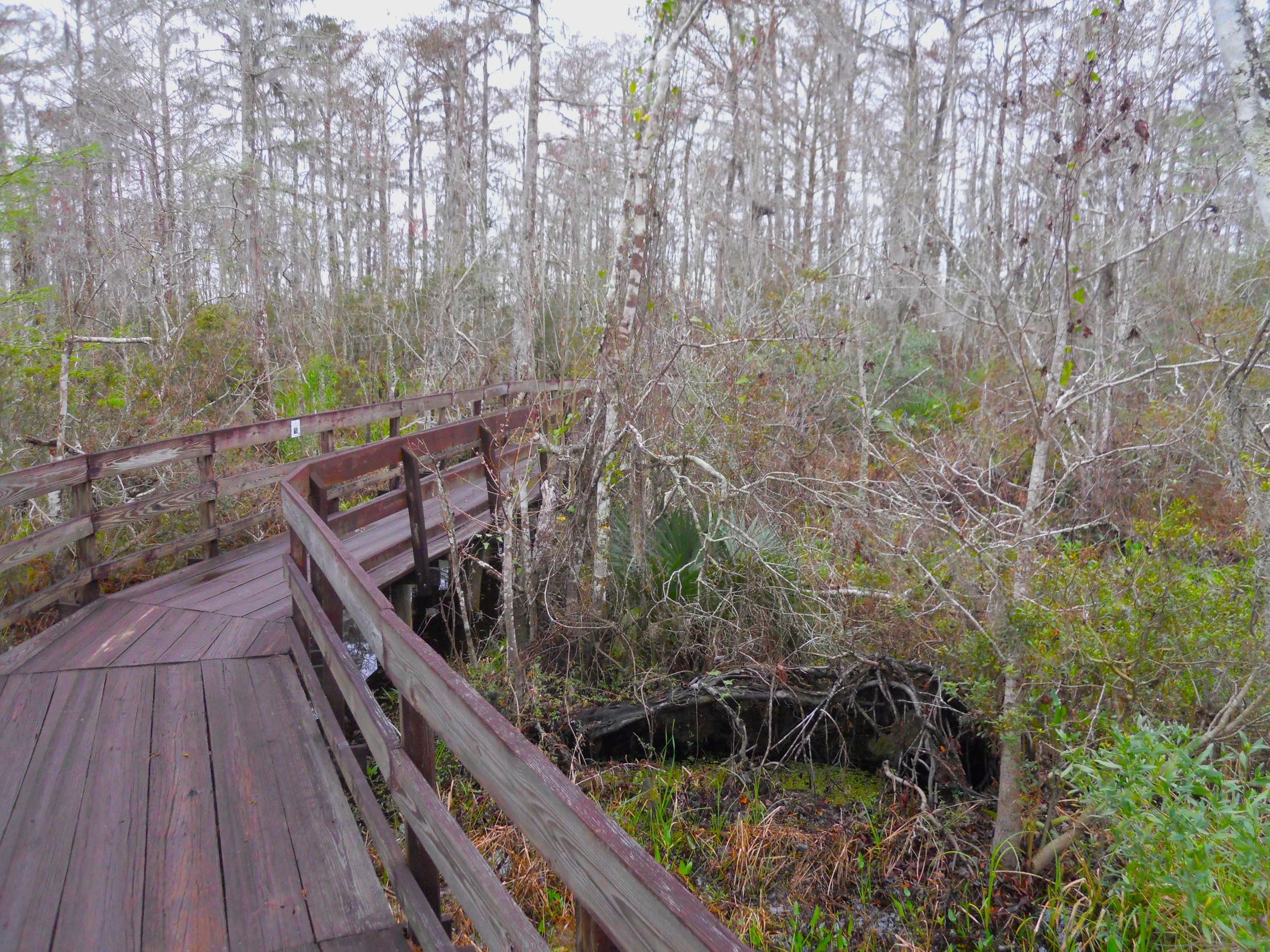
DAY 5 (February 9) - Though I did not see any alligators, I am told there are in the swamp at Barataria. They have probably learned to stay away from the wooden boardwalk.
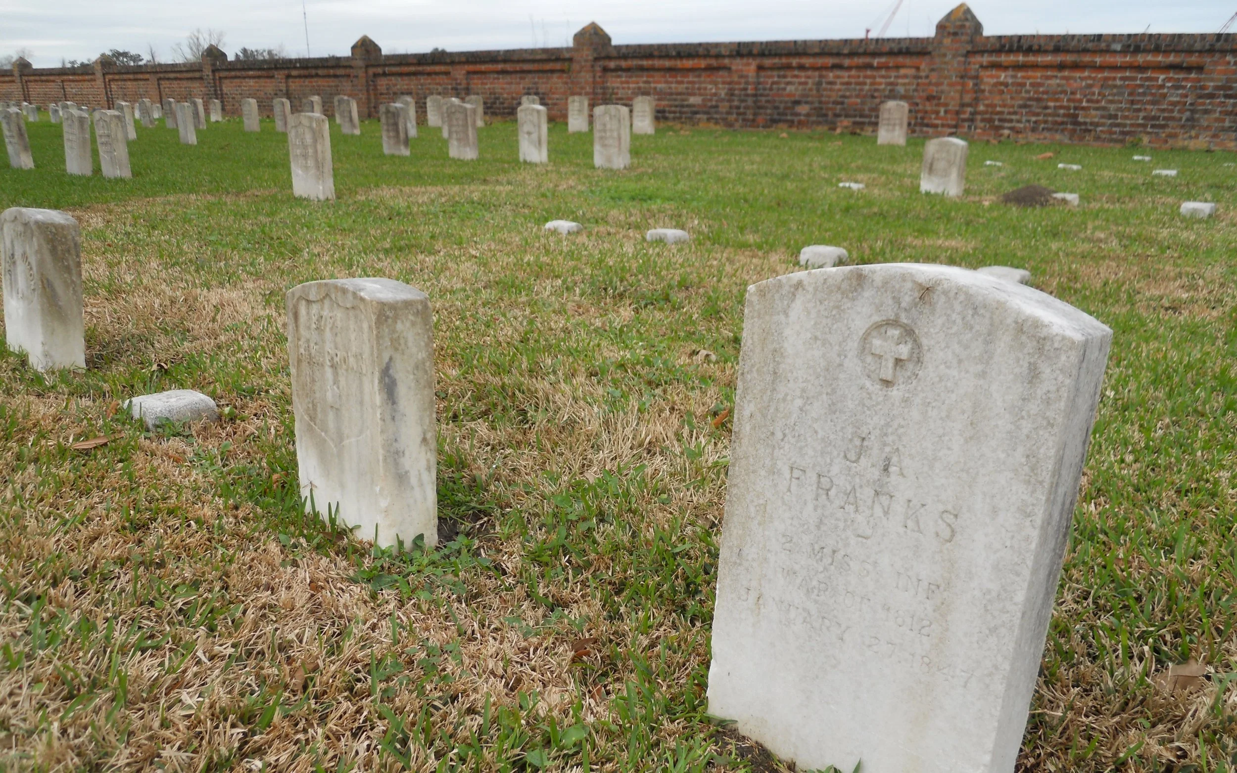
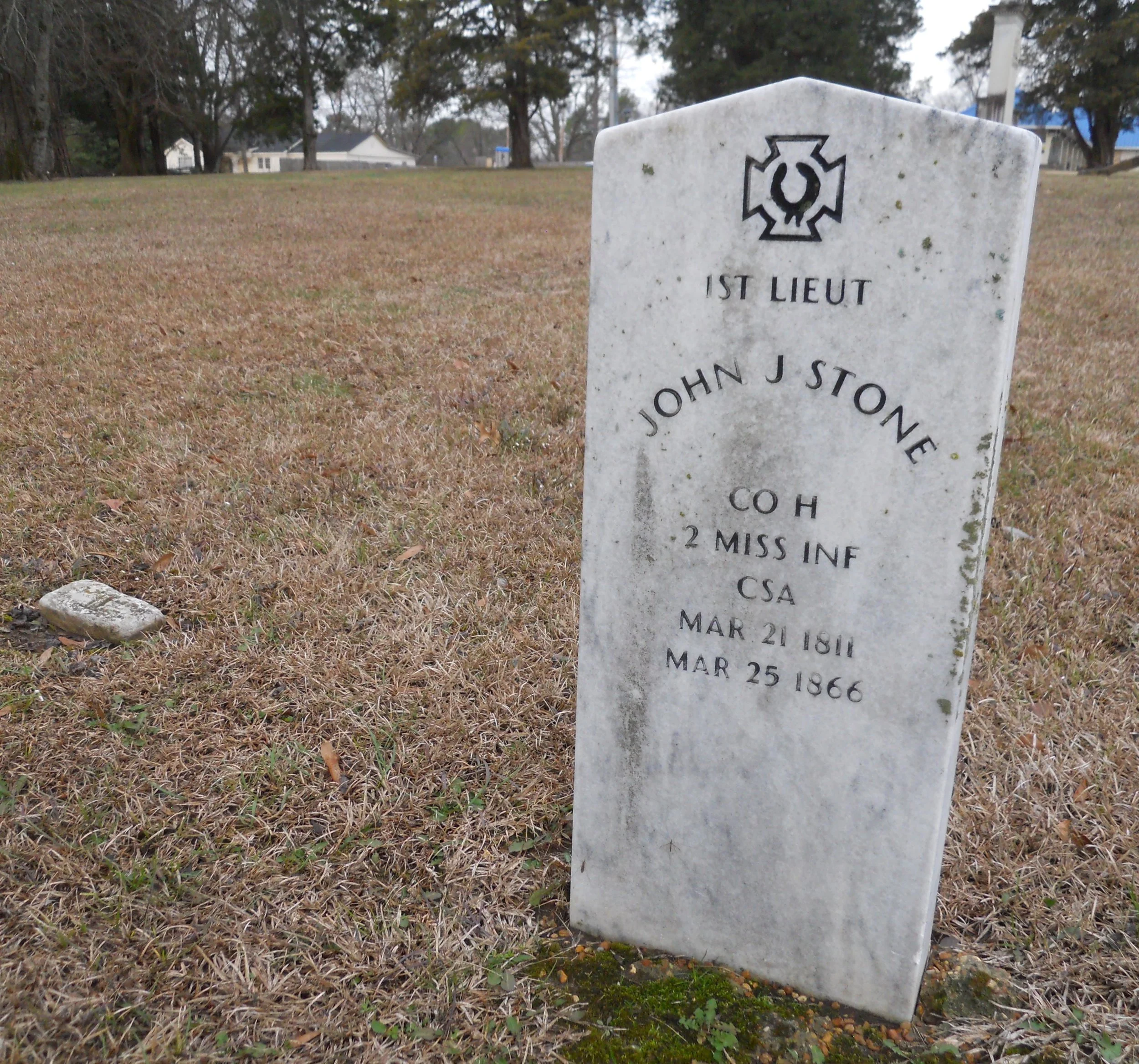
The British should have stayed away from Chalmette. But since they did not, General Jackson gave them a lesson in battlefield tactics. Some cannons are arranged on the American battleline. Four veterans of the War of 1812 are buried in the National Cemetery which is located behind what was the British line. JA Franks of the 2nd Mississippi Infantry (photo) is one who fought for our country.
I did not get any photos for the New Orleans Jazz NHP except for the entrance sign at the city’s Jazz museum. Jazz is considered pure-American. Everyone should take a week’s leave in this great city and tour the night spots.
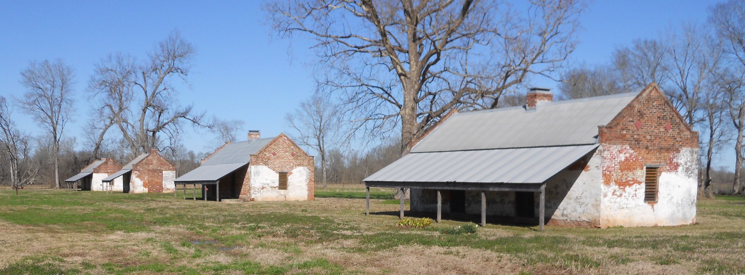
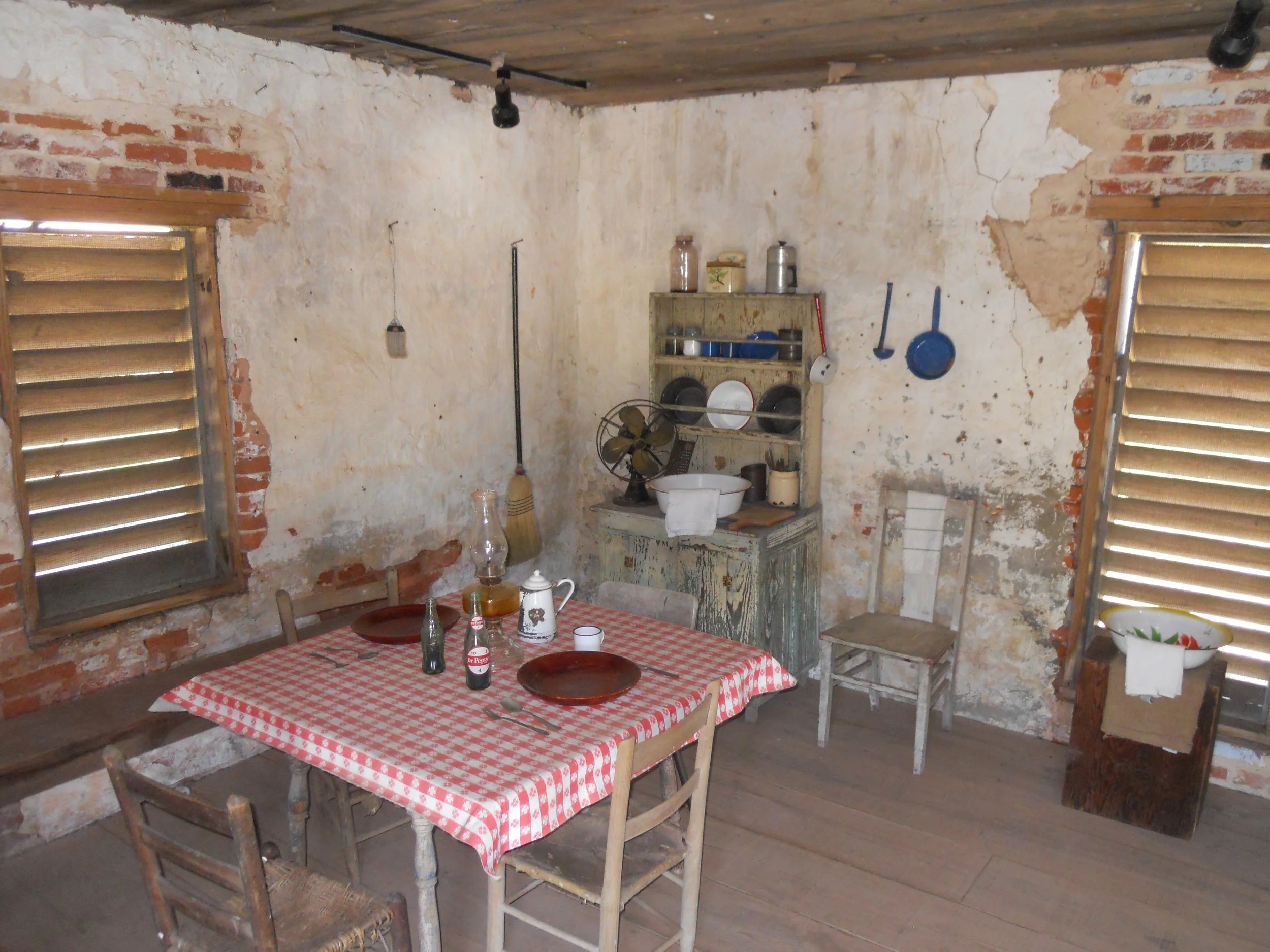
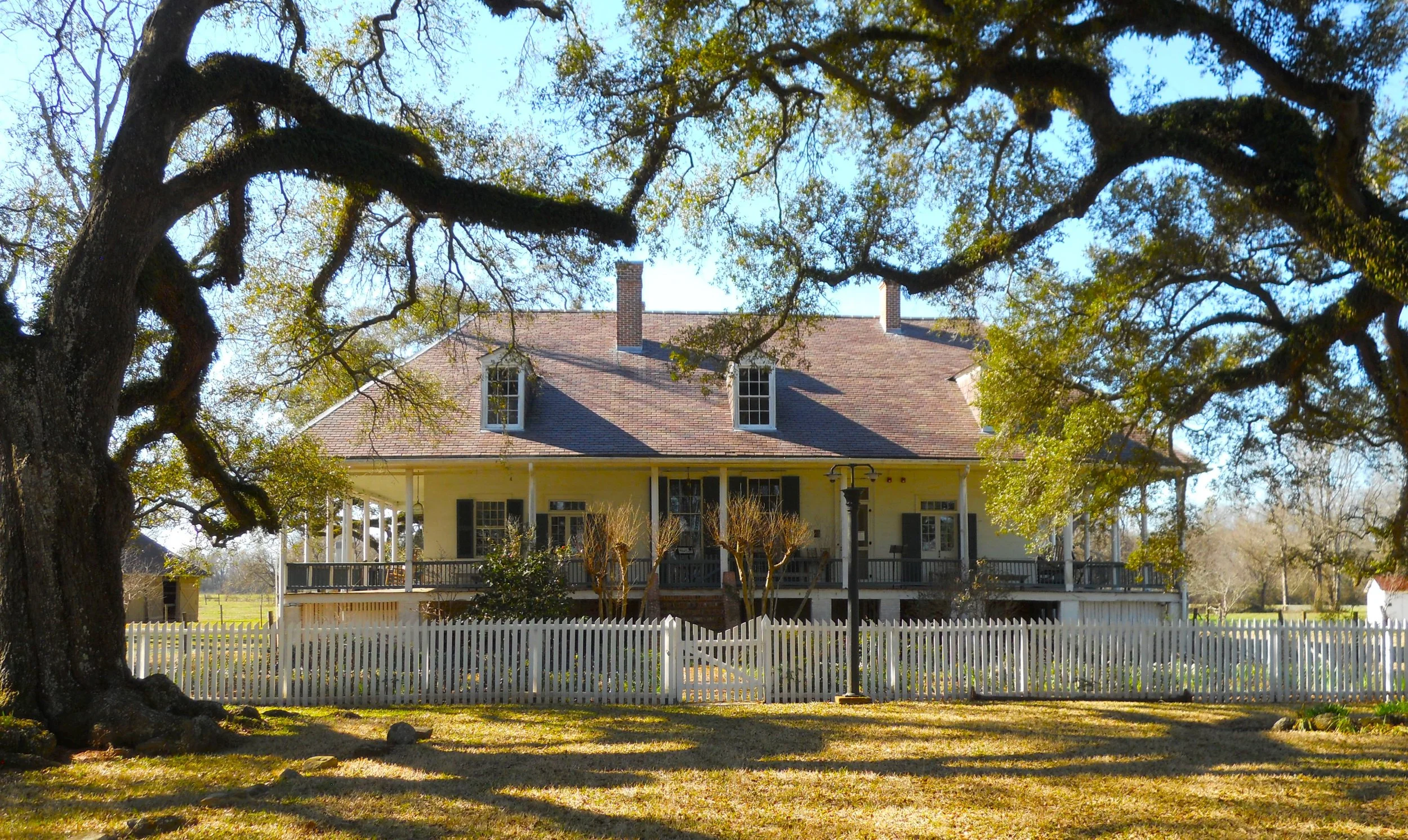
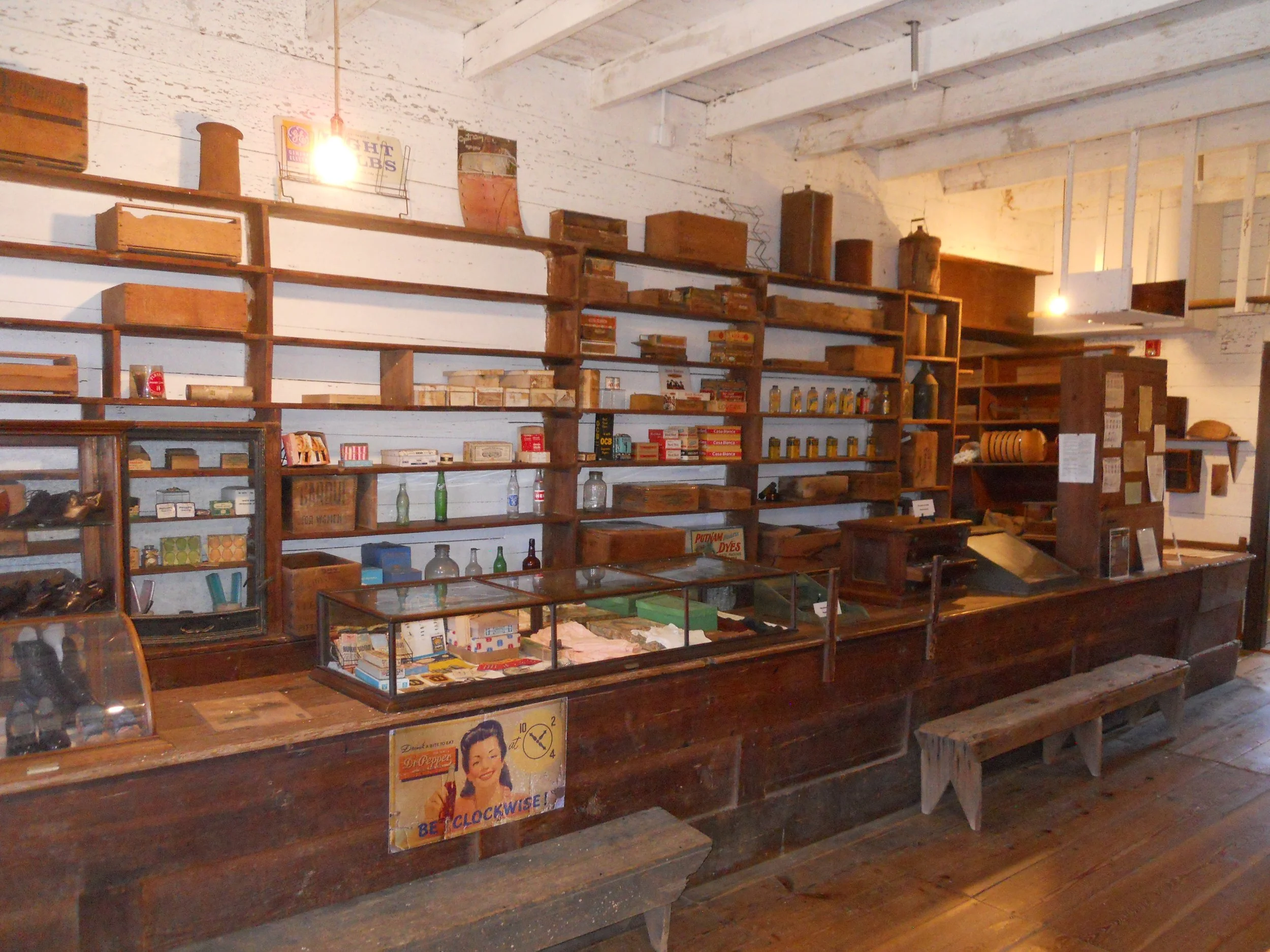
The freed slaves’ quarters at Magnolia Plantation had very few material items, just the necessities. A plantation owner’s home, though, was elegant, as seen at Oakland Plantation. Two rows of oaks formed an “allie” to the home. An estimate is the trees were planted in 1826. The plantation’s store displays goods from 50 years ago which could have been purchased by the people who worked at the plantation.
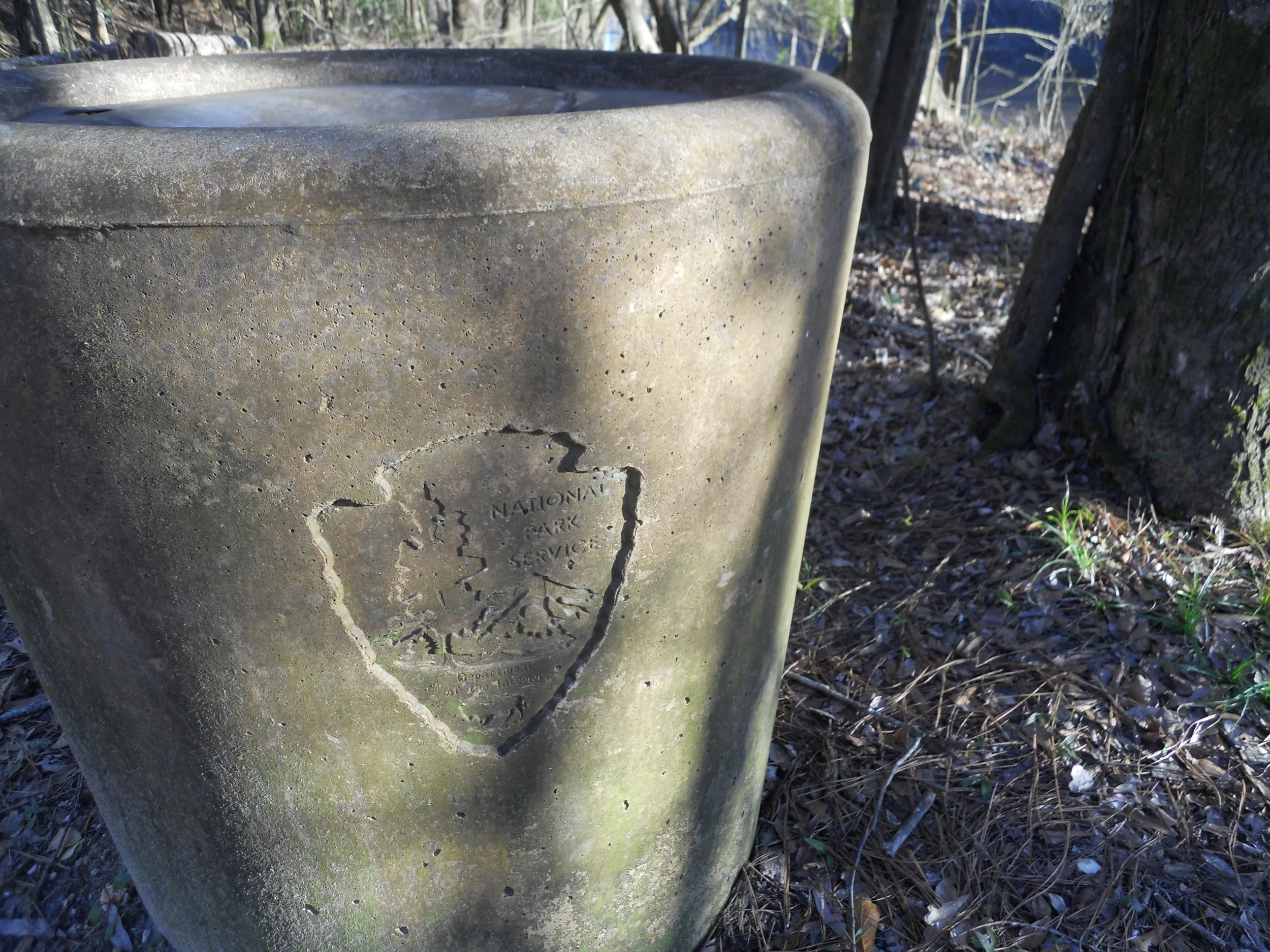
Big Thicket is known for Pitcher Plants and Sundews, along with great hunting areas and water recreation. Well, I saw or did none of those. A concrete waste can was at McQueen’s Landing, so I took a photo of it. The NPS emblem is imprinted on the side. The sole requirement for my Quest is that I step foot in each park. Well, I did that today, with Big Thicket.
DAY 4 (February 8) - As I started on the Tour Road at Vicksburg NMP, I noticed the vibrant blue sign of a Motel 6 behind a line of battlefield trees. Ah, yes… commercialization which approaches many of our National Parks. Just ask the rangers at Manassas NBP about this struggle.
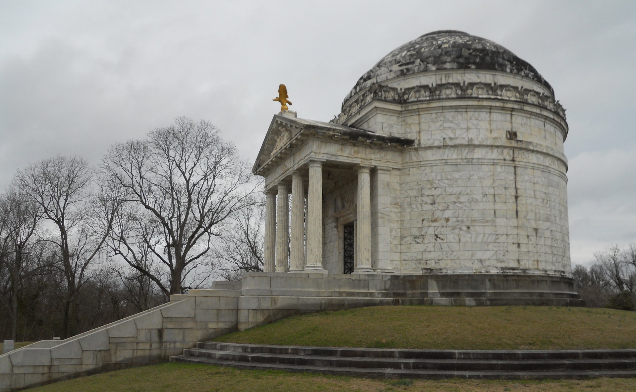
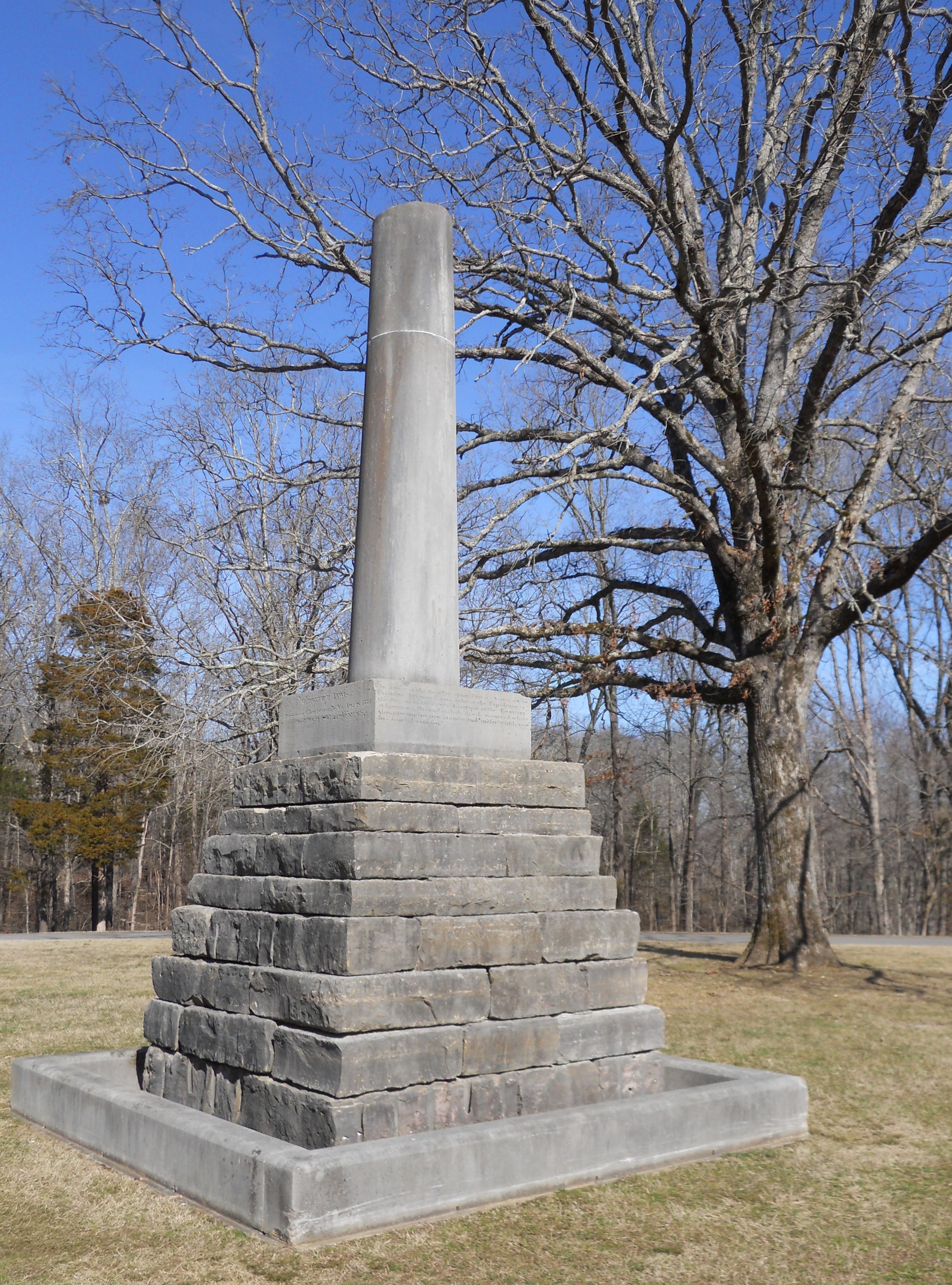
The large monument is for the State of Illinois. None of the other 1,300 markers in the park come close to its size.
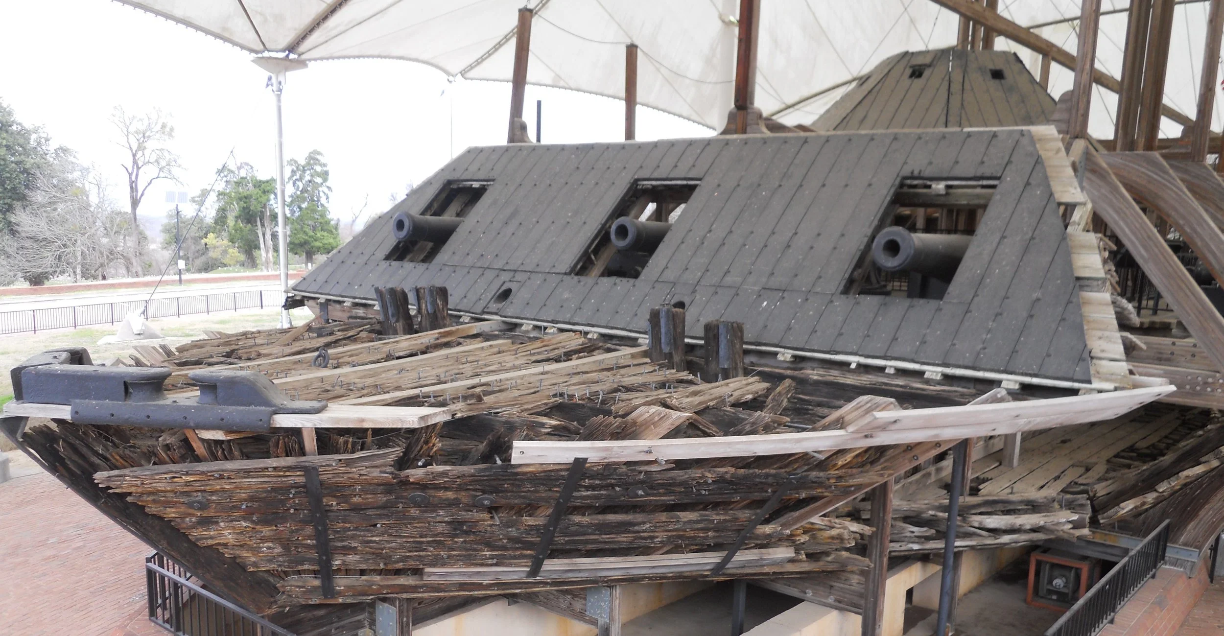
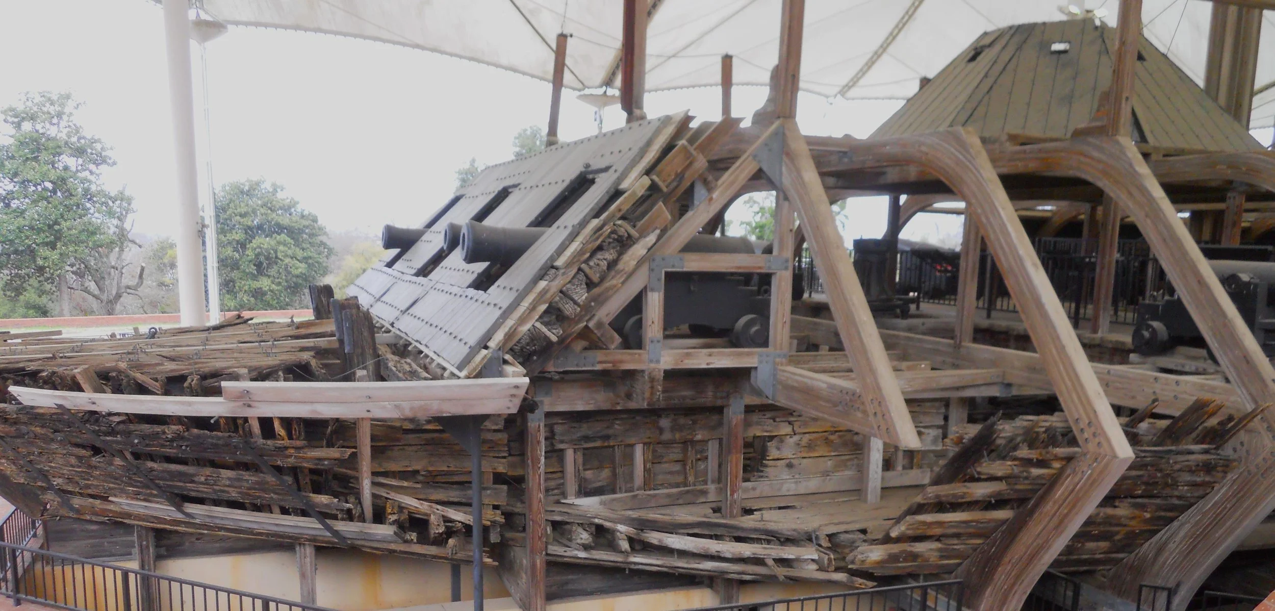
The two photos of the U.S.S. Cairo only provide a glimpse of this relic. The bottom photo is where the Confederate torpedo ripped through the hull (bottom-center in image).
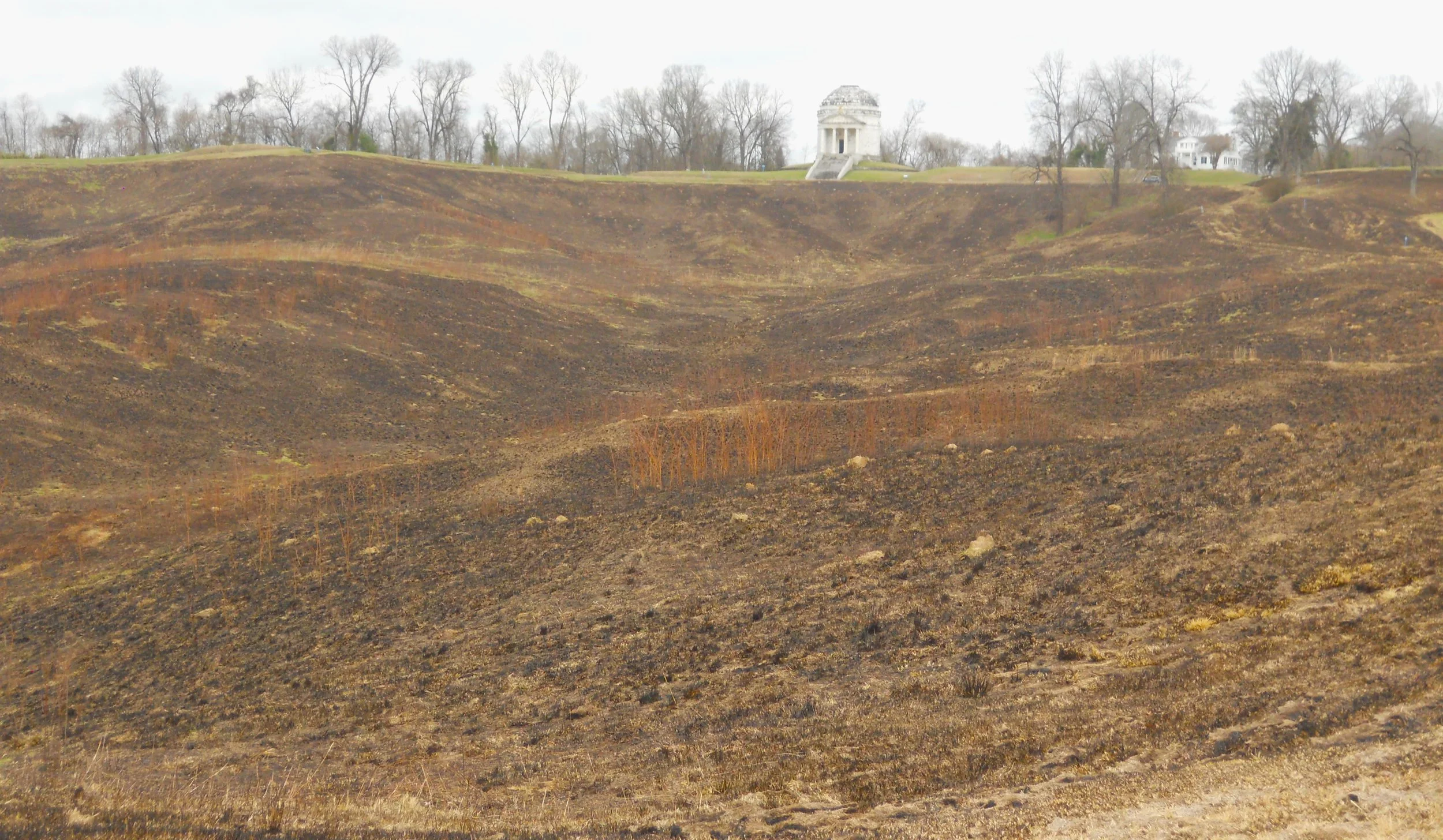
The one image is of the land between the Union lines and the Confederate fortifications. Nothing is able to grow here, after 150+ years. The Illinois monument is on the top of the ridge. The landscape seems Martian. Try to imagine what it was like for the first couple of weeks when General Grant gave orders to charge through this area and up against the Rebels’ redoubts and redans. With devastating defeats, the Union backed off to hunker down for a 47-day siege which finally forced the city’s defenders to surrender.
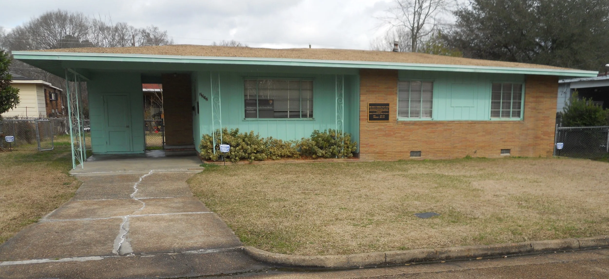
Medgar and Mrylie Evers home sits quietly on its street, looking the same as it did the night when Medgar was murdered in 1963. Thirty-one years later the culprit, Byron De La Beckwith, Jr., was retried (based on new evidence) and found guilty, to spend the rest of his life in prison. Two previous trials with all-white jurors resulted in hung juries. Medgar was a prominent Civil Rights leader.
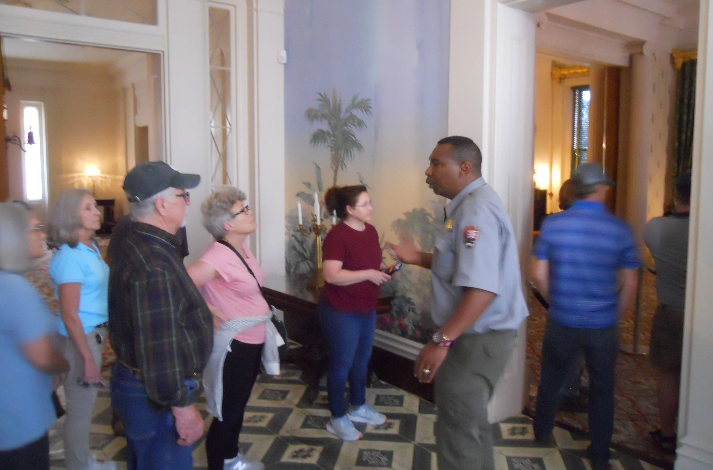
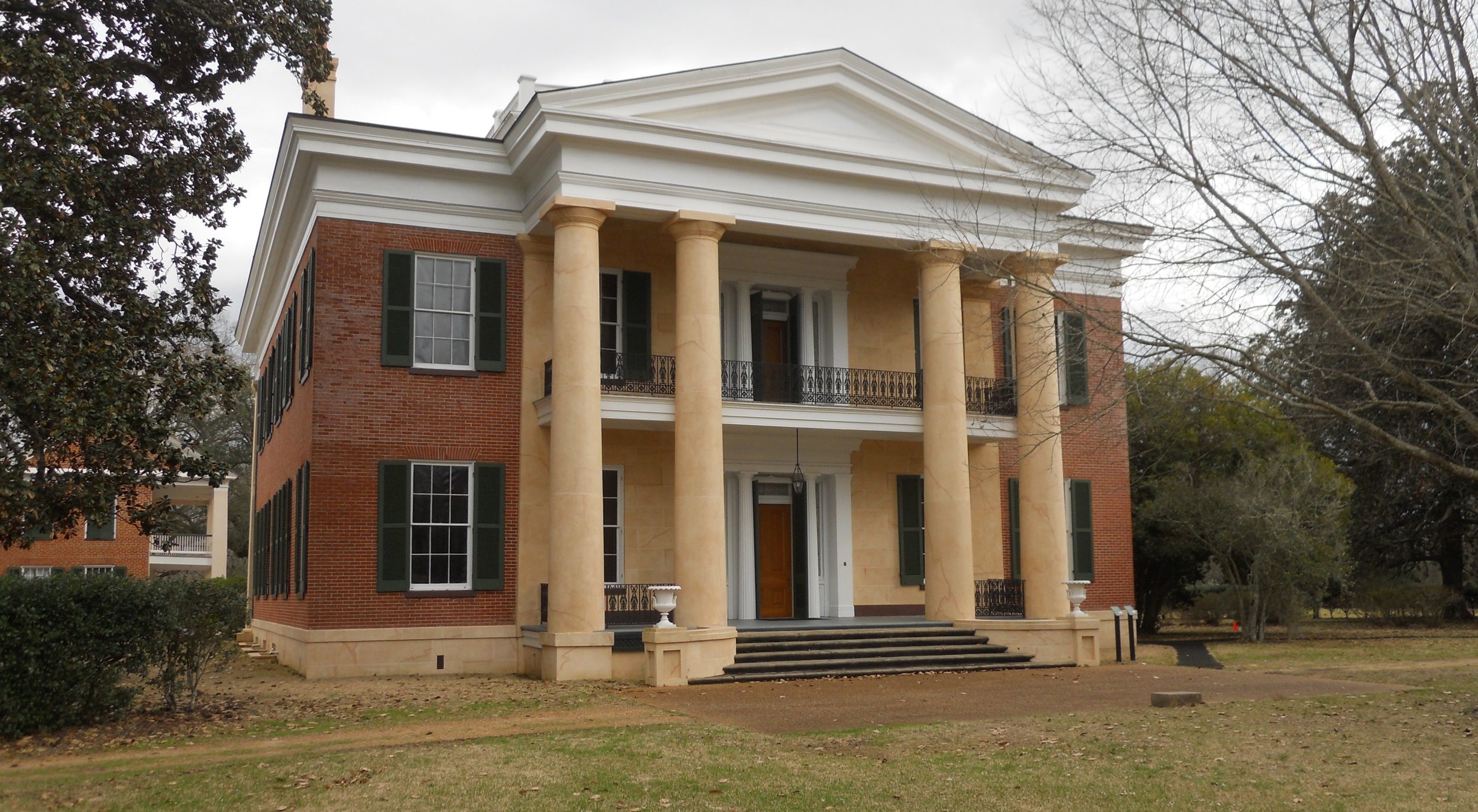
Melrose Mansion in Natchez NHP is the definition of opulence. And having Ranger Barney (in photo) provide the storytelling was a bonus. His descriptions made us feel like John McMurran and his family were right there, to be seen, living their lives in the 15,000 square-foot home. The McMurrans had 13 years to enjoy Melrose (no expense was spared) with their enormous wealth. But when the Civil War cut off shipping of cotton and sugar from the South, McMurran went bankrupt. Thankfully, the home was deeded to the NPS about 125 years later, so future generations can enjoy going back in time, even if just for a couple of hours.
DAY 3 (February 7) - On July 14/15, 1864, The Union’s 16th Army Corps of 14,000 men strong, fought the advances of General Forrest’s Confederate Cavalry units at Tupelo. The Confederates could not break the Union lines. The Union troops were sent to battle to ensure the Confederate Cavalry could not raid the supply lines of General Sherman. Sherman was preparing for his march on Atlanta and to the sea.
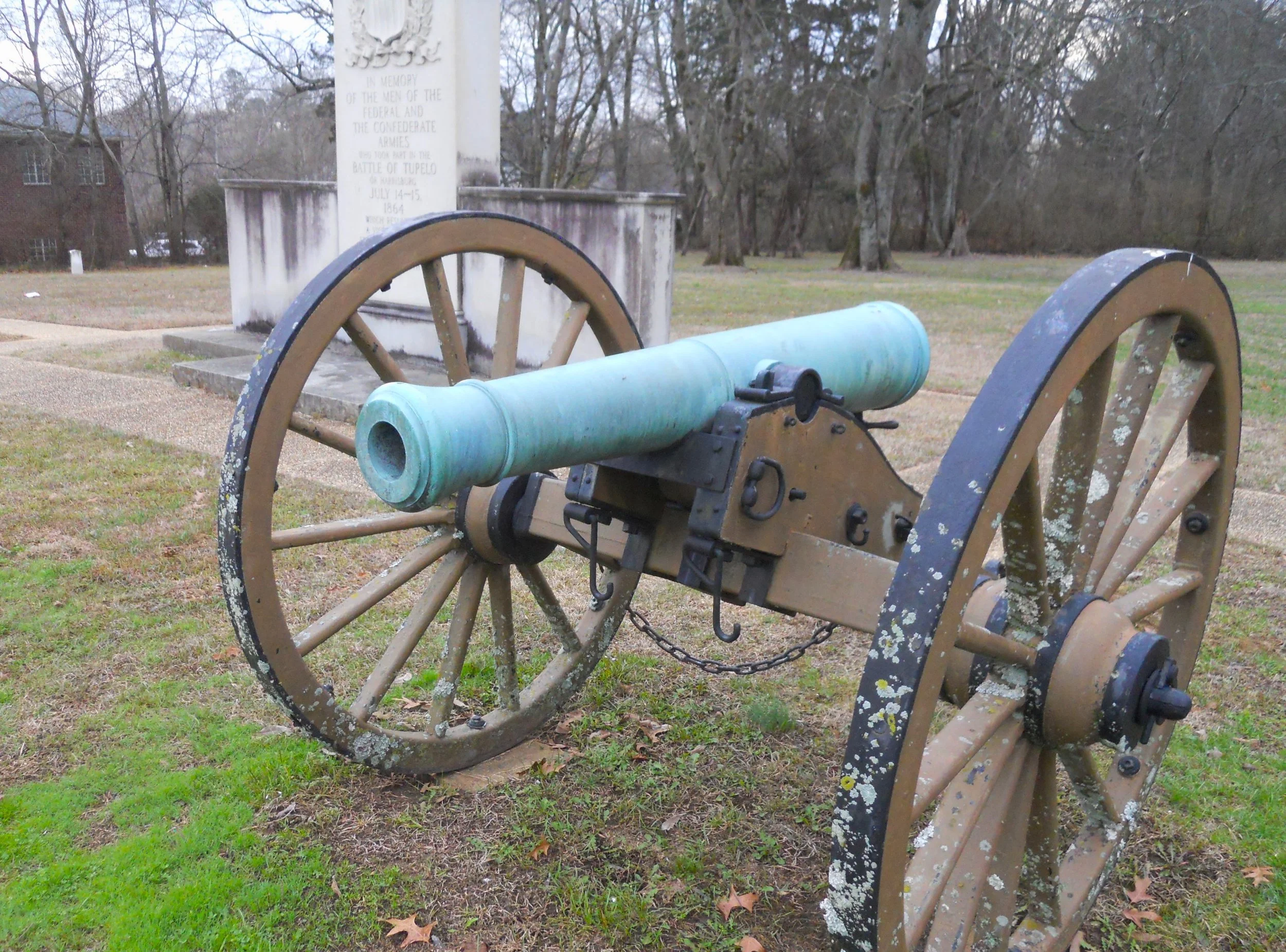
If you plan to visit the battlefield, please note there is only a small plot of land in downtown Tupelo to commemorate the event, since after the battle people began to rebuild across the city. Two cannon, a granite marker, and a couple of headstones can be viewed.
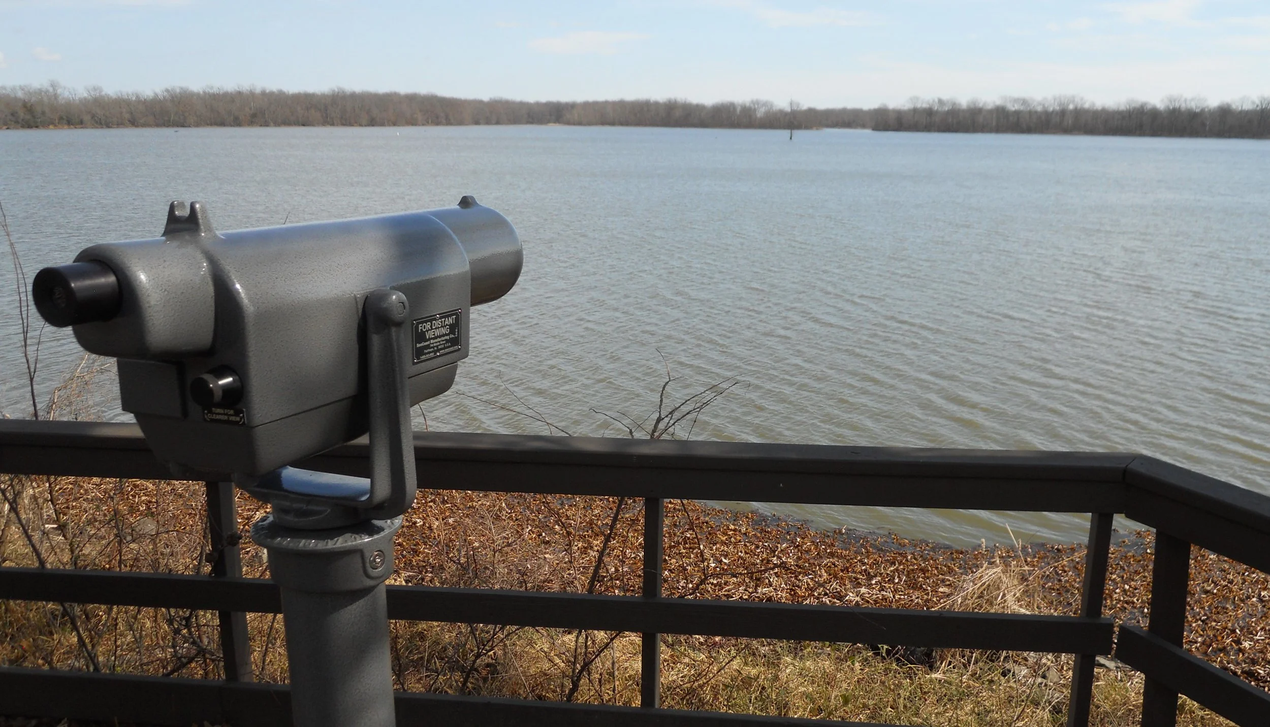
Arkansas Post NMem is like other memorials in the National Park System (think DeSoto in Florida); you cannot step foot on the actual land which is being memorialized unless you are outfitted with SCUBA gear. The photo with the field glass shows the area of the original Fort Hindman, 300 yards out in the middle of the Arkansas River. This mighty river has shifted course considerably since 1863 when Grant’s gunboats sailed against the Confederate defenders.
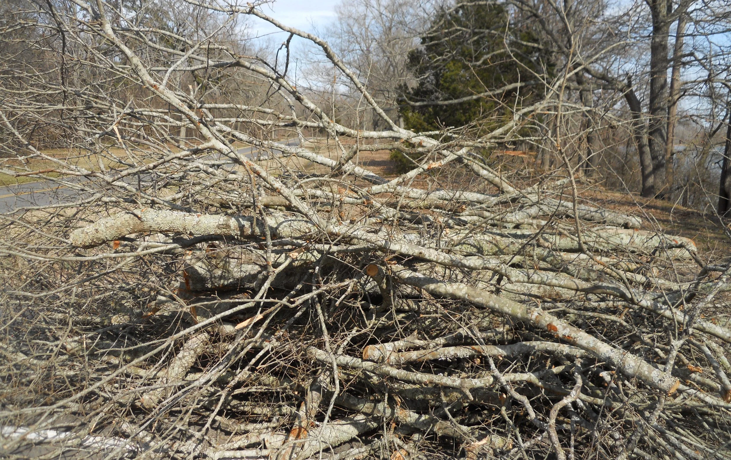
But the site was developed in 1686 by French explorers. Over the decades the French, Spanish, and English converged at this point for trade. Replica flags of those countries from that time period are raised each morning outside the Visitor Center. Today, a sign on the VC said all park trails were closed due to weather damage. Piles of branches and sawed logs were throughout the park.
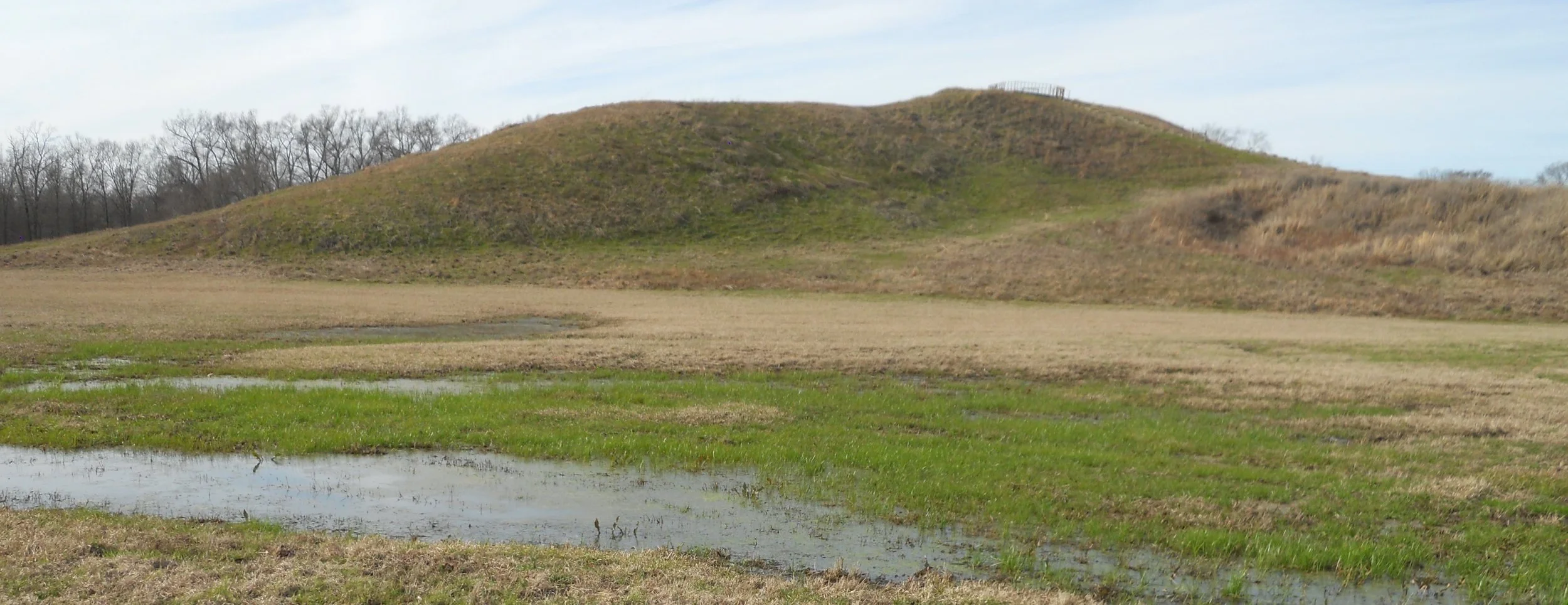
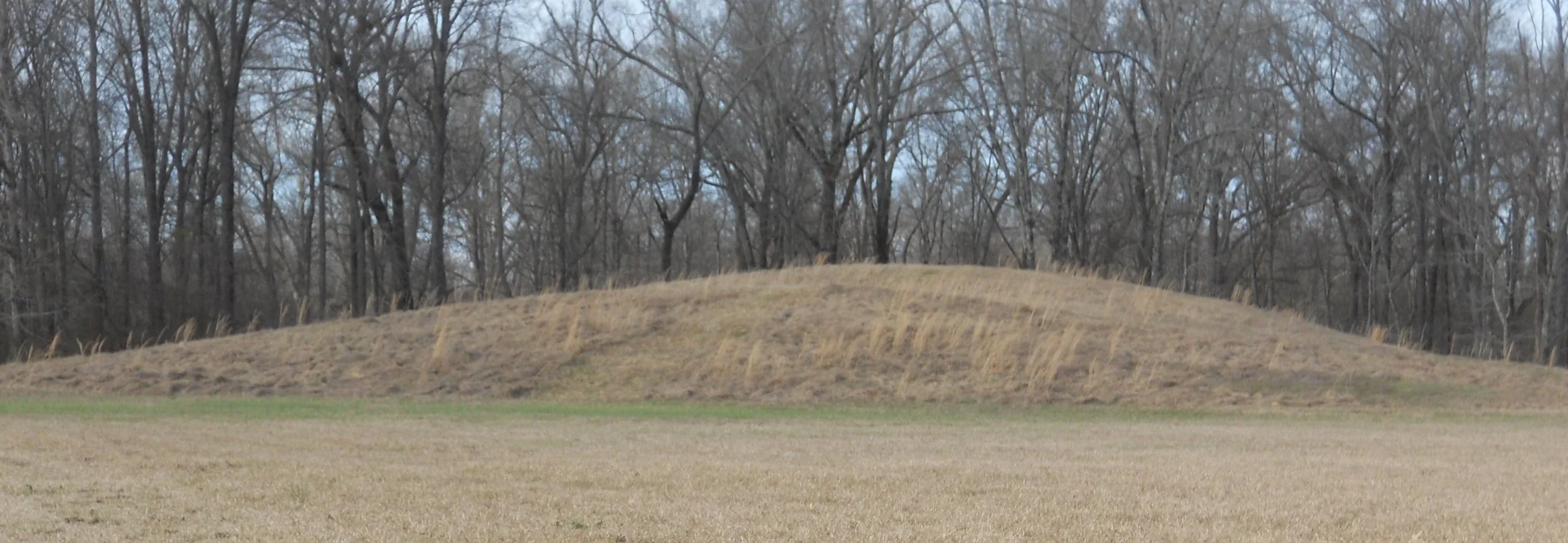
Poverty Point has multiple designations. For the NPS, it is a National Monument. It is also a Louisiana State Park, and a UNESCO World Heritage Site. This area was the largest “city” in the land. A trade network reached hundreds of miles in all directions, even into what is today Upper Michigan. And all this was around 1700 B.C. That is right, during the pharaonic time period (that means during the time when Pharaohs ruled Egypt… 3200 B.C. to 330 B.C.). There are five mounds and six semi-circular earth rings placed along a large expanse of land which was near waterway. The largest mound, “A” Mound (see top photo) was the largest constructed mound in the continent for 2,000 years, until the Cahokia Mounds in Illinois were built. Mounds A, B (photo), and E align perfectly North-to-South. Another example of ancient peoples being able to understand the Earth’s and stars’ alignments.
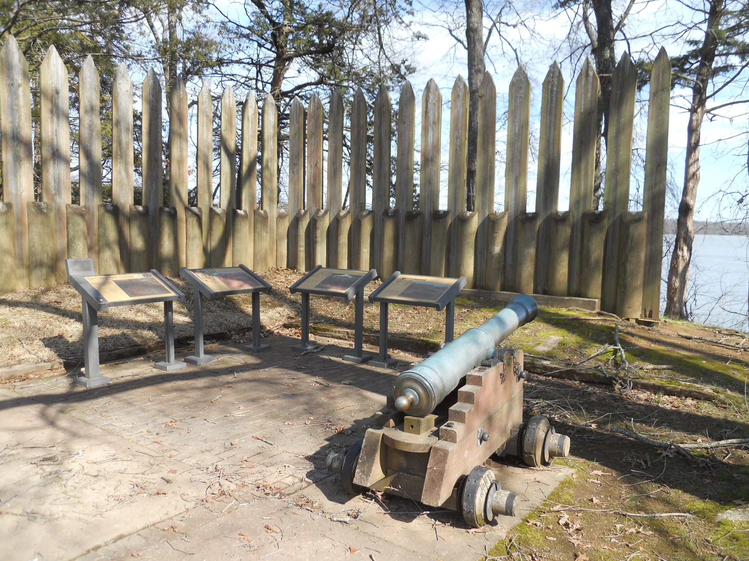
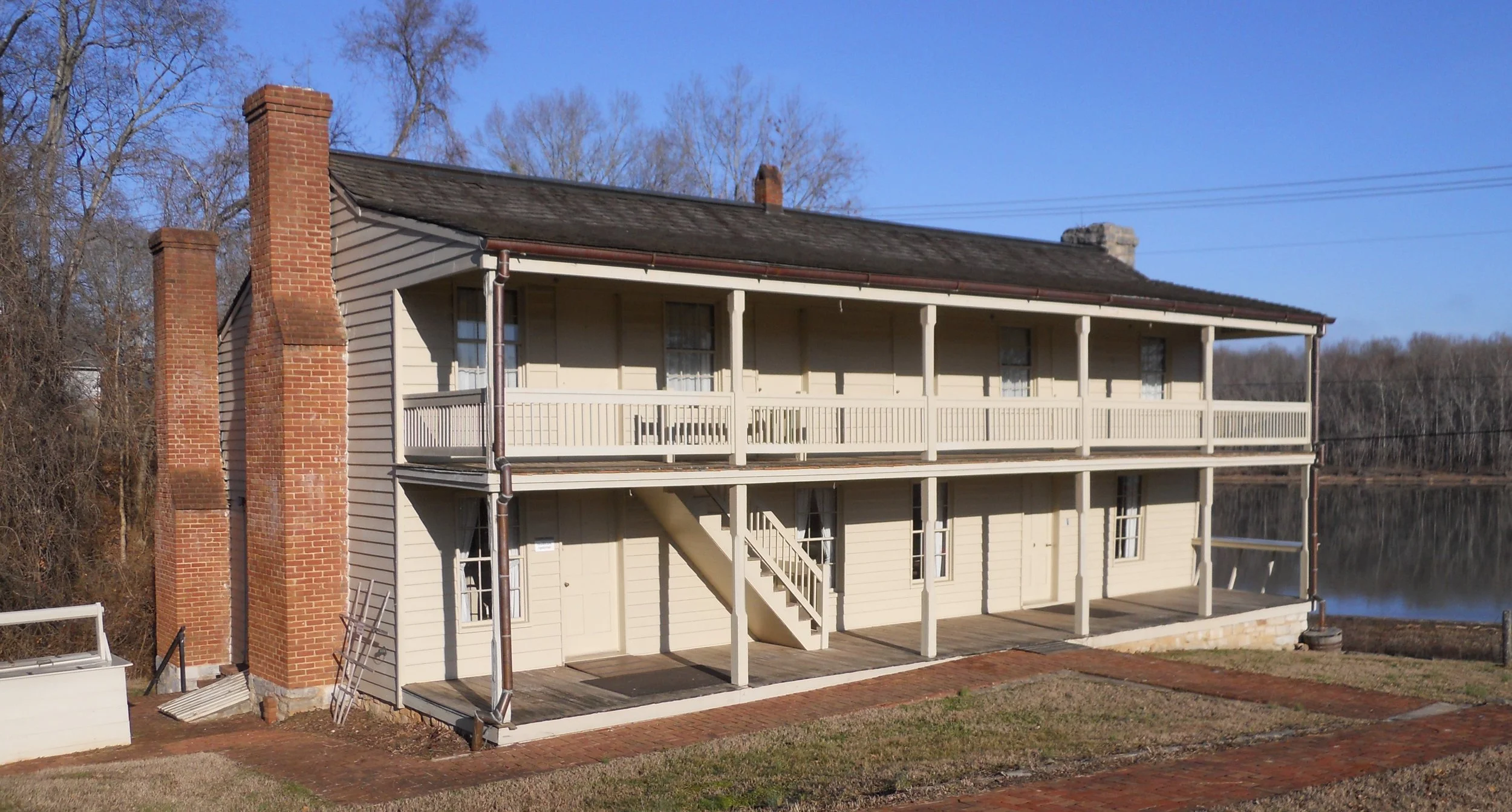
DAY 2 (February 6) - If Civil War History classes in high schools do not study the battle at Fort Donelson, they should. General Grants’ victory paved the way to winning the western front for the Union. The Dover Hotel, where Grant accepted the surrender, looks as new as the day it was built.
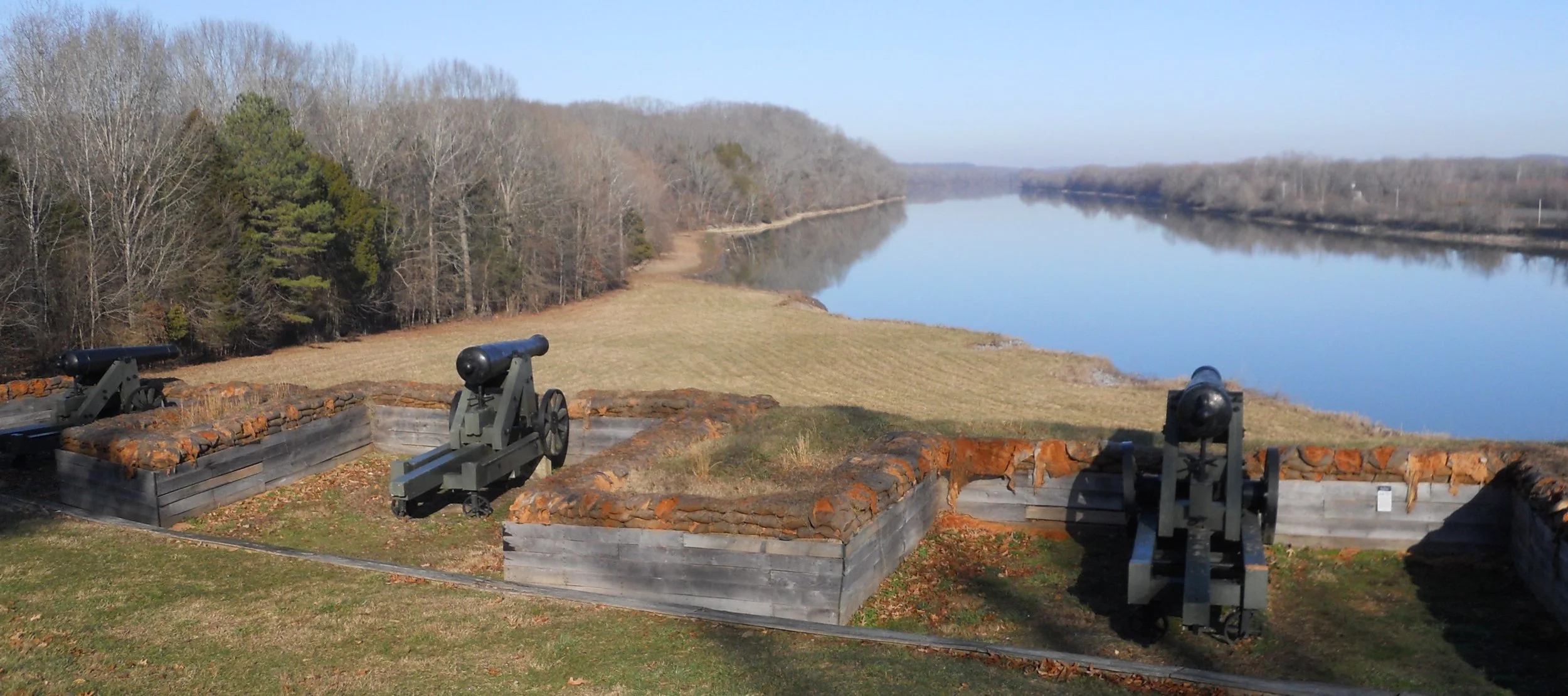
The Confederates had the “high ground”, looking down on the Cumberland River. The ironclads which the Union sailed upriver were no match for the cannon and rifle shot from the fort.
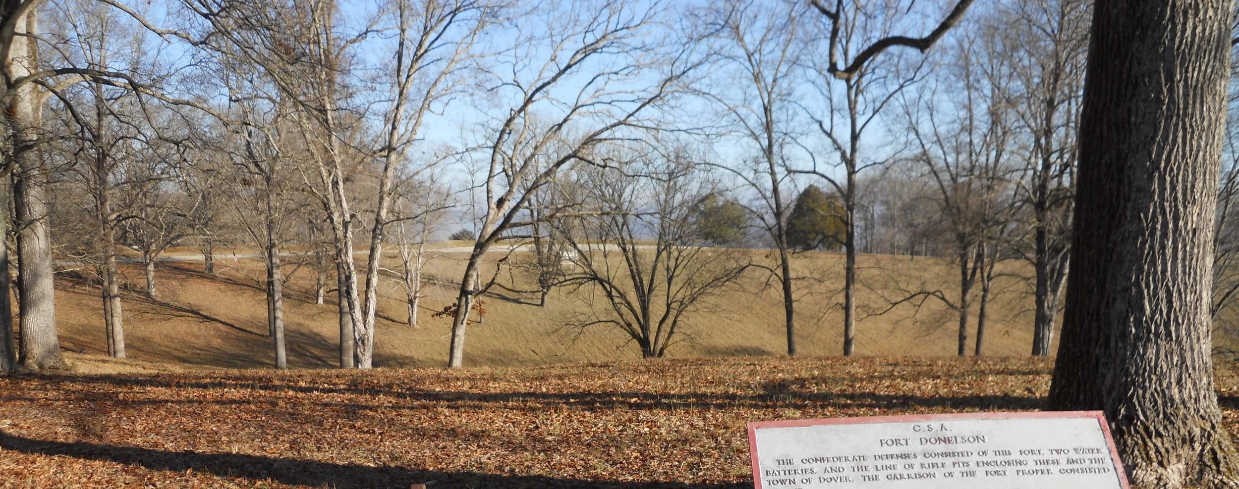
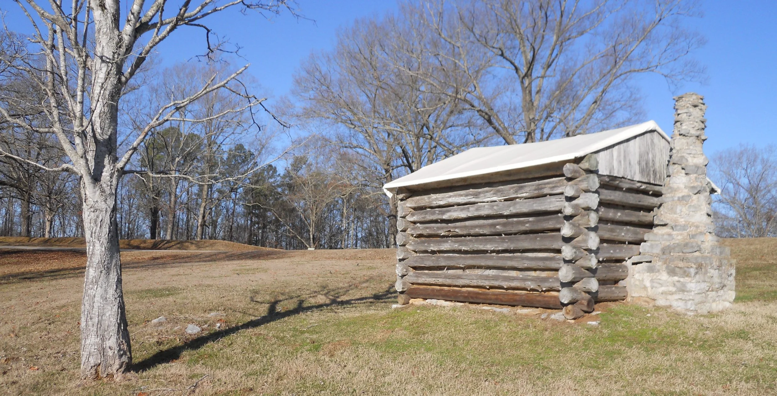
The one photo tries to show the “bowl” in which the Confederate forces called home at the fort. It is extremely sunken, protected by tall sides of earth. The soldiers lived in cabins such as the one shown in the photo. One can see this cabin in the center of the larger photo, maybe helping to grasp the size of this “crater”.
The young ranger at the Visitor Center said she and the rest of the staff will be curious to follow my trek. She intends to visit as many of the NPS units as she can.
Merriweather Lewis of Lewis and Clark fame was murdered (October 11, 1809) on the Natchez Trace. The path of the Trace is the National Scenic Trail. One can see a replica of the building where Lewis had stopped during his travels,, as well as the monument which now stands over his remains. The sections of the Trace which are accessible look unchanged (photo) since those early times.
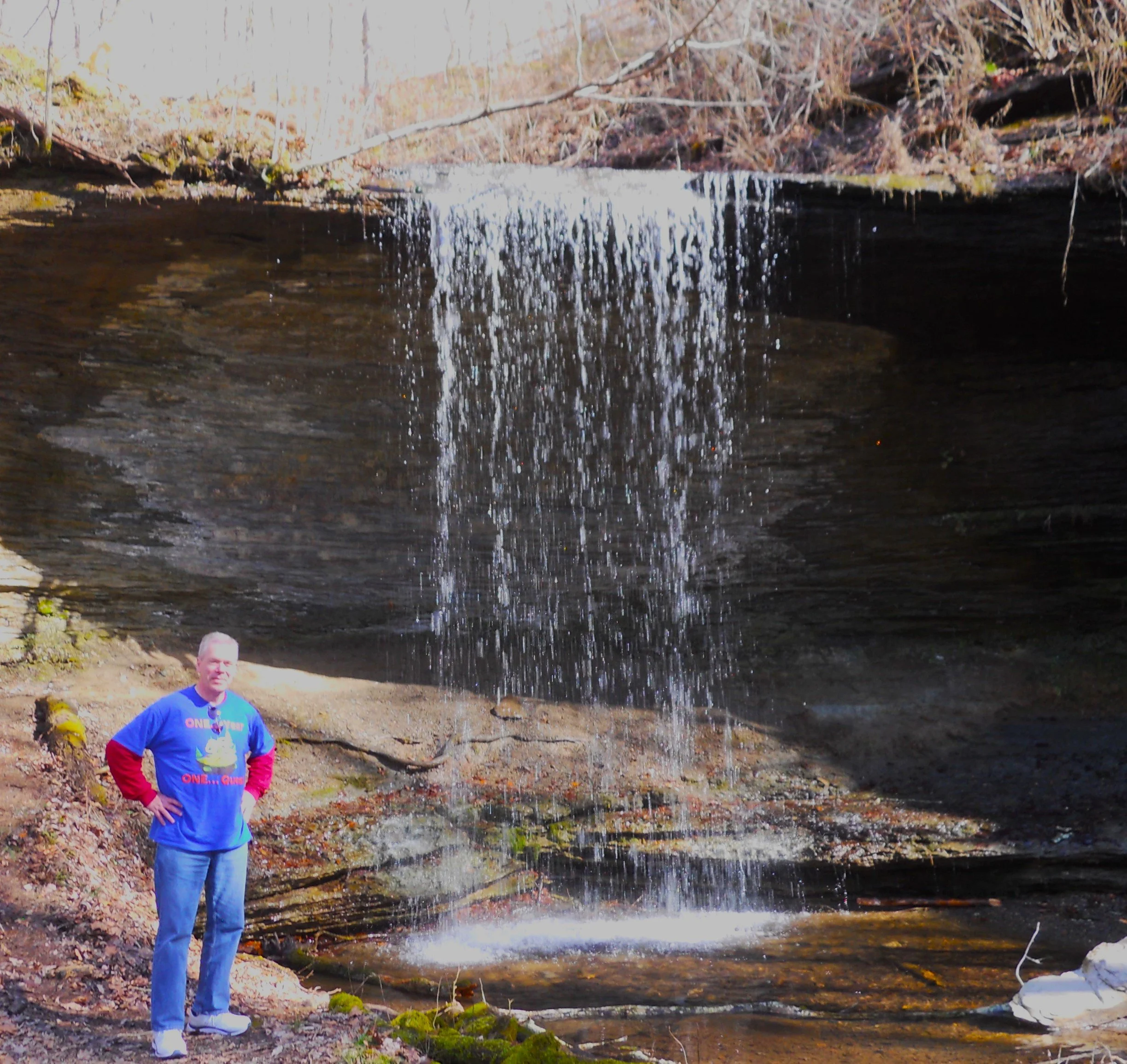
A bit north of this spot are two wonderful waterfalls. Donnie and Beverly, who live near the Parkway, graciously introduced me to Jackson Falls and Fall Hollow (Donnie took the picture of me at Fall Hollow). They concur these are gems which every visitor should hike to. Jackson Falls is a 2-section wonder, with the upper portion on a 30-degree gradient, while the bottom portion is the traditional 90-degree “watch out below” type.
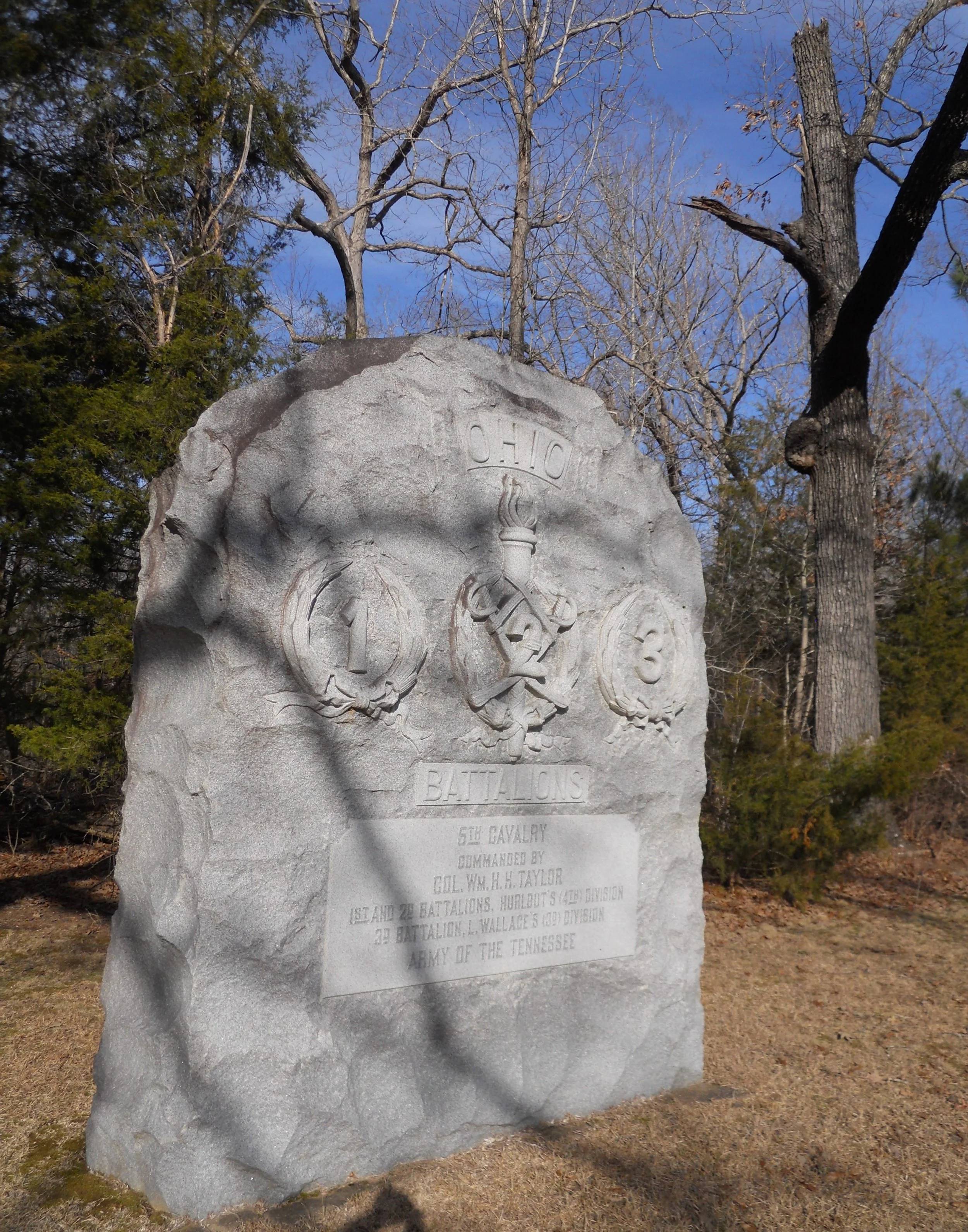
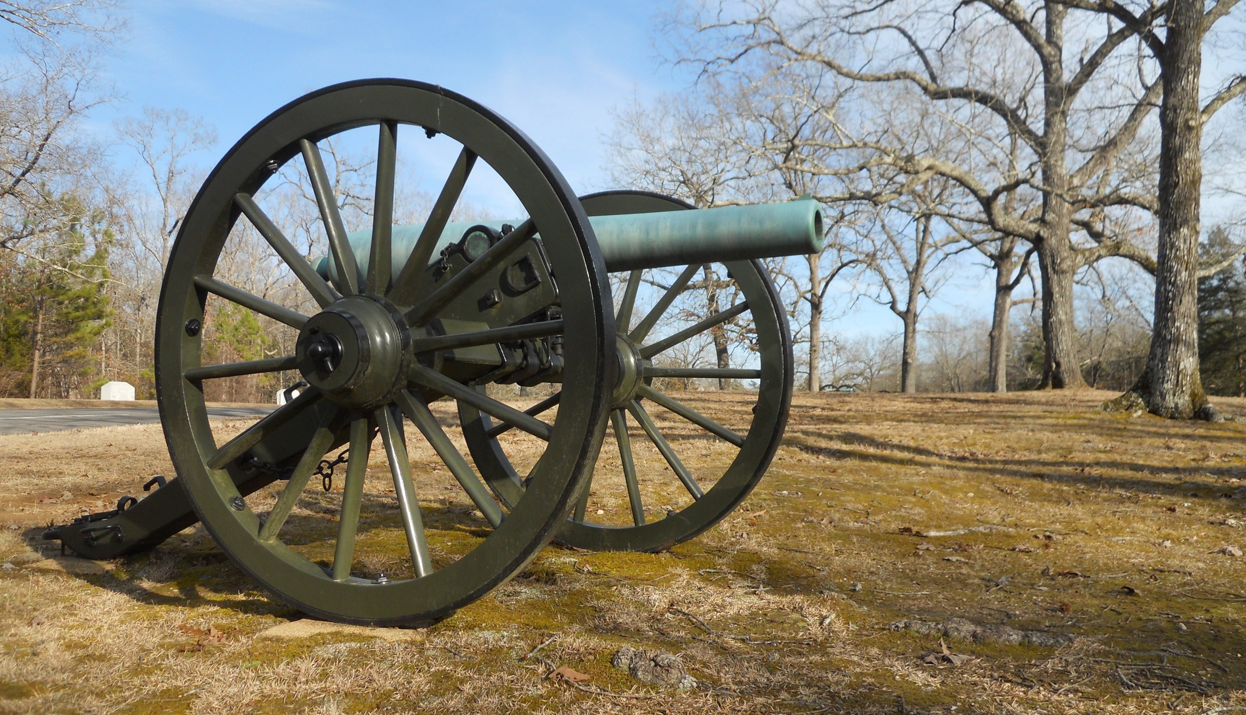
Shiloh NMP has hundreds of markers and monuments. One style which is seen across the park has the white base with stacked cannon balls. Each one identifies the spot of a specific unit and its commander. The white marker is for three Battalions of the 5th Cavalry from Ohio. And if you like to see cannon, this place will keep you entranced.
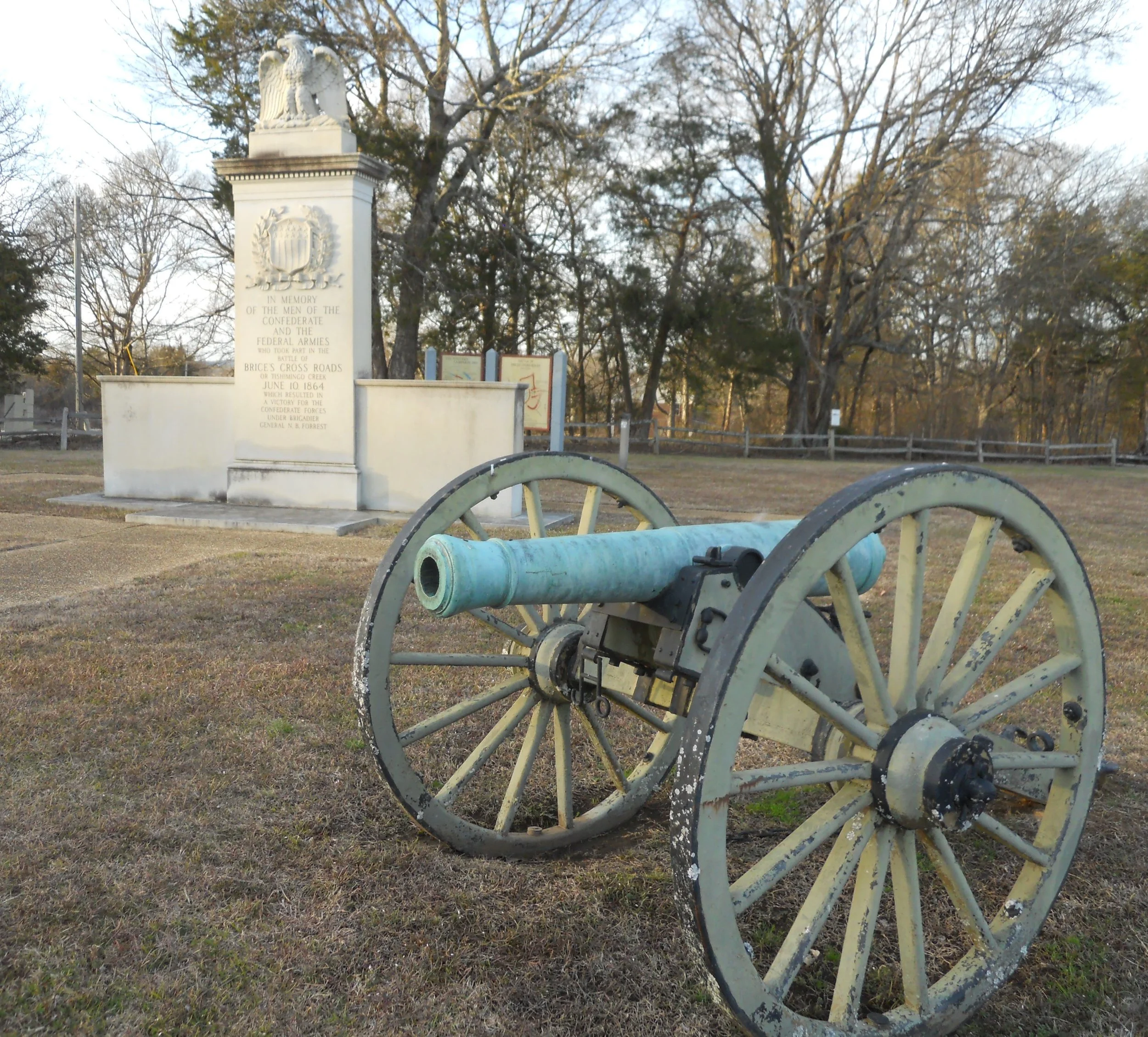
Brices Cross Roads was a Confederate victory in 1864, as the American Civil War was nearing its end. The victory secured supply lines between Nashville and Chattanooga which extended the war, but the joy was short lived. The Union soon came smashing across the South. The only items to see at the crossroads are seen in the one photo (there is one more cannon just outside the picture). There are markers along route 370 and other roads, detailing the movements of the two armies.
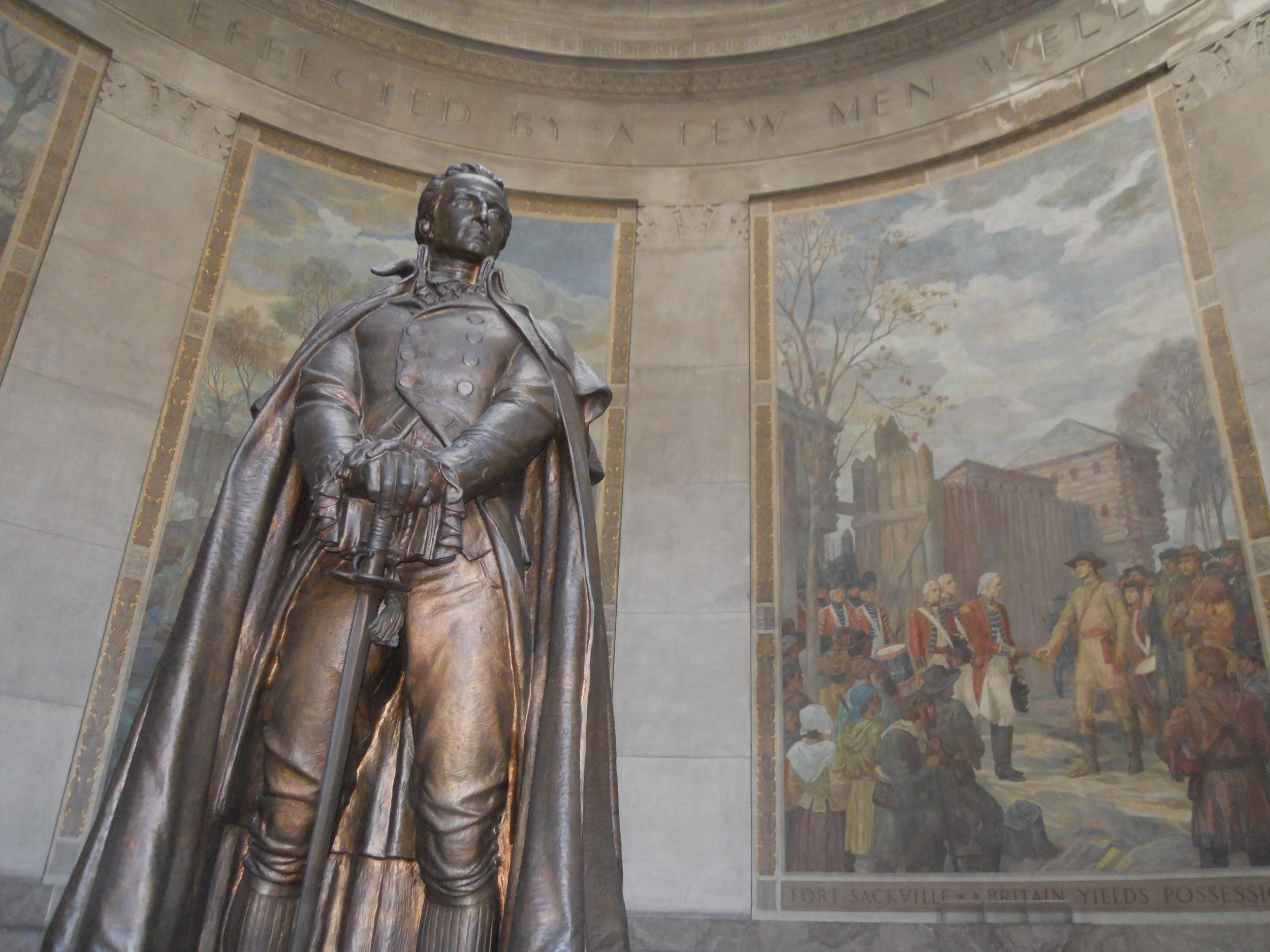
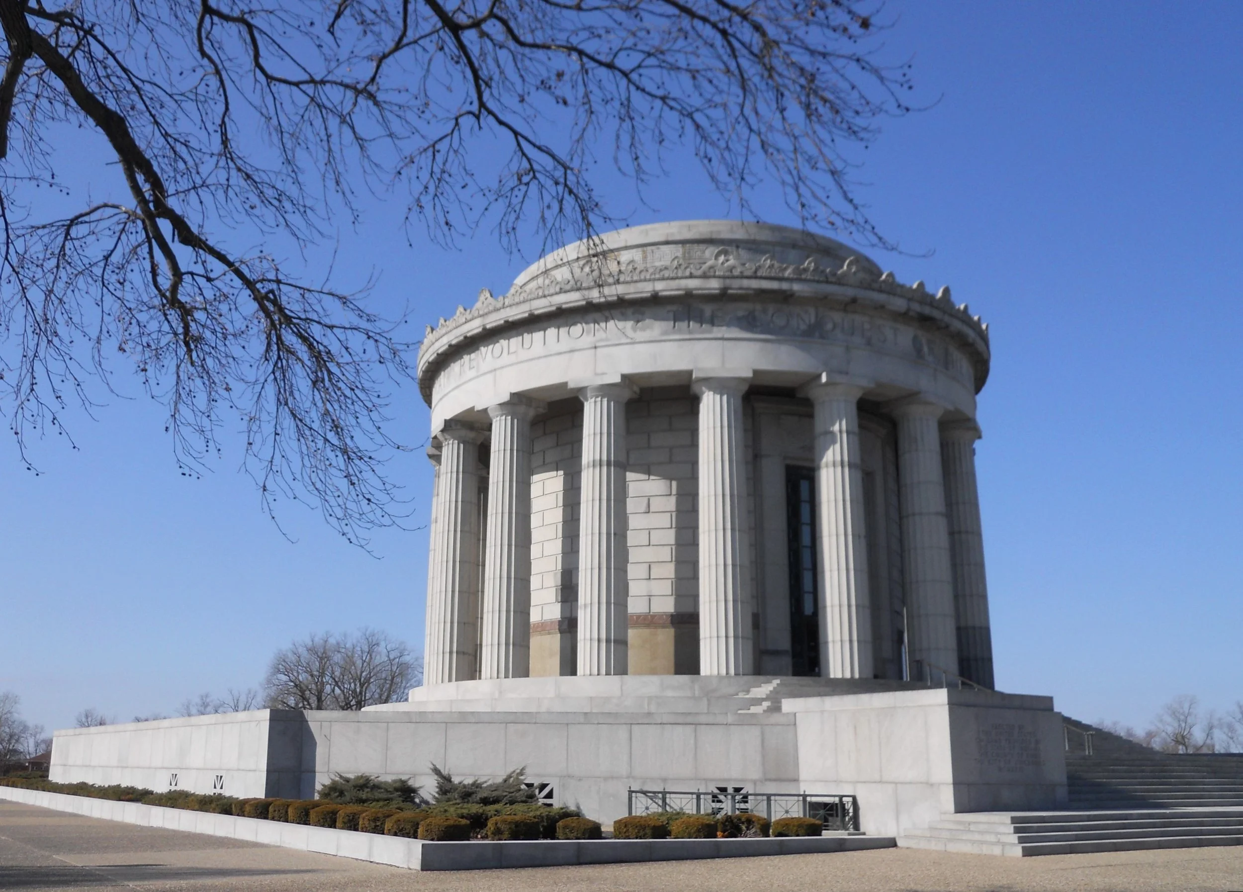
DAY 1 (February 5) - Not too many vehicles on the road being a Sunday and 5 AM in the morning. Seven hours later I was at George Rogers Clark NHP in Vincennes, IN. The ranger was about ready to go to lunch but asked if I wanted to see the inside of the monument. “Yes, of course,” I replied. This is the highlight of visiting this park. The exterior of the memorial makes one think of the more well known Thomas Jefferson Memorial in D.C. In fact, the architect who designed the Jefferson Memorial lost the bid to do the Clark Memorial, 10 years earlier. The interior also looks like the Jefferson pose. Oh yeah, the Clark Memorial came first. There are multiple “murals” around the perimeter, a pictorial of Clark’s engagement in the war. They are paintings on canvass, done off-sight, then transported and applied to the walls.
Without Clark’s victory at Fort Sackville (an outpost of the English army during the Revolutionary War), there might not have been any Louisiana Purchase in 1803. He and his men marched through the dead of winter, across flooded fields, nearly freezing to death. This is a feat due recognition in the history books.
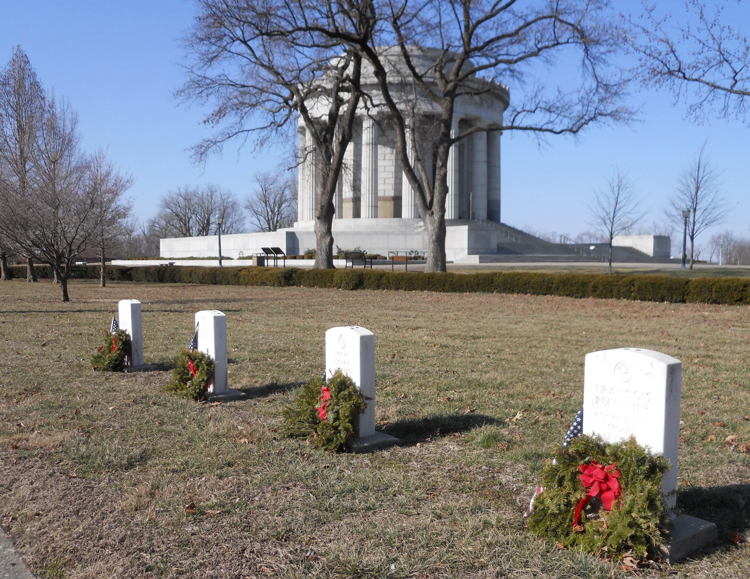
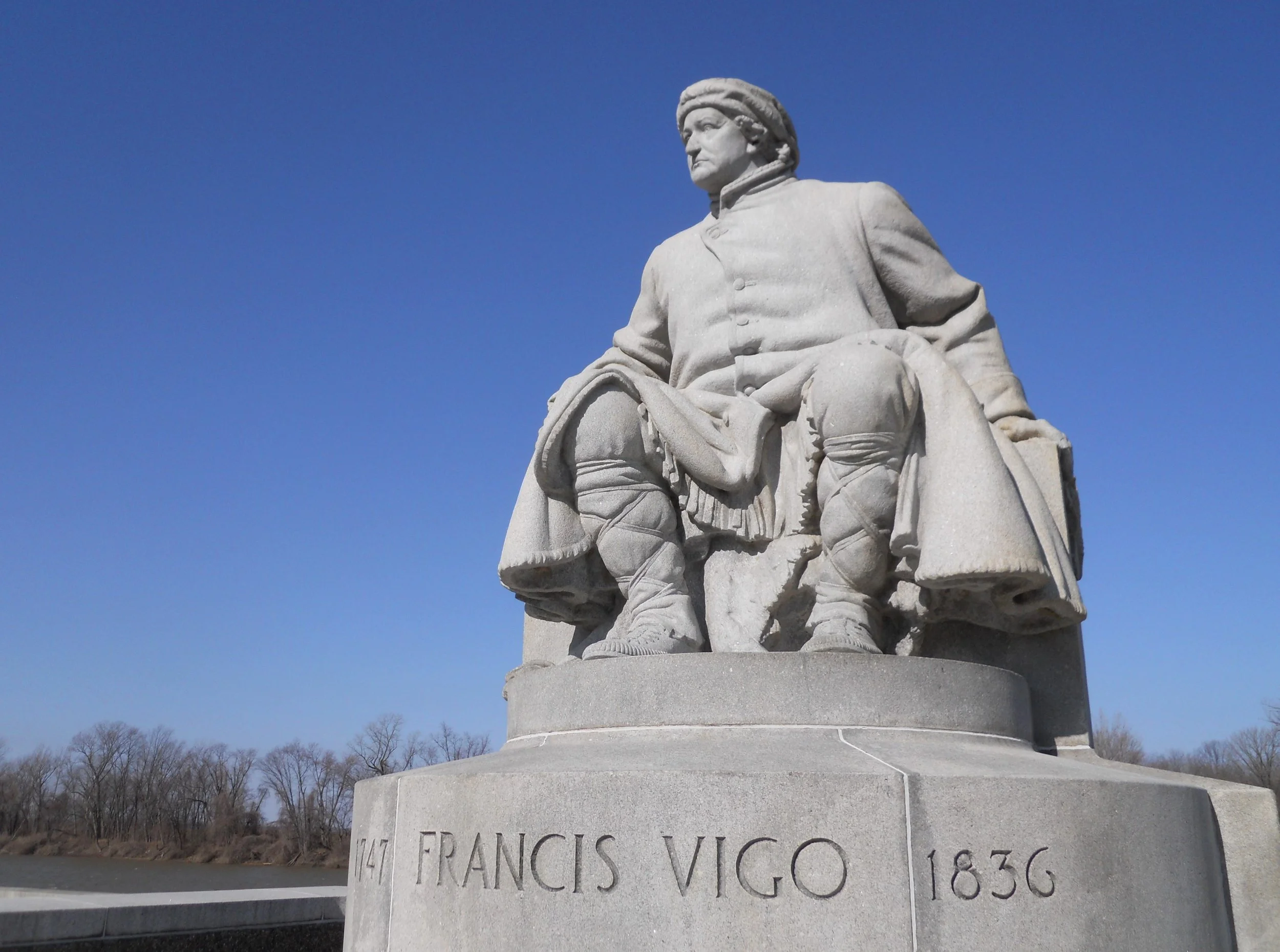
A statue of Francis Vigo is next to the Wabash River. Vigo is the famous informant who supplied Clark with information on how to take the fort, then was the primary financier to the Revolutionary Army in the northwest areas. And in the Cathedral Cemetery many Vincennes residents from 1750-1836 are buried, including citizens who fought for the American side during the Revolutionary War. A few markers identify some of those soldiers. The church is where the surrender took place.
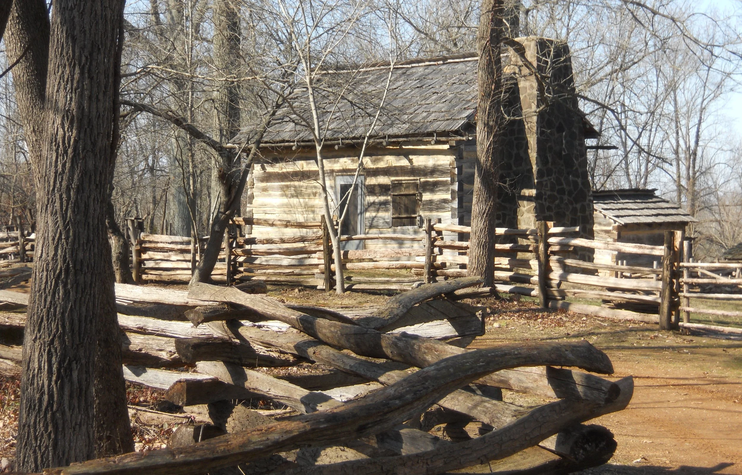
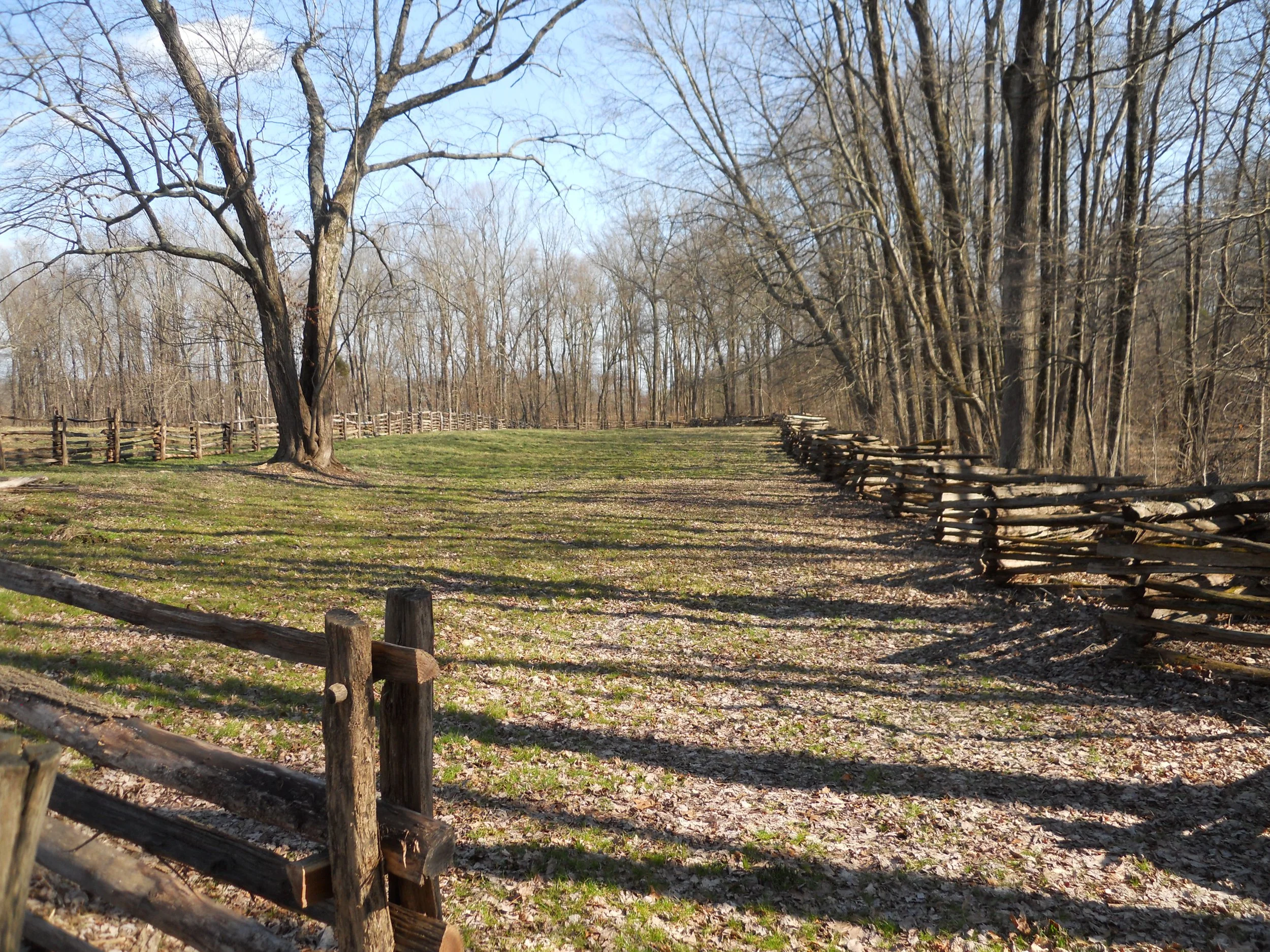
Next was Lincoln Boyhood Home National Memorial, in southern Indiana. A recreated farm (including a cabin home) allows the NPS to demonstrate life in the early-1800s. The one photo shows a portion of the ground which Thomas Lincoln farmed.
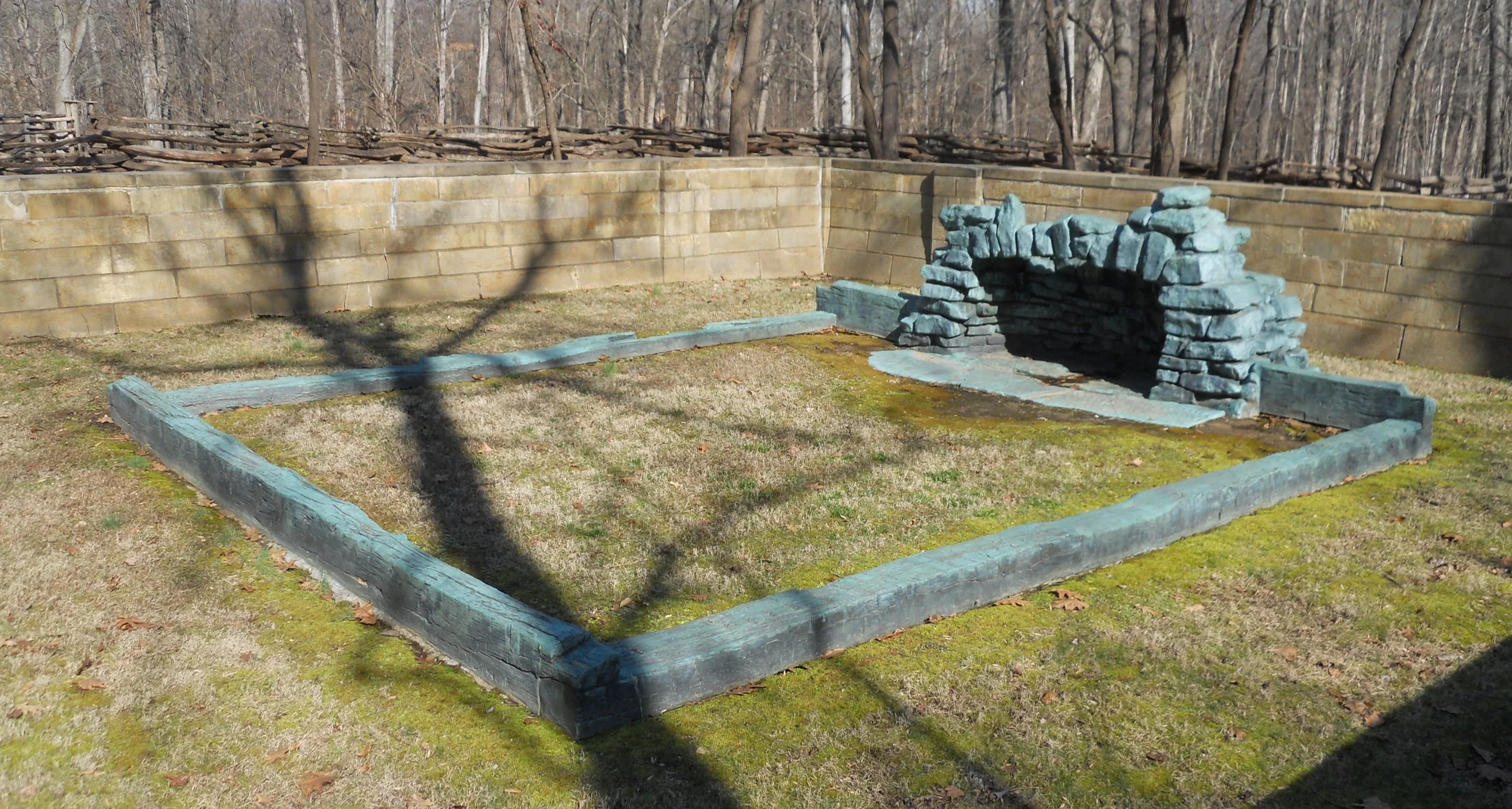
Bronze replicas of the hearth stones and sill logs which the NPS uncovered on the site of the original cabin are shown in the one photo.
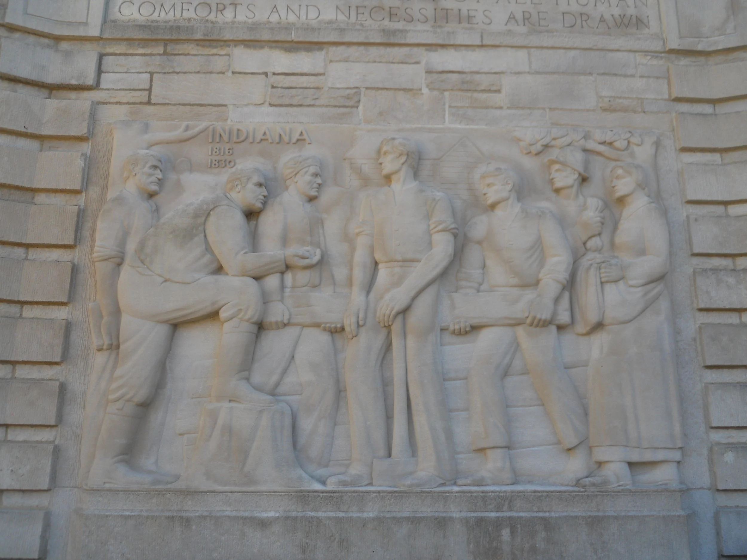
The Visitor Center has five limestone carvings which adorn its exterior. Each carving covers a certain period of Lincoln’s life. The one shown here is from the years he lived in Indiana.
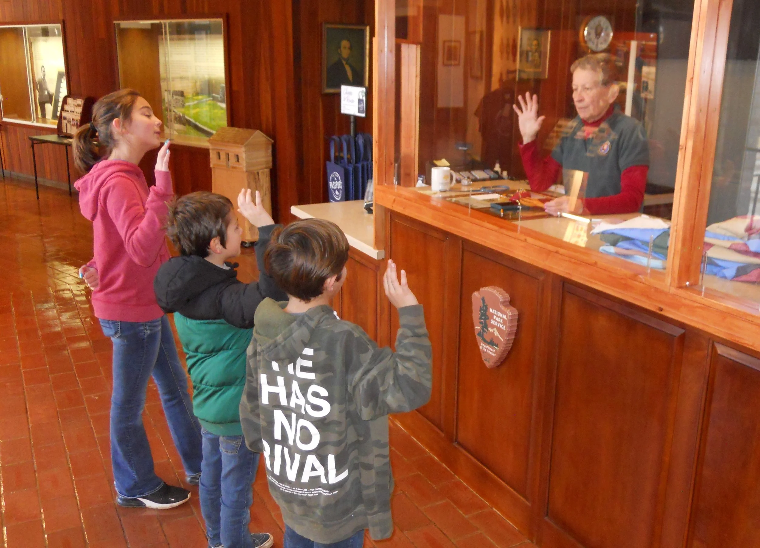
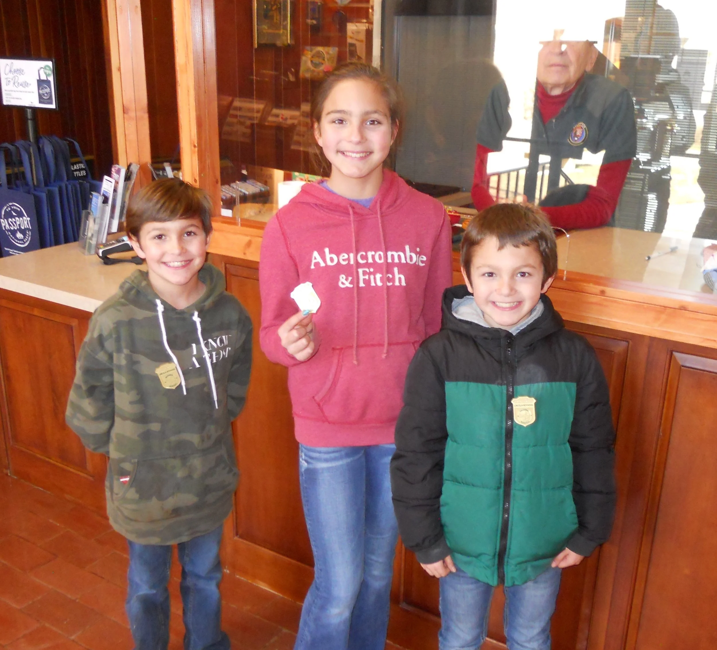
Speaking of the Visitor Center, a wonderful event occurred as I was looking at the bookstore. The residents of Portland, TN should be proud. Three of their fellow citizens were taking the Junior Ranger Oath. Ezra, Annabelle, and Alek (left to right) were sworn in by a member of the park staff. Their count is now 12 Junior Ranger badges. No doubt there are many more to come. Most NPS units have a Junior Ranger program. Stop at the Visitor Center and ask for that park’s brochure and begin the required activities. It is great to see our country’s next generation of citizens taking interest in its national parks.