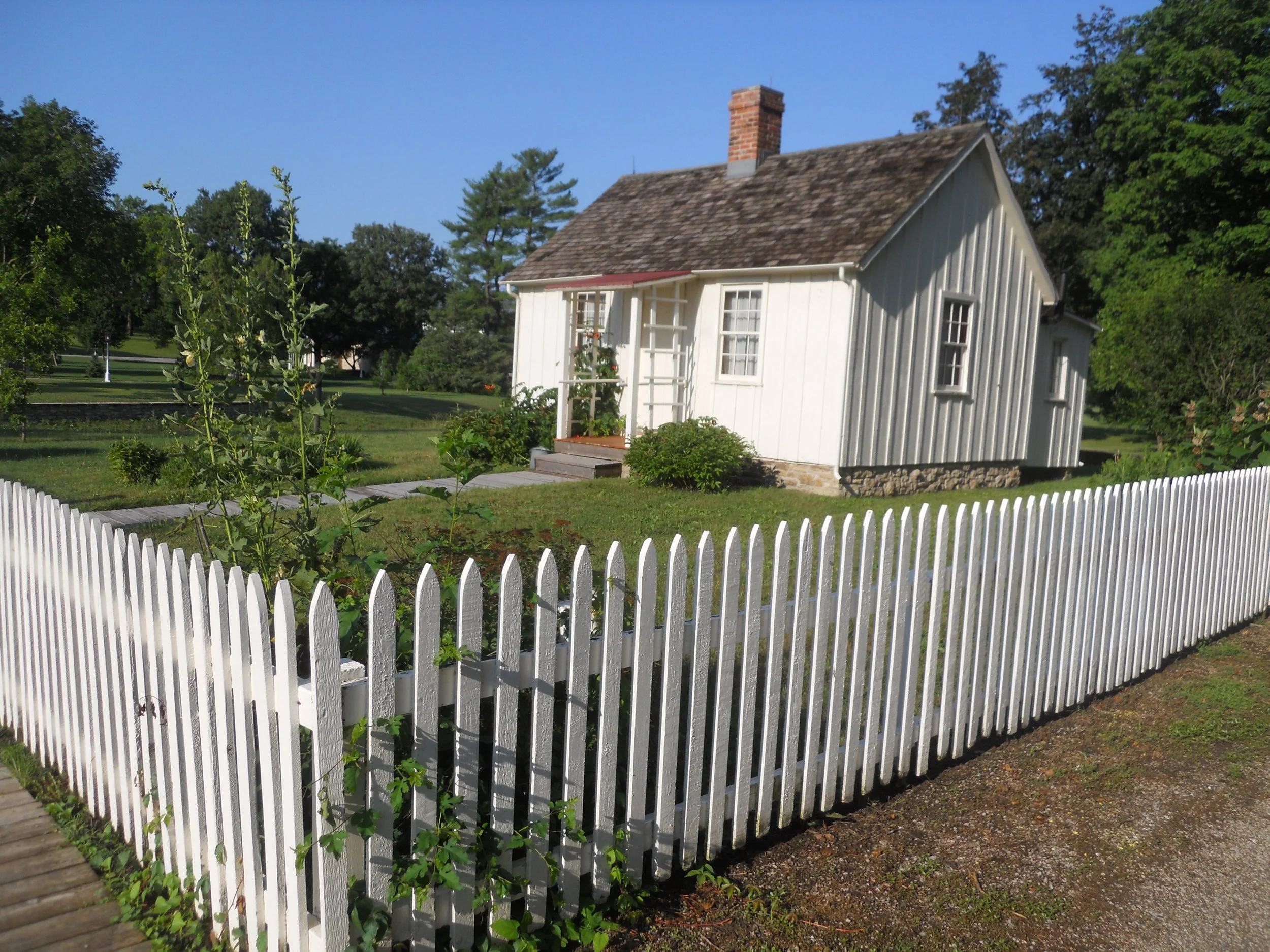
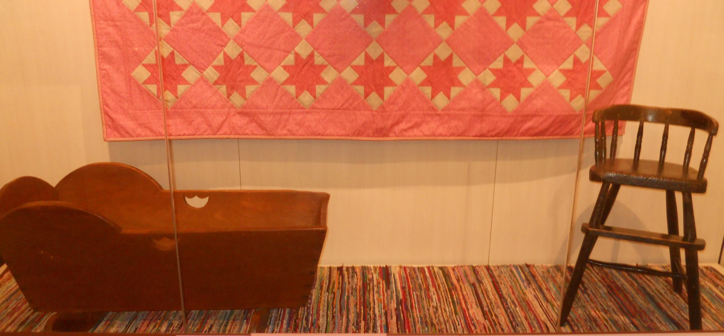
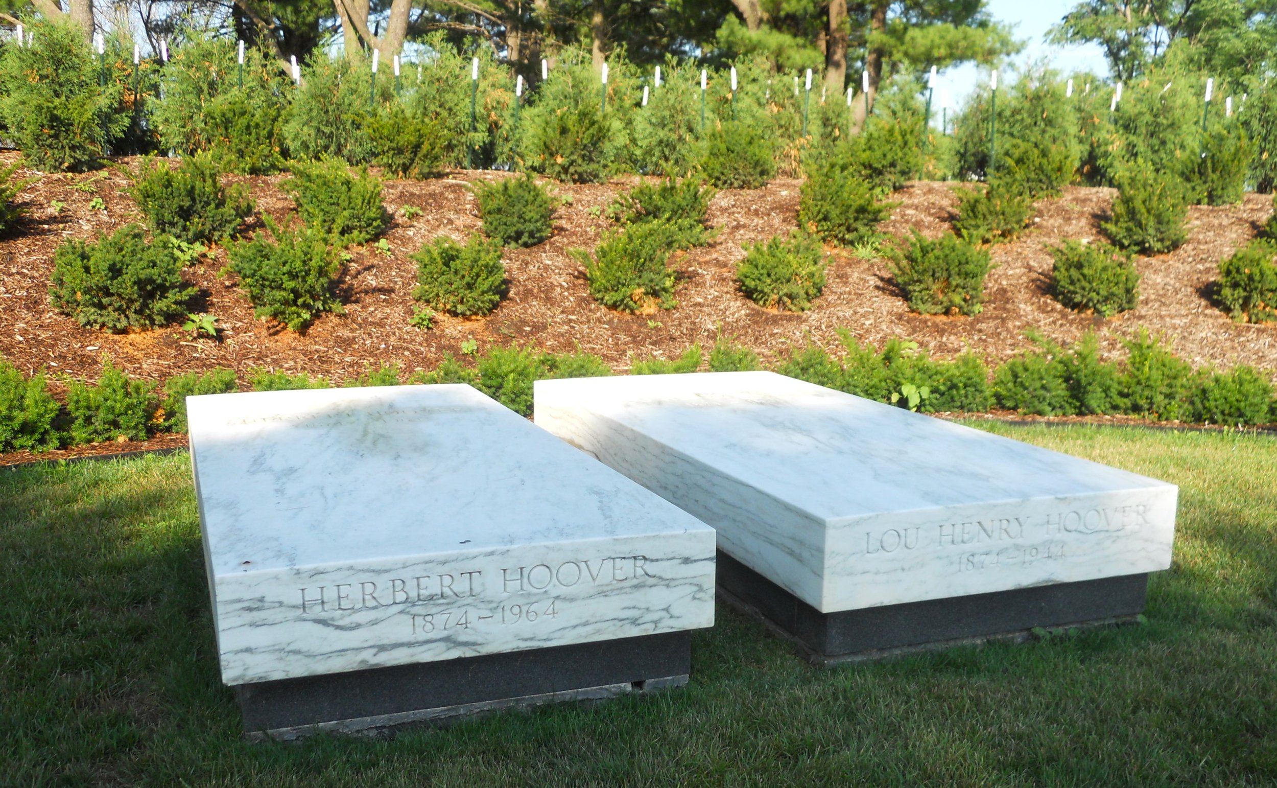
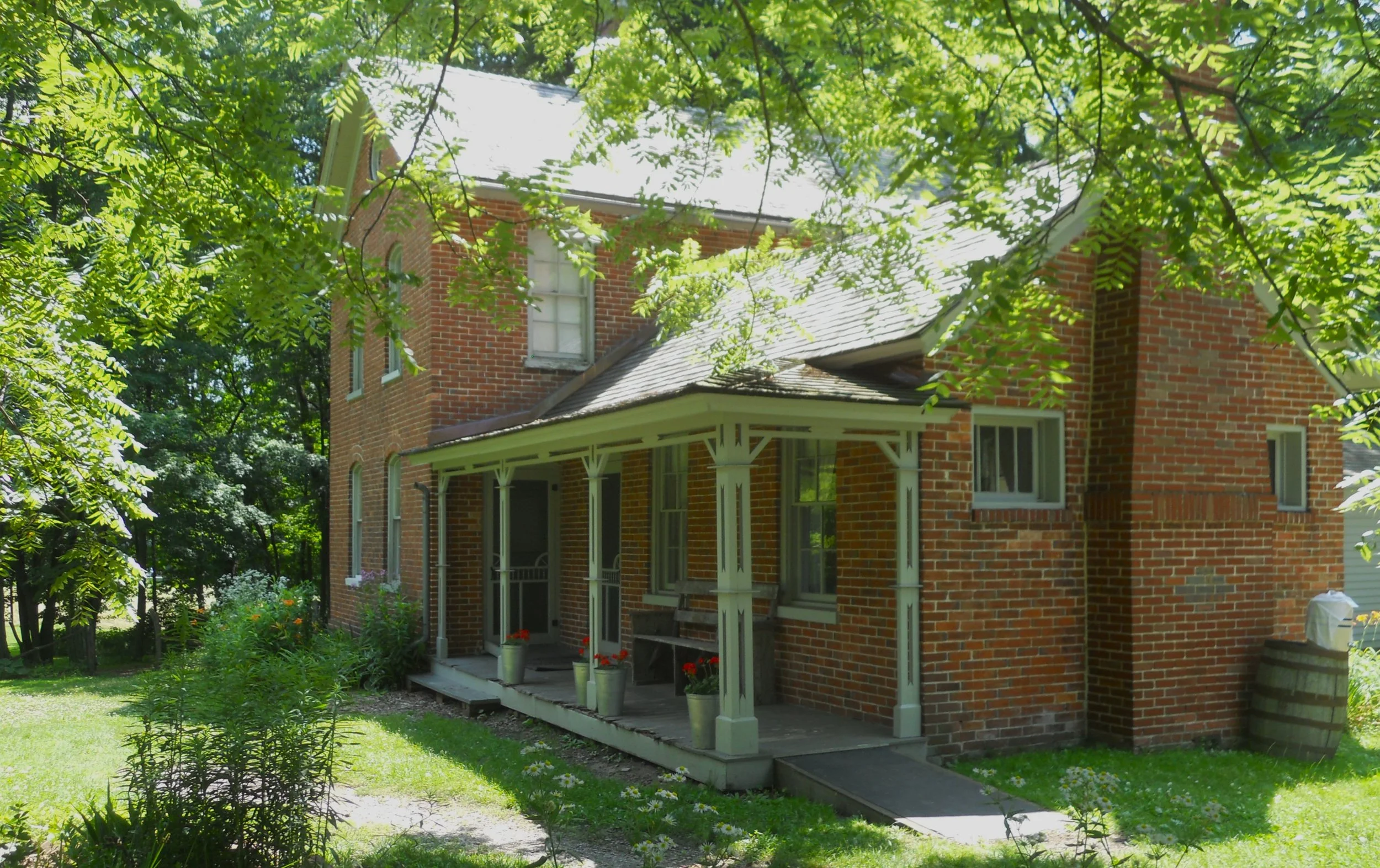
DAY 14 (July 4) - Herbert Hoover NHS is located in the serene town of West Branch, IA, right off I-80. He was born in a 2-room cottage, orphaned at age 9, and never lived there again. Later, in the 1930s, he and his wife purchased the structure to restore it to its original look. Other buildings, such as the Staples House (photo), within the park have been preserved to provide an 1870s experience for visitors. The Hoovers are buried at the west end of the park. The VC displays items used by Hoover when he was a toddler (craddle and high chair… the quilt and rug are reproductions).
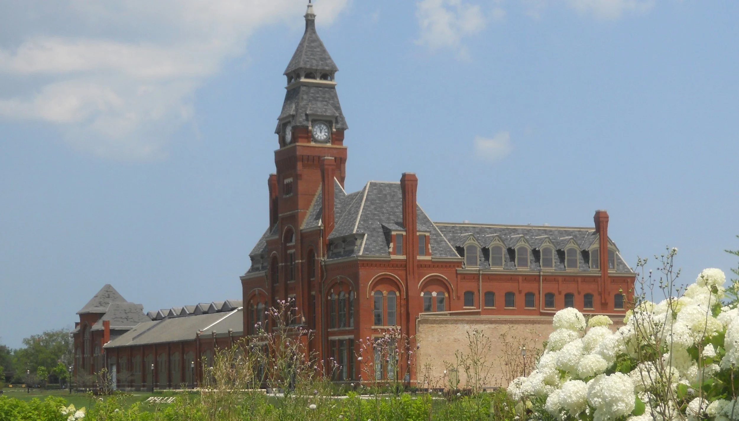
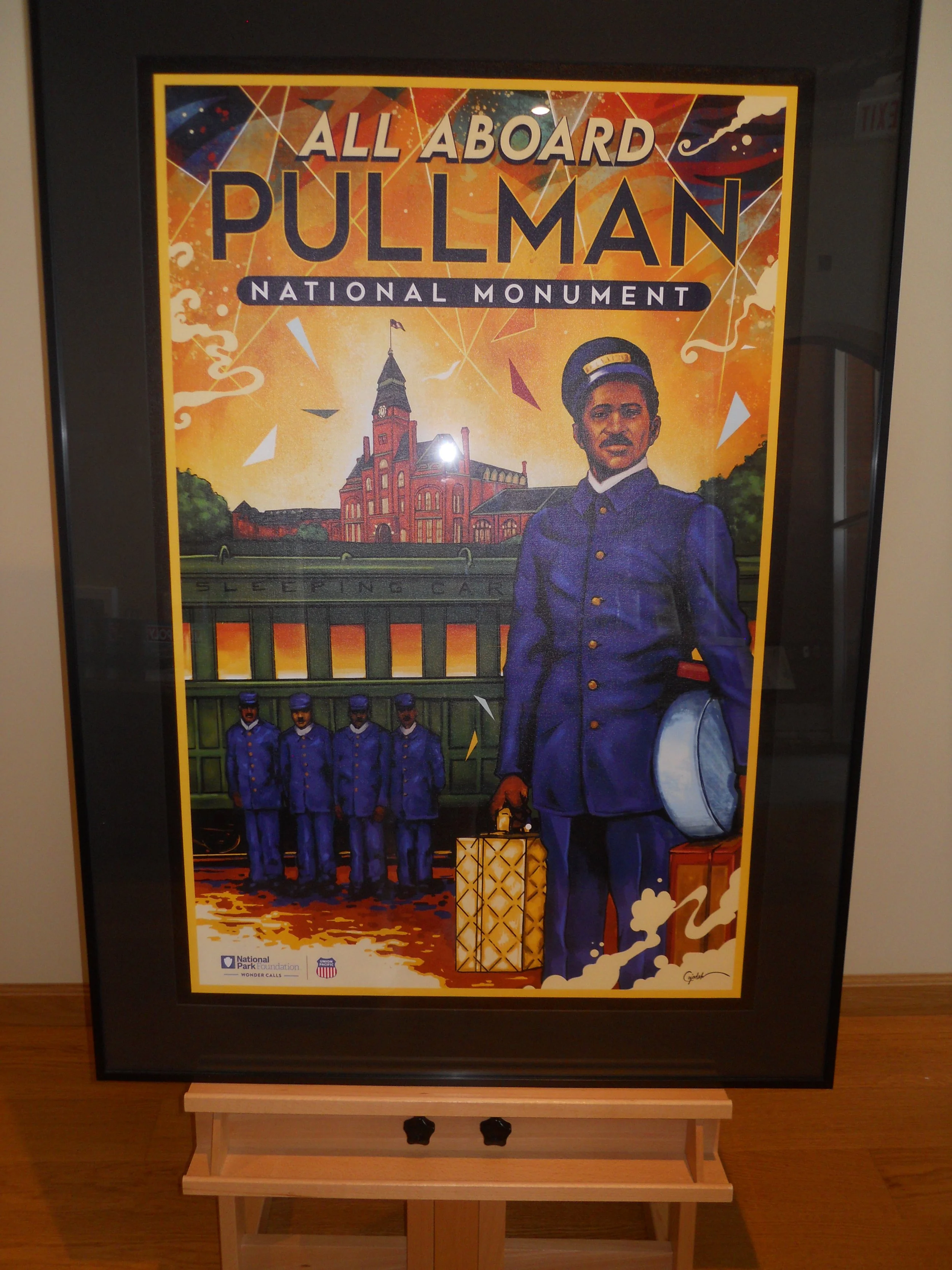
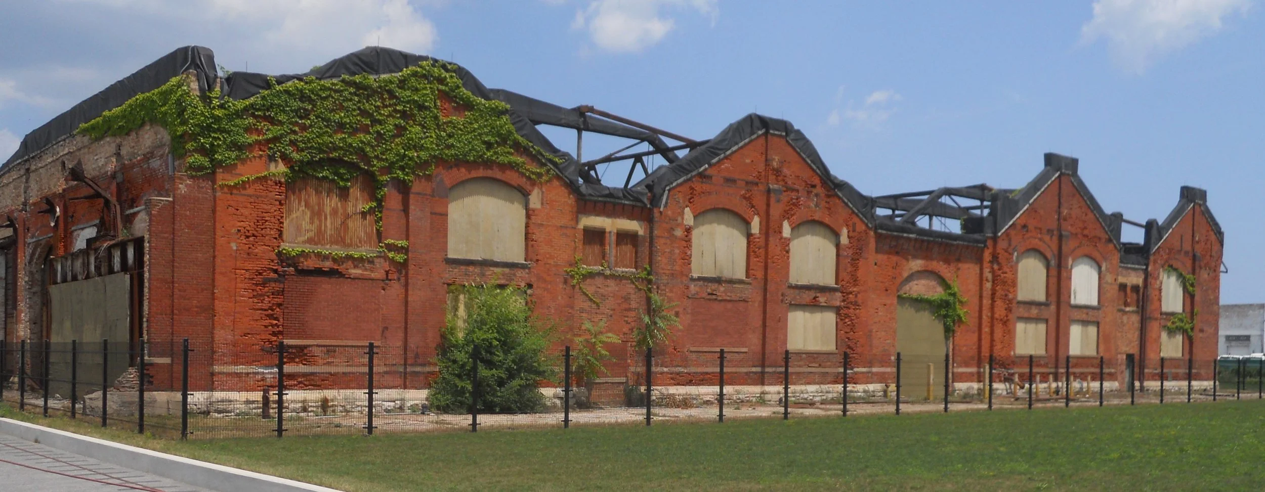
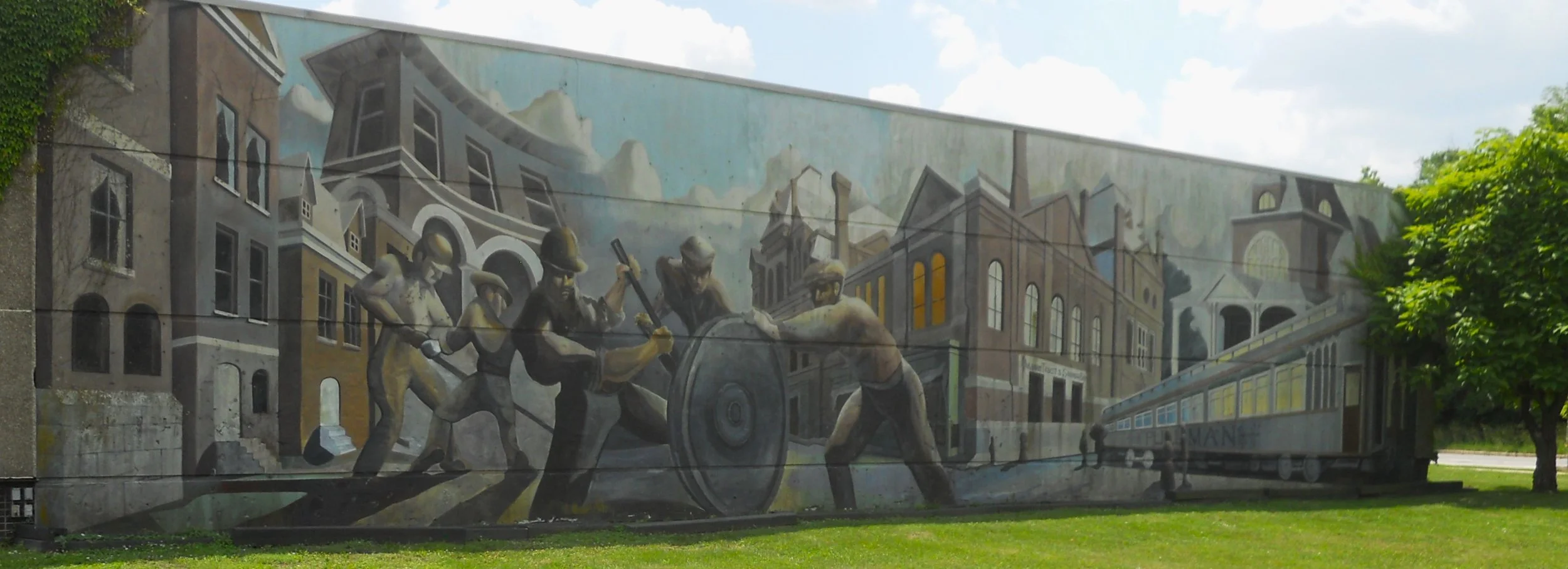
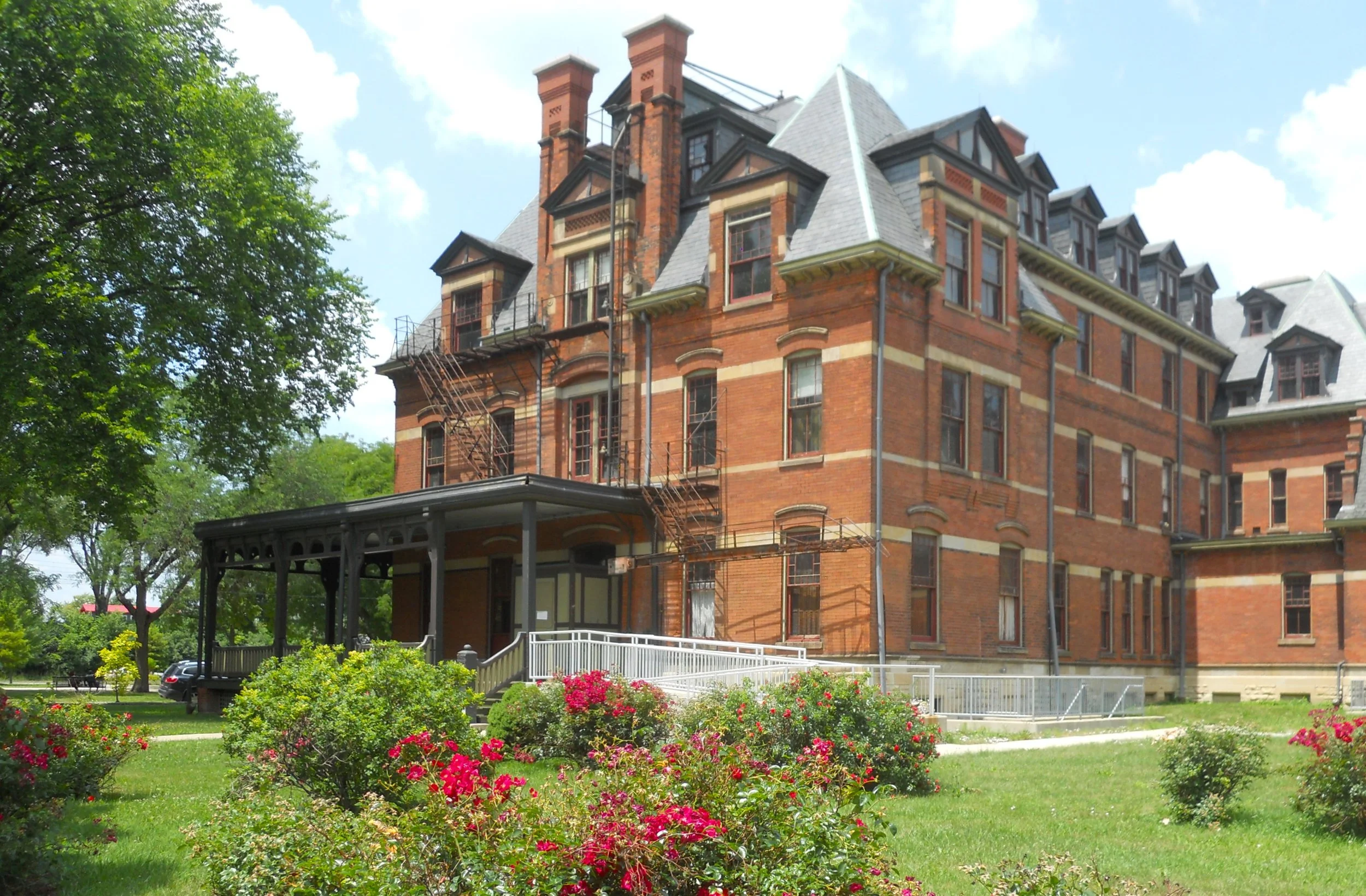
Pullman NHP honors the legacy of the Pullman Company. This was a planned manufacturing complex and living city for the workers, who plied their skills into turning out the most luxurious railroad cars around. The administrative building is impressive (today houses the VC and museum). The one end of this structure was the Front Erecting Shop. The Rear Erecting Shop is not in as good a condition. The Hotel Florence, across the street, is undergoing renovation. Aside from building the famous cars, Pullman supplied the world-class service labor to keep passengers comfortable. One of my favorite murals in the national parks is on the backside of the original VC.
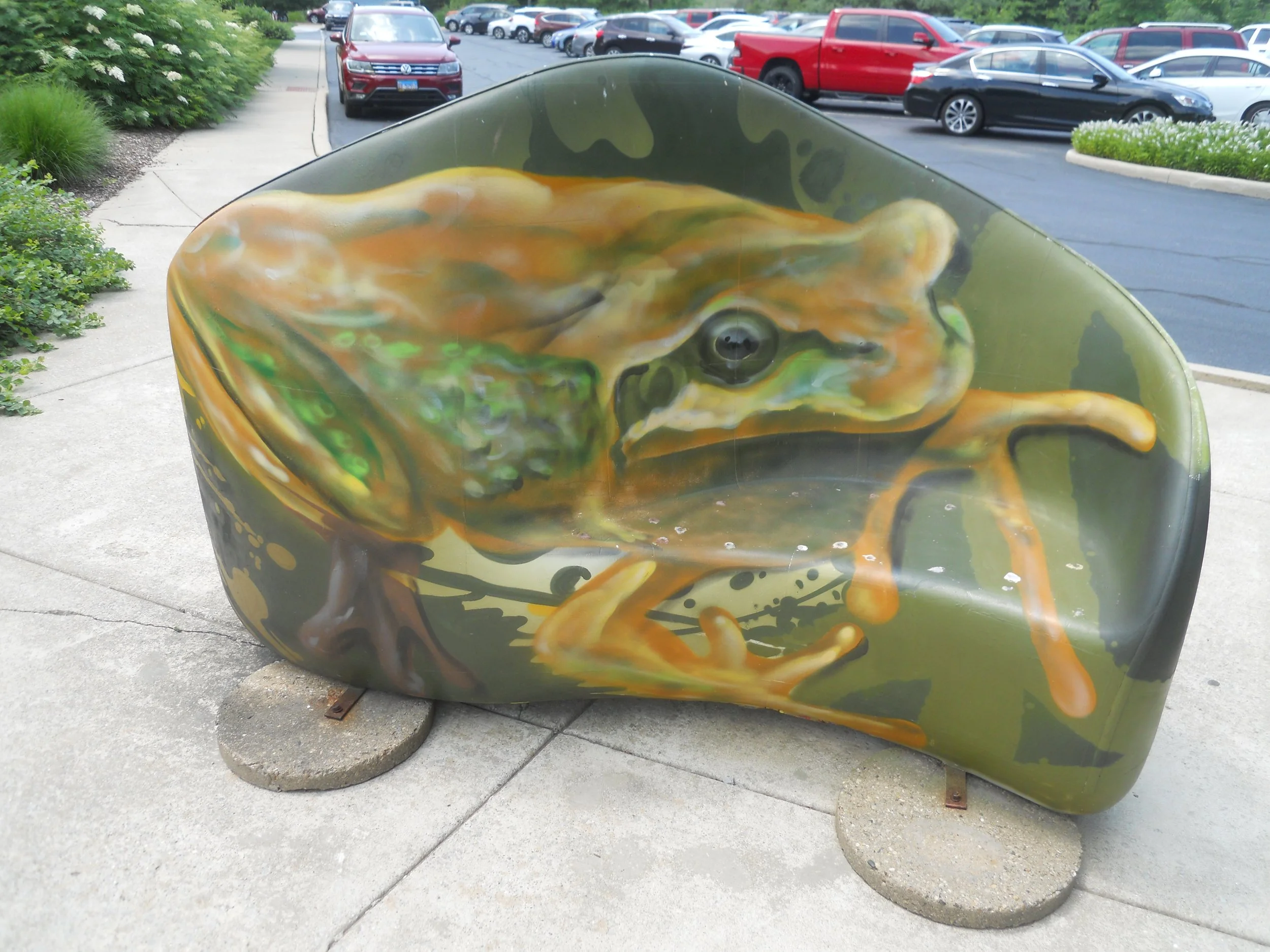
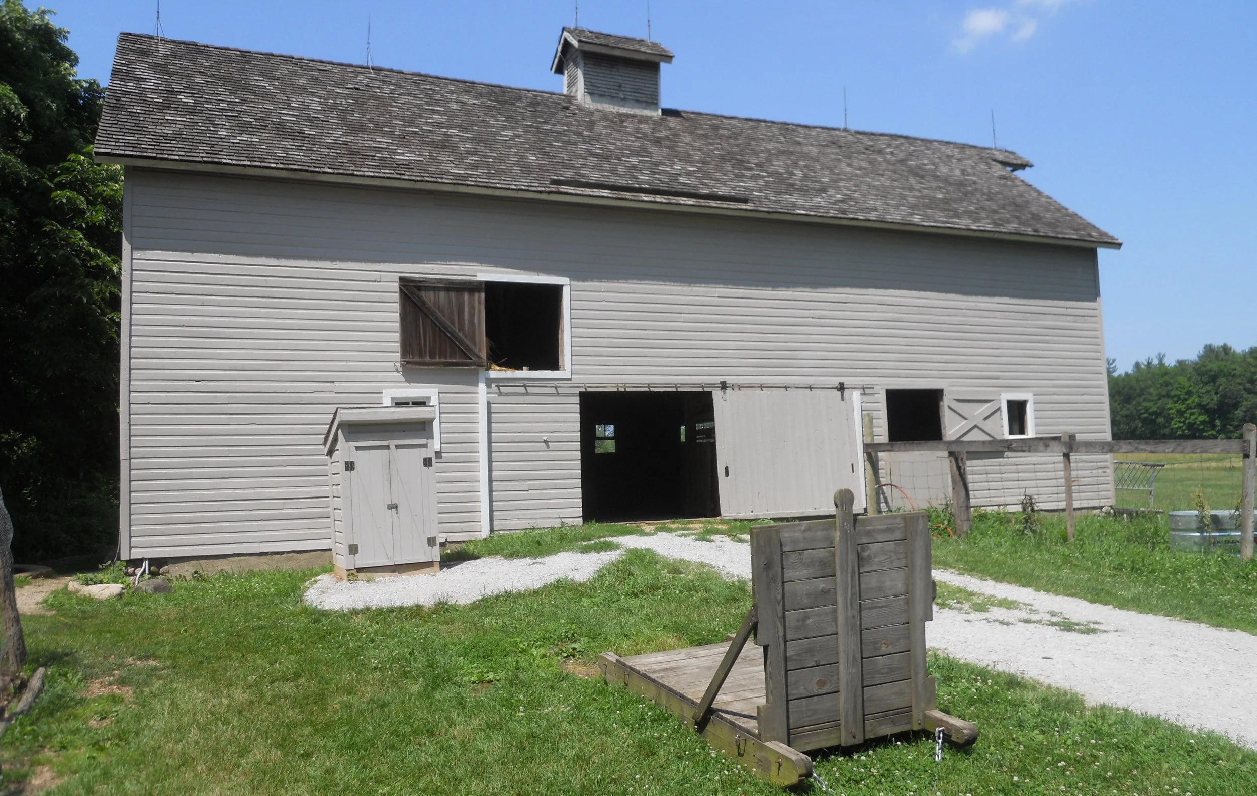
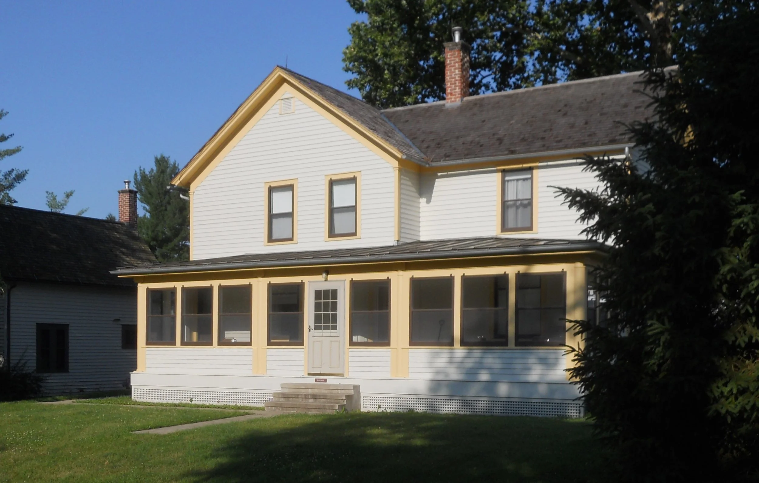
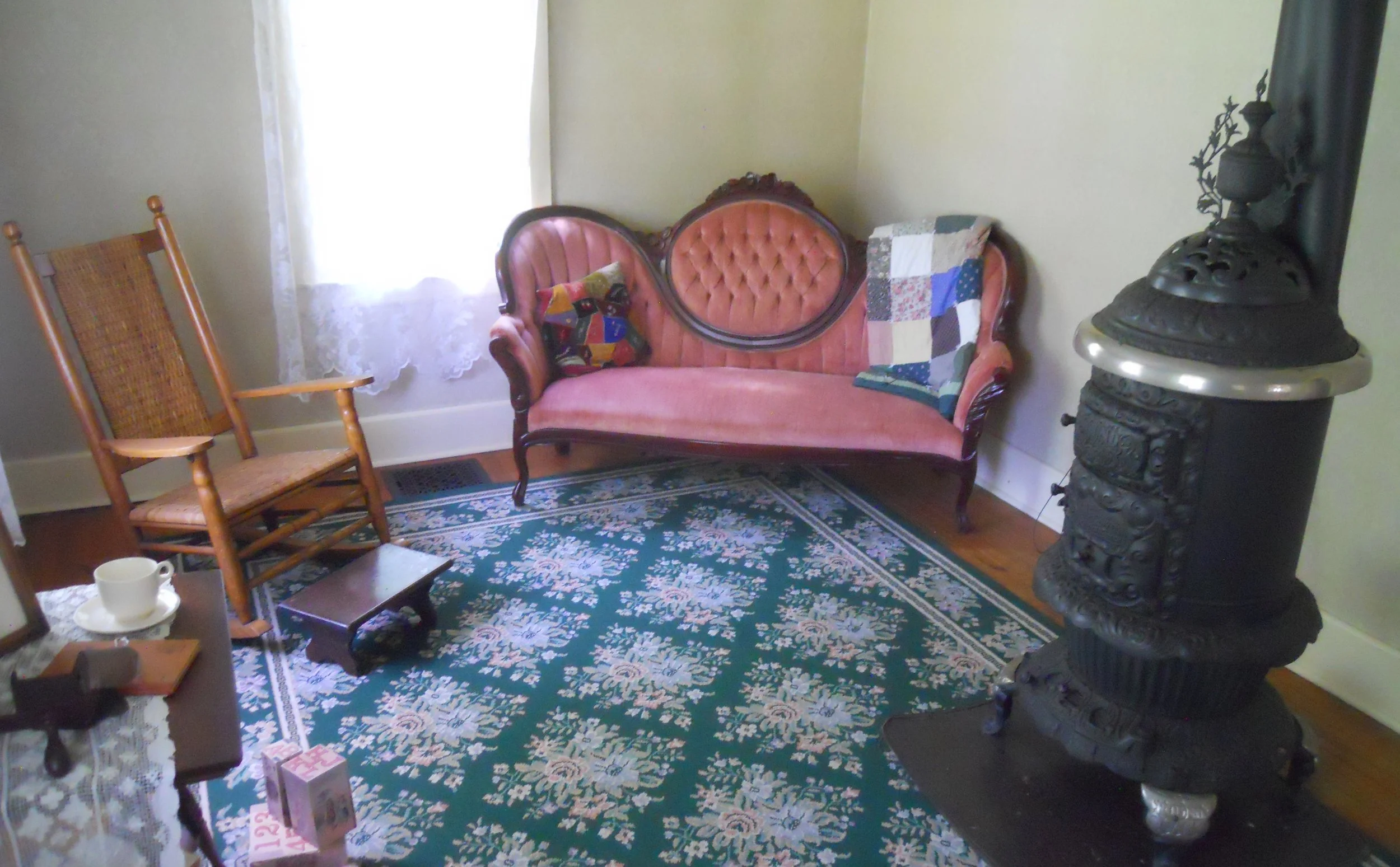
Indiana Dunes NP was packed beyond belief this day, with humans. A three-hour wait to get a parking spot at the beach, or one could walk 1.5 miles, one-way, from open lots. The VC has unique seating benches. A site which did not have many visitors was Chellberg Farm, a portion of the park I had not previously toured. The original wood home had burned down in 1884, replaced in 1885 by the current brick structure. This meant the family had to live in their barn for one year. The interior of the barn is all original wood, dating to 1870. The NPS still raises chickens and cattle at the farm. The house is furnished with period items.
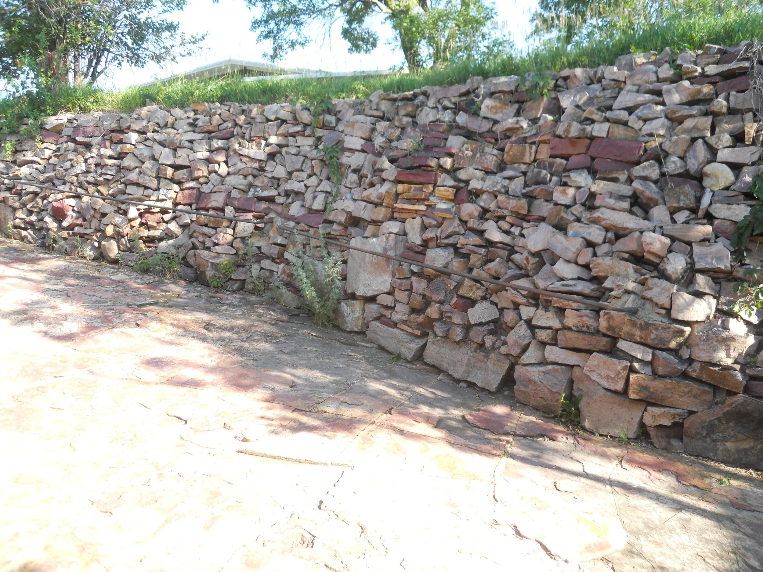
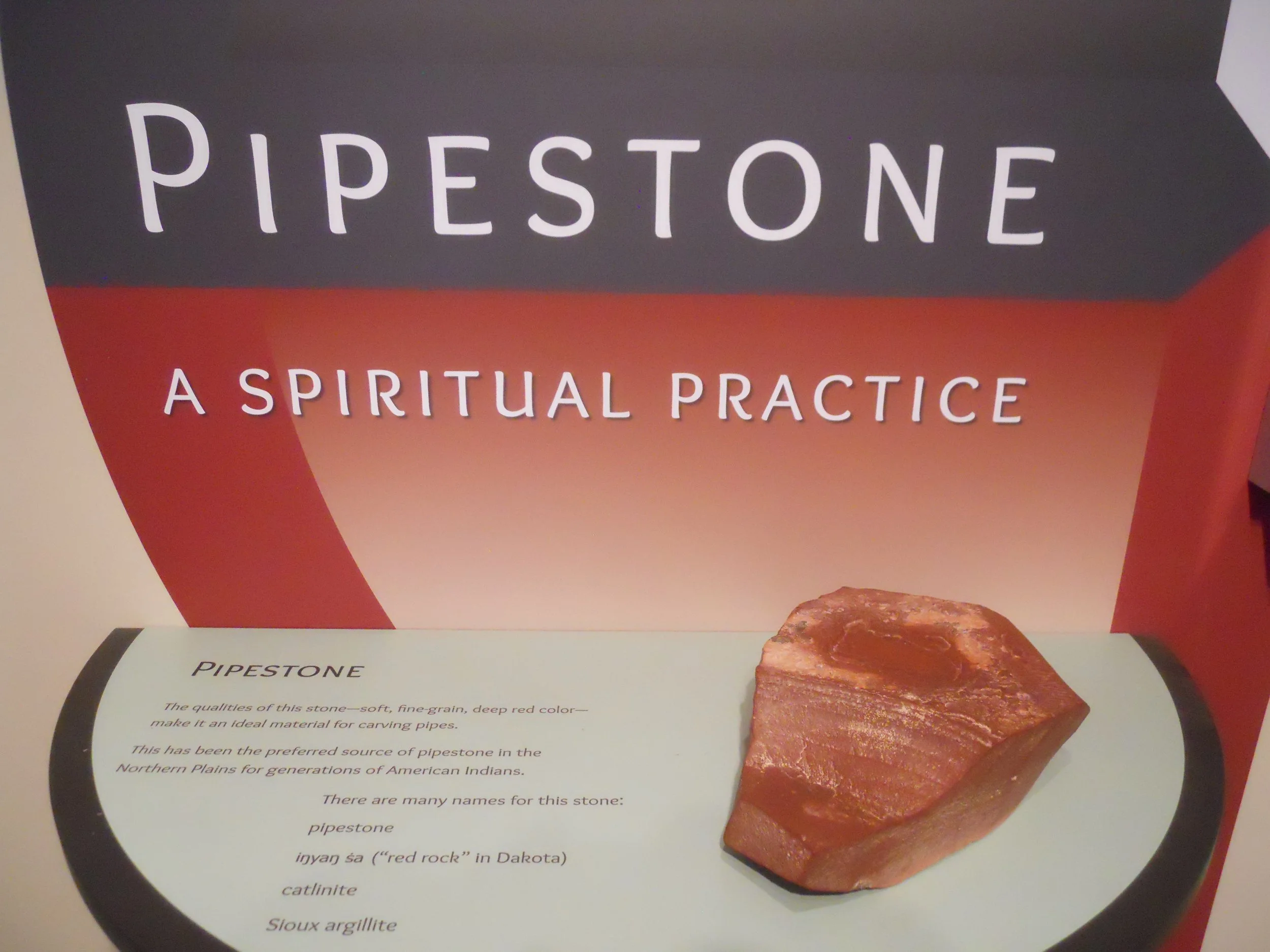
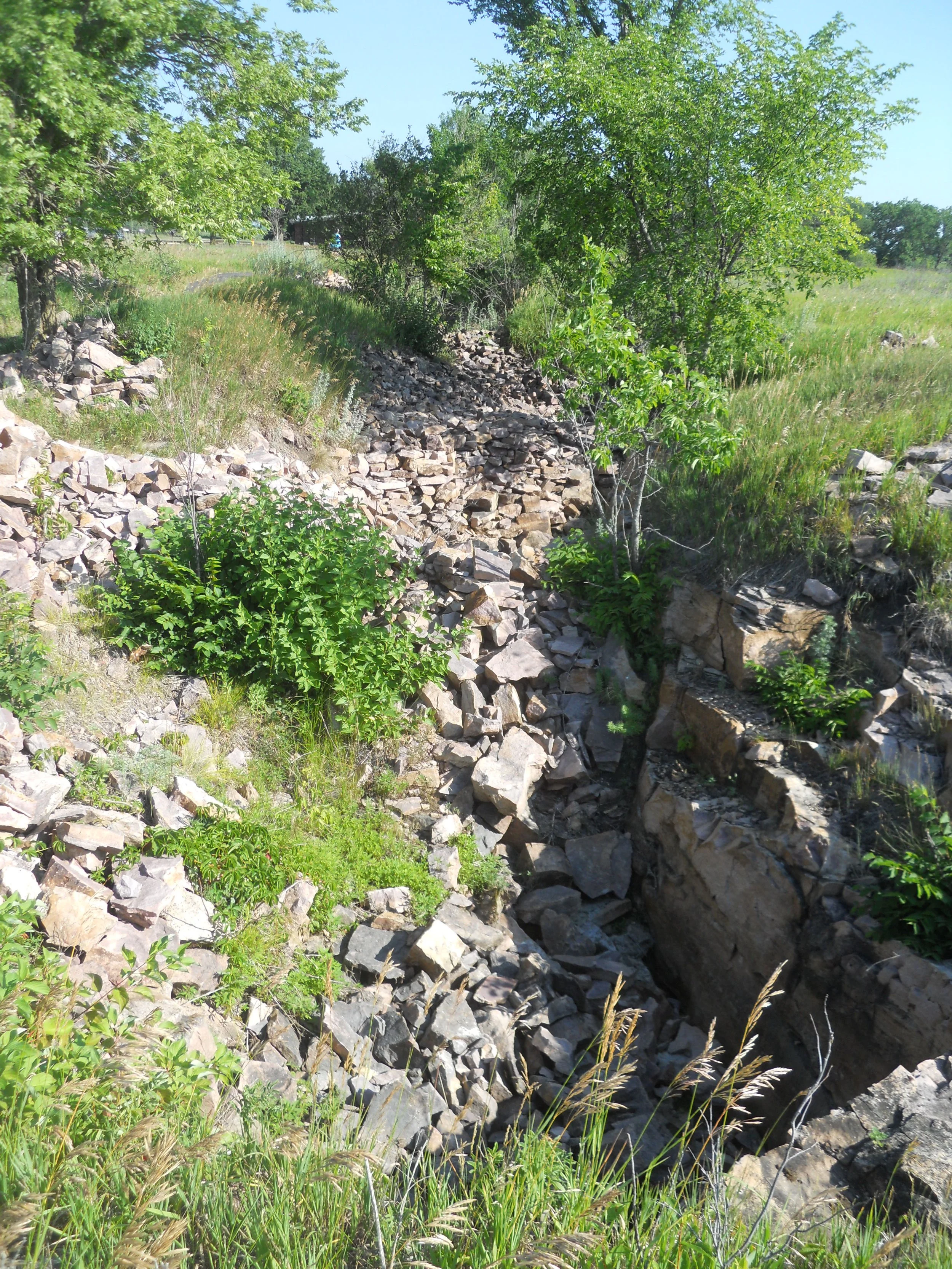
DAY 13 (July 3) - Pipestone NMon protects a quarry of red stone that has been mined by Indigenous peoples for over 3,000 years. Very hard Sioux Quartzite has sandwiched a thin layer of Catlinite, or Pipestone, over 1.6 billion years ago. Twenty-three tribes have a connection to this quarry and the stone. They use the pipes for ceremony and prayer. The iron bearing mineral Hematite gives the rock its red color. The Joe Taylor Pit (far right) is dedicated to a Dakota quarrier and carver, who died in 1933. His descendants still quarry in the park. I met Travis Erickson, a fourth generation quarrier and pipe maker. He said he learned the technique from his grandfather and father, practicing now for 44 years. Photos of Travis are on the park’s website.
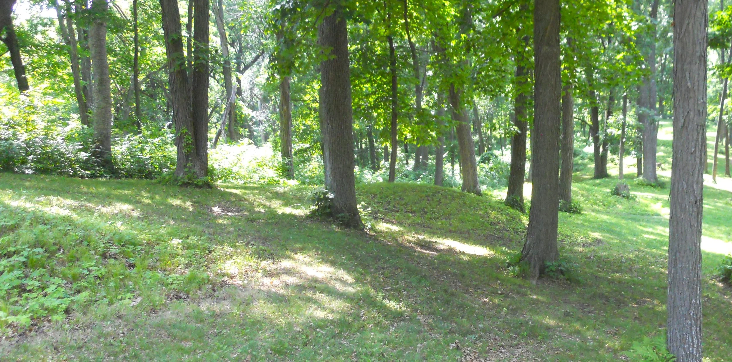
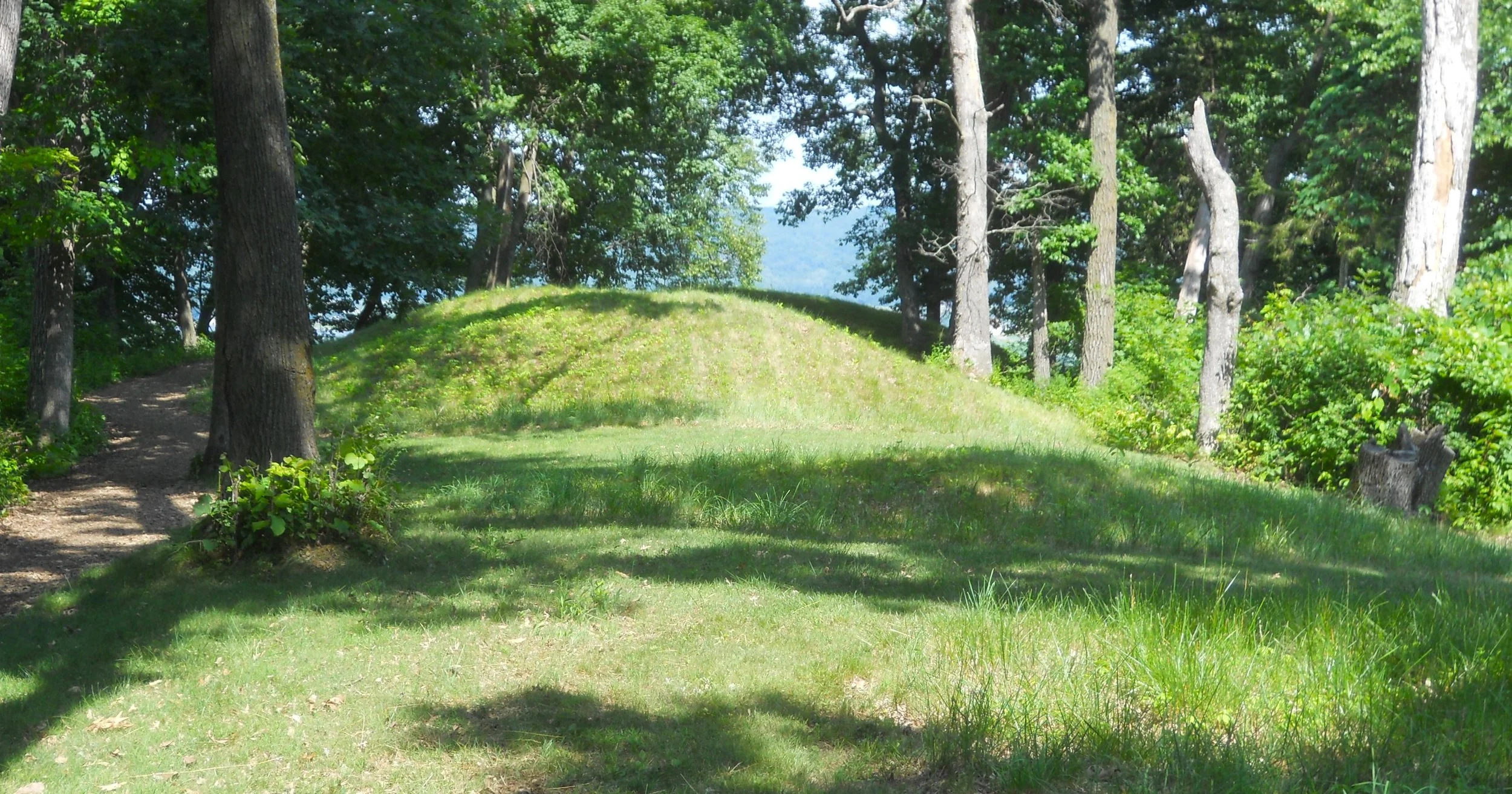
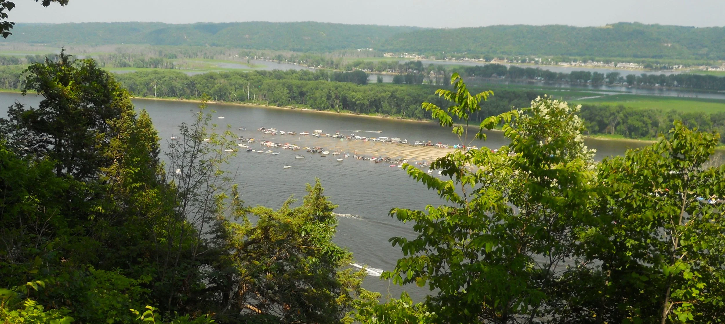
Effigy Mounds NMon preserves over 200 mounds, which sit high above the Mississippi River. Twenty native tribes are connected to this site. The mounds were built between 1400 and 750 B.P. (means “before present). Conical mounds (photo tries to show four heading down a hill) were for burial purposes. One of the largest conical mounds is at Fire Point, which overlooks the river (today there were plenty of boats going up and down the Mississippi). Other mounds in the park are mainly in the form of a bear (Little Bear Mound is bottom right photo, but hard to make it out… the raised weeds and flowers comprise the shape… the head is at the top of the photo).
DAY 12 (July 2) - Will have to wait until tomorrow to add photos and text.
Tomorrow is now today, and I have time.
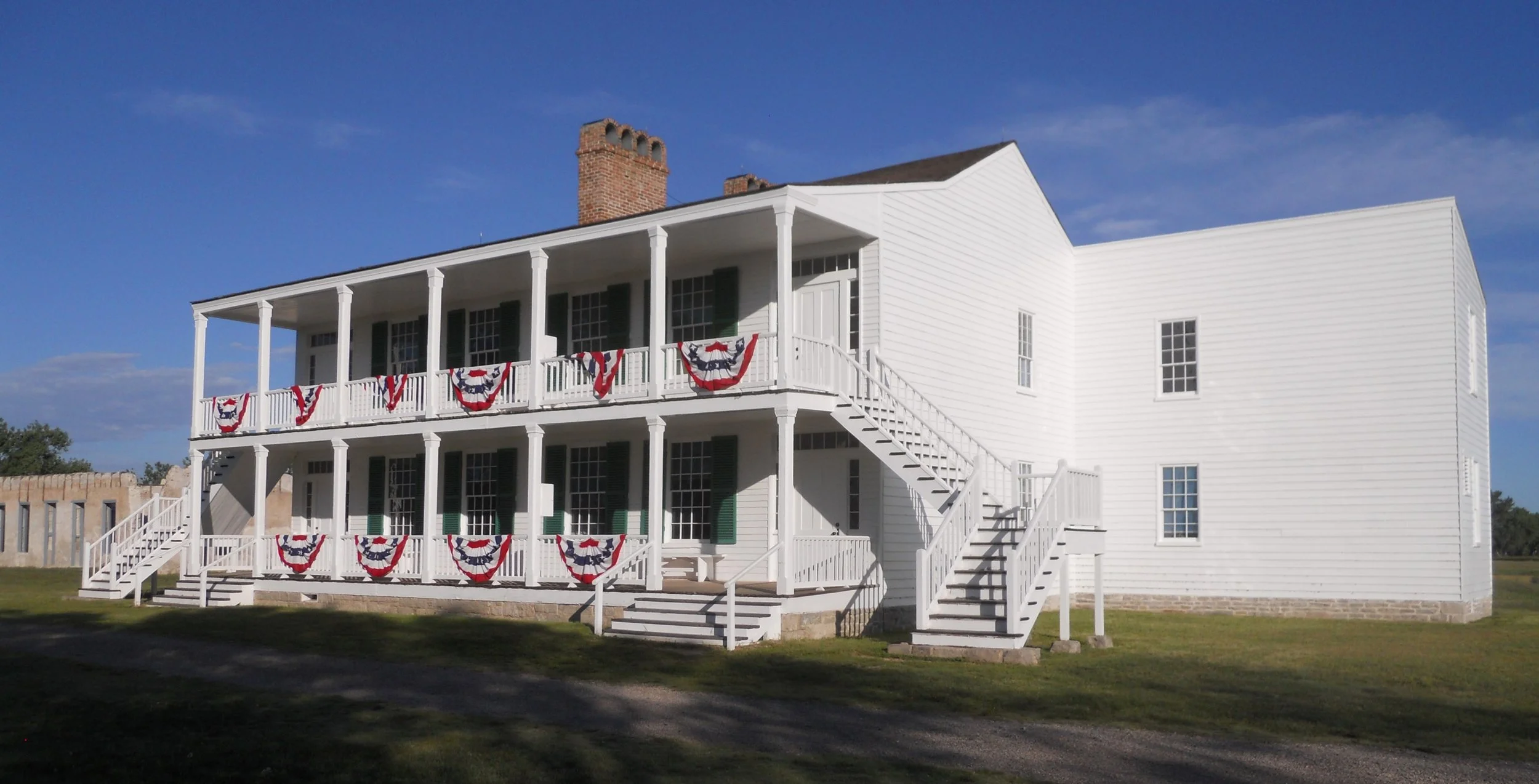
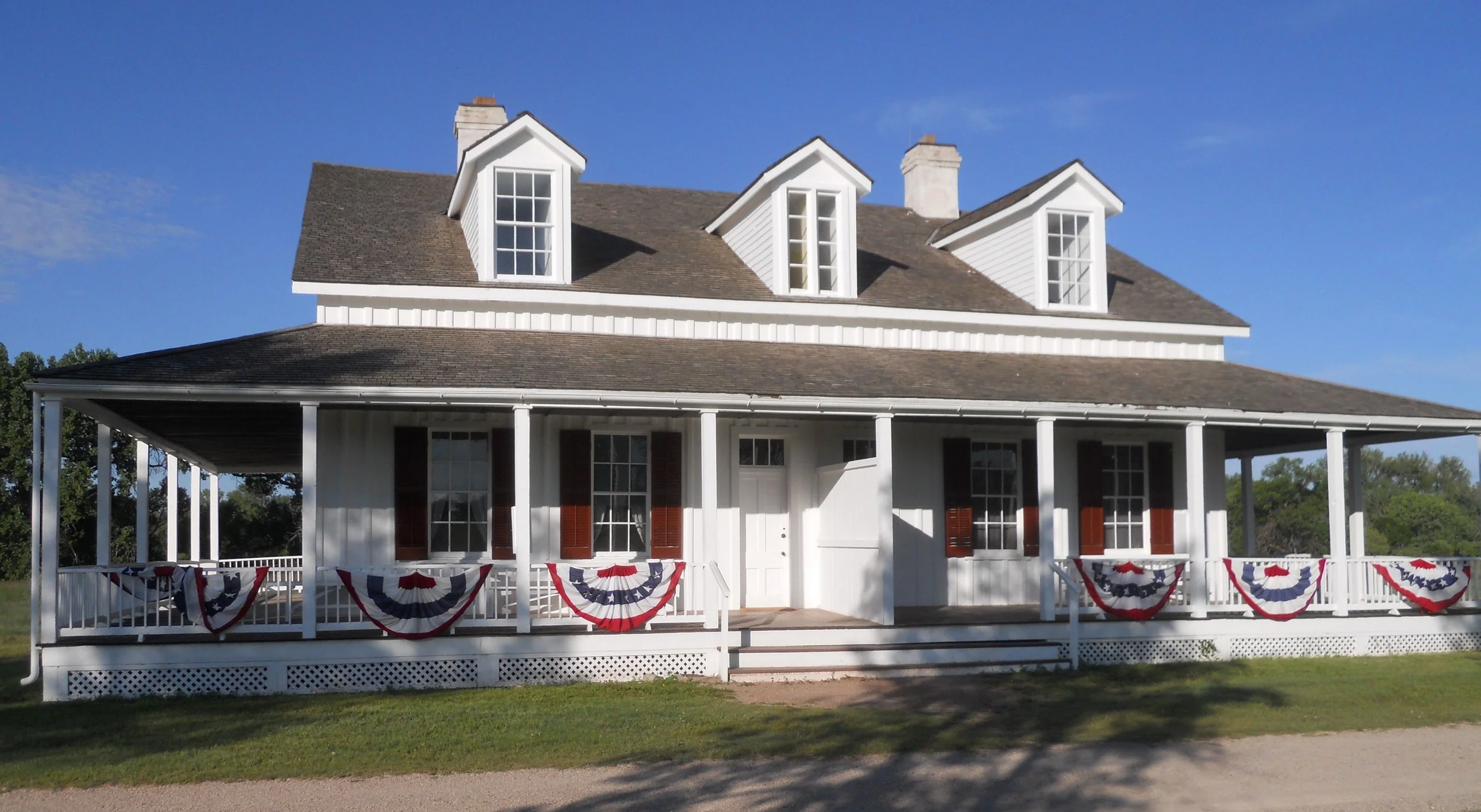
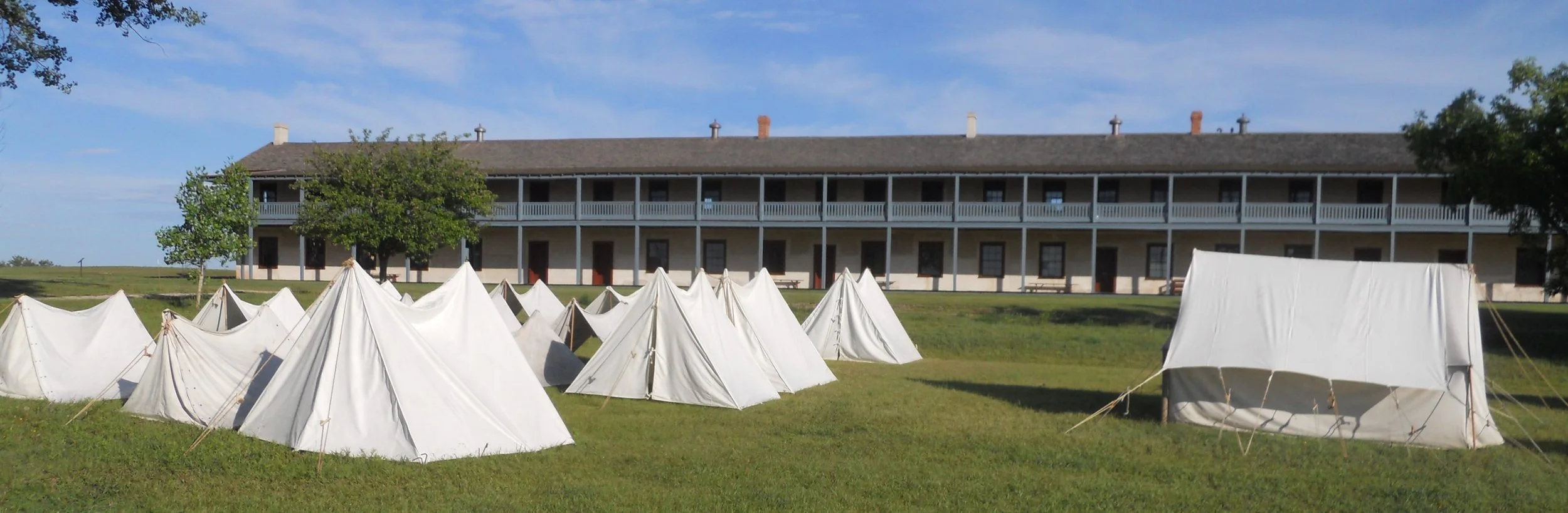
Fort Laramie began its existance as fur trading outpost in 1834. As tensions between different groups increased, the fort was turned in to a military base, not closing until 1890. During its heyday this was the largest and finest complex in the Northern Plains.
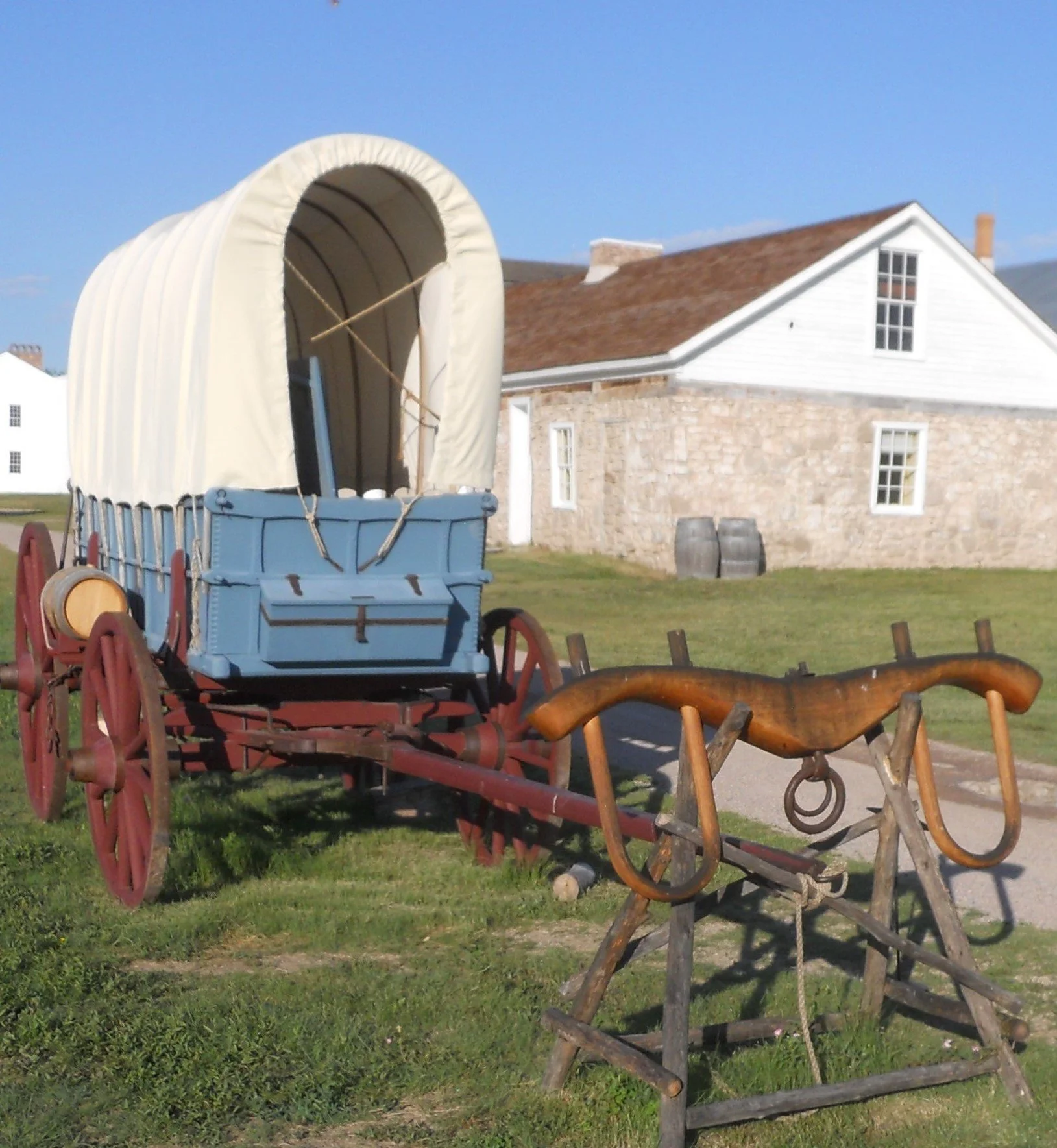
The top left photo is Old Bedlam, named after boisterous bachelor officers. It is the oldest standing structure in Wyoming, built in 1849. The top right photo is of the Commanding Officer’s house. A Prairie Wagon is on display outside the Sutler’s Store. The Cavalry Barracks is behind a number of period tents. The park will be holding military and fort-life reenactments on July 4.
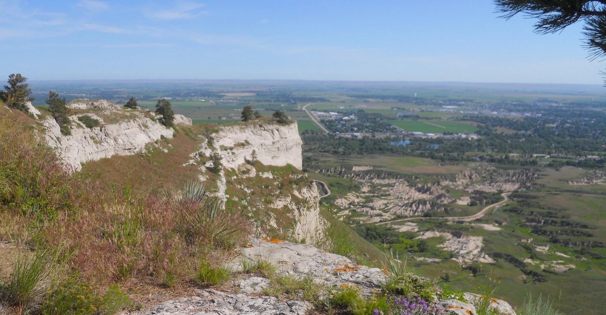
Scotts Bluff rises 800 feet above the North Platte River. The Oregon, California, and Mormon Trails each used this landmark for their westward paths. Today, cars can drive to the top (through three tunnels) to get a view of the surrounding river valley. Be on the lookout for rattlesnakes.
Bone Cabin in Agate Fossil Beds NMon sits in its own valley. Harold Cook thought Carnegie Museum was going to take ownership of the land to control the newly discovered fossils, so he filed a Homestead claim. The cabin has sat on this spot for over 100 years.
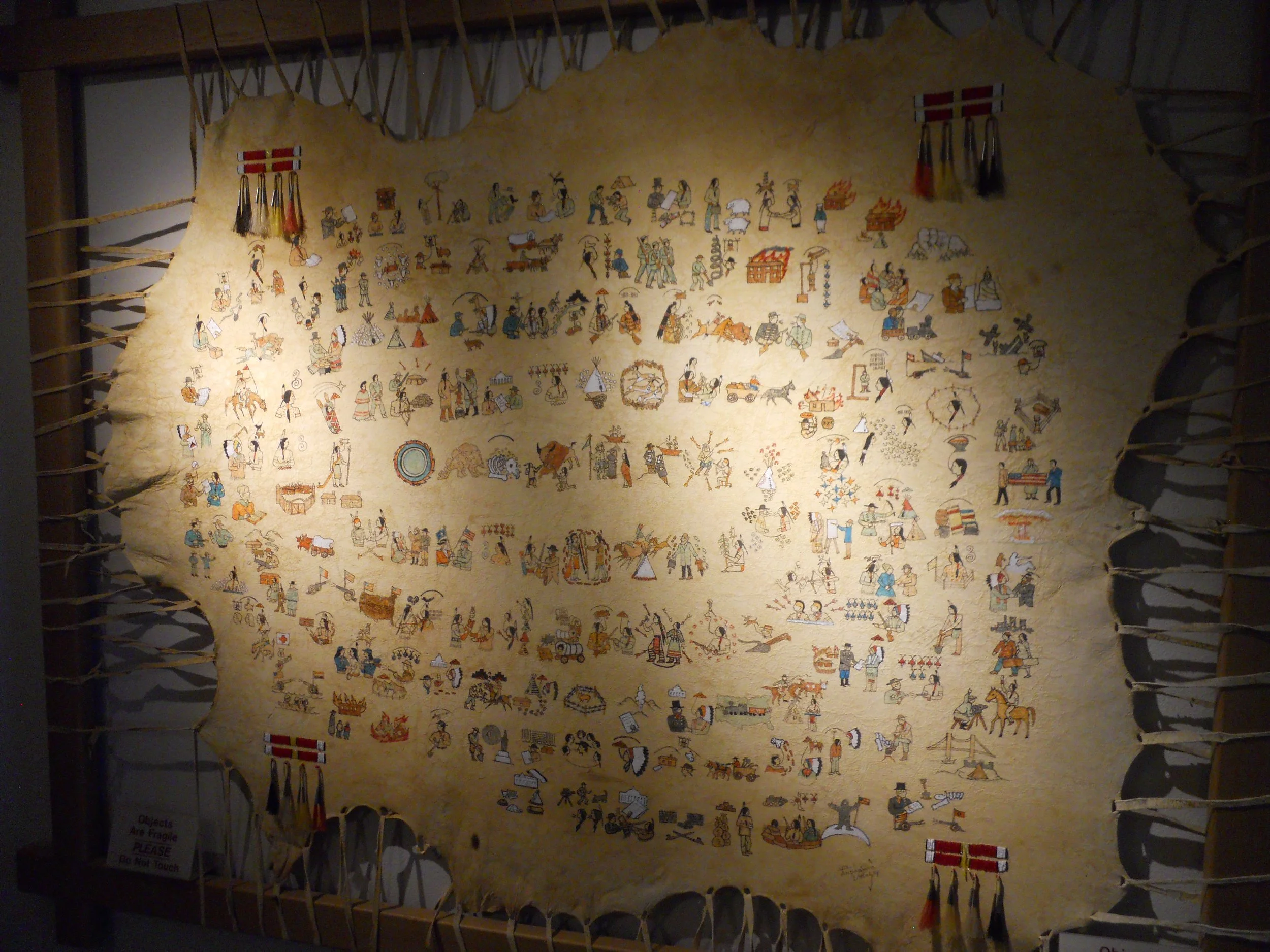
The VC has one of the finest Lakota Waniyetu Wiyawapi (“Winter Count”) around. Pictographs are added each year to a buffalo hide, describing important events, starting in the center and spiraling outwards.
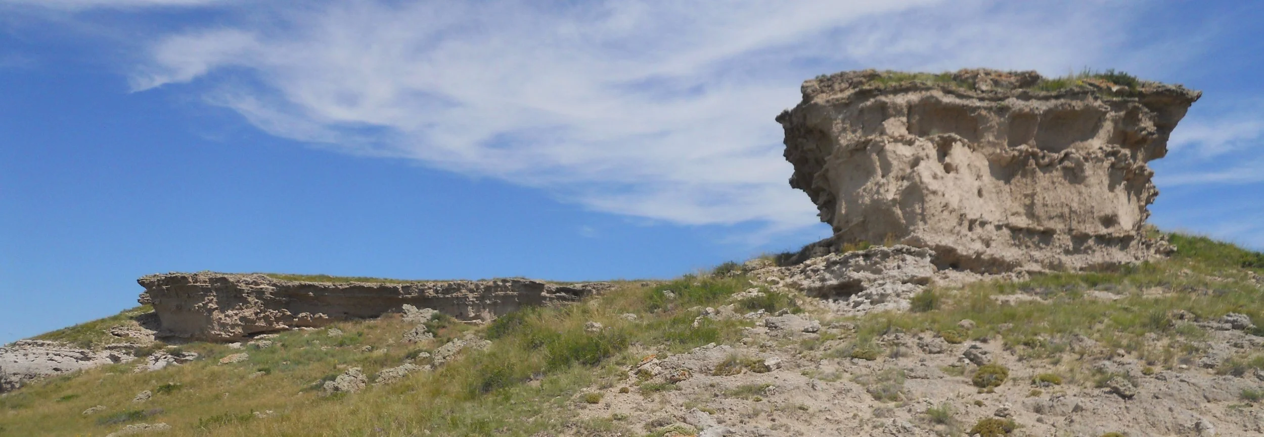
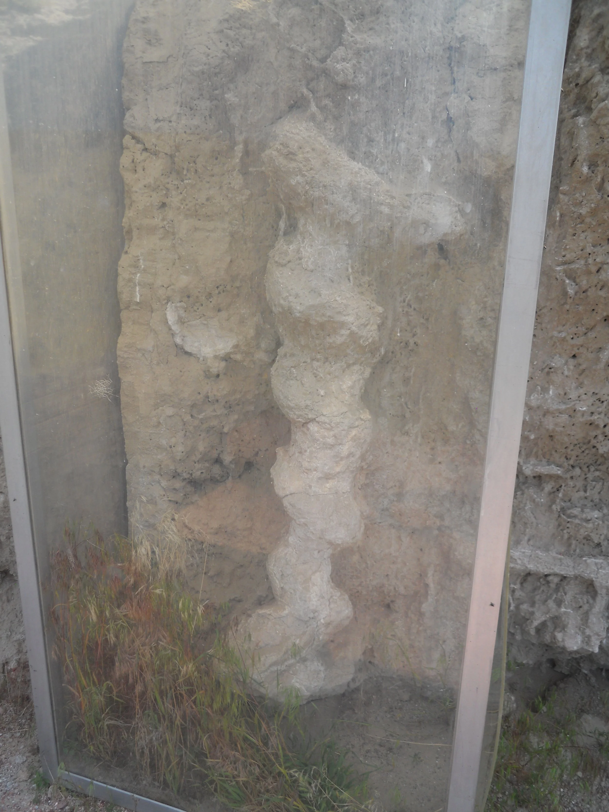
There are only two trails in the park. I decided to take the Daemonelix Trail, since I had not done so in my past visits. Sandstone buttes are along the Daemonelix Trail. Visitors are asked not to go off the marked trail since the sandstone is constantly eroding, exposing new fossils. The main item of interest on this trail are the Daemonelix. These are fossils of burrows by ancient beavers. The path goes by one specimen, protected by plexiglass.
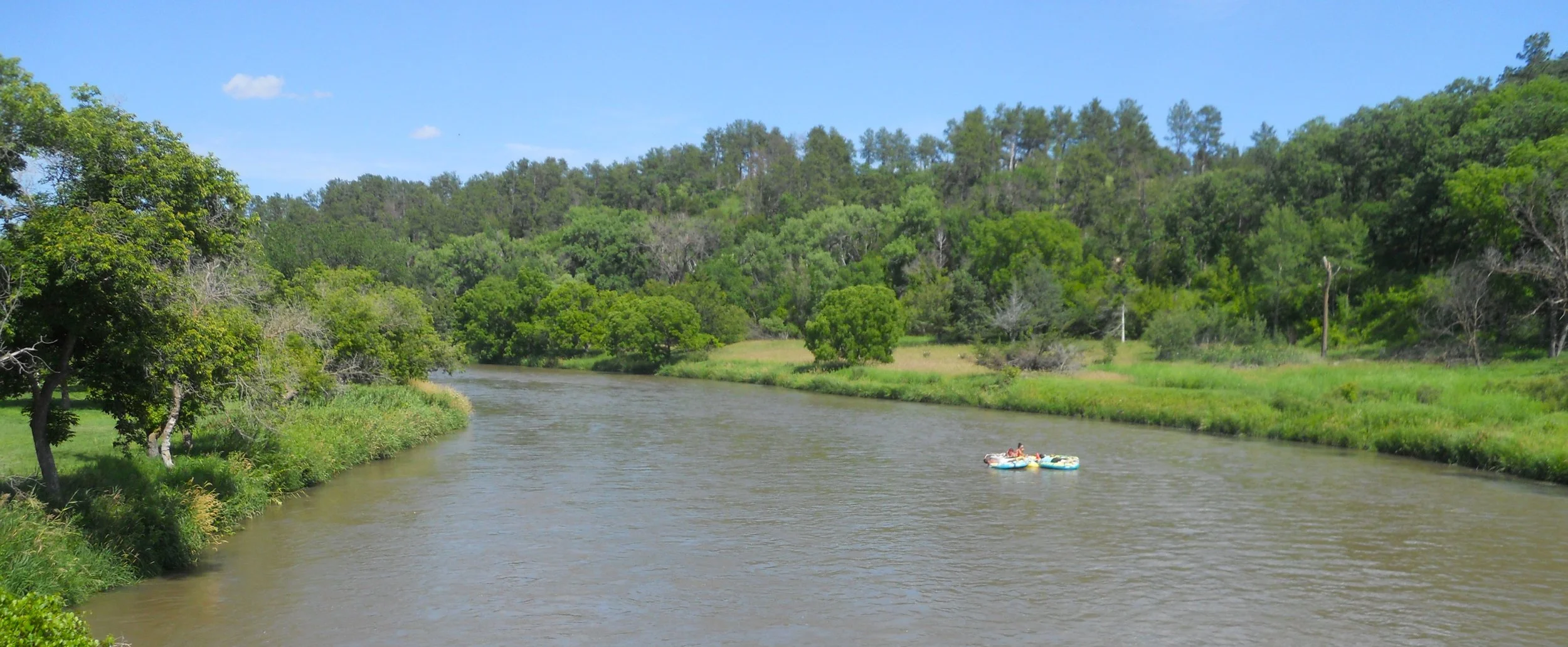
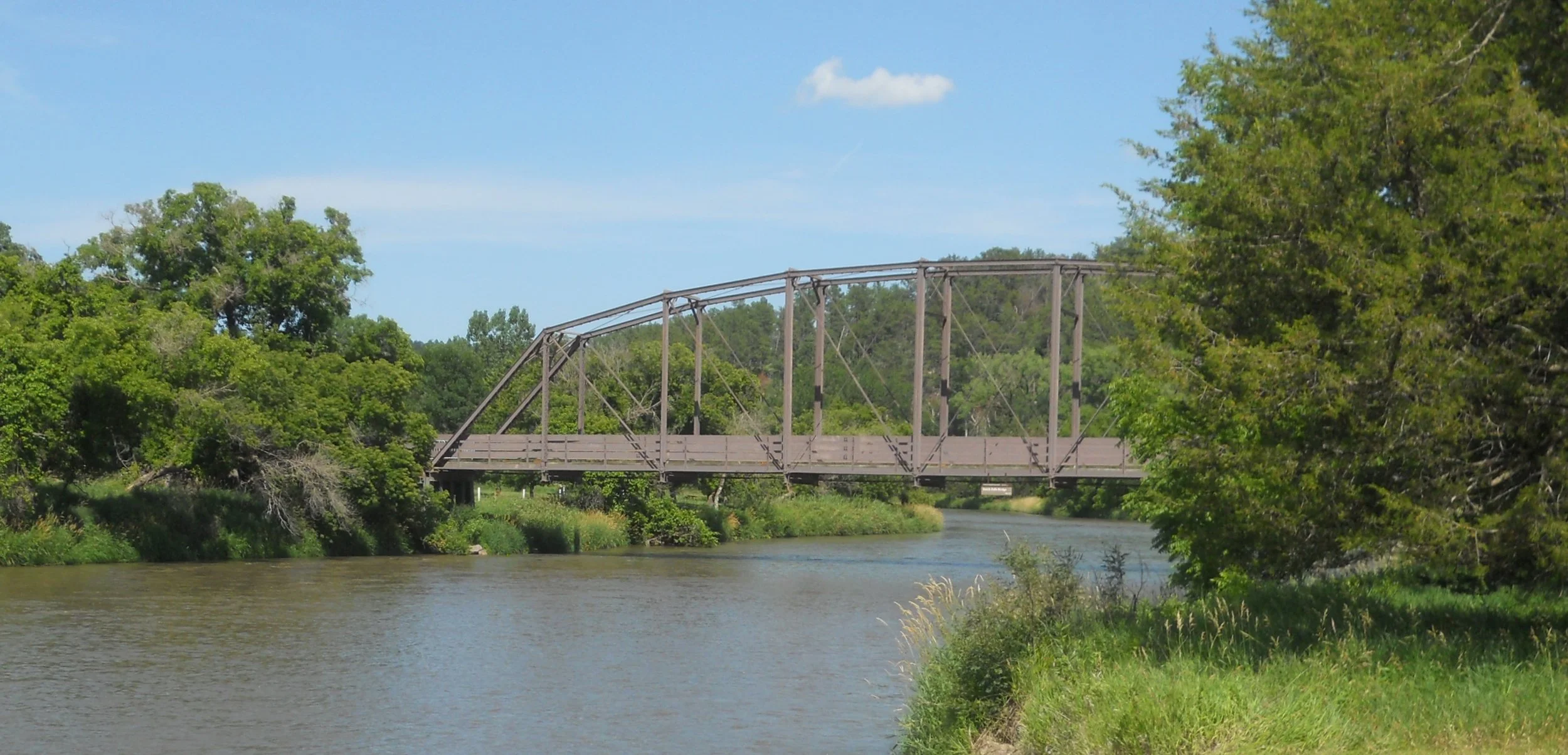
The Niborara National Scenic River was getting a good workout today. Plenty of visitors were on, in, or next to the water. Ranger Lela suggested I access the river at Smith Falls, the tallest waterfall in Nebraska. She said I had to get wet to make this an official visit since the NPS only manages the river’s water, not the shoreline or bordering land. I was prompt to do so once I reached the riverbank. The Verdigre Bridge spans the river at this location. It was built in 1910. In 1995 it was moved from the town of Verdigre to this location, to help visitors cross the Niobrara to see the falls.
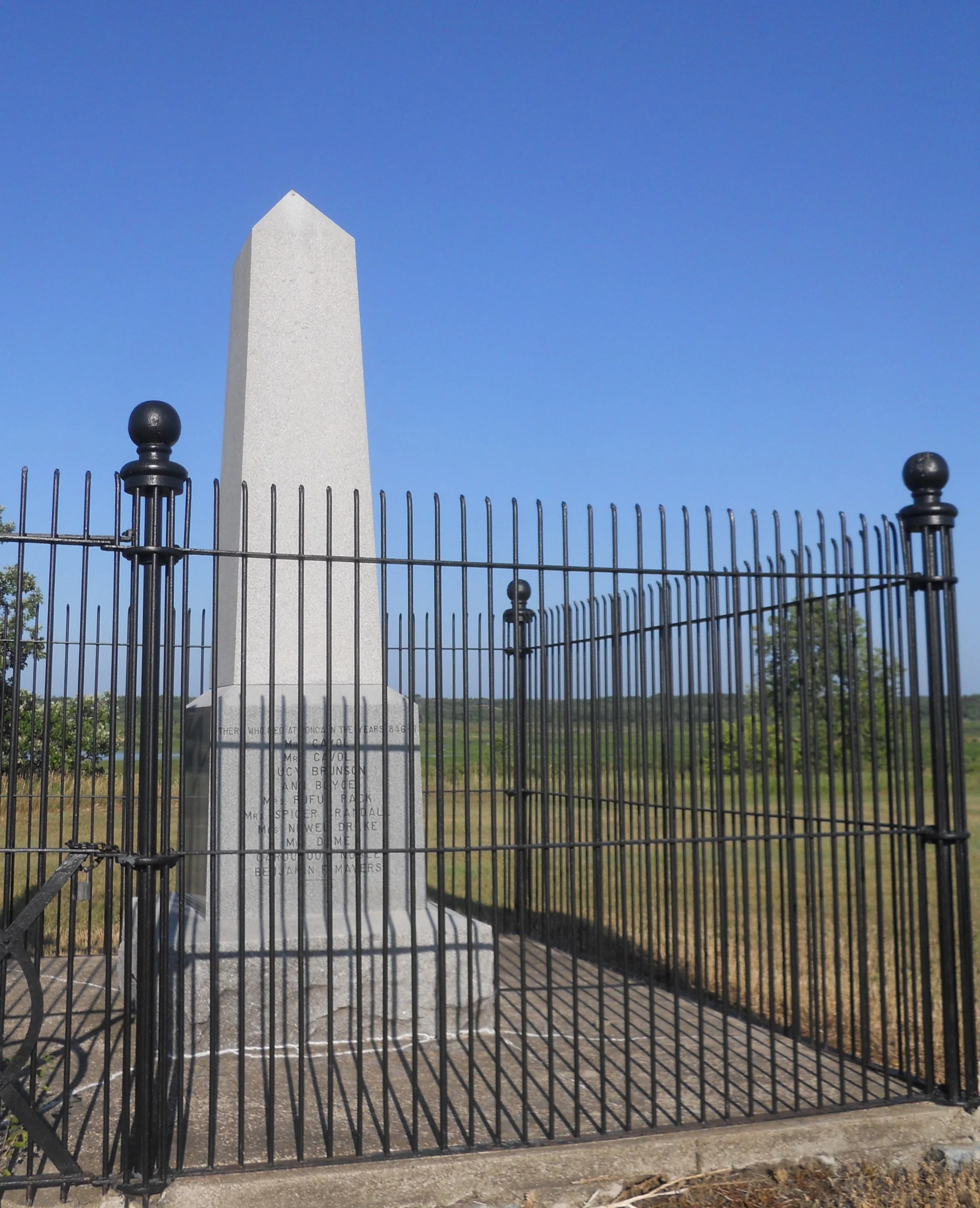
The Missouri National Recreation River is comprised of two sections. I stopped in both. A Mormon Monument is located just off route NE 12, west of the town of Niobrara, in the upstream section. It sits on the bank above the Niobrara River. The NPS map shows it to be within the park boundary.
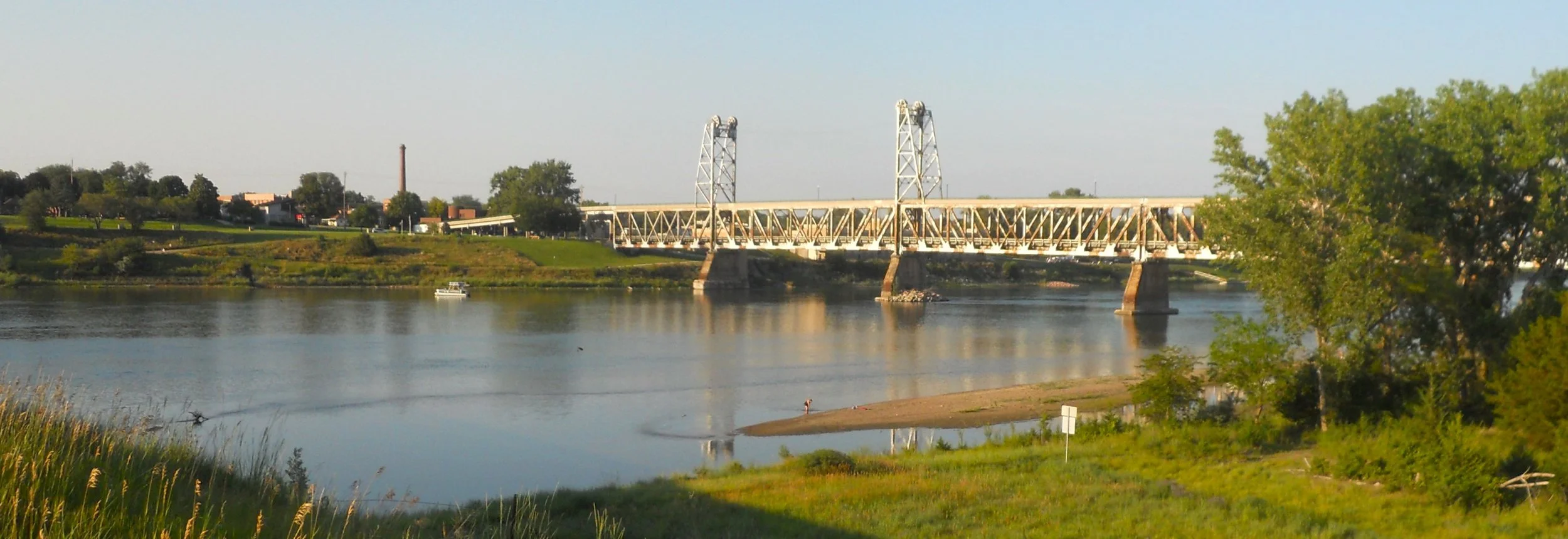
The US 81 bridge which goes over the Missouri River at Yankton, SD, is called the Discovery Bridge, and is in the downstream section. From there one can view the Meridian Bridge (photo), completed in 1924 with a “vertical lift” design. This bridge helped complete the Meridian Highway, a north-south road from Winnipeg to Mexico City.

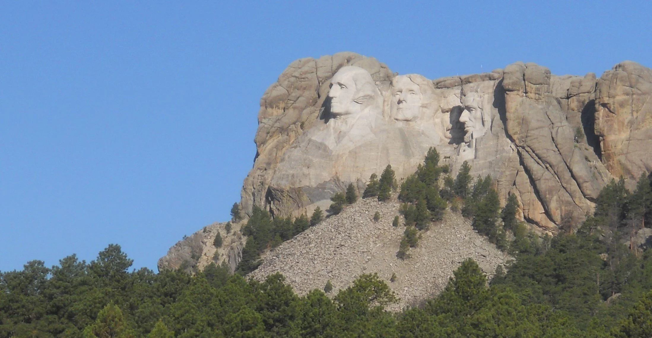
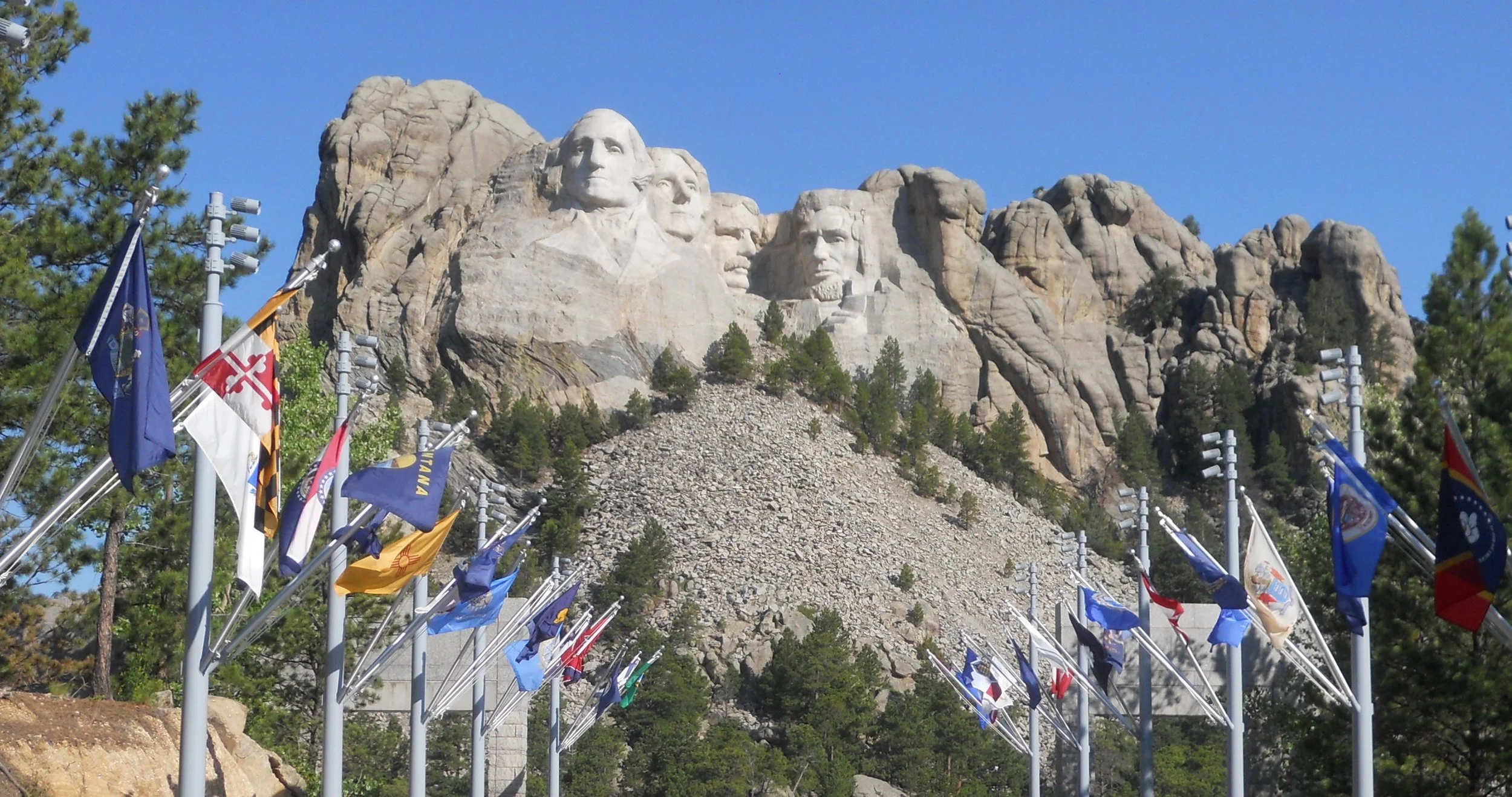
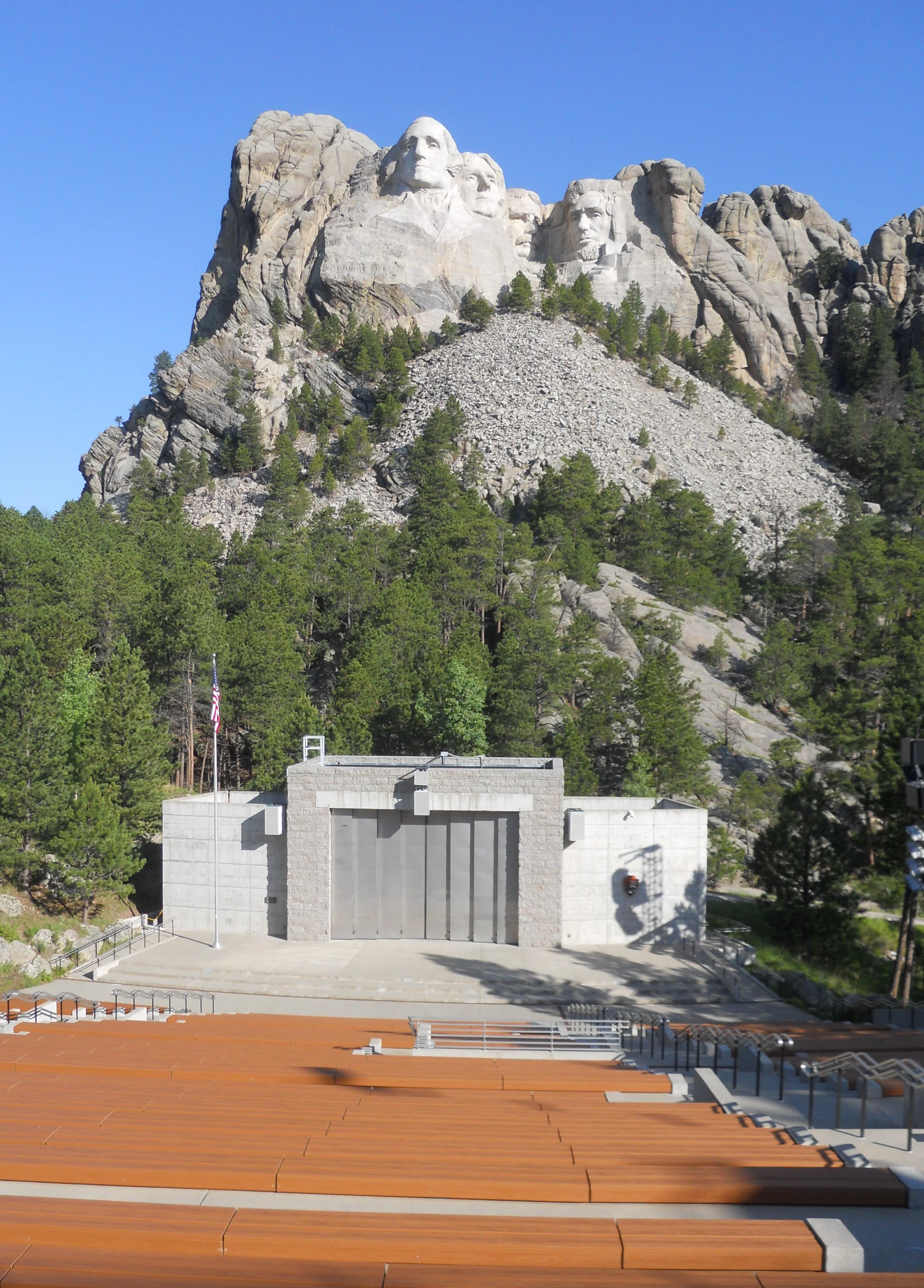
DAY 11 (July 1) - Who has not heard of Mt. Rushmore National Memorial? Who knows the four Presidents were not the initial choice for the granite carvings. Lewis and Clark were proposed, among others. In the end, four monumental aspects of America were chosen: birth, growth, development, and preservation. Those four words are connected to Jefferson, Washington, Lincoln, and Roosevelt. Gutzon Borglum was the sculptor. He chose to make the carvings colossal in size because he said men of this magnitude who transformed this country into the greatest on earth should be appropriately represented. Blasting began in 1927. The memorial was completed in October, 1941, seven months after Borglum had died due to complications from surgery. Flags of the fifty states and five territories line the pavilion leading to the amphitheater and viewing platform.
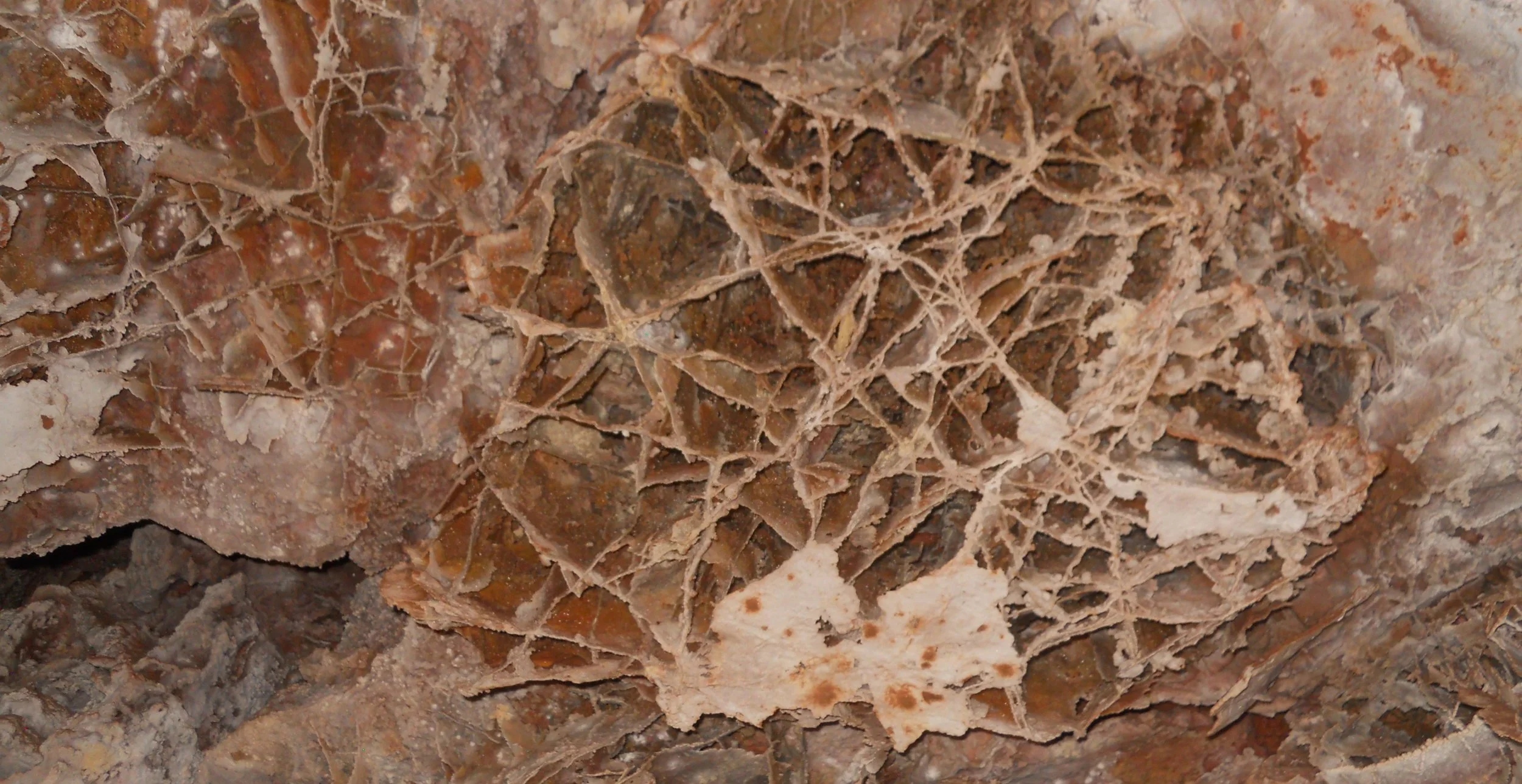
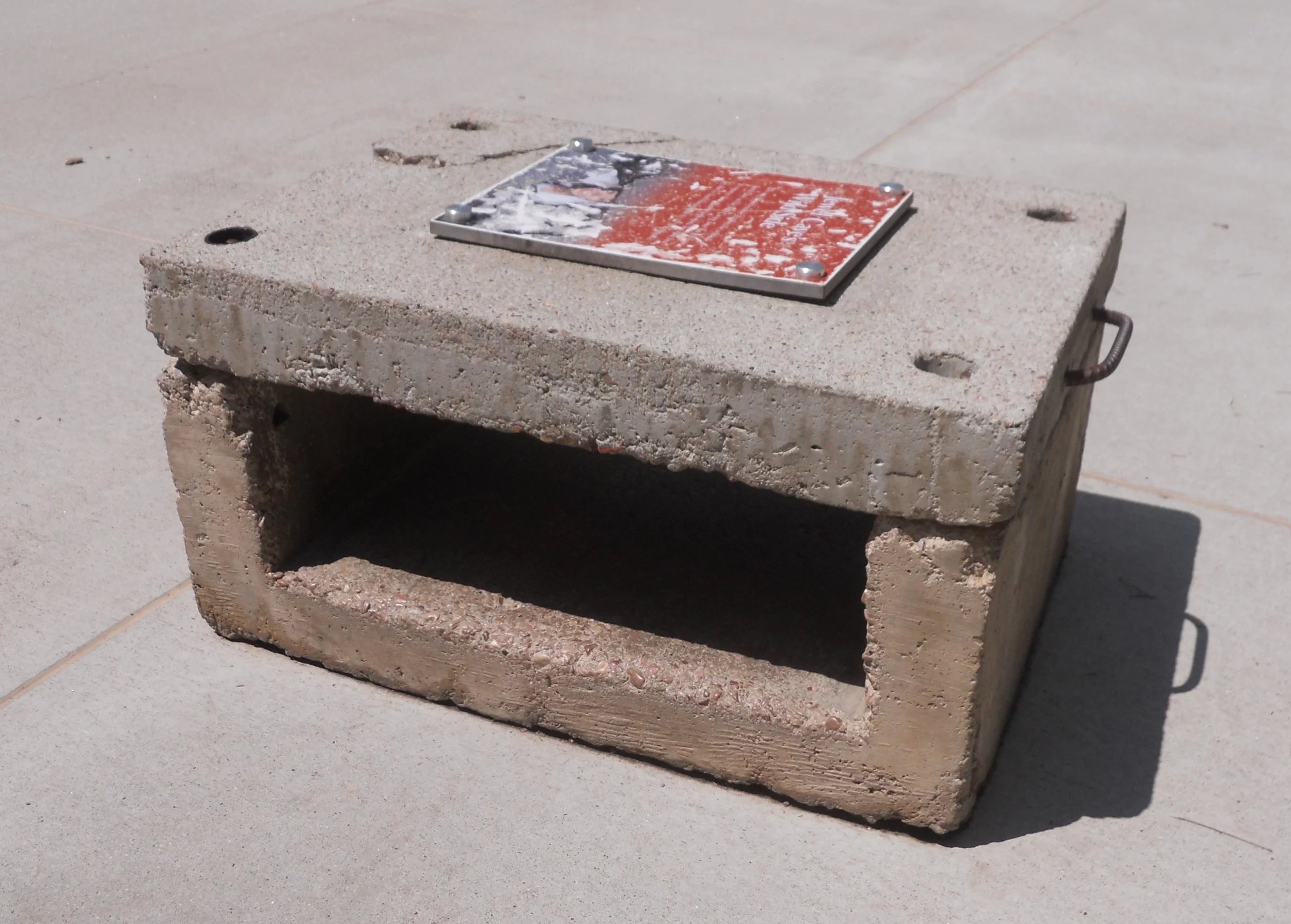
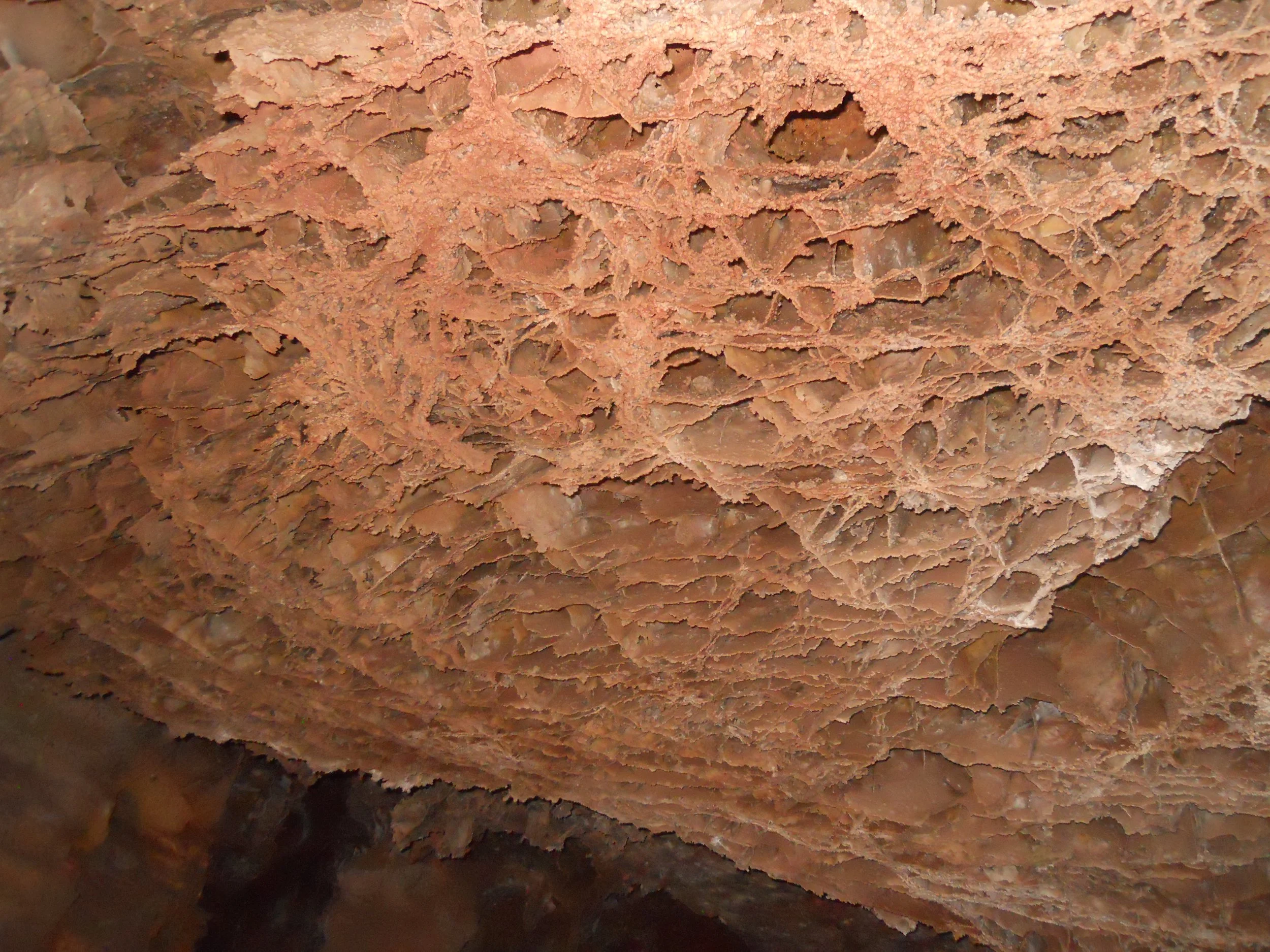
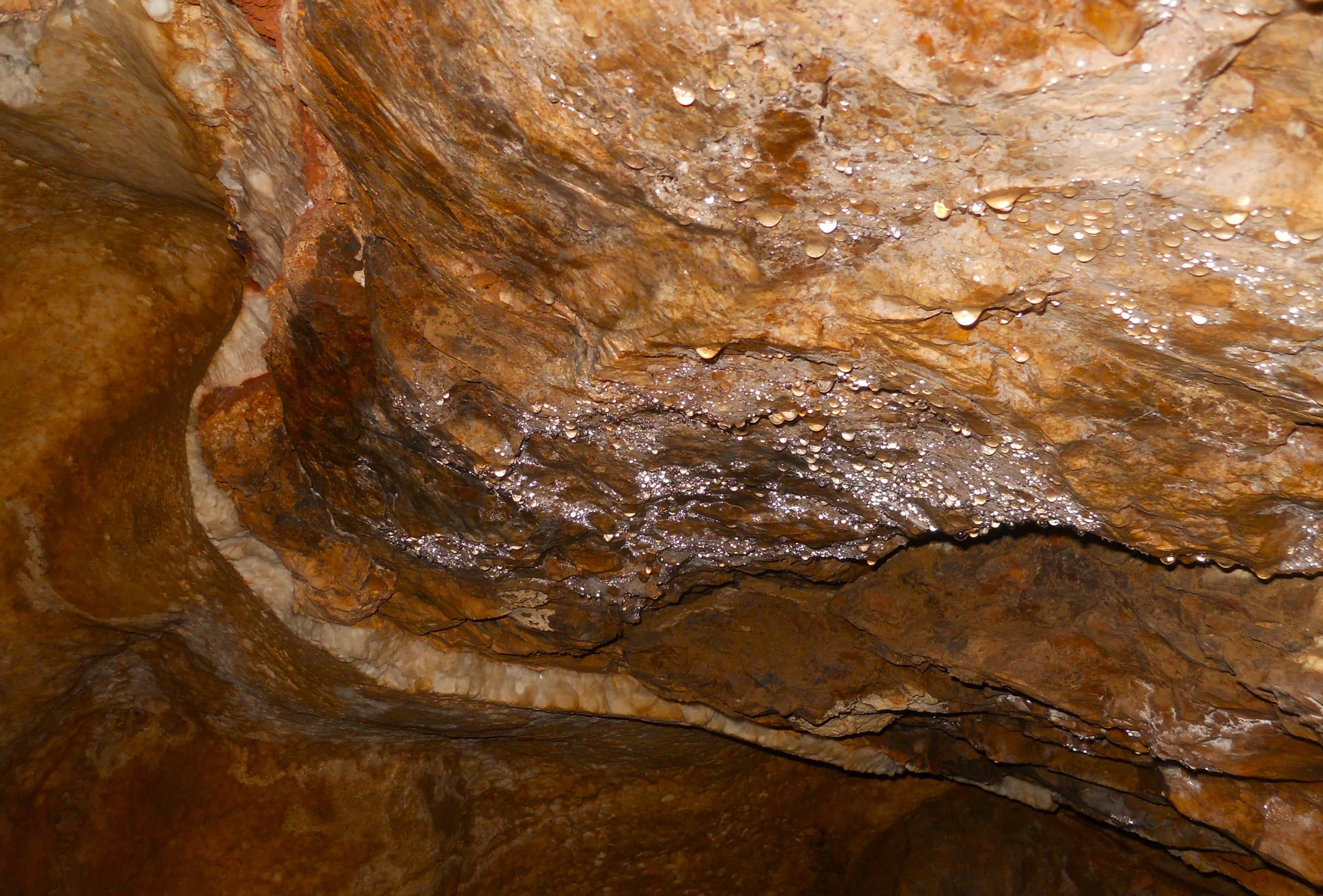
Wind Cave National Park is home to 95% of the world’s known “boxwork”. This is a cave formation where acid water has eaten away softer material, leaving behind the harder substance. In a couple sections on the Fairgrounds Tour, this is all we saw. At the VC a box awaits those willing to see if they can qualify to go on the Wild Cave Tour. Craig’s family was up from Texas. His son gave it a try, and was successful, but barely. The height is only 10”. I would not make it. Thankfully there are the other non-crawling tours at the park.
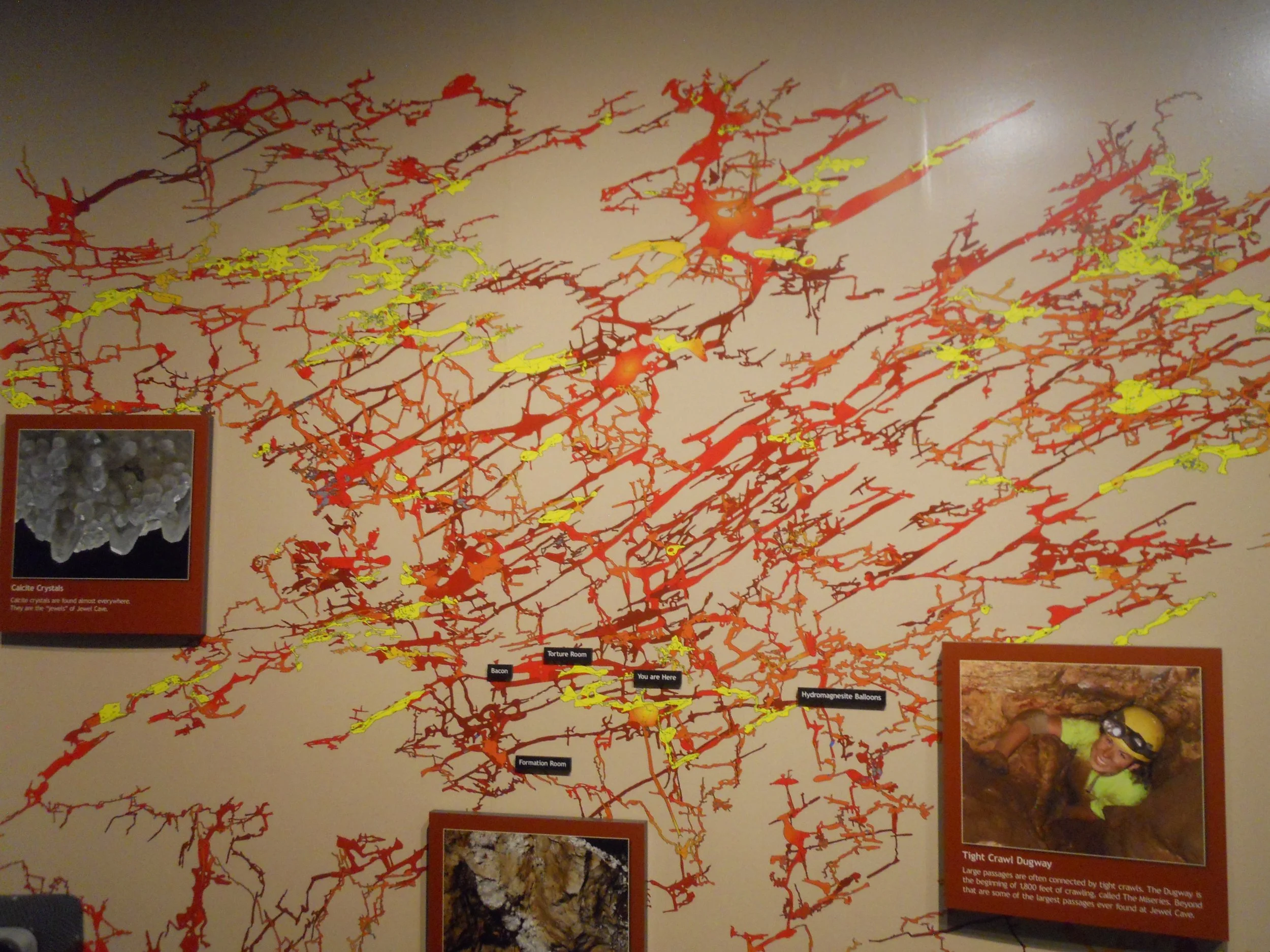
Jewel Cave National Monument is just down the road from Wind Cave. But the staffs say there is no current knowledge of the two cave systems being connected. That may change decades down the road as more exploration occurs. Jewel Cave also has its Wild Cave Tour entry test… a little narrower than Wind Cave. The VC has a large map of the cave system, the second longest in the country at over 200 miles. In the past seven years a number of cave lakes have been discovered, at the 700’ level (feet below the surface).
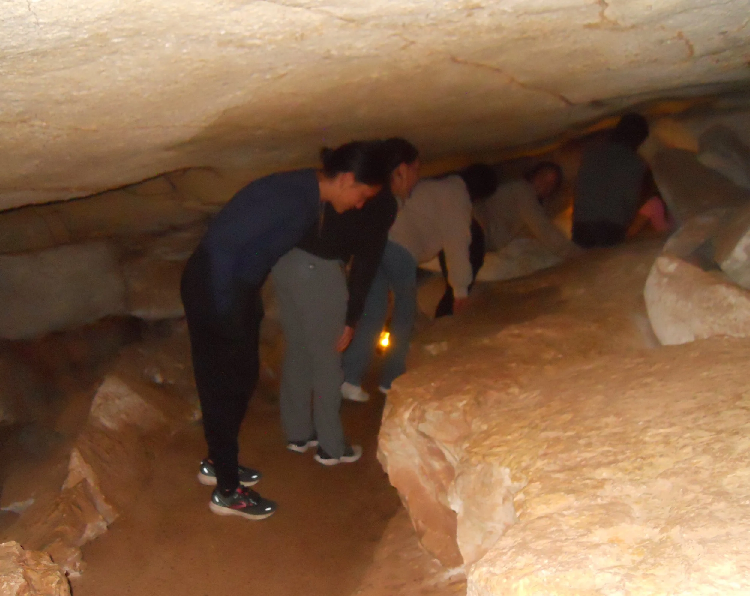
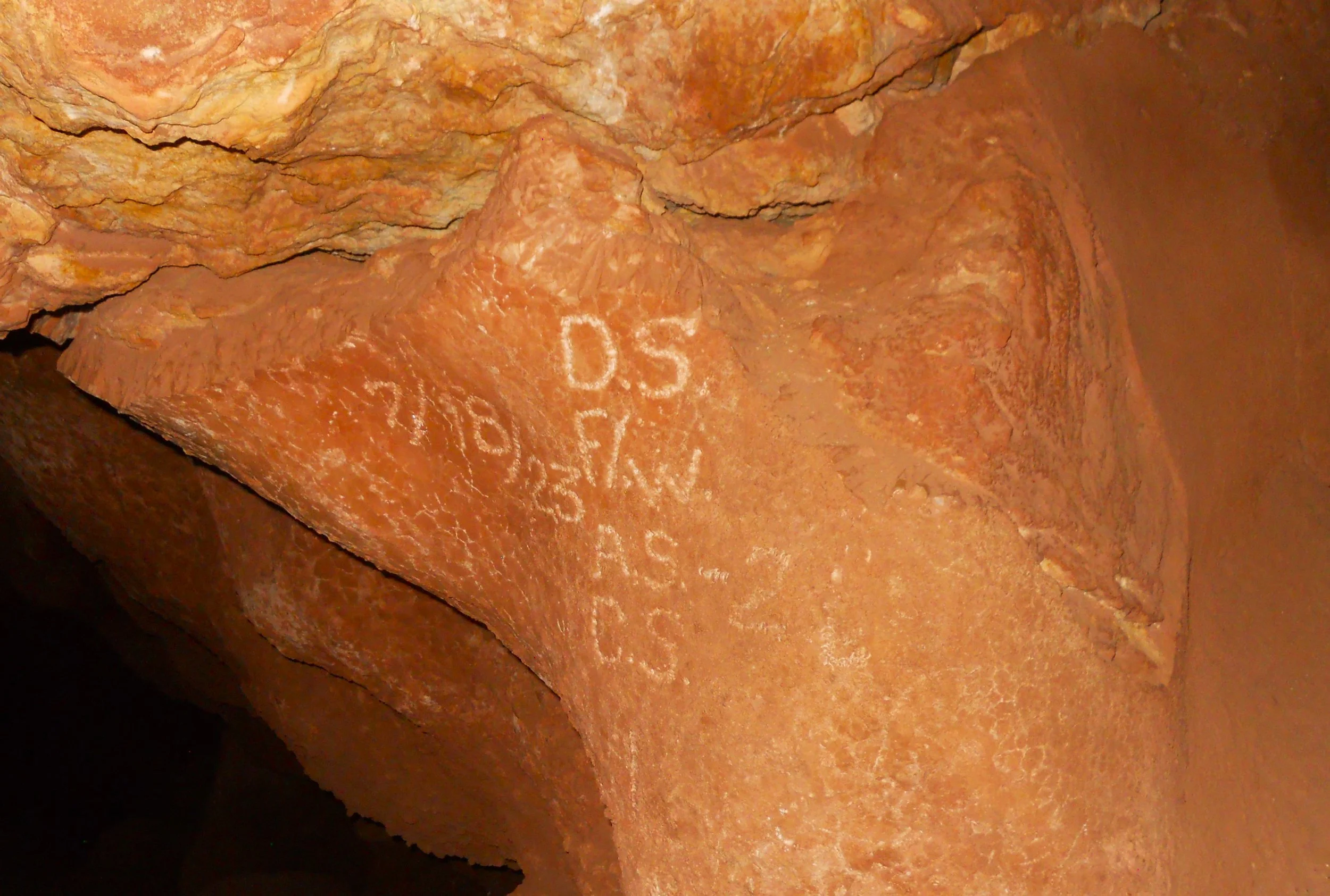
I had never taken the Historic Lantern Tour, so that was the objective today. One of the park’s earlier VCs is at the site of the natural entrance to the cave system (discovered in 1900 by two gold prospectors). The structure was built by the CCC in the 1930s. A short distance inside the cave we came to 1923 graffiti. But, since the markings are over 50 years old, they are considered artifacts. The Park Ranger said we should not be adding our own 21st century graffiti to the walls. Thankfully, we had 21st century battery powered lanterns, so no need to worry about waxes or oils. And this tour is not as ‘convenient’ as the other offerings. Bending over, turning in tight corners, climbing narrow/tall wooden staircases, and slipping on rocky floors made for an original experience.
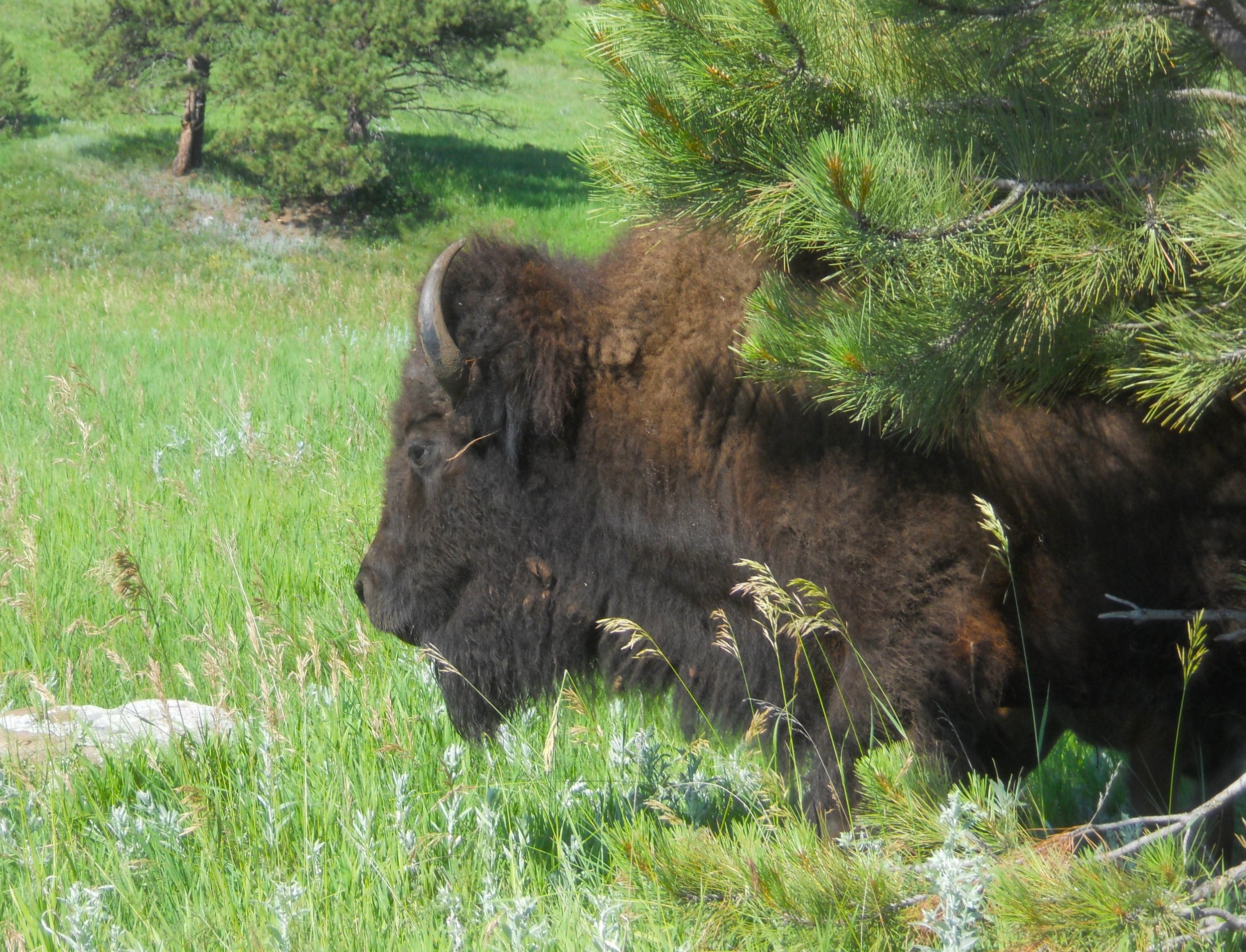
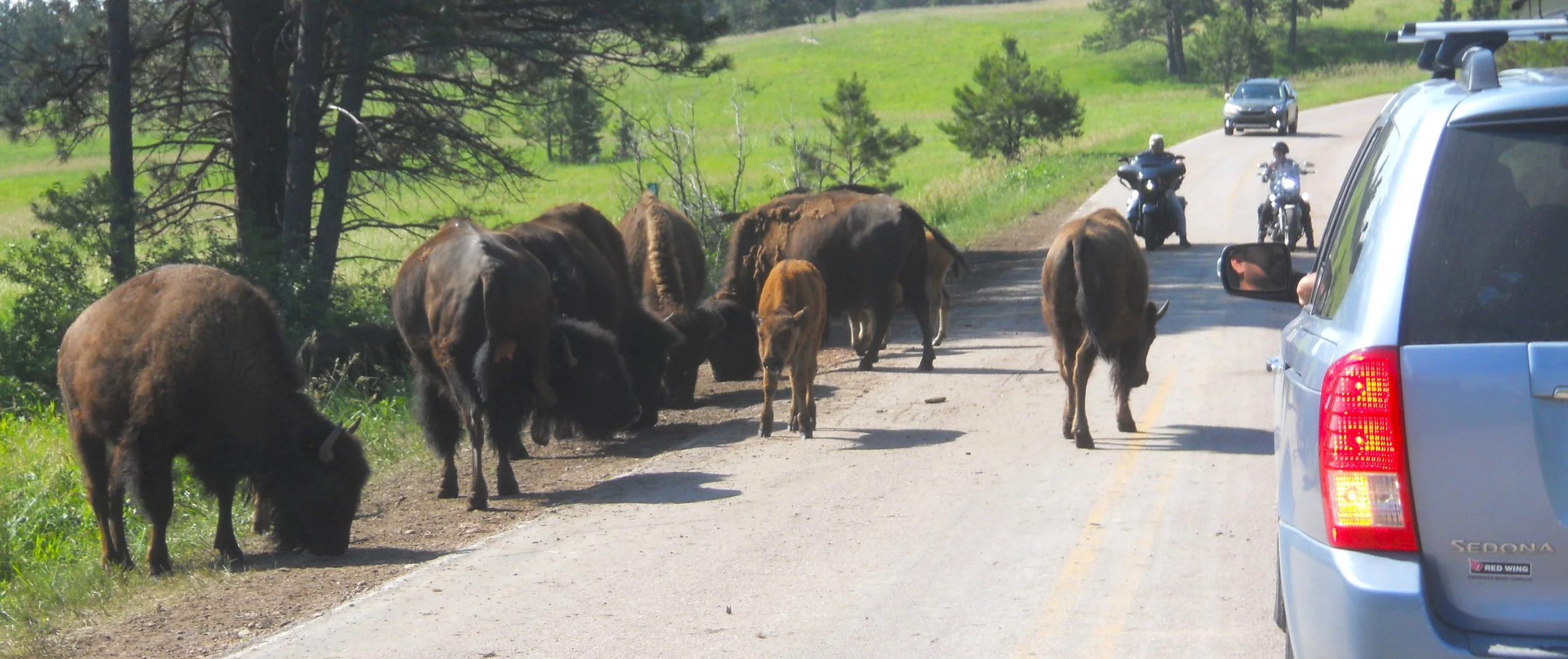
Almost forgot. Between Mt. Rushmore and Wind Cave, I came across a herd of 200 bison. This is the resident group in Custer State Park. Many of them did not want to get off route 87. We were stopped for ten minutes before some engine revving persuaded the group to completely move to one side of the road. A couple of the beasts came within eight feet of my car.


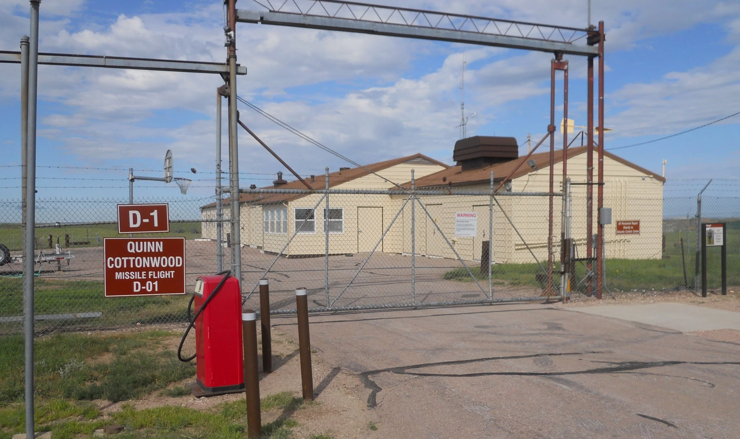
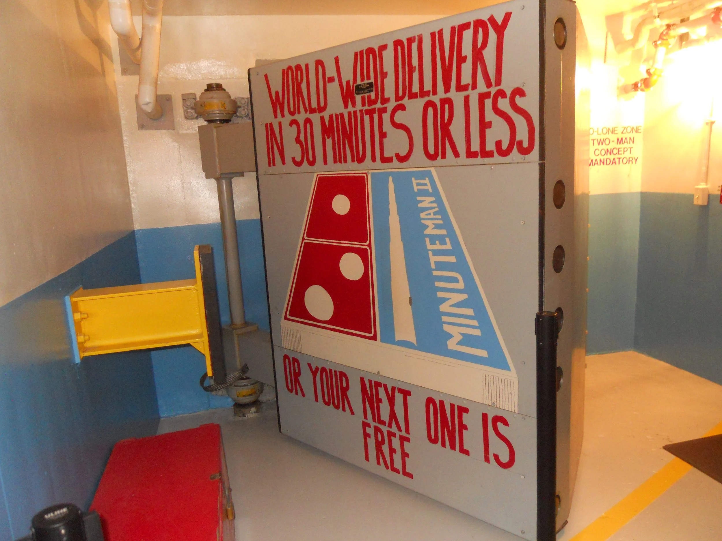
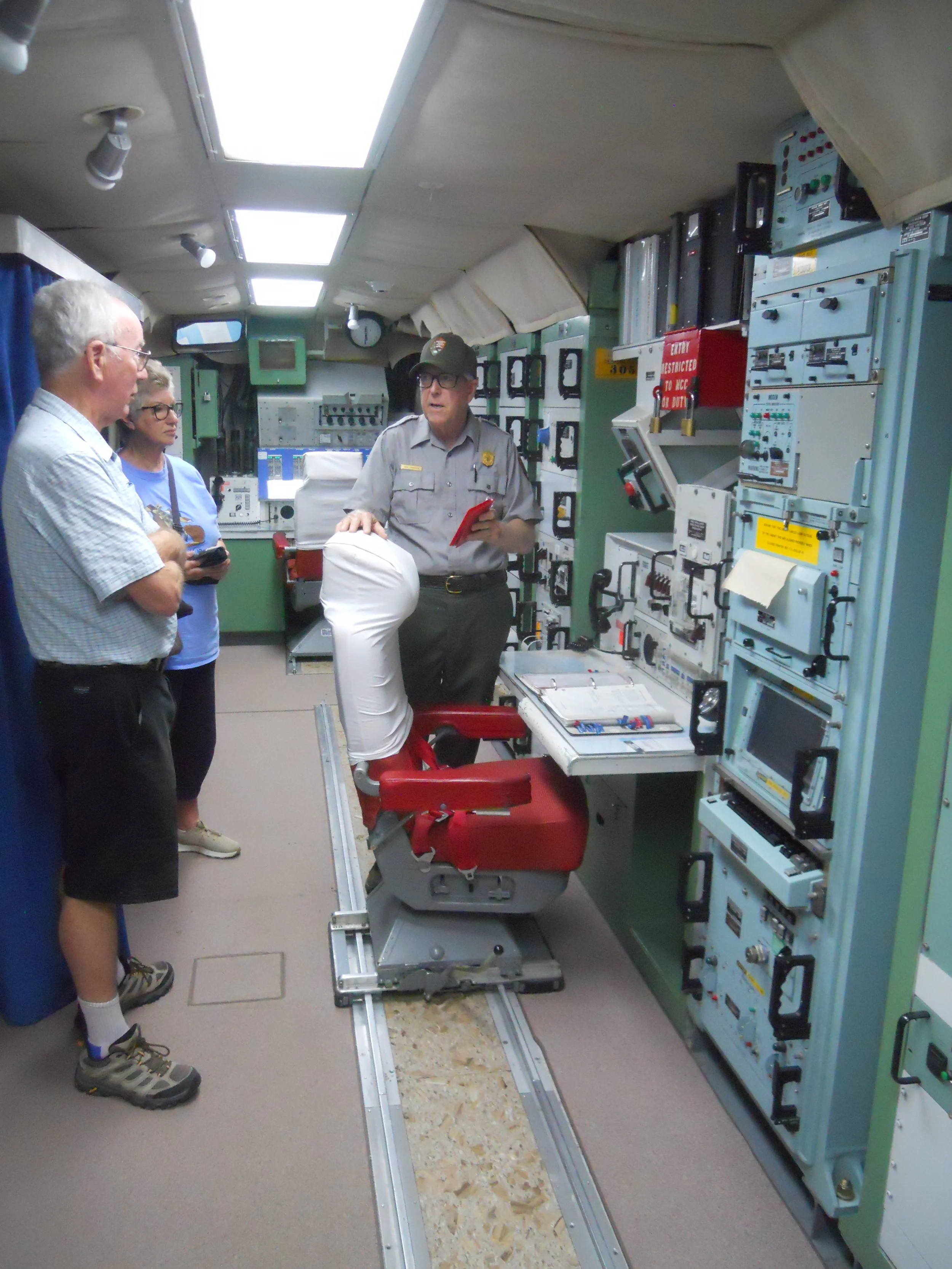
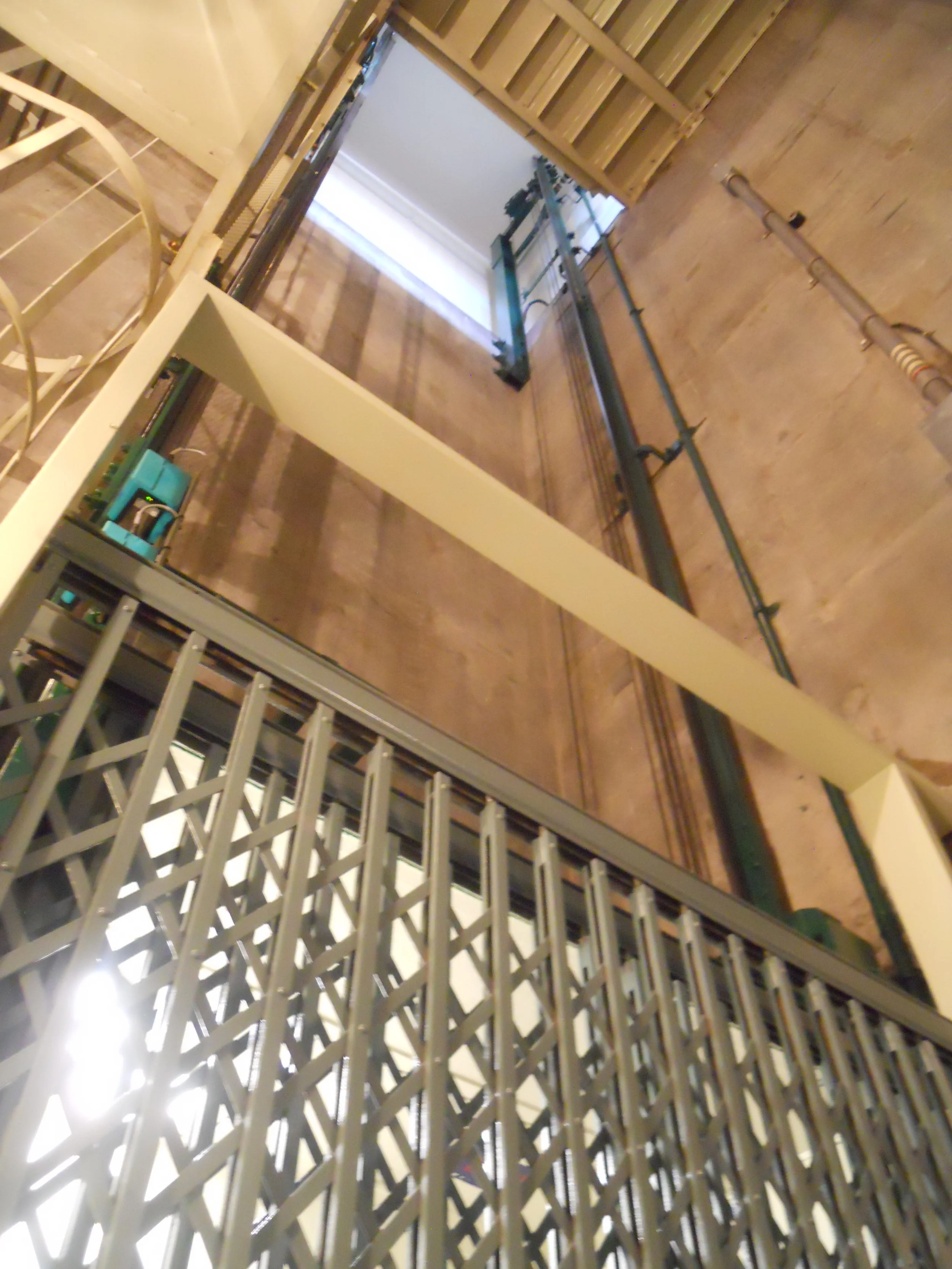
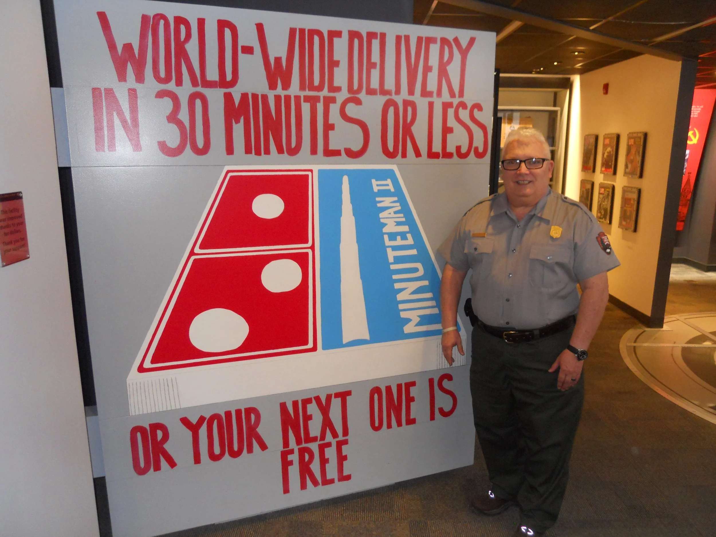
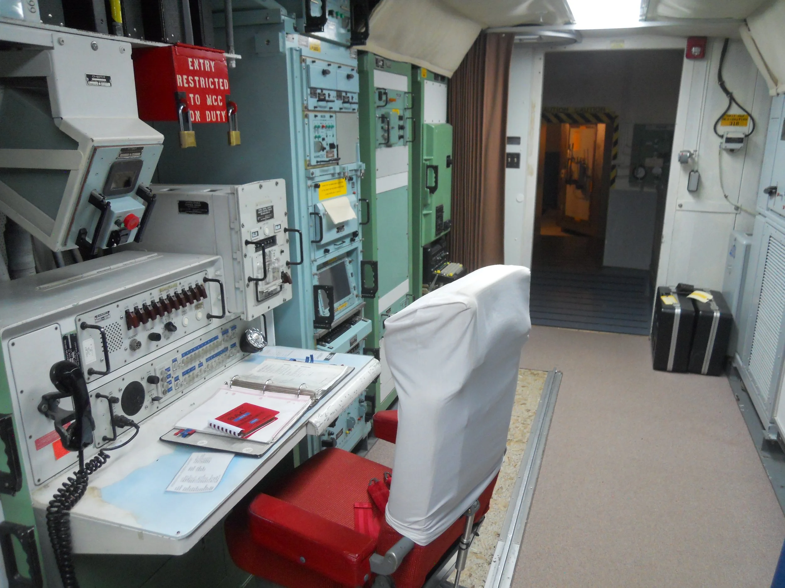
DAY 10 (June 30) - Minuteman Missile National Historic Site is the lone remaining Launch Control Facility left from the 1990’s agreement between the Soviet Union and the USA that deactivated three missile complexes in the upper Northern Plains. The agreement allowed for one facility to be left for educational purposes. Delta 1 was the lucky site. This site closed in 1993, and looks exactly like it did when the last airman left and locked the door behind him. A sign on the fence says deadly force is authorized. The above ground building has sleeping quarters, a kitchen, game room, tv room, etc. The tour goes down a 30-foot elevator shaft to the command capsule. The iconic painting on the 4-foot thick access door greets all who enter. A life-size model of the door is at the VC, where I met Ranger Tony. He used to be stationed with the Missile Squadron in his younger days. And during that time he was given the green light to paint the door at Delta 1. It was a thrill to meet the artist of this renowned painting.
Ranger Paul gave me and a wonderful couple from Australia the details of the command center, showing which key ports would be turned for a launch, as well as other dials and buttons. Two men would be locked in the center for 24 hours, before being relieved by two others.
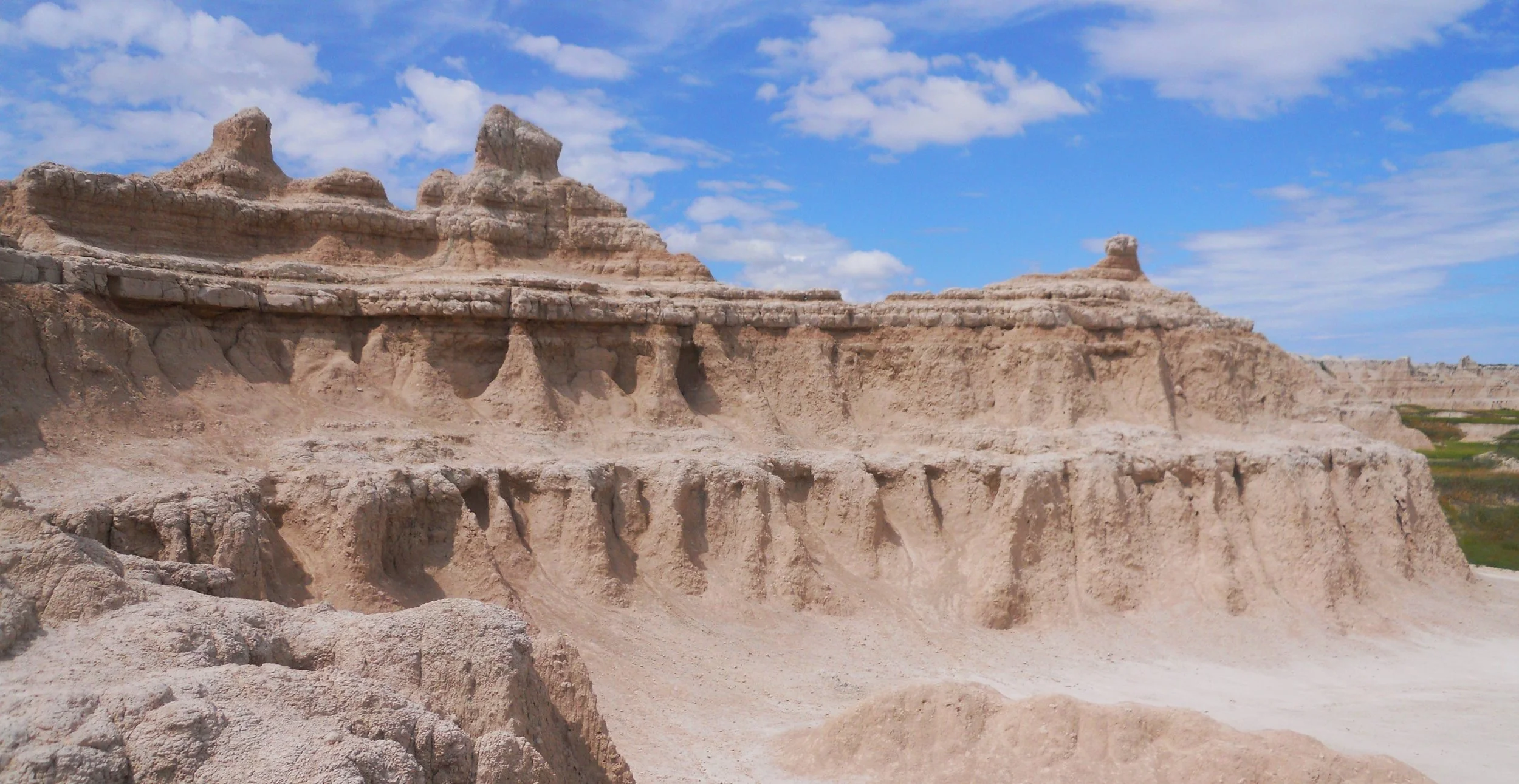
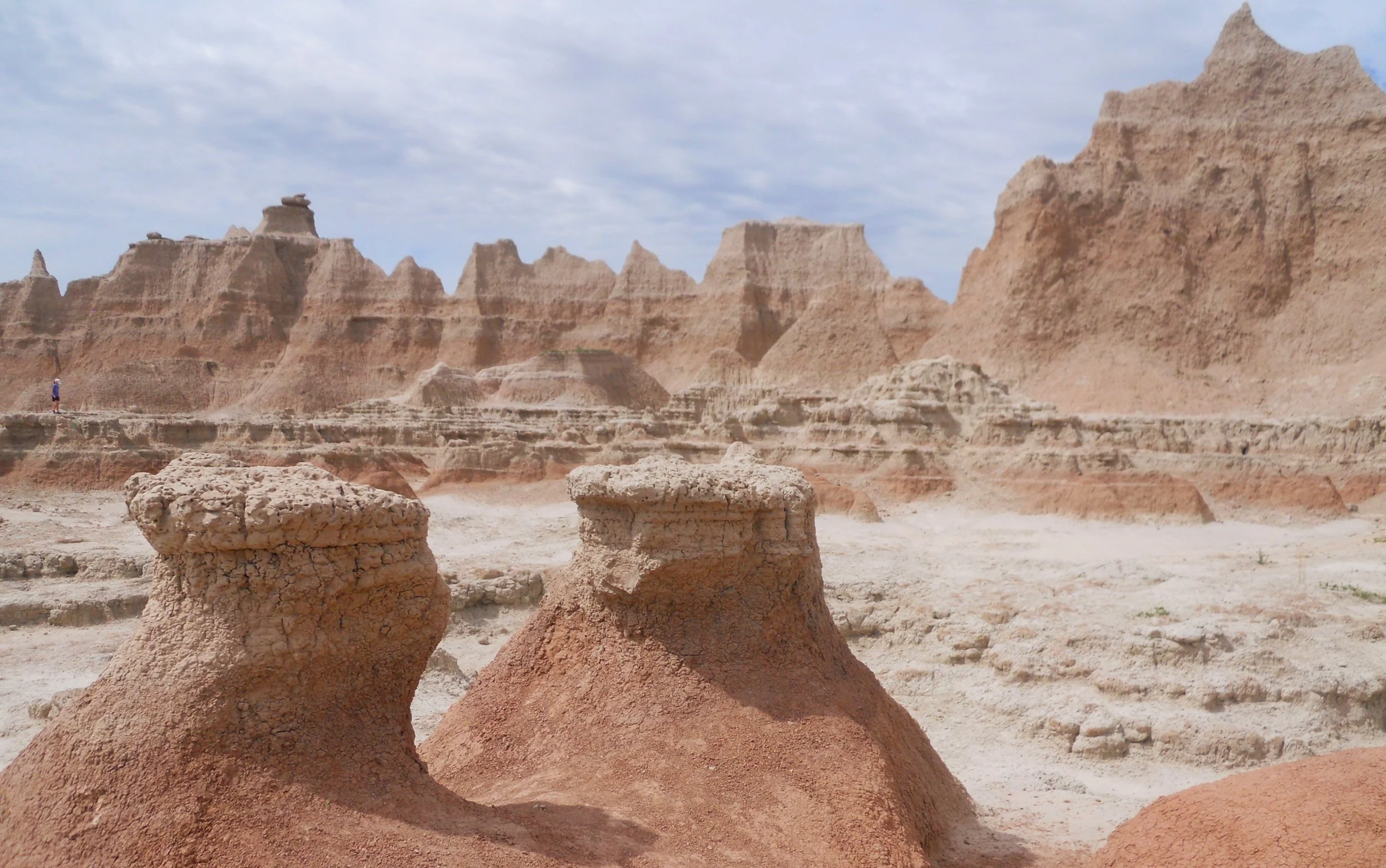
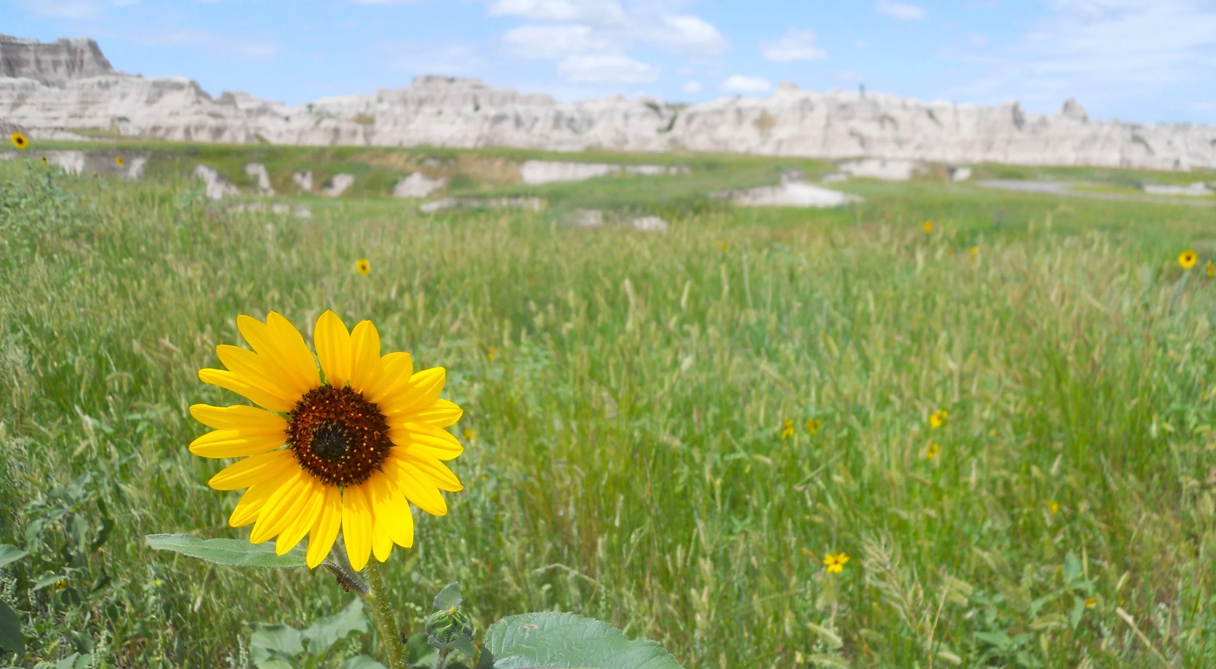
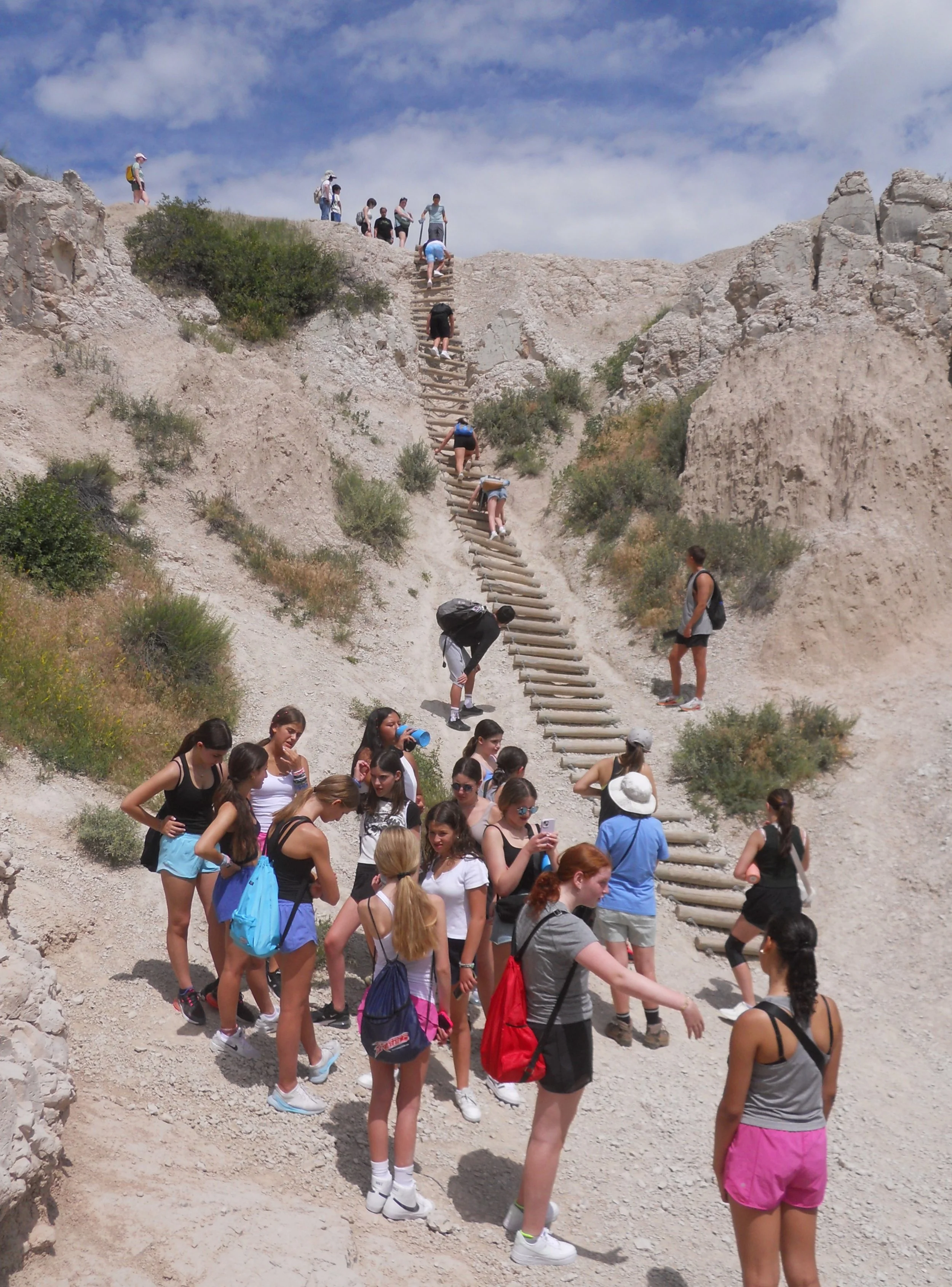
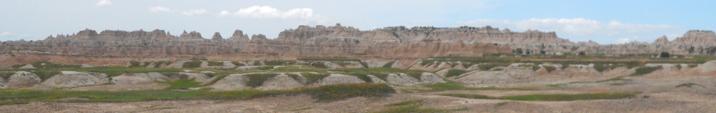
The east entrance to Badlands National Park is just down the road from Minuteman Missile. All the formations in the park are basically mud, silt and debris compressed over millions of years. There are some green grasslands in the park, with plenty of sunflowers popping up. The Notch Trail includes a 100-foot tall wood beam ladder. Though I saw one deer and tens of prairie dogs, the primary objective of observation is to find fossils sticking above ground. The park VC keeps a Polaroid collection of visitors who have discovered these ancient relics. It is amazing what some people have seen as they hiked across the park, then reported the new findings to rangers.
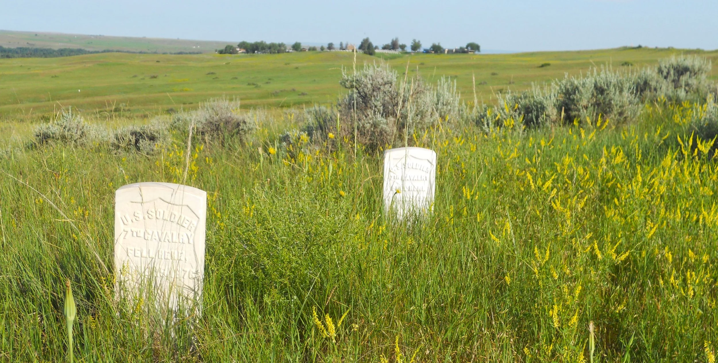
DAY 9 (June 29) - History books in junior high school mention Little Bighorn Battlefield as the place where General Custer and 263 of his men of the 7th Cavalry were killed in their “Last stand.” But that is a disservice to what transpired here. The other side of the story has been left out. The Arapaho, Cheyenne, and Lakota were fighting for their homelands. The U.S. Government had broken many of its promises to the native peoples, subsequently sending troops to force alignment. What would you have done?
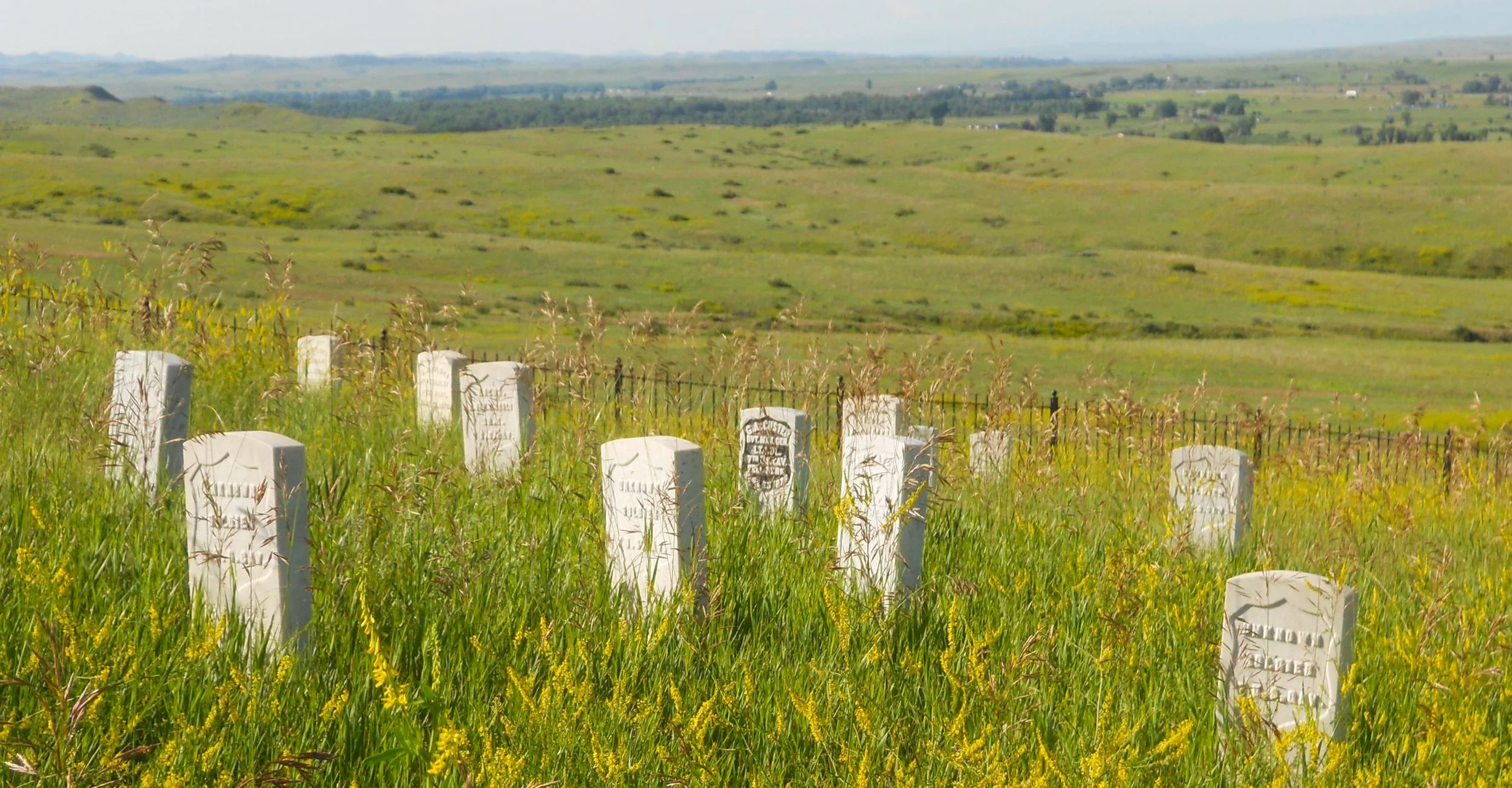
White markers dot the hillsides, each showing where a soldier fell. The distances vary from the main hill, where Custer was killed (his marker has the blank lettering).
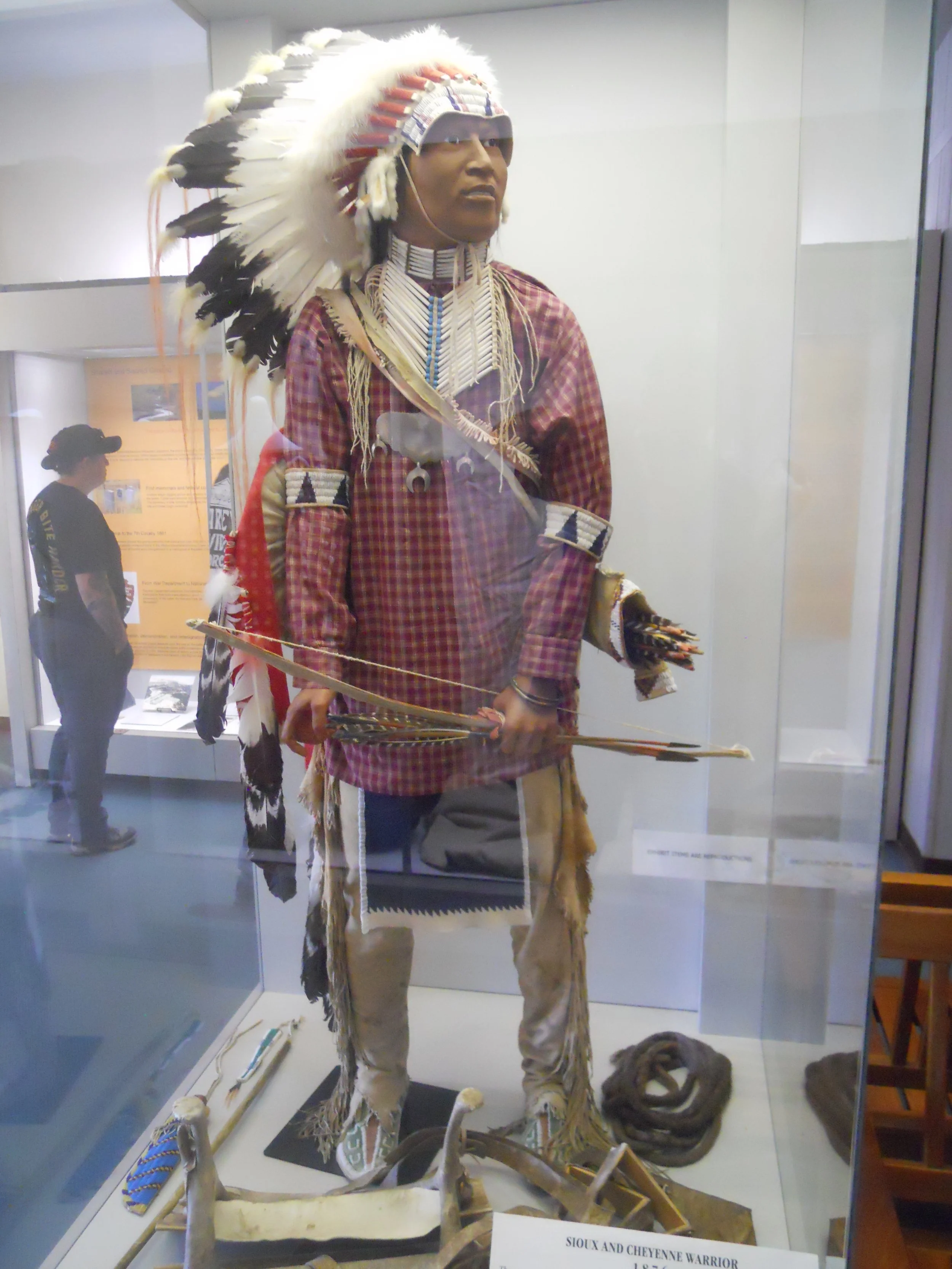
On this hill sits a large bush. Many tribal members have hung cloth and ribbons, to honor their ancestors. The VC has a display of how the warriors were dressed in the period around 1876 (the battle was fought on June 25, 1876). Photos in the VC show the 50th anniversary of the battle, with veterans returning to discuss that day’s events.
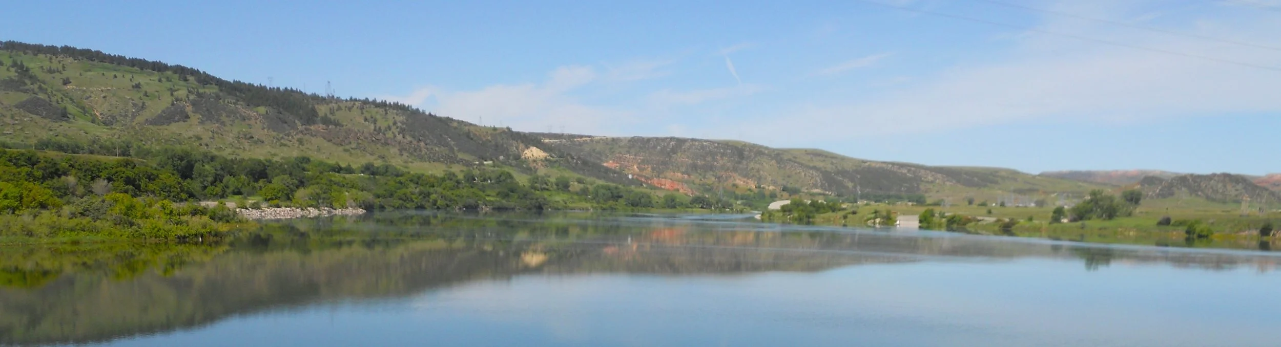
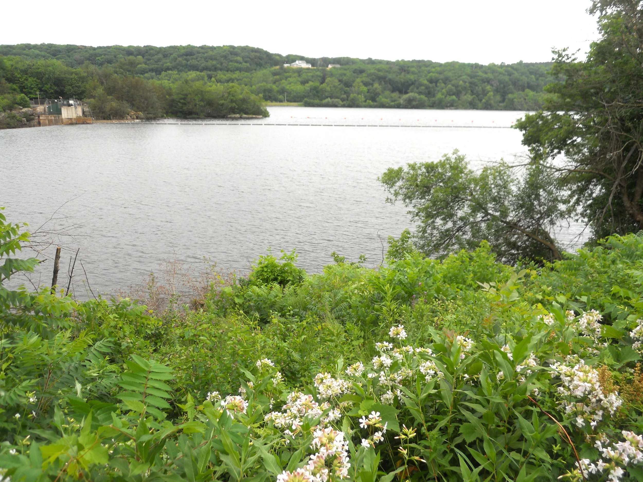
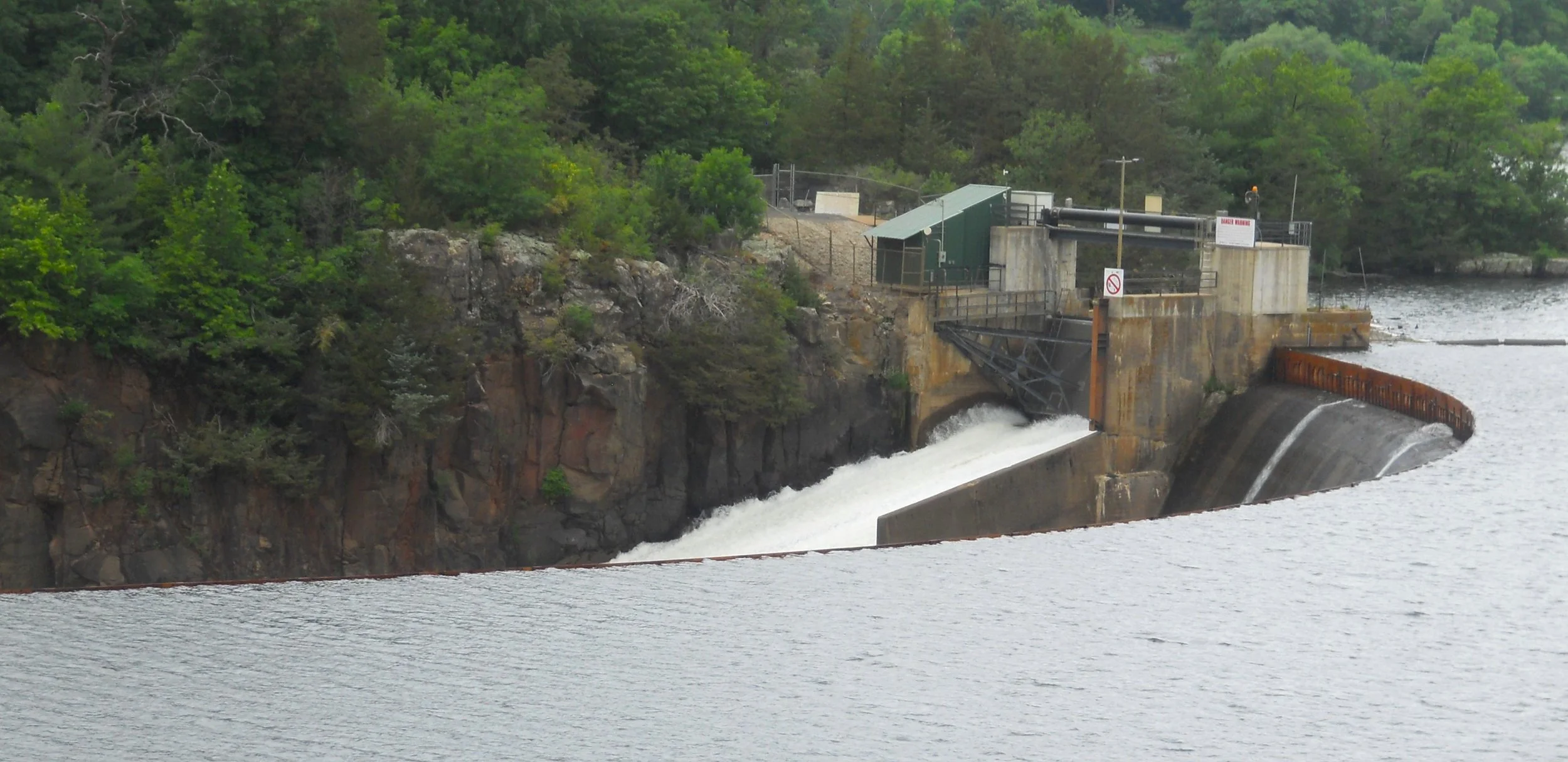
Bighorn Canyon NRA has two main sections, north and south. I went to the north, at Fort Smith. The Yellowtail Dam is the main attraction, since that controls the water flow of the Bighorn River going north to the Yellowstone River, and is what created the long lake for the southern portion of the park. Depending on how much water the Bureau of Land Reclamation needs to release, one might get unexpectedly wet if they are close to the water’s edge.
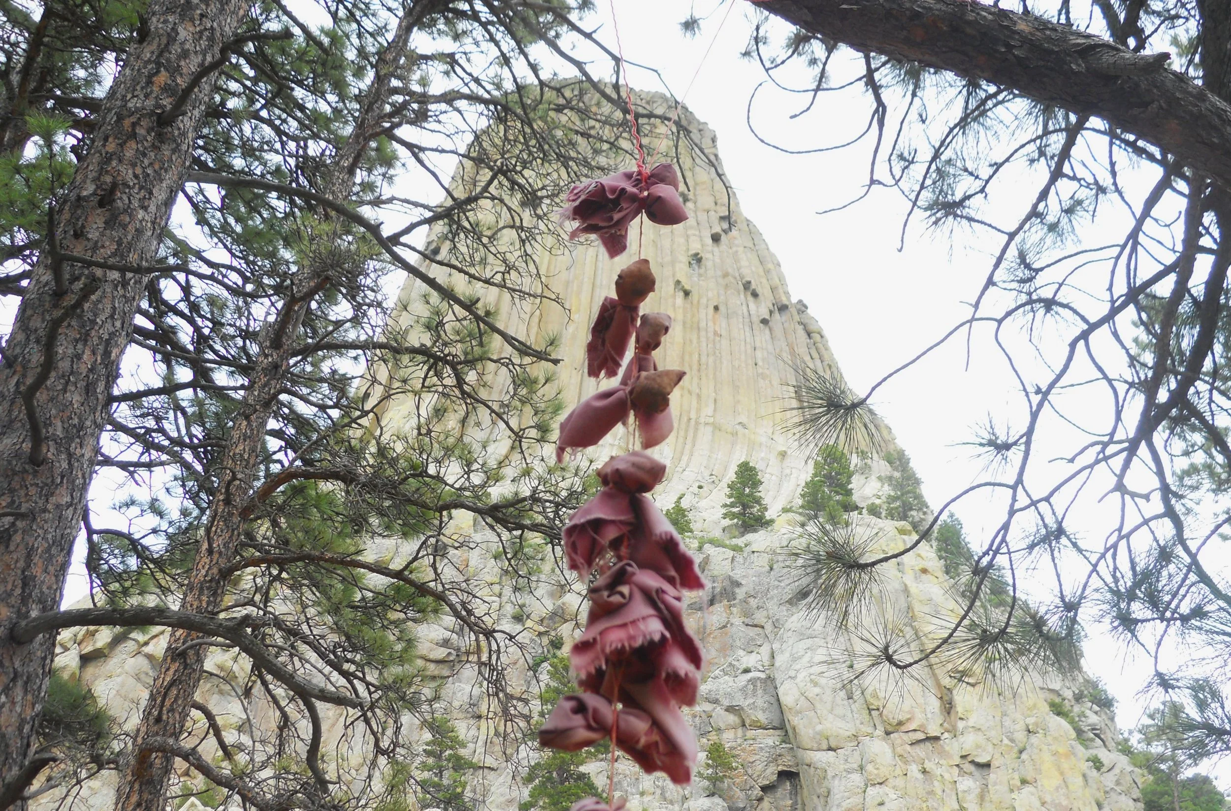
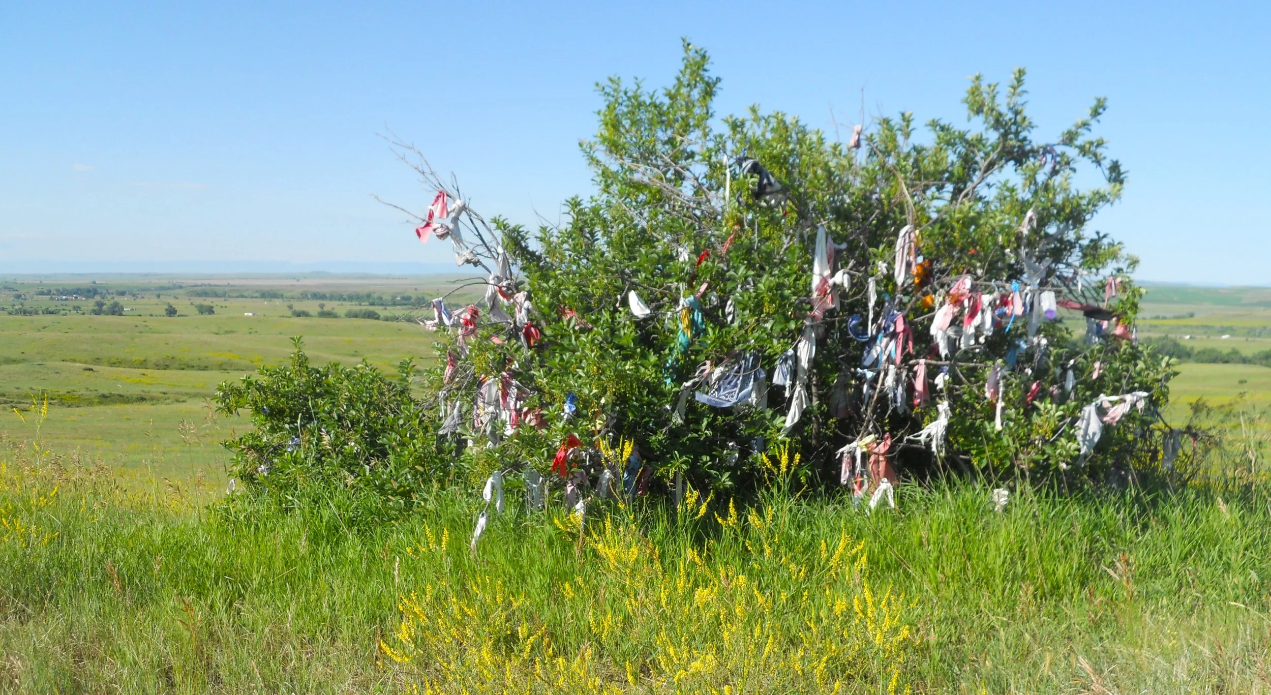
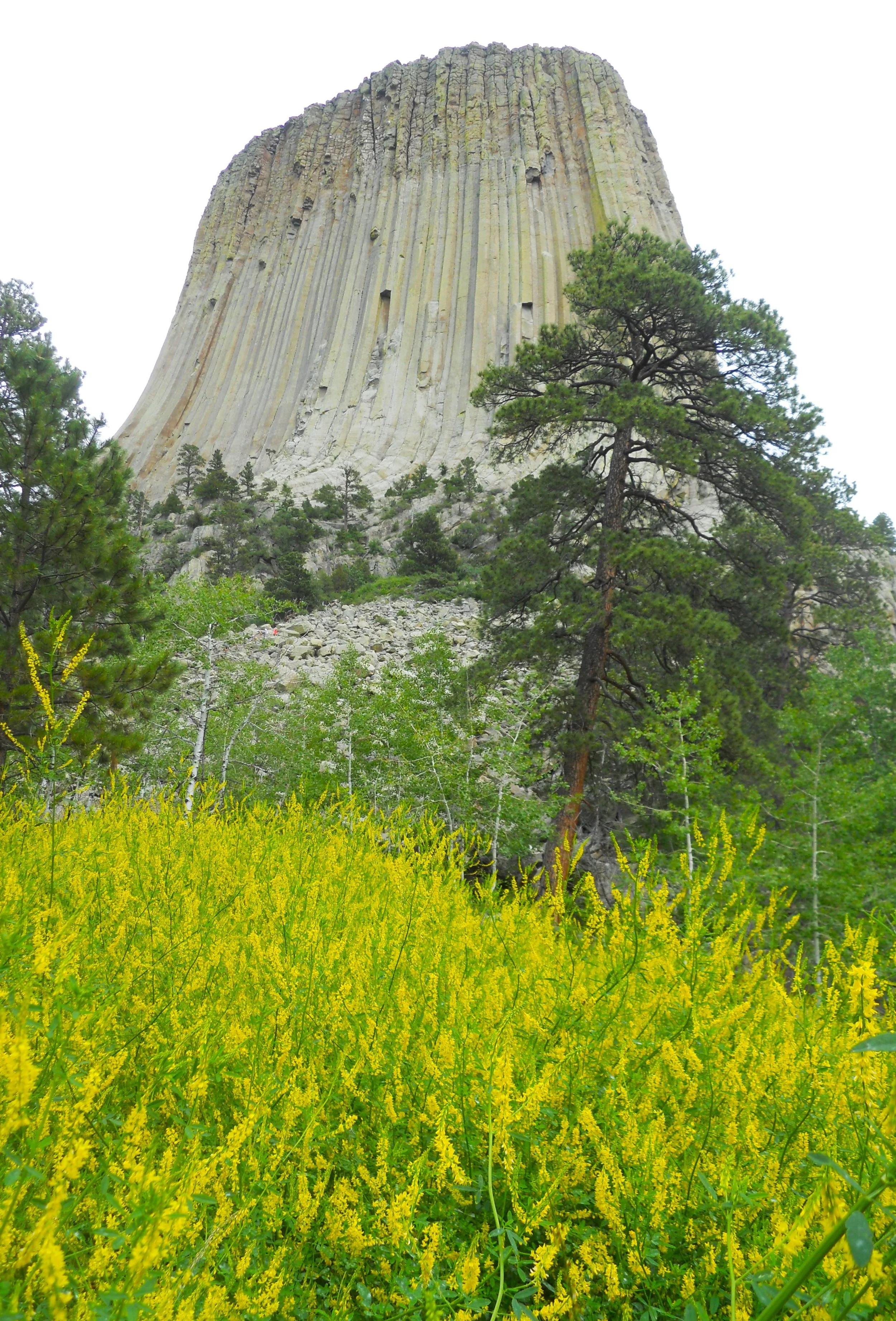
Devils Tower National Monument was the last stop. Each Northern Plains tribe has its own oral history of how the tower was created. A common thread is the presence of a giant bear, and the Great Spirit helping girls of the tribes escape death. As at Little Bighorn, pouches and ribbons are left on trees at the base of the tower.


DAY 8 (June 28) - Sorry for being a day late… WiFi in my hotel was slower than molasses flowing at the North Pole.
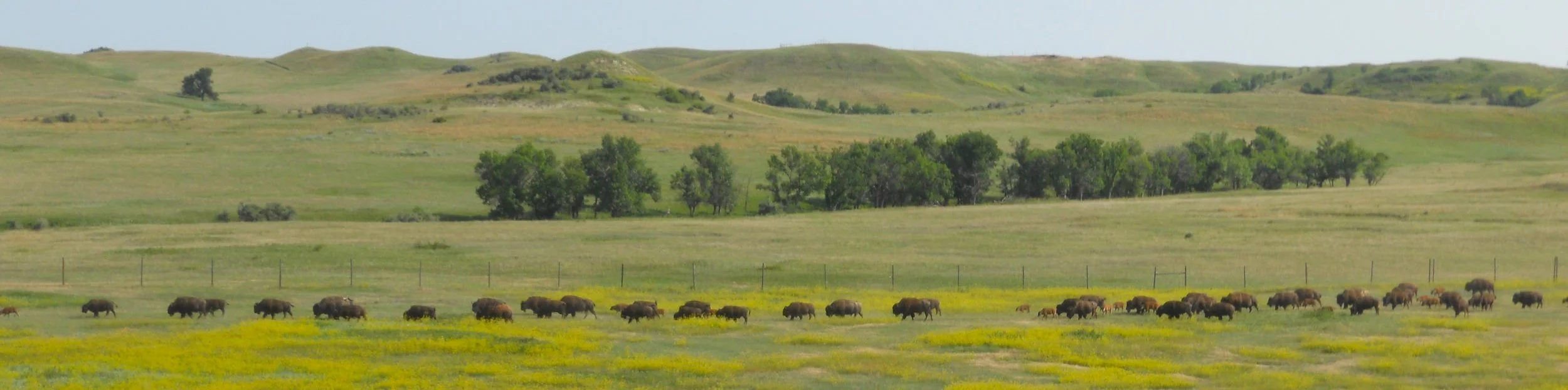
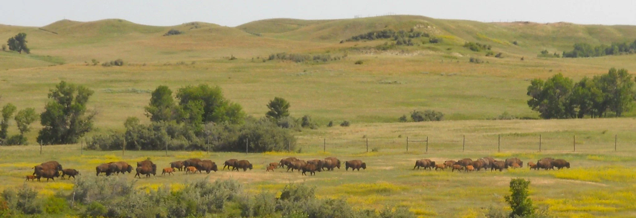
Theodore Roosevelt National Park has two sections; north and south. I went to the north part. The main attraction is the large bison herd. Sure enough, they were out sunning themselves. They were up on the high plateau, away from the Little Missouri River (which from here goes about 100 miles to reach The Missouri River). In the top photo they are moving right to left, then reversed their course ten minutes later.
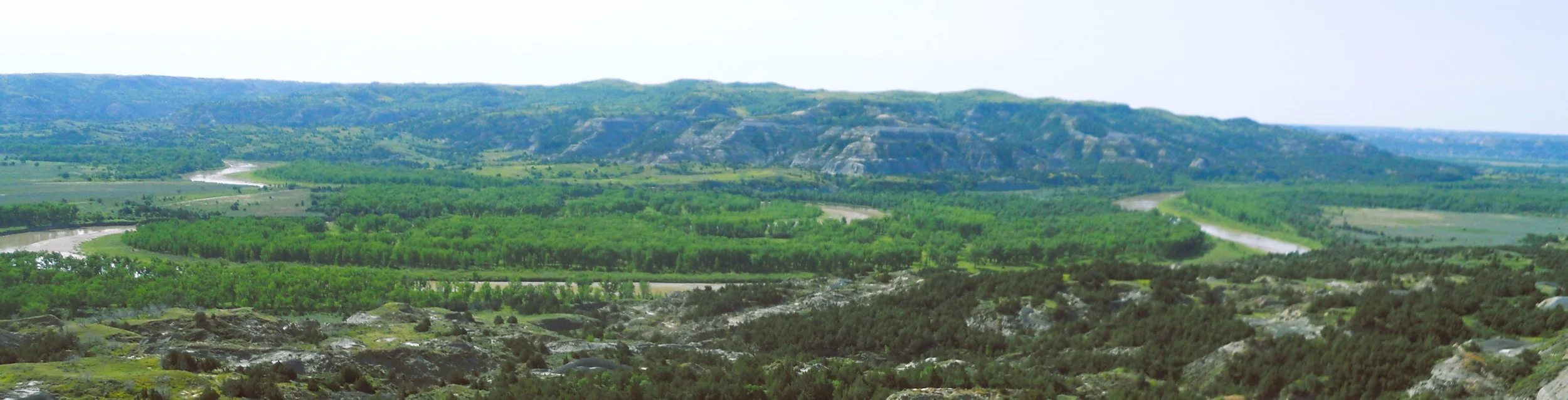
At the end of the 14-mile park road is Oxbow Overlook. The two sides of the oxbow (concave shapes) are moving towards each other, eventually creating a straight-line path in the river.
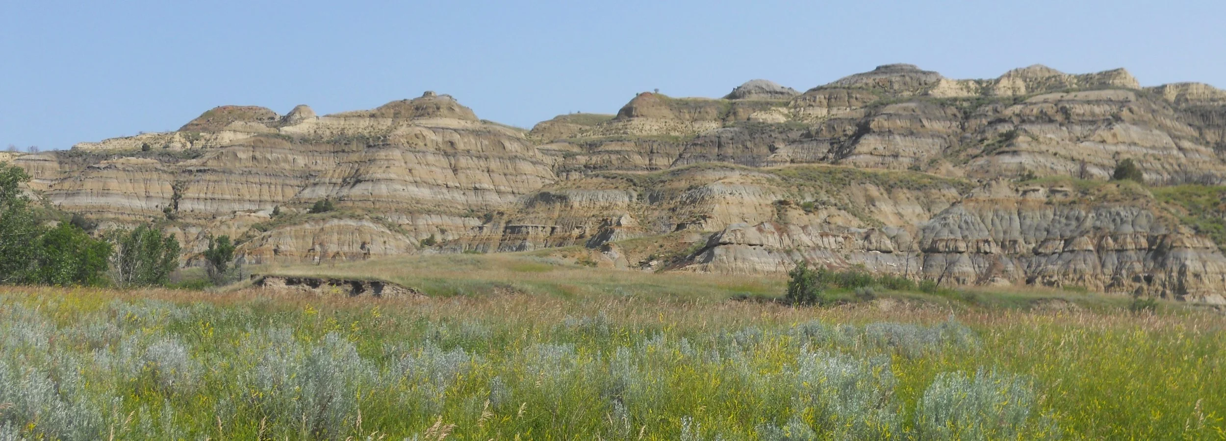
The first section of the road shows the different geological layers which have been compressed over the millennia.
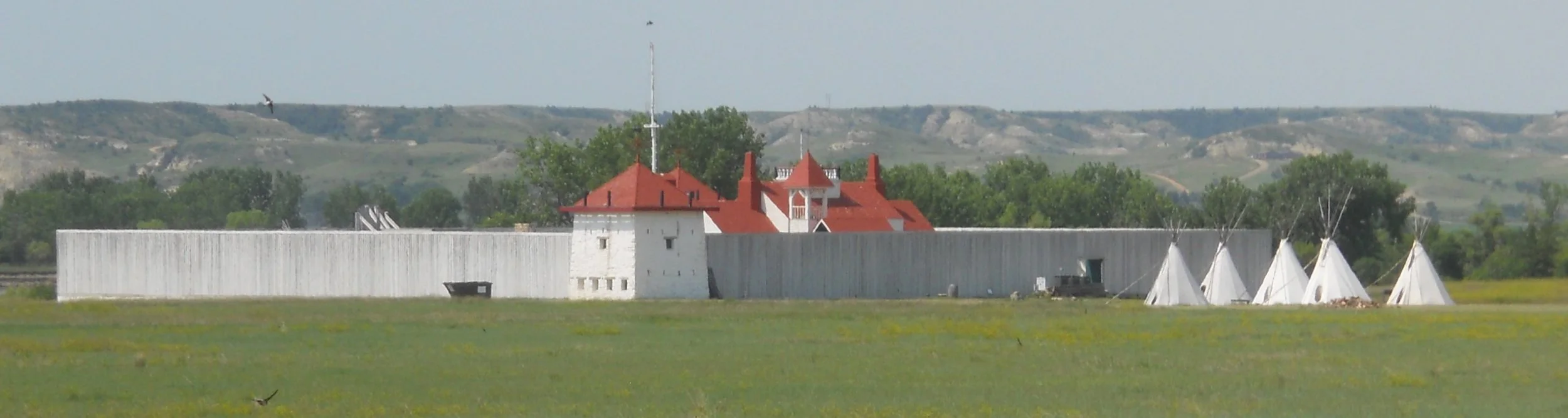
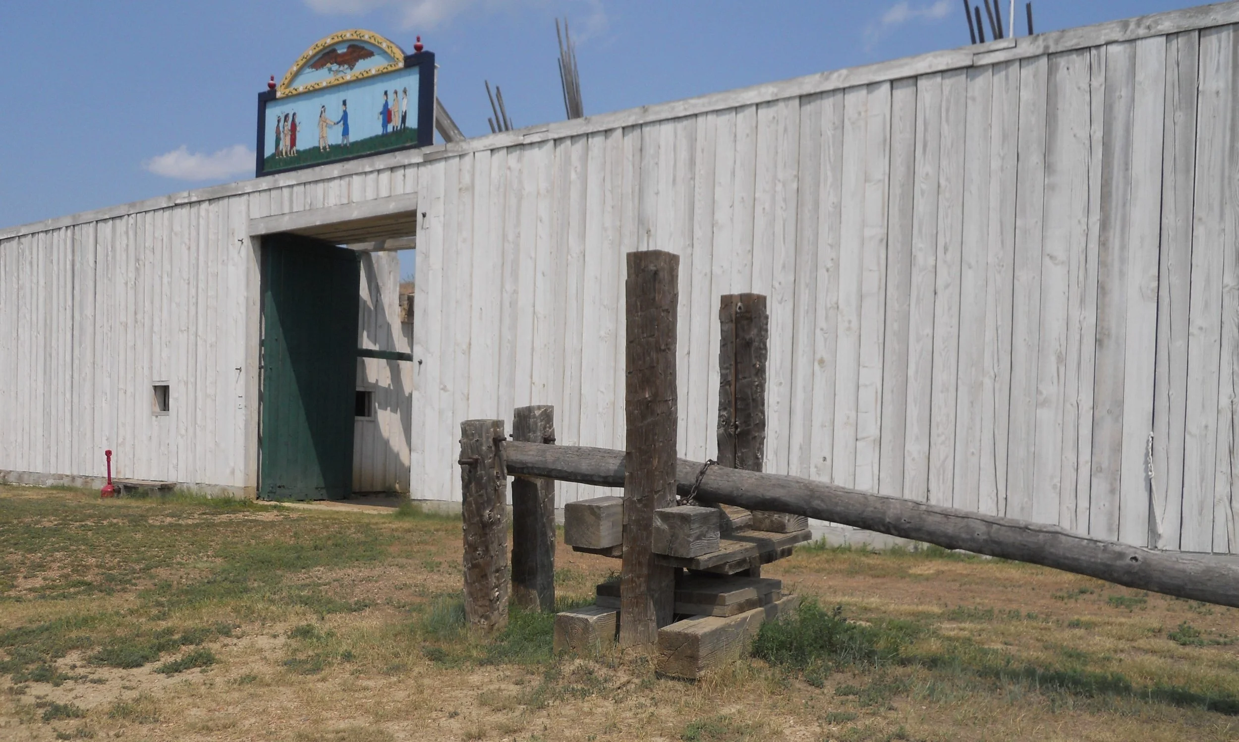
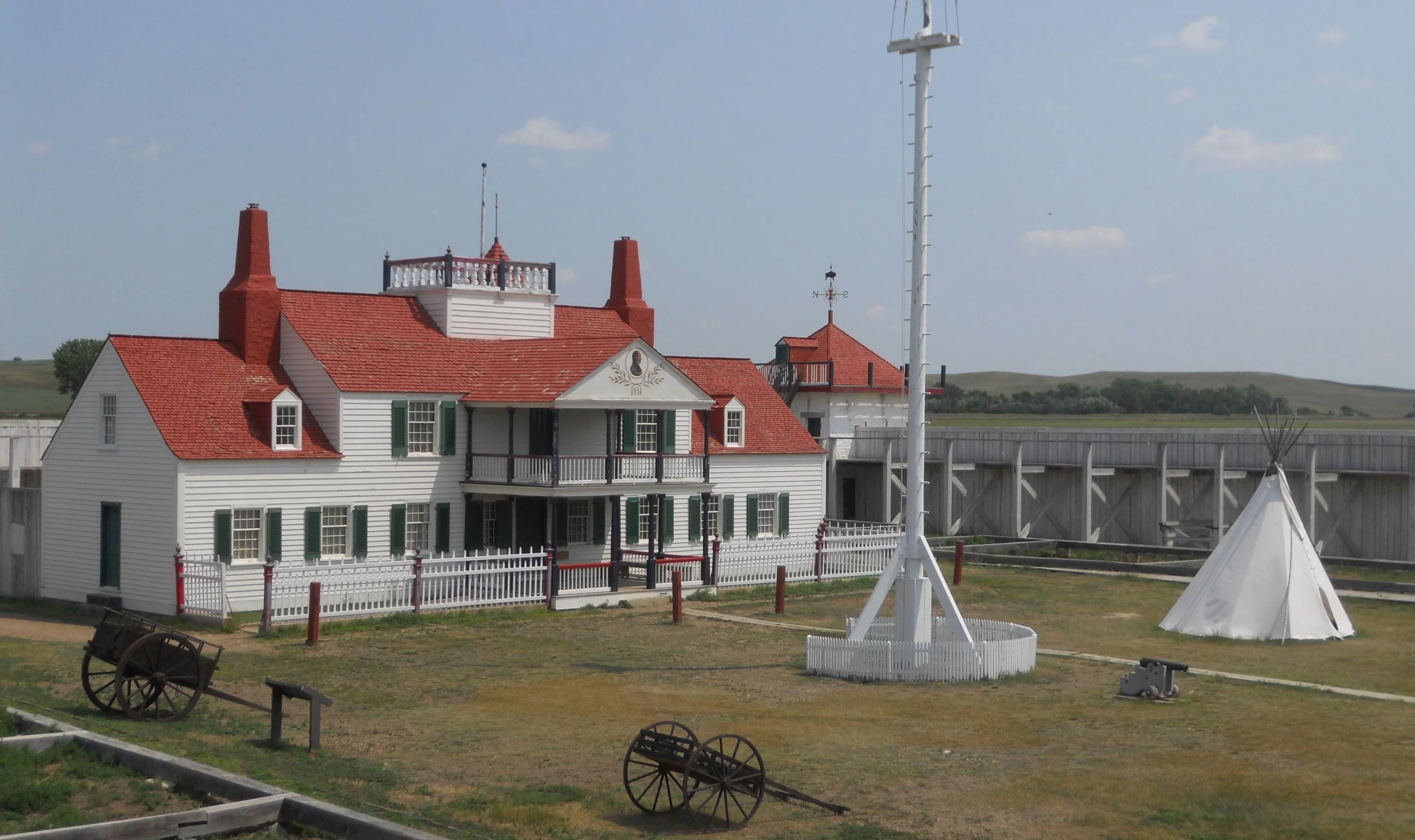
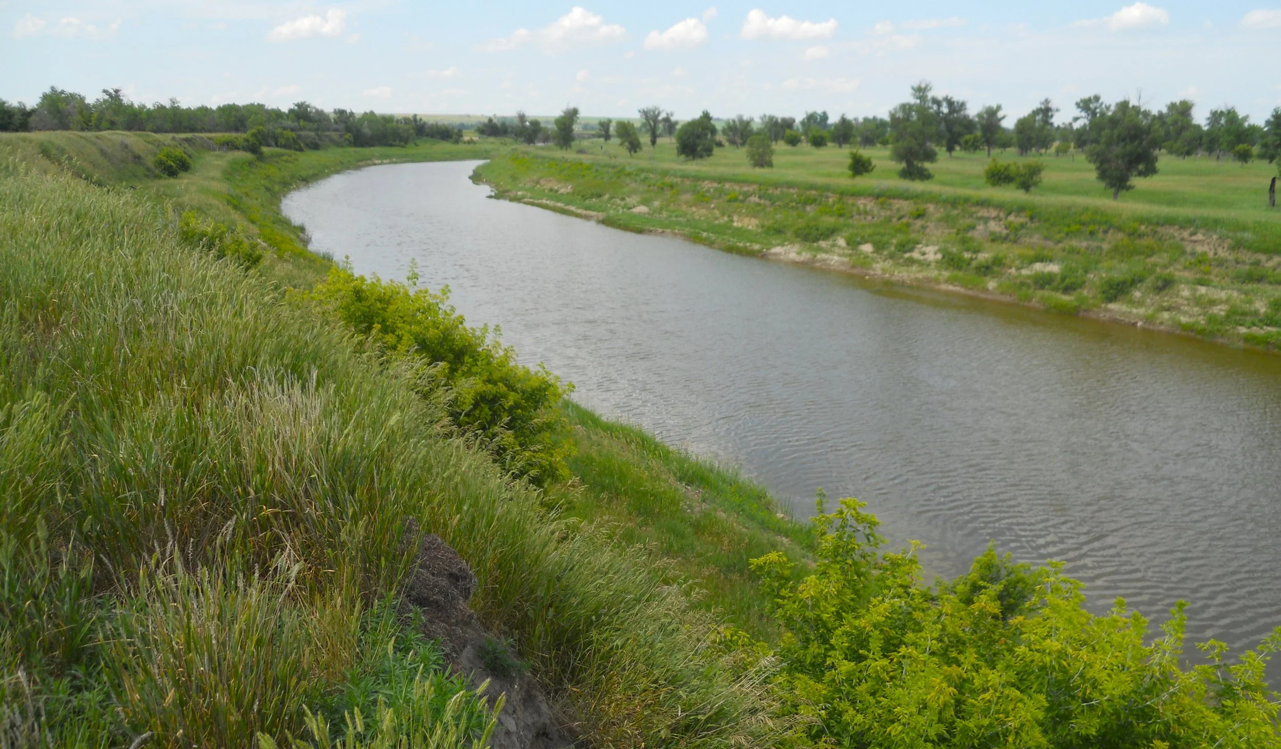
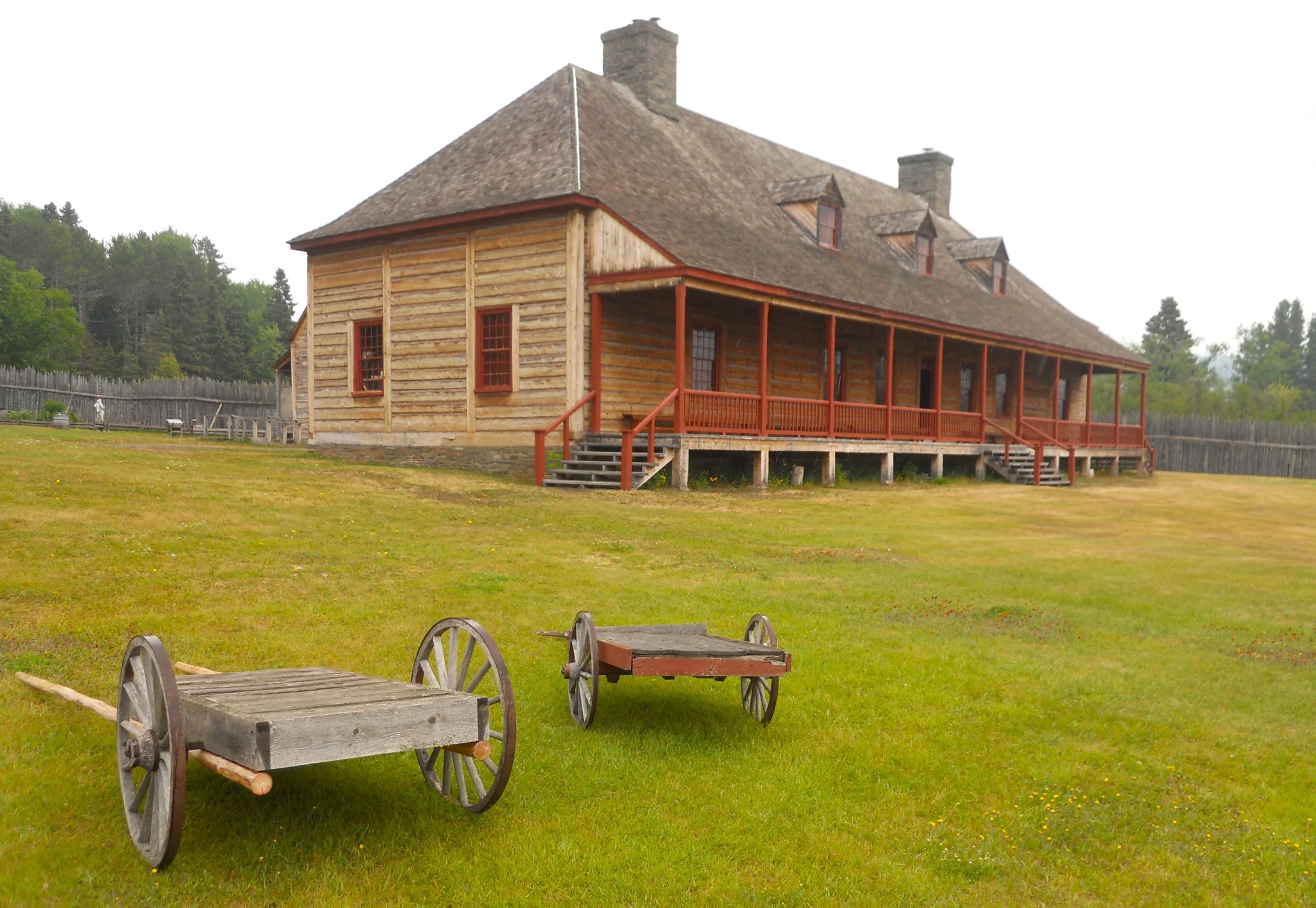
Fort Union Trading Post National Historic Site was instrumental in whiteman’s expansion into the northwest part of the continent. For forty years, starting in 1828, this was the hub of commerce between seven Northern Plains tribes and the Northwest Company. Beaver furs were the initial drawing card, but as those mammals were decimated, Bison hides became more important.
The location is strategic, just a short distance from where the Yellowstone River joins the mighty Missouri River, allowing for quick access to the markets back east. The riverboat landing on the Missouri is just down the slope from the fort’s front door, which is where a giant fur press was located. This could compress furs into 100-pound bales, for loading onto the boats.
The Bourgeois House, in the center of the fort, was the most elaborate and decorated home in the region during those 40 years. The NPS has restored the structure to look as it did in 1851.
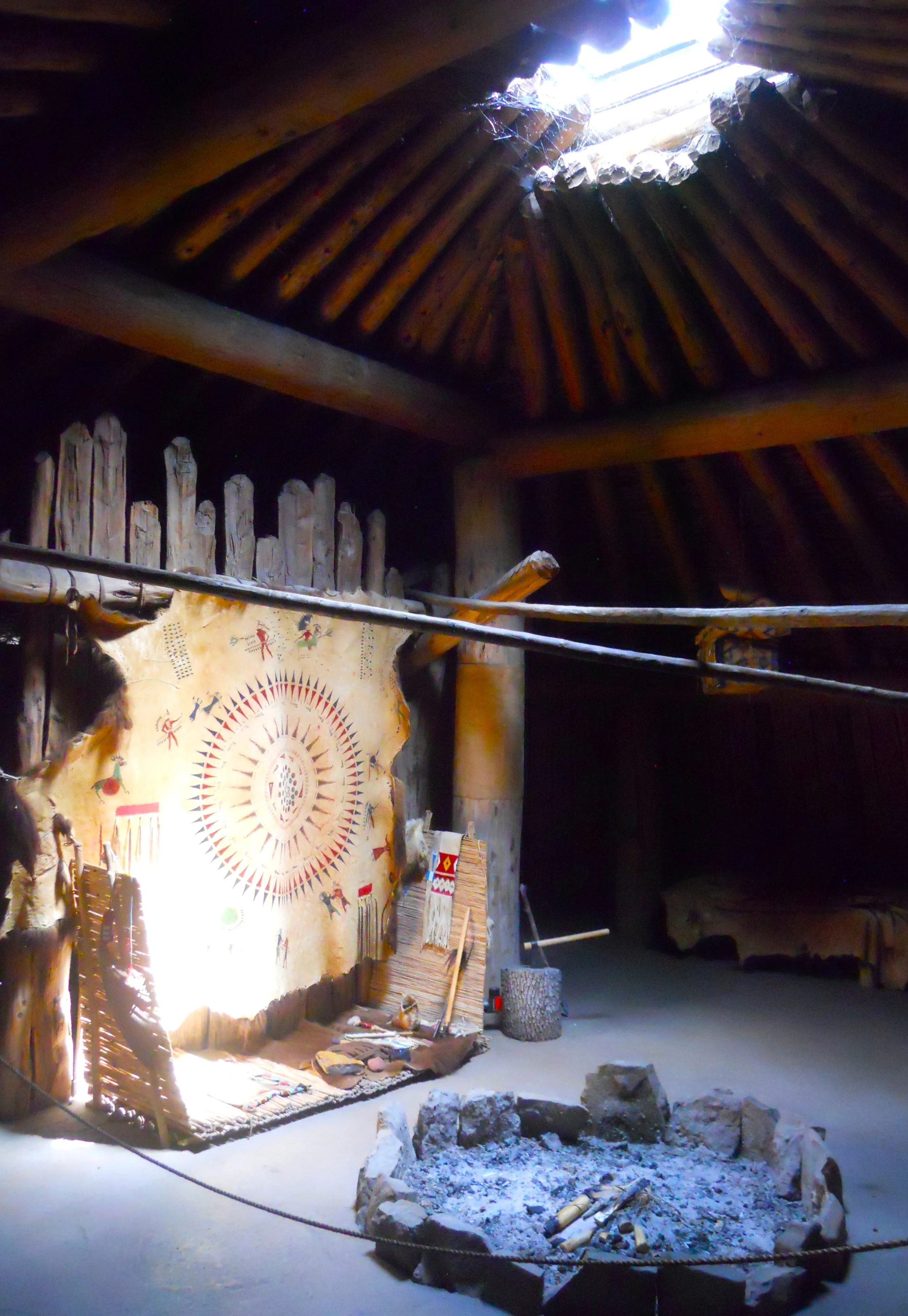
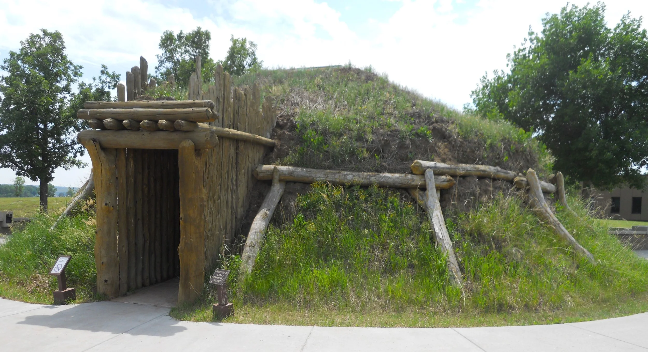
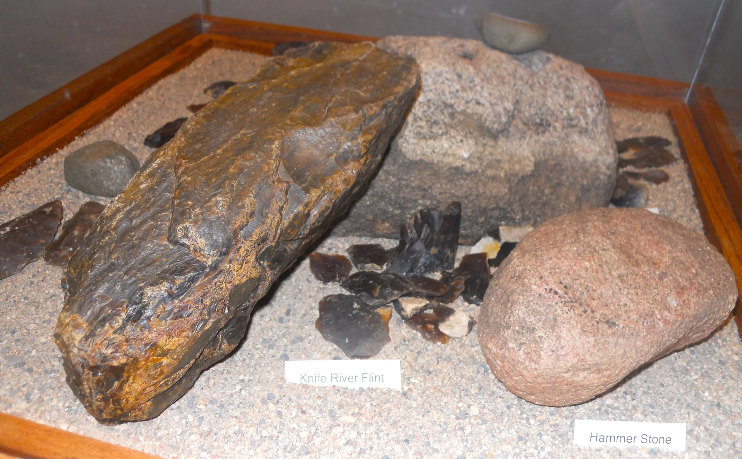
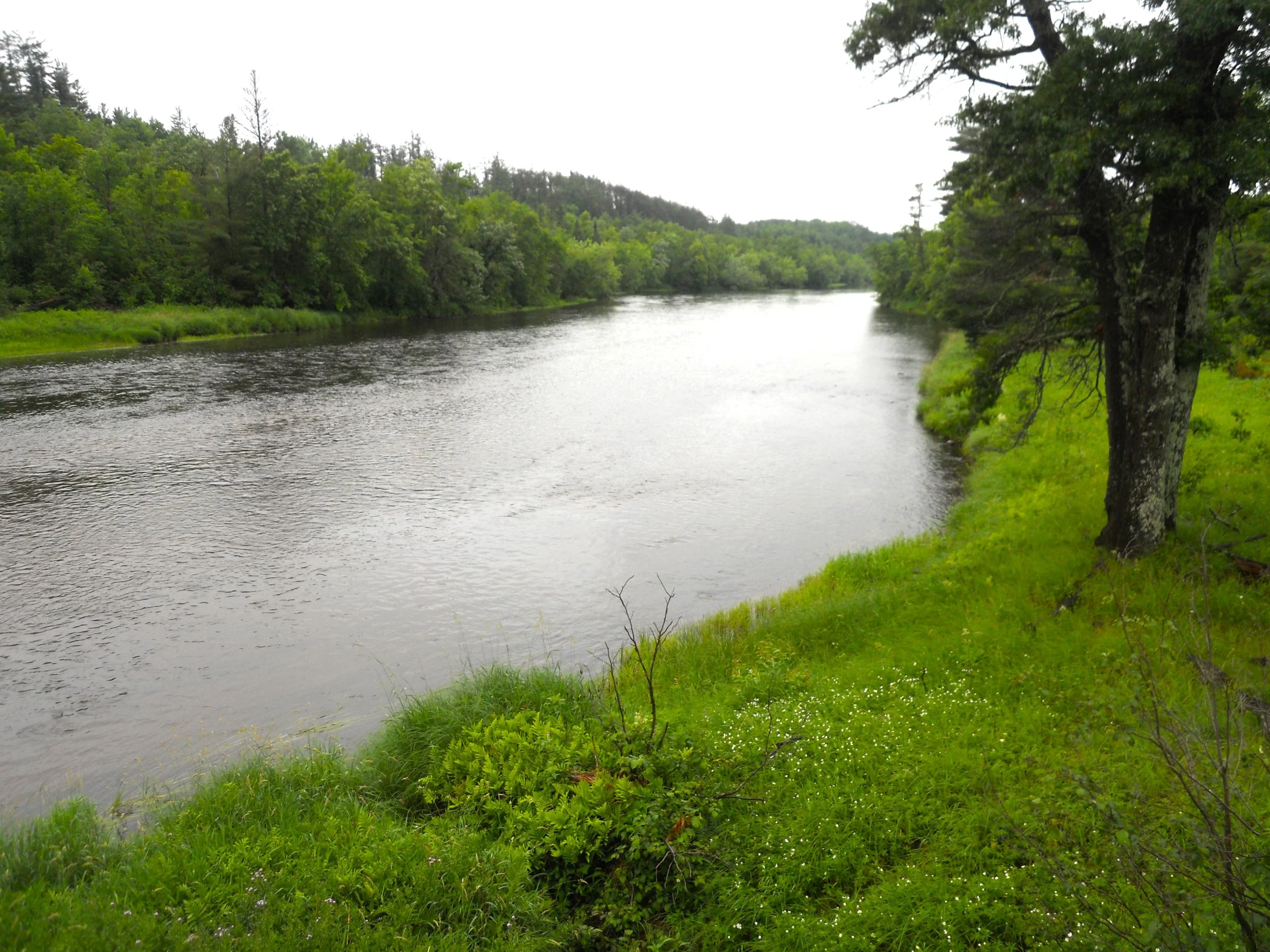
DAY 7 (June 27) - Knife River Indian Villages NHS is located along the great Missouri River (photo). This is the waterway Lewis and Clark travelled during their historic journey. They camped just a bit downstream from the Indian Villages, in October-1804, 128 days after leaving the St. Louis area. Earthlodges (photos) of the Hidatsa Tribe greeted them. Three villages occupied this stretch of river. The original lodges are gone, but when they collapsed at the end of their use, they left circular depressions in the ground. I am not showing photos, because it is hard to see them. I suggested to the Park Staff that raised platforms be installed so visitors can get a good 3-D view of the grounds. The VC had samples of Knife River Flint (KRF) which was renowned across the Upper Midwest and into Central Canada for making tools.
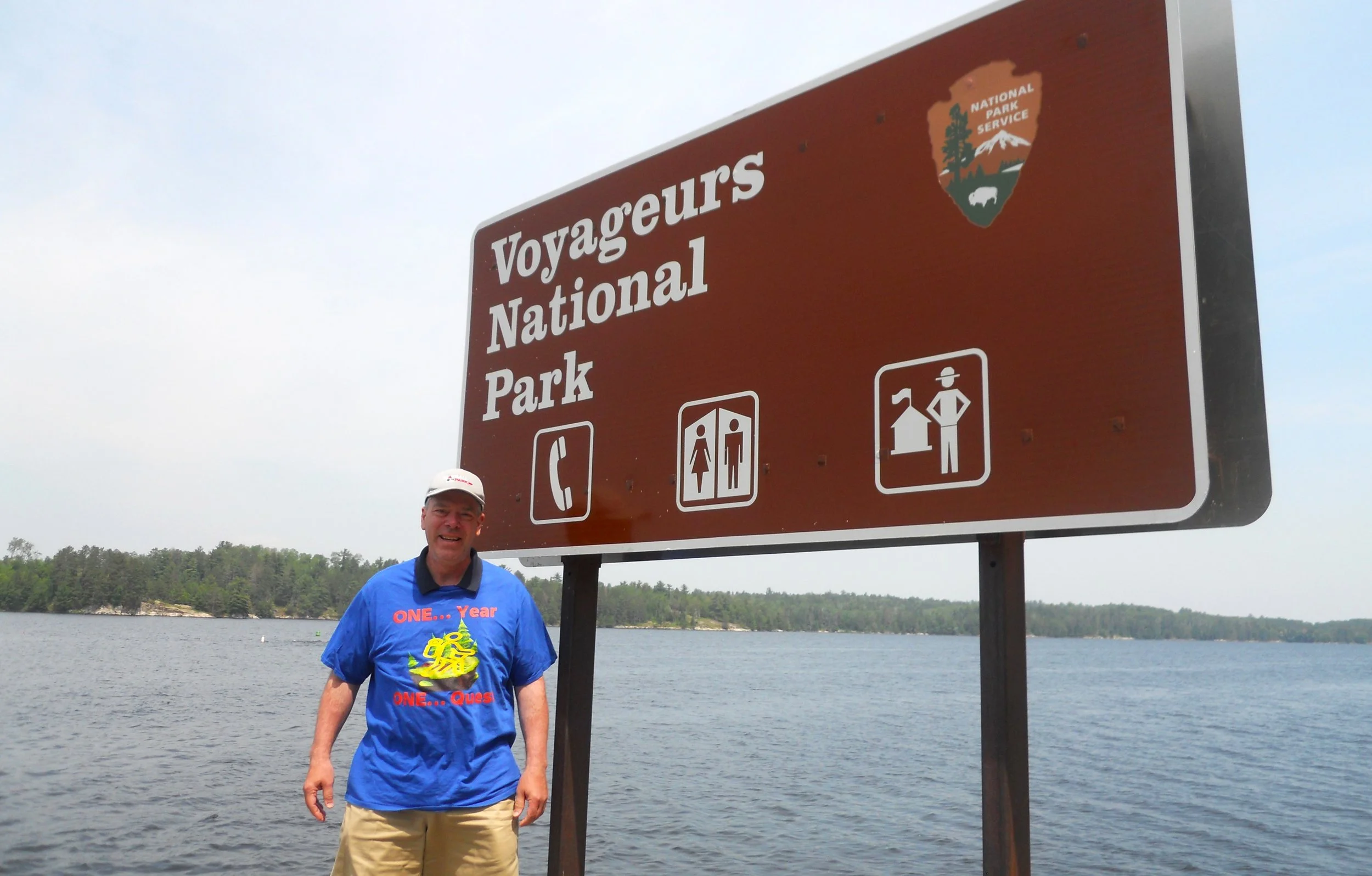
DAY 6 (June 26) - Voyageurs National Park is at the northern tip of Minnesota. And it borders Canada, such that if one takes a boat across the park’s waters and steps foot in the other country, that person has to contact Customs and Border Patrol. I met an American CBP agent while at one of the VCs today. Right next to the sign in the photo is a USA flag, to indicate American soil. The vast majority of the park can only be accessed via boat, unless you want to swim many miles.
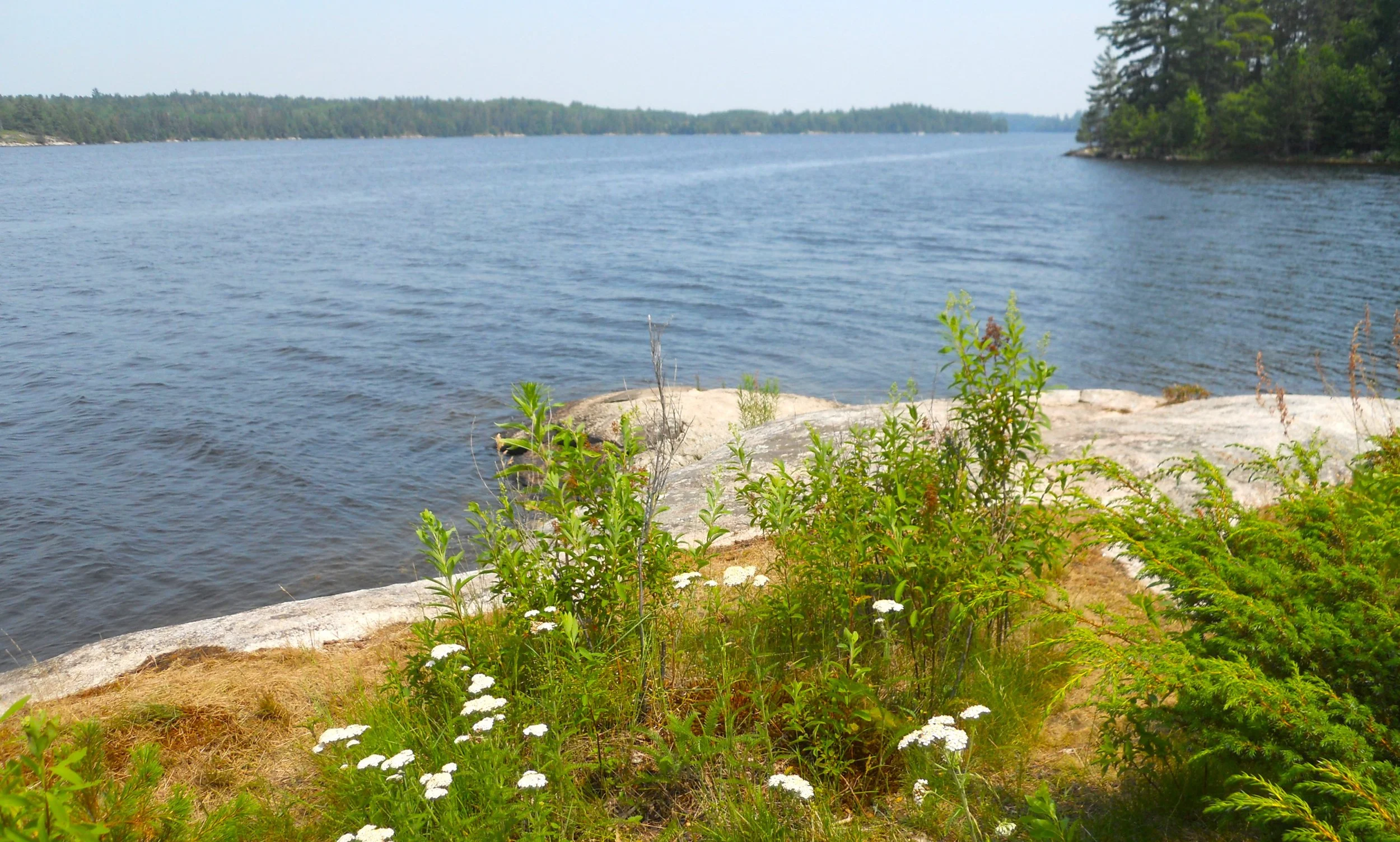
The Beaver Pond Trail does not get down to water’s edge. There is debate among the staff if any beavers are still in this specific spot. During the 1700s/1800s, fur trappers decimated the beaver population. The name of the park comes from the Voyageurs who plied the waters in their large canoes, carrying goods to the interior, while bringing out furs and pelts to satisfy European vanity.
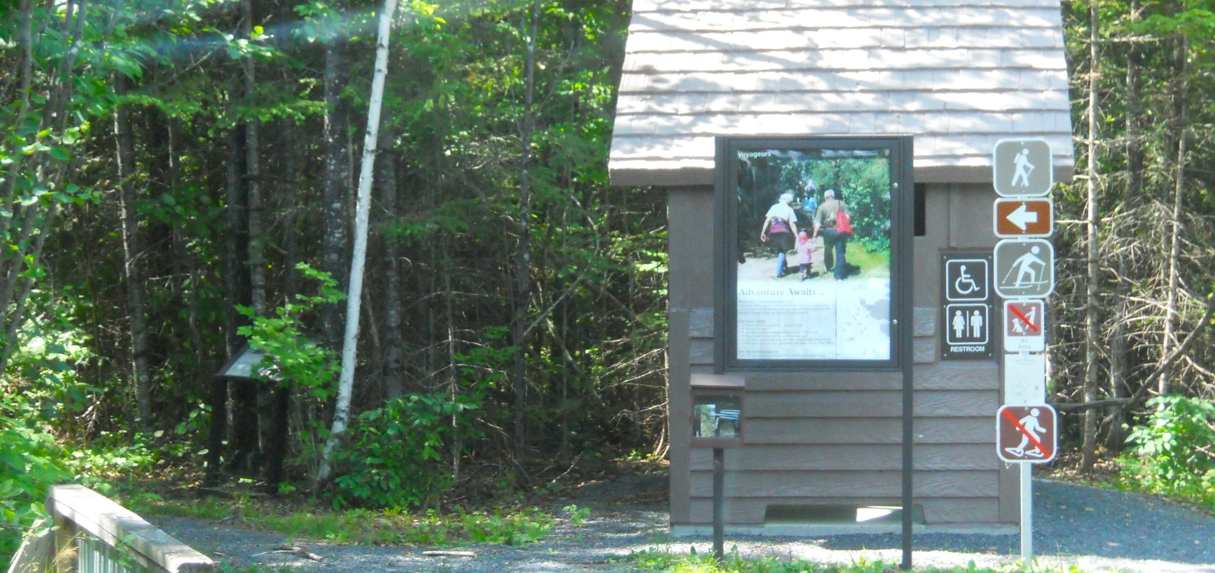
This is the first park in my Quest where I have seen signs for both hikers and skiers to use the same trails. In winter, snowmobiles can go where only boats go in the warmer months.
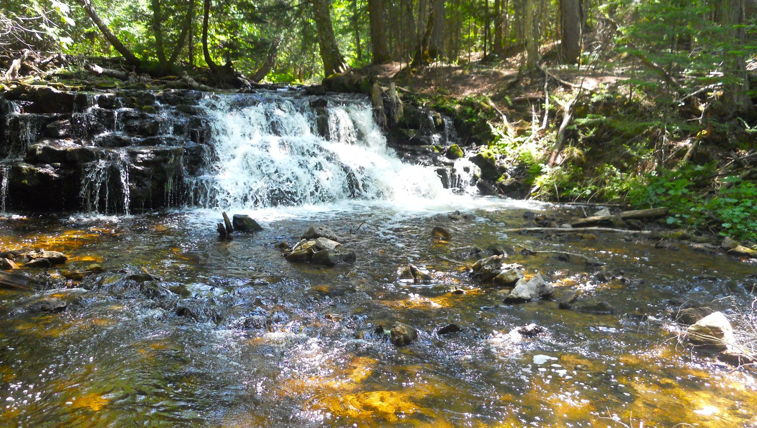
DAY 5 (June 25) - St. Croix National Scenic Waterway stretches over 200 miles, a combination of the St. Croix and the Namekagon rivers. This is the cleanest water in Wisconsin. Paddling and fishing seem to be the two main activities on and along the rivers. The first photo is from Riverside Landing on the north end of the park, with the far-right photo at St. Croix Falls, at the south end. St. Croix Falls was named after a stretch of falls at this location of the river, but the hydroelectric dam and spillway took care of that.
The two rivers contain 41 species of native freshwater mussels. The problem is one invasive species, the Zebra Mussel, brought over from Europe in the ballast of cargo freighters. The entire Great Lakes region continues to combat this massive threat.
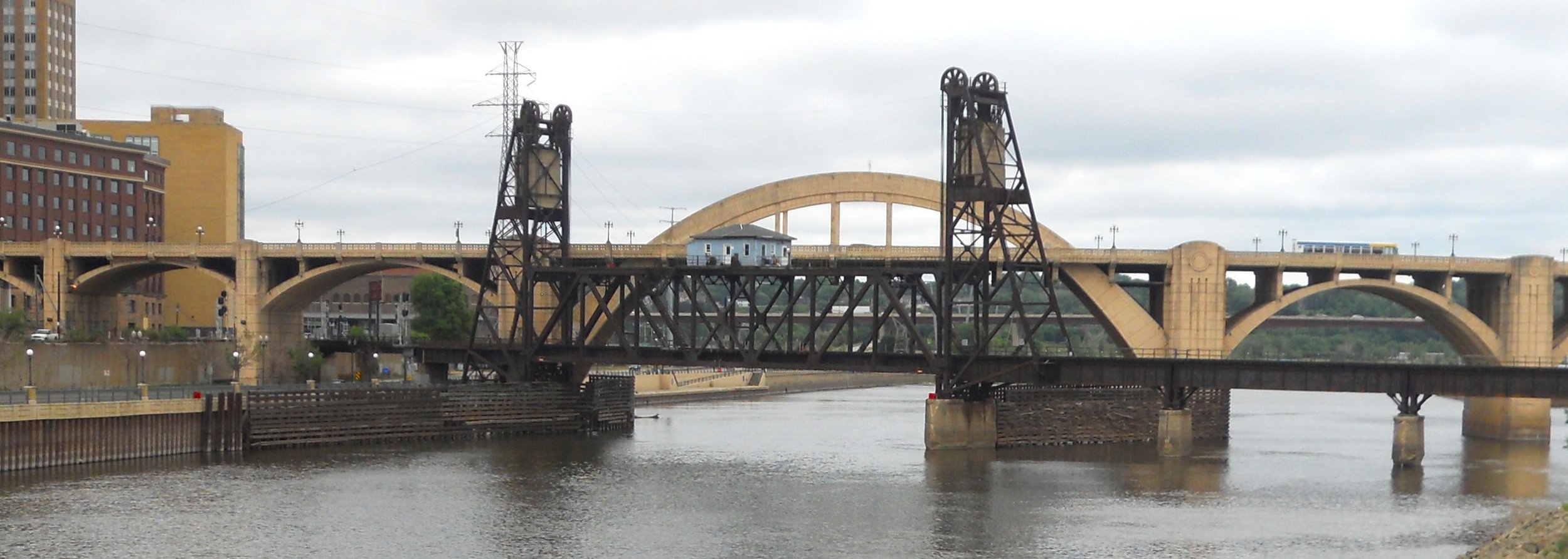
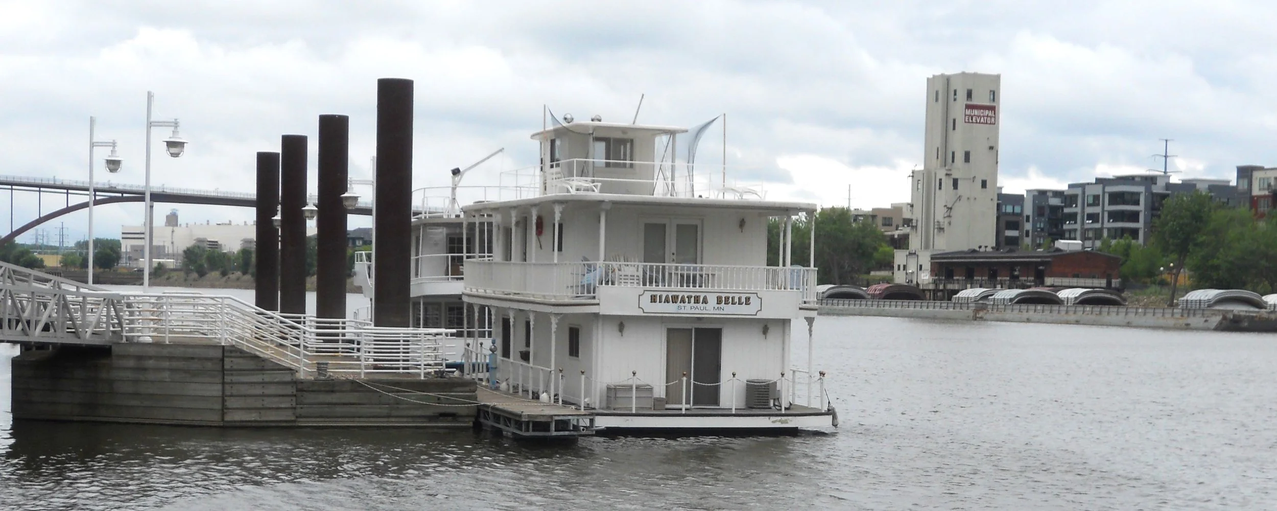
The Mississippi National River and Recreation Area spans 72 miles through the Twin Cities in Minnesota. Much of the property along the shore is owned and operated by city, county, and state governments, but are a joint partnership with the NPS. Heck, the main park VC is in the Science Museum of Minnesota. The first photo is of two bridge designs: an arch and a lift. The Mississippi River has many different types of bridges connecting its two shores up and down its 2,340 miles. The shot was taken on Raspberry Island, in the middle of the Great River.
The story of the Mississippi River would not be complete without mentioning is economic impact to our country. The second photo shows Capitalism at its best; a floating hotel and a grain storage facility towering above barges.
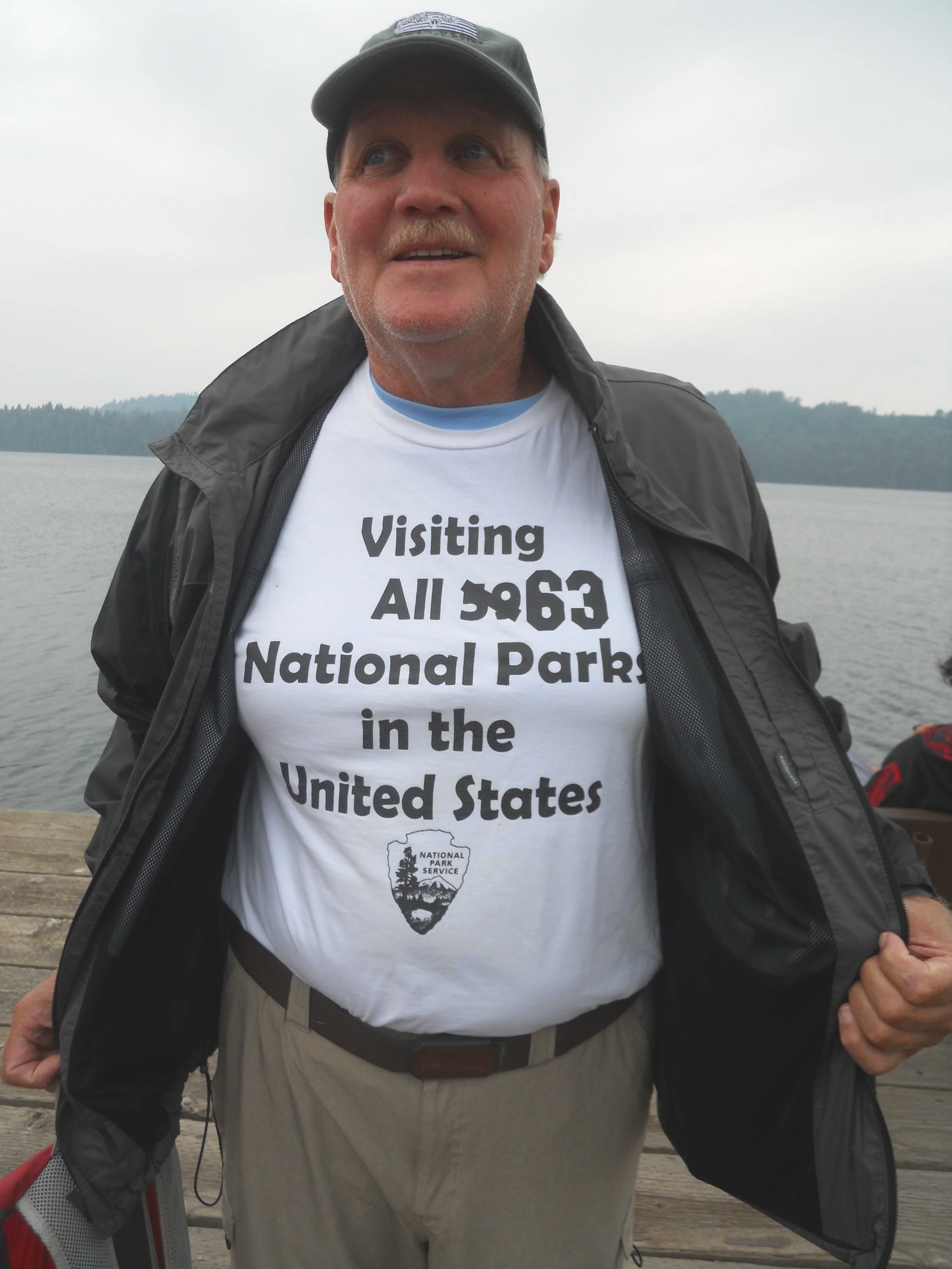
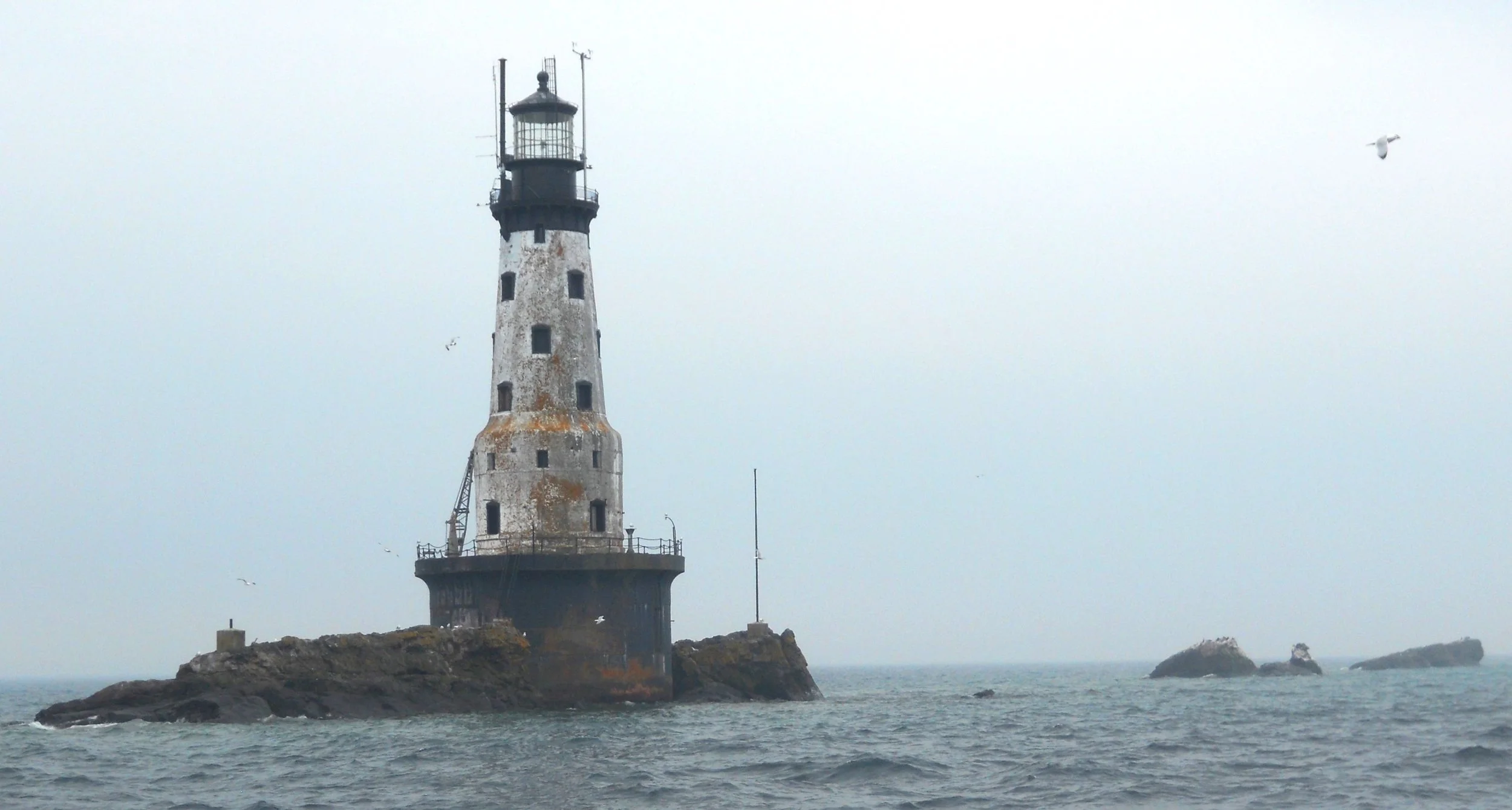
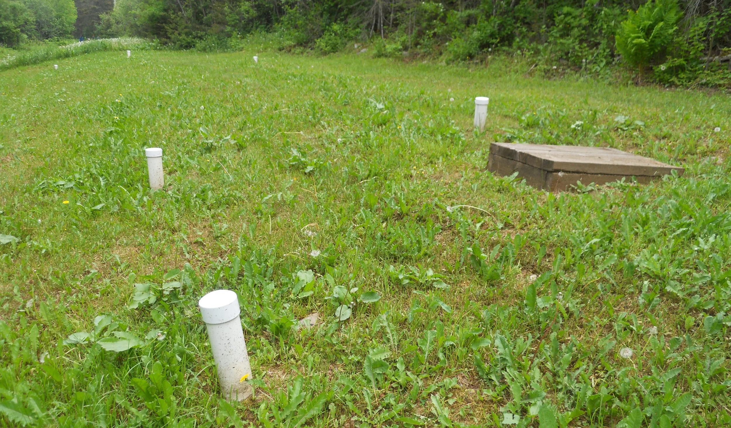
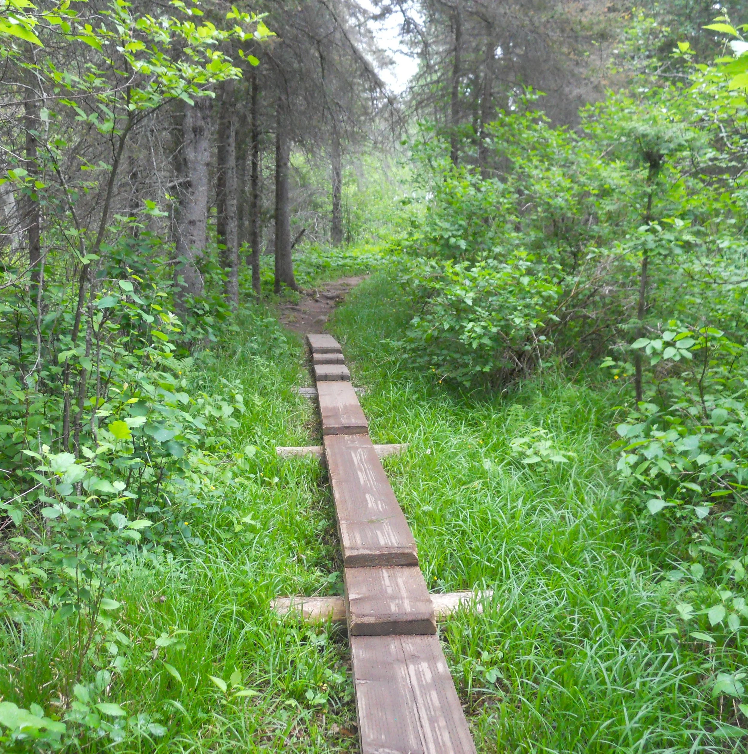
DAY 4 (June 24) - Isle Royal National Park is situated in the middle of the largest body of freshwater, by surface area, in the world; Lake Superior. This makes for some unique animal development, such as the Red Squirrel, its ancestors having developed independently that it is now its own species. I could not capture a photo of this mammal, but I photograph Tom. His wife Victoria designed the tee-shirt, something I could not pass up. And Congress is getting ready to “upgrade” another NPS park to “National Park” status. Don’t they have better things to do in D.C.? Some of the trails in the Windigo Bay area have makeshift boardwalks to help visitors traverse the ground. The 1908 Rock of Ages Lighthouse still helps passing ships navigate around this rocky spot. With the island being so remote, but rangers having to live here, three sewage absorption trenches were installed. Quite an unfamiliar site in a place that is supposed to be pristine.
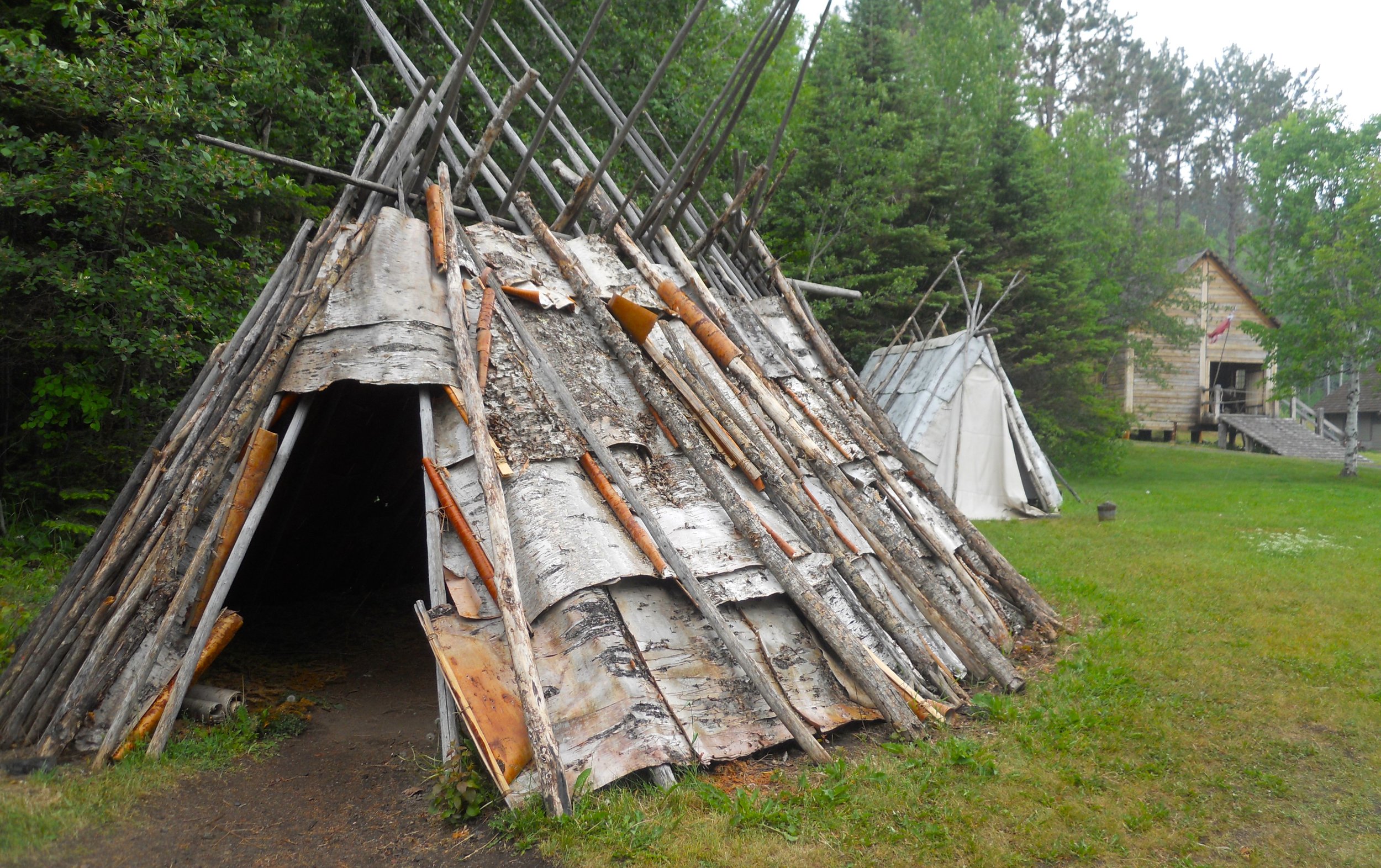
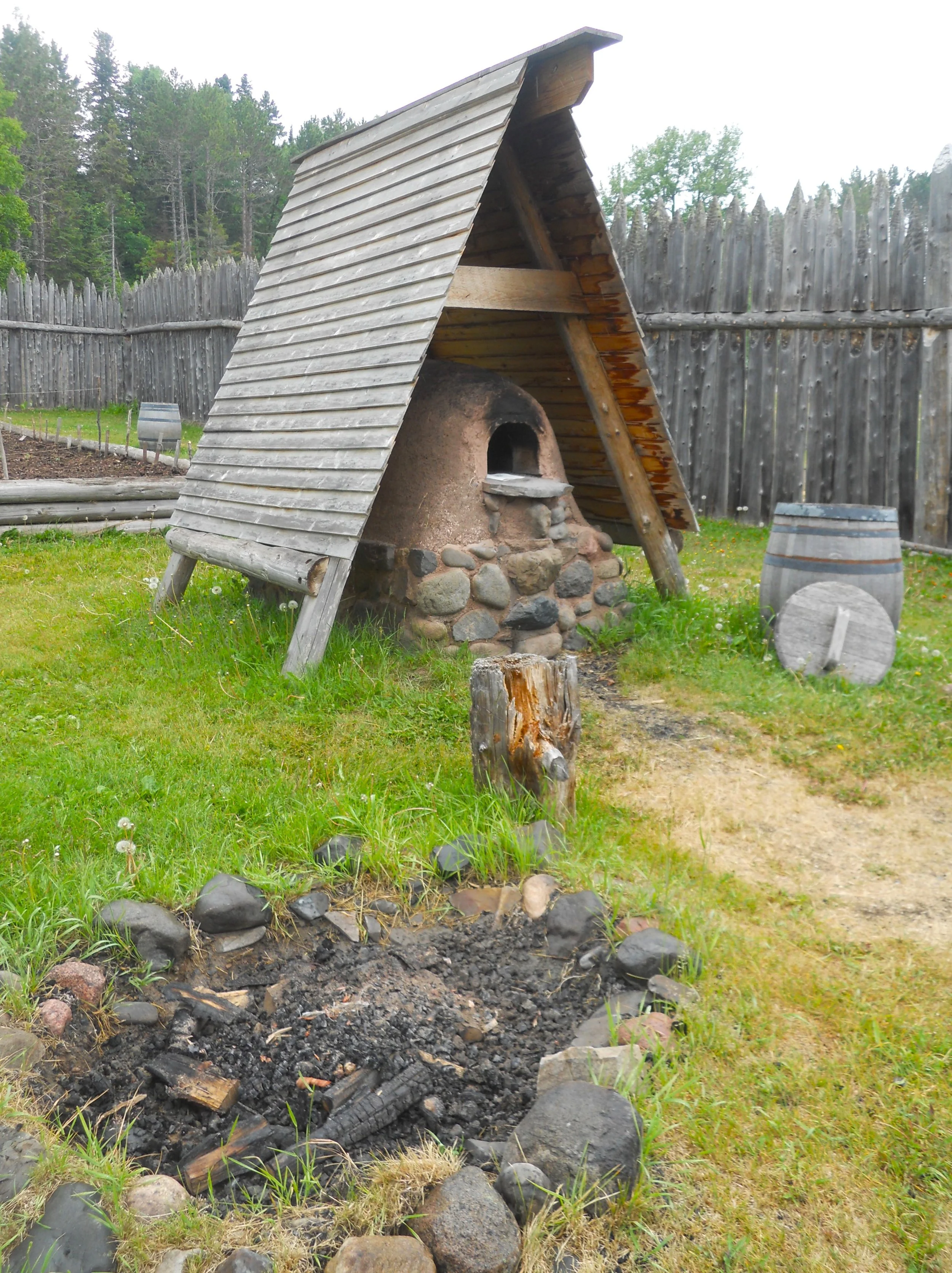
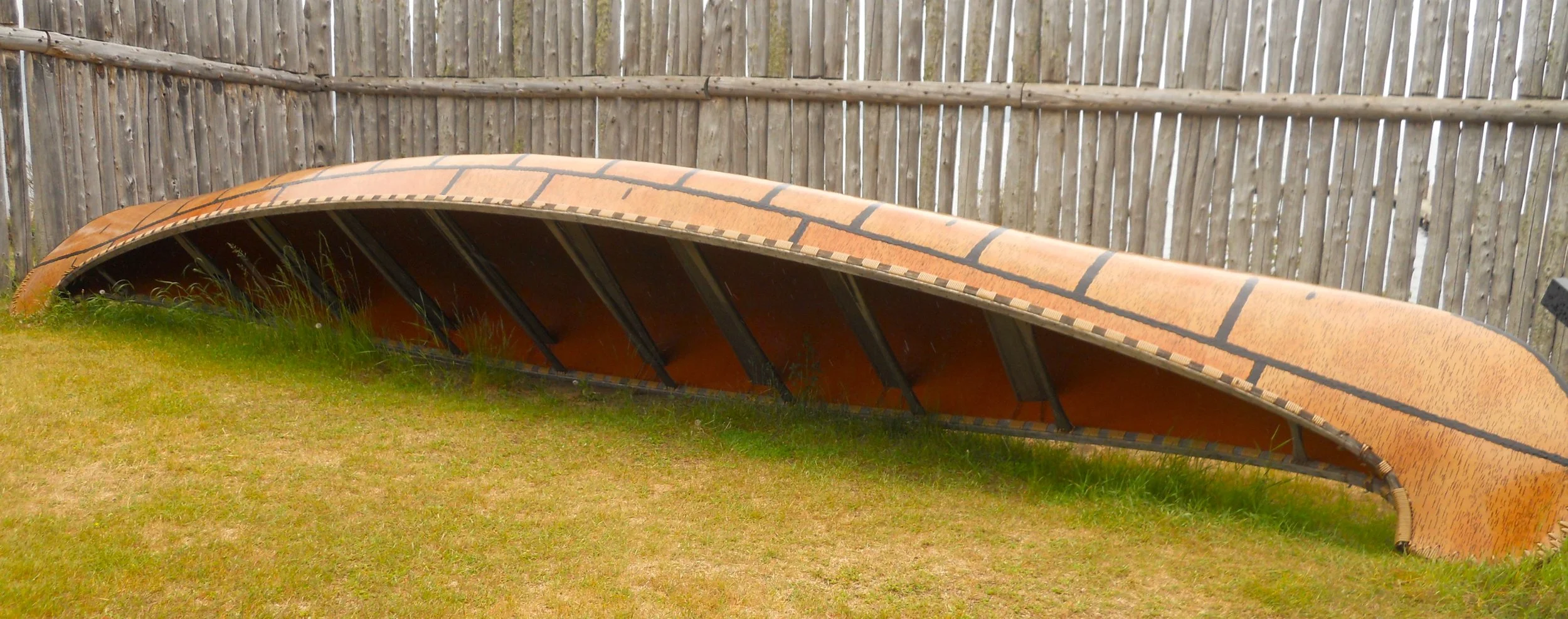
Grand Portage National Monument honors the business and cultural exchange between the indigenous natives and the Northwest Company (NWC). Different types of lodging have been recreated (on the spot of the original fort). A large Birch Bark Canoe is displayed. American Indians were excellent canoe craftsmen. It was this mode of transportation which then made NWC very profitable in this region. Some of the park’s docents/volunteers had used the hand-built oven to make desserts the day before, using recipes from the 1700s. The cakes, brownies, and pies were on visible under glass, but visitors were told “hands off”.
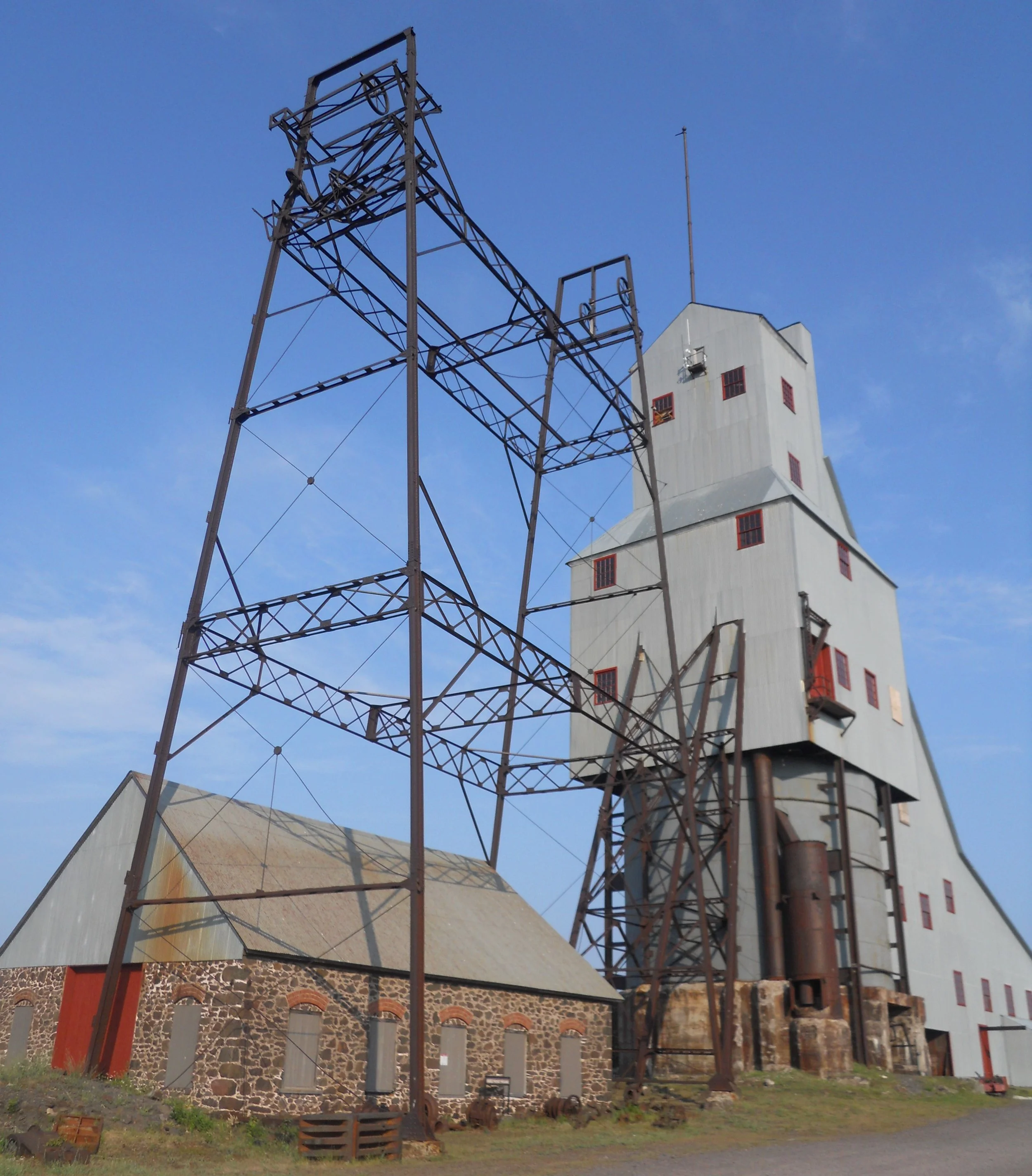
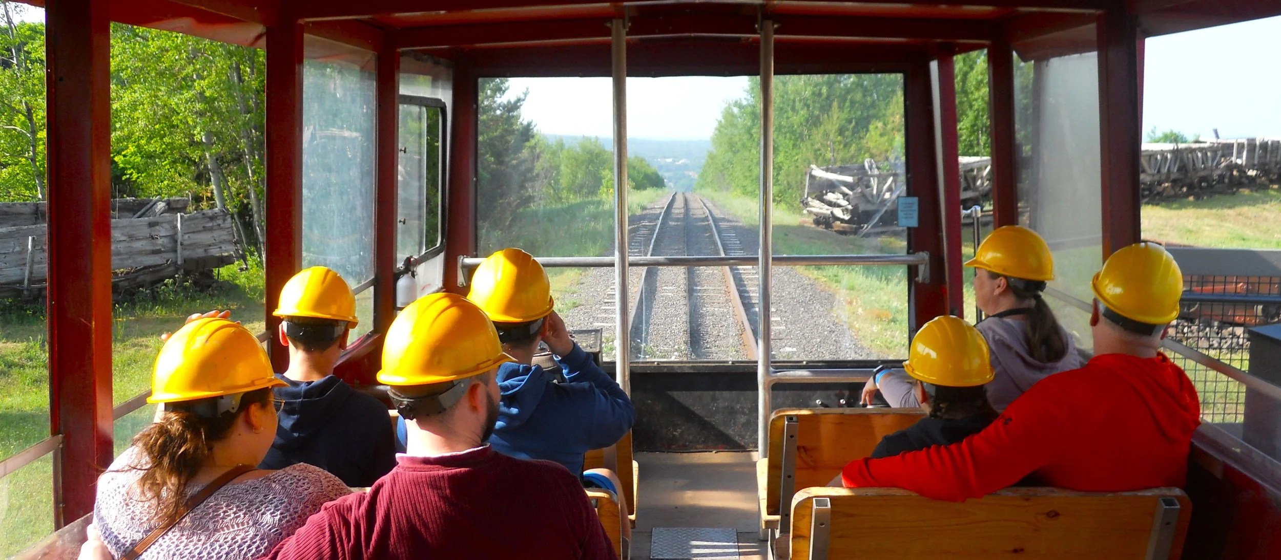
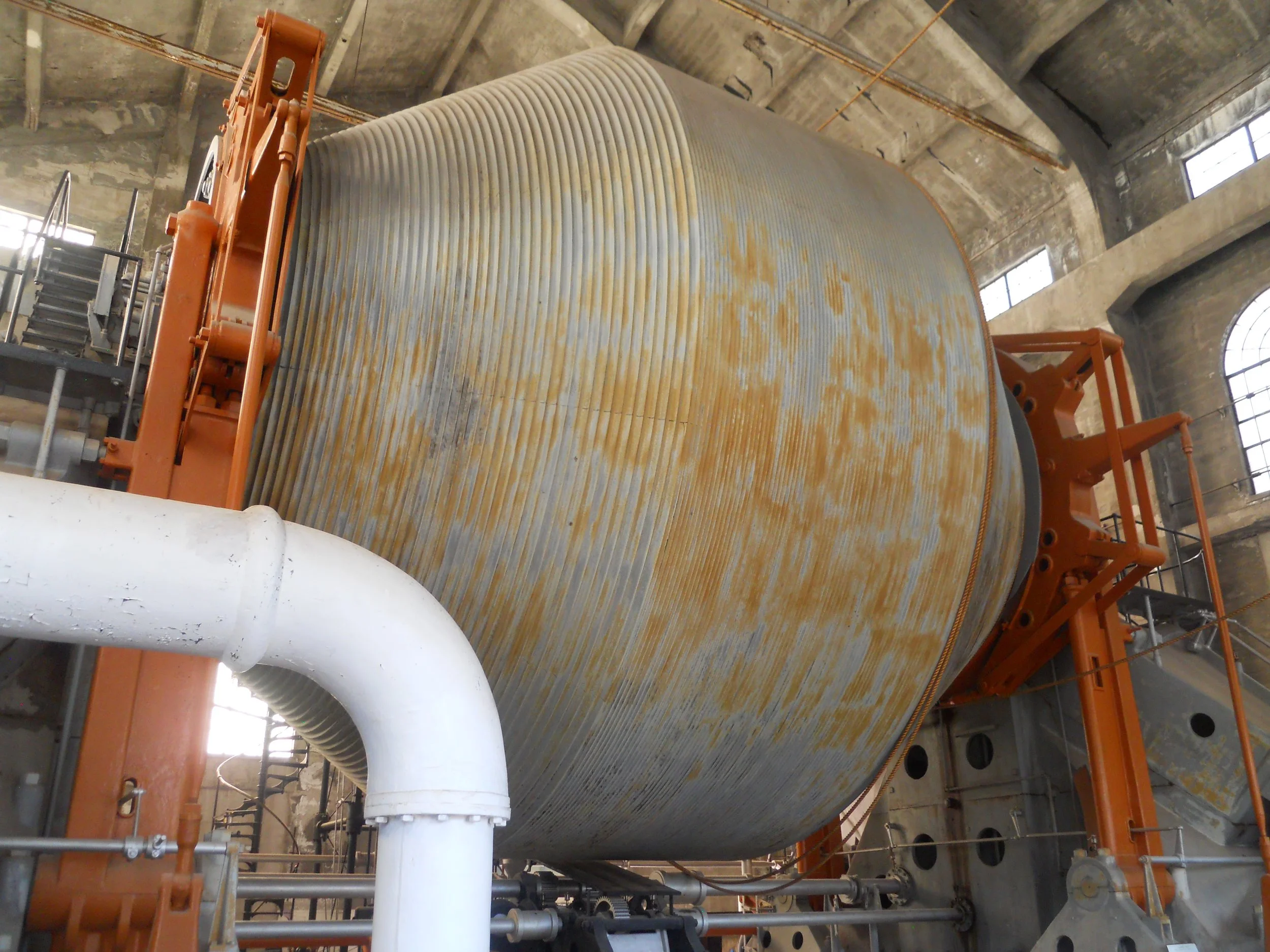
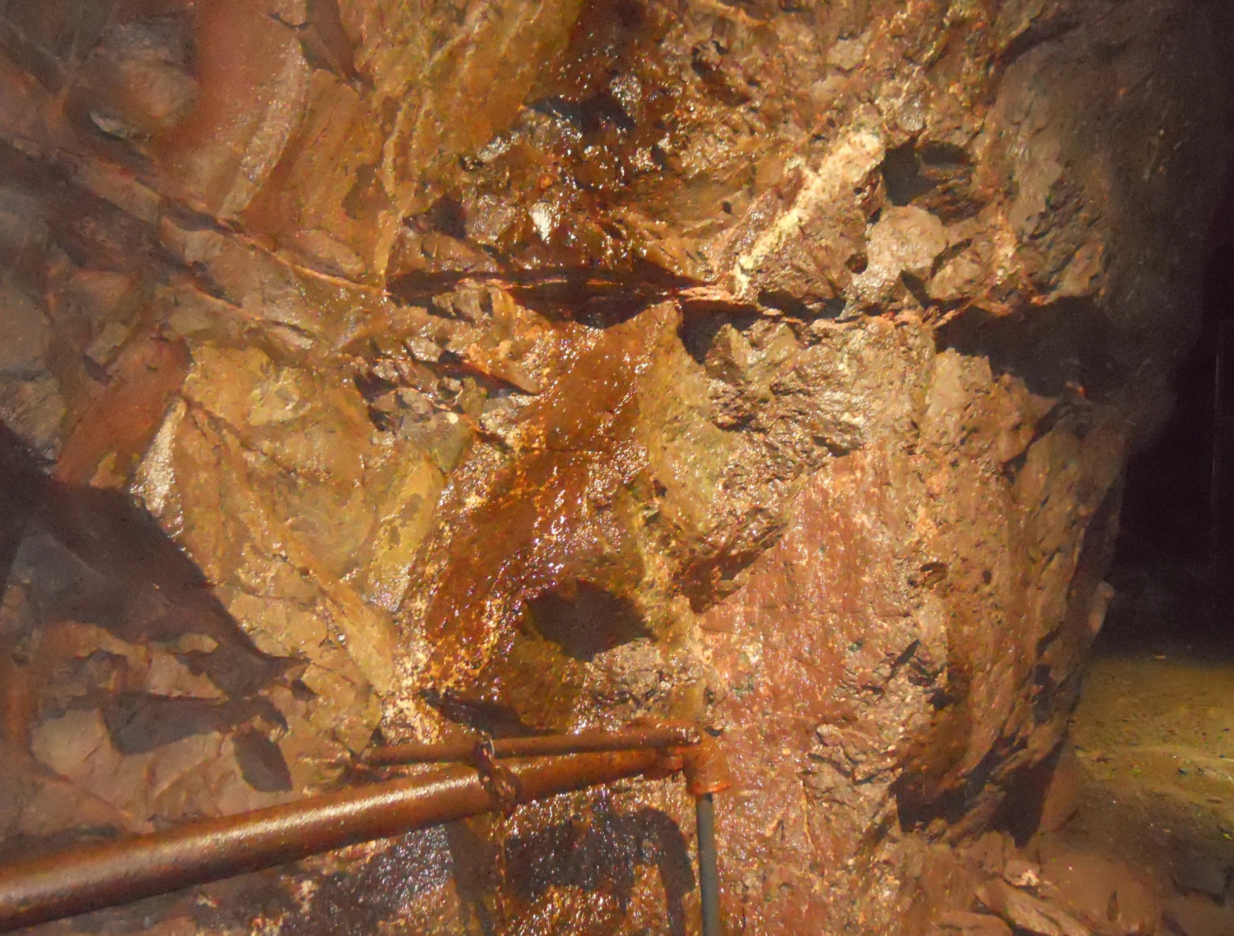
DAY 3 (June 23) - Keweenaw National Historic Park is spread across 21 properties. The park is a joint venture with Keweenaw Heritage Sites program, stretching from Copper Harbor at the tip of the Upper Peninsula to Ontonagon. Visitors get to experience the park by touring these properties which are owned by independent organizations. I chose the Quincy Mine. It began operations in 1846. During the Civil War it supplied 90% of the Union’s copper needs (cannon, guns, shells, etc.). In 1920 the #2 shaft had the largest hoist lift in the world installed. This could go down 9,000 feet, and pull upwards carloads of ore (weighing multiple tons) at a speed of 35 mph. Visitors take a railcar to the mine entrance, for a 4,000-foot walk. Due to a long geological story, the basalt rock here is 1 billion years old. I believe that is the oldest thing I have ever touched.
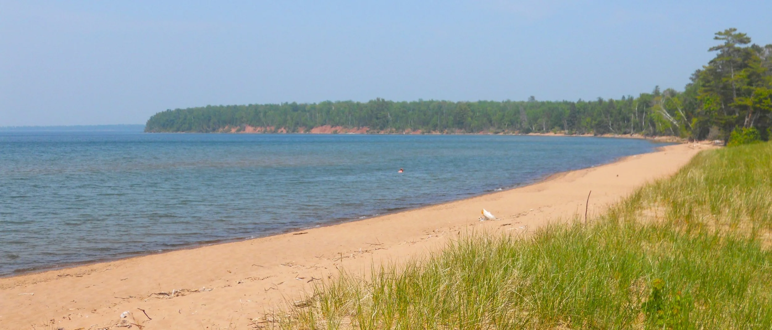
Apostle Islands National Lakeshore is comprised mainly of 22 islands in Lake Superior, near Bayfield and Ashland, in Wisconsin. But a portion of the shoreline on the mainland is in the park. For one who does not have access to a boat, this can constitute their visit. Folks were swimming in the calm waters off the beach at Little Sand Bay. A covered display of a fishing rig is inshore. To the west is a section of cliffs which hides sea caves from landlubbers. Kayakers, though, can go off Meyers Beach to access the recesses.
The next two days will cover the four parks shown in the map, starting at Ashland.

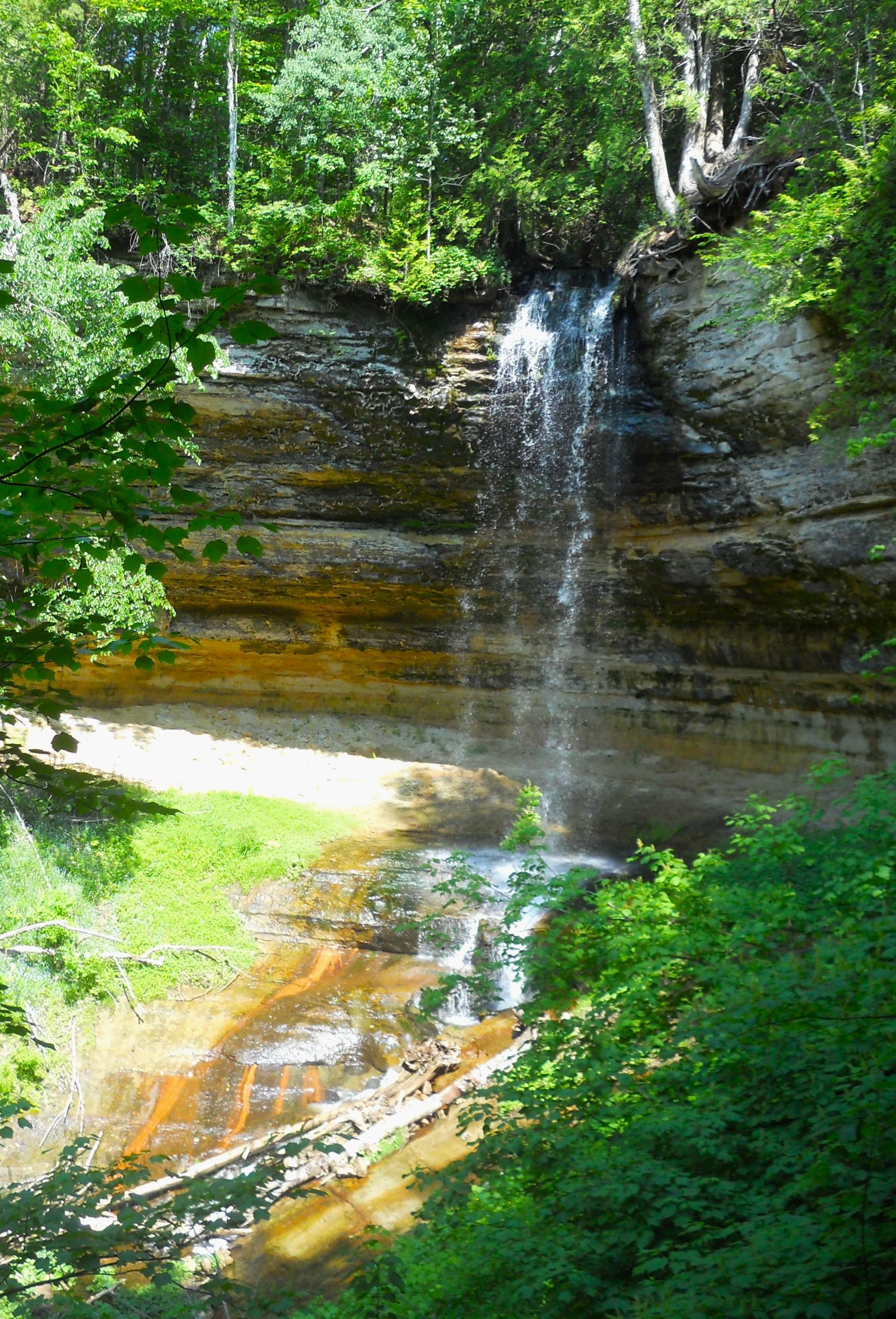
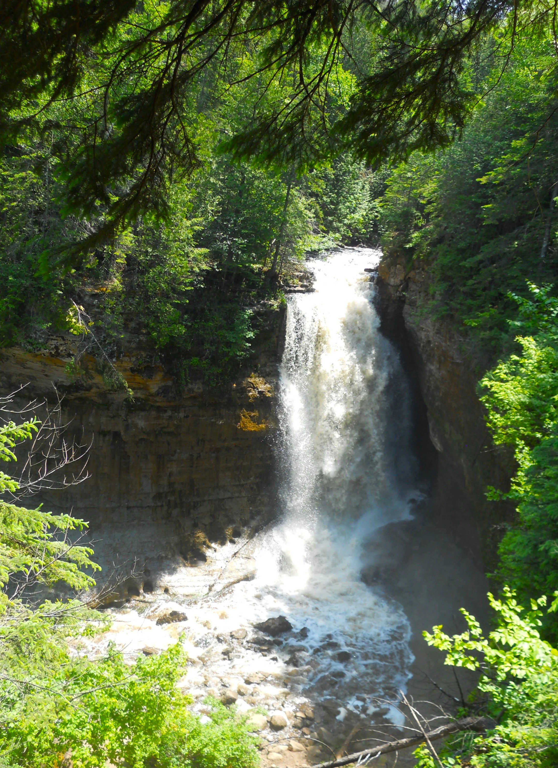
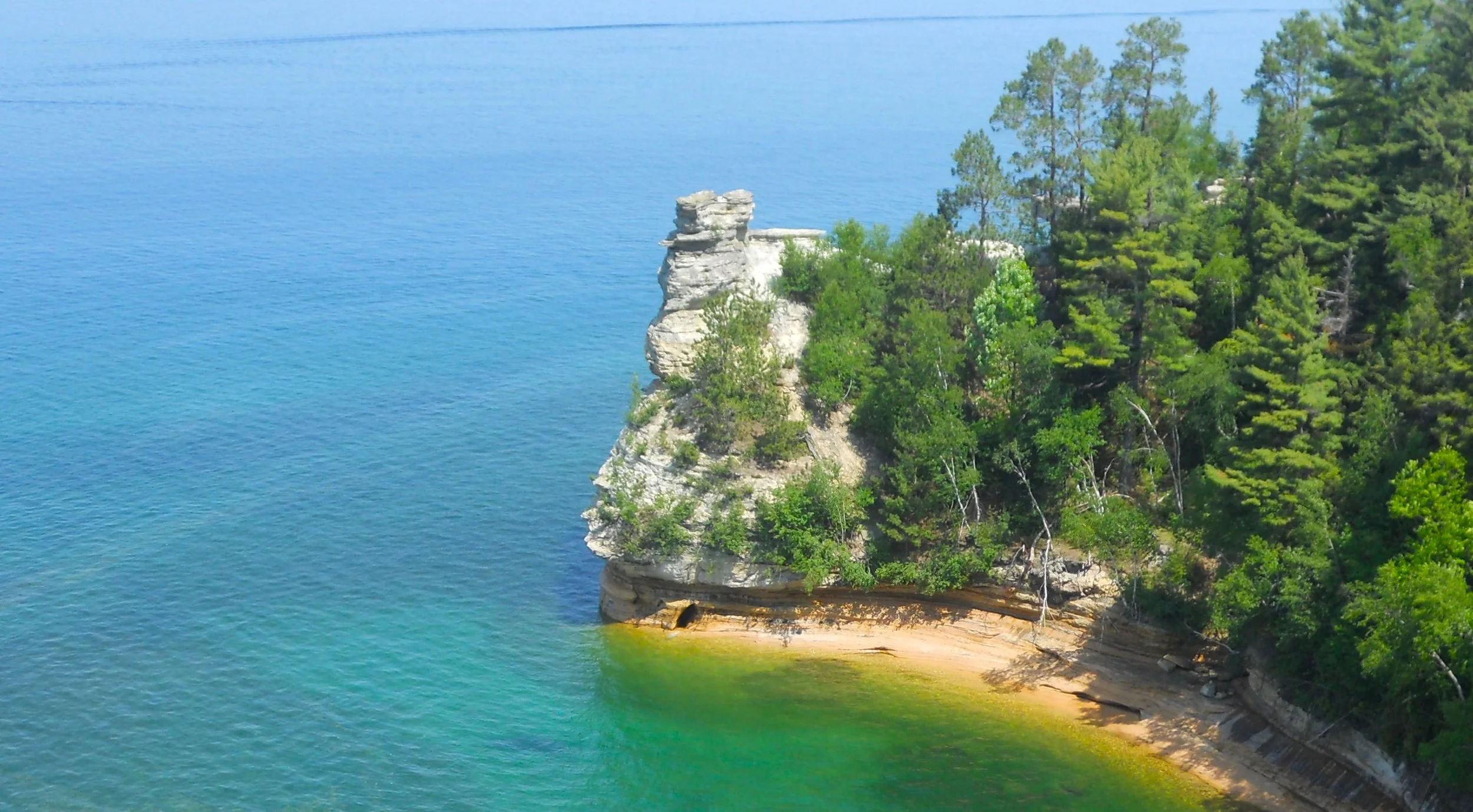
DAY 2 (June 22) - Pictured Rocks National Lakeshore seems to have more waterfalls than miles of Lake Superior shoreline. I lost track of the number of falls to which one can hike. Munising Falls is on the west end of the park (1st photo). Miners Falls is a few miles to the east, accessed via a paved road, then a 0.6 mile hiking trail. Where the Miners Falls road ends, a view of Miners Castle presents itself. I was thinking about entering the lake at Miners Beach, then swimming over to the caves under the Castle, but the 51 F deg water temperature kept me on land. The last waterfall for the day was called Mosquito Falls (bottom), aptly designated, thanks to many of Minnesota’s state “birds” taking some vacation time here in Michigan.
Route today was from Mackinaw City to Pictured Rocks. Tomorrow will continue to Keweenaw, park #235.

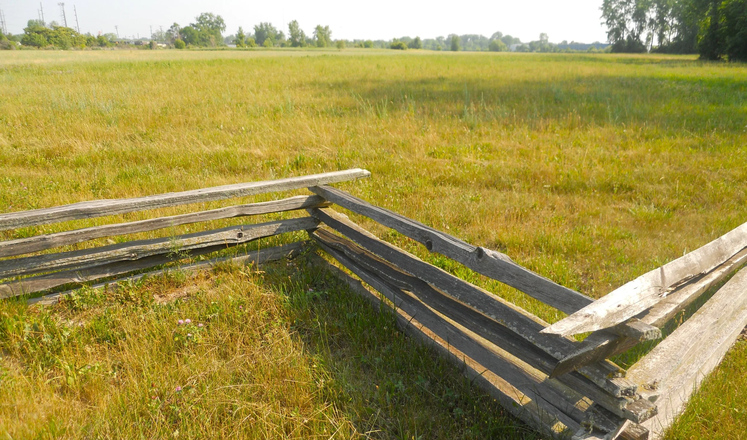
DAY 1 (June 21) - River Raisin National Battlefield Park is not so much a story about the two battles between British and American forces in January, 1813, but the decades of conflict between native peoples and white man, and the many promises by the American government relative to land ownership which were not kept, before, during, and after the War of 1812.
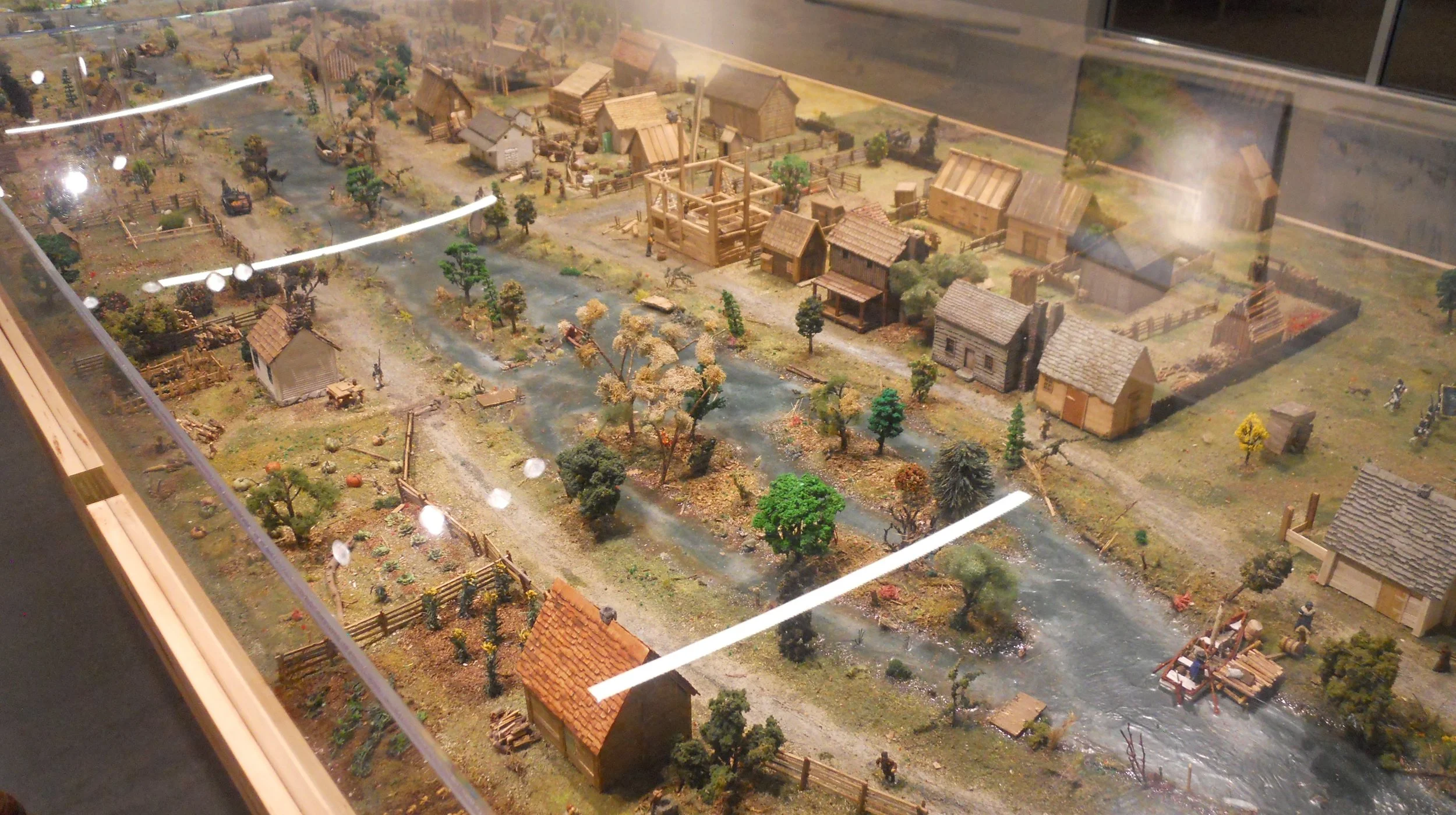
The first photo is at the puncheon fence line held by Kentucky militia, facing out to where the British had their cannons. A diorama in the VC shows Frenchtown (based on accounts of people who lived in the area), on the banks of the Raisin River, just before the first battle, on January 18. The fence row surrounding the buildings on the right is what the Kentuckians hid behind. When the British and Native Tribes returned on the 22nd with full force, the Americans had to retreat across the frozen river, back south. The loss was considered a national calamity by General William Harrison (later to be a U.S. President), and led to increased tightening of control on native peoples across the landscape. That aftermath is still felt today in our country. The new, very large, VC has an Educational Wing, including life-size cabins (photo), storerooms, and Indian shelters.
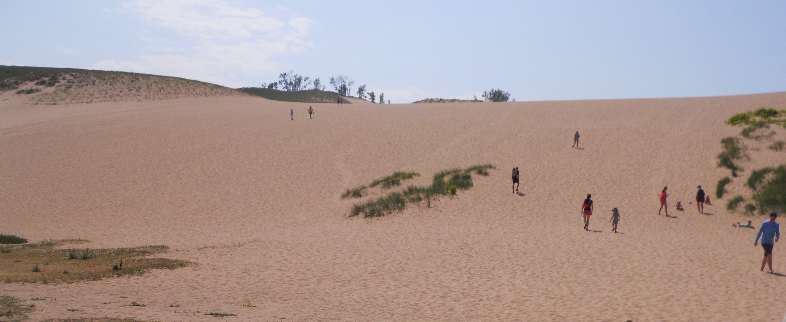
Sleeping Bear Dunes National Lakeshore stretches for miles along the shoreline of Lake Michigan. Most people seem to come to try their hand at climbing the steep dunes. But you had better hurry if you want your chance. In the 1950s, the height was 234 feet. By the 1960s it was down to 134 feet. By the 1980s another 31 feet had been eroded away. Wind is a masterful sculptor.
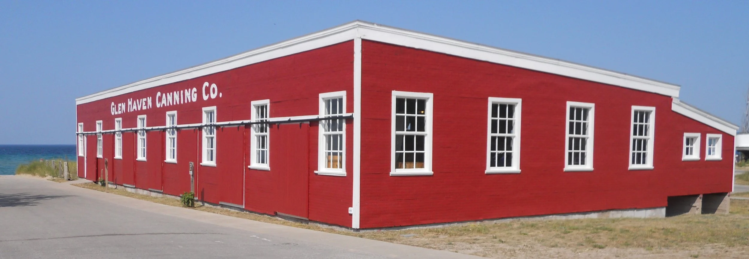
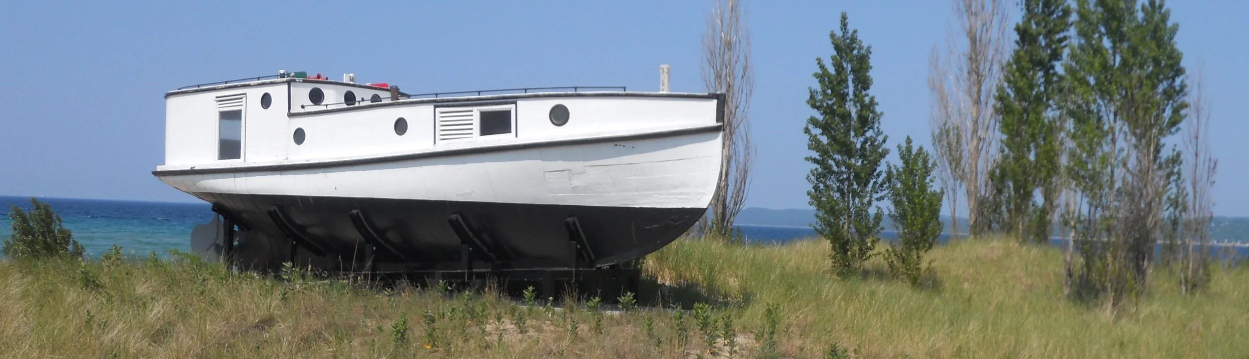
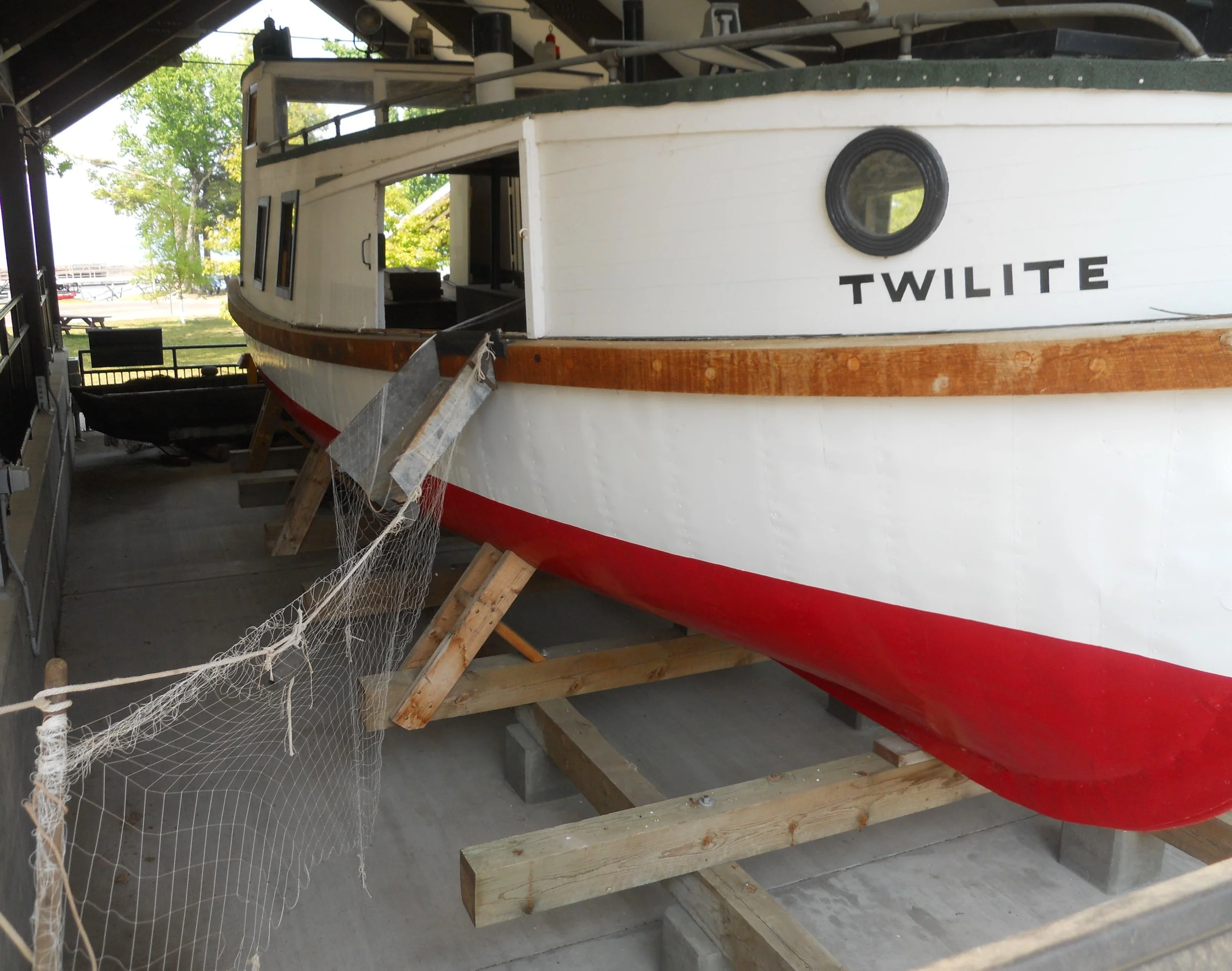
Two miles to the north is Glen Haven, an historic lake town. A large cannery sent boatloads of packed cherries to markets around the country. Of course, fishing was big business in the area. The fish tug Aloha has been “dry docked” a few yards off the beach. She is 70-years old, and was the style of boat for gill net fishing.
If in the area, stay in Petoskey, MI. I will be returning to enjoy the city and the lake.