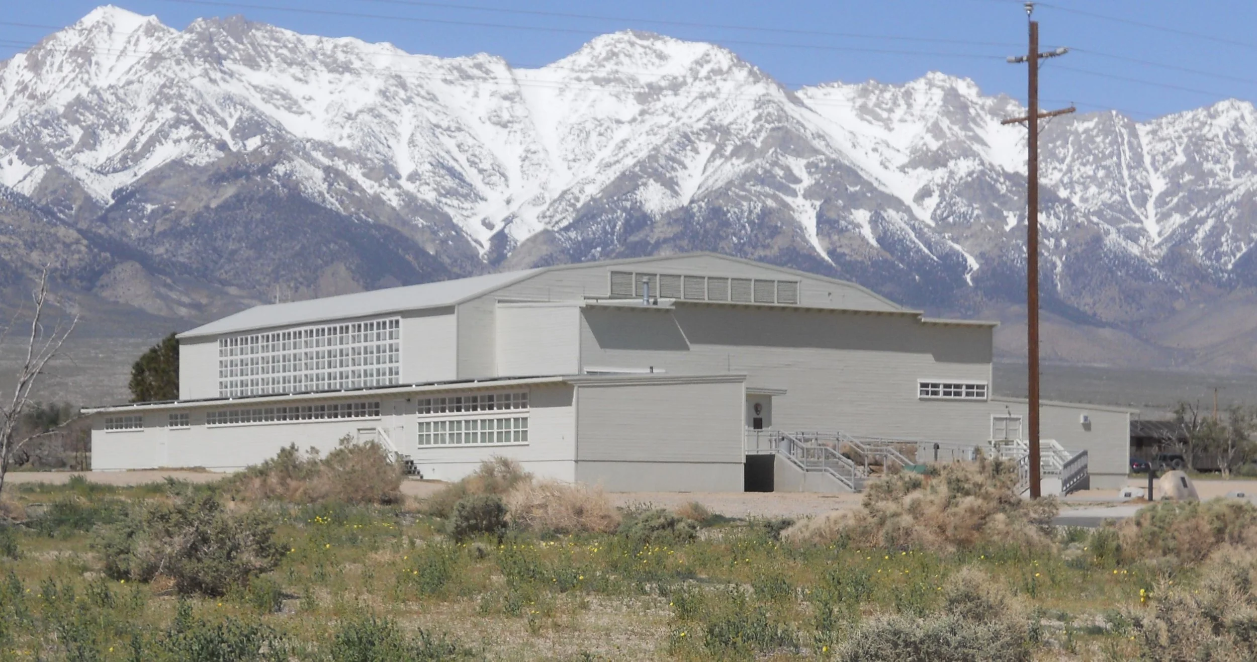
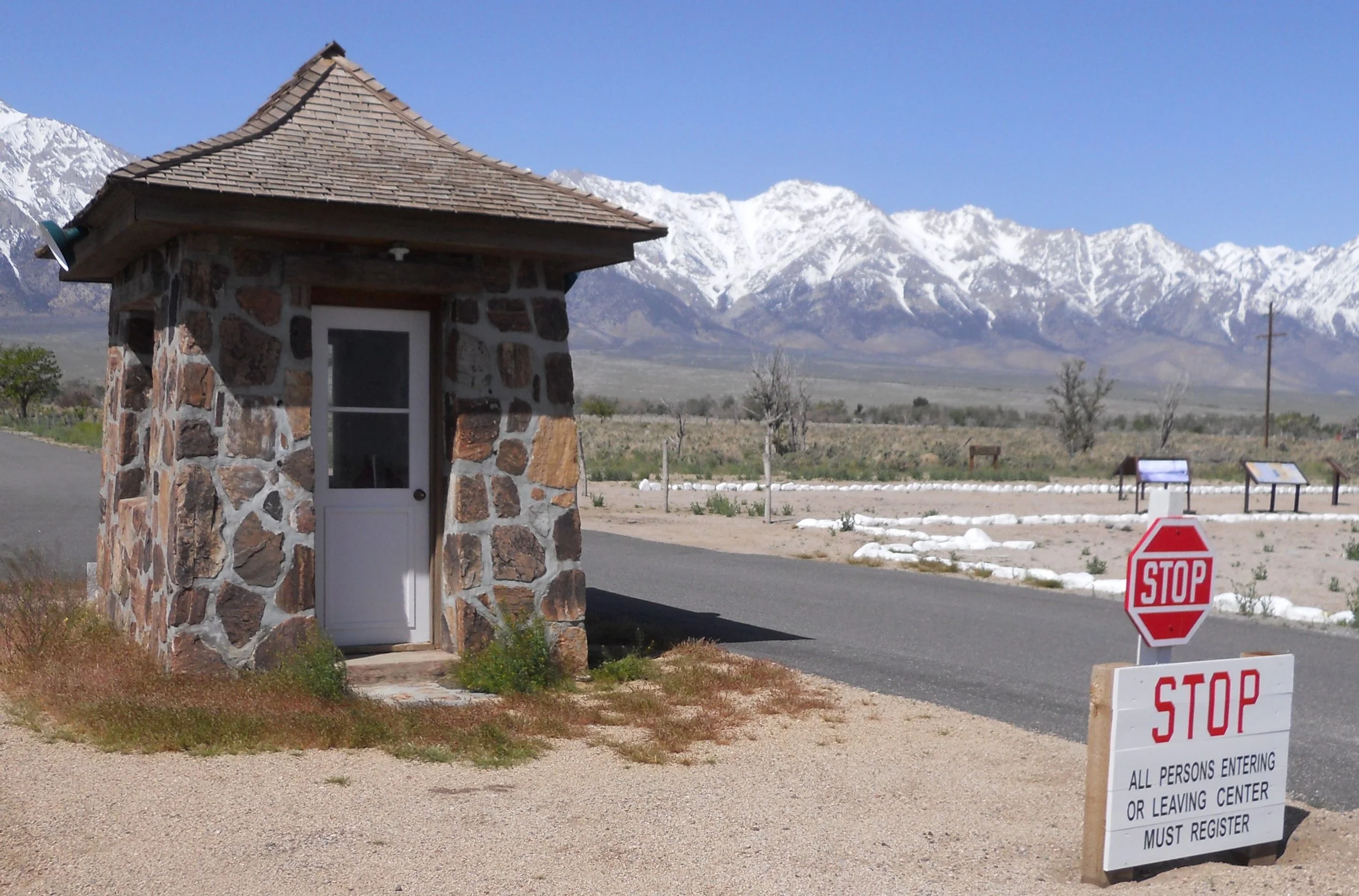
DAY 8 (April 25) - Manzanar NHS honors the American citizens of Japanese descent who were detained at this War Relocation Center during WW2. Only three buildings survived the deconstruction of the camp after the Supreme Court ruled these fellow Americans should not have been detained (the men, women, and children were released in early 1945).
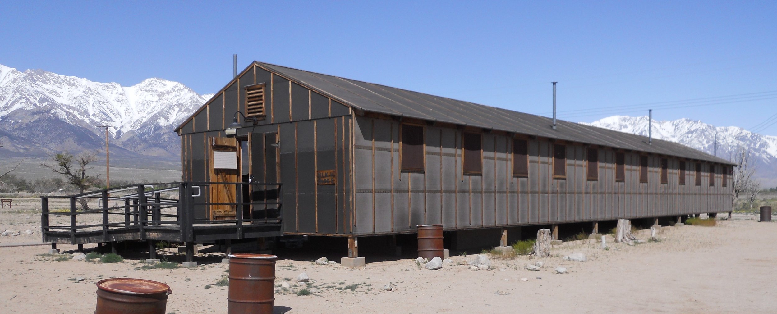
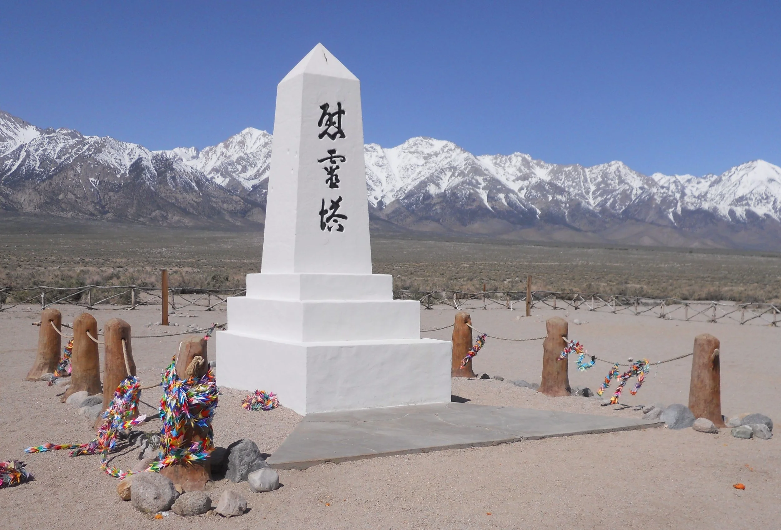
One is the gymnasium/auditorium, which now houses the park’s VC. The camp was arranged in Blocks, with multiple buildings per block. A reconstructed barricks for block #14 can be toured. The original entrance gate still stands. Maybe the most photographed item in the park is the cemetery memorial. The symbols mean in English, “Soul Consoling Tower”.
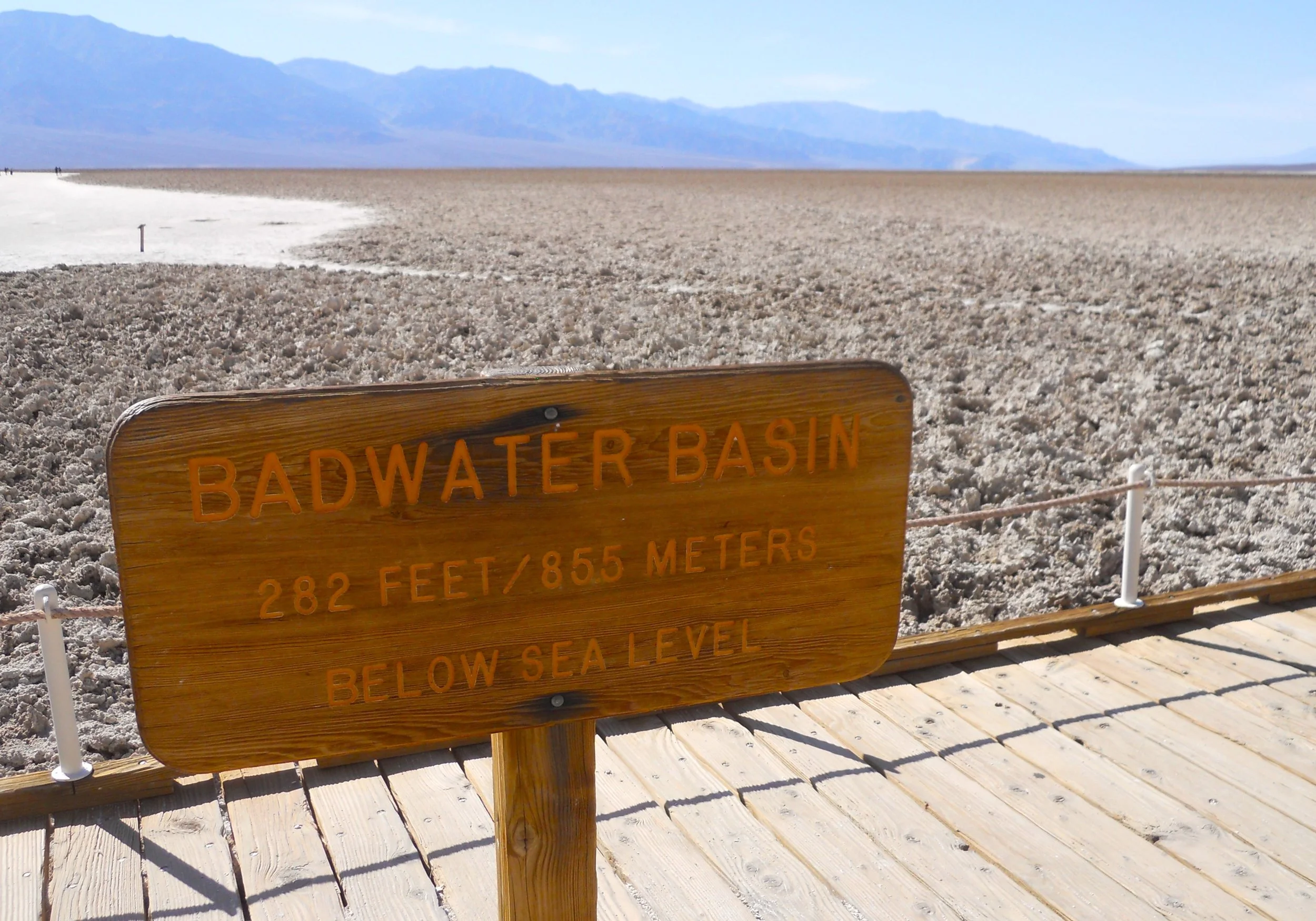
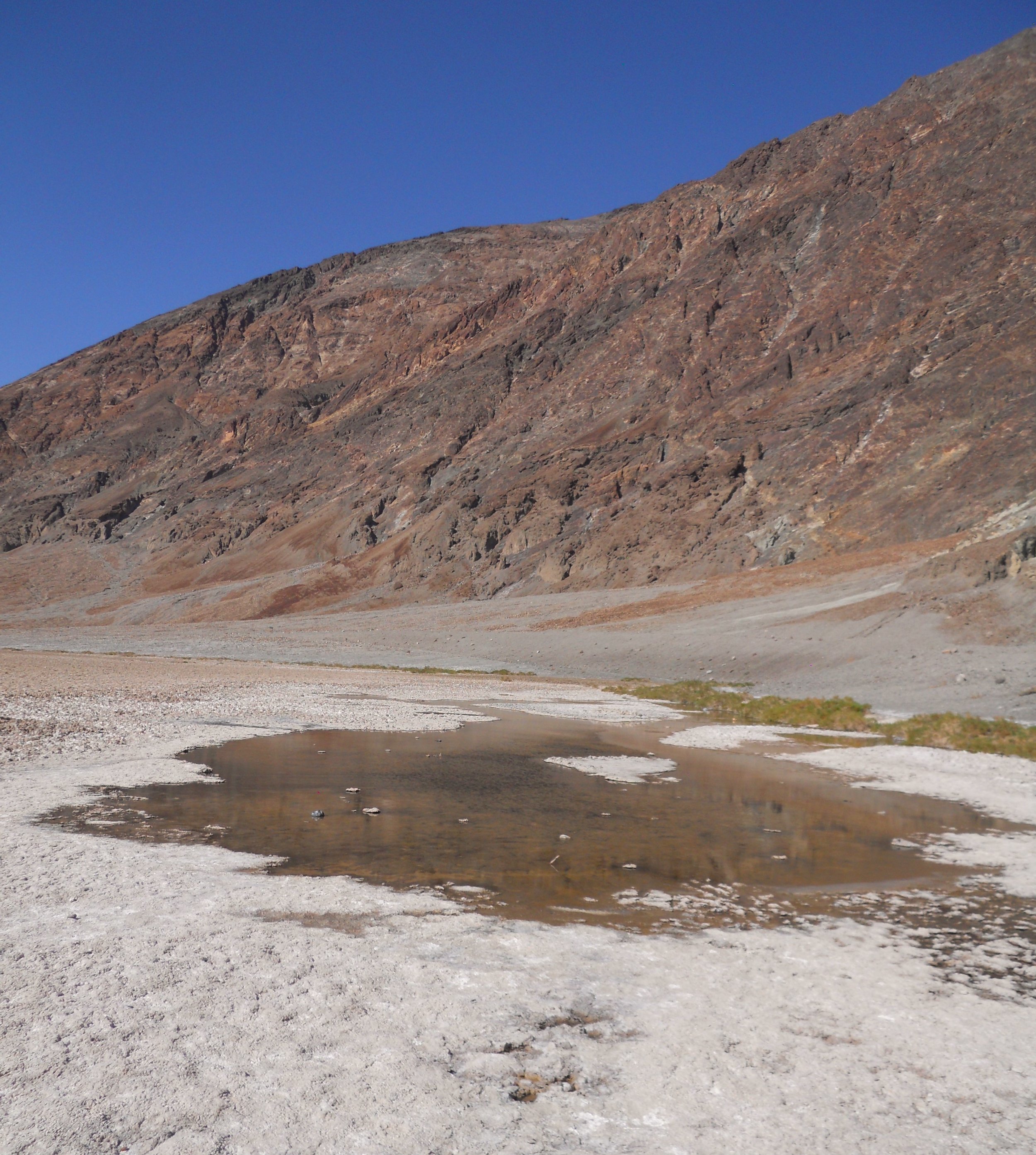
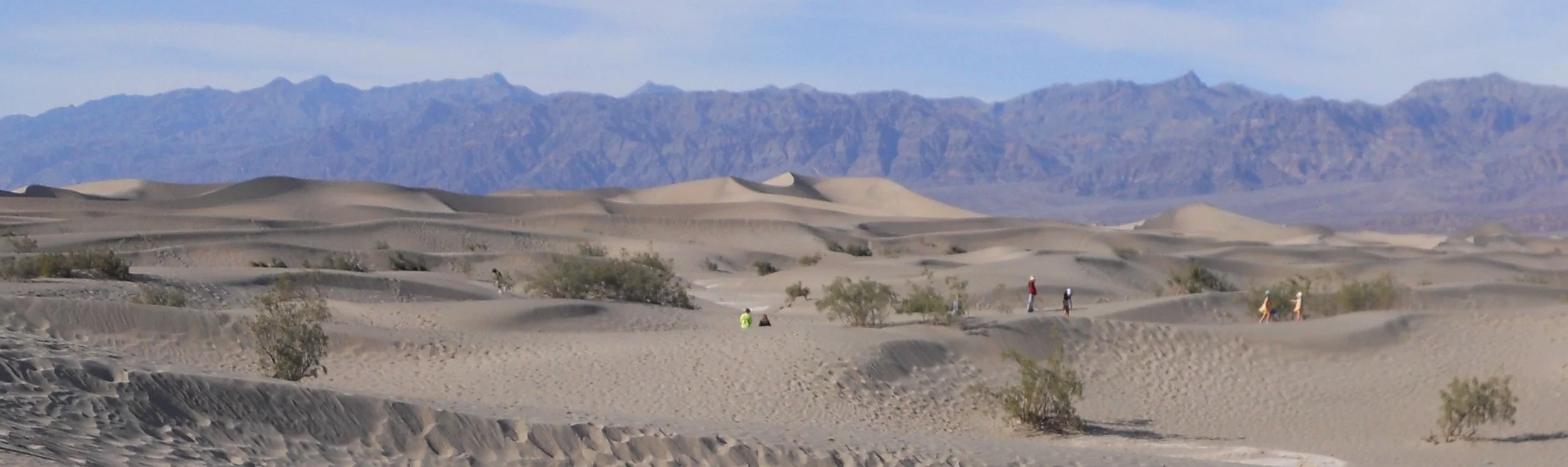
Death Valley NP is home to the lowest point in the United States and holds the record for the hottest temperature recorded on the planet (137degF), in Badwater Basin. There was still water in the Basin from the winter record snowfall, though it will be gone shortly.
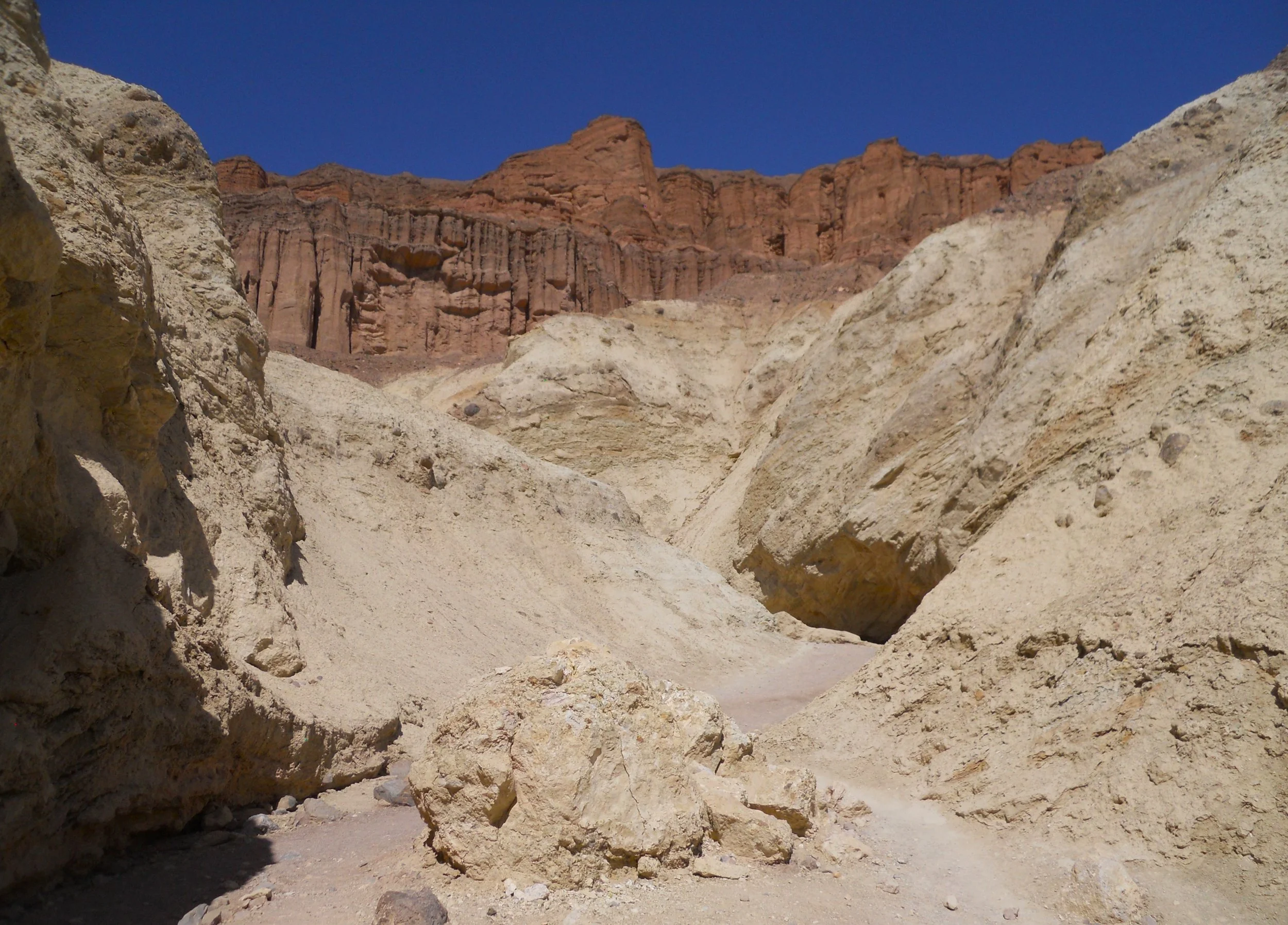
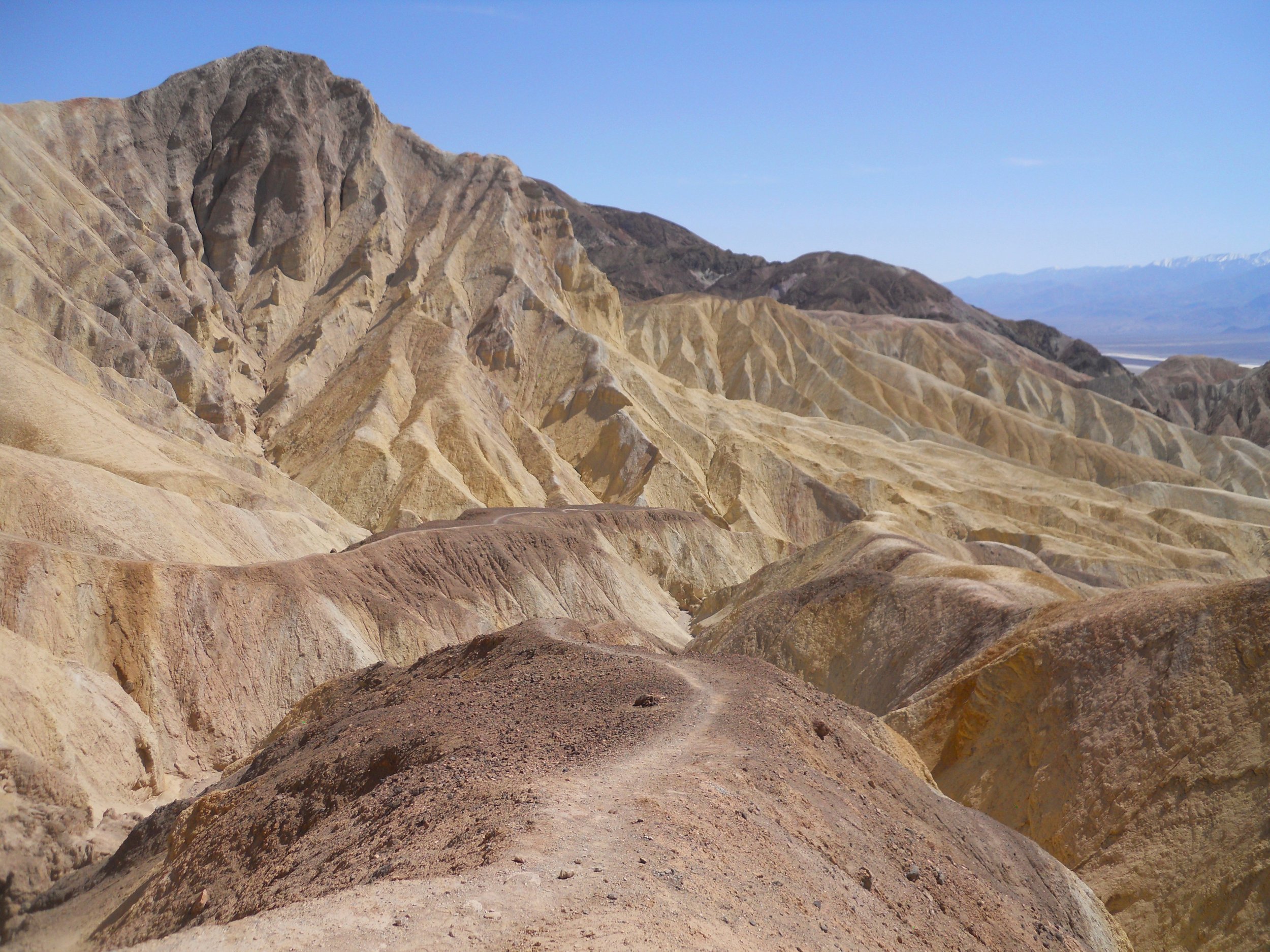
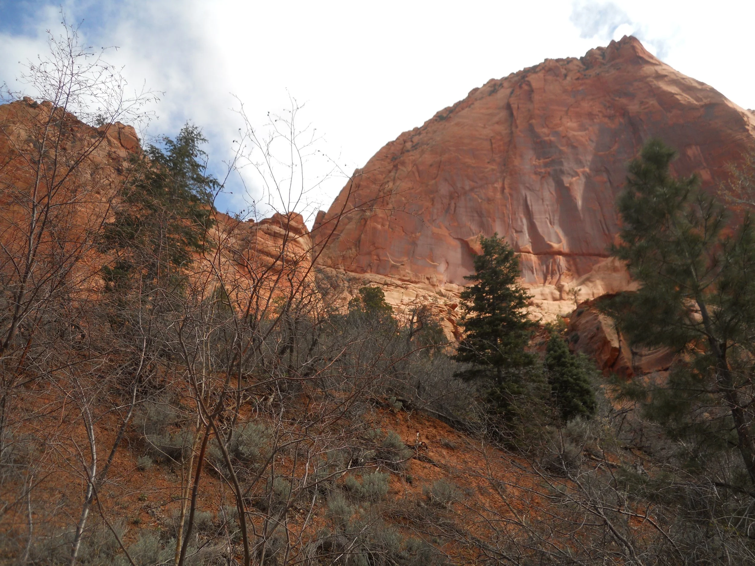
The hike to the end of Gold Canyon was 3 miles, round-trip. Plenty of switchbacks in the canyon, led to a view of the feature’s namesake.
And what would a desert environment be without sand dunes. The Mesquite Flat Sand Dunes are next to Stovepipe Wells (one of the few commercial spots in the park with lodging and food).
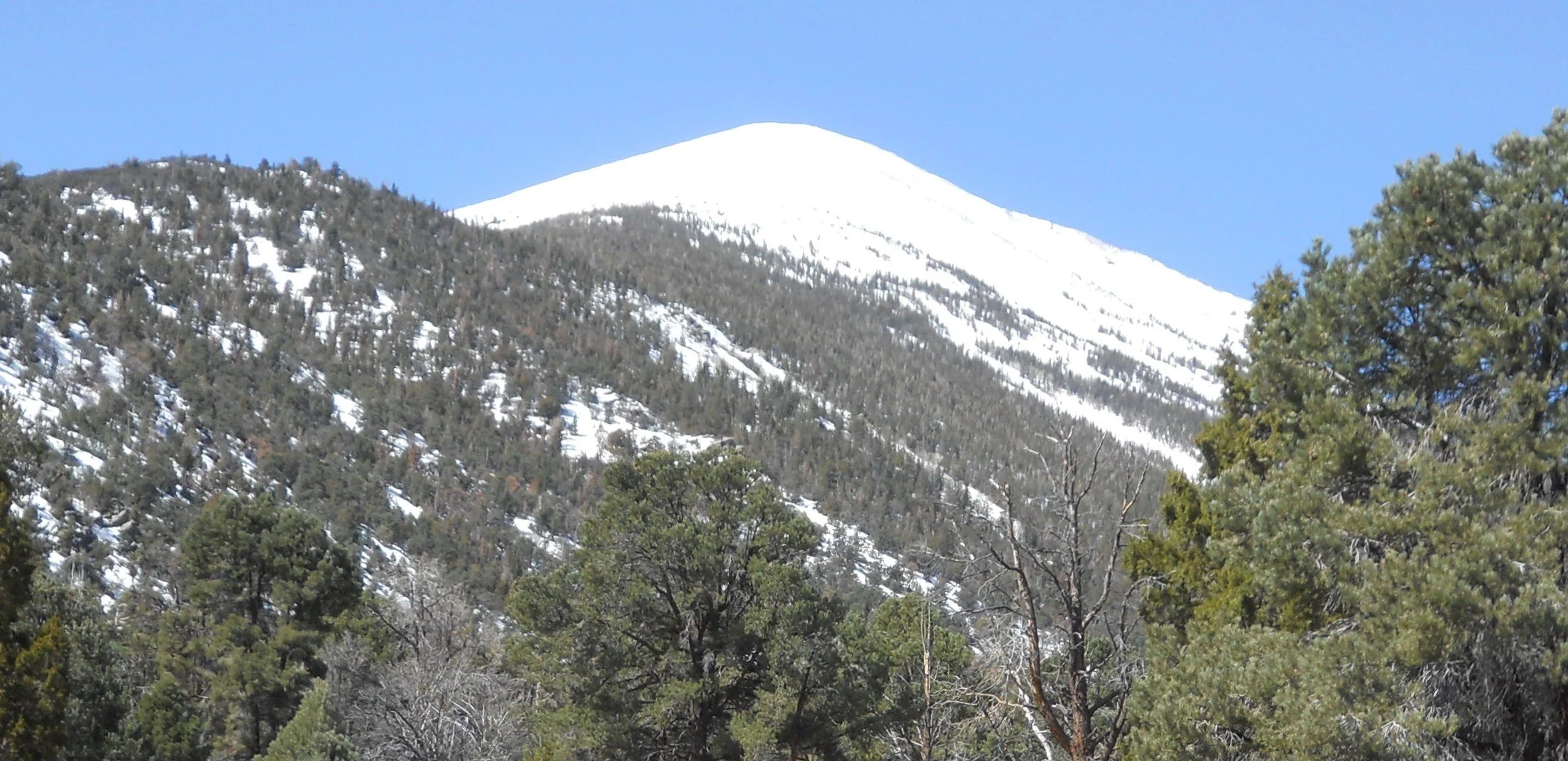
DAY 7 (April 24) - Great Basin NP used to be called Lehman Cave NMon. But in the 1980s the name was officially changed, by Congress. The most noticeable surface feature is Wheeler Peak, at 13,063 feet elevation. The road to the summit TH was closed to traffic, and will be for many weeks to come, due to abnormal snowfall amounts.
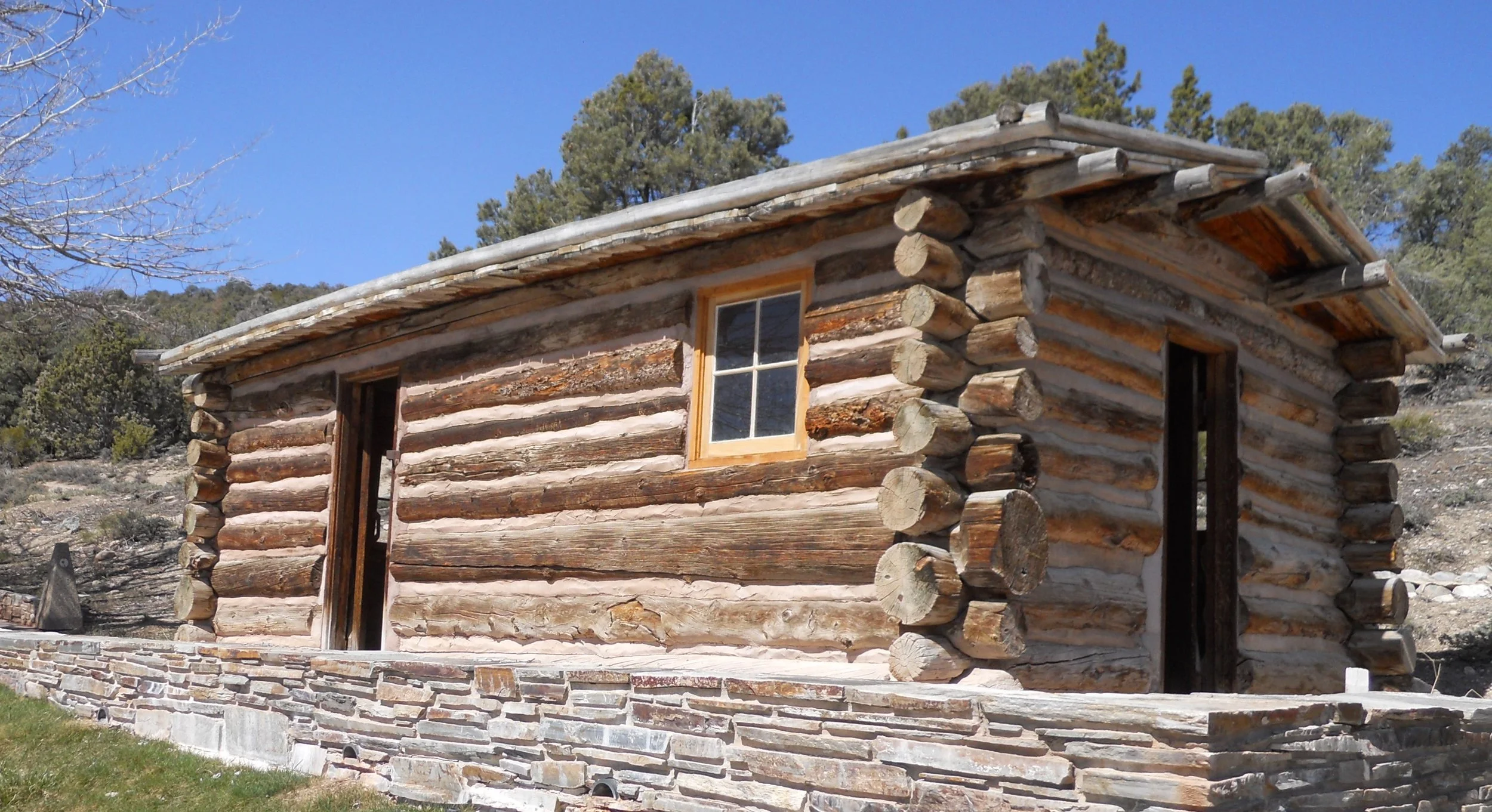
Near the VC is Rhodes Cabin. Built in the 1920s by the Forest Service caretakers, Clarence and Bea, it was used to lodge tourists. This is the last to survive of the many which dotted the area around the cave entrance.
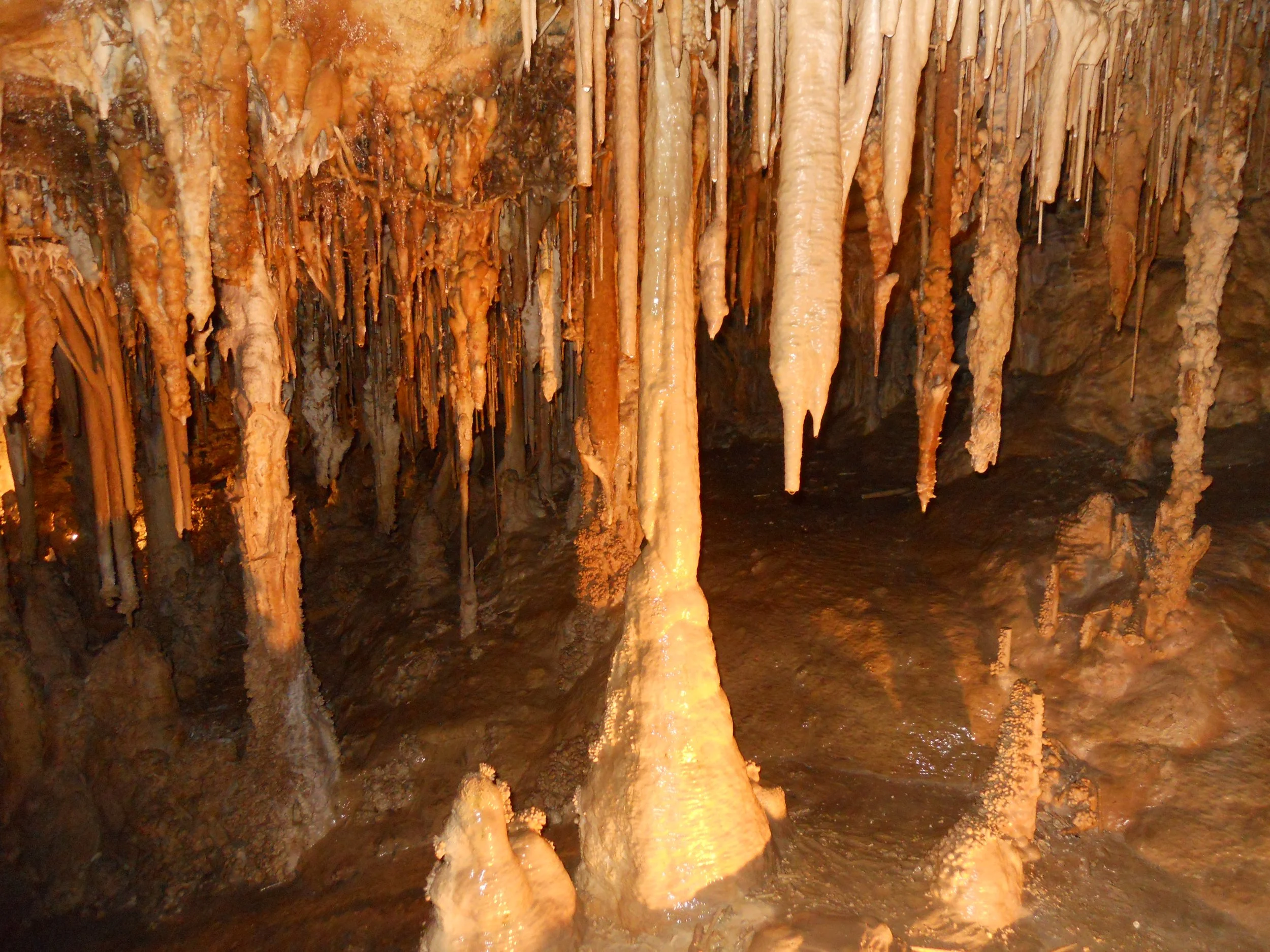
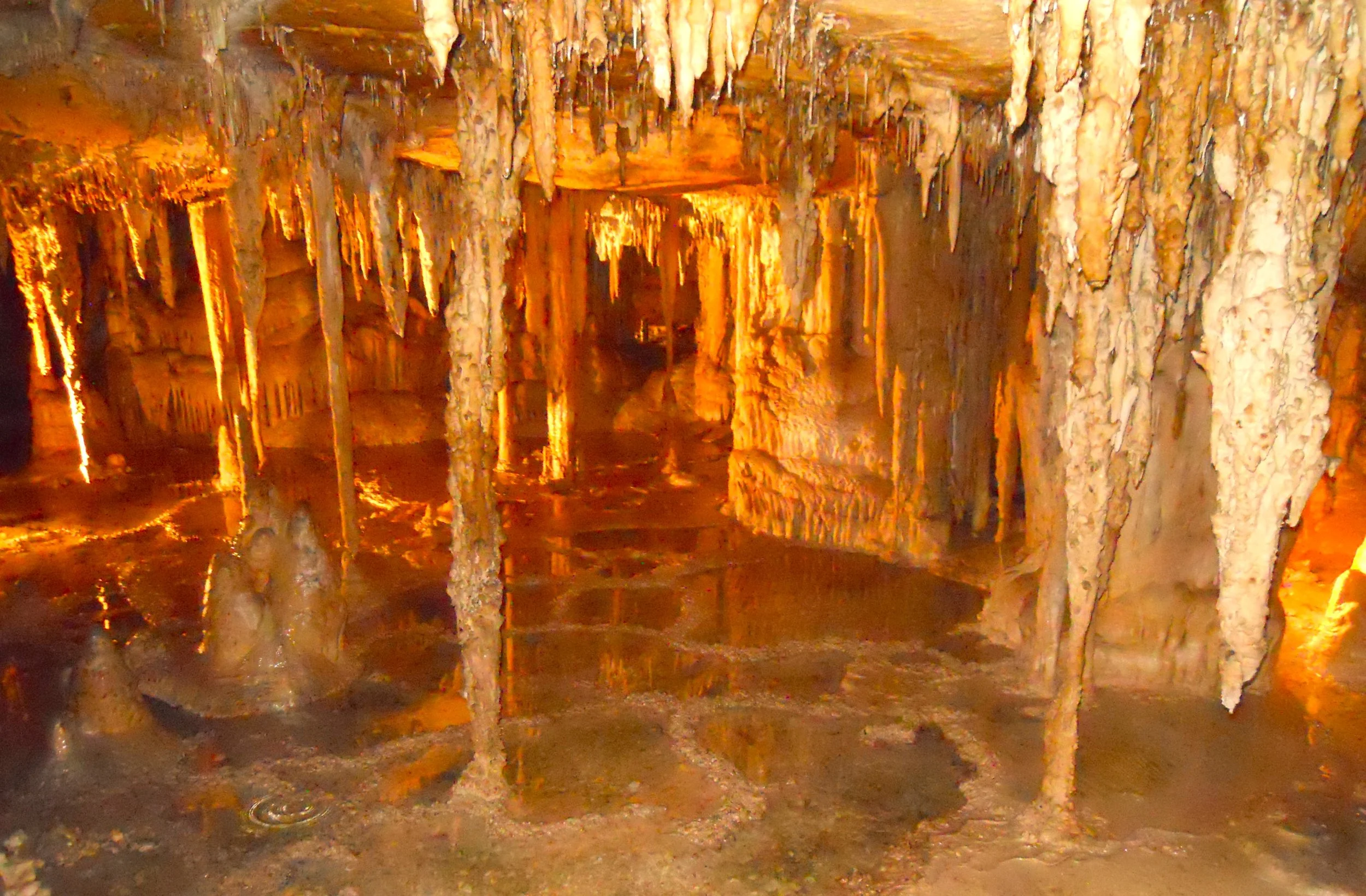
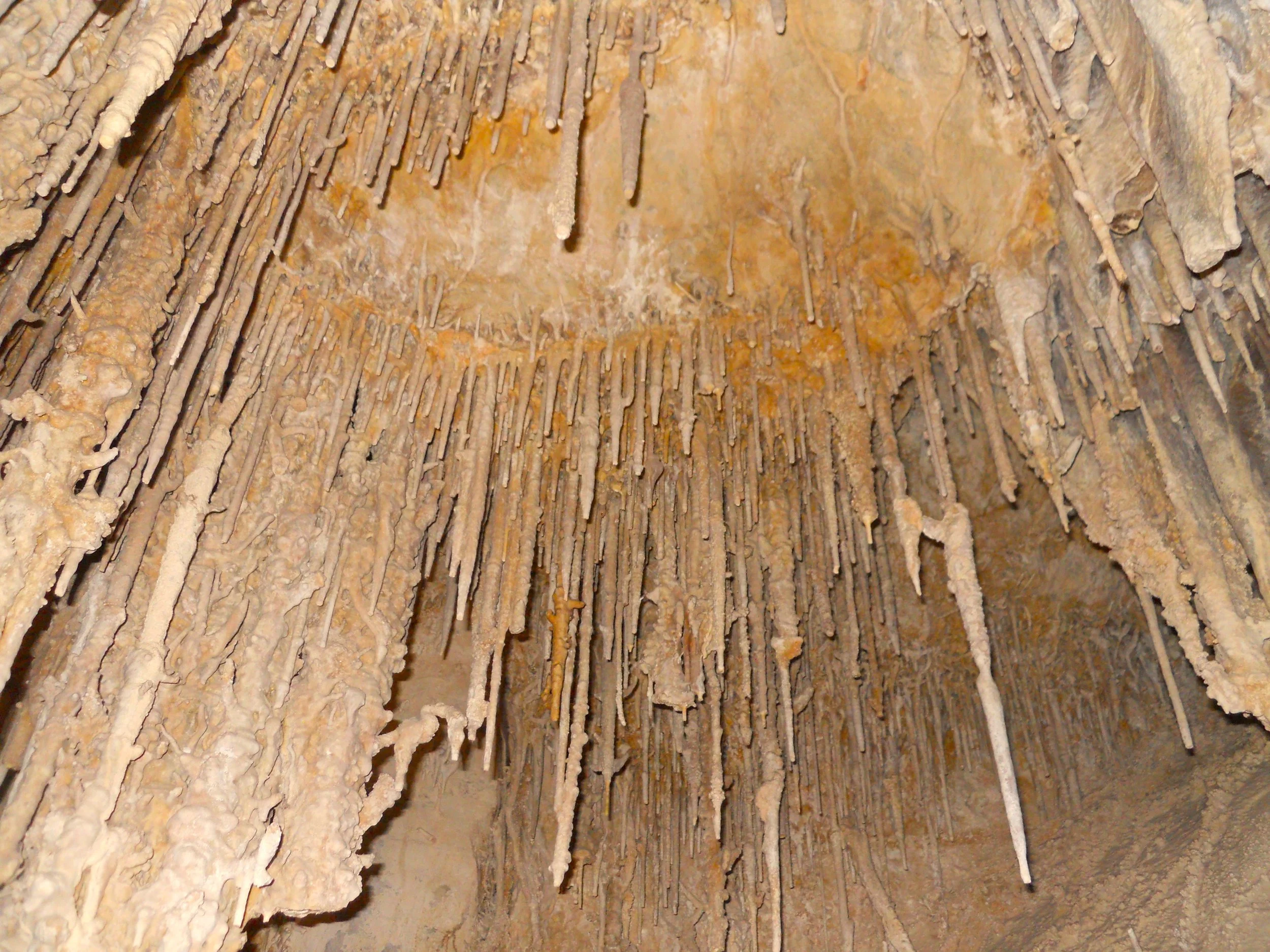
The real marvel for the park is Lehman Cave. Ab Lehman is credited with discovering the cave in 1885, since the opening he used was on his property. Little did he know the wonder which awaited his exploration. He began giving paid public tours… free market capitalism at its finest.
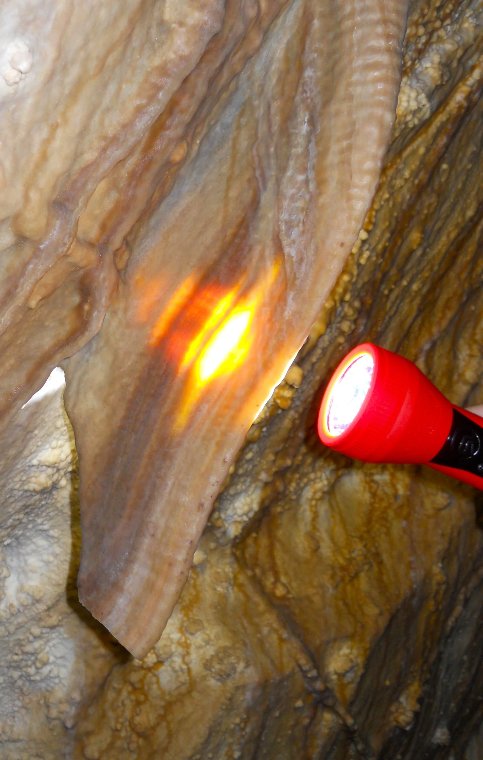
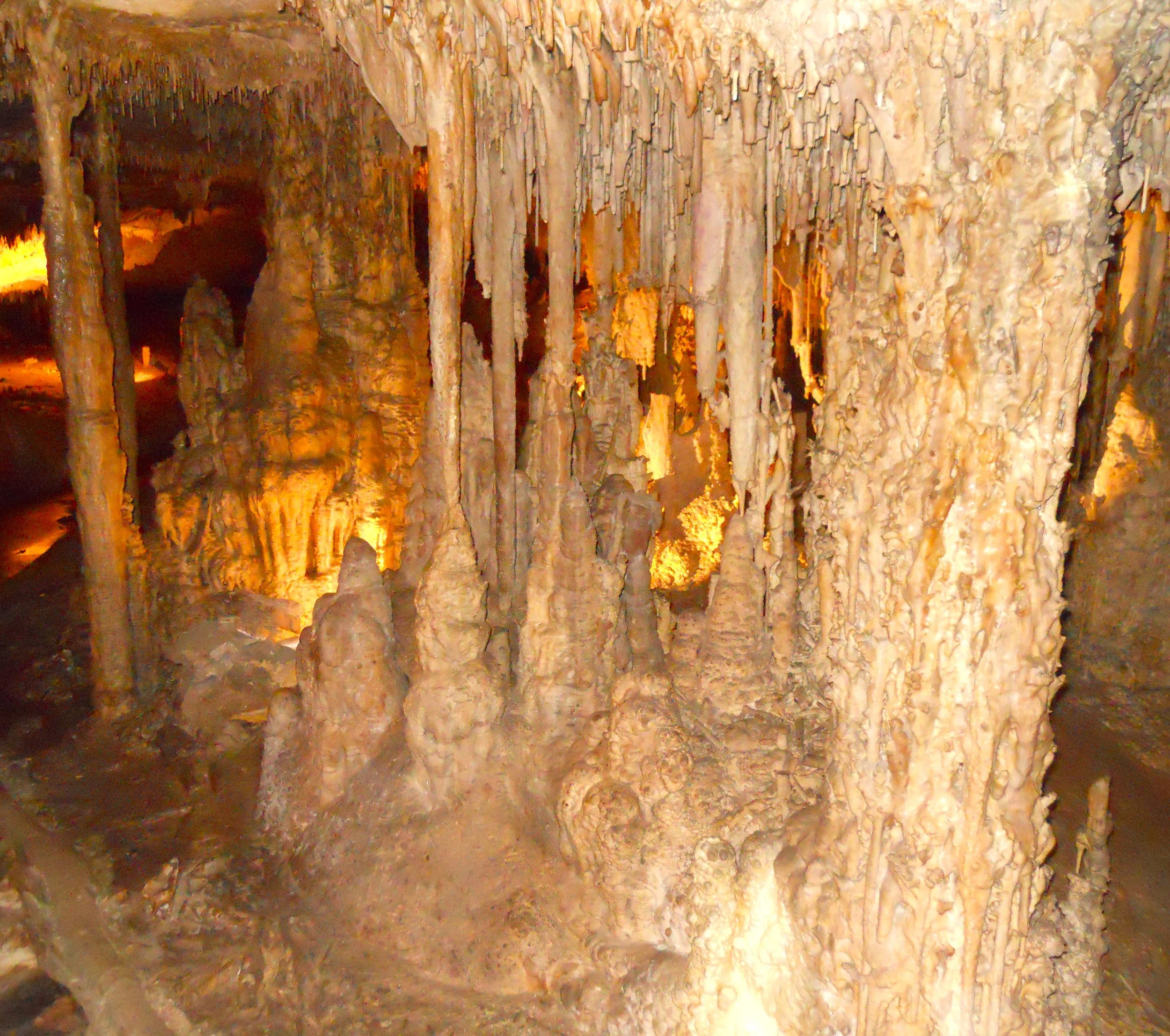
There happens to be dozens of caves within the park boundary, but Lehman Cave takes top spot. It contains myriad stalactites, stalagmites, soda straws, cave bacon (photo with the flashlight), draperies, popcorn, and pillars. The cave’s real fame comes from Shields (to the right of the bacon photo), cylindrical disks created when water flows horizontally through the limestone. The photo to the bottom is of Cypress Swamp, an area that collects a lot of water.


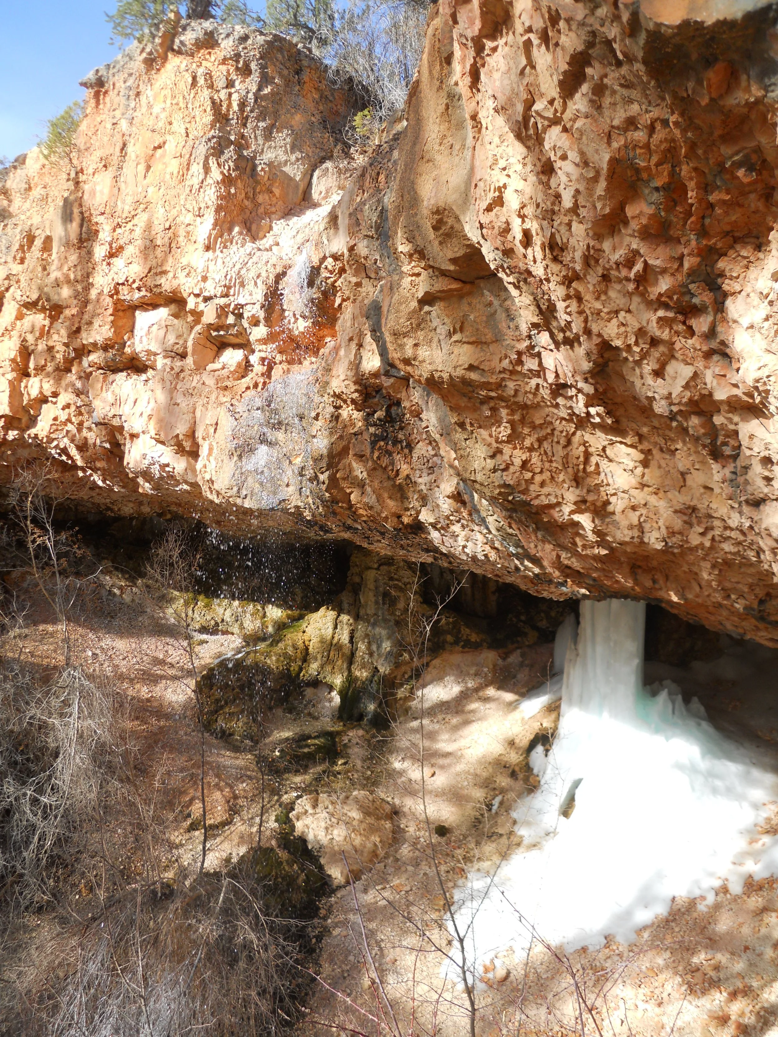
DAY 6 (April 23) - First stop was Mossy Cave in the northern section of Bryce Canyon NP. The spot is more of an alcove than a cave. A spring sends its water over the edge of a cliff (hard to see the dispersed water in the photo), generating plenty of moss on the surrounding canyon walls. The alcove is so sheltered from the sun that ice pillars form each winter.
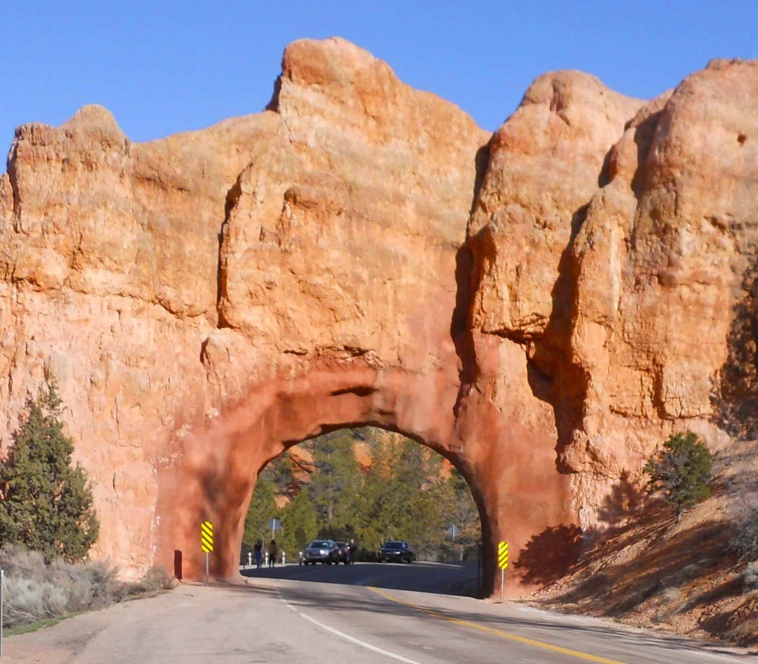
To the west of Bryce, by about nine miles, is Red Canyon. Its colors rival Bryce. A main tourist attraction is the two tunnels cut through the limestone. The pink, orange, and red colors come from oxidized iron. The variation in color is due to changing levels of FeO2. The tunnels were opened in 1925, allowing easy access to Utah National Park (today known as Bryce Canyon National Park) on route 12.
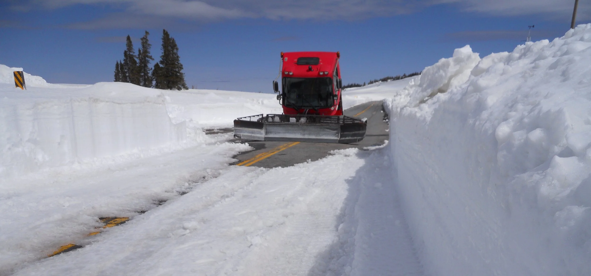
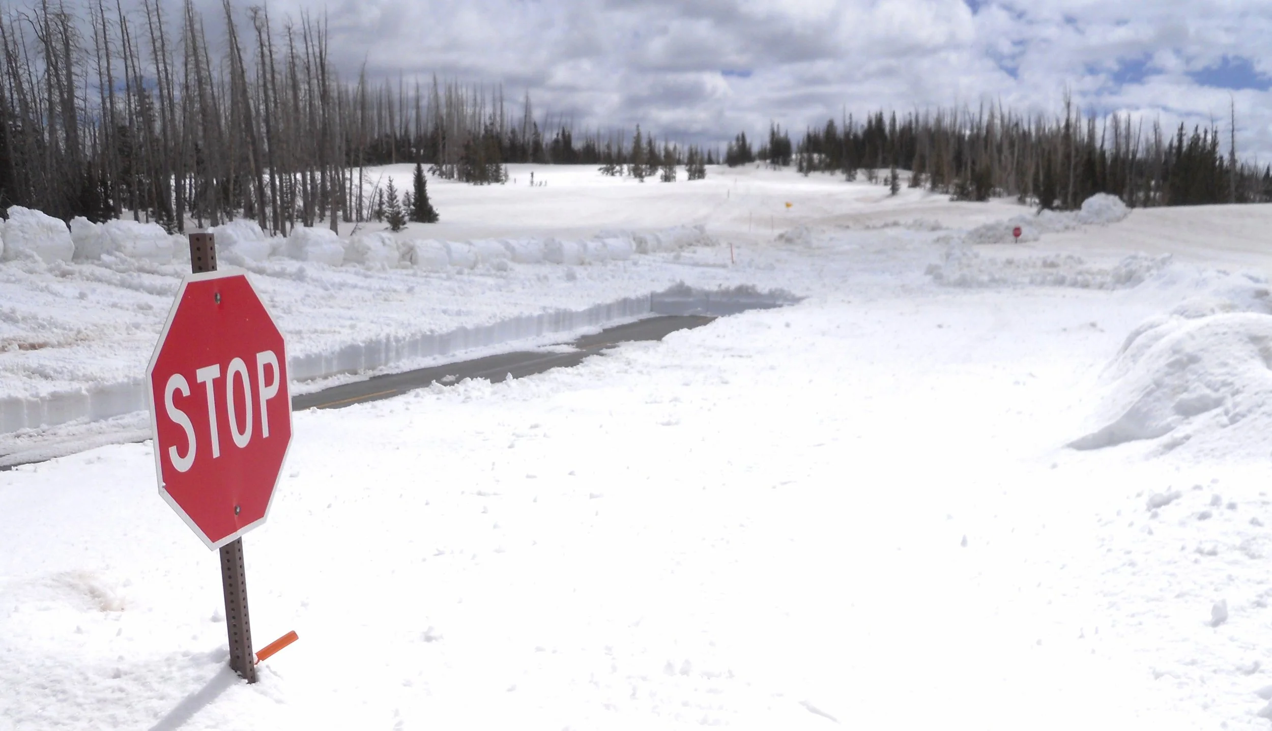
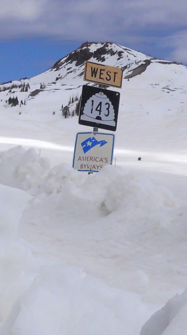
Well, if you think the ground looked pretty clear on route 12 as I took the photo, that was not necessarily the case at Cedar Breaks NMon. This park was having some weather issues, per the NPS. The park’s website says the two roads in the park, Utah routes 143 and 148 are closed. Well, what is a non-skier supposed to do? Read the Blog to learn more about today’s adventure. To get to the end, I made it into the park (is Mother Nature really going to stop me?) and viewed the “Bowl”, the amphitheater which is the geologic wonder if this area. There may be STOP signs along my Quest’s path, but are only temporary roadblocks.

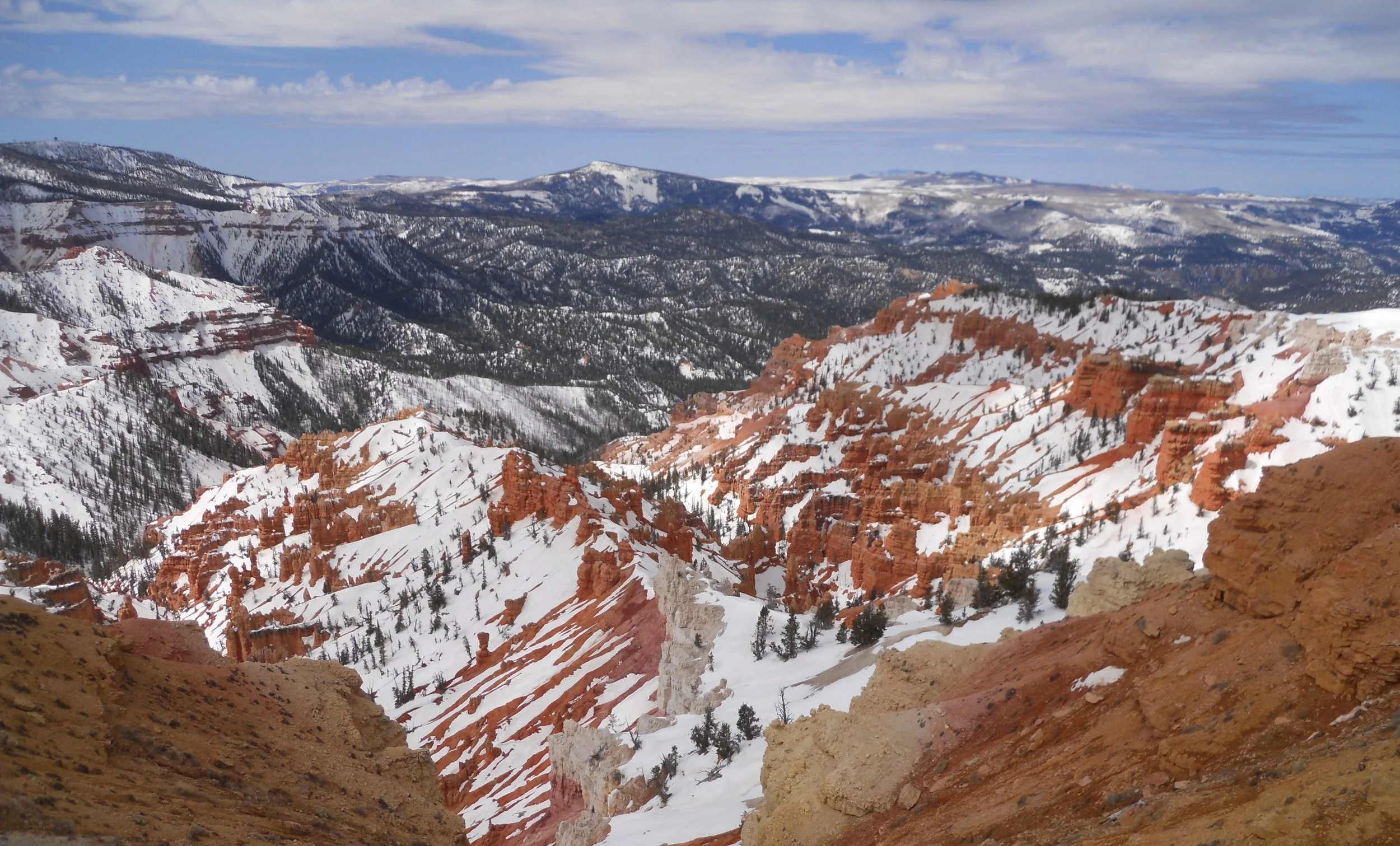
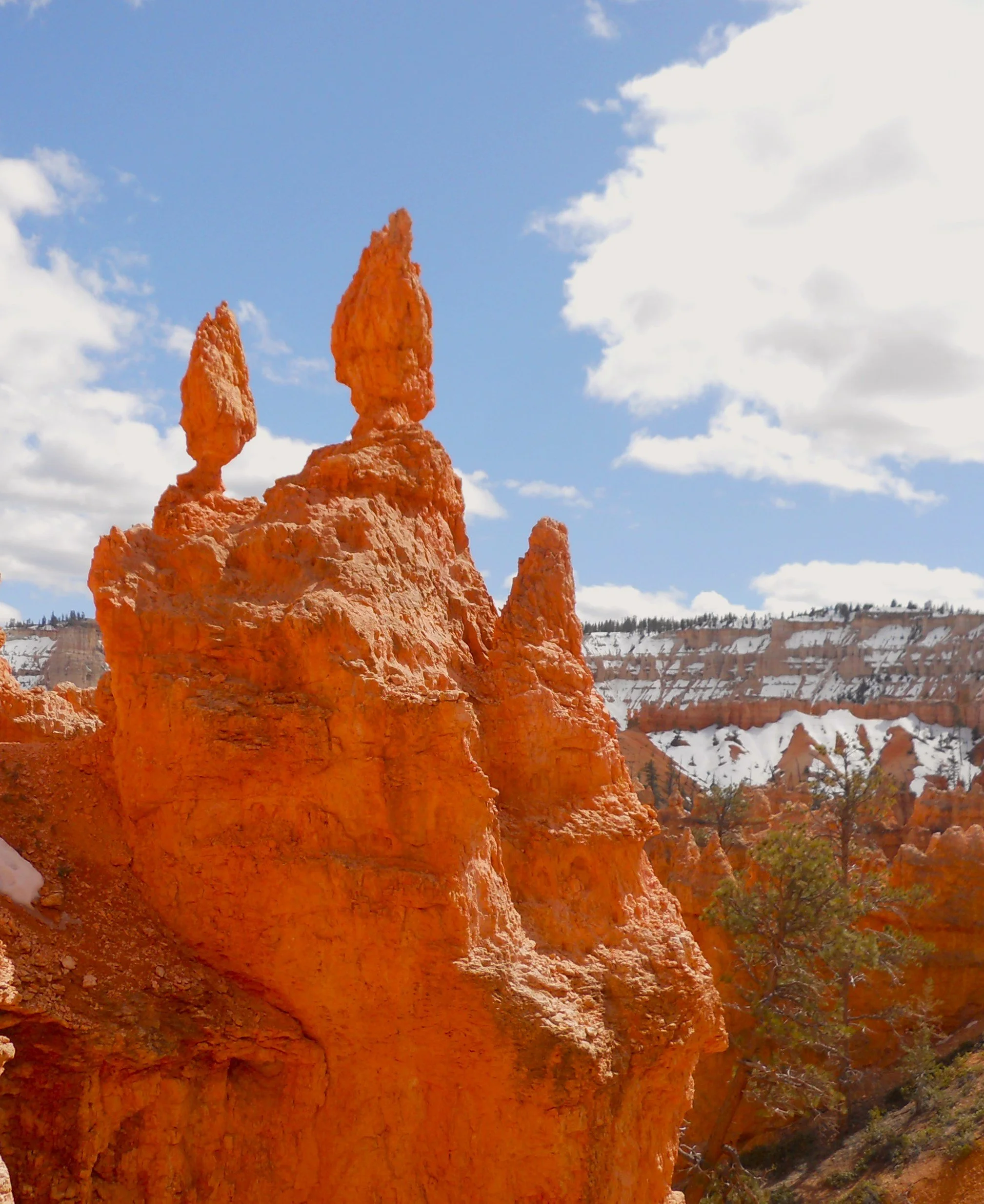
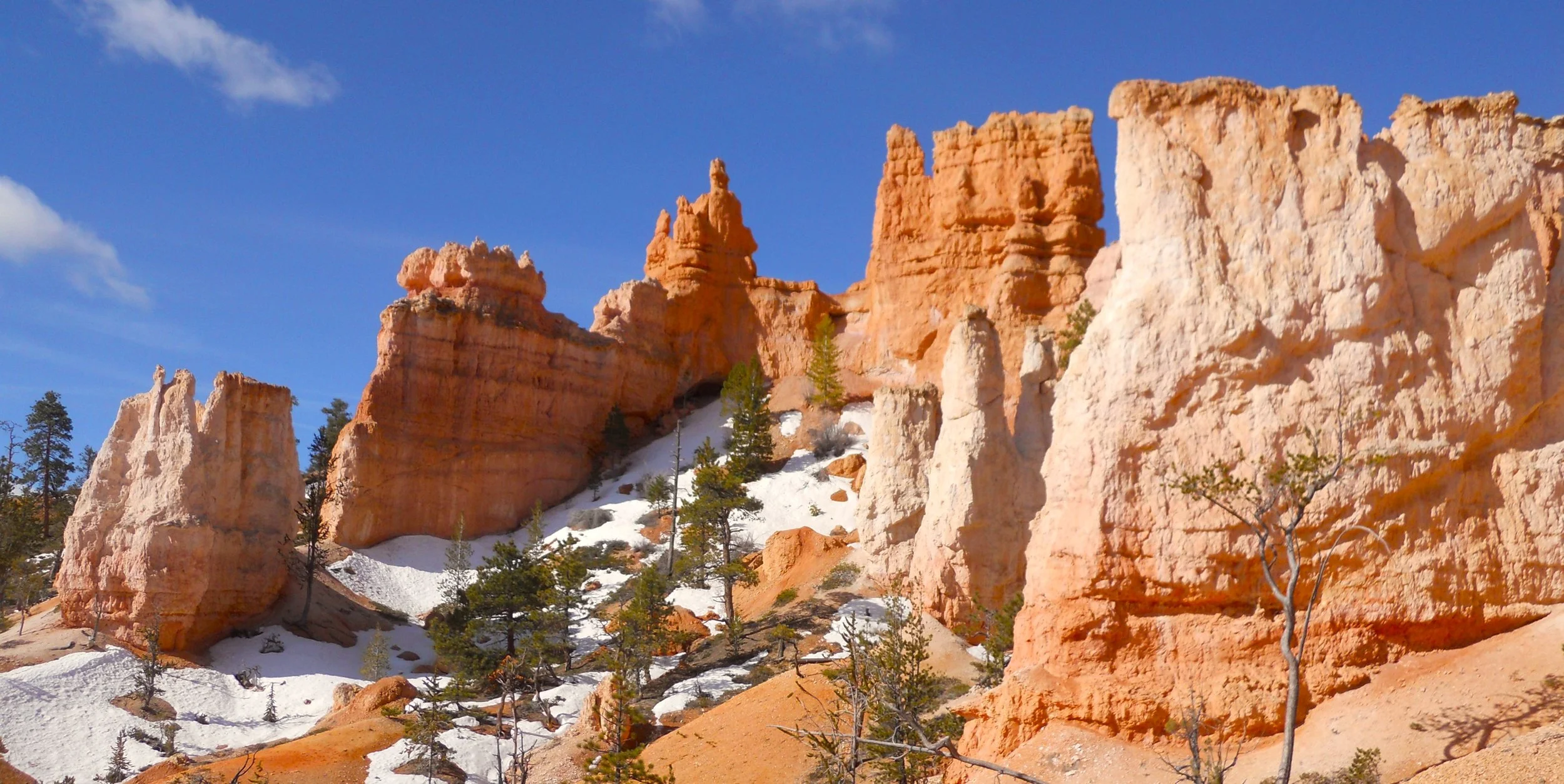
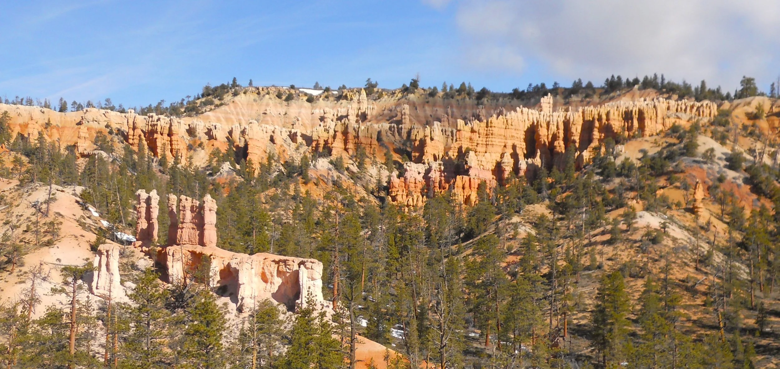
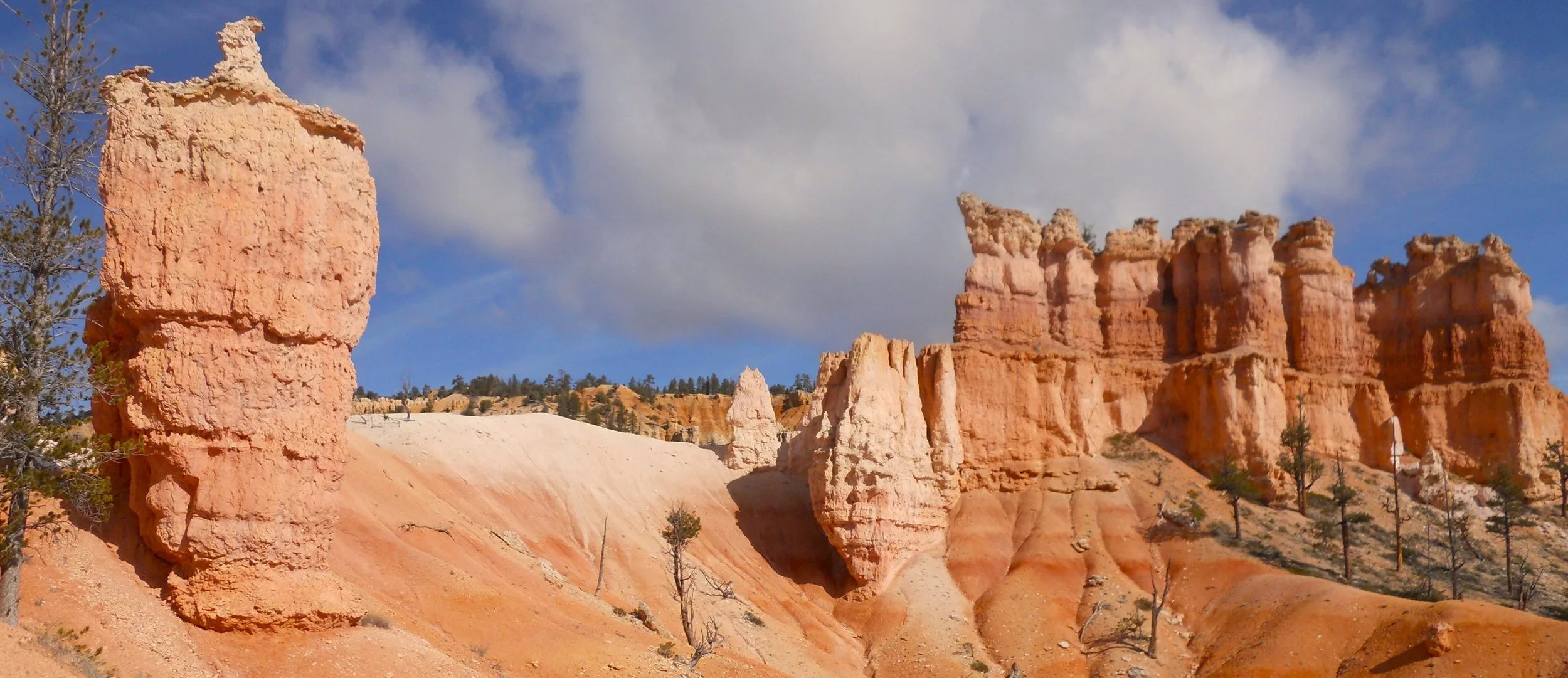
DAY 5 (April 22) - Bryce Canyon NP was today’s only attraction. So, there will be plenty of photos, because it is stunningly beautiful, and it is a major player in the National Park System. The first three photos are from the Fairyland Trail. A nine-mile drive took me to Natural Bridge. The sun was to the east, so the iron inducing red color does not pop out… one should wait until afternoon when the sun is to the west.
Farview Point is higher elevation, so one sees more of Winter’s lingering snow.
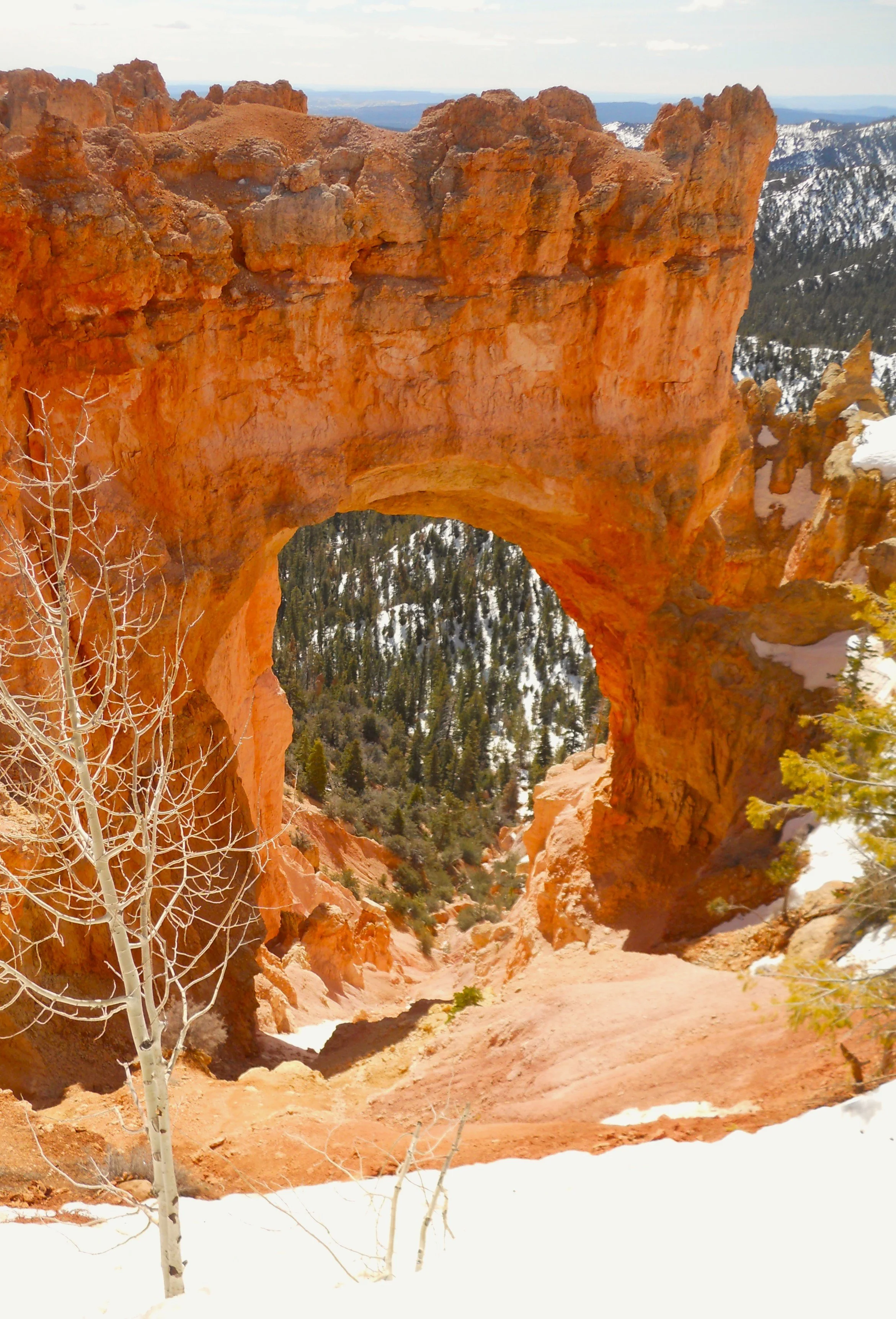
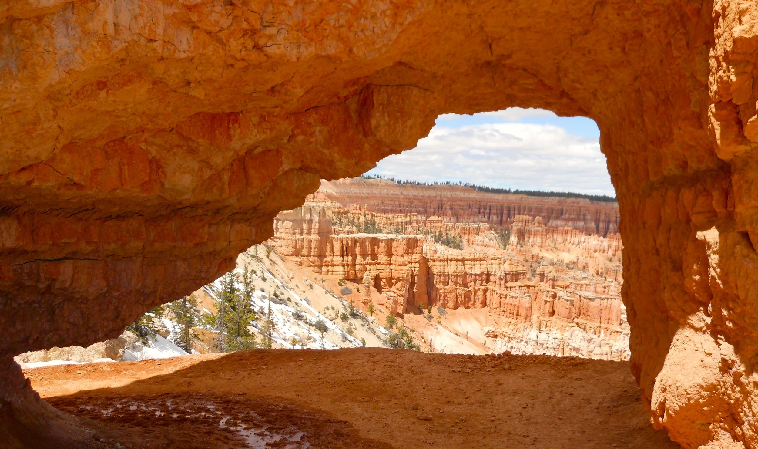
The photo which shows packed snow is from the Peekaboo Trail. There were various sections even narrower than this. The archway is also on the Peekaboo. A number of people were using this spot for a breather. Don’t let the dry ground fool you. Just before and just after the opening, mud galore.
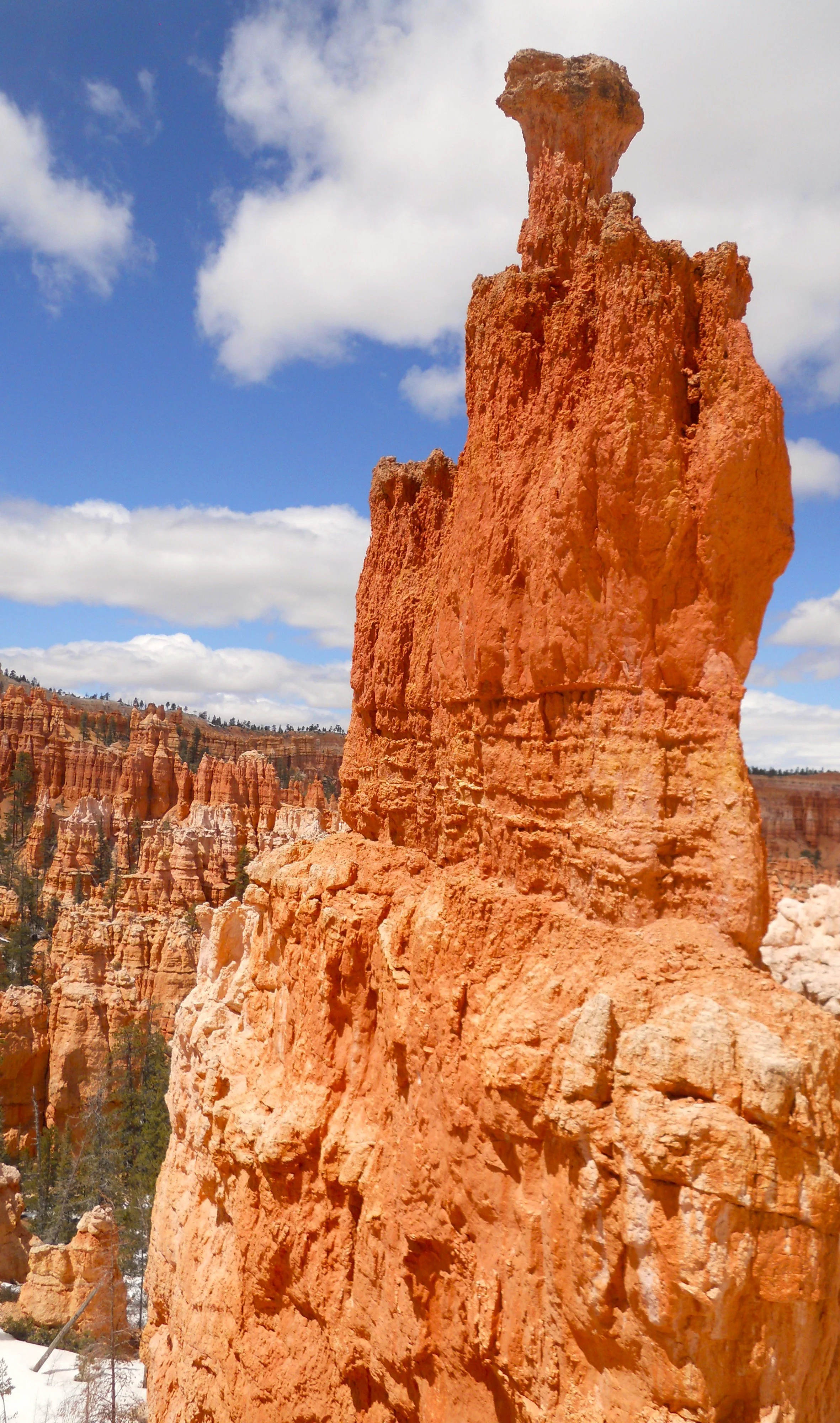
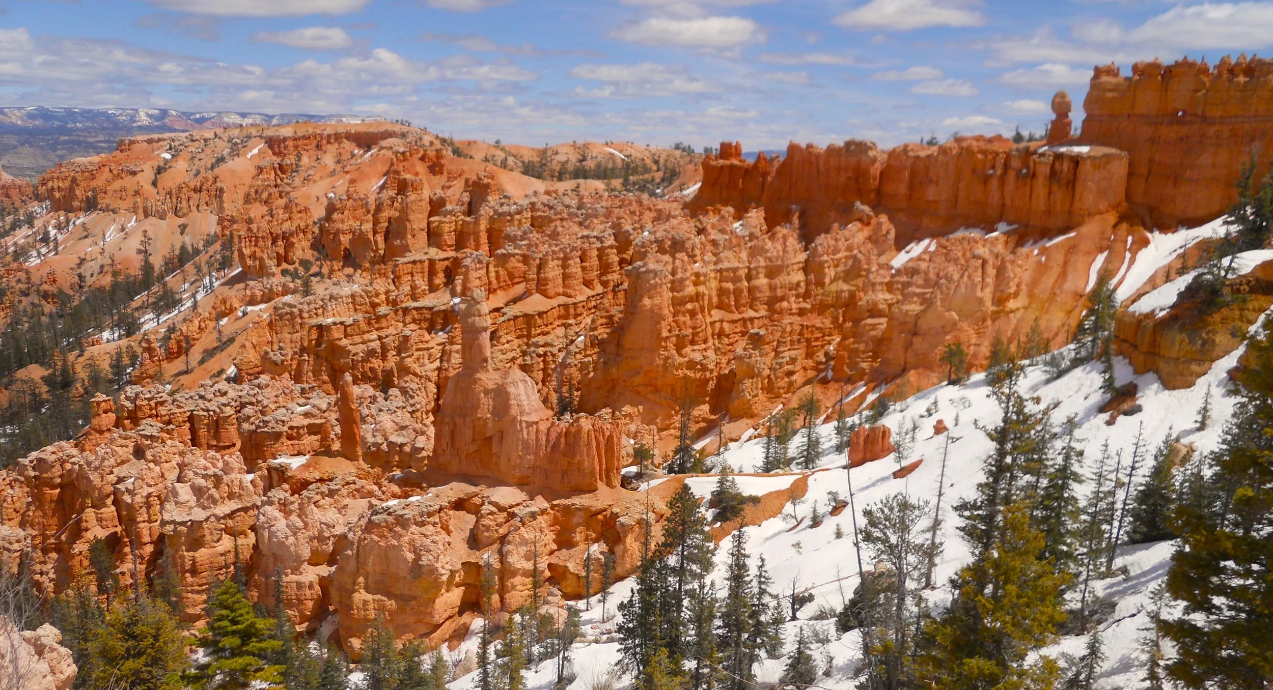
The next three photos are also from the Peekaboo path and its amphitheater.
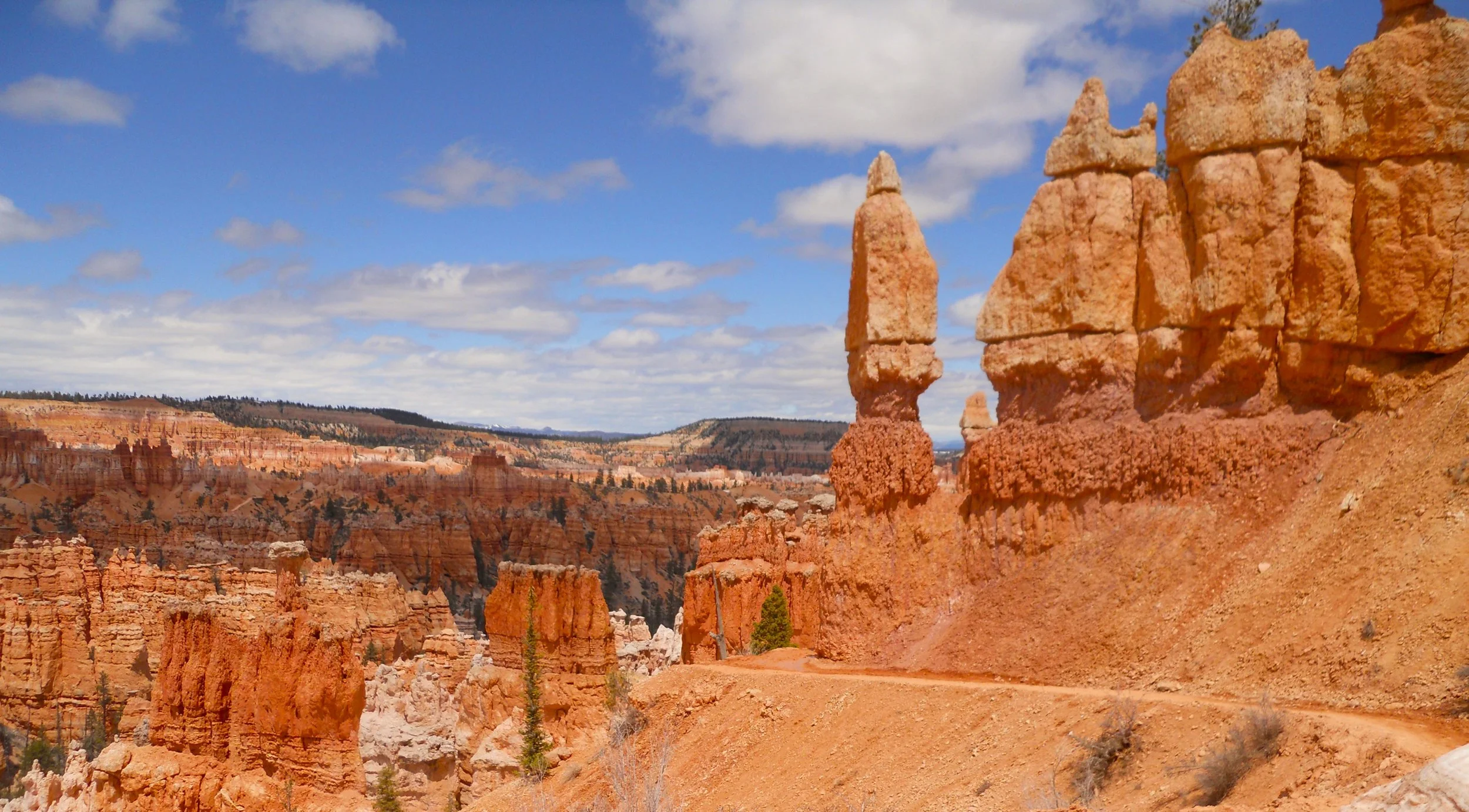
The last two photos are from the Queens Garden Trail. This is the most heavily traveled trail in the park.
A shout-out to all the folks I met on the trails today. Keep up your enthusiasm for visiting our national parks. And remember, there are 424 parks, not just 63 which have the designation of “National Park” as their suffix.
This year, 2023, is the park’s 100th anniversary, becoming a national park in 1923. Let’s do our best to keep it looking good for another 100 years.


DAY 4 (April 21) - Route 59 heads east out of Hurricane on its way to Pipe Spring NMon. The monument is on the Kaibab Paiute Indian Reservation. The turnoff for the monument is also the turnoff for the Tribal HQs. Due to this unique circumstance, the entrance sign for the park mentions both the NPS and the Kaibab Paiute Tribe.
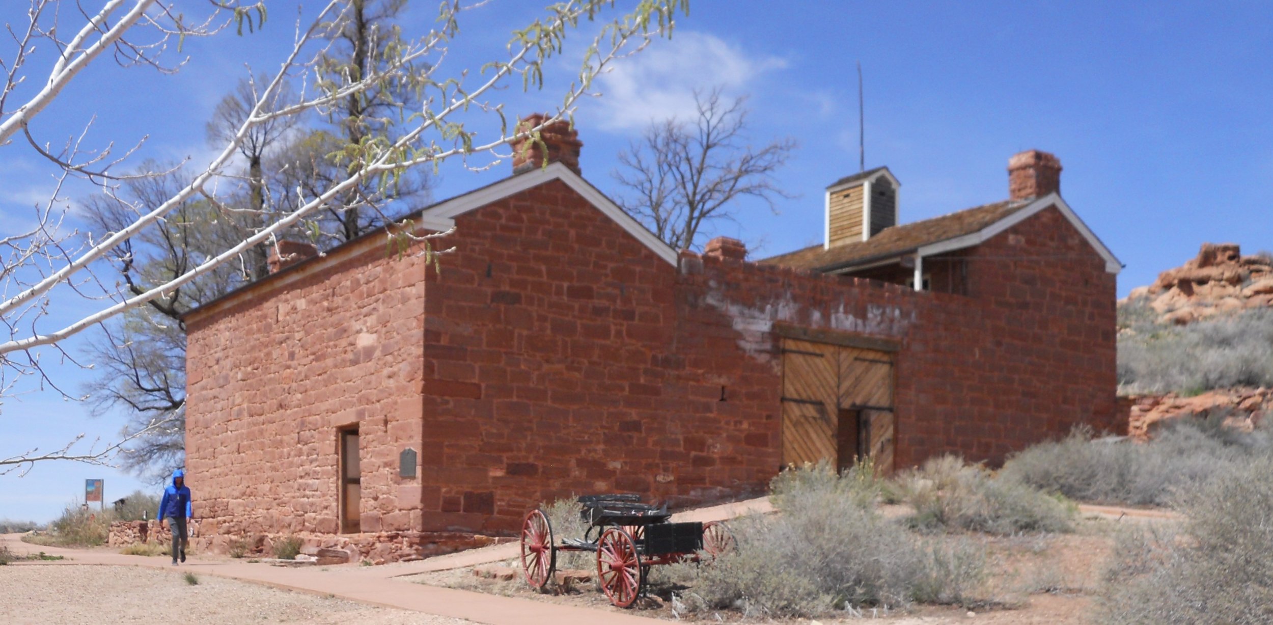
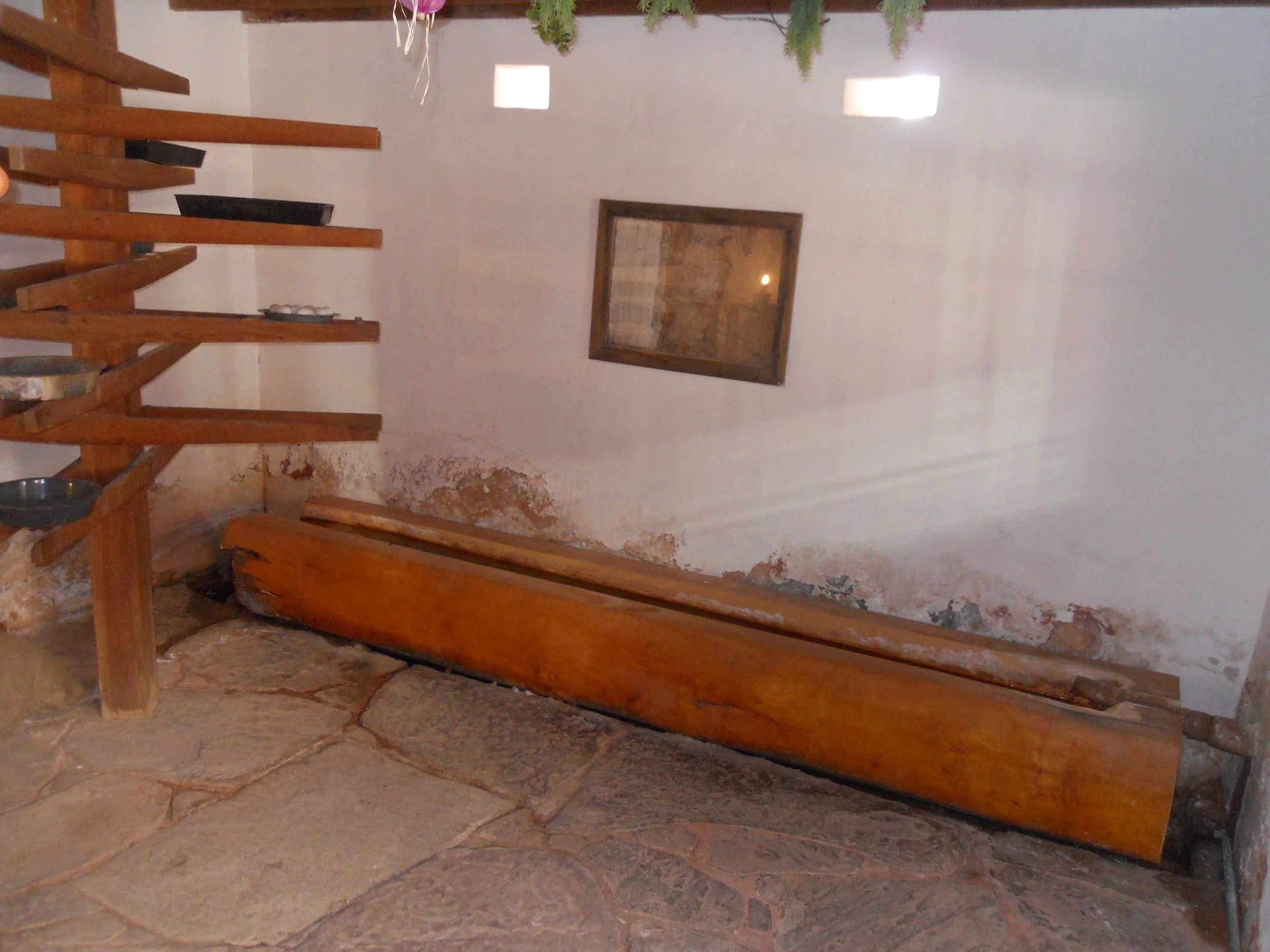
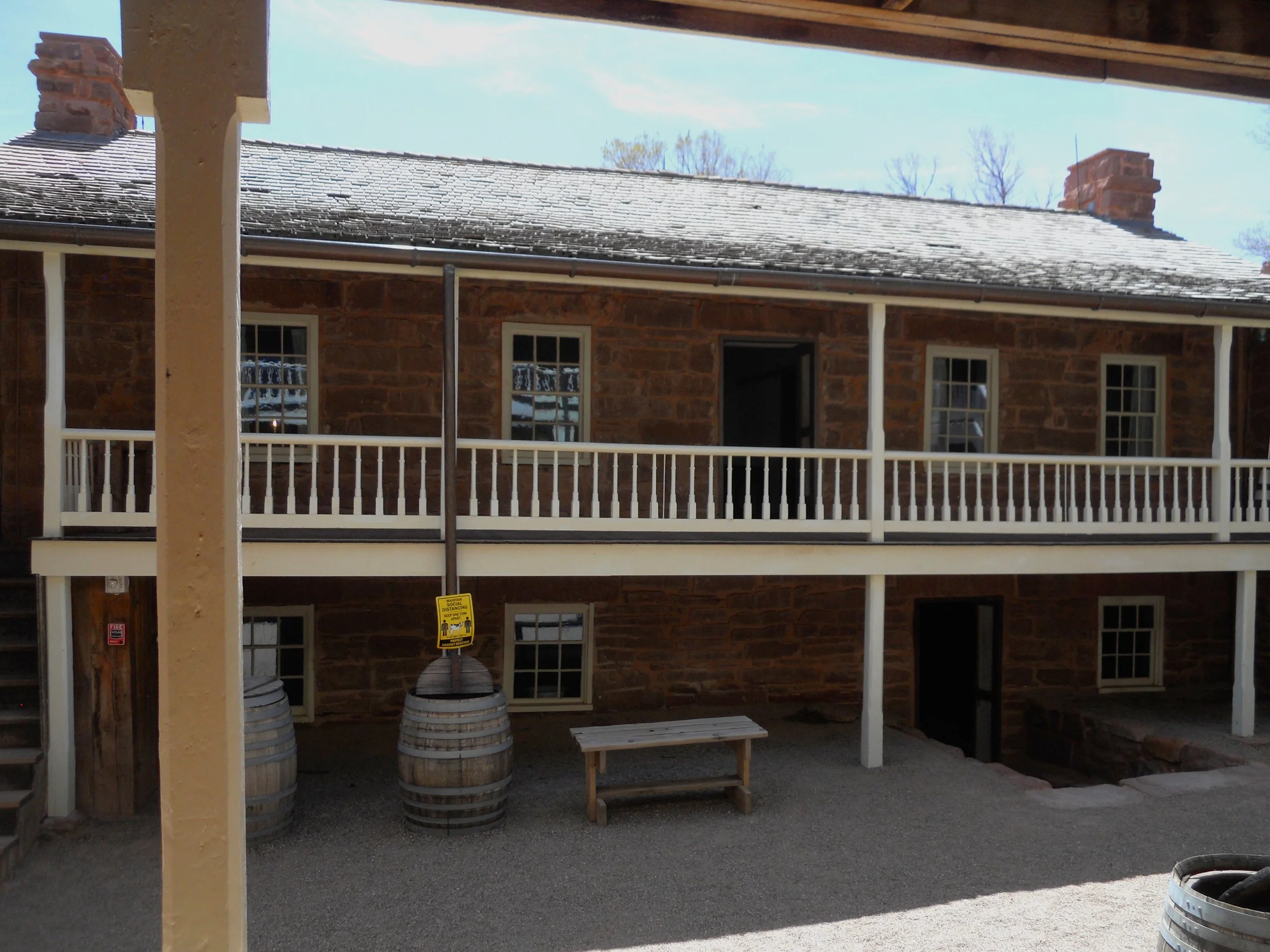
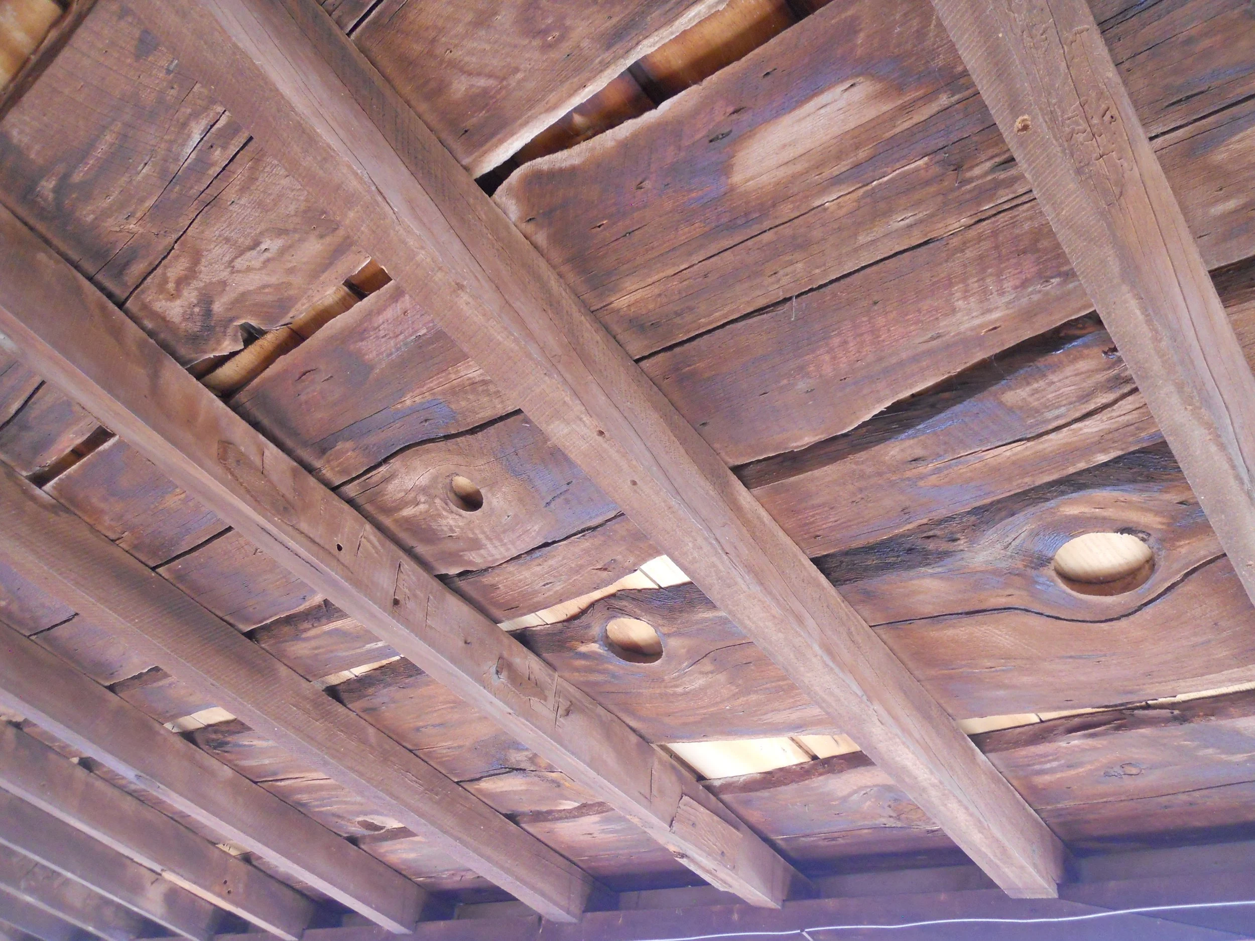
Pipe Springs is where the Mormon Church, the Kaibab Paiutes, and the U.S. Government butted heads for decades. When the Mormons first arrived, they decided to “own” the land. But the Paiutes already lived here. Washington, D.C. did not want the Mormons taking control because the Mexican Cession of 1848 gave this land to the United States, not the Mormons nor the Utah Territory. A natural spring surfaces at this location. The Mormons built a fort right on top of the spring outlet, thereby allowing them to guard the water, eventually forcing the Paiutes to move away. The outlet can still be seen today in its room. Much of the fort is original, including the wood roof planks.
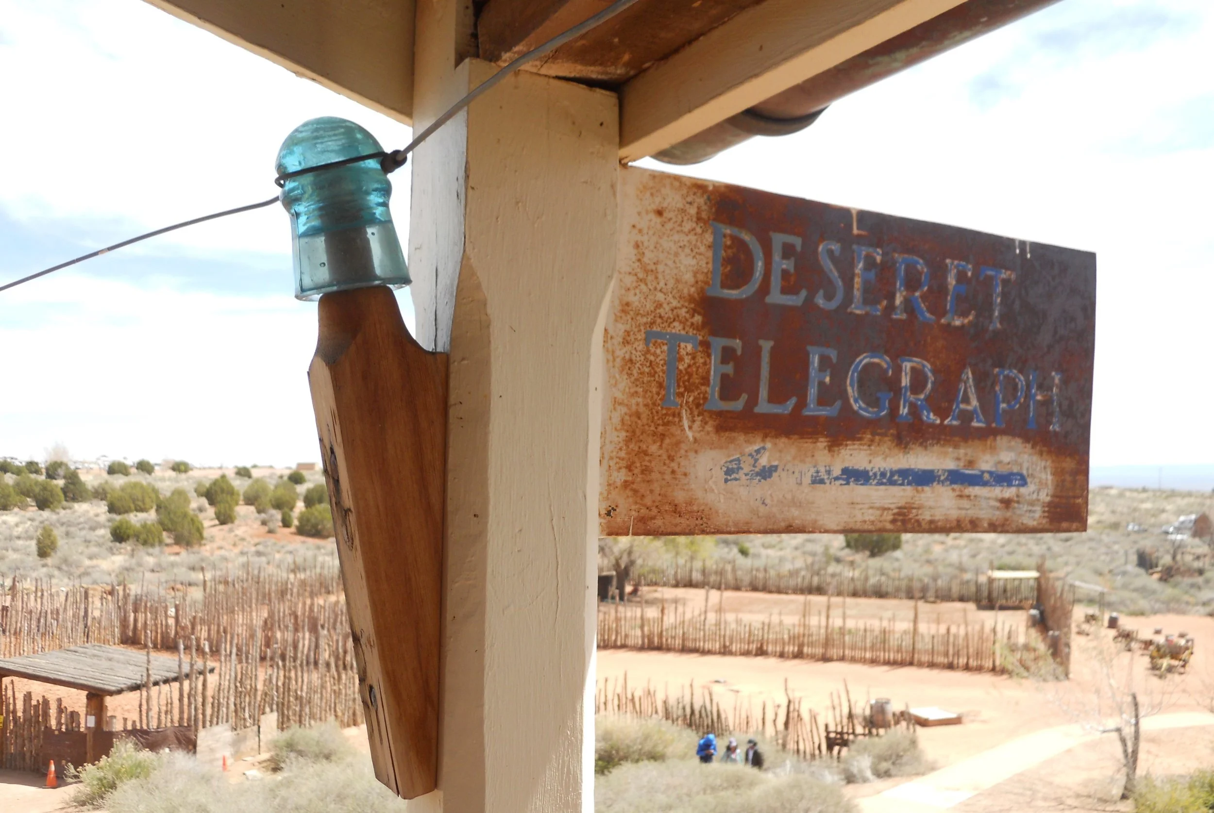
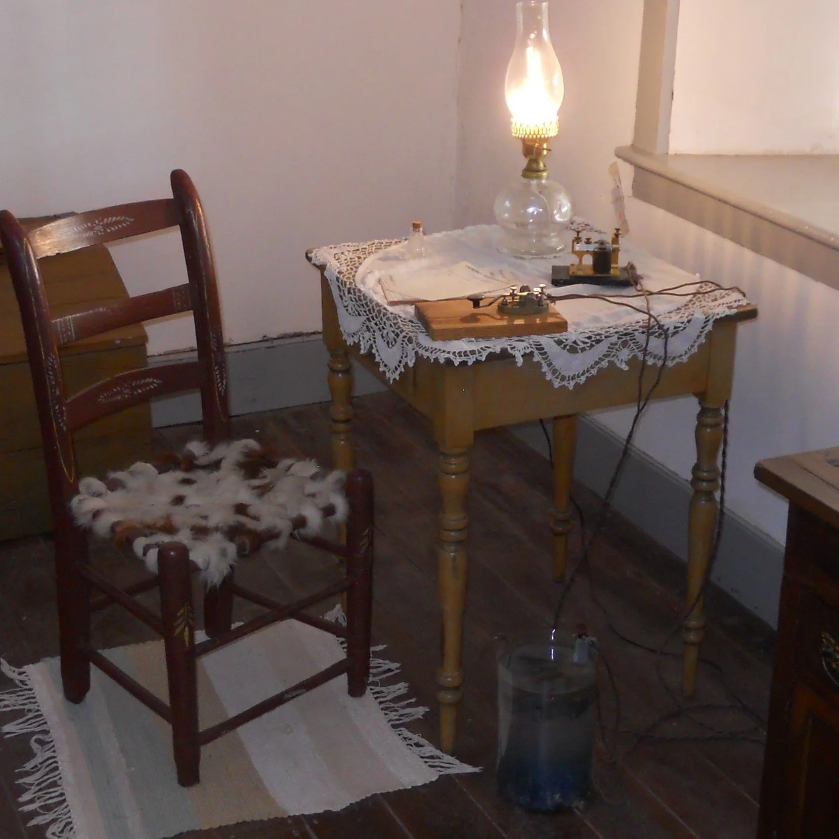
The fort was part of the Mormon-owned telegraph network, the Desert Telegraph. This stretched 995 miles between Idaho and Arizona (Juniper Pine poles spaced every 70 yards), so the Church’s elders in Salt Lake could keep tabs on their congregations.
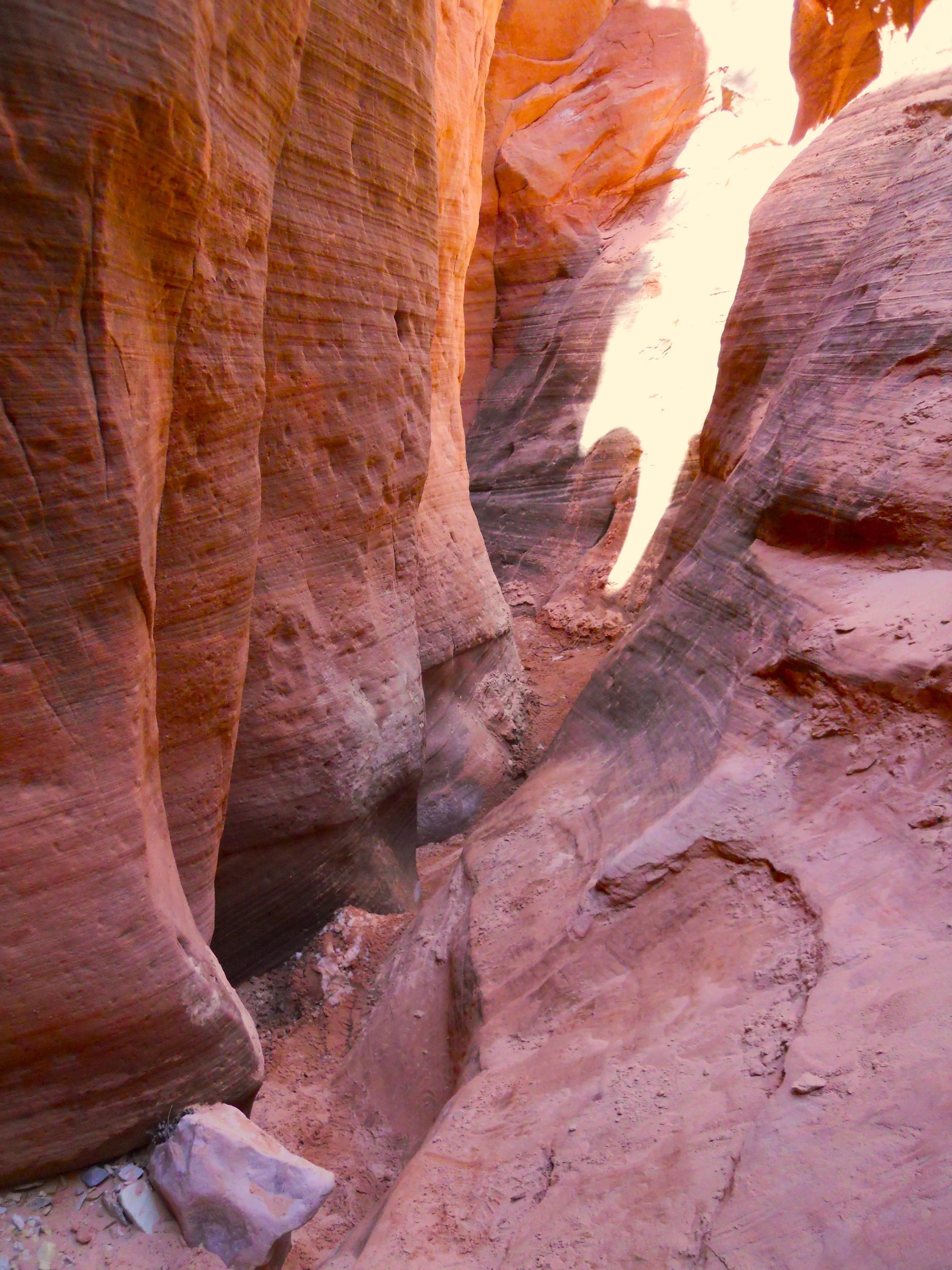
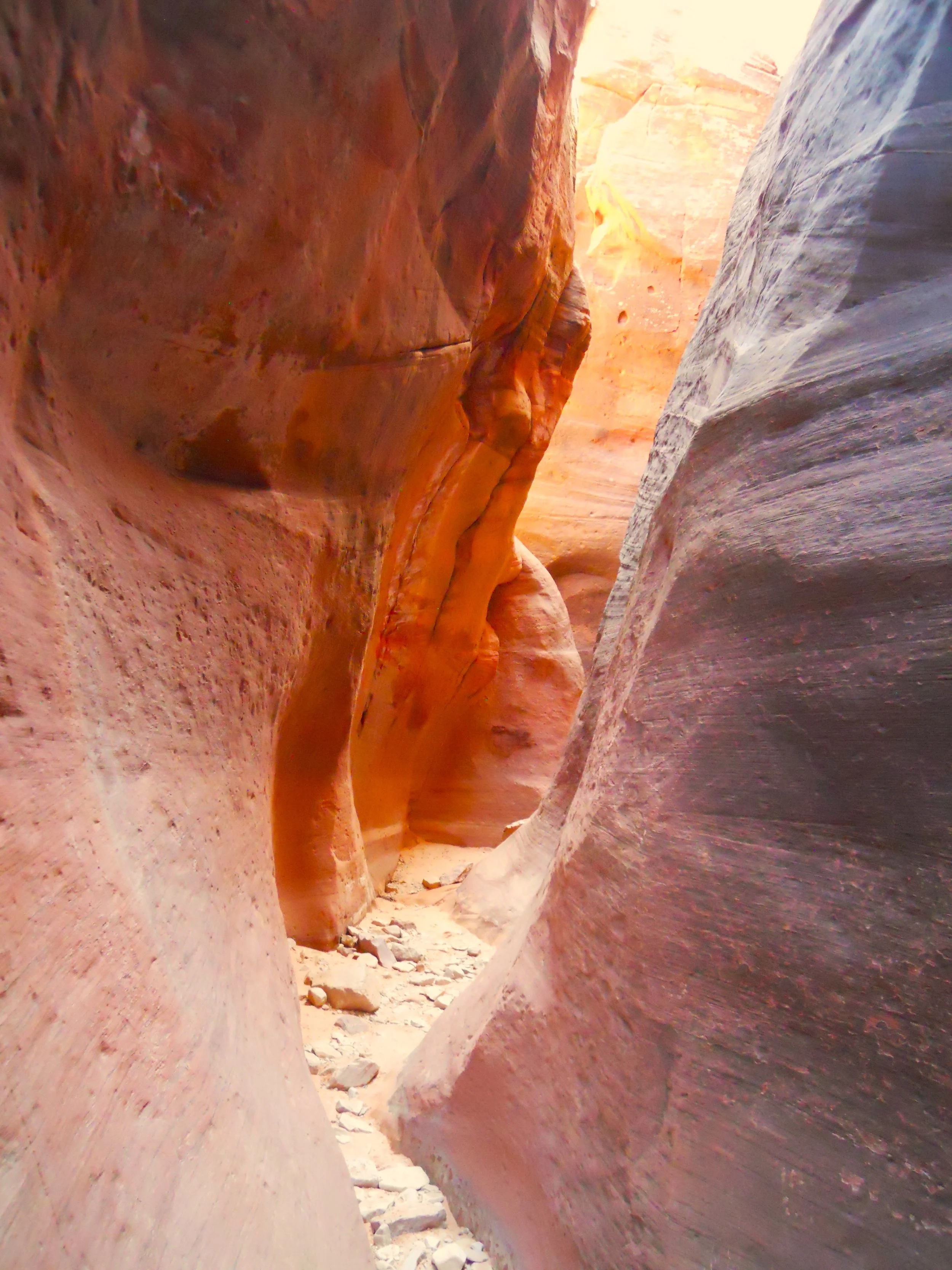
I made a stop at Red Hollow Slot Canyon in Orderville, UT. No, it is not a national park, but it is a wonderful geological feature. Just 500 yards to the slot entrance from the parking lot. If you are driving by the town on US89, take an hour to enjoy.
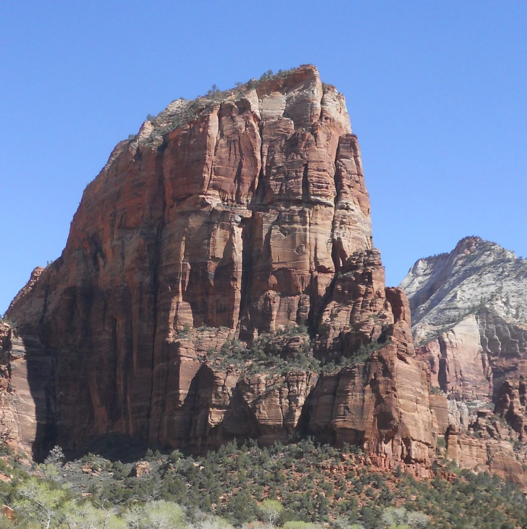
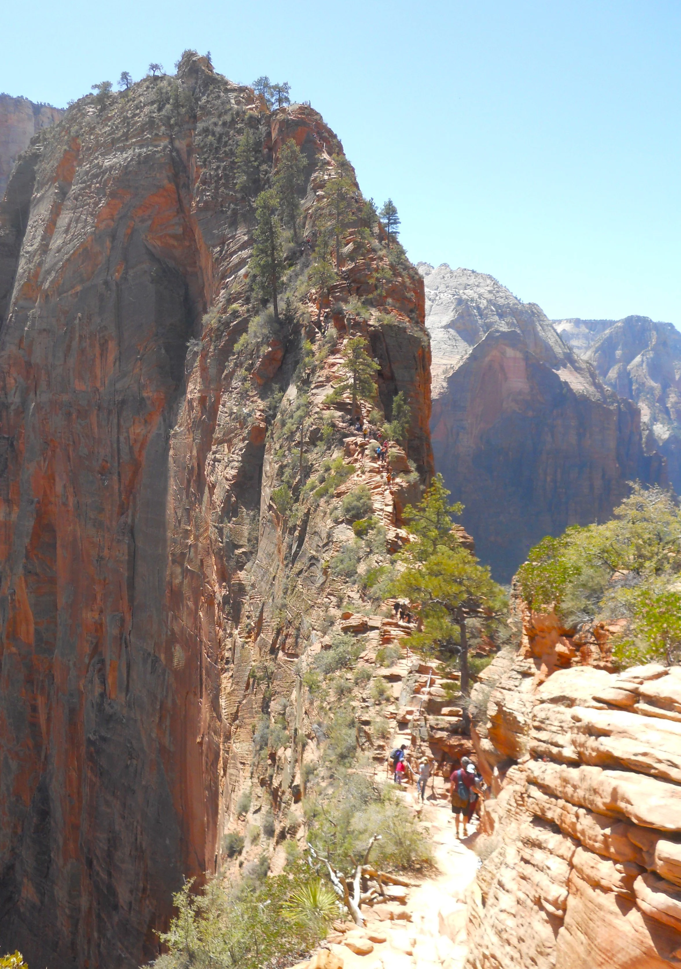
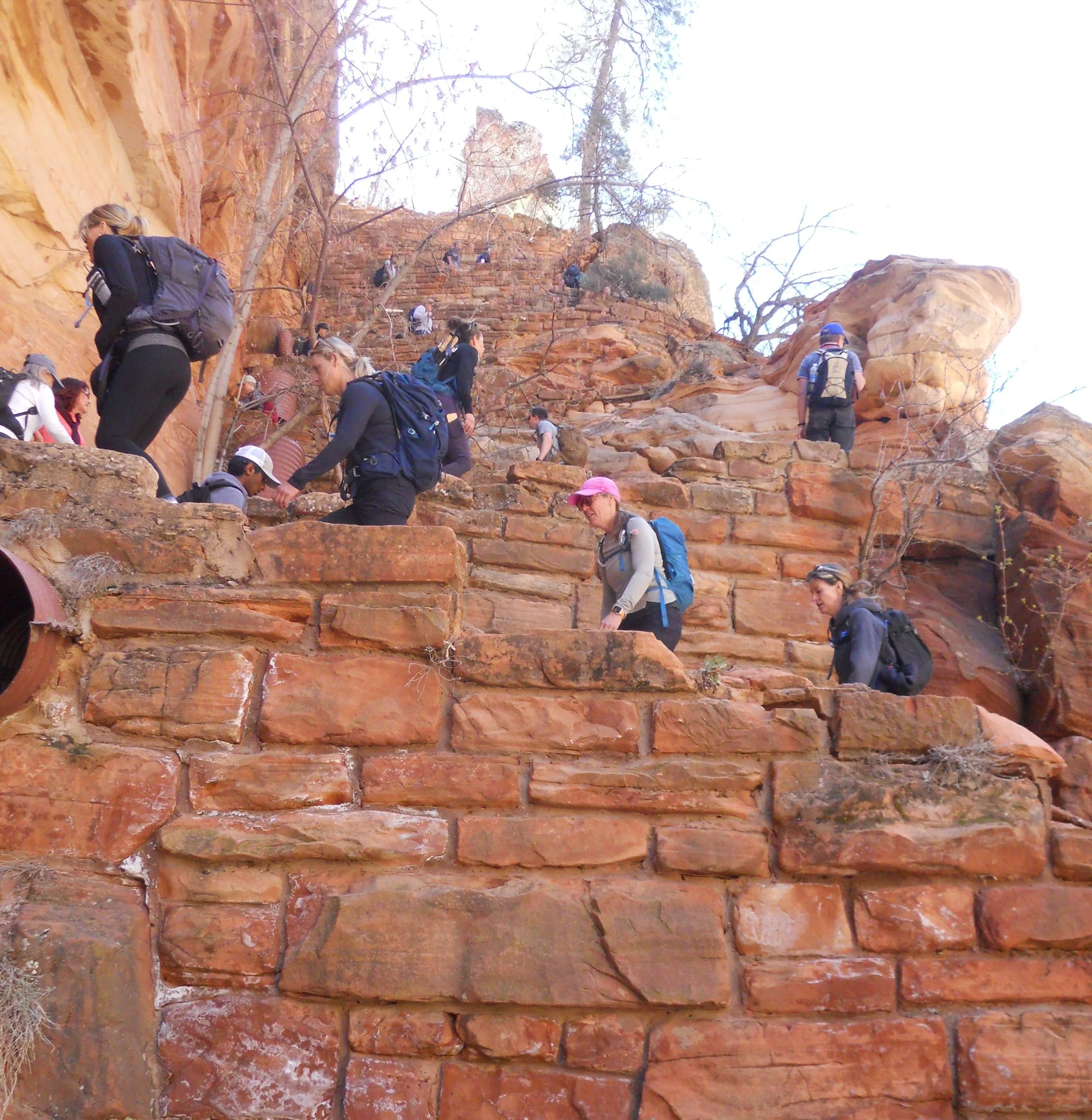
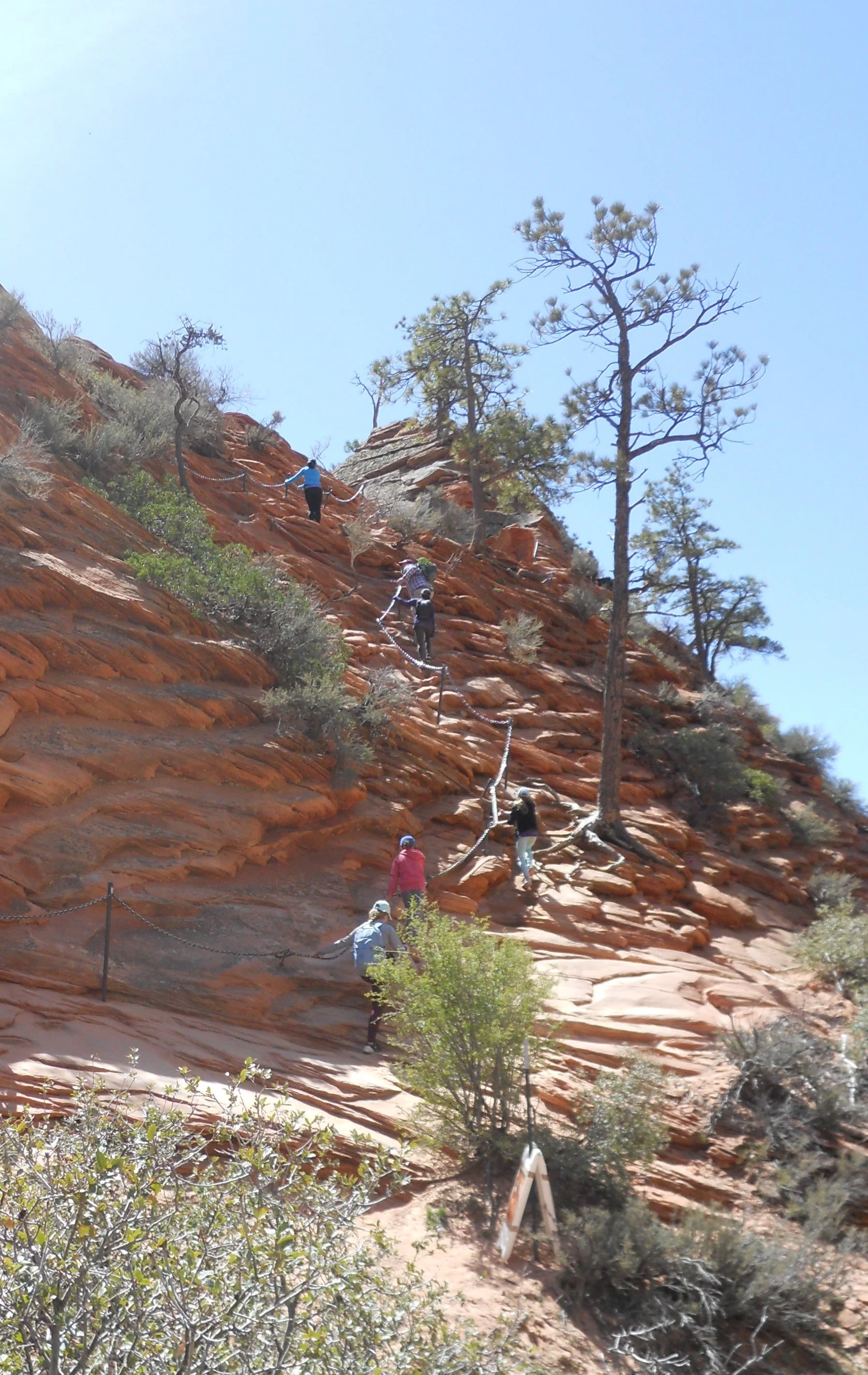
DAY 3 (April 20) - The free shuttle system in Zion Canyon whisked me to Stop 6, the trailhead for Angels Landing. The monolith looks intimidating from the valley floor. And as one discovers over its last 0.5 miles, it can be daunting as well. Methodist minister Frederick Fisher was in awe of the cliff that he stated only angels could land on it. After a little over 1.5 miles on the trail, hikers have to navigate Walter’s Wiggles, a quad and hamstring exercise consisting of 21 switchbacks. Maybe get to the gym a few times before doing this 1,400-foot climb.
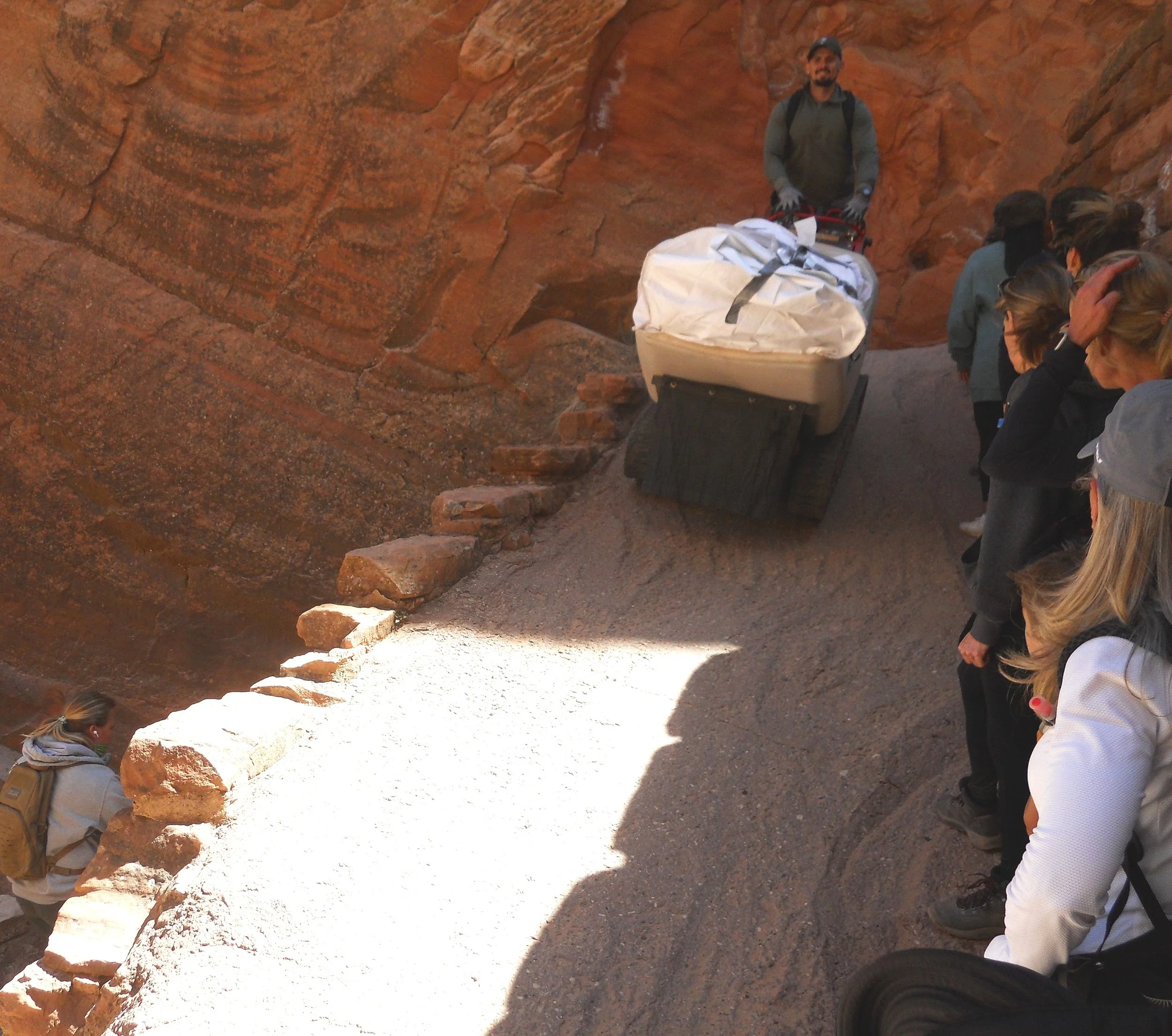
We had to be wary of a Canycom 2-track carrier which was making its way down from Scout Lookout (the point where the last 0.5 miles of Angels Landing trail starts).
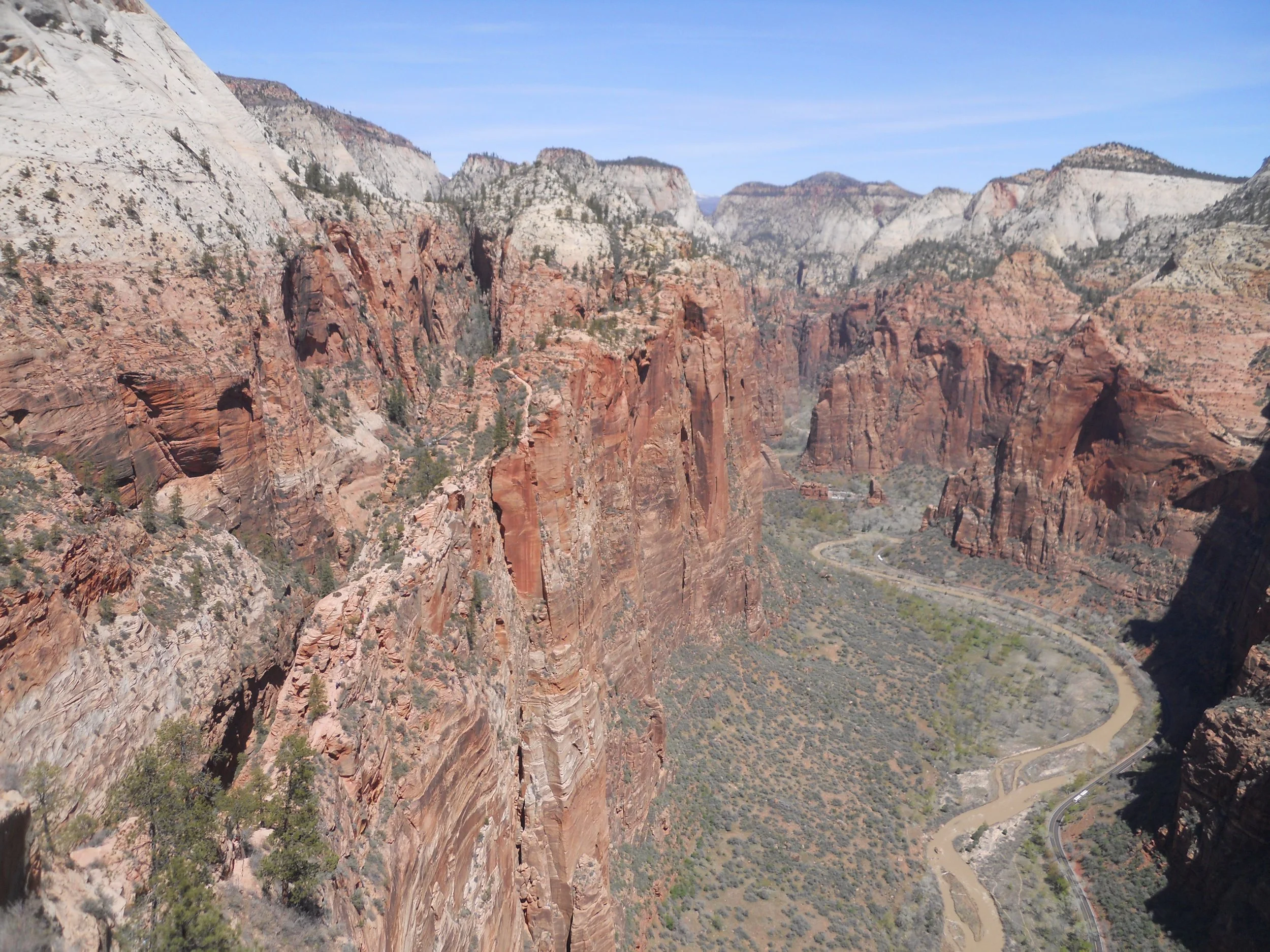
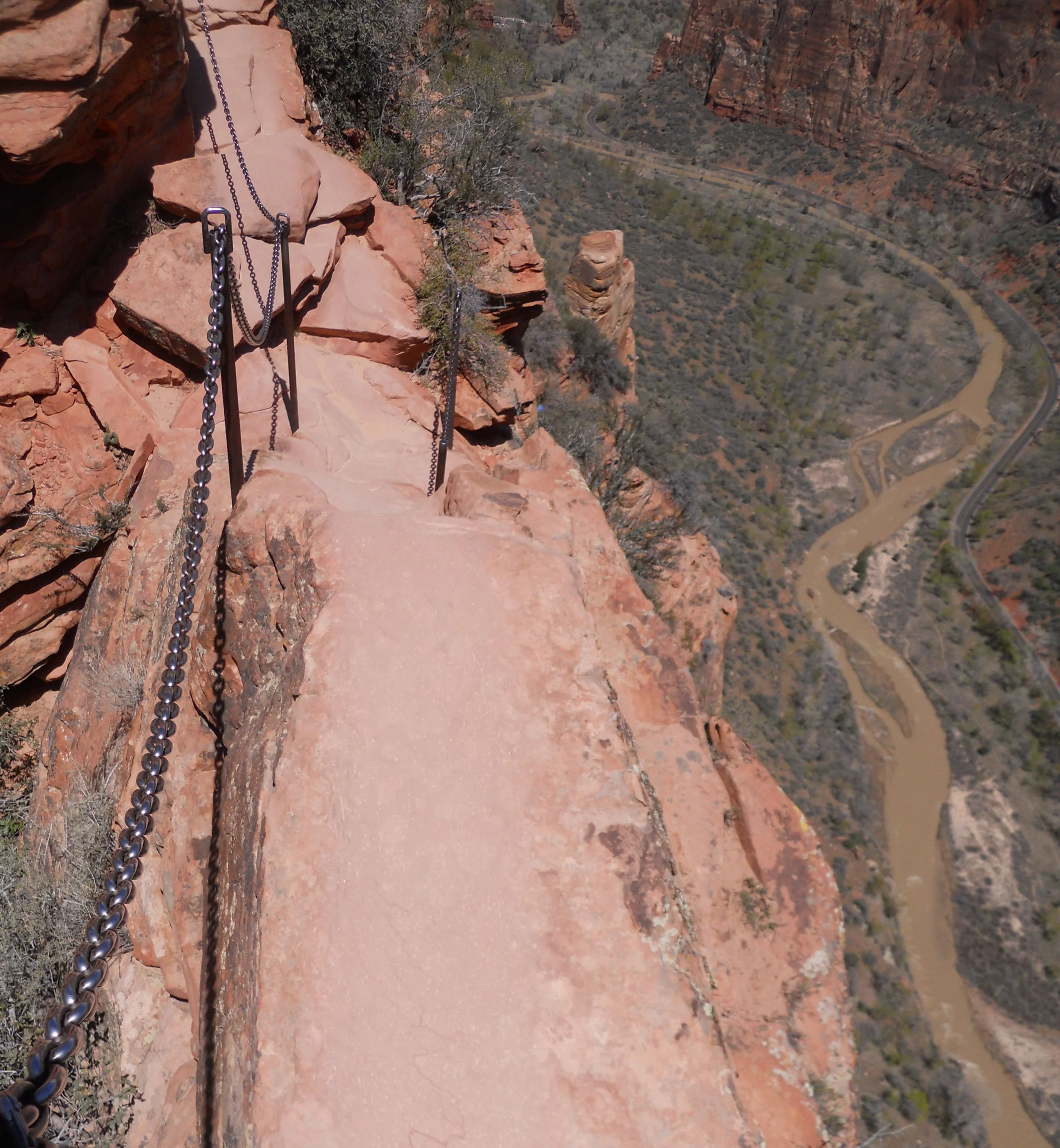
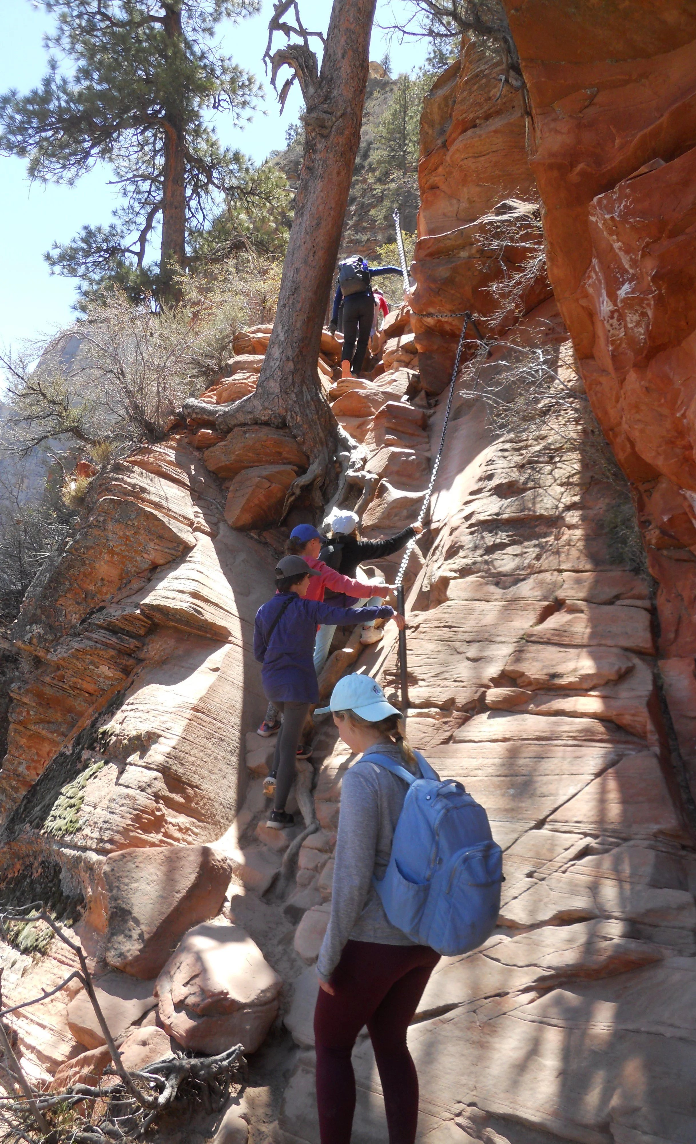
After going up and over a first section of sandstone (photo on far right), hanging onto steel chain, the final section comes into view. This is not an activity for folks who are afraid of heights. But the view looking up the valley is breathtaking.
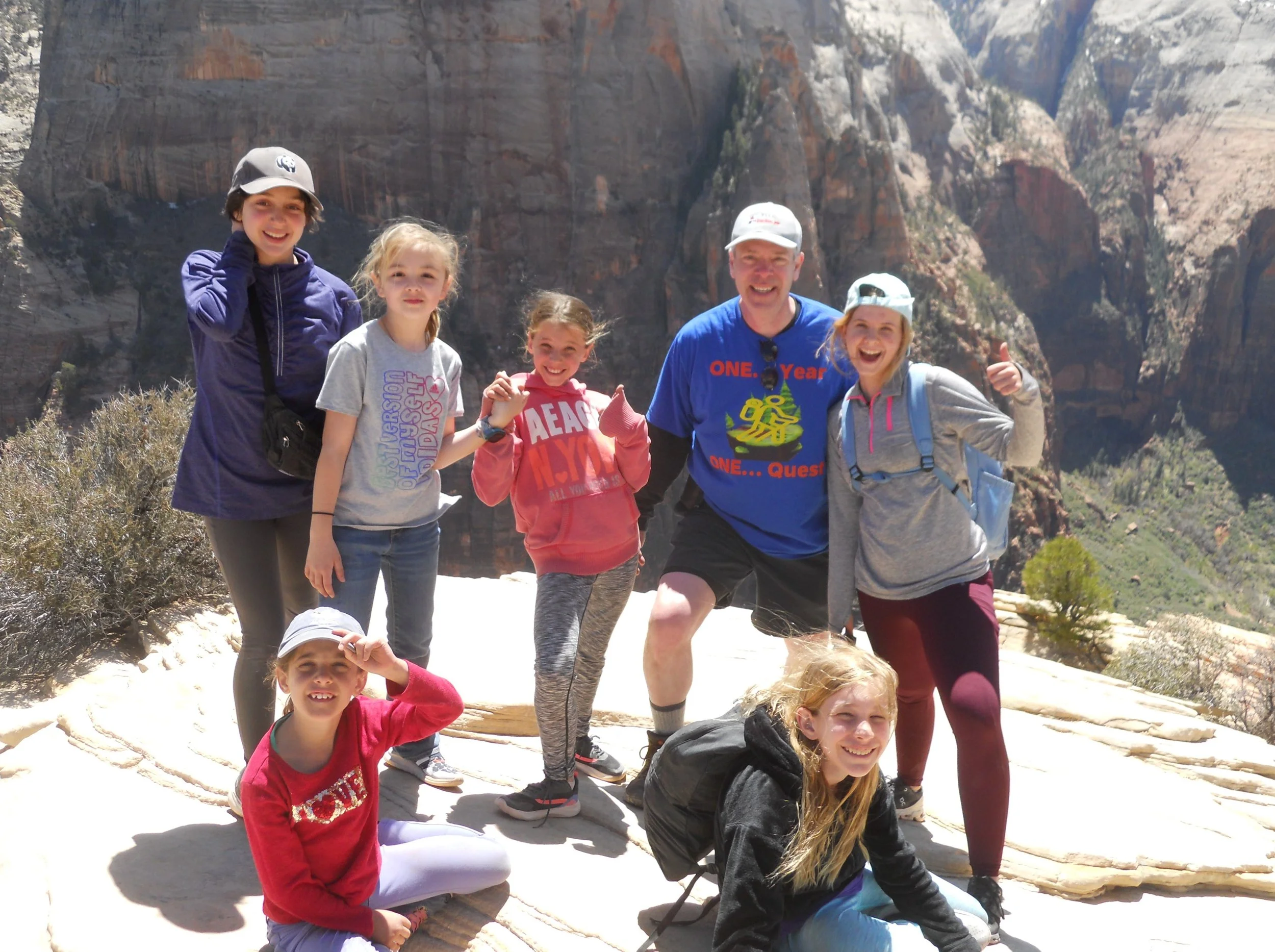
Along the way to the top, I happened across a group of Hurricanes from D.C. Having been born in Alexandria, lived in Fairfax County for many years, and my father working for the USDA in D.C., it was great to meet up with Federal City (historical name of our Capitol) folks. They were quite enthusiastic about their visit to Zion and wished me well on my Quest. Here’s hoping they continue their ventures into the other 423 national parks. With the energies they displayed, they can make it.
On the way down I took a photo at one of the narrowest spots on the trail. That is a long 1,400 feet, down to the Virgin River.
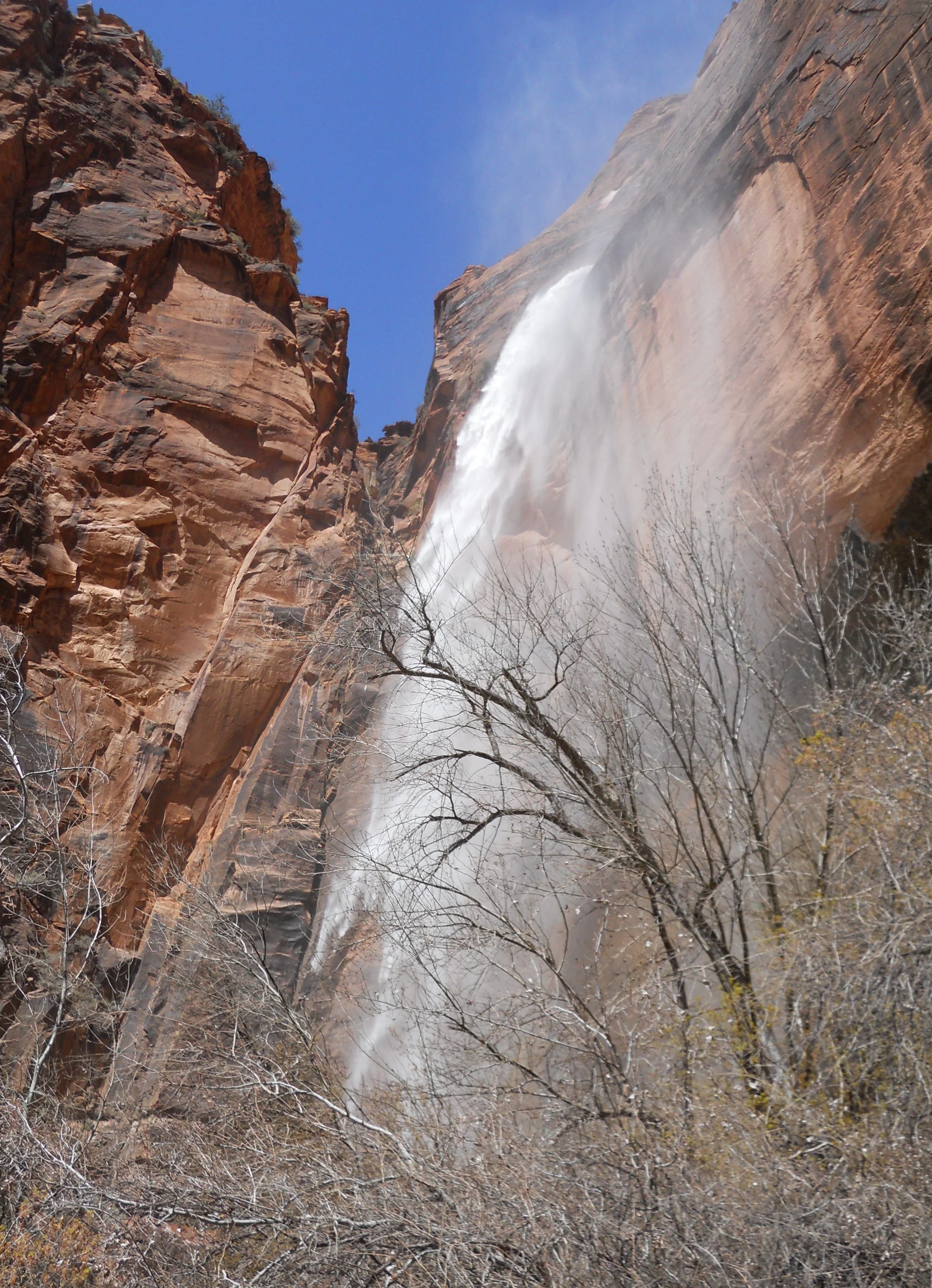
After the thrill of the climb, I went to Weeping Rock, Stop 7 on the shuttle system. This is the time to view the water fall since the snow melt continues to come down from the plateau region. During other visits I have made to the park in July and September, the wall was barely a trickle.
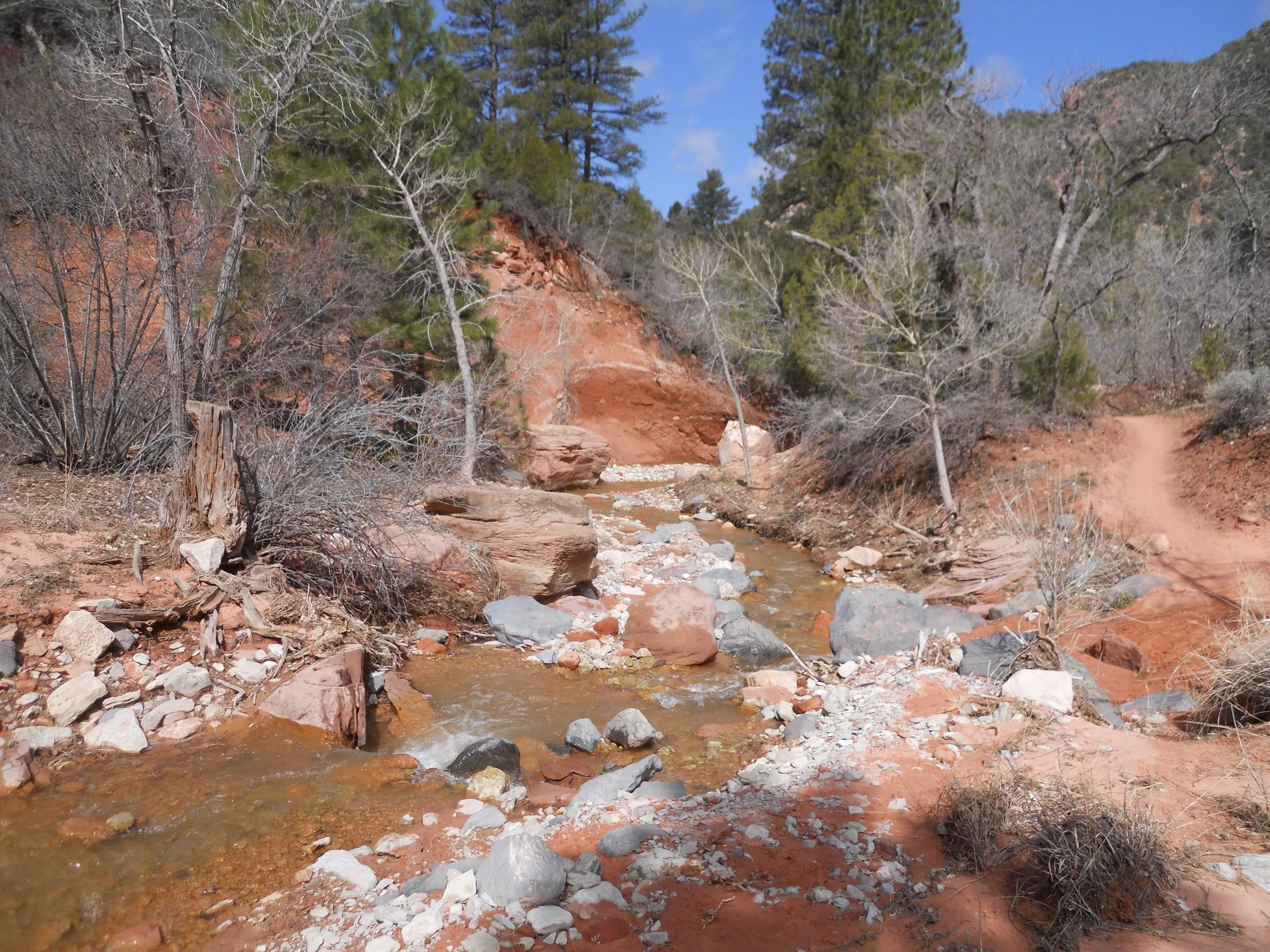
DAY 2 (April 19) - The primary objective today was to hike in the Kolob Canyon portion of Zion NP, particularly the Taylor Creek trail. This is a 5-star hike, for anyone who is considering coming to southwest Utah.
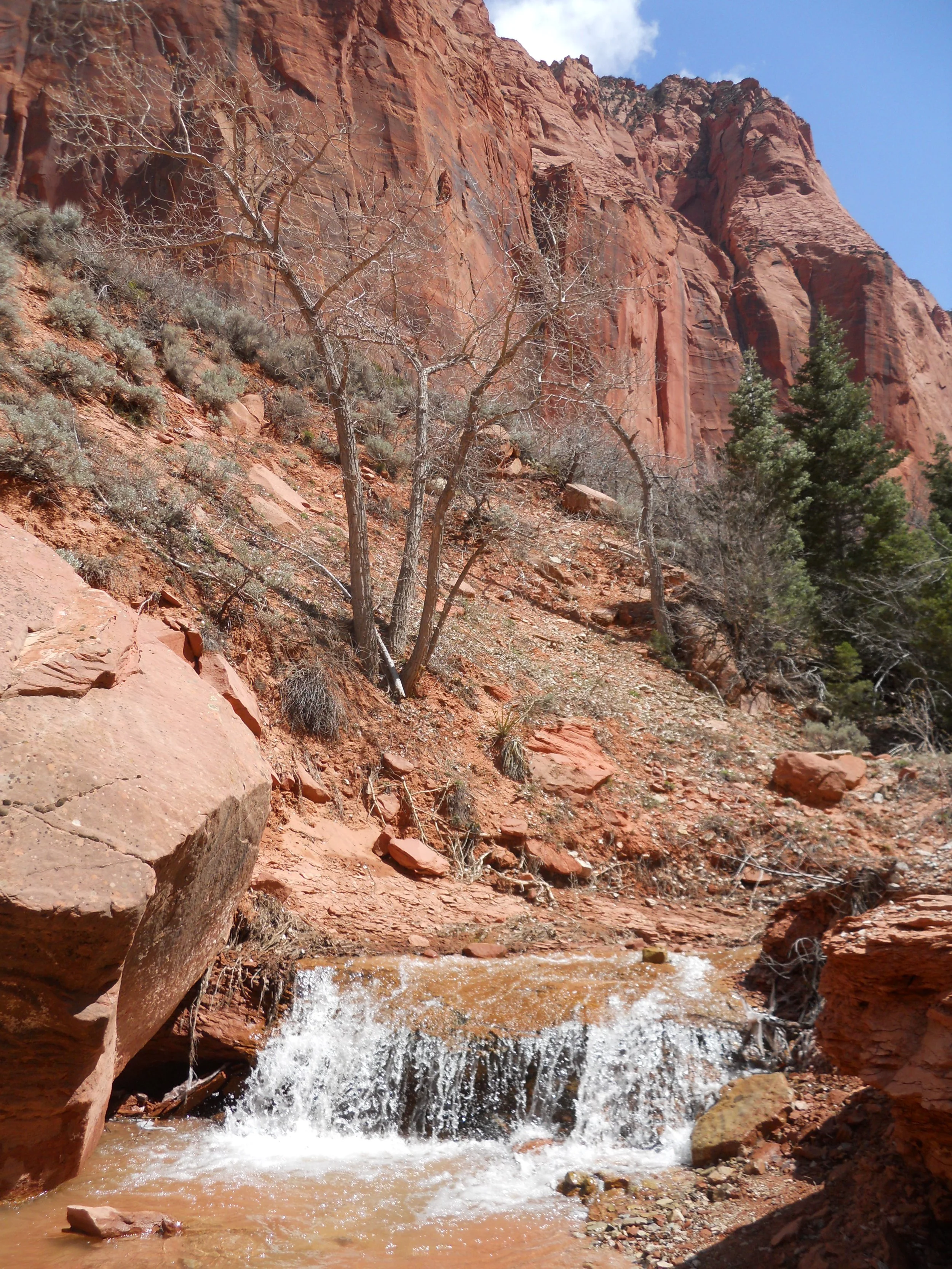
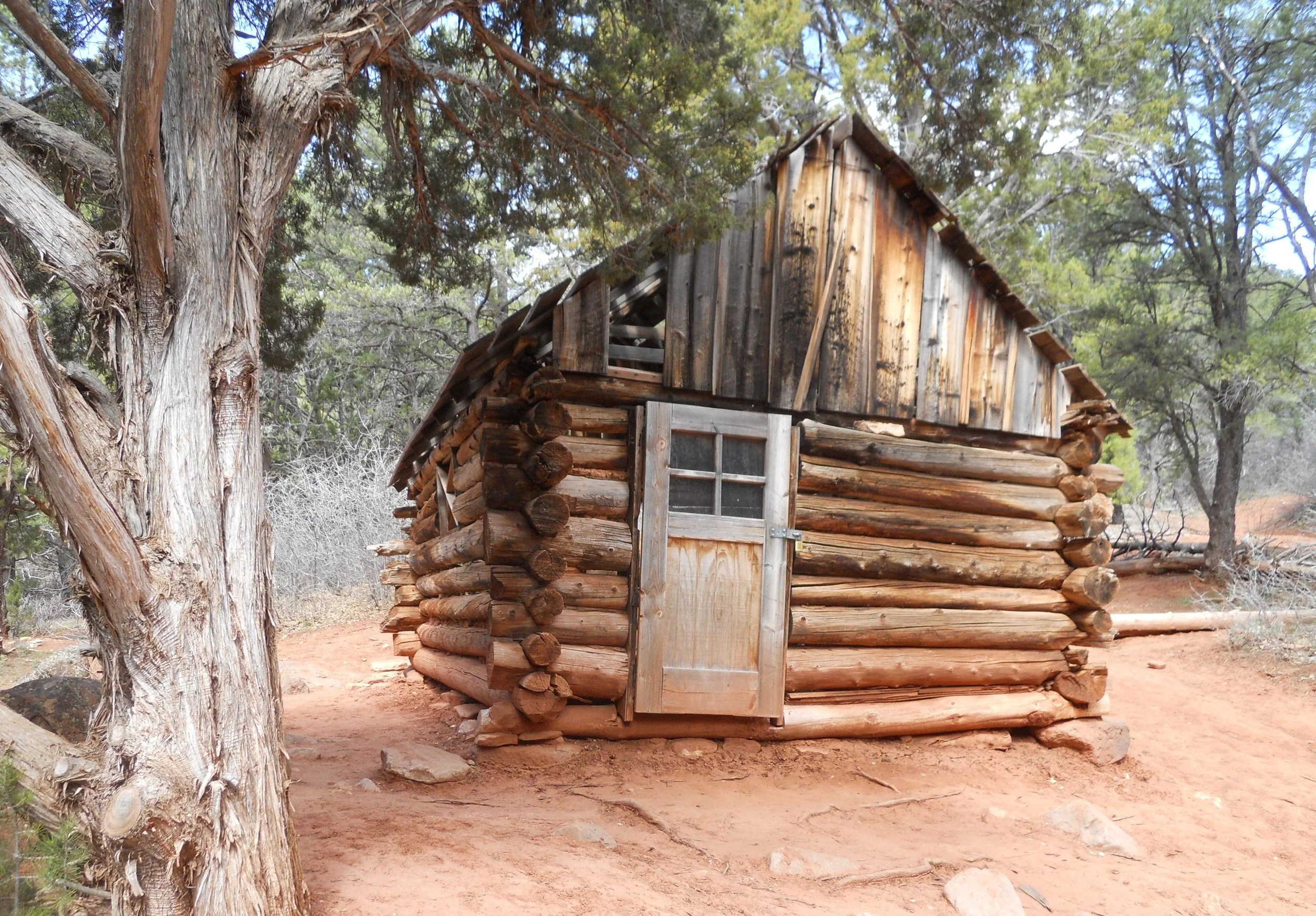
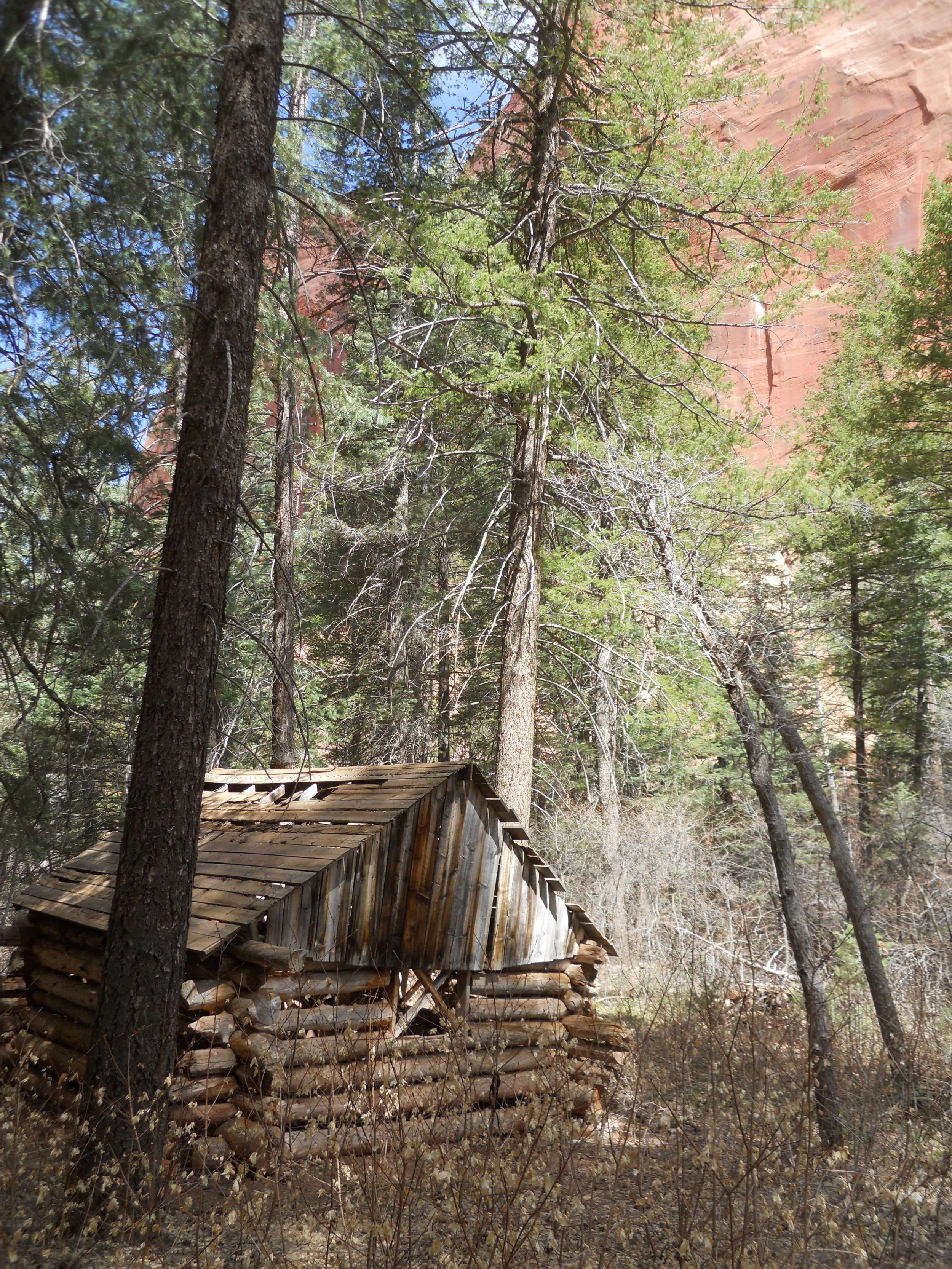
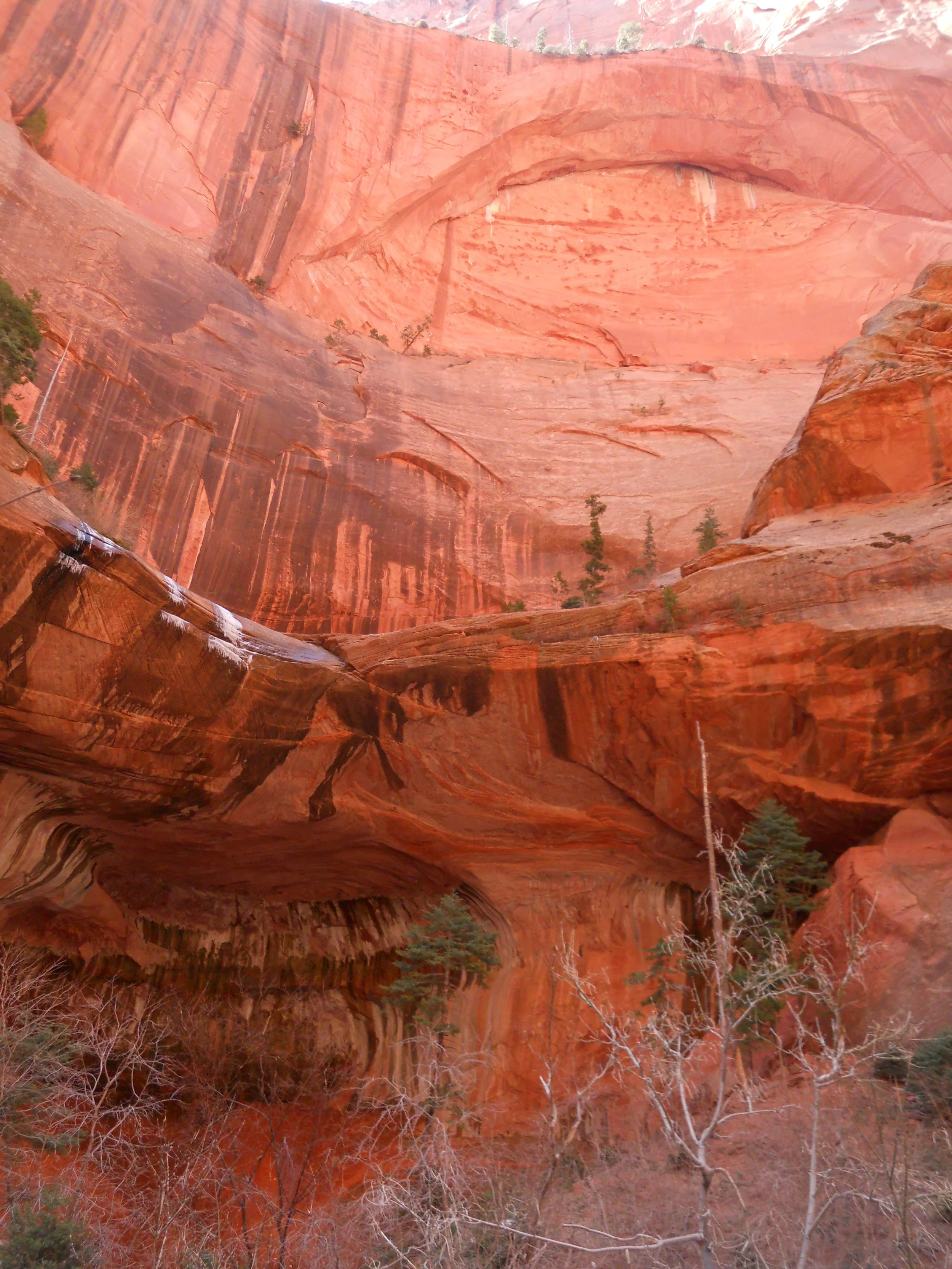
The open country begins to turn into a slot canyon after 1.5 miles. The Larson Cabin still survives after 90 years. Then the canyon walls begin to grow. The Fife Cabin is nestled in this area. After 2.5 miles of hiking, one comes to the Double Arch Alcove. The alcove in the photo is to the bottom left, with another arch starting at the top of the canyon wall. Among the 50 “river” crossings, there were a few small waterfalls. Tomorrow is Angels Landing.

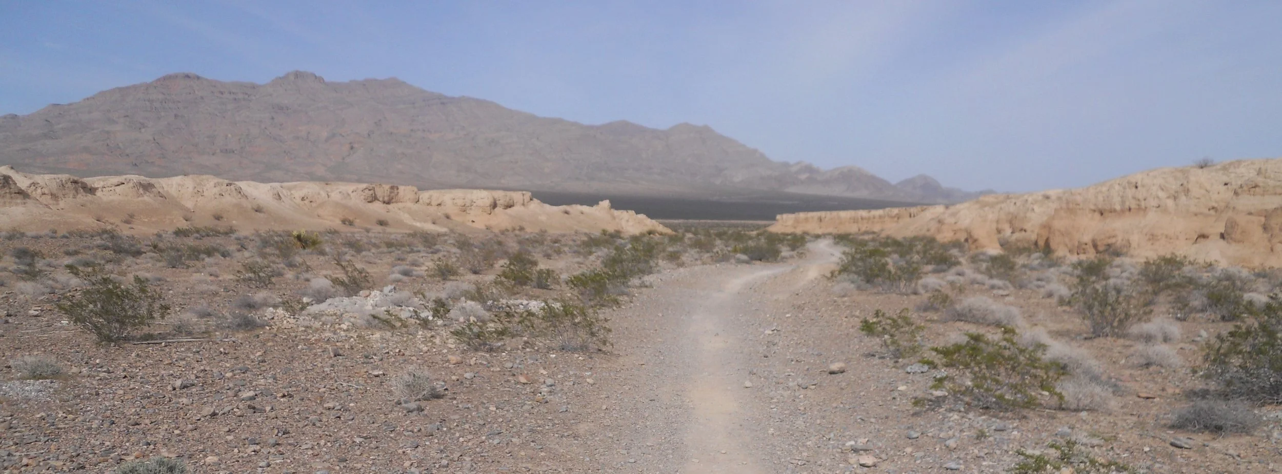
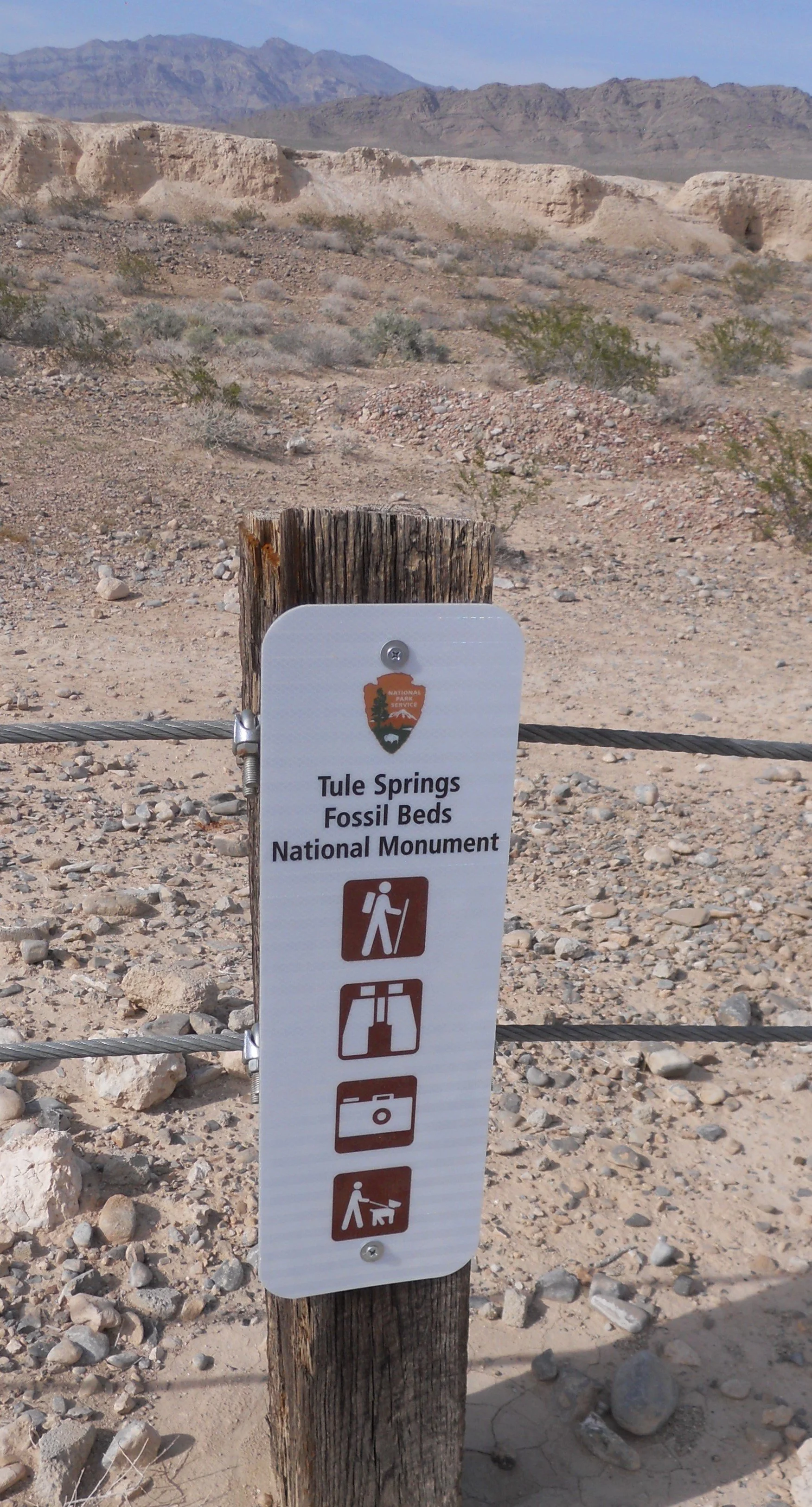
DAY 1 (April 18) - Tule Springs Fossil Beds NMon looks barren. There are a few bushes across the landscape, but the key feature of this park is the buried treasure; Pleistocene fossils. Signs say that if a visitor sees a fossil in the ground, to contact the NPS. First, I did not see any phone numbers on the on tri-board display at the main hiking entrance, and second, I would not know a fossil if it was staring me in the face.
There are wood posts and steel cables which separate the park from the residential neighborhoods of North Las Vegas. The signs say one can hike, use binoculars, take photos, and walk pets.
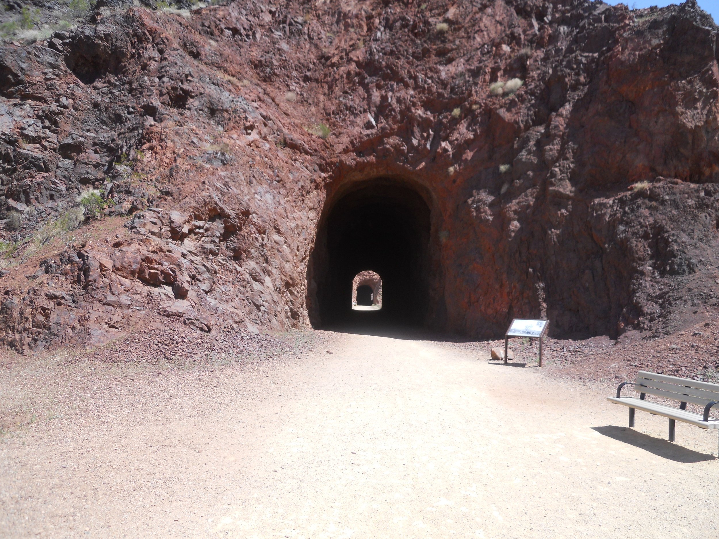
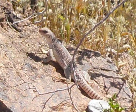
Lake Mead has three railroad tunnels which visitors now stroll through, on their way to a view of Hoover Dam. I can check that hike off my to-do list. And if you like lizards, the Southwest is your kind of environment.