DAY 7 (February 28) - Took a day to post this information, since I arrived home very late.
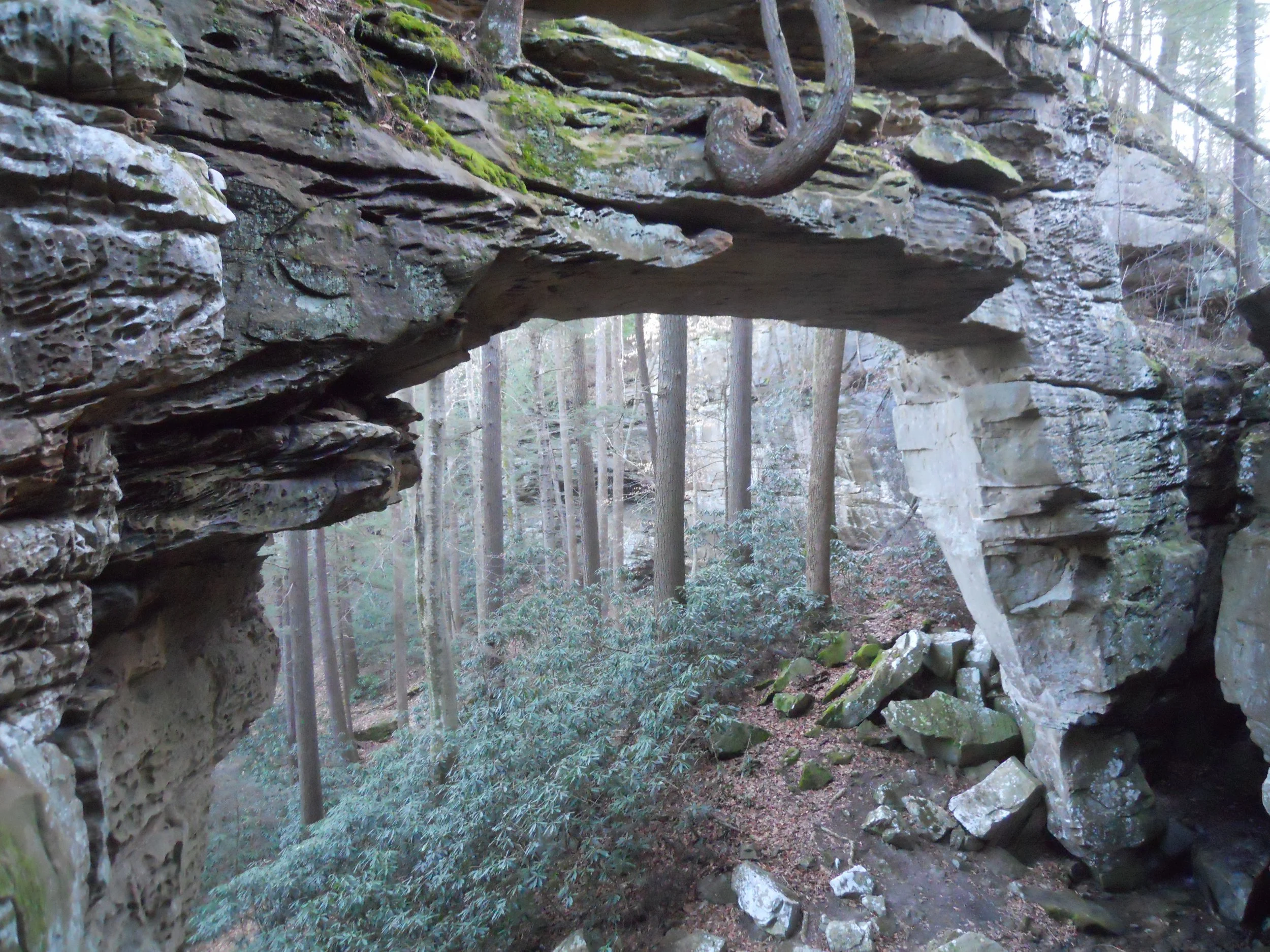
Anyone who visits Big South NRRA should include Split Bow Arch and Blue Heron Mine areas on their itinerary. The arches in this park are of Ridgeley Sandstone, whereas the arches found in Utah are Entrada Sandstone. For a non-geologist, can we just call it sandstone? If you have a wide-angle lens for your camera, bring it along.
The Blue Heron area is about 7 miles from Split Bow Arch. The tipple is the centerpiece of this park section. Coal would come out of the mine (from the hillside which is to the left of the photo), across the top of the tipple, then dumped into waiting railcars. Life as a coal miner is tough. But for 150 years much of our country has depended on coal for its energy needs.
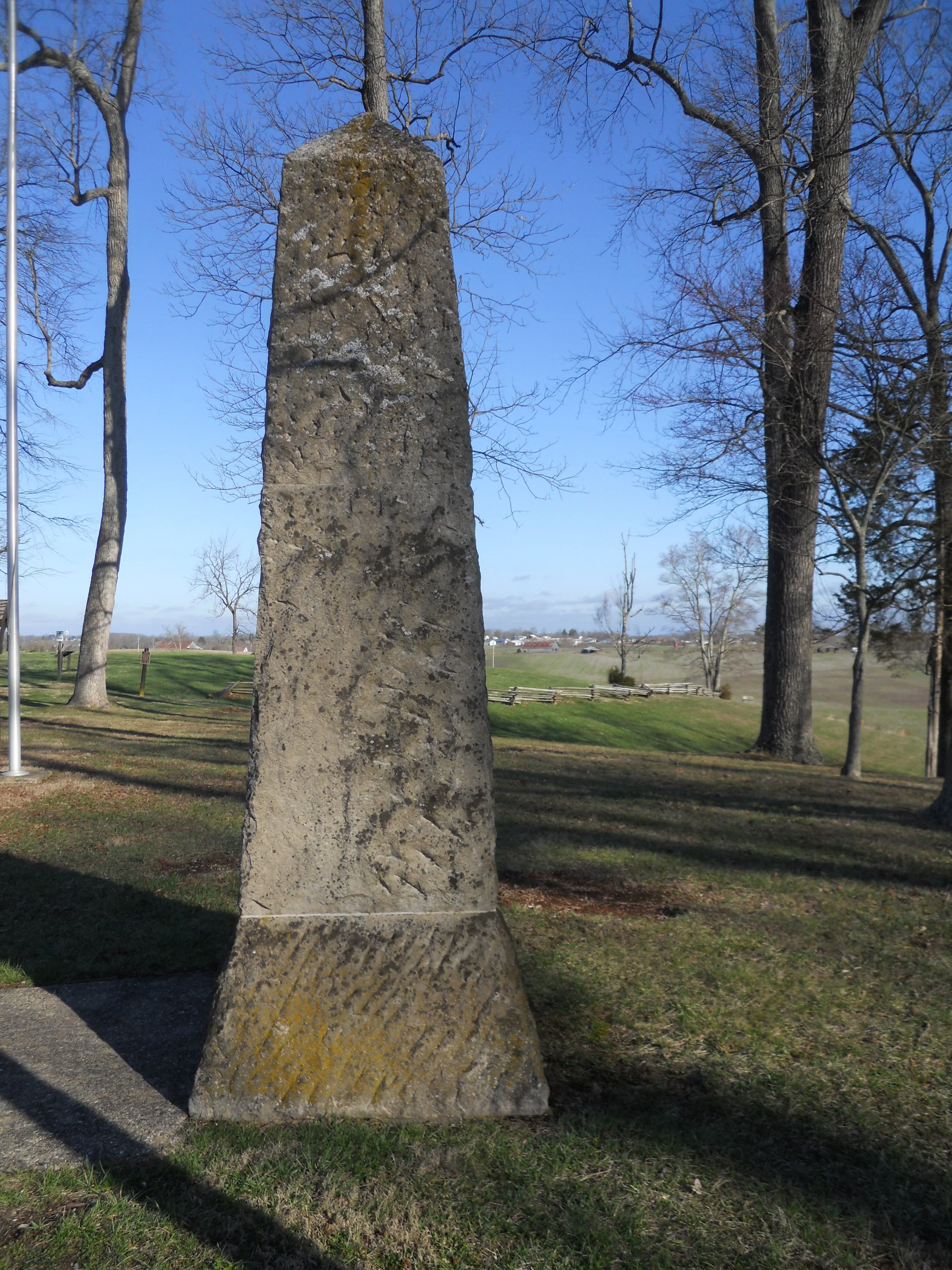
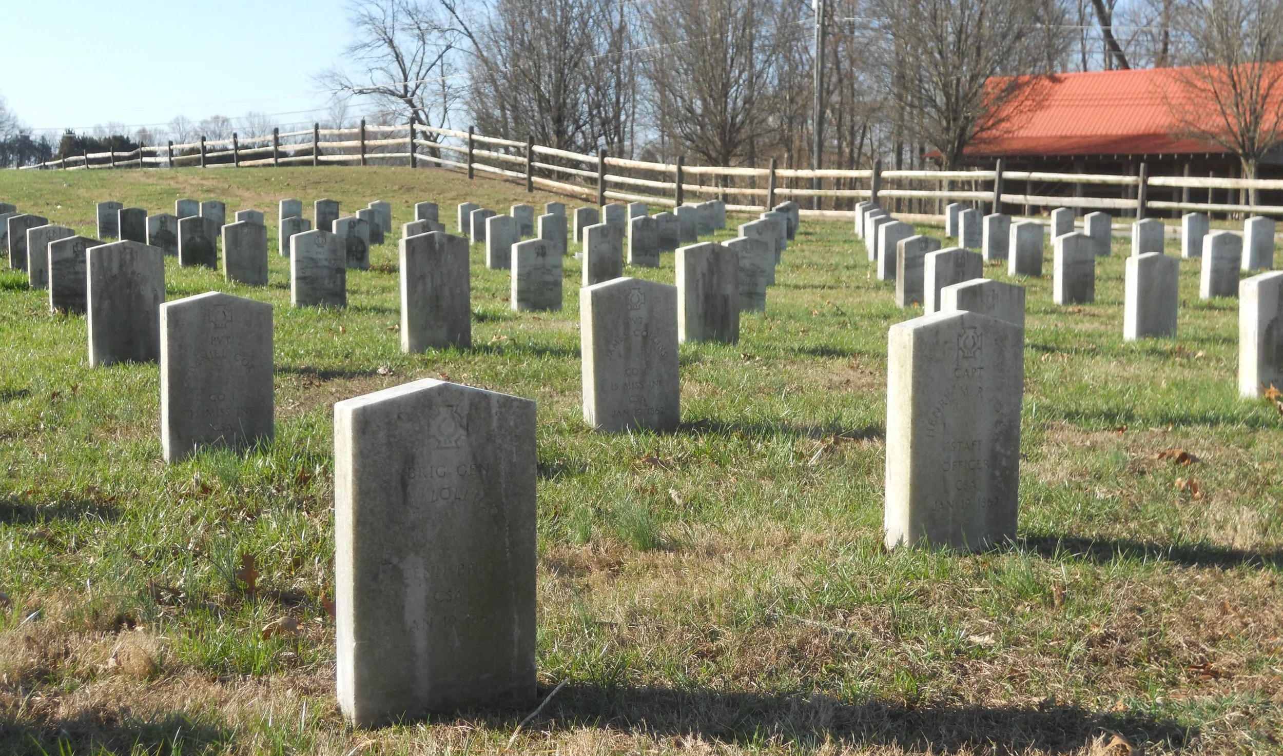
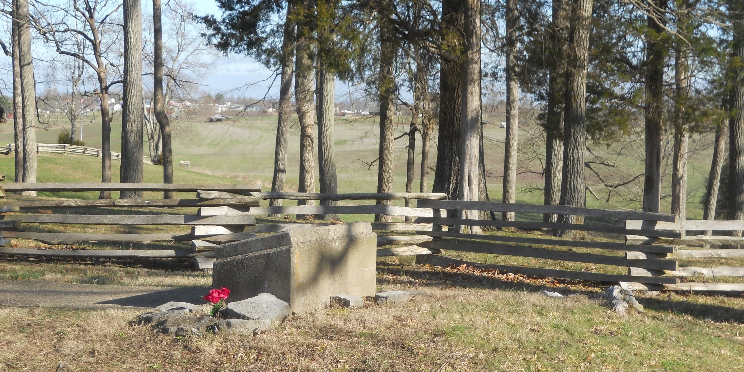
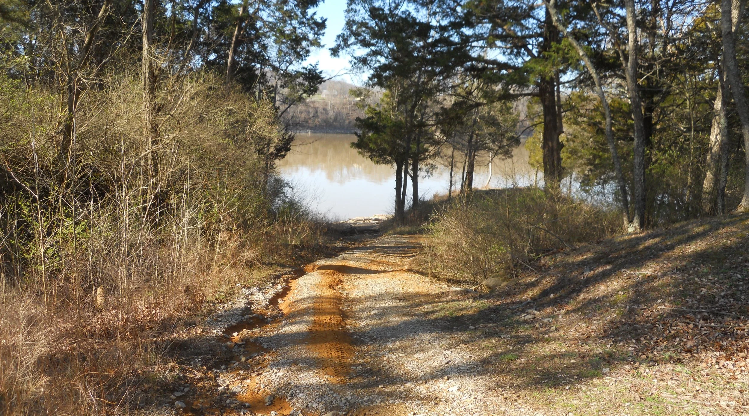
The first monument I saw at Mill Springs was for Confederate General Felix Zollicoffer, who fell at this spot. He was shot by a Union officer. Both men approached each other because each thought the other was one of their own, due to the dim light of the morning. The Union officer was the first to realize the error. Next to this spot is a marker for 100 Rebel soldiers who died next to Zollicoffer, but their names were not recorded. A mass grave was under my feet. Just to the south is a graveyard of Confederate soldiers for whose names were known. The site of the ferry crossing, to save the thousands of remaining men from being captured can be visited.
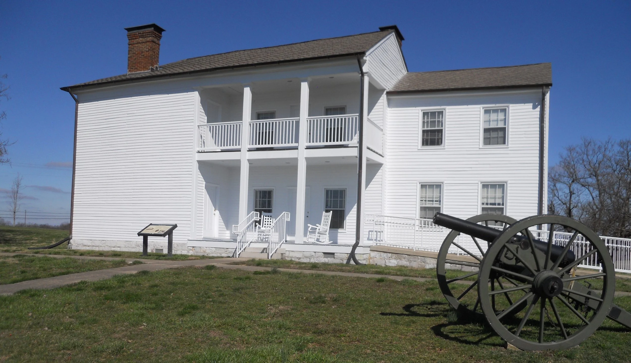
Camp Nelson’s main attraction is the “White House”. It is the only surviving structure from the time the depot and training base was used in the Civil War and subsequent years during reconstruction. A reconstructed barracks building can be toured. Five forts were built to defend the depot station, but only reconstructed earthworks pinpoint their locations.
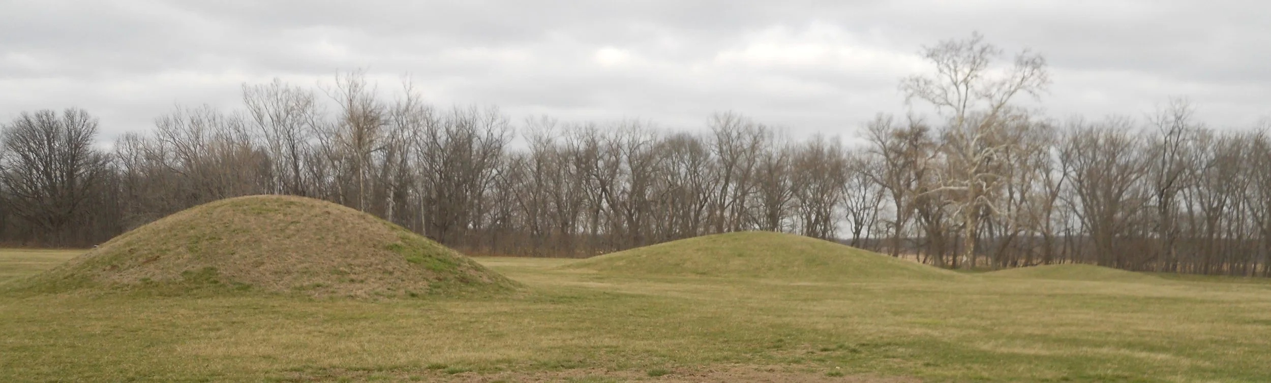
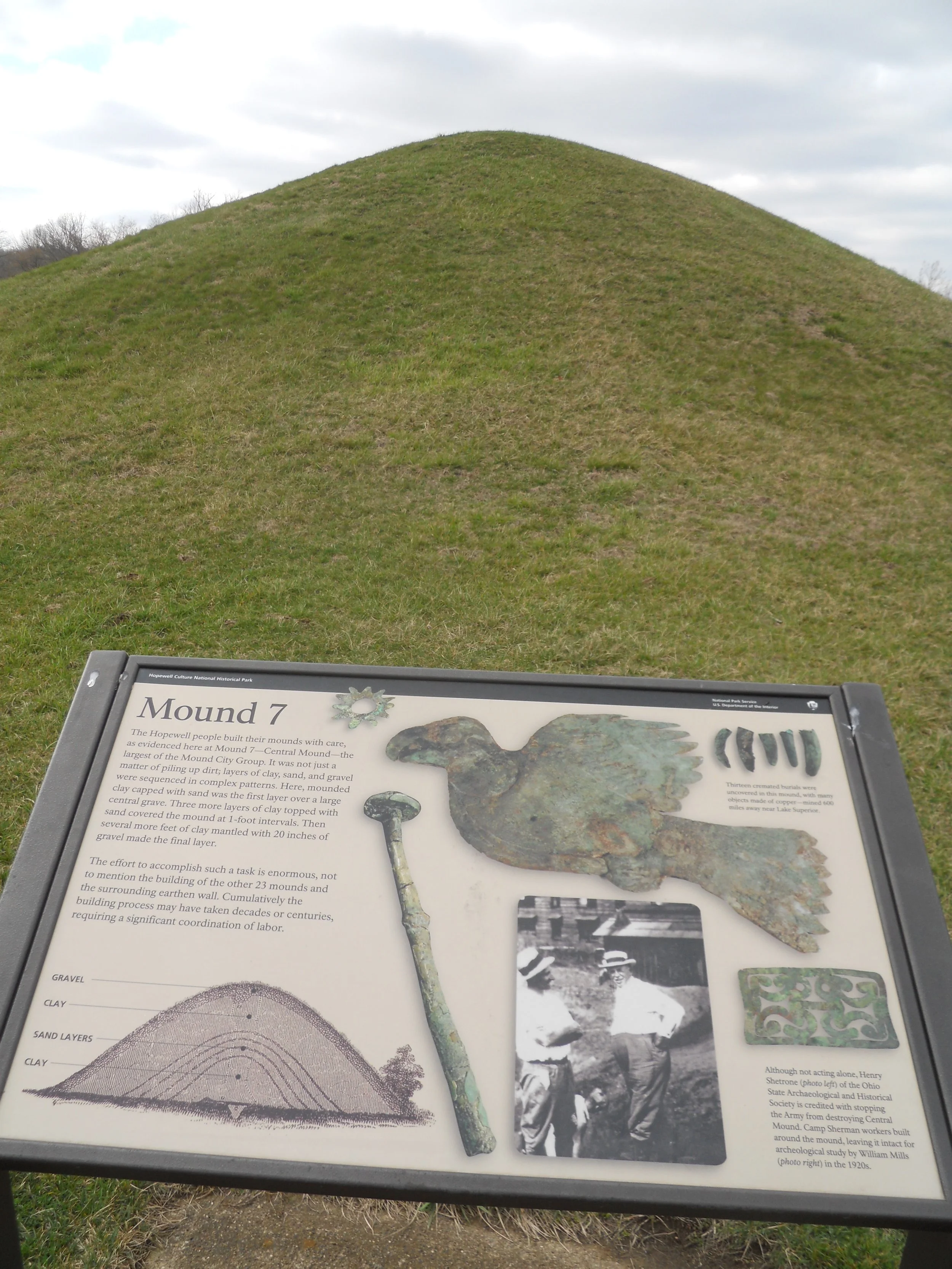
Hopewell Culture consists of six separate units, but only the Mound Group is fully restored, allowing visitors to see 25 “mounds”. Mound 7 (photo) is the largest of these ceremonial mounds. Copper from Lake Superior, 600 miles away, was found in one mound. That shows how widespread the trading routes were for the people who lived 2,000 years ago. One mound had over 200 stone pipes, one of the most sacred tools the Mississippian peoples utilized.

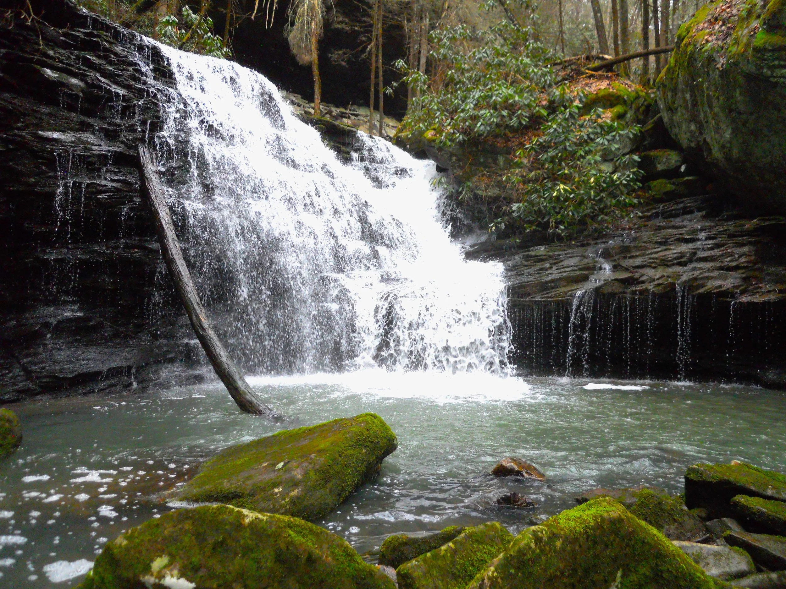
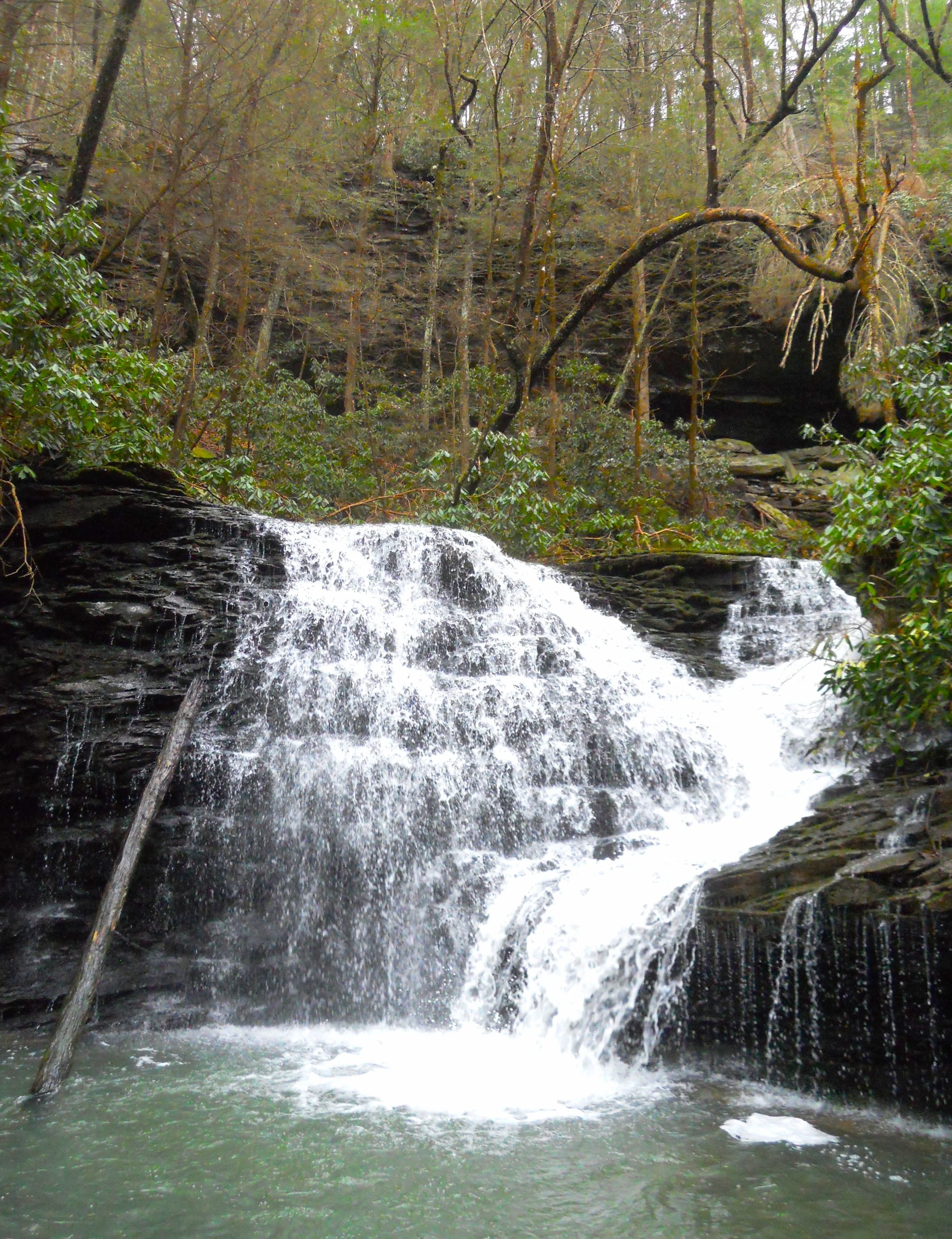
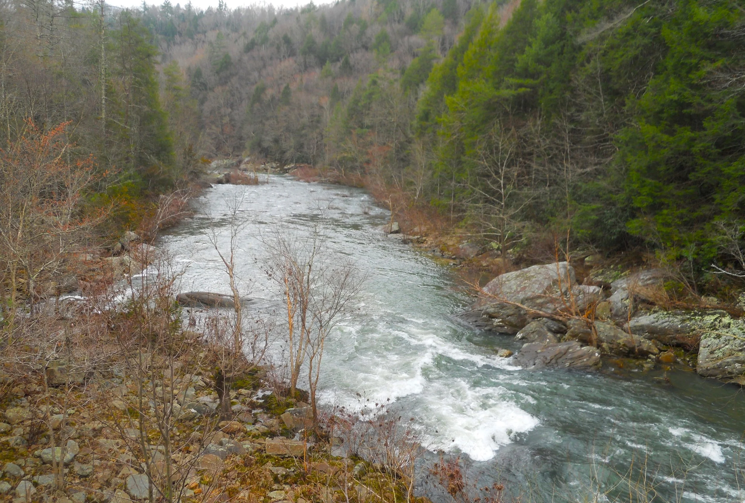
DAY 6 (February 27) - One of the reasons we should all trek to our National Parks was found in Obed Wild and Scenic River. The Melton Mill Branch waterfall was a delight. There are a couple of trails in the area, but it appears one has to basically blaze their own path, off the primary trail, to access the gem. I felt like Indiana Jones in the opening sequence of the first movie. With rain having come down overnight, all the boulders are leaves were slick. I almost wound up sliding into the stream. The stream pours into the Obed River, about half-way down the river’s edge in the one photo.
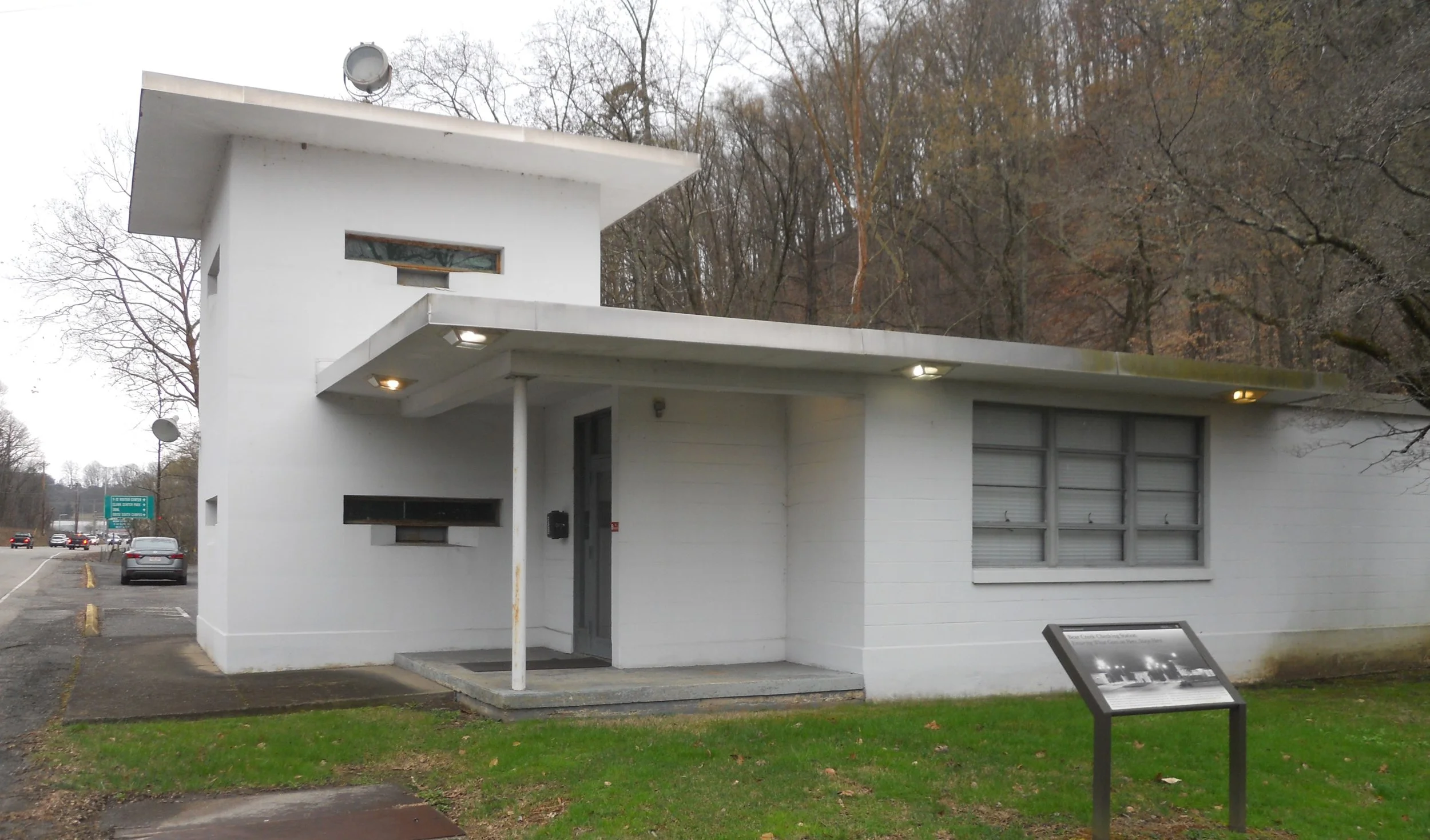
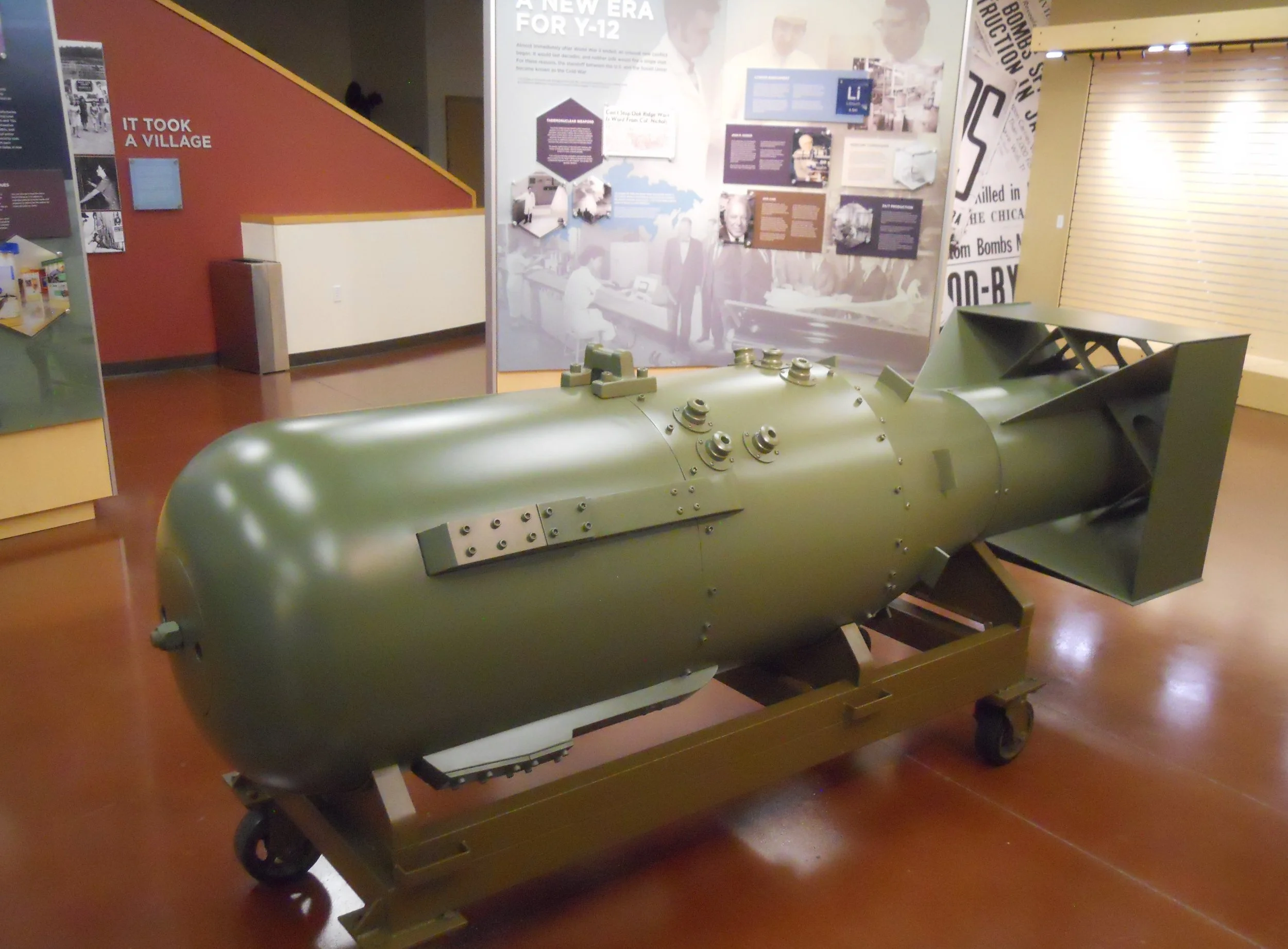
Manhattan Project NHP is comprised of three units; cities in the states of Washington, Tennessee, and New Mexico. Each of these areas played a major role in developing the first atomic bomb, which was used against Japan in 1945. I chose Oak Ridge as the city to visit for my Quest. An entire “Secret City” was built in Oak Ridge, to accommodate 30,000 workers, to conceal the effort of making U235 fissionable material. Most of the buildings from that era used in the work have disappeared, though a few remain such as the Bear Creek Checking Station (photo). It was known as the “Gate House”, controlling access to the Y-12 Complex. That complex is still around today (see the green sign in the background, above the car), but modern security systems made the checking station obsolete. The Y-12 complex does have a History Center, which is the starting point for guided tours of the DOE (Dept of Energy) facilities. Here one can see a replica of the first atomic bomb dropped on Japan; Little Boy. The enriched U235 made in Oak Ridge was the core of the bomb.
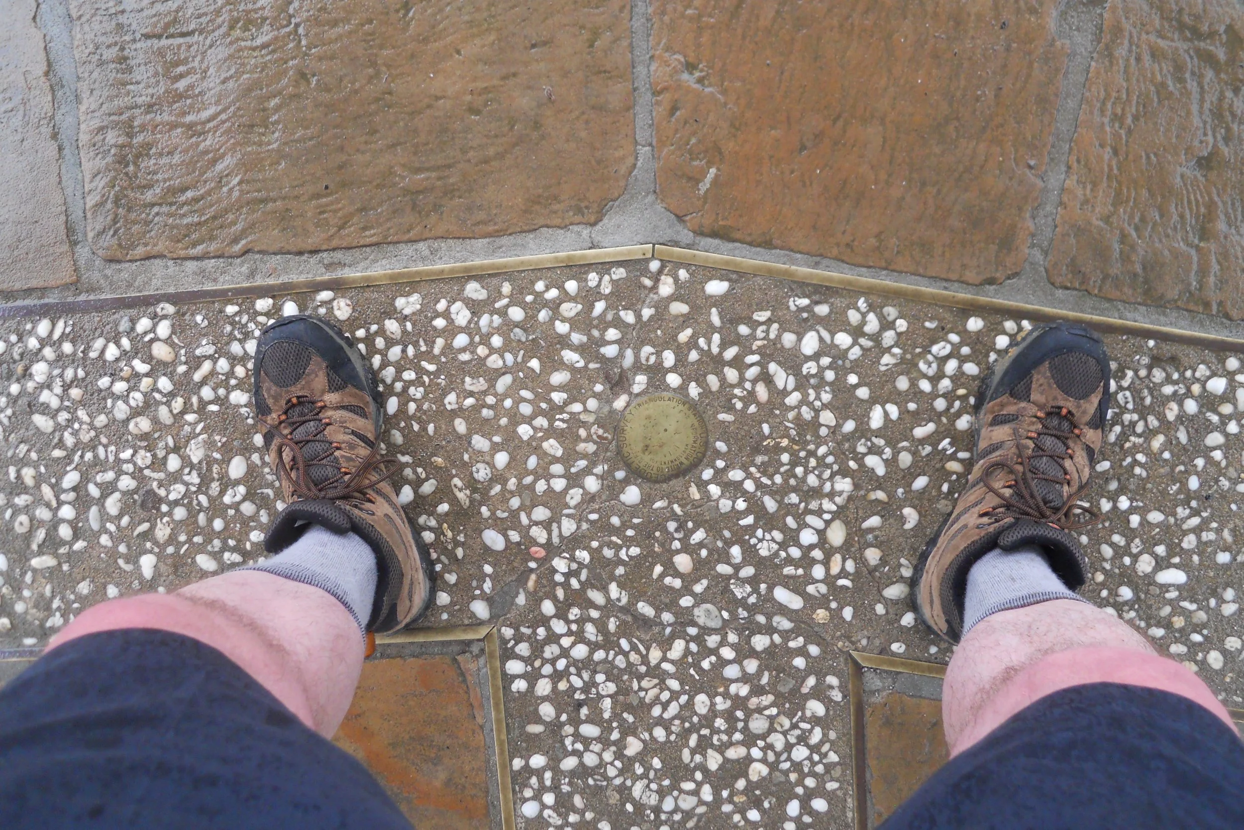
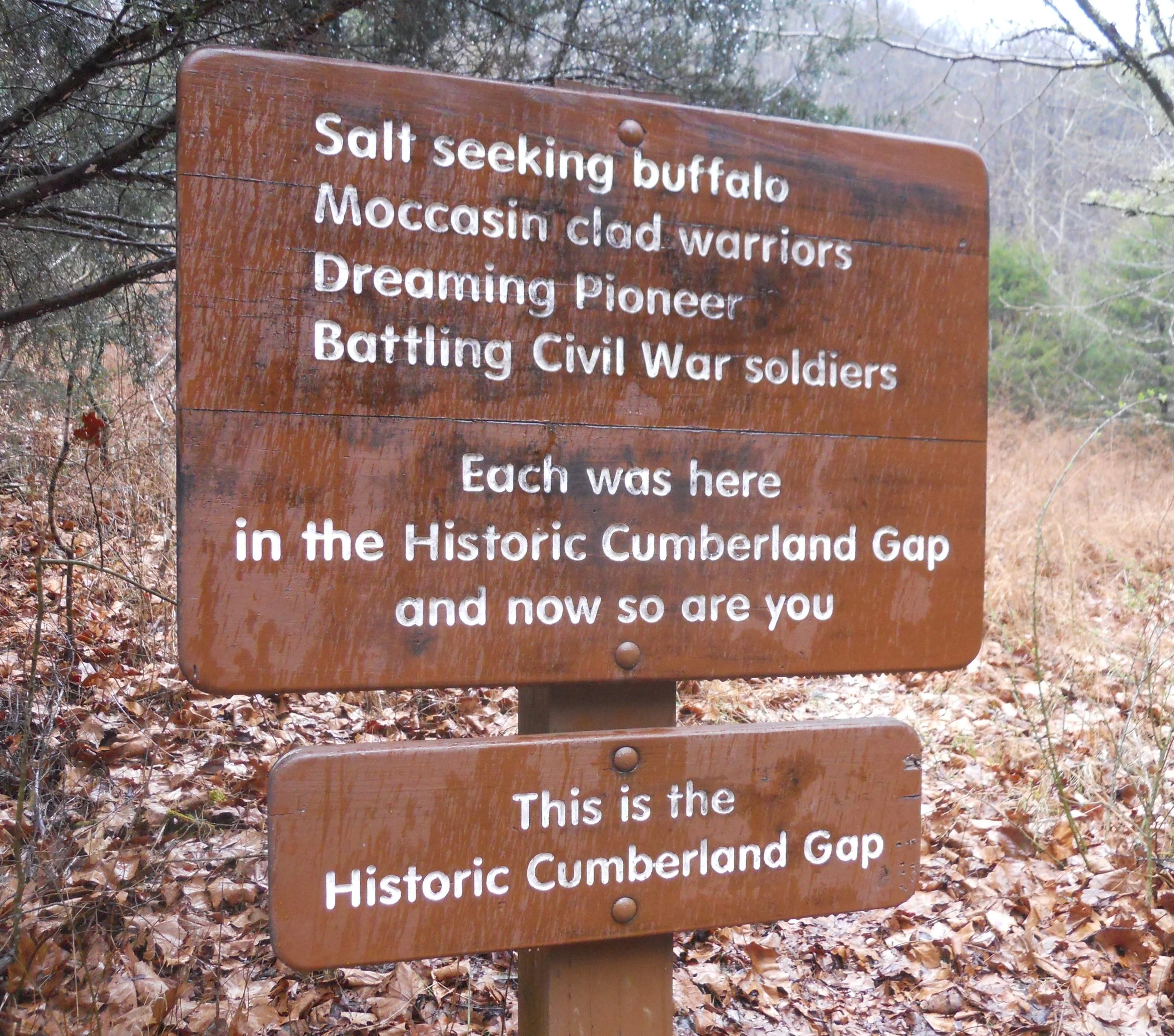
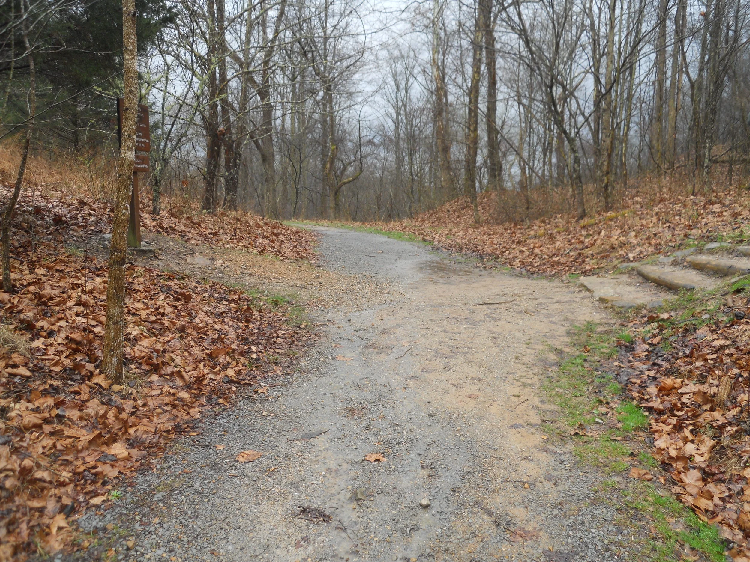
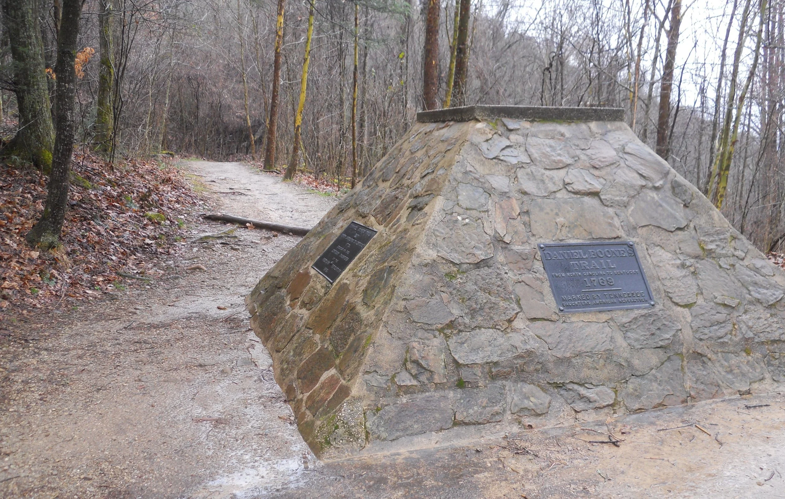
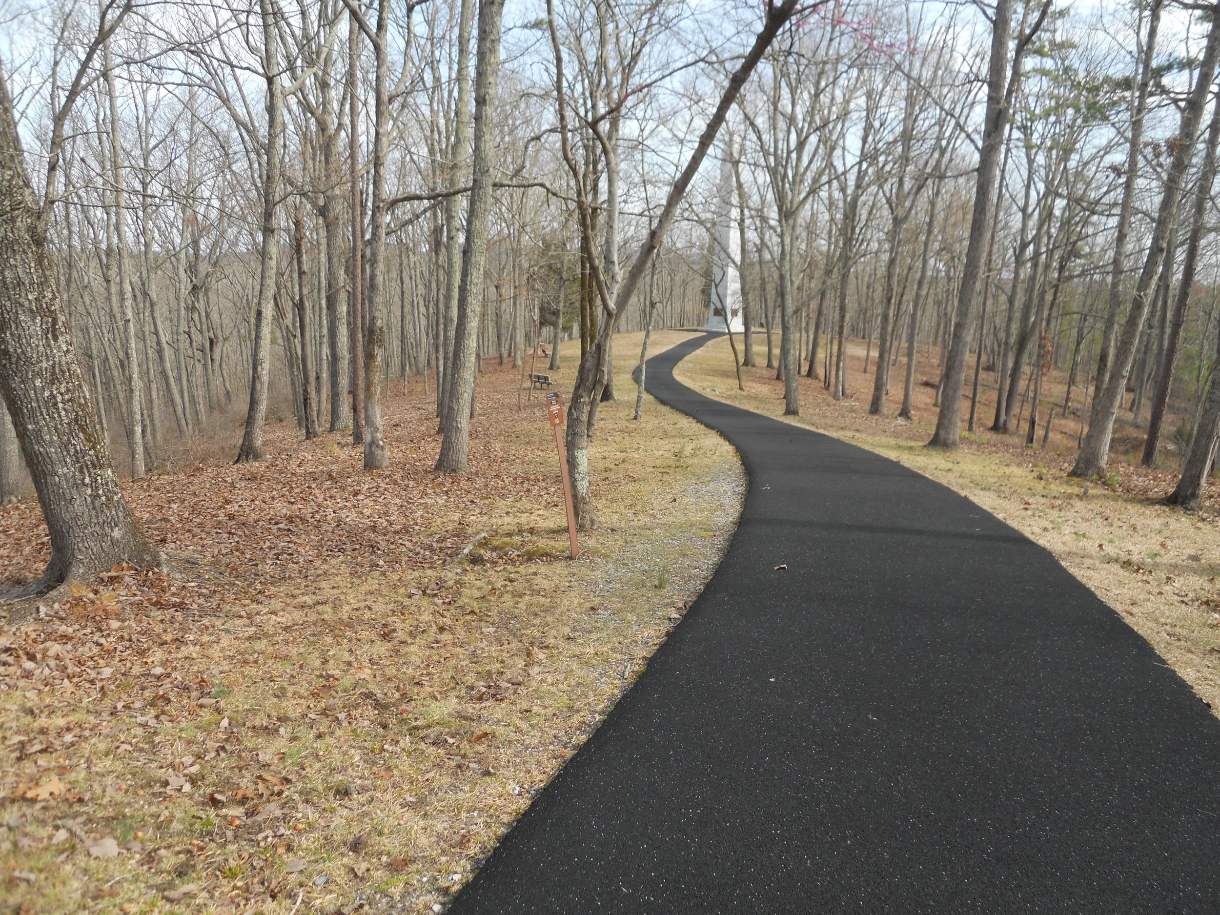
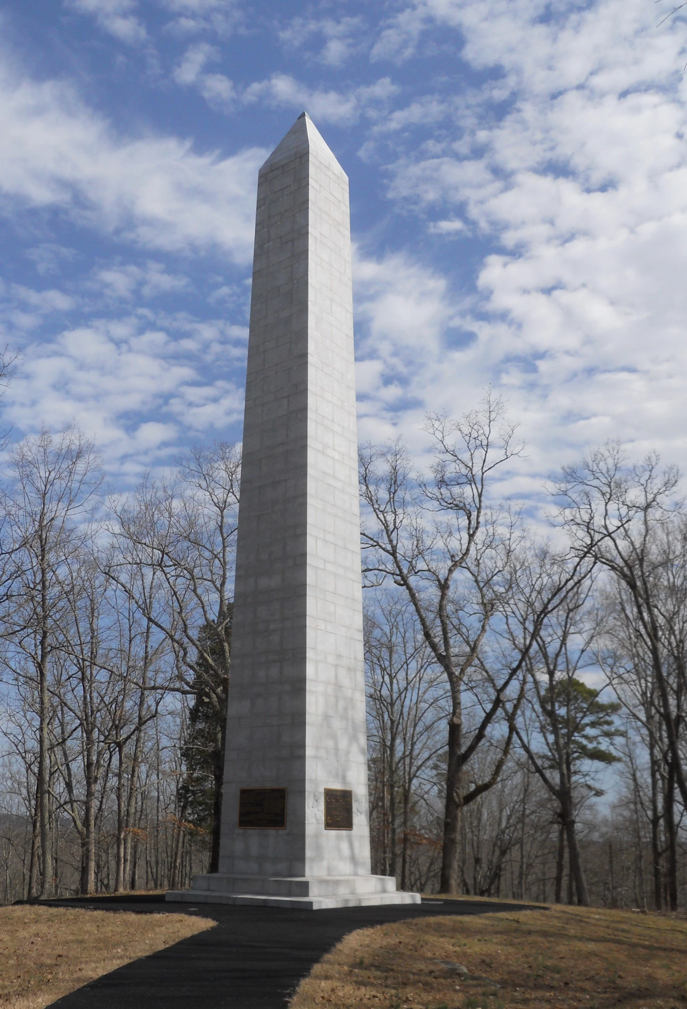
Cumberland Gap NHP lays across the boundaries of three states; Kentucky, Virginia, Tennessee. In 1665, King Charles II ordered his Virginia colony to be separated from his Carolina colony, with a line drawn at the 36 deg - 30 minutes latitude. Once the British Crown lost control of its colonies, greed by Virginia and North Carolina led to decades of disputes on the true boundary. Of course, once Kentucky and Tennessee became states, they too wanted some of the action. It just so happens that this area is known for the “Cumberland Gap”, the famous throughway discovered by Daniel Boone in 1769. Folks wanted to push westward, and this was the path of least resistance. Today, a marker sits at the point which the three states agreed in 1803 to recognize as the official boundaries (photo). My left foot is in Kentucky and Tennessee, while my right foot is in Kentucky and Virginia. A 2.5-mile roundtrip hike is needed to reach the spot. Along the way, one goes right over the actual “Gap”, the exact spot Boone used for multiple excursions over the mountains. The Kentucky DAR erected a monument to commemorate his efforts.
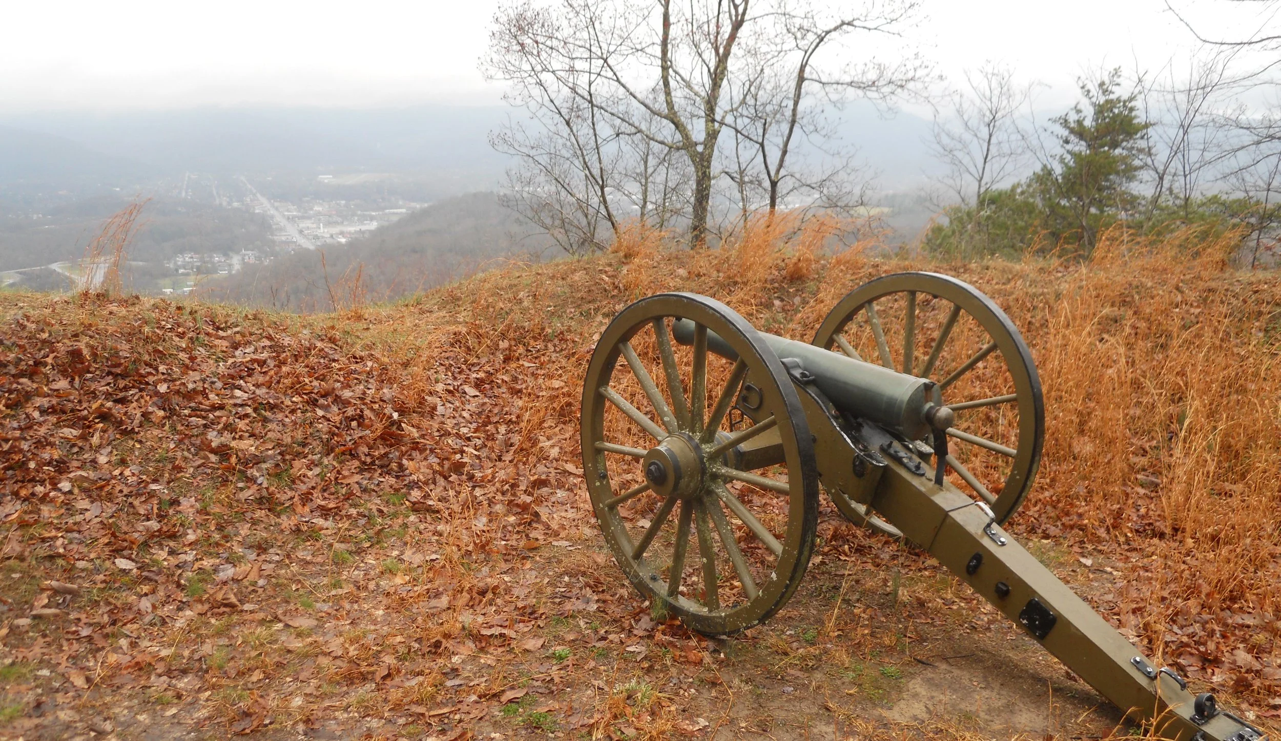
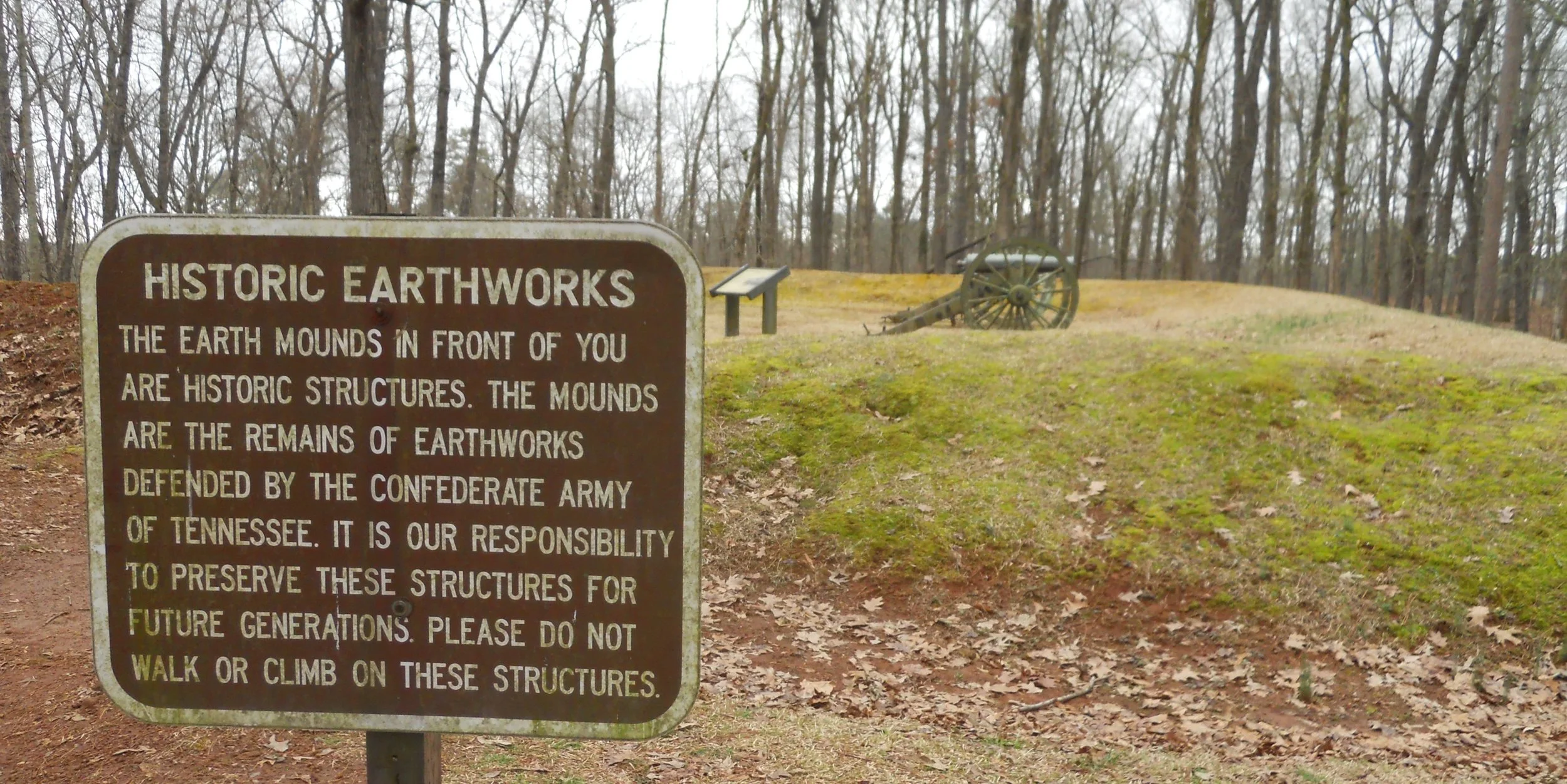
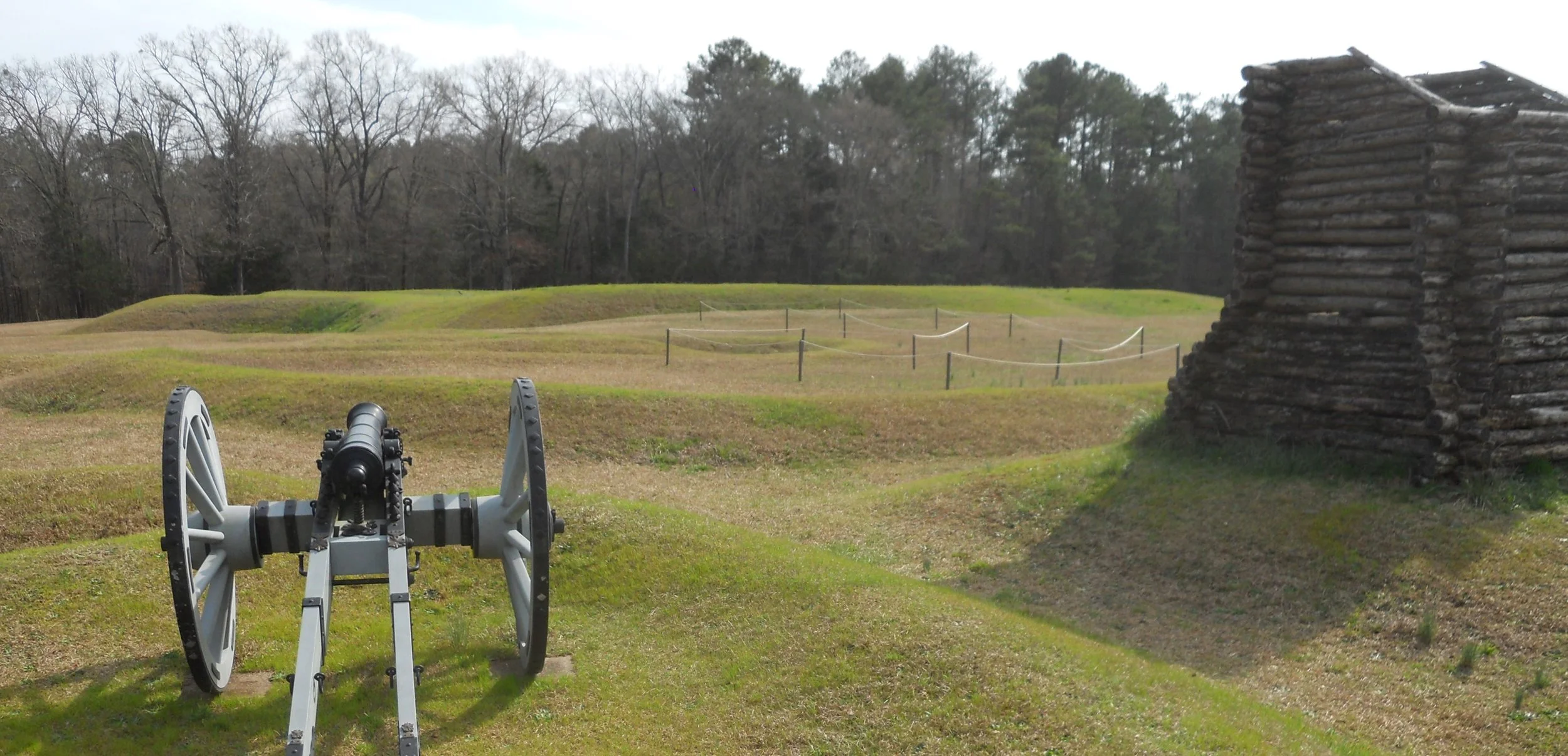
Not to be forgotten after the glory days of the 1700s, the Gap played an important role in our Civil War. Both sides held control of the Gap and the approaches. Transportation is a primary factor in running a war. Forts were built on the mountainsides. Fort McCook still has its earthworks, and a single cannon for display. The fort had been called Fort Rains when the Confederates built it, but the Union changed its name after they took command of the ridges.
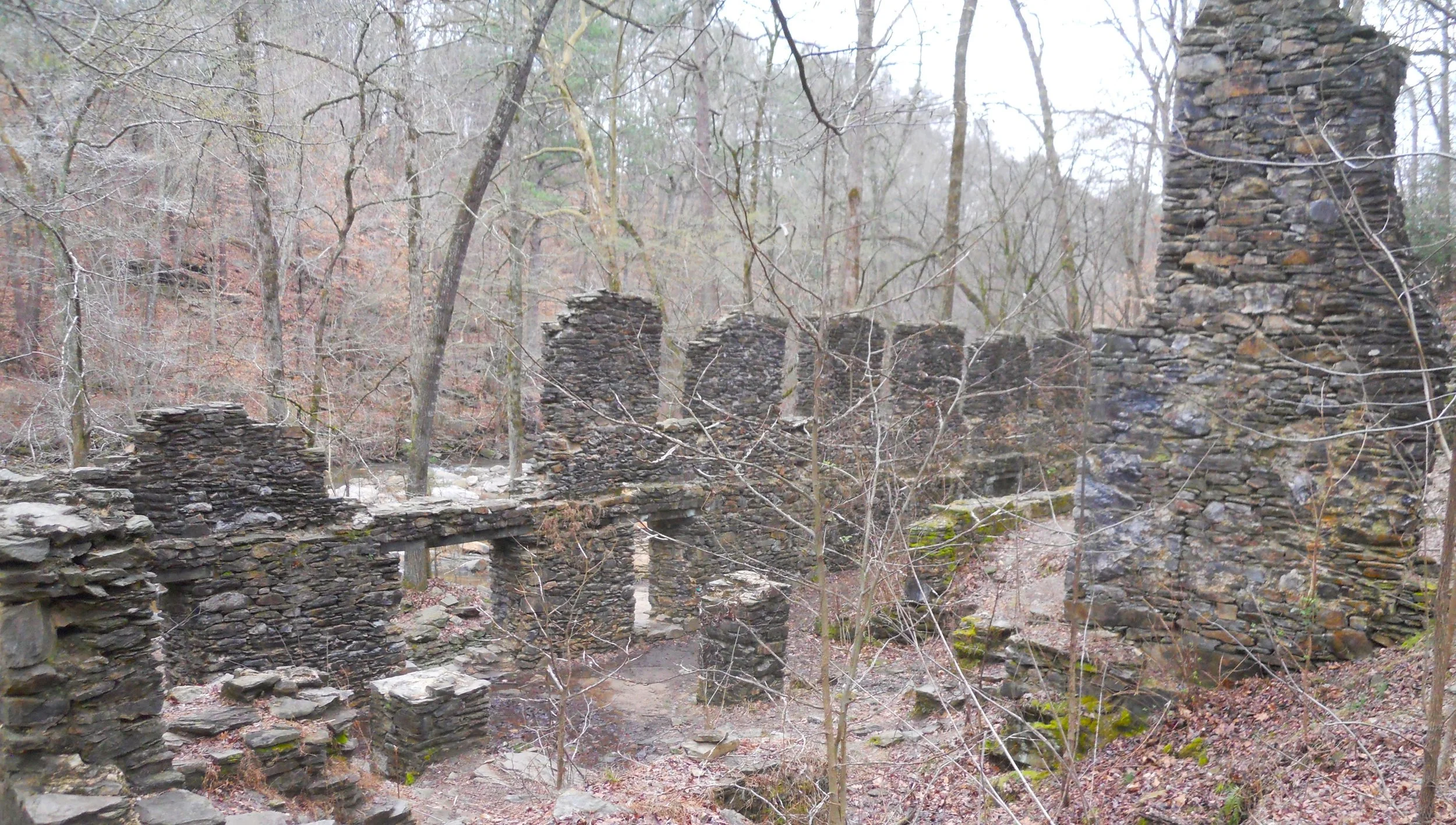
DAY 5 (February 26) - Clouds and cool temps made for a good day. Chattahoochee NRA seemed as laid back is the river itself, flowing so slowly. One of the trails had had some recent damage with fallen trees. Easy to see park maintenance had showed up with chainsaws to make quick work of the situation. The park’s VC was the summer home of a Georgia Supreme Court Justice… he sure had some money. Excitement was taking a one-mile hike to the Marietta Paper Mill ruins at Sope Creek. The mill supplied paper to the Confederate cause during the Civil War. Now the walls are protected by the NPS.
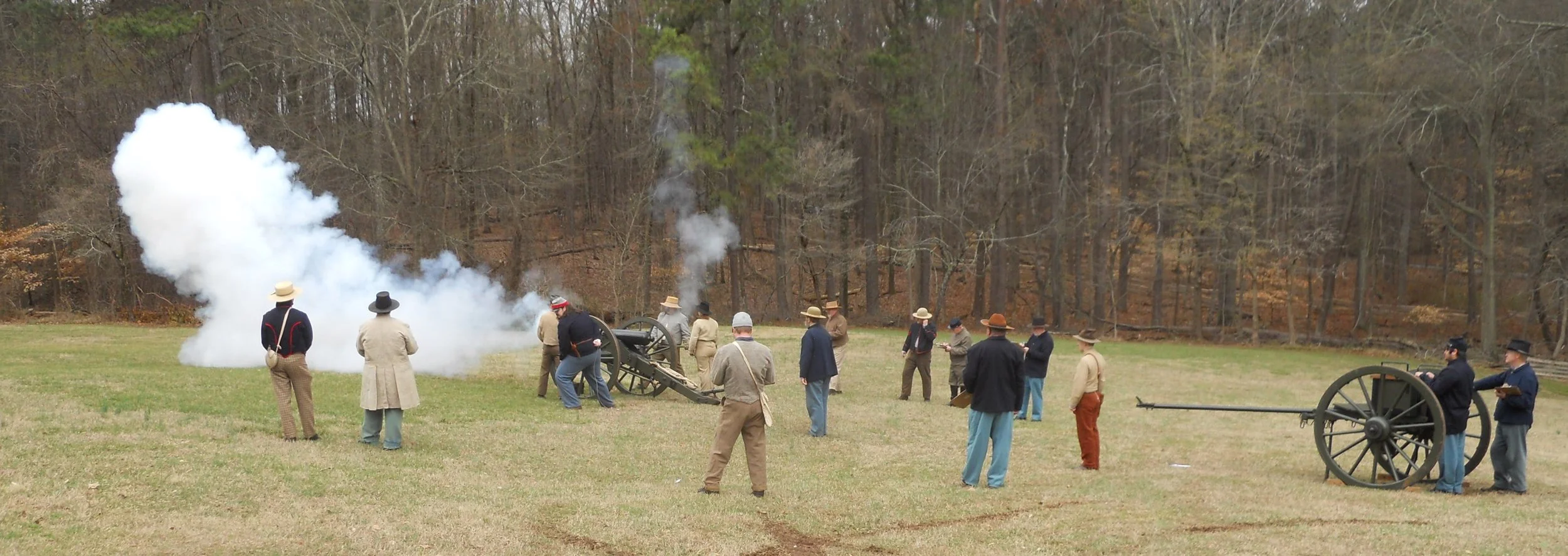
Kennesaw Mountain NBP was ground-zero for cannon training today. The park’s Live History group was training recruits and certifying old-timers. A small crowd of visitors had gathered over on the mountain access road by the VC to view (the mountain road is closed on weekends due to the massive crowds… so come on a weekday if you do not want to hike the 2-mile round-trip trail).
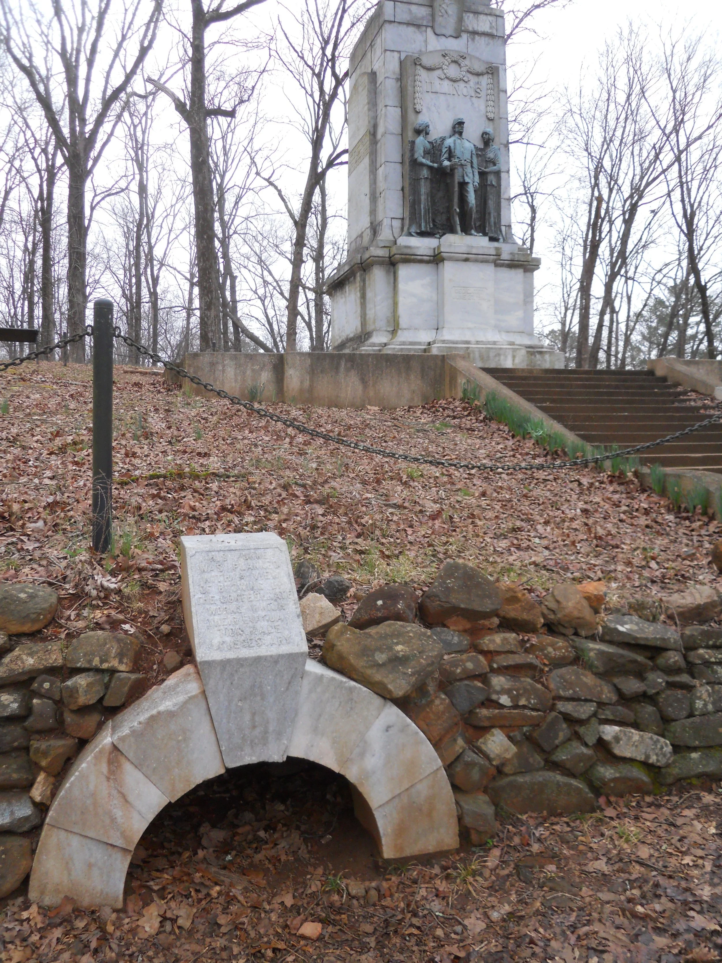
Kolb Farm is the last surviving structure (built in 1836) from the battle which is on park property. This is where the Union forces first suffered a pause in their advance, which led General Sherman to make the disastrous decision to charge his men up the sides of Kennesaw Mountain a few days later. Thousands were killed. In between, Cheatham Hill saw horrendous fighting, at some spots infantry from the two sides were within 30 yards of each other. The Union forces tried to dig a tunnel to go under the Confederate earthworks, with the intent of placing explosives inside. The tunnel was never completed due to a Rebel withdrawal, but the entrance can be seen today, in front of an Illinois monument. Union veterans, mostly from Illinois, dedicated this monument on June 27, 1914, 50 years after the fighting on the hill. Illinois soldiers had spearheaded the attack at this point, called the “Dead Angle”, and lost almost 400 men. Signs along the way ask people to stay off the earthworks, they are original from the battle. The one photo is of the Confederate Redoubt at Cheatham Hill. For anyone visiting parks with original earthworks, please respect the hallowed ground.
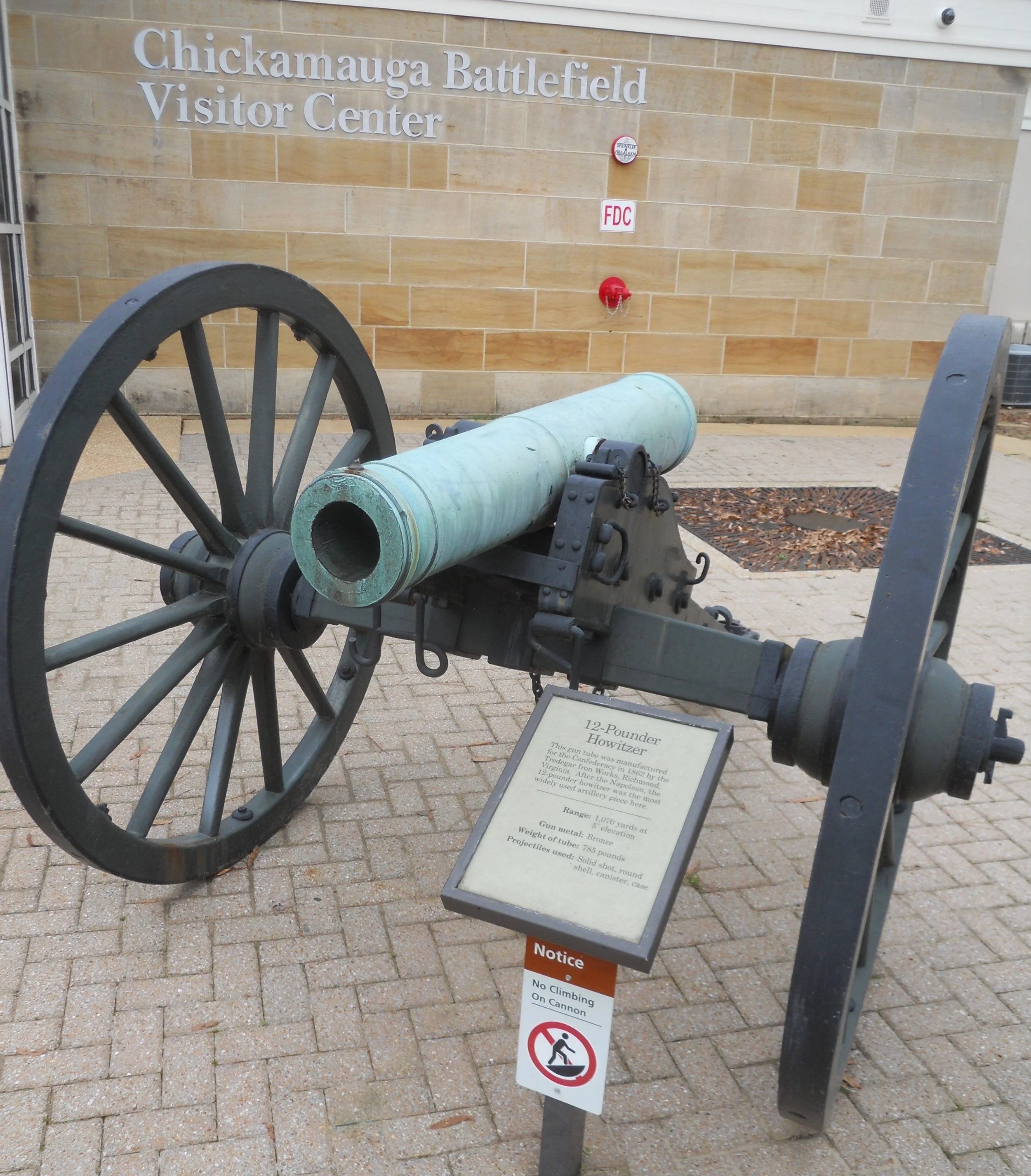
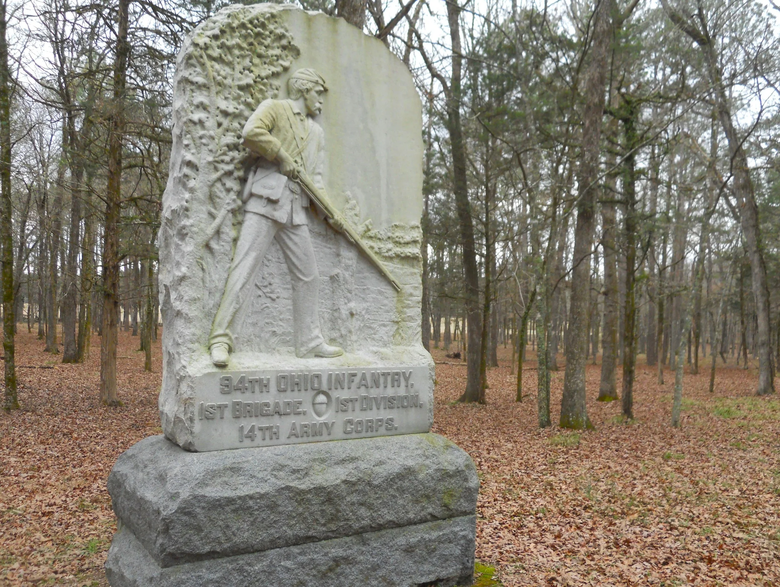
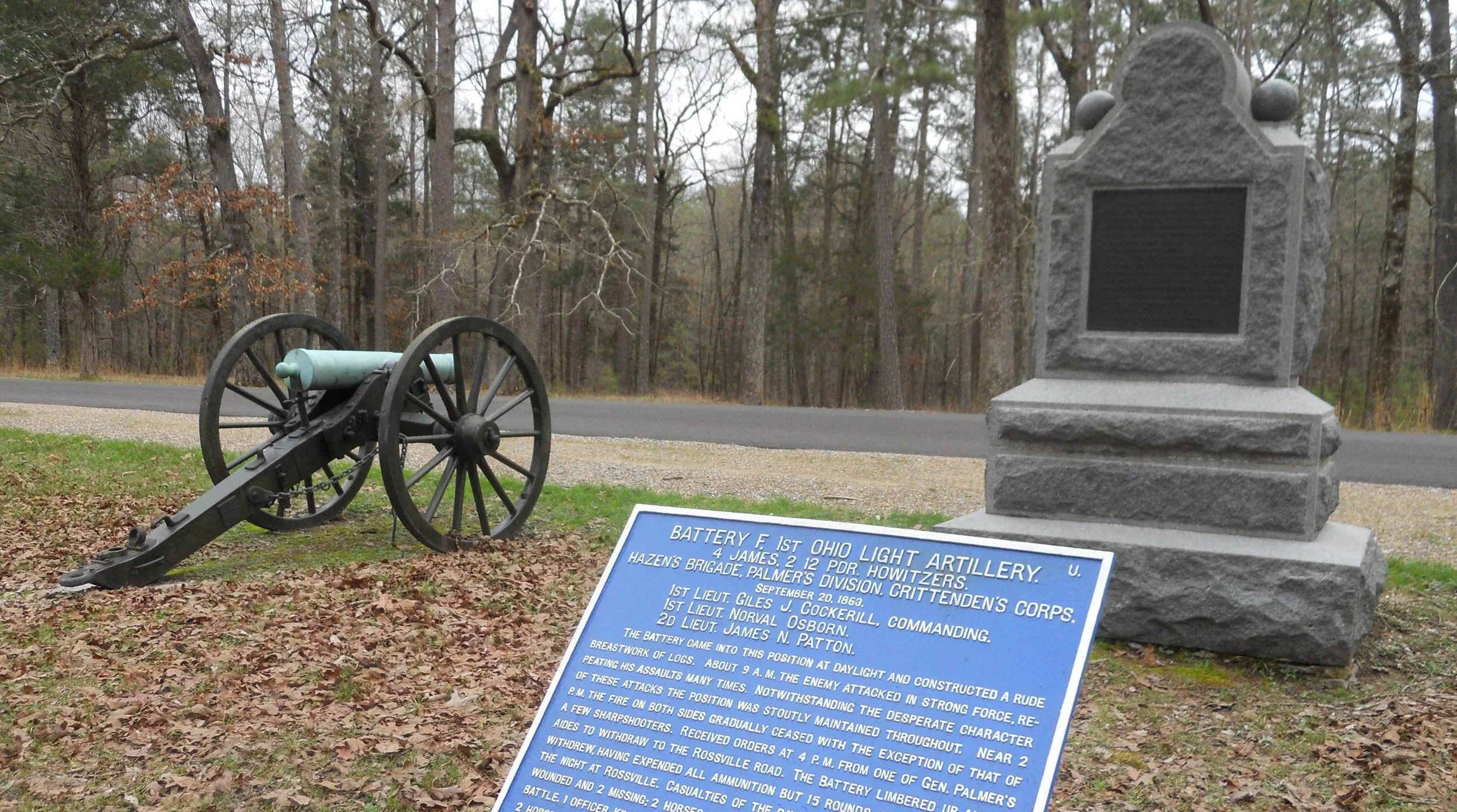
Chickamauga NMP has plenty of monuments, and actual cannon from the war. The one photo is of a 12-pound Howitzer, made at the Tredegar Iron Works (part of the Richmond National Battlefield) in Richmond, VA, in 1862. Another photo is the monument for the 94th Ohio Infantry.
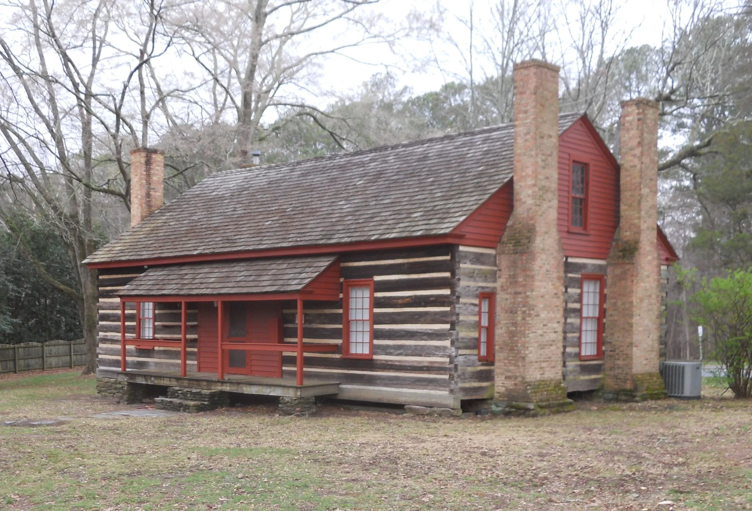
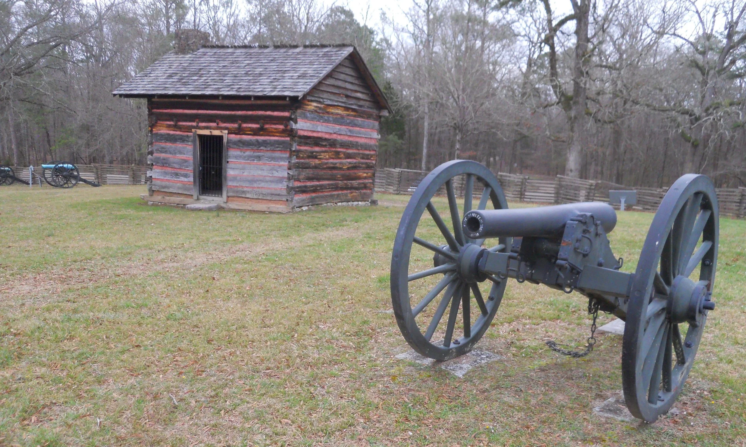
The park has placed blue (Union) and gray (Confederate) plaques across the fields and forests to describe what transpired at each of those locations. The one example is for the 1st Ohio Light Artillery, F Battery, comprised of four cannon and two howitzers. An example of the ground which the Confederates held, and eventually turned the tide of battle, was at the Brotherton Cabin. It still stands today, next to wooden fences and cannon.
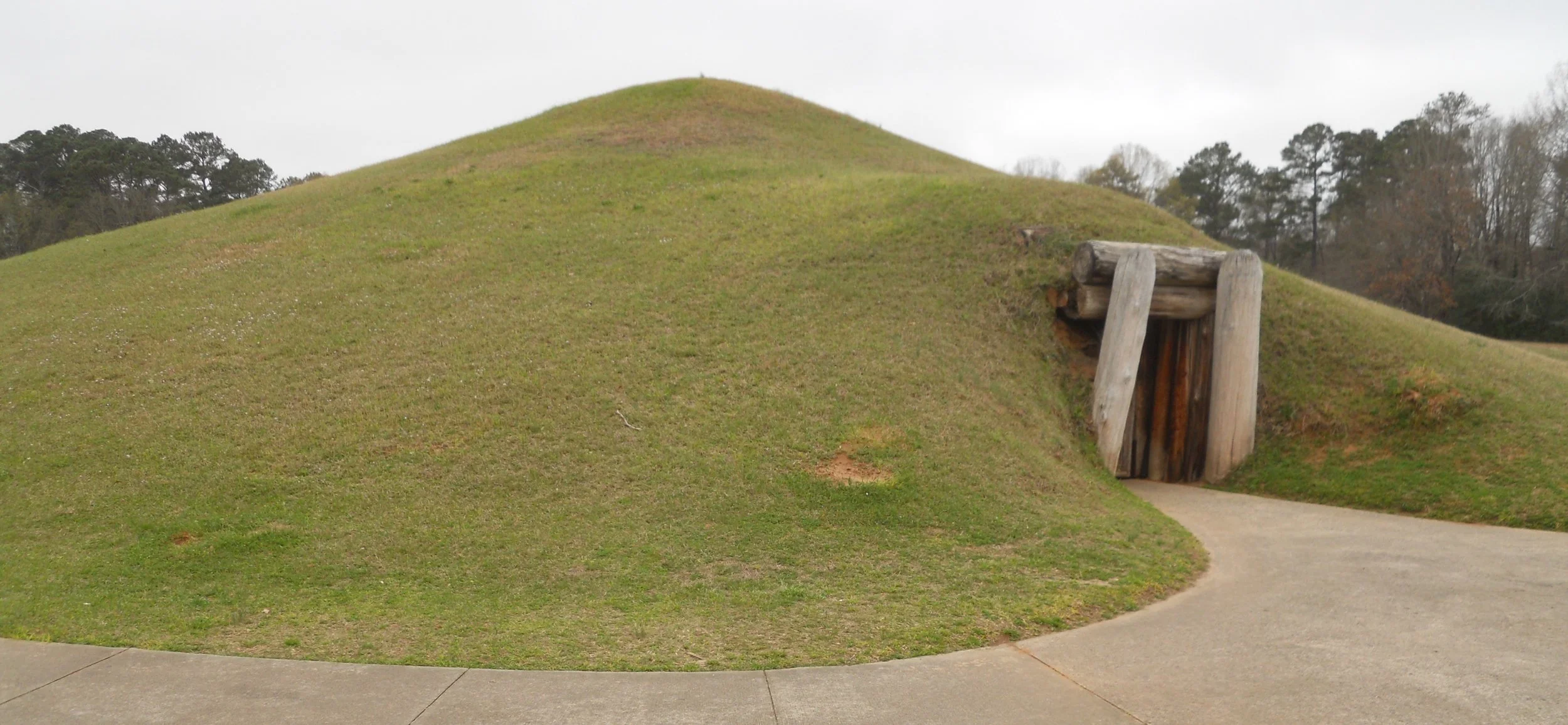
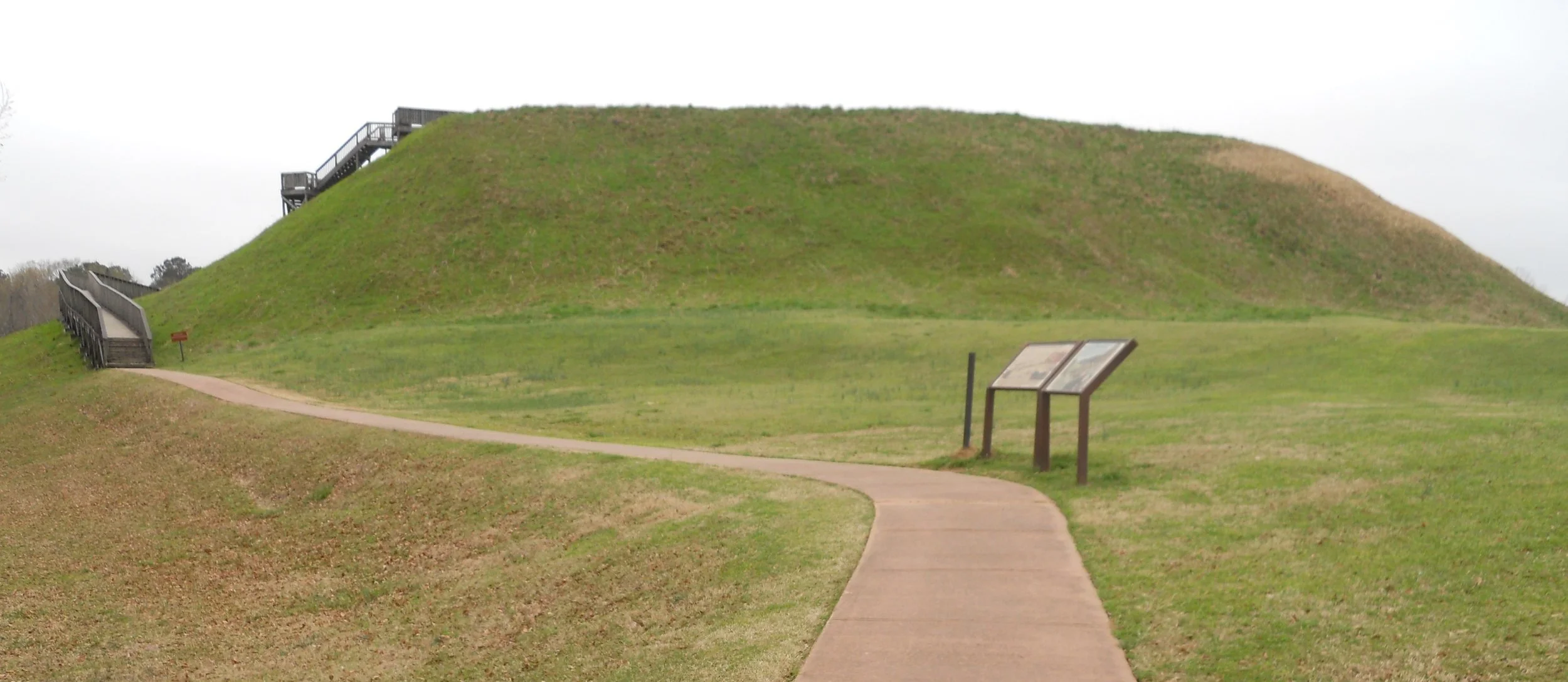
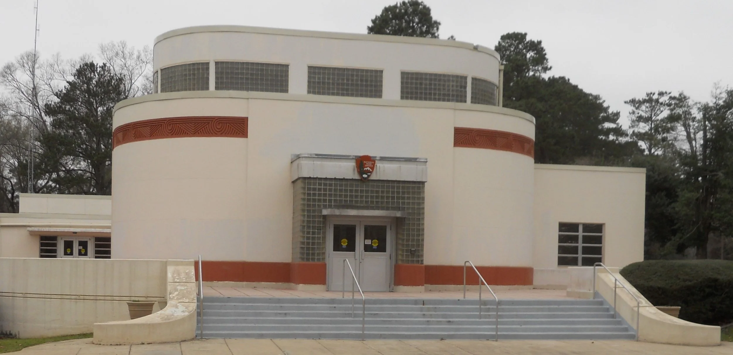
DAY 4 (February 25) - Ocmulgee Mounds displays a number of mounds from the Mississippian Period, 900 CE. The Earthen Lodge is the oldest ceremonial lodge in America. It has an entrance which visitors can use to look inside the mound. The other mounds are closed to the public. The Great Temple Mound is the largest in the park. The park’s VC is a mix between native peoples and 1950’s modern art (the entrance and upper level is glass block).
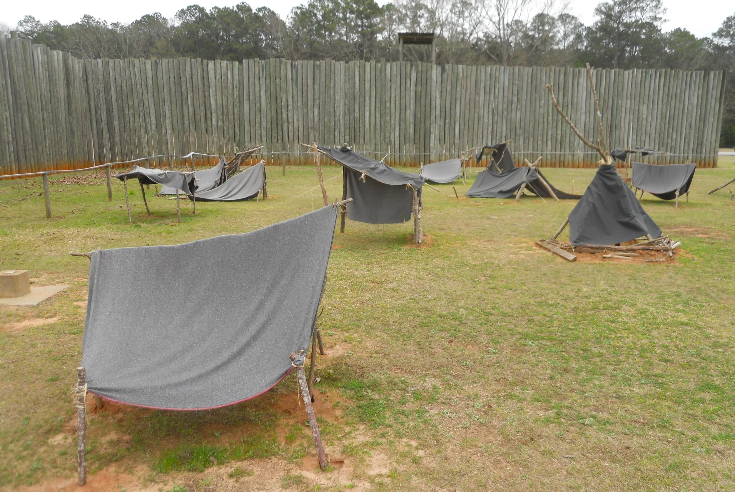
The Union prisoners at Andersonville NHS endured unspeakable pain during captivity. No food, no clean water, etc. They had to use the clothes off their backs, with sticks, to make small tents for covering. These were called “Shebangs”.
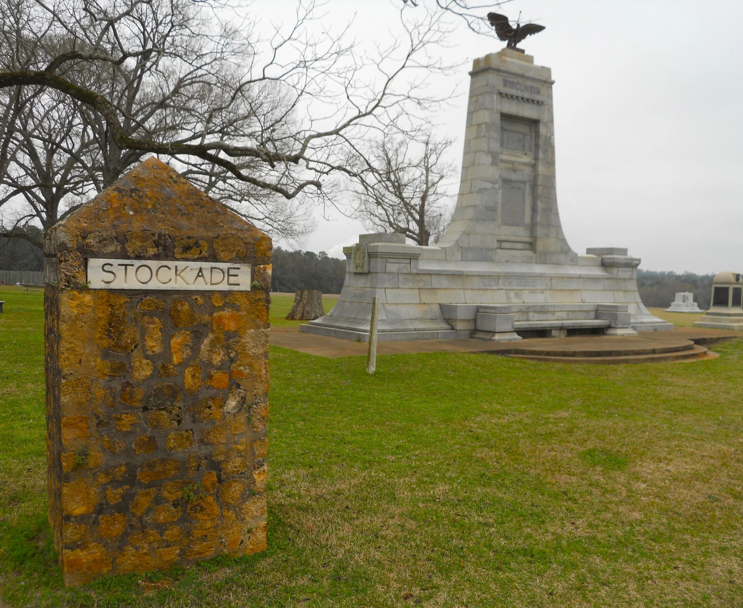
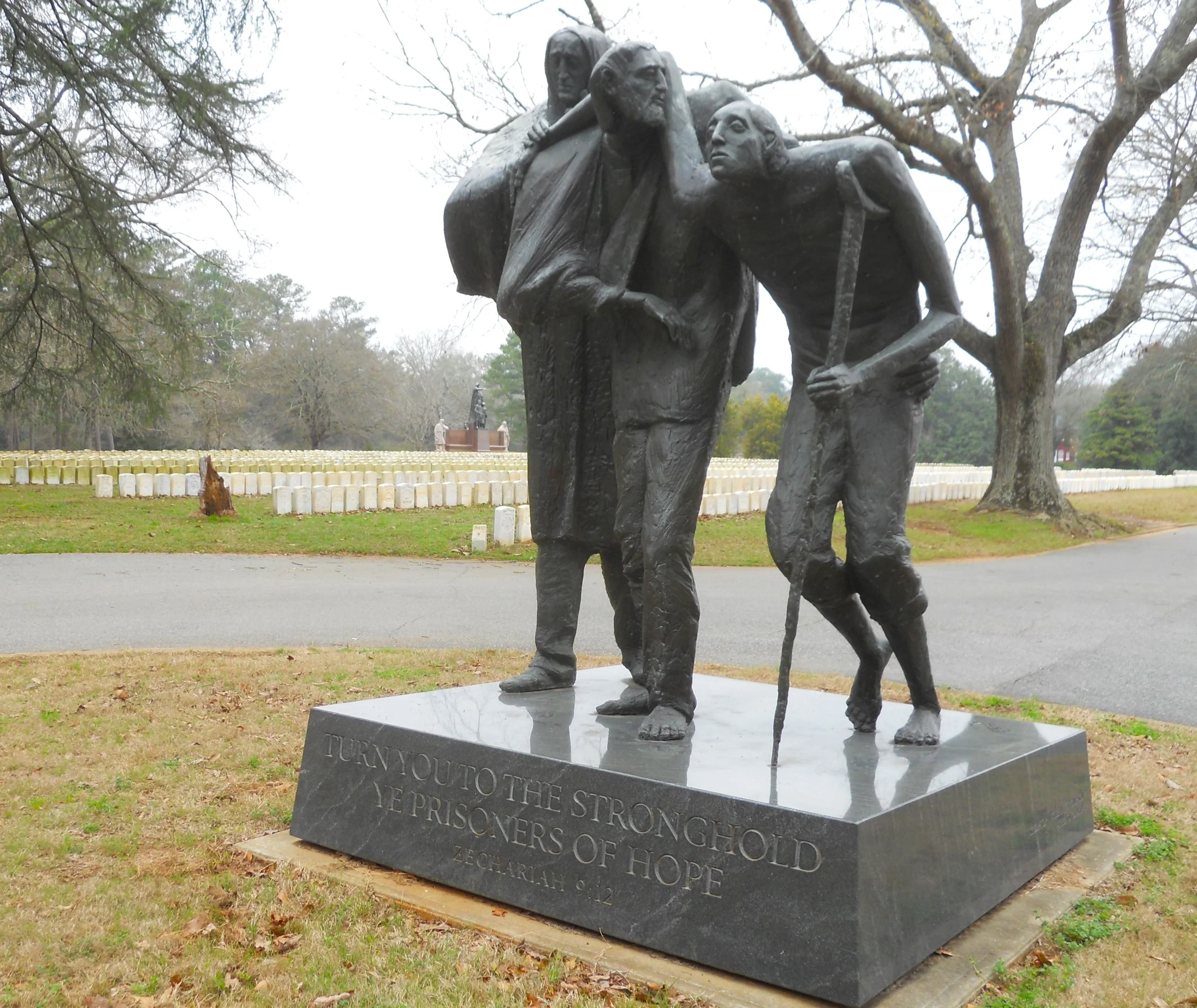
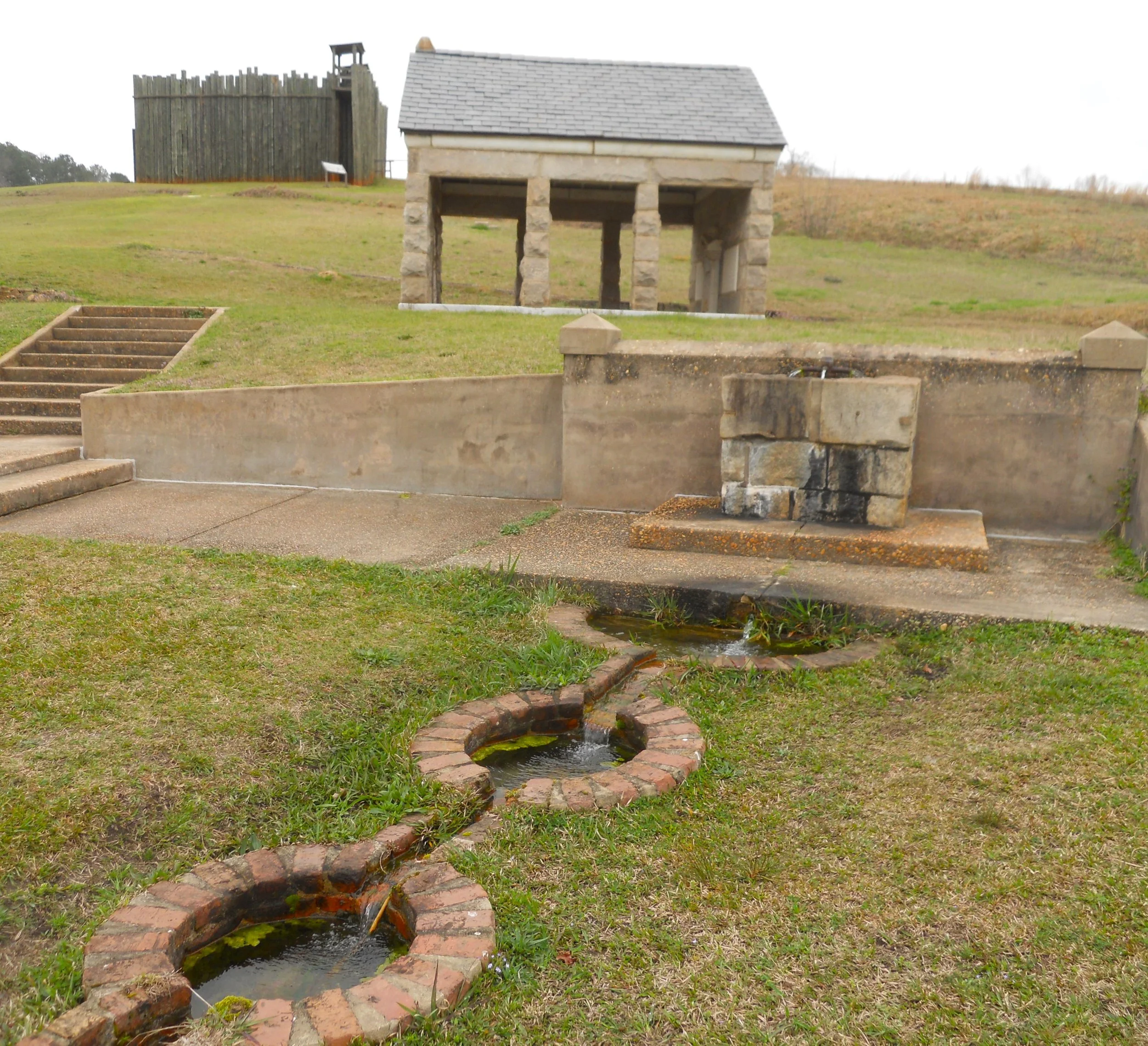
There are four “Stockade” boundary markers. Each of the states which had soldiers incarcerated, erected monuments (Wisconsin is in the one photo). The National Cemetery has one of my favorite sculptures of all the National Parks. The verse at the bottom reads, “Turn you to the stronghold, ye prisoners of hope.” The only fresh water in the prison came from Providence Spring (photo).
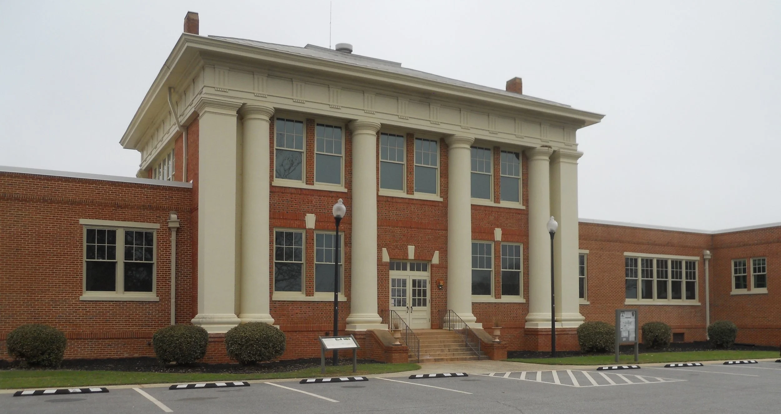
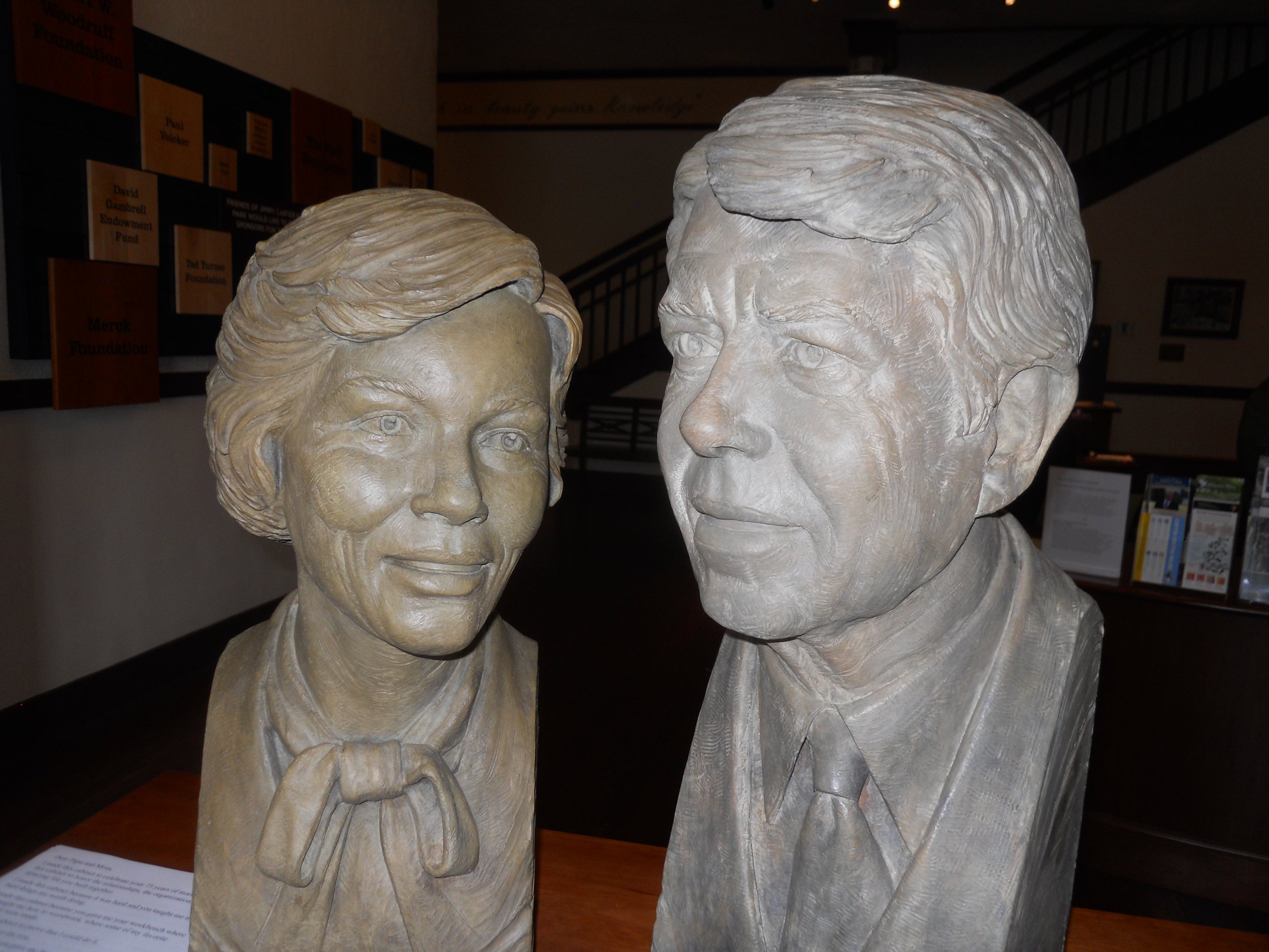
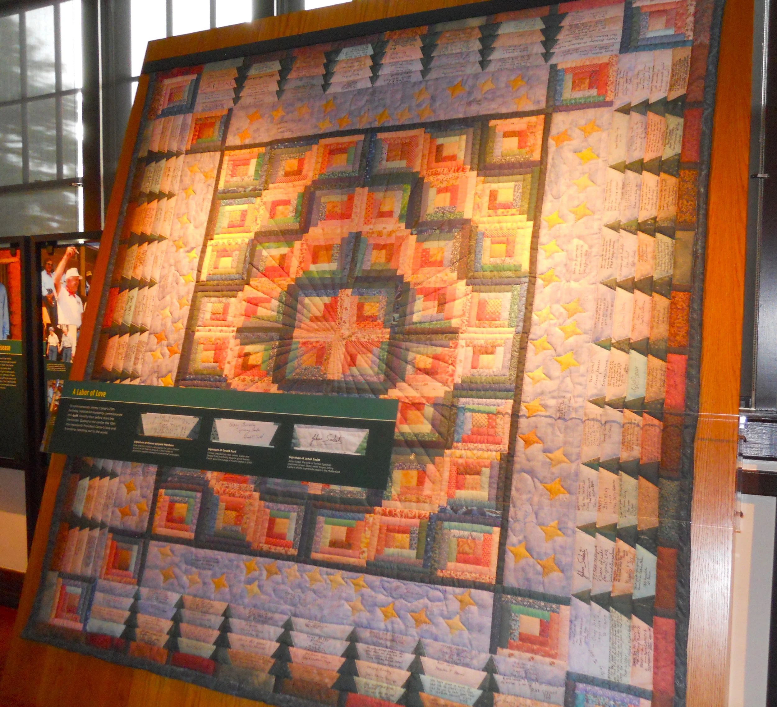
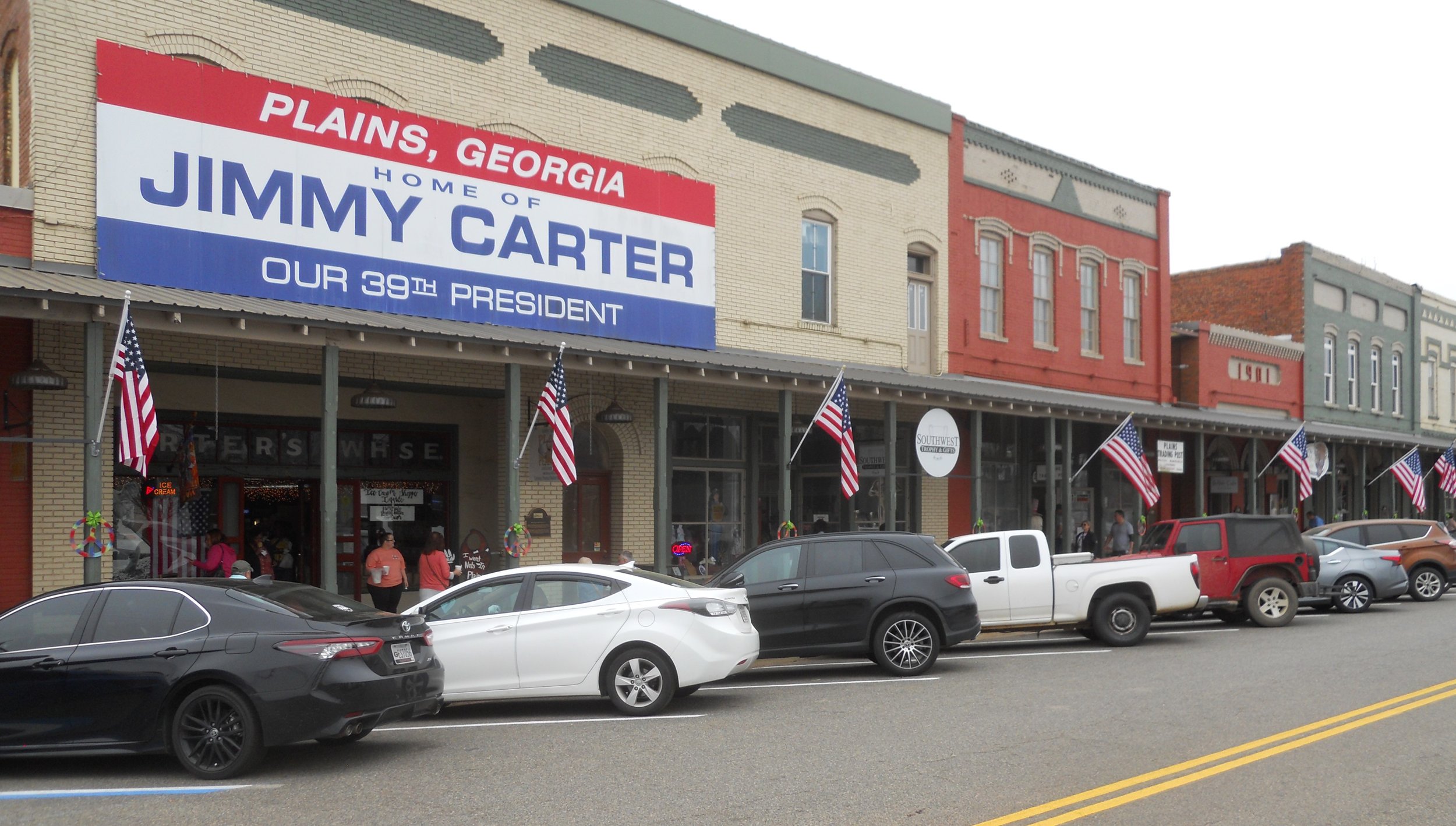
Jimmy Carter NHS had plenty of activity today, people all over the town. His boyhood home is closed, so I toured his school and the town’s train depot. The list of accomplishments Mr. Carter achieved after he left the White House will probably never be matched by any U.S. President. He was involved with his church (taught Sunday School), promoted Habitat for Humanity (a large quilt was presented to him on his 75th birthday, autographed by many famous people), wrote books, painted, joined peace delegations (he received the 2002 Nobel Peace Prize), etc. The train depot where he kicked off his presidential campaign is still used today. The town of Plains, the state of Georgia, and all the world, love and respect the Carters for what they have done for humanity.
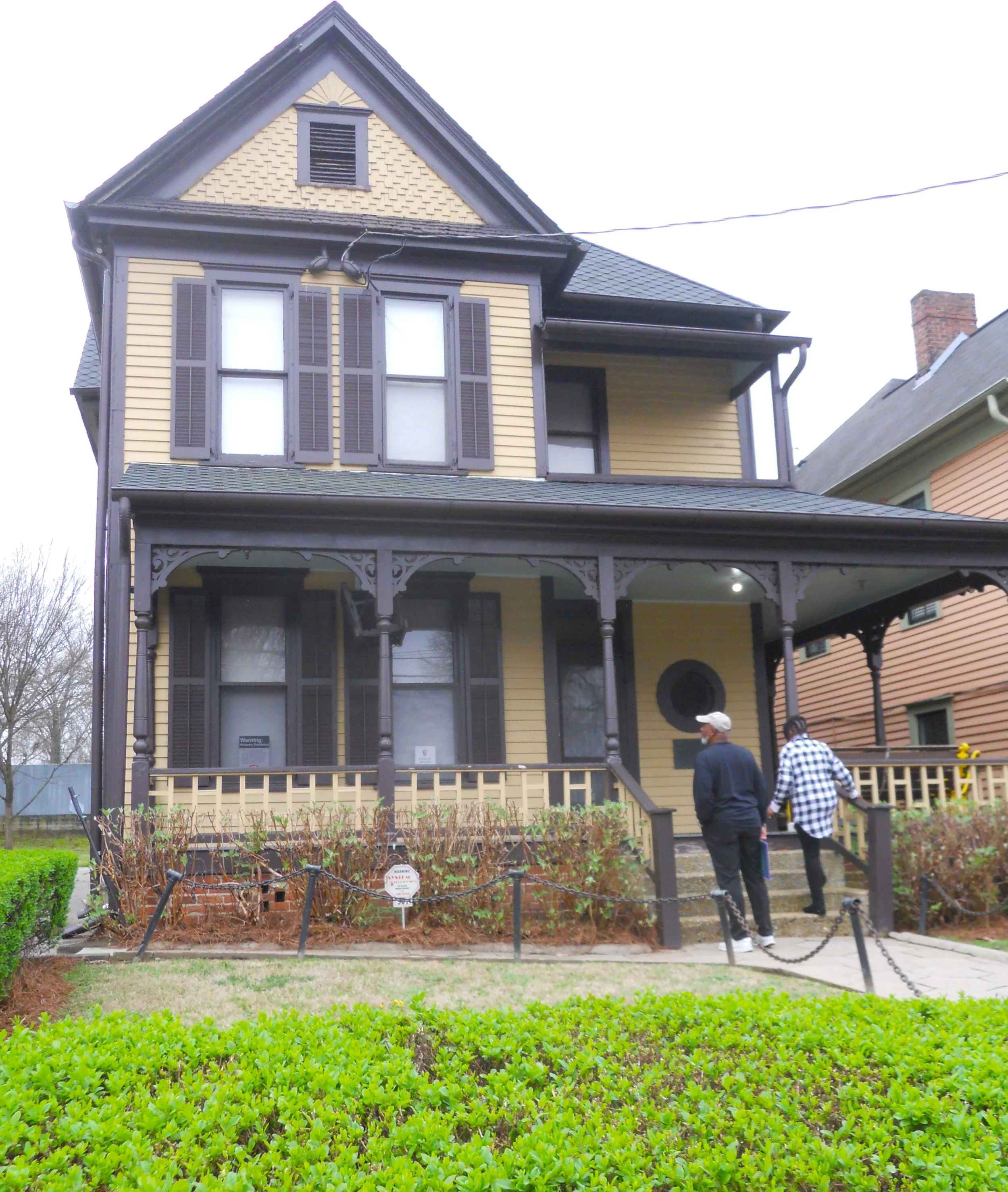
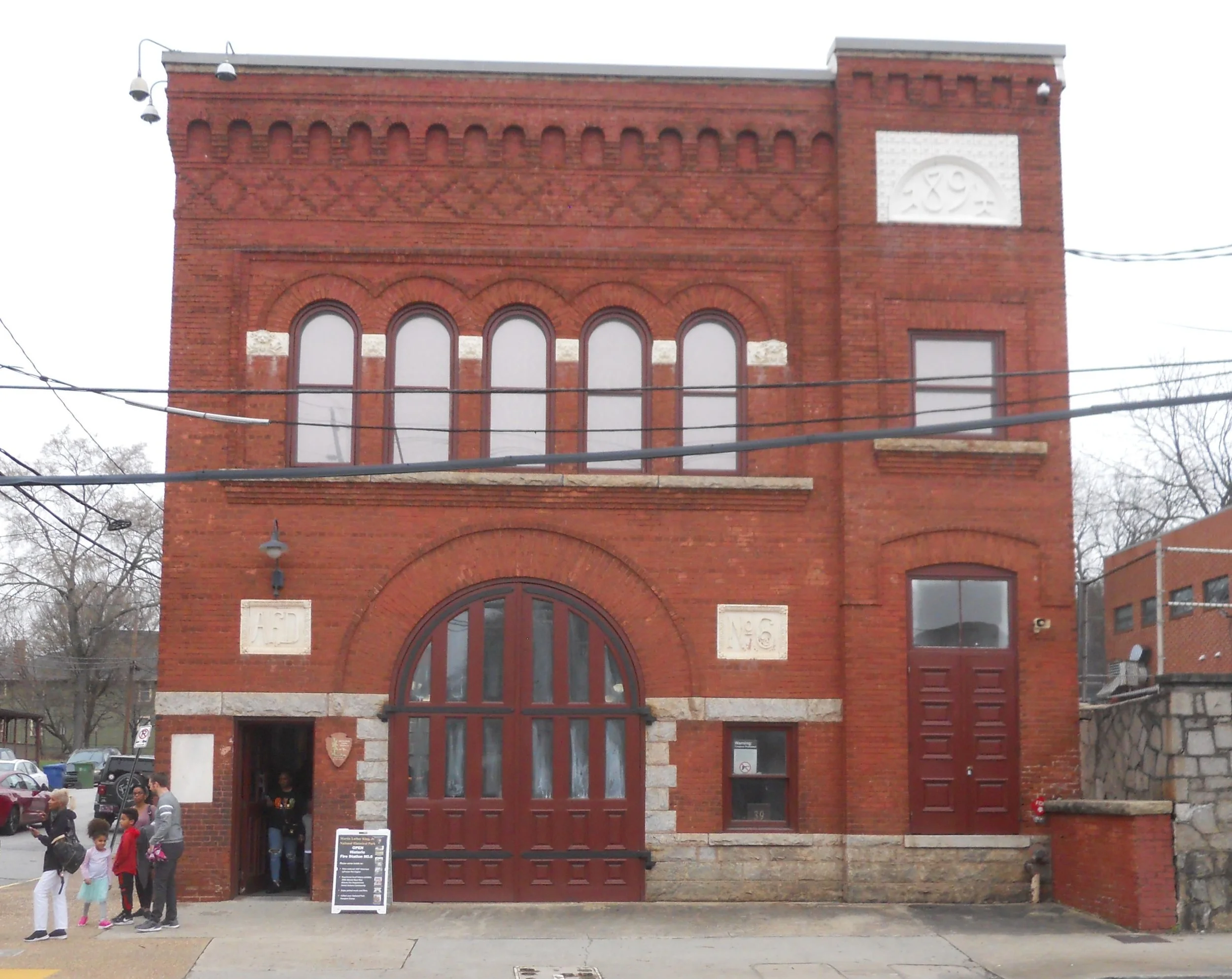
Dr. Martin Luther King Jr. was a good friend of Jimmy Carter. He also won the Nobel Peace Prize, in 1964, at the age of 35… at the time the youngest ever. His birthhome can be toured, as well as the fire station at the end of the block (the first to have African-American fire fighters).
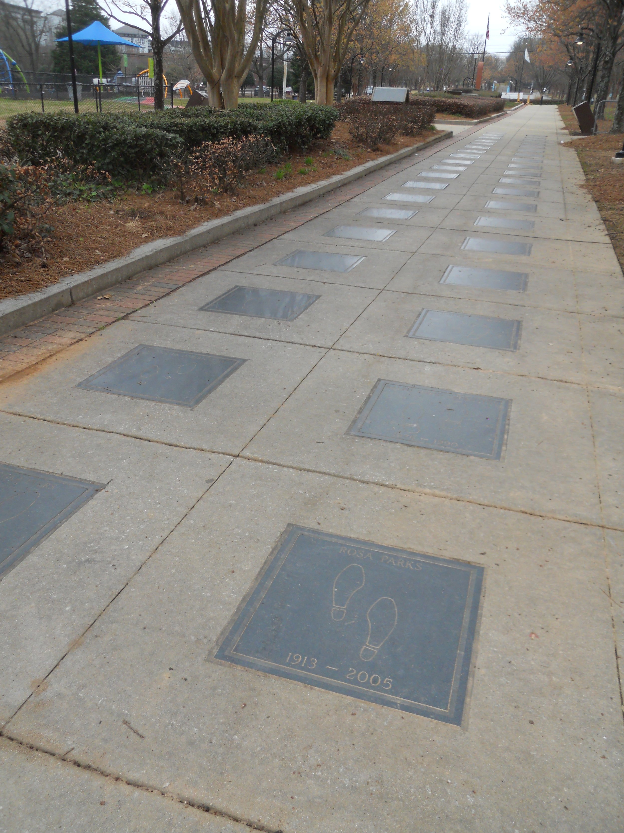
The Civil Rights Walk of Fame (photo) is located on the backside of the VC. Each year a new class of recipients is honored. The first class was in 2004.
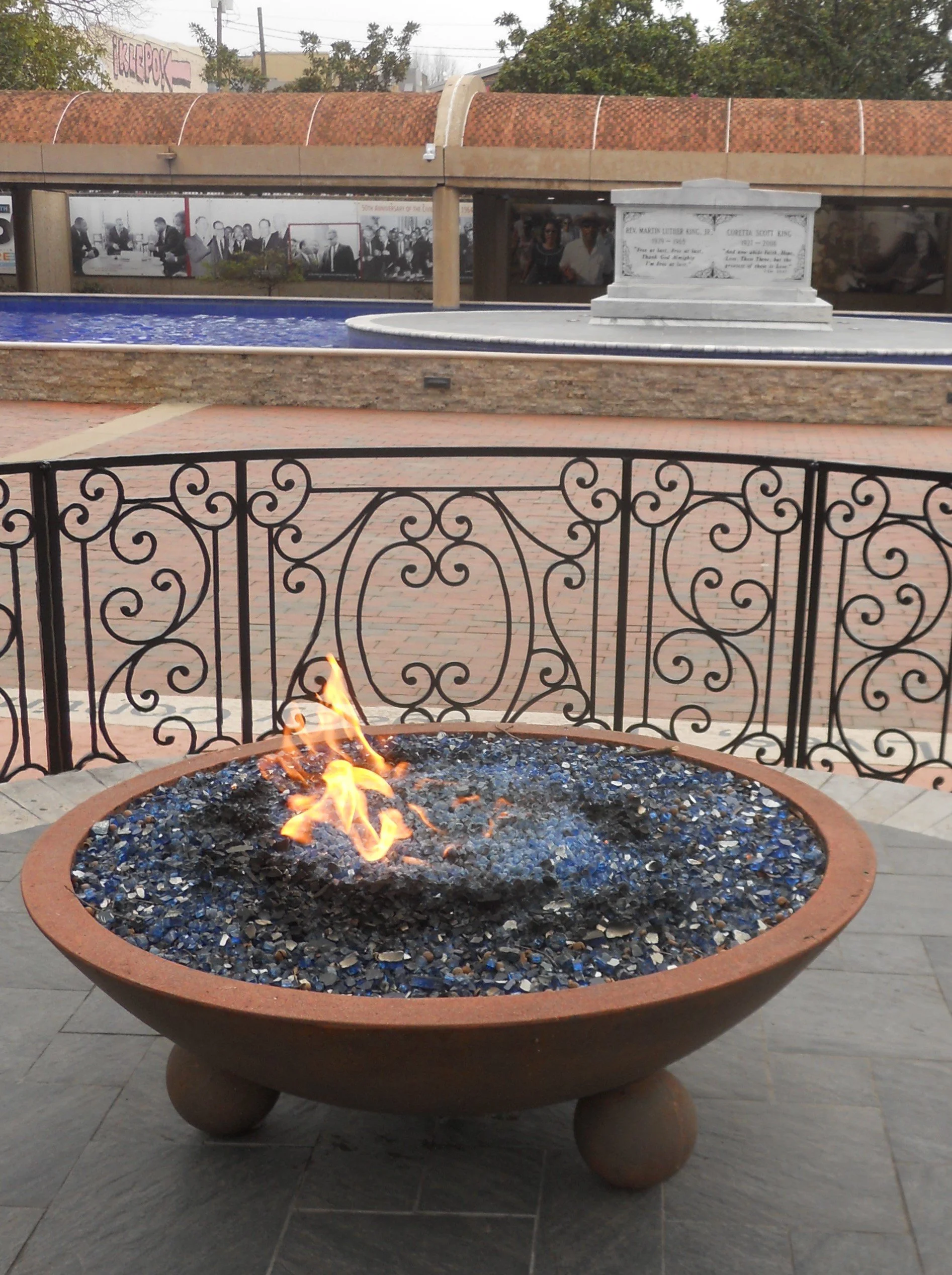
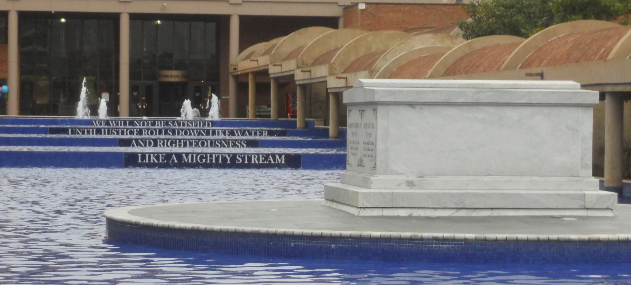
Across the street from the VC is where Dr. King and his wife, Coretta Scott King, have been laid to rest. An eternal flame flickers close by, symbolizing hope will never die.
“We will not be satisfied until Justice rolls down like water and Righteous like a mighty stream.”

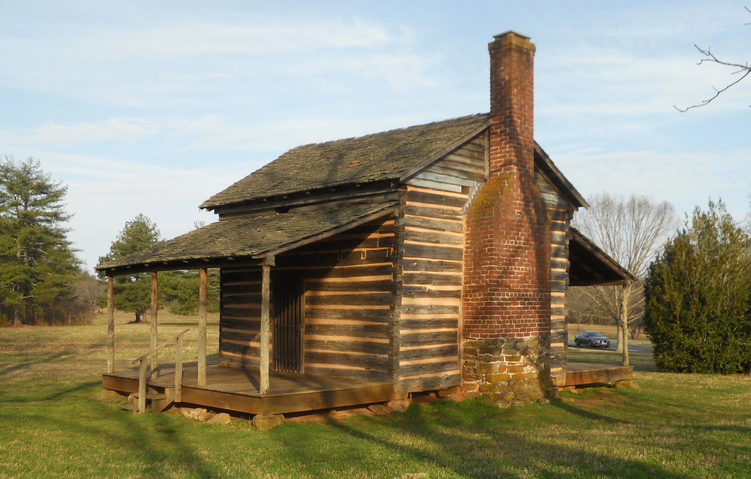
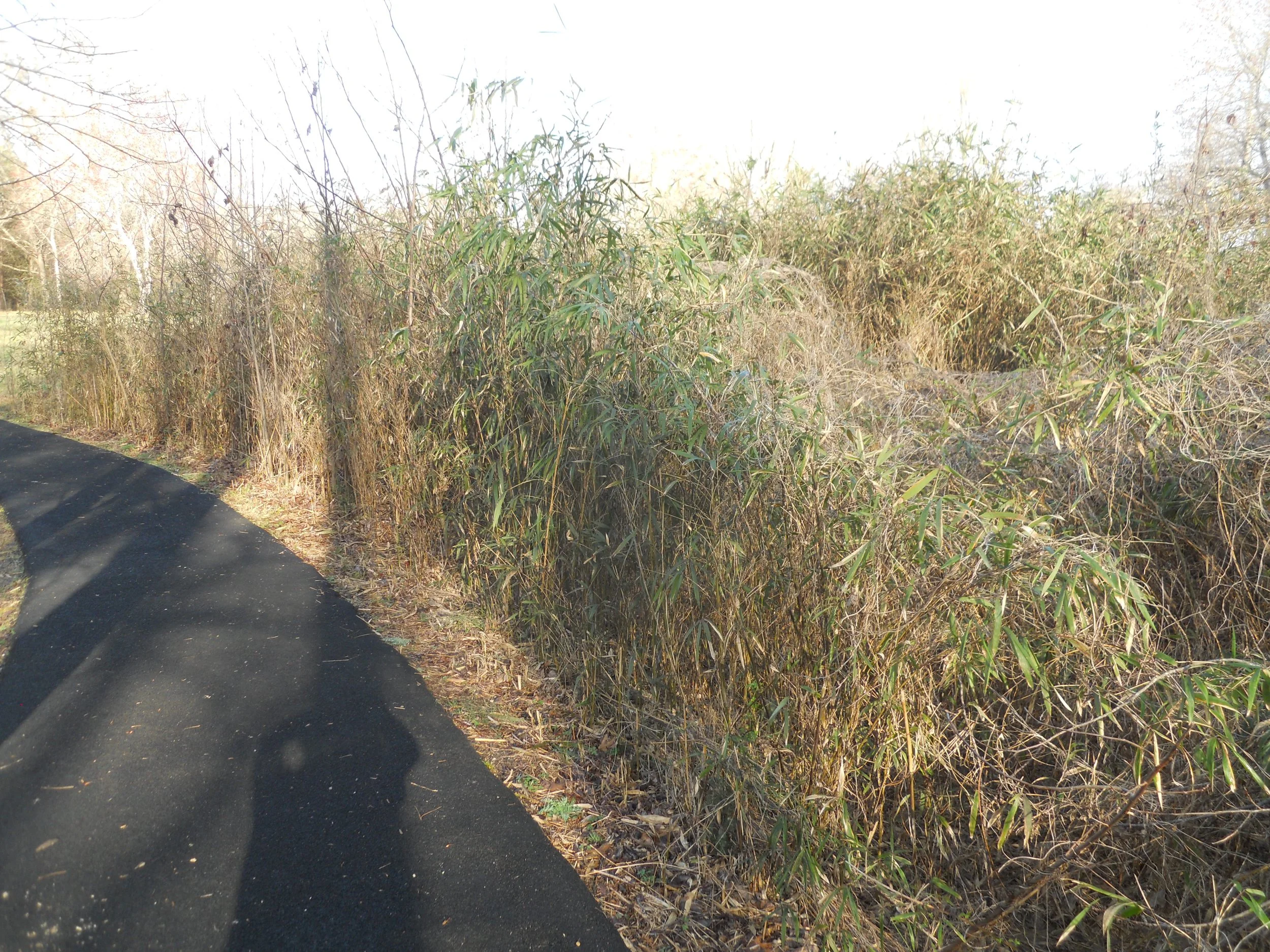
DAY 3 (February 24) - Cowpens NB proved a “double envelopment” tactic could win on the battlefield. This is one of the few instances in the history of war. General Morgan devastated the regular British army in this turning point of the Revolutionary War. After the war, Robert Scruggs built this log home on the land which 50 years earlier had seen bloodshed. The house and battle were on the Green River Road (photo shows the direction the British looked to see the Continental Army). The NPS is trying to restore Rivercane (photo) to the area. This is a bamboo plant. Rivercane ran down both sides of the road, such that the British had no place to run when the American’s finally attacked. A large monument is near the VC, honoring the men who fought here.
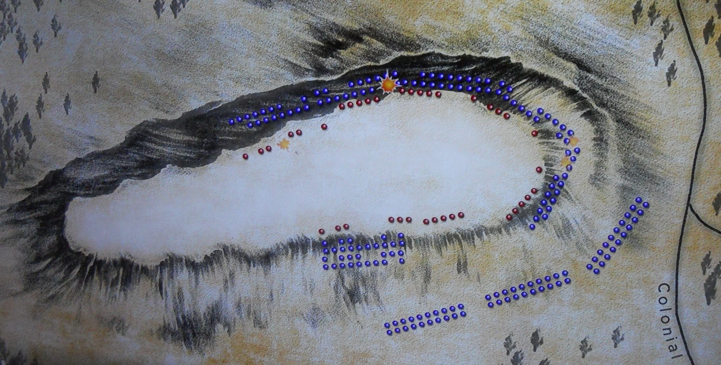
Kings Mountain NMP saw a force of Patriots from four colonies repel multiple downhill bayonet charges, then advance behind the cover of trees to the ridge of Kings Mountain to gain a much-needed victory in the Southern Campaign.
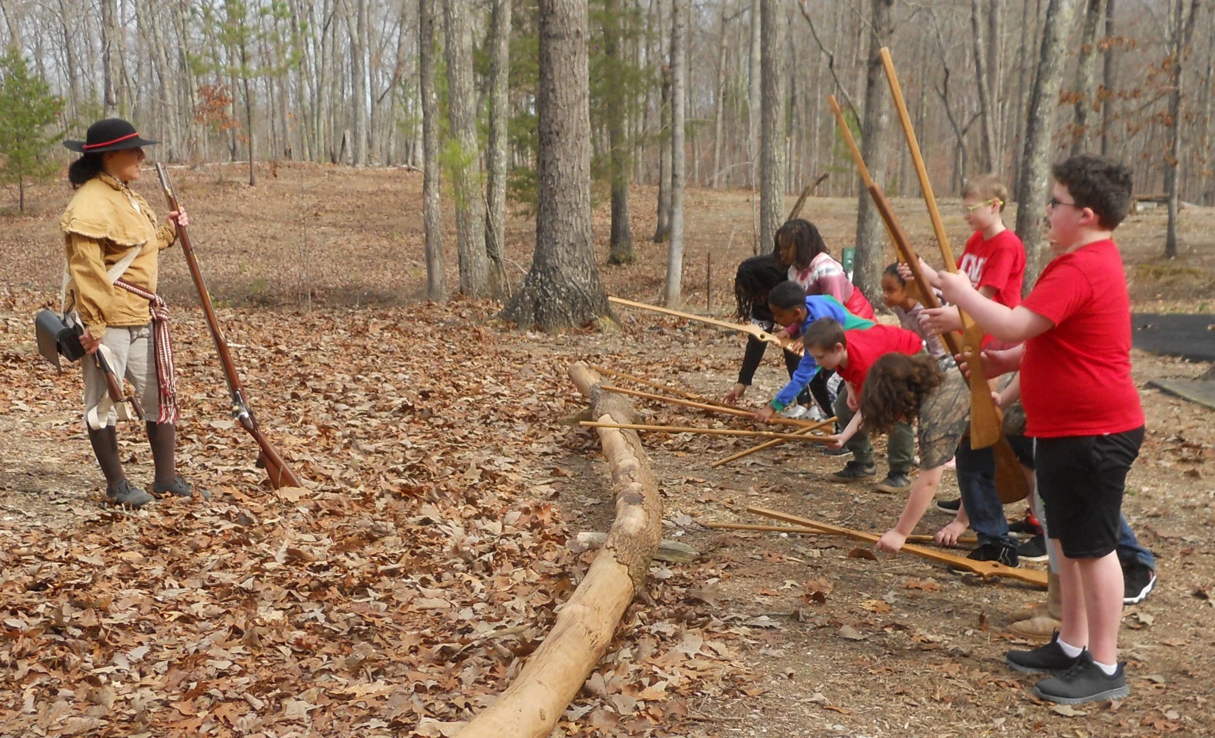
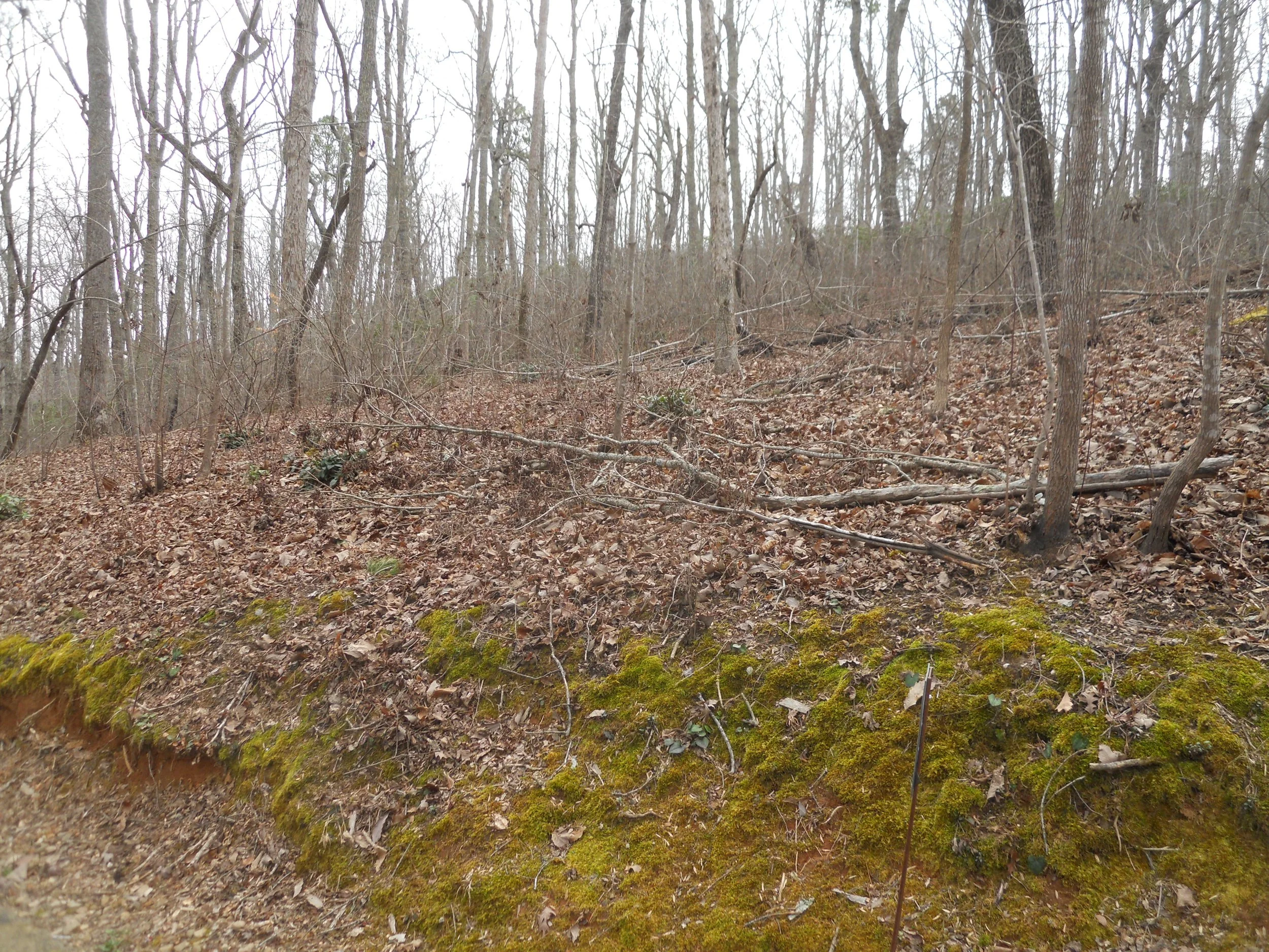
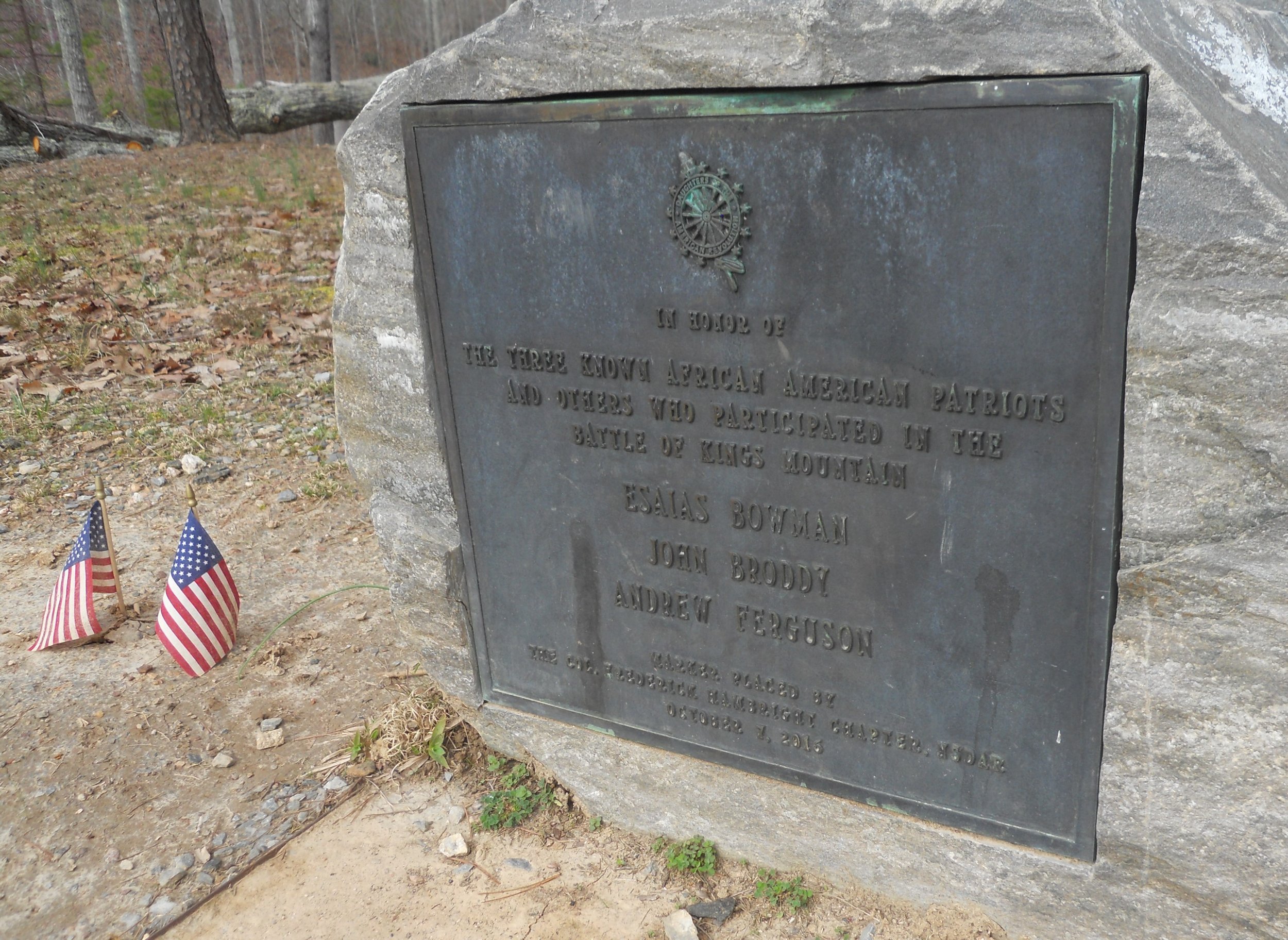
Ranger Katherine, dressed in the mountain man’s garb, was instructing a group of youngsters in the art of flintlock rifle use. Thankfully, the kids had wooden sticks. Only Katherine had a live rifle, which she discharged to the delight of the crowd. This park had a visual displayed which sequenced the battle’s events. The blue dots are the Patriots, with the red dots on top of the mountain being the British. The one photo is the view the South Carolina militia had for their uphill assault. The mountain itself has not changed in 240 years, though every tree seen today was not here then. One plaque lists the names of the three known African-American Patriots who heroically fought that day. The one photo is on the mountain ridge line, looking at the point where the Patriots first reached the top. A tall monument marks the spot. By the way, the path is made of recycled rubber… the NPS does try to help conservation.
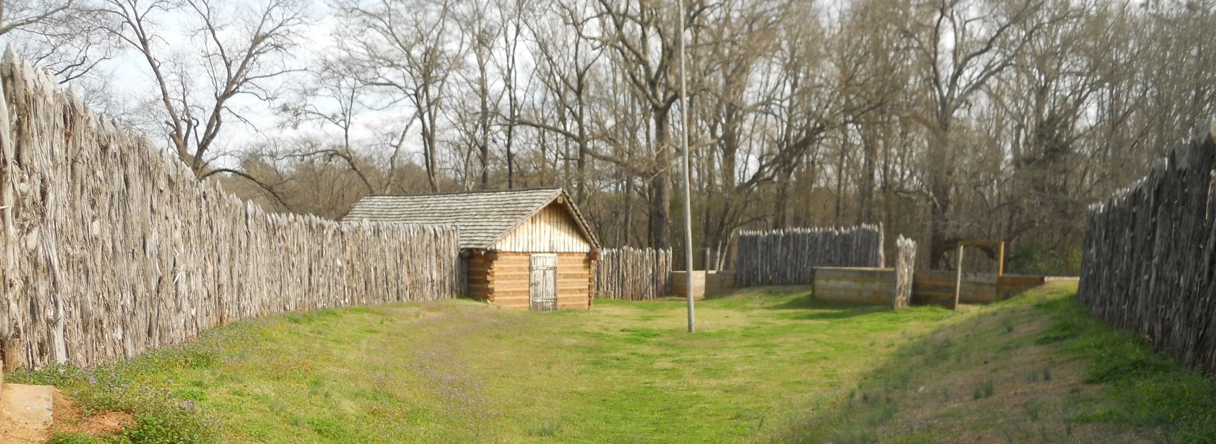
Ninety-Six NHS’s main attraction is the earthen Star Fort. It is 100% original. Not easy to get a photo since there is no means to go vertical. A replica of the “tower” which General Greene’s men built (in one night), as well as a cannon, are situated near the fort (the tallest green ridge towards the back is the top of the Star Fort… the roped area protects the underground mine which the Patriots had built to try and blow an opening in the fort). Sharpshooters would be positioned in the tower, so they could look down into the fort and pick off Loyalists. The Loyalists replied by adding more sandbags to the top of their earthen fort, and by trying to burn down the tower with heated cannon balls. That was not successful. A 1977 painting in the VC by Robert Wilson shows the various tactics used during the failed assaults on the fort, which led to the 28-day siege (the longest of the War). Near the Star Fort was a stockade (photo). Light Horse Harry Lee commanded a group to secure the small fort. Even though he was successful, with Greene eventually giving up the siege, this fort reverted back to the Loyalists.
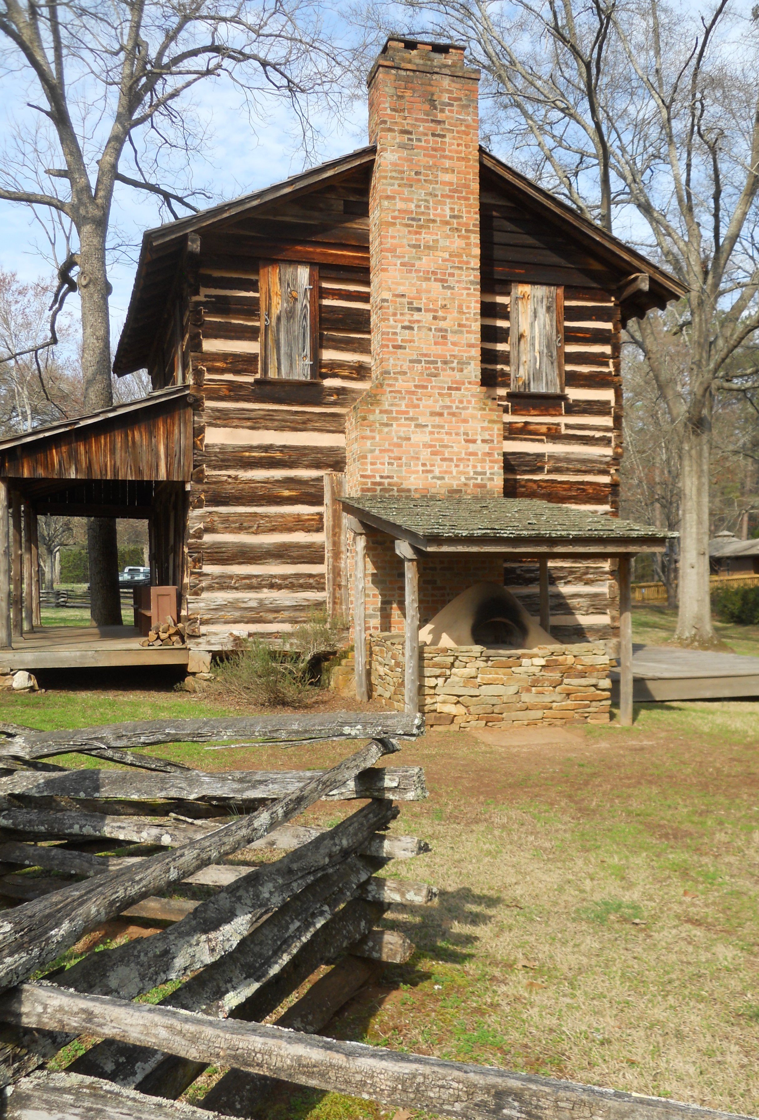
Also on the park grounds is Andrew Logan’s log home, built in the 1700’s in nearby Greenwood. It is extremely rare to find a 250-years old log home in such pristine condition.
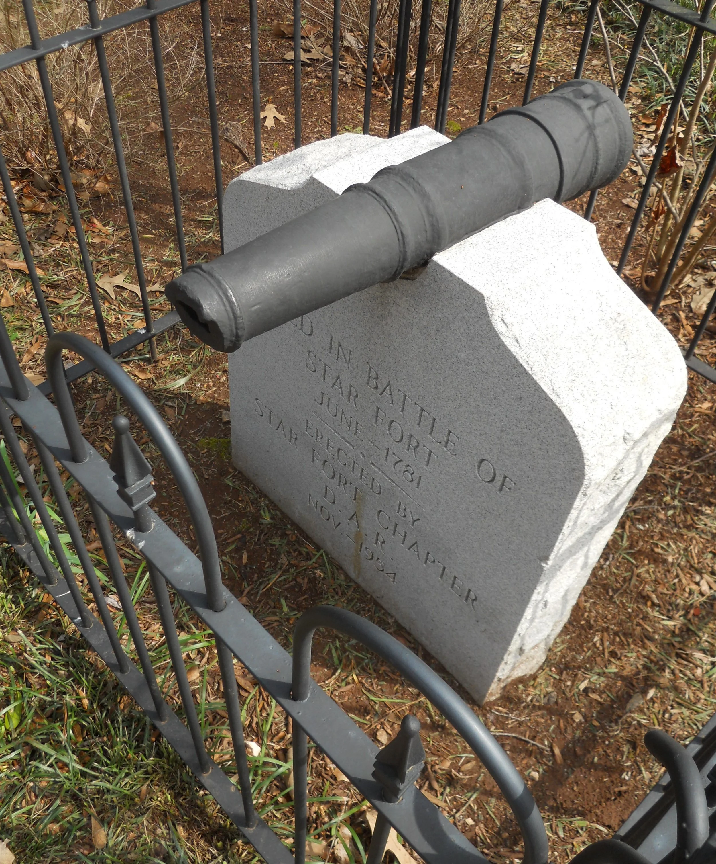
And lastly, the small cannon on the top of the white marker was used in the battle. It was recovered from the Star Fort. If that is not history staring you in the face, I do not know what would be.


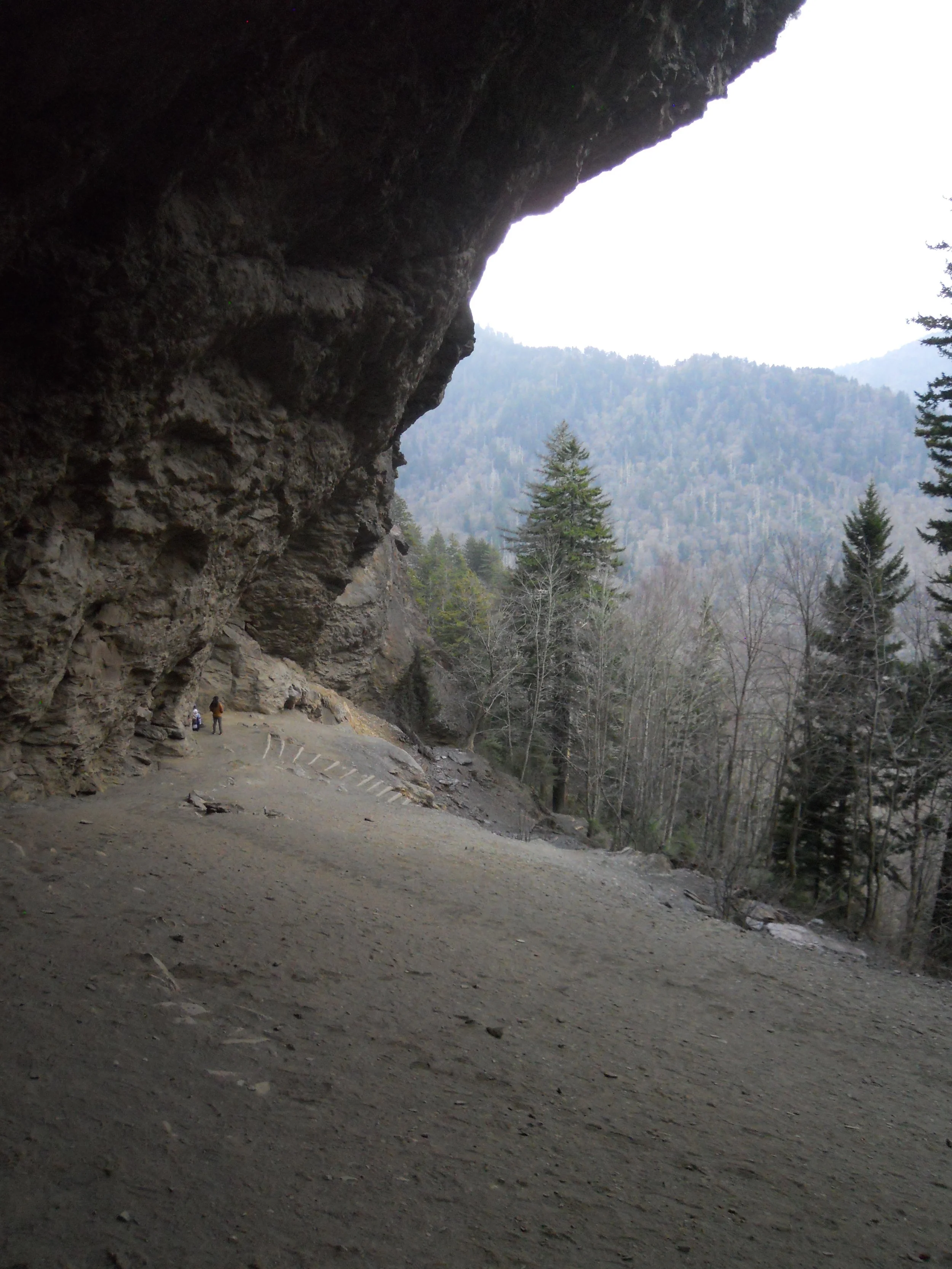
DAY 2 (February 23) - The internet connection from the hotel is very poor, so not able to load any more photos. Will do so once able. Anyone who is okay with a 1,200-foot climb over 2.3 miles should take the Alum Cave Trail. in Great Smoky Mtns NP. This park has more rhododendrons than I have ever seen, and many already have buds. Ohio has to wait until May to see buds.
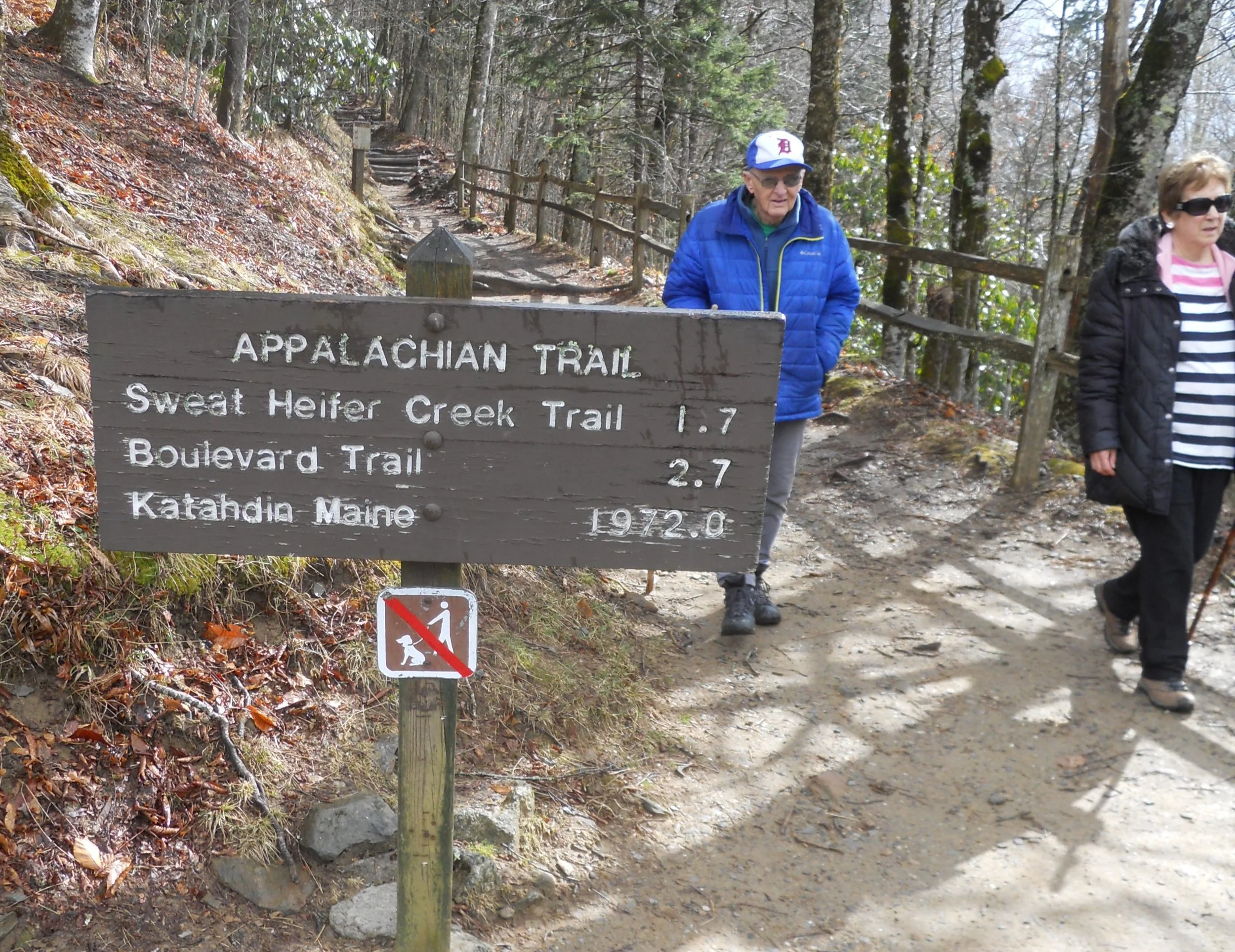
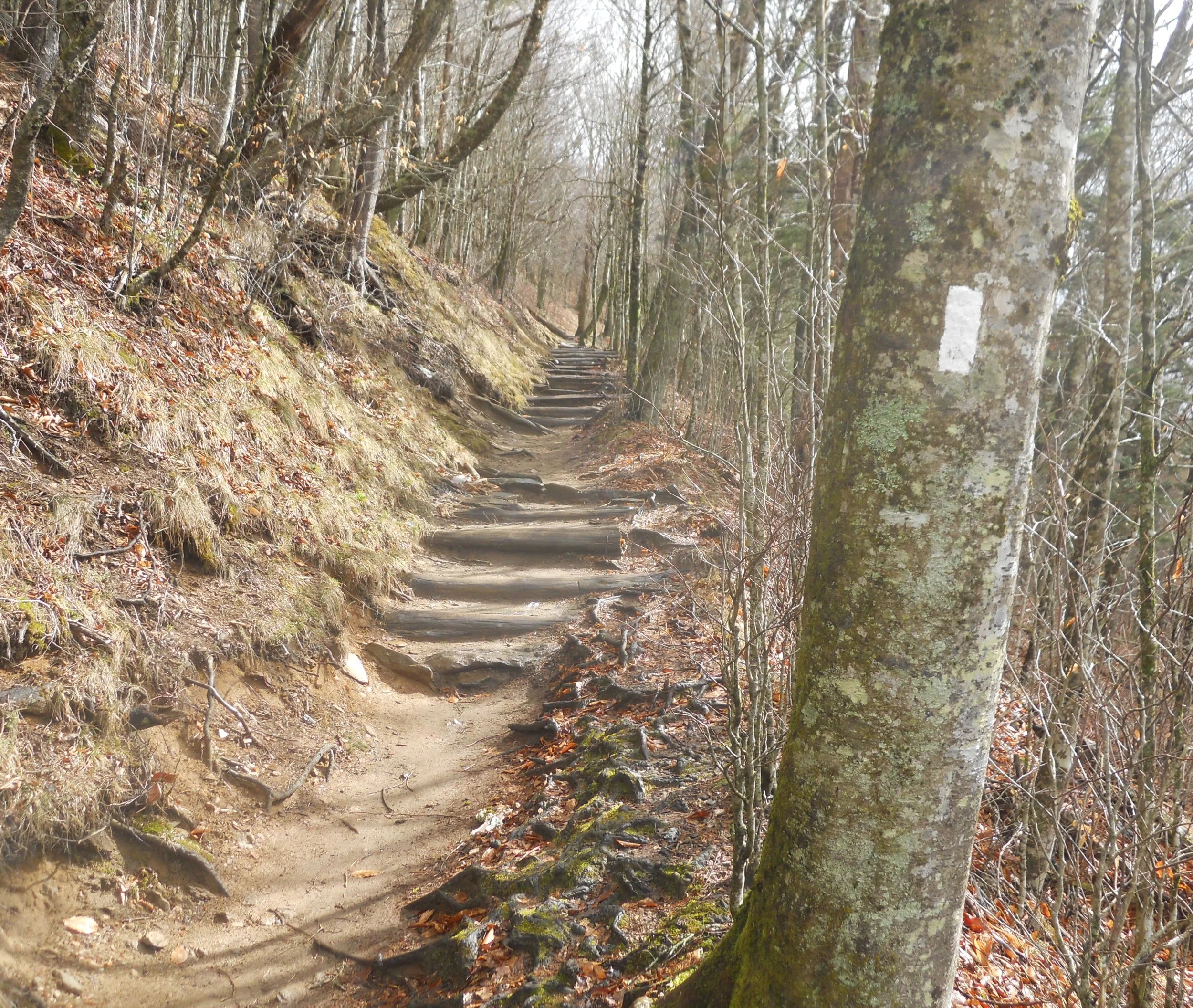
The Newfound Gap section of The AT was my first crossing of this iconic trail for this Quest. There will be many more encounters, since the trail runs through 14 states, and near many NPS parks. A couple were coming up on the sign which said “1,972 miles Katahdin” and another person asked if they had come that far. A few laughs all around, though some people have achieved this feat, one being the husband of my wife’s cousin Cheryl, Paul. Kudos to all those who made the trek. Keep looking for the white paint blaze marks, that is the trail. The AT crosses US441 at this point, to get from one side of the ridge to the other.
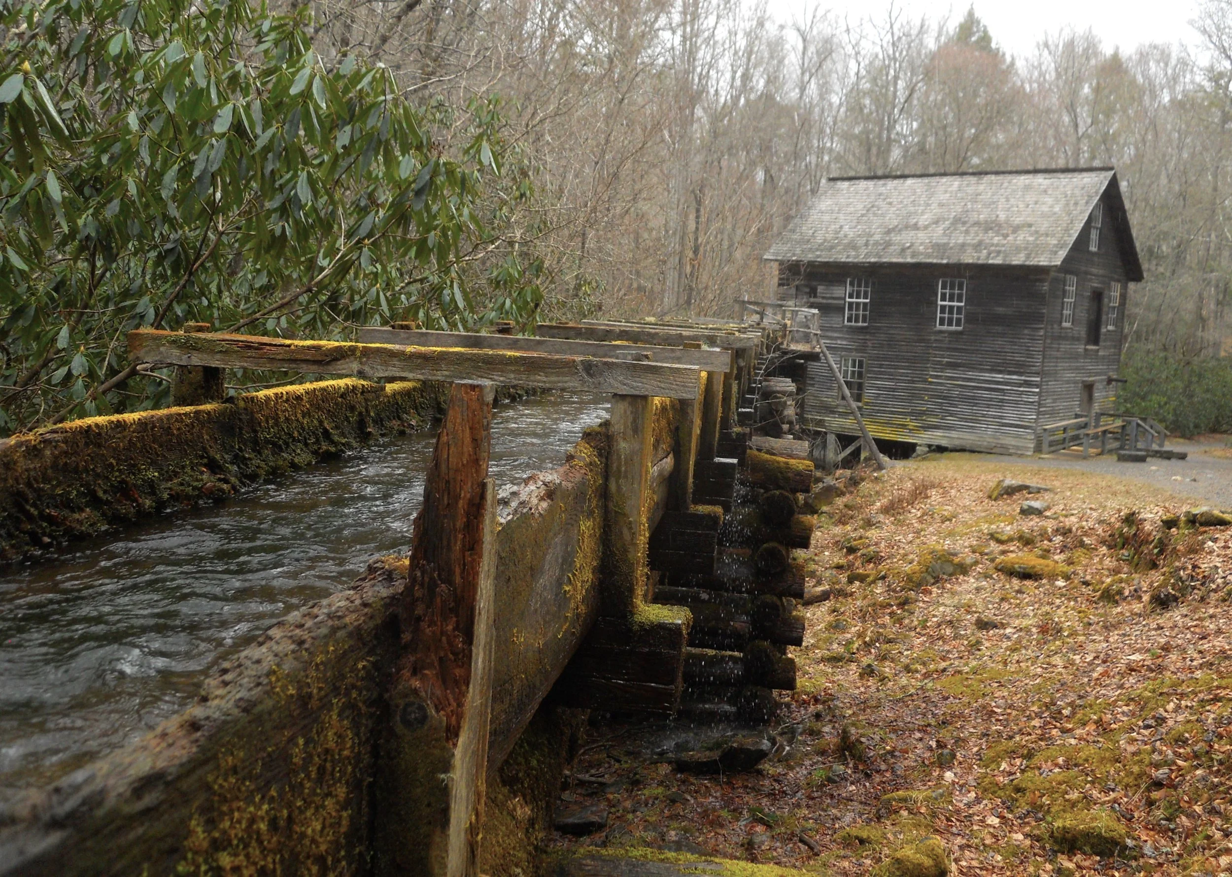
Further down US441, before exiting the park, was Mingus Mill. The 200-foot long wood flume brought a lot of water to this gristmill, the largest in the Smokies. The entire region revolved around corn and cornmeal. The Mingus family provided a great service.
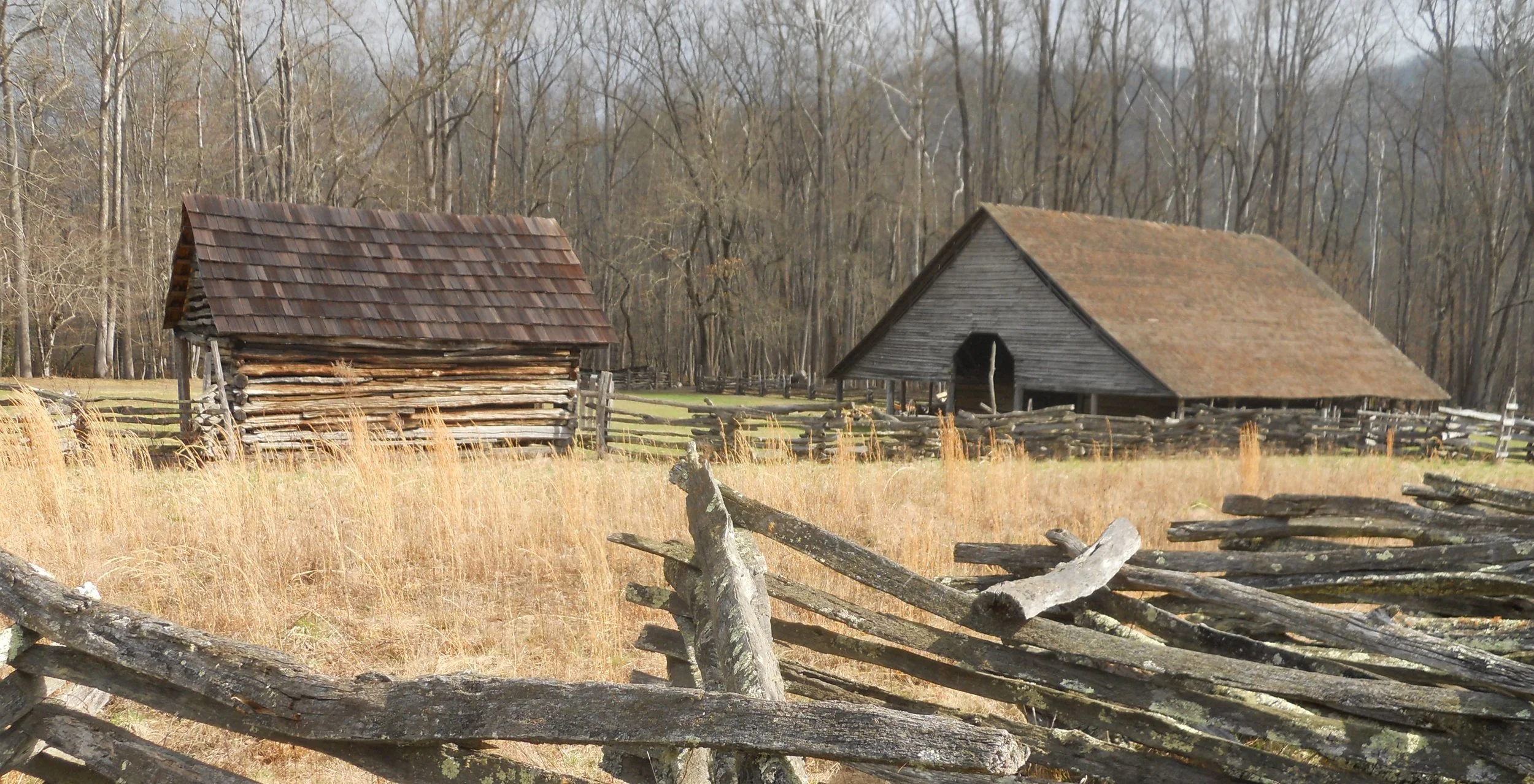
Also at the park entrance/exit was the Mountain Farm Museum. The one photo is of a corn bin and low-slung roof barn.
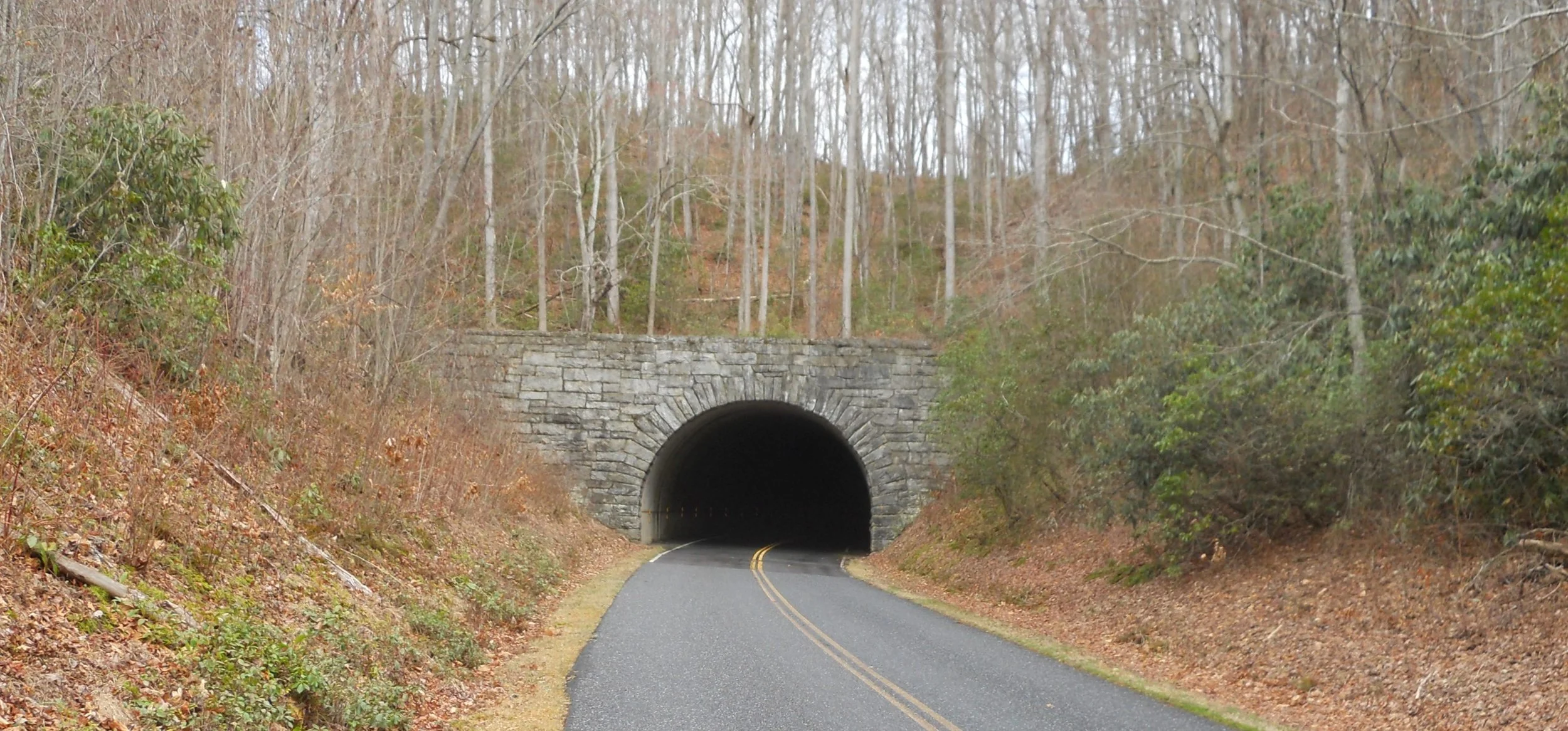
500 yards to the east was the southern terminus for the Blue Ridge Parkway. Three tunnels were blasted into existence to complete the road. The one photo is the Rattlesnake Mountain Tunnel. The olde south has the Natchez Parkway, and VA/NC have the Blue Ridge Parkway. If one is not rushed for time, these roads are worth the drive.
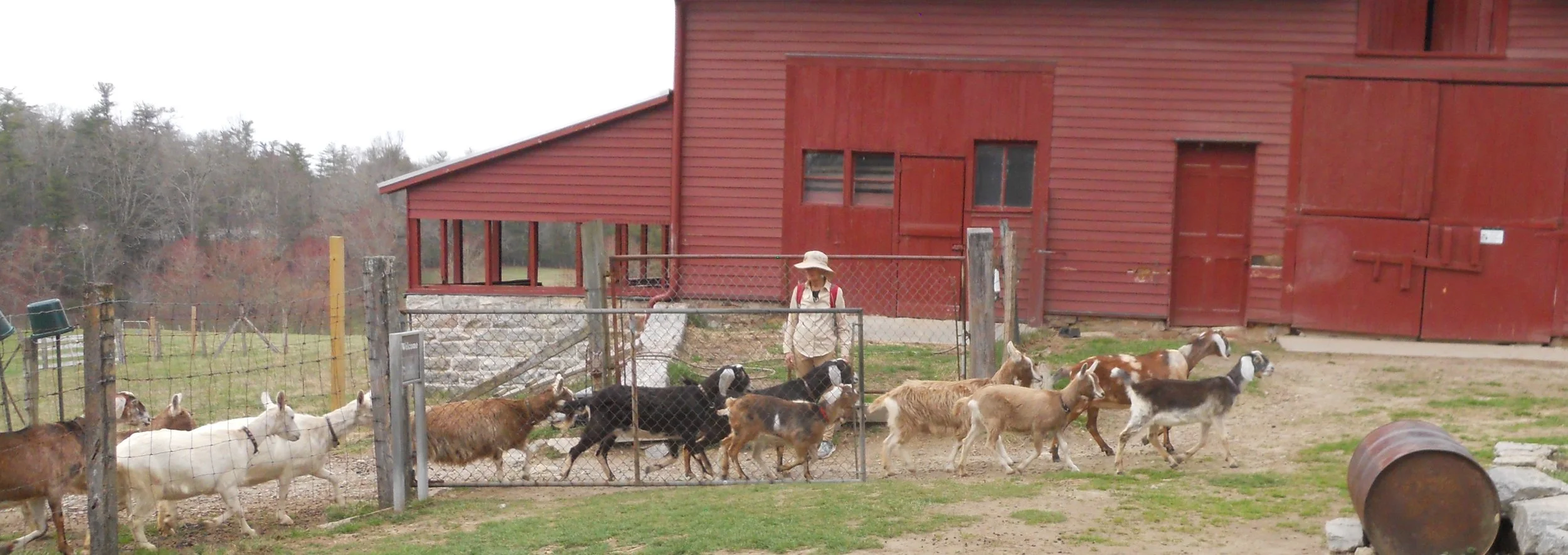
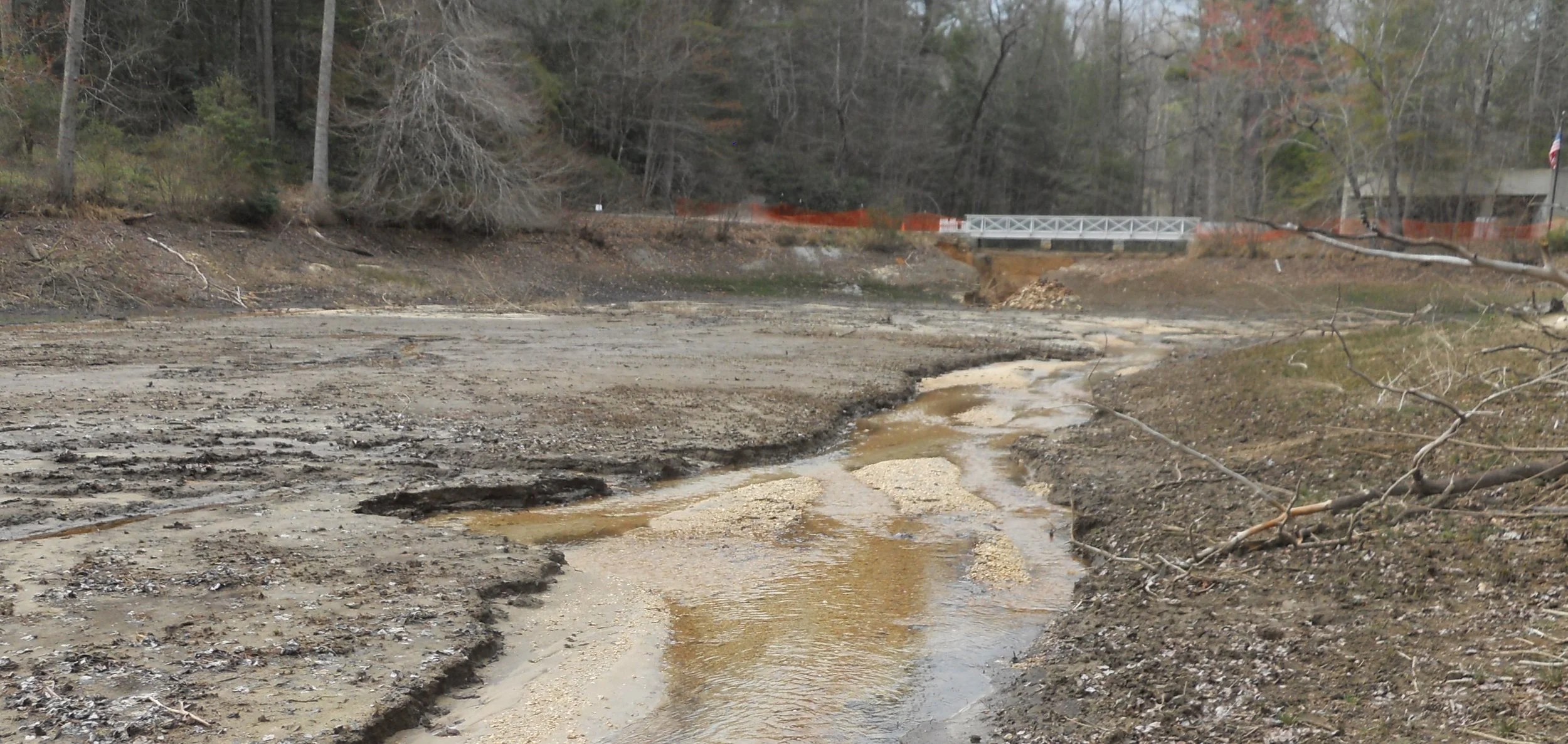
Carl Sandburg was the “poet of the people”. His home and farm are open to the public. His wife kept a herd of 15 milking goats. The NPS continues that tradition. Visitors can pet today’s goats and watch them run at 3 PM to their afternoon feeding. For those who have been to this park, and remember the lake at the bottom of the hill, it is no longer there. The dam broke two years ago. NPS does not know when it will be fixed. The breech is under the white bridge.
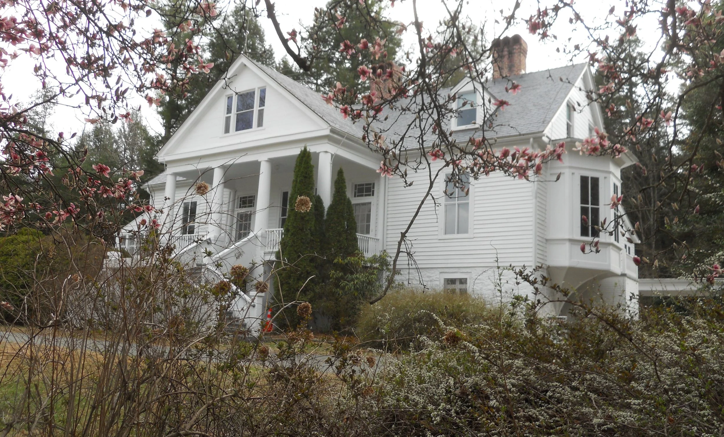
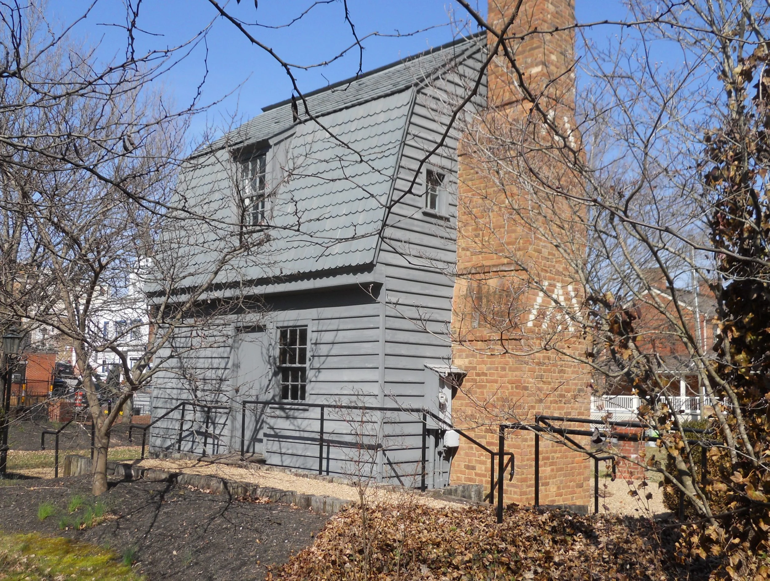
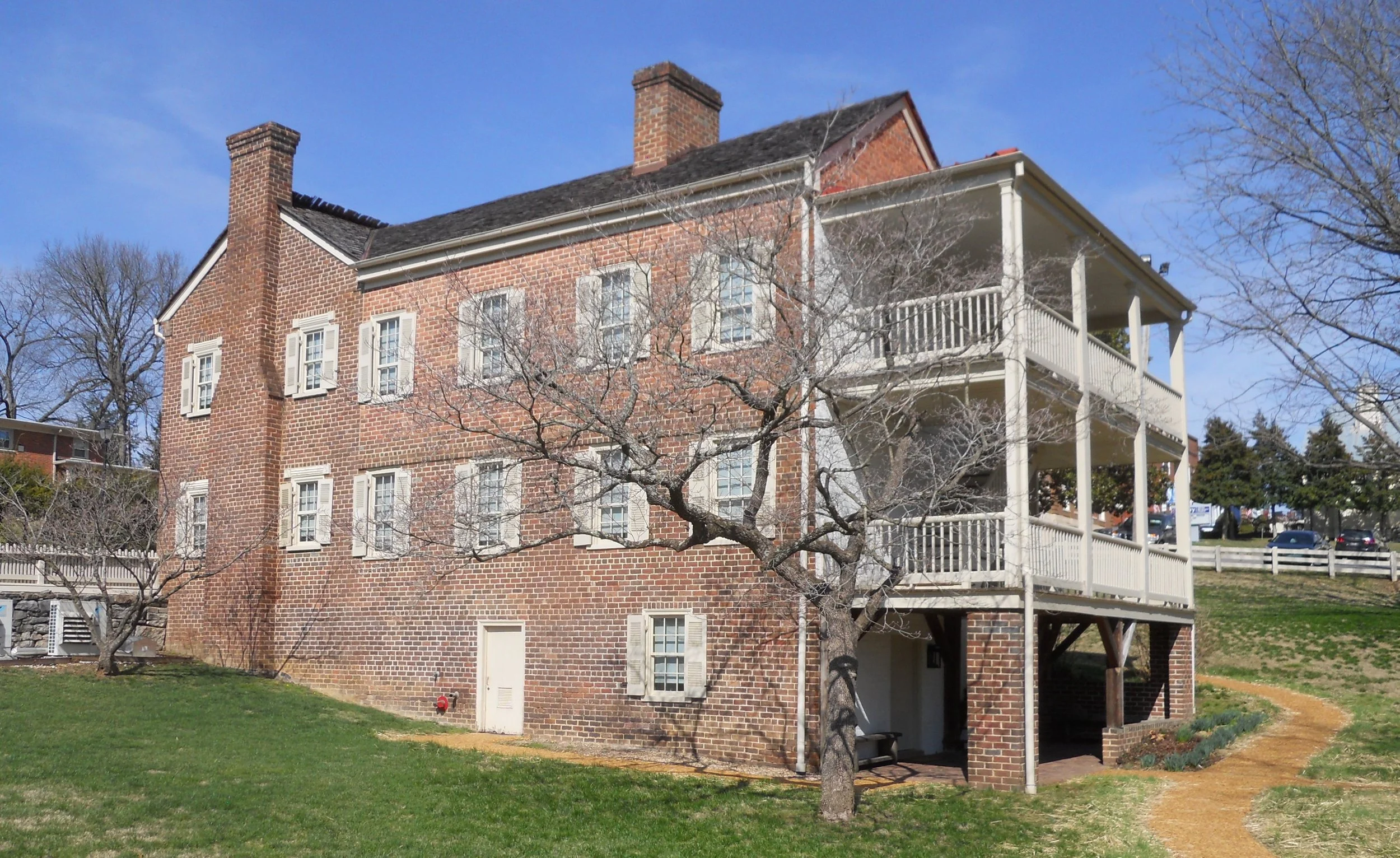
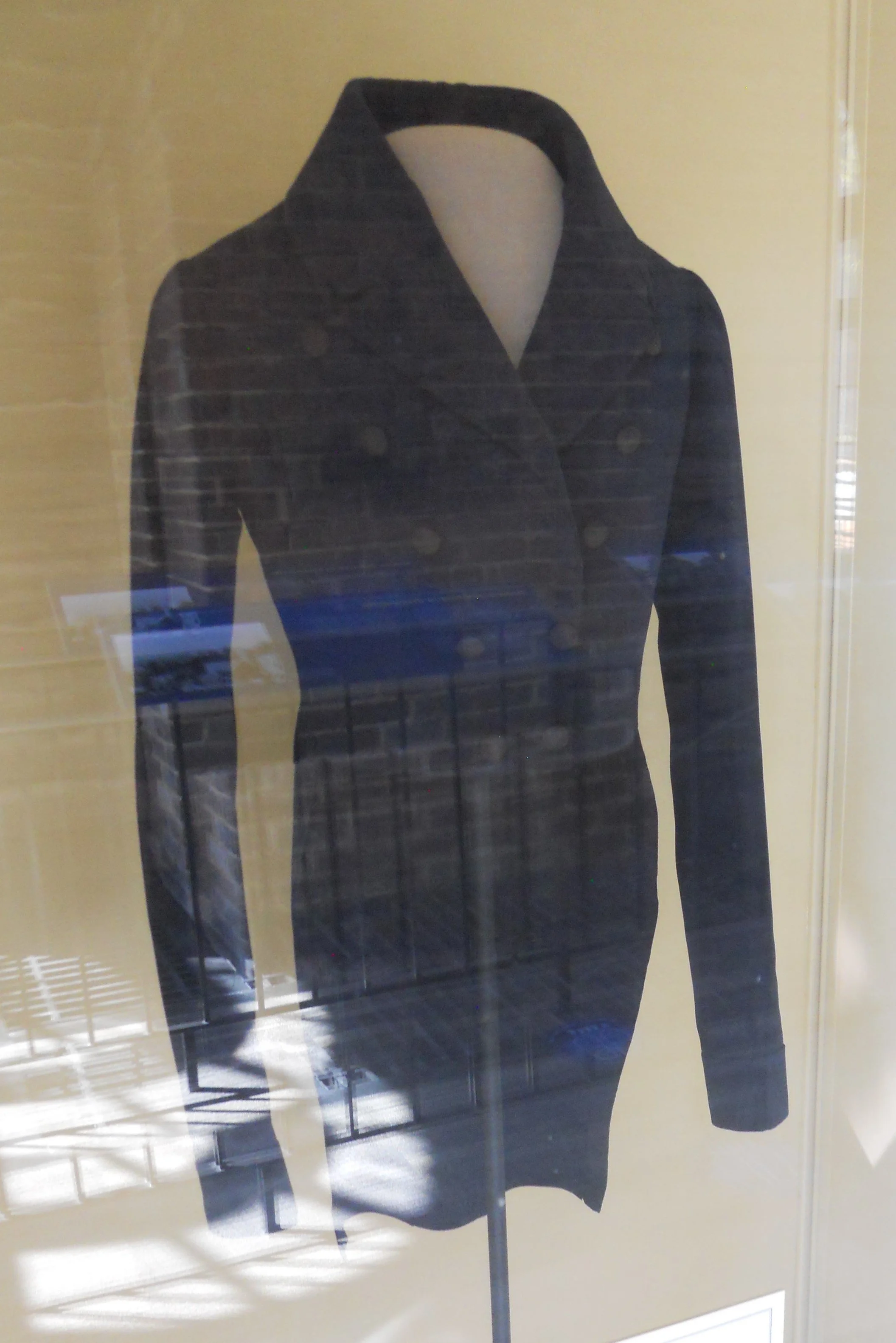
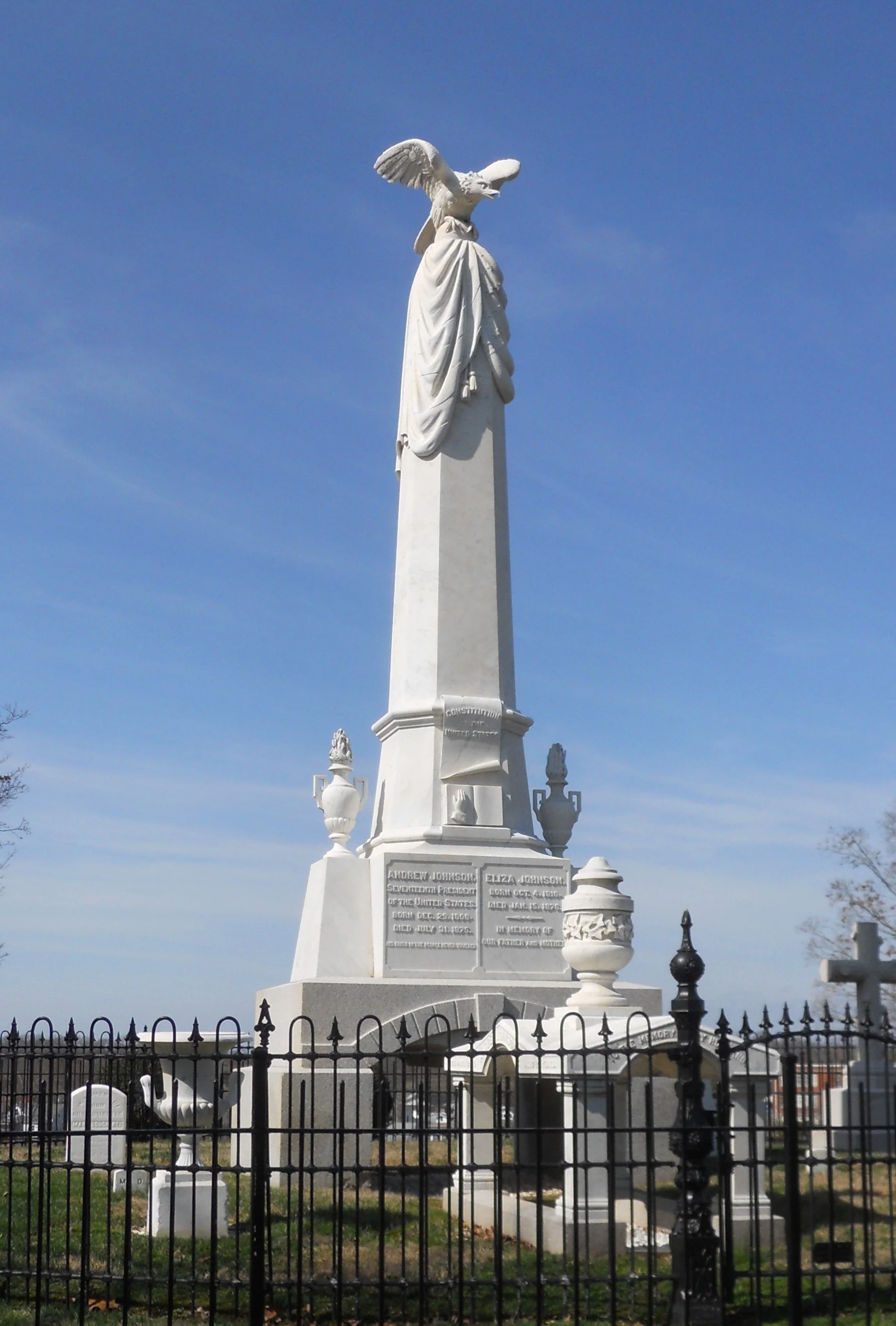
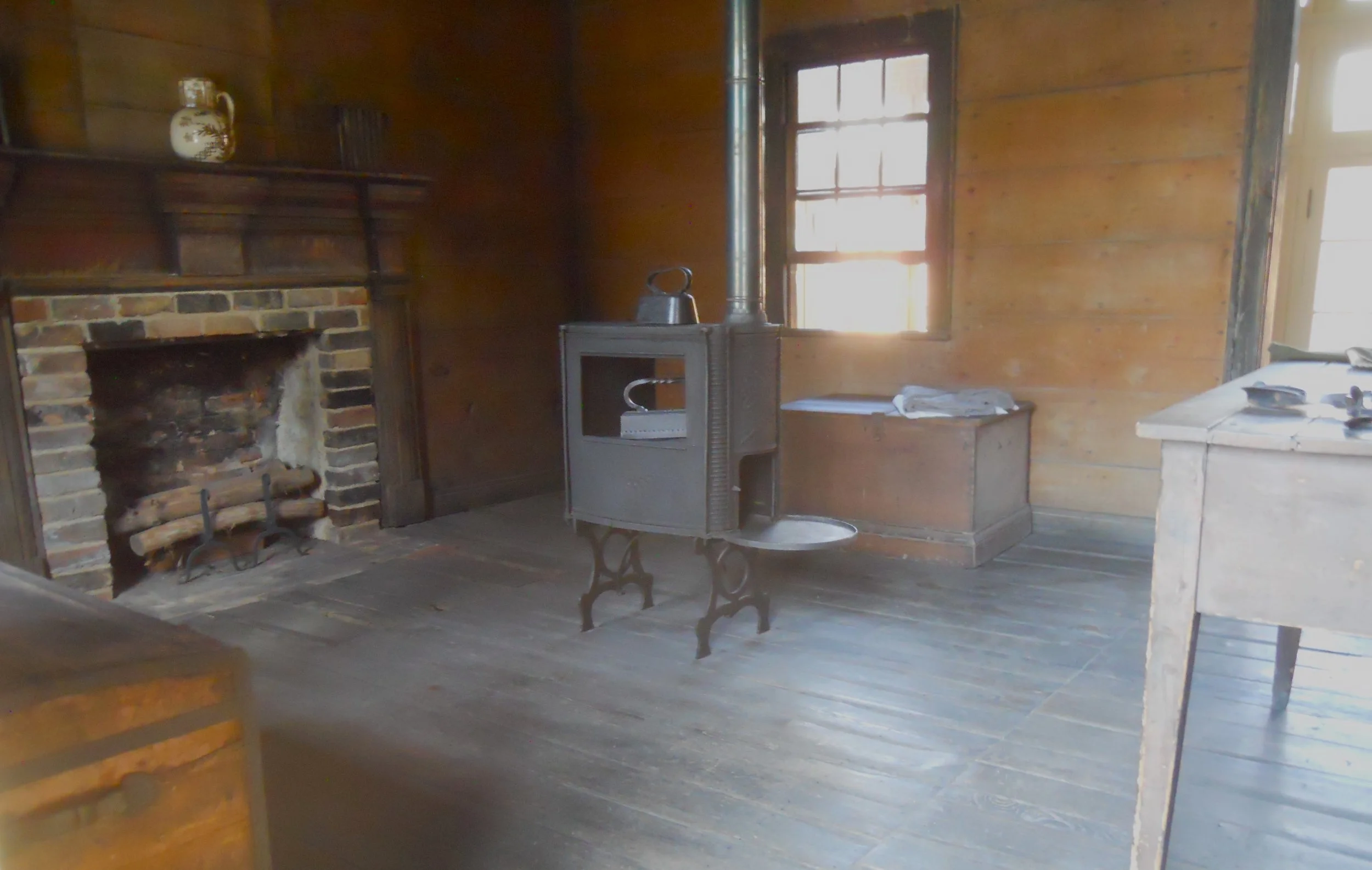
DAY 1 (February 22) - Andrew Johnson was born in Raleigh, NC. A reproduction of his birth home is across the street from the park’s VC (the gray structure). The VC houses the log structure which was Johnson’s tailor business. Some of the equipment he used is shown (photo). A formal wedding coat which Johnson created is in a glass display case next to the building. What talents some of our U.S. Presidents had. The photo of the large house is where three generations of Johnsons called home. Johnson, his wife, and other members of the family are buried in the Andrew Johnson National Cemetery. The tall monument contains the U.S. Constitution, and Johnson was wrapped in a U.S. flag, per his wishes. He said that everything he did in his political career was dedicated to upholding the Constitution.
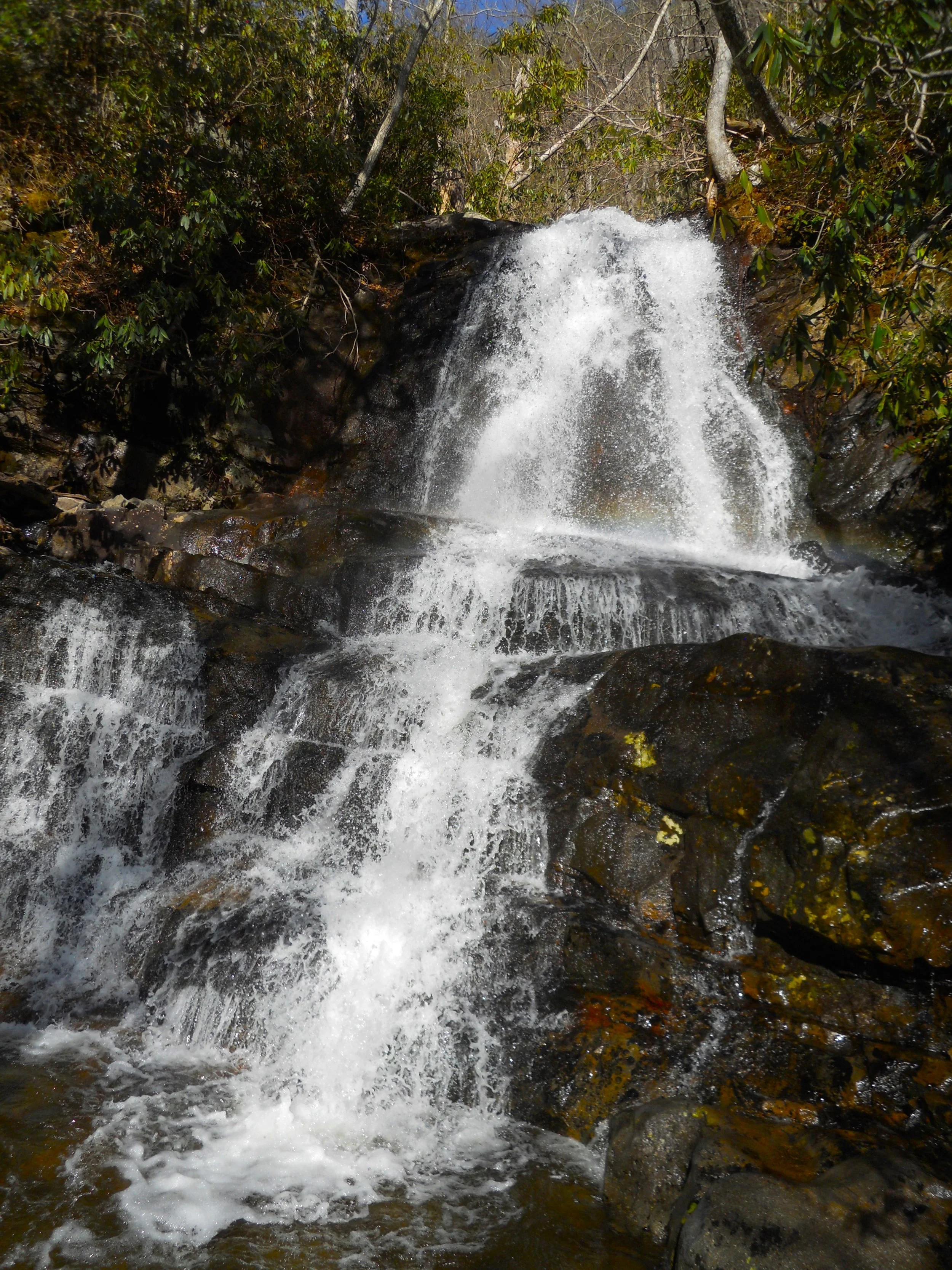
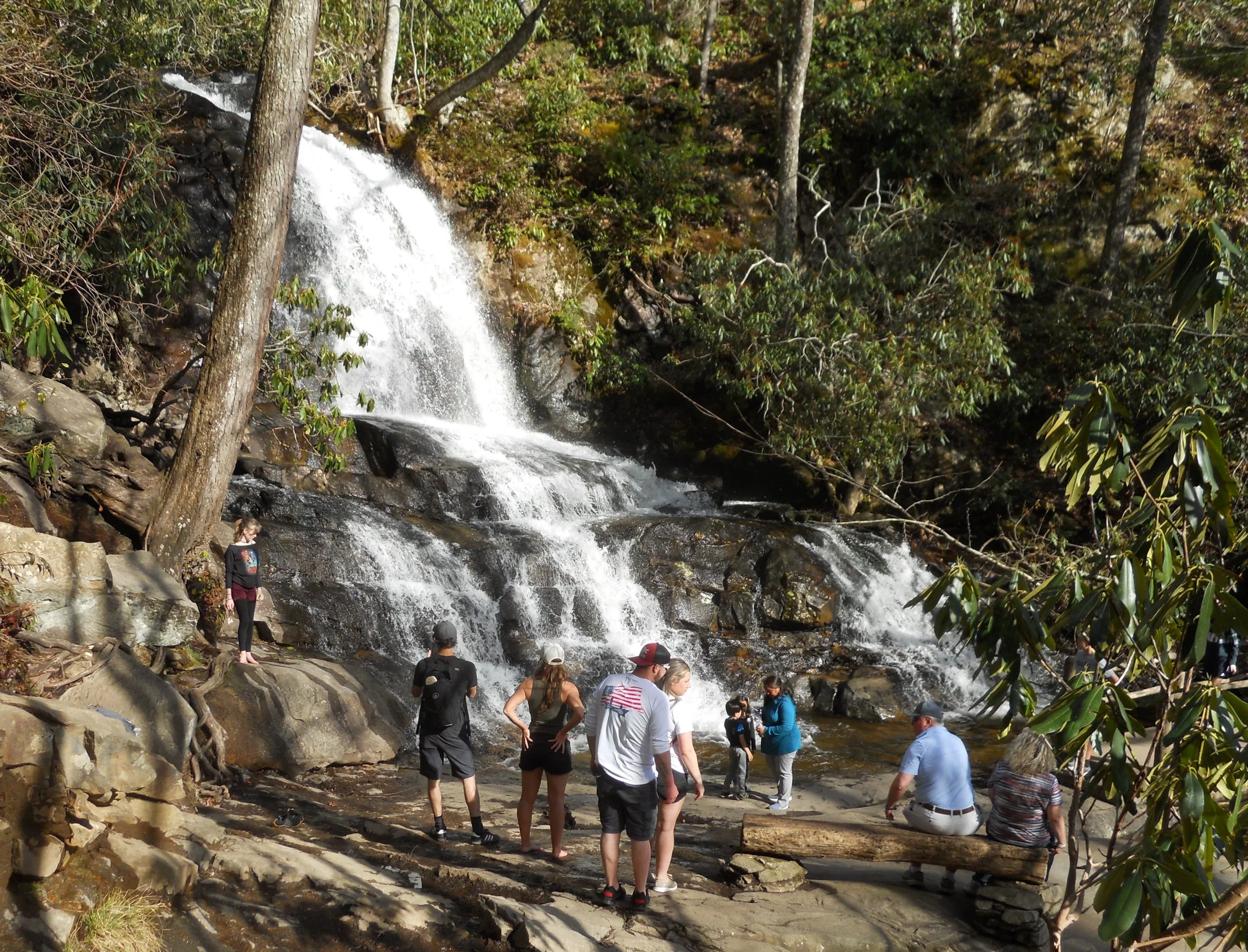
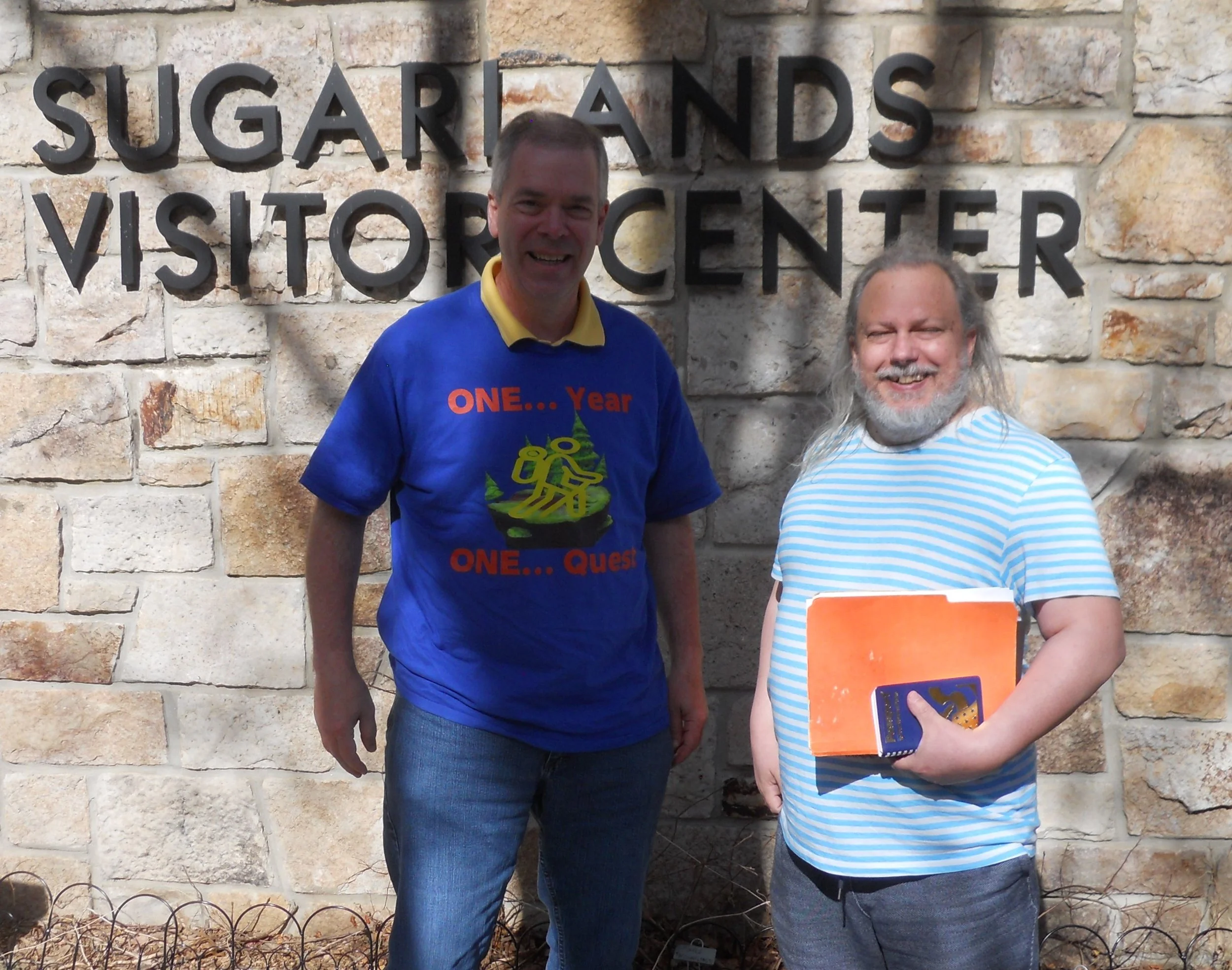
The 2.6-mile roundtrip hike to see 80-foot tall Laurel Falls in Great Smoky Mountains NP was worth the effort. Plenty of people were on the trail. Great to see so many folks enjoying a national park. Charlie, a fellow NPTC member, introduced himself (we all do not know each of the 3,000+ members) at the Sugarlands VC (the western entrance VC). He is one of the founding members going back 20+ years.
For those parks which have the “National Park” designation, Great Smoky NP has the distinction of being the most highly visited. This park does not give up its title, year after year being up to three times more visited than second place (in 2021 that was Zion NP). But we have to make sure everyone understands the counting. Golden Gate NRA takes the top spot for NPS “unit”. Just think of the thousands upon thousands of San Francisco Bay people who jog, walk, and drive through the Golden Gate NRA boundaries every day. Anyway, the key is not which park has the most visitors but rather that more people get out to visit all the parks.