photos and text coming in a couple of days for March 23… this wifi is the slowest I have ever seen.
Except this morning it is on high-octane.
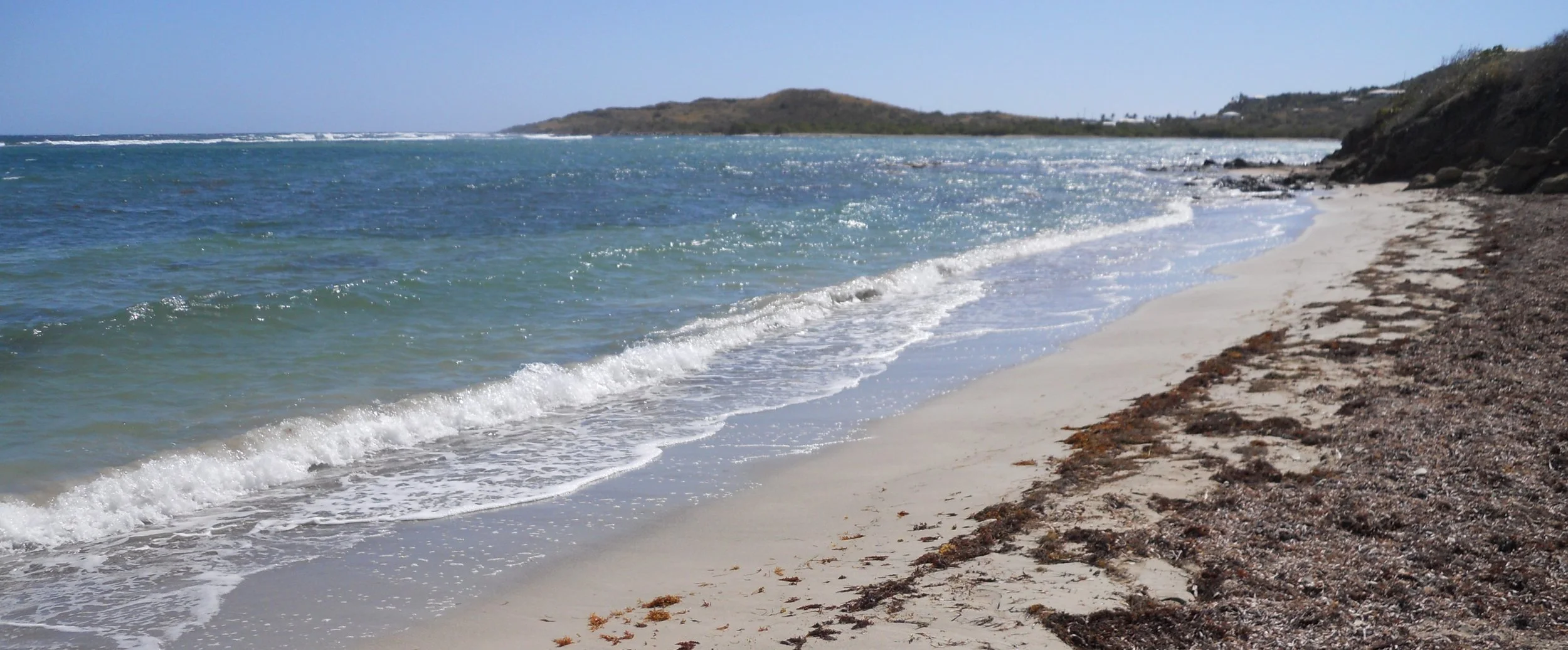
DAY 4 (March 23) - Salt River Bay is where Columbus made his second landing in the New World, in 1493. The photo is facing back towards the opening into the bay from the ocean. Archeologists have uncovered details which make them believe Columbus landed in the spot where I am standing.
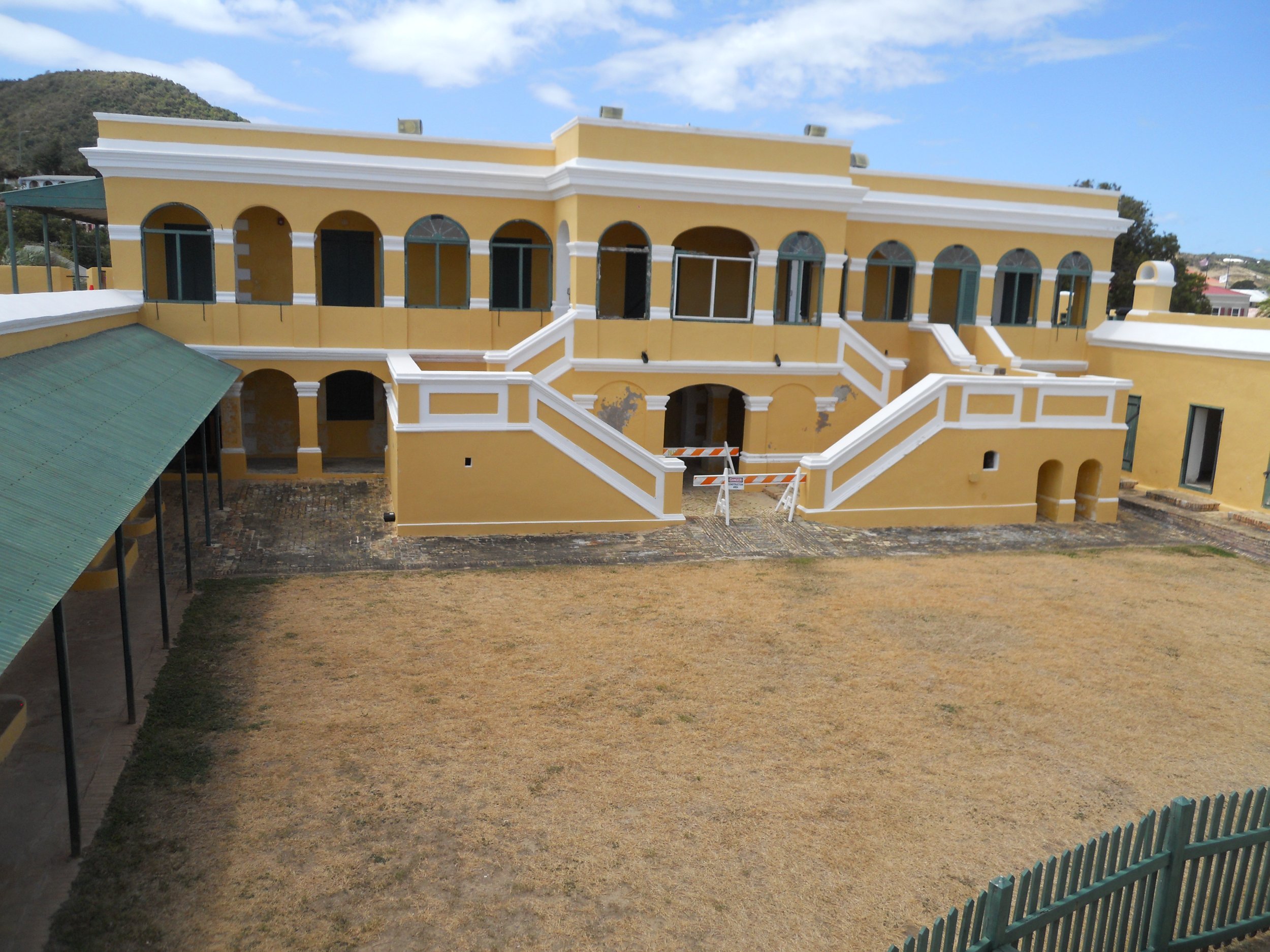
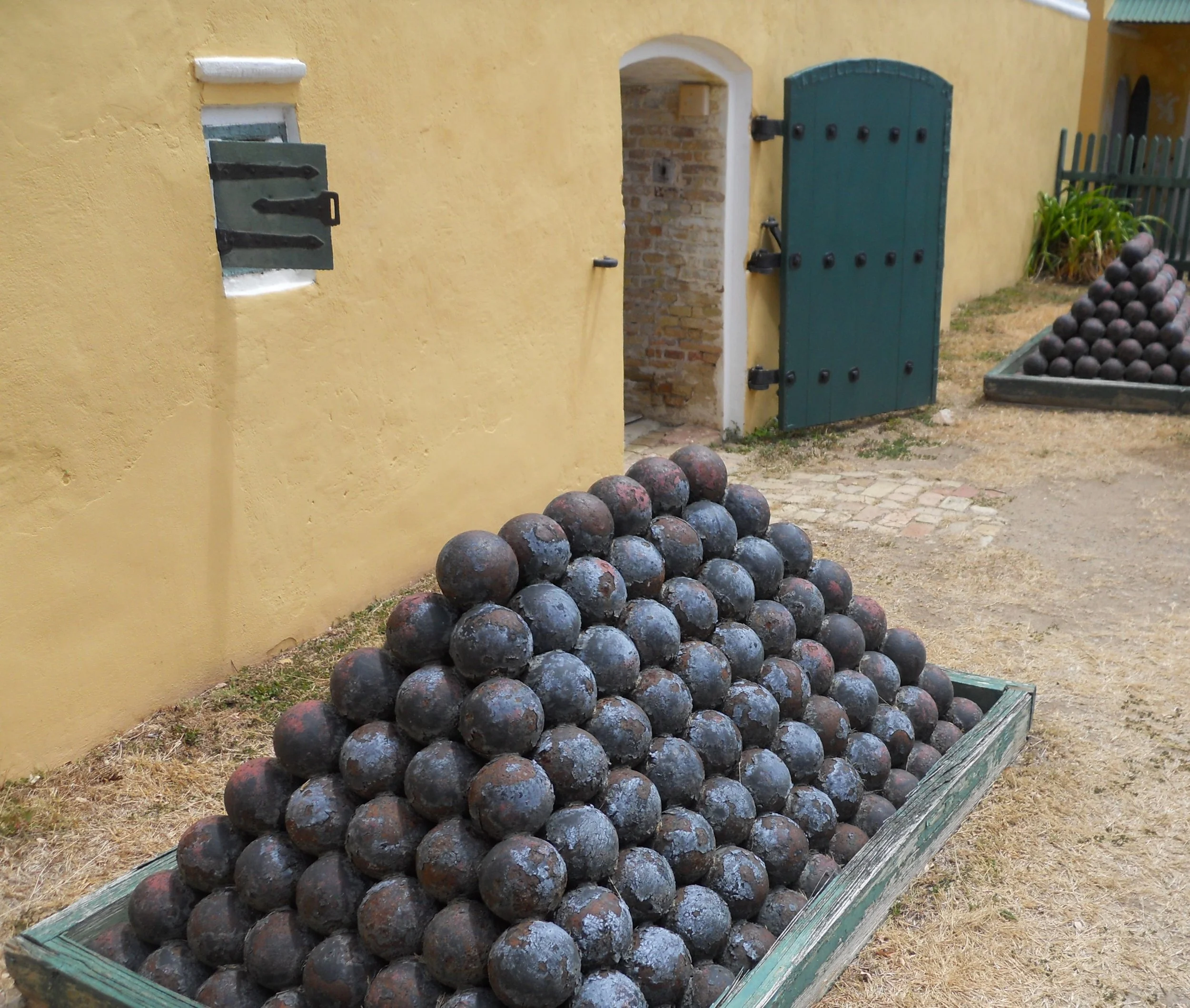
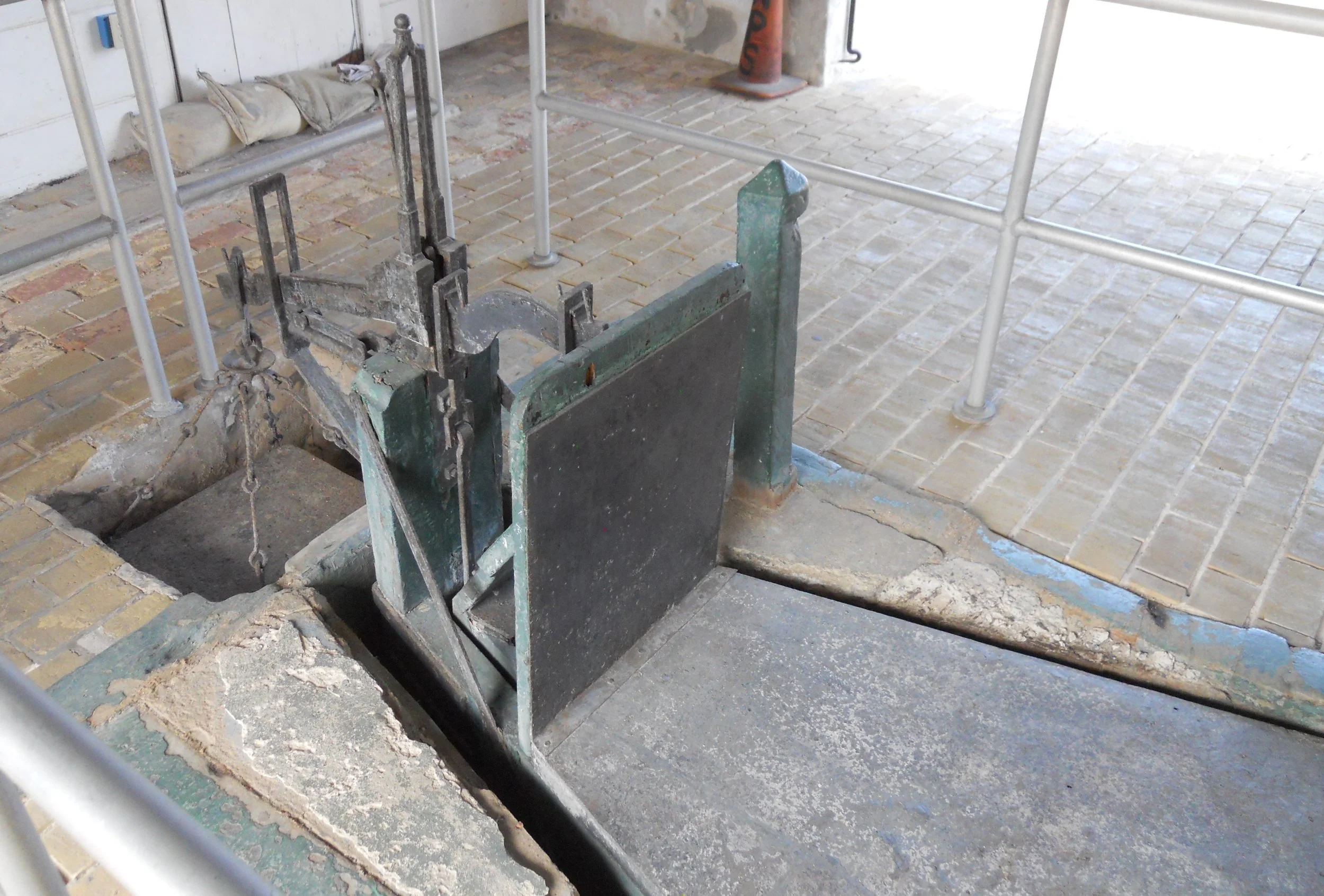
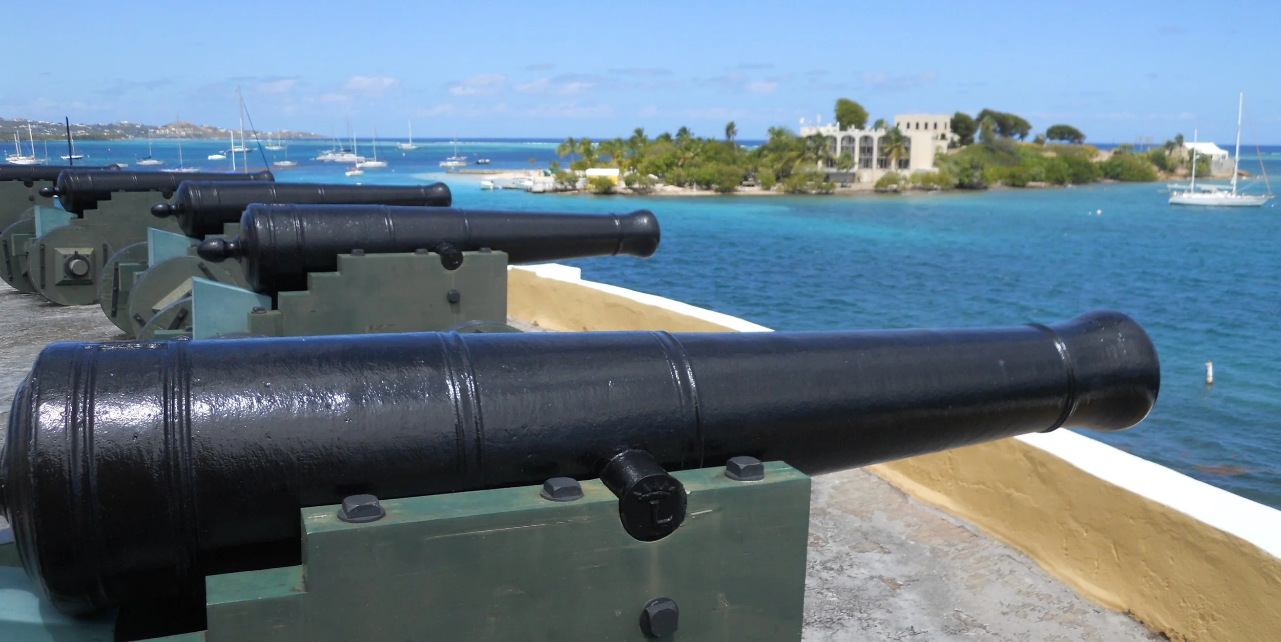
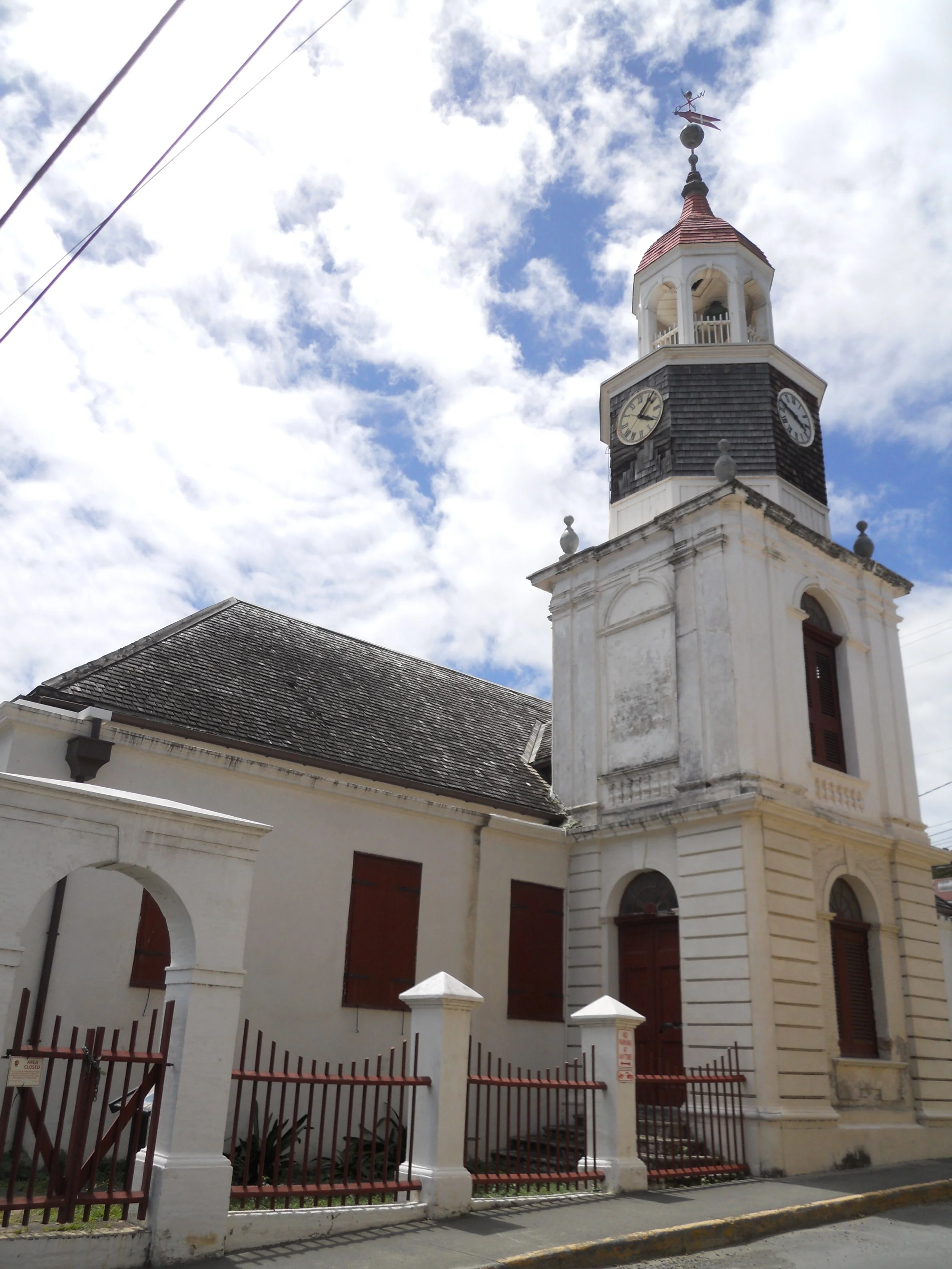
Fort Christiansted is in need of repairs (as are many of the structures in the NPS). Ranger Evan said new monies have been made available, but the process to get contractors and finalizing planning, can take some time. The courtyard is in the one photo, while the door to the ever-important Powder Magazine is in the other. Cannon are placed on the top of the fort. The first Lutheran church in St. Croix (circa 1750) is also a part of the NPS unit. The scale in the Scale House can be viewed. Every slave from Africa passed through this Scale House to measure his or her weight.
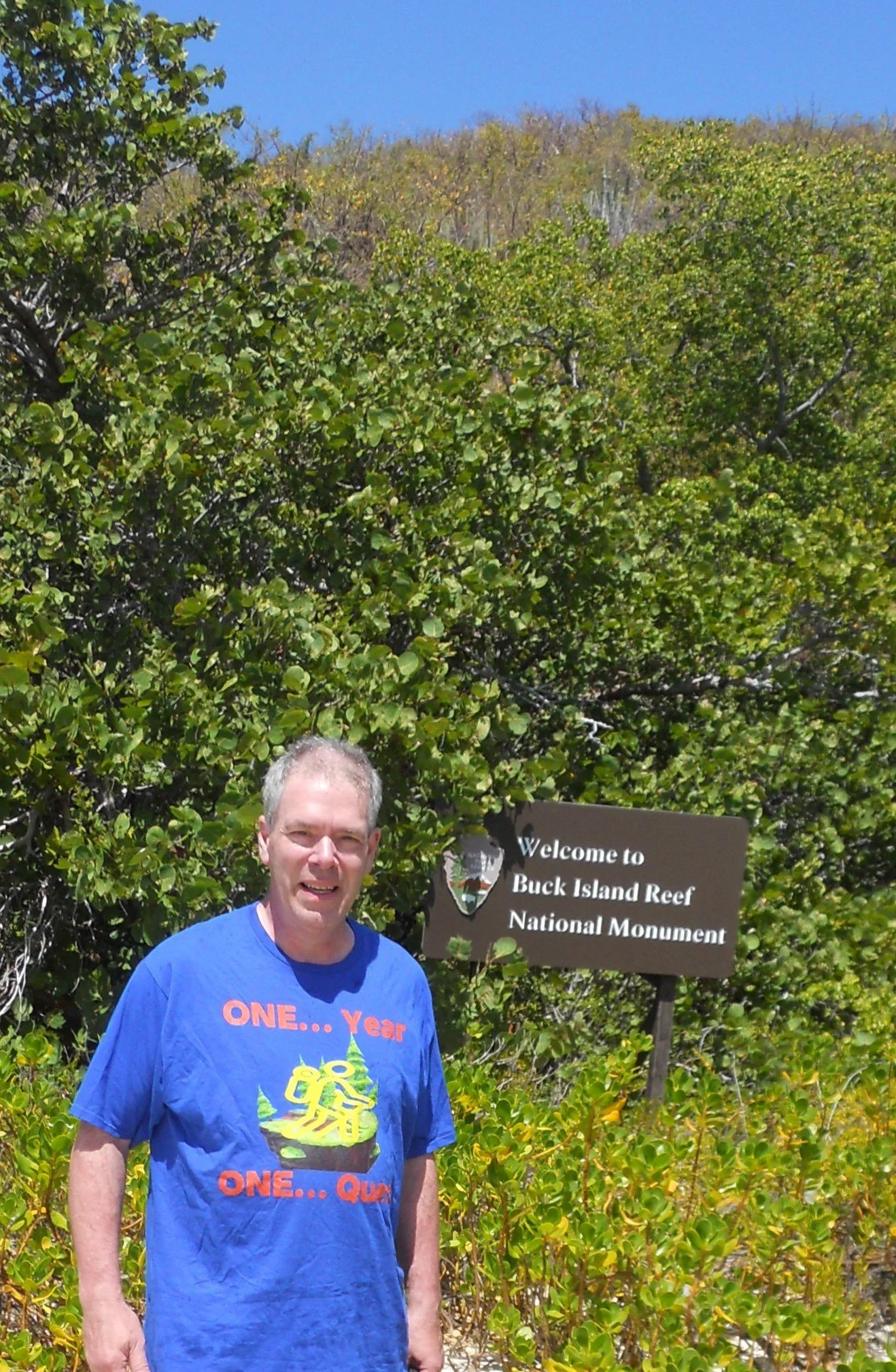
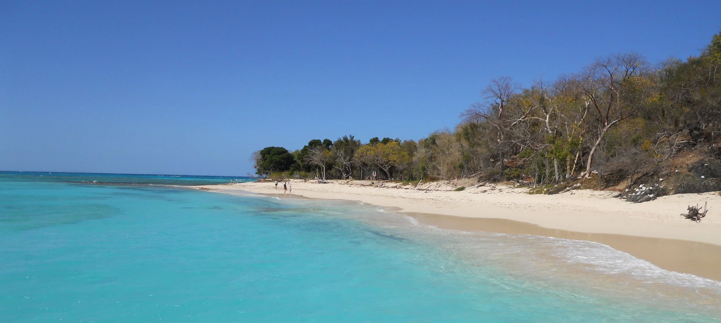
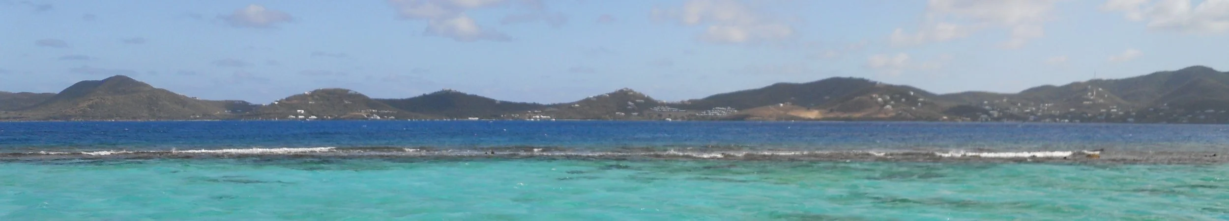
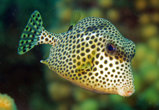
Buck Island Reef was fun. Seeing a lot of different fish is just fun. We saw multiple sea turtles on the trip out to the island, one whose head must have been as big as a softball. Yes, that is me on the island. Just to the right were areas of new turtle nests, so folks were reminded to keep their distance. White flags were stuck in the ground where nests had been identified. This is prime egg laying season. The west end of the island was nice and calm. The east end had waves crashing against the reef. Plenty of coral and rocks were protruding above the surf line. More fish species than I could ever log, but the Spotted Trunkfish and the Blueheaded Wrasse were two of my favorites. No need to show a Great Barracuda since most folks know what they look like. And nothing like having a professional boat crew to keep everyone safe and having a great time.
Likewise, no need to show a kayak. But the first blue image comes from the “blue cloud” of one type of glowing organism. The other which I saw during the trip were the single “sparkles”. At times there were hundreds flying beneath the sea-thru kayak I used.
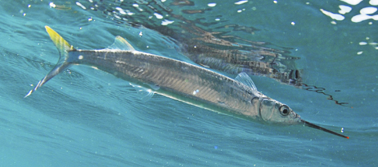
Lastly, one of those Ballyhoo fish which jumped into the kayak on the return to dock.


DAY 3 (March 22) - I just read the USA lost to Japan in the WBC 2023 final last night. This was the best WBC ever, even if the USA could not repeat as champions.
45 minutes of snorkeling at Salt Pond Bay this morning allowed me to view some of the fish in the photos… Beaugregory Damselfish (blue and yellow), Four-Eyed Butterflyfish (black dot), and Sand Diver (creepy green “tube”). Purple Sea Fans were among many of the other creatures I saw. There were too many species for me to count.
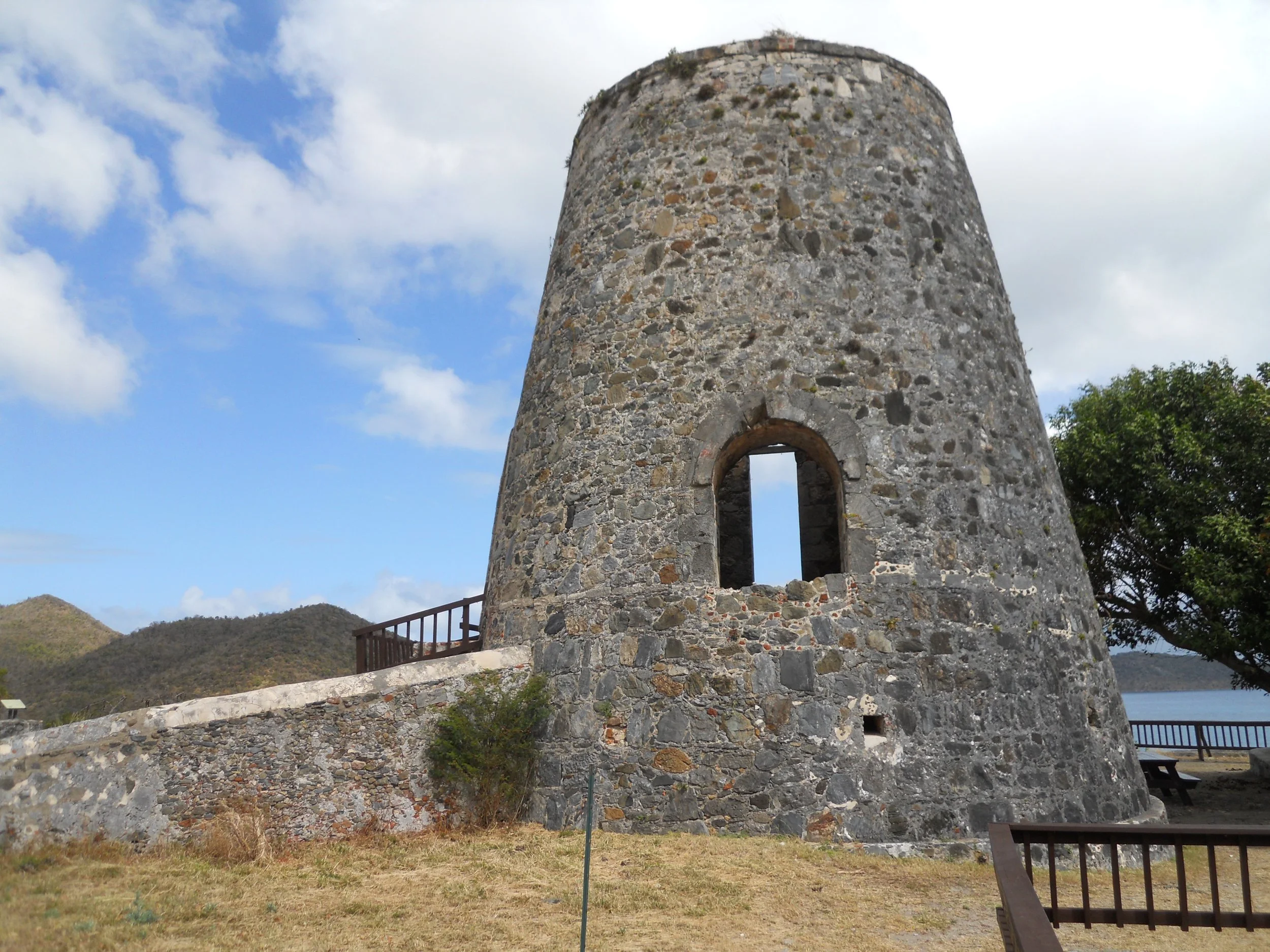
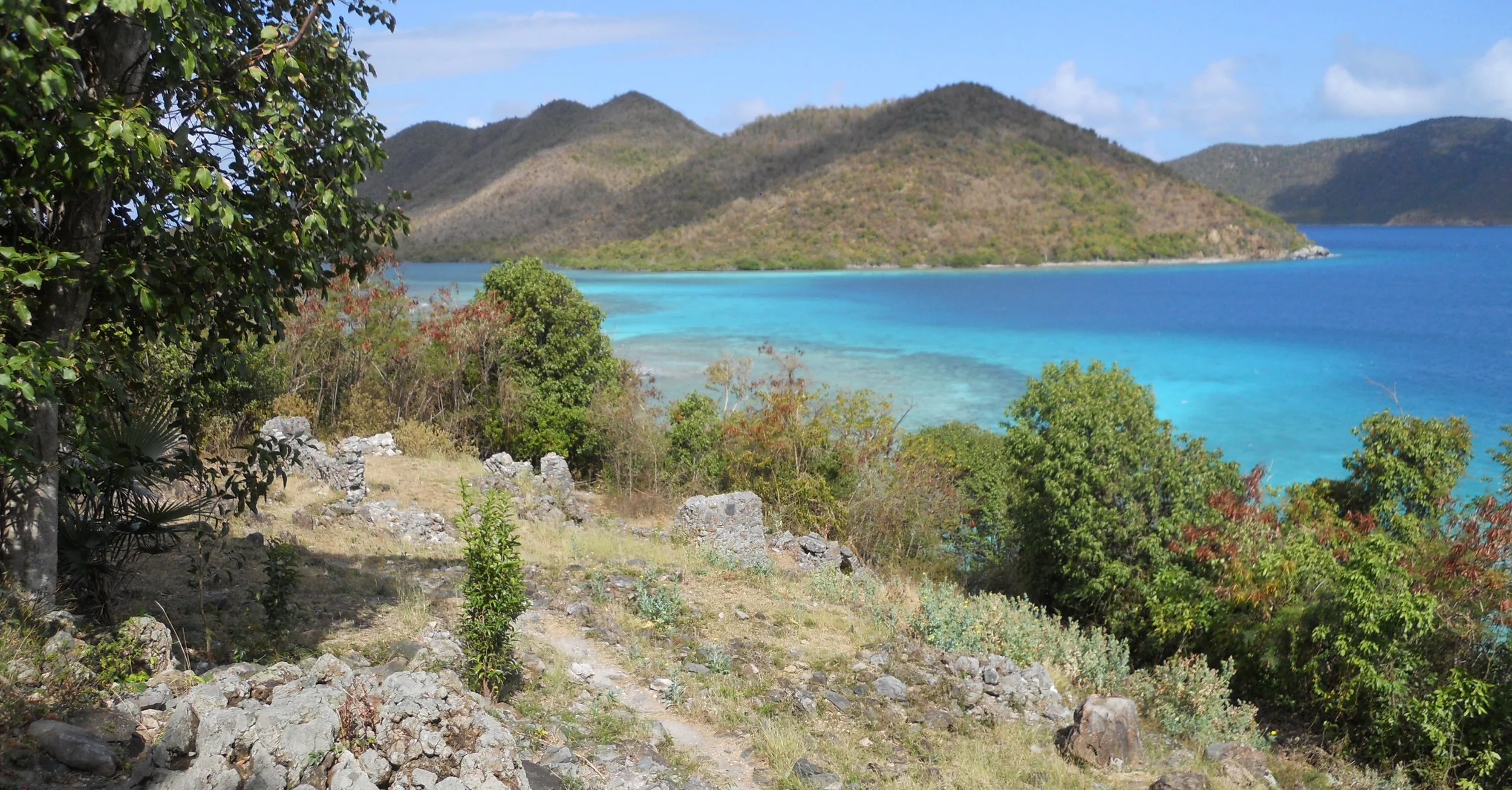
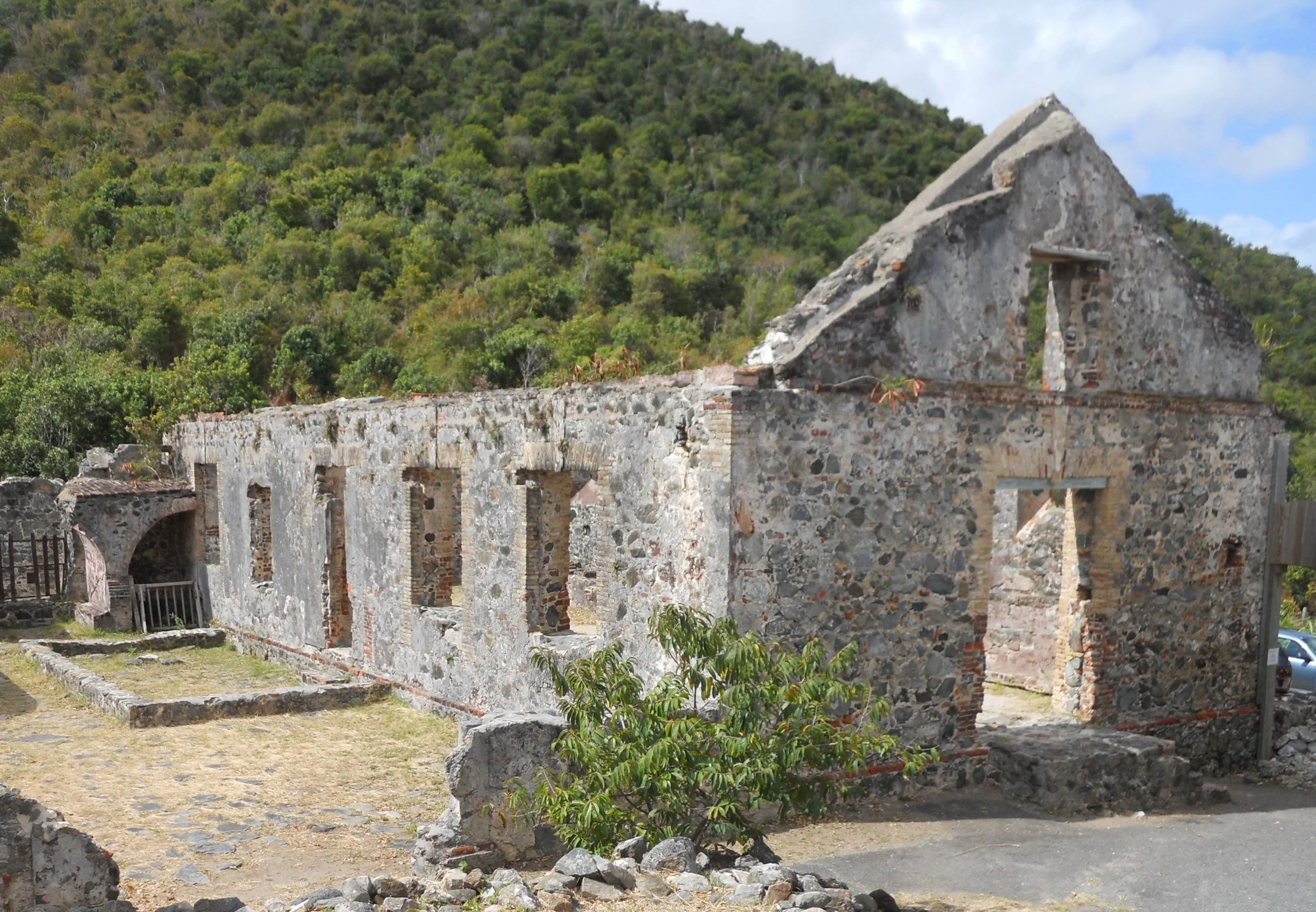
Back on land I toured the Annaberg sugar plantation ruins. The hillsides of the northeast section of St John were full of sugar cane, growing in terraces, in the early 1800s. Today one sees new growth forest and jungle. The tall Windmill and expansive Boiling Room are over 200 years old, having been started in 1797. A pulley system was built from the top of the ridge line down to the Windmill to help gravity do its work. This was Dutch East Indies territory back then, so the processed sugar was shipped to Europe. Over 600 slaves were used to maintain this one plantation, the largest among the islands. Ruins of slaves’ quarters (photo far right) are downhill from the windmill.


DAY 2 (March 21) - Not too many photos today since I do not have an underwater camera, and am leaving the on-land sites for tomorrow. Bar Jacks were present in Princess Bay. The photo is of the spot where I walked into the bay to do some snorkeling.
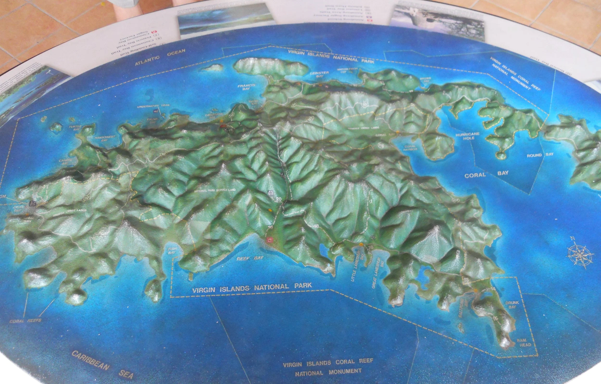
The VC has a large diorama of St John, showing the park boundaries (almost the entire island) and points of interest. The VC is currently undergoing major renovations.
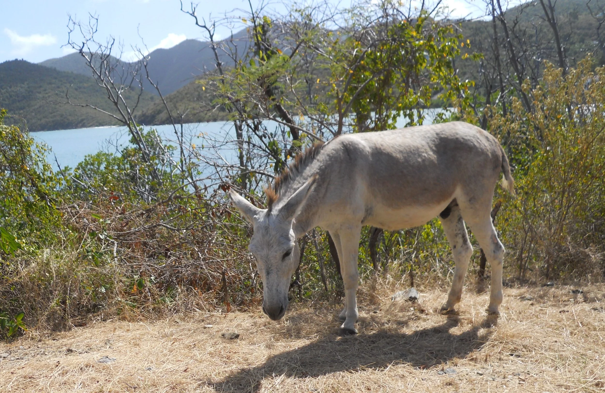
Feral donkeys are across the southern portion of the island, and therefore the park. One even came up to my car, looking for a handout.
My first recognition of a Bananaquit bird.


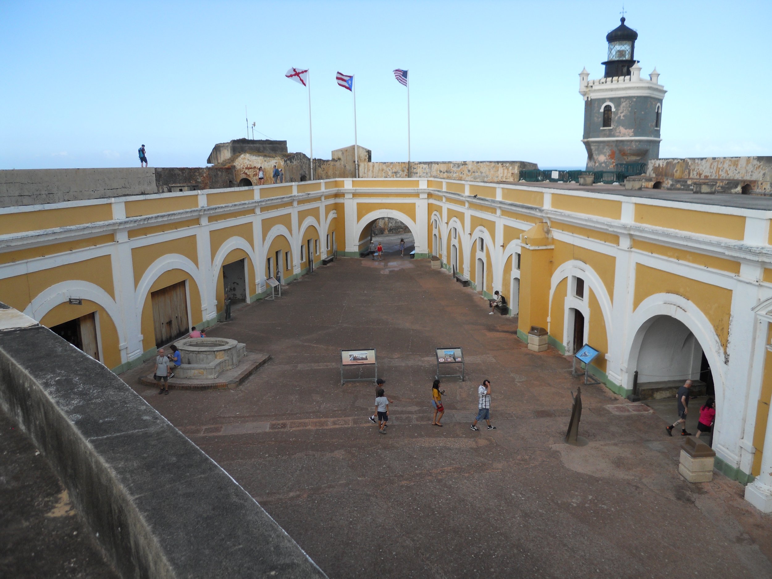
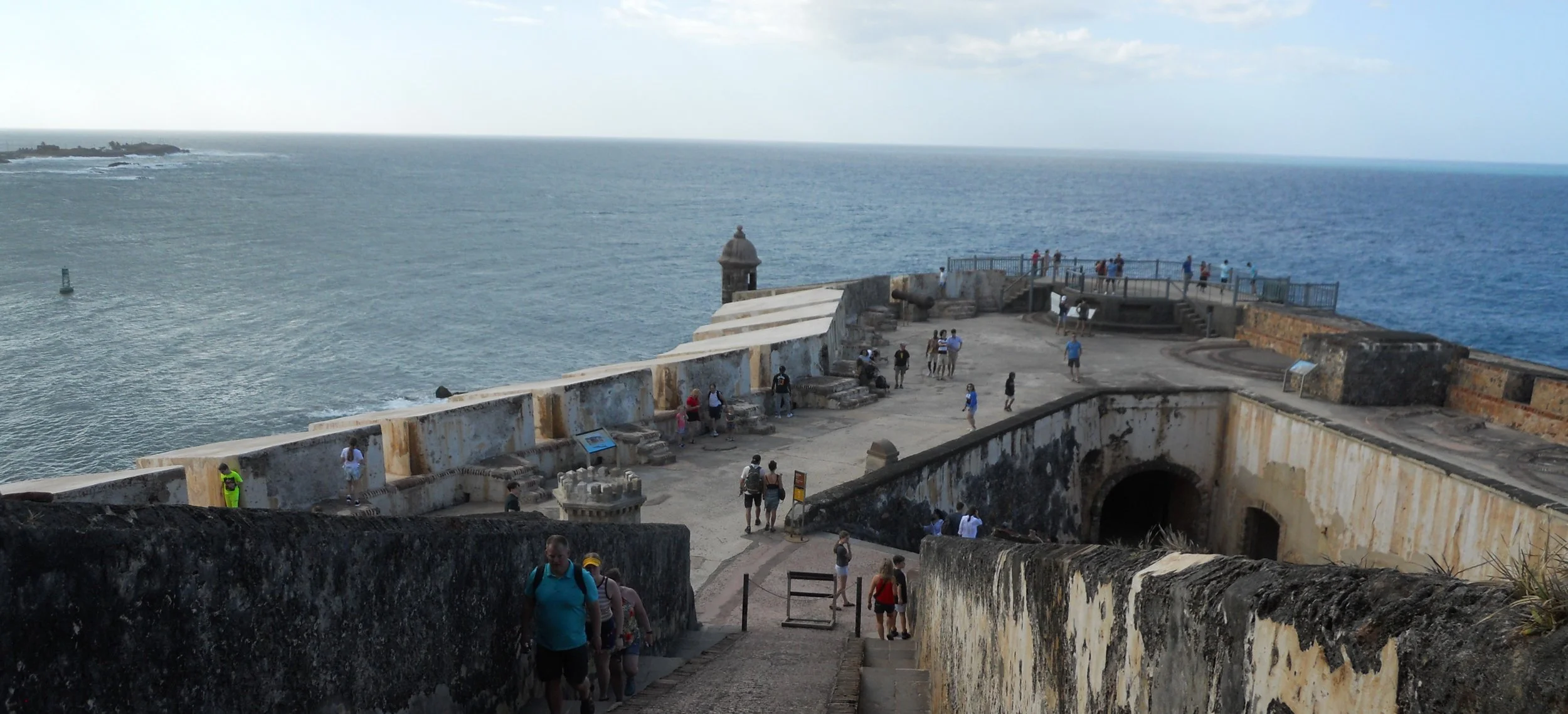
DAY 1 (March 20) - Only one park today, but as far as the Spanish were concerned in the 1500s, this would be worthy of a single stop for one day. Nothing was more important to guard the harbor into San Juan than this defensive fortification. The del Morro fort had six levels, teaming with mortars, cannon, and guns. Over the years the type of artillery changed (even during WW2 the fort was operational), but the purpose remained the same.
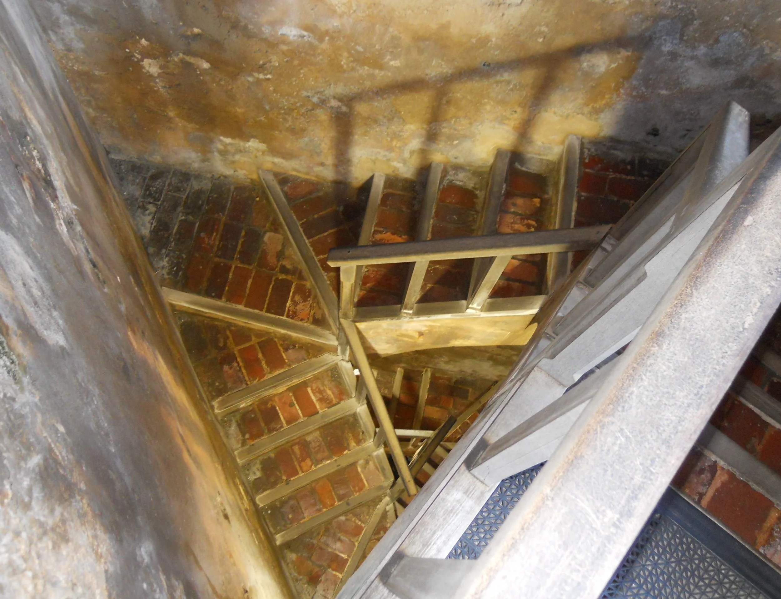
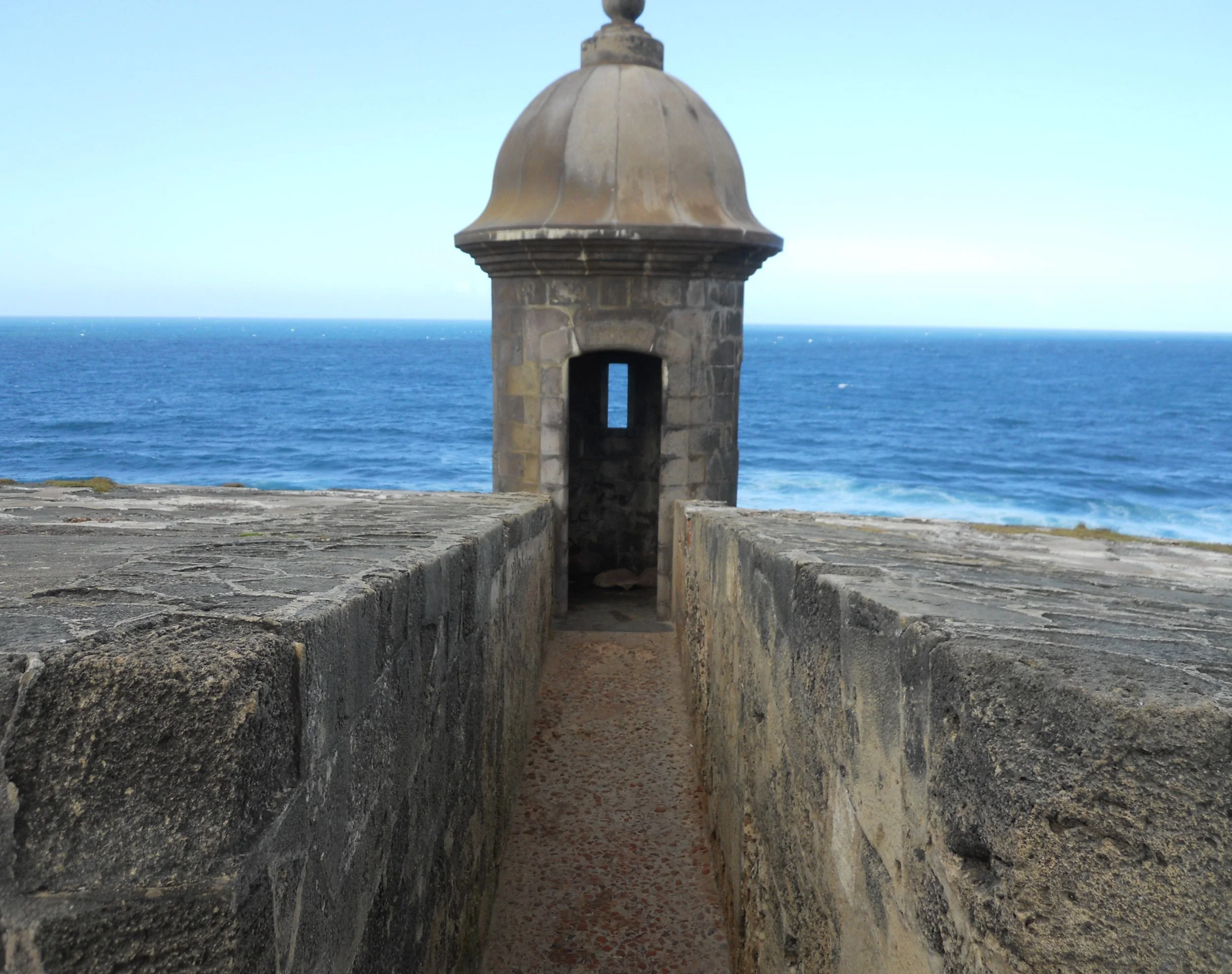
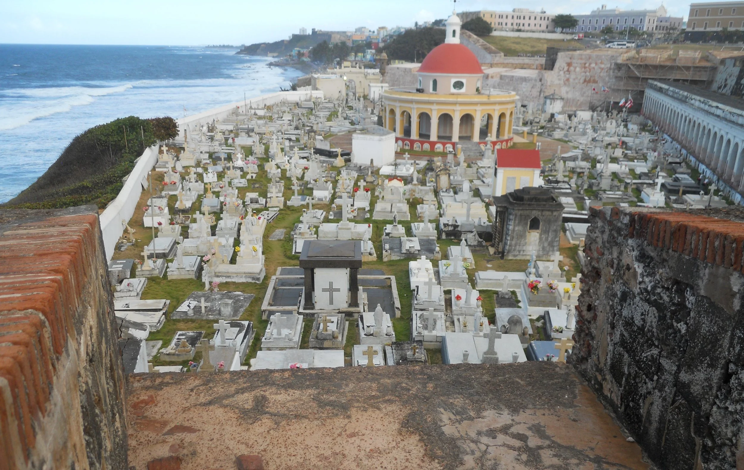
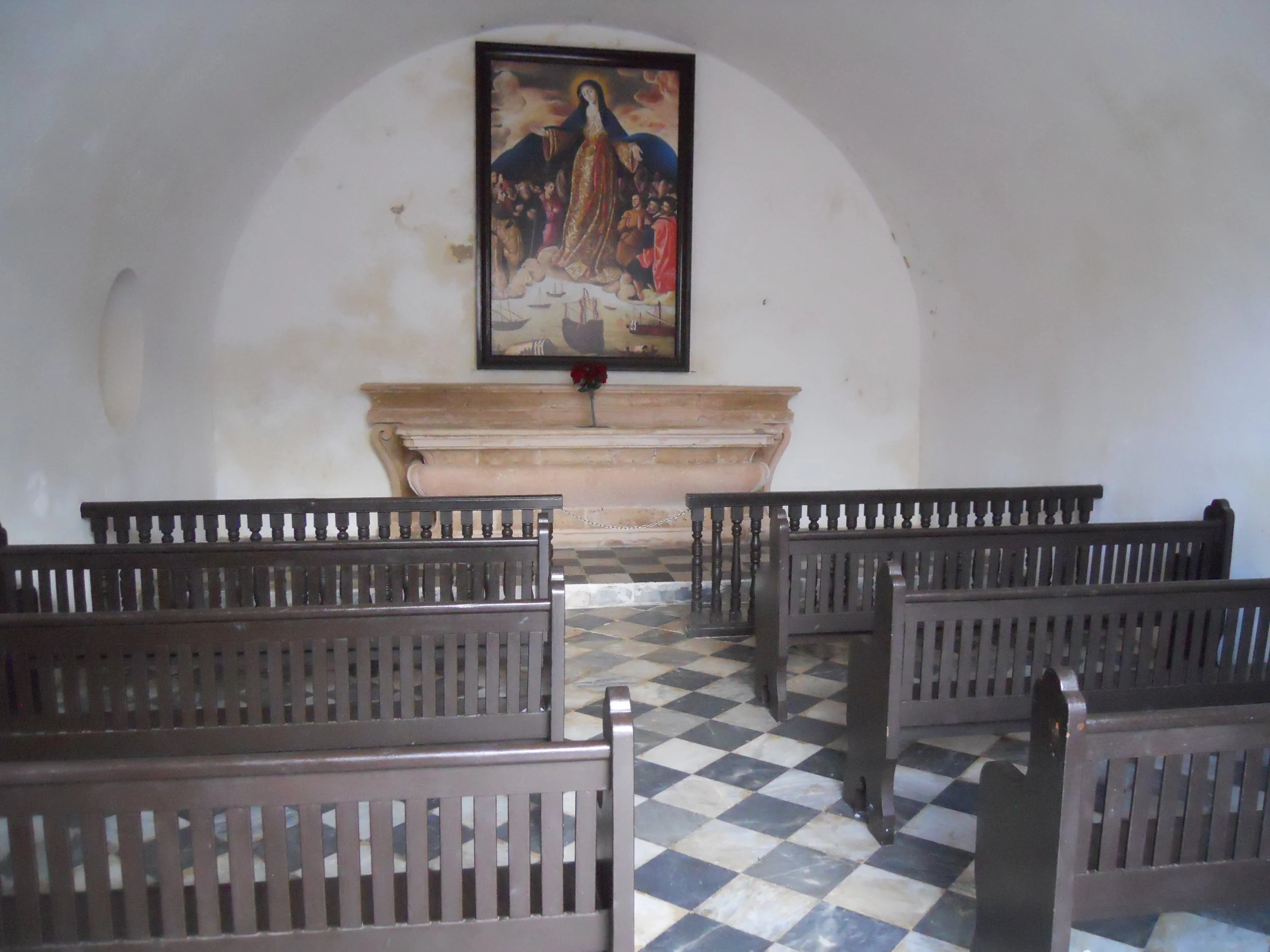
The Spanish built triangular staircases to help move men from one level to another. The fort’s lighthouse sits above the main parade ground inside the fort. Watch towers stand silently today, waiting for visitors to take their photos. A cementerio lays silently at the base of del Morro, as viewed from a rampart. And no self-respecting Spanish commander would not have a church on-site. The room was small, but it served its purpose.
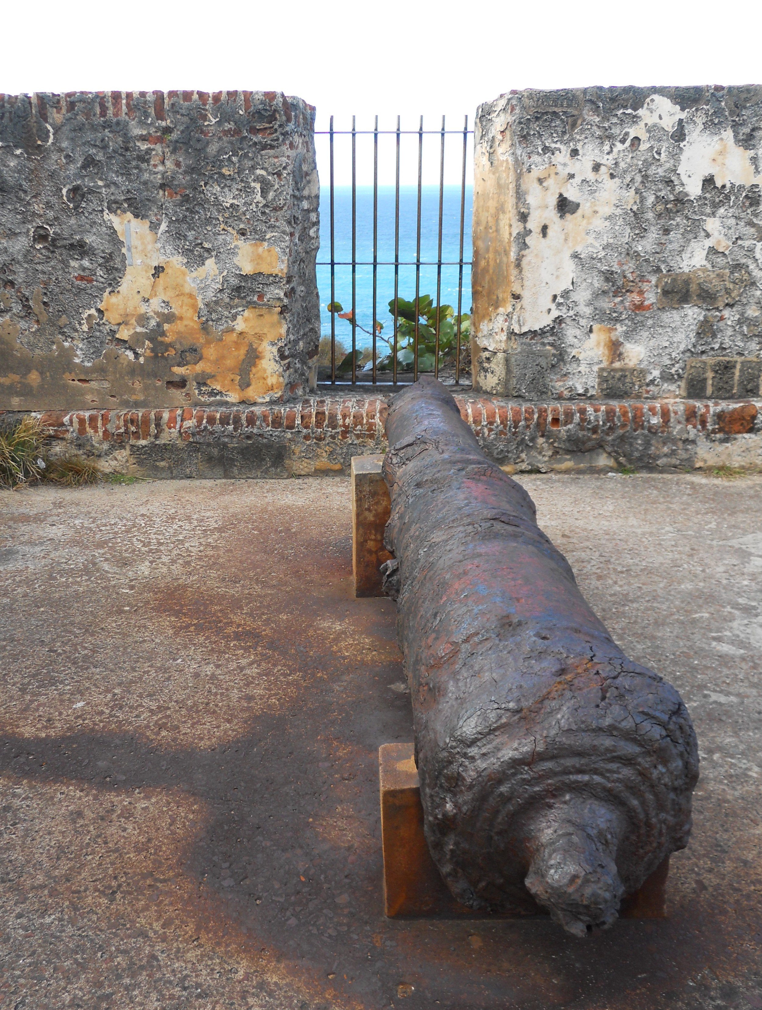
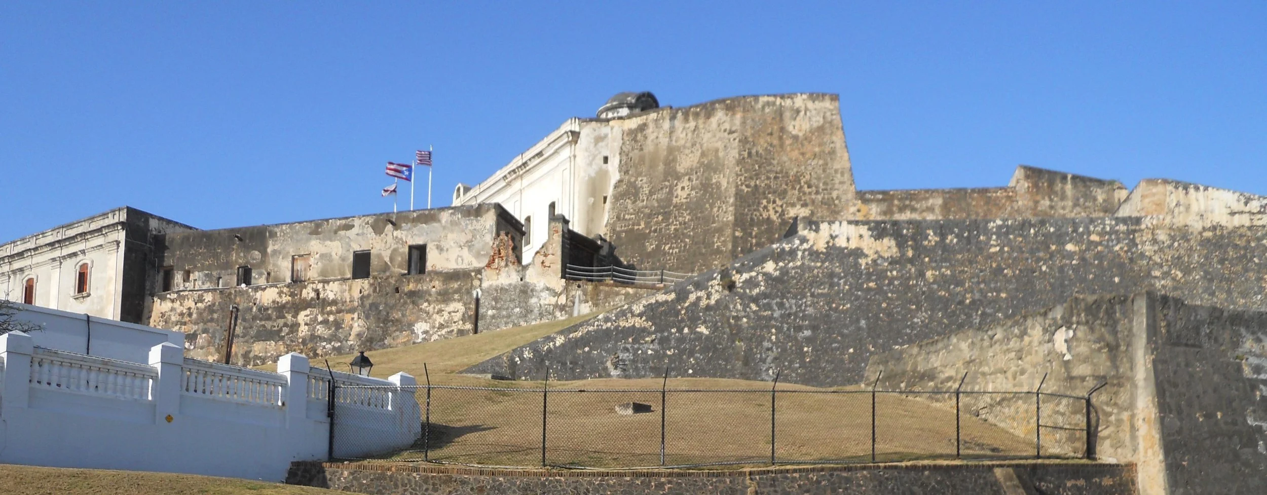
Some original cannon and guns are placed about del Morro. A dry moat covered any advance from land against the fort. The walls were a good 40-feet high. Lastly, an exterior photo of Cristobal. Its walls were also impressively tall.