DAY 2 (April 14) - A slight delay in getting this posted due to arriving in Ohio late last night. But a lot to think about on the drive home. Fort McHenry stands majestically at the entrance to the Baltimore Harbor. One can easily see its strategic location, as to why the American army built the fort. A cannon ball (photo) on display in the fort was fired by one of the British warships. This is next to the parade ground in the center of the fort, where a 10 AM flag raising is one of the highlights of the fort’s activities. In 1958, archeologists dug up the cross brace (photo) which supported the fort’s flagpole (other photo shows how the cross brace worked) during the bombardment. Now that is history you cannot see in a classroom. Various cannons are located around the fort. The “Gun Deck” (photo) had 26 cannons, able to fire 36-pound balls 1.5 miles, which kept the British ships far enough away that their shots fell short of the fort. Do you think that big cargo ship in the right side of the photo is getting a bit too close? Probably the most moving of the park’s activities is the playing of the National Anthem in the VC. After a 15-minute film about the battle and Francis Scott Key is shown, the screen is raised, exposing visitors to a view of the fort. Chris (photo), a fellow NPTC member, says this is his favorite experience at the park.
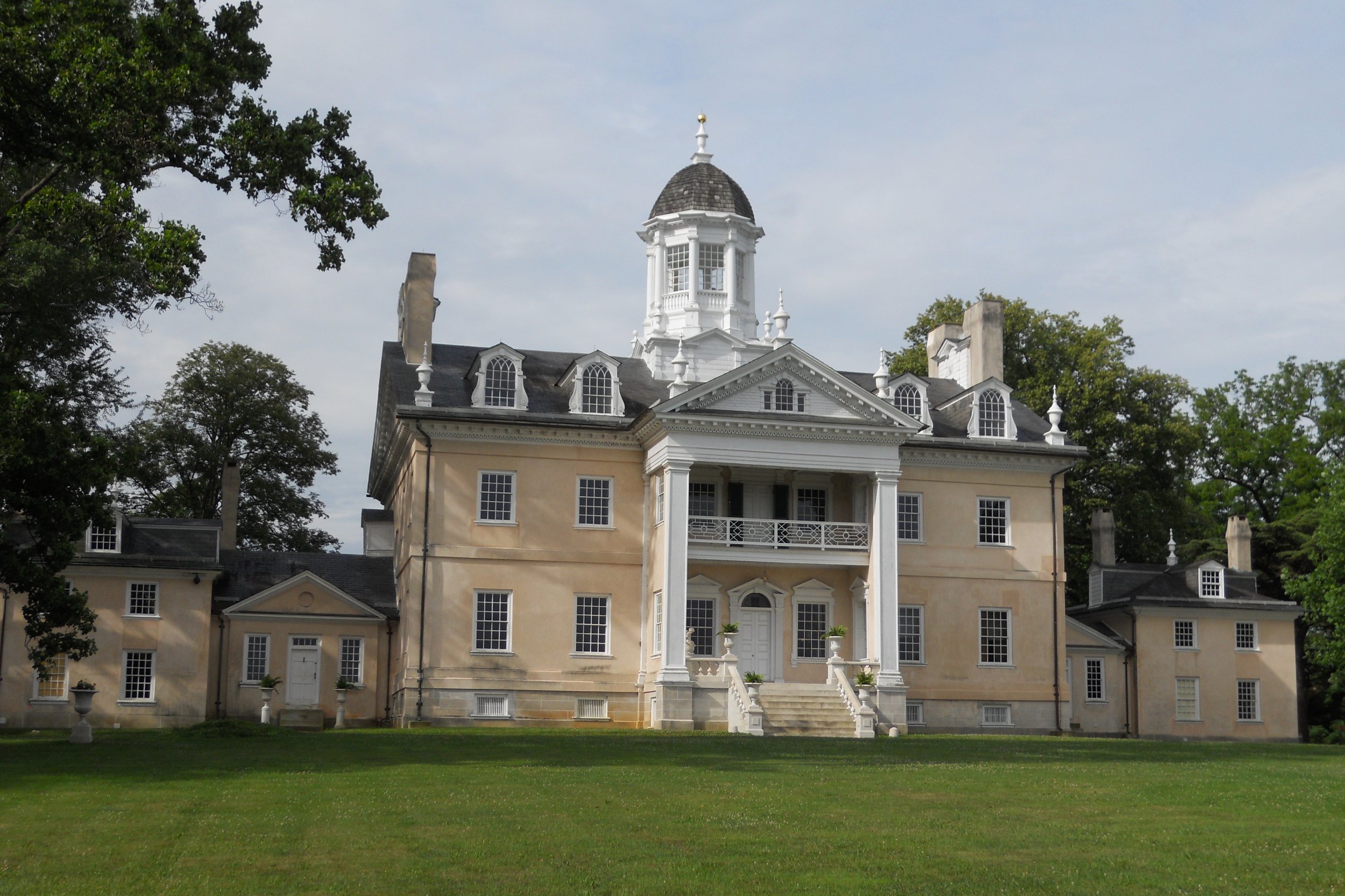
Hampton NHS is the site of the largest private home in America circa 1790. And when someone can build an Orangery (photo of white building) to grow oranges in Maryland in the bitter cold of December and January, you know the family is wealthy. Though the mansion looks fantastic (and you should see the insides), there are a couple of structures in disrepair. The #2 Greenhouse (photo), built around 1840, is one example.
A group of individuals were in the Orangery preparing for a painting exhibition (photo) about the park. It is great that a NPS unit can host such an event.
A group of visitors were ready for the 11 AM “Families, Farming, and Freedom” tour by Ranger Dustin at the farm area down the road from the mansion. The first photo is of the Overseer’s house. The portion on the right side is the oldest part of the building, where Colonel Charles Ridgely first lived, as he began amassing acres of land. His son, Captain Charles Ridgely, is known for building the mansion. He died a few months after its completion in 1790. The sixth generation Ridgely, John Jr., to own the property ended up moving back into this “Lower House” after selling the mansion to the Avalon Foundation (a Mellon Family Foundation), in 1948, which then donated the land and buildings to the NPS. The stone buildings to the right of the one photo are original to the property from the 1700s. They were used for housing enslaved laborers and later, tenants, after slavery became illegal. Yes, the Ridgely family owned slaves, nearly 450 at the height of their plantation’s and iron works’ heydays. It was not a pretty picture. In the last two decades the NPS has revised their presentation at the farm to focus on this segment of the Ridgely story.
In taking US30 back to Ohiom, I decided to revisit Flight 92 NMem, to get some more photos. The one photo is of the flight path of the plane, looking at the direction where the plane was coming from. The other photo is at the end of the flight path walk, looking down on the Wall of Names and the crash site (just under the word “honor”).


DAY 1 (April 13) - A short two-day trip. Today began with Flight 93 NMem in PA. I believe every American either remembers or has heard about 9/11. The Tower of Voices greets visitors to the park. There are 40 chimes in the tower, one for each passenger and crew of Flight 93. At the end of the park road, is a short walk to the Wall of Names, on white marble.
Next was Antietam NB. 23,000 casualties in one 12-hour period of fighting is the main take-away from this park; the deadliest day of fighting in the Civil War. Dunker Church, built in 1852, witnessed the horror, and was used by the Union as a hospital after the battle. The structure was rebuilt due to a windstorm in 1921. A few monuments and cannon dot the landscape, such as the large Maryland monument. A monument dedicated to Clara Barton is next to the “Cornfield”, scene of the most horrendous fighting. The red cross at the bottom is made from bricks which were in the fireplace at the home where Barton was born.
Further down the creek is Burnside Bridge. General Burnside attempted to sweep around the right flank of General Lee’s troops, but had to get over this bridge. The third assault was successful, though the delay allowed Lee and his Confederate army the time needed to retreat back into West Virginia. The Sycamore tree on the back-right of the bridge photo was quite young in 1862. A fence is around the base of the tree and a nearby sign asks visitors to view from afar, so it can be around for many decades to come. A relative on my mom’s side, uncle Robert Cunningham, fought at Antietam for a Vermont regiment, and is buried in the Antietam National Cemetery. Many of the headstones in the cemetery are now illegible after 150 years.
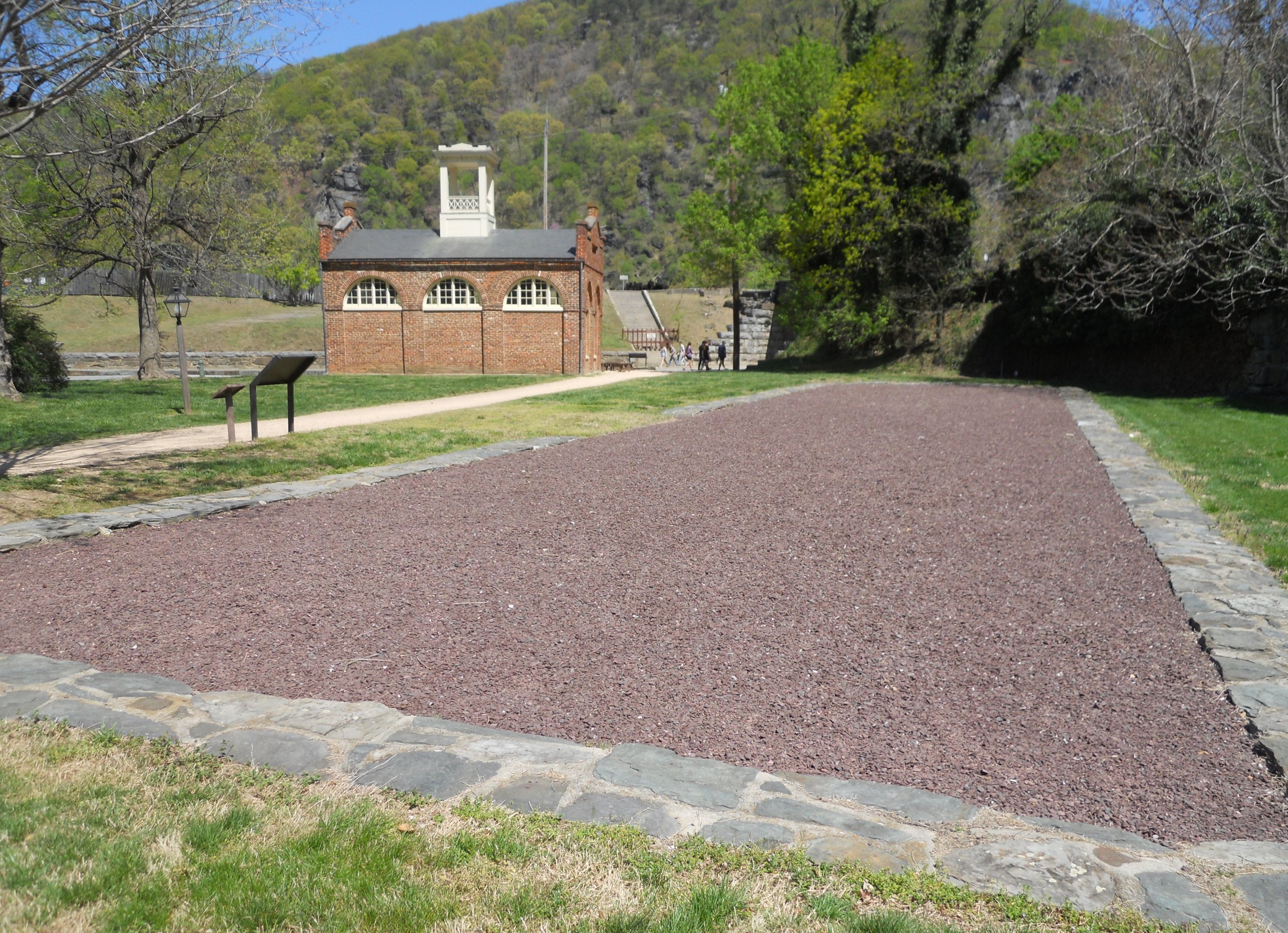
Harper’s Ferry NHP was the scene of the John Brown Raid in 1859, a large industrial complex (Thomas Jefferson and others saw this value), an arms manufacturing site (second only to Springfield, MA), the Potomac Canal, Storer College, and many other significant historical events. John Brown’s Fort is at the end of Shenandoah Street, such that no visitor can miss it. The foundation for Arsenal Square is next to it.
The C&O Canal crosses paths with the Potomac Heritage Trail and The AT, at Harper’s Ferry. Lift lock #33 is at the intersection. I plan to see other portions of the canal later in the Quest (just like I will see other portions of the Potomac Heritage and The AT), since it covers over 180 miles along the Potomac River.
The AT has a large sign next to the bridge which crosses the Potomac River. The bridge is part of The AT, as is the stone staircase in the middle of town.
I officially stopped at Monocacy NB, next. A cannon outside the VC is pointing at where the Union troops were positioned at a wood bridge across the Monocacy River (at the tree line). Ramseur’s artillery rained fire on the Federals from this vantage point. Two cannons were at the Best farm. The red roofed building was built in the 1790s.
The red sided house is on the Worthington farm. Mr. Worthington, his family and slaves, witnessed an ambush by 1,400 Federals, who were hiding in waist-high corn, against 1,400 Rebels who were trying to sweep the Union’s left flank. Later in the day the Confederates repeated their attack and forced their way to the Thomas farm (photo with fence), which quickly turned into a flight by the Union troops back to Baltimore.
The reason I said Monocacy was officially the fifth park for the day, is that after stopping at the VC, I headed to Catoctin Mountain Park, so I could be sure to get in the VC before it closed (then tour the park). I then went back to Monocacy to take the auto-tour to the farms and battlefield areas. Catoctin has the only gymnasium of which I am aware in the National Park System. One never knows what surprises await. The CCC built three camps on the land which today comprises the park. A portion of one totem pole from Camp Greentop is on display in the VC. If you like small streams, easy hiking paths, and quiet, this park is for you.