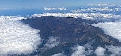
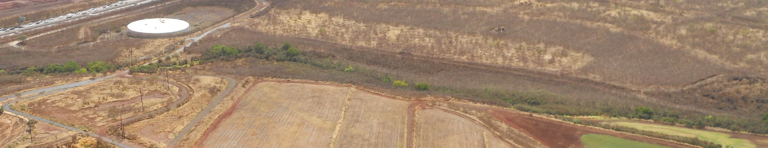
EXTRA - Haleakala NP kept popping up as I traveled around the Hawaiian islands. Here is a photo from the air on the Maui to Hawai’i flight, looking to the northwest.
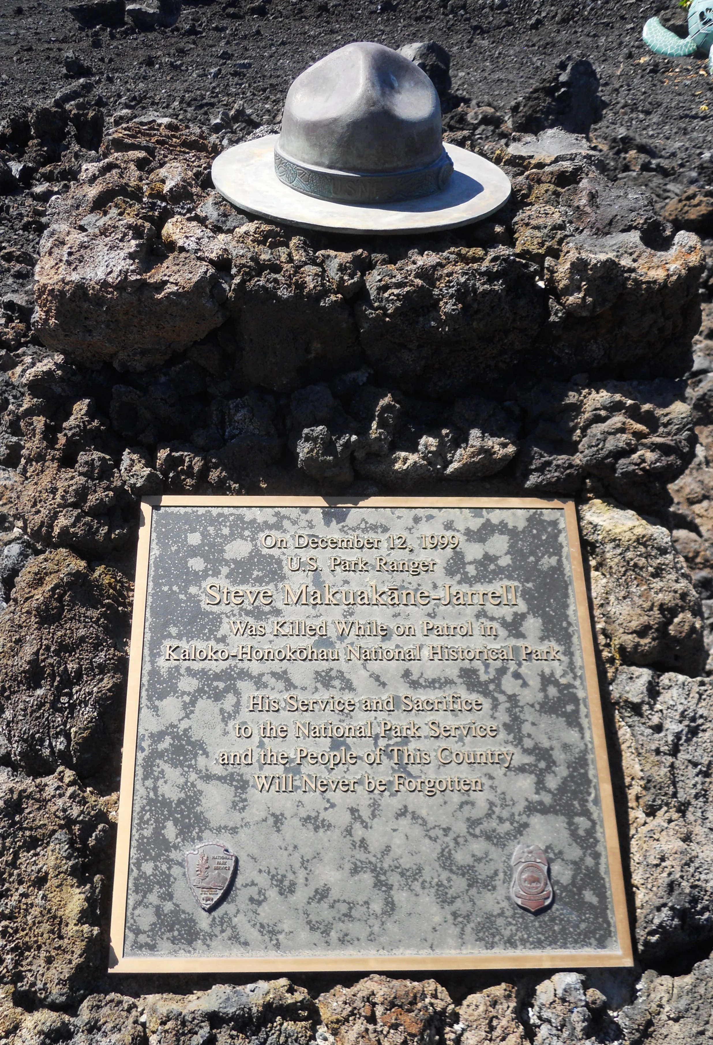
One aspect which most visitors never consider is that park rangers put their lives on the line everyday as they provide safe experiences to all. In 1999, ranger Steve Makuakane-Jarrell was killed while on patrol in Kaloko-Honokohau NHP. A plaque and ranger hat are near the VC. I have seen the same memorial in other parks for other rangers who lost their lives while on duty. When you travel to a park, be sure to thank the rangers for all the work they do to make our visits memorable and safe.
On my return layover at LAX (Los Angeles airport), I saw the NPS being advertised boldly on a few large walls. This mural was for Santa Monica Mountains NRA. I visited that park on January 2.

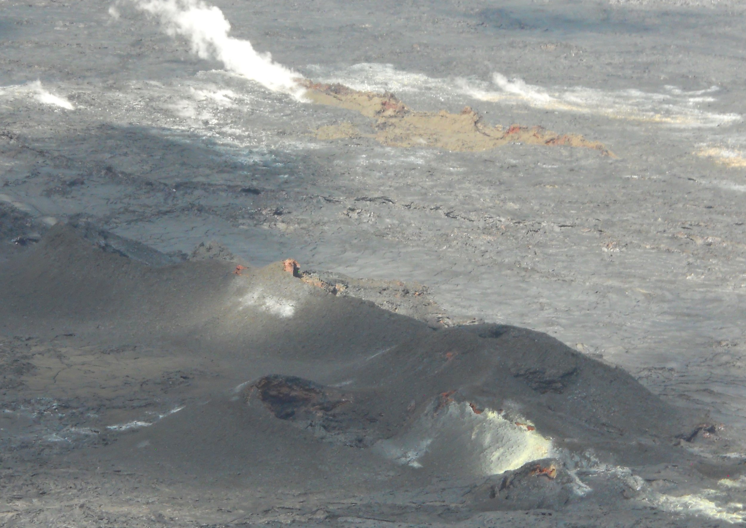
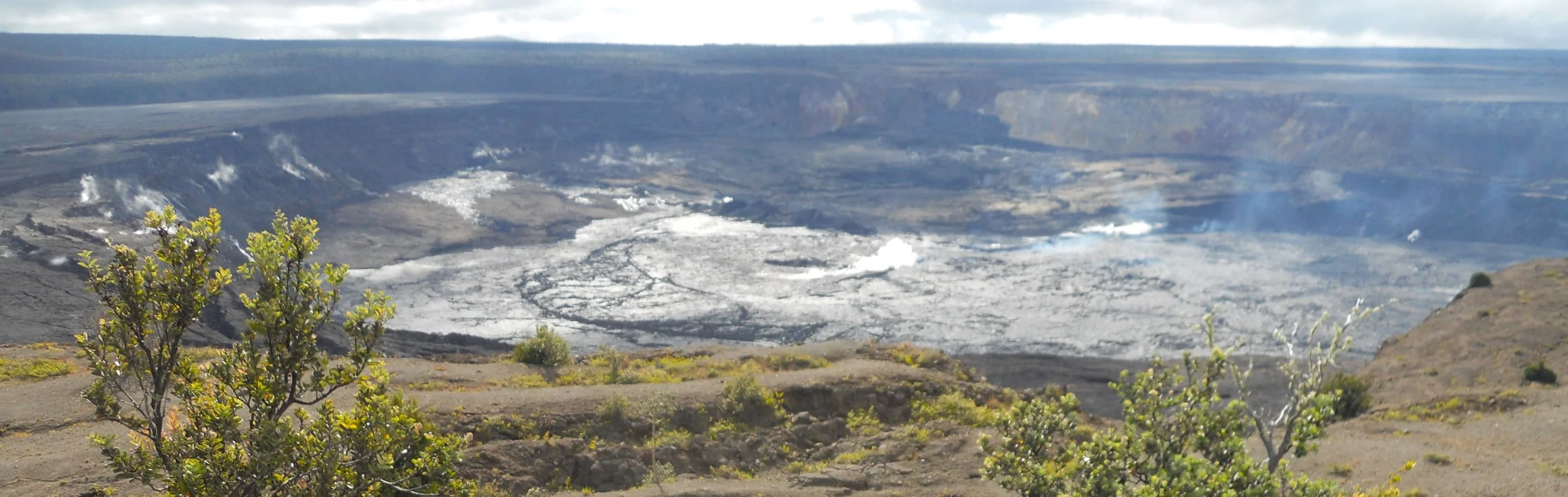
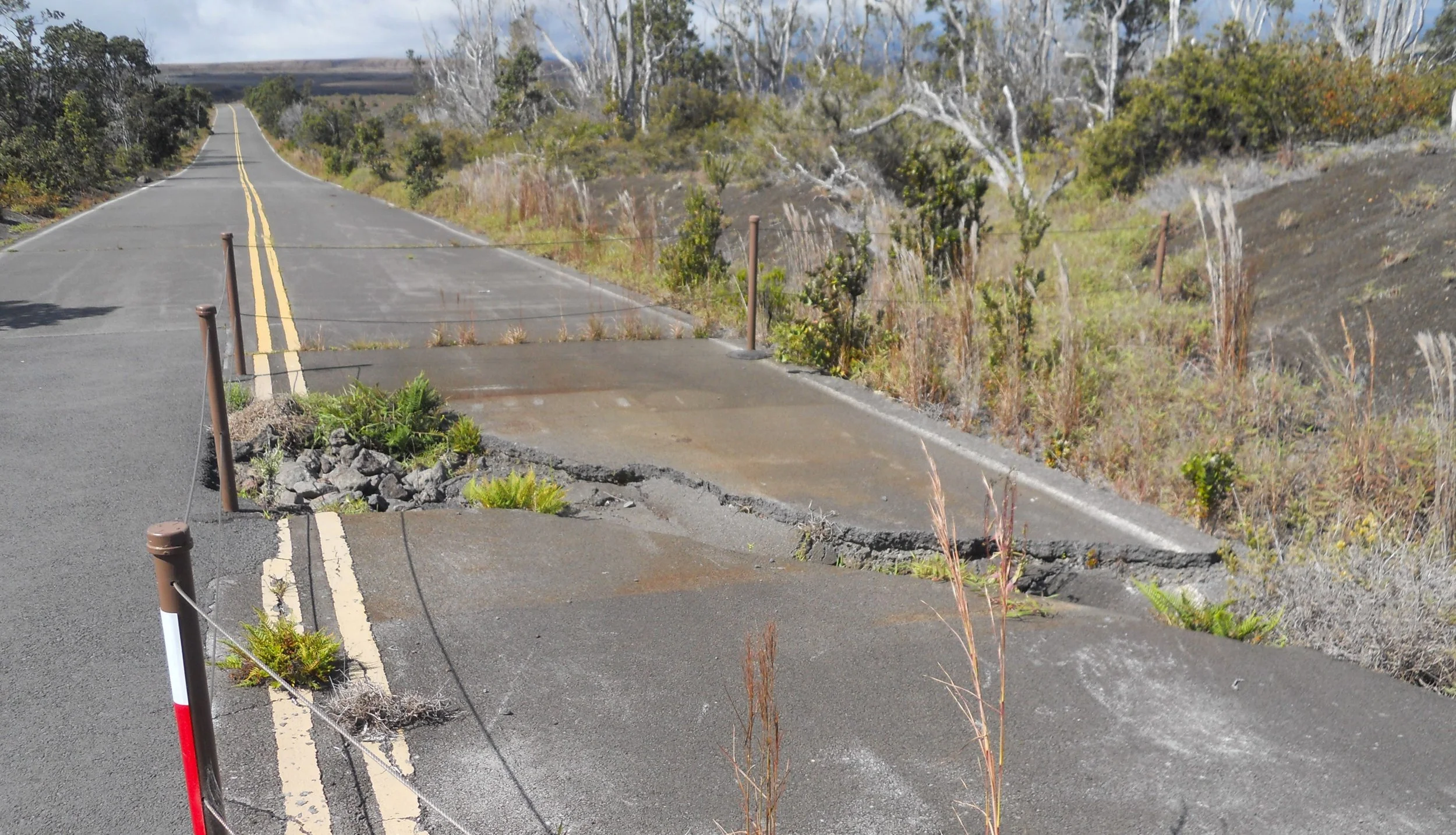
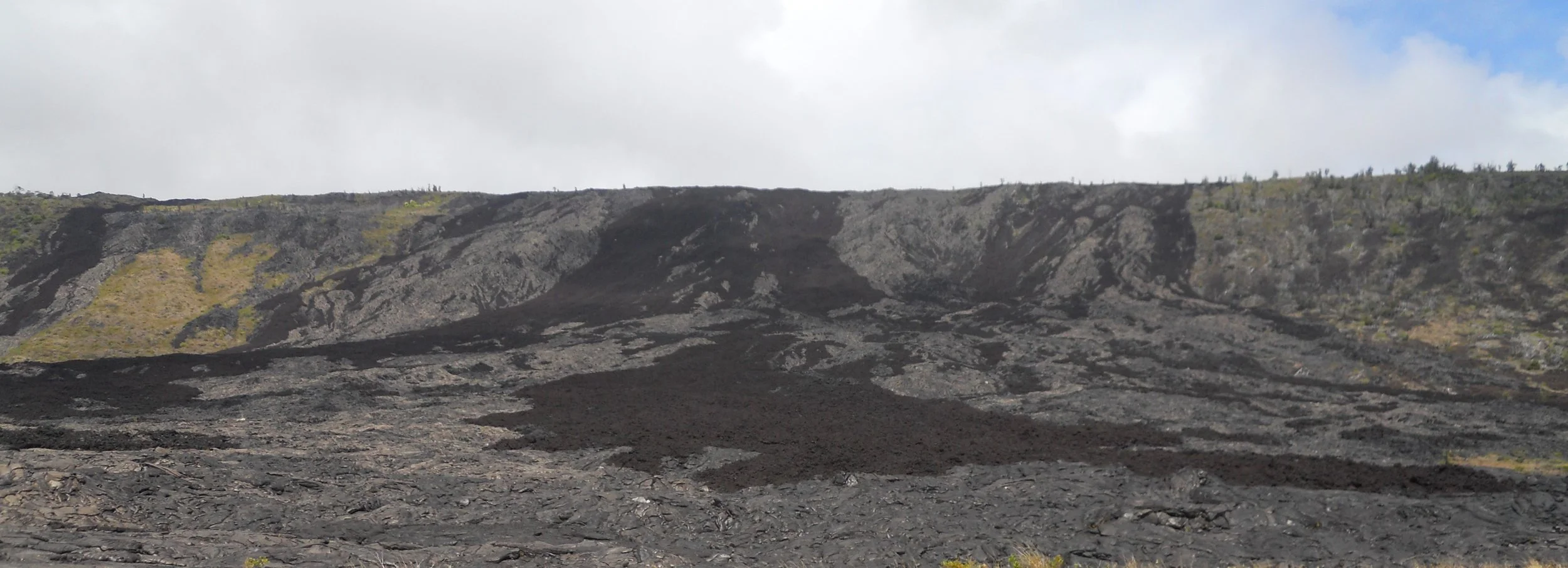
DAY 12 (October 30) - Hawai’i Volcanoes NP was relatively calm today, unlike last month when on September 10 Kilauea had an eruption (see NPS website for video). The black spatter ramparts and fissures from that week were visible today, with some of the newer magna still showing its red. As a ranger at the VC said, one never knows if they will be lucky enough to arrive on a day when Pele (Hawaiian goddess of volcanoes) decides to get active. The west end of the Kilauea caldera was steaming pretty good, but no lava. The west end seemed quite, just a white surface. To access the south side of the caldera, one has to walk a 2-mile roundtrip on a closed roadway. A few places along the road provides the clue as to why the road is closed. This park has the most earthquakes in the country, and a little asphalt is no match.
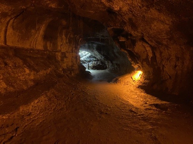
Before the hike, I stopped at Nahuku (lava tube). A short walk through the rain forest leads to the opening. The tube is lit during daylight hours for visitors.
There are two main roads in the park, the Crater Rim Road (circles Kilauea, including the above closed section) and the Chain of Craters Road, which travels 19 miles, descending 3,700 feet to the ocean. One of the main points of interest is the Holei Sea Arch.
Another spot on the roadway is Holei Pali. This is the remains of the lava flows between 1969 and 1974 from Mauna Ulu which flowed over this cliff. The difference in colors is due to the quickly cooling a’a lava that was then covered at places by fresher pahoehoe lava.
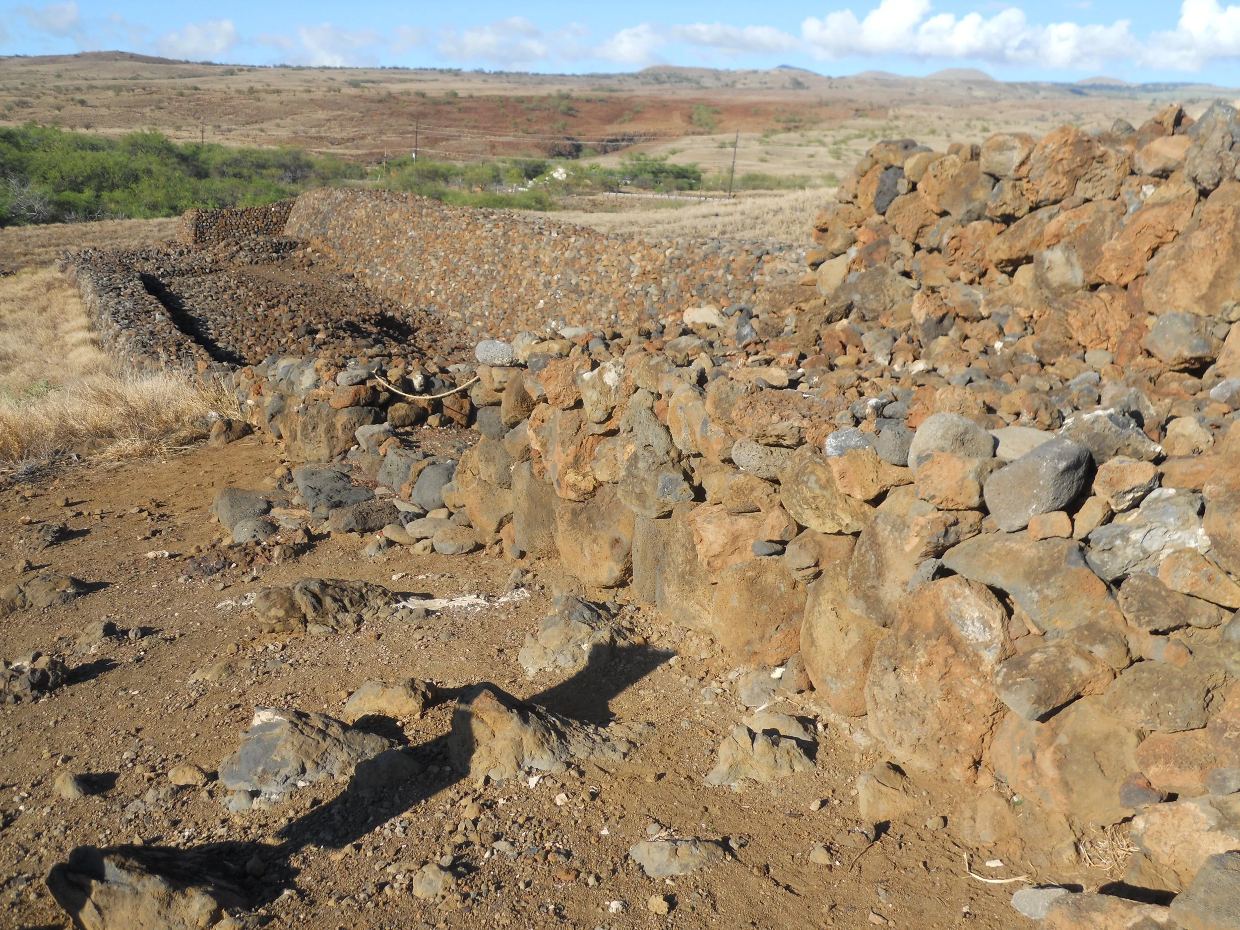
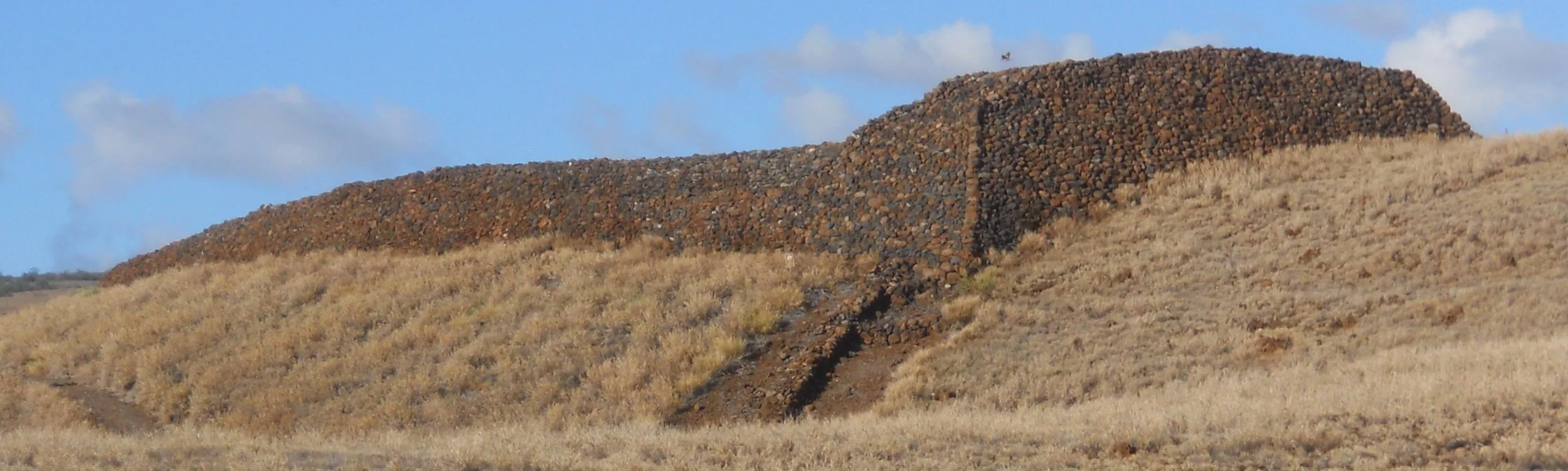
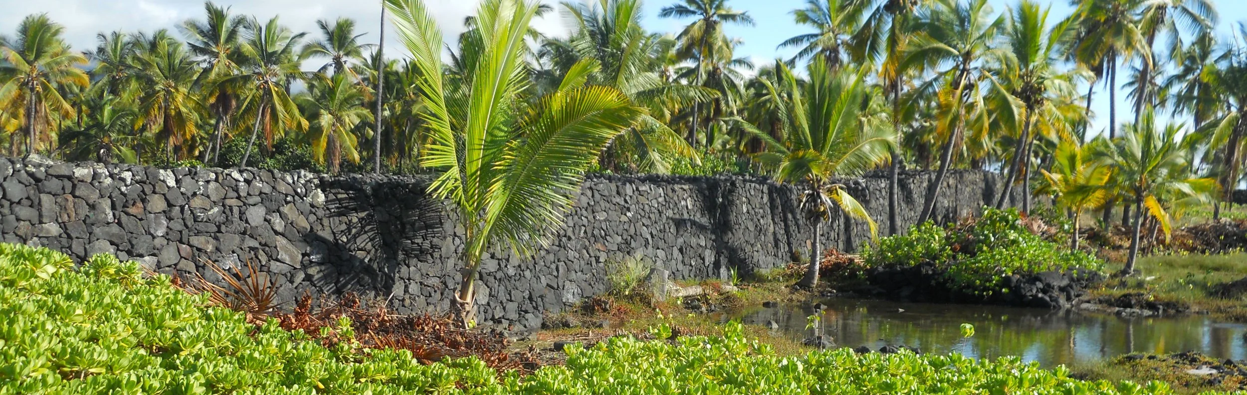
On the west side of the island is Pu’ukohola Heiau (Temple on the Whale Hill), the royal temple of Kamehameha the Great. It was the last major ancient Hawaiian temple built. Just down the hill is Mailekini Heiau. This temple predates Pu’ukohola, but experts do not know by how much. When Kamehameha took control of the area, he converted Mailekini into a fort, bristling with 21 cannons. Further down the 0.5-mile loop trail is Pelekane, the grounds of the royal residence, which included a royal fishpond. It is here, on the shore of Pelekane, where Kamehameha killed his rival Keoua in 1791, cementing his control over all the Hawaiian islands. Today, visitors look out into the bay and the ocean to see black-tipped reef sharks (usually in the morning), Humpback whales (winter months), and Spinner Dolphins.
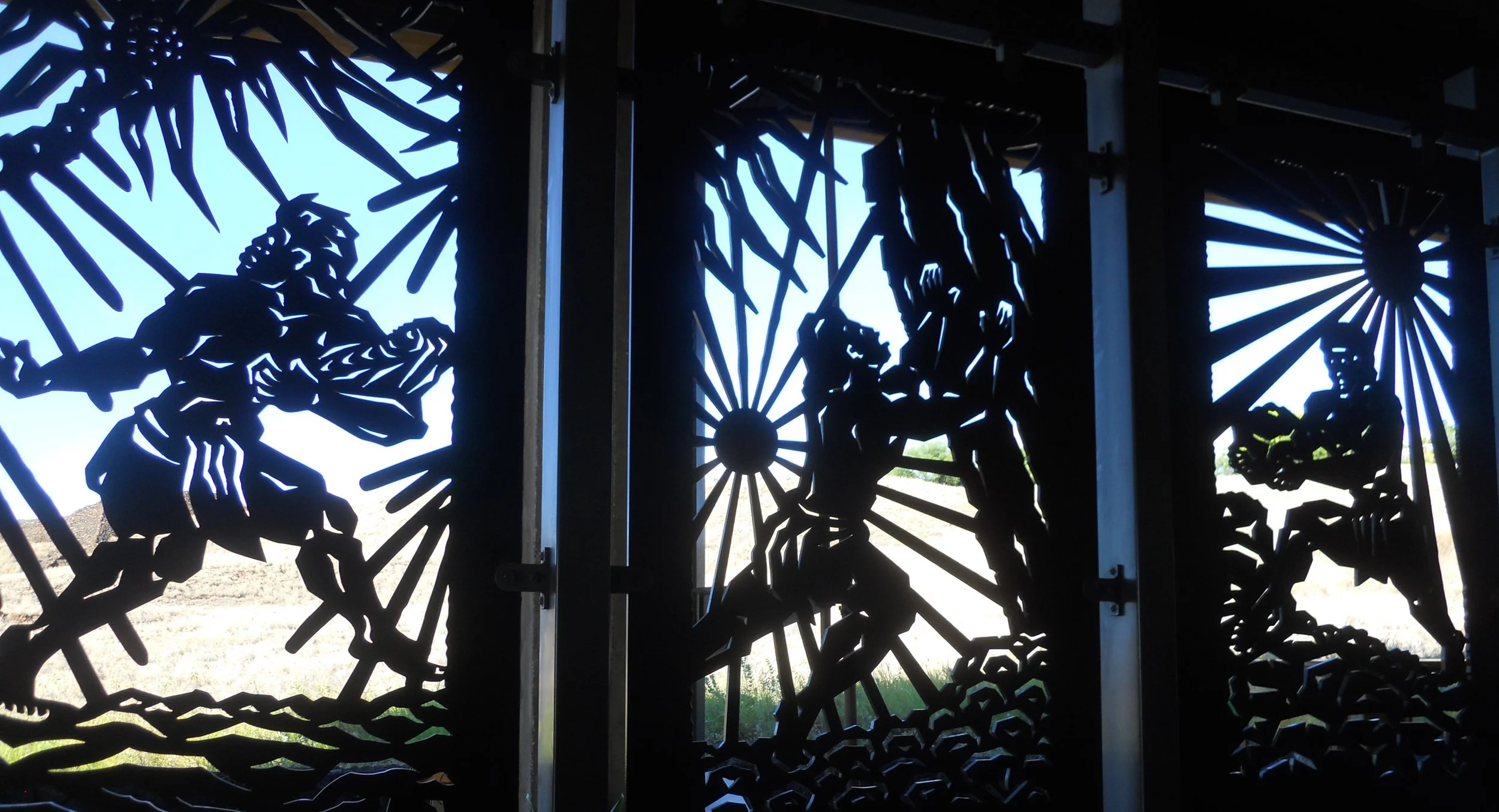
A copper metal cutting in the VC shows the sequence of events in Kamehameha’s life that led him to be the most renowned king of Hawai’i. When he was born, other chieftains wanted to kill him due to a prophecy which said he would one day become king, so the baby was hidden by his guardian Nae’ole. When he reached adulthood, he overturned the Naha Stone, a sign that he should be king (think King Arthur and Excalibur in the stone). A priest told Kamehameha if he built Pu’ukohola and gave a sacrifice he would control all of Hawai’i. Back breaking work by commoners delivered thousands of stones to the site over a 14-mile human “chain” from inland quarries. Kamehameha then invited his cousin Keoua to the royal grounds where he proceeded to kill his rival, laying his body on top the temple. The three prophecies all came to pass.


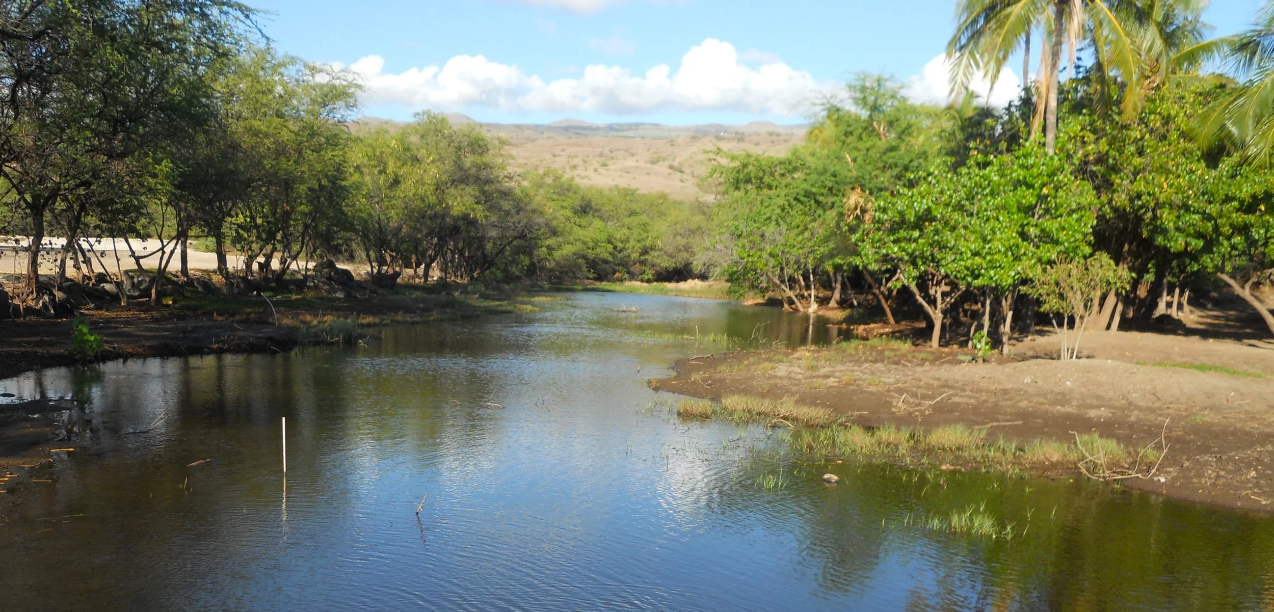
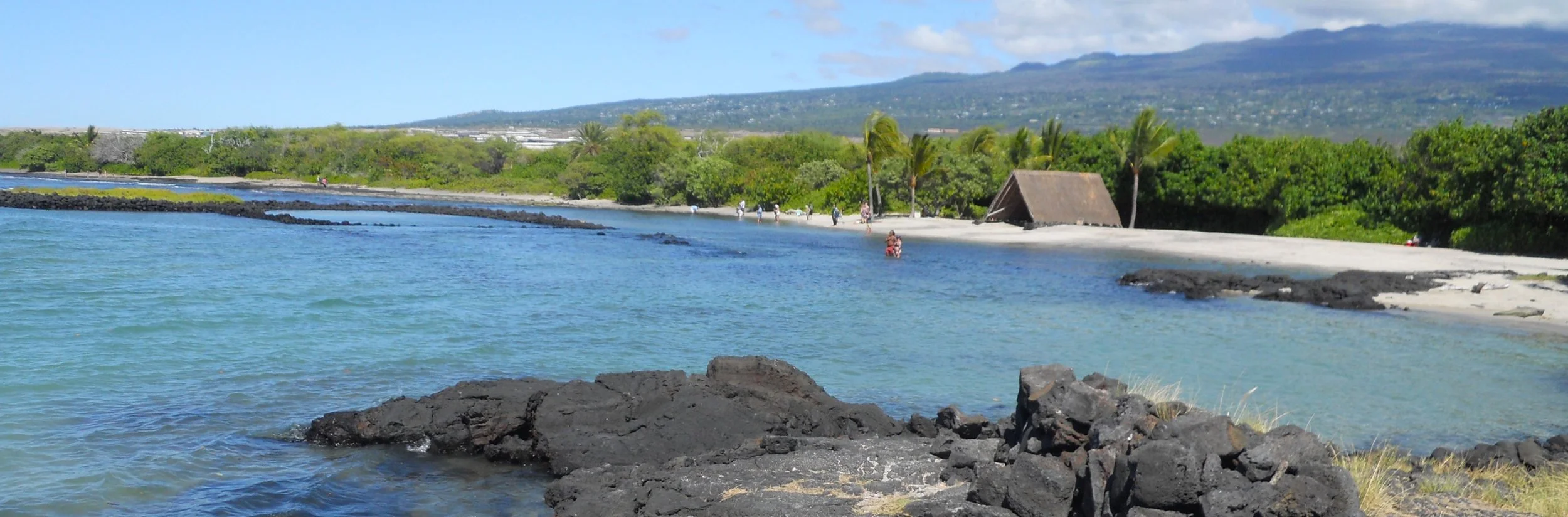
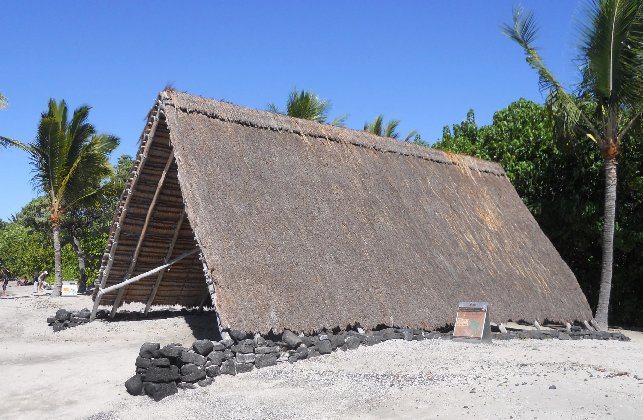
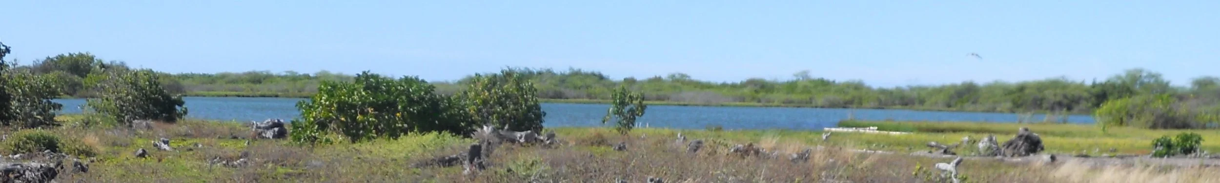
DAY 11 (October 29) - Kaloko-Honokohau NHP preserves two fishponds and a fishtrap, used by native Hawaiians long before Europeans appeared on these shores. The Ai’Opio Fish Trap includes a Canoe House.
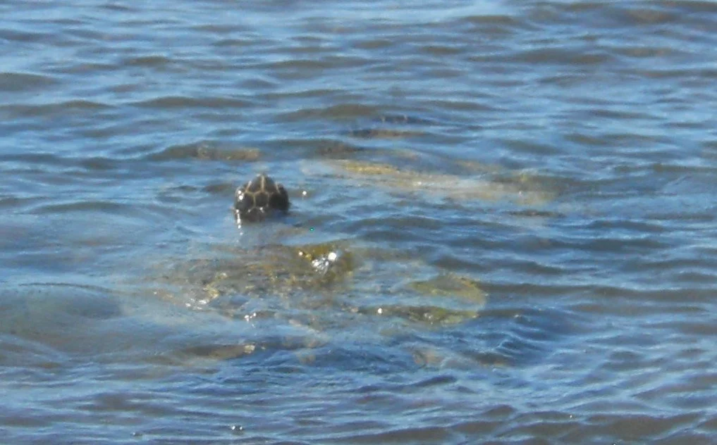
Today, a number of green sea turtles were frolicking in the shallow waters near shore. A ranger said they like this spot.
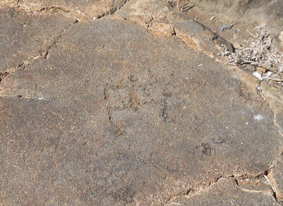
The 0.7-mile hike from the VC to the shore, on an old lava flow (have to watch your step), includes a small area with Hawaiian petroglyphs.
The side trail to the ‘Amakapa Fishpond was closed, so I viewed from a distance.
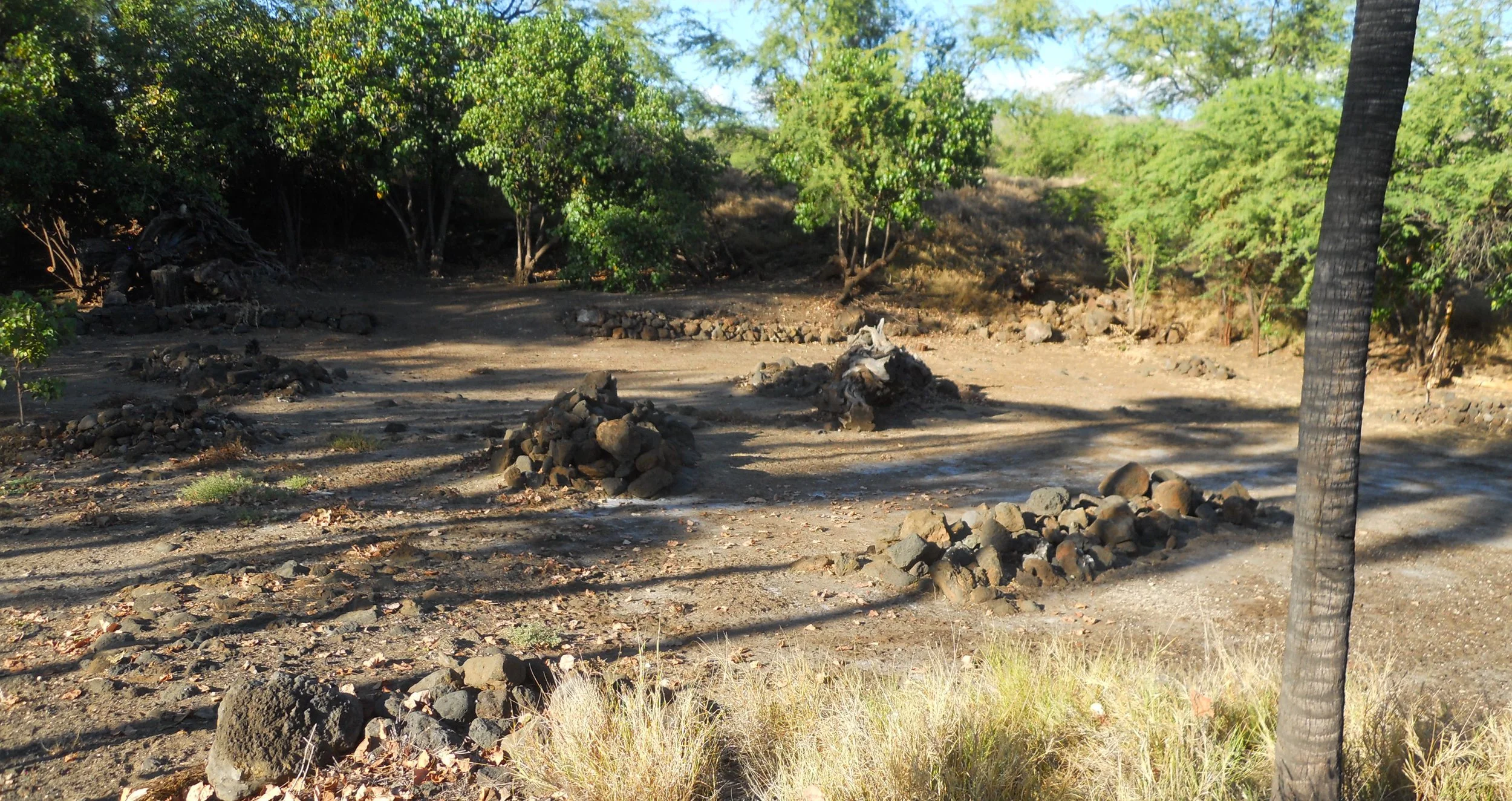
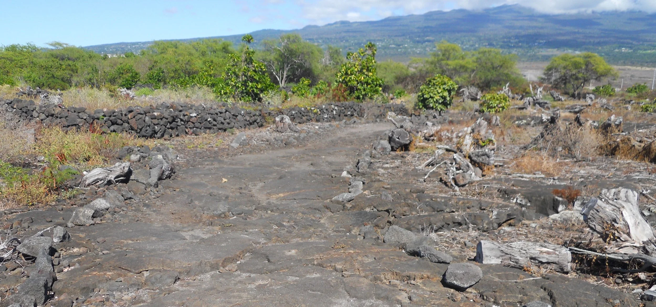
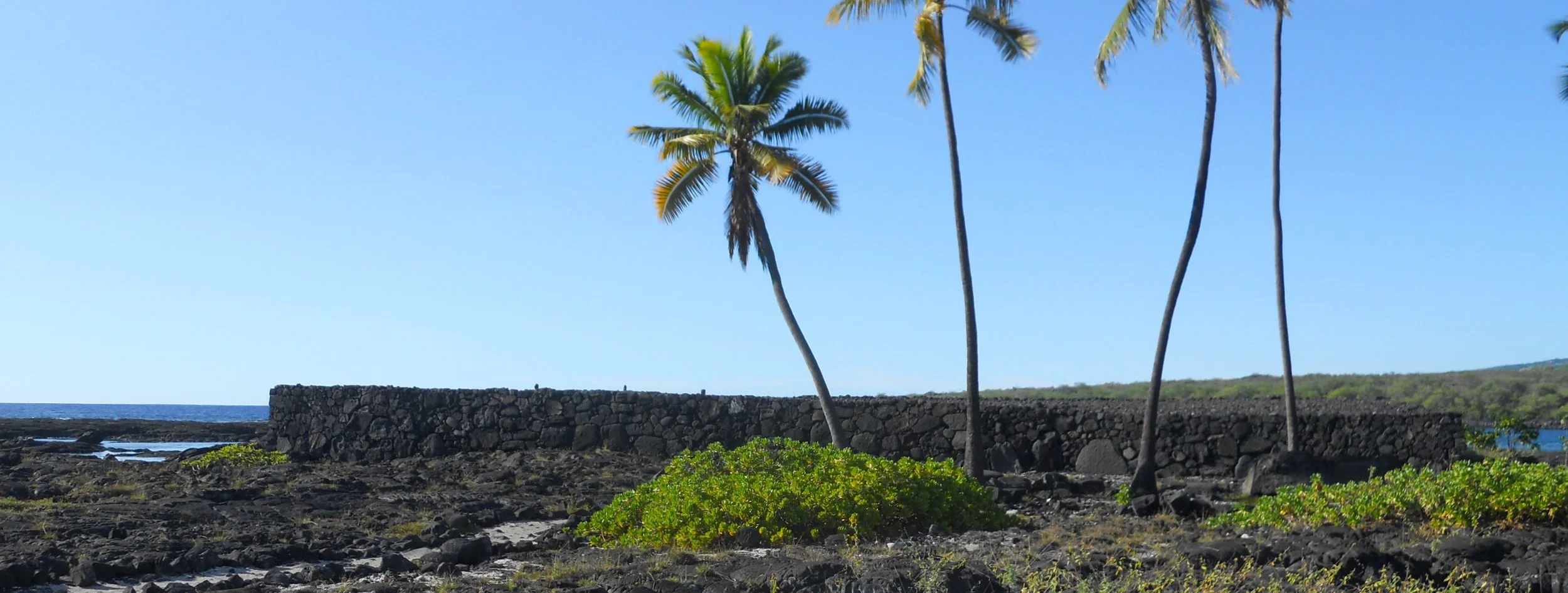
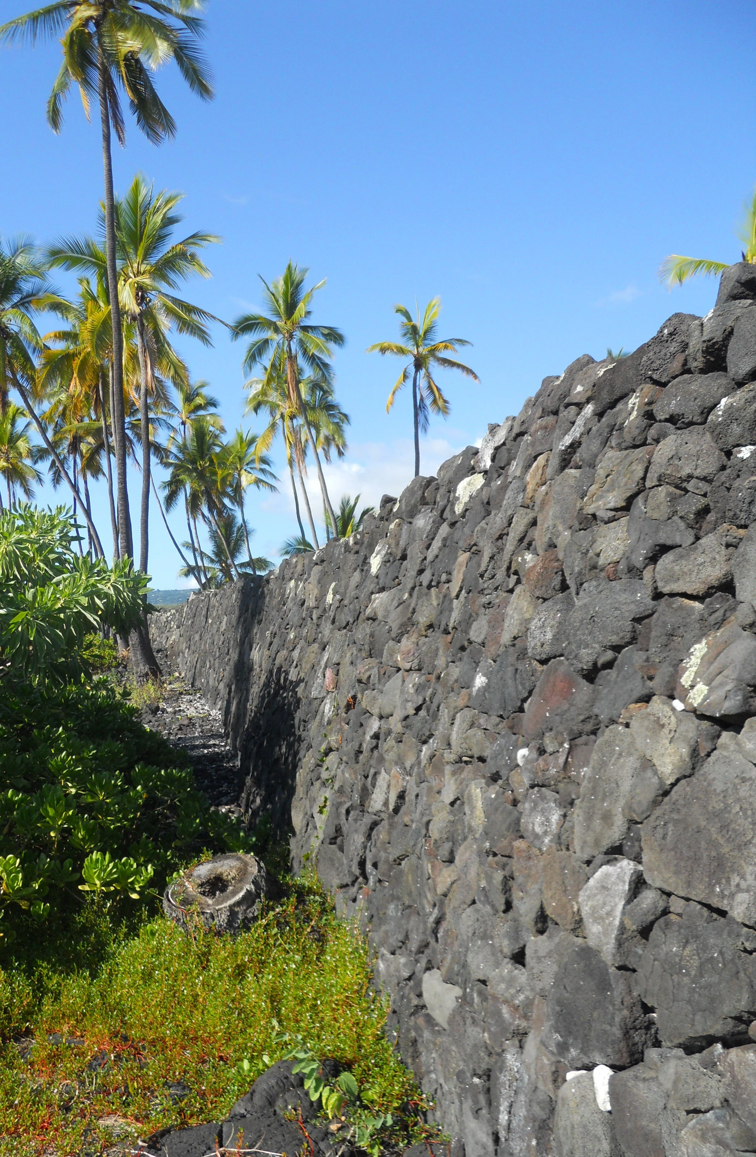
Pu’uhonua o Honaunau NHP preserves royal land and the refuge for those who broke “kapu”, the sacred laws. The boundary of the Pu’uhonua (the refuge area) was defined by the Great Wall (12 feet tall, 950 feet long), built over 400 years ago with lava rack. Death was the only punishment for breaking kapu, but if you reached the wall and made it to the other side, no one, including the King, could touch you.
Another item on the 16-stop self-guided tour is Ale’Ale’a, believed to be the primary heiau, or royal mausoleum, in the earliest days of this royal area.
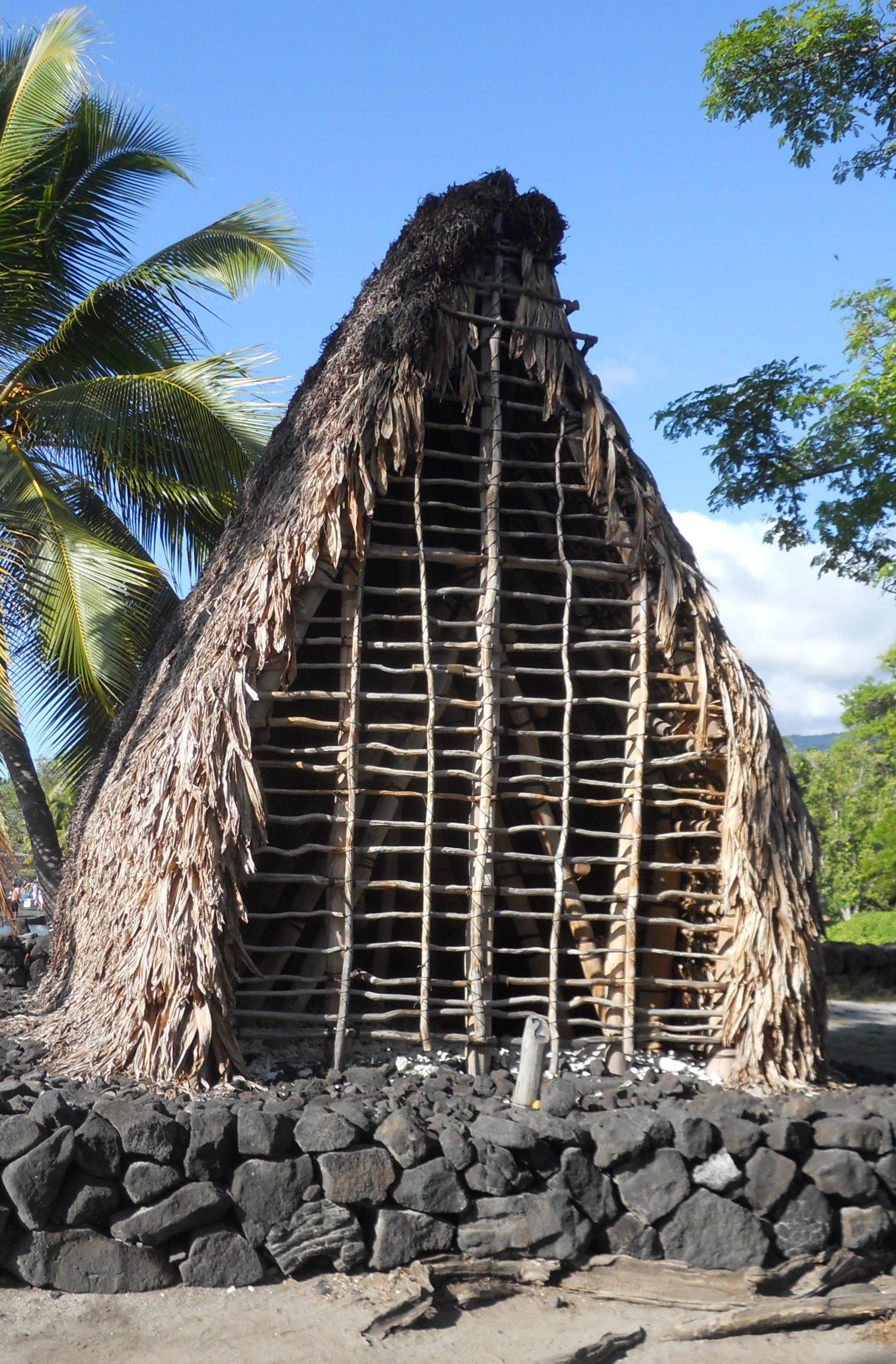
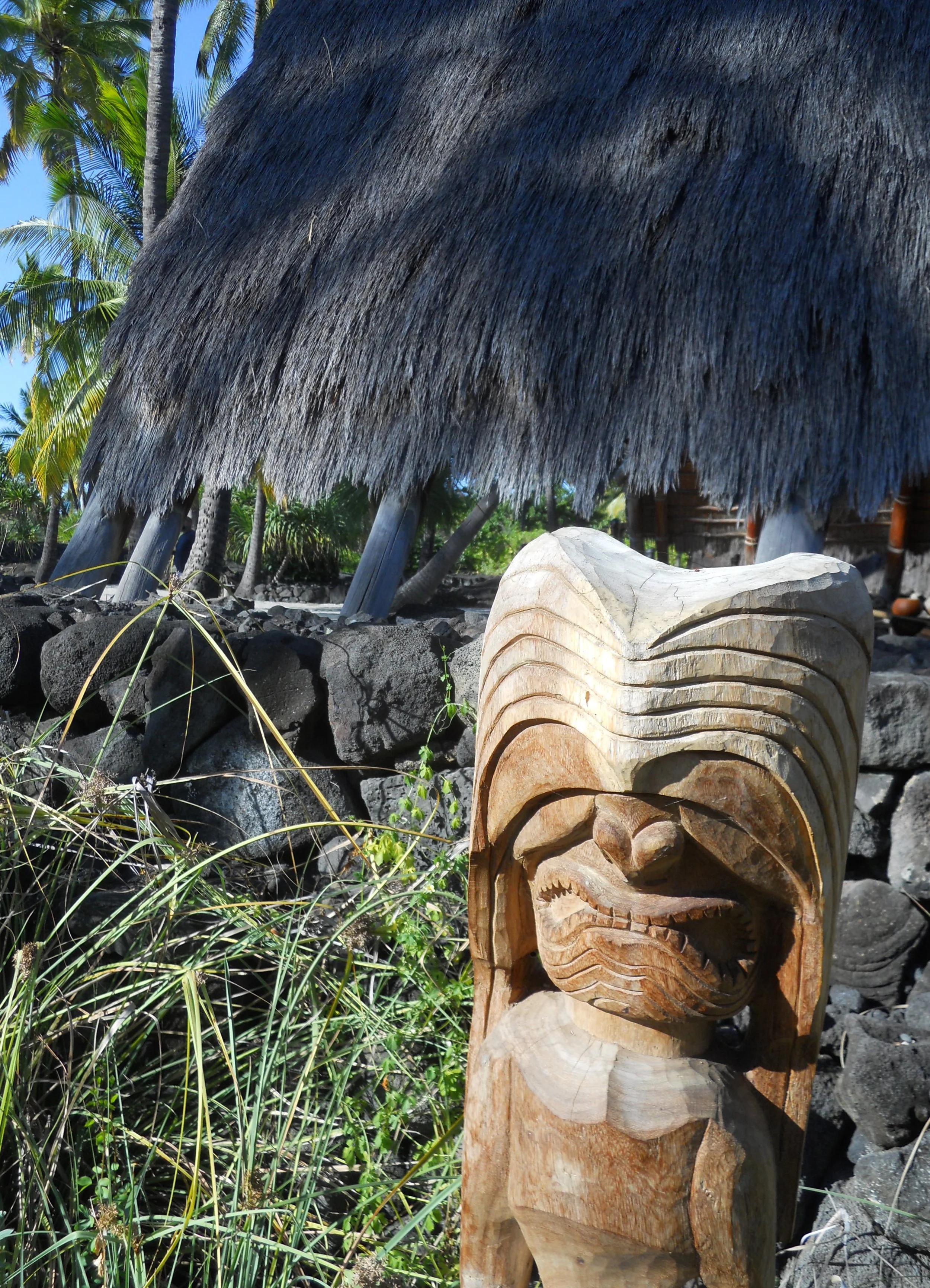
So, on one side of the Great Wall was the refuge, while the Royal Grounds were on the other, where today a Canoe House stands, with many carved wooden figures, known as ki’i.
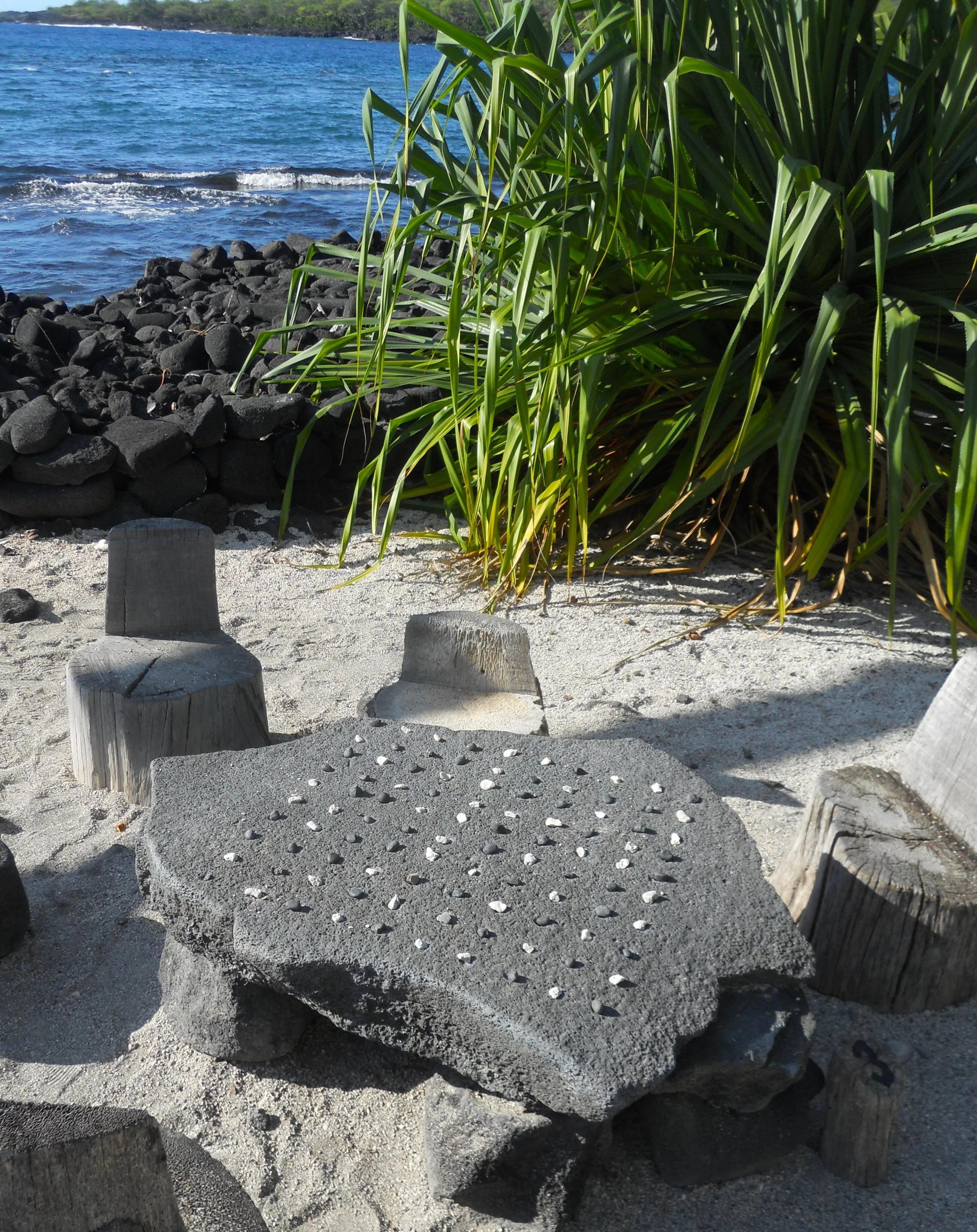
A replica of the Hale o Keawe temple (another royal mausoleum where the bones of 23 ali’i are interred, including Kamehameha’s great grandfather), is near the VC. Also on the Royal Grounds is a table for the Hawaiian strategy game of Konane, played with black and white stones. Seems most cultures let white and black counter each other. Chess anyone?
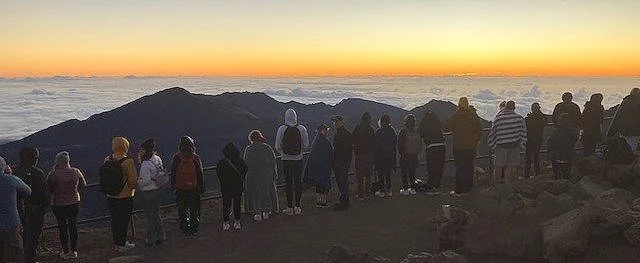
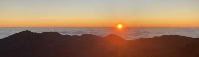
DAY 10 (October 28) - A reservation is needed for a vehicle to enter Haleakala NP between 3 AM and 7 AM. This is due to the high demand for witnessing a sunrise from the crater rim or summit. A couple hundred people were at the crater VC. We were well above the clouds, so the sun had to rise above that before its rays could hit the crater rim, but it eventually made it.
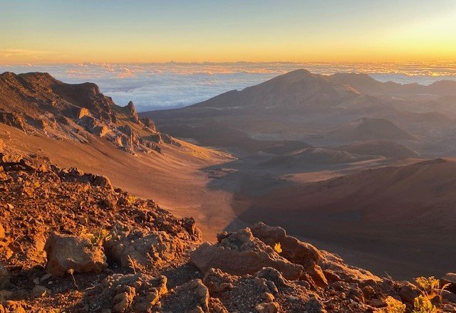
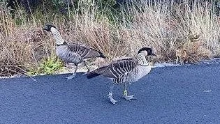
The observers had a treat, seeing the moon set while the sun rose. My understanding is if we had been down at sea-level there would have been a few minutes difference (6:18 AM and 6:26 AM). But, being 10,000-feet in elevation, we saw both, together. The sun was “chasing” after the moon. A wonderful surprise for me was finally seeing a couple of Nene, a goose species in the park which is found no other place in the world.
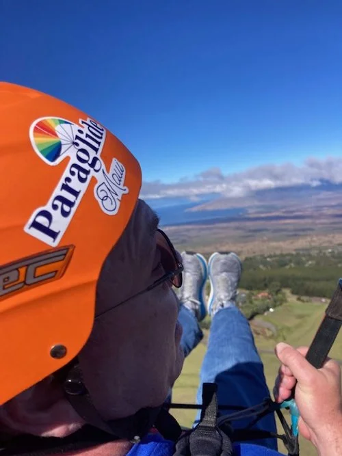
To celebrate, I took a couple of paraglider flights over the northwest slopes of Haleakala. Like Nike says, “Just do it!”
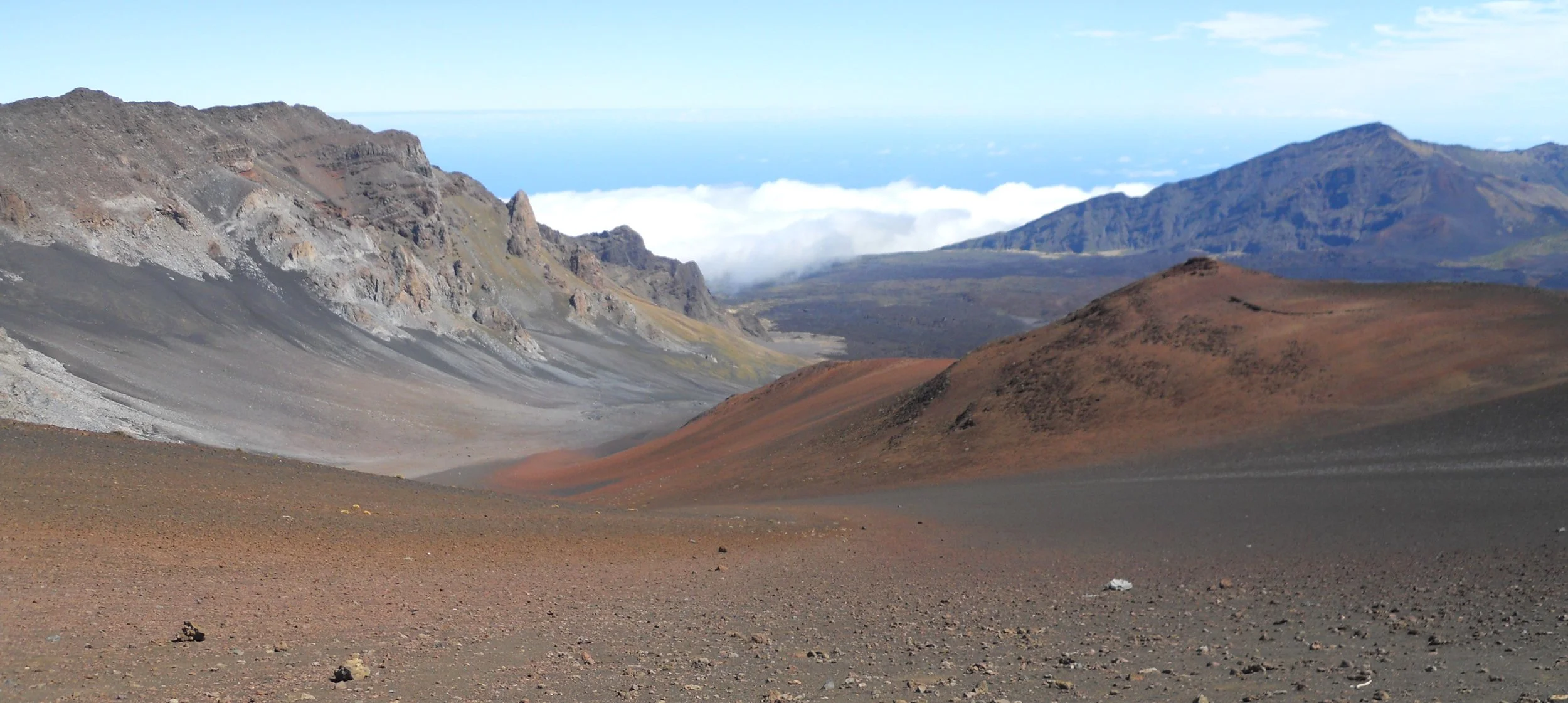
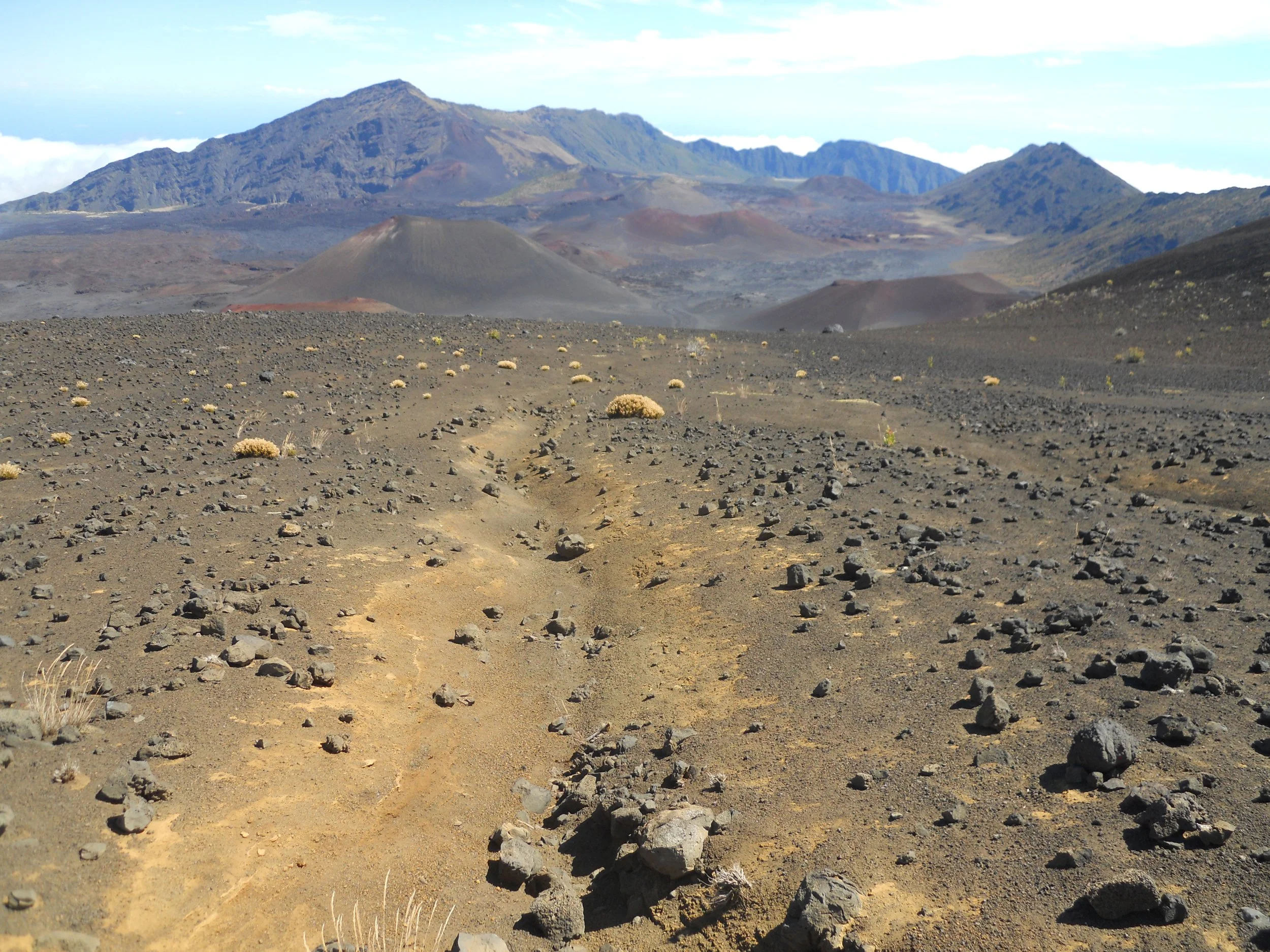
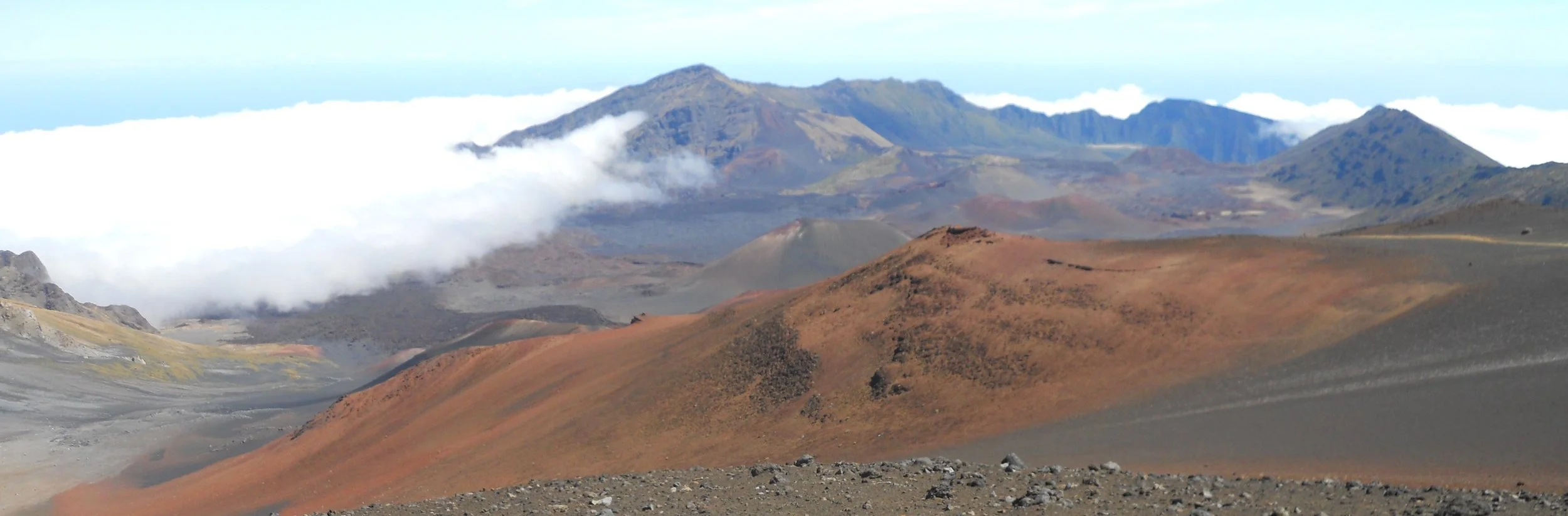
DAY 9 (October 27) - Haleakala NP seems to be a land out of place. This is Hawaii, full of lush tropical trees and fruit fields. But the crater of Haleakala looks more like a moon landscape, mixed in with some Martian red. Getting to the crater rim was almost as adventurous as hiking down to the crater floor. Twenty miles of switchbacks, climbing 8,000 feet, makes for a long drive. Sweeping views of the Maui low country, West Maui, and the ocean helps the time go by.
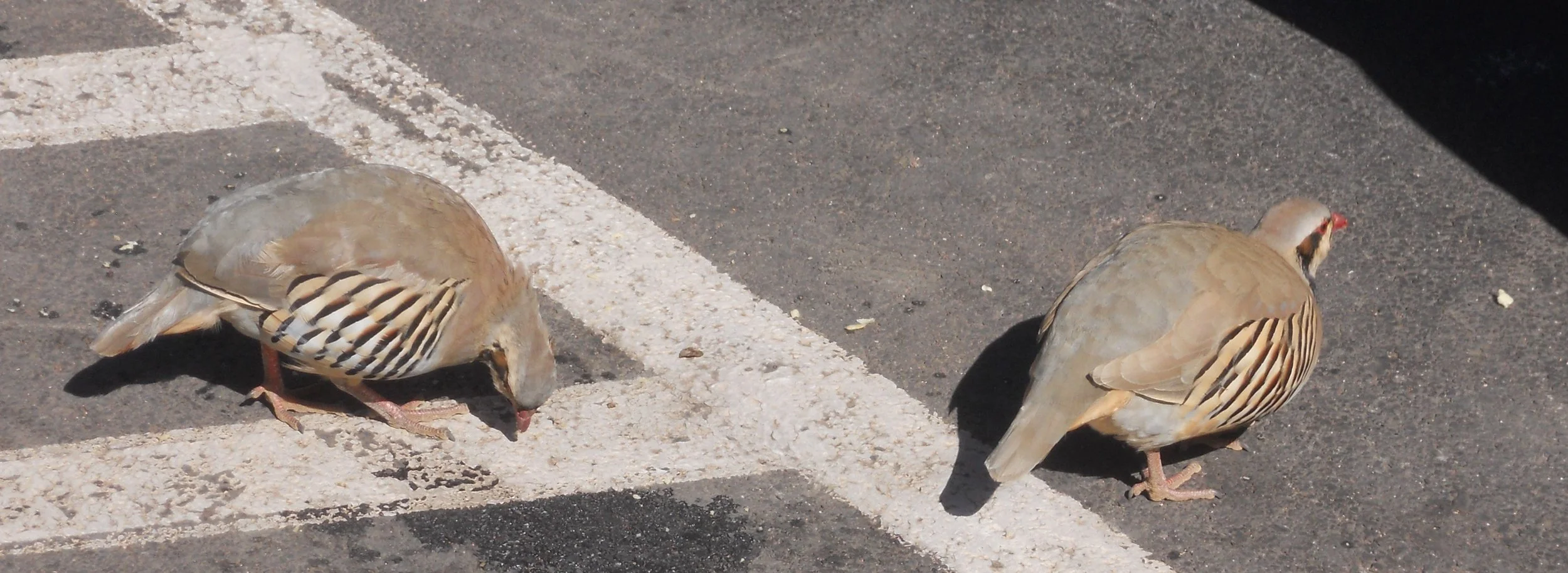
Once at the summit you can look down on the cloud tops. You can also converse with Chukar birds in the parking lot. They are native to Asia, brought here for hunting on the island. But hunting is not allowed within the park boundaries, so this group of birds has figured out easy meals can be had from human snack droppings.
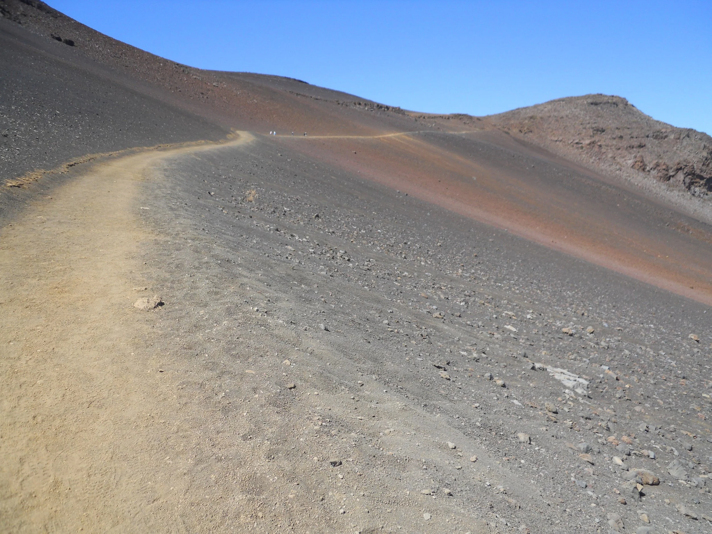
After enjoying the crater floor, you have to hike back up. This can be up to 2,500 feet.
As I was getting close to the top, I could see the clouds rolling in.
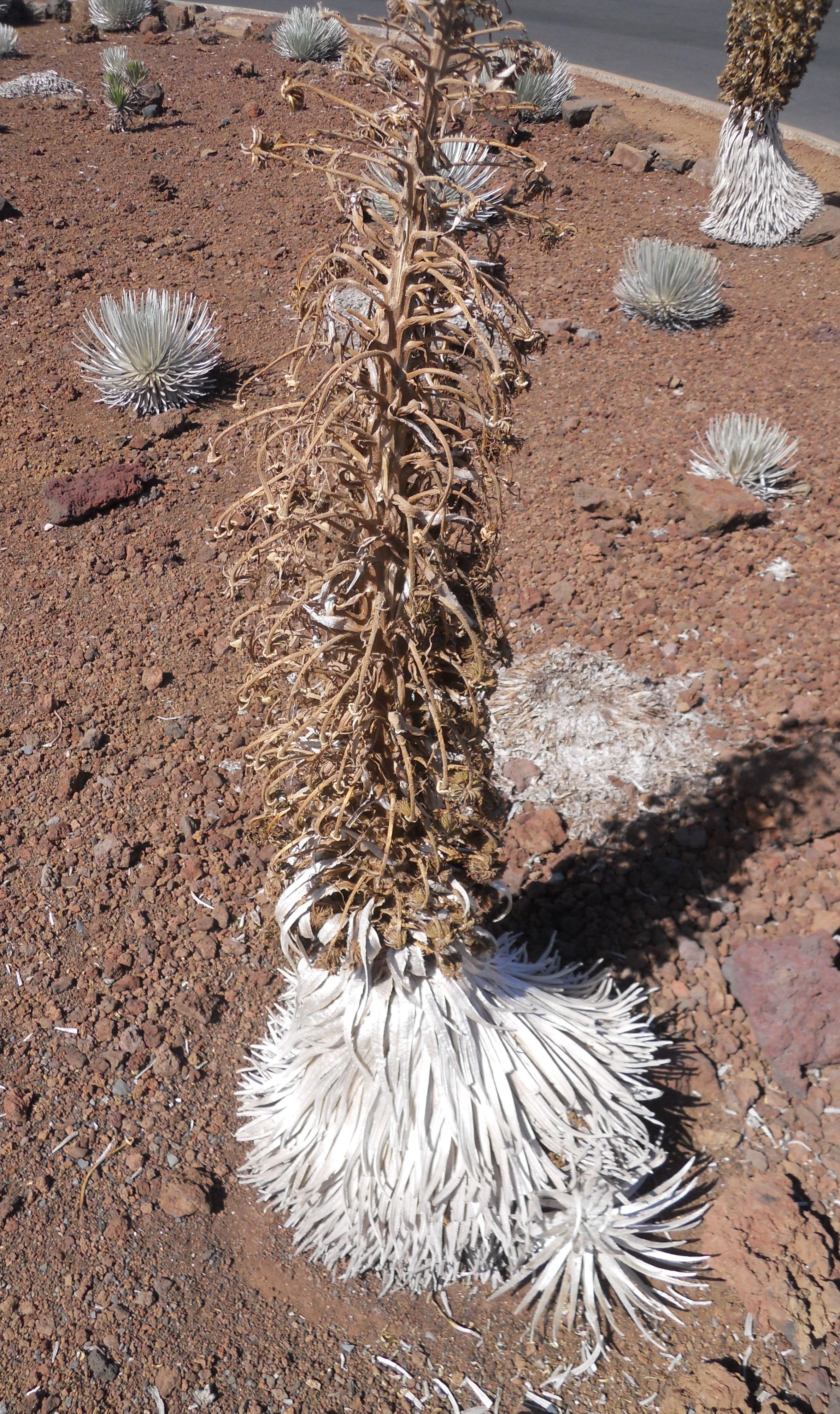
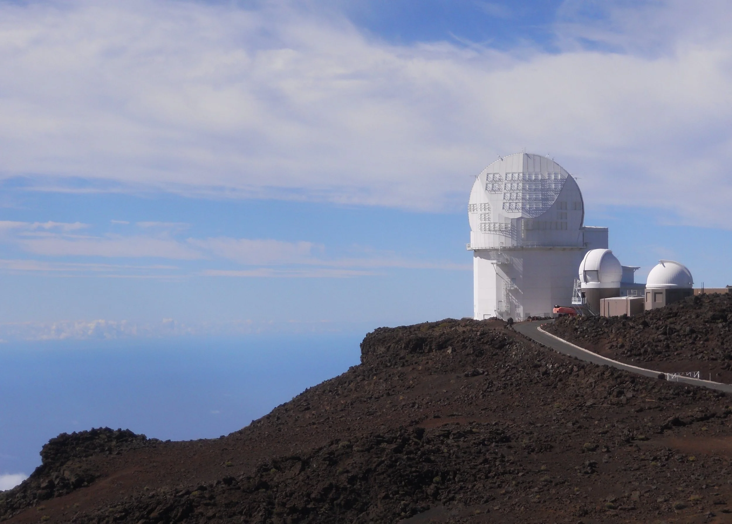
At the top, I took a short drive over to the viewpoint for the Maui Telescope. This parking lot has a small area with Silversword plants (photo at the top). They are found nowhere else on the planet.
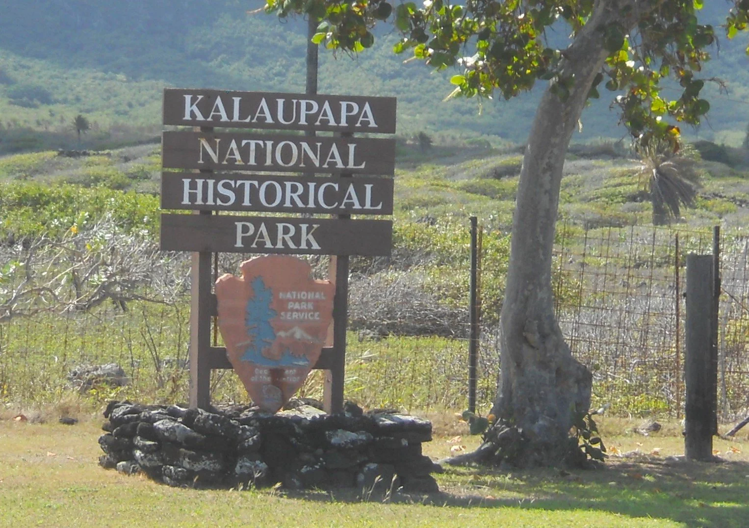
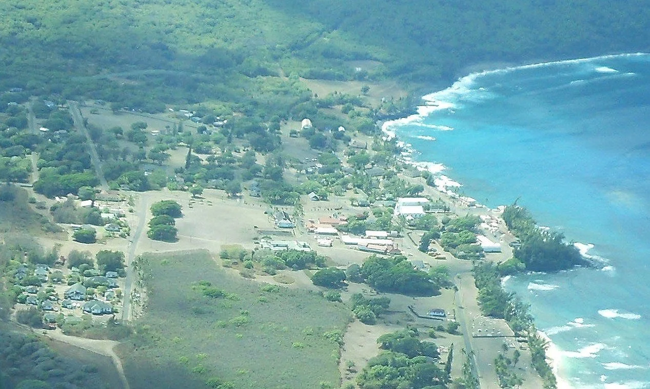
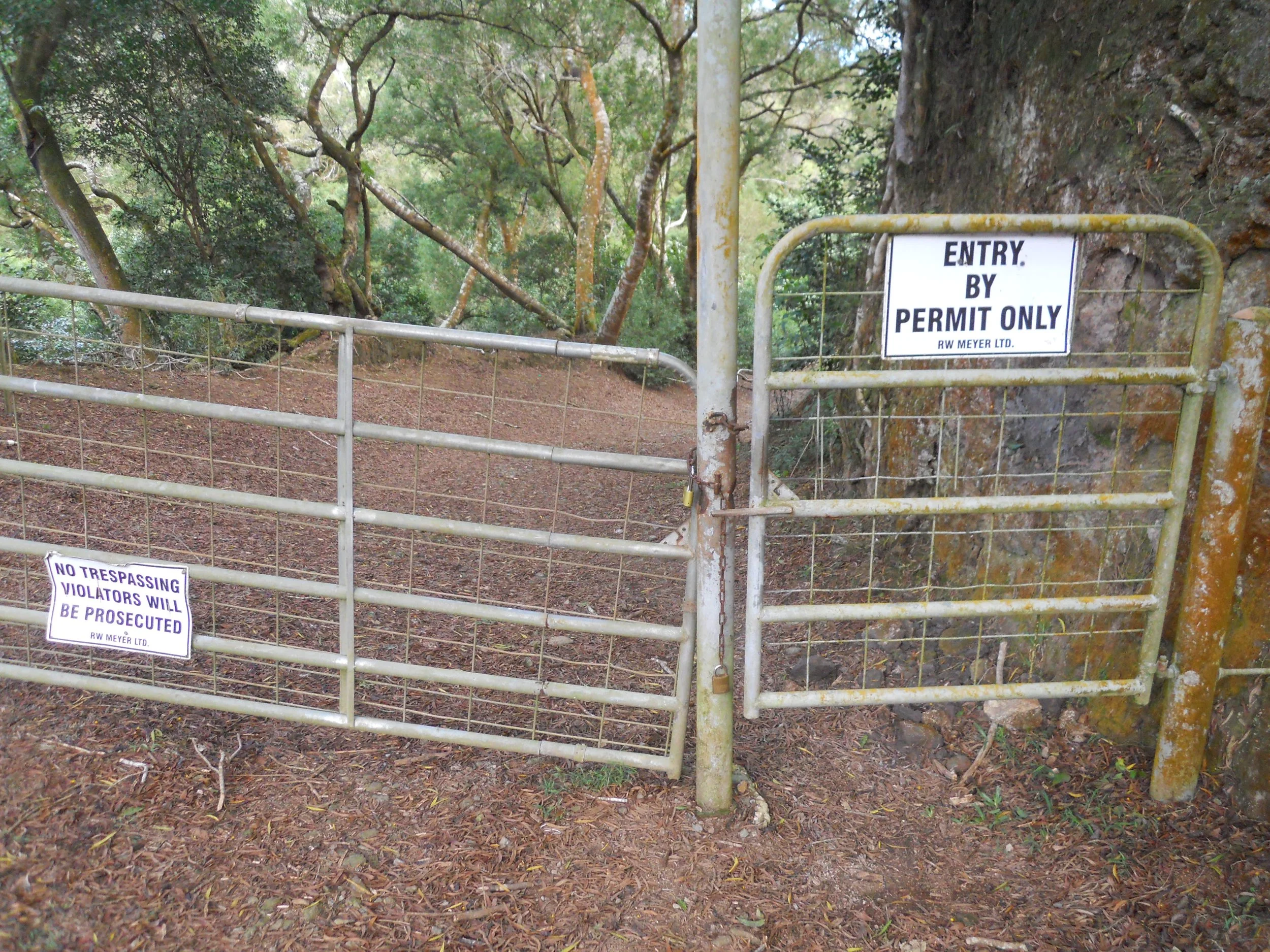
DAY 8 (October 26) - This is my second October 26 in two days. That is what one gets by going east across the International Date Line. Kalaupapa NHP is the site of the last leper colony in our country. The King of Hawaii banished all in the islands who had contracted Hansen’s disease to the low-lying peninsula on Molokai Island. This was back in 1866. Over 8,000 people have died in this “prison” since. A few “residents” remain in the village, having decided to live their remaining years here instead of moving. Leprosy was cured many decades ago.
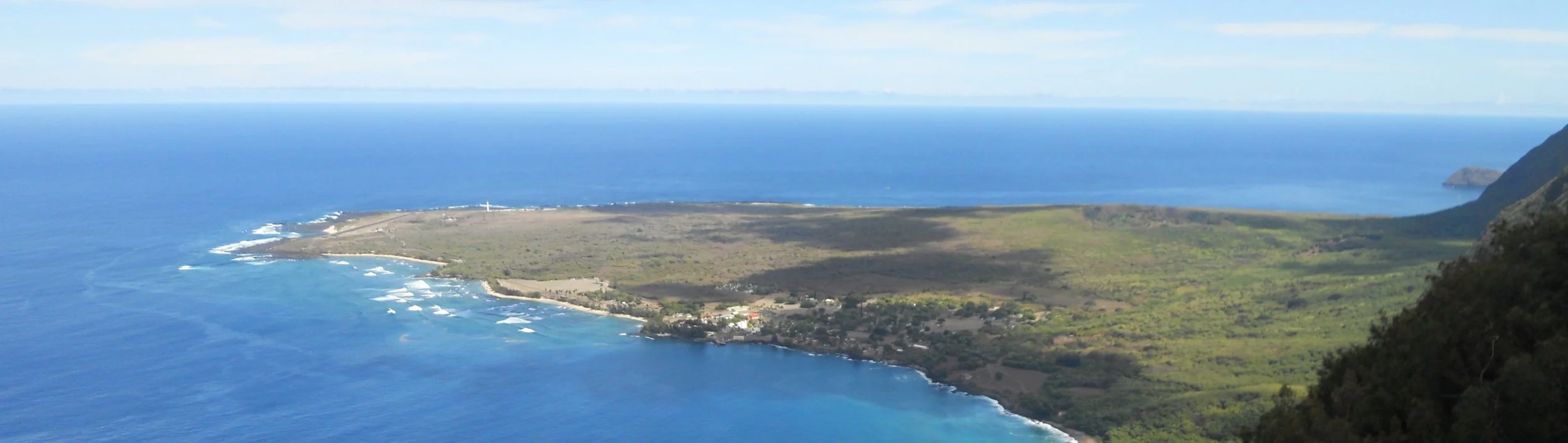
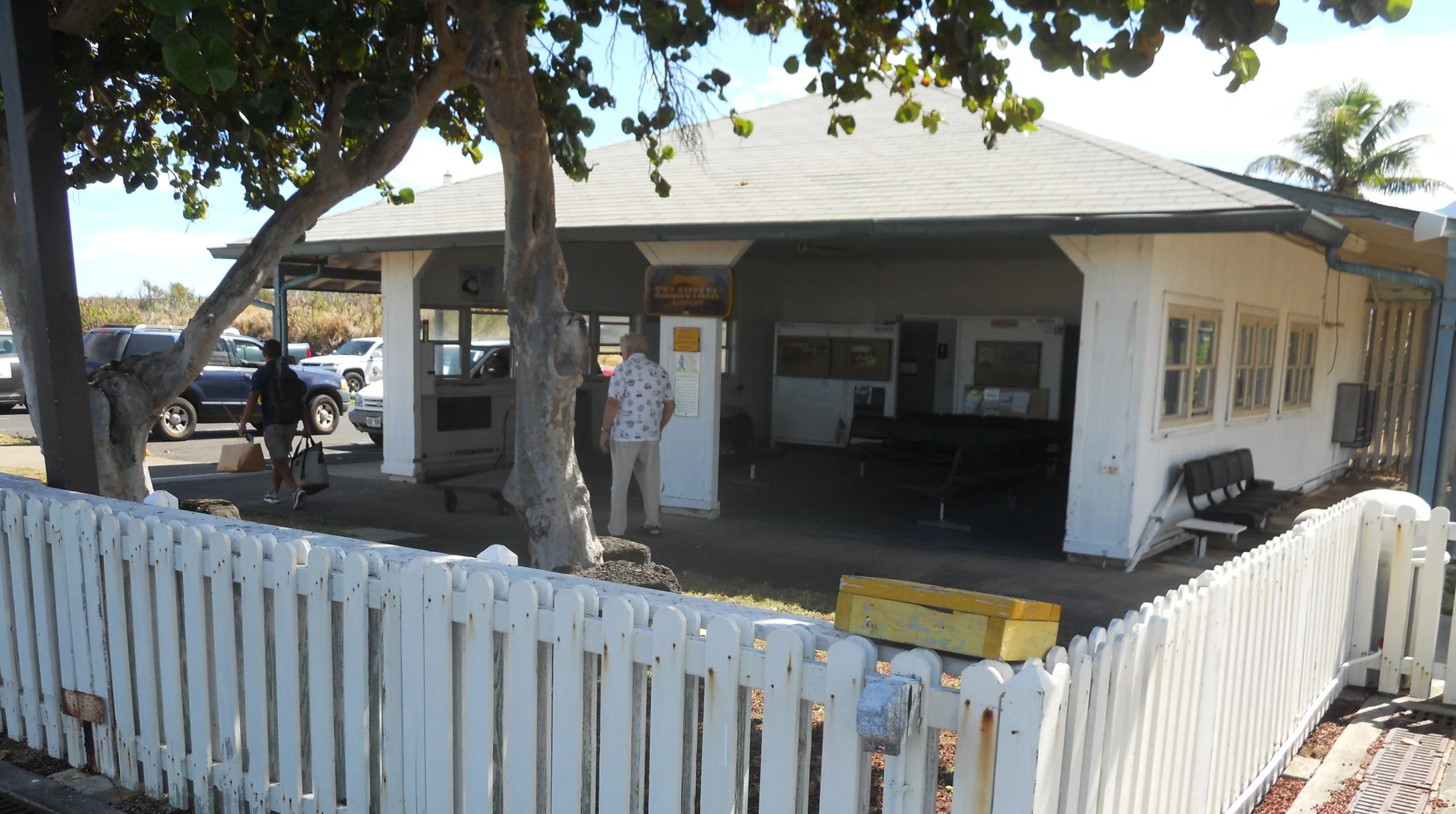
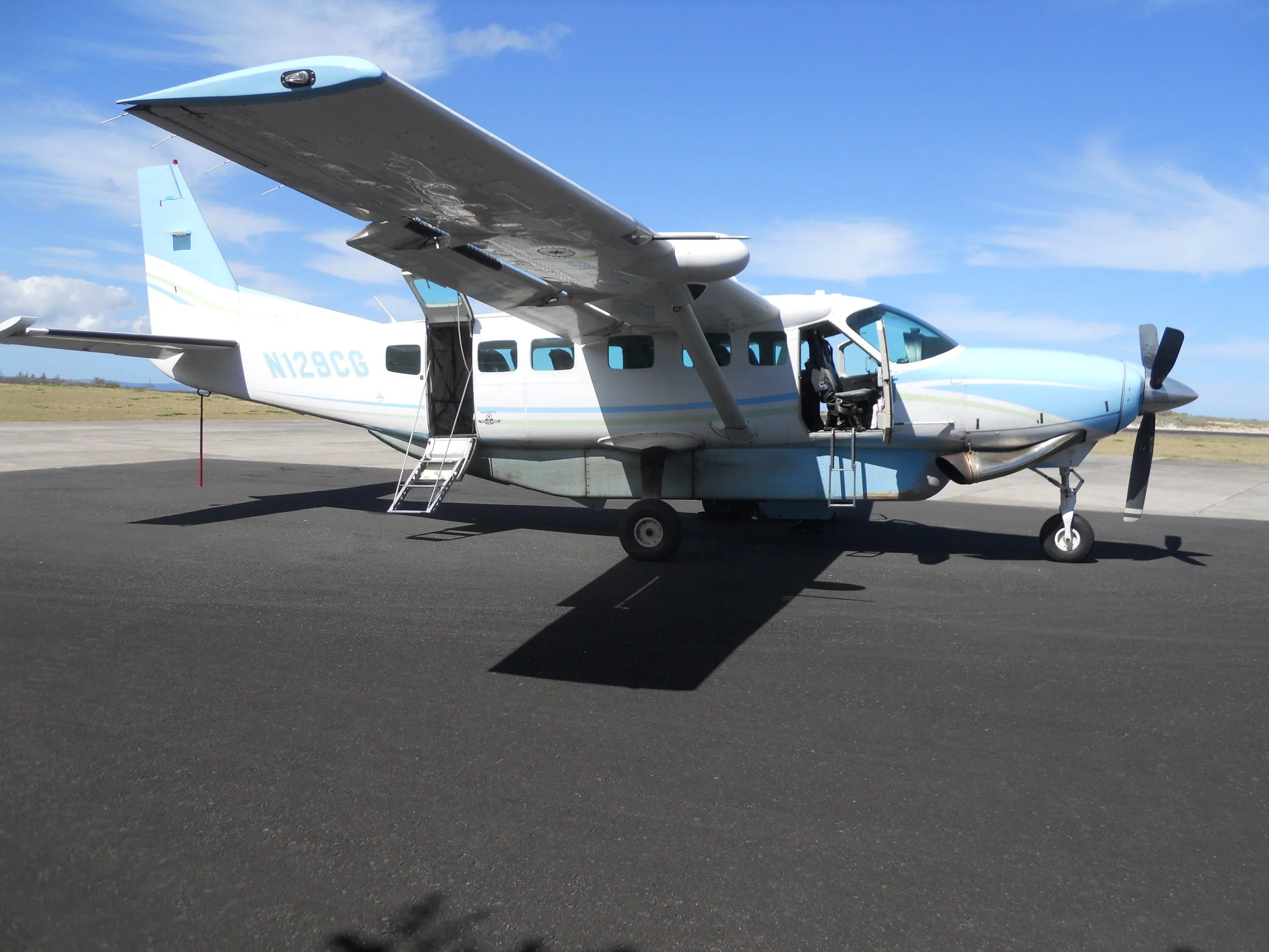
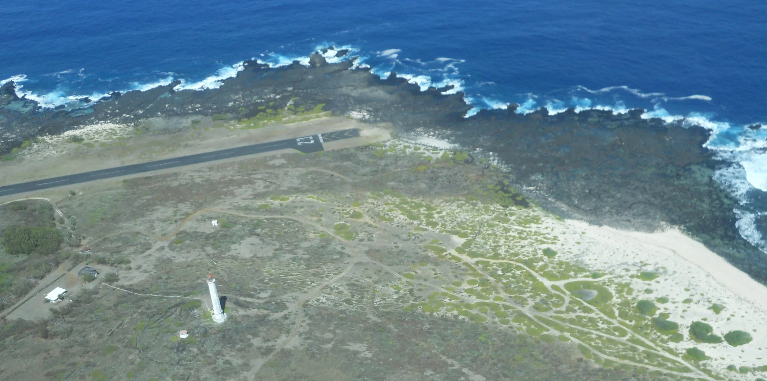
Mokulele Airways has a daily flight to Kalaupapa to transport residents, medical people, NPS, and authorized visitors. A Cessna-208 is used to land at the small runway and open-air terminal. This is the only current means to access the park (the NPS and State of Hawaii have closed off the village until the last resident passes, so no one can use the mule-trail from the topside… see last photo at bottom). The plane then continues on to the Molokai airport. So, a person can book this flight as long as they disembark at the Molokai airport. But one passenger and the pilots said I could get off the plane and take a few photos, including the park entrance sign. The entire peninsula, which includes the airfield, is within the park’s boundaries. The Molokai Lighthouse (built 1909) stands at the end of the peninsula and runway.
The village had been a Hawaiian fishing center before its use as a leprosy camp.
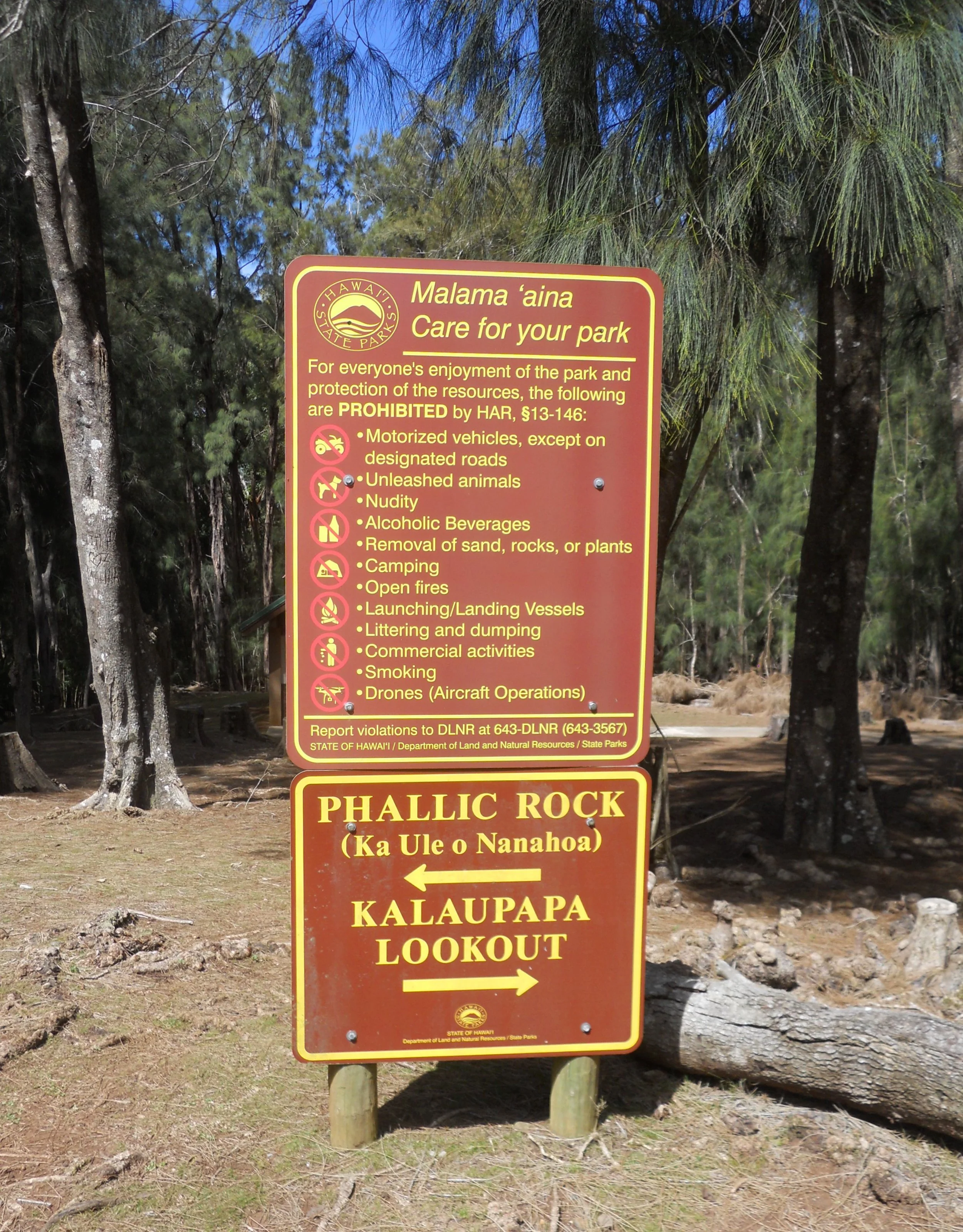
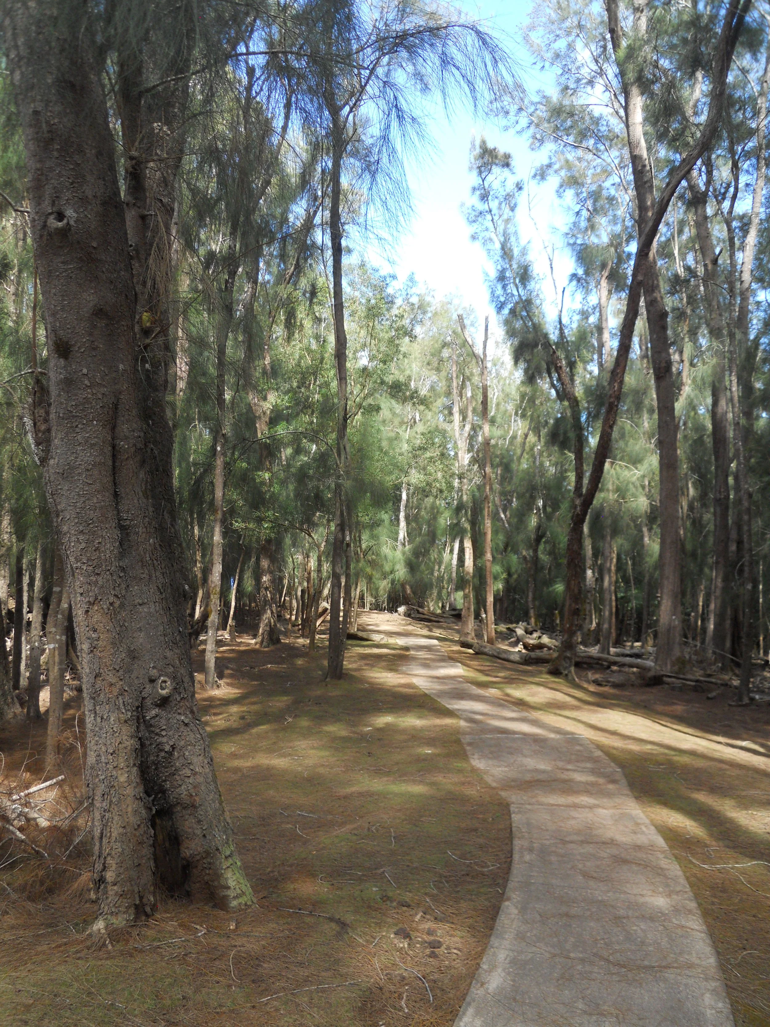
A few hundred yards of road and a short trail up on top of the cliffs (it is 2,000 feet from the top down to the peninsula) are also within the boundaries. After landing at Molokai airport, I took a car to the parking lot at the end of route 470, through Pala-au State Park. A sign points to the Phallic Rock (ancient petroglyphs) and the Kalaupapa Overlook. The trail to the overlook is paved. The view is stunning (top photo). Hopefully, the park becomes accessible in the future. There is more to see along the coastline which is out of sight in the top photo, such as Father Damien’s church and his grave. He settled here in 1873. At the end of the park’s coastline boundary is a region of tall, steep jungle hillsides which have been seen in countless Hollywood movies such as Jurassic Park.
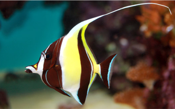
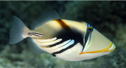
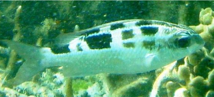
Extra DAY 7 - Figured folks might like to see some of the fish I swam with in Tumon Bay this afternoon. This is one easy place to snorkel. I used the Ypao Beach access (others are Gun Beach, Tumon Beach, etc.). Only a few cars. The parking lot goes right up to the beach and some shelters. About 15 yards of sand before the water’s edge. The first 15 yards or so in the water you are walking on sand, until you reach the first line of coral. A lot of dead coral at this point, but after another 25 yards things pick up, and then plenty of coral out to the 500-yard mark which is where the ocean waves crash upon the reef. This is one large area for humans to explore since the width of the reef in the bay is around 1.5 miles. There were Moorish Idols (top left), plenty of Yellow and Blueback Fusiliers (top right), colorful Triggerfish (middle), and Striped Monocle Bream. These are just four of the many swimming in the reef. I came across three Sea Cucumbers doing their thing on the seabed.
Please be sure to use eco-friendly sunscreen lotion when you snorkel, swim, or dive in the ocean, especially around coral reefs. I had my Sun Bum on today. Most sunscreen products have harmful chemicals which can kill coral.


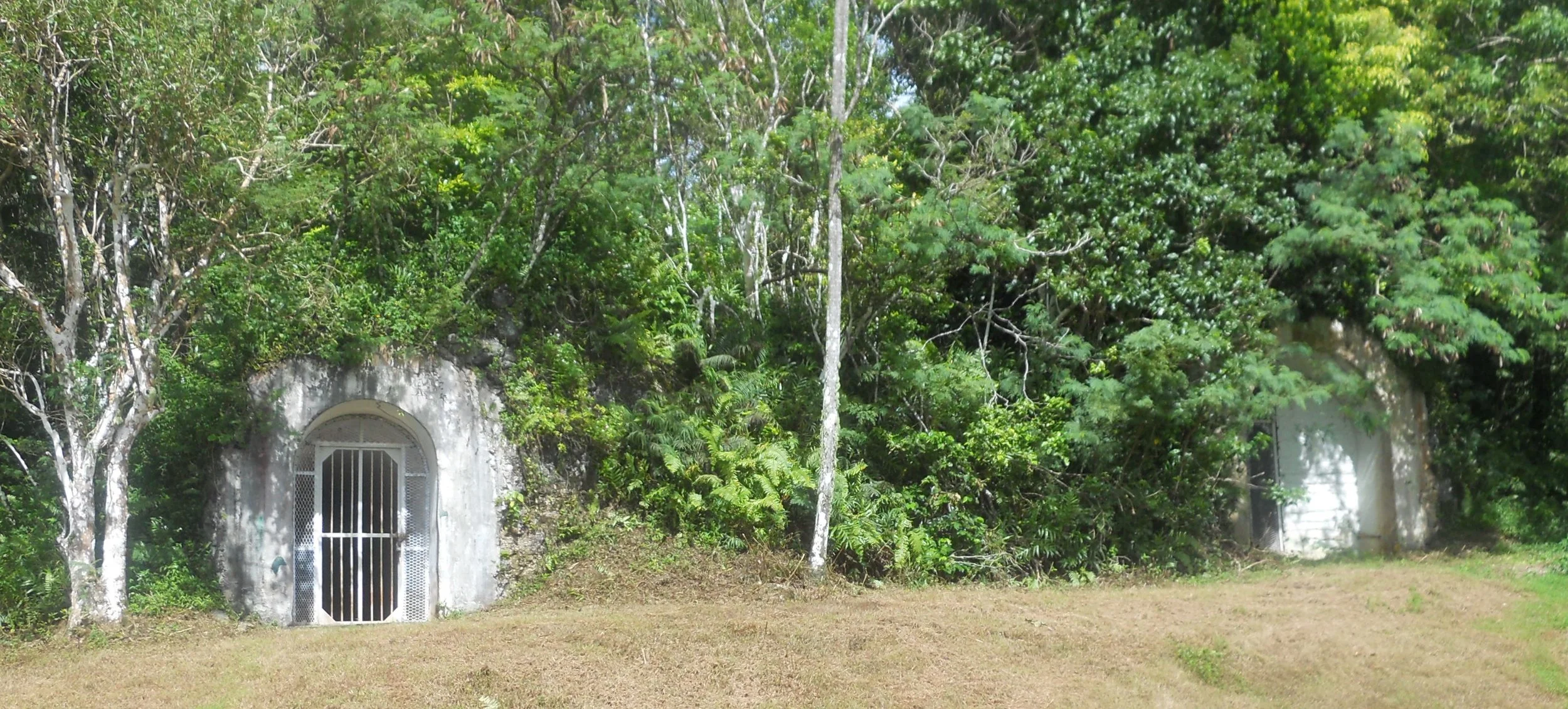
DAY 7 (October 25) - The Fonte Plateau unit of the park preserves the command post of Japanese commander General Takeshina. This is a U-shaped bunker, built into the side of a dense jungle hill.
A bit west is the Asan Inland unit. The only place to park a car is at the Overlook. There are no trails from here down to Asan Beach (where I was yesterday), so I decided to enjoy the view and the various memorials. A bronze bas relief shows American forces landing. About 10 panels list the 1,800 Americans who died during the invastion.
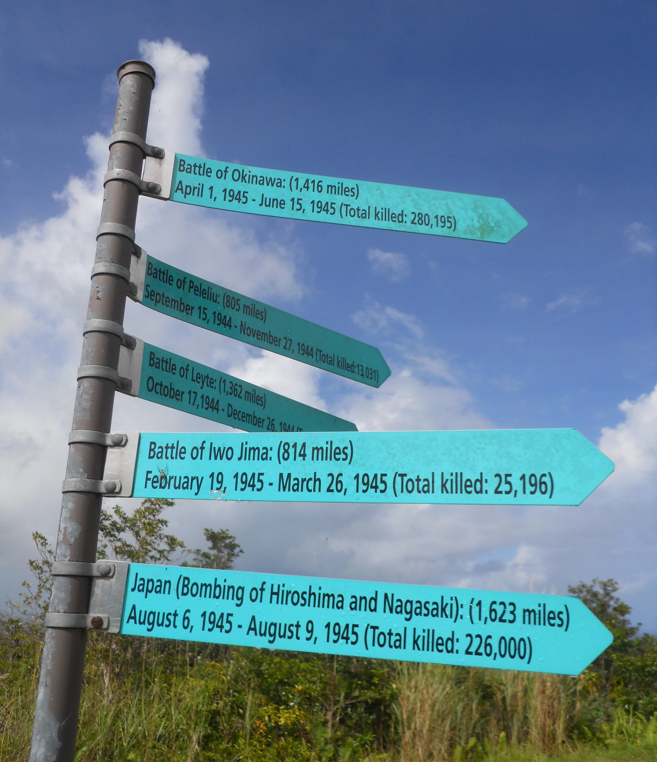
Three poles have signs pointing to major Pacific battles of the war, with the distance to each battle.
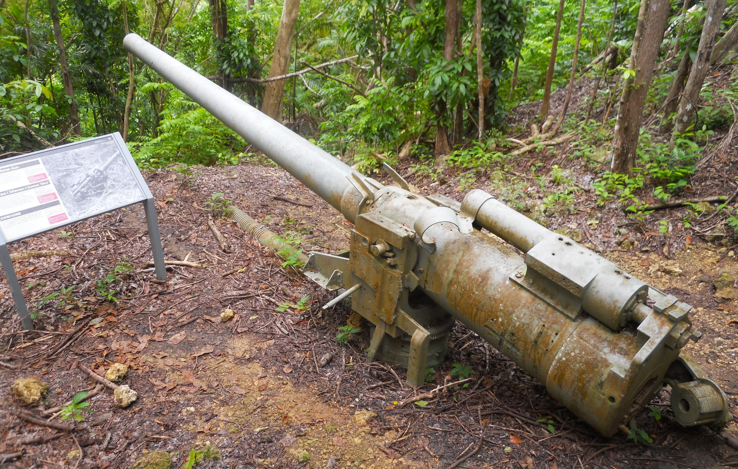
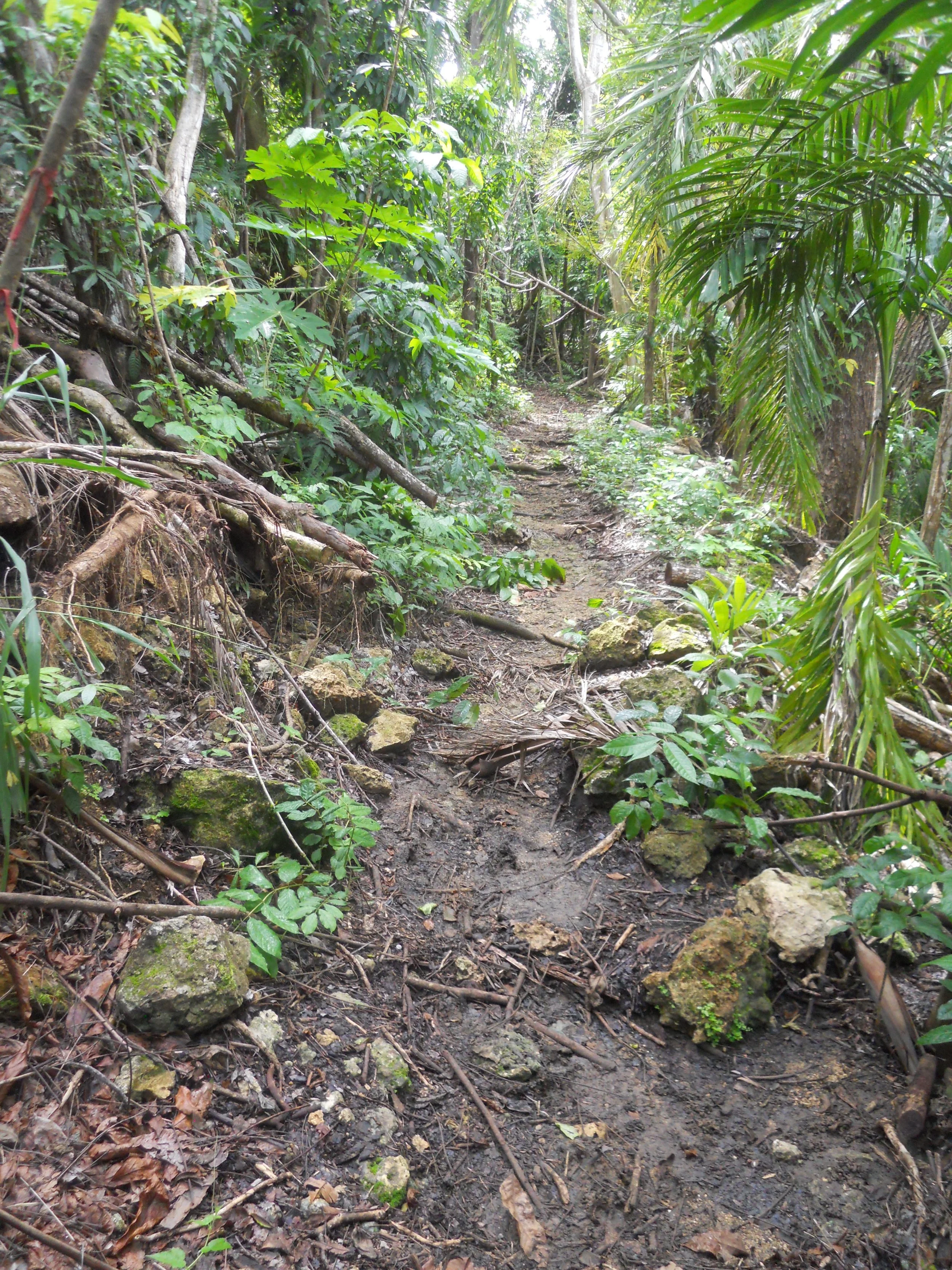
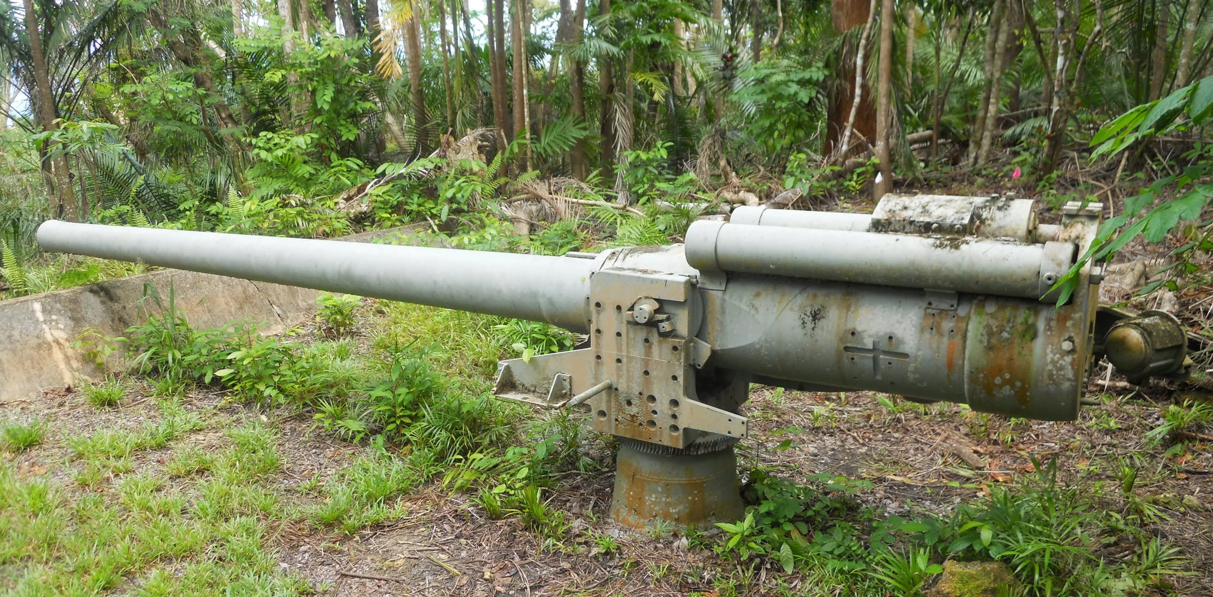
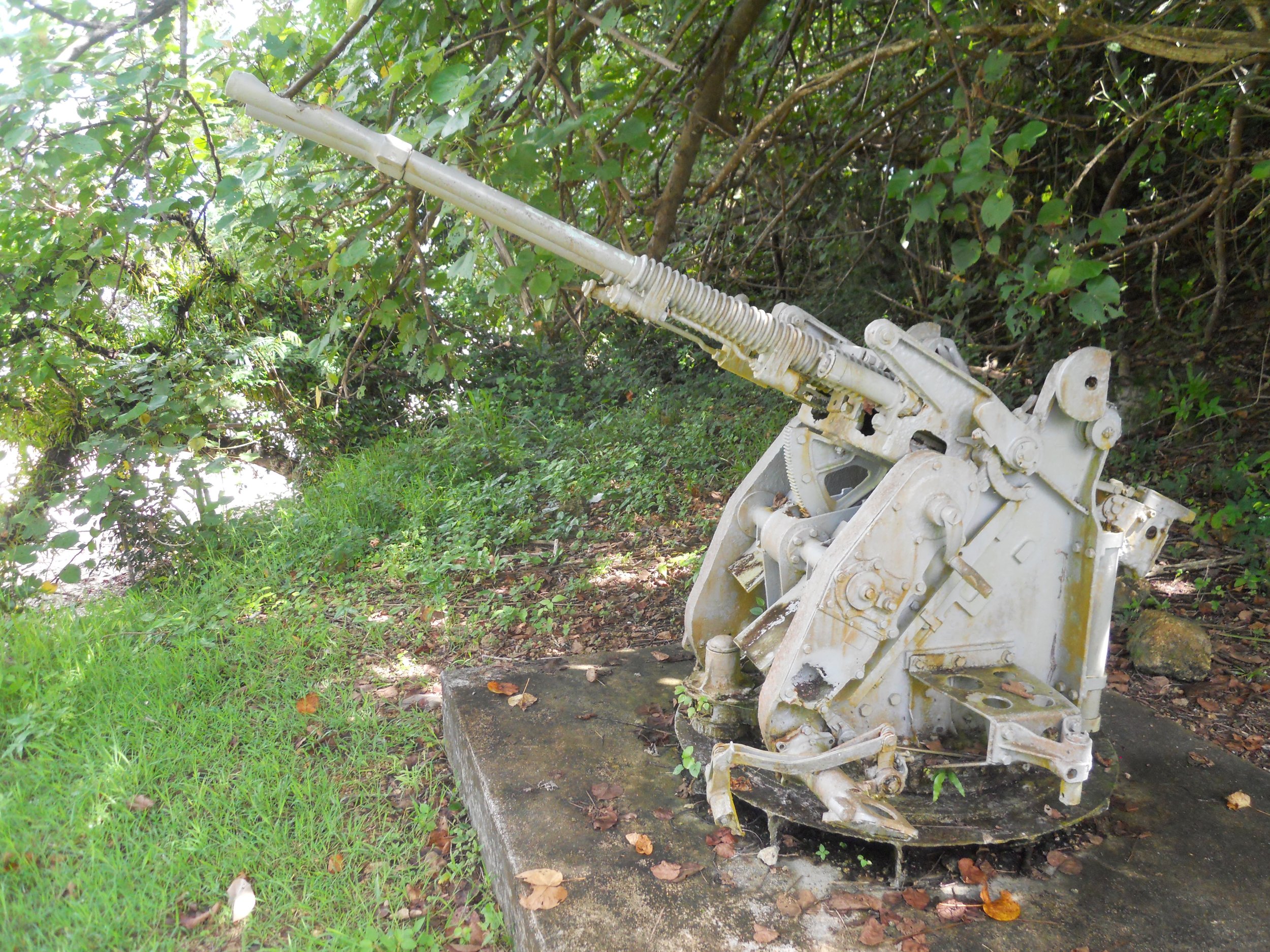
Down the hill is the Piti Guns unit. A maintained trail through the jungle takes a visitor to three 14" cm coastal defense guns. They look as old as their 80 years would suggest, especially being subjected to this ocean/jungle environment.
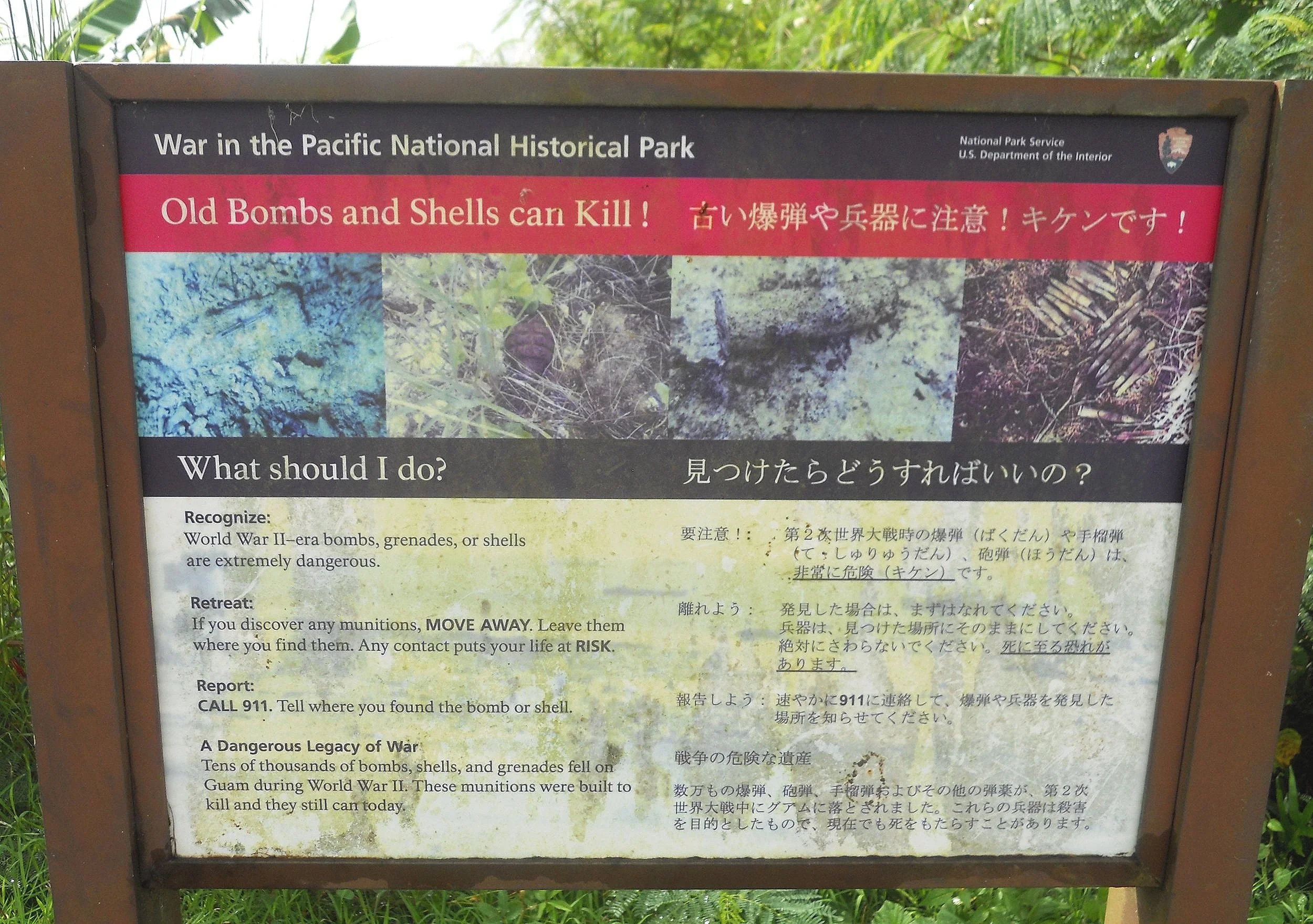
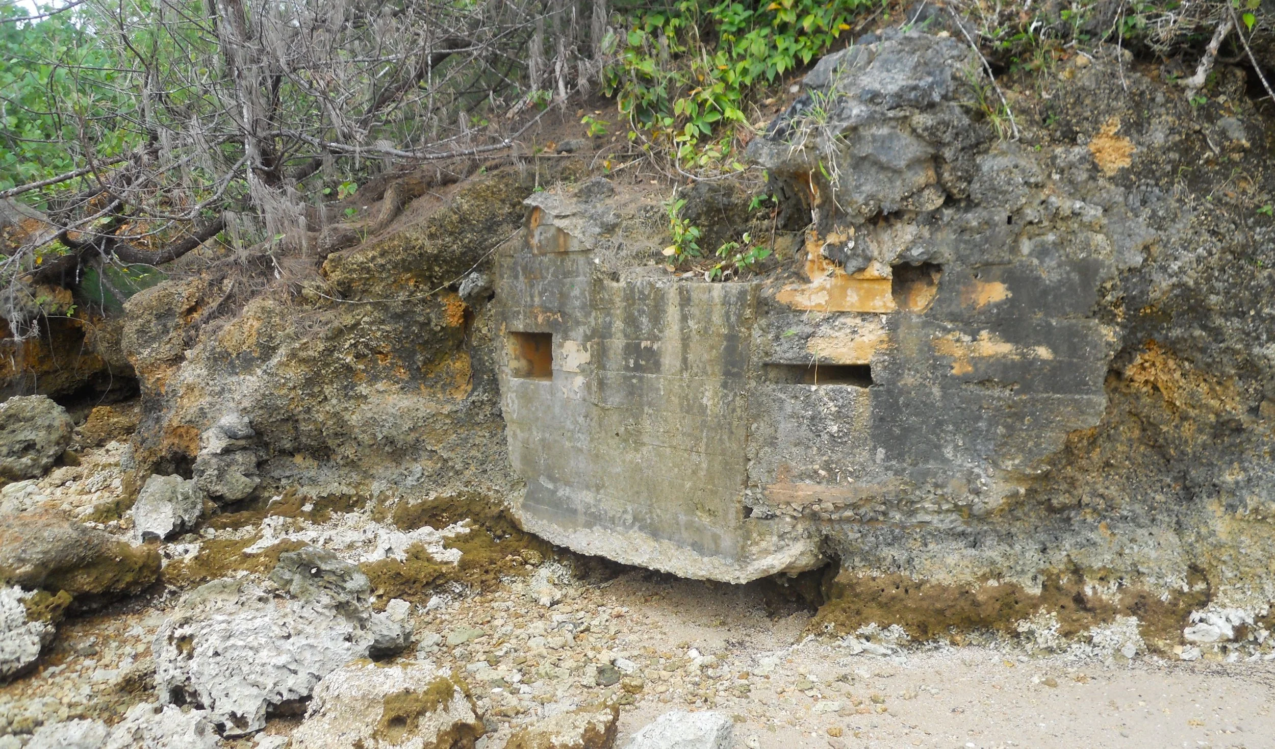
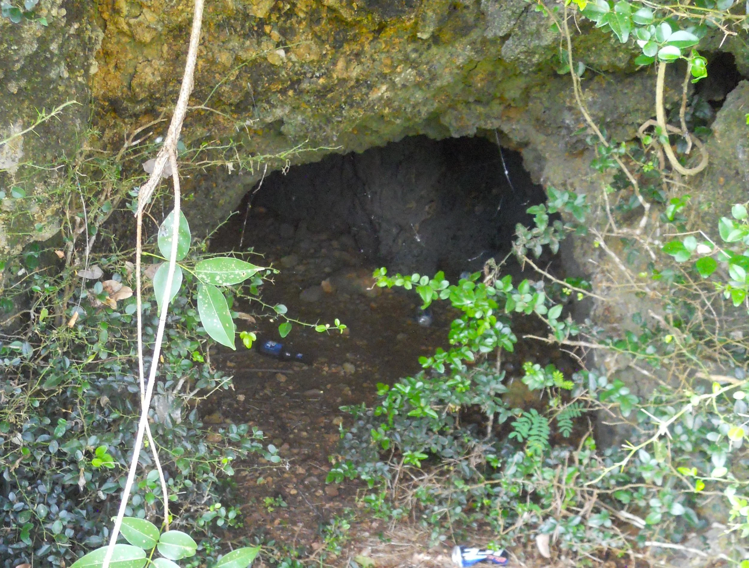
The last stop for the park was Apaca Point. Another one of those Warning signs was posted at the parking lot. Yes, there are unexploded munitions across the bays, beaches, and inland. One of the interesting items at this beach was the Japanese pill box and cave. The larger opening in the concrete structure was for the machine gun, which could sweep the entire Agat Beach. The smaller rectangular opening was for rifles. A grenade-proof vent is just above that.
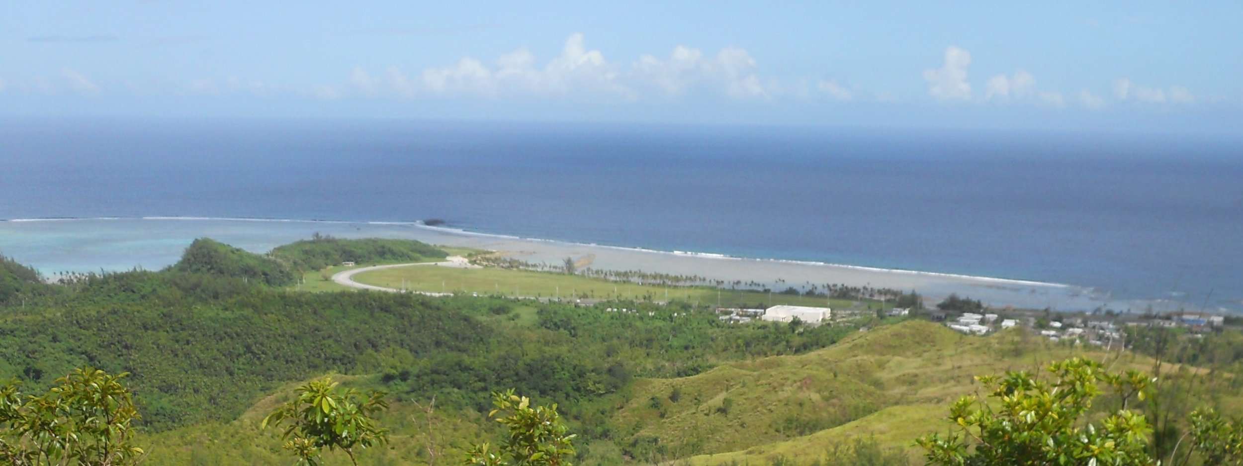
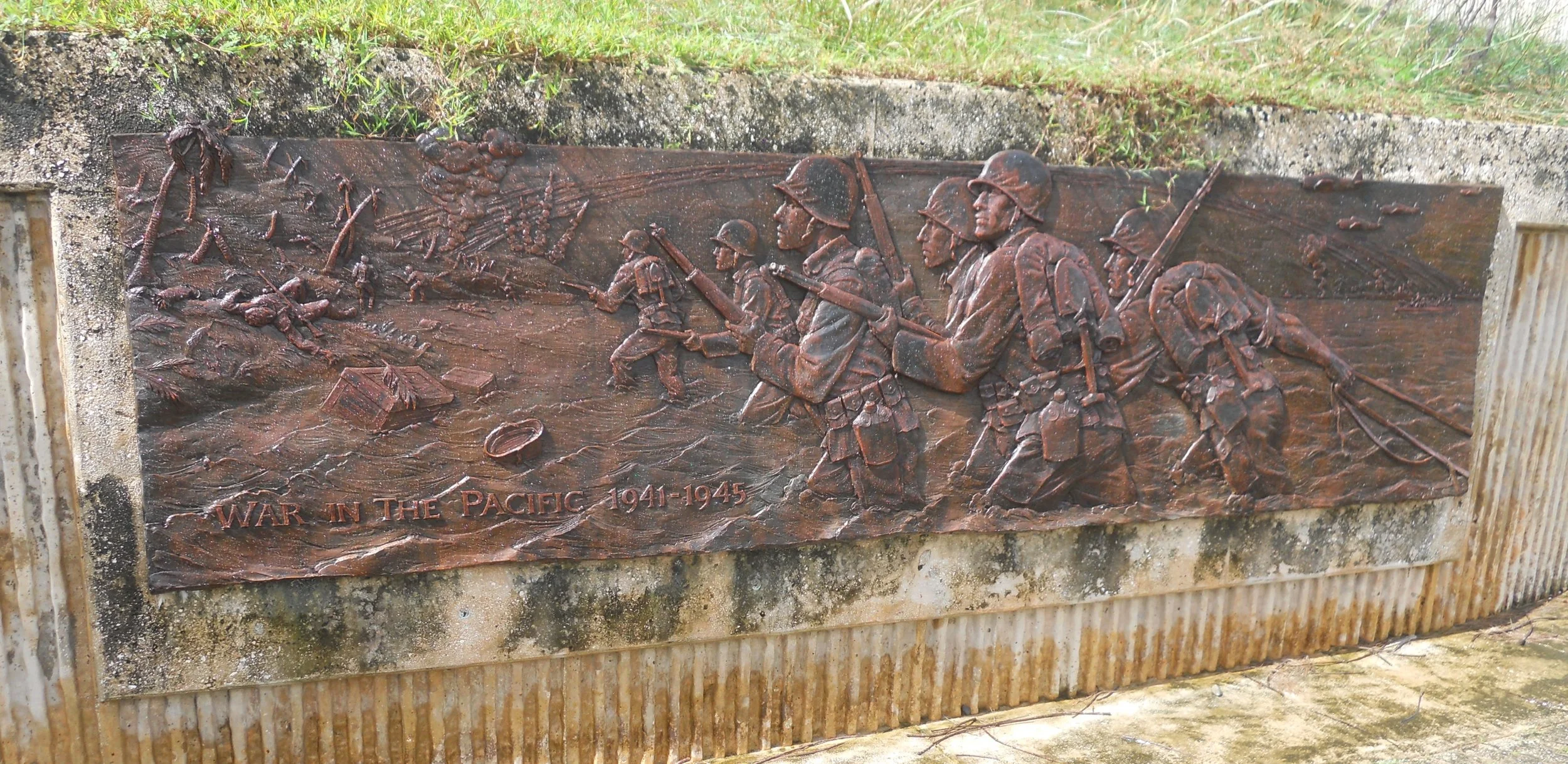
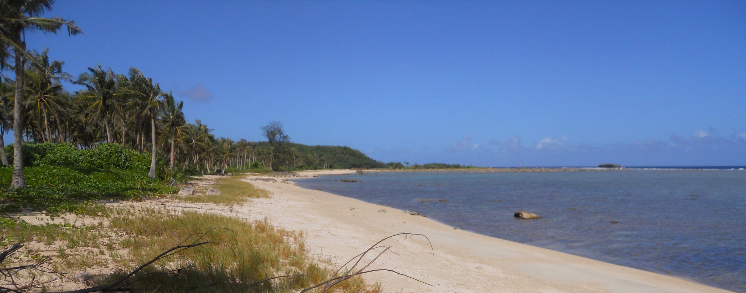
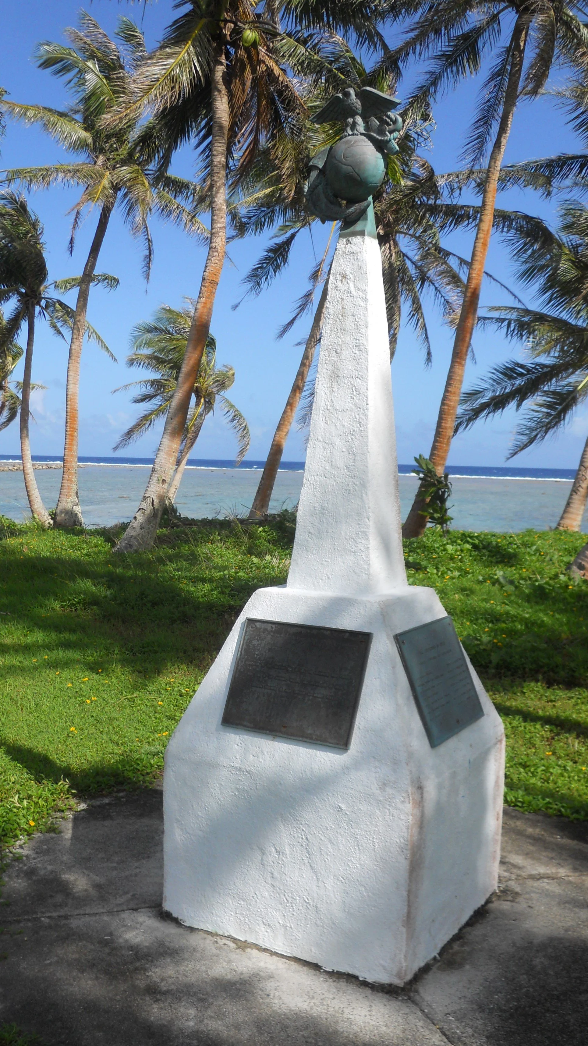
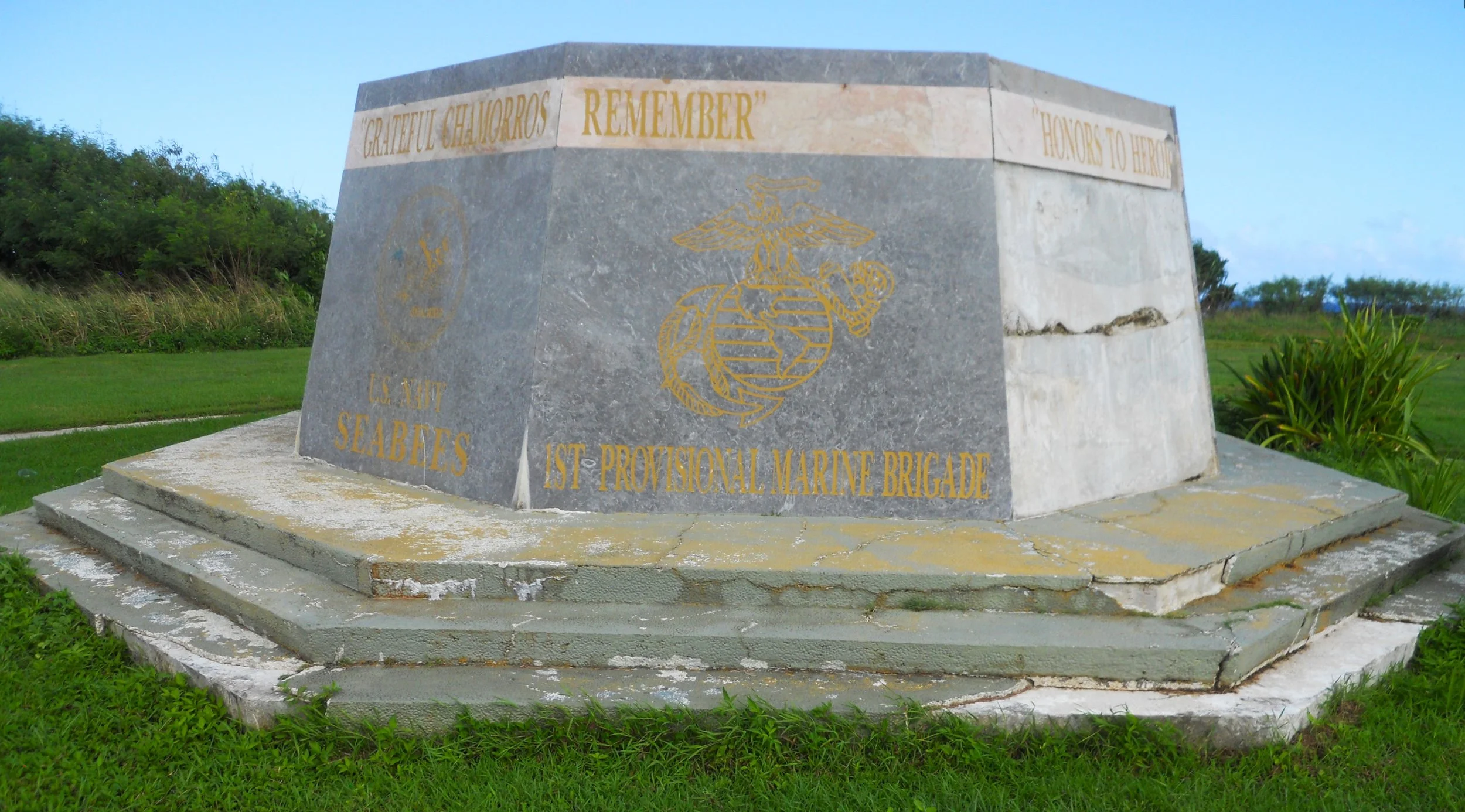
DAY 6 (October 24) - Day count has jumped a bit since I crossed the International Date Line to get to Guam. One leaves Oahu on the 22nd, but lands in Guam on the 23rd. How cool is that? I get the day back when I return. My first stop was the Asan Beach unit. The first photo is of Blue Beach, the code used by U.S. Military for the invasion landing. A memorial was erected at the end of the peninsula for the 1st Marines, Seabees, 77th Infantry, Army Air Corps, and III Marine Amphibious. The Asan Ridge trail does not appear to be used. A monument to ALL the men who were in the invasion and occupied the island lies just off the beach.
South of Asan Beach is the park’s VC. Outside is a Japanese 2-man sub which ran aground on Guam in August-1944 while trying to disrupt shore facilities which our military had constructed during the battle.
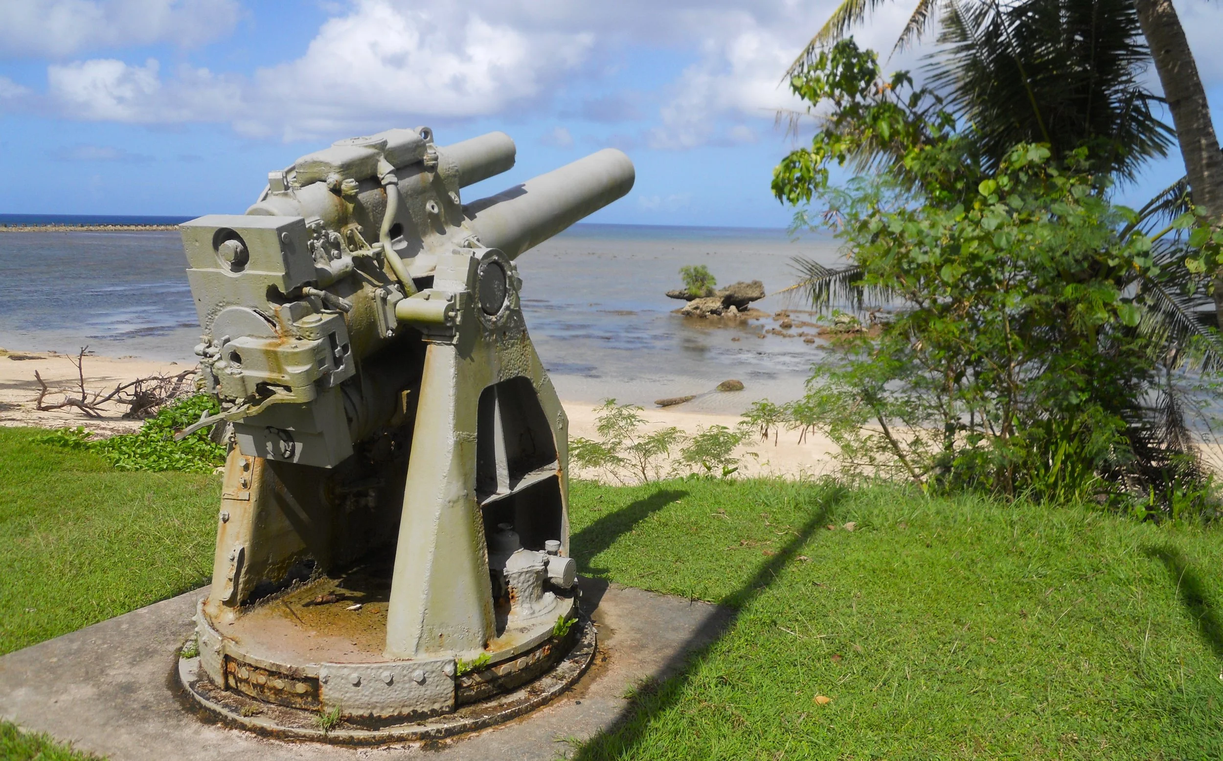
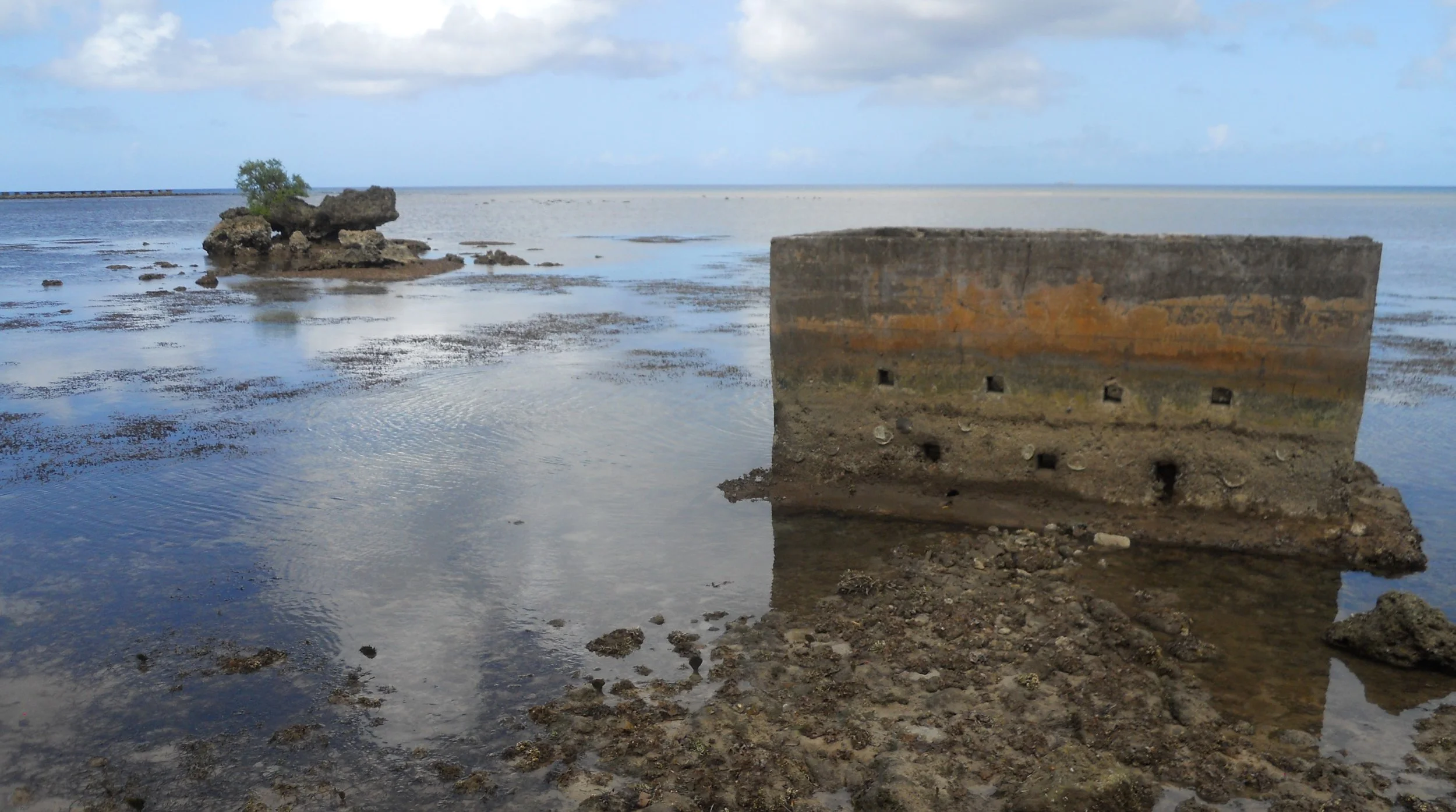
A 20 cm Japanese “coastal defense” gun which fired on the 1st Marine Brigade at Ga’an Point still sits on Agat Beach. A couple of tunnels and caves are in this area, with signs saying not all ordinance from the battle has been found and destroyed. Instructions are given as to what to do if you come across unexploded ammunition.
Only a few of the Japanese 25 mm anti-aircraft gun which bristled across the island are left (most were salvaged for scrap metal). One has been placed on Agat Beach. A few concrete remnants are inside the reef.
Tomorrow will be other sections of the park.

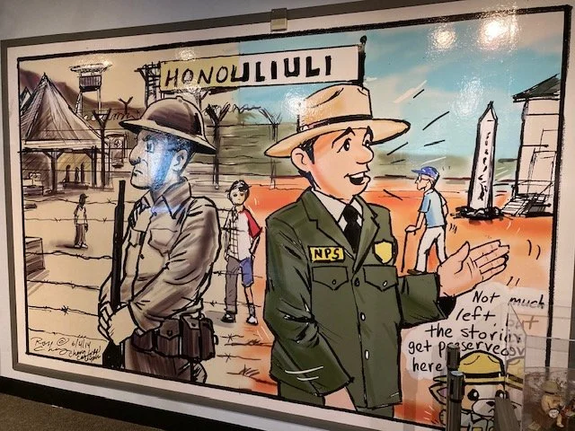
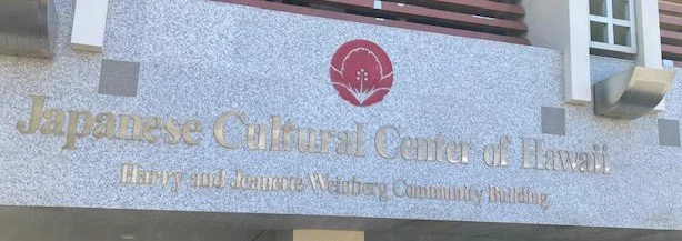
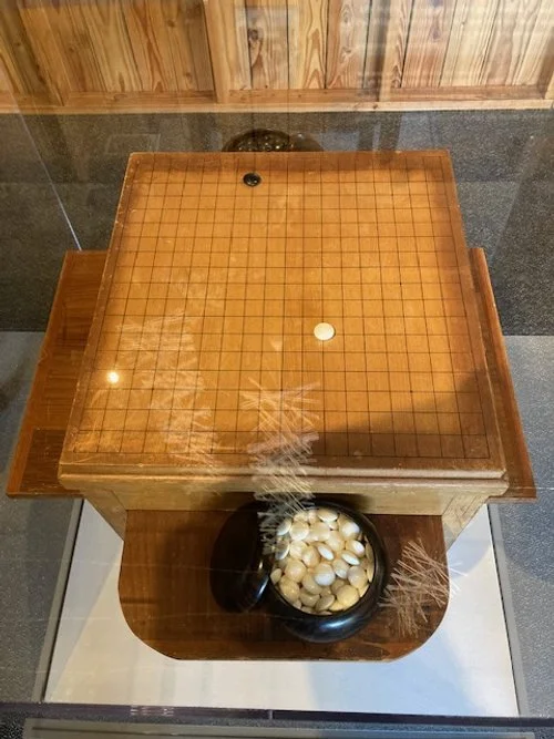
DAY 5 (October 21) - The Japanese Cultural Center of Hawaii is the partner with the NPS for the Honouliuli NHS. They have a wonderful display about the camp at their building in downtown Honolulu. I loved the wall mural depicting the WW2 era and today’s NPS era. A staff member confirmed what I have been told this year; the park will not be open for visitors for years to come due to all the infrastructure work needed. But she was extremely excited that I used a helicopter for my visit. We talked about the stone wall which the NPS is refurbishing (see photo from yesterday). The stones are being numbered so the NPS can replace them in identical sequence as they were originally laid when the camp was built. The museum has some artifacts from internees, such as the set and table for a game of Go which belonged to Sanji Abe. The camp had seven compounds; one for administration, five for POWs (including Germans and Italians), one for civilians. It was a miserable life while the camp was open from 1943 to 1946.
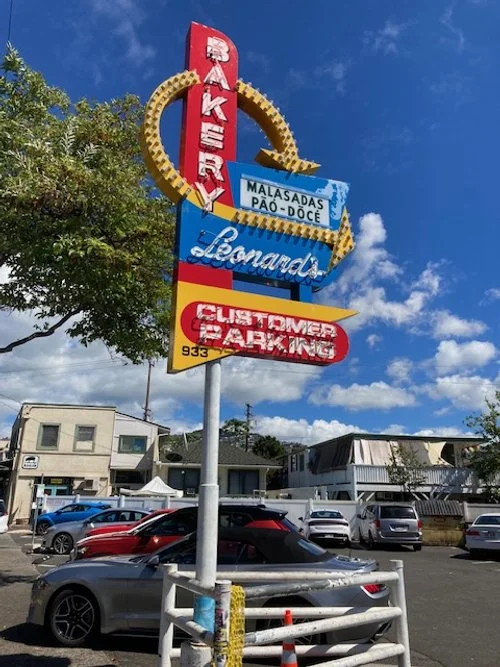
On a brighter note, if you ever visit Honolulu, be sure to stop at Leonard’s Bakery and enjoy the malassadas; Portuguese donuts. They were jumping out of the fryers and into boxes this morning for the steady stream of patrons. The shop has been making the pastries since 1952.
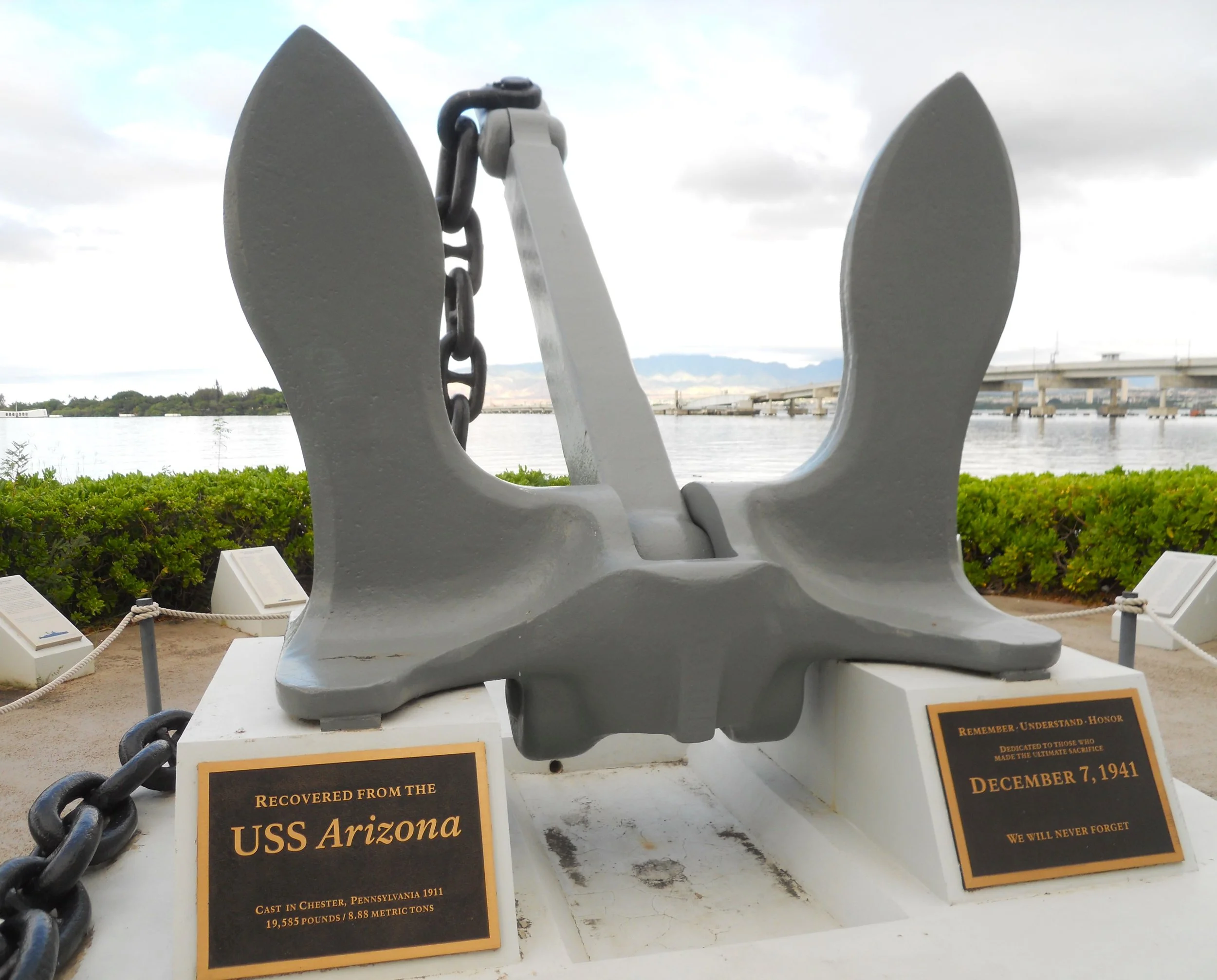
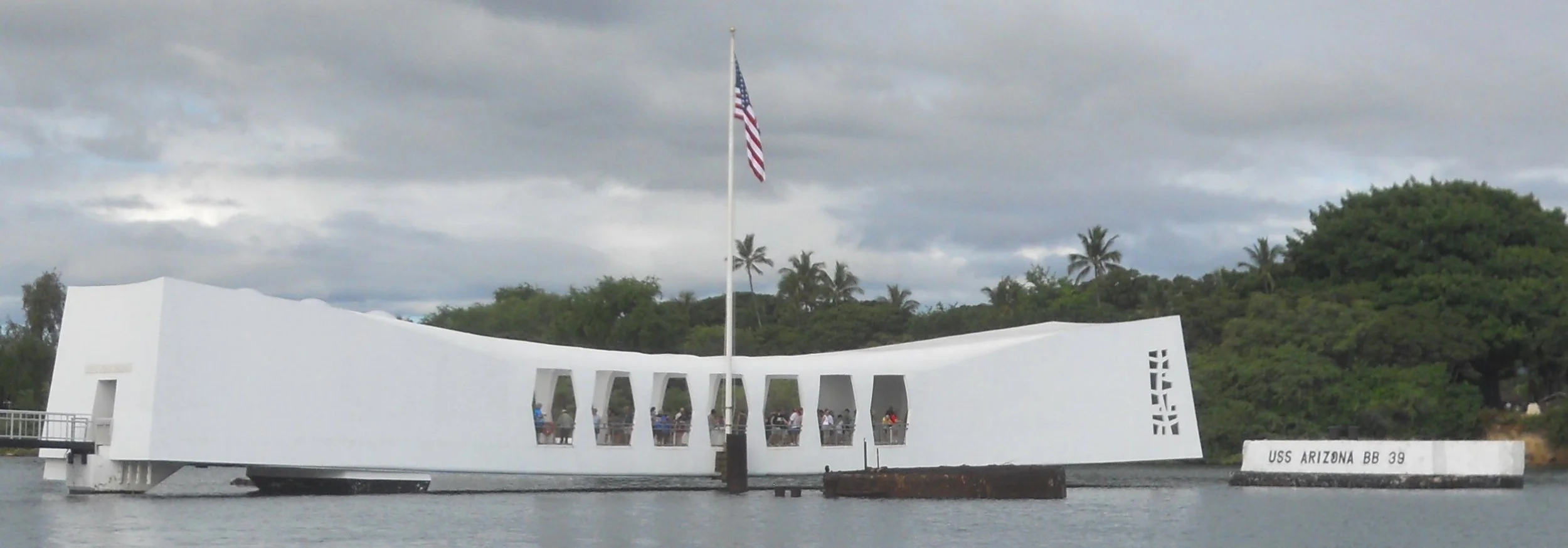
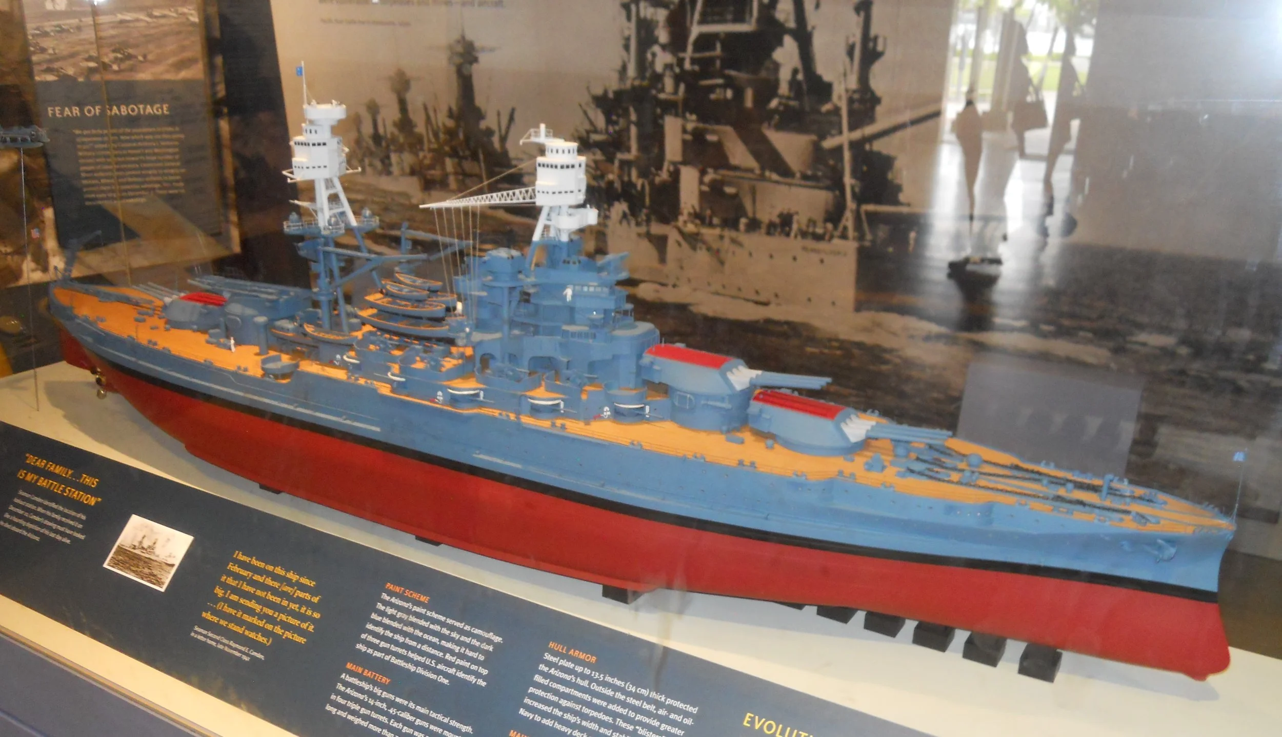
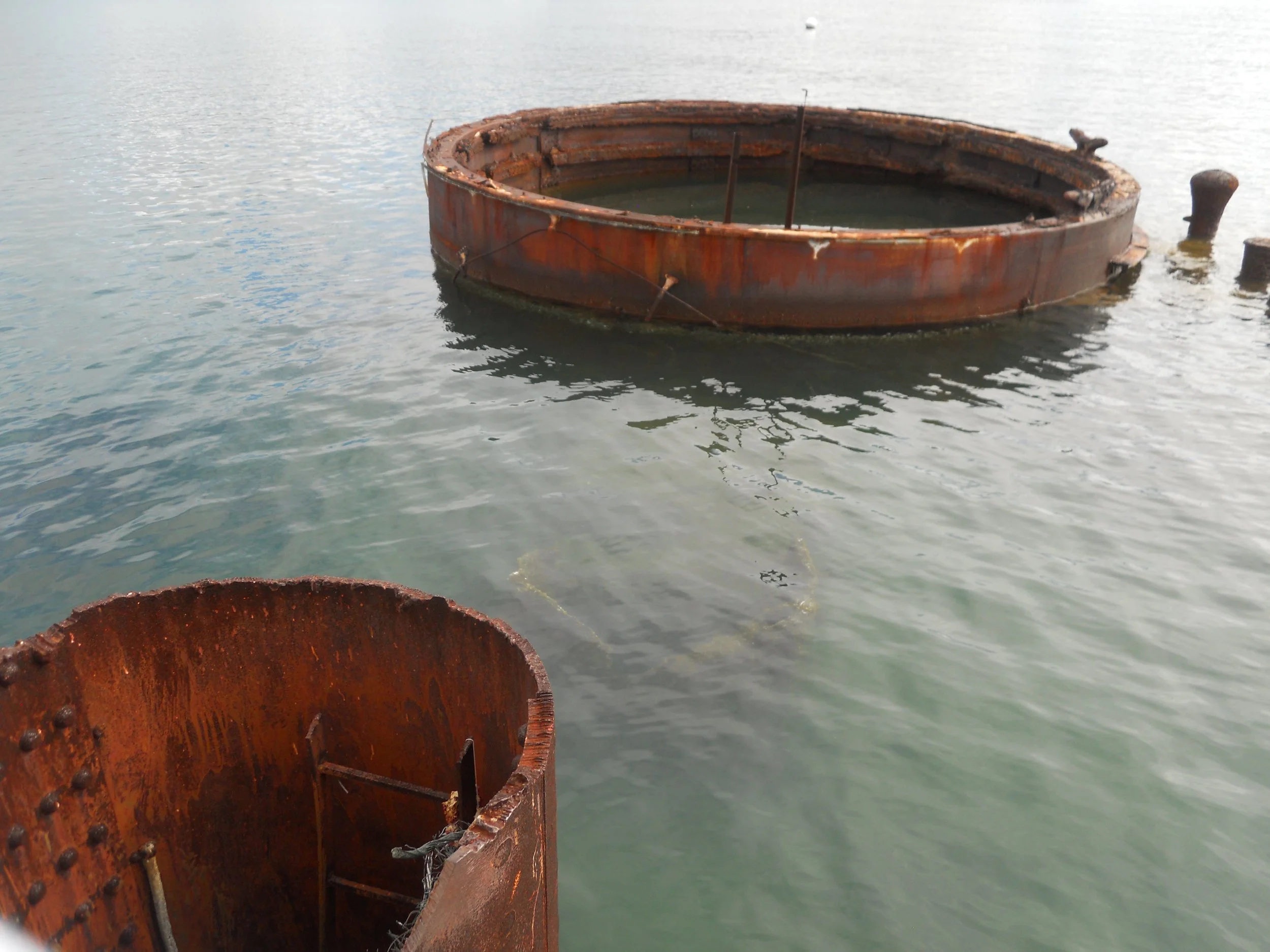
DAY 3, or 4? (October 20) - No park visits on the 19th, but today was one of the jewels in the National Park System; Pearl Harbor National Memorial. The primary activity for most visitors is the ferry ride to the U.S.S. Arizona Memorial. Prior to my boarding I stopped at the ship’s anchor. Next to the boarding area are two museums, one displaying a replica of the ship. This is an active Navy base, so Navy personnel do the ferrying between the VC area and the memorial. The Arizona’s mooring is visible, as are gun turret #3 and the mast leg. The rest of the ship is underwater.
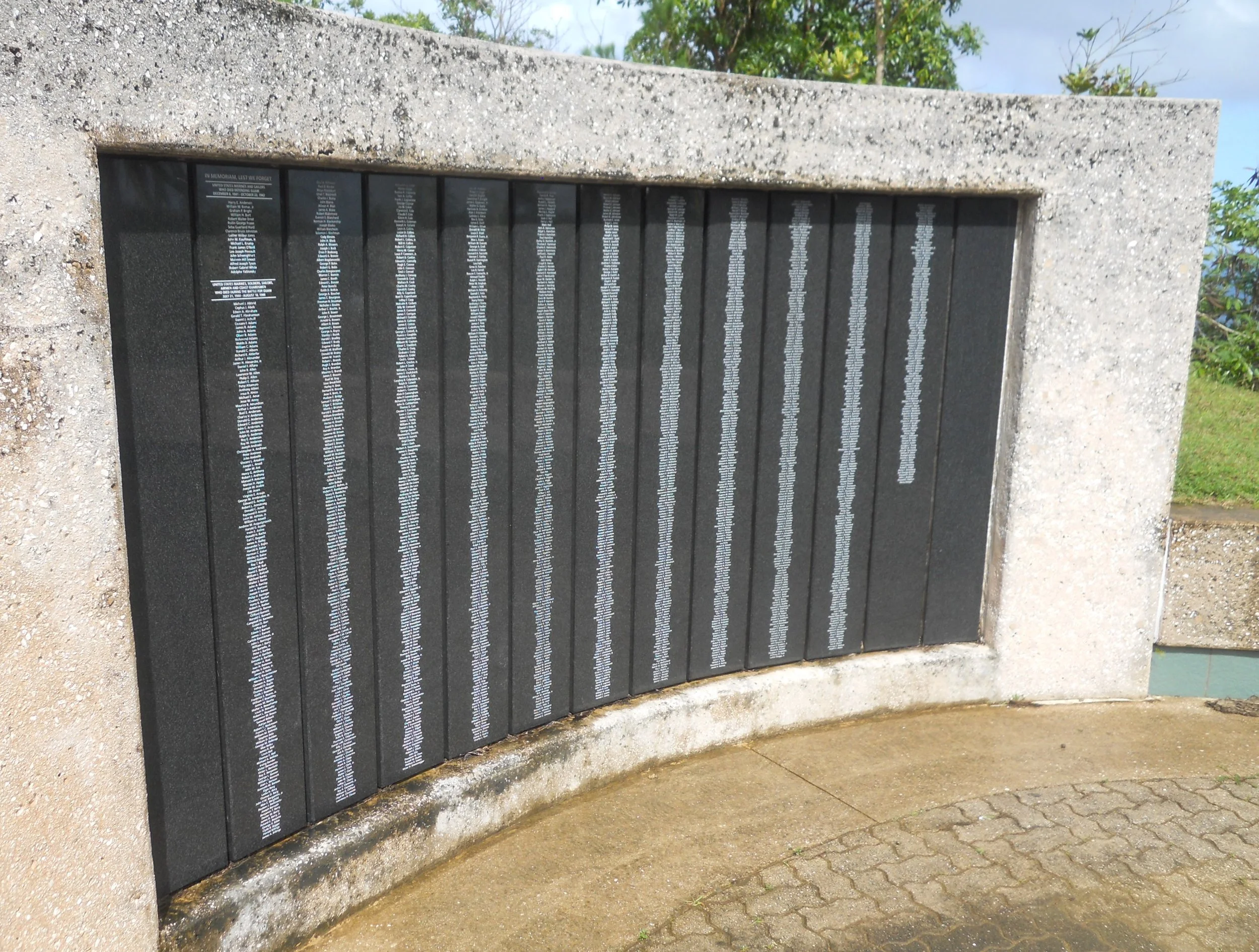
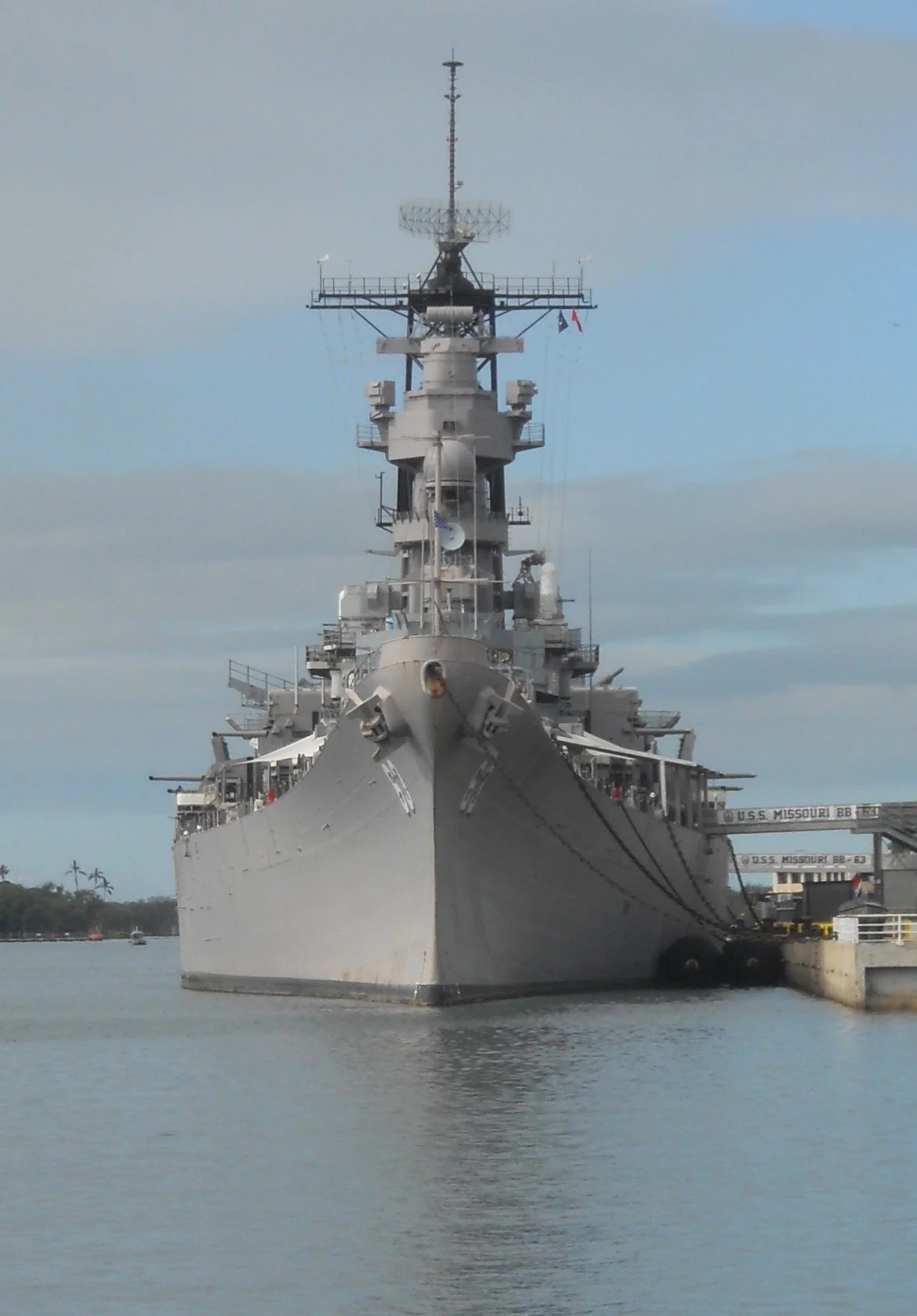
The Mighty Mo (U.S.S. Missouri) sits behind the Arizona. It is fitting to have the two bookends of America’s formal involvement in WW2 next to each other. The wall at one end of the Arizona lists all the men lost on December 7, 1941. Two granite stones at the base of the wall state the names of survivors whose last wish were to be interred with their fellow sailors. There are 45 names on those slabs. The last ceremony was held in 2021. Only one Arizona survivor remains, 102-years old Lou Conter. A ranger said Mr. Conter has not yet asked to have his ashes placed within the ship. He will be the last soldier afforded this honor if he so decides.
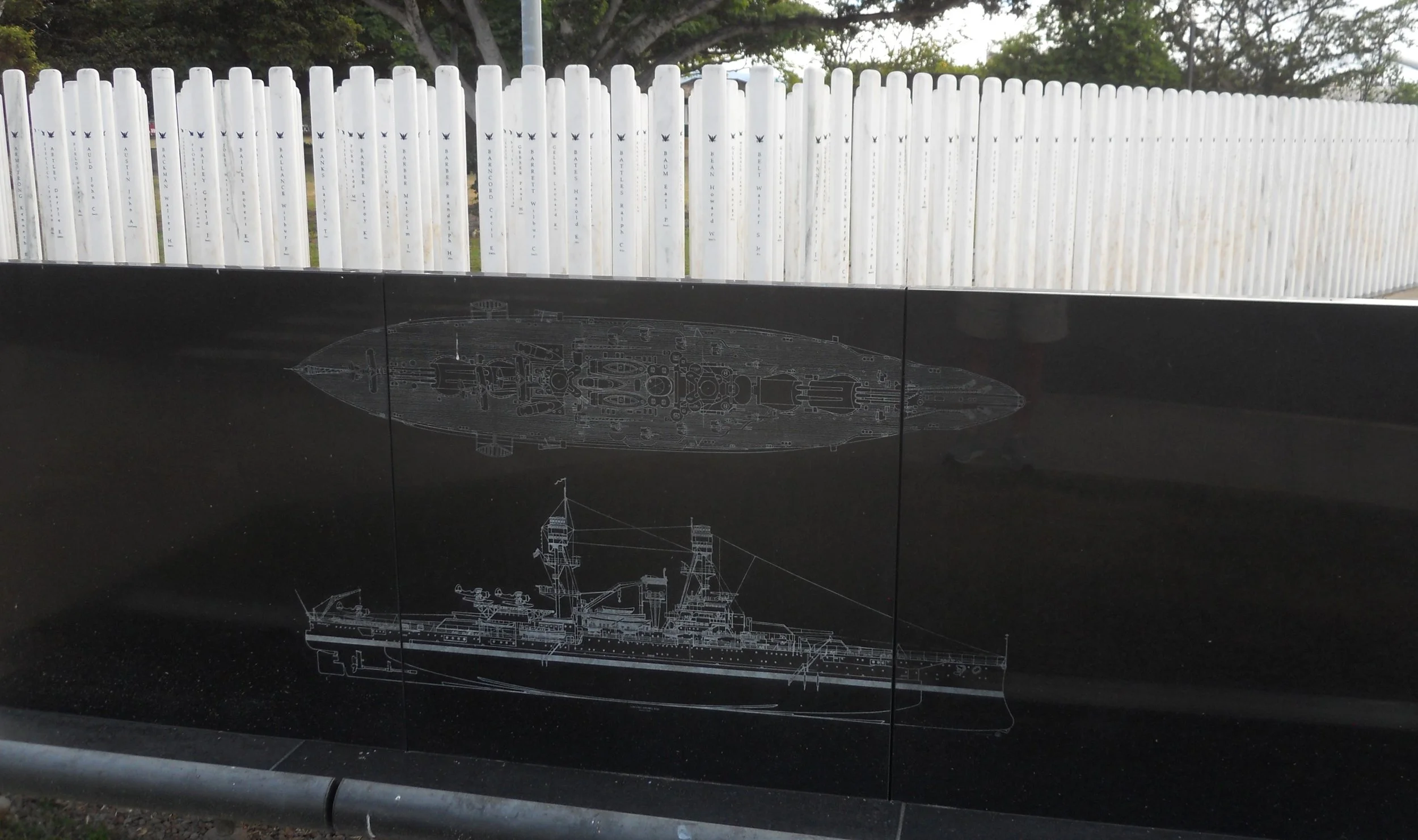
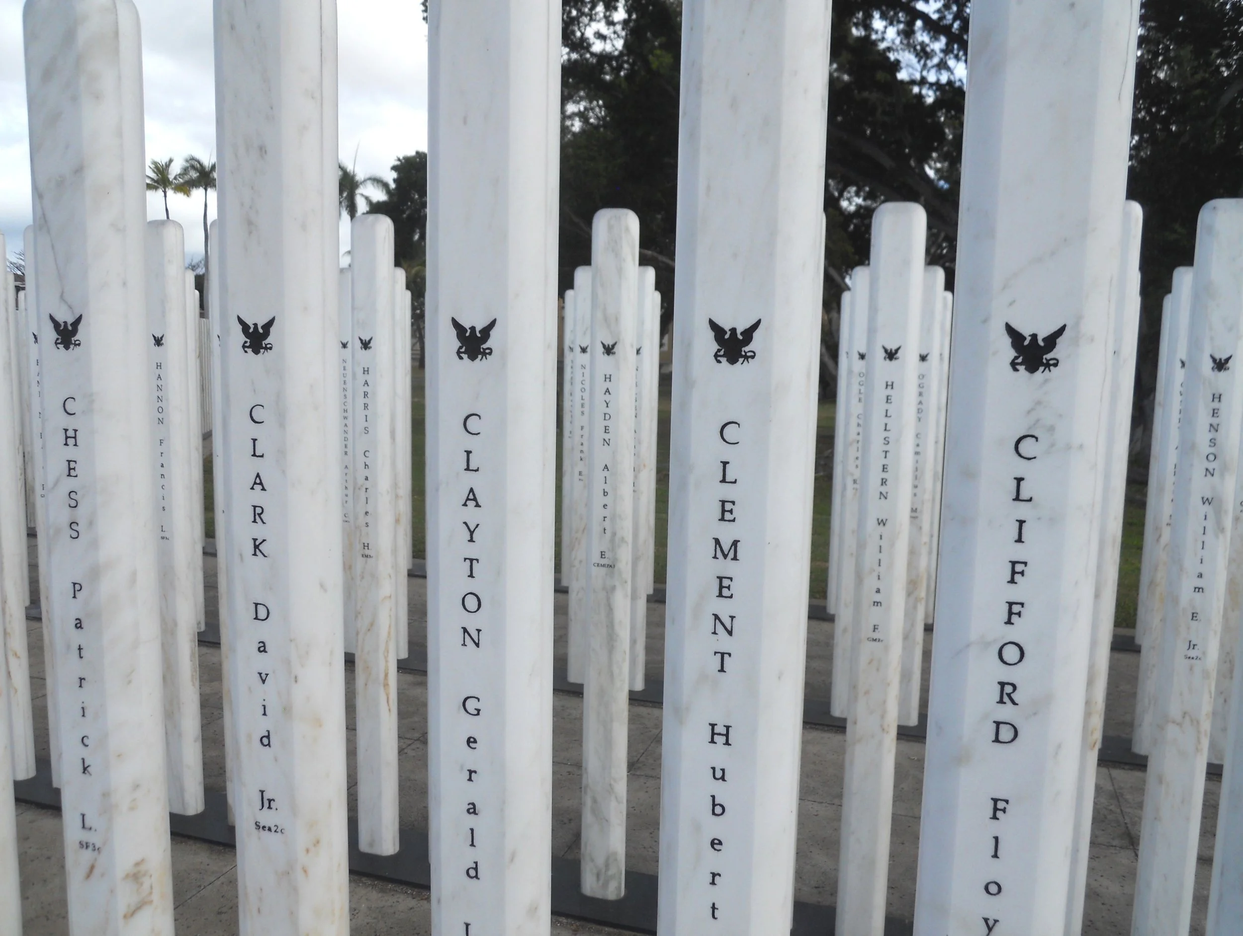
A shuttle bus takes visitors across the bridge to Ford Island, a fixture during that morning of December 7. The first stop is at the U.S.S. Missouri and the U.S.S. Oklahoma Memorial. 429 marble standards represent the men lost when the Oklahoma was bombed.
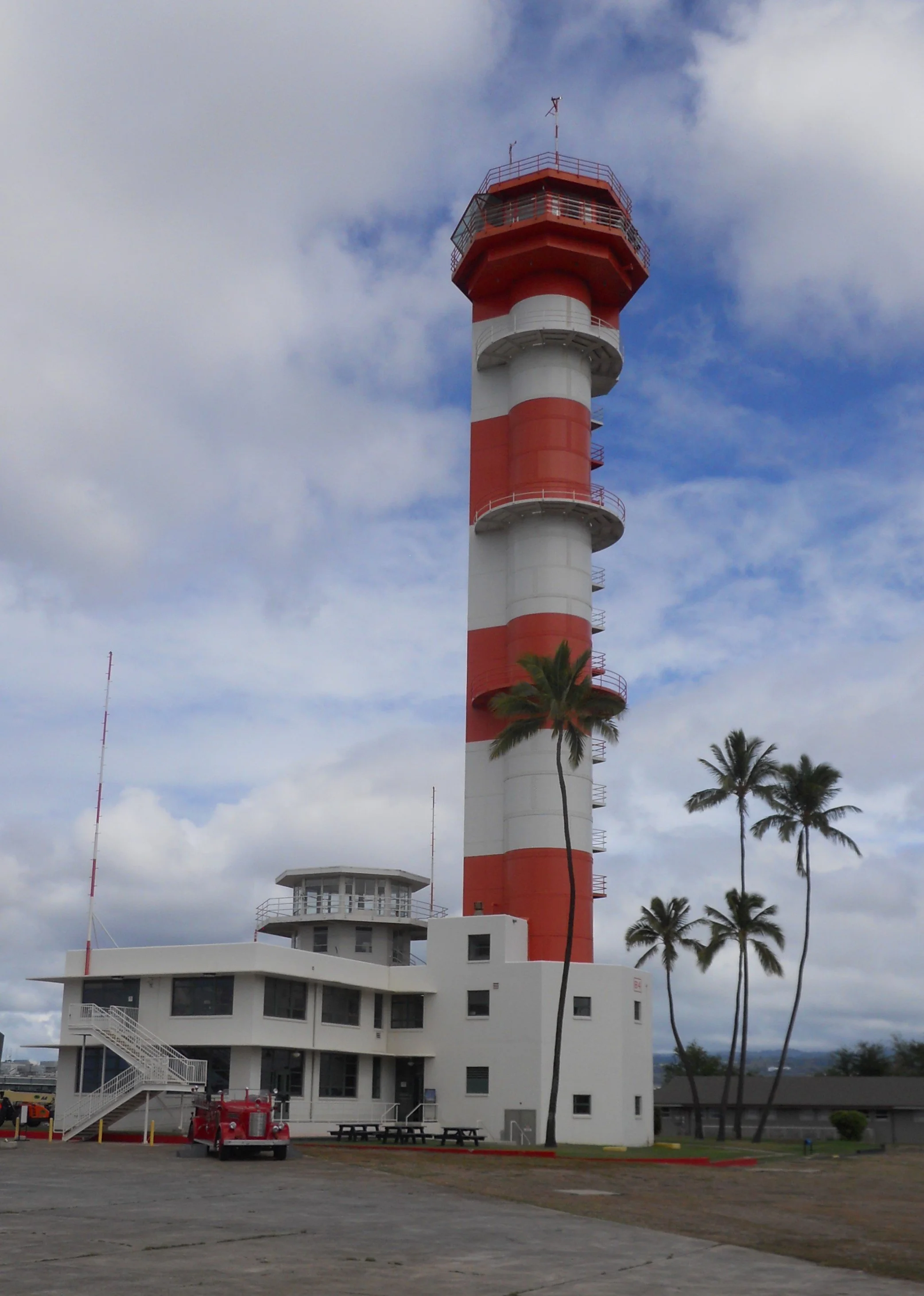
I have previously toured the Missouri so hopped back on the bus for the next stop at the Pearl Harbor Aviation Museum. The museum is housed next to the Ford Island Control Tower, a witness to the events that fateful morning. This was an enduring reminder throughout the war that no enemy could defeat America.
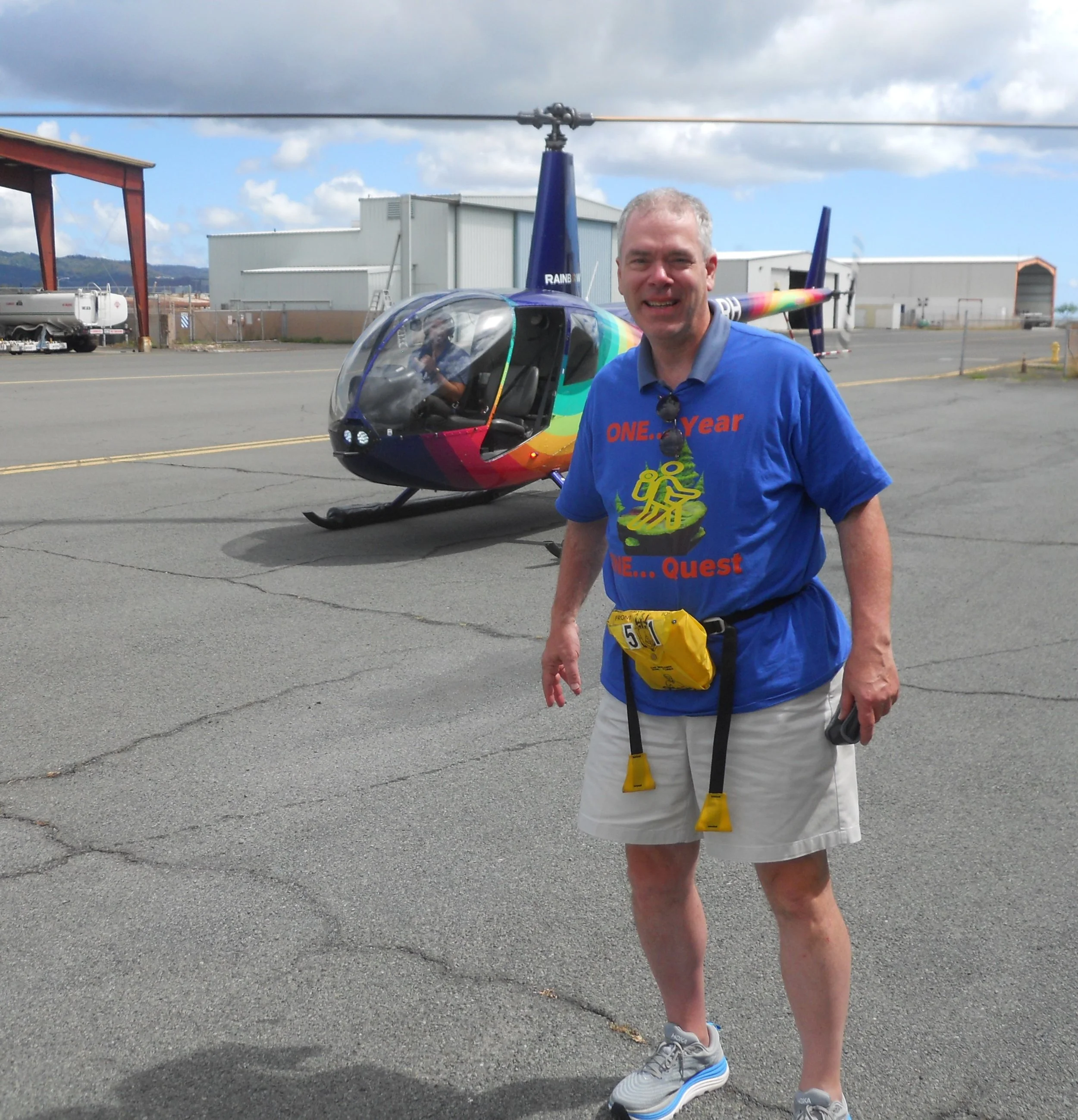
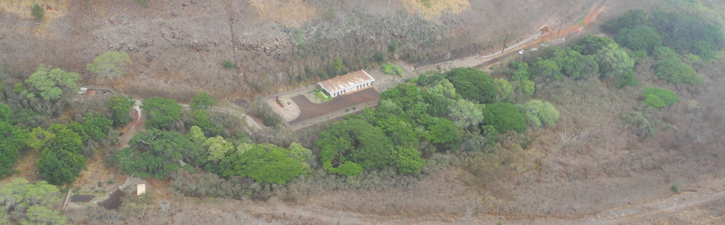
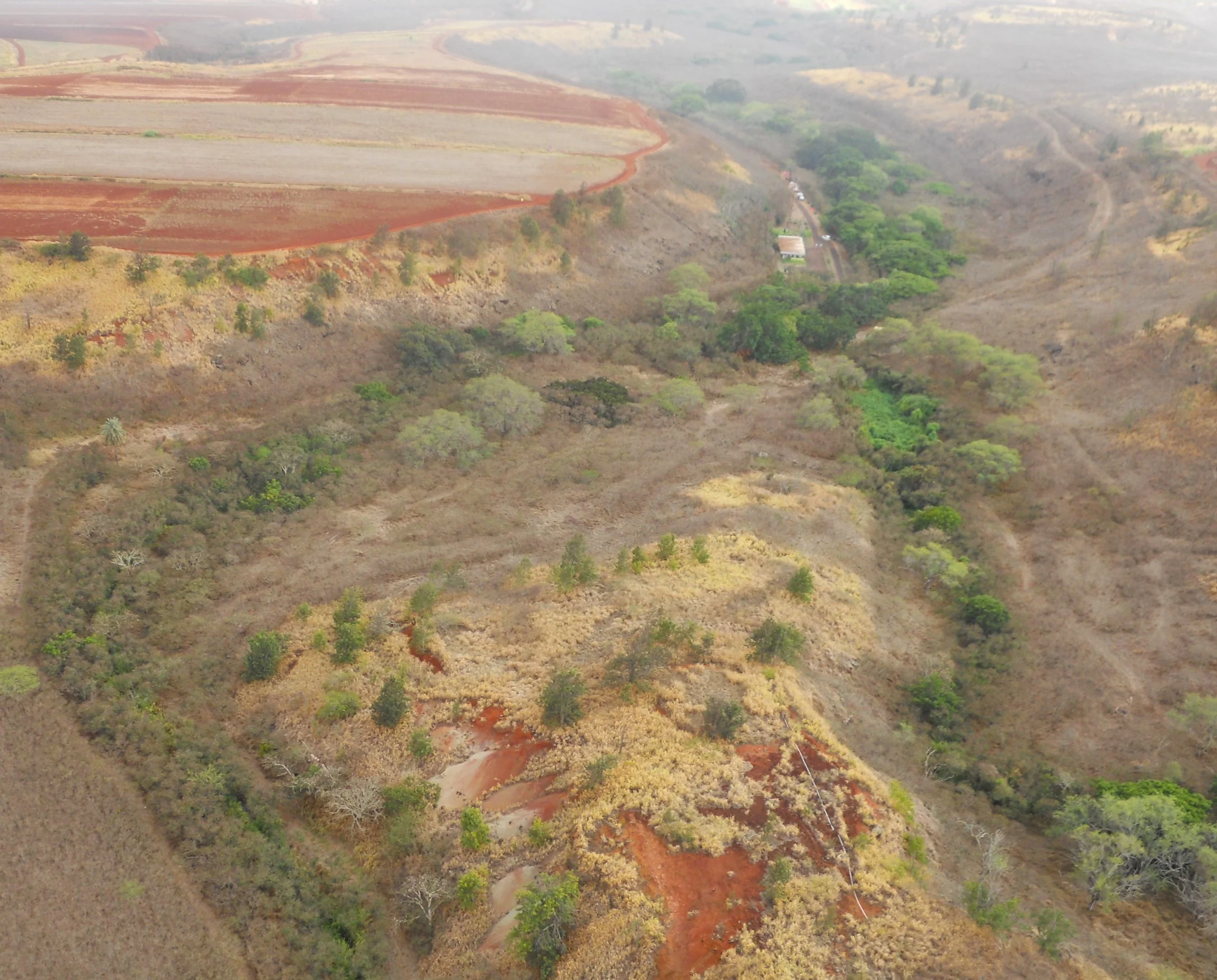
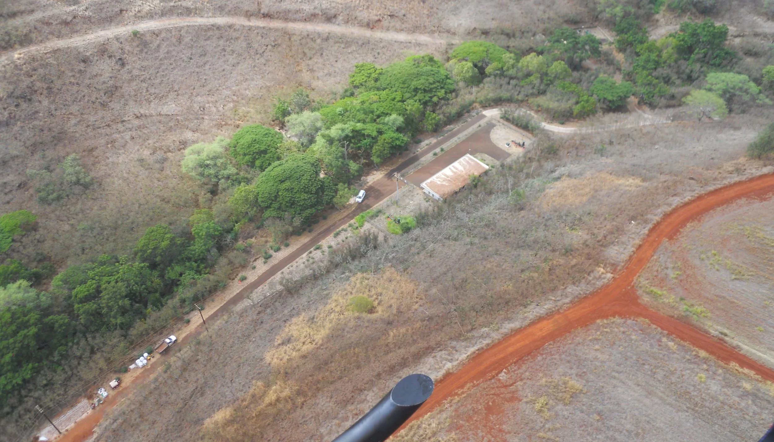
The second park for today was Honouliuli NHS. The NPS has closed ground access indefinitely. Even after the park was proclaimed in 2015, very few tours via the Japanese Cultural Center of Hawaii have been granted. But since last year those have stopped. It could be years before the public can drive to the park. Therefore, I took a helicopter ride, via Rainbow Helicopters. The first photo is an archived image of a portion of the camp. The first colored image is of that spot (use the long, covered building sitting on a concrete platform as a reference). The second colored photo is a view from the north. The yellow/orange area in the middle of the green trees and brush is the upper-center section in the B/W photo. One could easily see the NPS is installing a retaining wall against the east slope of the gulch.
The southern end of the park boundary is where the green trees cross the secondary road in the last photo (you can make out Interstate H1 in the far left). The boundary then works northward along the creek and gulch, identified by the trees, until getting to the wider section. This was an experience I will never forget. I will visit the Japanese Cultural Center tomorrow since that is a partner with the NPS for this National Park.


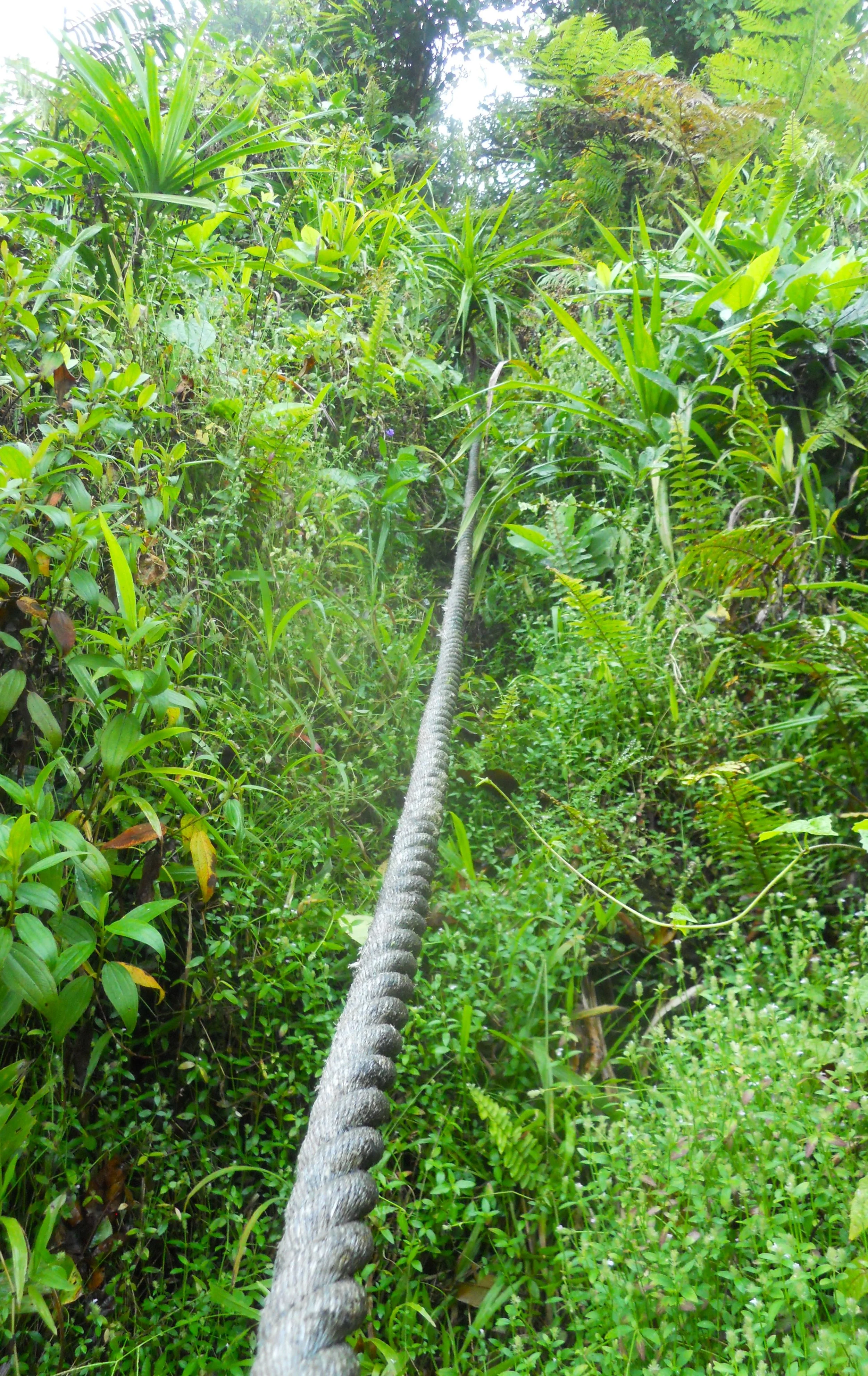
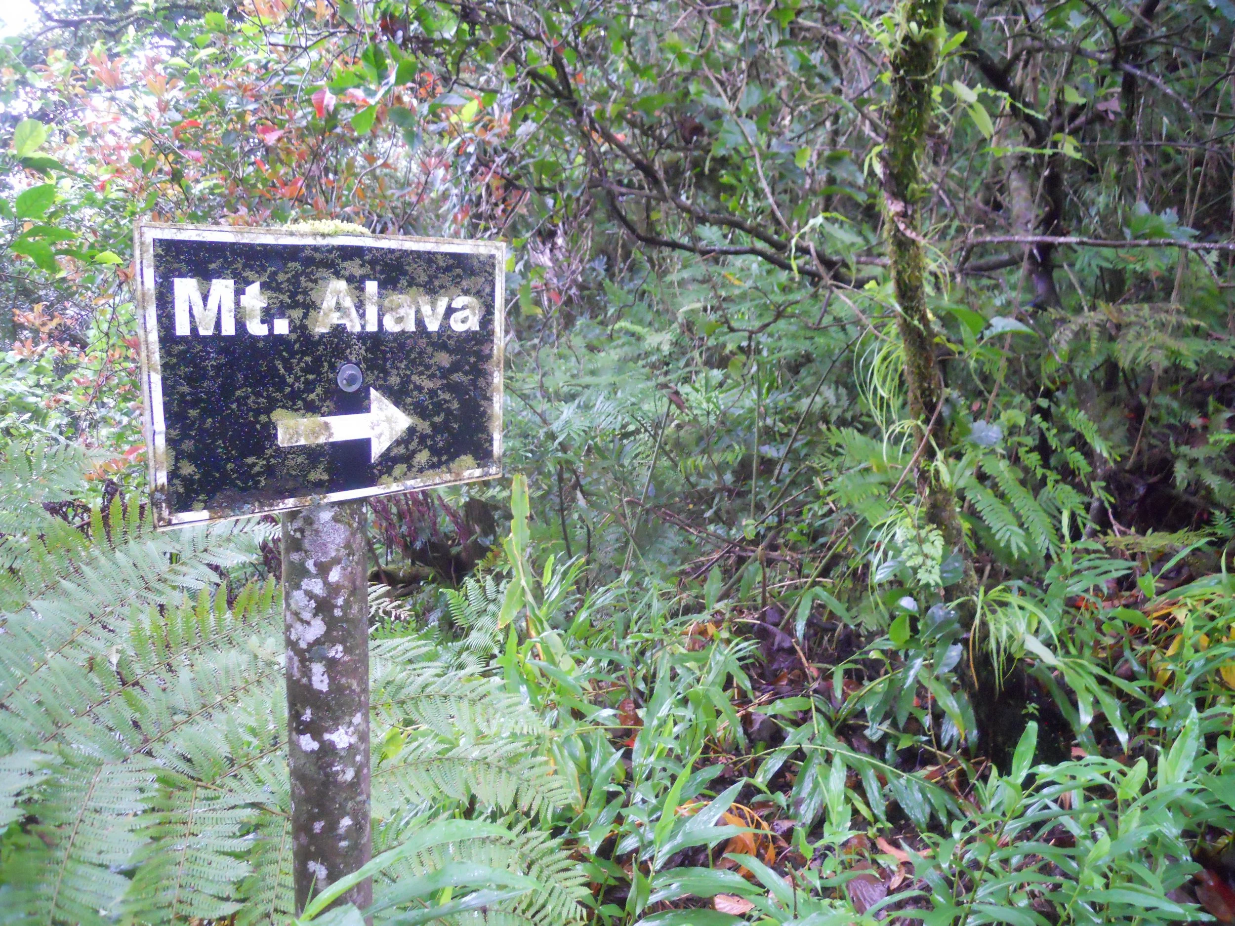
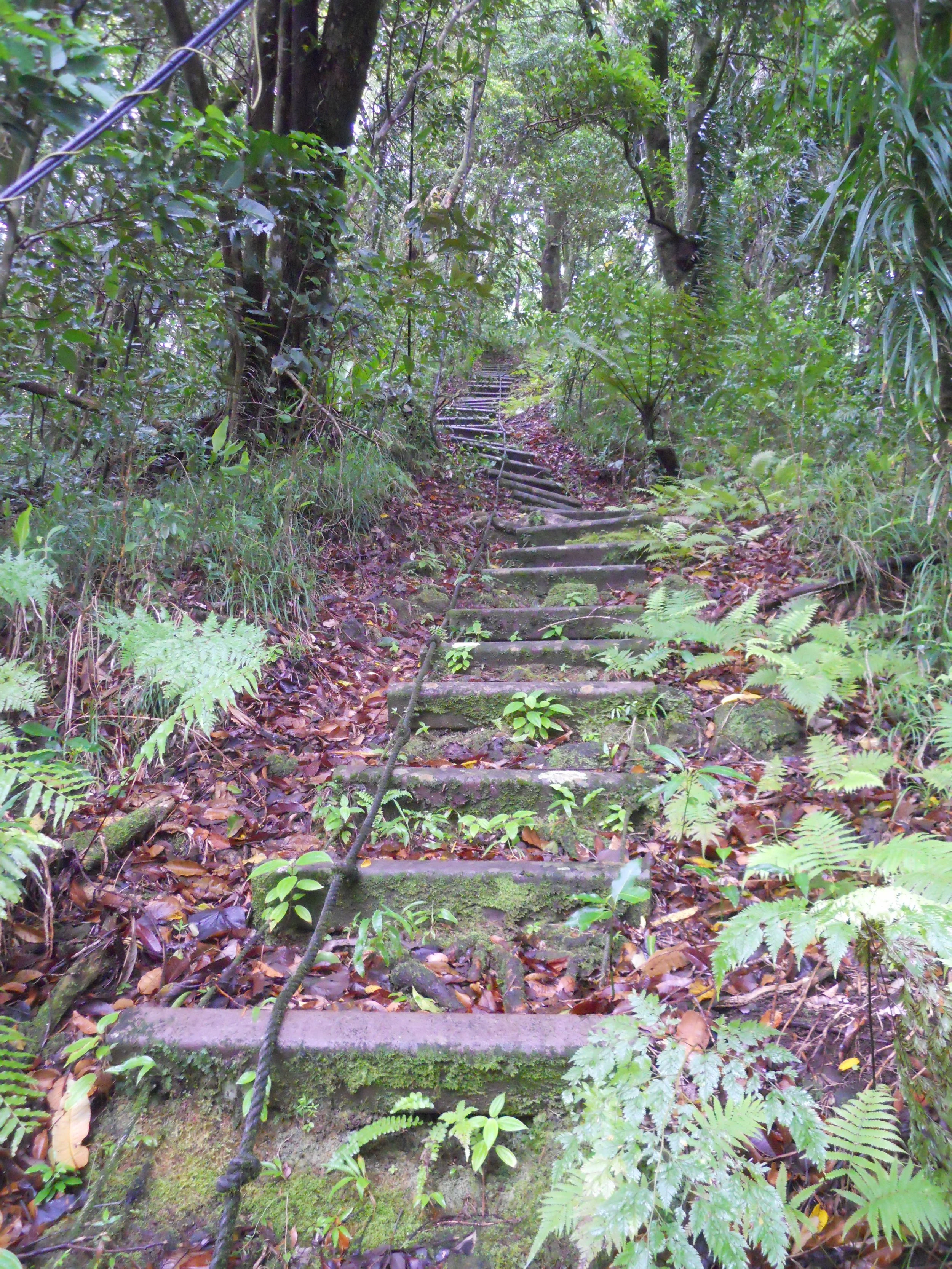
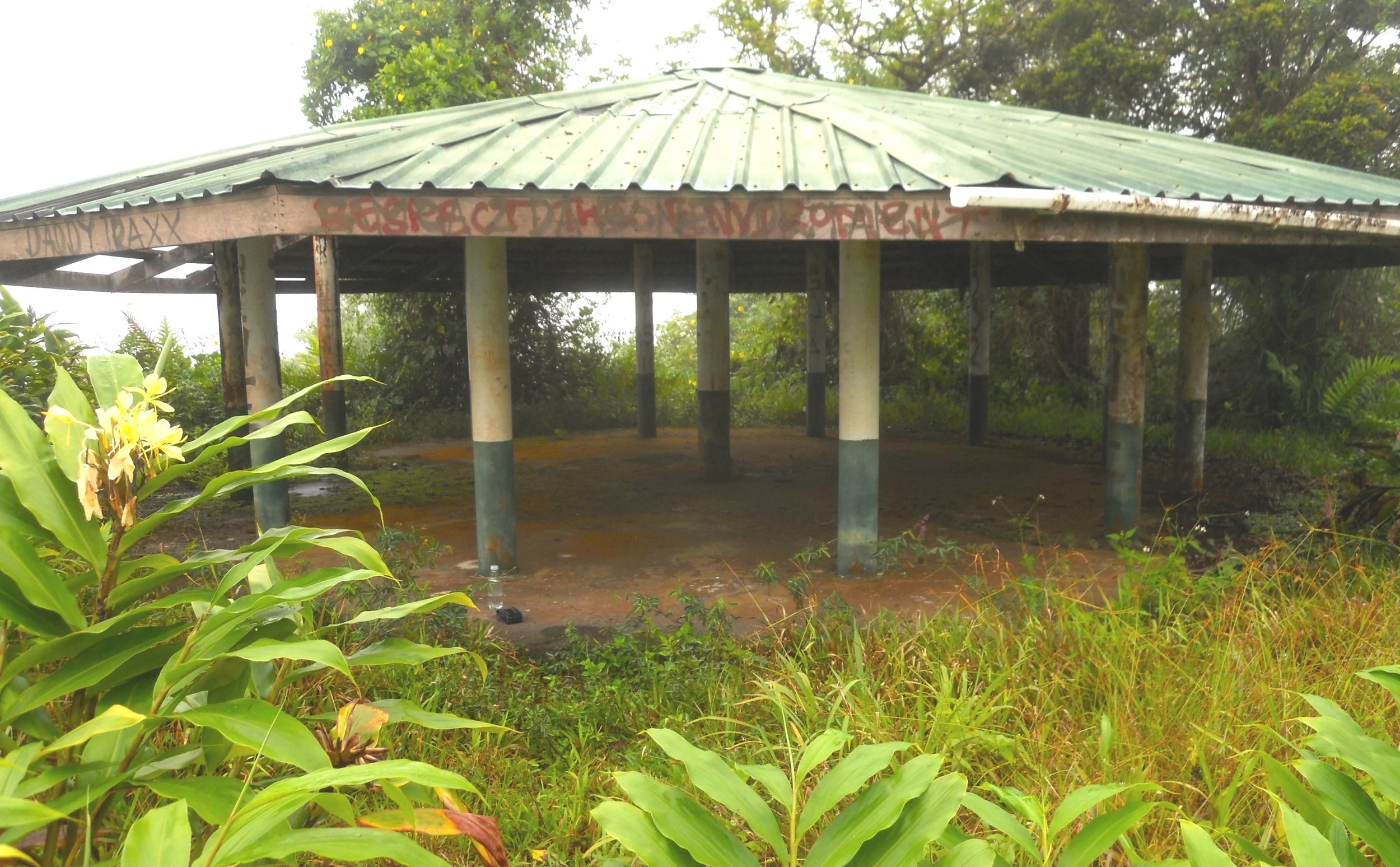
DAY 2 (October 18) - Today would the primary activity in the park, hiking the Mt. Alava Adventure Trail. There would be 20 or so sets of ladders with a few hundred steps to climb. Ropes were provided for most of the ladders, with some of the ladders being “vertical”. The NPS rates this trail as Challenging, and I agree, though all the letters should be capitalized. In some of the sections the jungle had reclaimed the trail. At times I had to search through the underbrush to find the ropes. The trail is a 5.6 mile loop, but I planned to go up the hard section, for 1.5 miles, then come straight back down (after taking a slight detour to Mt. Alava summit). The only sign on the entire trail was pointing to Mt. Alava. This is when I reached the Mt. Alava Trail, on the main ridgeline. The summit of Mt. Alava is less than a mile from this point, with more overgrown jungle and ladders to tackle. Once you reach the summit a traditional Samoan fale greets you.
This is when I made an error. I mistakenly thought the remainder of the loop was to the west of the summit, when in fact it was back at the sign. So, I headed west, waiting to see a trail breakaway from the Mt. Alava Trail. But I never did. Therefore, I walked the whole way to Fagosa Pass (another 3.2 miles), where I had been yesterday. Saw some pretty flowers and birds along the way.
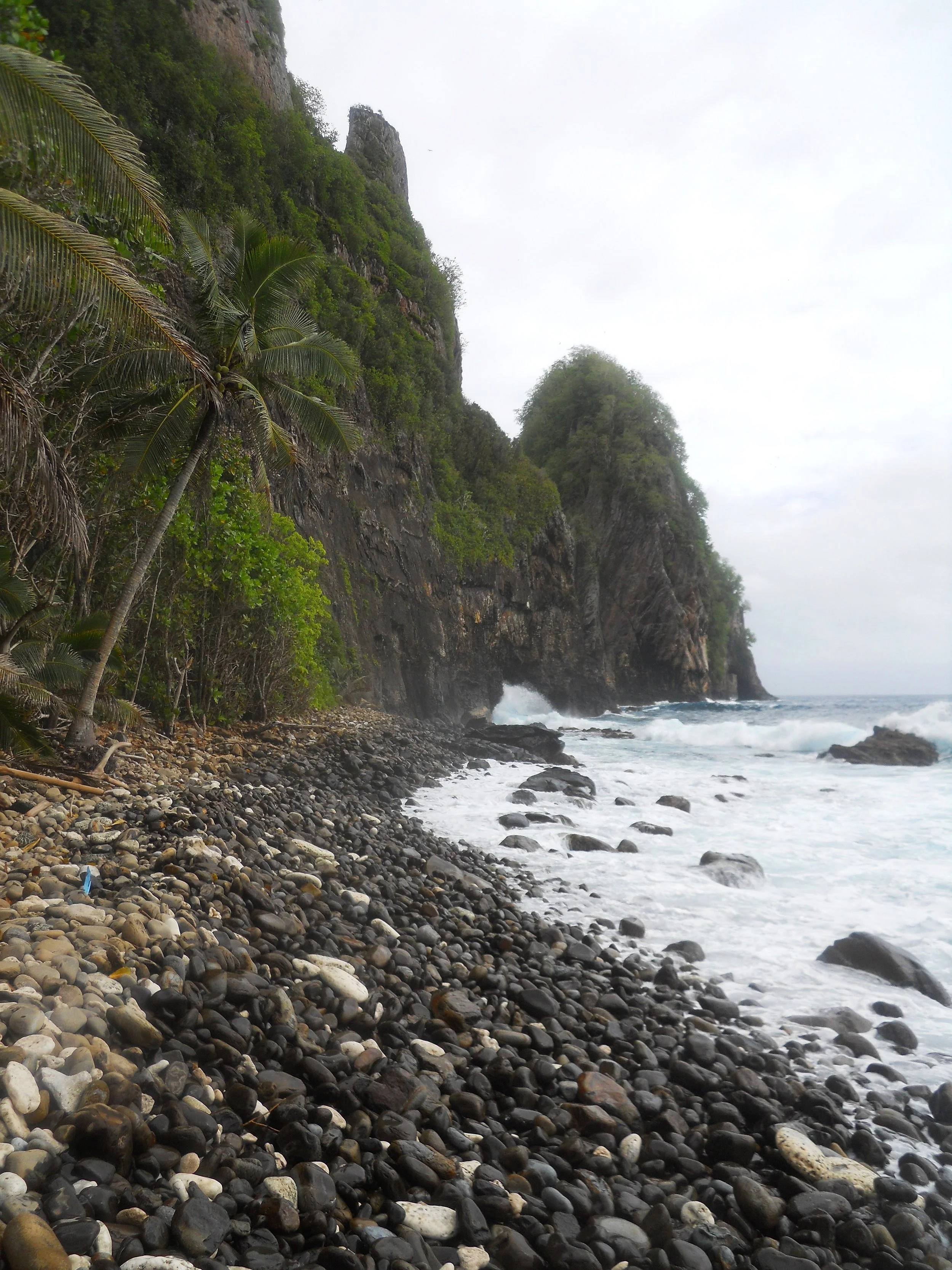
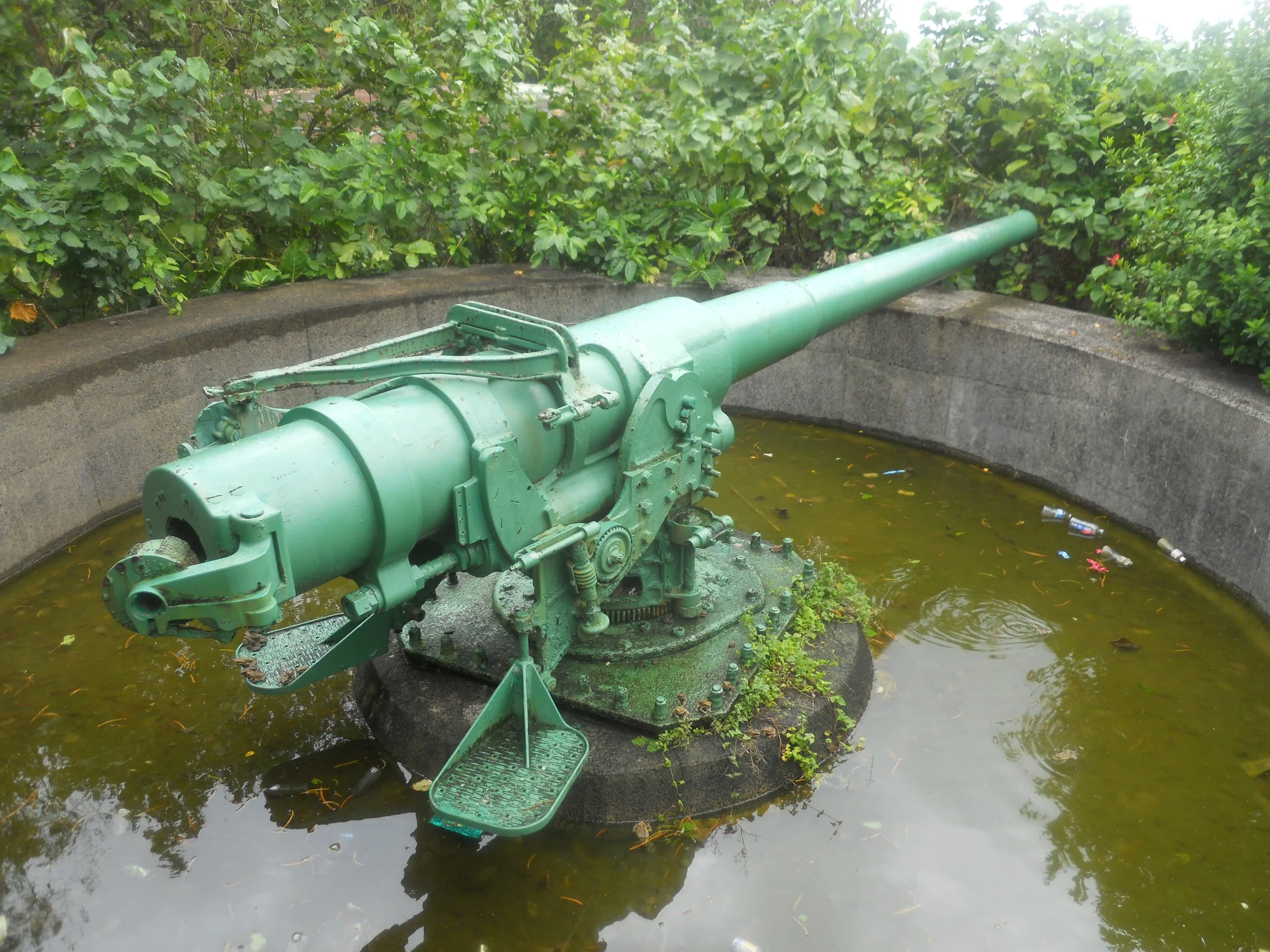
Before all the fun on Mt. Alava, I had stopped at Blunts Point Naval Gun Site. There are still a few of these guns along the coastline of this island, to protect the harbor of Pago Pago. I also took a short hike from Vatia Village to the Pola Island shore (Pola Island is the last feature, with the pointy top). As you can tell, this is no Florida or California beach environment.

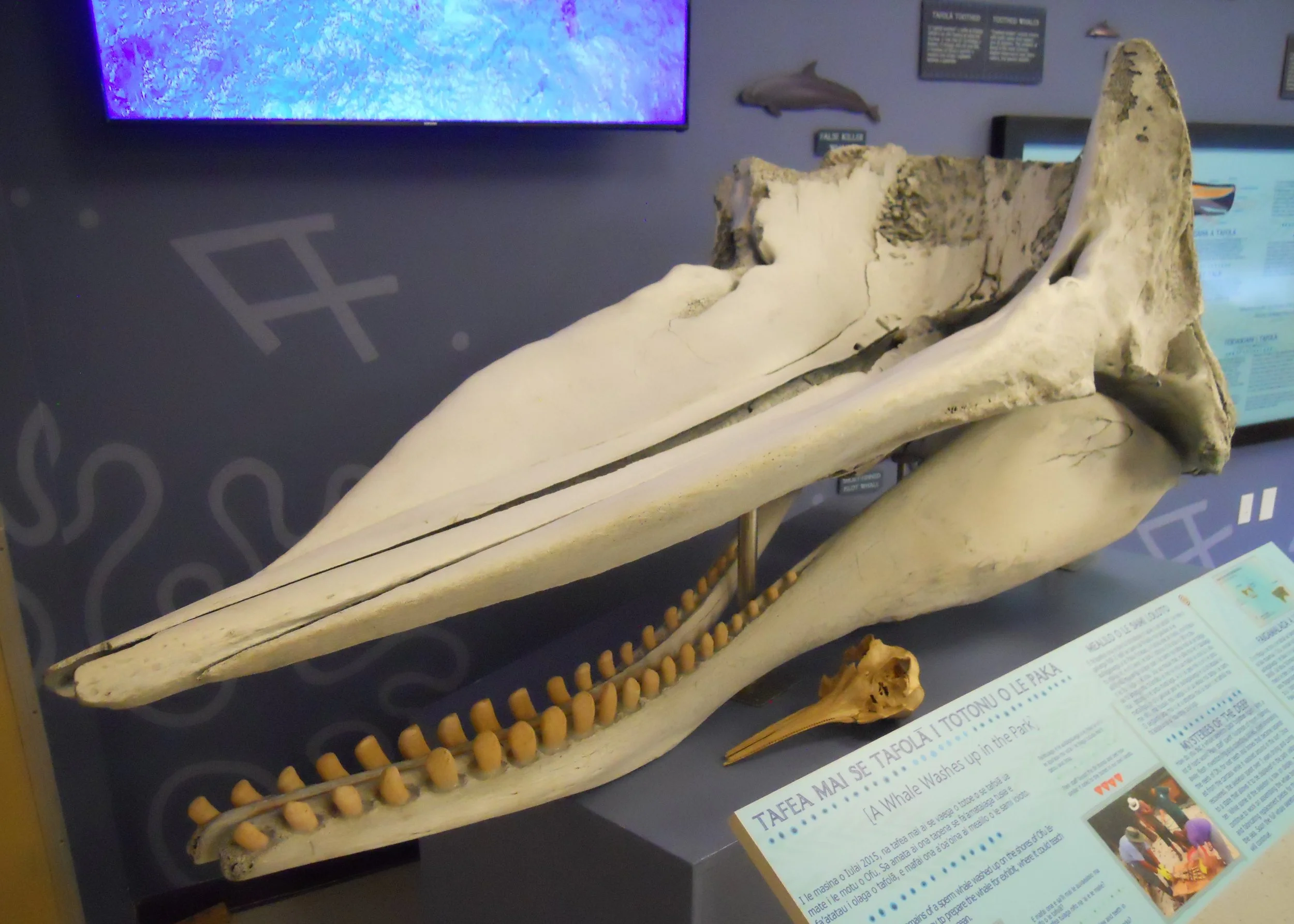
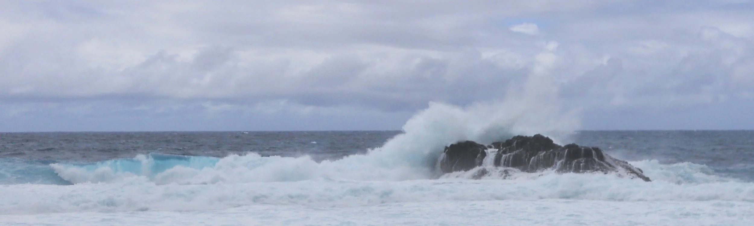
DAY 1 (October 17) - This will be my official visit to the National Park of American Samoa, only because I do not what will happen tomorrow. The VC has the skull of a sperm whale. The whale’s carcass washed ashore in July-2015. The surf gods were pounding the shoreline. I love the bright, light blue color of the water.
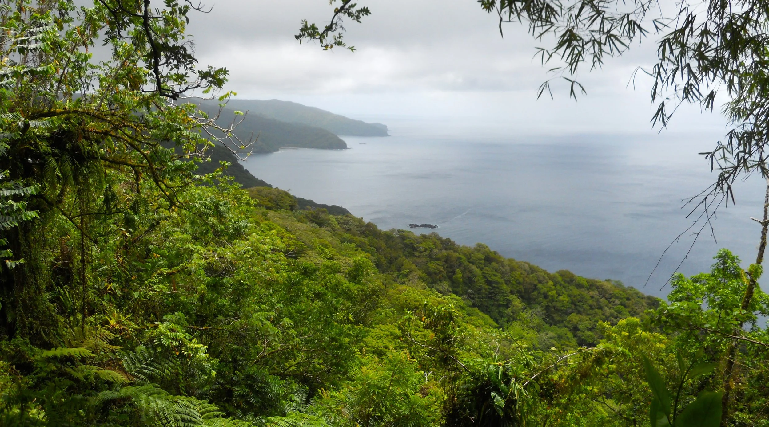
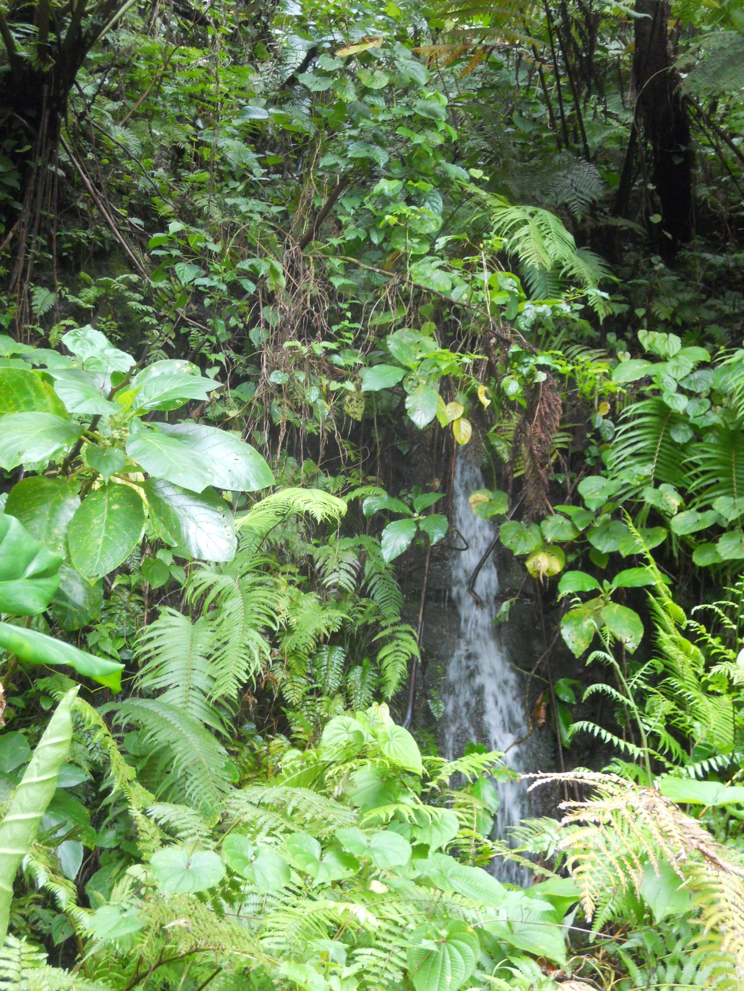
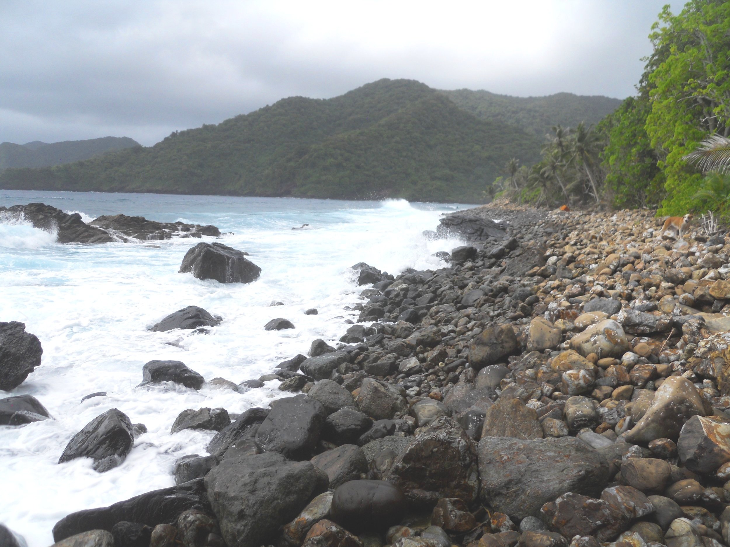
Due to the heavy rain during the night, some small waterfalls appeared in the jungle vegetation on the Mt. Alava Trail. The North-Central shoreline can be viewed from the trail. Tutuila (only 52 square miles) is the main island of American Samoa, being formed 7 million years ago by volcanic activity. The slopes to the ridgelines of the mountain summits are steep and rugged. “Jungle” is the term to use.