
Original Blog… Please see below for the Daily Trip Report of Loop 1 through Arizona and Southern California. The Blog entries, which this section covered, disappear after nine months of being posted. But I used an inserted text box to record the first Loop’s trip in this page before utilizing the Blog feature. So, by Fall-2024, all the daily Blog entries will be gone from the website.
My intent is now to use this section to keep folks updated into 2024/2025 as various activities are undertaken and completed.
The Quest’s Book… The first milestone has been met with the arrival of my book (see front and back covers images to the right). If you have interest, you can have a copy shipped directly to your home. I will not be putting the book with on-line retailers, such as Amazon and Barnes and Noble. They require a significant mark-up above the base cost of the book. By ordering directly from the publisher, you do not have pay that extra cost.
Also, I am not looking to make JK Rowling level income on this project. Just enough to cover the cost of the work with the publisher/printer plus a couple dollars. This is a hardback cover book. The price is $27, plus shipping and tax.
Here is the link… IngramSpark Publishing
For people whom I can meet directly, such as at local presentations, the cost is $25. The $2 difference is for me handling the logistics of selling on-site instead of using the publisher’s process. At this time, the ecommerce capability is not available for shipping addresses outside the United States. If any international viewers would like a copy, I would be more than happy to mail a book to you. Please use the 1year1quest@gmail.com address to communicate. I do not know the shipping costs to any specific country, so will have to determine that factor, and PayPal may be the only feasible payment option.
My primary intent was to provide a year-long story of visiting all the national parks. But there would be little value in going on and on about the minute details of what I did. Your experiences at a park may be much different than mine, and that is what you should enjoy. Therefore, the book is around an 80/20 split of what makes each park an integral part of the weaving of America’s heritage versus the funnier and exhilarating things that happened to me during the travels. Included throughout the book are short comments on America’s Pastime: Baseball. Did you know that at one time the world record for catching a baseball from the highest of heights was done at the Washington Monument? Read all about it in the book.
Guinness World Records… The second milestone was to receive word from Guinness World Records that my attempt met their requirements. Word came in early-July. My evidence of having been at each park was acceptable. BUT… and many times there is an associated “BUT.” While reviewing the means by which I accessed the parks, they noticed I had used personal and rental vehicles. GWR says this is not allowed, since travel records are not supposed to be a “race against the clock.” They probably felt I would reenact The Gumball Rally movie (worth watching if you have not seen it). Seems odd since the purpose of most time/travel records is to do something as fast as possible; faster than the other guy. Did they not accept my title of “Fastest to visit America’s National Parks”? What do they not understand about the word “fastest”? And, 70% of the parks are not reachable by what they term “commercial transportation.” I was supposed to use a regularly scheduled Greyhound bus to access Fossil Butte NMon in Wyoming. Guess what? There is no Greyhound bus which goes there. Nor Delta or United airlines. Nor a Princess Cruise Line boat. Nor an airport-to-airport shuttle. I can list nearly 300 more parks with the same situation. Only those parks in the bigger cities like New York and Boston have the public/commercial transportation which GWR considers acceptable.
I replied to GWR that the person currently in their database used a van to drive to the parks in the contiguous 48 states. He even states that on his website. So, how did they accept that, but not my driving effort? GWR has not answered the question, just like they never answered how that person visited the Alaskan parks which can only be accessed by bush planes, which they originally would not be acceptable in my attempt… though, GWR eventually gave me a waiver for that issue.
Let me ask all you readers. What means of transportation have you used to reach Big Bend National Park or Congaree National Park, let alone smaller parks like Big Hole National Battlefield? You drive your vehicle, right?
Anyway, I have had way too many troubles with GWR. I will move on. For now, I am confident I am the only person to have visited all 428 national parks which were within the National Park System in the calendar year 2023; the shortest time of any park enthusiast. And, I visited Amache NHS, #429 added in February-2024. #430 is planned to be added in September (it did come, but in August… Springfield 1908 Race Riot NMon). So, my stop-watch is still clicking. Whoever is the next person to accomplish this feat in less time, I will tip my hat to them. They will have had as much fun as I did.
Continuing notes, Blackwell School NMon (Texas), Carlisle Federal Indian Boarding School NMon (Pennsylvania), and Frances Perkins NMon (Maine) were added later in 2024, making the total tally 433 national parks. As of June 7, 2025 I have travelled to these three parks.
Community Presentation Events… Next, if anyone is interested in attending one of my upcoming presentations in Northeast Ohio, please note the dates/times and locations:
June 19 - Ellet Branch (Akron-Summit Library)… 6:00 p,m.
June 24 - Green Branch (Akron-Summit Library)… 6:30 p.m.
August 14 - St. Jacob’s Lutheran Church (State Street… North Canton)… 6 p.m.
August 17 - Jackson Branch (Stark County Library)… 2 p.m.
August 20 - North Branch (Stark County Library)… 6 p.m.
August 21 - Madge Youtz Branch (Stark County Library)… 3:30 p.m.
September 10 - Springfield Branch (Akron-Summit Library)… 6 p.m.
September 21 - Rodman Library (Alliance, OH)… 1 p.m.
October 1 - Wadsworth Branch (Akron-Summit Library)… 6:30 p.m.
January 16 - Stow-Monroe Falls Public Library… 6 p.m.
January XX - Goodyear Tire and Rubber Company… Akron campus… 9 a.m.
February 26, 2025 - Wright State University… Adventure Speaker Series… 7 p.m.
July 16, 2025 - Richfield Branch (branch of Akron-Summit Library)… 6 p.m.
July 19, 2025 - Austintown Library (branch of Youngstown, OH system)… 2 p.m.
October 13, 2025 - Norton Library (branch of Akron-Summit Library)… 6 p.m.
I am speaking to other organizations, but they are private entities, so will not list them.
I am available to give my presentation to any interested organization. I do not charge a speaking fee. The National Parks are for everyone to experience, and 75% do not charge an entrance fee. So, why should I? I just love talking about the parks to anyone else who has a similar appreciation. Granted, if your organization is farther than 200 miles or so from my home, any help with vehicle gasoline cost would be helpful. Therefore, all of Ohio and Western PA is fair-game for no cost.


Look below to see the BLOGs for every day.
As of March 1, there is another change to the scheme of my daily information. The BLOG section will have more details about the parks I visit on a given day. And I will allow the daily BLOGs to remain in this section, instead of keeping only the latest four days. Photos and shortened text will be over in the Daily Trip Reports section. I realize many visitors to this website enjoy seeing photos and a couple of comments instead of long text.
I will leave the daily information/photo sections from the first Loop (AZ-CA) below, so I don’t have to move them.
The BLOG section is not able to show photos, or else I might just use the BLOG section for all information.
I will still place one entrance photo in the BLOG section for each new day so people can see how varied some of the park signs can be. And folks can still post comments in the BLOG.


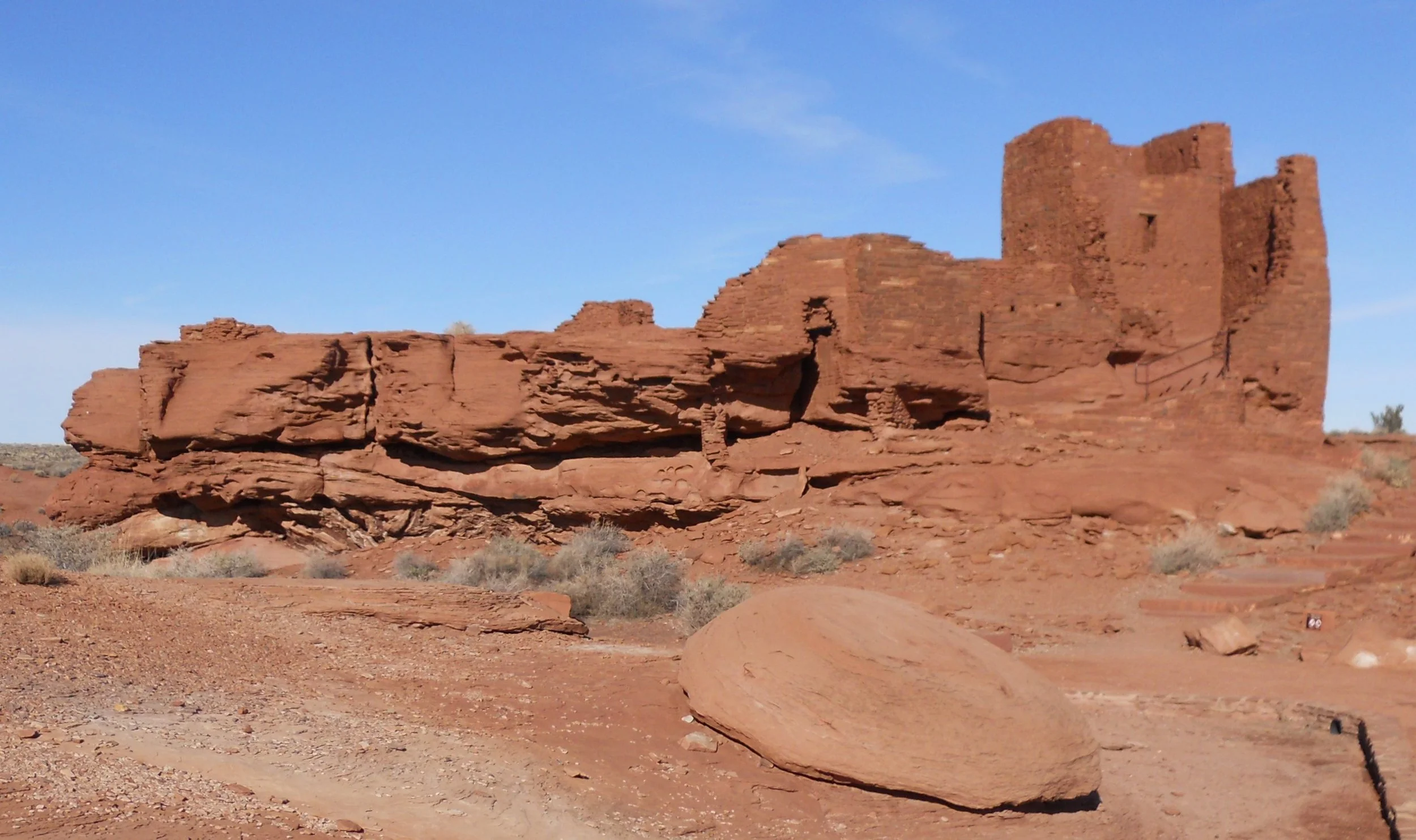
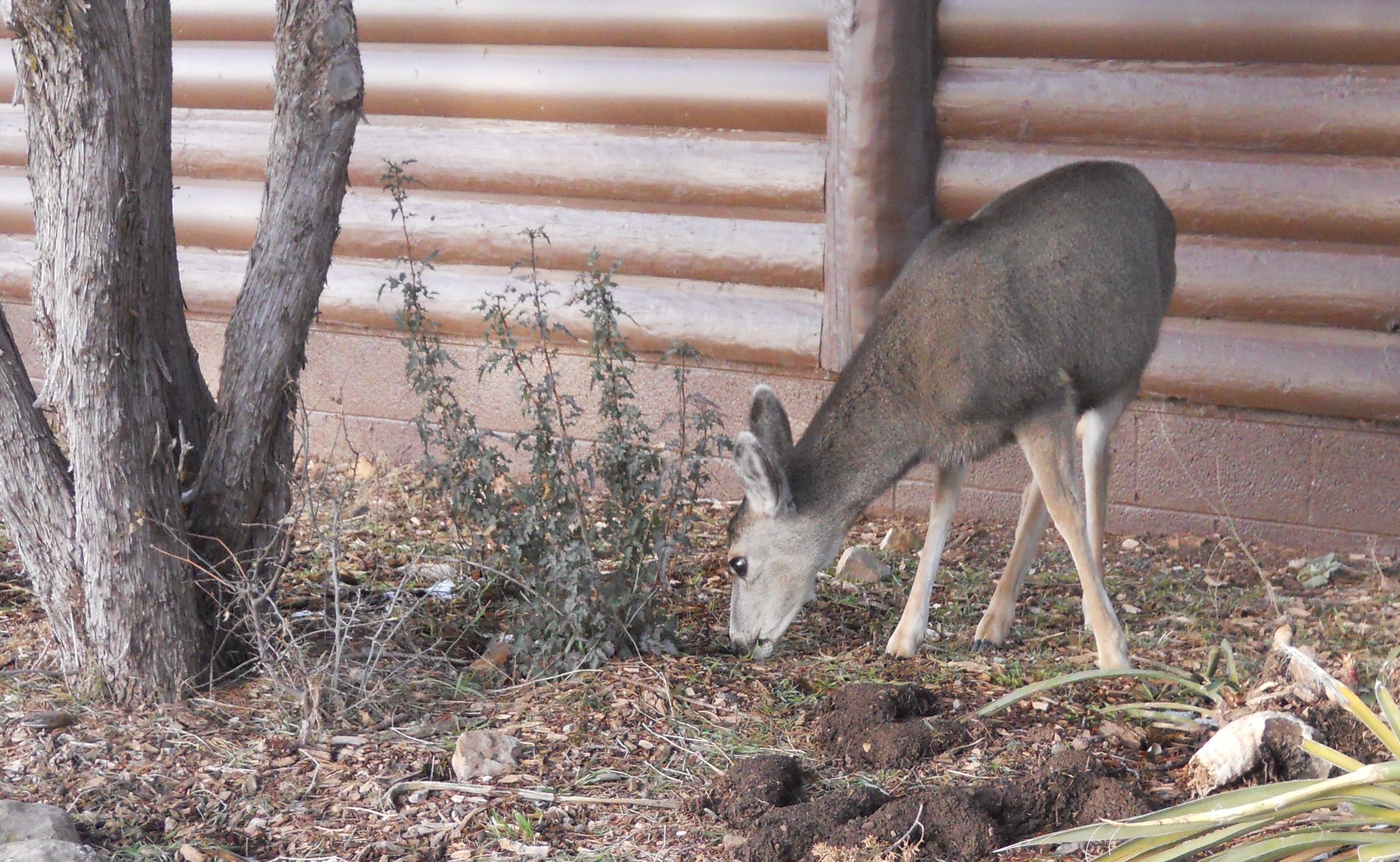
January 13 - Saw more elk and mule deer on the way out of the Grand Canyon. Wupatki NMon was first stop. The ruins in this park date back 900 years. Flat stones were piled on top of one another, with mud used as the glue. Amazing they still remain. Most artifacts were looted in the previous centuries, so very little remain to display at the Visitor Center.
The first photo to the right is the Lomaki Pueblo. To its right is the Nalakihu house, translated as “House outside the Village.”
The next row of photos is of Wupatki Pueblo, the best preserved and largest in the park.
The third row for this park shows the Wukoki Pueblo, as well as a resident raven, perched on the top of a pickup truck. Ravens are all over these parks, since they think they can find easy food pickings.
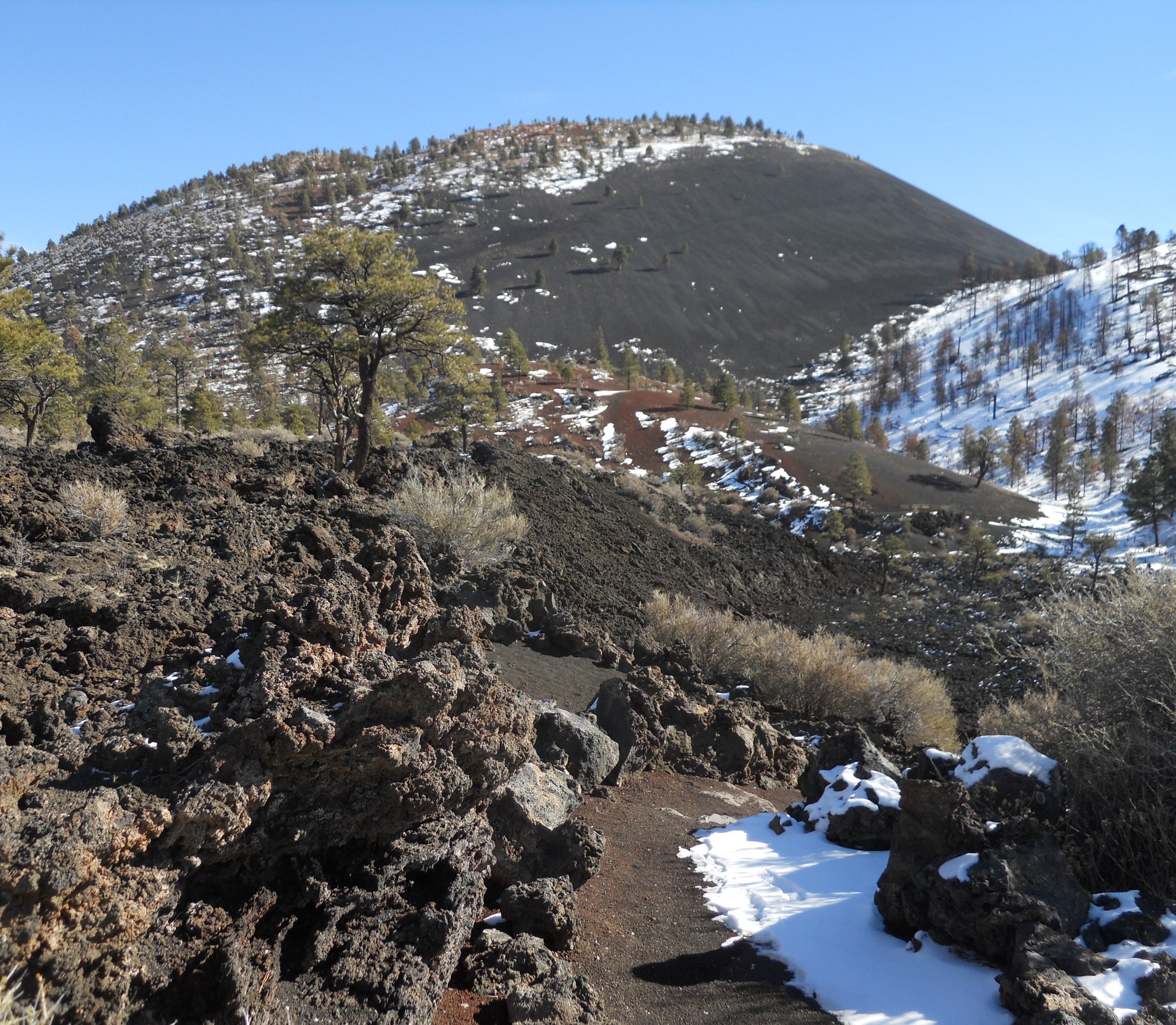
Sunset Crater NMon was next. Around year 1080 the earth shook. The top of a mountain blew into the air, scattering cinders for miles, and lava streaming to the valley. It is not known how many inhabitants in the surrounding area perished. A large lava field can be seen today, a sea of barren black rock. Noone is allowed to hike to the summit.
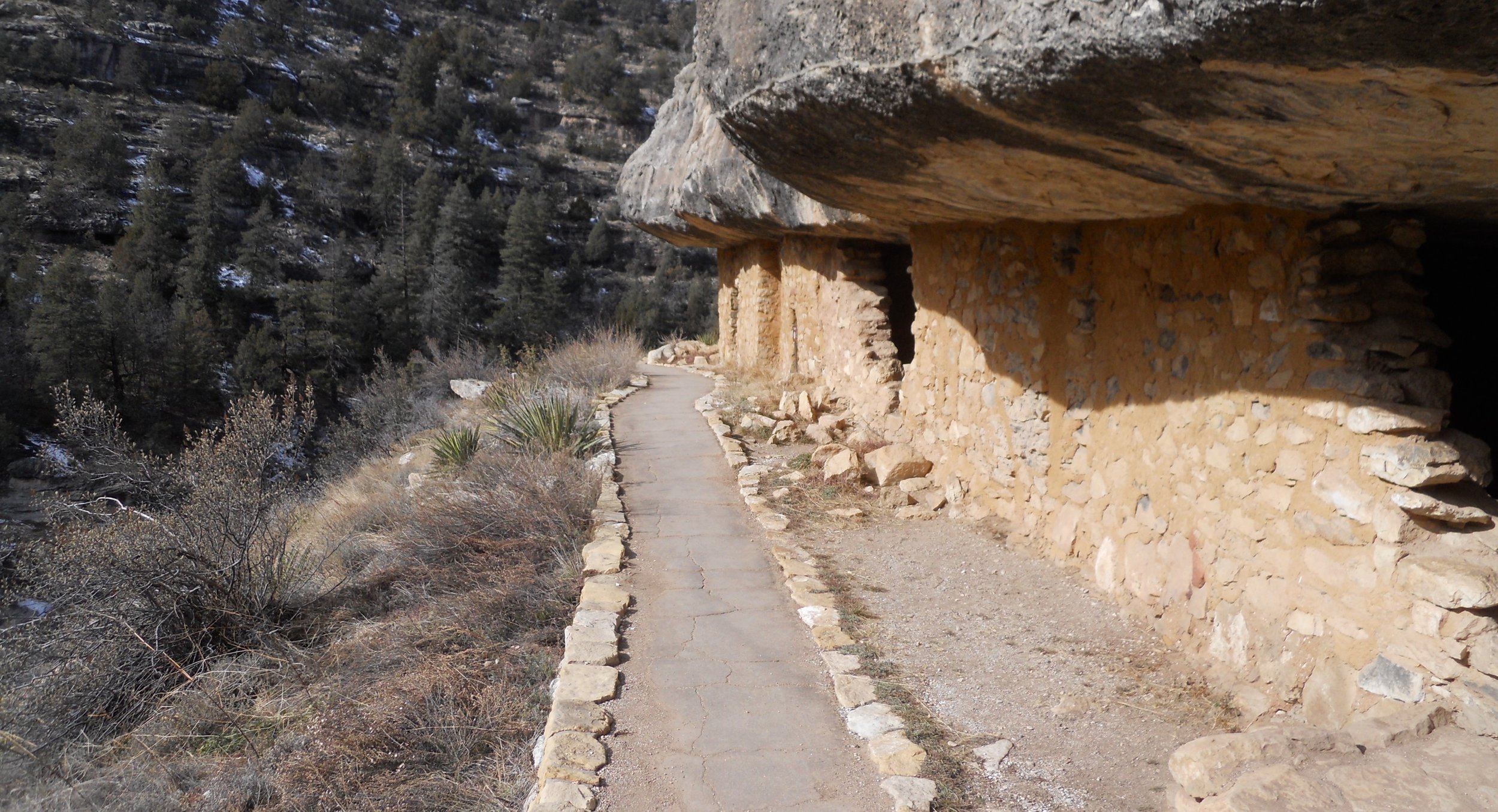
Walnut Canyon NMon preserves an “island” in the middle of a canyon. The residents built dwellings in a circular format around the island’s circumference. They were well above the canyon floor; another example of cliff dwellers. Their sounds vanished 700 years ago. A 1-mile round-trip hike takes a visitor to 25 dwellings. A Rim Trail can be hiked, taking one along the upper edges of the canyon in order to look at the canyon and the island.
Montezuma Castle NMon was a 45-minute drive down I-17. Talk about someone wanting to be left alone. Just look at how high up the cliff face this structure was built. Hard for any enemies to attack. This is a 4-story, 20 room, engineering marvel. The green trees seen in the bottom of the photo indicate the presence of multiple streams in the Verde Valley.
Last stop for the day was Tuzigoot NMon. This 110-room structure was built on a limestone/sandstone hill, overlooking vibrant farmland. Initial construction began 1000 years ago, with four distinct phases over the centuries. Trade routes to all corners of the compass passed through this area.


January 12 - A stop at the Carl Hayden VC for Glen Canyon NRA provided an opportunity to photograph the famous Glen Canyon Dam. Then it was off to Lower Antelope Canyon. Most of you have seen photographs of this canyon in multiple magazines and literature over the decades. I will not try to be Hemingway and explain the view. You will have to take the hike yourself some day. Maybe a few of my photos will generate some excitement. Or look up National Geographic and other professional venues. Yes, this is not a National Park, but it is as splendid as any.
A wonderful couple from Pennsylvania, Bernie and Linda, were visiting the canyon as well, with Jerry as our delightful and inciteful guide, from Ken’s Tours.
The last photo to the bottom right is that of the “Elephant Head”. See if you can make out the shape.
The single NPS park for today was Grand Canyon National Park. No need to restate the name…. everyone knows this place. This was my first time to GC during winter months. There was plenty of snow on the ground. Trails leading down to the Colorado River were iced over, so I gave up on trying to descend even a little way below the rim.
Two mule deer were munching in front of one of the restaurants in the park. Just after the one photo, this deer tried to get in the kitchen door, which was on the side of the building.
A family from South Carolina joined me in viewing five large elk at one of the canyon viewpoints. The two youngsters in the van had a thrill with this experience. The father mentioned the white-tailed deer in SC do not get this big. I concur. The elk in the photo was eating off the tree. It had yellow tags in its ears, probably due to the Park Service tracking the small herd.
The boat in the photo is named the GLEN. It was one of five used in the 1921-1923 USGS expedition of the Colorado River through the canyon. It alone weighs 900 pounds. That need some tough handling to get it through the rapids (a total of 84 were ran).
Last is the Watchtower at the Desert View area. One can see a long way from its turret.


January 11 - This was a wonderful day. 8:30 AM a group of six NPTC members met at the Antelope Point Marina in Page, AZ. Five of us boarded a powerboat and sped off to Rainbow Bridge NMon. The monument stands on Navajo lands. The boat had to go 50 miles north on Lake Powell to access the side canyons which lead to the Bridge. The ride is through Glen Canyon NRA.
The Glen Canyon Dam was built in 1966, creating a 150-mile-long Lake Powell, via the Colorado River. Since 1999 the lake has dropped 170 feet due to severe drought. A white line seen in most rocks indicates the height of the lake before the decrease. Indian ruins and canyon beds which have not been seen in 50 years are reappearing. This lake and NRA have seen a fair share of Hollywood movies, such as Planet of the Apes (1968 with Charlton Heston) and Maverick (Mel Gibson and James Garner).
The land is beautiful. The air is clear and clean. The water is so blue. What a place to enjoy the great outdoors… a perfect National Park.
After motoring up Forbidden Canyon, off the main lake channel, the boat had to be stopped 30 yards short of land. The photo does not do justice. Quicksand and muck had to be traversed. One of our five passengers got stuck in quicksand, with both feet heading down. The boat captain and I made it to her and pulled her up and out… then we all quickly headed to shore, with as gentle steps as we could muster.
After 1.5 miles we made it to the NPS shelter, which was built for folks to stop and view the Bridge up close. The Bridge is a religious site to the Navajo, so folks are asked not to walk under the crown or to get too close. A trail leads one around the northern end, so a person can view the Bridge from the east, as well as the west. The Bridge is 290 feet tall, and 275 feet wide at the creek, wide enough to fly a Boeing 747 through its opening.
The bottom photo is the standard view one gets if coming east from Lake Powell and is where one used to be able to start their 400-yard hike to the Bridge. Due to the two decades long drought, one now has to make the 1.5-mile hike to get to that point.


January 10 - The day began with an introduction to Eileen, at Hubbell Trading Post NHS. She and others run the trading post. Her tee-shirt is proof I was at the park. Beautiful Navajo blankets, baskets, and pottery were for sale. Select an item, or two, when you visit this park.
John L Hubbell established the trading post in 1878. It still looks much like it did then, with old rustic, and squeaking, floorboards (the one image is from a Visitor Center display). The Weaving Room is used today, outputting new rugs and blankets, all made by hand.
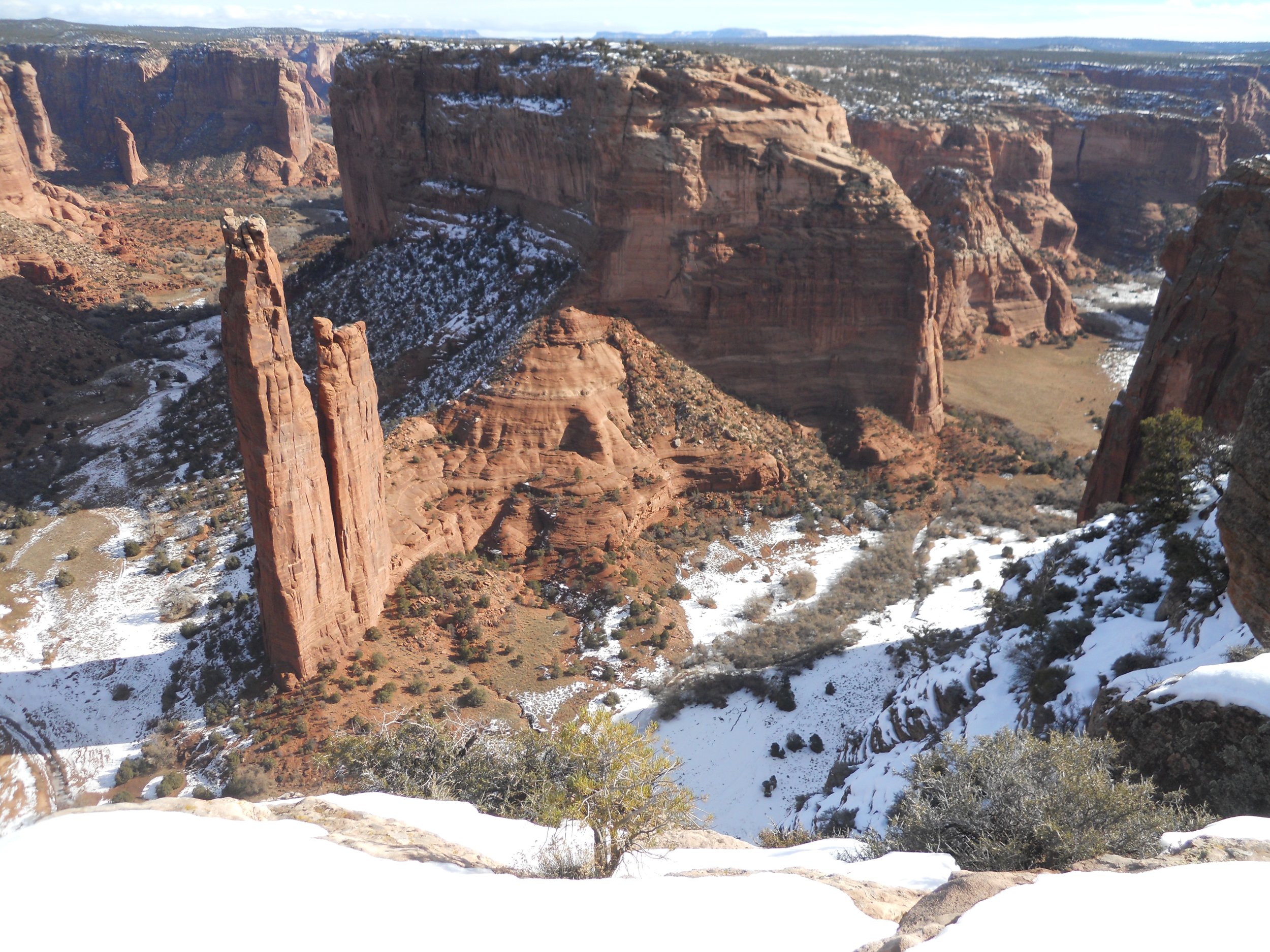
Next stop was Canyon de Chelly. Various dwellings of the Ancestral Puebloans dot the canyon floor and cliffs. Chinle Creek runs through the canyon, providing means for farming. Native peoples today still live in the canyon.
Pull-outs allow visitors to stop their cars, then look through metal rods, pointing to some of the ruins.
Spider Rock is the last stop on the southern side of the canyon (photo with two spires). Tours of the famous White House ruins have been stopped, so visitors are not able to get up close to any ruins. The closest one can get is to the Antelope ruins, seen from a vantage point on the northern rim. Can anyone make out the dwellings on the canyon floor?
To complete the visit to the Three Sisters (Navajo term for the previous park units and this third unit), I stopped at Navajo National Monument. During January there are no tours to the three groups of ruins in this park. Only one trail, the Sandel Trail, allows a visitor to view one of the ruins, the Betatakin (means “house on a ledge”) dwelling. When guided tours are available to Keet Steel, a visitor will view probably the finest example of Ancestral Puebloan dwellings in this country. But it is a 17-mile roundtrip hike, with 800 or so feet of elevation gain. Better be in shape.
The photo to the right does not do justice to the size of the complex. A model shown in the Visitor Center may do a better job.
Long before man inhabited this area, dinosaurs roamed. A footprint of a three-toed Jurrasic beast can be seen along the Sandel Trail.
The Hogan on the far right, was ingenious in keeping the people warm during winter months. The Hopi call this region the “Place of the Blue Corn Tassels”.
I quickly stopped at Glen Canyon NRA, to checkout tomorrow’s trip, so technically counts that I stepped foot in the boundary. I will feature that park January 11.


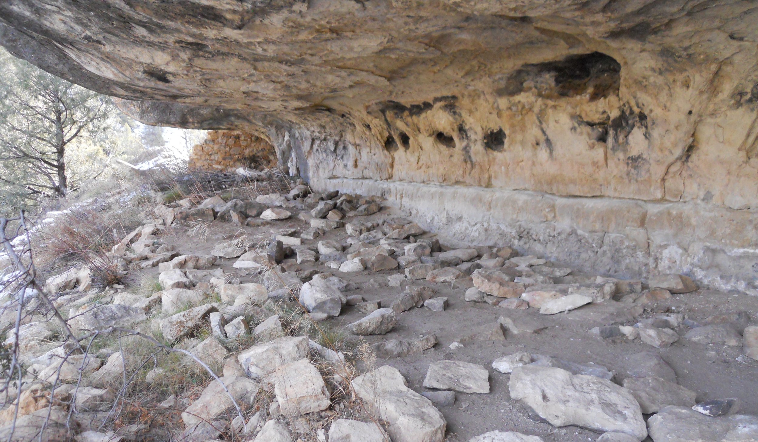
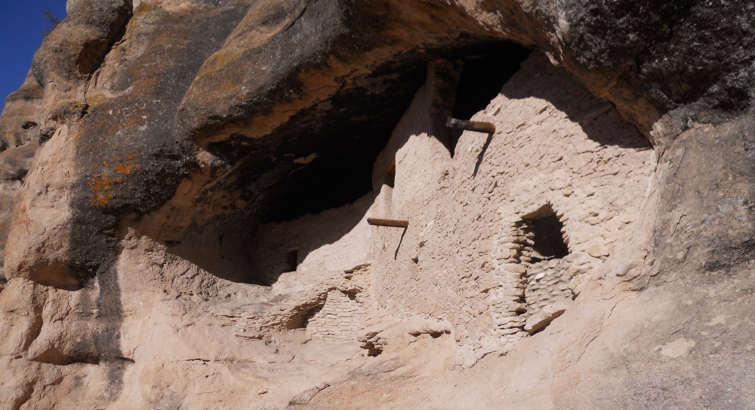
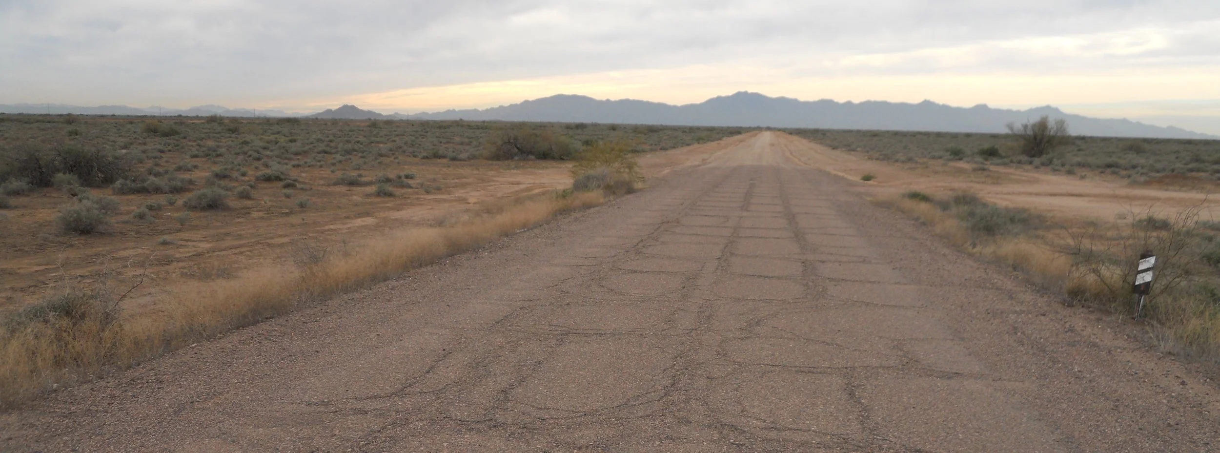
January 9 - That is the LONGEST 44-mile paved road in existence. The sign in Silver City says 2 hours to make the trek to Gila Cliff Dwellings NMon. Well, they are about right. If you go, be prepared for “mountain-type” driving, even though it is asphalt.
There is a 1-mile roundtrip trail to the cliff ruins. You must walk over 8 bridges (photo to right shows ice frozen on the rocks), and climb upwards 180 feet. You are met with five caves. Caves #2, #3, and #4 can be walked in. A wooden ladder provides access. Vegetation does grow up the slopes as seen in the one photo. The main reason people settled in this area was due to the proximity of the Gila River. Remember, man, animals, and plants all need water to survive.
The Mogollon people arrived in 1276, settling in the caves, building 2 and 3 story structures. In 1300 the people vanished. Zuni and Hopi groups today, consider themselves to be descendants of the Mogollon.
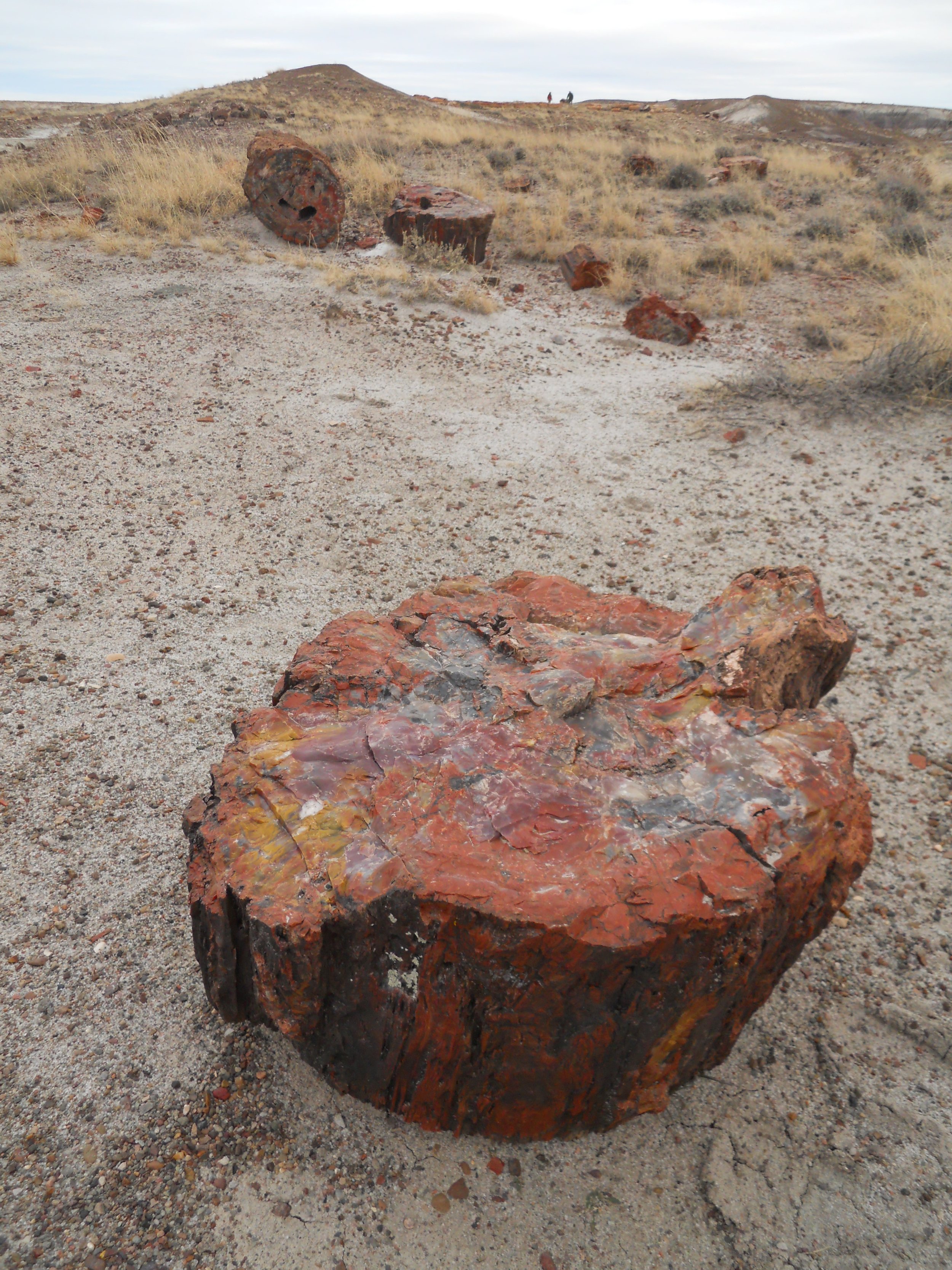
Next was Petrified Forest National Park. A 29-mile road connects the north and south sections. Most of the petrified “wood” is in the southern portion of the park. I say “wood”, because what you see is not actually wood… it is silica replicas of the giant trees which stood here 220 million years ago. When trees fell, they were covered over by soil, eventually having silica infused waters replace the organic molecules of the trees. Voila, petrification. The different colors are based on multiple metal oxides. Iron oxides produce reds, while manganese oxides show browns. Other minerals show off their colors in the “wood”.
Crystal Forest hike takes one through a small area with hundreds of fragments. Every color in the visible spectrum seems to exist.
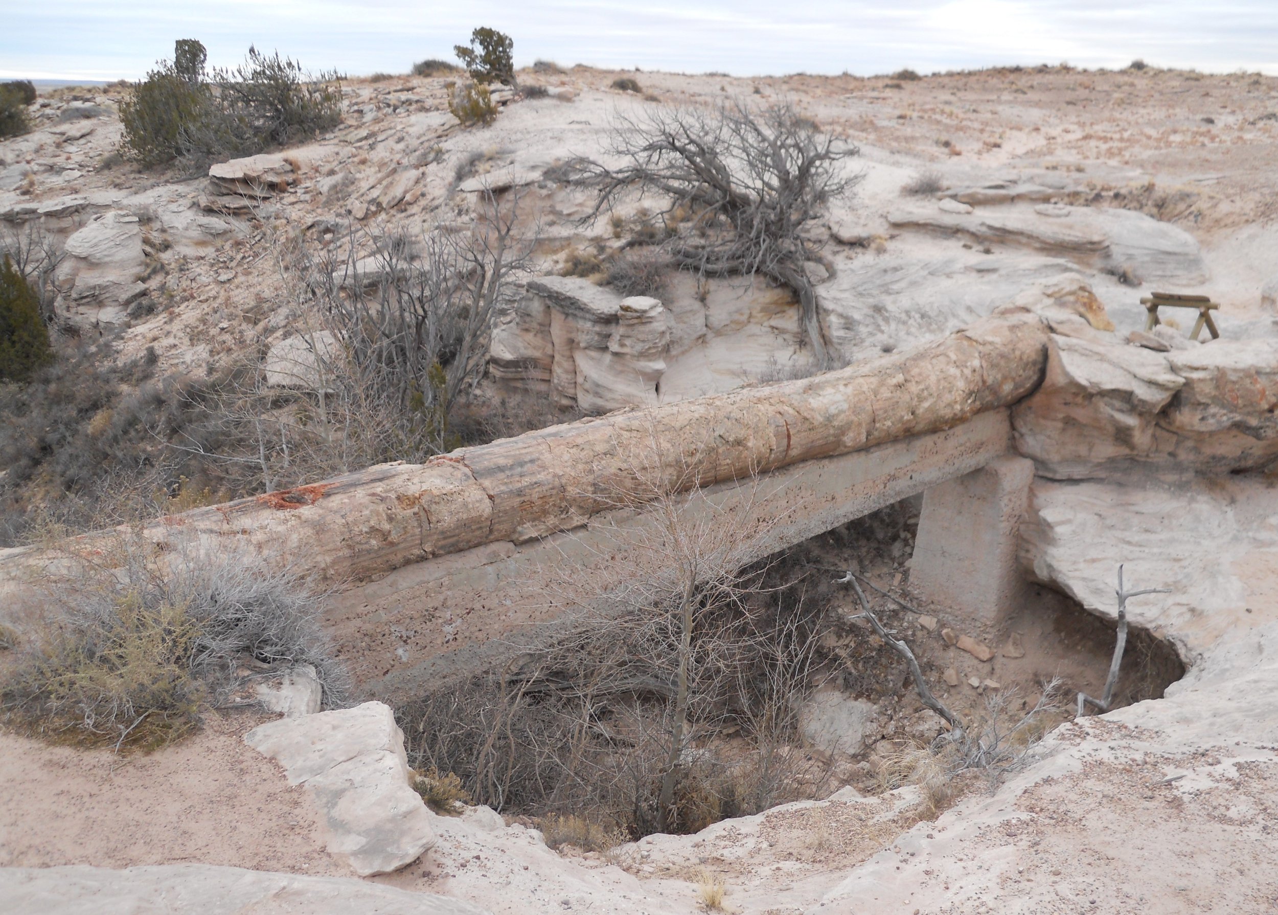
The Agate Bridge (photo to right) is a petrified log which fell over a gully, hence the name of “bridge”. In 1917, the NPS placed a concrete span across the gully for support, but eventually Nature will make the log fall and break.
An interesting stop is Newspaper Rock (photo to right), showing 600+ petroglyphs from Ancient Puebloans. It is doubtful anyone can make out a single item from the photo. Visitors must stand 100 feet away on a platform. Binoculars are available for viewing. Believe me, those etchings cover the entire rock. By the way, who knows the difference between a petroglyph and a pictograph? Both can be found in the American Southwest.
The last photo is Painted Desert Inn. It is in the park and is on the National Register of Historic Places. When famous Route 66 ran across this land, people would stay at the inn. Speaking of Route 66, tonight I stay in the iconic Wig Wam Hotel, on Route 66. It looks the same as it did in 1940. There are 15 separate wig wams. Some of the furnishings in each room are from 1940. The parking lot area is full of classic automobiles from the 1940s, 1950s, and 1960s, including Mater Tow Truck. I will leave it up to you to check out photos on the internet.


January 8 - Chiricahua NMon has more spires of rock than one can count, and they come in all shapes and sizes. I took the 3.3-mile Echo Canyon loop trail. Once at the bottom of the canyon, I did not test the echoing capabilities. Snow and ice remain from the last storm, making for a few slick spots on various trails. Said “hi” to many people who were excited to be hiking in the park.
A young boy, about 10 years old, was given his Junior Park Ranger badge after completing the required tasks. Each park has this program, so parents, ask once you get to a Visitor Center. Even adults will attempt to get the special badge which comes courtesy of the NPS.
Then onto Fort Bowie NHS, and its 3-mile roundtrip hike to the ruins and Visitor Center.
There are two groups of ruins at Fort Bowie. The first fort was built to address issues with Apache Chief Cochise. Once that was resolved, the fort was abandoned. Then, when Geronimo and his band of warriors began harassing the region, a second much larger fort was built. Most of the ruins are from that fort.
But none of this would have happened without the presence of water. The Apache Spring (bottom left photo) was the sole source of water for this area. Once discovered by white man, this area became a battleground against the Apache. The spring water allowed the Butterfield Stage to build a station at this site in 1858 (far right photo under Chiricahua photos).
The base commander and his wife lived in a 2-story, 13-room home; quite luxurious. The remains are seen in the bottom right photo. The women who lived in the fort wore clothes like those shown in the one photo.
The Calvary Regiment lived in a large adobe structure. Its ruins are the top-left of the Ft Bowie photos.
The three-legged device is a heliograph. The mirror would reflect the sun’s rays, allowing a soldier from far away to read Morse Code. With a span of five heliographs, Fort Bowie could message Fort Hachuca, 90 miles away. Do any 5th graders want to learn Morse Code?
The fort’s cemetery includes one of Geronimo’s sons, Little Robe, as well as a Medal of Honor recipient, Orisoba Spence, of the 8th U.S. Calvary, who fought in the Indian Wars (photo to the right).


January 7 - Tumacacori NMon was founded by Jesuit priest Eusebio Kino, in 1691. It is the oldest mission in Arizona. Aside from teaching the gospels to the local inhabitants, he helped create a farm system which included fruit trees; pears, plums, apples, oranges, and peaches to name a few. The NPS has recreated the fruit garden.
The centerpiece of the park is the chapel sanctuary. The first area with ropes was where the choir loft was located. At the far end is the alter, with original red paint of symbols still visible (remember, this has been more than 400 years).
I happened along two coyotes who appeared to be looking for food. The park ranger said it is rare for a visitor to see any of the local coyotes actually in the boundary of the park… they are more scared of us than we should be of them. Four cougars roam up and down the valley, but they have never entered the park, to anyone’s knowledge.
The next park was Coronado National Memorial. This unit honors the 339 soldiers and hundreds of Aztec men under Francisco de Coronado who trekked to this wilderness (which we call Arizona and New Mexico, today) in 1540, looking for the “Seven Cities of Cibola”. They expected to find gold and treasures. Along for the ride were 6,000 animals, enough to support the months-long mission.
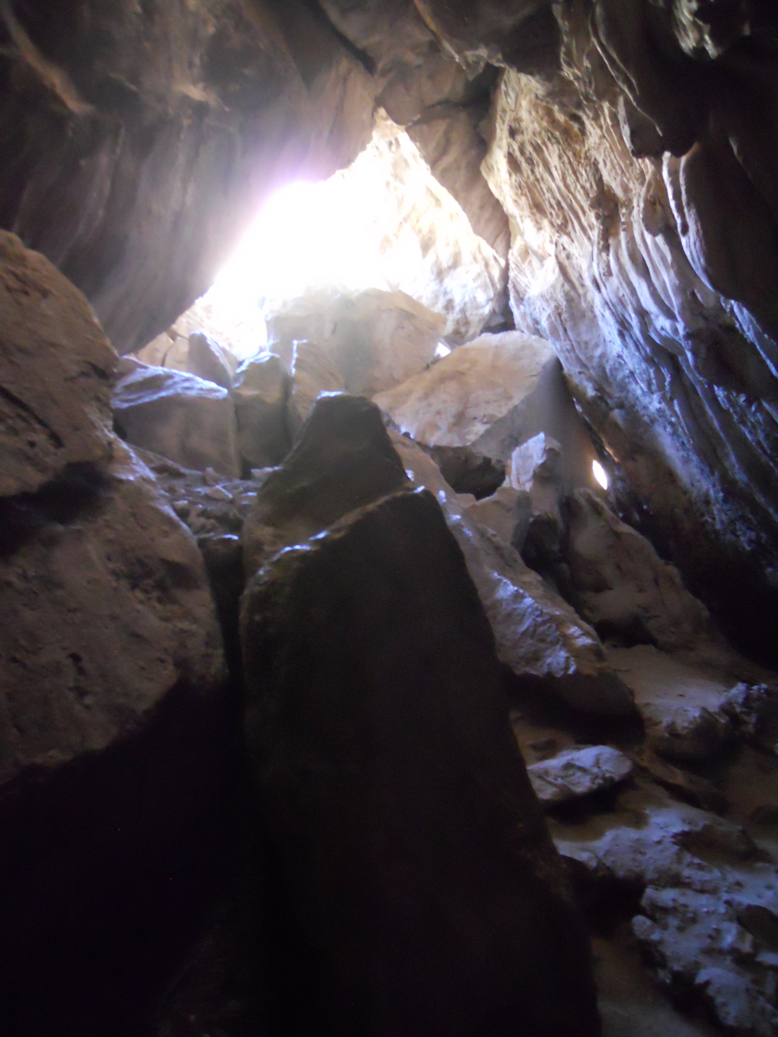
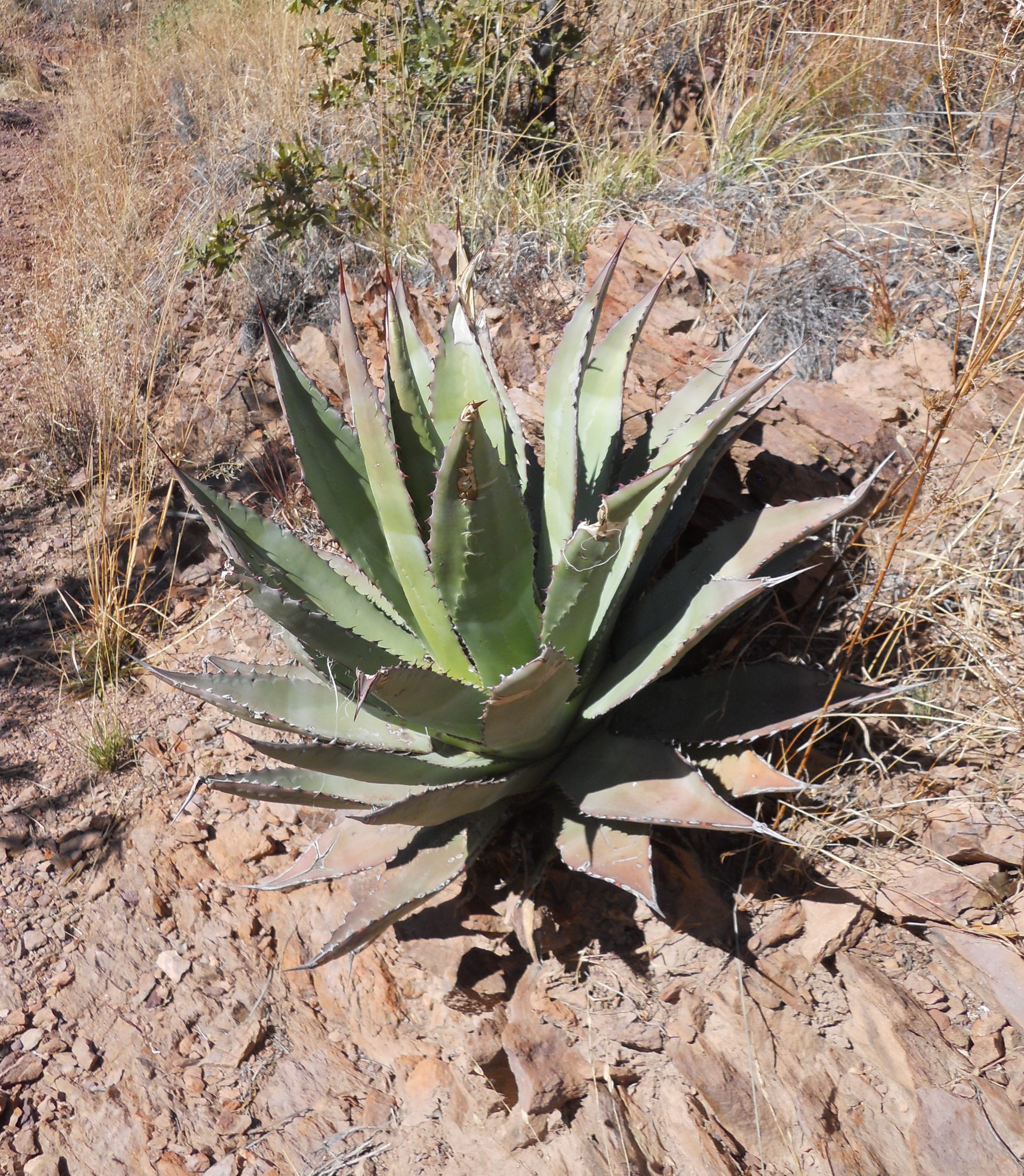
No such treasure hordes were found, just many native peoples. The view from the top of Montezuma Pass is to the right. A 2-mile bumpy, bounce drive on a gravel and rock road allows one to see this protected valley, which is at the Mexican border. The one photo is facing south into Mexico, showing the infamous “Wall”, which separates our two countries (it is in the bottom right of the photo). Plentiful in the region is the agave plant. It has a lifespan of between 25 and 30 years, bearing fruit just once during that time.
Another interesting feature in the park is the 600-foot-long tunnel which resides 500 feet up a mountain from the visitor center. After climbing down to the cave floor, one can only go a few feet before requiring a flashlight or IPhone to light the way. The photo is looking back up at the opening to the cave/tunnel.
Last item for the day. I had dinner at The Germain Cafe in Sierra Vista. I have highlighted this locale in the American Food Destinations page of this website. It is worthy of a stop.


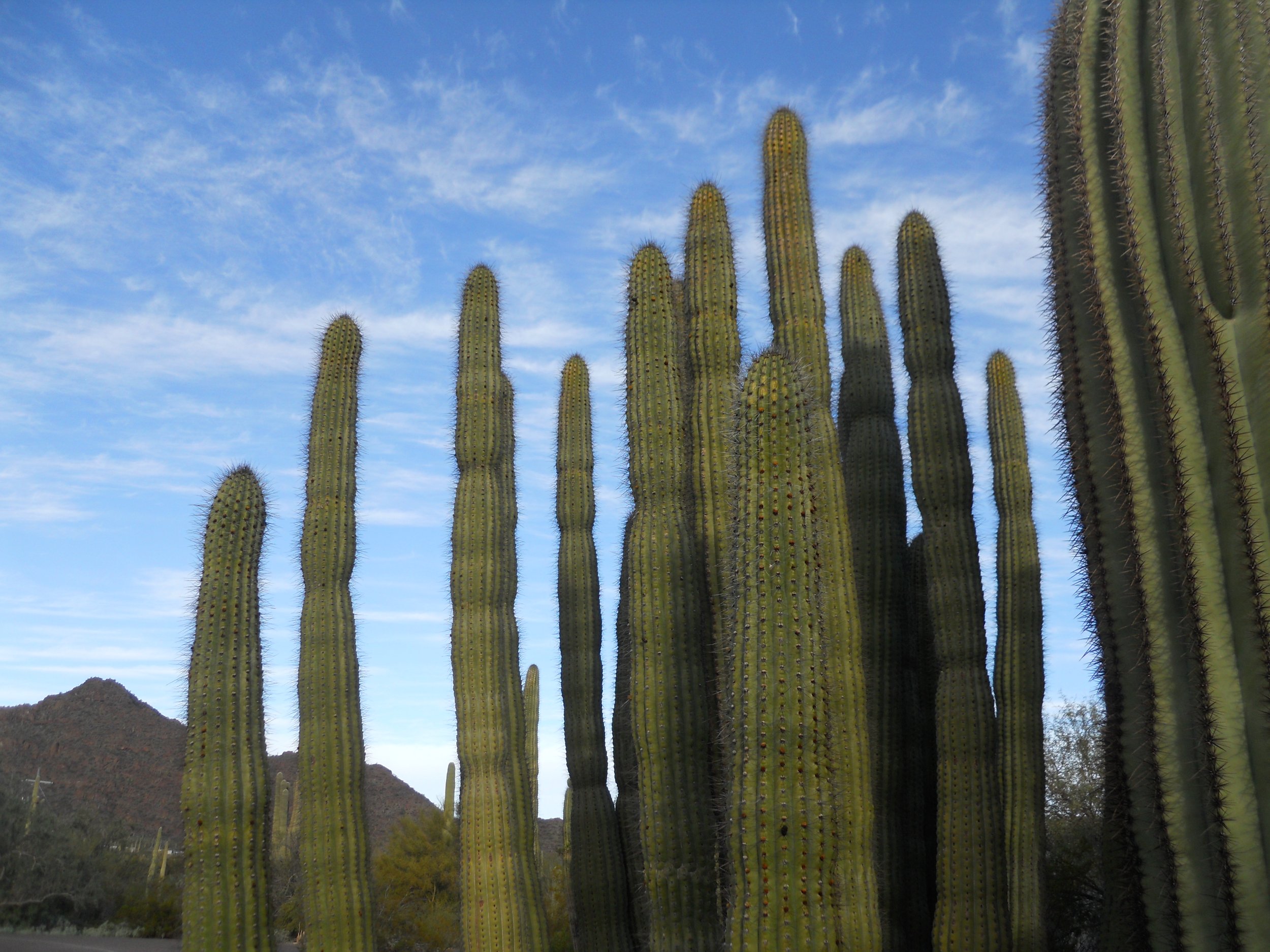
January 6 - Organ Pipe Cactus NMon is about the only place in the USA where you can see Organ Pipe Cactus. They surround the hillsides in Mexico, but only come across the border in a couple of spots. This monument protects the species in our country. Their name is derived from the groups which make them look like a pipe organ. They bristle with pointy needles.
A 4.4 mile hike takes one to Victoria Mine. The ruins of the General Store are still visible.
I saw two Gila Woodpeckers drilling on one cactus. A small lizard scurried past me to avoid being stepped on.
A somber point with regards to potential danger in our parks. About 40 park rangers have died while performing their duties. Ranger Eggle was helping Customs and Border Patrol apprehend smugglers in the park one night. He is remembered with a plaque and ranger hat at the Visitor Center. Always give your upmost respect to our National Park rangers, as we do our military and law enforcement officers.
The park borders Mexico. The one photo is at the border, giving people information for the crossing. Who can name the five National Park units which border Mexico?
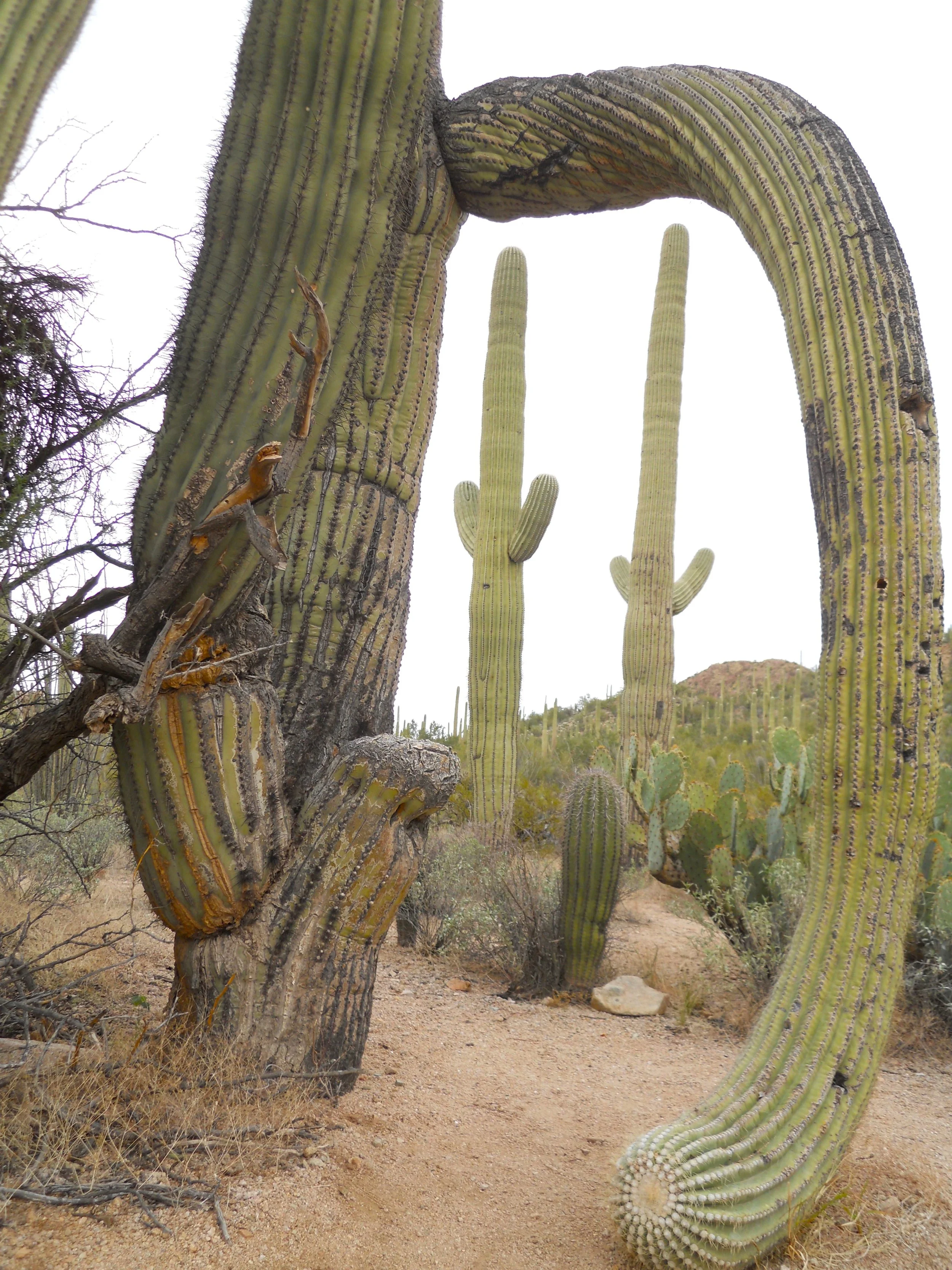
The next stop was Saguaro National Park which is split into two sections; west and east. I visited the western region. The valleys and hillsides are dotted with the gentle giants, some in odd twists and turns.
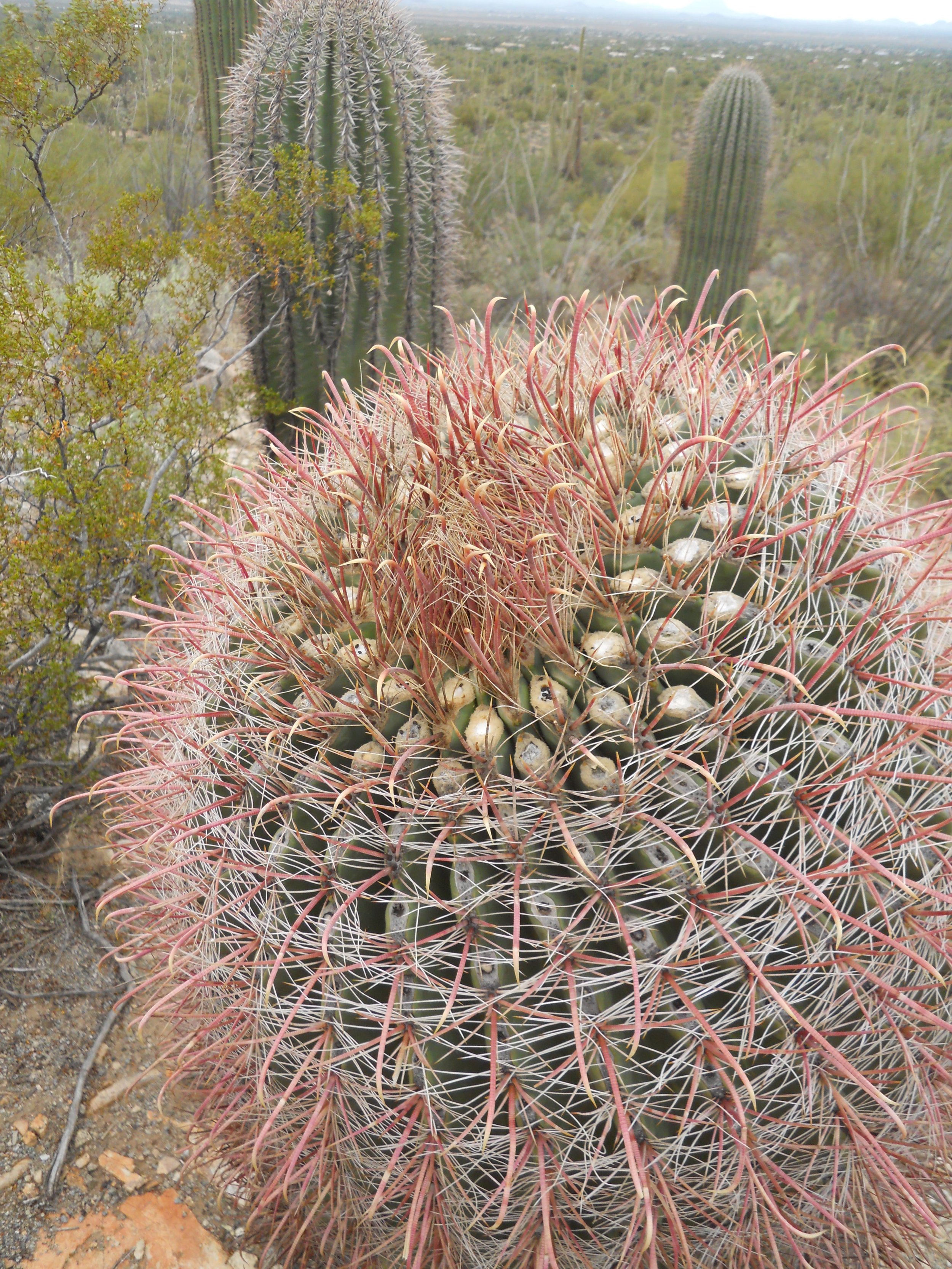
Many other cacti species call this park their home. The Hedgehog Cactus has the red needles and the small flowers.
Humans have been on this land for 10,000 years. Petroglyphs can be found in one location, on many rocks.
Rattlesnakes also call this park their home. A sign reminds visitors to be wary of their surroundings.
Last, but not least… a photo of our flag’s red color flying against the white and blue of the sky.


January 5 - A 5 AM breakfast in order to get to Tonto NMon as soon as possible. Traffic through Phoenix was slow by 8 AM.
First stop required a 350-foot climb over 0.5 miles. The cliff dwelling is well above the valley of Roosevelt Lake. Angeline Mitchell, a school teacher in the valley, was the first person to write about the discovery of these ruins. She led her students on trips to the structures, so they could learn about the ancestral puebloans. Artifacts which were found include those in the photo. The interior of the structures had living quarters, in multiple floors. Wood beams made for the floor supports. Saguaro cacti surround the site, on the hillsides. One of the signs on the uphill trail says, “rattlesnakes have the right-of-way.”
The next set of photos are from Case Grande NMon. The remaining structure is considered the grand palace of the area from when the ancestral puebloans lived here, up until about 700 years ago. The Gila Rive, Zuni, and Hopi tribes of today can trace their lineage to those peoples. A roof was installed over 100 years ago to help preserve the ruin. This site was the first granted the status of American archeological preserve, in 1892. The Gila River flowed close by. The natives were ingenious in engineering canals and irrigation systems to grow many crops, including cotton. And you thought cotton only grew in the Deep South.
The last photograph is of Hohokam Pima NMon. The land is owned by the Gila River Indian Reservation. They do not allow visitors on their reservation, in order to preserve their culture. There was excavation of the large Snaketown complex done in the 1930s and 1960s, but the land was subsequently refilled. There are no plans to repeat the old excavations. A portion of I-10 Interstate crosses through the official boundary of the National Monument, so people can correctly state they have been in the monument. But there is nothing to see except the surface of the land. A bridge which crosses over the interstate at the point of crossing the boundary is where this photo was taken.


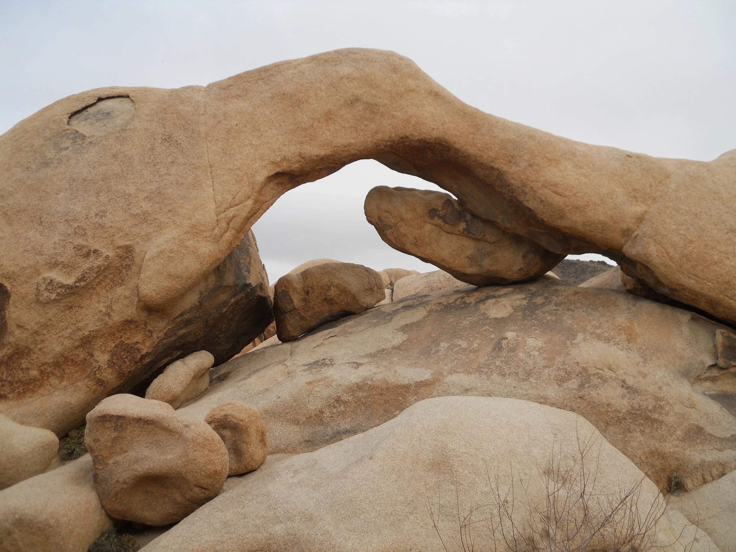
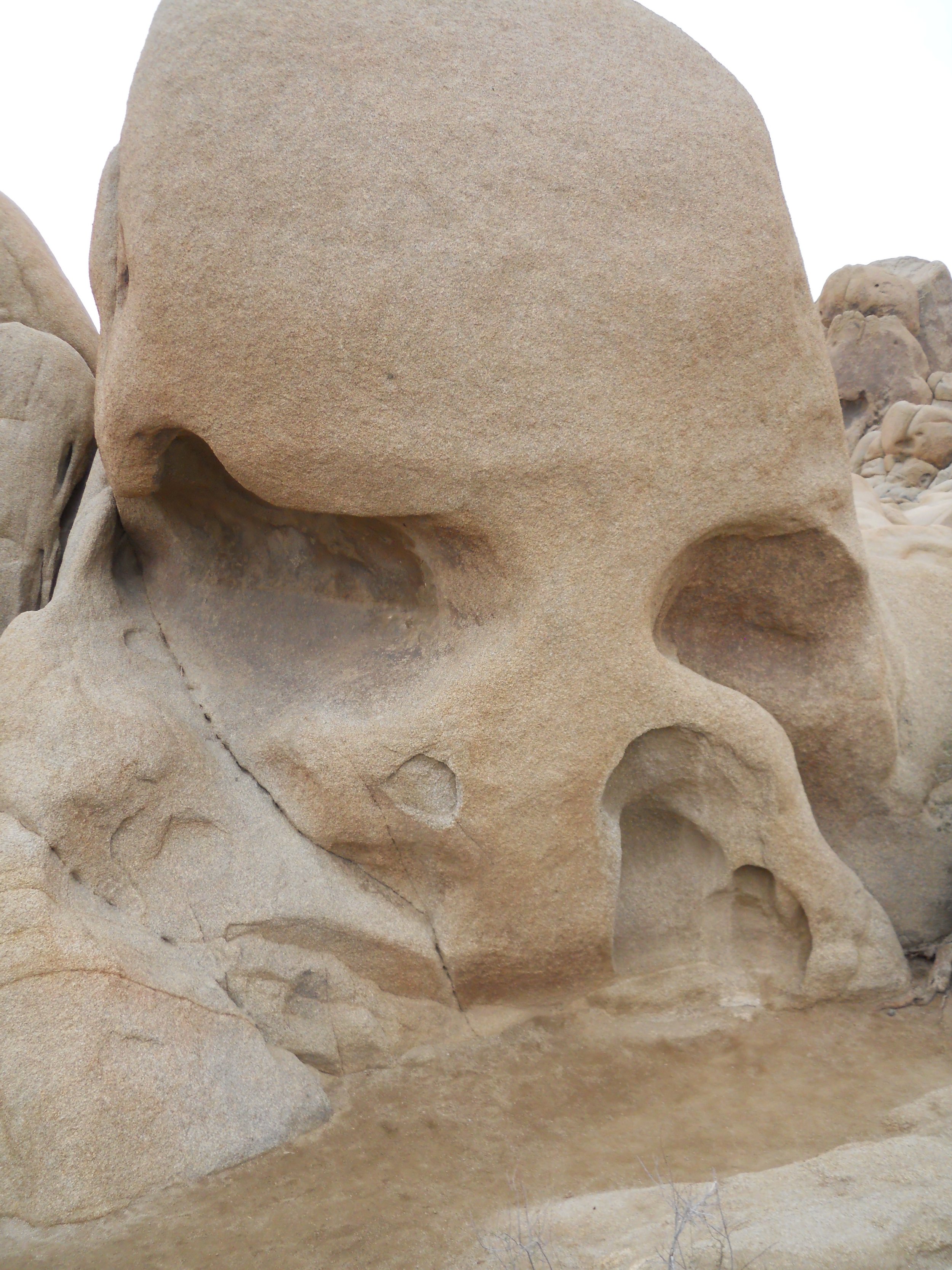
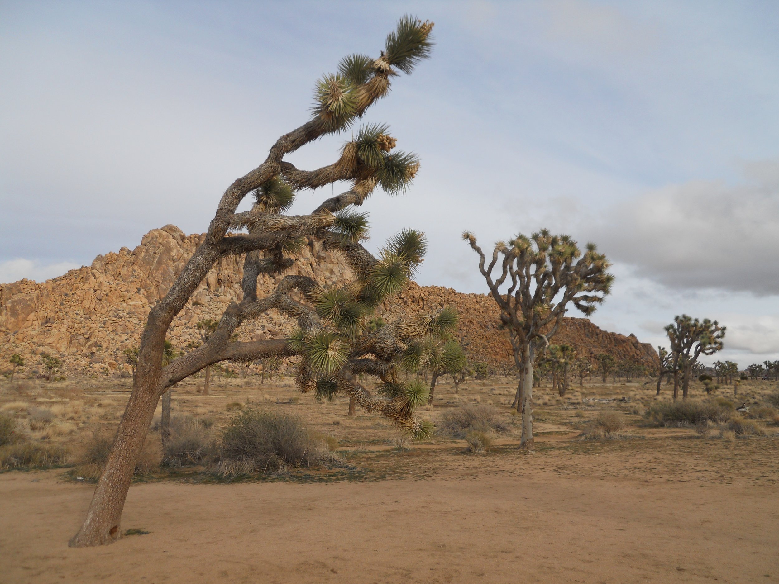
January 4 - Stayed in Joshua Tree NP for the entire day. Hiked Hidden Valley, Skull Rock, Split Rock, Ryan Ranch, Arch Rock, and Cottonwood Springs trails… many miles were put on the boots.
A spur on the Arch Rock trail (you can probably guess which photo is of the arch) leads one to Heart Rock. Does it not look like it is ready to be placed on a Valentine’s card?
The Joshua Trees like the northwest portion of the park, where I was yesterday. The southeast has Cholla Cacti, and by the thousands. One photo on the right shows one field, which stretches as far as one can see, in all directions.
The center portion of the park is home to large boulders, with piles upon piles of the rocks… with excellent climbing opportunities. Skull Rock, and its trail, is an example. Plenty of routes to take in the boulder field surrounding this eerie structure. A path leads up to the one window in the rock field. A 25-foot tunnel is hidden in the field. After discovering this feature, I told a young mother about the gem so she could try to quiet her 4-year-old daughter. Worked like a charm. The girl had a blast going back and forth and playing hide and seek.
The Ryan Ranch is right in the middle. Only portions of the ranch’s walls remain. The climate became too much for the family.
Basically, stay on Park Boulevard from entrance to entrance to enjoy almost all of the main sites. And Yucca Valley has plenty of hotels, restaurants, and civilization for you to use as your stepping off point.


January 3 - Cabrillo NMon had 50 mph wind gusts and rain at 9 AM. Not a fun way to start the morning. Toured the lighthouse (model of keeper’s area is in photo) and grounds. The cistern made to provide water for the lighthouse is visible. Looking down from the top of the lighthouse stairs makes for a great geometry image. Tide was high, so not able to walk in the tide pools. Juan Rodriguez Cabrillo (monument in photo) stepped foot in this area in 1542. Until a few years ago, everyone thought he was Portuguese due to the three-word name, but research shows he was a Spainard. Regardless, the uniforms worn back then were quite hot… and I do not mean “cool” hot, but really hot hot.
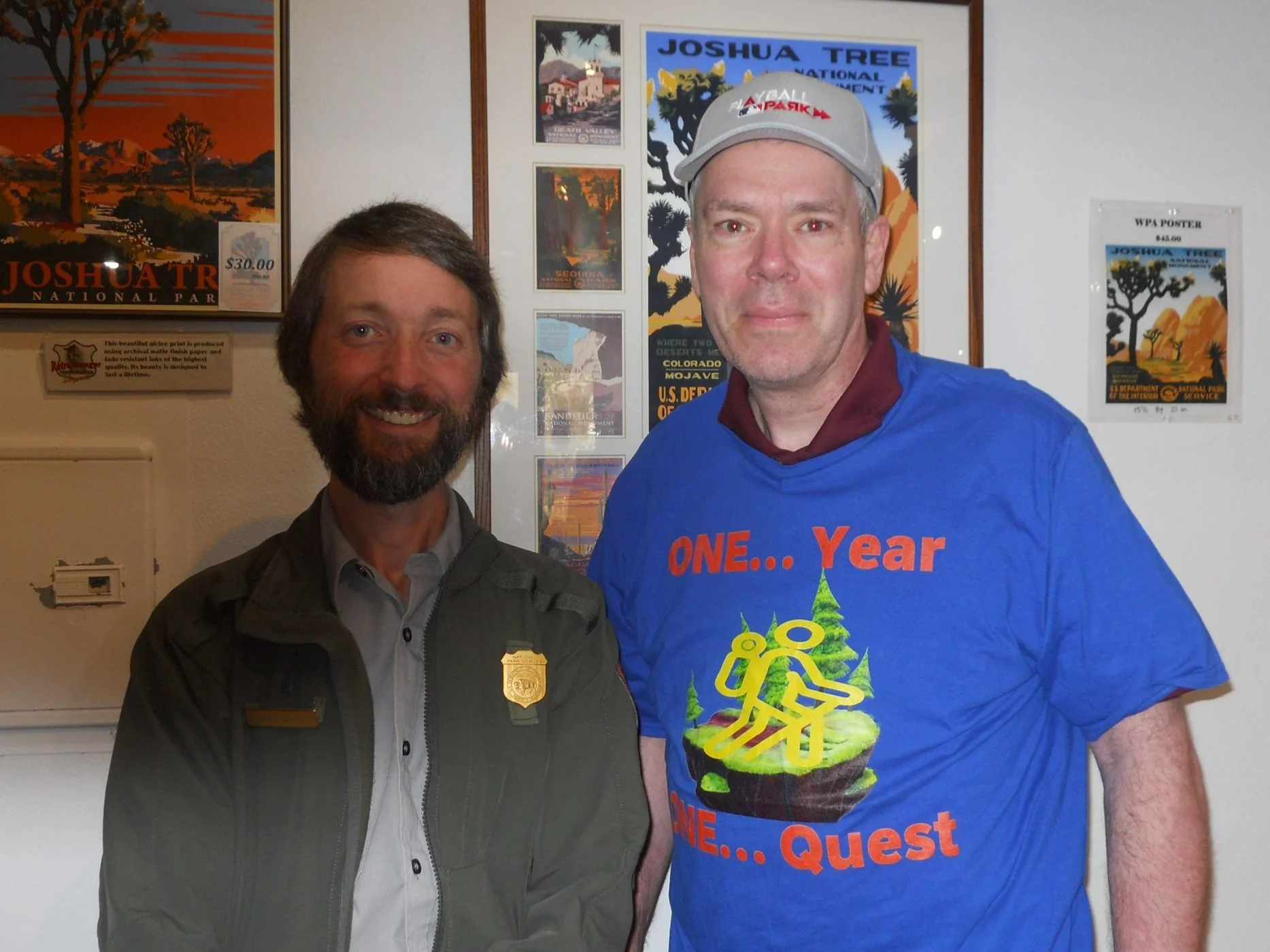
Joshua Tree NP was much more fun. The rain stayed on the coast, so dry inland at the park. Met Mark, one of the lead rangers for the park. He is also a NPTC member, at 192 parks and counting (the photographer appears to have put a finger a bit over the flash). I also met a couple with three young boys, who were very interested to hear about how to stamp their new Passport books, and to follow me on the trek. Another visitor, Terry, took my photo at the entrance sign and will post it and information on his Facebook page. Word is spreading. I hope many youngsters, and any adults as well, get excited about our parks.
These Joshua Trees dot the landscape between masses of rock outcroppings. And the trees come in all shapes and sizes. The one on the far right is going to need a crutch soon.
There are multiple species of cacti in the park.
Tomorrow will be hiking more trails in Joshua Tree.


January 2 - Channel Islands NP is a sanctuary for sea life, like these dolphins. For a quarter-mile radius, the sea was full of them.
A Santa Cruz Fox is ready to steal a bag of peanuts.
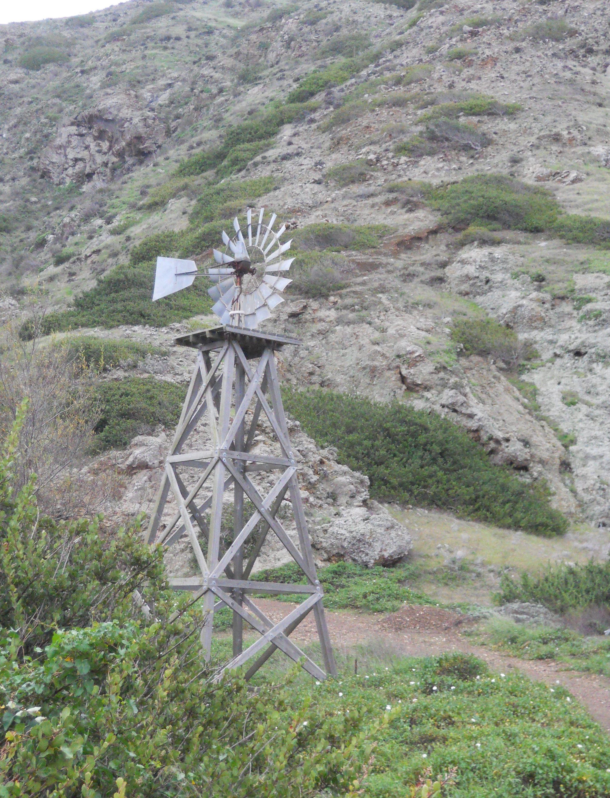
The island was one big ranch (wool from 20,000 sheep was the main export) until 1980. A large windmill was part of the ranch.
Paramount Ranch has been used in myriad Western Movies over the decades. It is in Santa Monica NRA. Only the historic church remains of the movie set due to a 2018 fire.


January 1 - These are two entry signs for the two parks, only unmaintained roads in Castle, and only a few paved roads in Mojave. A desert landscape with unique vegetation. The road to Castle Mountains is H***… only those with experience to drive over washouts and large rocks should attempt the Hart Mine Road. Did not see any mammals, just a lot of ravens and smaller birds. Rain, the nemesis of outdoor enjoyment, made early morning more frustrating, trying to go over the sand and gravel roads.
The Kelso Train Station Visitor Center was closed due to maintenance work.
Had to fill up with gas, which was $5.59/gal for 87-octane. I will stay in Ohio.


